

California 60 West - Interstate 15 to California 57 north
| California 60 - Pomona Freeway west | |
|---|---|
 |
As a towering 500kV power line crosses over the freeway and traffic from Interstate 15 joins the freeway, westbound California 60 leaves Riverside County and enters San Bernardino County (population 2,035,210 as of 2010 Census with a land area of 20,105 square miles). At this point, California 60 leaves Eastvale and enters the city of Ontario. As of the 2010 Census, Ontario had a population of 163,924, and as of the 2000 Census, Ontario had a population of 170,373 (the total population of the city decreased during this ten-year time period). The city incorporated on December 10, 1891. Photo taken 05/05/12. |
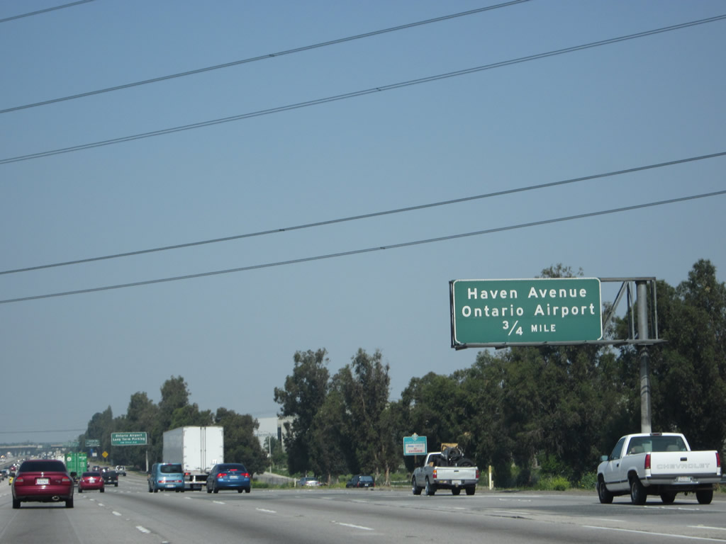 |
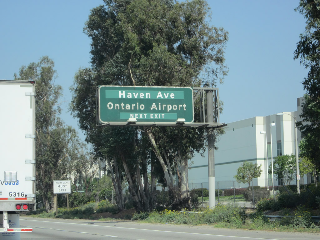
The next exit along California 60 west is Exit 39, Haven Avenue north to Ontario International Airport and south to residential/ranch areas. Photo taken 05/05/12. |
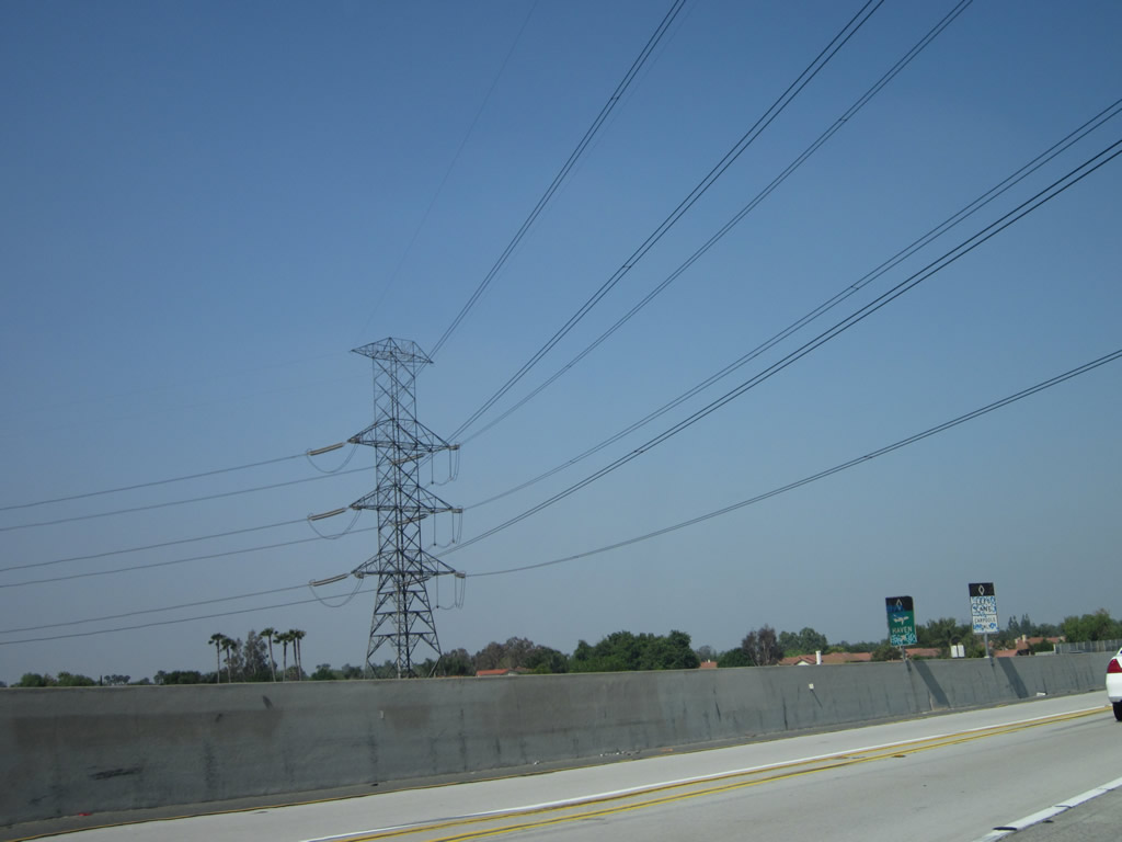 |
A really tall, double-circuit, 500kV Southern California Edison power line crosses over California 60. This line is most evident for travelers along Interstate 15 as it parallels Interstate 15 closely between Interstate 210 and California 91. Photo taken 05/05/12. |
 |
For long-term parking at Ontario International Airport, use Grove Avenue (Exit 36). For terminal access, take Exit 39, Haven Avenue north to Airport Drive west. Photo taken 05/05/12. |
 |
Ontario International Airport is managed as one of the Los Angeles World Airports (along with LAX owned and managed by the city of Los Angeles) and is widely used as an alternative airport to Los Angeles International Airport or John Wayne Airport in Orange County. Photo taken 05/05/12. |
 |
Westbound California 60 reaches Exit 39, Haven Avenue north to Ontario International Airport and south. Photo taken 05/05/12. |
 |
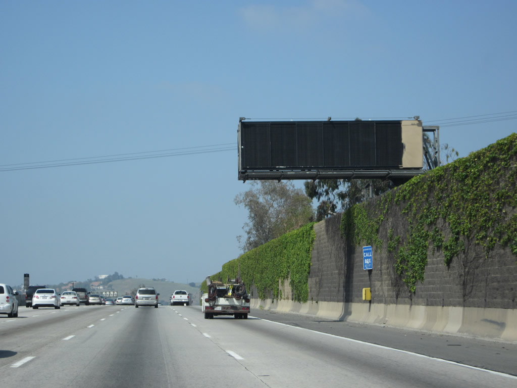
Another 500kV power line passes over California 60 just before the Haven Avenue off-ramp. This view looks south at the nearest 500kV delta pylon tower. This line converges with the double-circuit 500kV power line at a substation south of here near the Interstate 15 and Cantu Galleano Ranch Road interchange (Exit 106). Photo taken 05/05/12. |
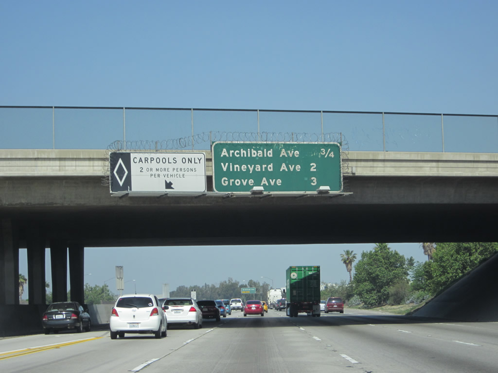 |
This interchange sequence sign along California 60 west provides the distance to the next three exits: Exit 38, Archibald Avenue; Exit 37, Vineyard Avenue; and Exit 36, Grove Avenue. California 60 is part of a major trucking corridor between Interstate 15 and Interstate 710 (since I-710 travels south to the Ports of Long Beach and Los Angeles). Photo taken 05/05/12. |
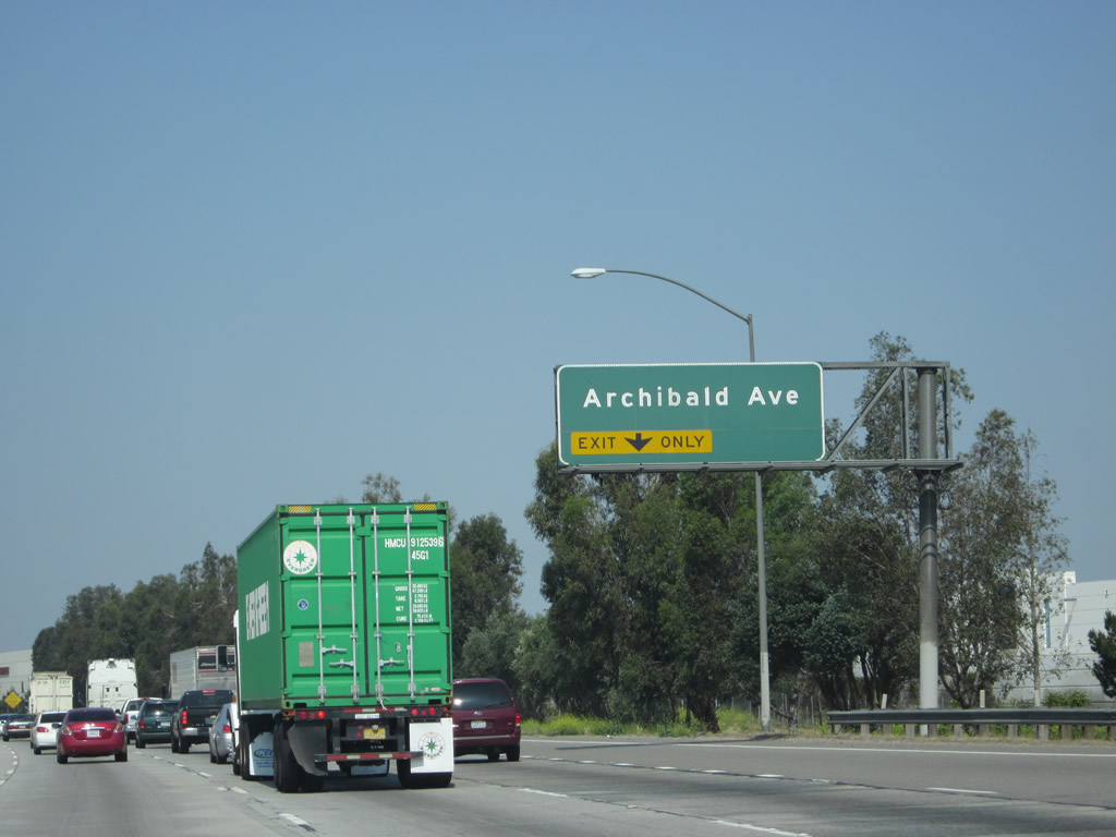 |
The next exit along California 60 west is Exit 38, Archibald Avenue; the right lane of California 60 west becomes exit only for Archibald Avenue. The left four lanes (plus HOV/carpool lane) continue west on California 60. Photo taken 05/05/12. |
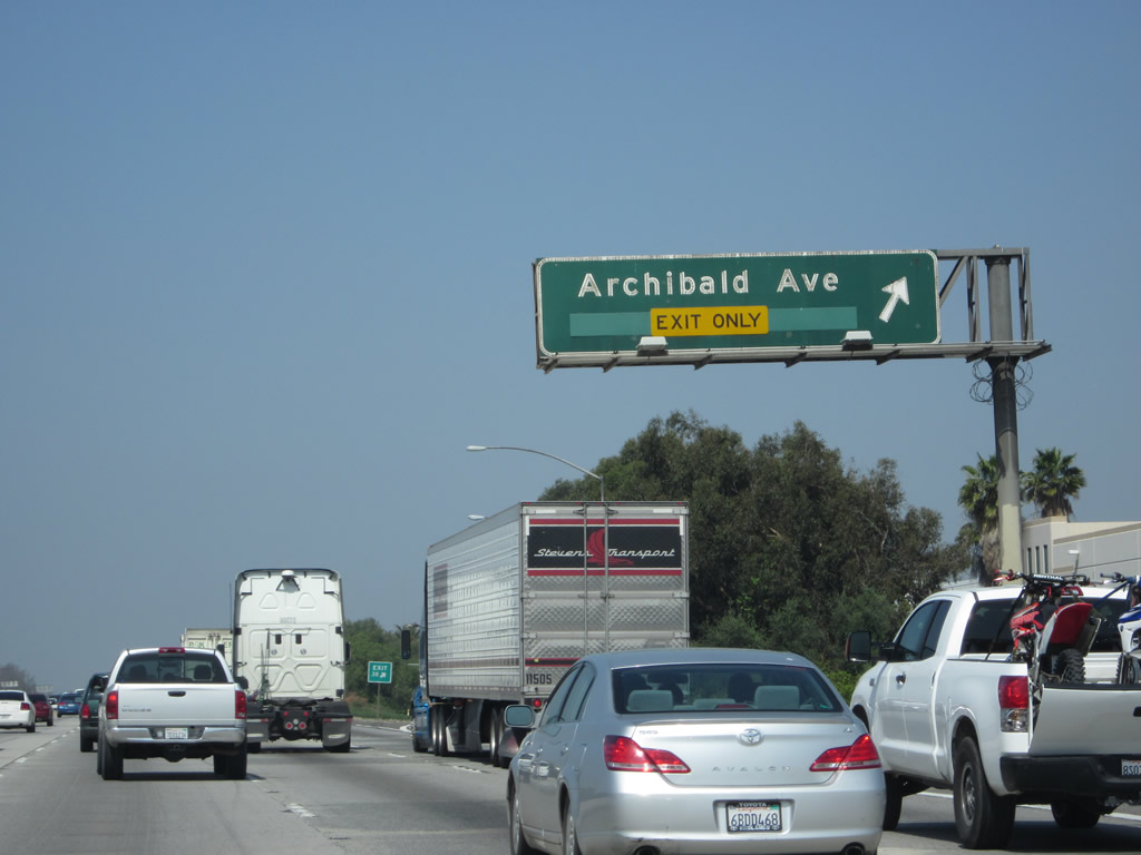 |
Westbound California 60 reaches Exit 38, Archibald Avenue. Photo taken 05/05/12. |
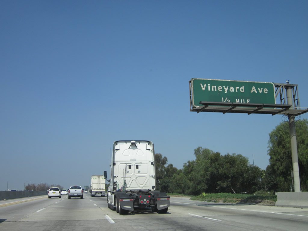 |
The next exit along California 60 west is Exit 37, Vineyard Avenue (one-half mile). Photo taken 05/05/12. |
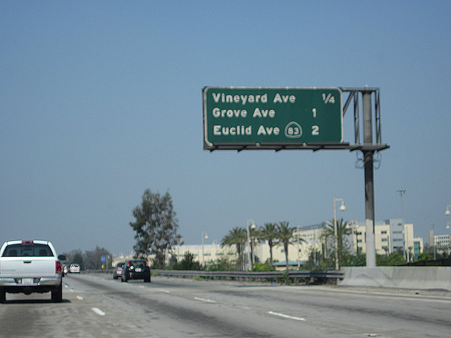 |
This interchange sequence sign along California 60 west provides the distance to the next three exits: Exit 37, Vineyard Avenue; Exit 36, Grove Avenue; and Exit 35, California 83 (Euclid Avenue). Photo taken 05/05/12. |
 |
Westbound California 60 reaches Exit 37, Vineyard Avenue. Photo taken 05/05/12. |
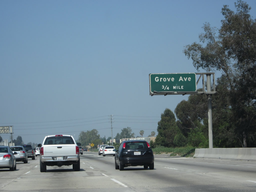 |
The next exit along California 60 west is Exit 36, Grove Avenue (one-half mile). Photo taken 05/05/12. |
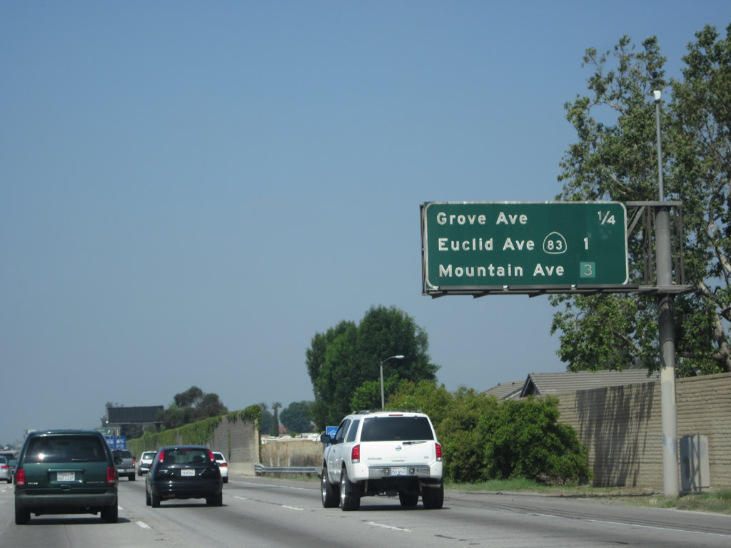 |
This interchange sequence sign along California 60 west provides the distance to the next three exits: Exit 36, Grove Avenue; Exit 35, California 83 (Euclid Avenue); and Exit 34, Mountain Avenue. Photo taken 05/05/12. |
 |
Westbound California 60 reaches Exit 36, Grove Avenue. Photo taken 05/05/12. |
 |
An access point to the carpool (high occupancy vehicle) lane is located just after the Grove Avenue off-ramp. Photo taken 05/05/12. |
 |
The ensuing off-ramp departs in one mile from California 60 west for California 83 (Euclid Avenue). California 83 follows Euclid Avenue from its inception on California 71 north through Ontario and Upland to its end at the point where Euclid Avenue meets 19th Street (former California 30), just shy of the Euclid Avenue bridge over California 210 freeway. The Euclid Avenue corridor is somewhat unique in that much of the route through Ontario and Upland has an extra wide median owing to its prior role for passenger transit via mule carts (a commemorative plaque is located at Euclid Avenue and C Street in Ontario). Photo taken 05/05/12. |
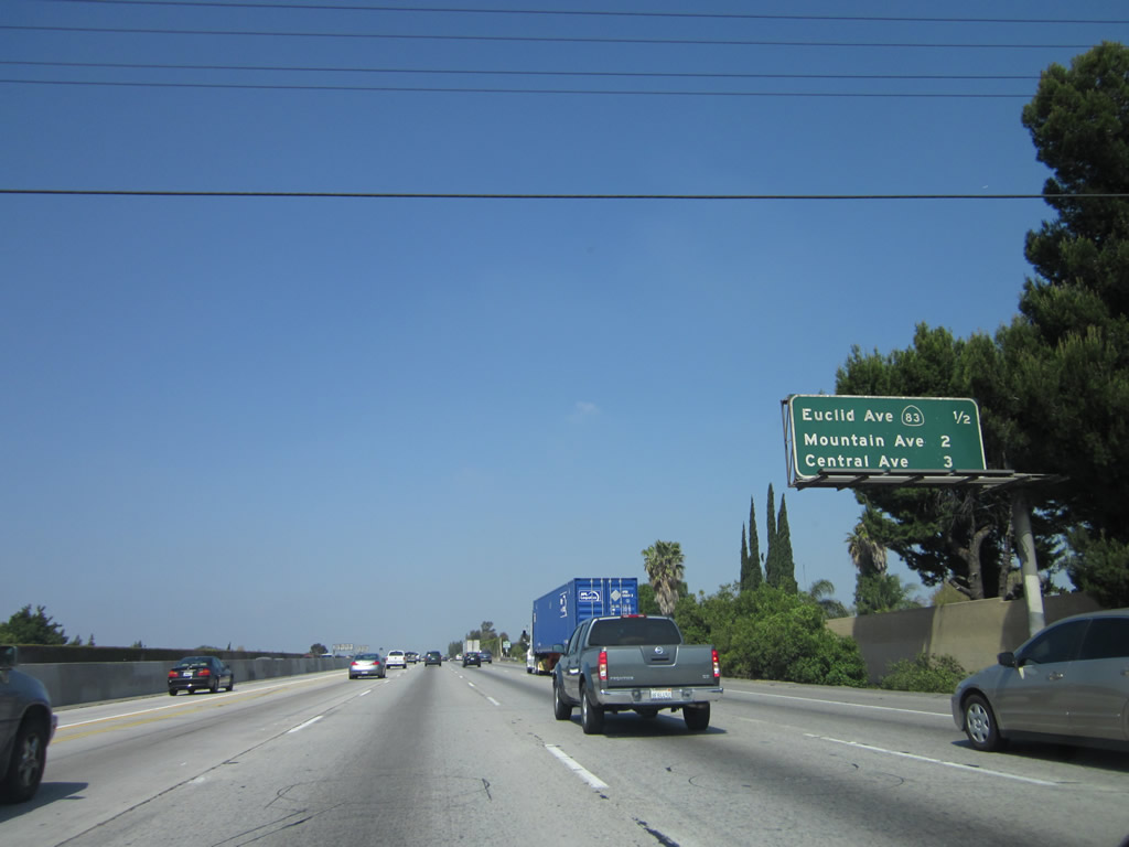 |
This interchange sequence sign along California 60 west provides the distance to the next three exits: Exit 35, California 83 (Euclid Avenue); Exit 34, Mountain Avenue; and Exit 33, Central Avenue. Photo taken 05/05/12. |
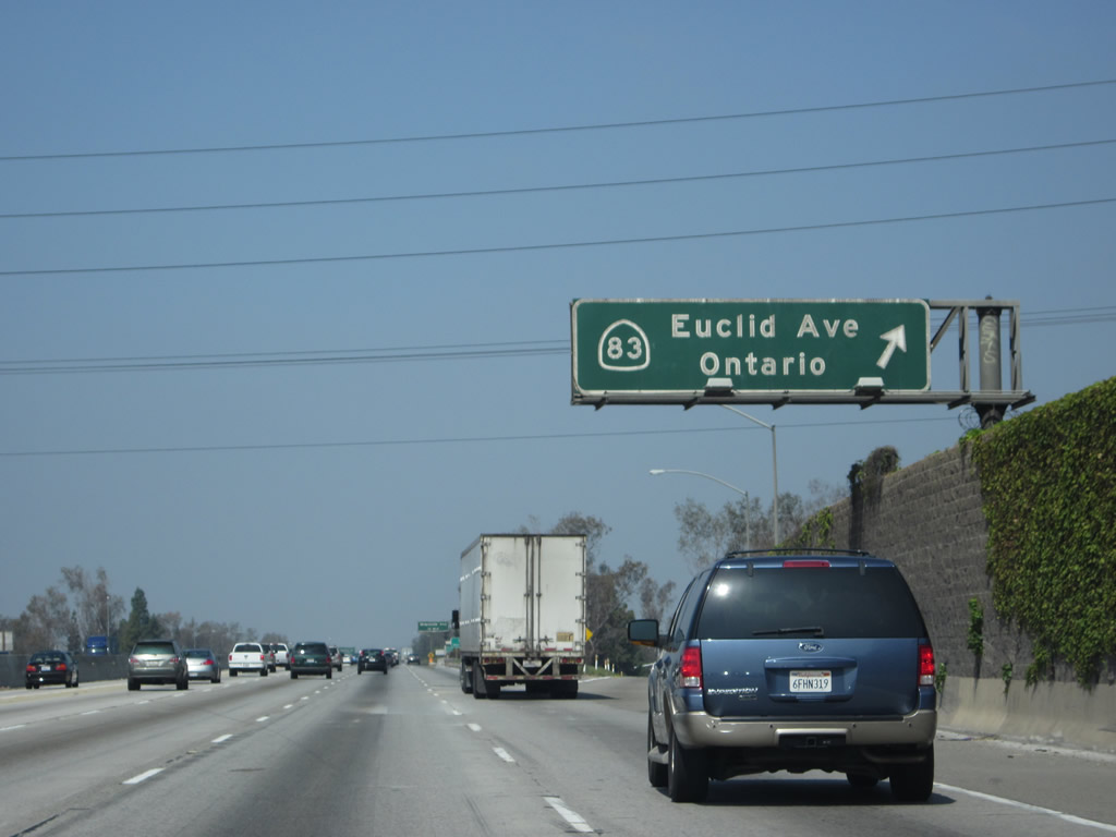 |
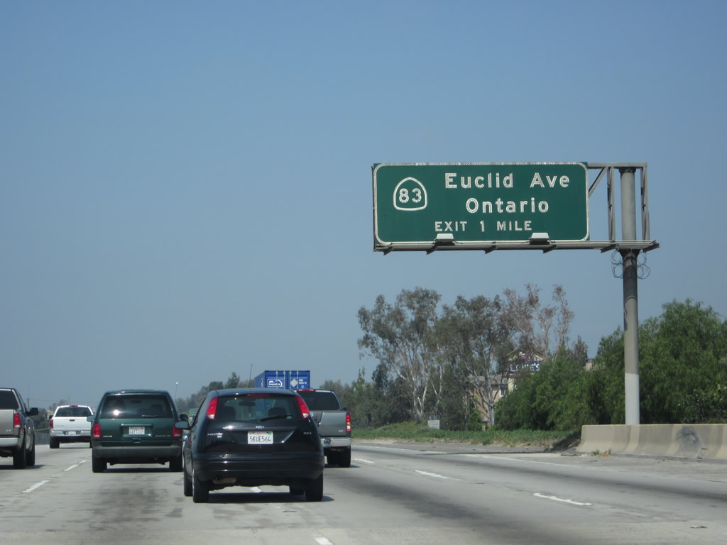
Westbound California 60 reaches Exit 35, California 83 (Euclid Avenue). Use California 83 (Euclid Avenue) south to Chino Airport (formerly Cal Aero Field), a general aviation airport. Photo taken 05/05/12. |
 |
Like many interchanges along this segment of California 60, the interchange with California 83 (Exit 35) is a diamond interchange. Photo taken 05/05/12. |
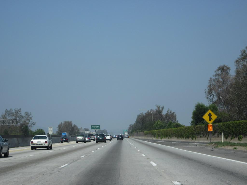 |
We see a rare break in the traffic at the merge point with traffic joining California 60 west from California 83 (Euclid Avenue). Photo taken 05/05/12. |
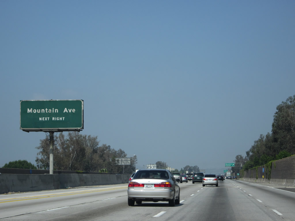 |
The next exit along California 60 west is Exit 34, Mountain Avenue. Around this point, California 60 leaves Ontario and enters the city of Chino, which had a population of 67,168 as of the 2000 Census and incorporated on February 28, 1910. Photo taken 05/05/12. |
 |
Westbound California 60 meets Exit 34, Mountain Avenue. Exit 34 is the first of three interchanges that serve the city of Chino. Photo taken 05/05/12. |
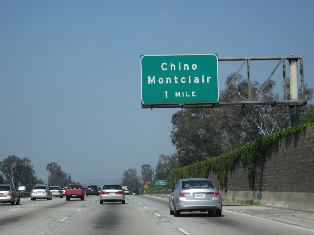 |
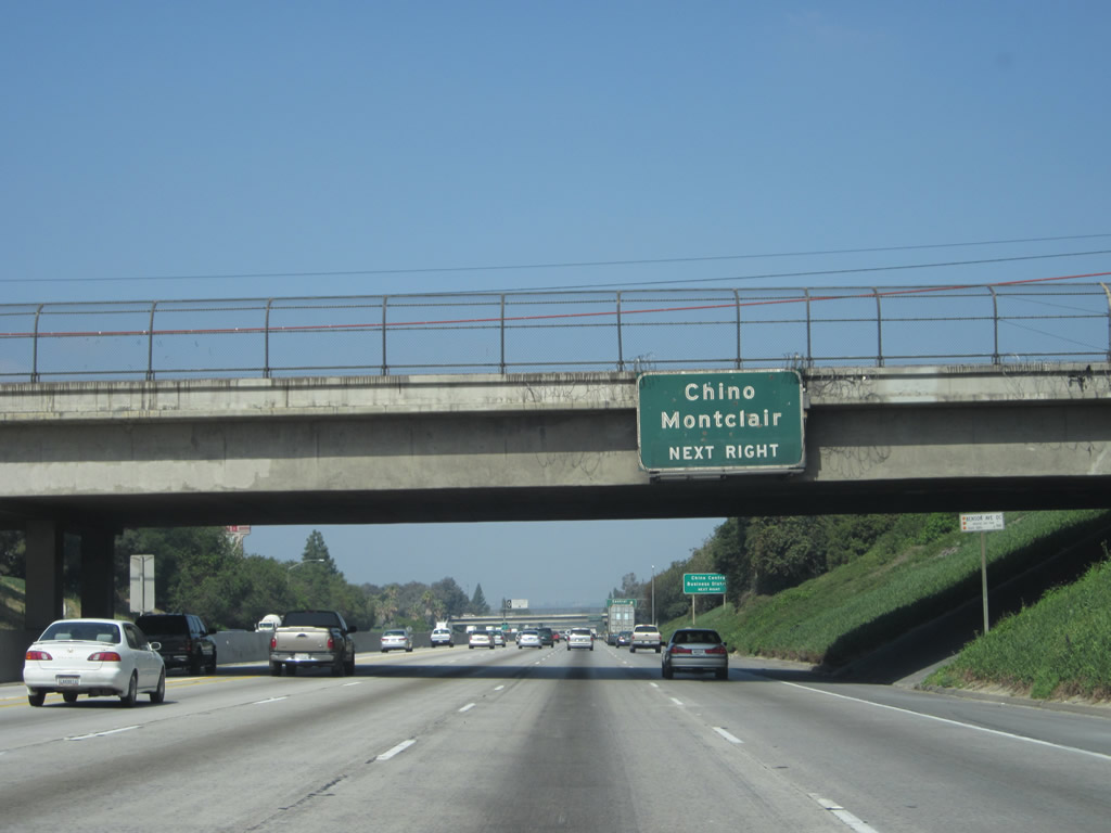
The next exit along California 60 (Pomona Freeway) east is Exit 33, Central Avenue to downtown Chino and Montclair. Photo taken 05/05/12. |
 |
A California 60 west reassurance shield is posted shortly after the on-ramp from Mountain Avenue. Photo taken 05/05/12. |
 |
One of the earlier exit number signs posted along this segment of SR 60 precedes the Central Avenue off-ramp (Exit 33). Photo taken 05/05/12. |
 |
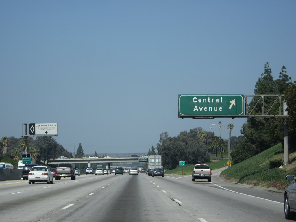
An overhead sign is posted soon thereafter for Exit 33, Central Avenue. Photo taken 05/05/12. |
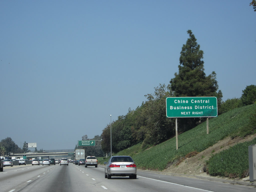 |
Use Exit 33 to the Chino central business district. Central Avenue is a major north-south arterial that travels north to Montclair and a connection to Interstate 10 Exit 49. To the south, Central Avenue serves downtown Chino and ultimately connects with California 71 Exit 7. Photo taken 05/05/12. |
 |
Westbound California 60 meets Exit 33, Central Avenue to downtown Chino and the city of Montclair. Photo taken 05/05/12. |
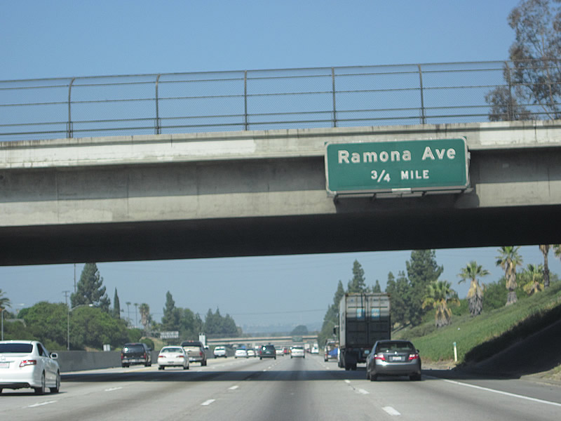 |
Passing under Central Avenue, the next exit along westbound California 60 is Exit 32, Ramona Avenue (0.75 mile). This is the third and final exit to the city of Chino. Photo taken 05/05/12. |
 |
California 60 (Pomona Freeway) west approaches Exit 32, Ramona Avenue to Chino. Photo taken 05/05/12. |
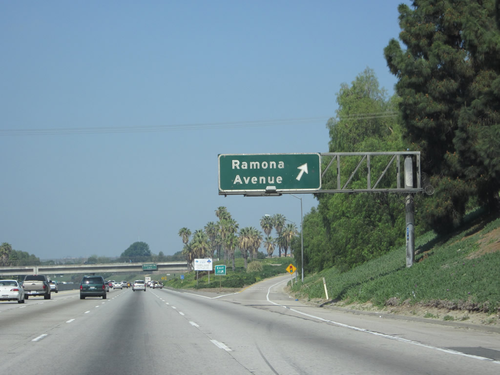 |
Westbound California 60 (Pomona Freeway) reaches Exit 32, Ramona Avenue. Photo taken 05/05/12. |
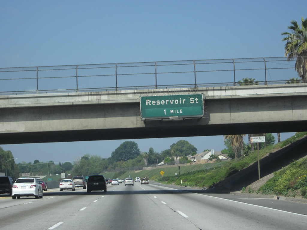 |
The next exit along California 60 (Pomona Freeway) west is Exit 30, Reservoir Street. Photo taken 05/05/12. |
 |
This California 60 reassurance shield is posted after the on-ramp from Ramona Avenue. Photo taken 05/05/12. |
 |
The next two exits along California 60 (Pomona Freeway) west are Exit 30, Reservoir Street and Exit 29B, California 71. Photo taken 05/05/12. |
 |
These three exits all serve the city of Pomona. At the Reservoir Street interchange, California 60 will leave Chino and enter the city of Pomona in Los Angeles County. The city of Pomona was home to 149,473 people as of the 2000 Census and was incorporated on January 6, 1888. Pomona is one of the larger cities in Los Angeles County and is the convergence point of several freeways, including Interstate 10, California 57, California 60, and California 71. Photo taken 05/05/12. |
 |
California 60 west approaches Exit 30, Reservoir Street; the interchange is the first to serve the city of Pomona and Los Angeles County. Photo taken 05/05/12. |
 |
A dynamic message sign is posted just prior to the Reservoir Street off-ramp. Note the towering soundwall on the north side of the freeway. Photo taken 05/05/12. |
 |
The Chino Hills lie ahead as California 60 continues west into Pomona. Photo taken 05/05/12. |
 |
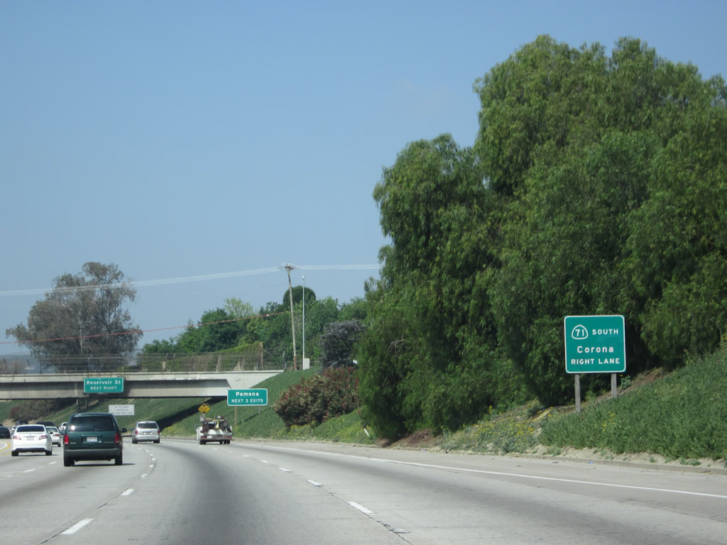
Westbound California 60 (Pomona Freeway) reaches Exit 30, Reservoir Street. The following interchange will be Exit 29B, California 71, a freeway that travels southeast through Chino Hills toward Corona and northwest through Pomona to the Kellogg Interchange with Interstate 10 (San Bernardino Freeway) and California 57 (Orange Freeway). Photo taken 05/05/12. |
 |
Beyond the gore point to Exit 30 (Reservoir Street), westbound California 60 leaves San Bernardino County and the city of Chino and enters both Pomona and Los Angeles County. Photo taken 05/05/12. |
 |
The next three exits along California 60 (Pomona Freeway) west are Exit 29B, California 71 north to Interstate 10 and California 57 and south to Corona; Exit 29A, Garey Avenue; and Exit 28, Phillips Ranch Road. Photo taken 05/05/12. |
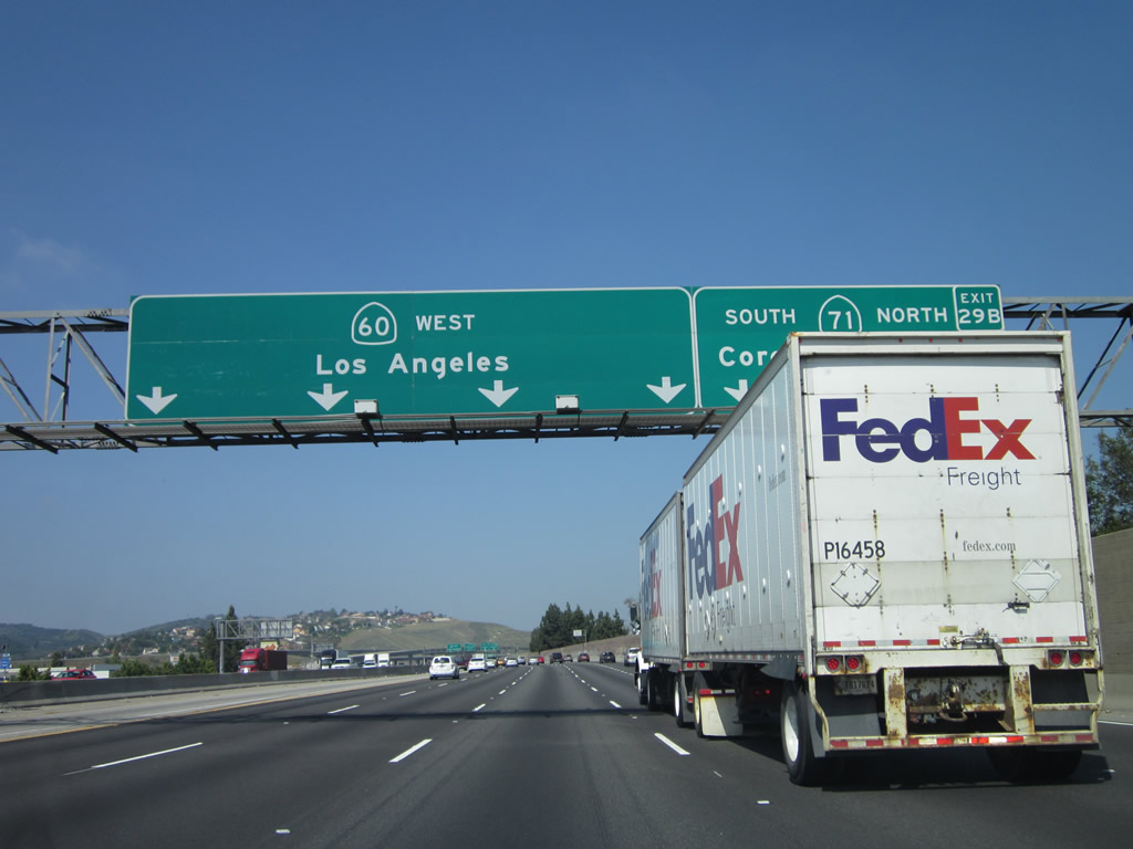 |
A pull-through sign advises that the left four lanes (plus HOV) will continue west along California 60 (Pomona Freeway) toward Los Angeles, while the right two lanes will connect to Exit 29B, California 71 north to San Dimas and south to Corona. Photo taken 05/05/12. |
 |
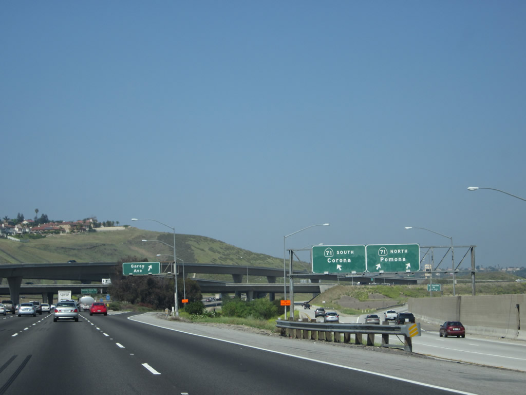
Westbound California 60 (Pomona Freeway) reaches Exit 29B, California 71. This freeway corridor travels in a northwest-southeast direction, passing from Corona northwest to Pomona. The last segment of California 71 between California 60 and Interstate 10 is an expressway (with traffic signals), but construction is planned to upgrade this portion of state highway into freeway standards. The following off-ramp connects to Exit 29A, Garey Avenue. Photo taken 05/05/12. |
 |
The off-ramp to California 71 splits, with the left lane connecting to southbound and the right lane linking to northbound. Photo taken 05/05/12. |
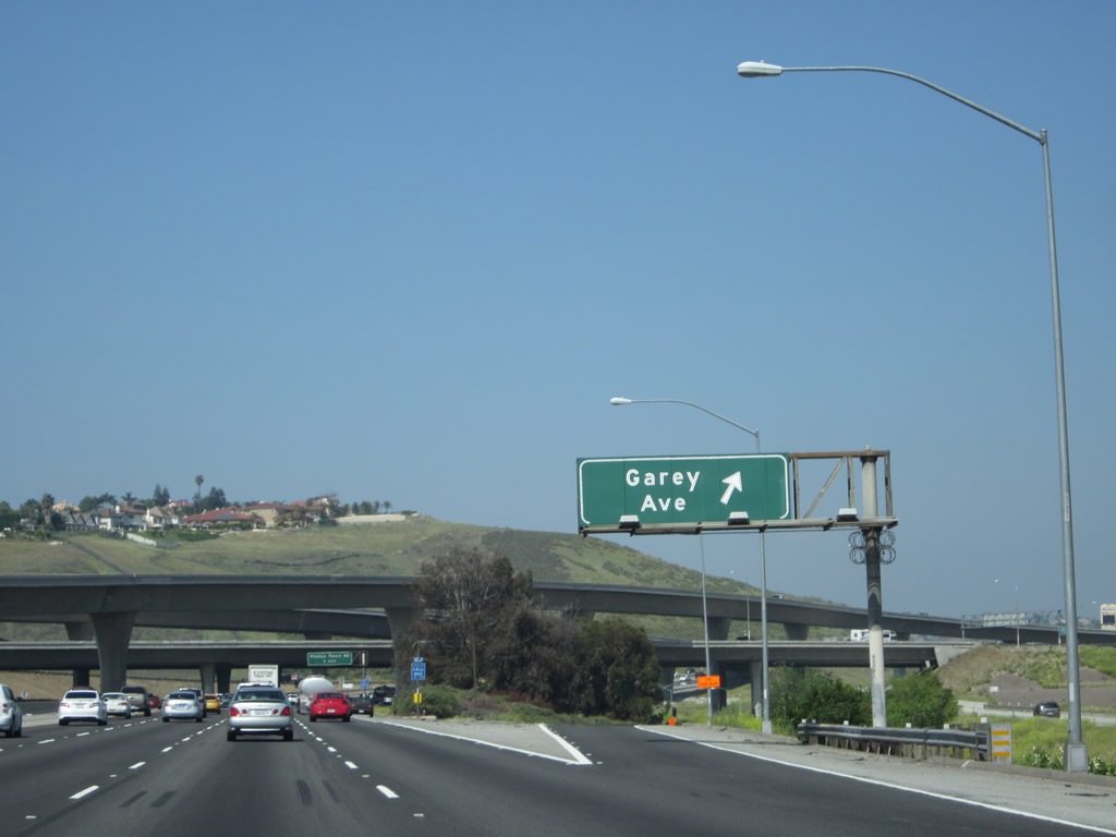 |
Westbound California 60 (Pomona Freeway) reaches Exit 29A, Garey Avenue. Photo taken 05/05/12. |
 |
California 60 (Pomona Freeway) passes through the California 71 interchange. Photo taken 05/05/12. |
 |
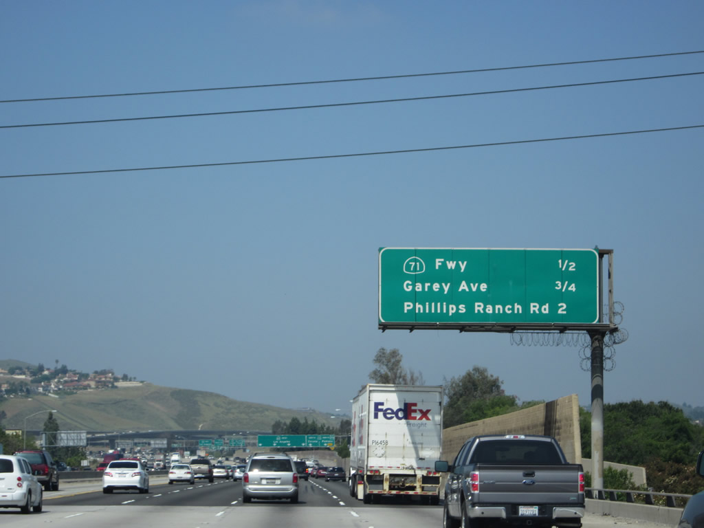
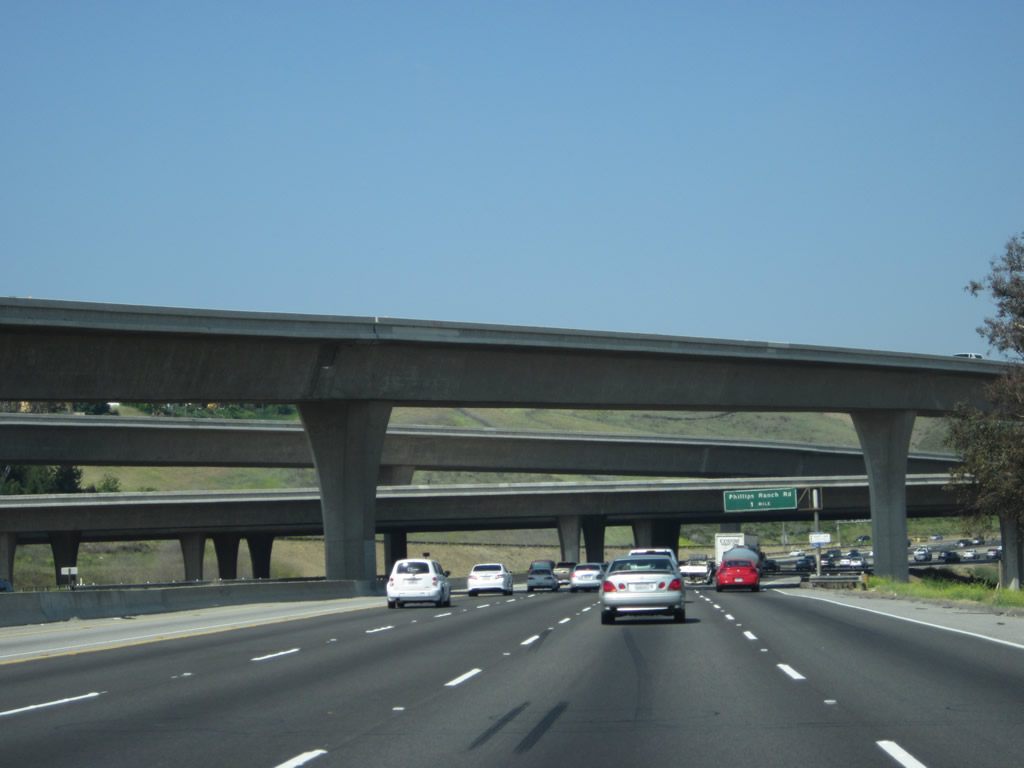
The next exit along California 60 (Pomona Freeway) west is Exit 28, Phillips Ranch Road (one mile). Photo taken 05/05/12. |
 |
This view looks up at the northbound lanes of California 71 as seen from westbound California 60. Photo taken 05/05/12. |
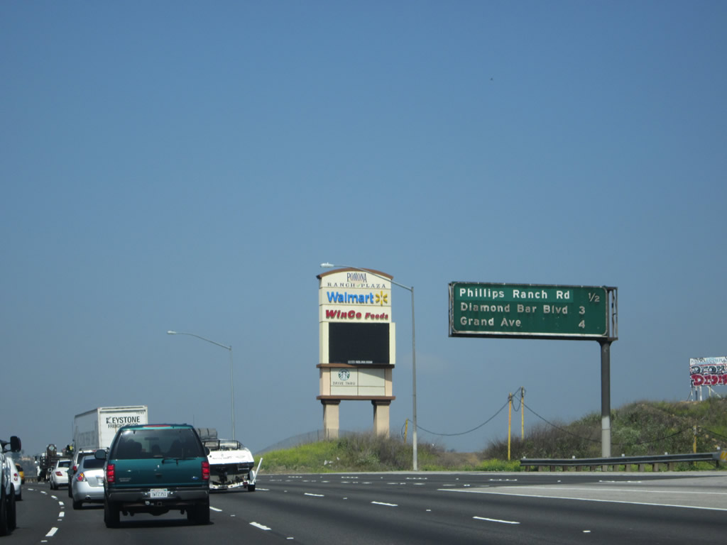 |
This mileage sign provides the distance to the next three exits along California 60 (Pomona Freeway) west: Exit 28, Phillips Ranch Road; Exit 26, Diamond Bar Boulevard to California 57 (Orange Freeway) north; and Exit 24B, Grand Avenue to Diamond Bar. Photo taken 05/05/12. |
 |
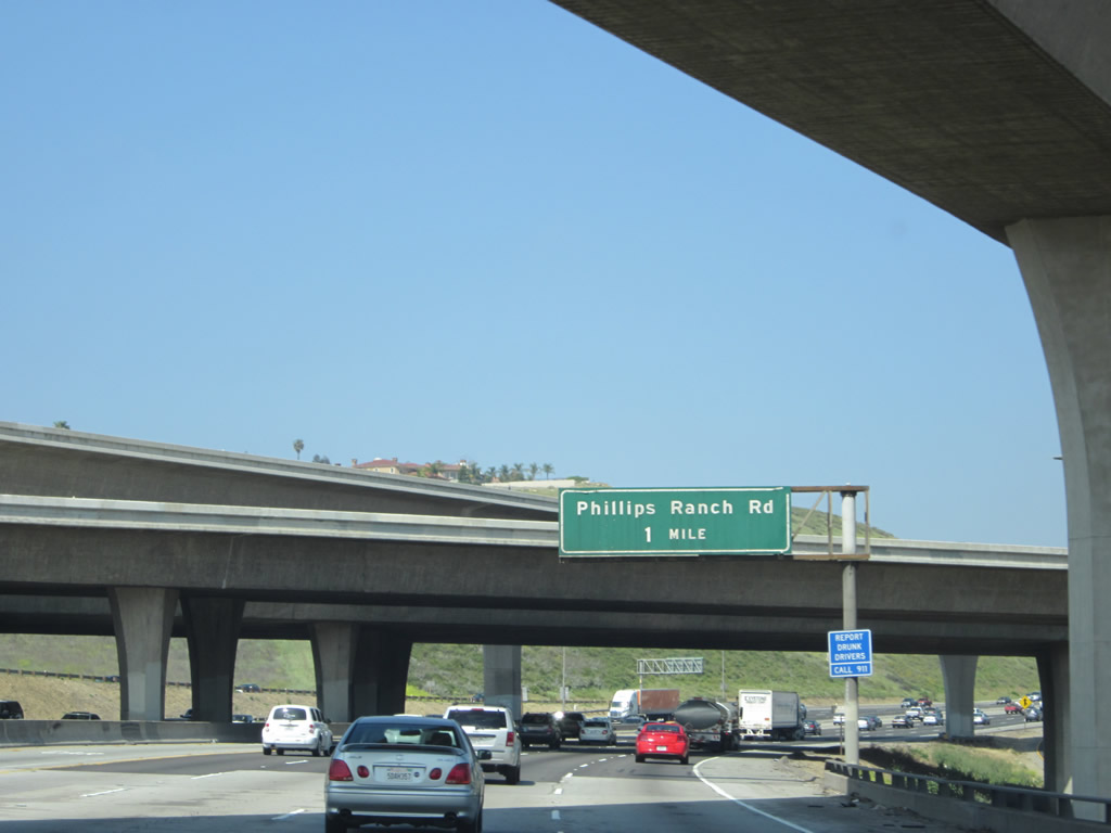
Use Exit 28 to the city of Chino Hills (population of 74,799 as of the 2010 Census and incorporated on December 1, 1991), which is located in San Bernardino County. California 71 provides the primary access to Chino Hills, but so does Phillips Ranch Road. Photo taken 05/05/12. |
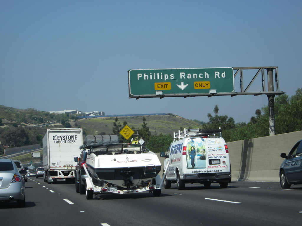 |
The right lane of California 60 (Pomona Freeway) west becomes exit only for Exit 28, Phillips Ranch Road. Photo taken 05/05/12. |
 |
Westbound California 60 (Pomona Freeway) reaches Exit 28, Phillips Ranch Road. The overhead sign normally found here was missing when we passed through in 2012. Photo taken 05/05/12. |
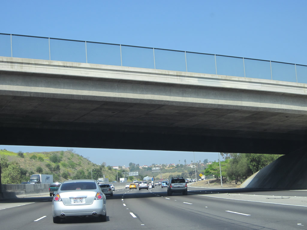 |
California 60 (Pomona Freeway) passes under the Phillips Ranch Road overpass. Photo taken 05/05/12. |
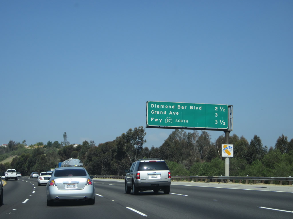 |
This mileage sign provides the distance to the next three exits along California 60 (Pomona Freeway) west: Exit 26, Diamond Bar Boulevard to California 57 (Orange Freeway) north; Exit 24B, Grand Avenue to Diamond Bar; and Exit 24A, California 57 (Orange Freeway) south to Anaheim and Santa Ana. Photo taken 05/05/12. |
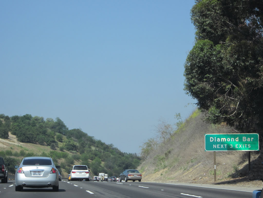 |
The next three exits along California 60 (Pomona Freeway) west all serve the city of Diamond Bar: Exit 26, Diamond Bar Boulevard to California 57 (Orange Freeway) north; Exit 24B, Grand Avenue to Diamond Bar; and Exit 24A, California 57 (Orange Freeway) south to Anaheim and Santa Ana. Photo taken 05/05/12. |
 |
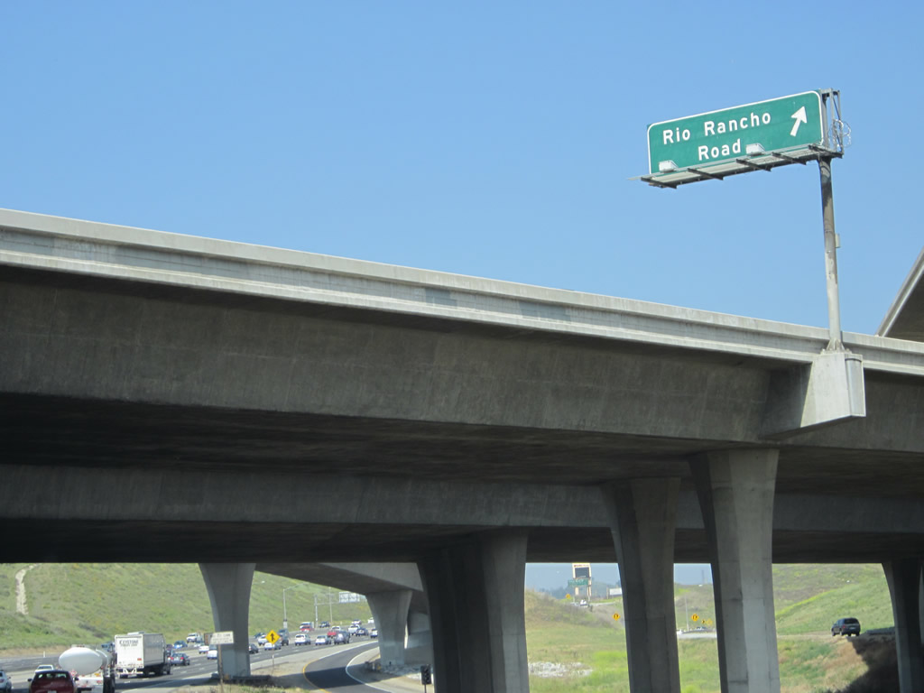
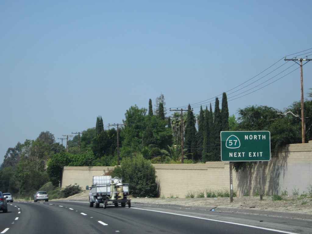
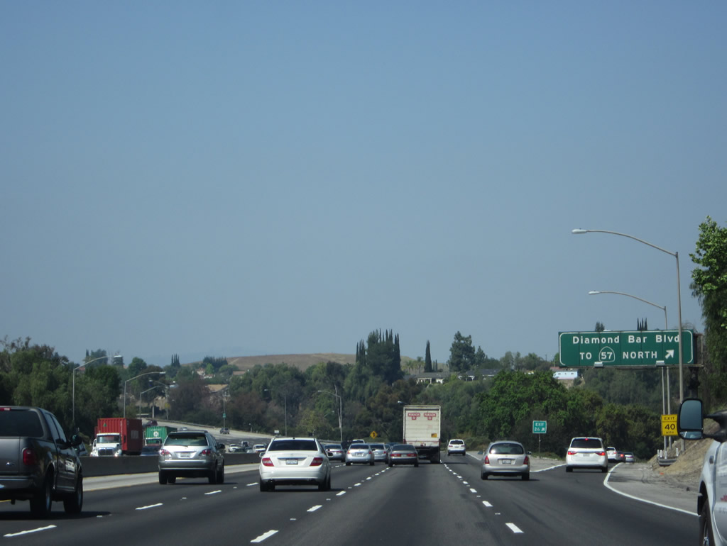
To California 57 north, take California 60 (Pomona Freeway) west to Exit 26, Diamond Bar Boulevard, then follow Diamond Bar Boulevard north to link to California 57 (Orange Freeway) north. After Exit 26, California 57 south and California 60 west will merge together to share pavements for a brief time, then separate again at Exit 24A. Photo taken 05/05/12. |
 |
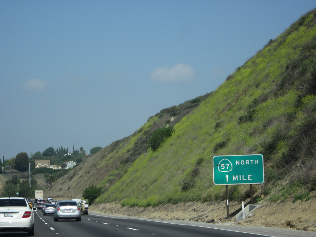
California 60 (Pomona Freeway) west approaches Exit 26, Diamond Bar Boulevard to California 57 (Orange Freeway) north. A California 57 shield was affixed to this porcelain enamel overhead guide sign. Photo taken 05/05/12. |
 |
 |
The HOV lane continues as the freeway lowers in elevation through the Chino Hills to the Diamond Bar merge with California 57 south. Photos taken 05/05/12. |
 |
Westbound California 60 (Pomona Freeway) reaches Exit 26, Diamond Bar Boulevard to California 57 (Orange Freeway) north. The following exit will be Exit 24B, Grand Avenue to Diamond Bar. Photo taken 05/05/12. |
 |
California 60 (Pomona Freeway) proceeds west into the city of Diamond Bar. A former cattle ranch (Diamond Bar Ranch), much of the city was master planned and developed through the 1960s, 1970s, and 1980s. Population increased as the Pomona Freeway opened, and Diamond Bar incorporated as a city on April 18, 1989. The population of Diamond Bar was 56,287 as of the 2000 Census. Photo taken 05/05/12. |
 |
A California 60 reassurance shield is posted after the on-ramp from Diamond Bar Boulevard. Photo taken 05/05/12. |
 |
The next exit along California 60 west will be Exit 24B, Grand Avenue. Photo taken 05/05/12. |
 |
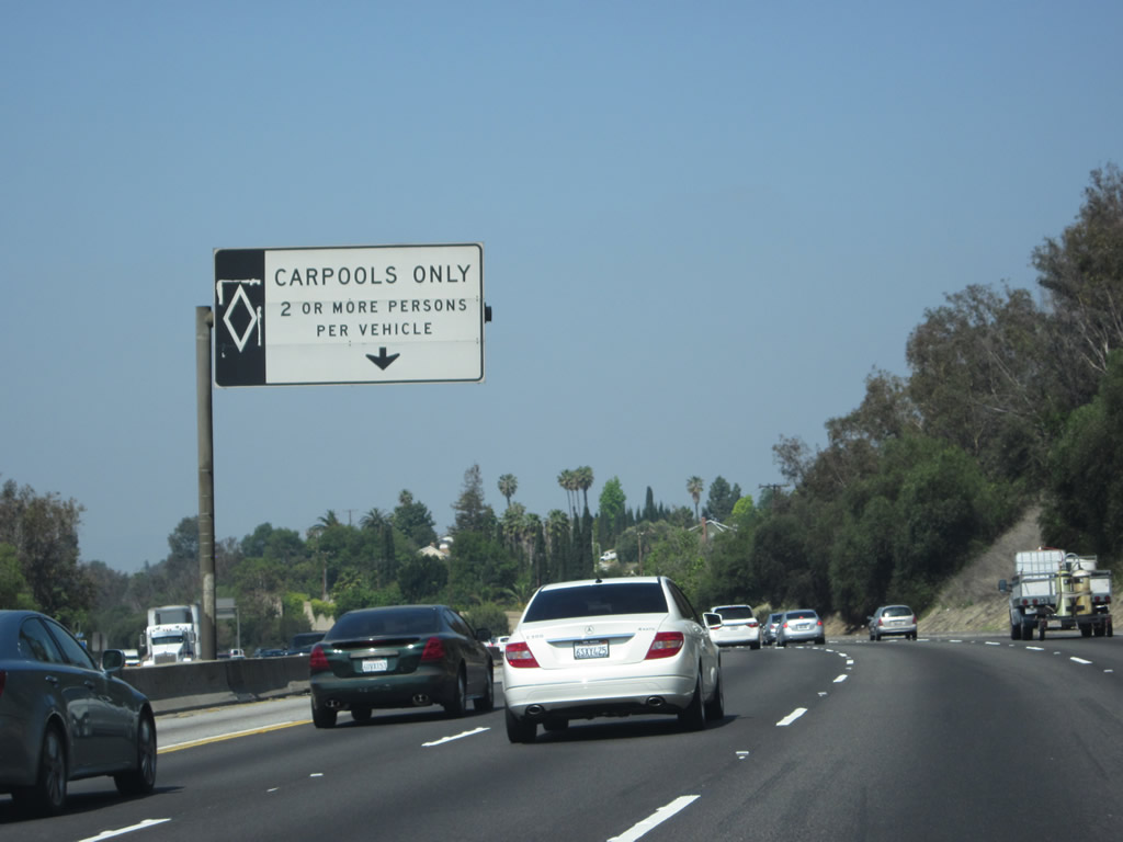
Traffic from California 57 south merges onto California 60 west; the two routes will be merged briefly. Watch for traffic crossing lanes ahead on this very busy, wide freeway. Photo taken 05/05/12. |

Page Updated October 5, 2012.
|
About Contact Glossary |
In The News Testimonials Interstate Guide |
Social Media:
 |
|
© 2000-23 AARoads.com | All Rights Reserved | Privacy Policy / Terms of Use
|
||