| California 73 north |
|
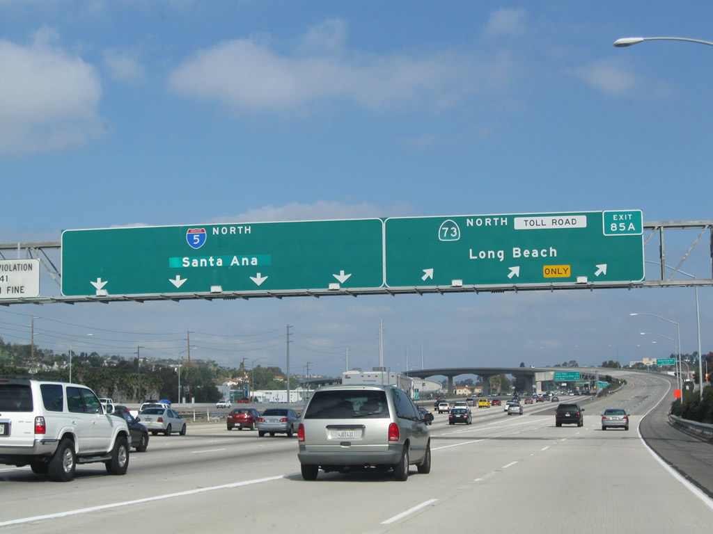
Interstate 5 north and California 73 (San Joaquin Hills Transportation Corridor) north split at Exit 85A. Three lanes depart to the right, connecting directly onto California 73 north. Photo taken 01/31/10. |
|
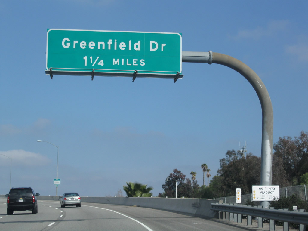
Leaving Interstate 5 north, the first exit from northbound California 73 (San Joaquin Hills Transportation Corridor) is Exit 2, Greenfield Drive. The connection to Greenfield Drive from Interstate 5 via California 73 does not require a toll. Photo taken 01/31/10. |
|
California 73 north passes over the main lanes of Interstate 5 on the transition ramp. Photo taken 01/31/10. |
|
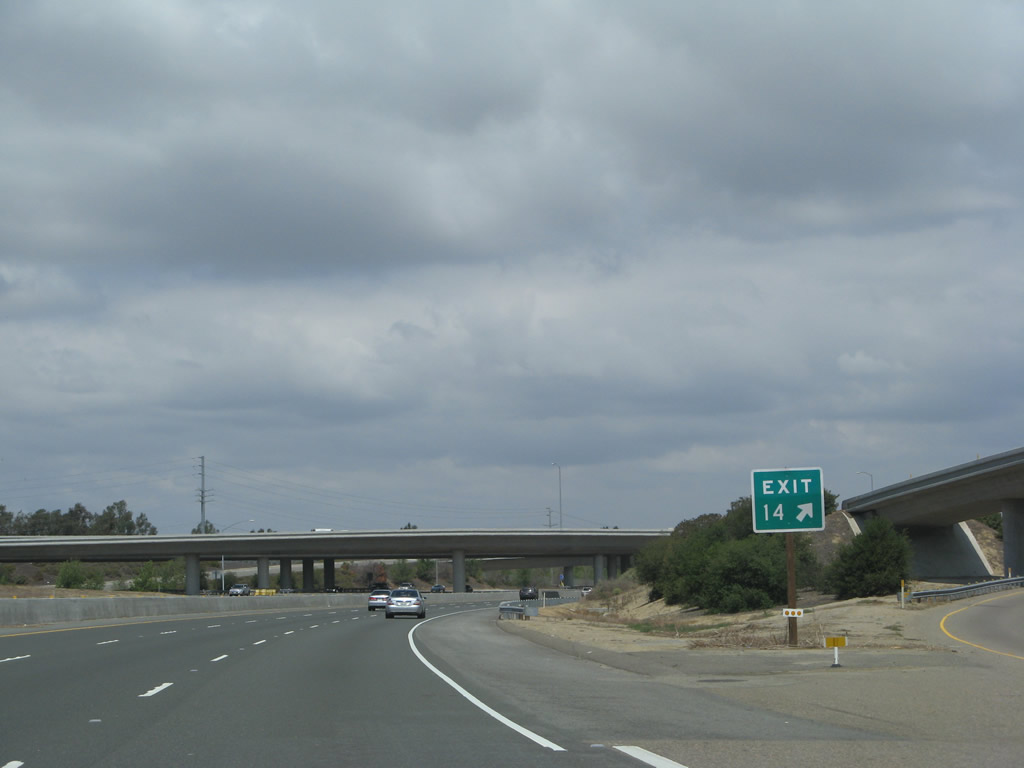
The next exit along California 73 (San Joaquin Hills Transportation Corridor) is Exit 2, Greenfield Drive. This exit serves Laguna Niguel and Laguna Hills. Photo taken 01/31/10. |
|
Immediately thereafter is the first reassurance shield for California 73 north along the San Joaquin Hills Transportation Corridor. Photo taken 01/31/10. |
|
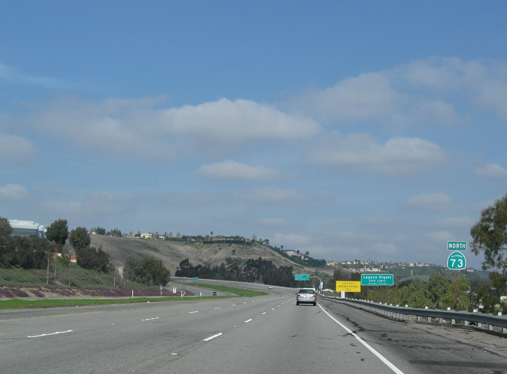
California 73 enters the city of Laguna Niguel (population 61,891 as of 2000 Census and incorporated on December 1, 1989). Photo taken 01/31/10. |
|
Greenfield Drive is the last exit before toll. Photo taken 01/31/10. |
|
This mileage sign provides the distance to the next three exits along California 73 north: Exit 2, Greenfield Drive; Exit 3, La Paz Road; and Exit 4, Aliso Creek Road. Photo taken 01/31/10. |
|
In the center median is the next advance sign for Exit 2, Greenfield Drive from California 73 north. Photo taken 01/31/10. |
|
Northbound California 73 (San Joaquin Hills Transportation Corridor) reaches Exit 2, Greenfield Drive. The next interchange is Exit 3, La Paz Road. Photo taken 04/21/07. |
|
California 73 leaves Laguna Niguel and enters the city of Laguna Hills. Home to 31,178 people as of the 2000 Census, Laguna Hills is located north of Laguna Niguel, east of Mission Viejo, west of Laguna Woods, and south of Lake Forest. Photo taken 01/31/10. |
|
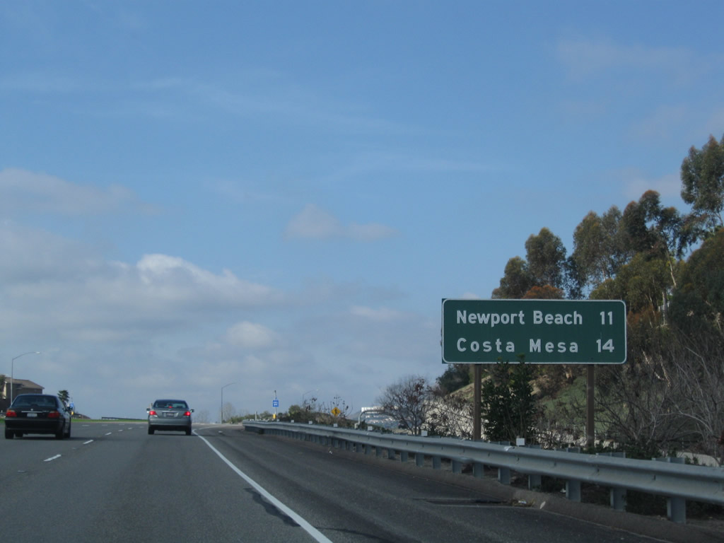
This mileage sign provides the distance to Newport Beach (11 miles) and Costa Mesa (14 miles) via California 73 north. Photo taken 01/31/10. |
|
The next exit along California 73 north is Exit 3, La Paz Road. Photo taken 01/31/10. |
|
Use La Paz Road to Laguna Niguel Regional Park. Photo taken 01/31/10. |
|
The next three exits of California 73 north all serve the city of Aliso Viejo. Photo taken 01/31/10. |
|
Northbound California 73 (San Joaquin Hills Transportation Corridor) reaches Exit 3, La Paz Road. The next exit is Exit 4, Aliso Creek Road. Photo taken 01/31/10. |
|
Ramp weaving allows the motorists to exit and enter the toll road without crossing each other. This view is taken at the La Paz Road off-ramp. Photo taken 01/31/10. |
|
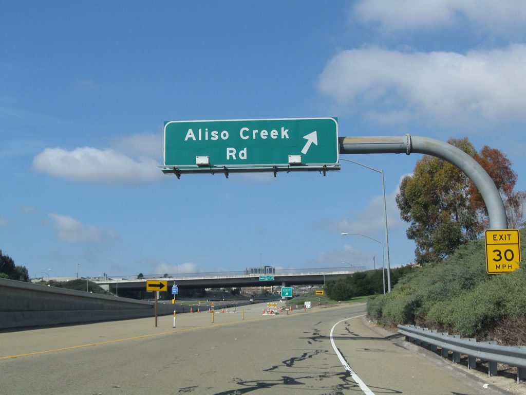
The next exit along California 73 (San Joaquin Hills Transportation Corridor) north is Exit 4, Aliso Creek Road. Use Aliso Creek Road to Aliso and Wood Canyons Wilderness Park. Photo taken 01/31/10. |
|
California 73 (San Joaquin Hills Transportation Corridor) leaves Laguna Hills and enters the city of Aliso Viejo. The city had a population of 40,166 as of the 2000 Census; Aliso Viejo was incorporated on July 1, 2001. Photo taken 01/31/10. |
|
Aliso Creek Road is a curving arterial that connects to Aliso Viejo Parkway to the north and Pacific Park Drive and Alicia Parkway to the south, ending at Moulton Parkway at the southern end in Laguna Niguel and at El Toro Road in Aliso Viejo at the northern end. Photo taken 01/31/10. |
|
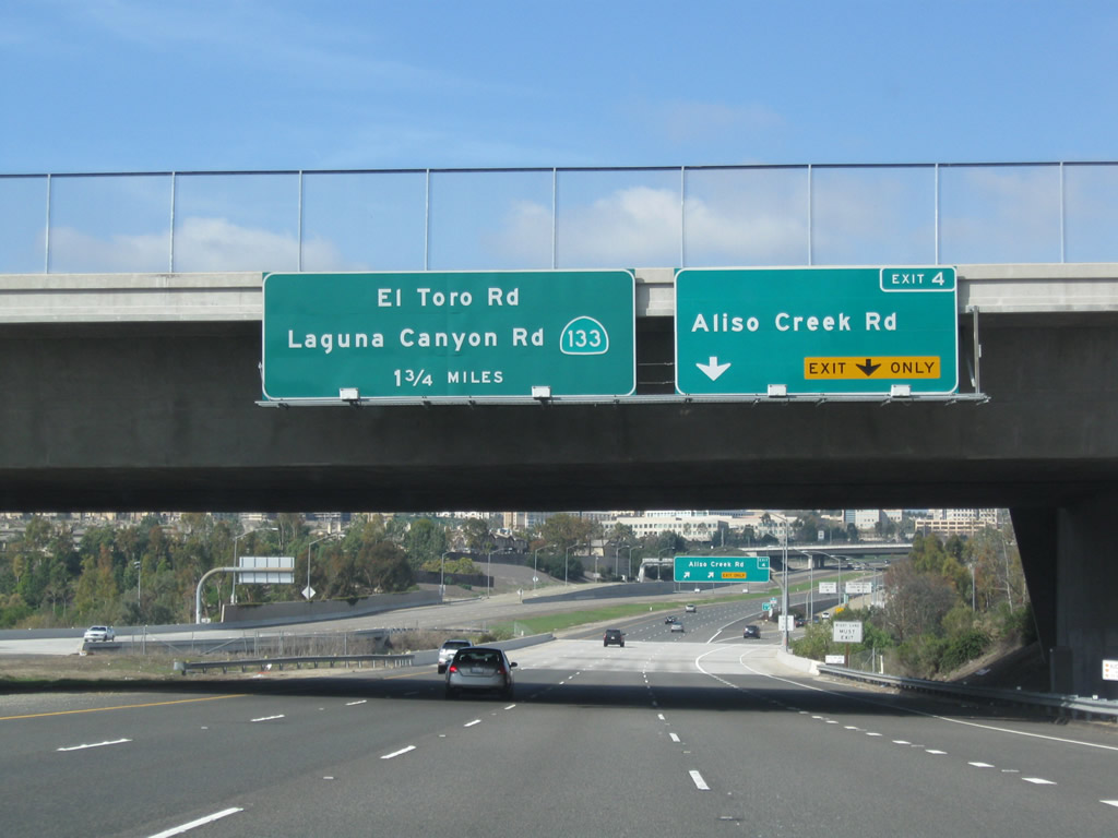
The next exit along California 73 (San Joaquin Hills Transportation Corridor) north is Exit 4, Aliso Creek Road. The second exit is Exit 6, California 133 (Laguna Canyon Road) and Orange County S-18 (El Toro Road). Photo taken 01/31/10. |
|
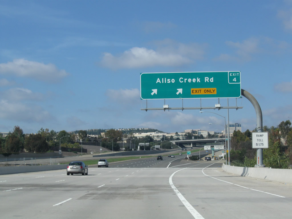
Northbound California 73 (San Joaquin Hills Transportation Corridor) reaches Exit 4, Aliso Creek Road to Aliso Viejo. Photo taken 01/31/10. |
|
Now on the off-ramp to Exit 4, Aliso Creek Road, the ramp was originally constructed to divide into a collector distributor lane format. However, the return ramp to California 73 north is not open. A toll booth lies ahead. Photo taken 01/31/10. |
|
The off-ramp approaches the traffic signal for Aliso Creek Road; turn left for Aliso and Wood Canyons Wilderness Park and Soka University. Photo taken 01/31/10. |
|
The next exit along California 73 (San Joaquin Hills Transportation Corridor) north is Exit 6, California 133 (Laguna Canyon Road) and Orange County S-18 (El Toro Road). Photo taken 04/21/07. |
|
Use California 133 (Laguna Canyon Road) southwest to Laguna Beach or northeast to Irvine. Orange County S-18 (El Toro Road) travels north to Laguna Woods and Lake Forest. Photo taken 04/21/07. |
|
California 73 approaches the Glenwood Drive overpass. While there is no direct access from California 73 north to Glenwood Drive, traffic from Glenwood Drive will join the toll road ahead. After passing under Glenwood Drive, California 73 will see a six percent grade downhill into Aliso and Wood Canyons Regional Park. Photo taken 04/21/07. |
|
California 73 passes under Glenwood Drive. The right two lanes of California 73 connect to Exit 6, California 133 (Laguna Canyon Road) and Orange County S-18 (El Toro Road). Photo taken 04/21/07. |
|
A California 73 south reassurance shield is posted after the on-ramp from Glenwood Drive. Photo taken 04/21/07. |
|
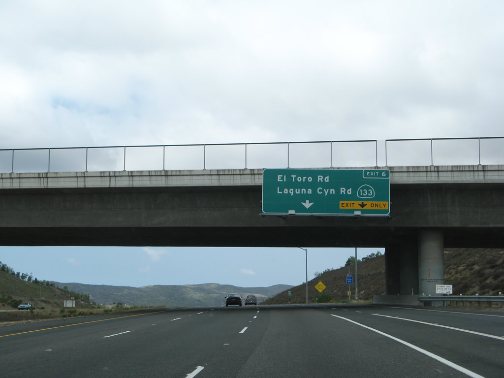
Northbound California 73 (San Joaquin Hills Transportation Corridor) reaches Exit 6, California 133 (Laguna Canyon Road) and Orange County S-18 (El Toro Road). The off-ramp first connects to El Toro Road (Orange County S-18) at a traffic signal, then continues (as an on-ramp/connecting ramp) to California 133. Photo taken 04/21/07. |
|
|
|
This series of pictures follows California 73 (San Joaquin Hills Transportation Corridor) north as it passes through the El Toro Road and California 133 (Laguna Canyon Road) interchange. All views are from the main lanes; the toll road (consisting of both the main lanes and the Exit 6 off-ramp) descends into the canyon. The third picture was taken from the El Toro Road overpass. Photos taken 04/21/07. |
|
Remember the mile-long off-ramp for Exit 6? After a traffic signal at El Toro Road, oncoming traffic to California 73 and exiting traffic to California 133 must choose their ramp. This view looks up from the main lanes toward the mile-long off-ramp. Photo taken 04/21/07. |
|
Northbound California 73 curves north as it prepares to pass over California 133 (Laguna Canyon Road). Photo taken 04/21/07. |
|
California 73 curves north as it passes over California 133 (Laguna Canyon Road). Two new lanes will soon merge onto California 73 from the right. These lanes join the freeway from El Toro Road (Orange County S-18) and California 133. Photo taken 04/21/07. |
|
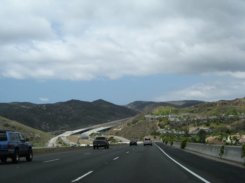
Climbing out of the canyon and leaving behind the lengthy Exit 6 interchange, southbound California 73 (San Joaquin Hills Transportation Corridor) gains elevation. The toll road will pass through lands partially within the Laguna Coast Wilderness Park and the Nature Conservancy (of Irvine). California 73 will not see significant residential development until it reaches Exit 11, Newport Coast Drive. Photo taken 04/21/07. |
|
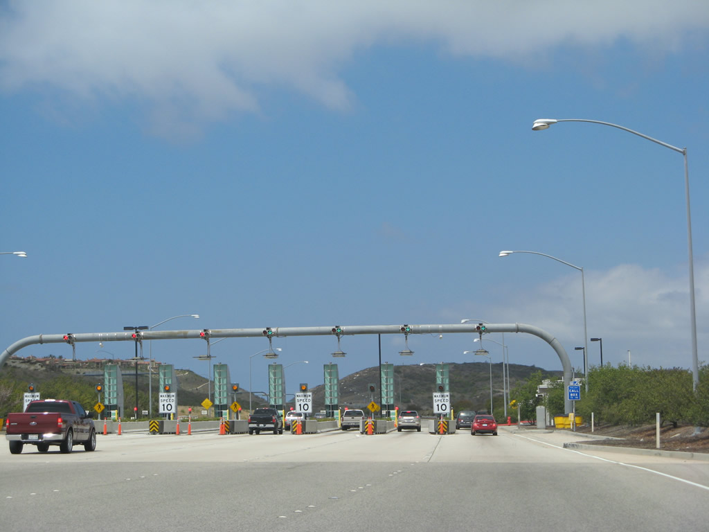
At the top of the upgrade is the only California 73 mainline toll plaza: Catalina View Toll Plaza. Those with FasTrak may use the left lanes for open road tolling (electronic transponder allows customers to pass through the plaza at freeway speeds). Those with cash should stay right to enter the plaza. Photo taken 04/21/07. |
|
A climbing lane allows more room for slower traffic to ascend the grade in the San Joaquin Hills. Photo taken 04/21/07. |
|
|
|
Northbound California 73 approaches Catalina View Toll Plaza. Those with FasTrak may use the left lanes for open road tolling (electronic transponder allows customers to pass through the plaza at freeway speeds). Those with cash should stay right to enter the plaza. Photos taken 04/21/07. |
|
|
|
|
The FasTrak and cash toll lanes merge back together again after the Catalina View Toll Plaza. Photo taken 04/21/07. |
|
California 73 enters the city of Irvine. Home to 143,072 people as of the 2000 Census, Irvine has grown substantially as the city continues to develop. Incorporated on December 28, 1971, Irvine is mostly a master planned community and is home to the University of California at Irvine and the Irvine Spectrum Center nestled between Interstate 5 and Interstate 405. Photo taken 04/21/07. |
|
As we approach the top of the grade, the fourth (climbing) lane comes to an end. After rounding the curve, the Pacific Ocean and Newport Beach will come into view. Photo taken 04/21/07. |
|
The next exit along California 73 (San Joaquin Hills Transportation Corridor) north is Exit 11, Newport Coast Drive (one mile). Photo taken 04/21/07. |
|
An outstanding view at the top of the grade in the San Joaquin Hills makes most of Newport Beach and the ocean visible for northbound travelers. Ahead is the long descent into Newport Beach. Photo taken 04/21/07. |
|
Between the toll plaza and the Jamboree Road interchange, California 73 serves as the boundary between the cities of Irvine (to the northeast) and Newport Beach (to the southwest). At MacArthur Boulevard and Jamboree Road (Exit 14), California 73 will fully enter the city of Newport Beach. The next four exits serve both cities: Exit 11, Newport Coast Drive; Exit 12, Bonita Canyon Drive; Exit 13, Bison Avenue; and Exit 14, MacArthur Boulevard and Jamboree Road. Photo taken 04/21/07. |
|
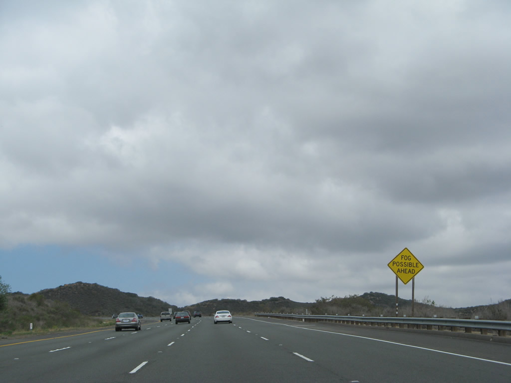
Low clouds and fog were in the process of burning off on this late spring morning. This kind of weather phenomenon is fairly common in Southern California. Photo taken 04/21/07. |
|
This mileage sign along California 73 (San Joaquin Hills Transportation Corridor) provides the distance to the next three exits: Exit 11, Newport Coast Drive; Exit 12, Bonita Canyon Drive; and Exit 13, Bison Avenue. Photo taken 04/21/07. |
|
Descending from the San Joaquin Hills, urbanized development comes into view in Newport Beach and Irvine. Use Exits 11-12-13-14 to the University of California at Irvine. Photo taken 04/21/07. |
|
The next exit along California 73 is Exit 11, Newport Coast Drive. Photo taken 04/21/07. |
|
Northbound California 73 (San Joaquin Hills Transportation Corridor) reaches Exit 11, Newport Coast Drive. Photo taken 04/21/07. |
|
The next exit along California 73 (San Joaquin Hills Transportation Corridor) north is Exit 12, Bonita Canyon Drive. Use Bonita Canyon Drive east to the University of California at Irvine and the Turtle Rock community within the city of Irvine. To the west, Bonita Canyon Drive leads to MacArthur Boulevard, which in turn travels south to the Newport Center and Corona del Mar neighborhoods within the city of Newport Beach. Photo taken 04/21/07. |
|
This mileage sign along California 73 (San Joaquin Hills Transportation Corridor) north provides the distance to the next three exits: Exit 12, Bonita Canyon Drive; Exit 13, Bison Avenue; and Exit 14, MacArthur Boulevard and Jamboree Road. Photo taken 04/21/07. |
|
The right lane of California 73 (San Joaquin Hills Transportation Corridor) north becomes exit only for Exit 12, Bonita Canyon Drive. Photo taken 04/21/07. |
|
Northbound California 73 (San Joaquin Hills Transportation Corridor) north reaches Exit 12, Bonita Canyon Drive. The next exit along northbound is Exit 13, Bison Avenue. Photo taken 04/21/07. |
|
As traffic from Bonita Canyon Drive prepares to merge onto California 73 (San Joaquin Hills Transportation Corridor) north, a toll booth is located on the on-ramp prior to joining the toll road. Photo taken 04/21/07. |
|
A retaining wall separates the freeway from nearby open space. Photo taken 04/21/07. |
|
This mileage sign along California 73 (San Joaquin Hills Transportation Corridor) north provides the distance to the next two exits: Exit 13, Bison Avenue and Exit 14, MacArthur Boulevard and Jamboree Road. MacArthur Boulevard serves John Wayne Airport, which is Orange County's primary commercial airport. Photo taken 04/21/07. |
|
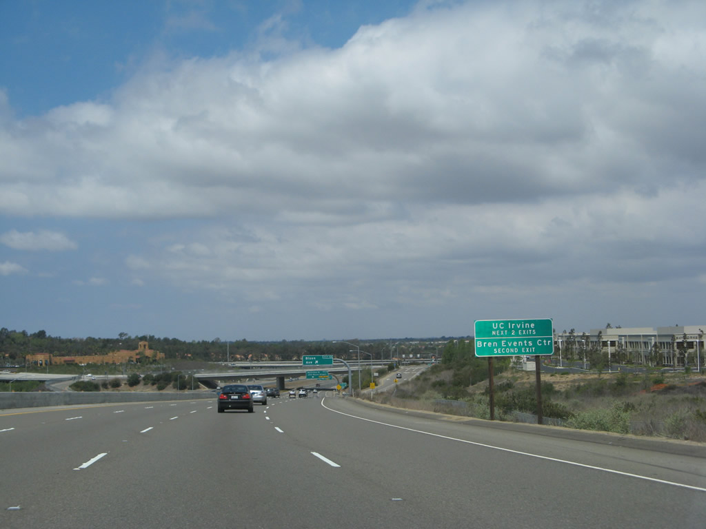
The next two exits along California 73 (San Joaquin Hills Transportation Corridor) north (Exit 13, Bison Avenue and Exit 14, MacArthur Boulevard and Jamboree Road) serve the University of California at Irvine. Photo taken 04/21/07. |
|
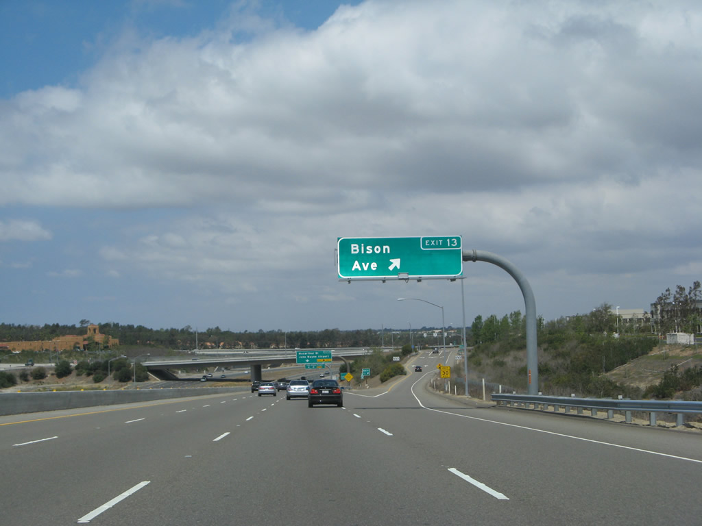
Northbound California 73 (San Joaquin Hills Transportation Corridor) reaches Exit 13, Bison Avenue. Photo taken 04/21/07. |
|
The next exit along California 73 (San Joaquin Hills Transportation Corridor) is Exit 14, MacArthur Boulevard to John Wayne Airport and Jamboree Road. Prior to the construction of the toll road, MacArthur Drive was former California 73. At that time, California 73 turned southwest to end at California 1 in Newport Beach. The toll road extension resulted in a realignment and extension of California 73. Photo taken 04/21/07. |
|
Northbound California 73 (San Joaquin Hills Transportation Corridor) reaches Exit 14, MacArthur Boulevard to John Wayne Airport and Jamboree Road. Photo taken 04/21/07. |
|
|
A multitude of ramps pass through the Exit 14 interchange. As traffic departs toward MacArthur Boulevard north at Exit 14, University Drive passes over California 73. Photo taken 04/21/07. |
|
The next exit along California 73 north is Exit 15, Birch Street, one and one-quarter miles. The ramp overhead is the connector from northbound MacArthur Drive onto northbound California 73. This marks the northern end of the toll section of California 73; from here northward, California 73 is free of tolls. Photo taken 04/21/07. |
|
Quite a bit of traffic joins California 73 after the toll road ends; these cars merge onto California 73 north from MacArthur Boulevard. Photo taken 04/21/07. |
|
California 73 (Corona del Mar Freeway) crosses the San Diego Creek Channel. Photo taken 04/21/07. |
|
This mileage sign along California 73 (Corona del Mar Freeway) north provides the distance to the next three exits: Exit 15, Birch Street; Exit 17A, California 55 (Costa Mesa Freeway) north to Santa Ana; and Exit 17B, California 55 (Costa Mesa Freeway) south to Newport Beach. Photo taken 04/21/07. |
|
California 73 enters the city of Newport Beach (population 70,032 as of 2000 Census and incorporated September 1, 1906). Photo taken 04/21/07. |
|
A pull through sign advises that California 73 (Corona del Mar Freeway) north serves Long Beach (via Interstate 405 north). Photo taken 04/21/07. |
|
The Corona del Mar Freeway section of California 73 was constructed much earlier than the toll road section. The next exit along northbound is Exit 15, Birch Street. Photo taken 04/21/07. |
|
Northbound California 73 (Corona del Mar Freeway) reaches Exit 15, Birch Street in Newport Beach. After this interchange, California 73 leaves Newport Beach and enters the city of Costa Mesa (population 108,724 as of 2000 Census, elevation 98 feet, and incorporated on June 29, 1953). Photo taken 04/21/07. |
|
The next two exits along California 73 (Corona del Mar Freeway) north are Exit 17A, California 55 (Costa Mesa Freeway) north to Santa Ana and Exit 17B, California 55 (Costa Mesa Freeway) south to Newport Beach. Photo taken 04/21/07. |
|
The right two lanes of California 73 (Corona del Mar Freeway) north will connect to Exit 17A, California 55 (Costa Mesa Freeway) north to Santa Ana and Exit 17B, California 55 (Costa Mesa Freeway) south to Newport Beach. Photo taken 04/21/07. |
|
Northbound California 73 (Corona del Mar Freeway) reaches Exit 17A, California 55 (Costa Mesa Freeway) north to Santa Ana. Use California 55 north to Interstate 405 south to Irvine and San Diego. The next exit along northbound is Exit 17B, California 55 (Costa Mesa Freeway) south to Newport Beach. Photo taken 04/21/07. |
|
Immediately thereafter, California 73 (Corona del Mar Freeway) north meets Exit 17B, California 55 (Costa Mesa Freeway) south to Newport Beach. Photo taken 04/21/07. |
|
Passing through the California 55 stack interchange, the next (and final standalone) exit from California 73 (Corona del Mar Freeway) north is Exit 17C, Bear Street. Photo taken 04/21/07. |
|
The right lane of California 73 north becomes exit only for Exit 17C, Bear Street. Photo taken 04/21/07. |
|
Northbound California 73 (Corona del Mar Freeway) reaches Exit 17C, Bear Street. Use Bear Street north to South Coast Plaza and Santa Ana. Photo taken 04/21/07. |
|
This mileage sign along California 73 (Corona del Mar Freeway) north provides the distance to three of the next four exits: Exit 18A, Fairview Road; Exit 18B, Harbor Boulevard; Exit 18C, Interstate 405 (San Diego Freeway) north; and Interstate 405's Exit 12, Euclid Street. Photo taken 04/21/07. |
|
Northbound California 73 (Corona del Mar Freeway) reaches Exit 18A, Fairview Road. The interchange between Interstate 405 and California 73 is complicated, and it includes side exits from California 73 north to both Fairview Road and Harbor Boulevard. Photo taken 04/21/07. |
|
|
|
The three lanes of northbound California 73 (Corona del Mar Freeway) curve from northwest to due west for the merge onto Interstate 405 north (which happens to go east-west through Costa Mesa). Photos taken 04/21/07. |
|
Northbound California 73 (Corona del Mar Freeway) ends as the freeway splits. Stay right to connect to Exit 18B, Harbor Boulevard or left to merge onto Interstate 405 north to Long Beach. No end shield is posted for California 73, which is fairly typical for state routes in Orange County. Photo taken 04/21/07. |
Page Updated September 24, 2010.


 >
>
