| California 75 south |
|
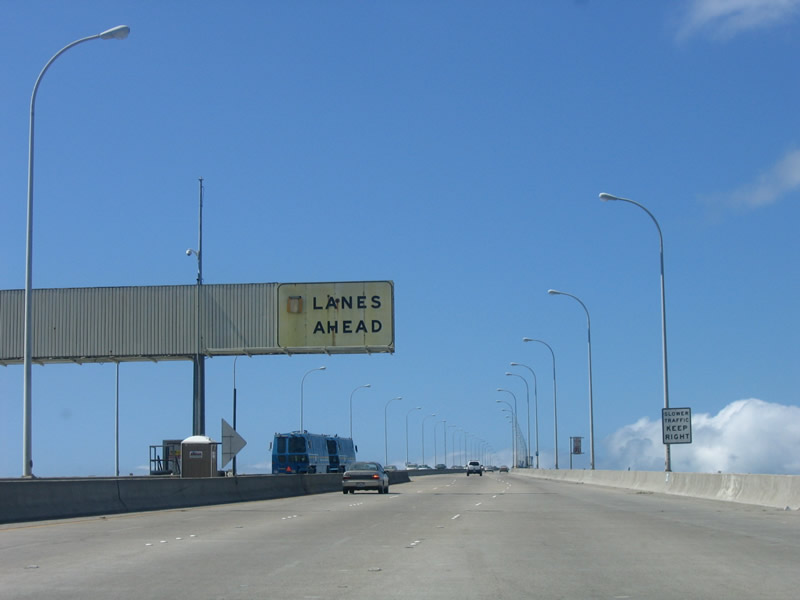
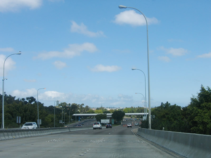
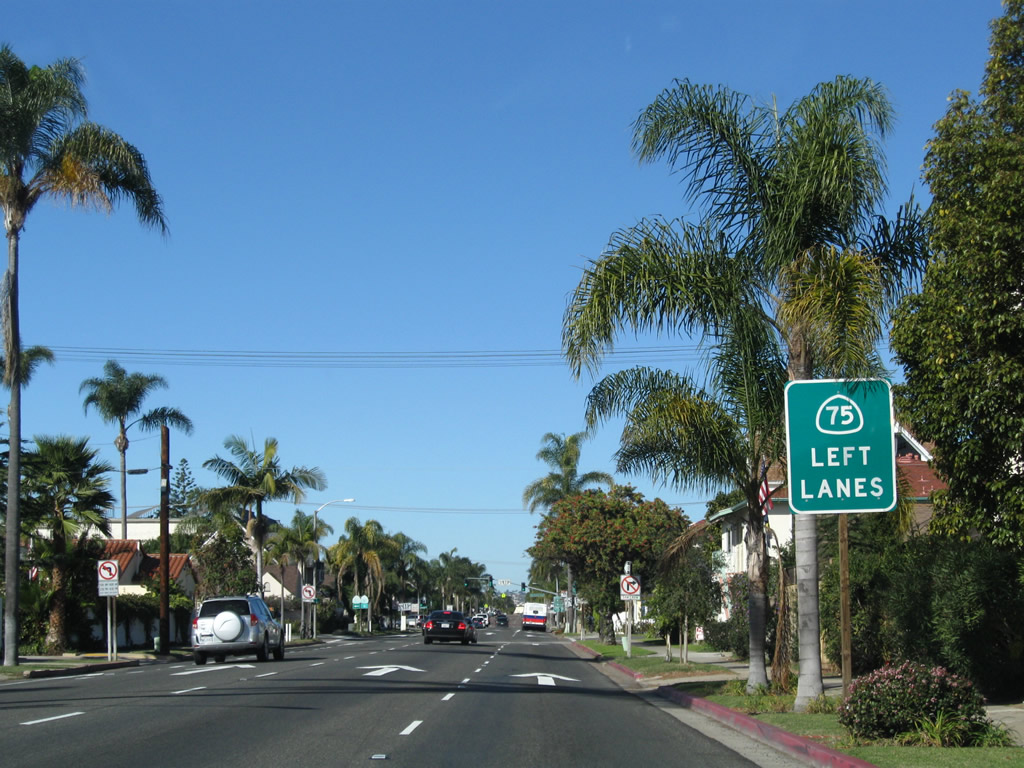
After leaving Interstate 5, SR 75 ascends across the San Diego-Coronado Bay Bridge toward Coronado and North Island Naval Air Station. This sign advises motorists on the number of lanes available for traffic headed westbound. Photo taken 04/09/06. |
|
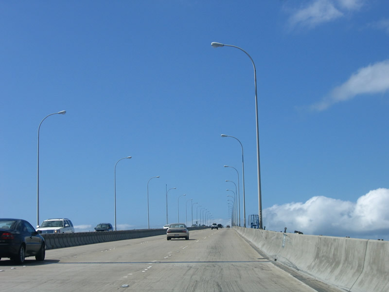
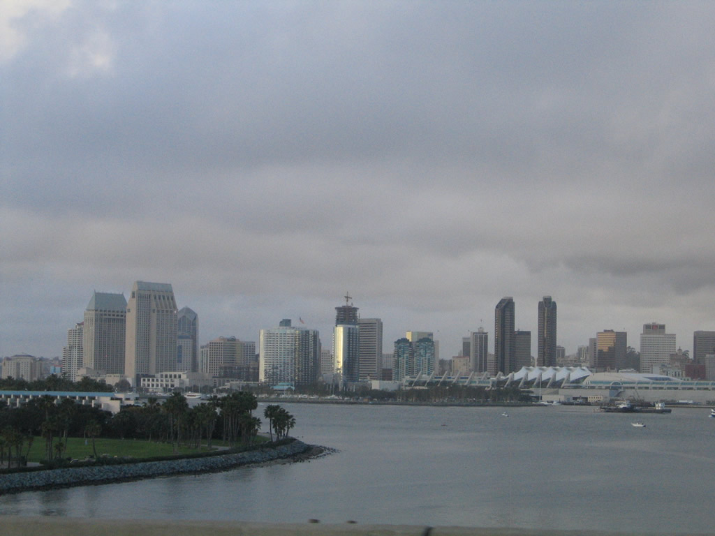
The San Diego-Coronado Bay Bridge is a very well-lit freeway, with closely spaced light fixtures. Looking to the right of the bridge is downtown San Diego, including Petco Park and the sprawling Convention Center. Photo taken 04/09/06. |
|
The bridge has five lanes, so the number of lanes allocated for westbound traffic may be either two or three lanes. The speed limit on the San Diego-Coronado Bay Bridge is 50 miles per hour. Photo taken 04/09/06. |
|
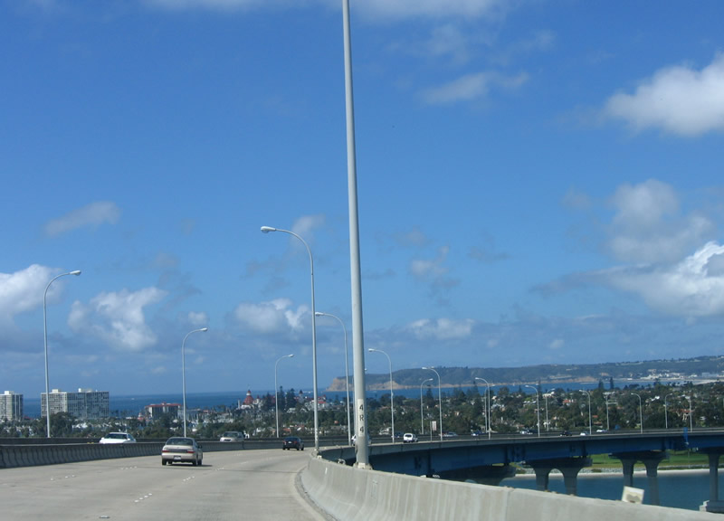
At the apex of the San Diego-Coronado Bay Bridge, the city of Coronado, the Silver Strand, and North Island Naval Air Station all come into view. The Pacific Ocean looms large, providing a majestic backdrop to the narrow strip of land that includes the city of Coronado. Photo taken 04/09/06. |
|
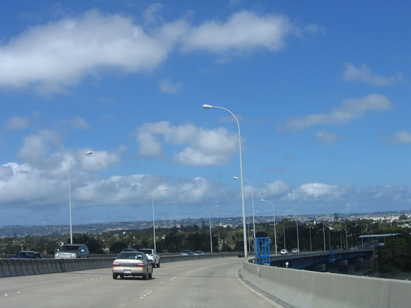
California 75 departs San Diego and enters the city of Coronado as the bridge begins to turn to the right (north) toward its landing. Photo taken 04/09/06. |
|
|
The city of Coronado spreads out as a thin line of land against the vast ocean. The condominiums south of the Hotel del Coronado form a line along the beach, and the Hotel del Coronado provides a contrast to the rest of the residential skyline in exclusive Coronado. The North Island Naval Air Station lies to the north of the city, and portions can be seen from the bridge. Photos taken 04/09/06 and 01/18/09. |
|
|
Point Loma, the westernmost part of San Diego, comes into view behind the Coronado peninsula; the Cabrillo lighthouse and tall brown cliffs look small against the expansive of the Pacific Ocean. The bridge turns northwest to make its landing close to downtown Coronado. Photos taken 04/09/06 and 01/18/09. |
|
The distant Point Loma at Cabrillo National Monument comes into view near the top of the San Diego-Coronado Bay Bridge. Photo taken 04/09/06. |
|
|
Shifting northward, California 75 angles Downtown Coronado. The North Island Naval Air Station appears at the tip of Coronado in the distance. Look north along the bay front to see massive aircraft carriers float on the bayshore. Straight ahead, the bridge lowers as it reaches toward land. Photos taken 04/09/06. |
|
|
Looking northeast from the San Diego-Coronado Bay Bridge are these views of downtown San Diego. Photo taken 02/19/05. |
|
Looking north from the San Diego Coronado Bay Bridge, a park lines the bayshore and a harbor for yachts is located next to it. A bike path and walkway lines parts of the bay in the city of Coronado, offering pedestrian and bicyclist access to the bay. Photo taken 01/18/08. |
|
The San Diego-Coronado Bay Bridge comes to an end upon reaching the Coronado shoreline, and southbound California 75 continues its westerly journey into the city of Coronado toward North Island Naval Air Station. This bridge was formerly a toll bridge, but today it is free. Photo taken 01/18/08. |
|
|
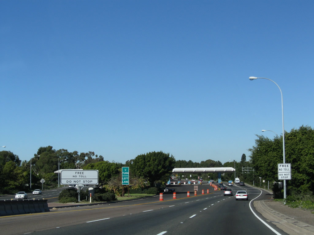
Traffic must navigate through the old toll booths that are still in place at the end of the San Diego-Coronado Bay Bridge. Southbound California 75 continues west as Third Street and becomes part of a one-way couplet. Photos taken 04/09/06 and 01/18/09. |
|
The toll booths will remain in place for the time being, as the booths serve as an effective traffic calming device. Most traffic will slow prior to passing through the former booths. Photo taken 04/09/06. |
|
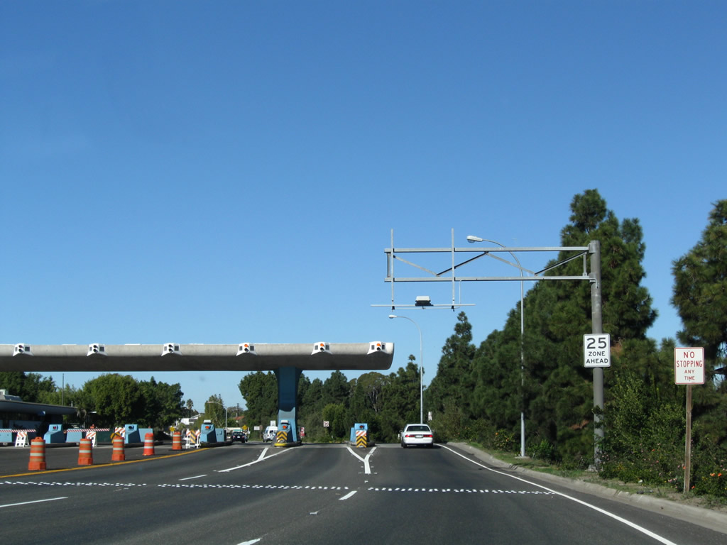
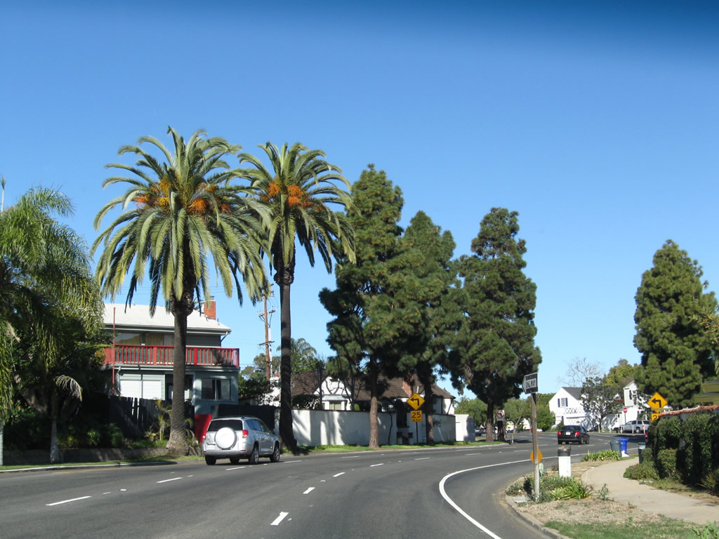
The speed limit along California 75 is only 25 miles per hour, and this section is heavily enforced by city of Coronado police. Watch your speed. Photo taken 04/09/06. |
|
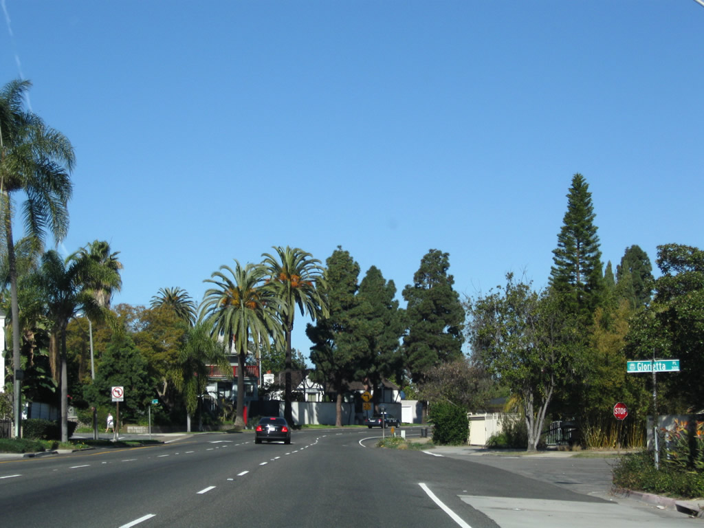
After passing by the former toll barriers, the first exit from California 75 into Coronado is Glorietta Boulevard. Use Glorietta Boulevard north to Tidelands Park and the bayshore walkway. Photo taken 04/09/06. |
|
Notably, Glorietta Boulevard does not cross California 75 (4th Street), even though some maps may make it look like it crosses the state route and thus provides a north-south through route along the eastern edge of Coronado. Instead, through traffic should use Orange Avenue (California 75). Photo taken 01/18/09. |
|
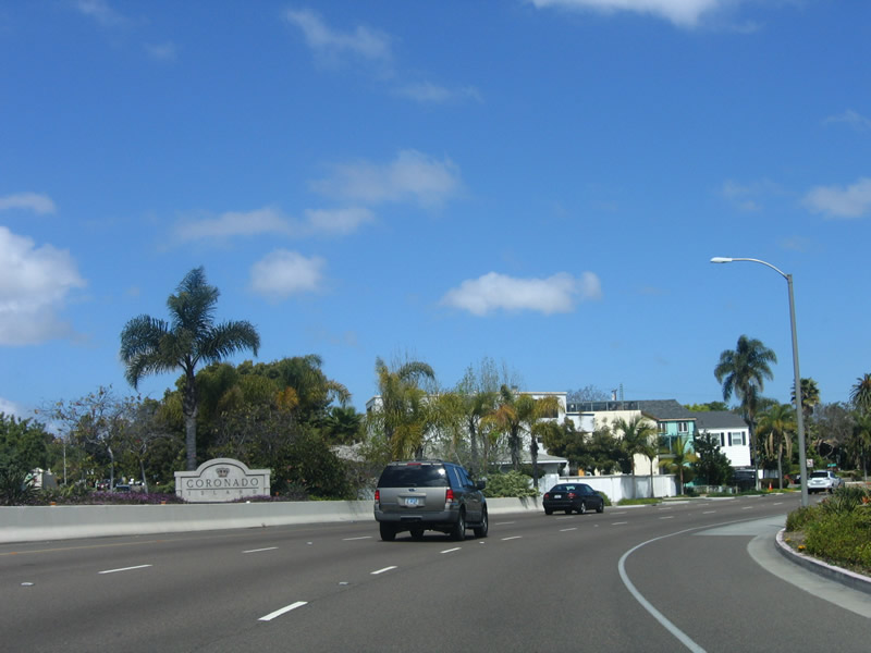
A small monument sign greets visitors to the city of Coronado (the sign reads "Coronado Island"). At this point, California 75 separates into two one-way couplets. Southbound traffic curves to the right onto 3rd Street, while northbound traffic uses 4th Street. Photo taken 04/09/06. |
|
|
For this brief section, southbound California 75 is actually traveling north. At the turn ahead, it will turn northwest for two blocks, then turn south onto Orange Avenue. The next cross street is Glorietta Place. Photos taken 04/09/06 and 01/18/09. |
|
|
Westbound California 75 curves onto 3rd Street. There has been discussion and plans made to construct a tunnel beneath California 75 and California 282 that would allow traffic en route to North Island Naval Air Station to avoid the Coronado city streets. Photos taken 01/18/09 and 04/09/06. |
|
Third Street merges onto California 75 from the right; the state route becomes part of Third Street for the next several blocks. Photo taken 01/18/09. |
|
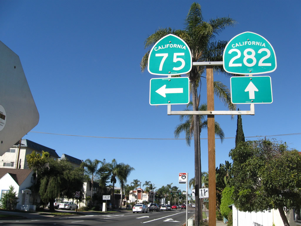
California 75 (Third Street) meets B Avenue and will next approach Orange Avenue. The intersection with Orange Avenue serves as the junction with California 282. At that intersection, California 75 will turn south onto Orange Avenue to serve downtown Coronado. California 282 continues northwest on Third Street to spur into the North Island Naval Air Station. Signage for both state routes is posted on sides on either side of Third Street. Photo taken 01/18/09. |
|
|
Crossing C Avenue, California 75 (Third Street) approaches California 282. Use the left two lanes to turn onto California 75 (Orange Avenue) south toward the Hotel del Coronado. Use the right three lanes to continue north onto California 282. Turn right to follow the California 75 spur north to the Coronado Ferry Landing. Photos taken 01/18/09. |
|
|
|
The control cities are Imperial Beach for California 75 south and North Island for California 282 northwest. The next sign advises of the ferry landing to the northeast. Photo taken 01/18/09. |
|
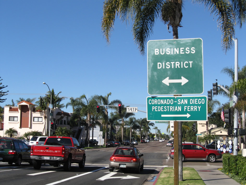
Turn right onto Orange Avenue (Spur California 75) to the San Diego-Coronado Pedestrian Ferry. This ferry connects Coronado at the Ferry Landing plaza with downtown San Diego near the Broadway Pier. The landing also serves as a shopping plaza, with shops and restaurants that face the bayshore and look out to the downtown San Diego skyline. Orange Avenue is the main commercial corridor through the city, and businesses line both sides of the street both north and south of this intersection. Photo taken 01/18/09. |
|
|
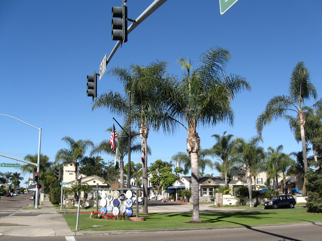
A traffic signal operates at 3rd Street and Orange Avenue. Continue straight ahead to follow California 282 north to North Island Naval Air Station or turn left to follow California 75 south toward downtown Coronado, the Silver Strand, and Imperial Beach. Beautiful landscaped medians, which feature turf along with various species of pine trees, line Orange Avenue from Centennial Park south toward the Hotel del Coronado through the Coronado Business District. Photo taken 01/18/09. |
|
Southbound Orange Avenue, this sign indicates that California 75 south continues straight ahead, while California 75 north (back to the San Diego-Coronado Bridge) is a left turn at the next intersection (4th Street). Photo taken 04/09/06. |
|
Turn left to return to the city of San Diego via northbound California 75/4th Street; continue straight ahead to downtown Coronado, the Silver Strand, and Imperial Beach via southbound California 75 (Orange Avenue). Photo taken 04/09/06. |
|
Reaching the 4th Street intersection, it becomes clear how wide Orange Avenue is. The four-lane roadway is separated into two dual lane segments by a wide landscaped median. Photo taken 04/09/06. |
|
Continuing south, California 75 (Orange Avenue) meets 6th Street at this intersection. The next block is a park on both sides of Orange Avenue. To the west lies a fire station, the public library, and police station. Photo taken 04/09/06. |
|
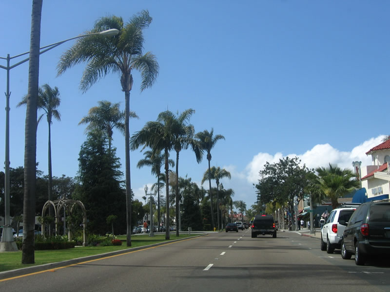
Two blocks further south, California 75 (Orange Avenue) crosses 8th Street and enters another business district, similar to the one closer to 3rd Street. Photo taken 04/09/06. |
|
|
|
|
Southbound California 75 (Orange Avenue) passes through the commercial area between 8th Street and 10th Street). Photos taken 04/09/06. |
|
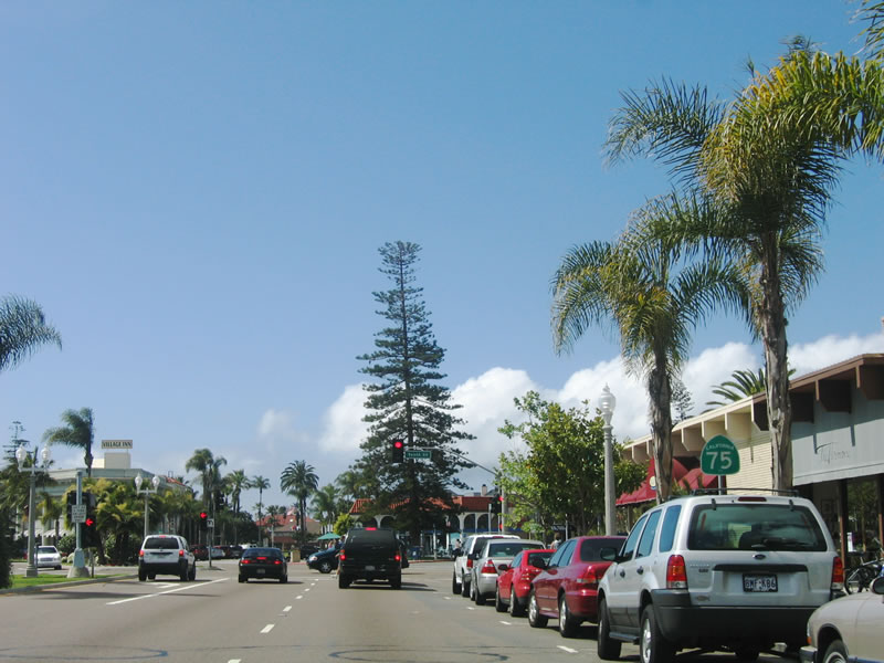
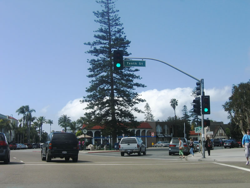
Now at 10th Street, Orange Avenue turns southeast past the Chamber of Commerce and Rotary Park. At this odd, almost six-way intersection, Isabella Avenue angles west toward the Coronado Municipal Beach, while Park Boulevard splits off southwest toward the same beach via the Star Park traffic circle. Photo taken 04/09/06. |
|
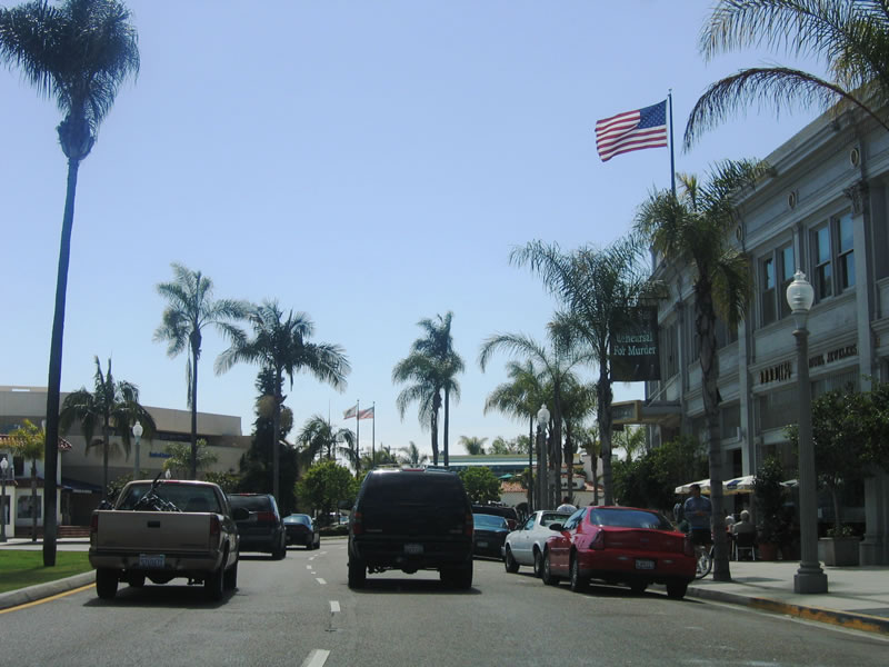
Continuing southeast, California 75 (Orange Avenue) passes by several businesses on both sides of the road, including the Post Office. After crossing C Avenue, Orange Avenue approaches Loma Avenue. Photo taken 04/09/06. |
|
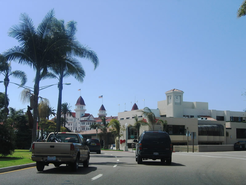
The famed Hotel del Coronado comes into view for the first time on southbound California 75 at the Churchill Place intersection. Photo taken 04/09/06. |
|
At the next block, Orange Avenue intersects R.H. Dana Place. The Hotel del Coronado sits on the southwest corner of this intersection. Photo taken 04/09/06. |
|
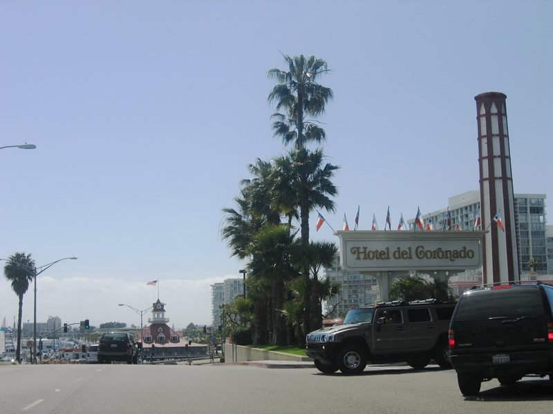
The next intersection is the main entrance into the Hotel del Coronado. Southbound California 75 continues along Orange Avenue toward the Silver Strand. Photo taken 04/09/06. |
|
The Coronado Boat House comes into view on the east side of Orange Avenue. With the Hotel del Coronado to the east, the peninsula narrows significantly. Photo taken 04/09/06. |
|
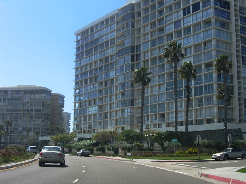
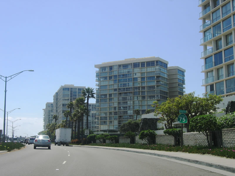
A series of high rise condominiums come into view after passing by the Hotel del Coronado. These buildings were visible from the San Diego-Coronado Bay Bridge. These condos are the only high rises in Coronado, and they will likely remain the only high rises for some time to come. Those fortunate enough to own a condominium here have commanding million-dollar views of the ocean, which are priceless at sunset. Photo taken 04/09/06. |
|
California 75 continues south as a four-lane, divided highway. For the first time, California 75 is signed with a "South" banner, since the highway meandered in nearly every direction while navigating through Coronado. After the merge with Pomona Avenue, Orange Avenue ends and Silver Strand Boulevard begins. Photo taken 04/09/06. |
|
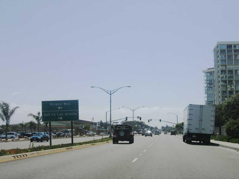
The next traffic signal along southbound California 75 is for Strand Way (eastbound) and Avenida de las Arenas (westbound). "Avenida de las Arenas" means Avenue of the Sands or Sand Avenue. Note the notched divoted concrete median curbing, which is indicative of older state route expressways. Photo taken 04/09/06. |
|
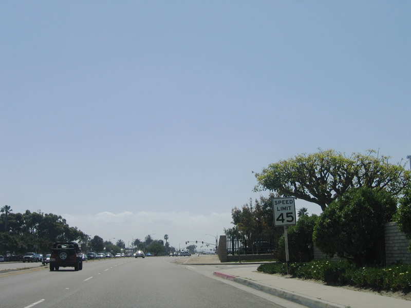
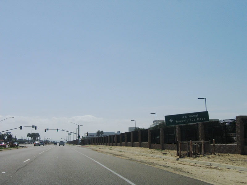
The speed limit finally increases from 25 miles per hour to 45 miles per hour as Silver Strand Boulevard leaves the commercial and residential areas. The state route, while still within the city of Coronado, now enters the U.S. Naval Amphibious Base. Photo taken 04/09/06. |
|
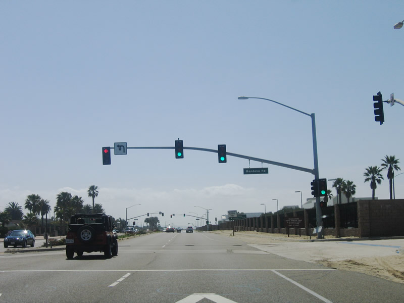
Rendova Road and Tarawa Road both offer access to the U.S. Naval Amphibious Base. The next signal is for Rendova Road. Photo taken 04/09/06. |
|
The next signal along southbound California 75 is for Tarawa Road. Photo taken 04/09/06. |
|
Continuing south, the next traffic signal is for Tulagi Road, which parallels Tarawa Road and serves the U.S. Naval Amphibious Base. Photo taken 04/09/06. |
|
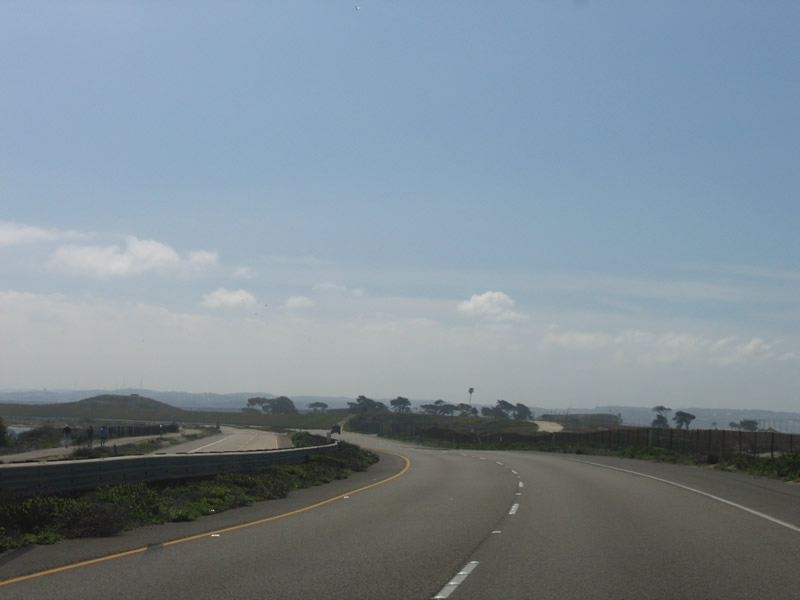
While still within the U.S. Naval Amphibious Base, southbound California 75 (Silver Strand Boulevard) becomes a state scenic highway. The highway becomes an expressway, with occasional intersections. To the west lie gorgeous sand dunes that separate the highway from the ocean, but these dunes are off-limits to hikers due to military operations. Continue south to the Silver Strand State Beach for recreational activities. Photo taken 04/09/06. |
|
The speed limit on this stretch of California 75 (Silver Strand Boulevard) is 65 miles per hour, but many choose to take this road slower due to the natural scenic beauty of the highway and its environment, surrounded by water on two sides. Photo taken 04/09/06. |
|
Continuing south, California 75 passes by Delta Beach within the U.S. Naval Amphibious Base. There is no beach access here. Photo taken 04/09/06. |
|
This left turn serves the Navy Yacht Club. The next intersection is with Leyte Road. Photo taken 04/09/06. |
|
The Pacific Ocean and sandy beach come into view as southbound California 75 meets Leyte Road in the U.S. Naval Amphibious Base. Photo taken 04/09/06. |
|
This unusual traffic signal design at Leyte Road allows southbound traffic to continue moving, while turning traffic lines up in a separate lane. Northbound traffic would have to stop for traffic turning from southbound California 75 to eastbound Leyte Road. Photo taken 04/09/06. |
|
Continuing south, California 75 (Silver Strand Boulevard) travels by more sand dunes. The highway will leave the amphibious base and enter the Silver Strand State Beach soon. For this distance, California 75 remains within the city of Coronado. Photo taken 04/09/06. |
|
The Silver Strand State Beach begins on the west side of California 75. Access to the beach is provided at the Coronado Cays interchange. Photo taken 04/09/06. |
|
Looking west, across the Silver Strand State Beach parking lot, the Pacific Ocean comes into view. Photo taken 04/09/06. |
|
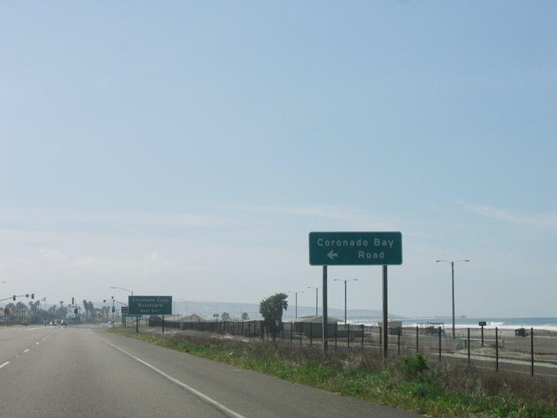
The next intersection along southbound California 75 is the left turn to eastbound Loews Coronado Bay Road (formerly Coronado Bay Road). The name of this road was changed on April 18, 2006, as a result of a resolution passed by the city of Coronado. This name change was warranted since the road only serves the Loews resort. Photo taken 04/09/06. |
|
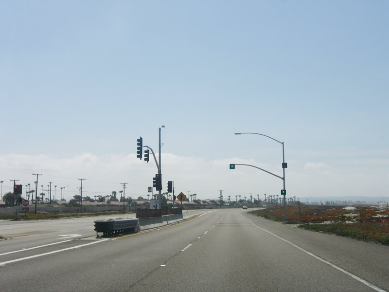
Southbound California 75 approaches Loews Coronado Bay Road (traffic signal ahead) and Coronado Cays Boulevard (interchange after the traffic signal). For most of the route between Imperial Beach and Coronado, California 75 is an expressway, and it features a half-interchange at Coronado Cays Boulevard. Southbound traffic encounters an exit ramp, while northbound traffic meets a traffic signal. Photo taken 04/09/06. |
|
|
Southbound California 75 reaches Coronado Bay Road (traffic signal); the next exit is for Coronado Cays Boulevard. Use that exit to connect to the Silver Strand State Beach. Both of these exits serve the Coronado Cays community of the city of Coronado. Photos taken 04/09/06. |
|
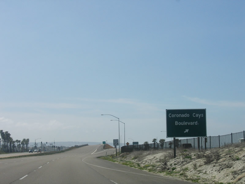
Immediately thereafter, southbound California 75 reaches Coronado Cays Boulevard. Photo taken 04/09/06. |
|
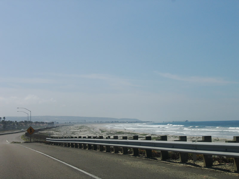
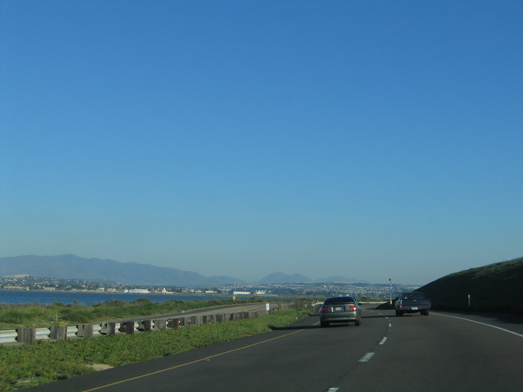
A stunning view of the Pacific Ocean, along with the Silver Strand State Beach and Imperial Beach pier, is afforded along Southbound California 75 as the expressway crosses over the Coronado Cays Boulevard overpass. Photo taken 04/09/06. |
|
This rusty chain link fence separates the California 75 expressway from the surf. Photo taken 04/09/06. |
|
Southbound California 75 passes through additional military land after leaving the state beach as it straddles the Silver Strand on its way from Coronado to Imperial Beach. An enclosure featuring an extremely tall fence is located west of California 75 (not photographed). This fence keeps people away from sensitive areas. Photo taken 04/09/06. |
|
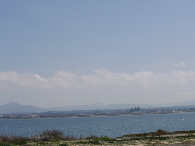
To the east, the Chula Vista power plant dominates the skyline above the waters of the San Diego Bay near the southern end. Near here, California 75 swings away from the ocean and moves toward the bayshore. Photo taken 04/09/06. |
|
California 75 continues southeast along the expressway as it passes by the South Bay Study Area to the east and the U.S. Naval Radio Station to the west. Photo taken 01/31/05. |
|
Continuing south, the mainland comes into view. California 75 skirts the edge of the U.S. Naval Radio Station as it approaches Imperial Beach. Photo taken 04/09/06. |
|
Southbound California 75 prepares to leave the Silver Strand and approaches Imperial Beach. The speed limit on the expressway will drop to 40 miles per hour shortly. Watch for cross traffic ahead. Photo taken 04/09/06. |
|
|
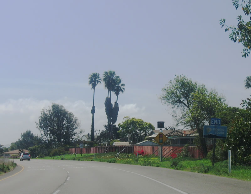
Leaving the Silver Strand, California 75 enters the city of Imperial Beach (population of 26,992 as of the 2000 Census; founded on June 1, 1887, and incorporated on September 17, 1956). This city, sometimes called "IB" by locals, is home to the world famous sand castle festival each year (normally each July). The official state scenic route comes to an end here. Photos taken 04/09/06. |
|
Now in the city of Imperial Beach, the first signalized intersection is with Rainbow Drive. The Silver Strand Plaza is located at the southeast corner of this intersection. Photo taken 04/09/06. |
|
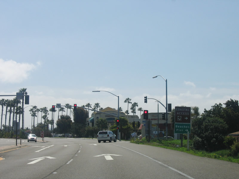
The next traffic signal is for 7th Street. Turn right onto 7th Street to Palm Avenue westbound. California 75 becomes Palm Avenue between 8th Street and 9th Street. Photo taken 04/09/06. |
|
Palm Avenue merges with California 75; from here eastward, California 75 is known as Palm Avenue. The state route travels due east to rendezvous with Interstate 5 in the Otay-Nestor community of the city of San Diego. Photo taken 04/09/06. |
|
The beautiful landscaped medians of Imperial Beach continue as California 75 travels east along Palm Avenue. Photo taken 04/09/06. |
|
California 75 (Palm Avenue) leaves Imperial Beach and re-enters the city of San Diego in the Otay-Nestor community. At the point where the state highway enters San Diego, a fence appears in the median. Recently, plants were installed to grow around the fence, making the look of this stretch of highway more like the section in Imperial Beach. Photo taken 04/09/06. |
|
|
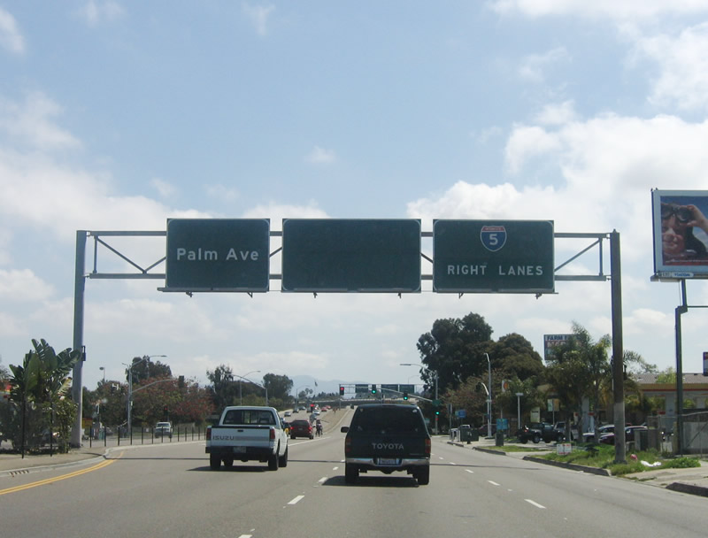
Southbound California 75 approaches its southern terminus at the junction with Interstate 5 in San Diego. Originally, the far right lane was for southbound Interstate 5 and the middle lane was for northbound Interstate 5, but this changed when the flyover ramp from southbound California 75 to northbound Interstate 5 was constructed. For whatever reason, the blank sign remains here. The next traffic signal is with Saturn Boulevard, then the highway splits onto Interstate 5. Photos taken 04/09/06 and 01/31/05. |
|
Southbound California 75 reaches the junction with Interstate 5 in San Diego. This off-ramp marks the southern terminus of California 75. No end shield is posted here. Photo taken 01/31/05. |
|
The transition ramp from California 75 east to Interstate 5 splits, with the left lane leading north to downtown San Diego and south to the international border. Photo taken 01/31/05. |
|
A flyover ramp connects California 75 with Interstate 5 northbound, owing to the commuter traffic leaving Imperial Beach and Otay-Nestor en route to Chula Vista, National City, and downtown San Diego. Photo taken 04/09/06. |
Page Updated June 23, 2009.