

California 89 North - Tahoe City to Truckee
| California 89 north | |
|---|---|
 |
Leaving the Tahoe City wye after the intesection with California 28, northbound California 89 turns toward the west initially, then will shift north toward Squaw Valley and the town of Truckee. Photo taken 07/21/09. |
 |
California 89 is designated as the Tenth Mountain Division Memorial Highway between Tahoe City and Truckee. The state route sees a change in character, as the road is much straighter and does not have as many small communities along its route as it did along the west shore of Lake Tahoe. Photo taken 07/21/09. |
 |
Floaters make their way along the Truckee River from Tahoe City toward Alpine Meadows. Photo taken 07/21/09. |
 |
Two lanes carry California 89 alongside the Truckee River through the Tahoe National Forest. Photo taken 07/21/09. |
 |
Northbound California 89 approaches Alpine Meadows Road (next left) to the Alpine Meadows Ski Area. Photo taken 07/21/09. |
 |
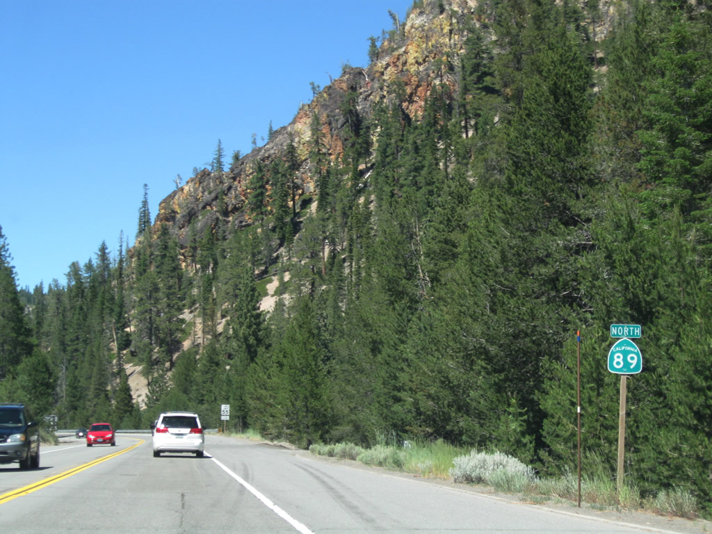
A California 89 north reassurance shield is posted after Alpine Meadows Road. Photo taken 07/21/09. |
 |
California 89 crosses over the Truckee River. A bike trail, which also passes under California 89 here, continues north along California 89 from Tahoe City to the entrance to Squaw Valley. Photo taken 07/21/09. |
 |
The next left from California 89 is the entrance to Squaw Valley USA and Village at Squaw Valley, a large ski resort that served as the location of the 1960 Winter Olympics. An aerial tramway similar to the one found at Heavenly Village in South Lake Tahoe takes summer passengers and winter skiers to the top of the mountain. Photo taken 07/21/09. |
 |
Squaw Valley's Olympic history is proudly proclaimed at the entrance marquee. Photo taken 07/21/09. |
 |
Northbound California 89 meets Squaw Valley Road west into Squaw Valley USA resort and ski area. Photo taken 07/21/09. |
 |
A California 89 north reassurance shield is posted after Squaw Valley Road. Photo taken 07/21/09. |
 |
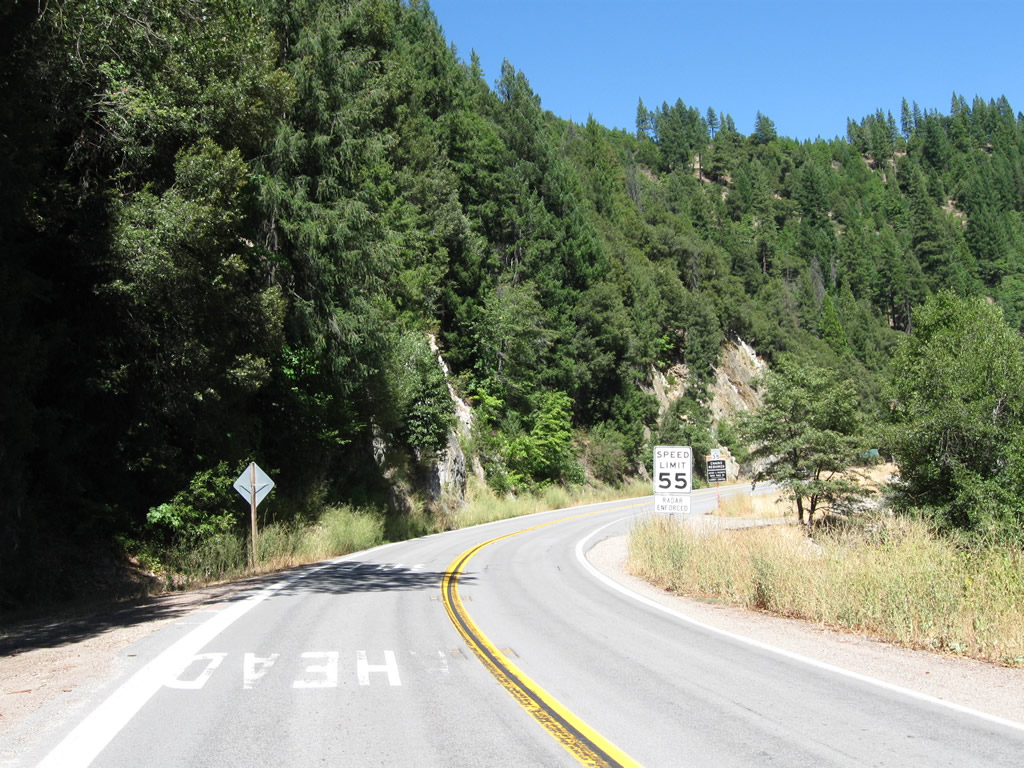
Northbound California 89 continues north from Squaw Valley alongside the Truckee River. The highway retains a 55 miles per hour speed limit and offers a fast trip between Tahoe City and Truckee. Photo taken 07/21/09. |
 |
A few Tahoe National Forest campgrounds, such as the Silver Creek campground, are located along the Truckee River. Photo taken 07/21/09. |
 |
The elevation drops below 6,000 feet for the first time since leaving the Lake Tahoe Basin. Photo taken 07/21/09. |
 |
 |
Northbound California 89 approaches the Goose Meadows campground. This is also administered as part of Tahoe National Forest. Photos taken 07/21/09. |
 |
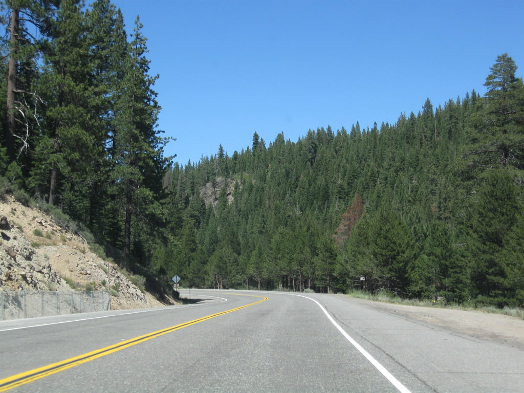
California 89 continues north along the Truckee River through the scenic valley. Photo taken 07/21/09. |
 |
The state route and river follow each other closely, with the river occasionally revealing itself to the travelers on the highway. Photo taken 07/21/09. |
 |
Another scenic view sans traffic appears after rounding a bend in the highway. Photo taken 07/21/09. |
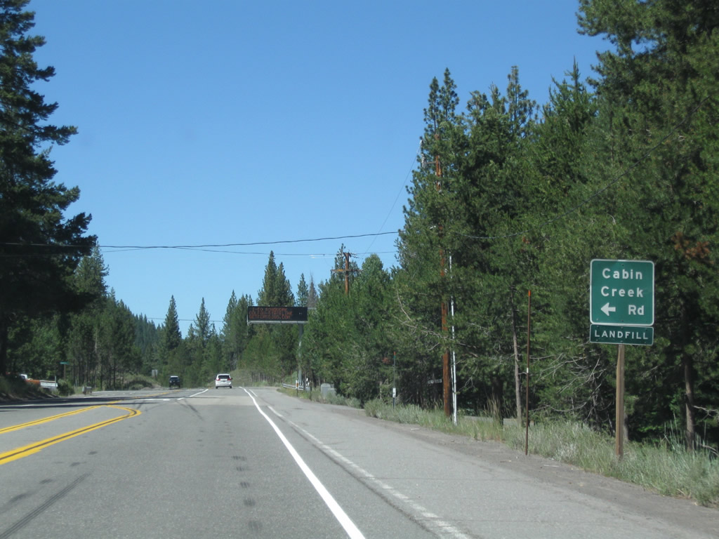 |
Northbound California 89 approaches Cabin Creek Road west to the landfill. Photo taken 07/21/09. |
 |
A dynamic message sign is posted after the Cabin Creek Road intersection. At the time this photo was taken, a major reconstruction project was underway along Interstate 80. The Get Across 80 project includes various rehabilitation projects between Colfax and the California-Nevada state line between 2007 and 2013. Construction can result in delays for trips east or west along Interstate 80. Photo taken 07/21/09. |
 |
A third national forest campground (Granite Flat) is located ahead on the right (east) side of California 89. Photo taken 07/21/09. |
 |
The Union Pacific Railroad tunnel, which is one-half mile ahead, has a low clearance. Photo taken 07/21/09. |
 |
Northbound California 89 approaches West River Road (old alignment of California 89) northeast to downtown Truckee. Continue straight to Interstate 80. Photo taken 07/21/09. |
 |
Northbound California 89 approaches West River Road (likely an old alignment of California 89) northeast to downtown Truckee. Continue straight to Interstate 80. West River Road is the most direct route into downtown Truckee. The Truckee River pulls away from California 89 and turns east toward downtown as well. Photo taken 07/21/09. |
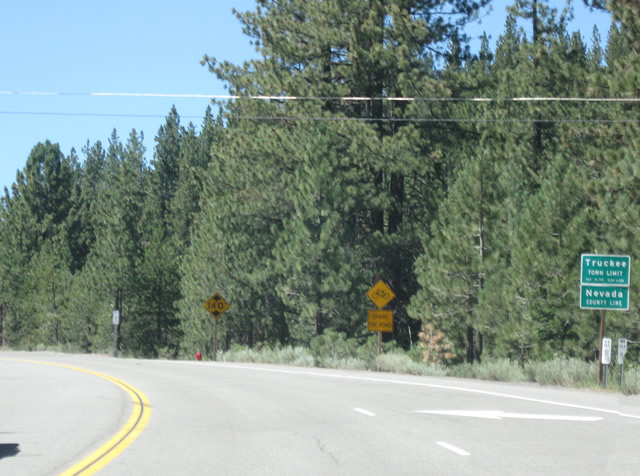 |
California 89 leaves Placer and enters the town of town of Truckee in Nevada County. The town had a population of 13,864 as of the 2000 Census, consists of 33.8 square miles, has an elevation of 5,817 feet, and was incorporated on March 23, 1993. This view looks east after the intersection with California 89 in Truckee. While California 89 used to follow U.S. 40 through the town, it now shares alignment with Interstate 80 to bypass downtown. Photo taken 07/21/09. |
 |
Soon thereafter, California 89 passes under a 1929 grade separation with the Union Pacific Railroad. Look for a date stamp (1929) at the top of the tunnel. Photo taken 07/21/09. |
 |
Northbound California 89 pulls out of the Union Pacific Railroad tunnel and will soon approach Interstate 80. Photo taken 07/21/09. |
 |
California 89 next approaches Deerfield Drive. Photo taken 07/21/09. |
 |
Northbound California 89 meets Deerfield Drive at this signalized intersection. Photo taken 07/21/09. |
 |
California 89 crosses over Donner Creek (1959 bridge) and approaches the interchange between California 89 and Interstate 80. This interchange incorporates a pair of roundabouts, one at each end of the interchange. These roundabouts eliminate the need for two traffic signals and help keep traffic moving through the interchange. Photo taken 07/21/09. |
 |
Entering the first (southern) roundabout, the first right connects to Interstate 80 east and California 89 north to downtown Truckee and Reno, Nevada. The two routes will share alignment for a few miles, then split at Exit 188. Photo taken 07/21/09. |
 |
Stay right for Interstate 80 east and California 89 north. Stay left for Interstate 80 west to Sacramento and San Francisco or Historic U.S. 40 (Donner Pass Road). Photo taken 07/21/09. |
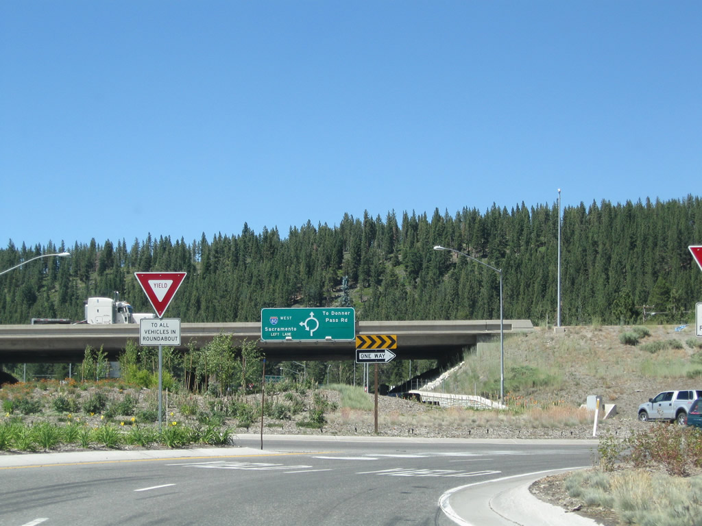 |
Traffic inside the roundabout always has the right of way over those trying to enter the roundabout, hence the yield sign. Photo taken 07/21/09. |
 |
A lone California 89 north trailblazer is posted at the right turn onto Interstate 80 east to Reno. Photo taken 07/21/09. |
| California 89 Connector north | |
|---|---|
 |
After passing through the first roundabout, the connector passes under Interstate 80. While this brief segment north to Interstate 80 west is not part of the signed continuation of California 89 north, it is still a state route. Photo taken 07/21/09. |
 |
The second (northern) roundabout is very similar to the first. Both roundabouts were dedicated on December 21, 2005, as part of a major revision to the Interstate 80 and California 89 south interchange west of downtown Truckee.1 Photo taken 07/21/09. |
 |
Turn left here to follow Interstate 80 west over Donner Summit to Auburn, Sacramento, Oakland, and San Francisco. Photo taken 07/21/09. |
 |
The California 89 connector ends at Historic U.S. 40 (Donner Pass Road). Turn left to Donner Lake and Donner Pass, which is the original highway crossing over the Sierra Nevada (prior to Interstate 80's construction over Donner Summit). Photo taken 07/21/09. |
 |
A U.S. 40 historic trailblazer is posted at the Donner Pass Road intersection. Originally a transcontinental route and prior to completion of I-80, U.S. 40 traveled through Truckee along one of the Lincoln Highway routes through the Sierra Nevada. California legislatively decommissioned U.S. 40 in 1964. Historic signage started appearing for U.S. 40 by the late 1990s and early 2000s. Photo taken 07/21/09. |
| California 89 north | |
 |
Now in Plumas County, northbound California 89 passes by Clio State 40A Road and proceeds north toward Graeagle. Photo taken 09/04/10. |
 |
Northbound California 89 approaches Gold Lake Highway, which travels west and then south to Gold Lake. Gold Lake Highway is a through highway all the way to California 49/Mother Lode (Golden Chain) Highway. Photo taken 09/04/10. |
 |
Continue north on California 89 to Quincy (26 miles) or turn left on Gold Lake Highway to Gold Lake (seven miles). Photo taken 09/04/10. |
 |
Northbound California 89 crosses Graeagle Creek. Photo taken 09/04/10. |
 |
California 89 enters the unincorporated community of Graeagle, "The Gift of a Lifetime." Graeagle had a population of 737 people as of the 2010 Census. Photo taken 09/04/10. |
 |
 |
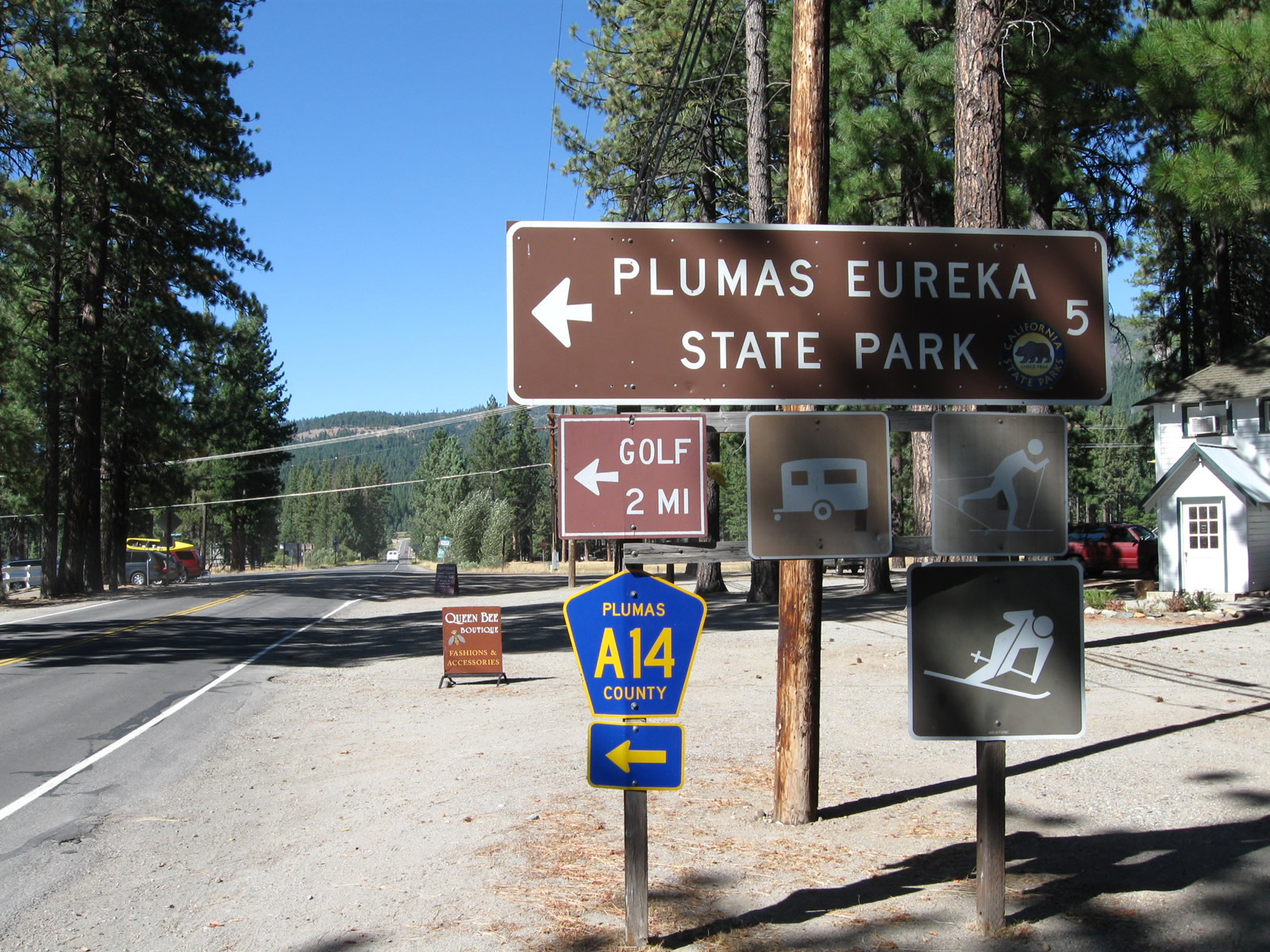
Northbound California 89 approaches Plumas County A-14 (Graeagle-Johnsville Road) in the community of Graeagle. Turn left here for A-14, which travels west along Graeagle-Johnsville Road to the unincorporated communities of Mohawk and Johnsville. Plumas County A-14 is not a through route; it ends in Johnsville (about five miles west of Graeagle). Johnsville is an unincorporated community that had a population of 20 people as of the 2010 Census. Photos taken 09/04/10. |
 |
 |
A second Plumas County A-14 route marker is posted at the intersection between California 89 and Graeagle-Johnsville Road in the community of Graeagle. A-14 travels for about five miles east to both Johnsville and Plumas-Eureka State Park, which was established in 1959. In addition to its scenic setting in the Sierra Nevada, the park offers a glimpse into the mining history of the area, including stamp mills and a historic miner residence. Photos taken 09/04/10. |
 |
Just beyond the intersection with Plumas County A-14 (Graeagle-Johnsville Road), the backside of the Caltrans placed wooden Graeagle community limits sign appears. Wood-backed signs are relatively uncommon in California. Photo taken 09/04/10. |
 |
This California 89 route marker is posted after the intersection with Plumas County A-14 (Graeagle-Johnsville Road) in the community of Graeagle. Photo taken 09/04/10. |
 |
California 89 crosses over the Middle Fork of the Feather River. Photo taken 09/04/10. |
 |
Northbound California 89 approaches Little Bear Road west and Bonta Street east to Blairsden. Photo taken 09/04/10. |
 |
California 89 passes under the Union Pacific Railroad (formerly Western Pacific Railroad), which is part of the transcontinental railroad that extends east toward Reno and Salt Lake City and west to Sacramento via the Feather River Canyon. Photo taken 09/04/10. |
 |
The next left connects California 89 with the Eastern Plumas Chamber of Commerce, which offers a visitors center with tourist information. Photo taken 09/04/10. |
 |
Immediately thereafter, California 89 north approaches California 70 (Feather River Highway). California 70 is a major trans-Sierra Nevada highway that includes the lowest mountain pass in the northern Sierra. Turn left to follow California 70 west (and California 89 north) to Quincy, the seat of Plumas County. Turn right to follow California 70 east to Portola and Reno (via a connection with U.S. 395). Photo taken 09/04/10. |
 |
A mileage sign provides the distance to Quincy (24 miles west) and Portola (10 miles). California 70 and California 89 will share pavement west to Quincy before splitting near Paxton. The two routes share about 35 miles of alignment together. Photo taken 09/04/10. |
 |
This California 89 postmile marker is posted on the turn from California 70 west to California 89 northwest of Quincy. Photo taken 09/04/10. |
 |
California 89 resumes its journey northwest after leaving California 70. From here, California 89 will proceed north to Greenville and Lake Almanor, where it will meet California 36. Photo taken 09/04/10. |
Sources:
- Two roundabouts down, more to come, Sierra Sun, by David Bunker, December 23, 2005

Page Updated April 11, 2012.
|
About Contact Glossary |
In The News Testimonials Interstate Guide |
Social Media:
 |
|
© 2000-23 AARoads.com | All Rights Reserved | Privacy Policy / Terms of Use
|
||