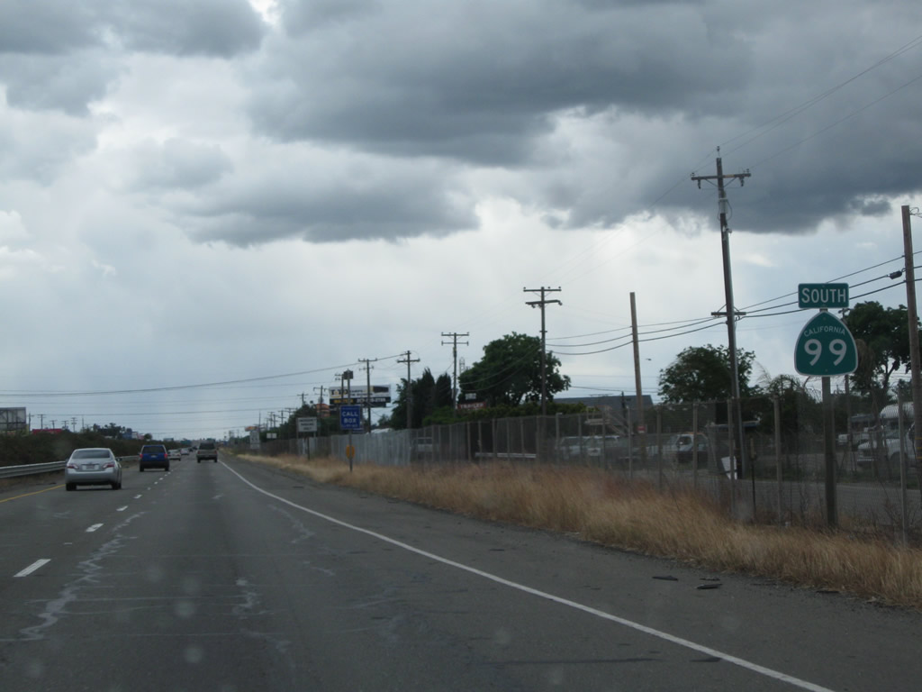
| California 99 south |
|
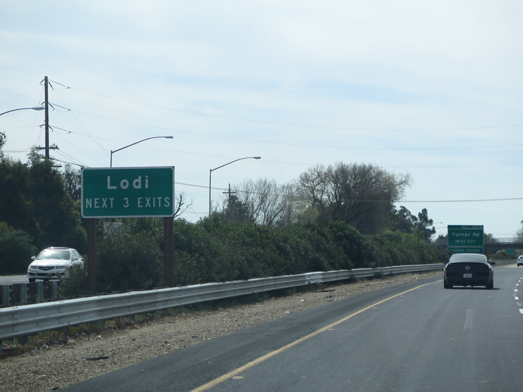
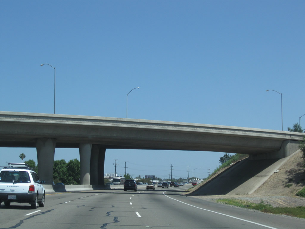
Southbound California 99 meets Exit 268, Woodbridge Road. The next two exits along California 99 south are Exit 267B, Frontage Road and Exit 267A, California 99 Business (Cherokee Lane) south and Turner Road. Photo taken 03/15/15. |
|
After the frontage road off-ramp (Exit 267B), the next three exits from southbound California 99 will serve the city of Lodi: Exit 267A, California 99 Business (Cherokee Lane) south and Turner Road; Exit 266, California 12 (Victor Road) east and Victor Road west to California 99 Business; and Exit 264B, California 12 (Kettleman Lane) west. Photo taken 03/15/15. |
|
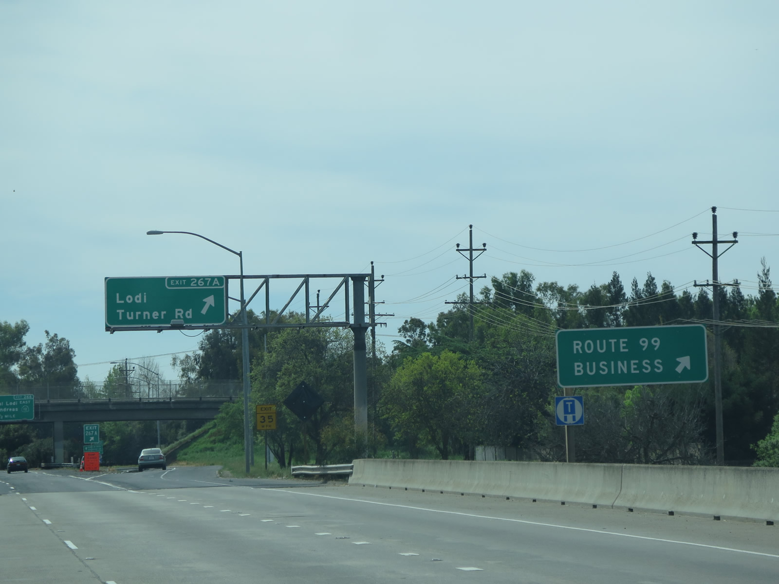
Southbound California 99 reaches Exit 267A, California 99 Business (Cherokee Lane) south and Turner Road. Lodi had a population of 62,134 as of the 2010 Census and has seen a surge in popularity due to its well known wine-making region. The city incorporated on December 6, 1906, and it has the motto of "Livable, Lovable, Lodi." Lodi is also notable for being having a namesake song "Lodi" written and recorded by Credence Clearwater Revival in 1969. California 99 Business, which follows the old alignment of U.S. 99 along Cherokee Lane, will reconnect with mainline California 99 at northbound's Exit 254A. Cherokee Lane does not pass through downtown Lodi. To downtown Lodi, follow Pine Street west under the historic Lodi Arch. Photo taken 03/15/15. |
|
The next exit along California 99 south is Exit 266, California 12 (Victor Road) east to Lockeford, Camanche Reservoir, and San Andreas, where it ends at California 49. To the west, Victor Road travels only a short distance to meet up with California 99 Business (Cherokee Lane). Photo taken 03/15/15. |
|
Due to a number of bridges that cross over this segment of California 99, the viewshed is limited. This sign takes the unusual tact of noting the 500-foot distance to the off-ramp to Exit 266, California 12 (Victor Road). California 12 west will merge onto California 99 south briefly. Photo taken 03/15/15. |
| California 12 west & 99 south |
|
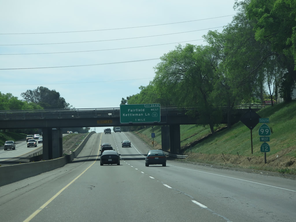
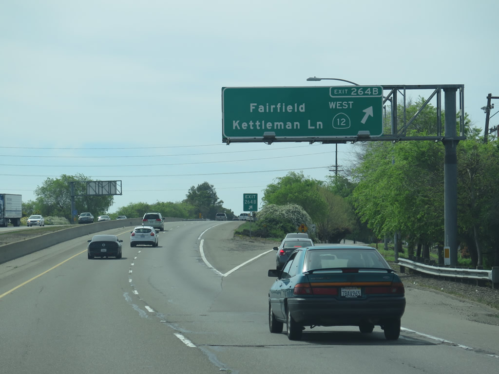
California 99 south and California 12 west are signed together for a brief stretch between Exits 266 and 264B. This is one of several times in which California 99 will share pavement briefly with another state route. Photo taken 03/15/15. |
|
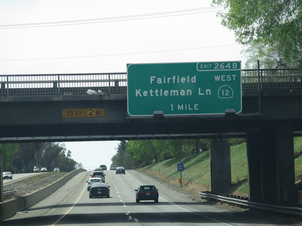
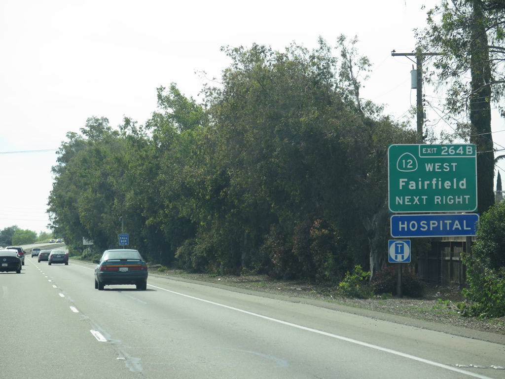
The next exit along California 99 south is Exit 264B, California 12 (Kettleman Lane) west to Fairfield. Photo taken 03/15/15. |
|
The segment of California 12 between California 99 and Interstate 5 is a typical urban arterial, and it becomes a rural highway west of Interstate 5 as it passes through the California Delta and eventually connects with Interstate 80 in Fairfield. After a brief overlap, California 12 continues northwest to Napa, Sonoma, and Santa Rosa (where it meets U.S. 101). California 12 ends at California 116 in Sebastopol. Photo taken 03/15/15. |
|
Southbound California 99 reaches Exit 264B, California 12 (Kettleman Lane) west to Fairfield. At this point, the two state routes divide. California 99 will continue south toward Stockton. Photo taken 03/15/15. |
| California 99 south |
|
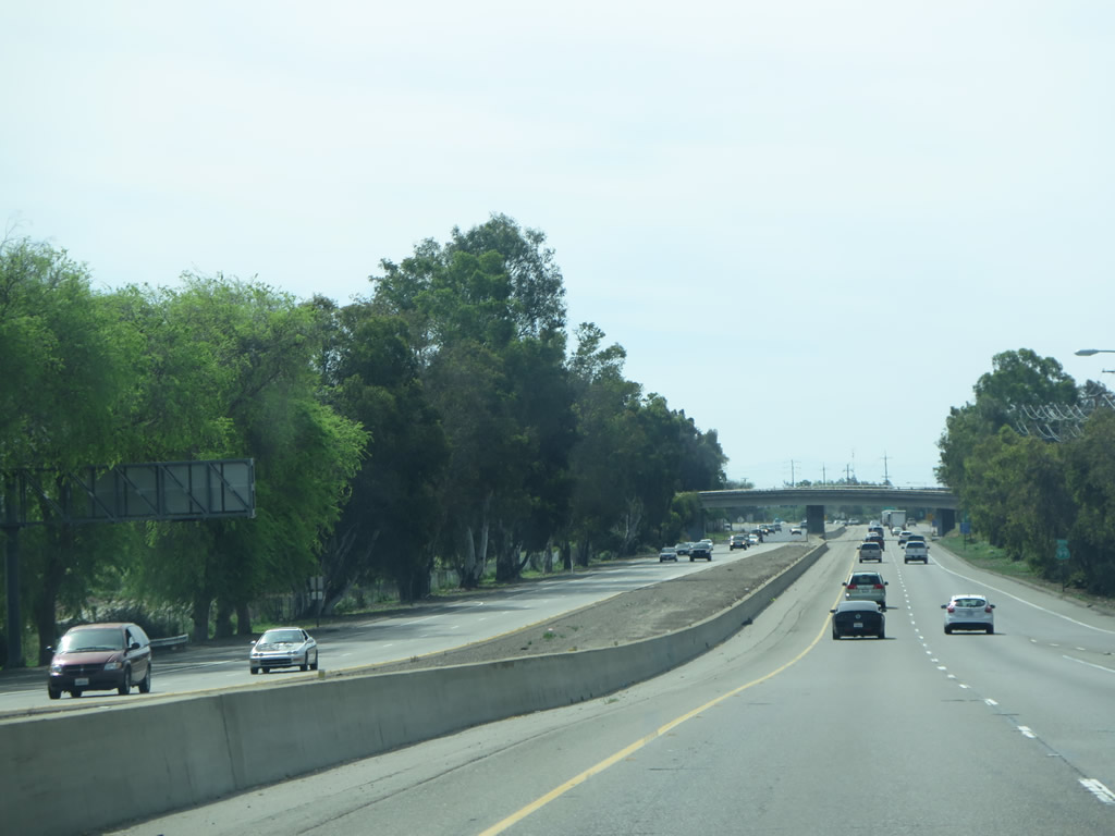
This view looks south on California 99 between Exits 264B and 263. Photo taken 03/15/15. |
|
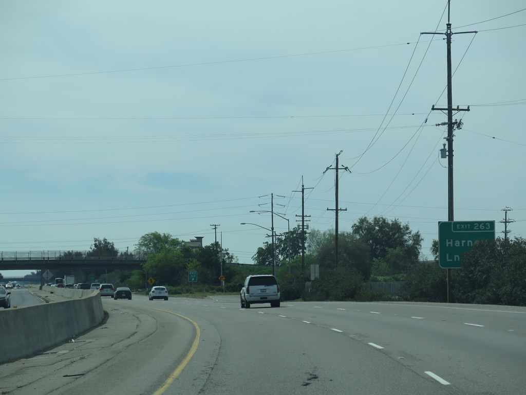
Southbound California 99 meets Exit 263, Harney Lane. Photo taken 03/15/15. |
|
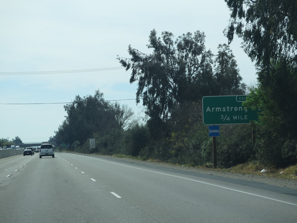
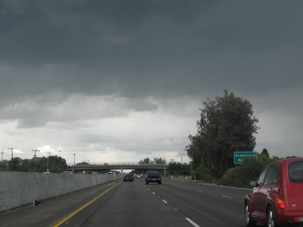
The next exit along California 99 south is Exit 262, Armstrong Road and Frontage Road. Photo taken 03/15/15. |
|
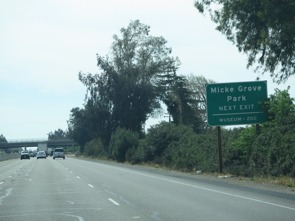
Use Armstrong Road west to Micke Grove Park. The county-operated park includes a zoo, county historical museum, pond, and golf course among other amenities. Photo taken 03/15/15. |
|
Southbound California 99 reaches Exit 262, Armstrong Road. Photo taken 05/15/11. |
|
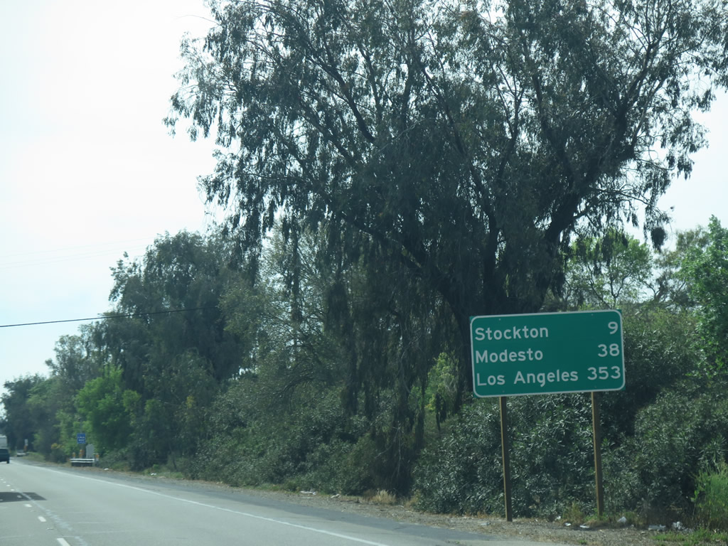
After the Armstrong Road interchange, this mileage sign along southbound California 99 provides the distance to Stockton (eight miles), Modesto (38 miles), and Los Angeles (353 miles). Omitted are the distances to Fresno and Bakersfield, both large cities located along the California 99 corridor. Photo taken 03/15/15. |
|
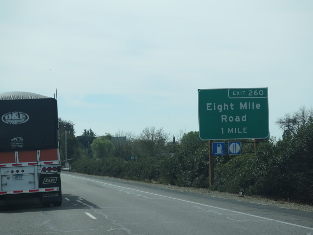
The next exit along California 99 south is Exit 260, Eight Mile Road (one mile). Photo taken 03/15/15. |
|
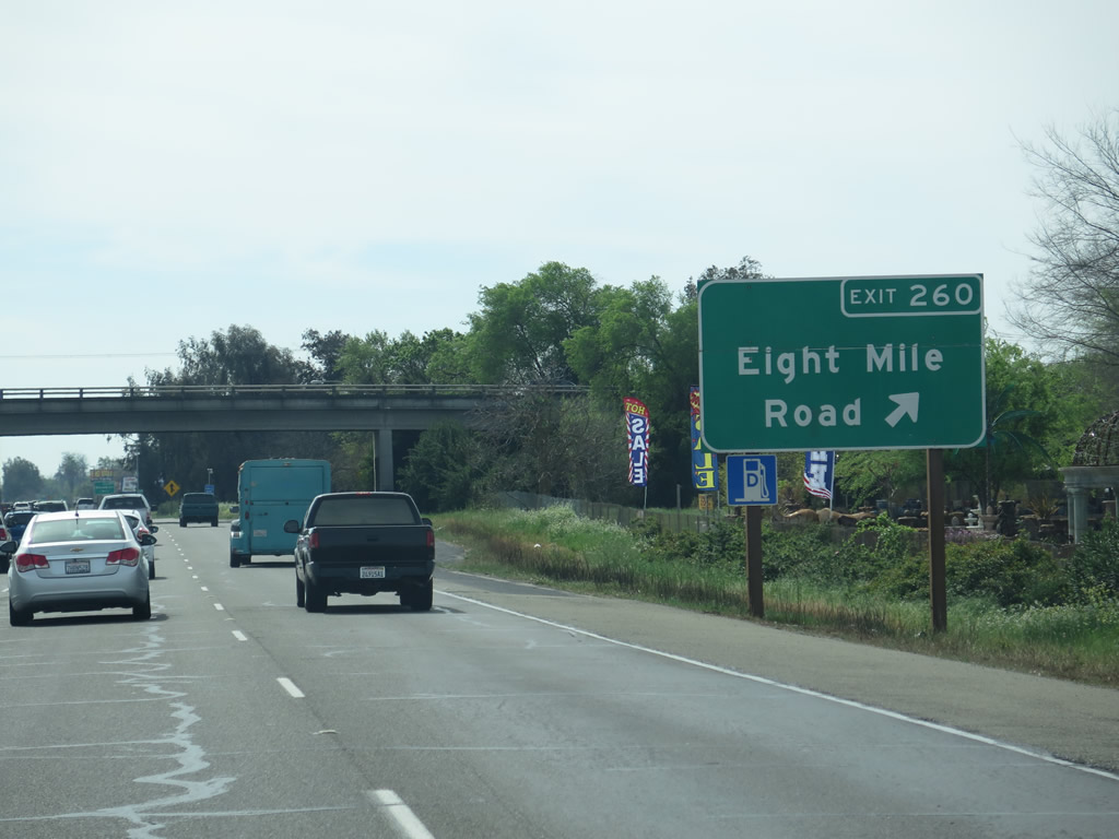
Southbound California 99 reaches Exit 260, Eight Mile Road. Photo taken 03/15/15. |
|
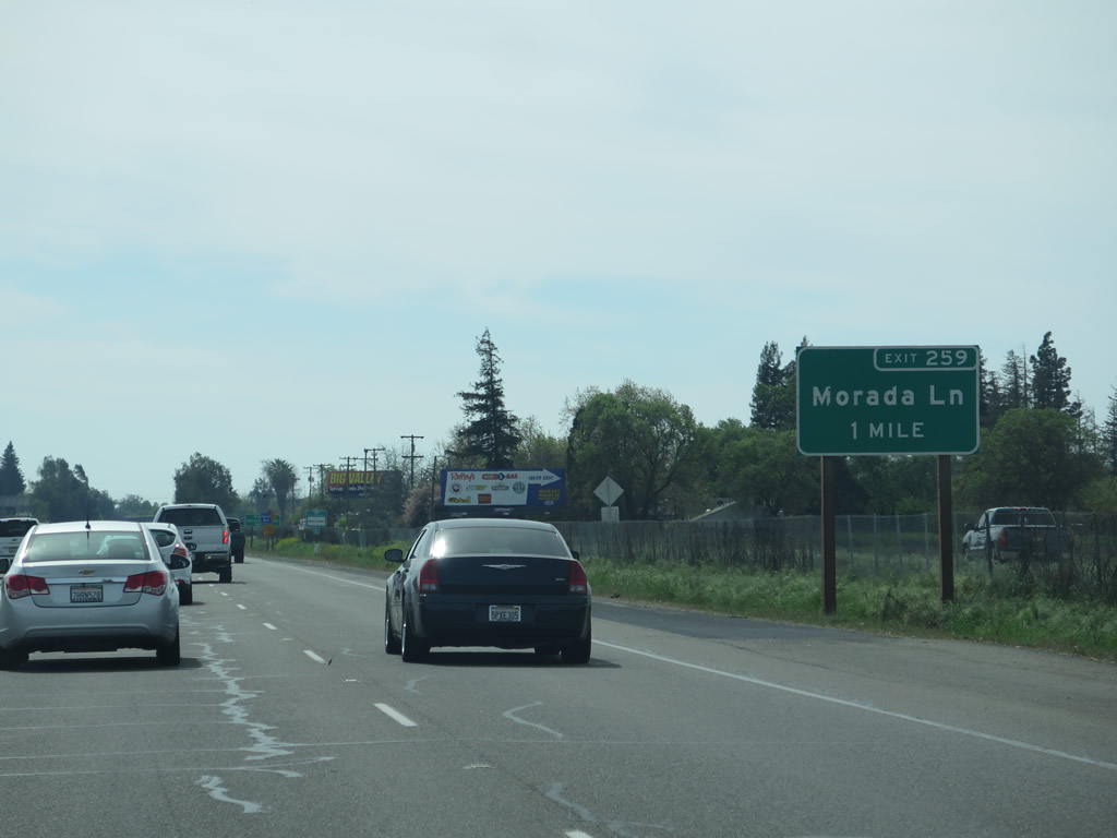
The next exit along California 99 south is Exit 259, Morada Lane (one mile). Photo taken 03/15/15. |
|
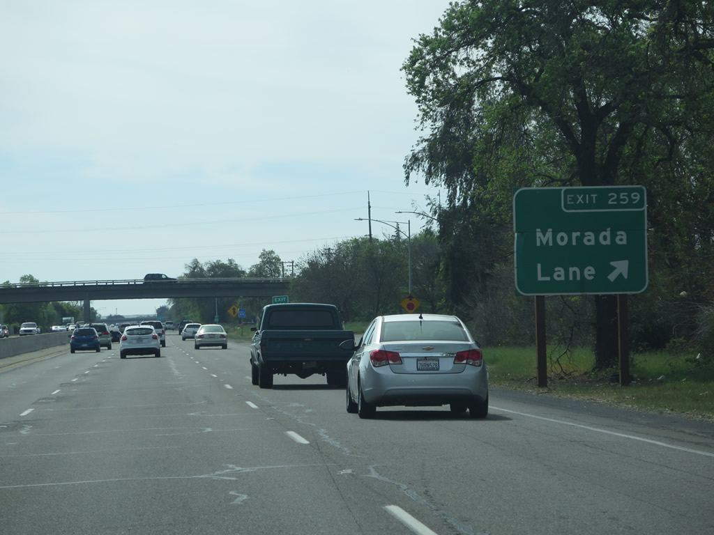
Southbound California 99 reaches Exit 259, Morada Lane. Photo taken 03/15/15. |
|
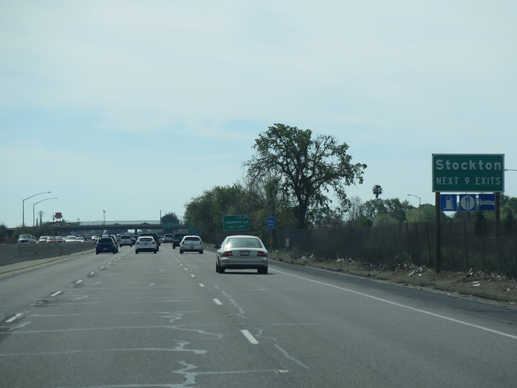
The next nine exits along California 99 south serve the city of Stockton. Sitting at an elevation near sea level (around 13 feet), Stockton incorporated as a city on July 23, 1850. As of the 2010 Census, Stockton had a population of 291,707. Due to the housing crisis and Great Recession of 2008, Stockton went into bankruptcy in 2012 and exited bankruptcy on February 25, 2015. The city is home to the University of the Pacific and the Port of Stockton, notable for its inland deep water port and location near the crossroads of Interstate 5 and California 4. Photo taken 03/15/15. |
|
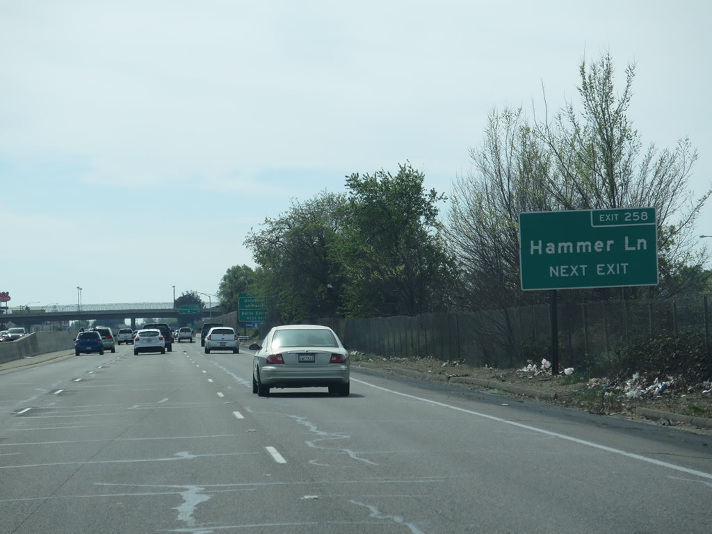
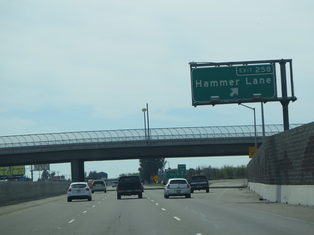
The next exit along California 99 south is Exit 258, San Joaquin County J-8 (Hammer Lane). Use Hammer Lane west to a large automobile mall. CR J-8 is a north-south route shared between San Joaquin and Sacramento Counties. CR J-8 begins here at the California 99 interchange and extends west to Thornton Road, then turns northwest on Thorton Road, closely following the east side of Interstate 5 for a time. Eventually, CR J-8 connects to Franklin Boulevard (upon crossing the San Joaquin-Sacramento County Line at the Mokelumne River) and travels north. As California 99 curves northwest, CR J-8 and California 99 rendezvous again at the Broadway interchange in the shadow of the Business Loop I-80 and U.S. 50 interchange in Sacramento. This marks the northern terminus of CR J-8. Photo taken 03/15/15. |
|
Southbound California 99 reaches Exit 258, San Joaquin County J-8 north and Hammer Lane west. Photo taken 03/15/15. |
|
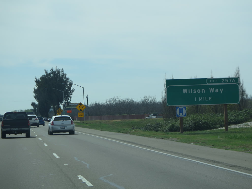
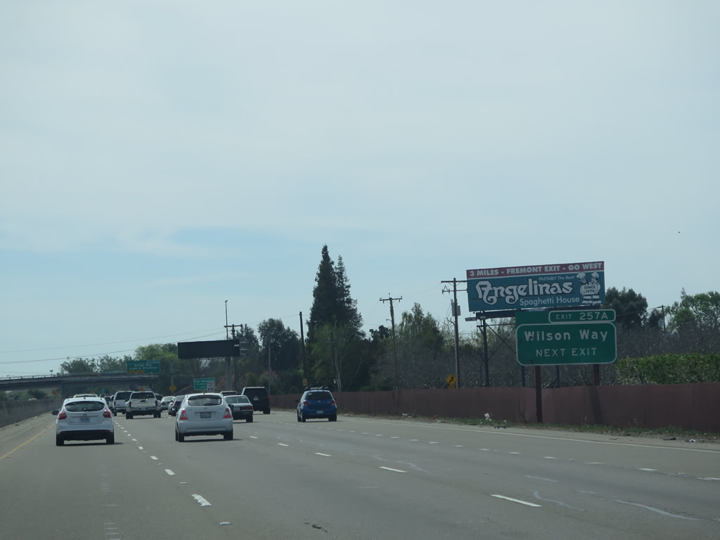
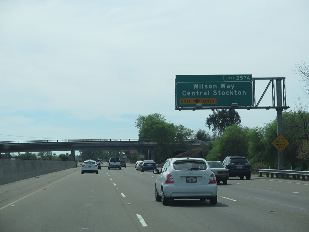
The next exit along California 99 south is Exit 257A, California 99 Business (Wilson Way) south. The business route is unsigned, and it may have been decommissioned by the city of Stockton. When it was clearly signed, California 99 Business traveled southwest on Wilson Way to pass through downtown Stockton. At Charter Way (Dr. Martin Luther King, Jr. Boulevard), California 99 Business turned east, and the two business routes followed Golden Gate Avenue southeast to merge back with California 99 at Exit 252 (California 4) east). Photo taken 03/15/15. |
|
Another advance sign is posted for Exit 257A, Wilson Way. The original ramp for Exit 257B to the western frontage road was removed and not replaced. Extensive construction was underway along California 99 near the California 4 east interchange. Photo taken 03/15/15. |
|
Use California 99 Business (Wilson Way) south to the Stockton campus of California State University - Stanislaus. Photo taken 03/15/15. |
|
The right lane of California 99 south becomes exit only for Exit 257A, California 99 Business (Wilson Way) south. Photo taken 03/15/15. |
|
Southbound California 99 reaches Exit 257A, California 99 Business (Wilson Way) south. Photo taken 03/15/15. |
|
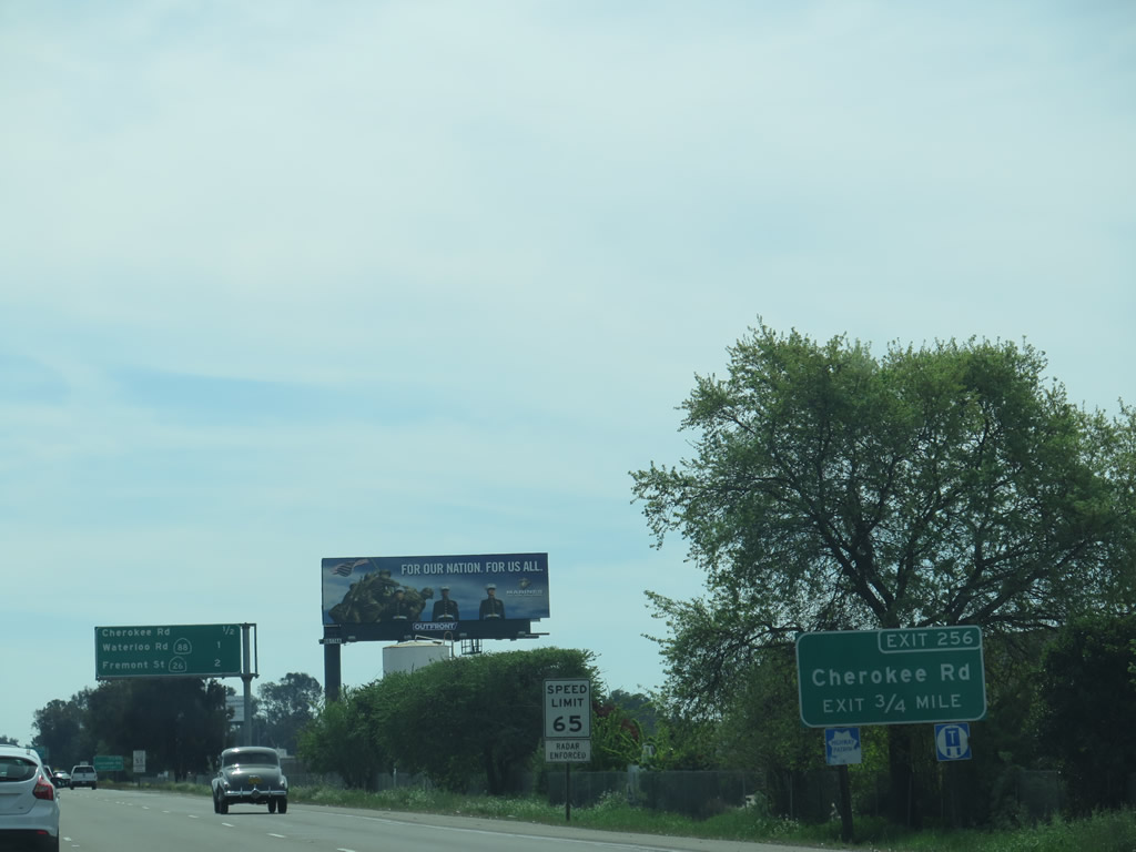
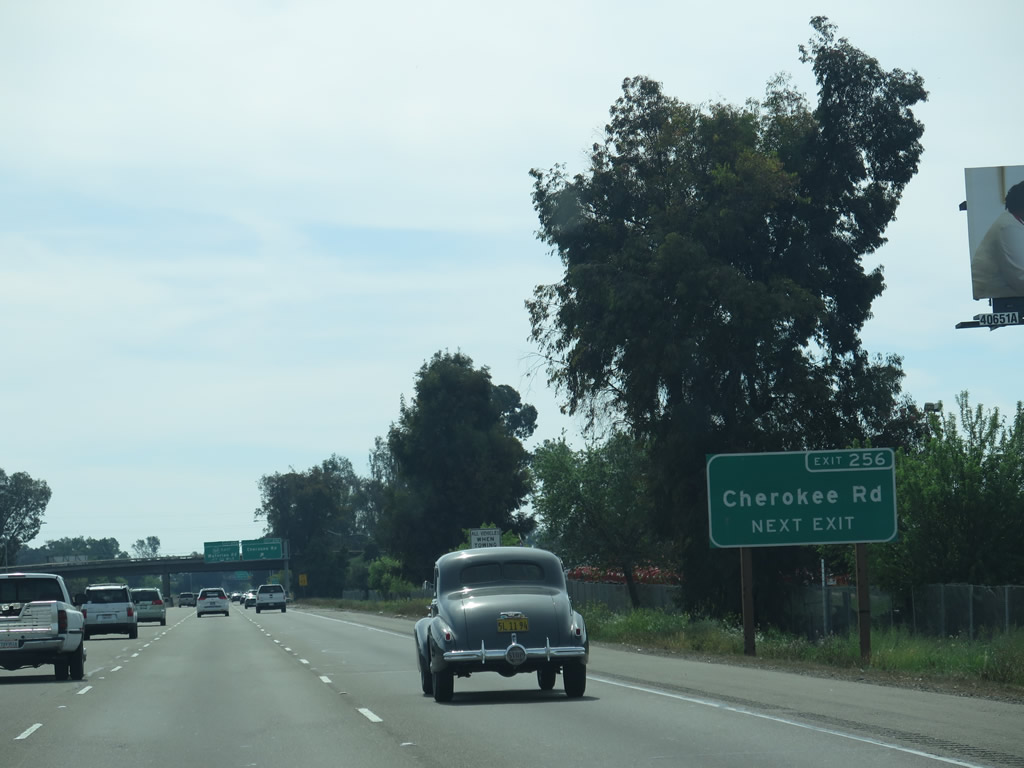
The next exit along California 99 south is Exit 256, Cherokee Road. Photo taken 03/15/15. |
|
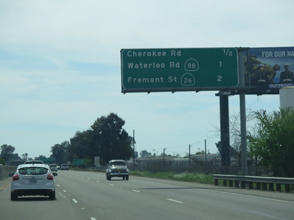
This mileage sign provides the distance to the next three exits along California 99 south: Exit 256, Cherokee Road; Exit 255, California 88 (Waterloo Road); and Exit 254, California 26 (Fremont Street). Photo taken 03/15/15. |
|
Another roadside guide sign for Exit 256 (Cherokee Road) is posted shortly thereafter. Photo taken 03/15/15. |
|
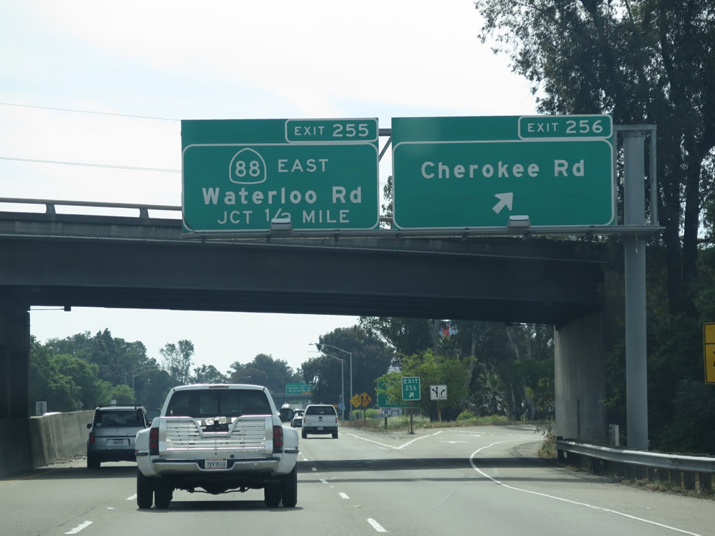
Southbound California 99 reaches Exit 256, Cherokee Road; Exit 255, California 88 (Waterloo Road); and Exit 254, California 26 (Fremont Street). Photo taken 03/15/15. |
|
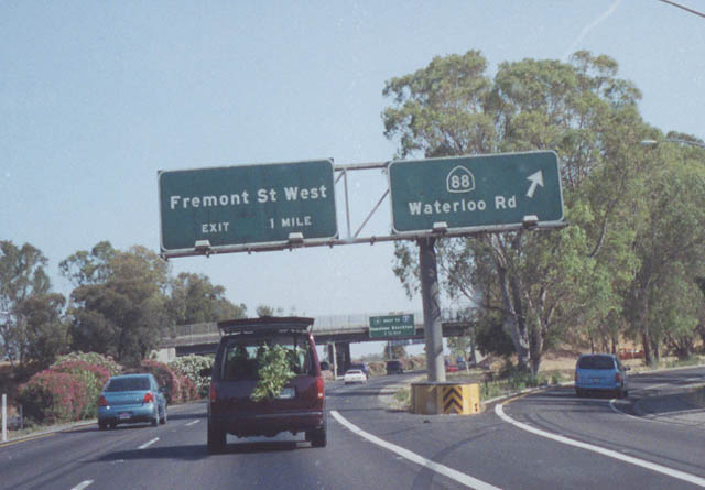
California 88 is a major east-west state route that travels east from this interchange as an all-weather route over the Sierra Nevada Mountains via Carson Pass. Other all-weather passes over the Sierra Nevada include Interstate 80, U.S. 50, and California 70. Photo taken 03/15/15. |
|
|
Southbound California 99 meets Exit 255, California 88. Use California 88 east to Jackson, which sits in the Sierra Nevada foothills along the California 49 corridor. The guide sign here was replaced between 2002 and 2011. The "butterfly gantry" seen in the 2002 picture is obsolete and generally not used anymore. Photos taken 03/15/15 and by Pete Sison (05/02). |
|
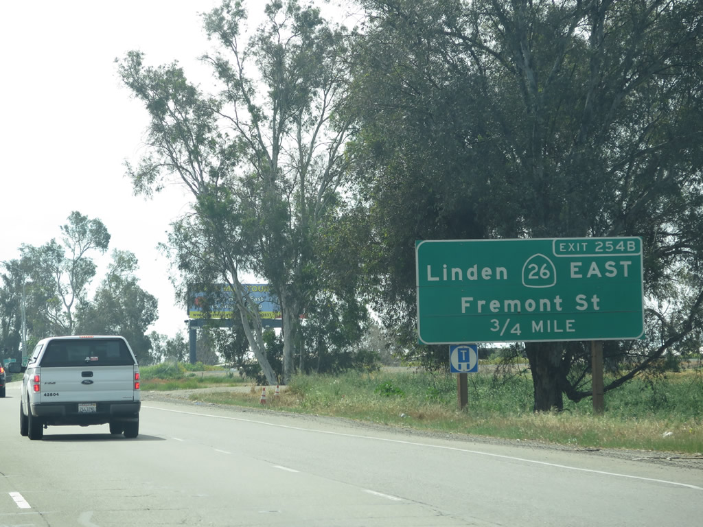
The next interchange along California 99 south is Exit 254B, California 26 (Fremont Street), followed by Exit 254A, California 4 (Crosstown Freeway) west to Interstate 5. In California, it is rare to see so many state routes converge so close to each other (California 99 intersects California 88, California 26, and California 4 in sequence). Photo taken 03/15/15. |
|
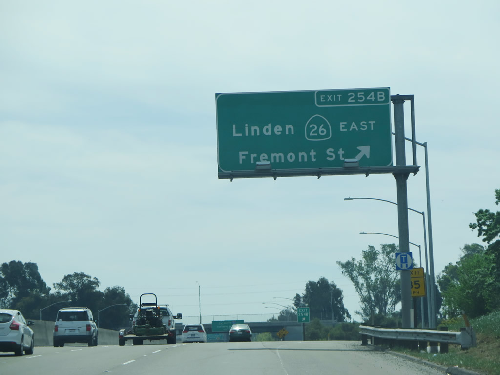
California 26 travels northwest along Fremont Street toward Linden, Rancho Calaveras, Valley Springs, Mokelumne Hill, and West Point, ending at California 88. While it seems like California 26 and California 88 are interchangeable routes, California 88 is designed as the better through route between Stockton and West Point, while California 26 meanders a bit more and "takes the scenic route," so to speak. Photo taken 03/15/15. |
|
This mileage sign provides the distance to the next three exits along California 99 south. This sign was replaced between 2011 and 2015, as the direct interchange between California 99 and Dr. Martin Luther King, Jr. Boulevard (Charter Way) was demolished and removed from service during that timeframe (in September 2014). Ongoing construction activities to widen California 99 through this area (Measure K work) were underway when we passed through this area. Photo taken 03/15/15. |
|
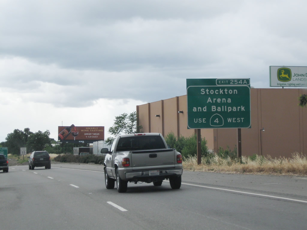
Use Exit 254A (California 4 (Crosstown Freeway) west) to the Stockton Arena and Ballpark. Photo taken 05/15/11. |
|
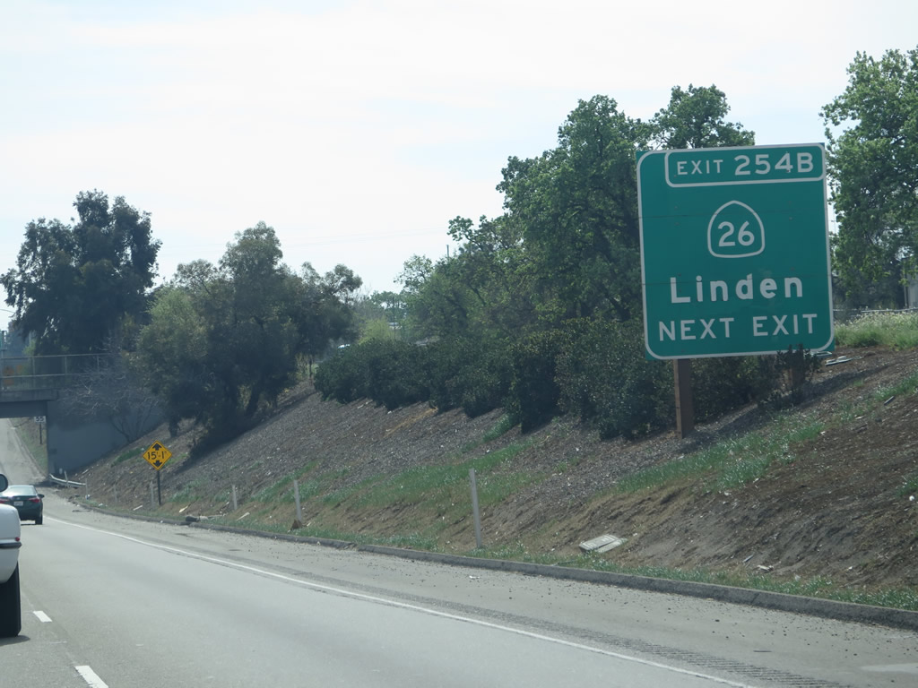
Another roadside guide sign along California 99 south points the way to Exit 254B, California 26 (Fremont Street) east to Linden. Photo taken 03/15/15. |
|
Southbound California 99 reaches Exit 254B, California 26 (Fremont Street) east to Linden. Photo taken 03/15/15. |
|
The next exit along California 99 south is Exit 254A, California 4 (Crosstown Freeway) west to Interstate 5, Central Stockton, and the Port of Stockton. Photo taken 05/15/11. |
|
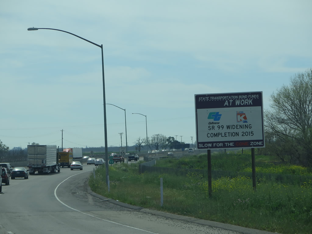
Southbound California 99 reaches Exit 254A, California 4 (Crosstown Freeway) west to Interstate 5, Central Stockton, and the Port of Stockton. This short freeway busily connects California 99 with Interstate 5, and the Route 99 Master Plan calls for any Interstate designation of the majority of the California 99 corridor to utilize California 4 as a means to link the two freeways together, which may result in a proposed Interstate 7 or Interstate 9 to transfer off California 99 in Stockton and follow California 4 west to Interstate 5 (rather than converting all of California 99 between Stockton and Sacramento to Interstate standards). Photo taken 03/15/15. |
|
High speed ramps link all connections between California 99 and California 4. Ahead, California 4 east will join California 99 south. Photo taken 03/15/15. |
| California 4 east & 99 south |
|
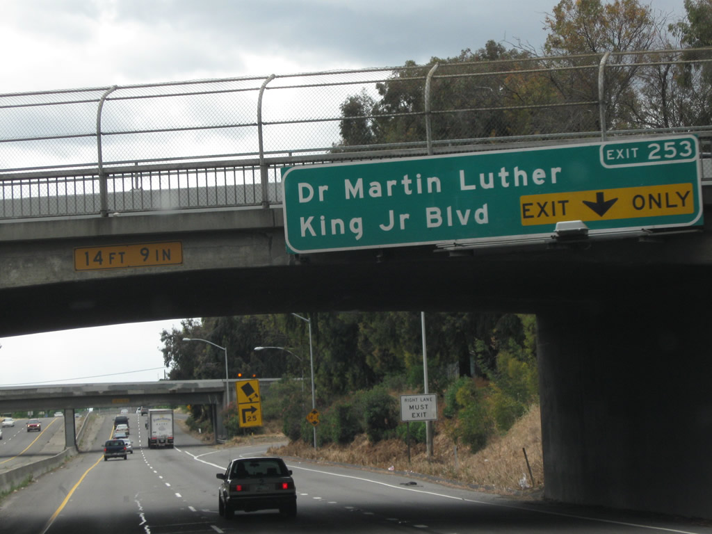
Following their merge, a reassurance shield assembly omits the California 4 east. Forthcoming Exit 253 connects with Dr. Martin Luther King, Jr. Boulevard, which was previously known as Charter Way. Dr. Martin Luther King, Jr. Boulevard (Charter Way) leads west into Downtown Stockton, and it connects to the original alignment of California 4 through the city. Photo taken 05/15/11. |
|
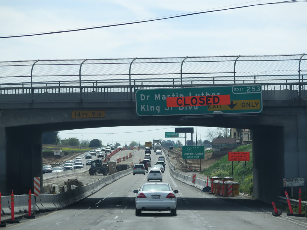
Southbound California 99 and eastbound California 4 meet Exit 253, Dr. Martin Luther King, Jr. Boulevard (Charter Way). This exit is now closed as a result of freeway widening work. Use Exit 252B, Golden Gate Avenue, as a permanent detour. Photo taken 05/15/11. |
|
By 2015, quite a bit had changed, and Measure K work was still underway. Former Exit 253, Dr. Martin Luther King, Jr. Boulevard (Charter Way), was marked as closed, and the former bridges and off-ramp were demolished. New signs for Golden Gate Avenue were in place. Photo taken 03/15/15. |
|
Looking back to the original ramp configuration, a fairly sharp turn upon exiting onto Dr. Martin Luther King, Jr. Boulevard required a significant reduction in speed upon exiting the freeway. This curve is now gone. Photo taken 05/15/11. |
|
Southbound California 99 approaches its next off-ramp, which is Exit 252B, Golden Gate Avenue to California 4 (Farmington Road) east. This sign was removed as a result of freeway widening by 2015. Photo taken 07/18/09. |
|
|
The two state routes divide at the next exit along California 99 south and California 4 east. The next exit is Exit 252B, Golden Gate Avenue and California 4 (Farmington Road) east to Angels Camp. This roadside guide sign was moved once construction activities began. Photos taken 03/15/15 and 07/18/09. |
| California 99 south |
|
Southbound California 99 meets Exit 252B, California 4 (Farmington Road) in Stockton. Prior to the construction of the Crosstown Freeway, California 4 used to enter Stockton via Farmington Road, which connects to Charter Way. This old alignment was previously designated as California 4 Business, but signs for the route were removed sometime in the 2000s. This sign was modified by 2015 to remove the reference to California 4, since the new Golden Gate Avenue off-ramp carries California 4 traffic. Photo taken 03/15/15. |
|
Southbound California 99 passes under the new Golden Gate Avenue bridge. Photo taken 03/15/15. |
|
|
Shortly thereafter, southbound California 99 meets Exit 252A, Farmington Road. Prior to the construction of the Crosstown Freeway and reconfiguration of the Golden Gate Avenue / Dr. Martin Luther King, Jr. interchange area, California 4 used to enter Stockton via Farmington Road, which connects to Charter Way via Golden Gate Avenue. This old alignment was previously designated as California 4 Business, but signs for the route were removed sometime in the 2000s. This sign was modified by 2015 to remove the reference to California 4, since the new Golden Gate Avenue off-ramp carries California 4 traffic. Photos taken 03/15/15 and 07/18/09. |
|
This sign used to be posted on the connecting ramp from California 99 south to Farmington Road; it has likely been removed since California 4 was relocated onto Golden Gate Avenue. Photo taken 07/18/09. |
|
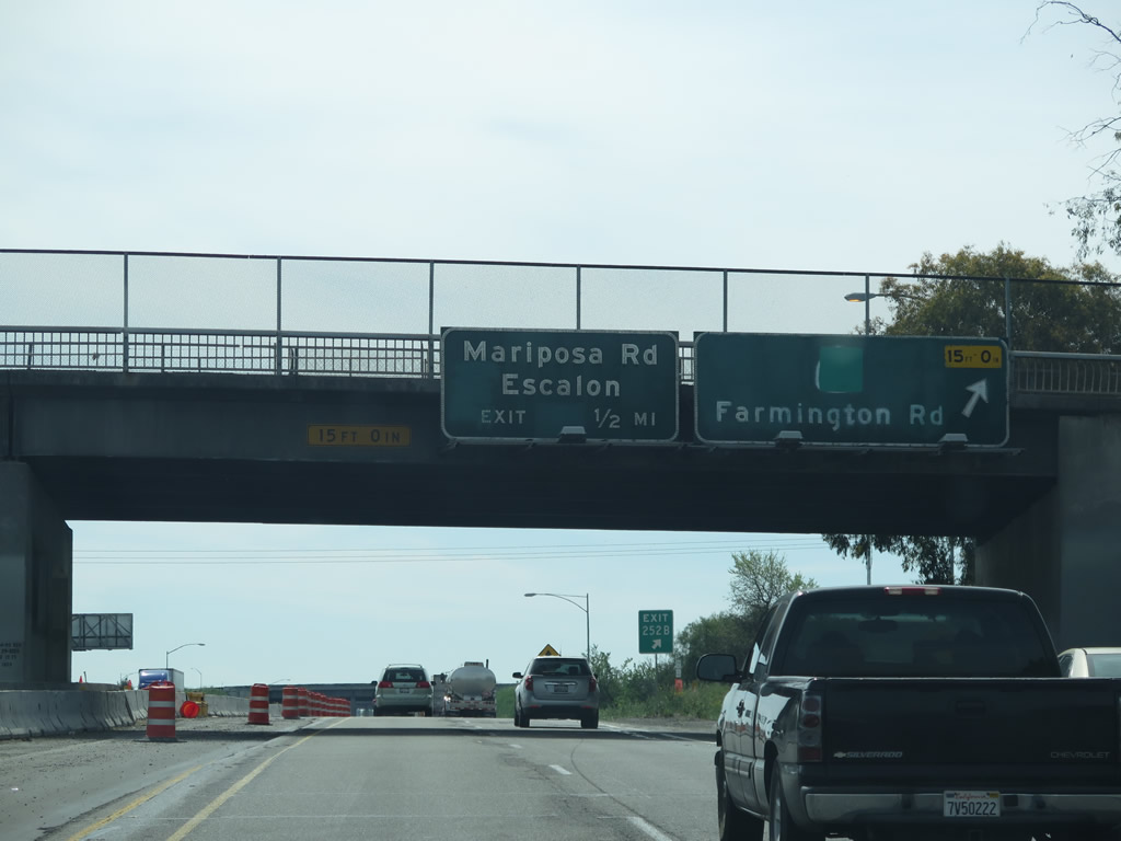
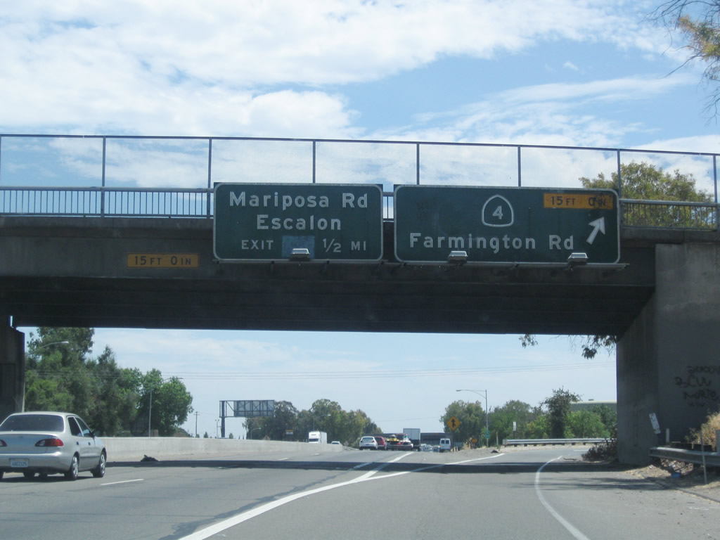
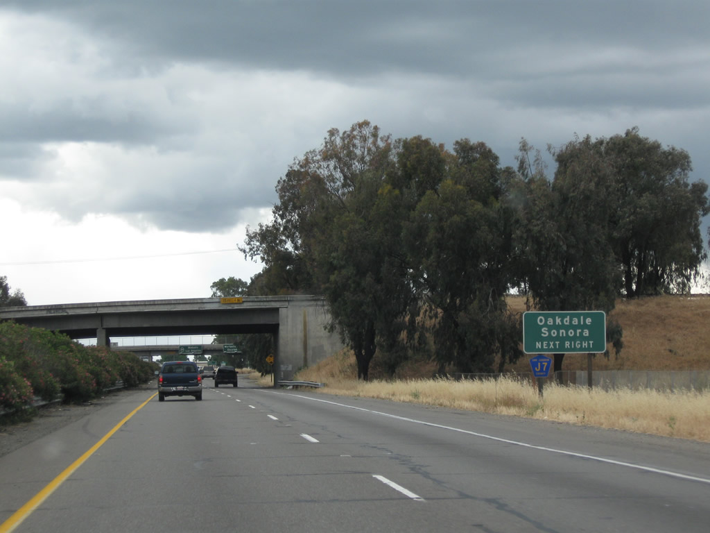
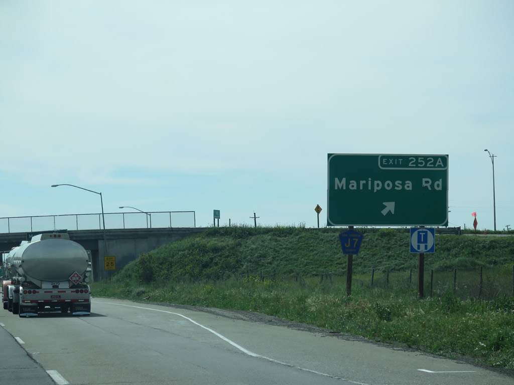
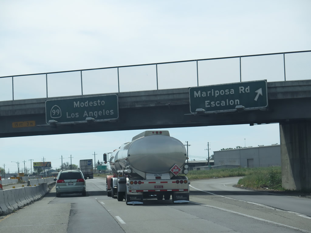
Back on the mainline, the next exit along California 99 south is a second iteration of Exit 252A, which in this case serves as a connection to San Joaquin County J-7 (Mariposa Road). CR J-7 is a nearly 60-mile long county route that serves San Joaquin, Stanislaus, and Merced Counties. The highway begins here at the junction with California 99 and travels southeast on Mariposa Road to Escalon (California 120), Santa Fe Avenue to Riverbank (California 108), Empire (California 132), Hughson, Denair, and ultimately Merced, ending at California 59. Photo taken 05/15/11. |
|
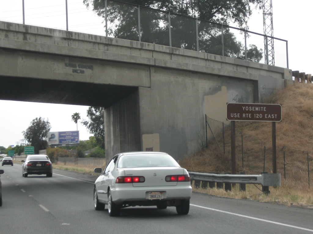
Use San Joaquin County J-7 (Mariposa Road) southeast to California 120, then California 120 east to California 108 en route to Sonora. CR J-7 cuts the hypotenuse to the right triangle created by the intersection of California 99 and California 120, which makes Mariposa Road the superior route to Sonora and points east via California 120 (such as Yosemite National Park). Photo taken 03/15/15. |
|
Southbound California 99 reaches Exit 252A, San Joaquin County J-7 (Mariposa Road) to Escalon, Oakdale, and Sonora. Photo taken 03/15/15. |
|
Leaving the central area of Stockton, this mileage sign provides the distance to Manteca (nine miles), Modesto (28 miles), and Los Angeles (341 miles) via California 99 south. Photo taken 05/15/11. |
|
A California 99 south reassurance shield assembly is posted shortly thereafter. Photo taken 05/15/11. |
|
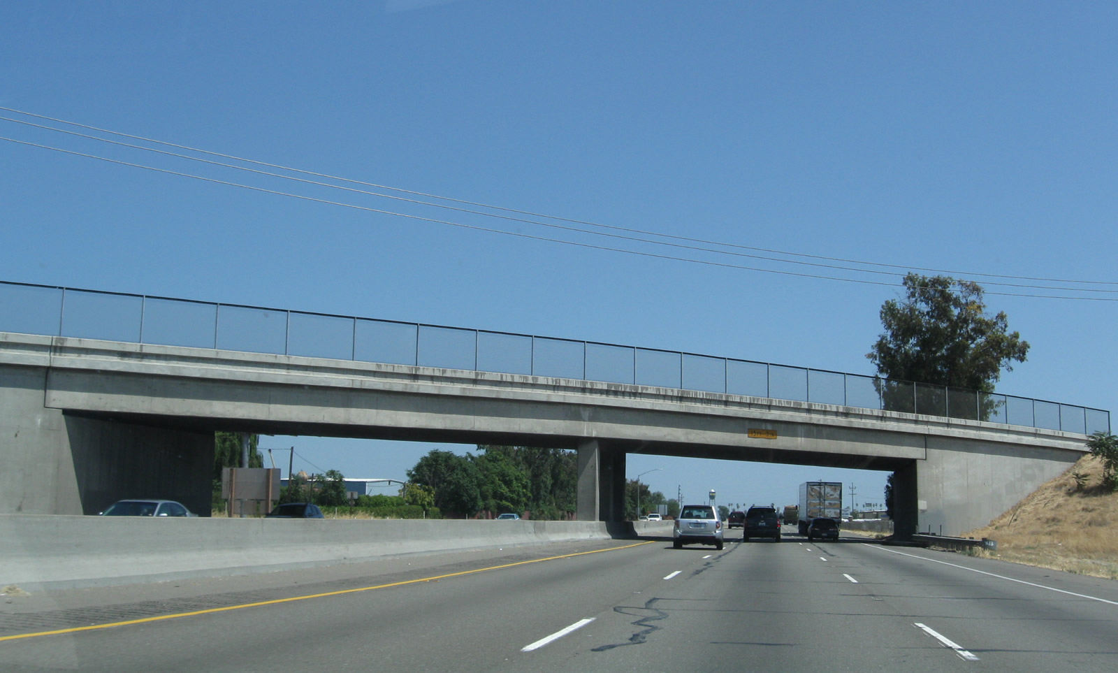
Pacific Gas and Electric power lines cross over the California 99 freeway just north of Arch Road. Photo taken 03/15/15. |
|
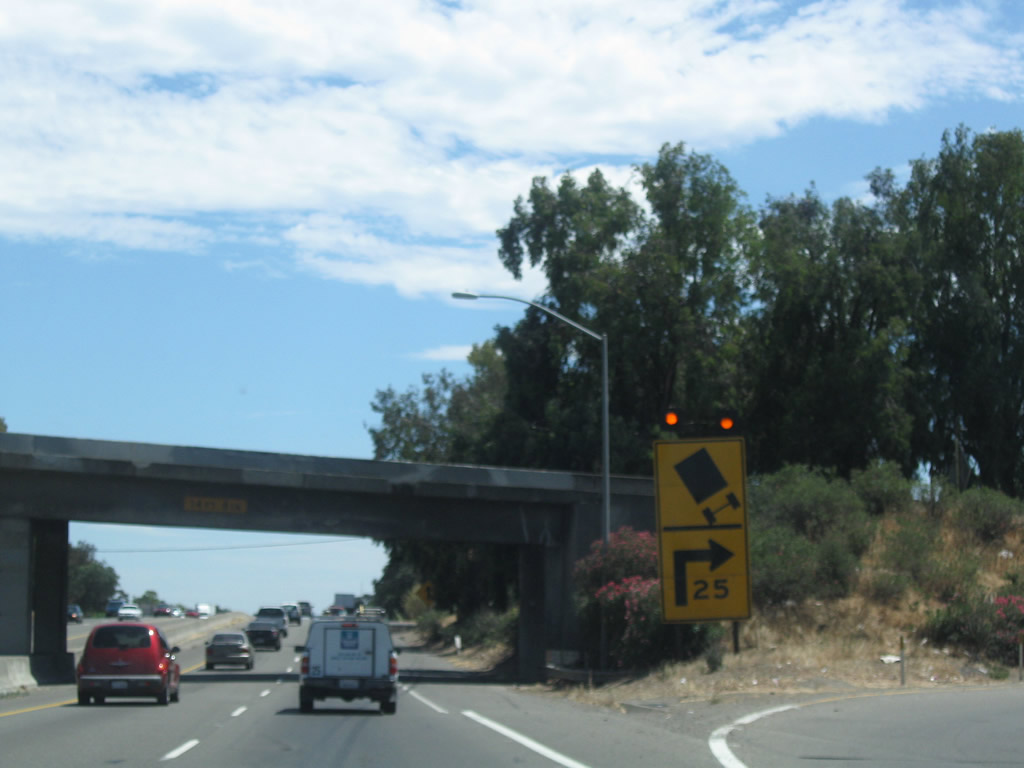
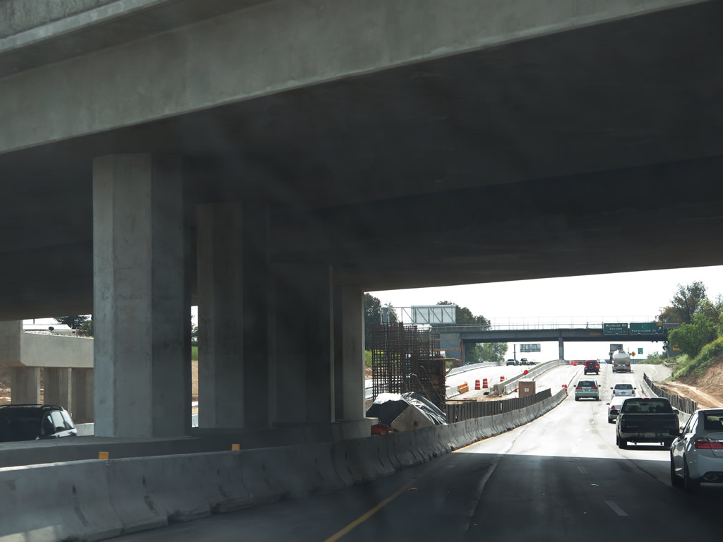
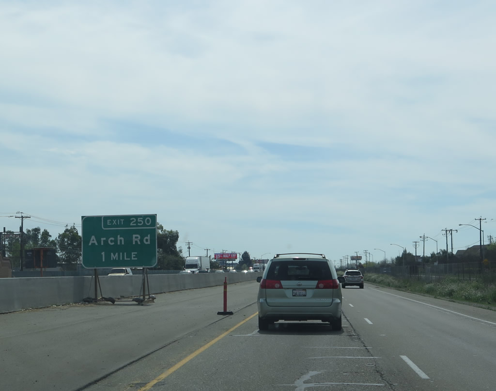
The next exit along California 99 south is Exit 250, Arch Road. The freeway was in the process of being widened to accommodate a third through lane at the time this picture was taken. Photo taken 03/15/15. |
|
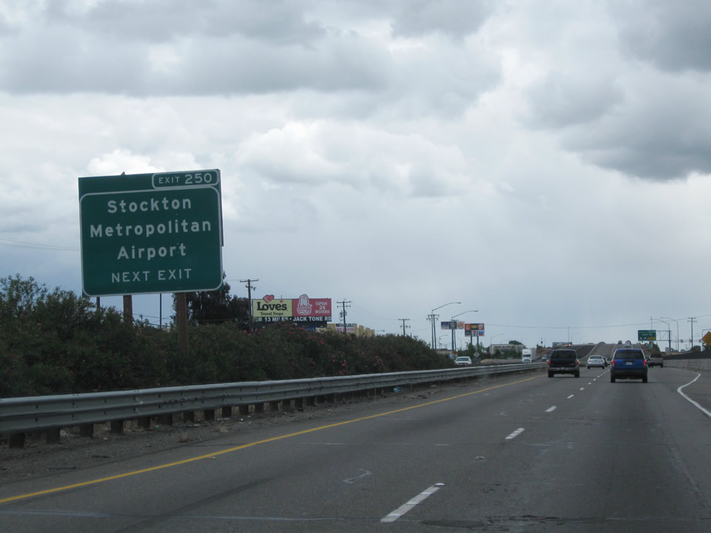
Use Exit 250, Arch Road west, to the Stockton Metropolitan Airport. Photo taken 05/15/11. |
|
Southbound California 99 reaches Exit 250, Arch Road. Photo taken 03/15/15. |
|
A temporary construction sign advises of the freeway widening underway on California 99 in 2015. Photo taken 03/15/15. |
|
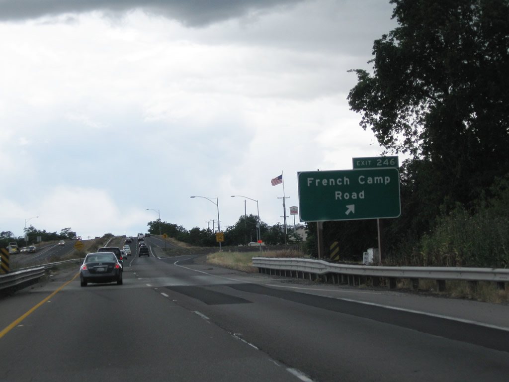
After passing through some rural agricultural lands, southbound California 99 approaches its next interchange: Exit 246, French Camp Road (one mile). Photo taken 03/15/15. |
|
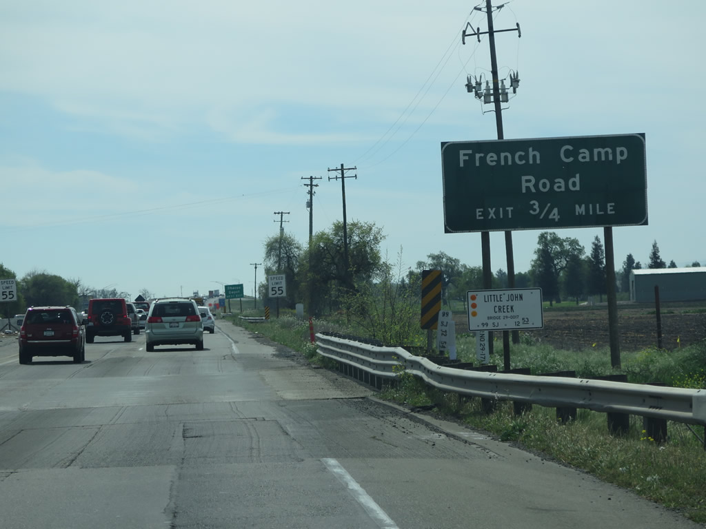
The original roadside guide sign for Exit 246 is posted shortly thereafter, near the Little John Creek crossing. Photo taken 03/15/15. |
|
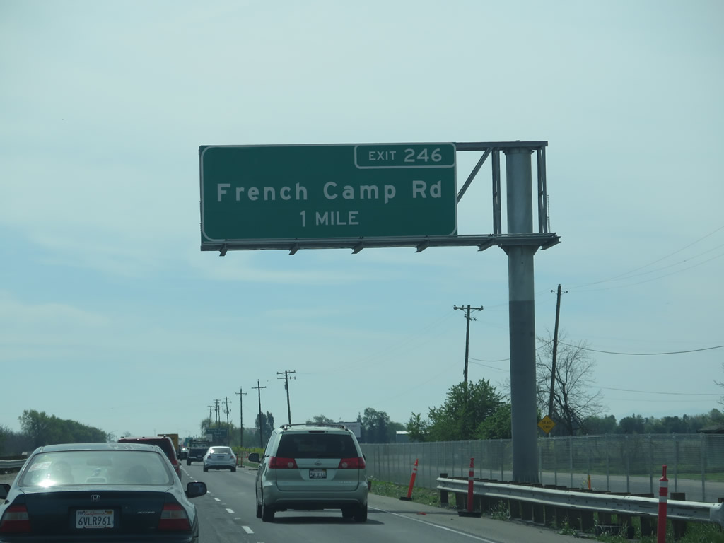
Southbound California 99 reaches Exit 246, French Camp Road. Use French Camp Road west to Interstate 5 and the community of French Camp or east to join California 120 (Yosemite Avenue) west of Escalon. Photo taken 05/15/11. |
|
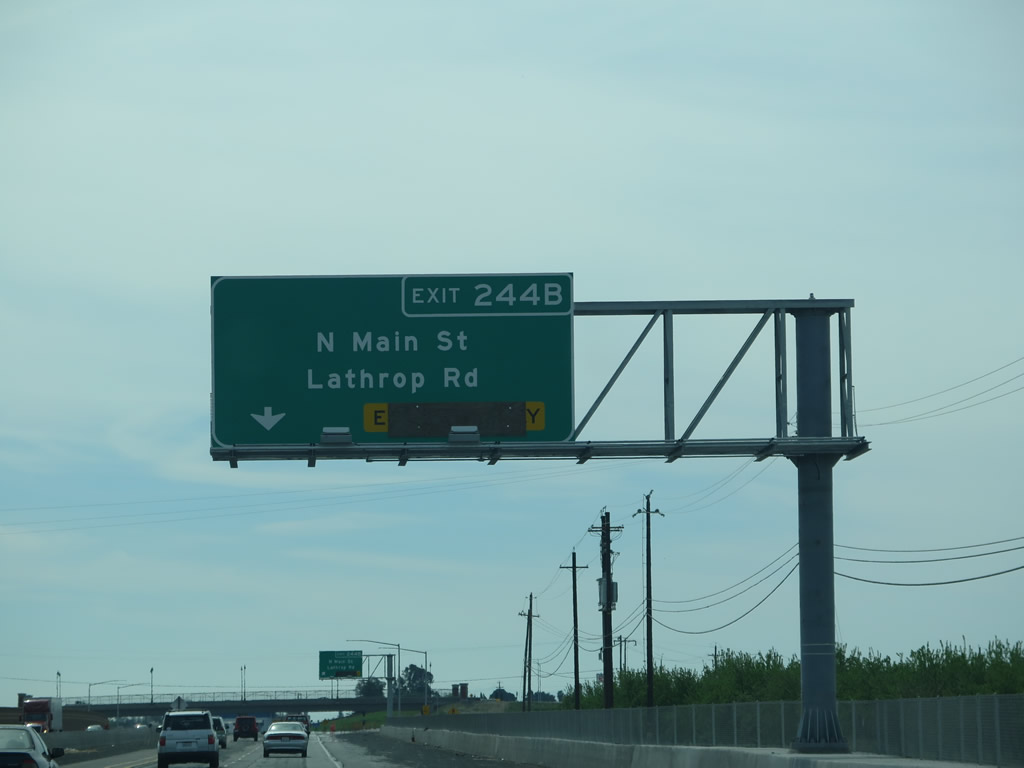
The next exit along southbound California 99 is Exit 244B, Lathrop Road and Main Street(one mile). This sign was new as of 2015 as part of the freeway widening project; it used to be a roadside sign placed in the median. Photo taken 03/15/15. |
|
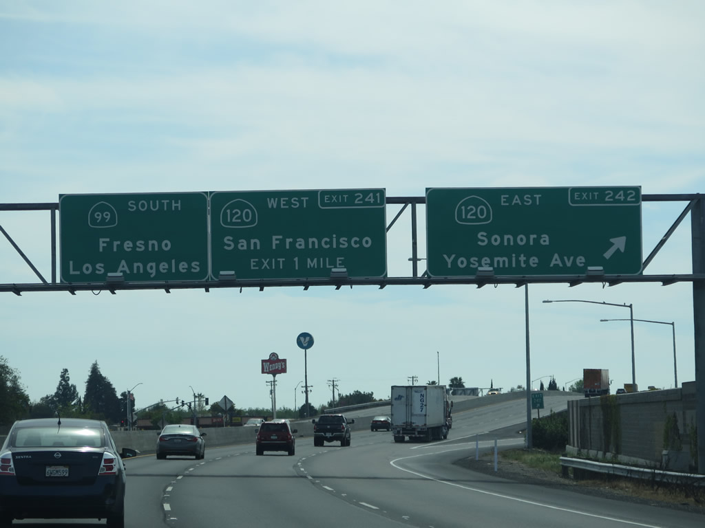
The next three exits along southbound California 99 serve the city of Manteca: Exit 244B, Lathrop Road and Main Street; Exit 242, California 120 (Yosemite Avenue) east and Yosemite Avenue west; and Exit 241, California 120 west to Tracy and San Francisco. Photo taken 03/15/15. |
|
The next three exits along southbound California 99 serve the city of Manteca: Exit 244B, Lathrop Road and Main Street; Exit 242, California 120 (Yosemite Avenue) east and Yosemite Avenue west; and Exit 241, California 120 west to Tracy and San Francisco. Photo taken 03/15/15. |
|
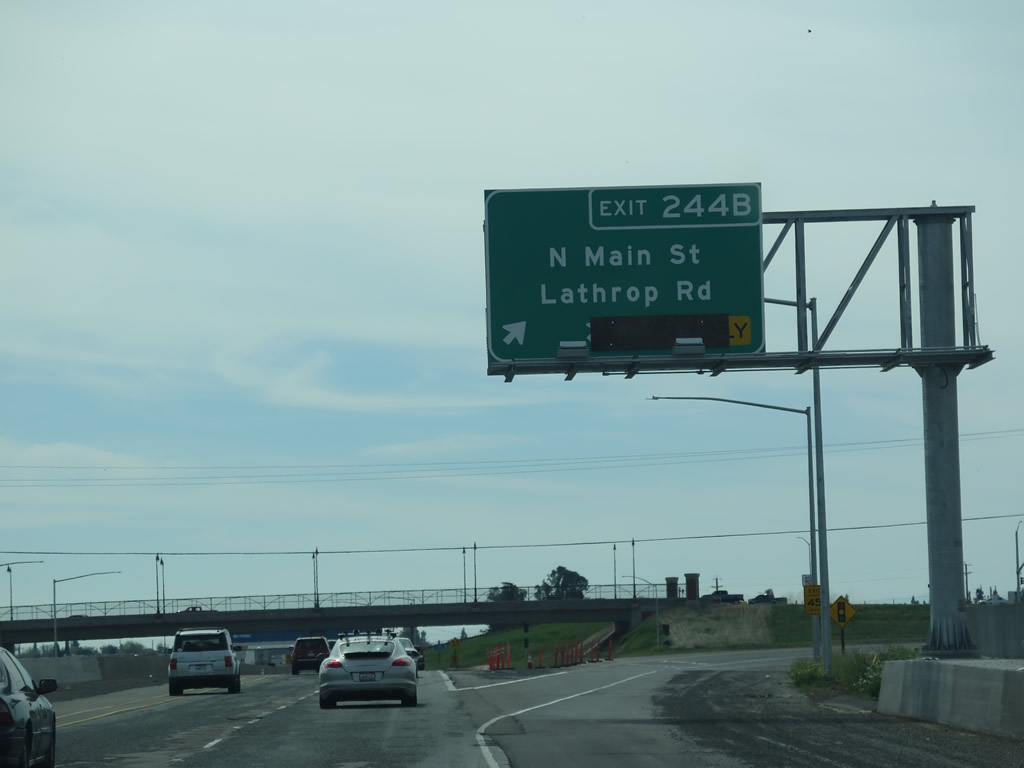
Southbound California 99 reaches Exit 244B, Lathrop Road and Main Street. It is possible that Main Street once was a California 99 Business alignment, but that is not evident today. Main Street was once part of U.S. 99. Photo taken 03/15/15. |
|
California 99 enters the city of Manteca, noted as a "friendly city located at the crossroads in the heart of California: the family city." Manteca had a population of 67,096 as of the 2010 Census and was incorporated on June 5, 1918. Its elevation is about 36 feet, as it resides not far from the San Joaquin River. Photo taken 03/15/15. |
|
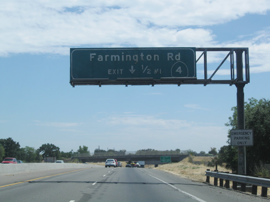
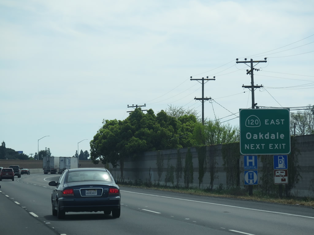
The next exit along California 99 south is Exit 242, California 120 (Yosemite Avenue) east to Escalon, Oakdale, Sonora, and Yosemite National Park. This off-ramp also connects to Yosemite Avenue west into downtown Manteca. Photo taken 03/15/15. |
|
Use California 120 (Yosemite Avenue) east to Yosemite National Park. Photo taken 05/15/11. |
|
Most motorist services can be found along Yosemite Avenue in Manteca. Photo taken 03/15/15. |
|
Southbound California 99 reaches Exit 242, California 120 (Yosemite Avenue) east to Escalon, Oakdale, Sonora, and Yosemite National Park. This off-ramp also connects to Yosemite Avenue (possible former California 120 Business?) west into downtown Manteca. Photo taken 03/15/15. |
| California 99 south & 120 west |
|
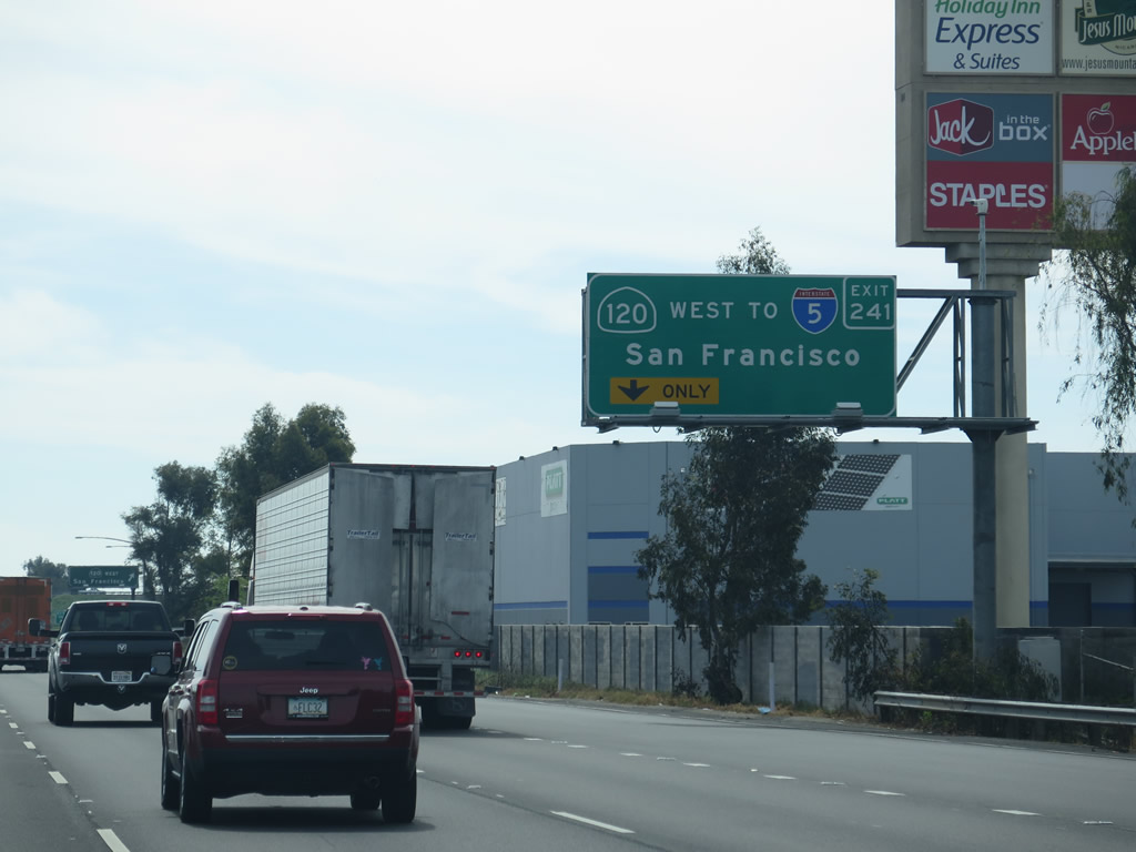
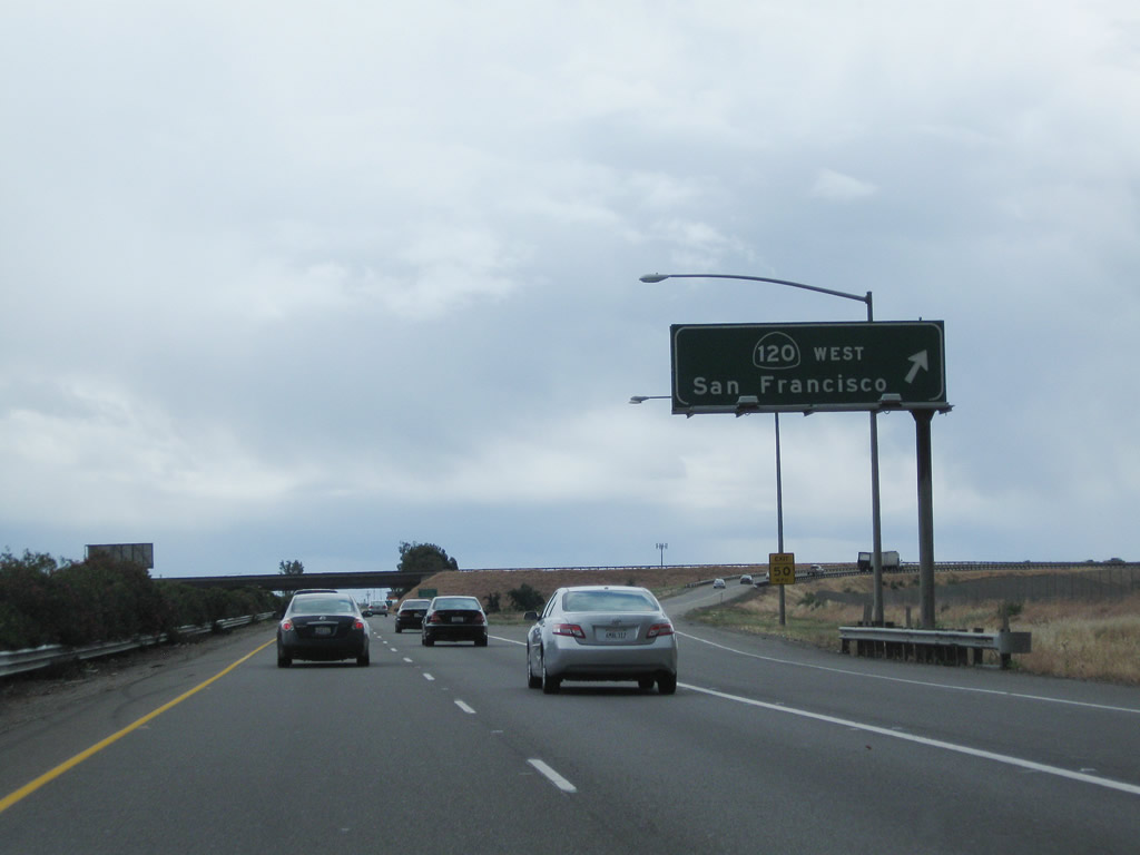
The next exit along California 99 south is Exit 241, California 120 freeway west to Tracy and San Francisco via Interstate 205 and Interstate 580. Photo taken 03/15/15. |
|
California 99 south and California 120 west split at Exit 241, California 120 freeway west to Tracy and San Francisco via Interstate 205 and Interstate 580. For long-distance travelers, this is the last opportunity to shift from the California 99 to the Interstate 5 corridor for the journey from here to Wheeler Ridge. Once past this point, motorists will remain on California 99 unless they want to make some baktracking to get to Interstate 5. Photo taken 03/15/15. |
| California 99 south |
|
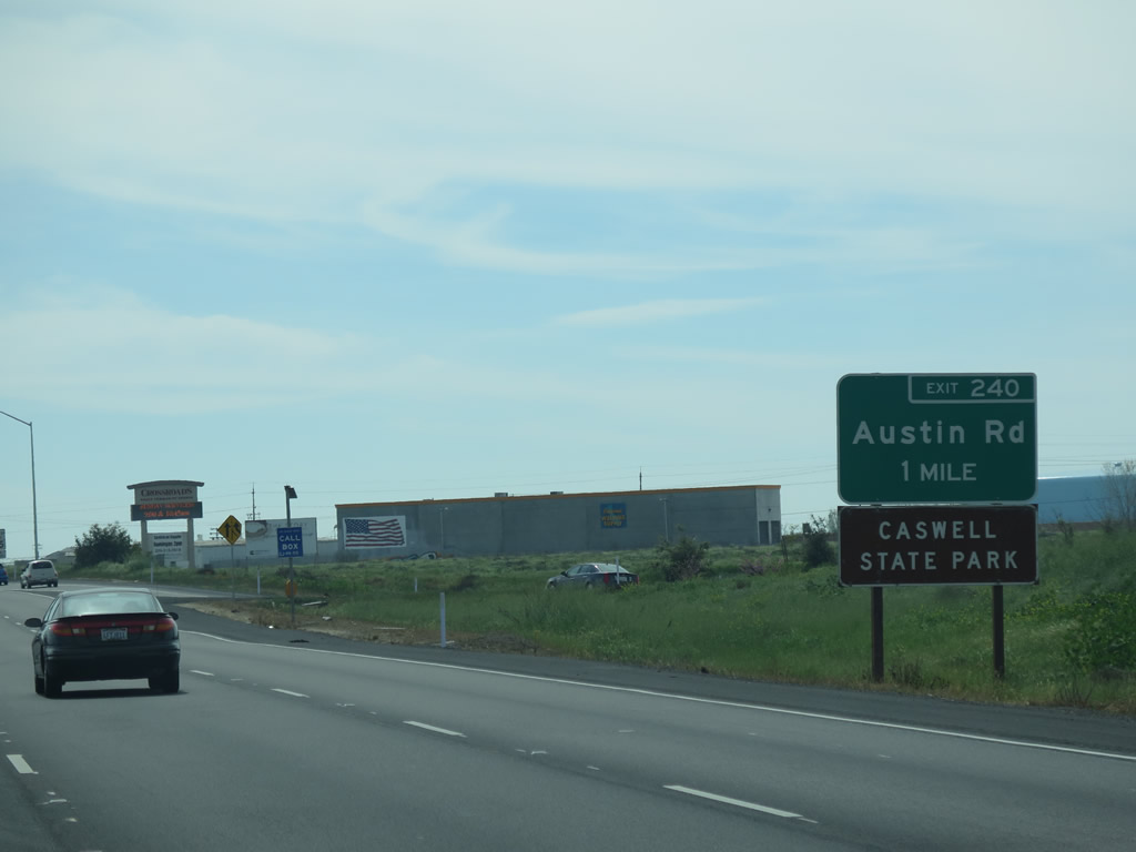
The next exit along California 99 south is Exit 240, Austin Road. Photo taken 03/15/15. |
|
A California 99 south reassurance shield is posted at the point where traffic from California 120 freeway east merges onto California 99 freeway south. Photo taken 06/21/09. |
|
This mileage sign along California 99 south provides the distance to the cities of Ripon (six miles), Modesto (15 miles), and Fresno (108 miles). Los Angeles, often shown as a southbound control city, is omitted from this sign. Photo taken 06/21/09. |
|
Southbound California 99 reaches Exit 240, Austin Road. Use Austin Road south to Caswell Memorial State Park, which is not far from Ripon and is located along the Stanislaus River. The park consists of 258 acres, of which 134 acres were from an initial donation by the Caswell family. The park was established in 1958 and is notable for its riparian oak woodland. Photo taken 06/21/09. |
|
California 99 passes under Austin Road. Photo taken 06/21/09. |
|
The ubiquitous Kat Country 103 can be heard up and down the California 99 corridor in this part of the San Joaquin Valley. Photo taken 06/21/09. |
|
|
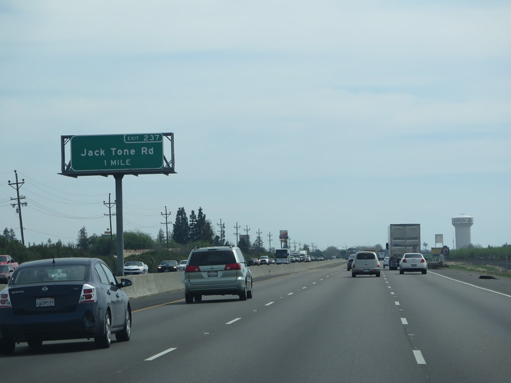
The next exit along California 99 south is Exit 237, Jack Tone Road. This one-mile advance exit guide sign for Jack Tone Road was replaced between 2009 and 2015 to include the exit number. Noted as the "longest straight road in the county" by the Jack Tone Ranch Historical Foundation, Jack Tone Road carries San Joaquin County J-5 north from Ripon to near Lockeford for a distance of over 28 miles. And yes, CR J-5 is one long, straight, almost due north drive in the rural agricultural lands east of Stockton. CR J-5 shifts off Jack Tone Road prior to meeting California 88, and it terminates at its junction with CR J-12 (Peltier Road). Photos taken 03/15/15 and 06/21/09. |
|
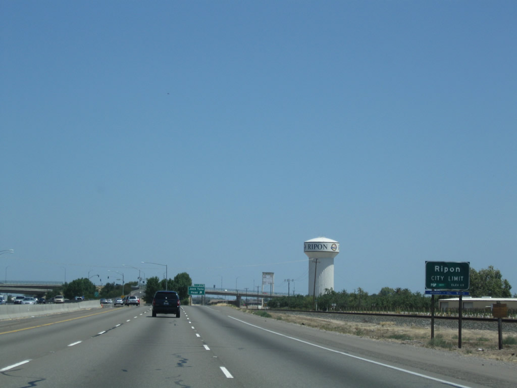
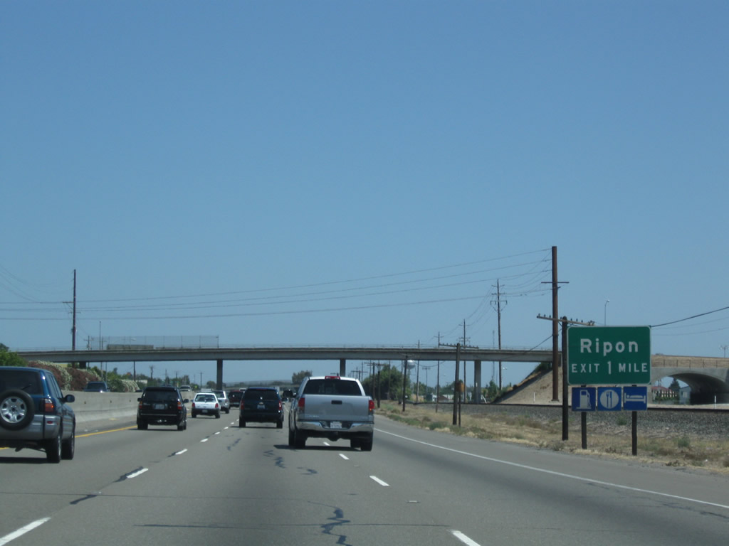
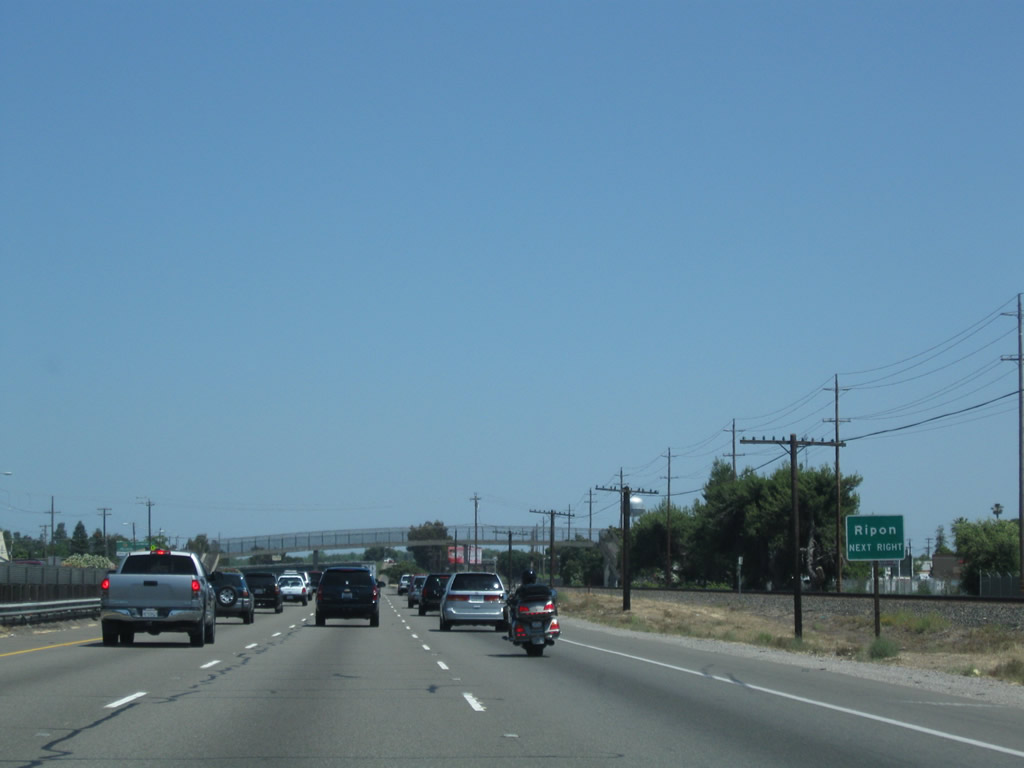
California 99 enters the city of Ripon, the "Jewel of the Valley." Ripon had a population of 14,297 as of the 2010 Census and was incorporated on November 27, 1945. This is the southernmost city within San Joaquin County along California 99. Photo taken 06/21/09. |
|
|
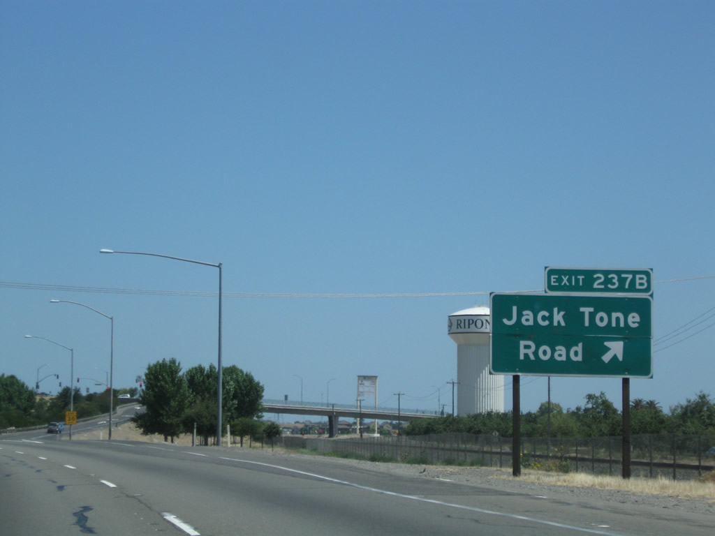
Southbound California 99 reaches Exit 237, San Joaquin County J-5 (Jack Tone Road) north and Jack Tone Road south. This interchange marks the southern terminus of CR J-5. Photos taken 03/15/15 and 06/21/09. |
|
California 99 passes under Jack Tone Road. Photo taken 06/21/09. |
|
SR 99 reassurance shield posted after the Jack Tone Road overpass in Ripon. Photo taken 05/15/11. |
|
|
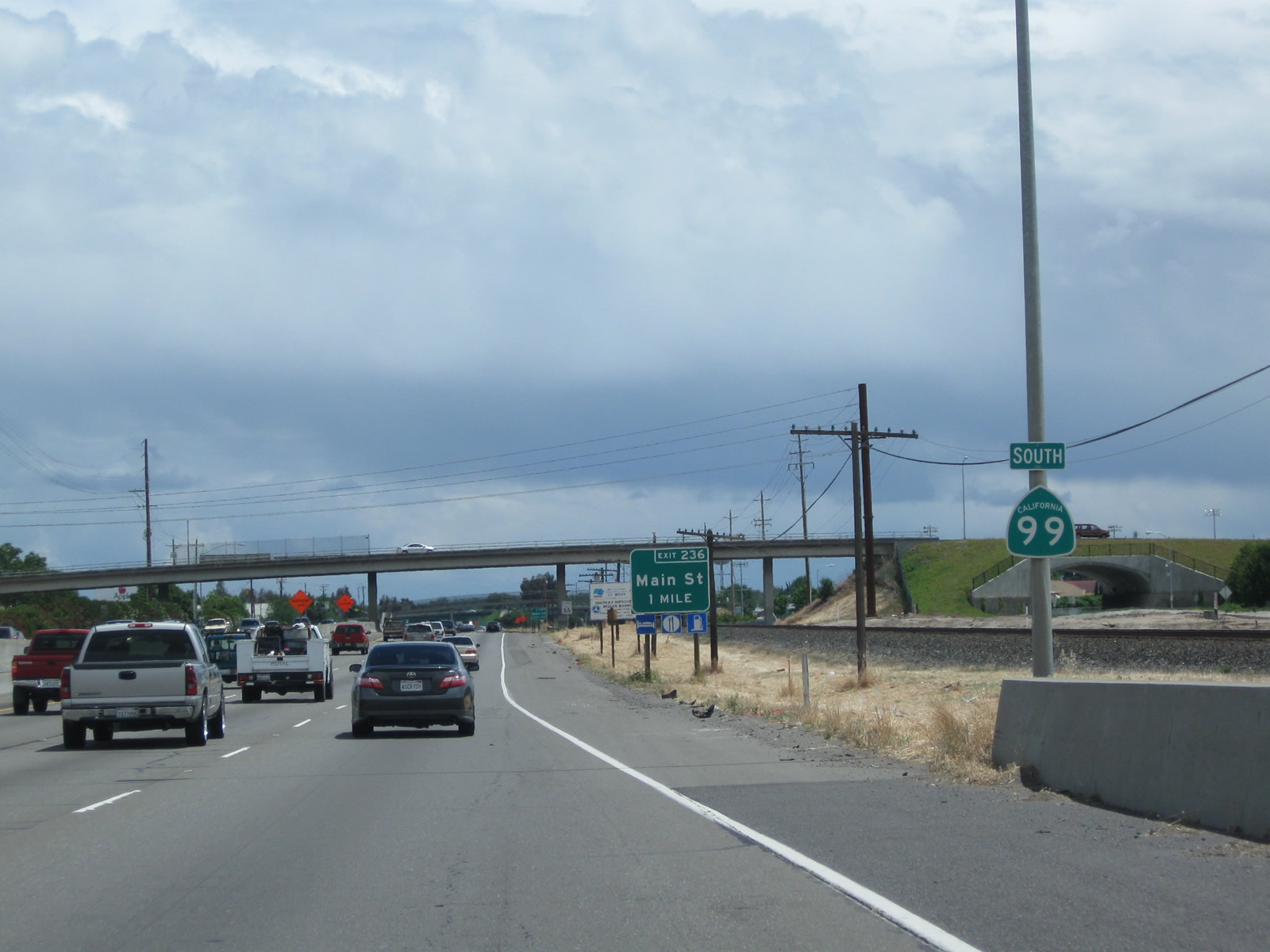
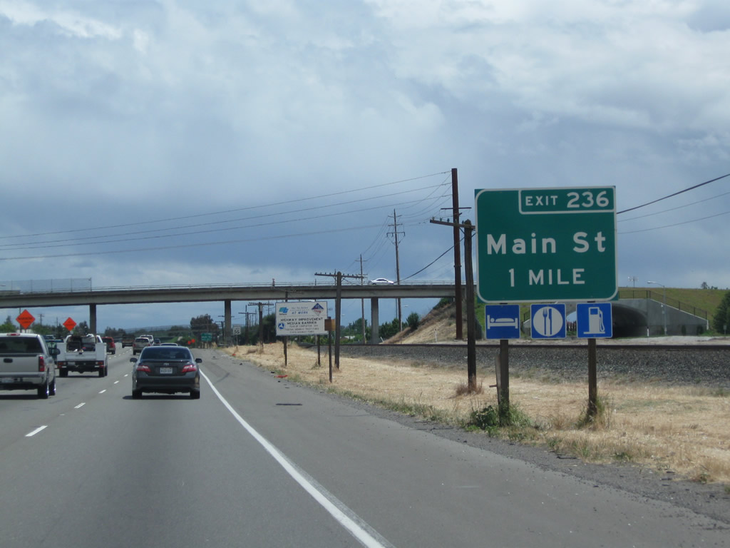
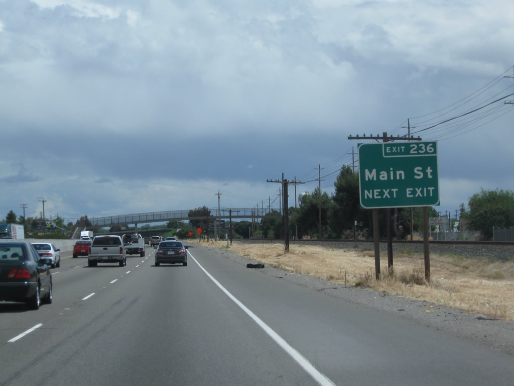
The next exit along California 99 south is Exit 236, Main Street (one mile) to Ripon. Photos taken 05/15/11 and 06/21/09. |
|
|
Use Exit 236, Main Street to Ripon. Photos taken 05/15/11 and 06/21/09. |
|
Southbound California 99 reaches Exit 236, Main Street to Ripon. Photo taken 05/15/11. |
|
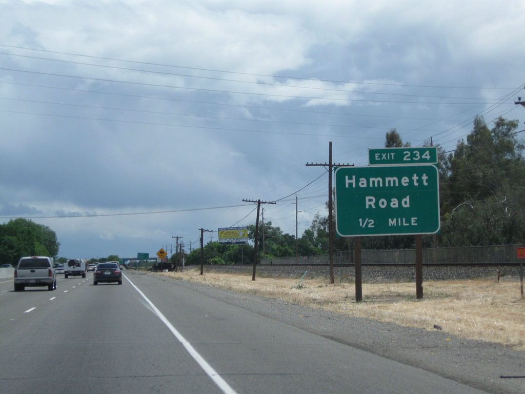
The next exit along California 99 south is Exit 234, Hammett Road. Photo taken 05/15/11. |
|
This mileage sign along California 99 south provides the distance to Salida (three miles), Modesto (10 miles), and Fresno (103 miles). Photo taken 05/15/11. |
|
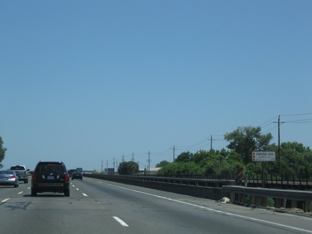
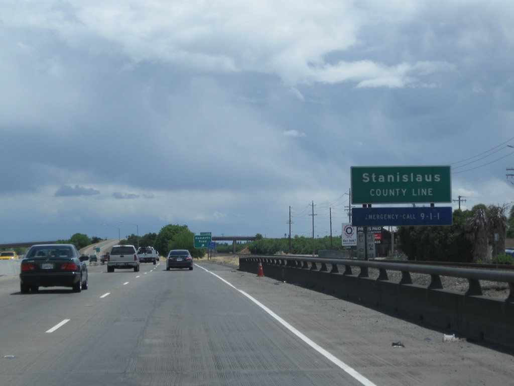
California 99 crosses the Stanislaus River, which serves as the county line between San Joaquin and Stanislaus Counties. Photo taken 06/21/09. |
|
Sure enough, California 99 leaves San Joaquin County and enters Stanislaus County just before the off-ramp to Exit 234, Hammett Road. Photo taken 05/15/11. |
Page Updated March 22, 2015.