

California 99 South - Merced County
| California 99 south | |
|---|---|
 |
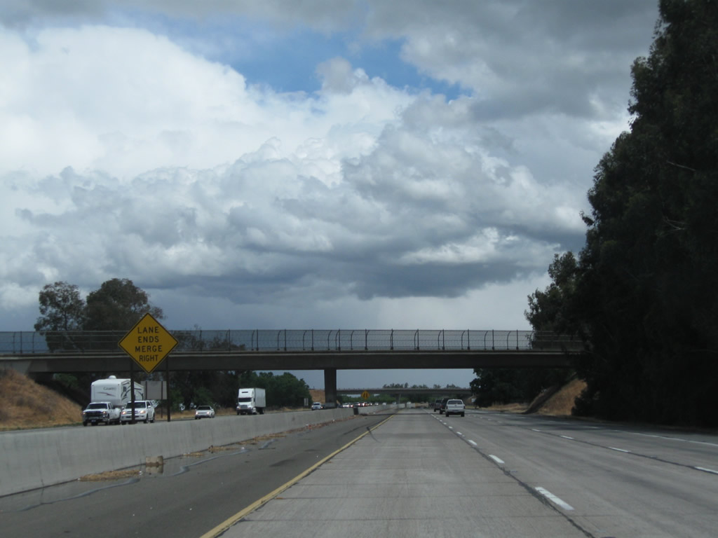
After the rest area, California 99 leaves Stanislaus County and enters Merced County. A profusion of postmile paddles are located at the county line to show changes in mileage at the county line. Ahead, the next exit will be Exit 208, Bradbury Road. There is no access along southbound California 99 to Exit 209, California 99 Business (Golden State Boulevard) north to Turlock. Photo taken 06/21/09. |
 |
The next exit along California 99 south is Exit 208, Bradbury Road (one mile). Photo taken 05/15/11. |
 |
As of 2015, the three-lane southbound segment narrows to two lanes; however, plans call for this section to be widened to three lanes in each direction. Ahead is the Delhi bypass freeway segment of California 99. Photo taken 05/15/11. |
 |
Traffic connecting from California 99 Business (Golden State Boulevard) crosses over California 99; the freeway and business routes will reunite shortly. Photo taken 06/21/09. |
 |
Traffic from southbound California 99 Business merges with the California 99 freeway. A California 99 route marker is posted here as well. Ahead, the new right lane becomes exit only for Exit 208, Bradbury Road. Photo taken 06/21/09. |
 |
Southbound California 99 reaches Exit 208, Bradbury Road. Photo taken 06/21/09. |
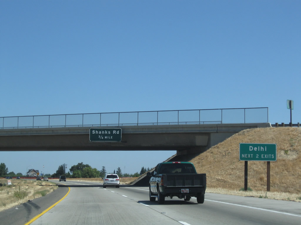 |
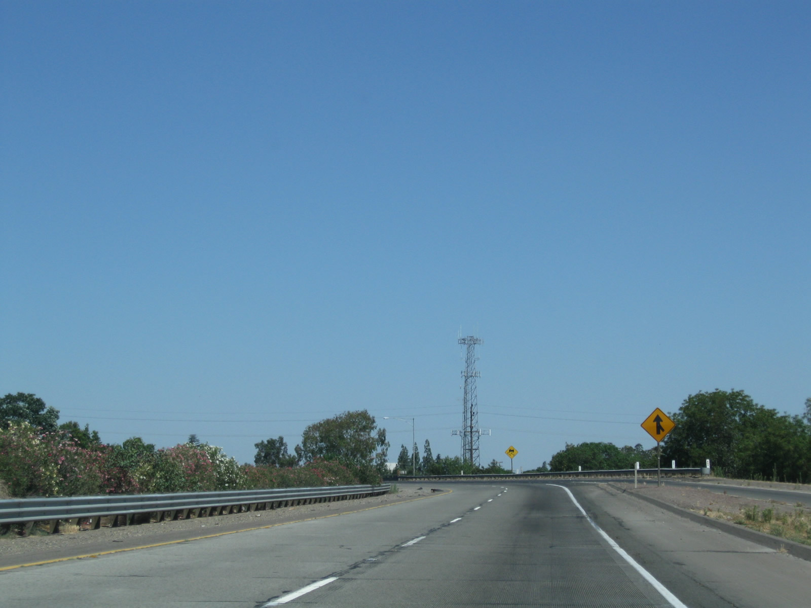
The next exit along California 99 south is Exit 207, Shanks Road (0.75 mile). Both Exit 207 (Shanks Road) and Exit 206 (South Avenue) serve the unincorporated community of Delhi (population 10,755 as of the 2010 Census). Photo taken 06/21/09. |
 |
A California 99 south reassurance shield is posted shortly after the on-ramp from Bradbury Road in Delhi. Photo taken 06/21/09. |
 |
Use Shanks Road east to McConnell State Recreation Area. Photo taken 06/21/09. |
 |
Southbound California 99 meets Exit 207, Shanks Road in Delhi. Photo taken 06/21/09. |
 |
This view looks south on California 99 as it passes through the Shanks Road interchange in Delhi. Photo taken 06/21/09. |
 |
A California 99 south route marker is posted after the on-ramp from Shanks Road in Delhi. Photo taken 06/21/09. |
 |
The next interchange along California 99 south is Exit 206, South Avenue in Delhi. Photo taken 06/21/09. |
 |
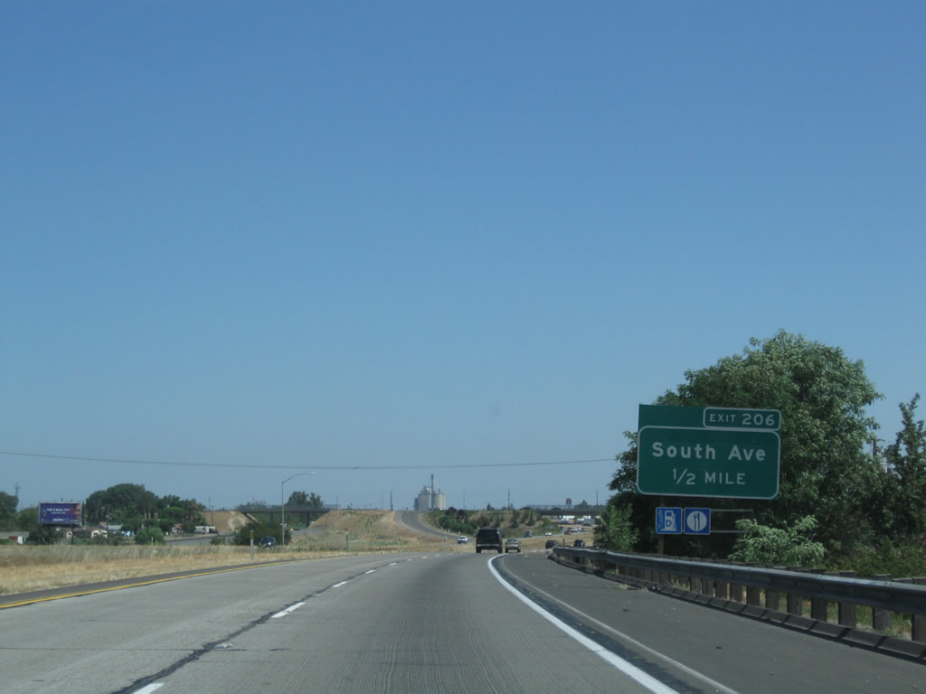
Southbound California 99 reaches Exit 206, South Avenue. Photo taken 06/21/09. |
 |
This mileage sign along California 99 south provides the distance to Livingston (three miles), Merced (18 miles), and Los Angeles (293 miles). Photo taken 06/21/09. |
 |
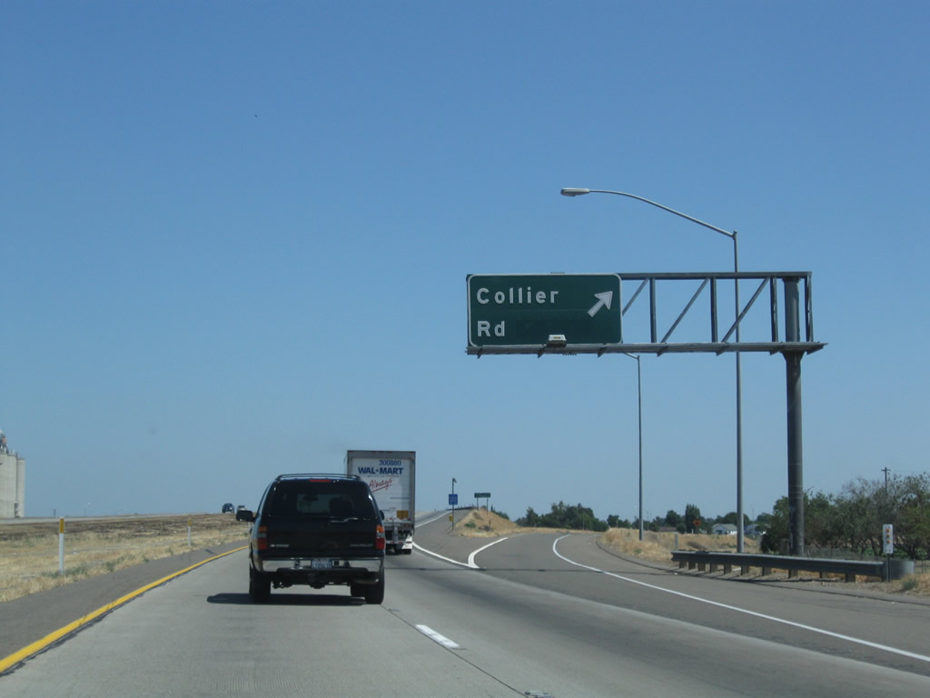
The next exit along California 99 south is Exit 204, Collier Avenue (one mile). Photo taken 06/21/09. |
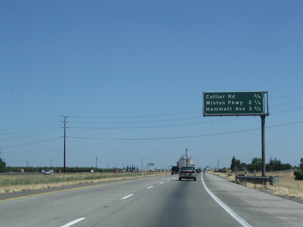 |
An interchange sequence sign is posted soon thereafter along California 99 south; the sign provides the distance to the next three exits: Exit 204, Collier Avenue; Exit 203, Winton Avenue; and Exit 201, Hammatt Avenue. Photo taken 06/21/09. |
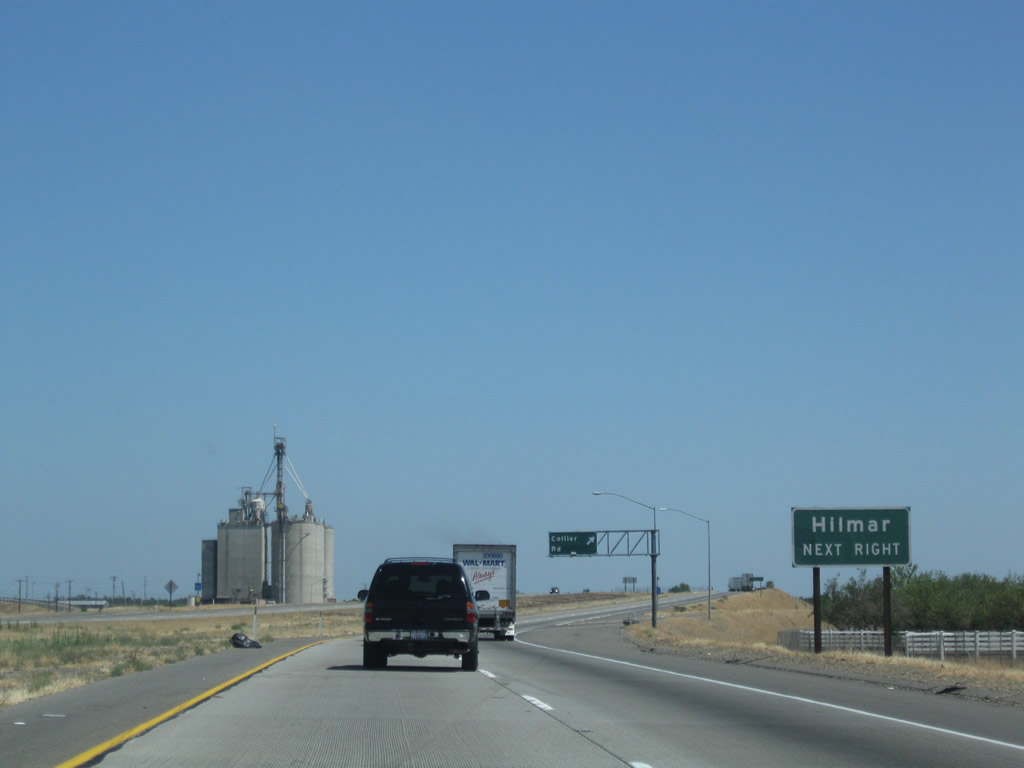 |
Use Collier Avenue west to Bloss Avenue to the city of Hilmar, which is located on the California 165 corridor west of here. Photo taken 06/21/09. |
 |
Southbound California 99 reaches Exit 204, Collier Avenue. Photo taken 06/21/09. |
 |
The next exit along California 99 south is Exit 203, Winton Parkway (0.75 mile). Photo taken 06/21/09. |
 |
The next two exits along California 99 south serve the city of Livingston, "The Last Stop." Livingston likely received this motto for its notoriety of being the location of the last traffic signal along the California 99 corridor from Wheeler Ridge to Sacramento; the signal was removed from the state highway in December 1996 as part of a new California 99 bypass of Livingston.1 This traffic signal was formerly located at today's intersection of Campbell Boulevard (historic routing of California 99 before freeway was implemented) and Main Street, also known as Livingston-Cressy Road. To see the old traffic signal, it is preserved on the grounds of the Livingston Historical Museum, which is located at the intersection of Main Street and C Street. The museum is reached via Winton Parkway south and B Street east into downtown Livingston. The city had a population of 13,058 as of the 2010 Census and was incorporated on September 11, 1922. The two exits to serve Livingston are Exit 203, Winton Parkway and Exit 201, Hammatt Avenue. Photo taken 06/21/09. |
 |
Use Exits 203 or 201 to the city of Livingston. There does not appear to be a signed business route through downtown Livingston, but the most direct route appears to be Winton Parkway south to B Street east to Main Street. There is no direct access from southbound California 99 to the extant, remaining segment of old California 99 on Campbell Boulevard, which is the eastern frontage road. Photo taken 06/21/09. |
 |
Southbound California 99 reaches Exit 203, Winton Parkway. The next exit will be Exit 201, Hammatt Avenue. Photo taken 05/15/11. |
 |
All motorist services are available in Livingston and many are freeway-close at Exit 203, Winton Parkway. Photo taken 05/15/11. |
 |
Between Exit 203, Winton Parkway and Exit 201, Hammatt Avenue, California 99 follows the 1996 bypass route that skirts the northeastern edge of downtown Livingston. Photo taken 06/21/09. |
 |
The next exit along California 99 south is Exit 201, Hammatt Avenue in Livingston. Here, California 99 passes under the railroad. Photo taken 06/21/09. |
 |
The railroad bridge is uniquely constructed due to the angles at which the railroad and freeway intersect each other. Photo taken 06/21/09. |
 |
A third southbound lane could be accommodated under the railroad overpass. Photo taken 06/21/09. |
 |
Southbound California 99 meets Exit 201, Hammatt Avenue. Photo taken 06/21/09. |
 |
Widening to three southbound lanes, the next exit along California 99 south is Exit 200, Sultana Drive south and Liberty Avenue east. The 2009 picture only shows two southbound lanes, but by 2011, the freeway was widened to three southbound lanes. Photo taken 06/21/09. |
 |
Southbound California 99 reaches Exit 200, Sultana Drive south and Liberty Avenue east. Photo taken 05/15/11. |
 |
The next exit along California 99 south is Exit 198, Merced County J-18 (Westside Boulevard) west and Bellevue Road east. This interchange opened to traffic around 2010; it was not yet in service when we passed through in June 2009. Photo taken 05/15/11. |
 |
A dynamic message sign is in place shortly thereafter. Photo taken 05/15/11. |
 |
This view shows the old 99 expressway still in use in 2009, with the new freeway visible in the distance. The overpass under construction is now in service as the Westside Boulevard interchange. As a result of the freeway opening, the expressway segment here was removed from service and is no longer in use. Photo taken 06/21/09. |
 |
Merced County J-18 follows Westside Boulevard from this interchange west to Interstate 5 at the Stuhr Road interchange. From California 99 Exit 198, J-18 travels west via Westside Boulevard, River Road, Hills Ferry Road, and Stuhr Road. Photo taken 05/15/11. |
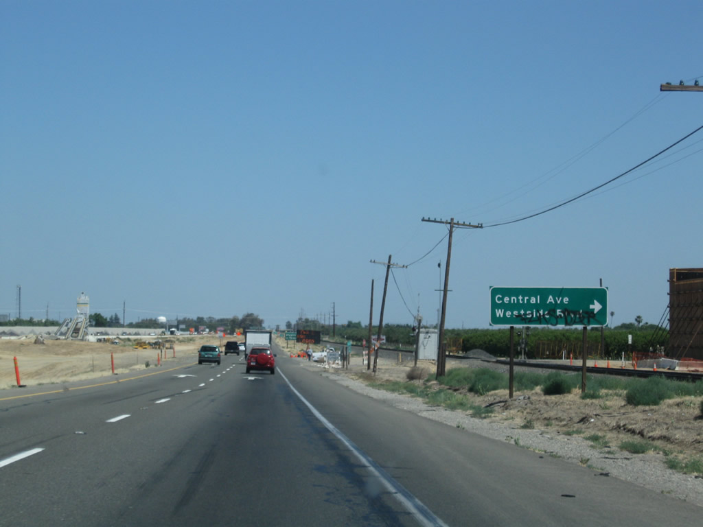 |
Going back to 2009, the SR 99 expressway approaching the turnoff onto Westside Boulevard and Central Avenue. Photo taken 05/15/11. |
 |
Southbound California 99 reaches Exit 198, Merced County J-18 (Westside Boulevard) west and Bellevue Road east. No standalone signs for CR J-18 are apparent on this recently opened stretch of freeway. Photo taken 05/15/11. |
 |
Coming into Atwater, this mileage sign provides the distance to the next three exits along California 99 south: Exit 196, California 99 Business (Atwater Boulevard); Exit 195, Bell Drive and Applegate Road; and Exit 193, Buhach Road and Castle Airport. Photo taken 05/15/11. |
 |
The next two exits along California 99 serve the city of Atwater ("Community Pride, City Wide"), which had a population of 28,168 as of the 2010 Census and was incorporated on August 16, 1922. Photo taken 05/15/11. |
 |
Back on the old expressway that is no longer in use, a temporary advance sign appeared for Exit 196, California 99 Business (Atwater Boulevard). Photo taken 06/21/09. |
 |
Returning to the new freeway mainline, a California 99 south reassurance shield is posted after the on-ramp from Westside Boulevard. Photo taken 05/15/11. |
 |
California 99 Business (old U.S. 99) follows Atwater Boulevard through the city of Atwater by connecting to the freeway at Exits 196 and 194. The freeway bypasses the city center to the southwest. Photo taken 05/15/11. |
 |
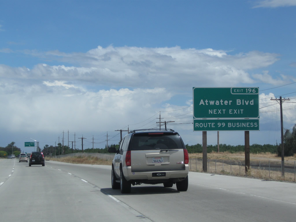
Southbound California 99 reaches Exit 196, California 99 Business (Atwater Boulevard) south. Photo taken 05/15/11. |
 |
Back in 2009, the original porcelain enamel guide sign for Exit 196 was in place. Notably, it featured two California 99 route markers that overlaid larger U.S. 99 route markers, and the effort to hide the U.S designation was still evident decades after U.S. 99 was decommissioned through the Central Valley. This sign and its companion "Atwater" sign have since been removed from service once the approach freeway from the north was completed in 2010. Photo taken 06/21/09. |
 |
After Exit 196, California 99 formally enters the city of Atwater. Photo taken 05/15/11. |
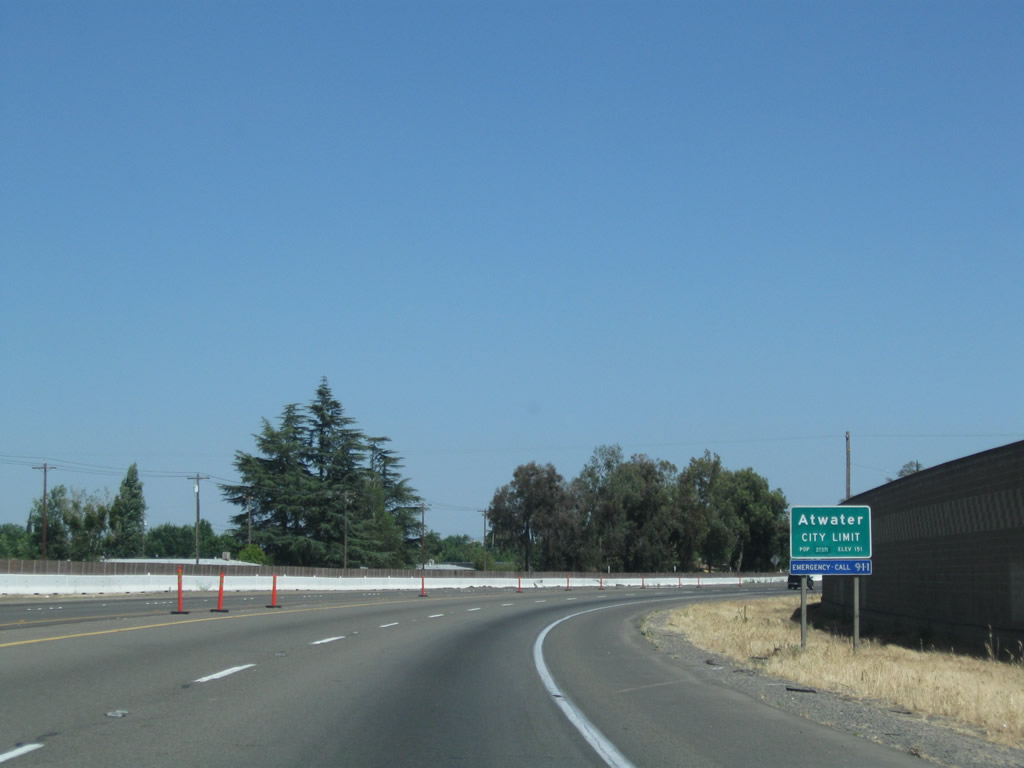 |
The city limits sign for Atwater appeared larger back in 2009. Photo taken 06/21/09. |
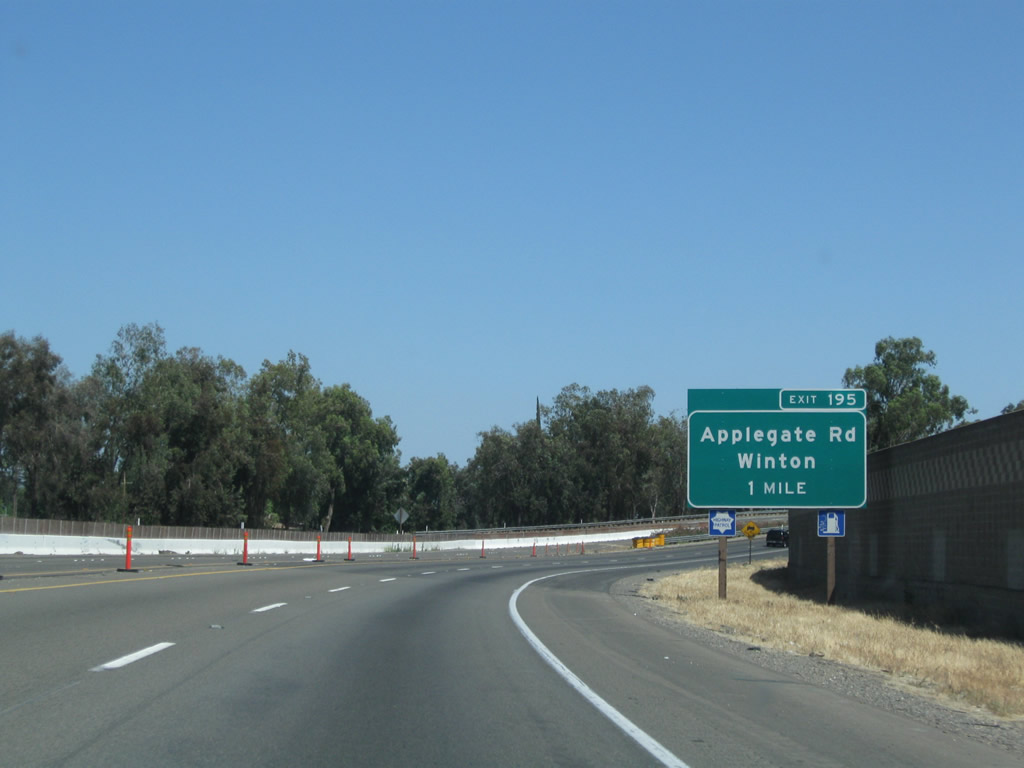 |
The next exit along California 99 south is Exit 195, Applegate Road. The connection from California 99 to Applegate Road is made via Bell Road. Photo taken 05/15/11. |
 |
 |
Use Applegate Road south to California 140 west en route to the city of Gustine or north to Winton Way north to the city of Winton, which is located along Merced County J-7 (Santa Fe Drive). This sign was replaced between 2011 and 2015. Photos taken 03/15/15 and 05/15/11. |
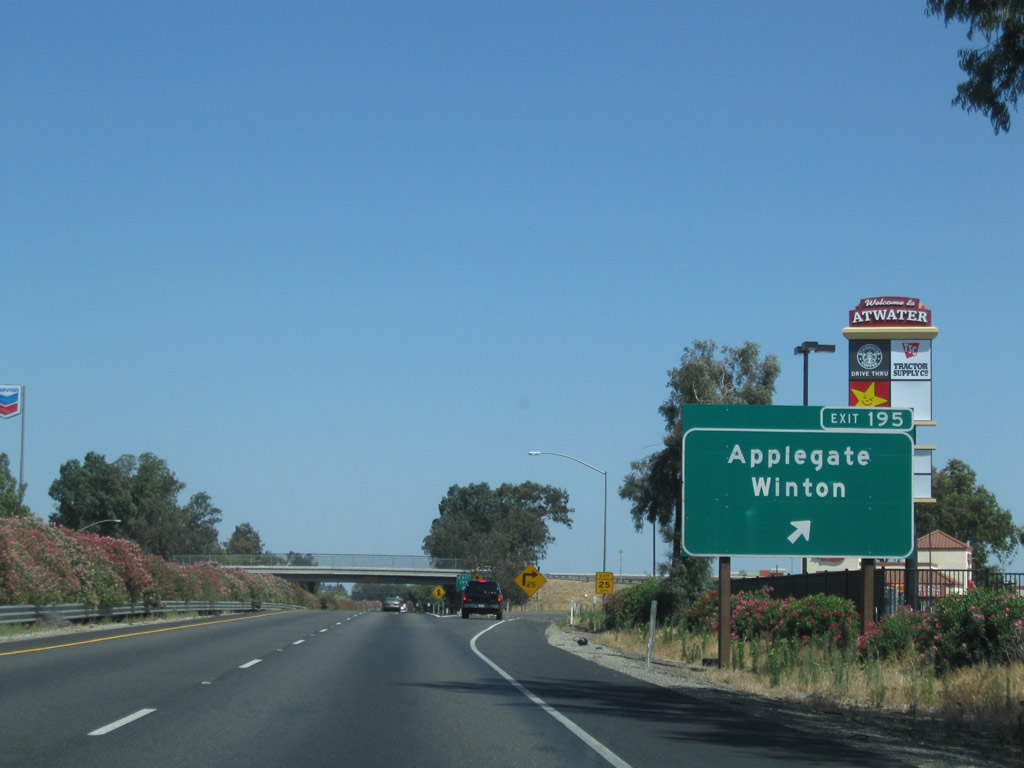 |
Southbound California 99 reaches Exit 195, Applegate Road to Winton. Photo taken 06/21/09. |
 |
A California 99 south reassurance marker is posted after the on-ramp from Exit 195, Applegate Road. Photo taken 06/21/09. |
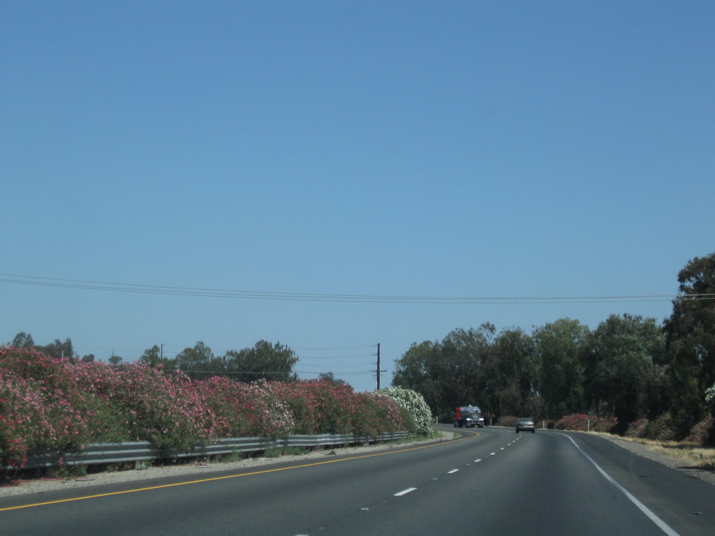 |
Colorful oleander again lines the median along California 99 between Applegate Road and Buchach Road. Look for changes here once the third lane is installed. Photo taken 06/21/09. |
 |
California 99 proceeds south toward the southern reaches of Atwater. Photo taken 06/21/09. |
 |
The next exit along California 99 south is Exit 193, Buchach Road to Castle Airport (former Air Force Base). The off-ramp to Exit 193 used to be left exit, but as of 2015 the interchange and freeway alignment were being moved so that California 99 would meet Interstate standards between Atwater and Merced. Photo taken 05/15/11. |
 |
Traffic from the Atwater business loop rejoins California 99 at this merge point. This would be Exit 194, but there is no direct access from southbound California 99 to northbound California 99 Business. Photo taken 06/21/09. |
 |
Prior to freeway conversion, the off-ramp to Exit 193, Buchach Road, was a left exit. This left exit was eliminated once the new freeway alignment was built. This will become an interchange with the Atwater Merced Expressway. Photo taken 06/21/09. |
 |
The Atwater Merced Expressway is a three-phase project that would connect California 99 with the Castle Commerce Center (former military base) as well as UC Merced. It would create a four-lane link to both California 59 and California 140. The route would roughly follow Bellevue Road east and Gurr Road south. A new alignment to connect Bellevue Road and Gurr Road would become part of the northwestern quadrant of the proposed Merced Loop. The first phase of this project is to expand California 99 to six lanes and to construct a new expressway northeast from this point to join with Bellevue Road. This also includes partial construction of an interchange with Merced County J-7 (Santa Fe Avenue). The second phase will construct the remainder of the Santa Fe Avenue interchange and extend the four-lane expressway east along Bellevue Road to California 59, and the third phase will extend the four-lane expressway south along Gurr Road to California 140. Photo taken 03/15/15. |
 |
Prior to the construction project, southbound California 99 used to connect to Exit 193, Buchach Road to Castle Airport at this point. Photo taken 05/15/11. |
 |
Construction for the new SR 99 interchange and freeway mainline. Photo taken 03/15/15. |
 |
Prior to the freeway expansion project, a left entrance was shared with the left exit at Buchach Road. This configuration has since been removed. Photo taken 06/21/09. |
 |
A short drive links Atwater with Merced, the county seat. All motorist services are available in Merced. Advancing south, California 99 traveled along a remaining expressway section that was upgraded through 2015. Photo taken 06/21/09. |
 |
This mileage sign along California 99 south provides the distance to Merced (four miles), Fresno (60 miles), and Los Angeles (280 miles). Photo taken 03/15/15. |
 |
Exits 189, 188, and 187B connect SR 99 with the Merced Welcome Center. The center is located at the Greyhound Station by the intersection of SR 99 Business (16 Street) and O Street in Downtown Merced. Photo taken 05/15/11. |
 |
The next exit along California 99 south is Exit 189, California 99 Business (Sixteenth Street) south to Merced. Photo taken 05/15/11. |
 |
Follow California 99 Business (Sixteenth Street) south to California 59 north, then turn east on Bellevue Road to the University of California at Merced. Photo taken 05/15/11. |
 |
This sign recommends using Exit 189 (California 99 Business - Sixteenth Street to the Merced Welcome Center in downtown Merced. Photo taken 06/21/09. |
 |
The next six exits serve the city of Merced. Photo taken 05/15/11. |
 |
Southbound California 99 reaches Exit 189, California 99 Business (Sixteenth Street). California 99 Business follows Historic U.S. 99 along Sixteenth Street through Merced, reconnecting with California 99 at Exit 186C. The following exit will be Exit 188, California 59 north and California 140 west. Photo taken 06/21/09. |
 |
Forthcoming Exit 188 connects SR 99 to SR 140 west to Gustine and SR 59 north to Snelling. Photo taken 03/15/15. |
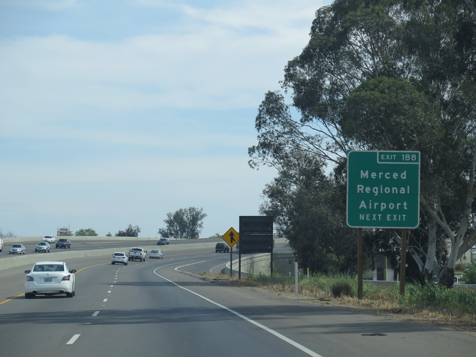 |
Use Exit 188 to the Merced Regional Airport (Macready Field) via V Street south to Grogan Avenue. Photo taken 03/15/15. |
 |
A California 99 south reassurance shield is posted shortly thereafter. Note the type and condition of pavement between 2011 and 2015: the concrete pavement was replaced with asphalt overlay. The bridge that carries the freeway over 16th Street was reconstructed and widened. Extra space was added to the left shoulder for eventual conversion into a third southbound lane. Photo taken 05/15/11. |
 |
This picture shows the reconstruction and widening work underway at the California 99 and 16th Street grade separation in 2011. The next bridge carries California 99 over Bear Creek. Work in this area has since been completed. Photo taken 05/15/11. |
 |
A portion of the oleander hedge within the median of California 99 near the bridge reconstruction project is now gone. Also gone is this roadside guide sign for Exit 188, V Street and R Street. Photo taken 06/21/09. |
 |
California 99 enters the city of Merced, the seat of Merced County and the "Gateway to Yosemite." Merced incorporated on April 1, 1889. It had a population of 78,958 as of the 2010 Census and is home to the University of California, Merced. The university is located northeast of the city center and away from California 99; use either California 59 (Snelling Highway) north or G Street north to Bellevue Road east into the campus. Photo taken 03/15/15. |
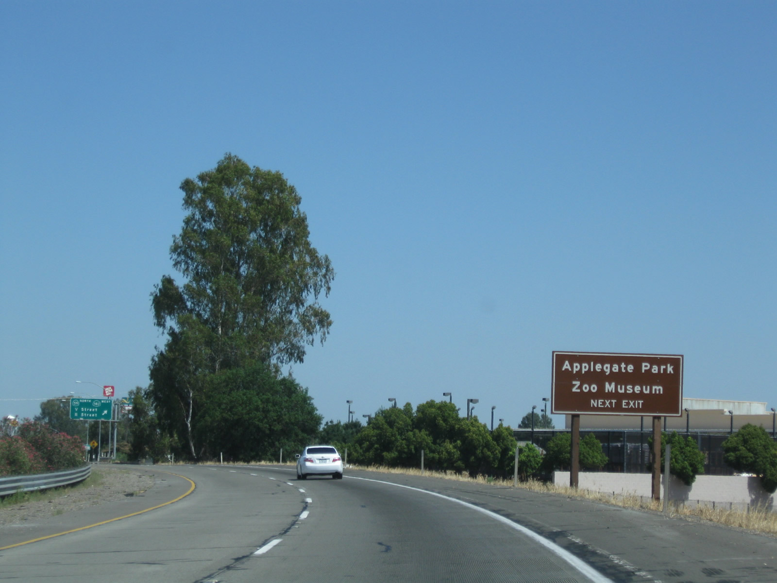 |
Use Exit 188 for Applegate Park Zoo. According to the City of Merced Parks and Recreation web page the zoo has been in operation since 1962. The zoo is located along Bear Creek between R Street and M Street. Also available via Exit 188 is the Merced County Courthouse Museum, which is located at the intersection of N Street and 21st Street. This three-story courthouse was built in 1875, making it one of the oldest standing buildings in California. Photo taken 06/21/09. |
 |
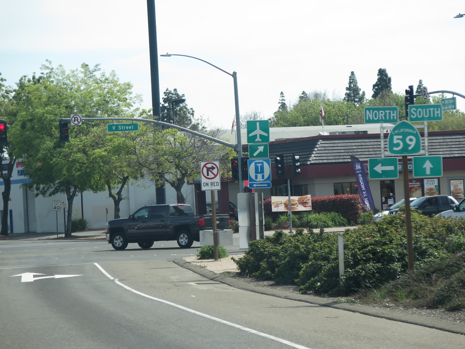
Southbound California 99 reaches Exit 188, California 59 north and California 140 west. From this interchange, California 59 travels north along V Street, turns northwest along California 99 Business (Sixteenth Street), crosses Bear Creek, and turns north again via Snelling Highway. Changing into Merced County J-59 at Snelling, the combined state and county route connects Merced with Sonora. To California 59 south to El Nido, stay on California 99 to Exit 187B. This off-ramp also connects to California 140 west to Gustine and Newman. For California 140 east, follow California 99 south to Exit 186B. Photo taken 06/21/09. |
 |
 |
 |
Departing California 99, we see a series of signs that provide directions to California 59 via V Street north, California 140 west via McSwain Road, and California 59 south via 13th Street, which serves as a frontage road to California 99. All motorist services are available at or near this interchange. The city has placed wayfinding signs (notable for the steeple at the top of the sign) that point the way to key attractions such as UC Merced, Merced College, downtown, and the airport. Photos taken 03/15/15. |
 |
This view shows the frontage road (13th Street) and its guide signs as seen from California 99. These signs point the way to California 59 south to El Nido and California 140 east to Mariposa and Yosemite National Park. Photo taken 06/21/09. |
 |
The next exit along California 99 south is Exit 187B, California 59 south to El Nido and Los Banos. California 59 follows Martin Luther King, Jr. Way (J Street) and Los Banos Highway south to El Nido and ends at an interchange with California 152. A major east-west state route, California 152 travels west to Los Banos and Gilroy, with connections to Monterey and Santa Cruz. California 99 will meet California 152 a bit further southeast of here, close to Chowchilla. Photo taken 06/21/09. |
 |
Use Exit 187B (California 59 and Martin Luther King, Jr. Way [J Street] south) to the Merced County Fairgrounds. This sign was replaced by 2015. Photo taken 06/21/09. |
 |
Southbound California 99 reaches Exit 187B, California 59 south to El Nido and Los Banos. Martin Luther King, Jr. Way follows former J Street; to the north, it travels to downtown, and to the south, it follows California 59 en route to Childs Avenue, where California 59 continues south toward El Nido. Photo taken 06/21/09. |
 |
The on-ramp from 13th Street and G Street joins California 99 just before the off-ramp to Exit 186B, California 140 east. Photo taken 06/21/09. |
 |
Immediately thereafter, southbound California 99 meets Exit 186B, California 140 east. California 140 leads through Merced, then climbs into Mariposa and ultimately Yosemite Valley. Photo taken 06/21/09. |
 |
The on-ramp from California 99 Business (Sixteenth Street) joins California 99 just before the off-ramp to Exit 186A, Motel Drive and Childs Avenue. Photo taken 06/21/09. |
 |
Immediately thereafter, southbound California 99 meets Exit 186B, California 140 east. California 140 leads through Merced, then climbs into Mariposa and ultimately Yosemite Valley. Photo taken 06/21/09. |
 |
Southbound California 99 reaches Exit 186A, Motel Drive and Childs Avenue. Use Childs Avenue west to the airport and east to Planada. Motel Drive travels north from this interchange along the north/east side of California 99; several motels are located along this short drive. Photo taken 05/15/11. |
 |
After Exit 186A (Motel Drive and Childs Avenue), we find this California 99 route marker. Photo taken 06/21/09. |
 |
The next exit along California 99 south is Exit 185, Campus Parkway and Mission Avenue (0.75 mile). Photo taken 06/21/09. |
 |
Southbound California 99 reaches Exit 185, Campus Parkway and Mission Avenue. Campus Parkway is, as of 2015, a partially completed route, as it does not go all the way to UC Merced. It currently ends at Childs Avenue, but plans call for it to go north to Yosemite Avenue to serve UC Merced. Campus Parkway is part of a proposed Merced Loop. The loop is partially constructed and would follow alignments generally traced by Campus Parkway north to UC Merced, Bellevue Road west, the Atwater-Merced Expressway west and south, Gurr Road south, Dickenson Ferry Road east, and Mission Avenue east. Photo taken 06/21/09. |
 |
California 99 passes under the Campus Parkway and Mission Avenue bridge overpass. Photo taken 05/15/11. |
 |
Before the freeway expansion project, California 99 used to shift from a freeway to an expressway alignment at this point. This is no longer the case, as the freeway is now three southbound lanes through here. Photo taken 05/15/11. |
 |
An old end freeway sign was posted at the point where freeway became expressway, but this changed when California 99 was rerouted onto the new six-lane freeway that was open by 2015. Photo taken 05/15/11. |
 |
California 99 used to settle onto its expressway alignment, which generally looked like this -- asphalt lanes, middle barrier, and at-grade intersections with side roads. Photo taken 05/15/11. |
 |
With the freeway expansion project (actively under construction in 2014-2016), California 99 was shifted onto a new roadway built with concrete and carrying three southbound lanes. The northbound lanes were constructed on new alignment, and the southbound lanes were constructed on top of the former expressway's northbound lanes. The expressway southbound lanes became a new frontage road known as Doppler Road. A new eastern frontage road was also constructed to provide local access; it is known as Marino Way. Photo taken 03/15/15. |
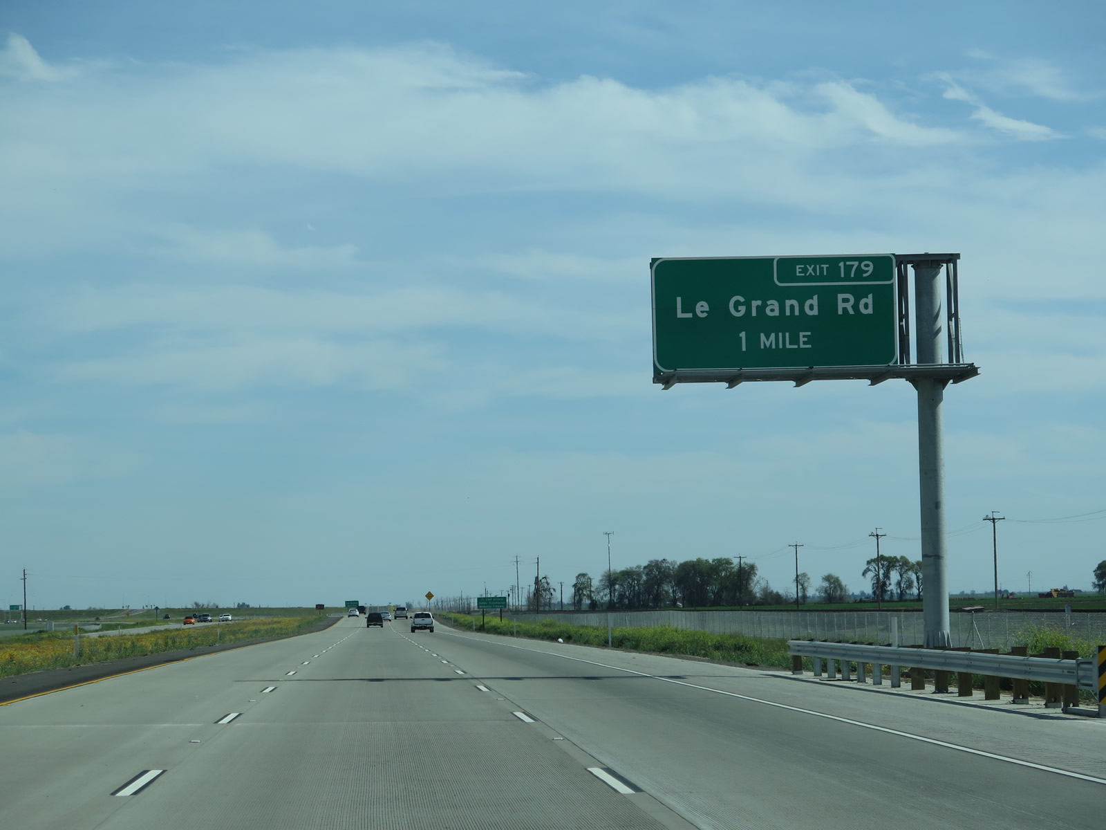 |
The next exit along California 99 south is Exit 179, Le Grand Road (one mile). This single interchange replaces several at-grade intersections, which are shown below. Photo taken 03/15/15. |
 |
Before the freeway expansion project, California 99 had this at-grade intersection with Mariposa Way, which used to travel east to Plainsburg Road. Access to Mariposa Way is now afforded by a frontage road on the east side of California 99 (Marino Way). Photo taken 05/15/11. |
 |
Another former access point was to Lingard Road west, which is now accessed via Doppler Road, which is a western frontage that uses the old expressway alignment of California 99. Photo taken 05/15/11. |
 |
The next former at-grade intersection along California 99 was with Pioneer Road north. This access point has also been removed in favor of the new frontage road. Photo taken 05/15/11. |
 |
Back on the mainline of California 99, the new freeway alignment approaches Exit 179, Le Grand Road. Photo taken 05/15/11. |
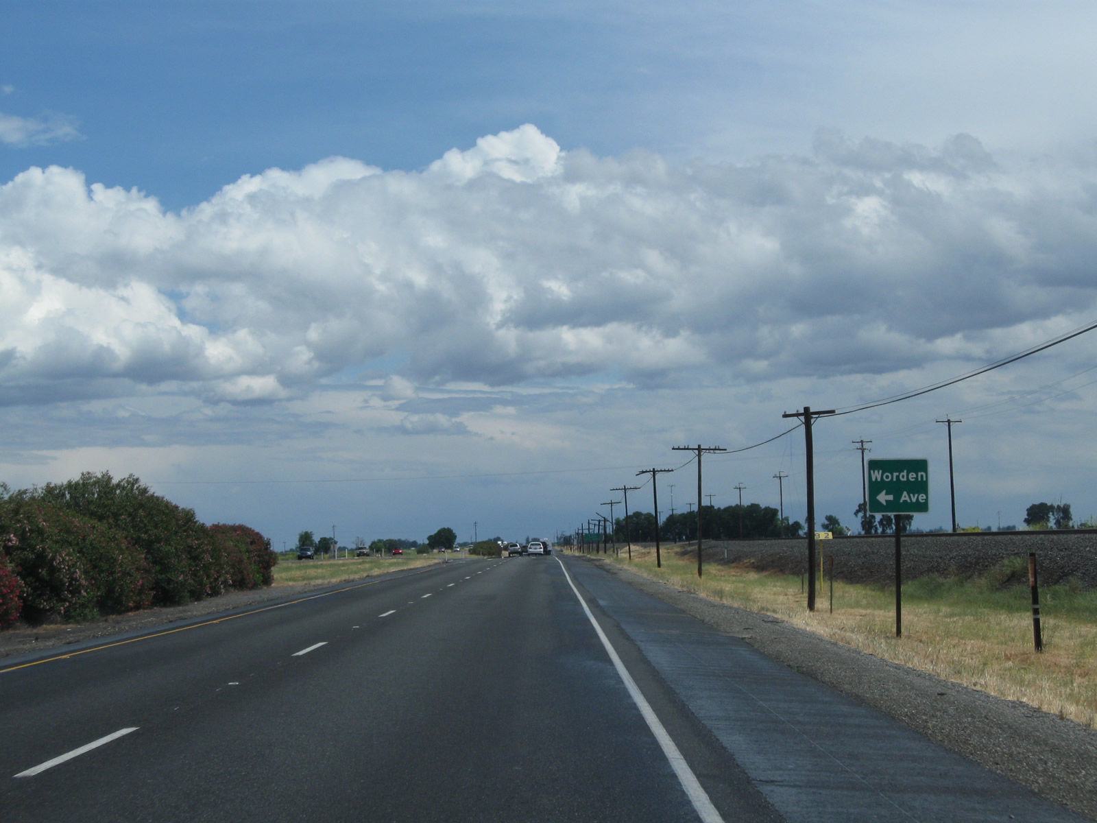 |
Historically, the next former at-grade intersection along California 99 was with Worden Road east. This access point has also been removed in favor of the new eastern frontage road (Marino Way). Photo taken 05/15/11. |
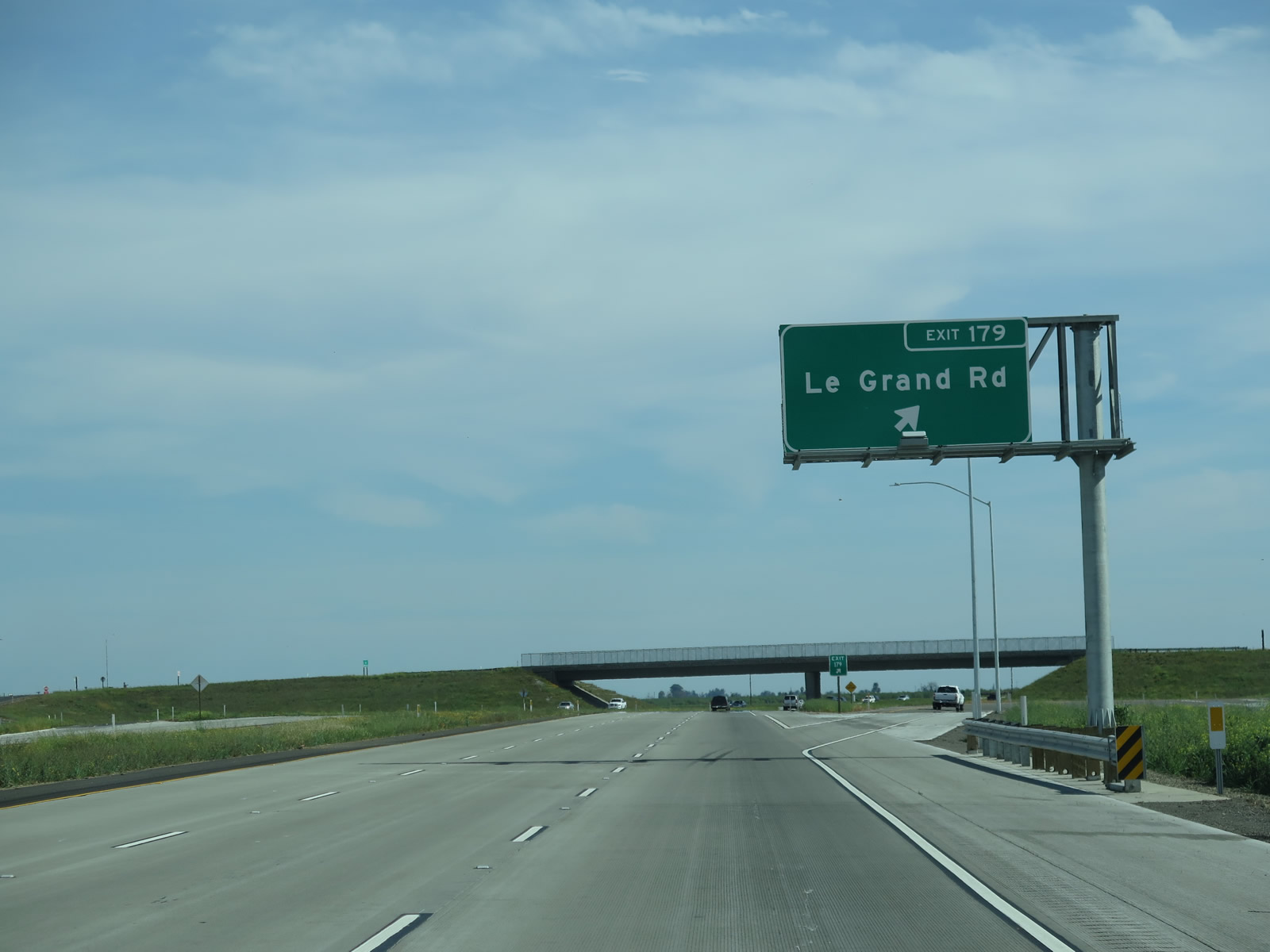 |
Again looking at the current six-lane freeway, southbound California 99 meets Exit 179, Le Grand Road. Photo taken 03/15/15. |
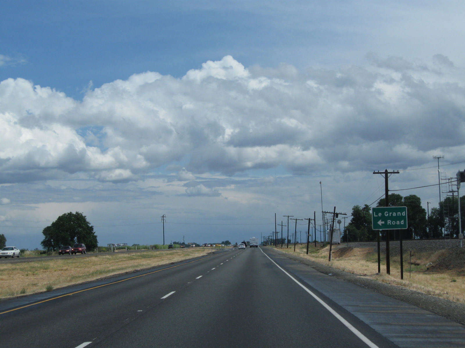 |
Historically, here is the former at-grade intersection along California 99 with Le Grand Road. Photo taken 05/15/11. |
 |
After the Le Grand Road interchange (Exit 176), as of spring 2015, the six-lane freeway reverted to its old expressway alignment. At that time, construction was underway to expand the freeway. Note that some had misjudged the transition here, given the tire marks on the concrete. Photo taken 03/15/15. |
 |
A freeway construction sign advises that the Plainsburg Road Freeway project would be completed in 2015. Photo taken 03/15/15. |
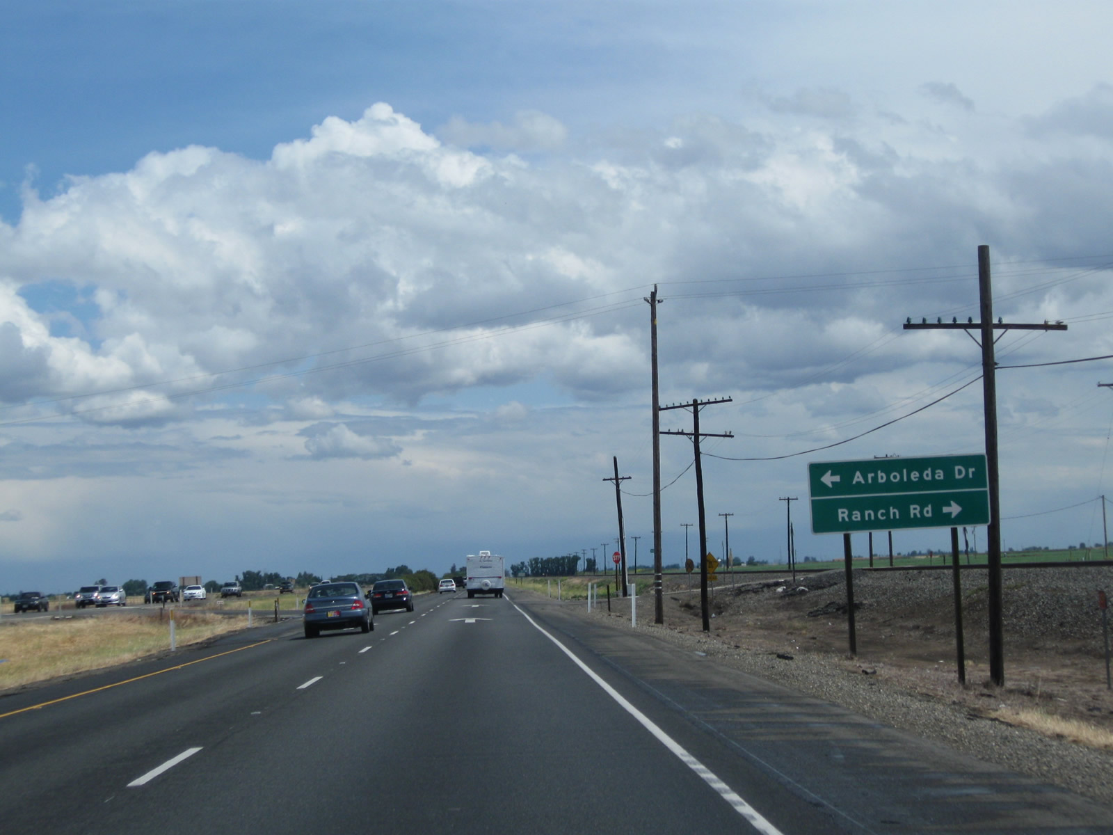 |
Prior to completion of the Plainsburg Road Freeway Project, California 99 used to have an extended expressway segment with multiple at-grade intersections. All of this was replaced in 2015 with a new southbound freeway, and the former southbound lanes became a frontage road as noted above. Here, old California 99 approached Arboleda Road and Ranch Road . Photo taken 05/15/11. |
 |
The area where the hay bales are in this picture is where the new freeway alignment is now located. This expressway alignment is now a frontage road. Photo taken 05/15/11. |
 |
Storm clouds gather on the old expressway alignment as California 99 proceeds south toward Chowchilla. Photo taken 05/15/11. |
 |
The next intersection along California 99 south used to be with Athlone Road. Photo taken 06/21/09. |
 |
The former California 99 expressway approached Buchanan Hollow Road. Photo taken 06/21/09. |
 |
Southbound California 99 expressway next approached Sandy Mush Road. Use Sandy Mush Road west to local farm and ranch access as well as Merced National Wildlife Refuge. Photo taken 06/21/09. |
 |
The next exit along southbound California 99 is Exit 176, Plainsburg Road. This used to be an at-grade intersection as shown here in 2009 but is now a full freeway interchange. Use Plainsburg Road north to Plainsburg and Planada, where it connects to California 140. Photo taken 06/21/09. |
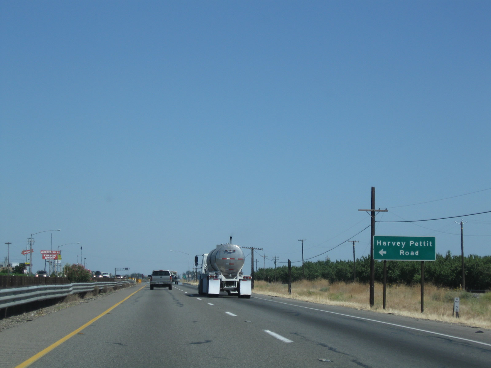 |
Just after the former Plainsburg Road intersection was an intersection with Harvey Petit Road. Access to this business is via the western frontage road. Photo taken 06/21/09. |
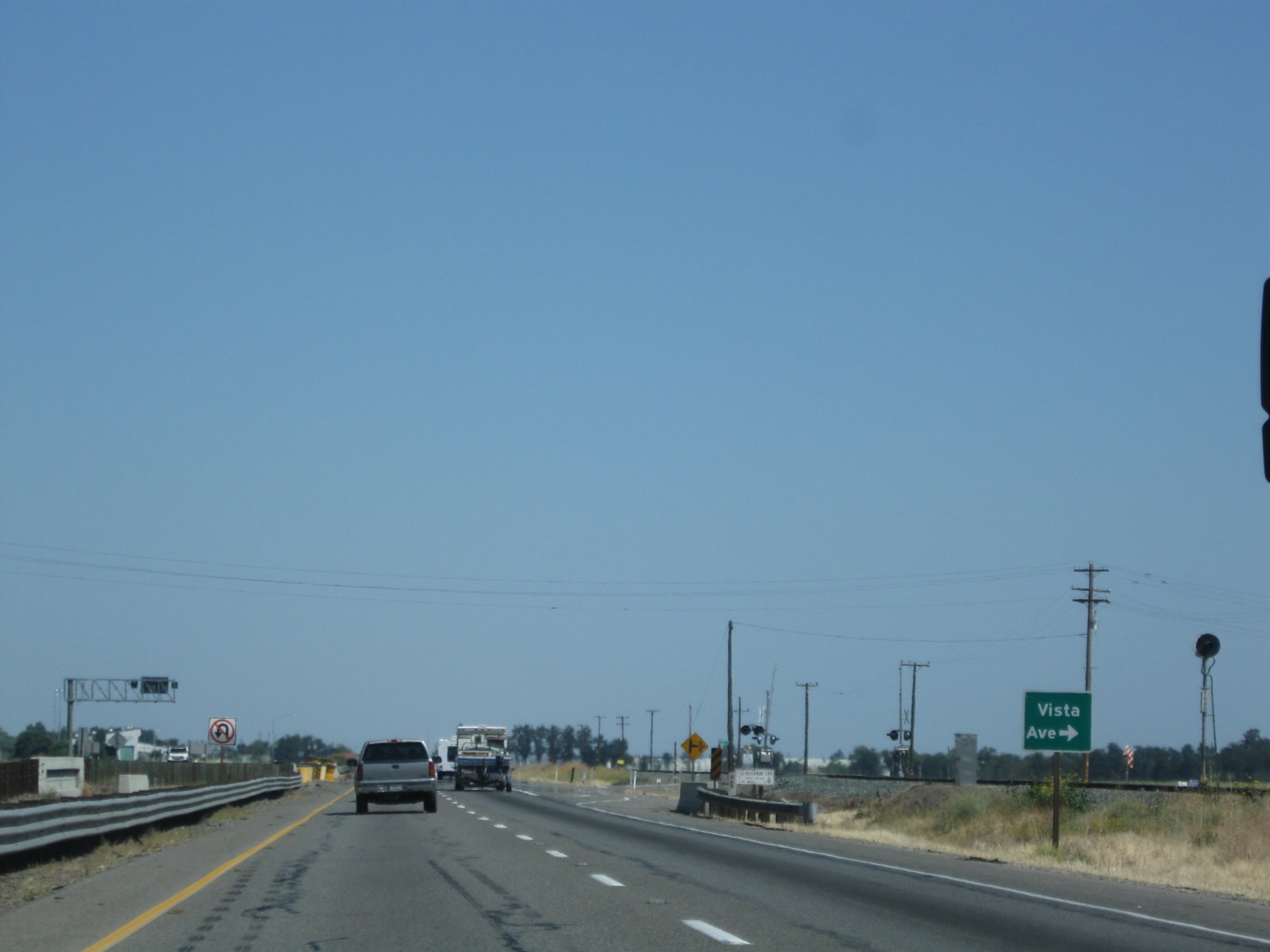 |
The next exit along southbound California 99 is Exit 171, Road 15 and Chowchilla Boulevard. In between the Plainsburg Road interchange and Chowchilla Boulevard, California 99 connected to Vista Avenue at this at-grade intersection, which has since been eliminated with the construction of the new freeway alignment. Photo taken 06/21/09. |
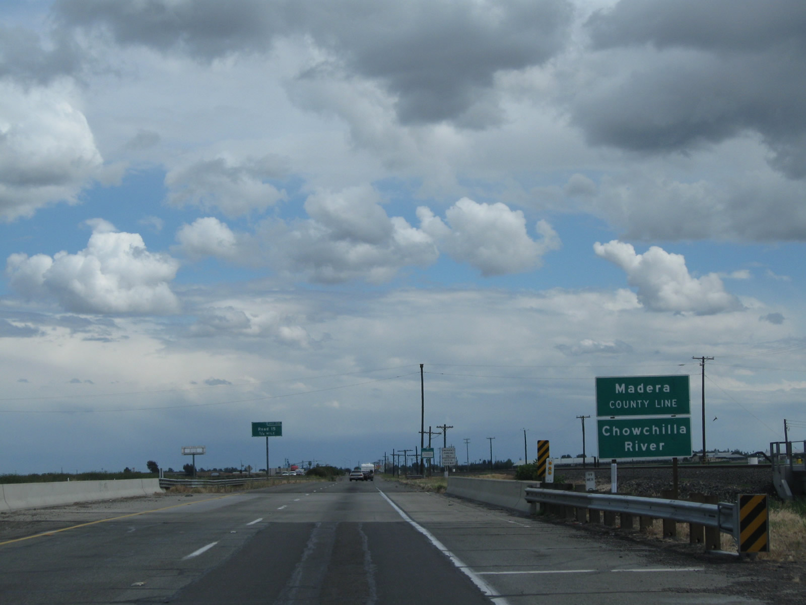 |
California 99 leaves Merced County and enters Madera County when it crosses the Chowchilla River. Photo taken 03/15/11. |
Sources:
- "Infamous Blood Alley to Disappear / New bypass around Highway 99 stoplight." San Francisco Chronicle, November 4, 1996.
- "Atwater-Merced Expressway Opens Up to Drivers, and Business Opportunities to City." YourCentralValley.com, June 24, 2015.

Page Updated October 18, 2015.
|
About Contact Glossary |
In The News Testimonials Interstate Guide |
Social Media:
 |
|
© 2000-23 AARoads.com | All Rights Reserved | Privacy Policy / Terms of Use
|
||