

California 241 North
| California 241 - Foothill Transportation Corridor north | |
|---|---|
 |
Leaving Oso Parkway, northbound California 241 (Foothill Transportation Corridor) begins its northbound journey. Ahead, the on-ramp approaches the first of several toll booths. To the left, grading shows where California 241 would continue south from this point, but the extension remains unconstructed. Photo taken 01/30/05. |
 |
Upon reaching the toll booth, the left lane is for FasTrak (electronic toll customers) and the right lane is for cash customers. On most on-ramps and off-ramps, the cash booth requires exact change or will make change from paper money. Photo taken 01/30/05. |
 |
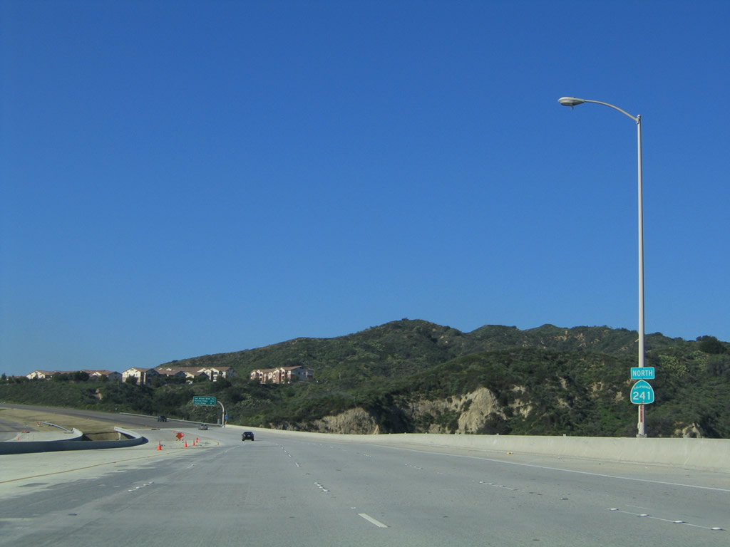
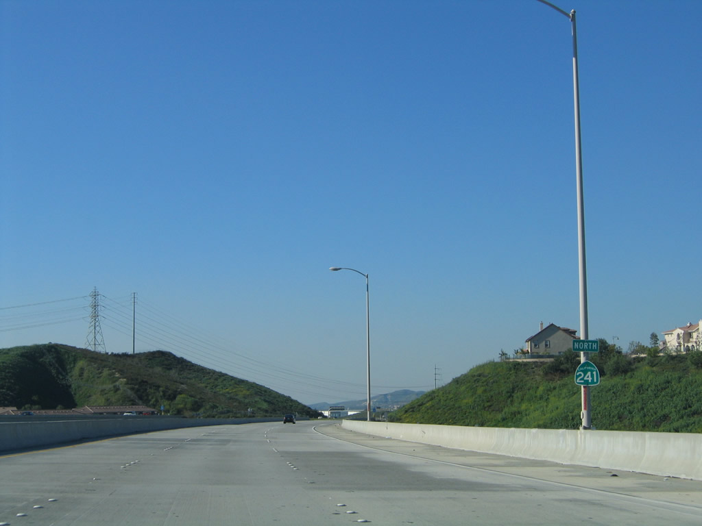
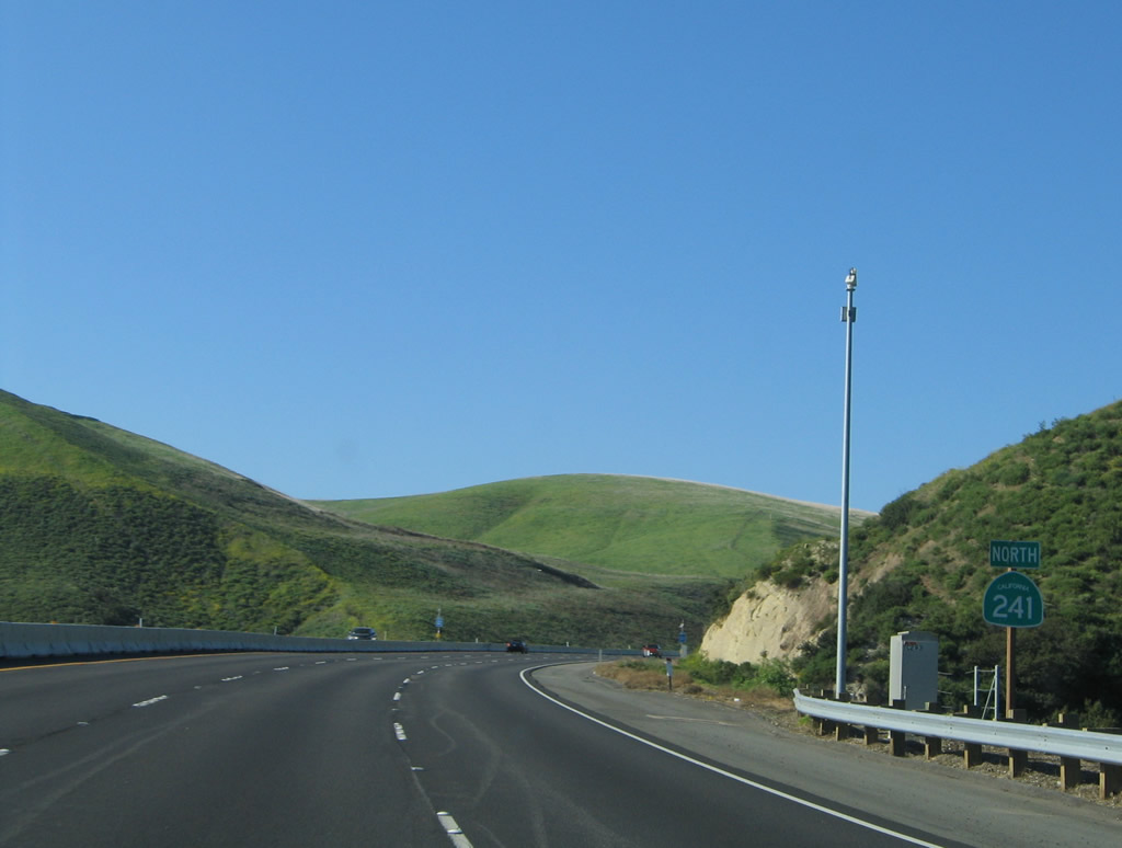
This California 241 north reassurance shield is posted along the Foothill Transportation Corridor after the on-ramp from Oso Parkway. The toll road begins at the southern edge of the city of Rancho Santa Margarita. Incorporated on January 1, 2000, the city had a population was 47,214 as of the 2000 Census. Many of the neighborhoods were master planned within the city. Use either Exit 18 or Exit 19 east to central Rancho Santa Margarita. Photo taken 01/30/05. |
 |
Provisions have been left at this location, about a half mile north of the Oso Parkway southern terminus, for a future interchange (that would likely connect to Canada Chiquita Road or Telephone Road) that would likely serve future development. It is not clear when this interchange would be built. Photo taken 01/30/05. |
 |
 |
 |
 |
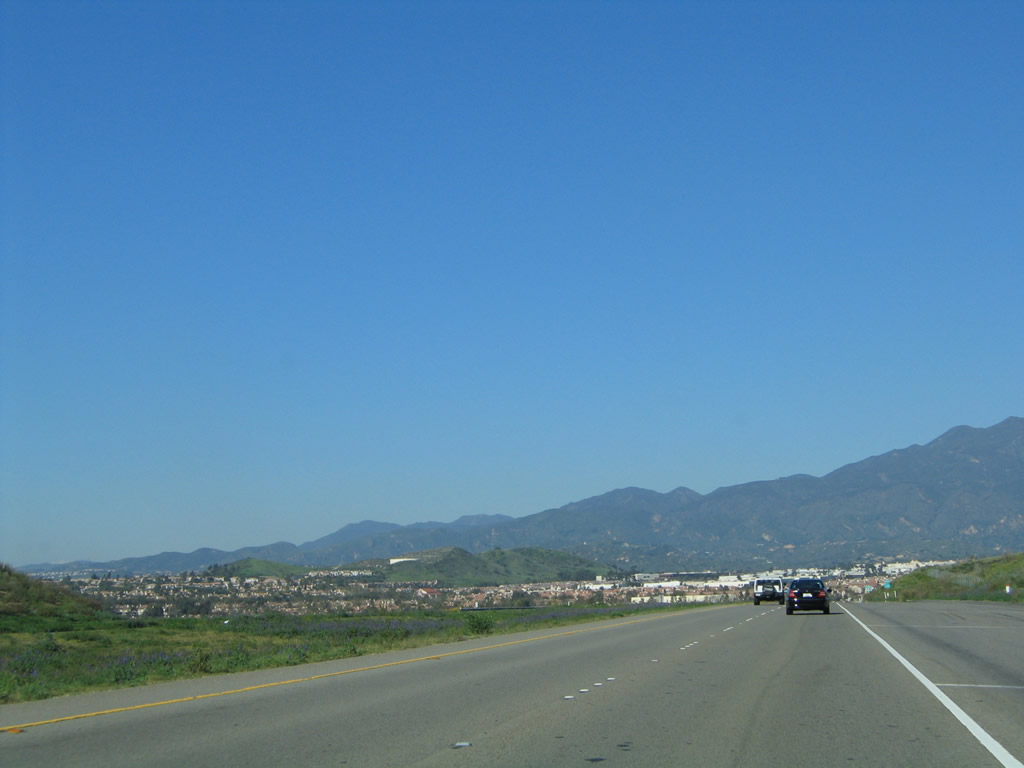
This series of pictures follows California 241 north as it passes Canada Vista Park in a canyon in Rancho Santa Margarita. To the west of here is Tijeras Creek and to the east is Coto de Caza; both are residential developments. In the distance is Saddleback Mountain, which is notable for its distinctive look that gives it its name. Photos taken 01/30/05. |
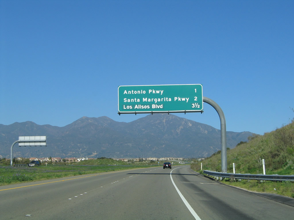 |
The first three exits along California 241 north are: Exit 18, Antonio Parkway; Exit 19, Santa Margarita Parkway; and Exit 20, Los Alisos Boulevard. Photo taken 01/30/05. |
 |
The toll road continues in a northeasterly direction toward Saddleback Mountain. Photo taken 01/30/05. |
 |
A new right lane is formed, adding an exit-only lane for Exit 18, Antonio Parkway. This sign is a bit unusual in that it is reflective yet uses button copy for the lettering. This type of signage is very rare in California, as most newer signs are reflective with no button copy. Photo taken 01/30/05. |
 |
Northbound California 241 (Foothill Transportation Corridor) reaches Exit 18, Antonio Parkway. Use Antonio Parkway south to Tijeras Creek, Ladera Ranch, and San Juan Capistrano; use Antonio Parkway north to Rancho Santa Margarita and Coto de Caza. Photo taken 01/30/05. |
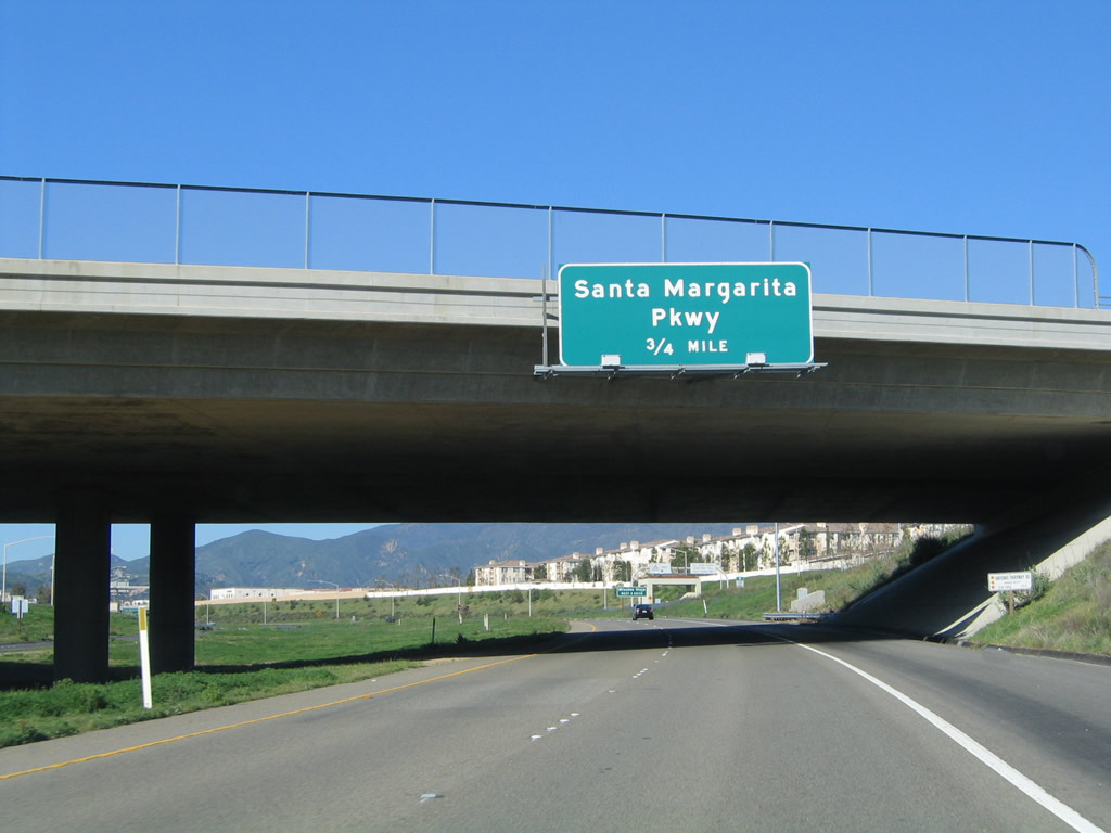 |
The next exit along California 241 north is Exit 19, Santa Margarita Parkway. Use Santa Margarita Parkway east to Central Park and the City Hall complex for the city of Rancho Santa Margarita. Photo taken 01/30/05. |
 |
The next three exits along California 241 north serve the city of Mission Viejo: Exit 19, Santa Margarita Parkway; Exit 20, Los Alisos Boulevard; and Exit 22, Portola Parkway. Mission Viejo ("Make Living Your Mission") had a population of 93,102 as of the 2000 Census. Like neighboring Rancho Santa Margarita, Mission Viejo is master planned; the city incorporated on March 31, 1988. California 241 will leave Rancho Santa Margarita and enter Mission Viejo at Exit 20 (Los Alisos Boulevard). Photo taken 01/30/05. |
 |
The right lane of California 241 (Foothill Transportation Corridor) north becomes exit only for Exit 19, Santa Margarita Parkway. Use Santa Margarita Parkway west to Mission Viejo, with a connection to Alicia Parkway upon crossing O'Neill Regional Park in Trabuco Canyon. Photo taken 01/30/05. |
 |
Northbound California 241 (Foothill Transportation Corridor) meets Exit 19, Santa Margarita Parkway. Photo taken 01/30/05. |
 |
After the Santa Margarita Parkway interchange, northbound California 241 passes under Live Oak Canyon Trail. Photo taken 01/30/05. |
 |
California 241 crosses over Trabuco Canyon. The toll road was originally constructed with four lanes, but it was graded to accommodate as many as eight lanes plus two high-occupancy vehicle lanes when the freeway is fully built out. Photo taken 01/30/05. |
 |
This California 241 north reassurance shield is posted on the bridge over Trabuco Canyon and O'Neill Regional Park in Rancho Santa Margarita. Photo taken 01/30/05. |
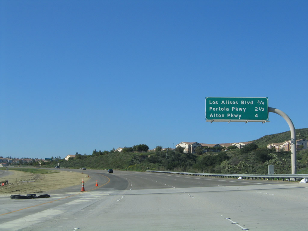 |
This interchange sequence sign provides the distance to the next three exits along California 241 (Foothill Transportation Corridor) north: Exit 20, Los Alisos Boulevard; Exit 22, Portola Parkway; and Exit 23, Alton Parkway. Photo taken 01/30/05. |
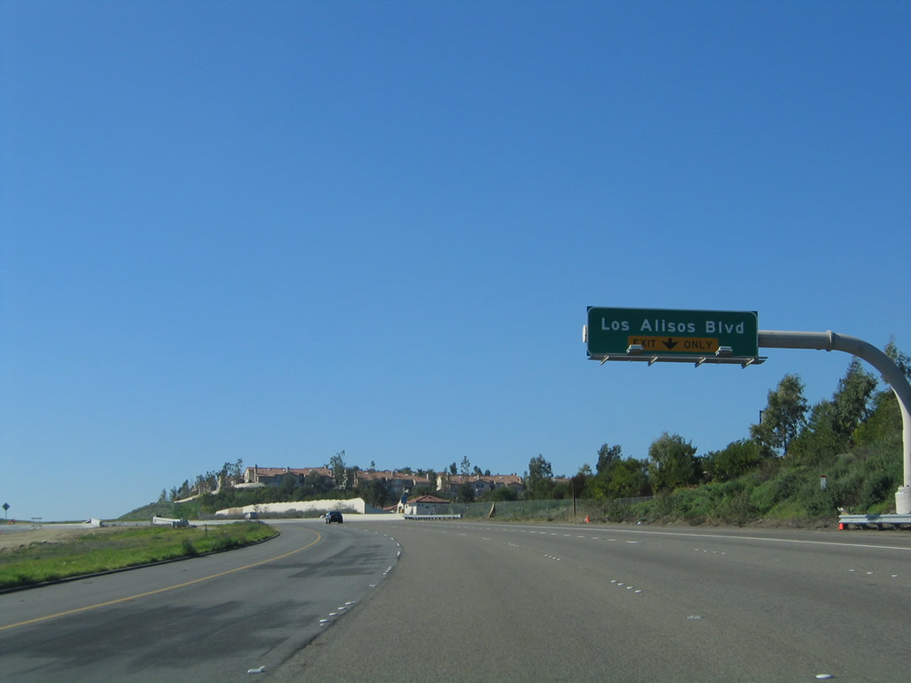 |
The right lane of California 241 (Foothill Transportation Corridor) north becomes exit only for Exit 20, Los Alisos Boulevard. Photo taken 01/30/05. |
 |
Northbound California 241 (Foothill Transportation Corridor) meets Exit 20, Los Alisos Boulevard. At this point, California 241 leaves Rancho Santa Margarita and enters the city of Mission Viejo. The next exit along northbound is Exit 22, Portola Parkway. Photo taken 01/30/05. |
 |
Exiting traffic to Los Alisos Boulevard must pay a toll. Once again, the ramp is divided between FasTrak and cash customers. Photo taken 01/30/05. |
 |
This California 241 north reassurance shield is posted on the bridge over Trabuco Canyon and O'Neill Regional Park in Rancho Santa Margarita. Photo taken 01/30/05. |
 |
This mileage sign provides the distance to next three exits along California 241 north: Exit 22, Portola Parkway; Exit 23, Alton Parkway; and Exit 25, Portola Parkway (Irvine). The bridge ahead crosses Aliso Creek. Photo taken 01/30/05. |
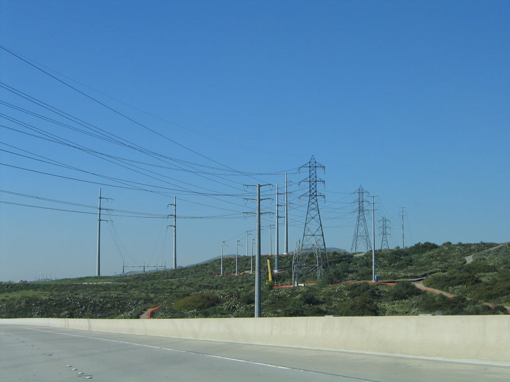 |
A Southern California Edison substation is located on the east side of California 241. Photo taken 01/30/05. |
 |
The right lane of California 241 north becomes exit only for Exit 22, Portola Parkway. Use this exit to the city of Lake Forest. Around this point, California 241 leaves Mission Viejo and enters Lake Forest, which was incorporated on December 20, 1991, and had a population of 58,707 as of the 2000 Census. Exit 22 provides links to two other significant arterials: Orange County S-18 (El Toro Road) via Portola Parkway south and Lake Forest Drive via Portola Parkway north. Photo taken 01/30/05. |
 |
Exiting traffic to Portola Parkway in Lake Forest must pay a toll. Once again, the ramp is divided between FasTrak and cash customers. Photo taken 01/30/05. |
 |
This mileage sign provides the distance to next two exits along California 241 north: Exit 23, Alton Parkway and Exit 25, Portola Parkway (Irvine). After the second Portola Parkway interchange, California 241 will approach a mainline toll plaza. Photo taken 01/30/05. |
 |
The right lane of California 241 (Foothill Transportation Corridor) north becomes exit only for Exit 23, Alton Parkway. Photo taken 01/30/05. |
 |
Northbound California 241 meets Exit 23, Alton Parkway. After Alton Parkway, California 241 will leave Lake Forest and enter unincorporated Orange County near the city of Irvine. The next interchange along northbound is Exit 25, Portola Parkway, which connects the toll road to the city of Irvine near the proposed Orange County Great Park, being built on top of the former Marine Corps Air Station El Toro. Photo taken 01/30/05. |
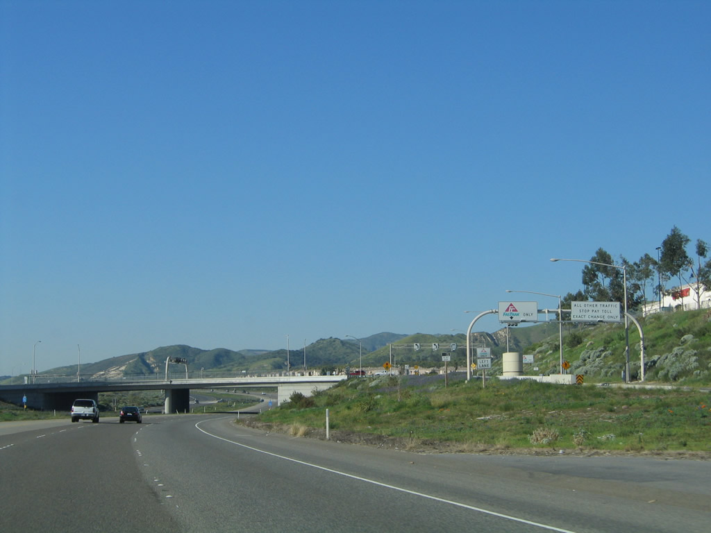 |
The interchange between California 241 and Alton Parkway is a single-point urban interchange. Exiting traffic must pay a toll. Photo taken 01/30/05. |
 |
This mileage sign provides the distance to next two exits along California 241 north: Exit 25, Portola Parkway (Irvine); Exit 26, Toll Plaza; and Exit 27, California 133 (Eastern Transportation Corridor) and Laguna Freeway south to Irvine and Laguna Beach. Photo taken 01/30/05. |
 |
Northbound California 241 meets Exit 25, Portola Parkway (Irvine). There are two Portola Parkway exits on California 241. The first such meeting is at Exit 22, and a second junction with Portola Parkway occurs at Exit 25. This second interchange is referred to as "Portola Parkway - Irvine," since Portola Parkway leads southwest into Irvine from this interchange. The next stop will be Exit 26, Tomato Springs Toll Plaza. Photo taken 01/30/05. |
 |
California 241 passes under Portola Parkway. The toll booths are coin-based rather than ticket-based, so there are several of them along California 241. This particular plaza is in between Exits 25 and 27 along northbound. For frequent users, there is a program called Fastrak that allows motorists to drive under a transponder without stopping to pay a toll. The transponder automatically charges the account of FasTrak members each time they pass through the toll plaza. Photo taken 01/30/05. |
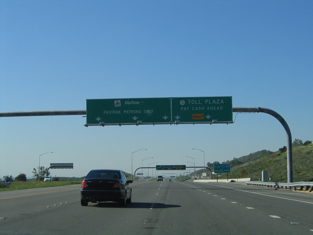 |
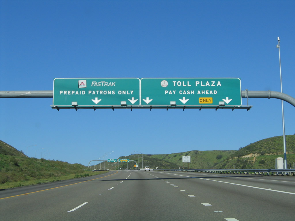
FasTrak customers should stay left for open road tolling, which allows the transponder to charge their accounts without having to stop or slow down significantly. Cash customers should merge right for assistance from a toll attendant. Photo taken 01/30/05. |
 |
Through traffic to Interstate 5 and Interstate 405 should use Exit 27, California 133 (Eastern Transportation Corridor) and Laguna Freeway south. Photo taken 01/30/05. |
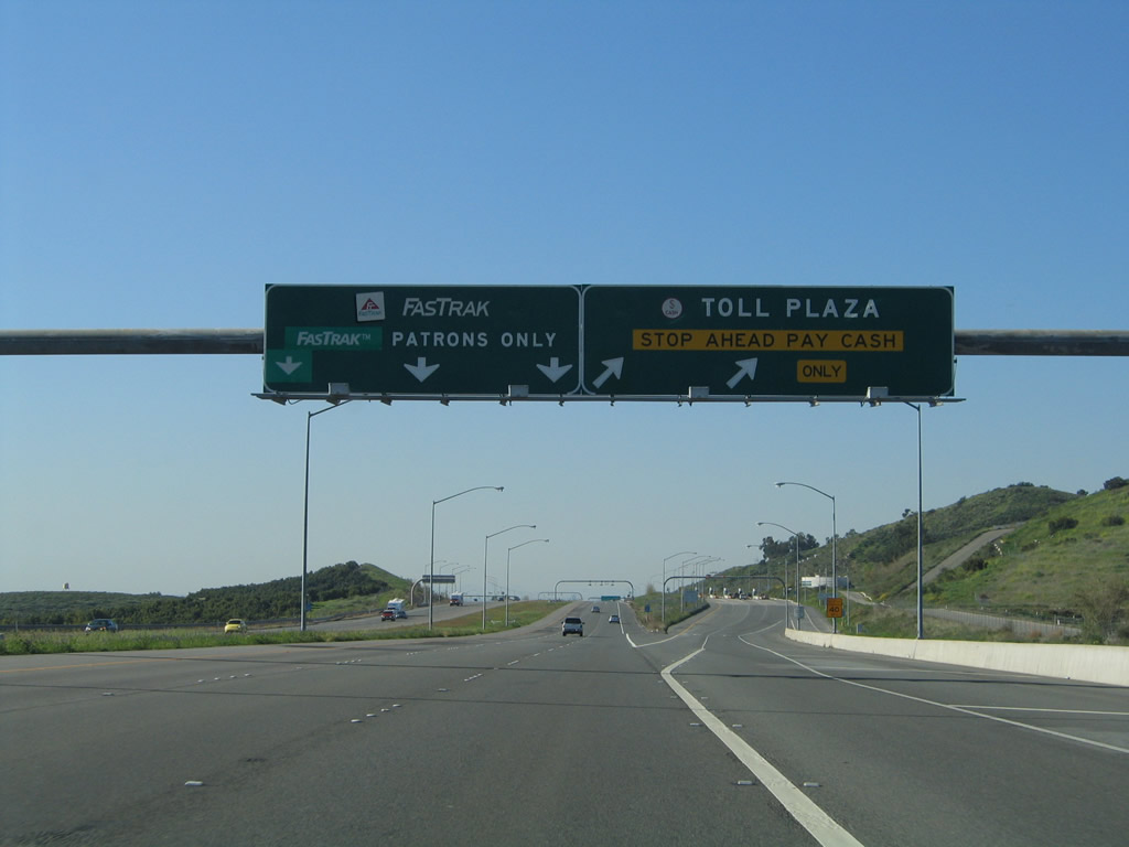 |
Northbound California 241 reaches Exit 26, where the main lanes divide between the FasTrak open road toll lanes and the cash toll plaza at Tomato Springs. Photo taken 01/30/05. |
 |
The next exit along California 241 north is Exit 27, California 133 (Eastern Transportation Corridor) and Laguna Freeway south. Stay left to continue north on California 241 (Eastern Transportation Corridor) north to Riverside. Photo taken 01/30/05. |
 |
Northbound California 241 reaches Exit 27, California 133 (Eastern Transportation Corridor) and Laguna Freeway south. Use California 133 south to Interstate 5 and Interstate 405. At this point, the Foothill Transportation Corridor ends; California 241 (former California 231) continues north from this point as the Eastern Transportation Corridor. Photo taken 01/30/05. |
 |
This view looks north as California 241 approaches the California 133 interchange. Photo taken 01/30/05. |
 |
After passing through the interchange, an on-ramp brings California 133 north traffic onto California 241 north. Photo taken 01/30/05. |
| California 241 (Eastern Transportation Corridor) north | |
|---|---|
 |
Shortly thereafter, this California 241 north is posted on the Eastern Transportation Corridor. Photo taken 01/30/05. |
 |
California 241 gains elevation as it proceeds north after the California 133 interchange. This segment has three lanes for northbound traffic to allow for slower uphill traffic. Photo taken 01/30/05. |
 |
Between California 133 and California 261, California 241 rises through the foothills, which were green on this winter's day (which was a wetter than average winter). Photo taken 01/30/05. |
 |
A jersey barrier (K-rail) separates the two directions of traffic on California 241 (Eastern Transportation Corridor). Provisions and grading are visible on the west side of the freeway for eventual expansion to four lanes in each direction. Photo taken 01/30/05. |
 |
A California 241 north reassurance shield is posted at the top of the grade, where the toll road ascends to Loma Ridge. Thereafter, the highway will descend toward Presida Canyon and Irvine Lake (Santiago Reservoir). Photo taken 01/30/05. |
 |
California 241 briefly flattens out on top of Loma Ridge. Presida Canyon and Irvine Lake will come into view to the east of the toll road. Photo taken 01/30/05. |
 |
The next exit along California 241 north is Exit 33, Orange County S-18 (Santiago Canyon Road) to California 261 south to Irvine and Tustin. Photo taken 01/30/05. |
 |
A variable message sign is posted shortly thereafter. California 241 briefly curves northwest as it approaches California 261. Photo taken 01/30/05. |
 |
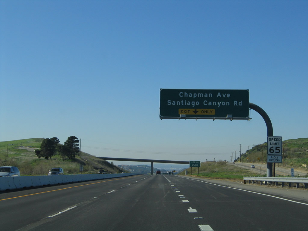
Use Santiago Canyon Road west into the city of Orange, including the communities of Santiago Hills, Orange Park Acres, and El Modena. California 241 avoids entering Orange as it approaches California 261. Photo taken 01/30/05. |
 |
The right lane of California 241 (Eastern Transportation Corridor) becomes exit only for Exit 33, Orange County S-18 (Santiago Canyon Road) to California 261 south to Irvine and Tustin. Photo taken 01/30/05. |
 |
California 261 is a short state route that follows a spur of the Eastern Transportation Corridor southwest to Irvine and Tustin. After passing under Interstate 5 (with no direct connection ramps between the two freeways), California 261 ends at the point where the toll road changes into Jamboree Road. From there traveling southwest, Jamboree Road leads through Irvine into Newport Beach as a multi-lane arterial roadway. Photo taken 01/30/05. |
 |
Northbound California 241 (Eastern Transportation Corridor) meets Exit 33, Santiago Canyon Road and Chapman Avenue (Orange County S-25) and Santiago Canyon Road (Orange County S-18). Chapman Avenue, which is barely signed as County Route S-25, leads west into Orange and Anaheim. Santiago Canyon Road/County Route S-18 parallels California 241 as it heads in a southeasterly direction. Use Santiago Canyon Road north to the connection with California 261 south to Irvine and Tustin. Photo taken 01/30/05. |
 |
With Santiago Hills visible in the background, northbound California 241 (Eastern Transportation Corridor) passes under Santiago Canyon Road. The connecting ramp from California 261 north to California 241 north is not visible as the connector is in a tunnel below the interchange. Photo taken 01/30/05. |
 |
Passing through the interchange, traffic from California 261 north approaches it merge with California 241 (Eastern Transportation Corridor) north. Photo taken 01/30/05. |
 |
After merging with California 261, California 241 (Eastern Transportation Corridor) turns northeast and crosses over Santiago Creek. Irvine Lake is visible to the southeast of this bridge, which carries three northbound lanes. Widening of this segment was completed in 2002. Photo taken 01/30/05. |
 |
This view looks northeast as California 241 begins the journey to Windy Ridge. Photo taken 01/30/05. |
 |
Approaching the top of Windy Ridge, a toll plaza for mainline California 241 is one mile ahead. Photo taken 01/30/05. |
 |
The mainline again divides, with cash paying customers merging right and FasTrak electronic toll collection customers merging left. Behind this sign, a set of Southern California Edison power lines cross over the toll road, including one 230kV line and one 500kV power line. Photo taken 01/30/05. |
 |
Approaching the Windy Ridge Toll Plaza, the left two (now three) lanes serve FasTrak customer and the right lane leads to the cash toll plaza. A third through lane was added here in 2008. Photo taken 01/30/05. |
 |
The toll road divides between FasTrak and cash lanes at the Windy Ridge Toll Plaza along California 241 north. Photo taken 01/30/05. |
 |
The toll rates for Windy Ridge were $2.50 per automobile (two-axle) on the mainline as of 2005. A wildfire originated from a car fire off California 241 on March 11, 2007, resulting in the burn of 2,036 acres.3 Signs were posted in the aftermath of that blaze advising motorists that this toll road passes through a high-fire risk area. Photo taken 01/30/05. |
 |
Electronic transponders are situated over the FasTrak lanes to calculate the toll owed amount. The surrounding land around the Windy Ridge Toll Plaza are owned by the Nature Conservancy. Photo taken 01/30/05. |
 |
On a clear day (such as this day in winter 2005), the distant San Gabriel Mountains are visible from Windy Ridge Toll Plaza, including Mt. San Antonio (Mt. Baldy). Photo taken 01/30/05. |
 |
With that, it is also a long descent from this point down to California 91 in the Santa Ana Canyon. Once the cash toll plaza lanes rejoin the mainline, three northbound lanes will descend at six percent grade down to California 91 (Riverside Freeway). Photo taken 01/30/05. |
 |
California 241 leaves unincorporated Orange County and enters the city of Anaheim, one of the largest in Orange County and home to 345,556 people as of the 2000 Census. The city, which is home to Disneyland, the Los Angeles Angels of Anaheim, and Anaheim Ducks was incorporated on March 18, 1876. California 241 proceeds downhill into the eastern reaches of the Anaheim Hills community of the city of Anaheim. A proposed interchange between California 241 and Gypsum Canyon Road is planned between Windy Ridge and California 91 as nearby residential development warrants. Photo taken 01/30/05. |
 |
The San Gabriel Mountains continue to dominate the view as California 241 proceeds south toward the California 91 interchange. Photo taken 01/30/05. |
 |
Continuing downhill, California 241 north approaches its final interchange: Exits 39A-B, California 91 (Riverside Freeway) in the Santa Ana Canyon. California 91 is a major east-west freeway that connects Orange County with Riverside County via a path taken alongside the Santa Ana River. Despite the fact that California 241 and 91 Express Lanes are both toll facilities, there is no direct connection between them. Photo taken 01/30/05. |
 |
On the ridge in the distance is development that is part of the city of Yorba Linda, which stays on the north bank of the Santa Ana River. Behind Yorba Linda is Chino Hills in San Bernardino County. Photo taken 01/30/05. |
 |
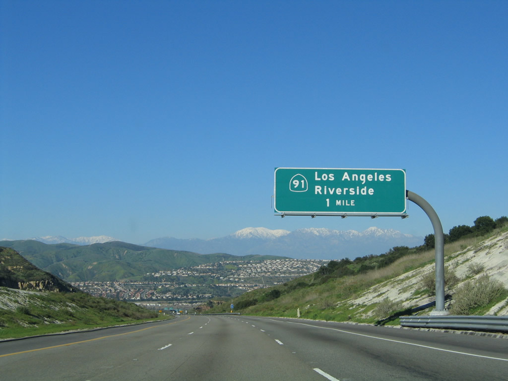
Approaching the northern terminus of California 241, stay left for California 91 west to Long Beach and Los Angeles or right for California 91 east to Riverside and points north via Interstate 15. Photo taken 01/30/05. |
 |
An overhead sign provides lane allocations for traffic leaving California 241 north and connecting to California 91 west and east. Photo taken 01/30/05. |
 |
Northbound California 241 (Eastern Transportation Corridor) reaches Exits 39A-B, California 91 (Riverside Freeway). Keeping true to recent Caltrans practice, these California 91 do not reference the name "Riverside Freeway," even though many older signs pointing the way to California 91 continue to reference the original name. Photo taken 01/30/05. |
 |
At the gore point between Exit 39A and Exit 39B, California 241 draws to an end. There is no end shield posted here, however. Photo taken 01/30/05. |
 |
This view looks down on California 91 as seen from the transition ramp that connects California 241 (Eastern Transportation Corridor) north with California 91 (Riverside Freeway) east in Anaheim. Notably, traffic on California 91 east was much worse in the main lanes than on the segregated 91 Express Lanes. Photo taken 01/30/05. |

Page Updated November 15, 2010.
|
About Contact Glossary |
In The News Testimonials Interstate Guide |
Social Media:
 |
|
© 2000-23 AARoads.com | All Rights Reserved | Privacy Policy / Terms of Use
|
||