| Interstate 5 north |
|
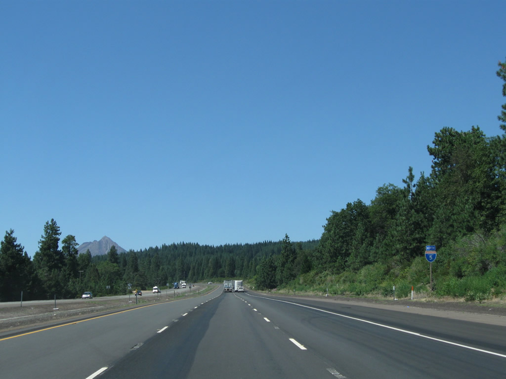
Shortly thereafter, interstate 5 leaves Shasta County and enters Siskiyou County. The section of Interstate 5 from the county line north to the Sacramento River bridge in Dunsmuir was built in 1960. Photo taken 03/31/05. |
|
The next exit along Interstate 5 north is Exit 729, Business Loop I-5/Dunsmuir Avenue to Old U.S. 99 and the city of Dunsmuir. The business loop follows Dunsmuir Avenue through downtown Dunsmuir, then crosses under the freeway at Exit 730, and finally terminates at Interstate 5 Exit 732. Photo taken 03/31/05. |
|
Historic downtown Dunsmuir is on the National Register of Historic Places. Dunsmuir received its name in 1886 after Alexander Dunsmuir from Canada who offered to give the town a water fountain if they would name the town after him. This fountain still exists and is located in the city park at Exit 730 west of Dunsmuir Avenue (Business Loop I-5/Old U.S. 99).1 Photo taken 03/31/05. |
|
|
Rather than have an auxiliary guide sign that says, "Route 5 Business Next Right," a Historic U.S. 99 trailblazer is posted along northbound Interstate 5 prior to Exit 729, Business Loop I-5 and U.S. 99 to Dunsmuir. Massive Mount Shasta, with its dominating height and girth, controls the view of Interstate 5 north. Upon exiting the freeway, Business Loop I-5 is relatively well-signed for a California business loop. Photos taken 08/02/11 and 03/31/05. |
|
Northbound Interstate 5 reaches Exit 729, Business Loop I-5/Dunsmuir Avenue to Old U.S. 99 and the city of Dunsmuir. Although Dunsmuir has its roots in the Union Pacific Railroad that passes through town, it is largely known today as a tourist destination, including its historic town center. Photo taken 03/31/05. |
|
|
Upon exiting, another U.S. 99 historic trailblazer is posted. At the bottom of the ramp, merge right onto Dunsmuir Avenue northbound toward downtown. Unsigned is Business Loop I-5, which was likely removed from advance signage when Historic U.S. 99 signs were added. Photos taken 05/25/08 and 03/31/05. |
|
Back on the freeway mainline, the next exit along Interstate 5 north is Exit 730, Business Loop I-5/U.S. 99 (Dunsmuir Avenue) to central Dunsmuir. Photo taken 03/31/05. |
|
Northbound Interstate 5 enters the city of Dunsmuir, the southernmost city in Siskiyou County. The city of Dunsmuir had a population of 1,650 as of the 2010 Census, which is a reduction from its population of 1,923 as of the 2000 Census. Sitting in the Sacramento River valley, Dunsmuir sits at an elevation of 2,347 feet and receives an average of 63.31 inches of precipitation per year. Dunsmuir is located at the southern end of Siskiyou County and was incorporated as a city on August 7, 1909. Photo taken 03/31/05. |
|
Clouds began to form on Mount Shasta on this late spring day in anticipation of a storm that would impact the area on the next day. Photo taken 03/31/05. |
|
Northbound Interstate 5 reaches Exit 730, Business Loop 5 and U.S. 99/Dunsmuir Avenue to central Dunsmuir. All motorist services are available at each Dunsmuir exit. Photo taken 03/31/05. |
|
This view shows the gore point signage for Exit 730. Photo taken 08/02/11. |
|
Passing through the Exit 730 interchange, ahead is an on-ramp from Dunsmuir Avenue and another crossing over the Sacramento River. Exit 730 is a fairly complicated interchange that has its northbound on/off ramps on the south side of the river crossing, which the southbound off-ramp is located north of the river crossing. Photo taken 08/02/11. |
|
|
|
After Exit 730, Interstate 5 again crosses the Sacramento River on this bridge, which was built in 1966. Old U.S. 99 and Business 5 follow Interstate 5 north on the west side of the freeway. The U.S. 99 concrete deck arch bridge over the Sacramento River was built in 1955 and widened in 1983. An Interstate 5 north reassurance shield was added here by 2011. Photos taken 08/02/11 and 03/31/05. |
|
The next exit along Interstate 5 north is Exit 732, Siskiyou Avenue to Business Loop I-5/U.S. 99 (Dunsmuir Avenue). In preparation for a long climb uphill, a third climbing lane is added to the northbound freeway. Photo taken 03/31/05. |
|
|
Northbound Interstate 5 reaches Exit 732, Siskiyou Avenue to Business Loop I-5/U.S. 99 (Dunsmuir Avenue). This is the final exit for the city of Dunsmuir. Photos taken 08/02/11 and 03/31/05. |
|
An Interstate 5 north reassurance shield is posted after the on-ramp from Siskiyou Avenue and Business Loop I-5. Old U.S. 99 again merges back onto Interstate 5 north, with another extant, non-contiguous section located at Exit 734. Photo taken 08/02/11. |
|
This mileage sign after the north Dunsmuir interchange provides the distance to Mount Shasta City (six miles) and Portland, Oregon (369 miles). Photo taken 03/31/05. |
|
|
The next exit along Interstate 5 north is Exit 734, Mott Road. Three northbound lanes continue as Interstate 5 gains elevation. Photos taken 08/02/11 and 03/31/05. |
|
This mileage sign after the north Dunsmuir interchange provides the distance to Mount Shasta City (six miles) and Portland, Oregon (369 miles). Photo taken 03/31/05. |
|
|
Traveling uphill toward the Mott Road interchange, Interstate 5 has three northbound lanes and median without a walled center divider. Photos taken 08/02/11. |
|
Northbound Interstate 5 meets Exit 734, Mott Road. The Dunsmuir Municipal Airport is located at this interchange northeast of the freeway. The portion of Interstate 5 was widened to three lanes in 1976. Photo taken 03/31/05. |
|
|
Interstate 5 turns to the northwest to avoid Mount Shasta. At this point, all views of Mount Shasta are to the northeast of the freeway. Photos taken 08/02/11 and 03/31/05. |
|
The next two exits along Interstate 5 north are Exit 736, California 89 east to McCloud and Exit 737, Business Loop I-5/U.S. 99 north to the city of Mount Shasta. Interstate 5 around the city of Mount Shasta was built in 1964, and the freeway from there north to Weed (U.S. 97) was built in 1973. Photo taken 03/31/05. |
|
California 89, a major north-south corridor connects Interstate 5 near Mount Shasta City with U.S. 395 near Topaz Lake via Lassen Volcanic National Park and Lake Tahoe. The state route is mostly two lanes and connects some of the most scenic areas of Northern California. At Exit 736, California 89 travels due east to McCloud, then turns southeast toward Lassen Volcanic National Park. Photo taken 08/02/11. |
|
Upon interchanging with California 89, Interstate 5 meets the Volcanic Legacy Scenic Byway. This arcing route originates along California 89 in Lassen National Park, travels northwest to Interstate 5 at Mount Shasta City, then follows U.S. 97 from Weed north into Oregon en route to Crater Lake National Park, with a spur along California 161 at the California-Oregon state line east to Lava Beds National Monument. Photo taken 08/02/11. |
|
|
Northbound Interstate 5 reaches Exit 736, California 89/Volcanic Legacy Scenic Highway east to McCloud. The next exit is Exit 737, Business Loop I-5/U.S. 99 north to the city of Mount Shasta. This set of porcelain enamel signs dates back to the freeway's opening in 1964. Note the Interstate 5 pull through sign, which has space for a U.S. 99 shield. The shield was removed at some point after the sign was placed, since a shadow of the shield can still be seen. This sign was replaced by 2011. The trumpet interchange for Exit 736 has connections to Business Loop I-5 (Exit 737). Photos taken 08/02/11 and 03/31/05. |
|
The next two exits (Exit 737/Business Loop I-4 and Exit 738/Siskiyou County A-10/Lake Street) serve the city of Mount Shasta, which was home to 3,621 people as of the 2000 Census and sits at an elevation of 3,561 feet. Photo taken 08/02/11. |
|
Consistent with the Dunsmuir interchange, a U.S. 99 historical trailblazer is posted prior to the business loop exit for Mount Shasta city. While the Mount Shasta city bypass (Interstate 5) was built in 1964, the section of Interstate 5 from the north Mount Shasta interchange to the city of Weed was built in 1973. Photo taken 03/31/05. |
|
|
Northbound Interstate 5 reaches Exit 737, Business Loop I-5/South Mount Shasta Boulevard into downtown Mount Shasta. Photos taken 08/02/11 and 03/31/05. |
|
Looking northeast from the freeway after the Exit 737 off-ramp is this view of downtown Mount Shasta and of its namesake mountain. Note the "M S" written on the antenna in the foreground. Photo taken 03/31/05. |
|
Reaching the top of the grade, the climbing lane comes to an end, leaving Interstate 5 again with two northbound lanes. Photo taken 08/02/11. |
|
|
This Interstate 5 north reassurance shield is posted after Exit 737. In the distance is Black Butte (el. 6,325 feet), which be on the horizon for Interstate 5 travelers for the next several miles as we bypass the city of Mount Shasta. The mileage sign provides the distance to Weed (nine miles) and Portland (364 miles). Photos taken 08/02/11 and 03/31/05. |
|
|
The next exit along Interstate 5 north is Exit 738, Siskiyou County A-10/Lake Street east and Hatchery Lane west to the Old Stage Road. Use Siskiyou County A-10 east into downtown Mount Shasta and to the Everitt Memorial Highway, which is one of the few paved highways to approach the slope of Mount Shasta. The upper sections of the road are closed in winter. Photos taken 08/02/11 and 03/31/05. |
|
|
Upon passing under Ream Avenue, Interstate 5 enters the City of Mount Shasta. Located on the edge of the namesake volcano, the City of Mount Shasta had a population of 3,394 as of the 2010 Census, which is a decrease from the 2000 Census (then population of 3,624). The city rests at an elevation of 3,561 feet, and it was incorporated on May 31, 1905. Photos taken 08/02/11 and 03/31/05. |
|
A variety of services are located at Exit 738, including a ranger station, state highway patrol, hospital, national guard armory, and tourist information center. Additionally, all motorist services are available in the city of Mount Shasta. Photo taken 08/02/11. |
|
Siskiyou Lake, which is located along the Upper Sacramento River, is located southwest of Interstate 5 via Hatchery Lane and WA Barr Road south. All recreation opportunities are available here. At this point, the common path shared by the Sacramento River and Interstate 5/U.S. 99 comes to an end. The Sacramento River has its official headwaters in Mount Shasta City Park, located northwest of downtown along Business Loop I-5/North Mount Shasta Boulevard. From this point, the river flows south into Siskiyou Lake (where various branches of the Sacramento River join with the nascent stream), then turns south to create a corridor for Interstate 5 south for approximately 400 miles. The two remain connected and intertwined until entering the California Delta region between the cities of Sacramento and Stockton. Photo taken 03/31/05. |
|
Northbound Interstate 5 meets Exit 738, Siskiyou County A-10/Lake Street east and Hatchery Lane west. To A-10, follow Lake Street east past Business Loop I-5 (U.S. 99)/North Mt. Shasta Boulevard to Washington Drive, which travels north to become Everitt Memorial Highway en route to the western flank of Mount Shasta itself. The highway was constructed in 1959 to bring skiiers to the now-defunct Mount Shasta Ski Bowl (the ski area closed in 1978 after damage from an avalanche). A new ski area at a nearby location opened in 1985.3 Photo taken 08/02/11. |
|
Mount Shasta remains in view to the east of Interstate 5. Photo taken 03/31/05. |
|
This view shows the gore point for Exit 738. Photo taken 08/02/11. |
|
An Interstate 5 north reassurance shield is posted shortly after the Exit 738 interchange and on-ramp from Lake Street. Photo taken 08/02/11. |
|
Interstate 5 passes under the Lassen Lane overcrosing. Photo taken 08/02/11. |
|
Continuing north on Interstate 5, Black Butte dominates the view. Photo taken 08/02/11. |
|
These bridges carry the railroad over Interstate 5 and also serve as the connection from Interstate 5 south to Business Loop I-5/U.S. 99 south into Mount Shasta city. There is no access to this interchange (Exit 740) from northbound. Photo taken 03/31/05. |
|
The next exit along Interstate 5 north is Exit 741, Abrams Lake Road. Photo taken 03/31/05. |
|
Northbound Interstate 5 meets Exit 741, Abrams Lake Road. Photo taken 03/31/05. |
|
|
Mount Shasta can be seen to the east of Interstate 5 after Exit 741, Abrams Lake Road. The freeway now bends to the northwest to skirt Black Butte, cross Black Butte Summit, and enter the city of Weed. Photos taken 08/02/11 and 03/31/05. |
|
This mileage sign provides the distance to Weed (five miles) and Portland (362 miles). Photo taken 03/31/05. |
|
The next exit along northbound Interstate 5 is Exit 743, Summit Drive and Truck Village Drive. Photo taken 03/31/05. |
|
Interstate 5 ascends to the top of Black Butte Summit (el. 3,917 feet). This takes Interstate 5 out of the Sacramento River watershed and into the Klamath River and Shasta River watershed. Photo taken 03/31/05. |
|
|
Northbound Interstate 5 meets Exit 743, Summit Drive and Truck Village Drive. Photos taken 08/02/11 and 03/31/05. |
|
This view looks east toward Black Butte as seen from the Summit Drive interchange. Photo taken 08/02/11. |
|
The next three exits serve the city of Weed: Exit 745, Business Loop I-5/South Weed Boulevard and Vista Drive; Exit 747, U.S. 97 north and Business Loop I-5 (Weed Boulevard) to downtown Weed; and Exit 748, Business Loop I-5/California 265/North Weed Boulevard. Photo taken 03/31/05. |
|
The next exit along Interstate 5 north is Exit 745, Business Loop I-5/South Weed Boulevard and Vista Drive. Old U.S. 99 follows the business route through town. Once again, the business route is not mentioned on the auxiliary signs. Photo taken 03/31/05. |
|
|
An interchange sequence sign is posted soon thereafter, with the distance to Exit 745, Business Loop I-5/South Weed Boulevard and Vista Drive and Exit 747, U.S. 97 north and Business Loop I-5 (Weed Boulevard) to downtown Weed. Photos taken 08/02/11 and 03/31/05. |
|
|
All motorist serves are available as northbound Interstate 5 reaches Exit 745, Business Loop I-5/South Weed Boulevard (Old U.S. 99) and Vista Drive. The 2011 sign includes the exit number. Photos taken 08/02/11 and 03/31/05. |
|
A Weed city limits sign is posted on the off-ramp from Interstate 5 north to South Weed Boulevard. At the bottom of the ramp, turn left on Vista Drive for Business Loop I-5/South Weed Boulevard (Old U.S. 99) north or right on Vista Drive for gas and food. The business route again interchanges with Interstate 5 at Exit 747. Photo taken 08/02/11. |
|
After Exit 745, this Interstate 5 north reassurance shield is posted. Photo taken 03/31/05. |
|
|
The next exit along Interstate 5 north is Exit 747, Business Loop I-5 and U.S. 97 to downtown Weed. This exit marks the southern terminus of U.S. 97. This interchange is the first time Interstate 5 has intersected a U.S. highway since the U.S. 50 junction in downtown Sacramento. The next U.S. highway interchange will be U.S. 199 in Grants Pass, Oregon. The business route is cosigned with U.S. 97 for the southern half and with California 265 on the northern half. Photos taken 08/02/11 and 03/31/05. |
|
Back in 2000, this sign included a plate indicating that the Weed business route began at Exit 747. This is now gone, so there are no shields advising motorists that Business Loop I-5 serves the city of Weed. Photo taken by Jerry Mullady (03/19/00). |
|
U.S. 97 is a major north-south route in the Pacific Northwest. Originating in Weed, U.S. 97 departs California on a northeasterly trajectory toward Klamath Falls, Oregon, then becomes part of a major north-south corridor toward a junction with U.S. 20 in Bend and eventually meeting Interstate 84/U.S. 30 east of The Dalles. Oregon hopes to expand U.S. 97 to four lanes for much of its route in that state. Upon crossing the Columbia River near Biggs, U.S. 97 eventually joins the Interstate 82 corridor near Yakima, Washington, then sets out toward the international border with Canada. U.S. 97 changes into British Columbia 97 upon entering the province of British Columbia, and the 97 designation continues north to Dawson Creek. At that point, British Columbia 97 follows the Alaska Highway, which plows northwest through the Yukon Territory and eventually reenters the United States in Alaska. Photo taken 03/31/05. |
|
|
Use Exit 747 for the continuation of Historic U.S. 99 north through downtown Weed via Business Loop I-5 and the Volcanic Legacy Scenic Byway north via U.S. 97. Photos taken 08/02/11. |
|
|
Northbound Interstate 5 meets Exit 747, Business Loop I-5 (Weed Boulevard) north to downtown Weed and U.S. 97 north to Klamath Falls. The city of Weed was incorporated as a general law city on January 25, 1961, and was home to 2,967 people as of the 2010 Census and 2,978 people as of the 2000 Census. Weed consists of 4.8 square miles of area and sits at an elevation of 3,467 feet. Photos taken 08/02/11 and 03/31/05. |
|
Traffic departs from Interstate 5 north to Exit 747, Business Loop I-5, Historic U.S. 99/Weed Boulevard, and U.S. 97 north. Photo taken 08/02/11. |
|
Now on the exit ramp, turn left for Business Loop I-5 and Old U.S. 99/Weed Boulevard south to the College of the Siskiyous or right for Business Loop I-5 and U.S. 97-99 north to Weed, Klamath Falls, and Bend. Photo taken 08/02/11. |
|
A Historic U.S. 99 sign is posted on the off-ramp to Weed Boulevard. Photo taken 08/02/11. |
|
|
At the base of the ramp from Exit 747 is this sign for Business Loop I-5 (Weed Boulevard) and U.S. 97 north. Turn left to the College of the Siskiyous, and turn right toward downtown Weed. Photos taken 03/31/05 and 08/02/11. |
|
|
Here are a close-up of the angular Business Loop I-5 and the cut out U.S. 97 shields that are found at the base of the sign shown in the previous photobox. Photos taken 03/31/05. |
|
Back on the mainline, the next exit along northbound Interstate 5 is Exit 748, Business Loop I-5/California 265 (Old U.S. 99/North Weed Boulevard) south to downtown Weed. Photo taken 03/31/05. |
|
This mileage sign provides the distance to Yreka, the seat of Siskiyou County (24 miles) and the control city of Portland (355 miles). Photo taken 03/31/05. |
|
The next exit along Interstate 5 north is Exit 751, U.S. 99 ("Old 99 Highway") north to Gazelle and Edgewood Road north to Edgewood. This section of Interstate 5, from north Weed to south Yreka, was built in 1969. Photo taken 03/31/05. |
|
A tall median barrier separates the two directions of traffic as Interstate 5 approaches Exit 751, Junction Old U.S. 99 north. This exit also serves Stewart Springs Road southwest to California 3 and the Trinity River via Parks Creek and Jackson Ranch Road northeast to Lake Shastina. Photo taken 03/31/05. |
|
Northbound Interstate 5 reaches Exit 751, U.S. 99 ("Old 99 Highway") north to Gazelle and Edgewood Road north to Edgewood. Photo taken 03/31/05. |
|
The next exit along Interstate 5 north is Exit 753, Weed Airport Road to the Rest Area. Photo taken 03/31/05. |
|
Northbound Interstate 5 approaches Exit 753, Weed Airport Road to the Rest Area. Photo taken 03/31/05. |
|
Mount Shasta can again be seen to the southeast of the freeway, but it is no longer prevalent for motorists continuing north. Photo taken 03/31/05. |
|
Northbound Interstate 5 reaches Exit 753, Weed Airport Road to the Rest Area. Photo taken 03/31/05. |
|
The next exit along Interstate 5 north is Exit 759, Louie Road. Note the change in topography as Interstate 5 continues north: the forests of the Upper Sacramento River valley give way to sagebrush and shorter trees as Interstate 5 passes through the Shasta Valley. Photo taken 03/31/05. |
|
Northbound Interstate 5 reaches Exit 759, Louie Road. No services are available at this interchange. Photo taken 03/31/05. |
|
The next exit along Interstate 5 north is Exit 766, Siskiyou County A-12/99-97 Cutoff Road east to Grenada, Siskiyou County A-28/Montague-Granada Road north to Montague, and U.S. 99 south to Gazelle and north along frontage road to Yreka. Photo taken 03/31/05. |
|
A standalone trailblazer for Siskiyou County A-12 (99-97 Cutoff Road) is posted prior to Exit 766. Siskiyou County A-28 (Montague-Granada Road) does not have a similar trailblazer, nor does Historic U.S. 99. Photo taken 03/31/05. |
|
Northbound Interstate 5 reaches Exit 766, Siskiyou County A-12/99-97 Cutoff Road east to Grenada, Siskiyou County A-28/Montague-Granada Road north to Montague, and U.S. 99 south to Gazelle and north along frontage road to Yreka. Photo taken 03/31/05. |
|
This mileage sign provides the distance to Yreka (six miles) and Portland (334 miles). Photo taken 03/31/05. |
|
The next exit along Interstate 5 north is Exit 770, Easy Street and Shamrock Road. Easy Street is old U.S. 99. Photo taken 03/31/05. |
|
Northbound Interstate 5 reaches Exit 770, Easy Street and Shamrock Road. Photo taken 03/31/05. |
|
The next three exits along Interstate 5 north serve the city of Yreka, the seat of Siskiyou County: Exit 773, California 3 (Fort Jones Road) south and Business Loop I-5/U.S. 99/California 3 (Main Street) north; Exit 775, Miner Street/Center Street west and Foothill Drive east; and Exit 776, California 3 (Montague Road) east to Montague, Business Loop I-5 south to Yreka, and California 263/State of Jefferson Scenic Byway (Old U.S. 99) north through the Shasta River Canyon. Photo taken 03/31/05. |
|
California 3 (Fort Jones Road) travels southwest from this interchange to Fort Jones, then turns south through Scott Valley and over the Scott Mountains. At that point, California 3 leaves Siskiyou County and enters Trinity County, passing by massive Trinity Lake before meeting California 299 at the city of Weaverville. South of Weaverville, California 3 connects with Hayfork before ending at California 36 in the Shasta-Trinity National Forest. From here north to Exit 776, California 3 follows the business route, but a bypass of Yreka is offered via Interstate 5 north. At Exit 776, California 3 turns due east to Montague, ending at the eastern city limits. Photo taken 03/31/05. |
|
Situated at an elevation of 2,595 feet, Yreka (incorporated on April 21, 1857) contains approximately 12 square miles and receives about 17 inches of precipitation annually. This is far less rain and snowfall than is received areas along the coast such as Eureka and Crescent City. The Coast Range separates the coast from the Shasta River Valley, and this results in reduced rainfall in the rainshadow (as evidenced by the miles of rolling, treeless hills south of Yreka on Interstate 5). Yreka had a population of 7,290 at the 2000 Census. Yreka is the seat of Siskiyou County and was briefly considered the capital of the "state of Jefferson," which was a proposed new state that would have carved portions of Northern California and southern Oregon into a new state. The counties considered part of Jefferson in the original 1941 proposal (by Gilbert Gable, the mayor of Port Orford, Oregon) were the California counties of Del Norte, Modoc, and Siskiyou, and the Oregon counties of Curry, Jackson, Josephine, and Klamath.2 Photo taken 03/31/05. |
|
The College of the Siskiyous, which has a branch in Weed, also has a branch located in Yreka. The campus is located west of Interstate 5; follow Business Loop I-5 (Main Street) north, then turn west on Greenhorn Street. Photo taken 03/31/05. |
|
Although there are several advance signs for Exit 773, none of them mention Business Loop I-5. The business route begins at Exit 773 and follows Old U.S. 99 (Main Street) north to Montague Road, then rejoins the freeway at Exit 776. Interestingly, a second business loop shield assembly is posted on Fairlane Road on the east side of Interstate 5, even though Fairlane Road is not the old alignment and does connect with Interstate 5 at either end. Use Exit 773 to the Siskiyou County Fairgrounds, which are located southeast of this interchange via Fairlane Road. Photo taken 03/31/05. |
|
As Interstate 5 enters the city of Yreka, the freeway splits with Exit 773, California 3 southwest to Fort Jones and Etna and Business Loop I-5 and California 3 (Main Street) north into downtown Yreka. The Yreka segment of Interstate 5 was built in 1970. Photo taken 03/31/05. |
|
The next exit along northbound Interstate 5 is Exit 775, Central Yreka. This exit connects to Miner Street westbound and Foothill Drive eastbound. Miner Street is part of a one-way couplet; the eastbound road is Center Street. Photo taken 03/31/05. |
|
Use Miner Street west into downtown Yreka including the historical mining district. Yreka was founded after gold was found in Black Gulch ravine in 1851; while mining is not as prevalent today, the city early roots are still on display in the historical district. Photo taken 03/31/05. |
|
Northbound Interstate 5 reaches Exit 775, Miner Street west and Foothill Drive east. Photo taken 03/31/05. |
|
The next exit along northbound Interstate 5 is Exit 776, California 3 (Montague Road) east to Montague and west to California 263/State of Jefferson Parkway north to the Shasta River Canyon. This interchange also serves as the northern terminus of Business Loop I-5 in Yreka; this is the final business route along the Interstate 5 corridor in California. Photo taken 03/31/05. |
|
A standalone trailblazer for California 3 east is the only mention of the state highway served by Exit 776. Photo taken 03/31/05. |
|
Northbound Interstate 5 reaches Exit 776, California 3 (Montague Road) east to Montague and west to California 263/State of Jefferson Parkway (U.S. 99) north to the Shasta River Canyon and Business Loop I-5 (Main Street) south to Yreka. Photo taken 03/31/05. |
|
An Interstate 5 reassurance shield is posted after Exit 776. The next exit is almost ten miles ahead. Photo taken 03/31/05. |
|
This mileage sign provides the distance to Exit 786, California 96/State of Jefferson Scenic Parkway (nine miles) and the control city of Portland (322 miles). Photo taken 03/31/05. |
|
|
|
Leaving the urban area of Yreka, Interstate 5 offers sweeping views of the Shasta Valley. Magnificent Mount Shasta can be seen to the southeast of the freeway. Photos taken 03/31/05. |
|
Prior to crossing the Shasta River, the Anderson Grade comes into view. Interstate 5 will climb to the Anderson Grade Summit and then descend it before connecting with California 96/State of Jefferson Scenic Parkway (via Klamathon Road). Photo taken 03/31/05. |
|
Interstate 5 crosses the Shasta River (bridge built in 1970), which is a tributary of the mighty Klamath River. The river begins on the northwest slope of Mount Shasta, travels north through Lake Shastina, then passes between Yreka and Montague through the Shasta Valley. After crossing Interstate 5, the Shasta River leads northwest into Shasta River Canyon before merging with the Klamath River. Photo taken 03/31/05. |
|
|
|
|
This suite of photos follows Interstate 5 north as it ascends and crosses the Anderson Grade Summit (el. 3,067 feet). While this is not the highest point of Interstate 5 in California, it is a locally high spot with steep elevation gains and some curves. Watch for slower vehicles in the right lane. Note the lack of median barrier. Photos taken 03/31/05. |
|
|
|
|
|
The downgrade from Anderson Grade Summit is six percent, and it continues at this gradient for three miles after crossing the summit. Photo taken 03/31/05. |
|
Only a slightly depressed median separates the two directions of Interstate 5 as we continue down the grade. Photo taken 03/31/05. |
|
The final Rest Area along Interstate 5 north in California is located at Exit 786. This rest area serves both directions of Interstate 5 and is situated off of California 96/State of Jefferson Scenic Byway (Klamath River Highway). Photo taken 03/31/05. |
|
A jersey barrier separates the two directions of Interstate 5 as we continue downhill. Photo taken 03/31/05. |
|
The next exit along Interstate 5 north is Exit 786, California 96/State of Jefferson Scenic Byway. Use this exit for the rest area. Photo taken 03/31/05. |
|
Visitor information and the Klamath River recreation area is located at Exit 786. Photo taken 03/31/05. |
|
Northbound Interstate 5 reaches Exit 786, California 96/State of Jefferson Scenic Byway and Rest Area. California 96 is a north-south state route that begins at Exit 786 and travels west along the Klamath River to Happy Camp, then turns south until ending at California 299 at Willow Creek. At Weitchpec, California 96 meets California 169, which is the location where the Klamath River and Trinity River merge together. The Klamath River follows California 169 northwest to the Pacific Coast near the town of Klamath (note: California 169 is unconstructed between Johnsons and Klamath Glen; it is unlikely this segment will ever be constructed). Photo taken 03/31/05. |
|
At the gore point for Exit 786 is this unique exit number and rest area sign pair. Exit 786 is the final California state route interchange along Interstate 5 north. After crossing the Klamath River, Old U.S. 99 merges back onto the Interstate 5 freeway. Photo taken 03/31/05. |
|
Interstate 5 crosses the Klamath River via this 1969 bridge at postmile R58.18 (bridge inventory number 02-0134R). The Klamath River is a 263-mile long river that originates in southern Oregon and travels on a winding path to the Pacific Ocean in northern California. Photo taken 03/31/05. |
|
Looking northeast from the Klamath River bridge, the connector from California 96 east to Interstate 5 north on the north bank of the river comes into view. The interchange with California 96 is split into two halves: the southern ramps on the south bank of the Klamath River connect Interstate 5 with Klamathon Road, and the northern ramps are a high-speed, directional interchange. Photo taken 03/31/05. |
|
Eastbound California 96 and northbound Interstate 5 prepare to merge at the end of this long directional ramp. Interstate 5 finishes crossing the fairly long Klamath River bridge. From this interchange north to the Oregon state line, Interstate 5 was built in 1974. Photo taken 03/31/05. |
|
An Interstate 5 reassurance shield is posted after clearing the California 96 interchange. U.S. 99 rejoins the freeway here after passing through Shasta River Canyon. Photo taken 03/31/05. |
|
This mileage sign provides the distance to the Oregon cities of Ashland (27 miles) and Medford (40 miles). This is the first time either city appears on a California mileage sign, and it also marks a brief shift in control cities, since Portland does not appear on this mileage sign. Photo taken 03/31/05. |
|
The next exit on Interstate 5 north is Exit 789, Siskiyou County A-28, Copco Road east to Henley and Hornbrook. This is the final signed county route along Interstate 5 north within the state of California. Photo taken 03/31/05. |
|
A standalone trailblazer for Siskiyou County A-28 is posted prior to Exit 789. Photo taken 03/31/05. |
|
Northbound Interstate 5 reaches Exit 789, Siskiyou County A-28, Copco Road east to Henley and Hornbrook. The county route eventually turns south onto Ager Road en route to Montague. Photo taken 03/31/05. |
|
Upon departing from Interstate 5 north, we find another sign for Siskiyou County A-28 (Copco Road) at the bottom of the off-ramp from Exit 789. Use A-28 east to Henley and Hornbrook. The county route eventually turns south onto Ager Road en route to Montague. Photo taken 05/25/08. |
|
The next exit on Interstate 5 north is Exit 790, Hornbrook Highway east to Hornbrook and Ditch Creek Road west into ranchlands. Photo taken 03/31/05. |
|
Northbound Interstate 5 reaches Exit 790, Hornbrook Highway east to Hornbrook and Ditch Creek Road west. Photo taken 03/31/05. |
|
This mileage sign along Interstate 5 provides the distance to Ashland (22 miles) and Portland (307 miles). Omitted this time is Medford. All three cities are in the state of Oregon. Photo taken 03/31/05. |
|
The next exit along Interstate 5 north is Exit 793, Bailey Hill Road. Photo taken 03/31/05. |
|
Northbound Interstate 5 reaches Exit 793, Bailey Hill Road. Photo taken 03/31/05. |
|
The final California exit along Interstate 5 north is Exit 796, Hilt Road to the unincorporated community of Hilt. An extant but not traversable section of Old U.S. 99 is located at this exit. Photo taken 03/31/05. |
|
Northbound Interstate 5 reaches Exit 796, Hilt Road. Photo taken 03/31/05. |
|
The gore point sign for Exit 796 contains the exit number. Photo taken 05/25/08. |
|
Upon exiting, turn left to the unincorporated community of Hilt. Photo taken 05/25/08. |
|
A final California Interstate 5 reassurance shield is posted after the Hilt Road interchange. Photo taken 03/31/05. |
|
Shortly thereafter, Interstate 5 leaves California (Siskiyou County) and enters the state of Oregon (Jackson County). The speed limit immediately reduces as Interstate 5 begins to climb to Siskiyou Summit, which is the highest point on Interstate 5 (el. 4,310 feet). Photo taken 03/31/05. |
| Interstate 5 scenes |
|
These Interstate 5 trailblazers are located at the unincorporated community of Gazelle in Siskiyou County along Old U.S. 99 (marked as "Old 99 Highway"). Photo taken by Joel Windmiller (01/07/02). |
|
|
This sign is posted at the exit from the Randolph Collier rest area, which is located at Exit 786 (California 96) near Yreka. The rest area serves both north and southbound Interstate 5 traffic as well as California 96, a north-south route known partially as the Jefferson Scenic Highway and Klamath River Highway. This scenic highway designation is in reference to a once-proposed state of Jefferson. Locals in extreme northern California and southern Oregon once proposed to have been this new state carved from several counties in the region. Photos taken 05/25/08 by AARoads and 03/99 by Jerry Mullady. |
Page Updated April 6, 2015.


 >
>


