| Interstate 8 east |
|
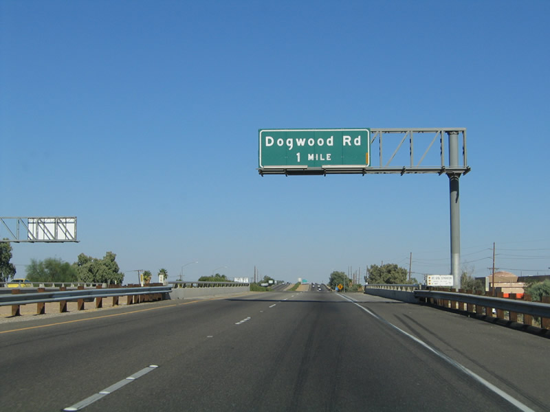
The next exit along eastbound Interstate 8 is Exit 116, Imperial County S-31, Dogwood Road. This sign is located on the bridge spanning California 86 below. Photo taken 08/27/04. |
|
|
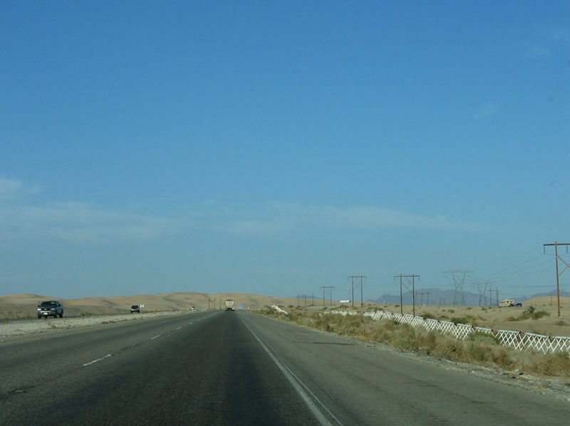
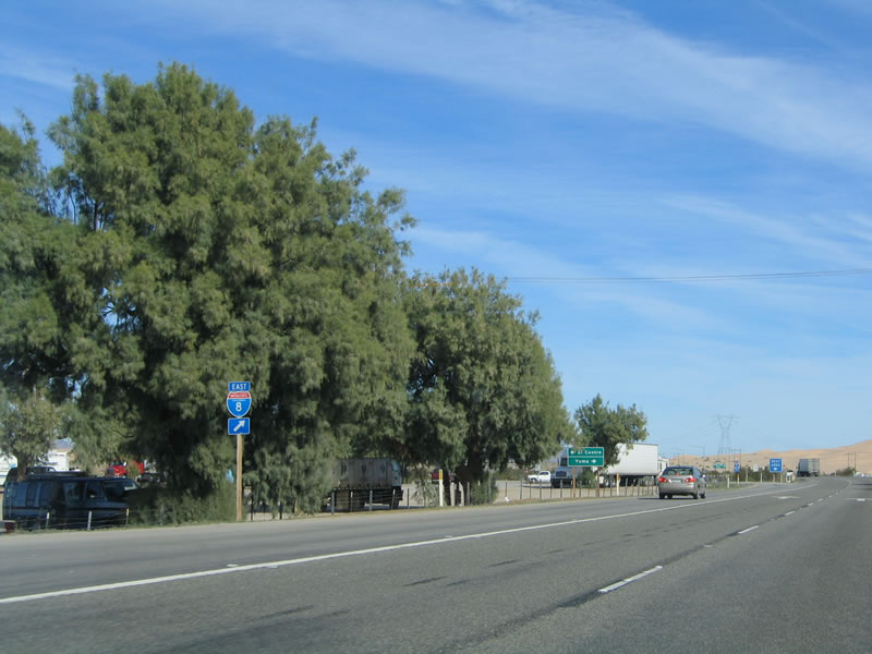
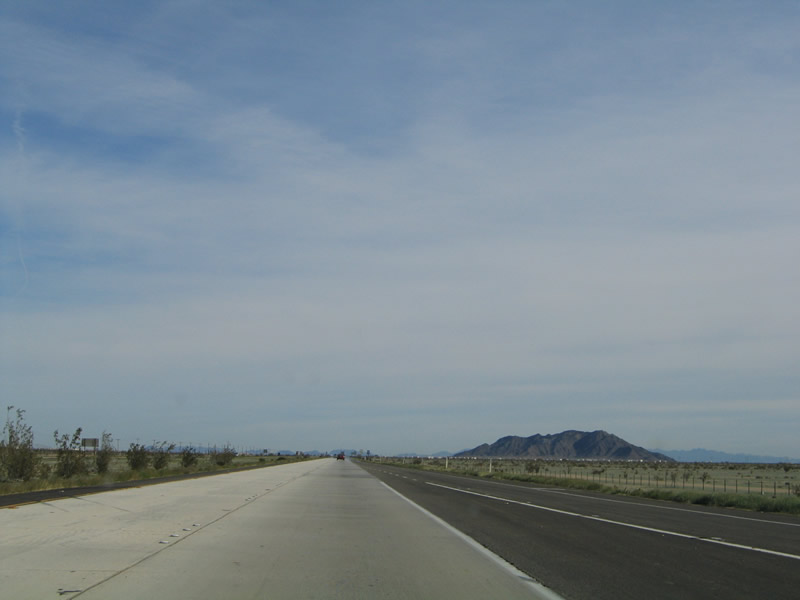
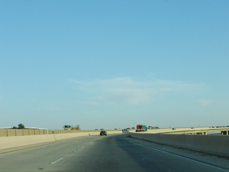
An Interstate 8 reassurance shield is posted after the point where traffic from California 86 merges onto eastbound Interstate 8. The two directions of traffic are separated by a wall of oleander, which is growing in the center median. While oleander is drought resistant and brings greenery to the desert, it can be flammable when dry and is poisonous to eat. Photos taken 08/27/04 and 04/20/13. |
|
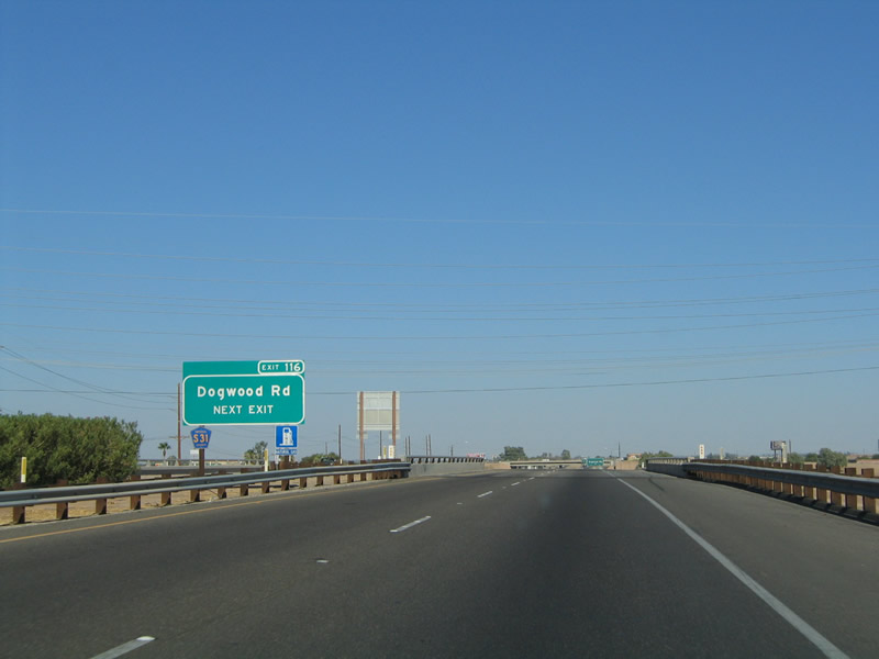
A newer exit number is sign for Imperial County S-31 is posted in the median along eastbound Interstate 8. Following Dogwood Road from California 98 west of Calexico north to California 78 in Brawley, Imperial County S-31 offers an alternative to busy California 86 and California 111. Photo taken 08/27/04. |
|
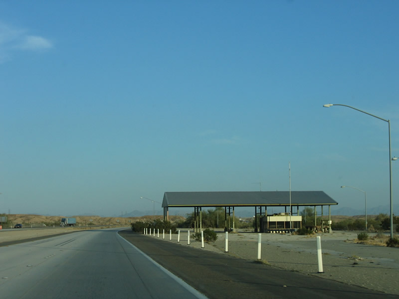
To the south of the freeway, we see this storage tank with the sea level painted on the side, along with "Welcome to El Centro." Photo taken 04/20/13. |
|
|
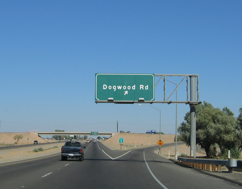
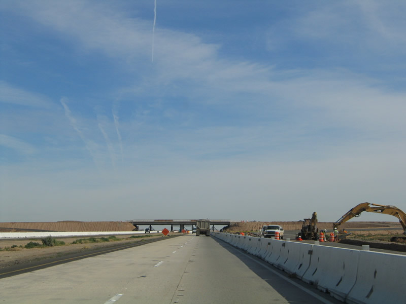
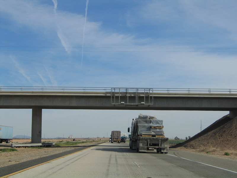
Eastbound Interstate 8 reaches Exit 116, Imperial County S-31, Dogwood Road. Dogwood Road is a local road that provides north-south arterial access between California 86 and California 111. Traffic was heavy on Dogwood Road both times when we passed through the area, and the stop sign at the top of the ramp was replaced with a traffic signal once a large shopping mall opened to the south of the freeway interchange. Photos taken 08/27/04 and 04/20/13. |
|
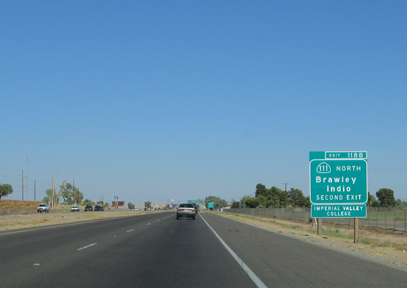
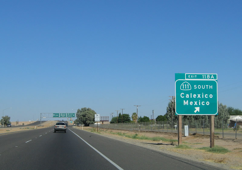
The next exit along eastbound Interstate 8 is Exits 118A-B, California 111 south and north. California 111 bypasses the urban areas to the east, and it is a four-lane expressway between Calexico and near Brawley. Between 2002 and 2005, the section of California 111 was widened to expressway standards between Interstate 8 and California 78 near Brawley. The north end of the expressway will eventually connect to the as-yet unconstructed Brawley bypass, creating a link between the California 86 expressway northwest of Brawley and the California 111 expressway southeast of Brawley. Photo taken 08/27/04. |
|
The first ramp in this cloverleaf interchange connects eastbound Interstate 8 to southbound California 111 en route to Calexico and the International Border. Only passenger cars may use the port of entry via California 111; commercial trucks must use the border crossing found on California 7. San Diego State University has an Imperial Valley satellite campus in Calexico that may be reached via this exit. Photo taken 08/27/04. |
|
The second ramp in this cloverleaf interchange connects eastbound Interstate 8 to northbound California 111 via a loop ramp. Northbound California 111 skirts the eastern edge of the cities of El Centro and Imperial, then curves northwest into Brawley. Photo taken 08/27/04. |
|
A second exit number sign is posted here for the connection to southbound California 111. The destination city is Calexico, while the control "city" is Mexico and the International Border Crossing. Trucks wishing to enter Mexico should use the California 7 expressway south (via Exit 125). Photo taken 08/27/04. |
|
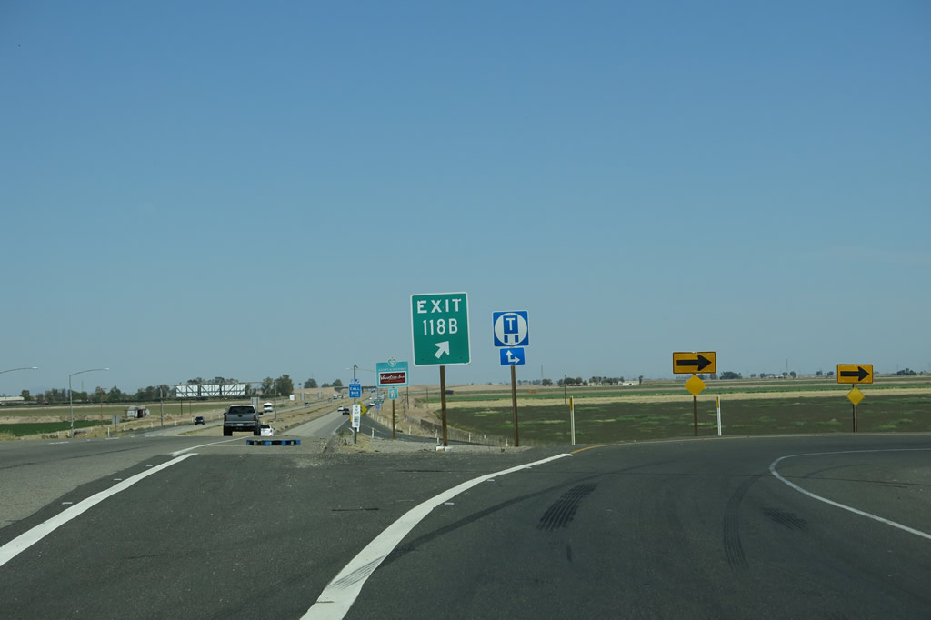
Eastbound Interstate 8 reaches Exit 118A, Southbound California 111 to Calexico and the International Border with Mexico. The second ramp in this interchange (Exit 118B) serves northbound California 111 en route to Brawley, the Salton Sea, Indio, and Palm Springs. This interchange is a classic cloverleaf interchange. Photo taken 08/27/04. |
|
After the transition ramp to southbound California 111, the second ramp connects eastbound Interstate 8 with northbound California 111 via a loop ramp. California 111 travels north to Brawley, Indio, and Palm Springs via the eastern shore of the Salton Sea. This is the last exit with easy to reach motorist services until the Sidewinder Road interchange (although Holtville has services, the town is located several miles north of Interstate 8). Photo taken 08/27/04. |
|
The ramp from Interstate 8 east to California 111 north is a tight loop ramp required slow speeds. Photo taken 04/20/13. |
|
This reassurance shield for Interstate 8 is posted along eastbound after the California 111 interchange. From here, it is another seven miles to the California 7 expressway (Exit 125), which travels south to the commercial border crossing into Mexico. Photo taken 01/14/05. |
|
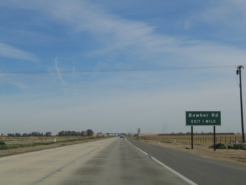
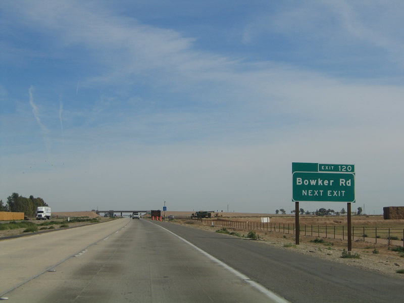
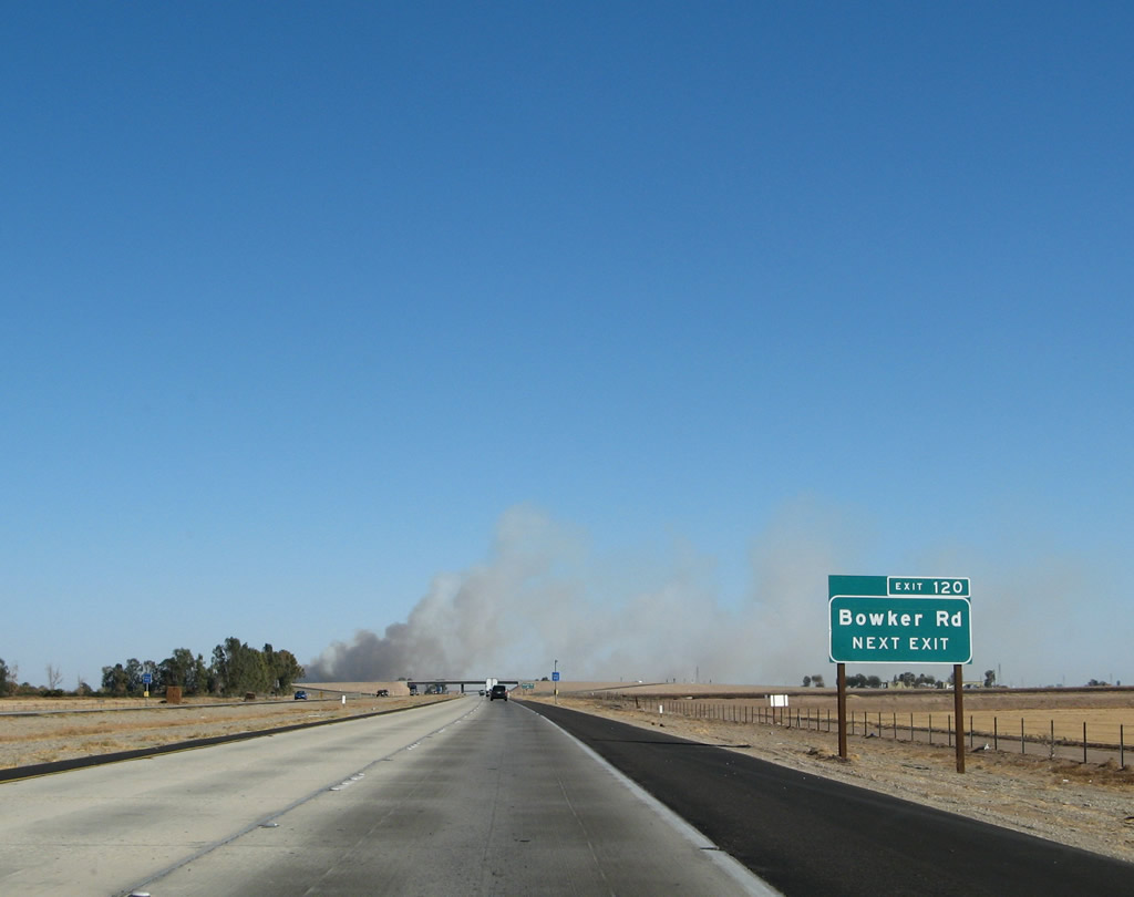
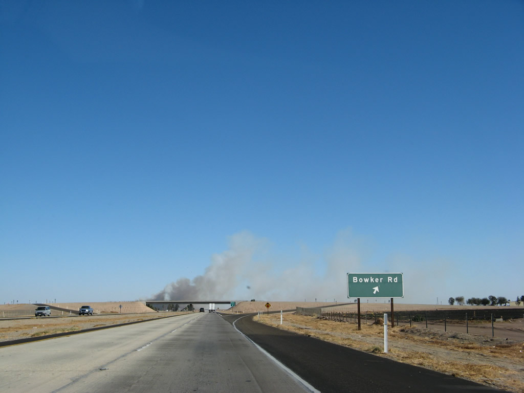
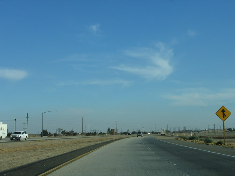
The next exit along eastbound Interstate 8 is Exit 120, Bowker Road. Bowker Road parallels California 111 about two miles to the east of the expressway, traveling north-south from near the border fence in the south to Imperial County S-80 in the north. Photo taken 01/14/05. |
|
|
Bowker Road travels north to meet Old U.S. 80 west of Meloland and east of El Centro and California 111. The road continues north to end at Imperial County S-28, Worthington Road. In the 2007 photo, notice the smoke. This is due to farmers burning their fields to restore nutrients to the soil. Photos taken 01/14/05 and 01/15/07. |
|
|
Eastbound Interstate 8 reaches Exit 120, Bowker Road. The next exit along eastbound is Exit 125, California 7 and Imperial County S-32/Orchard Road. In the 2007 photo, the smoke is blowing over the freeway ... not a good thing! Photos taken 01/14/05 and 01/15/07. |
|
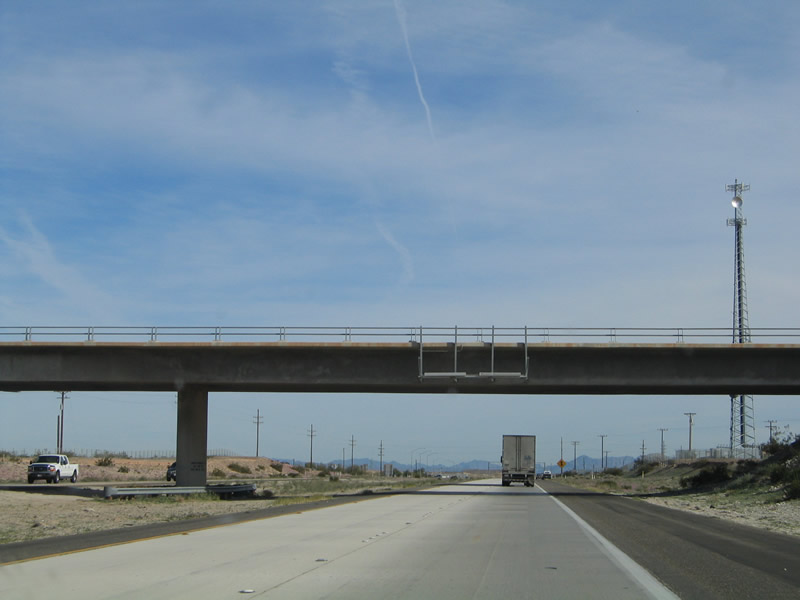
An Imperial Irrigation District (IID) power line crosses Interstate 8; this line connects to the hydroelectric and geothermal electricity generation facilities along the All-American Canal corridor. Photo taken 01/15/07. |
|
|
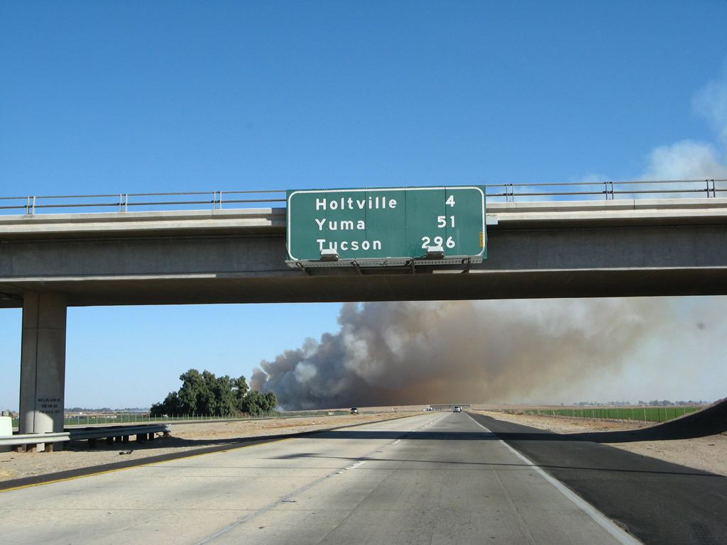
This mileage sign provides the distance to Holtville (four miles), Yuma (51 miles), and Tucson (296 miles). The sign is posted on the Meloland Road overpass. For the 2007 photo, the smoke grows more ominous. Photos taken 01/14/05 and 01/15/07. |
|
Entering the billowing cloud of smoke, the period of low visibility on Interstate 8 is short. We soon pull through and next approach the California 7 expressway. Photo taken 01/15/07. |
|
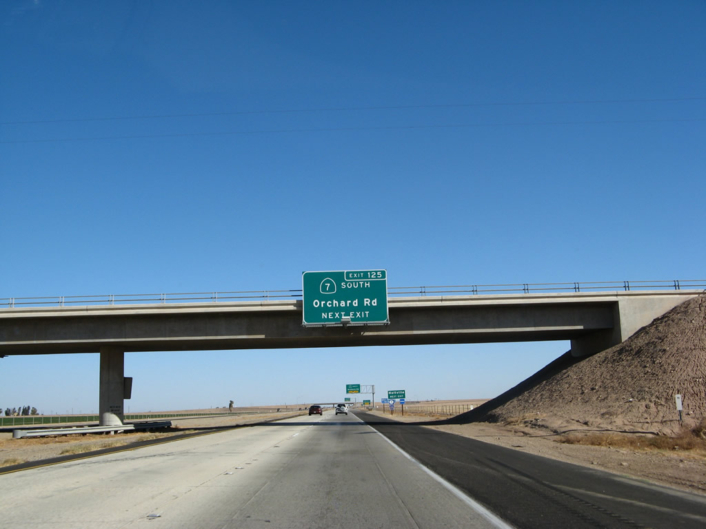
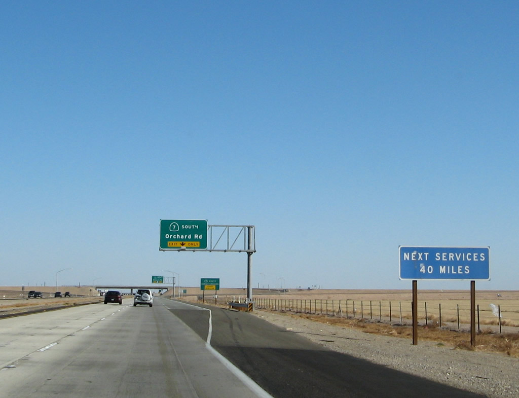
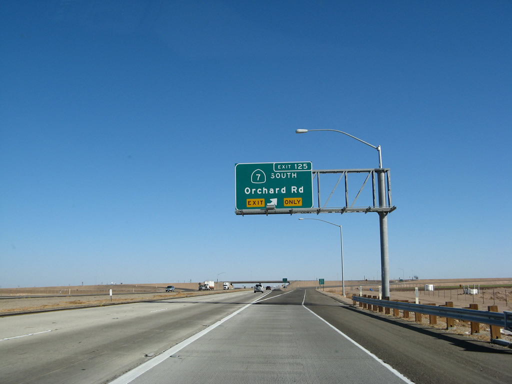
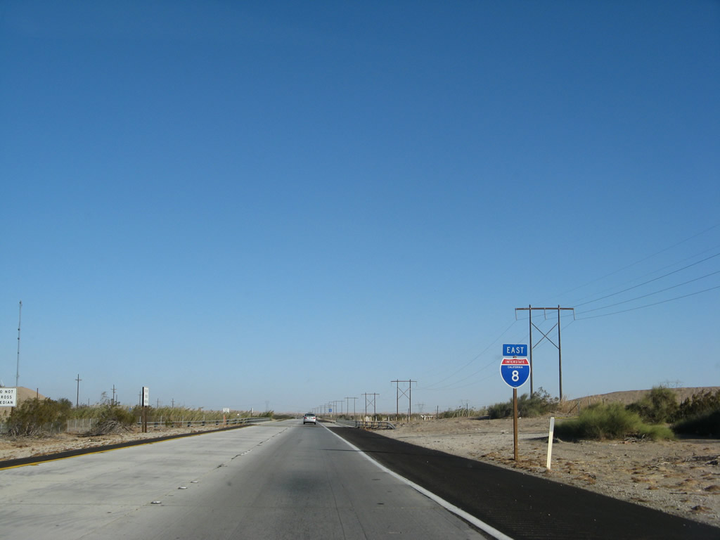
Continuing east, the next exit along Interstate 8 is the California 7 expressway south to the eastern International Border Crossing between the United States and Mexico. This expressway was opened in 2005 with a revised Exit 125. Photo taken 01/13/06. |
|
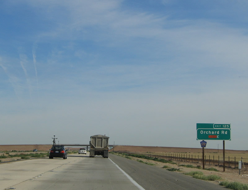
Prior to the completion of the California 7 interchange, Exit 125 served the junction with Imperial County S-32, Orchard Road. The county route south of Interstate 8 was replaced with California 7 in 2005 when the new expressway opened. To the north, Imperial County S-32 still exists, even though plans call for California 7 to be extended further north to connect to Old U.S. 80 (Imperial County S-80) and California 115. This sign may be one of the shortest-lived exit number signs in the state (in only lasted a couple years). Photo taken 01/14/05. |
|
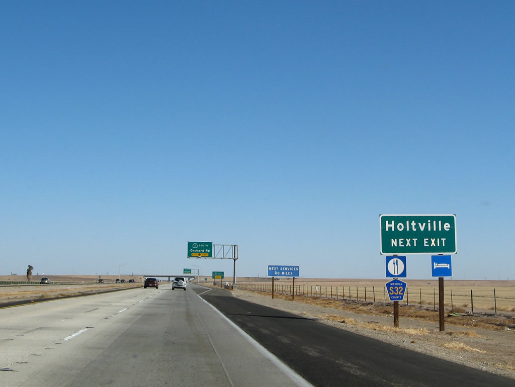
Motorist services are available via Imperial County S-32/Orchard Road north to Holtville. Gas and food are also available at the Calexico East Port of Entry via California 7 south. Photo taken 01/15/07. |
|
The next services on the freeway are not until Exit 164, Sidewinder Road in Felicity, a disatnce of 40 miles. Photo taken 01/15/07. |
|
A new, third lane opens up on the right to accommodate exiting traffic en route to the truck border crossing via California 7. California 7 is a designation that has been used on no fewer than three different roadways in Southern California. It was first used on Sepulveda Boulevard in Los Angeles County before that arterial roadway was replaced with parallel Interstate 405. The Long Beach Freeway (originally California 15, then California 7, and now Interstate 710) was known as California 7 until the mid-1980s. This short spur from Interstate 8 to Mexico is the third incarnation of California 7. Photo taken 01/15/07. |
|
California 7 provides a direct connection to the Calexico East Port of Entry, which is also known as "Garita Numero Dos" in Mexicali. The port of entry at the international border with Mexico is open from 6:00 a.m. to 10:00 p.m. daily. Photo taken 01/15/07. |
|
One year earlier, this picture shows the reconstruction of the Interstate 8 and California 7 interchange. Photo taken 01/14/05. |
|
Now on the transition ramp, a left turn connects to Imperial County S-32/Orchard Road north to Holtville, while a right turn connects to California 7 south to Calexico East Port of Entry (International Border Crossing). Photo taken 01/15/07. |
|
The connection from Interstate 8 east to California 7 south is smooth and requires no hard turns. It is built nearly to freeway-to-freeway standards. However, the same is not true of the connection from Interstate 8 west to California 7 south. Photo taken 01/15/07. |
|
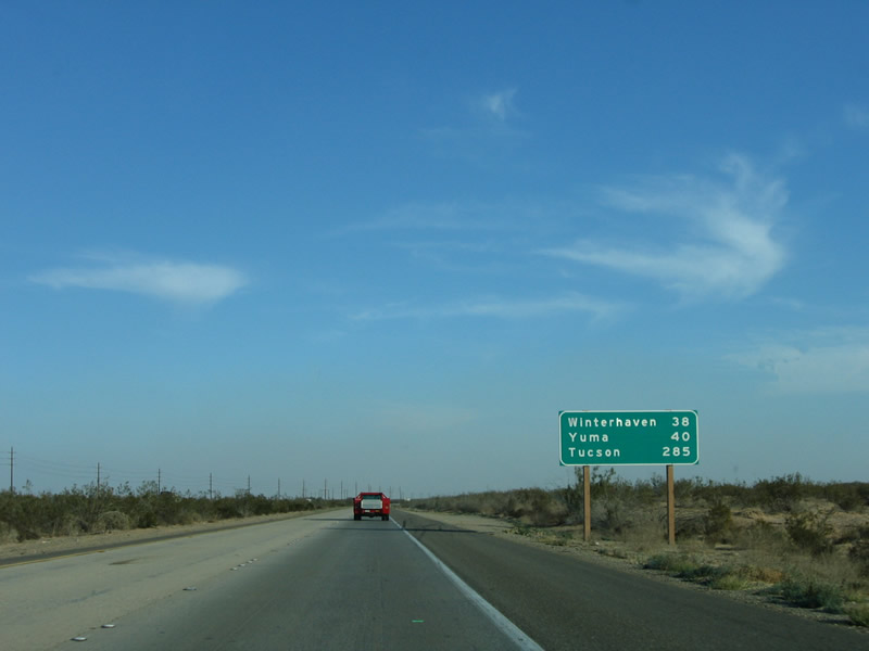
Getting back to the mainline of Interstate 8 after the California 7 interchange, this mileage sign provides the distance to Winterhaven (44 miles), Yuma (46 miles), and Tucson (291 miles). There are not many motorist services between here and Felicity. There is only a rest area at Exit 155. Photo taken 01/27/06. |
|
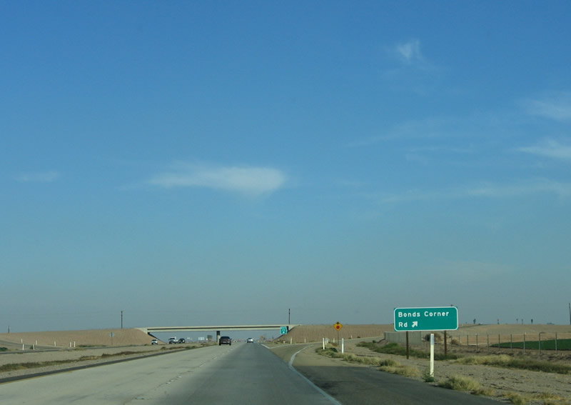
The next exit along eastbound Interstate 8 is Exit 128, Bonds Corner Road. Photo taken 01/27/06. |
|
Eastbound Interstate 8 reaches Exit 128, Bonds Corner Road. A friend who had recently traveled to Ohio commented that the main difference between the Imperial Valley irrigated fields and an agricultural field in Ohio is that there are weeds and trees along the boundary of the agricultural fields and the natural/native areas in Ohio. By comparison, there are no accidental weeds growing alongside any fields in the Imperial Valley, unless there's a water leak or a recent monsoonal storm. Photo taken 01/27/06. |
|
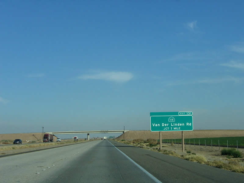
The freeway passes under the Bonds Corner Road overcrossing; the next exit along eastbound is Exit 131, California 115 north to Historic U.S. 80 (Evan Hewes Highway). The interchange also serves Van Der Linden Road south. Photo taken 01/27/06. |
|
The next exit along eastbound Interstate 8 is Exit 131, California 115, one mile. This state highway provides an alternative to California 111 between Interstate 8 and Calipatria southeast of the Salton Sea. Photo taken 01/27/06. |
|
California 115 follows Old U.S. 80 west to Holtville, then breaks north toward Calipatria on an alignment generally parallel to the Highline Canal. While Old U.S. 80 between Exits 89 and 131 remains significantly north of Interstate 8 and is largely signed as Imperial County S-80 or California 115, the portion of old alignment east of Exit 131 to Exit 151 follows the north side of Interstate 8 as a frontage road. Photo taken 01/27/06. |
|
A vacant sign bridge assembly sits on the Miller Road (Imperial County S-33) overcrossing. The Van Der Linden Road (California 115 to Historic U.S. 80) interchange is about a half-mile ahead. Photo taken 01/14/05. |
|
Van Der Linden Road travels south from this interchange as a local road, remaining west of the Highline Canal and ending at Connelly Road. Photo taken 01/27/06. |
|
Eastbound Interstate 8 reaches Exit 131, California 115. Use this exit to follow Old U.S. 80 east between here and Exit 143 (California 98) as a frontage road on the north side of the freeway. Between California 115 and California 98, Interstate 8 turns southeast. The freeway will meet California 98 at a point only a few miles north of the International Border with Mexico. Photo taken 01/27/06. |
|
Several power lines come into view as traffic from California 115 and Van Der Linden Road merge onto eastbound Interstate 8. These power lines transmit electricity generated from several geothermal power plants, one of which is immediately visible to the north of Interstate 8 (McCabe Generating Station). Most of these power lines serve the Imperial Valley, and one large transmission line travels north along the Highline Canal toward the Los Angeles regional electricity grid. Photo taken 01/27/06. |
|
This mileage sign provides the distance to Winterhaven, which sits on the west side of the Colorado River at the Arizona state line; Yuma, the control city for traffic headed eastbound; and Tucson, the second-largest metropolitan area in Arizona. While Interstate 8 does not travel all the way east to Tucson, it transitions onto Interstate 10 at Casa Grande, which is located about midway between Phoenix and Tucson. Photo taken 01/27/06. |
|
The landscape along Interstate 8 between the California 115 interchange and the California 98 interchange is flat and covered with low scrub and sagebrush. This area can be exceedingly hot during the summer months, as temperatures frequently rise to above 110 degrees. There are no services between Holtville and the Sidewinder Road interchange. Photo taken 01/27/06. |
|
A second mileage sign is located about seven miles east of the previous mileage sign. The terrain has not changed much during the intervening seven miles. The frontage road to the north of the freeway carries Old U.S. 80, but that highway seldom carries much traffic. This mileage sign only provides the distance to Winterhaven and Yuma but omits Tucson. Photo taken 01/27/06. |
|
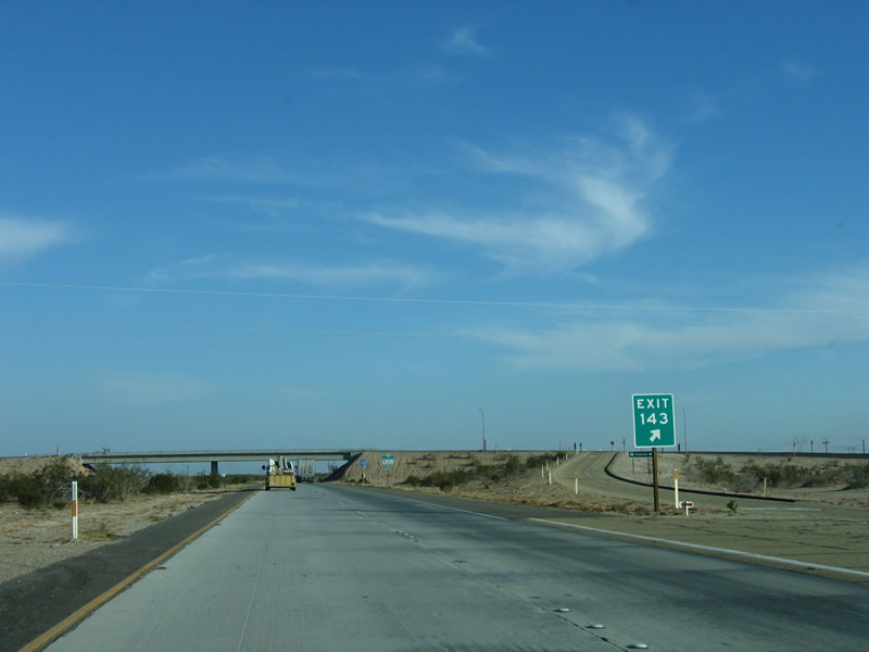
The next exit along eastbound Interstate 8 is Exit 143, California 98, one mile. This is the eastern terminus of California 98, which had paralleled Interstate 8 to the south between Exits 87 and 143 via Calexico. Note that this exit has a signed exit number. Photo taken 01/27/06. |
|
Eastbound Interstate 8 reaches Exit 143, California 98. There is not much development along California 98 between this interchange and the Highline Canal, except for the Tamarisk Long Term Visitor Area. During late 2005 and early 2006, California 98 between California 7 and Interstate 8 was closed. Photo taken 01/14/05. |
|
This is the gore point signage for Exit 143, which uses a Series E Highway Gothic font. This makes the numerals appear larger than the typical gore point signage found on California's freeways. From here east to the sand dunes, Interstate 8 travels east alongside the International Border with Mexico, which is visible to the south. Photo taken 01/27/06. |
|
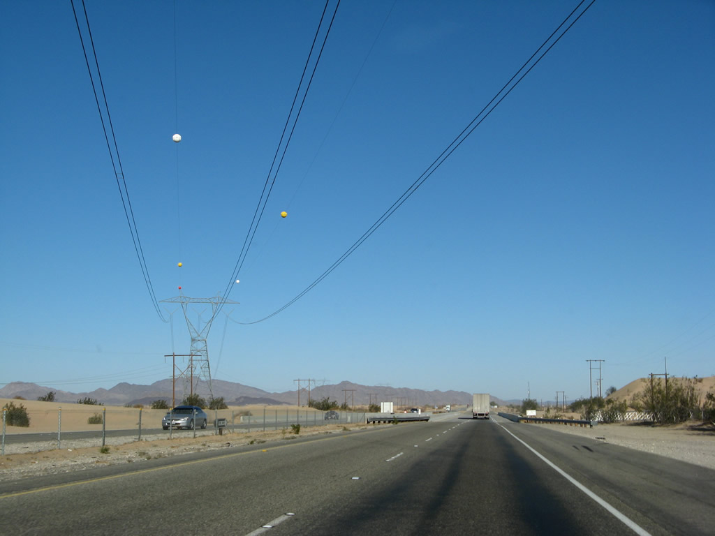
This reassurance shield is posted on eastbound Interstate 8 after Exit 143 (California 98). Several sets of power lines and the All-American Canal join the freeway on this stretch between California 98 and the junction with Imperial County S-34, Ogilby Road. Photo taken 01/14/05. |
|
Another mileage sign is located after the California 98 interchange, again showing Winterhaven and Yuma but not Tucson. The frontage road (U.S. 80) remains on the north of the freeway carries Old U.S. 80; it will remain extant from the Interstate until the Gordons Well interchange (Exit 151). Photo taken 01/27/06. |
|
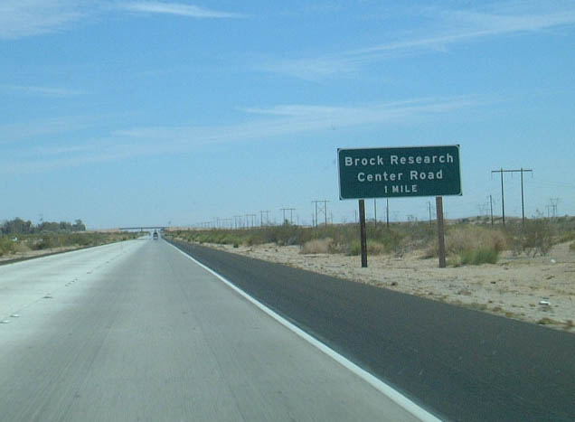
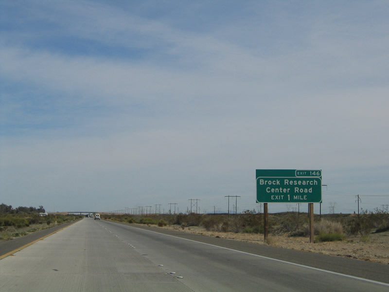
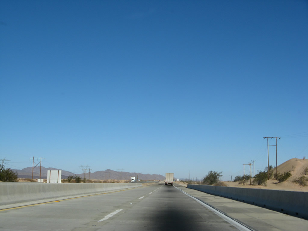
Eastbound Interstate 8 reaches Exit 146, Brock Research Center Road. Brock Ranches Experimental Farm is located on the north side of the freeway off of Old U.S. 80. Like the previous several exits, once again there are no services at this interchange. Photo taken 01/27/06. |
|
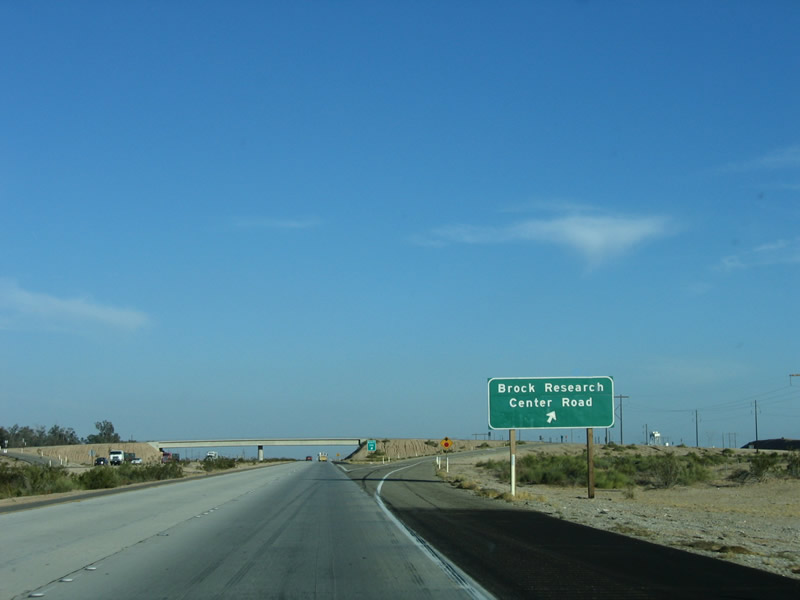
This reassurance shield for eastbound Interstate 8 is posted after the Brock Research Center Road interchange. Photo taken 01/27/06. |
|
Between Brock Research Center and Gordons Well, Interstate 8 is very flat and straight. Tall sagebrush rises above the highway, offering more shade than the desert closer to Ocotillo (within the rain shadow of the Laguna Mountains). Photo taken 01/27/06. |
|
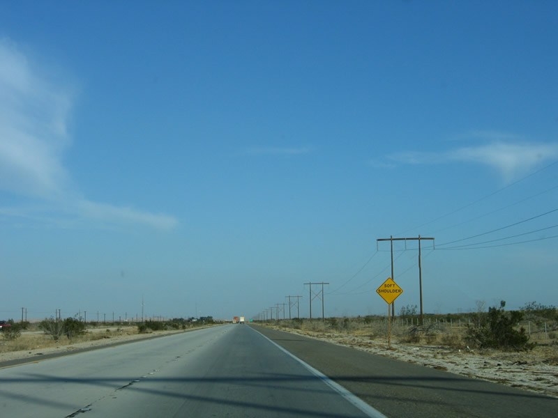
Beyond the Interstate-standard shoulder is a much softer area, so care should be taken if motorists decide to park off the freeway shoulder for any reason. Photo taken 01/27/06. |
|
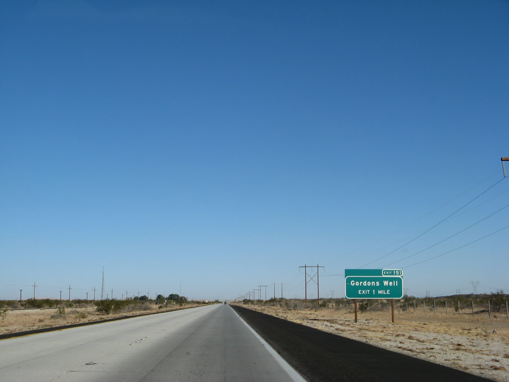
The next exit along eastbound Interstate 8 is Exit 151, Gordons Well. The Old U.S. 80 frontage road returns to Interstate 8 at Exit 151, as there is no frontage road between Exits 151 and 159. At this interchange, Interstate 8 is about a mile from the International Border with Mexico, which is as close as the freeway ever gets to Mexico. Photo taken 01/15/07. |
|
|
Eastbound Interstate 8 reaches Exit 151, Gordons Well. Upon crossing the Algodones (also known as Imperial) Sand Dunes, Interstate 8 leaves the Imperial Valley and crosses the Ogilby Hills en route to the Colorado River Valley where the city of Yuma is located. Photos taken 01/14/05 and 01/15/07. |
|
|
"H" Frame power lines follow Interstate 8 as the freeway leaves Gordons Well and approaches the Algodones Sand Dunes. Ahead is the first All-American Canal Bridge, which allows the canal to pass under the freeway and follow the freeway on the north side through the dunes. Photos taken 01/14/05 and 01/15/07. |
|
Interstate 8 east crosses over the All-American Canal on this bridge. The original 1939 U.S. 80 bridge serves the eastbound lanes; it was widened in 1969 to accommodate the freeway shoulders. The westbound lanes were built in 1969 as well. Photo taken 01/15/07. |
|
This mileage sign provides the distance to Winterhaven (18 miles) and Yuma (20 miles). Photo taken 01/15/07. |
|
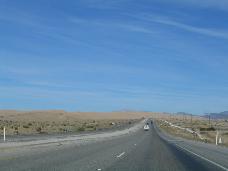
Blowing and drifting sand becomes a concern for Interstate 8 travelers as the freeway passes through the Algodones Sand Dunes. Photo taken 01/27/06. |
|
|
Just as the Imperial Dunes come into view, Interstate 8 turns northeast to pass through the dunes. The All-American Canal, power lines, and other infrastructure corridors turn northeast with the freeway. Photos taken 01/27/06 and 01/15/07. |
|
|
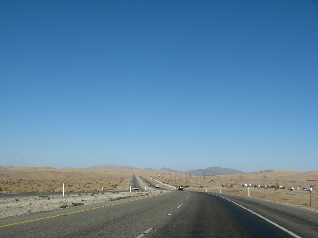
East of Gordons Well, the freeway prepares to cross the Imperial (Algodones) Sand Dunes. These dunes extend from north to south, from just north of California 78 at Glamis south across the International Border to just north of Mexico Federal Route 2. These dunes are primarily made up of sand that has blown for centuries across the arid Imperial Valley. Now a popular recreational area, the dunes teem with four-wheel enthusiasts year-round. Photos taken 01/14/05 and 01/27/06. |
|
The white barriers seen on the right (south) side of the freeway are designed to provide a visual and actual barrier between four-wheel vehicles riding on the sand dunes and the Interstate route. Photo taken 01/27/06. |
|
|
The next exit along eastbound Interstate 8 is Exit 155, Sand Hills Rest Area (left exit), about two miles east of here. The freeway now enters the Buttercup Valley area within the Algodones Dunes (Imperial Sand Dunes). Photos taken 01/14/05 and 01/27/06. |
|
The dunes come into view on the north side of Interstate 8, offering a contrast with the power lines and freeway corridor. Do not use the rest area exit to visit the sand dunes. Since the rest area is located in the median of Interstate 8, there is no access from the rest area to the surrounding dunes. Motorists must use Exit 156 (Grays Well Road) to reach the dunes. Photo taken 01/27/06. |
|
|
Passing through the Imperial (Algodones) Dunes, the All American Canal briefly comes into view as Interstate 8 crests over a slight summit. It is the only hint of water in this otherwise arid corridor. The Cargo Muchacho Mountains are visible in the distance. Photos taken 01/14/05 and 01/15/07. |
|
|
As seen in this picture along eastbound, various forms of infrastructure consolidate into a narrow corridor to cross the dunes, including power lines and the freeway itself. The green area to the left (north) in this picture is the All-American Canal. Photo taken 01/27/06 and 01/15/07. |
|
In addition to the Sand Hills Rest Area, eastbound Interstate 8 also approaches Exit 156, Grays Well Road, one mile. This exit is also signed with an exit number. In addition to the dunes, a major attraction at this exit is the remnants of the original Plank Road. Prior to the construction of U.S. 80 as a conventional two-lane highway (or Interstate 8 as a four-lane freeway), engineers constructed a wooden plank road in the 1910s for vehicular traffic. The restored remnants of the plank road are accessible via Exit 156. Photo taken 01/27/06. |
|
Eastbound Interstate 8 approaches Exit 155, Sand Hills Rest Area, next left. Interstate 8 through California is known as the Jefferson Davis Highway, the once-president of the Confederacy during the Civil War. A marker was placed in the rest area by the Daughters of the Confederacy to commemorate this designation. Since California is so far away from the origins of the Civil War, it is somewhat surprising to learn that Interstate 8 is named for a political figure from another region and another era. By comparison, finding Jefferson Davis Highway designated in Alabama is something we would expect to see (that's Alabama 5 in case you were wondering). Photo taken 01/27/06. |
|
The left exit to the rest area is odd. First traffic reentering the freeway merges onto eastbound Interstate 8 from the left, then traffic exiting to the freeway veer off the freeway. Photo taken 01/27/06. |
|
This photo shows the awkward merging situation created by the odd location of the Sand Hills Rest Area. Photo taken 01/14/05. |
|
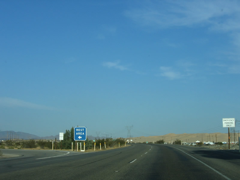
Eastbound Interstate 8 reaches Exit 155, Rest Area. This exit is a sharp left turn, so motorists should use the left deceleration lane prior to this point. Photo taken 01/27/06. |
|
Immediately thereafter, eastbound Interstate 8 reaches Exit 156, Grays Well Road. Use this exit to the Imperial Sand Dunes Recreation Area, Buttercup Valley Off-Road Area, Midway Campground, and the Old Plank Road. Photo taken 01/27/06. |
|
At the top of the ramp, turn right to follow an orphaned section of U.S. 80 west to the Imperial Sand Dunes Recreation Area and Buttercup Valley. Turn left to connect to westbound Interstate 8 back to El Centro. There is no connection to the sand dunes north of Interstate 8, since the All American Canal effectively breaks the connection between the freeway and those dunes. However, off road vehicles can reach the dunes through other connections. Photo taken 01/27/06. |
|
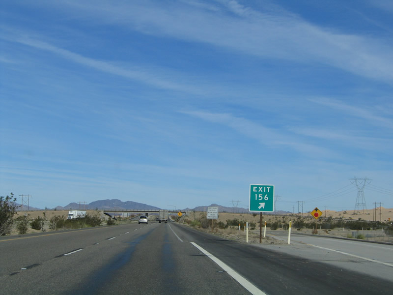
This is the gore point signage for Exit 156, Grays Well Road. From here, Interstate 8 leaves the Algodones (Imperial) Sand Dunes. Photo taken 01/14/05. |
|
A reassurance shield for Interstate 8 east is posted after the on-ramp from Exit 156, Grays Well Road. Photo taken 01/14/05. |
|
This mileage sign provides the distance to Winterhaven (14 miles) and Yuma (16 miles). The next services are available in Felicity at Exit 164, about five miles east of here. Photo taken 01/15/07. |
|
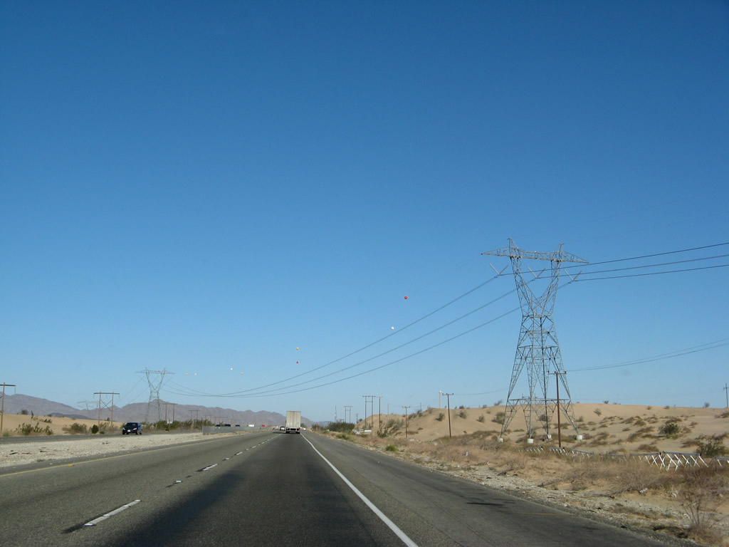
Interstate 8 crosses over the All American Canal after passing under the power lines. The eastbound bridge that carries Interstate 8 over the canal was built in 1938 and dates to when U.S. 80 was the primary route across the Algodones Sand Dunes; the westbound bridge was built as a parallel span that allowed for a four-lane crossing in 1961. Both spans were widened (westbound in 1987 and eastbound in 1990). The canal itself was built between 1934 and 1940 to carry water from the Colorado River (via a diversion at the Imperial Dam) to the arid fields of the Imperial Valley. The canal ends in Calexico for a total distance of 80 miles. By staying within the United States, the All American Canal avoids Mexico and replaces the Inter-California Canal that preceded it. Photos taken 01/14/05 and 01/15/07. |
|
|
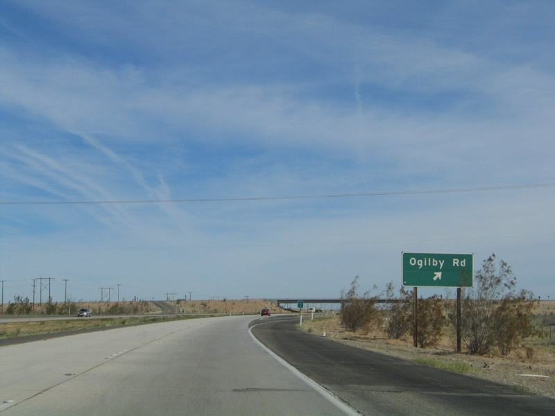
The next exit along eastbound Interstate 8 is Exit 159, Imperial County S-34, Ogilby Road. Imperial County S-34 is the best-marked county route from Interstate 8, since its shield is pasted onto one advance guide sign in each direction. A similar sign is posted on westbound Interstate 8 at Exit 159. Photo taken 01/14/05. |
|
|
At Exit 159, Historic U.S. 80 resumes its eastbound journey on its original alignment. Follow Imperial County S-34 north, then turn right (east) on the frontage road, also known as Center of the World Drive. Center of the World Drive parallels Interstate 8 on the north side between Exits 159 and 164. At Felicity (Exit 164), Old U.S. 80 turns to the southside of the freeway. Photos taken 01/14/05 and 01/15/07. |
|
|
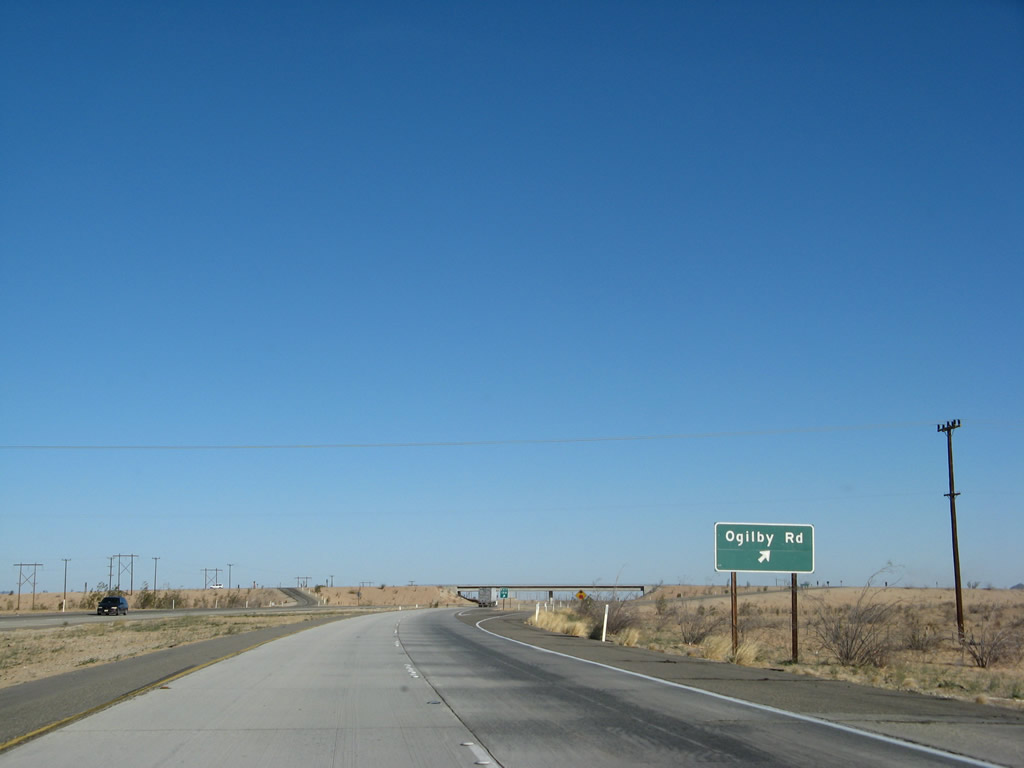
Eastbound Interstate 8 reaches Exit 159, Ogilby Road/Imperial County S-34. This is the best north-south route from Interstate 8 north to Blythe via California 78. Imperial County S-24 (Exit 170) does not continue north of Laguna Dam, so it does not connect to California 78 or Blythe. Photos taken 01/14/05 and 01/15/07. |
|
The gore point signage again reflects the exit number; this was one of the first areas to receive exit numbers once the state began the long, slow process of signing the new exit numbers in the field. Many exits along Interstate 8 started to receive mileage-based numbers in 2002. Photo taken 01/27/06. |
|
After the Imperial County S-34 (Ogilby Road) interchange, Pilot Knob Mesa appears in the distance ahead. Photo taken 01/14/05. |
|
As Pilot Knob Mesa rises in the distance, this mileage sign provides the distance to Winterhaven; Yuma, Arizona; and Tucson, Arizona. These same cities have appeared on mileage signs since leaving Holtville. Photo taken 01/27/06. |
|
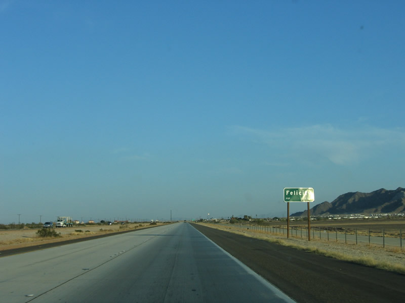
Felicity, a "town dedicated to remembrance," is the next community along eastbound Interstate 8. Locally famous for its "Official Center of the World" attraction, the town was legally established on March 11, 1986. While the pyramid itself is the official center of the world, other items of interest are found nearby. A section of the original stairway of the Eiffel Tower can be seen from the freeway; it was installed in 1990. A California Highway Patrol area headquarters is located in Felicity, as is a gas station. Photo taken 01/27/06. |
|
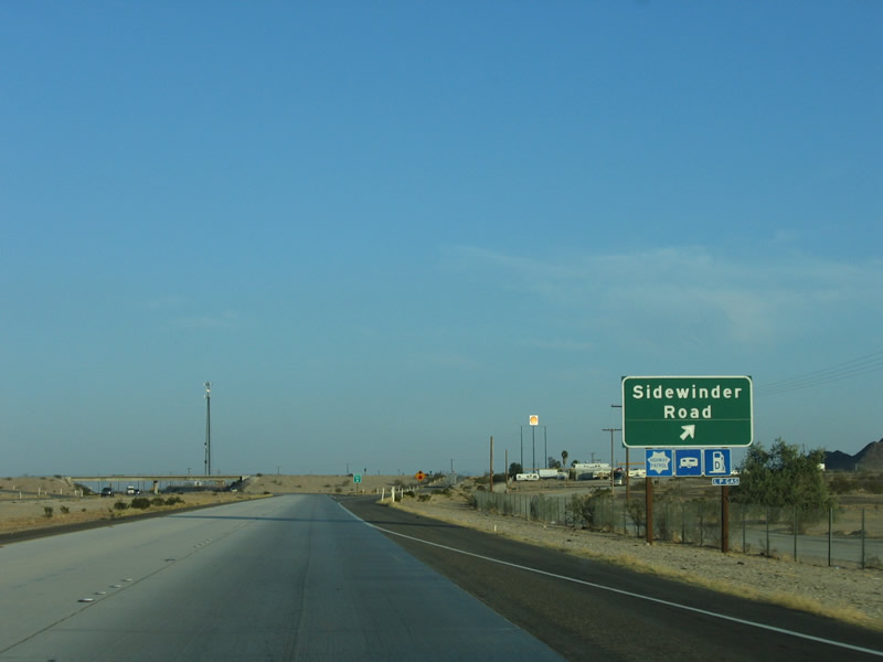
The next exit along eastbound Interstate 8 is Exit 164, Sidewinder Road. This is the first exit with services in over 34 miles, but there really is not much else available at this exit, except two things: the site of the town of Felicity and the "Official Center of the World." Look for the official center of the world on the north side of Interstate 8. Photo taken 01/27/06. |
|
Eastbound Interstate 8 reaches Exit 164, Sidewinder Road and Felicity. Photo taken 01/27/06. |
|
Another empty sign assembly is posted on the Sidewinder Road overcrossing along eastbound Interstate 8, perhaps for the defunct inspection station located east of Exit 164. Photo taken 01/27/06. |
|
After this reassurance shield for eastbound Interstate 8, a vacant overhead sign bridge comes into view. This sign bridge used to provide directions to eastbound motorists for the former inspection station located between Exit 164 (Sidewinder Road) and Exit 166 (California 186). Old U.S. 80 skirts past this inspection station on the south side of the freeway in the shadow of Pilot Knob Mesa. Photo taken 01/27/06. |
|
The inspection station along westbound Interstate 8 is fully functional and is in use, currently by the U.S. Border Patrol to inspect those entering California. Previously, this station was used by the State of California - Department of Agriculture for agricultural inspections. The inspectors would ask incoming motorists whether they carried any fruits or vegetables that might be quarantined. This helps avoid the spread of various agricultural diseases that might otherwise infest farms throughout the region. Photo taken 01/27/06. |
|
On the eastbound side, the remnants of the former agricultural inspection station are visible near Milepost 165. The agricultural inspection station used to be run by the State of Arizona (even though we are still in California), but that station was relocated into Arizona at a new facility east of Yuma. At the Arizona inspection facility is another U.S. Border Patrol checkpoint. Photo taken 01/27/06. |
|
The next exit along eastbound Interstate 8 is Exit 166, California 186, Algodones Road after the abandoned inspection station. This is a new reflective sign placed sometime between 2002 and 2005; the pre-2002 sign was also reflective, but it omitted the state route designation and the exit number. Photo taken 01/27/06. |
|
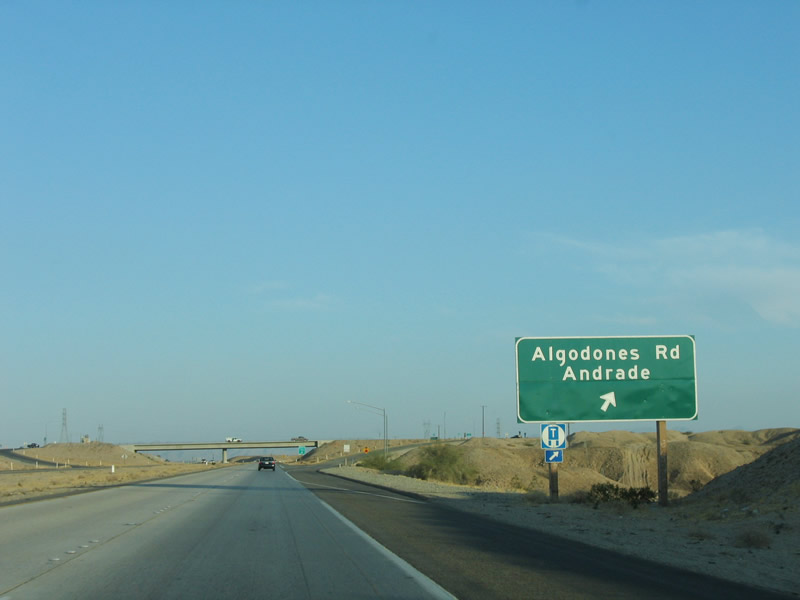
The next guide sign advises that California 186 travels south to Mexico. A lone California 186 shield is found beneath the "Mexico Next Exit" sign; prior to 2002, this sign was the only indication that this exit connects to the short California 186 state route. California 186 is a two-lane highway that leads south into Mexico via Andrade, with a direct connection to Mexico Federal Route 2. Photo taken 01/27/06. |
|
Eastbound Interstate 8 reaches Exit 166, California 186, Algodones Road, south to Andrade and Algodones, Mexico. This exit also connects to Old U.S. 80, which changes from the south side of Interstate 8 to the north side. From here to the Arizona state line, Old U.S. 80 follows Winterhaven Drive. It will remain on the north side of the freeway until the second Winterhaven interchange, which is where U.S. 80 crosses back to the south side of Interstate 8. Photo taken 01/27/06. |
|
Now on the off-ramp to California 186, turn left to follow Historic U.S. 80 along Araz Road to Winterhaven or turn right to follow California 186 (Algodones Road) south to Andrade and Algodones, Baja California Norte. Photo taken 01/15/07. |
|
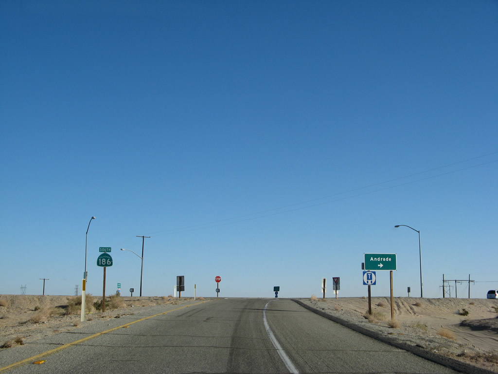
The trailblazer for California 186 south is missing an arrow pointing to the right. Photo taken 01/15/07. |
|
At the top of the ramp, turn right to California 186 south to Andrade or turn left to Old U.S. 80 east to Winterhaven. Photo taken 01/15/07. |
|
After Exit 166, this reassurance shield is posted along eastbound Interstate 8. In the distance is the first view of the Colorado River Valley, home to the cities of Winterhaven in California and Yuma in Arizona. The desert environs will change to fertile fields as the highway passes into a better soil for farming. Photo taken 01/27/06. |
|
This mileage sign provides the distance to Winterhaven (three miles), Yuma (five miles), and Tucson (246 miles). Mileage signs with Tucson as a control city are in place from El Centro eastward along Interstate 8, even though Interstate 8 never reaches Tucson. Photo taken 01/27/06. |
|
Between the California 186 interchange and the second Winterhaven interchange (a distance of about six miles), Interstate 8 closely parallels the Colorado River. While the river is not visible from the freeway, the berm on the south side protects the freeway from the river. While it would seem that Interstate 8 is below sea level, that is no longer the case. After leaving the Holtville area (el. 11 feet below sea level), Interstate 8 gradually gained elevation. Passing through the Algodones/Imperial Sand Dunes, Interstate 8 remains above sea level. Winterhaven is at an elevation of 130 feet, and Pilot Knob Mesa to the south rises to 742 feet. Photo taken 01/27/06. |
|
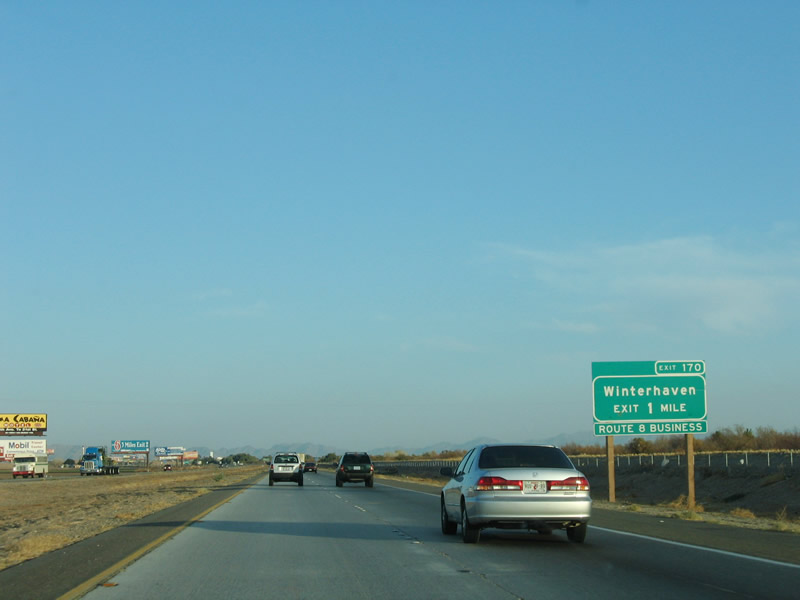
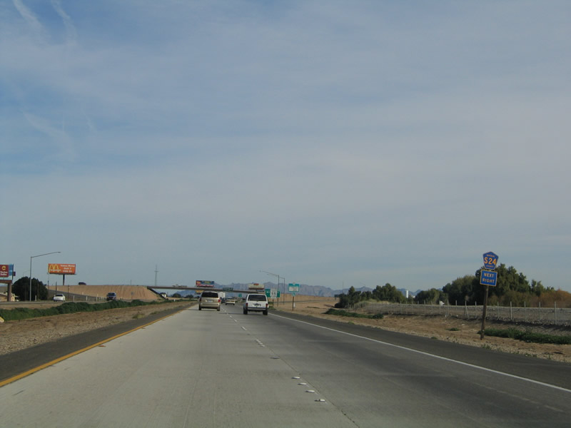
The next exit along eastbound Interstate 8 is Exit 170, Business Loop I-8, Winterhaven Drive. While this exit serves the town of Winterhaven, it is also the most direct route from eastbound Interstate 8 to northbound Imperial County S-24. Imperial County S-24 follows Picacho Road, Ross Road, and Imperial Dam Road north to Laguna Dam and Imperial Dam. Imperial County S-24 serves the Fort Yuma Indian Reservation and the town of Bard. Photo taken 01/27/06. |
|
As of the 2000 Census, Winterhaven has a population of 529 people. This town rests on the western bank of the Colorado River, while larger Yuma, Arizona, sits on the other side of the river. Photo taken 01/27/06. |
|
Use Imperial County S-24 north to Laguna Dam and Imperial Dam via Exit 170. Photo taken 01/14/05. |
|
Eastbound Interstate 8 reaches Exit 170, Business Loop I-8 and Imperial County S-24, Winterhaven Drive. Use this exit to connect to Old U.S. 80/Winterhaven Drive. Photo taken 01/14/05. |
|
The final exit along eastbound Interstate 8 in California is Exit 172, Business Loop I-8/Fourth Avenue in Winterhaven, one and one-half miles. This exit leads to the former U.S. 80 bridge that still crosses the Colorado River as Business Loop I-8 into Yuma to the south of Interstate 8 and also the historic Ocean-to-Ocean Highway truss bridge, which crosses the Colorado River to the north of Interstate 8. Photo taken 01/27/06. |
|
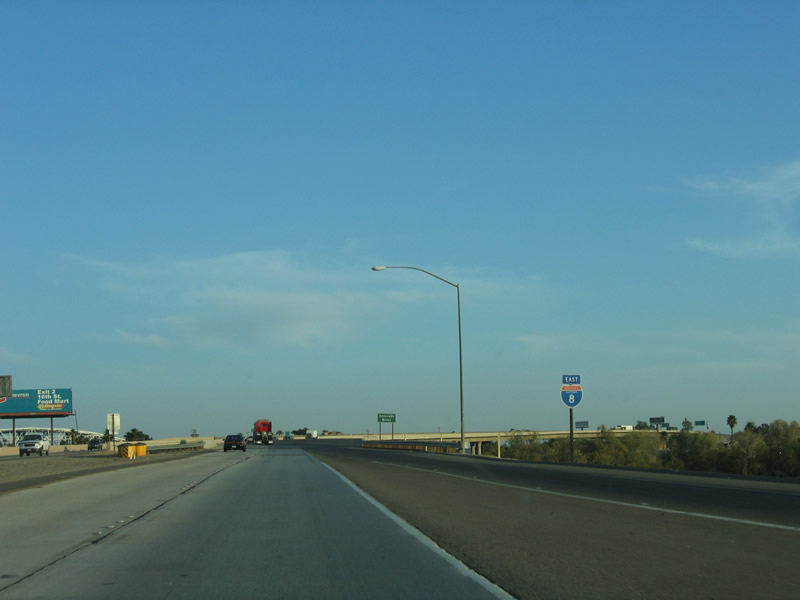
This is the penultimate reassurance shield for Interstate 8, found immediately after the on-ramp from Winterhaven Drive (Exit 170). Photo taken 01/27/06. |
|
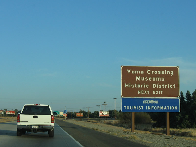
This sign, indicating that the next five exits serve Yuma, was fabricated by Arizona's Department of Transportation, as it adheres to Arizona signing standards rather than California. There are a few other Arizona signs located along California's stretch of Interstate 8 in this vicinity. Photo taken 01/27/06. |
|
These signs, just after the "Yuma - Next Five Exits" sign, were also placed by Arizona. They point to an Arizona welcome center, the historic downtown district, and the Yuma Crossing Historic Museum. Photo taken 01/27/06. |
|
On the California side of the river, this ancillary sign shows that Exit 172 also serves historic Fort Yuma and the Quechan Indian Nation. A large casino is located within the Indian reservation at the northwest end of the historic Ocean-to-Ocean Highway bridge. Photo taken 01/27/06. |
|
Exit 172 is the most direct route to Business Loop I-8 east into Yuma via Fourth Avenue. In addition, this exit connects to Business Loop I-8/Winterhaven Drive west to downtown Winterhaven. To follow Old U.S. 80 into Yuma via the business loop, exit here to cross the Colorado River into Arizona. Photo taken 01/27/06. |
|
Eastbound Interstate 8 reaches Exit 172, Business Loop I-8/Fourth Avenue/Winterhaven Drive. Eastbound Business Loop I-8 crosses the Colorado River via Historic U.S. 80, while westbound Business Loop I-8 leads into downtown Winterhaven and connects to Imperial County S-24. This is the last exit in California; ahead, all through traffic will cross the Colorado River and head into Arizona. Photo taken 01/14/05. |
|
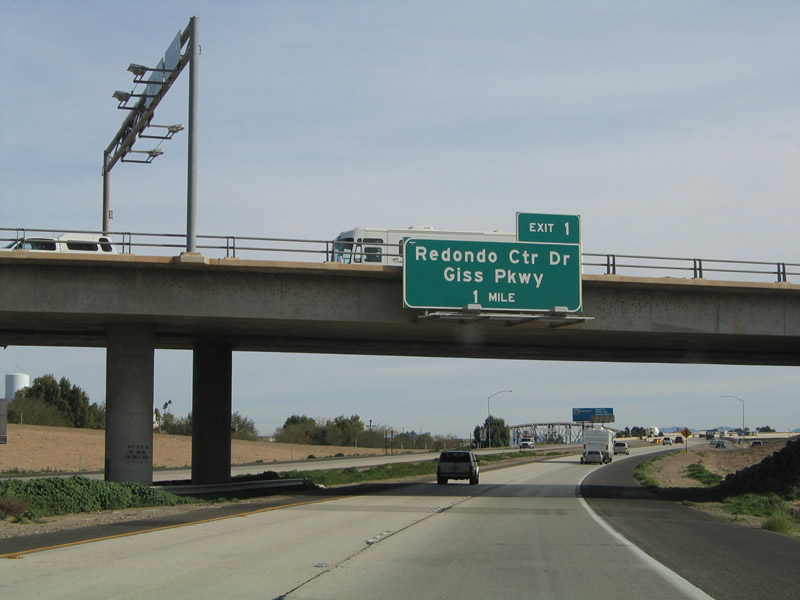
The next exit along eastbound Interstate 8 is Exit 1, Redondo Center Drive/Giss Parkway (one mile). This is the first exit in Yuma, and this sign is located on the Business Loop I-8 (Winterhaven Drive and Fourth Avenue) overpass. The sign was placed by Arizona DOT. Photo taken 01/14/05. |
|
This is the final shield along eastbound Interstate 8 in California. The freeway prepares to cross the Colorado River. The dual truss bridges in the distance are older bridges. The north bridge carries the railroad across the river, while the south bridge carries the Ocean-to-Ocean Highway over the river. Photo taken 01/27/06. |
|
A major corridor from the Rocky Mountains of Colorado south to the Gulf of California in Mexico, the Colorado River brings water to an otherwise dry and arid region. All Southwestern States rely on Colorado River water, including the vibrant metropolises of Los Angeles, Las Vegas, San Diego, Phoenix, and other desert cities. Although imported water has allowed all of these areas to grow, the upper limits of the availability of this water has come into question, especially in light of growing ecological concerns and growth in northern basin states such as Utah and Colorado. Possible future implications may include a reduced presence of agriculture in places like the Imperial Valley and Yuma as water demands grow. Photo taken 01/27/06. |
|
A concrete bridge carries Interstate 8 as the freeway curves over the Colorado River. Two other automobile crossings over the Colorado River are available: the first by way of the Ocean-to-Ocean Bridge and the second via Business Loop I-80/Old U.S. 80 (Fourth Avenue). Photo taken 01/27/06. |
|
Interstate 8 leaves the Golden State of California and enters the Grand Canyon State of Arizona at this state line sign, which is posted on the Colorado River Bridge. Photo taken 01/27/06. |
Page Updated May 26, 2013.