

Interstate 80 West - Alta to Sacramento County
| Interstate 80 west | |
|---|---|
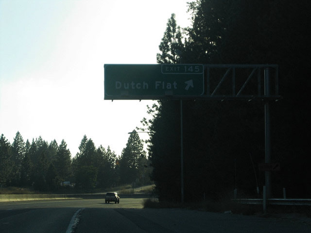 |
Ridge Road (Historic U.S. 40) arcs 2.1 miles west from Alta to Dutch Flat. The historic alignment of U.S. 40 turns west onto Lincoln Road parallel to Interstate 80 between Dutch Flat and Gold Run. Ridge Road continues south from Lincoln Road to Interstate 80 at the Exit 145 diamond interchange. High Sierra Drive ties into the interchange from Monte Vista (el. 3,320 feet) to the south. Photo taken 09/09/05. |
 |
High Sierra Drive parallels Interstate 80 from Monte Vista west to Gold Run. A half-diamond interchange joins the surface road with the freeway at Exit 144. Gold Run (el. 3,250 feet) itself lies west of Exit 144 along Lincoln Road (Historic U.S. 40), the Union Pacific Railroad, and Gold Run Road. Photo taken 09/09/05. |
 |
Westbound Interstate 80 passes the High Sierra Drive over crossing, and an interchange sequence sign lists the distances to the Gold Run Rest Area and Exit 143A, Gold Run Road. Photo taken 09/09/05. |
 |
Interstate 80 west meets Exit 143B, Gold Run Rest Area. Although no sign indicates this, the Gold Run Rest Area is the second to last rest area facility along the westbound Interstate 80 freeway. The final rest area resides at Vallejo (Exit 34) between the California 12 and California 37 interchanges. Photo taken 09/09/05. |
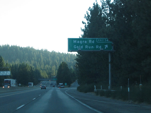 |
Historic U.S. 40 crosses paths with Interstate 80 again at Exit 143A, Gold Run Road (a diamond interchange). The historic route follows Gold Run Road west to Magra Road west from Lincoln Road and Gold Run. Magna Road crosses Interstate 80 and turns west adjacent to the freeway en route to the community of Magra. Photo taken 09/09/05. |
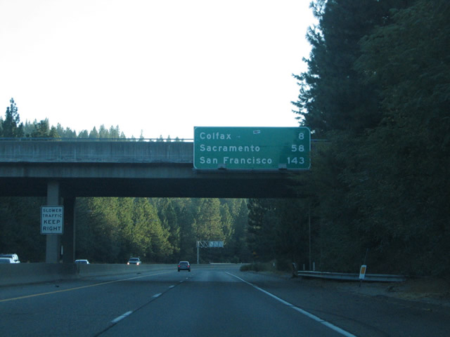 |
San Francisco, 143 miles away, becomes the westbound control city along westbound Interstate 80 at the Magra Road over crossing. Sacramento, which had been the major control city, is still listed on mileage signs from here west to the Business Loop I-80 split. Photo taken 09/09/05. |
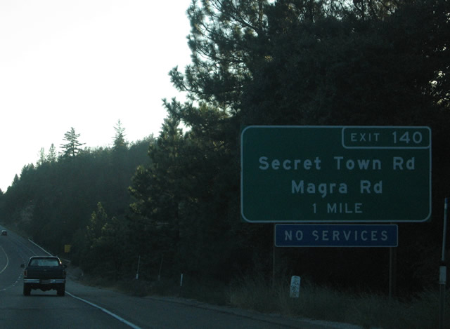 |
Interstate 80 continues west to the Exit 140, Rollins Lake Road at a partial-cloverleaf interchange. Rollins Lake Road joins the parallel Secret Town Road and Magra Road across the freeway. Photo taken 09/09/05. |
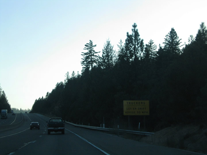 |
Truckers observe a "Let Er' Drift" warning sign, which advises a 50 miles per hour speed on the Interstate 80 descent toward Magra (el. 2,850 feet) due to the rapid descent along this stretch of freeway. Photo taken 09/09/05. |
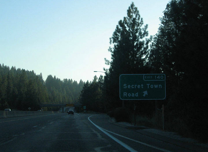 |
Exit 140 departs Interstate 80 westbound for Rollins Lake Road. Secret Town Road ties into the interchange from the Rollins Reservoir area north of the freeway. Magra Road (Historic U.S. 40) continues to parallel the freeway to the south through community of Magra. Photo taken 09/09/05. |
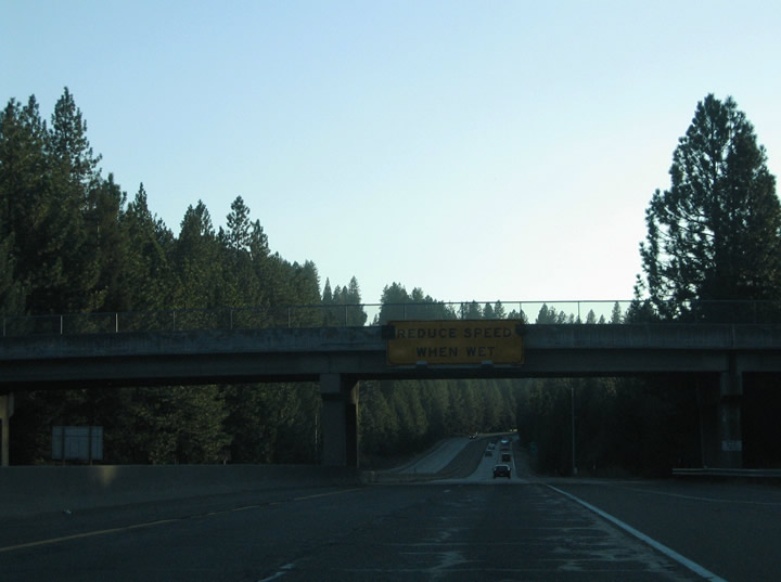 |
Another in the series of "reduce speed when wet" overheads appears on Interstate 80 westbound. The descend toward Auburn remains fairly steep, so travelers should exercise caution during rainy or snowy events. Photo taken 09/09/05. |
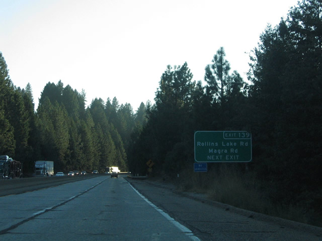 |
Magra Road (Historic U.S. 40) continues west and again intersects Interstate 80 at Exit 139. At that interchange, Magra Road name changes to Rollins Lake Road and proceeds northwest to Rollins Reservoir. The Rolls Lake Campgrounds lie three miles to the north in a steep canyon. Photo taken 09/09/05. |
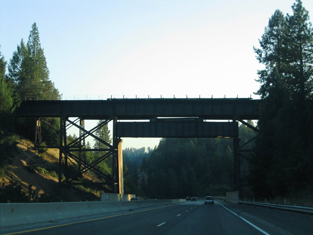 |
The Union Pacific Railroad travels across Interstate 80 via this trestle bridge at Cape Horn and Long Ravine. According to Dave Waters, "the road is located at a spot where the Nevada County Narrow Gauge Railroad crossed under the (then-) Southern Pacific. Cape Horn is the prominent outcropping of rock to the south and a community a mile or two further east along the railroad" (email dated 5/8/06). The railroad line skirts the hill south of Interstate 80 on the edge of the American River Canyon. Photo taken 09/09/05. |
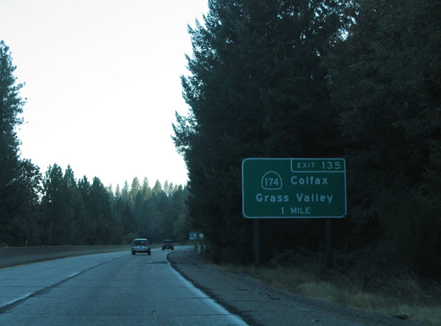 |
Interstate 80 nears the Colfax vicinity and Exit 135, California 174/Central Street north and Canyon Way south. Use Exit 135 to Historic U.S. 40/Auburn Street. A variation of this name (such as Auburn Boulevard) becomes the dominant designation for segments of the historic road, especially northeast of downtown Sacramento. As for California 174, this short state route travels north-south between Colfax and Grass Valley, where it meets California 20 and California 49. California 174 serves the communities of Chicago Park, Peardale, Cedar Ridge, and Union Hill on its 13-mile journey. Photo taken 09/09/05. |
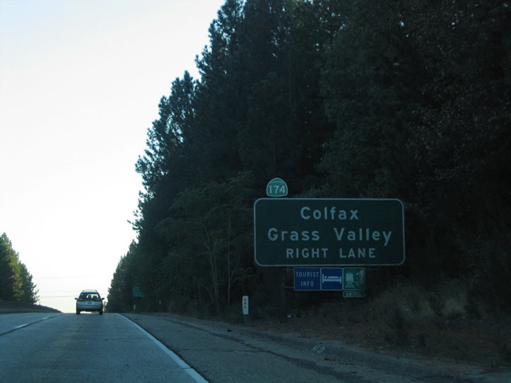 |
A California 174 shield was added after the fact on the approach guide sign for Exit 135. California 174 travels Canyon Way west to Auburn Avenue north from Interstate 80. The state route turns onto Central Street on its northward trek out of town. California 174 follows the Colfax Highway west of Rollins Reservoir to Grass Valley. Prior to the replacement of several of these guide signs in 2003-2004, only a "California 174" shield assembly advised that this interchange connected to a state route. Photo taken 09/09/05. |
 |
Exit 135 departs Interstate 80 westbound for Auburn Street south of its intersection with California 174 and Canyon Way. Auburn Street and Canyon Way comprise a frontage road system southwest to Exit 133. Iowa Hill Road meanders east from Canyon Way to the Auburn State Recreation Area, Iowa Hill, and Pine Reservoir within the Tahoe National Forest. Photo taken 09/09/05. |
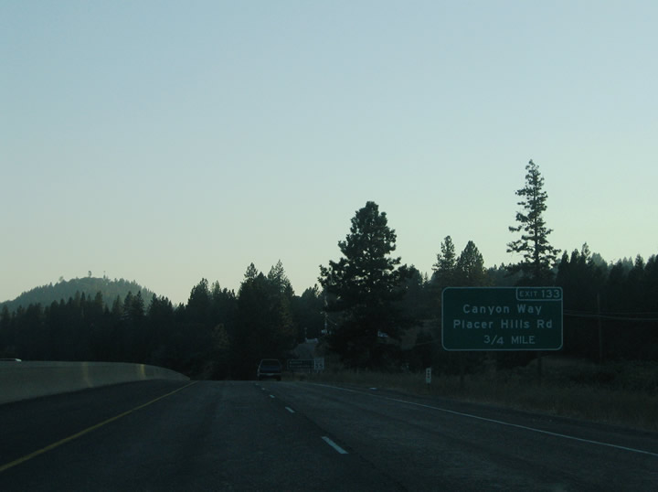 |
Exit 133 serves southern reaches of Colfax via connections with Auburn Street and Canyon Way. A folded-diamond interchange connects the freeway with the adjacent frontage roads. Canyon Way represents Historic U.S. 40 between Colfax and Weimar. Photo taken 09/09/05. |
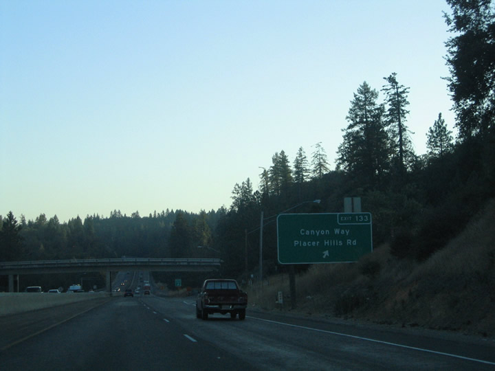 |
Westbound Interstate 80/Alan S. Hart Freeway reaches Exit 133, Auburn Street (Historic U.S. 40). A connector road travels above Interstate 80 between Canyon Way (Historic U.S. 40) and Auburn Street. Placer Hills Road continues Auburn Street southwest to Meadow Vista. Canyon Way remains close to Interstate 80 through Weimar and Twin Pines. Photo taken 09/09/05. |
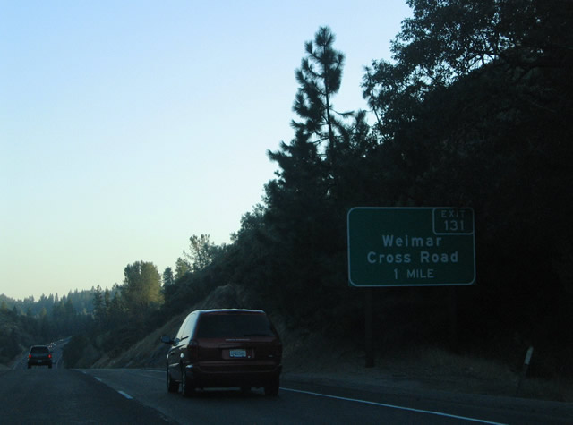 |
Weimar Cross Road intersects Interstate 80 between Canyon Way (Historic U.S. 40) and Placer Hills Road. A partial-cloverleaf interchange joins the two roads at Exit 131. Photo taken 09/09/05. |
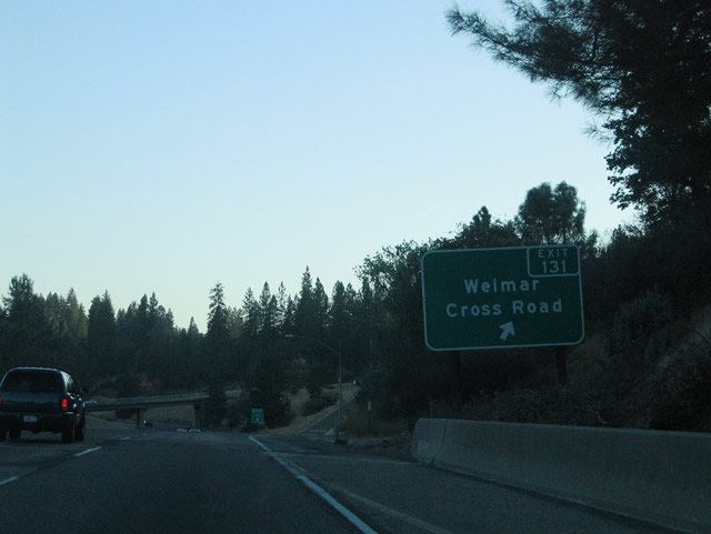 |
Interstate 80 west meets the Exit 131 ramp departure to Weimar Cross Road. Weimar Cross Road ends 1.3 miles to the west at the intersection of Placer Hills Road and Lake View Drive. The road continues beyond Canyon Way (Historic U.S. 40) into the hills east of Weimar (el. 2,280 feet). Historic U.S. 40 follows Ponderosa Way south through Weimar to Paoli Lane. Photo taken 09/09/05. |
 |
Interstate 80 next meets West Paoli Lane at Exit 130. A folded-diamond interchange joins the freeway with West Paoli Lane and Geisendorfer Road on the west side of the freeway and Paoli Lane (Historic U.S. 40) on the east side. Use Exit 130 for the Weimar Institute of Health and Education. West Paoli Lane and Geisendorfer Road comprise a frontage road system southward through Twin Pines. Photo taken 09/09/05. |
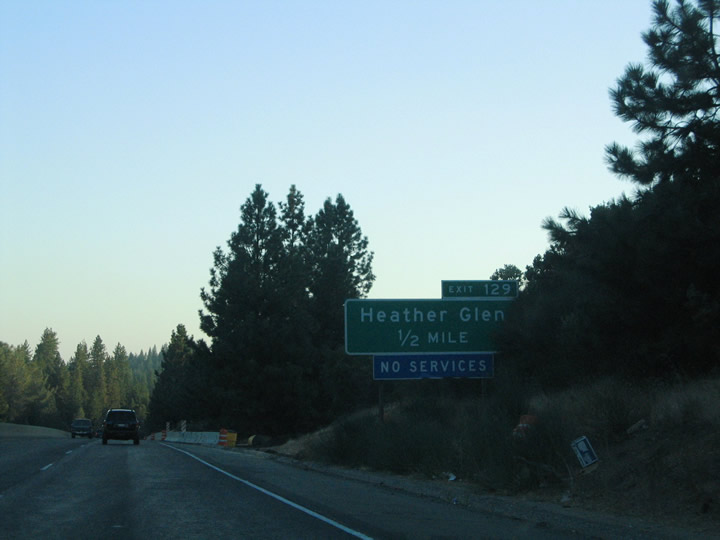 |
Geisendorfer Road transitions into Applegate Road at Heather Glen. The road turns south across Interstate 80 at the Exit 129 diamond interchange. Photo taken 09/09/05. |
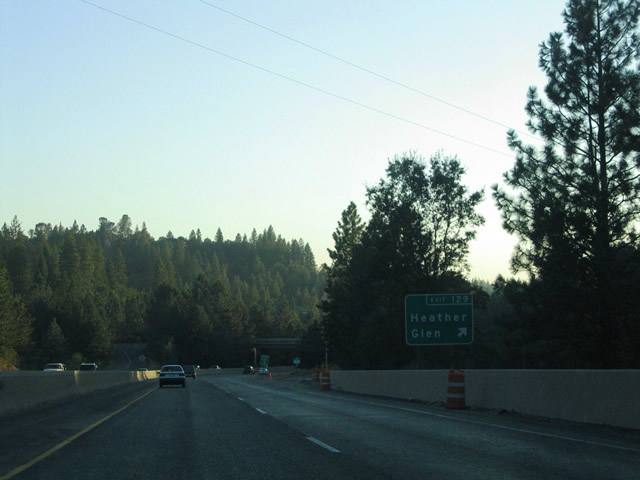 |
Drivers bound for Geisendorfer Road north to Twin Pines and Applegate Road south to Applegate travel the Exit 129 off-ramp from Interstate 80 west. Historic U.S. 40 (West Paoli Lane) ties into Applegate Road at Heather Glen nearby. Photo taken 09/09/05. |
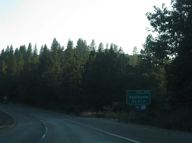 |
Interstate 80 west approaches the Exit 128 diamond interchange with Crother Road to Orchard Avenue at Applegate. Crother Road starts at Placer Hills Road, crosses the Interstate 80 freeway, and then travels down to intersect with Applegate Road on the south side of the freeway. Lake Arthur Road starts where Crother Road begins to cross the freeway. Orchard Avenue travels west from Hazel Avenue and Burgen Drive to Crother Road west of the freeway. Crother Road links Orchard Avenue with Placer Hills Avenue near Meadow Vista (el. 1,722 feet). Photo taken 09/09/05. |
 |
Westbound Interstate 80 reaches the Exit 128 off-ramp to Crother Road to Orchard Avenue. Hazel Avenue links Orchard Avenue with Applegate Road (Historic U.S. 40) at the settlement of Applegate. Historic U.S. 40 continues southward along the freeway between Applegate and Clipper Gap. Lake Arthur Road follows Interstate 80 westbound from Orchard Avenue to Clipper Gap as well. Photo taken 09/09/05. |
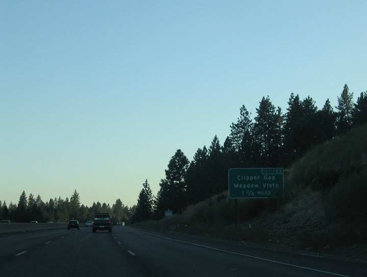 |
Placer Hills Road returns to Interstate 80 at Exit 125 in Clipper Gap. Placer Hills Road loops ten miles west of Interstate 80 between Clipper Gap and Colfax. The roadway reaches Meadow Vista in 2.5 miles. Photo taken 09/09/05. |
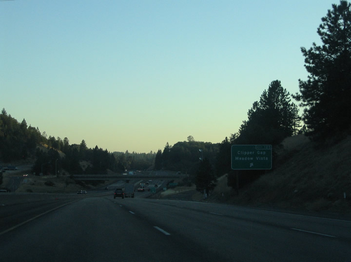 |
Placer Hills Road ends at the Exit 125 diamond interchange with Interstate 80. Applegate Road (Historic U.S. 40) ties into the junction from the east and ends nearby as well. Lake Arthur Road continues to parallel the freeway west to Lake Arthur itself and Dry Creek Road. Photo taken 09/09/05. |
 |
The next exit along westbound Interstate 80 is Exit 124, Neil Road (signed as "Dry Creek" since Neil Road spurs into Dry Creek Road). Neil Road spurs east from Lake Arthur Road to Interstate 80. Lake Arthur Road intersects Dry Creek, Borman, and Christian Valley Roads just west of Neil Road. Photo taken 09/09/05. |
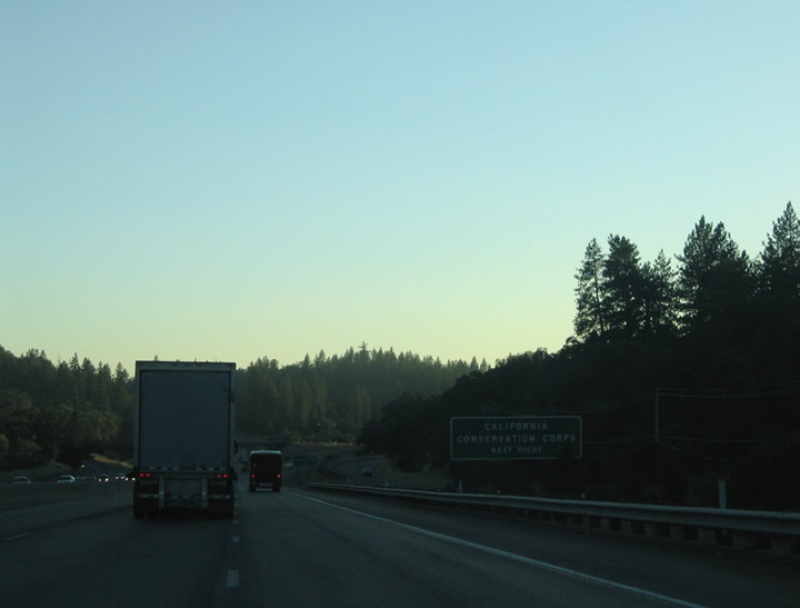 |
Christian Valley Road travels north of Lake Arthur Road and Dry Creek Road, ultimately terminating at a facility of the California Conservation Corps (CCC). Photo taken 09/09/05. |
 |
Exit 124 leaves Interstate 80 westbound to serve Neil Road, Lake Arthur Road, and Dry Creek Road. The latter of this group -- Dry Creek Road -- stems west 3.75 miles to junction with California 49/Grass Valley Highway. Christian Valley Road arcs northwest and Bowman Road takes the place of the westbound side frontage road southward to Auburn. Photo taken 09/09/05. |
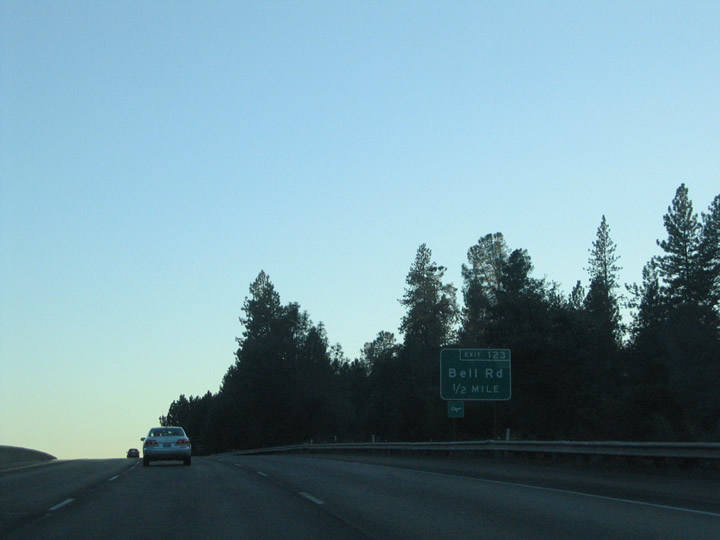 |
Bell Road intersects Interstate 80 at the Exit 123 diamond interchange between Bowman and Musso Roads. Bell Road travels east-west three miles between California 49 (Grass Valley Highway) and Musso Road. Photo taken 09/09/05. |
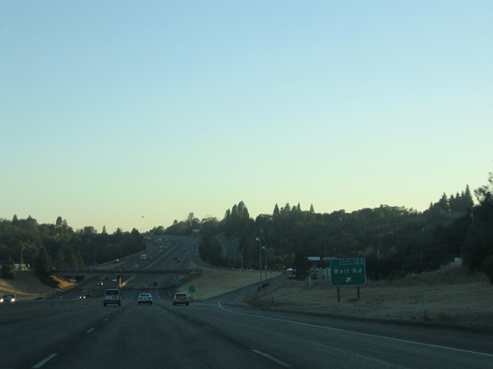 |
Interstate 80 westbound meets Bell Road at Exit 123. Bell Road connects with New Airport Road about two miles to the west of this interchange. New Airport Road travels north and serves the Auburn Municipal Airport. Photo taken 09/09/05. |
 |
 |
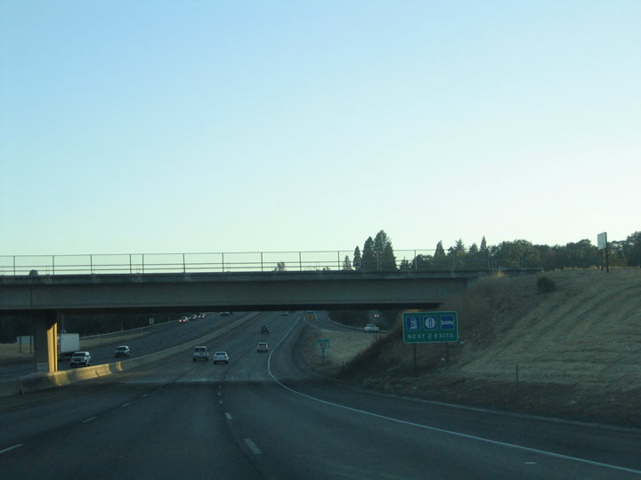
Interstate 80 enters the greater Auburn area south of the Bell Road overpass. A number of traveler services greet road weary drivers as they leave the sparsely populated trek through the Sierra Nevada. The city of Auburn is the seat of Placer with a population of 13,330 as of the 2010 Census. Auburn sits at an elevation of 1,227 feet and was incorporated on May 2, 1888. Photos taken 09/09/05. |
 |
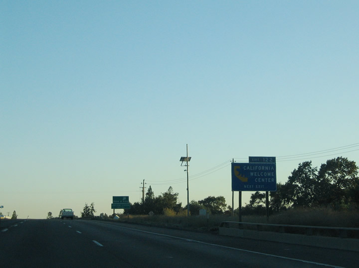
Exit 122 departs Interstate 80 westbound for Bowman, a community located north of Auburn. A short connector links the parallel Bowman Road and Lincoln Way (Historic U.S. 40) with the freeway here. Use Bowman Road south for Luther Road west. Historic U.S. 40 parallels Interstate 80 east from Covey Road south to downtown Auburn. Photo taken 09/09/05. |
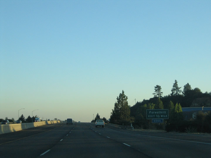 |
Foresthill Road crosses paths with Interstate 80 at the next westbound interchange, which is Exit 121. Foresthill Road stems 17 miles east from Auburn through the Auburn State Recreation Area to Foresthill (el. 3,225 feet). To see the Foresthill Bridge (the highest bridge in California at 731 feet above the riverbed of the North Fork of the American River), follow Foresthill Road east from this interchange. The bridge was built between 1971-1973 and underwent a seismic retrofit project starting in 2011. It was intended to become part of California 49 had a reservoir been constructed in the valley below the bridge, but Auburn Dam was never built. As a result, the bridge remains well above both the valley floor and proposed water level of the never-filled reservoir. The dam and reservoir will not be built. Photo taken 09/09/05. |
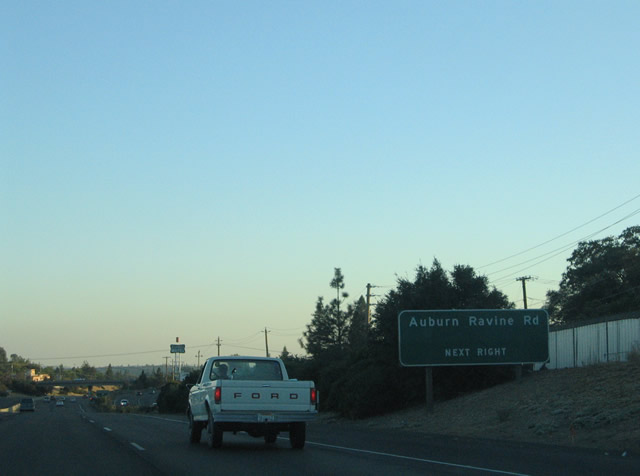 |
Auburn Ravine Road continues Foresthill Road southwest to Elm Avenue north of downtown Auburn. Auburn Ravine Road intersects Shockley Road in 0.75 miles, Dairy Road in 1.1 miles, and Palm Avenue in 1.6 miles. Photo taken 09/09/05. |
 |
Westbound Interstate 80 meets Exit 121, Foresthill and Auburn Ravine Road. Exit 121 is a diamond interchange. Adjacent Bowman Road ends at the Foresthill and Auburn Ravine Road intersection. Historic U.S. 40 (Lincoln Way) meanders southward from Foresthill Road to Russell Road before its turn toward downtown Auburn. Photo taken 09/09/05. |
 |
Russell Road heads west from its intersection with Historic U.S. 40 (Lincoln Way) to meet Interstate 80 at Exit 120. The east-west road serves residential areas north of downtown Auburn. Photo taken 09/09/05. |
 |
Russell Road passes over Interstate 80 ahead of the Exit 120 ramp departure. Russell Road ends at Hilltop Drive nearby. Hilltop Drive provides no outlet however due to the Union Pacific Railroad nearby. East of the freeway, Russell Road wanders southeast to Canyon Drive and Foresthill Avenue. Canyon Drive provides a connection to California 49 (El Dorado Street). Photo taken 09/09/05. |
 |
The next two exits serve the downtown Auburn Area. A pair of interchanges (Exits 119C-B) joins Interstate 80 with Elm Avenue and California 49 (Grass Valley Highway). Photo taken 09/09/05. |
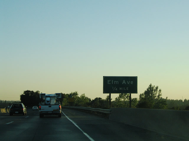 |
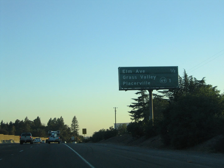
Interstate 80 passes over the Union Pacific Railroad line one quarter mile north of the Elm Avenue half-cloverleaf interchange. Elm Avenue comprises an east-west arterial between California 49 (Grass Valley Highway) and California 49 (High Street). California 49 loops into downtown with Elm Avenue providing a half mile long bypass to the north. Photo taken 09/09/05. |
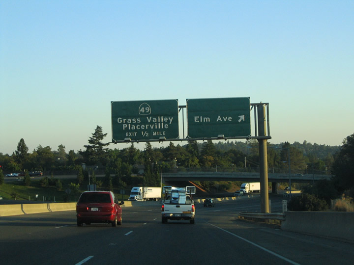 |
The Exit 119C loop ramp departs Interstate 80 westbound for Elm Avenue in downtown Auburn. Elm Avenue meets Auburn Ravine Road between the freeway and California 49 (Grass Valley Highway). Interstate 80 directly interchanges with California 49 in one half mile at Exits 149B/A. Photo taken 09/09/05. |
 |
Drivers merging onto Interstate 80 westbound from Elm Avenue form the exit-only lane for Exit 119B, California 49. Historic California 49 travels Grass Valley Highway southward to Lincoln Way and High Street through downtown Auburn. The state route ventures 10.5 miles north to Higgins Corner and 22 miles to Grass Valley. Photo taken 09/09/05. |
 |
A sharp loop ramp joins Interstate 80 west with California 49/Grass Valley Highway at Exit 119B. The geography of the area requires tight movements between the two highways. California 49 follows Lincoln Way (old U.S. 40) east to High Street, and High Street northeast to El Dorado Street east and the El Dorado County line. This interchange is also the implied link with California 193. Photo taken 09/09/05. |
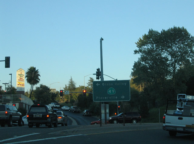 |
This view looks at the end of the Exit 119B off-ramp at California 49 (Grass Valley Highway). Travel California 49 south six miles to Cool and California 193. California 49 and California 193 follow independent paths from Cool southward to Placerville. Placerville, the El Dorado County seat, lies at the state highway junction with U.S. 50, which is 26 miles to the southeast. Photo taken 09/09/05. |
 |
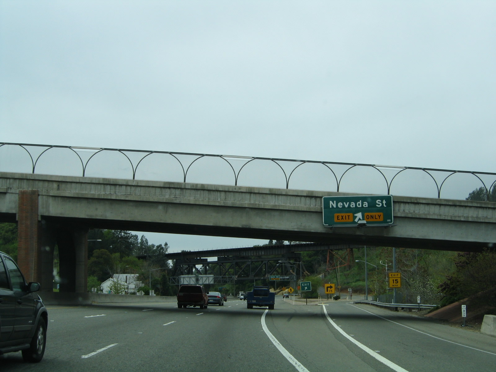
Interstate 80 continues west a short distance to the Exit 119A modified-diamond interchange with Nevada Street. Nevada Street travels northward from the freeway to Fulweiler Avenue, Mt. Vernon Road, and California 49 (Grass Valley Highway). Photo taken 04/03/05. |
 |
Exit 119A departs Interstate 80 westbound at the Maple Street Extension overpass. The extension joins Placer Street north of the freeway and Maple Street to the south. Exit 119A joins Nevada Street at its intersections with Andrews and Placer Streets. Maple Street and Lincoln Way (Historic U.S. 40) tie into Interstate 80 eastbound ramps at Sacramento Street. Photo taken 04/03/05. |
 |
Drivers merging onto Interstate 80 westbound from Nevada Street form the exit-only only lane for Exit 118, Ophir Road. The Union Pacific Railroad travels high above the freeway in this scene. The original alignment of U.S. 40 passed underneath the railroad span between Exit 119A and Ophir Road. Photo taken 04/03/05. |
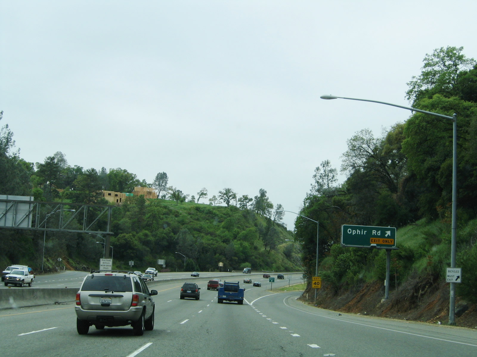 |
Ophir Road (Historic U.S. 40) departs Interstate 80 westbound via the Exit 118 wye interchange. Ophir Road travels three miles west from Auburn to Newcastle north of Interstate 80. Historic U.S. 40 intersects Wise Road in three-quarters of a mile. Photo taken 04/03/05. |
 |
A traditional reassurance marker for Interstate 80 is posted along westbound between Ophir Road (Exit 118) and Newcastle (Exit 116). Photo taken 04/03/05. |
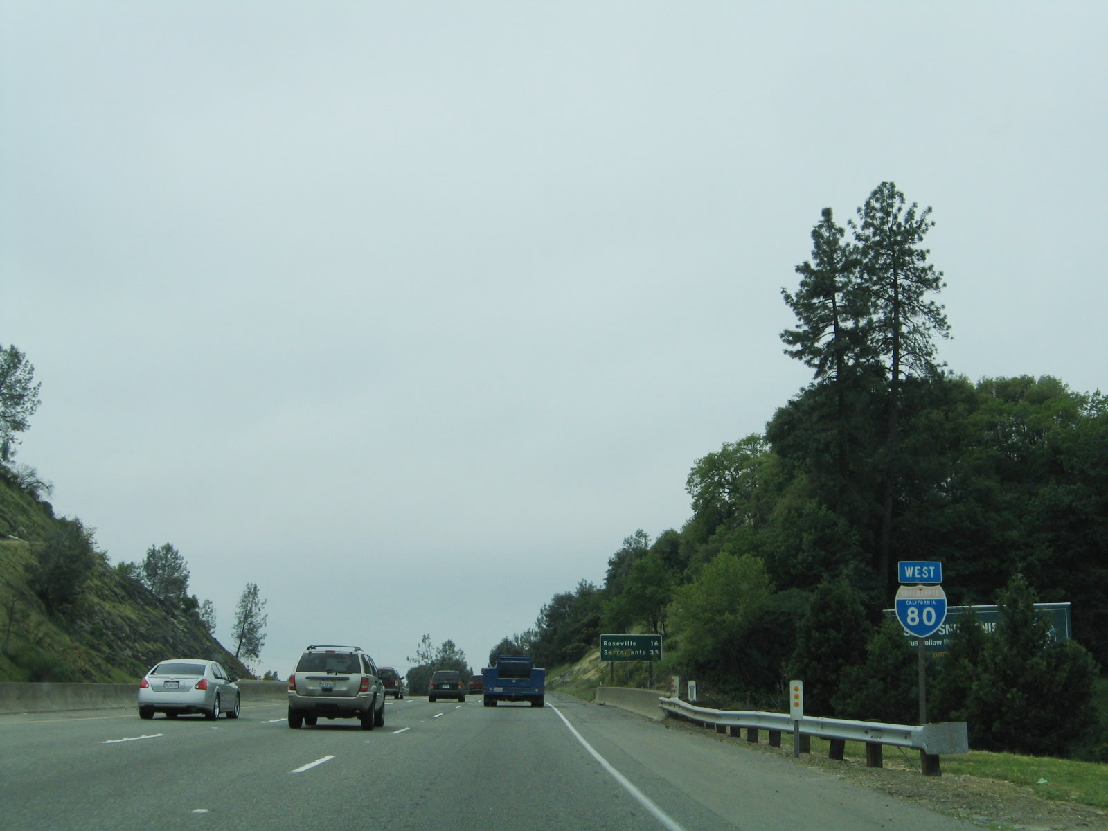
 |
Interstate 80 continues 19 miles southwest to Roseville and 33 miles to Sacramento. The six-lane freeway becomes increasingly busy on the drive west from Auburn. Many make this drive a part of their daily work commute to the capital city. Photo taken 04/03/05. |
 |
California 193 emerges from Interstate 80 at the Exit 116 folded-diamond interchange with Taylor and Ophir Roads. The state route exists in two portions: the western segment links Lincoln with Newcastle, the eastern portion provides an alternate route to California 49 between Auburn and Placerville. Photo taken 04/03/05. |
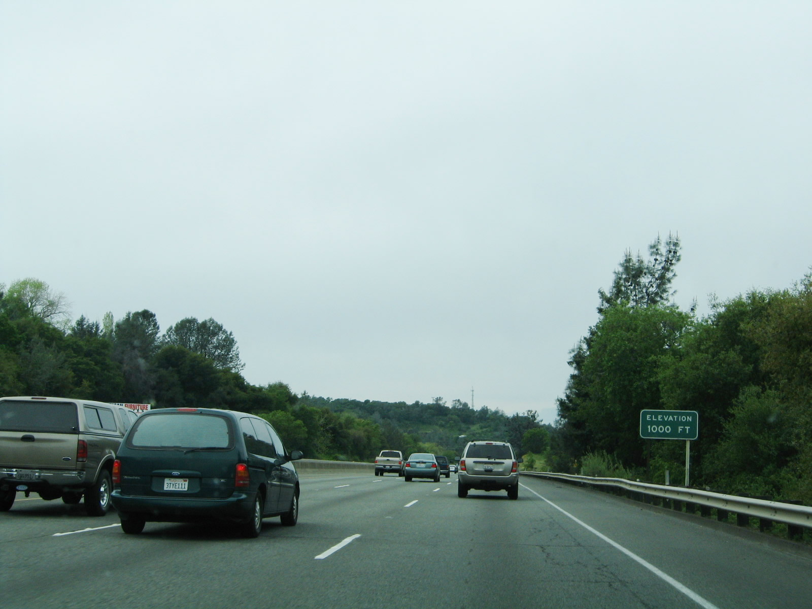 |
Interstate 80 westbound descends to 1,000 feet for the first time within the Golden State and for the first time since leaving Omaha, Nebraska. The freeway had peaked at Donner Pass (el. 7,239 feet) in the Sierra Nevada and continues southwest on a s a rapid descend toward Sacramento, which sits at only 20 feet. Photo taken 04/03/05. |
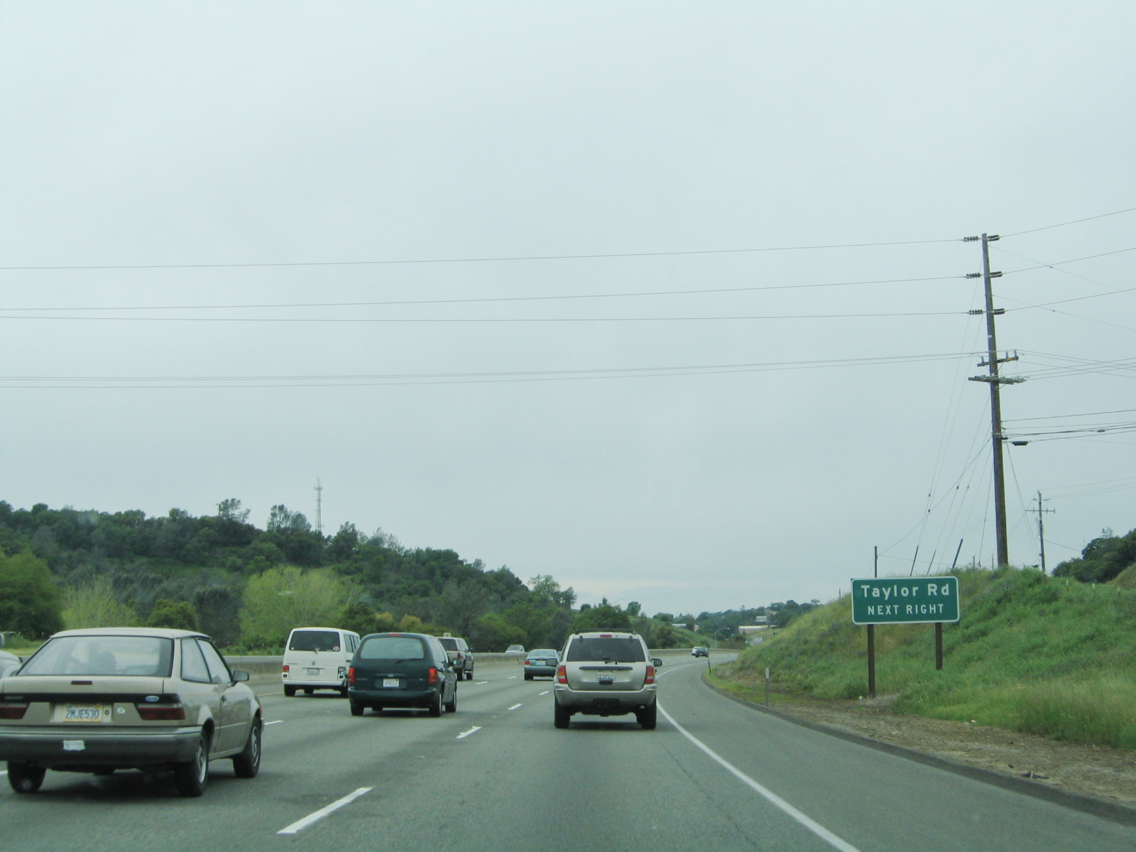 |
The next exit along Interstate 80 west is Exit 116, California 193/Taylor Road and Ophir Road. California 193's western segment begins at this interchange and proceeds west, initially following the Historic U.S. 40 alignment west through Newcastle. While U.S. 40 curves southwest toward Loomis and Rocklin, California 193 will proceed west toward Lincoln. Taylor Road overtakes Ophir Road at Exit 116. Photo taken 04/03/05. |
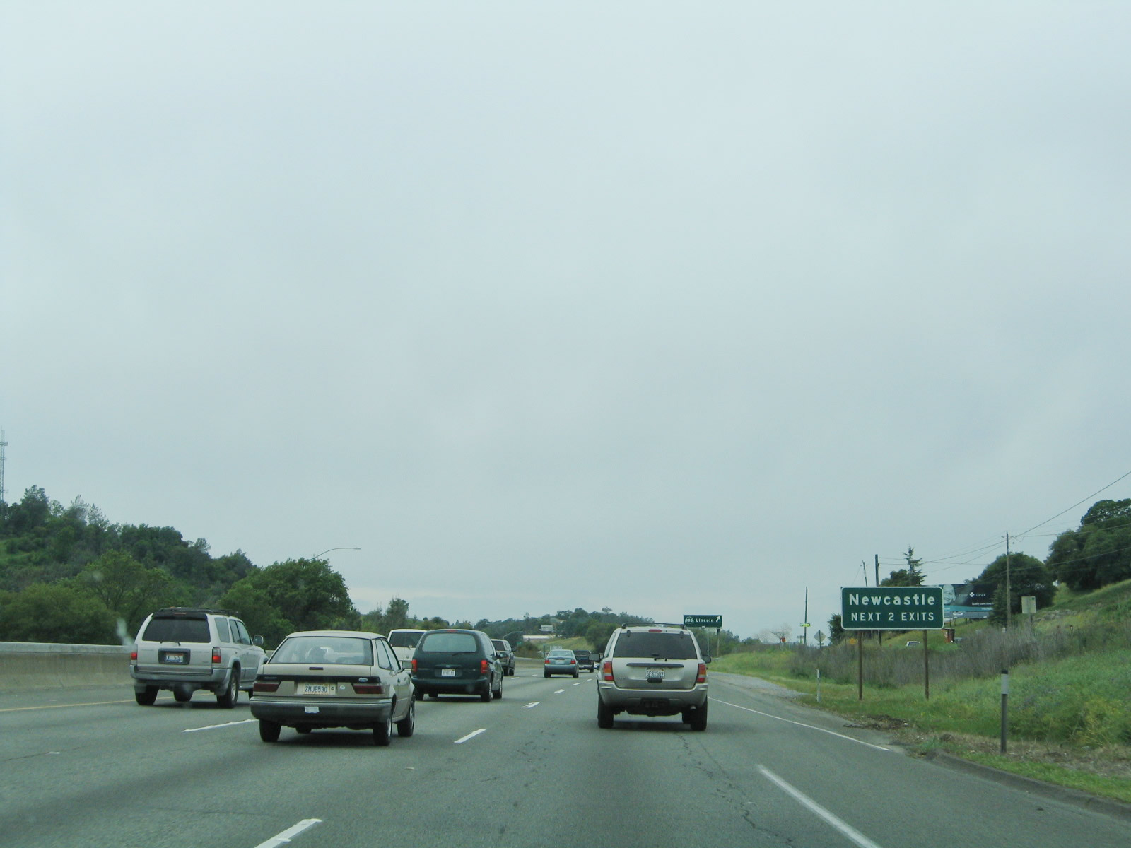 |
The next two exits from Interstate 80 west serve the community of Newcastle. Photo taken 04/03/05. |
 |
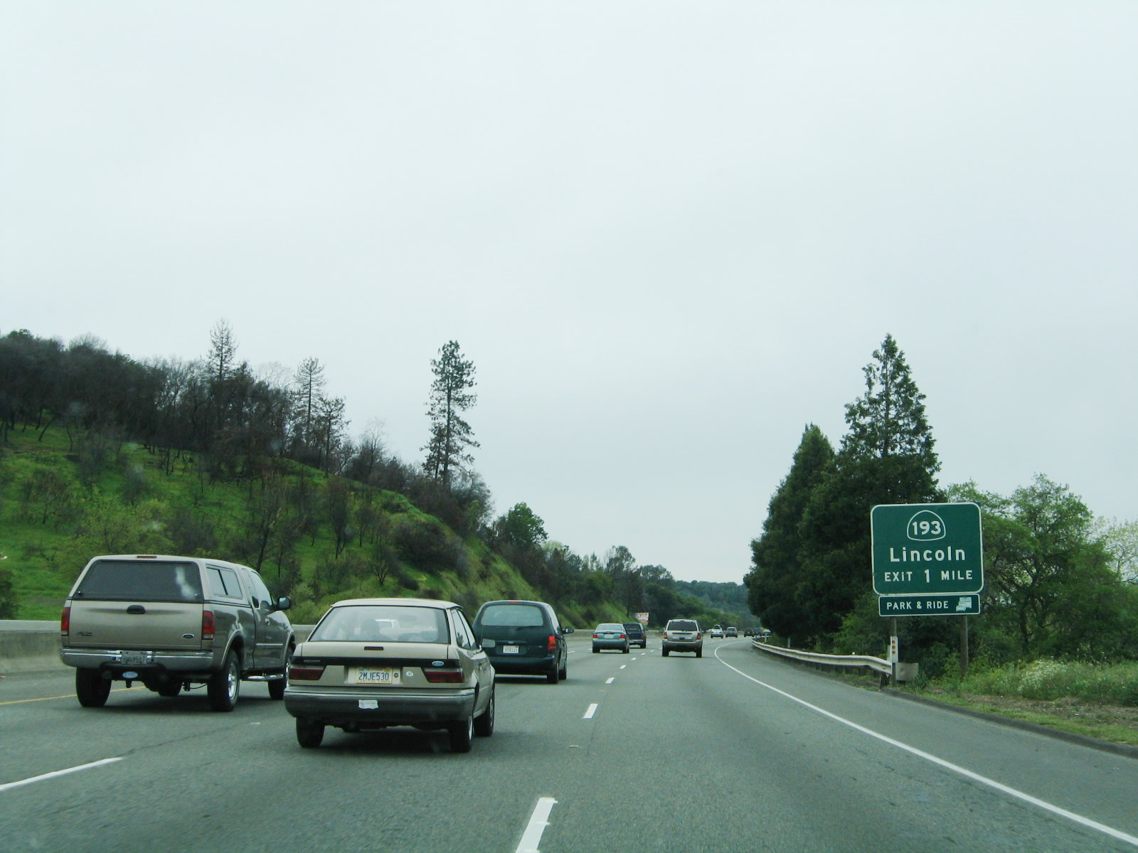
California 193/Taylor Road westbound departs Interstate 80 west at Exit 116. The state route ventures ten miles west to meet Lincoln Boulevard (former California 65) in downtown Lincoln. California 193 turns westward onto the Newcastle Highway one half mile west of Exit 116. Taylor Road continues through the unincorporated community of Newcastle itself on the 2.5-mile drive to Penryn. Photo taken 04/03/05. |
 |
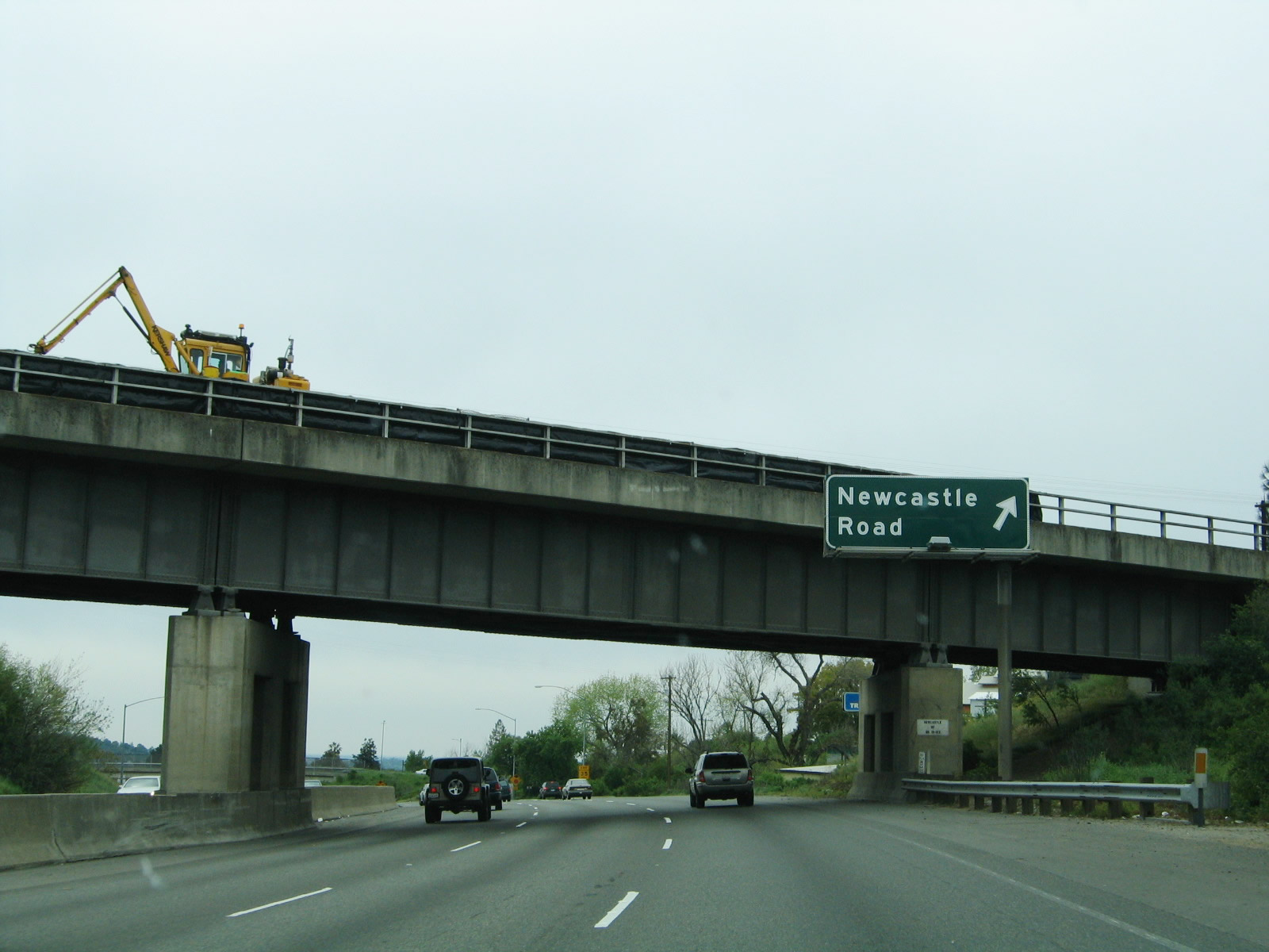
The next exit along Interstate 80 west is Exit 115, Newcastle Road, Old State Highway, and Indian Hill Road. Photo taken 04/03/05. |
 |
Interstate 80 turns southward briefly and passes under the Union Pacific Railroad line again ahead of the Newcastle Road modified-diamond interchange (Exit 115). Indian Hill Road stems east from Newcastle Road and Exit 115 2.3 miles to Auburn Folsom Road south of Auburn. Newcastle Road flows south from Newcastle three miles to Auburn Folsom Road near the Folsom Lake area. Photo taken 04/03/05. |
 |
Exit 115 departs Interstate 80 westbound for Newcastle Road south and Old State Highway. Old State Highway links the area with Taylor Road (Historic U.S. 40) and California 193/Newcastle Highway to the north and Kellogg Street to the west. Photo taken 04/03/05. |
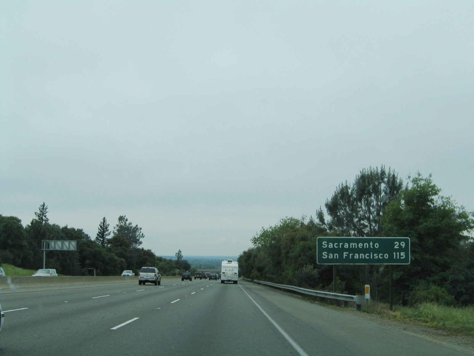 |
This mileage sign provides the distances to Sacramento and San Francisco via Interstate 80 westbound near Newcastle. Photo taken 04/03/05. |
 |
Interstate 80 leaves the foothills of the Sierra Nevada and descends into the Central Valley near Penryn, an unincorporated community located northeast of the town of Loomis. The six-lane freeway becomes quite busy on the approach to the Sacramento metropolitan area. Photo taken 04/03/05. |
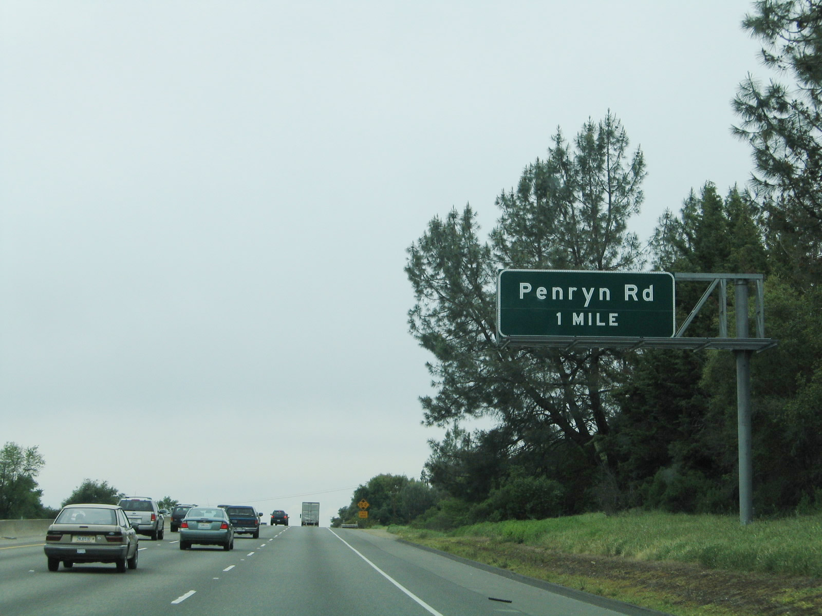 |
The next exit along Interstate 80 west is Exit 112, Penryn Road at a half-cloverleaf interchange (one mile). Penryn Road travels north-south 1.4 miles between King Road and Historic U.S. 40 (Taylor Road). Penryn itself lies north of Interstate 80 via Penryn or Taylor Roads. Photo taken 04/03/05. |
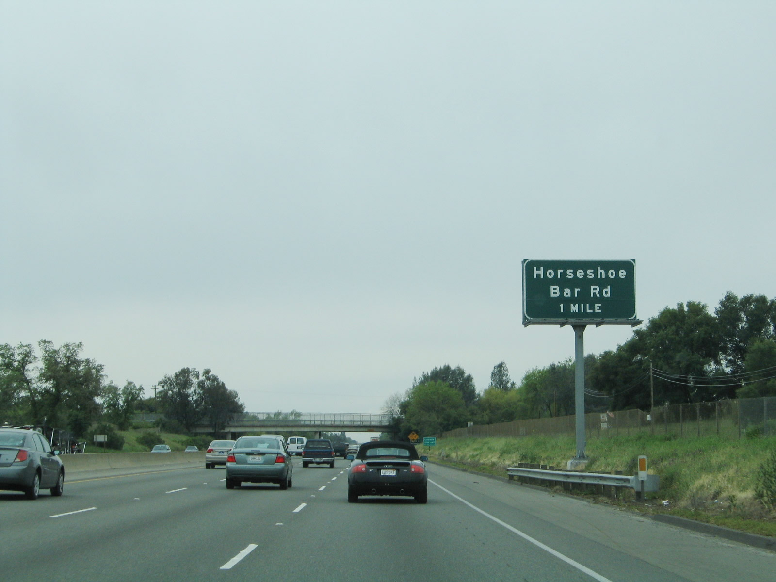 |
Intersecting Interstate 80 next is Horseshoe Bar Road at Exit 110. Horseshoe Bar Road comprises a rural road between Taylor Road (Historic U.S. 40) and Brace Road and Laird Road. In conjunction with Horseshoe Bar Road, Laird Road provides a link to Auburn Folsom Road at Hidden Valley. Photo taken 04/03/05. |
 |
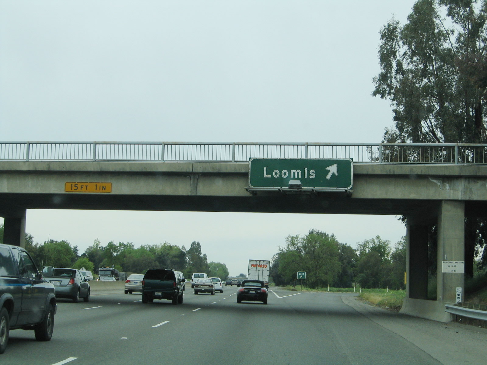
King Road passes over Interstate 80 one-half mile north of the Exit 110 half-cloverleaf interchange. The town of Loomis (incorporated on December 17, 1984) lies just north of the freeway along Historic U.S. 40 (Taylor Road) between Rocklin and Penryn. Loomis sits at an elevation of 399 feet and had a population of 6,430 as of the 2010 Census. Photo taken 04/03/05. |
 |
Interstate 80 westbound meets Exit 110, Horseshoe Bar Road. Use Horseshoe Bar Road south toward the Folsom Lake area and the city of Folsom via connections with Laird Road and Barton Road to the south. Horseshoe Bar Road itself travels east from Brace and Laird Roads to Auburn Folsom Road. Brace Road heads west across Interstate 80 to Sierra College Boulevard and Taylor Road. Photo taken 04/03/05. |
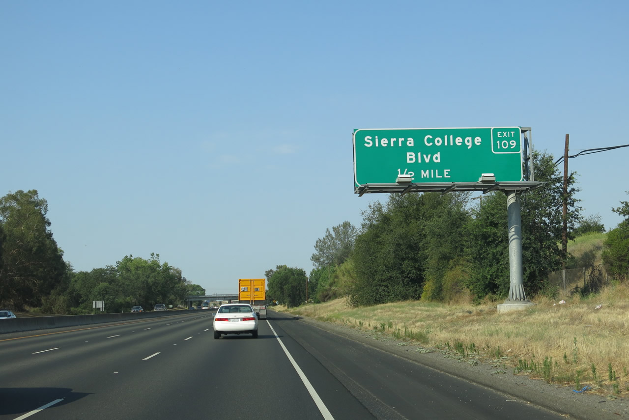 |
Continuing southwest, Interstate 80 next approaches Exit 109, Placer Route E-3/Sierra College Boulevard. Placer Route E-3 is designated solely from Interstate 80 south to the Placer-Sacramento County Line; south of the county line, Sacramento County S-3 proceeds south to connect with U.S. 50 via Hazel Avenue. E-3 was not extended north to the current northern terminus of Sierra College Boulevard at California 193. Photo taken 07/02/13. |
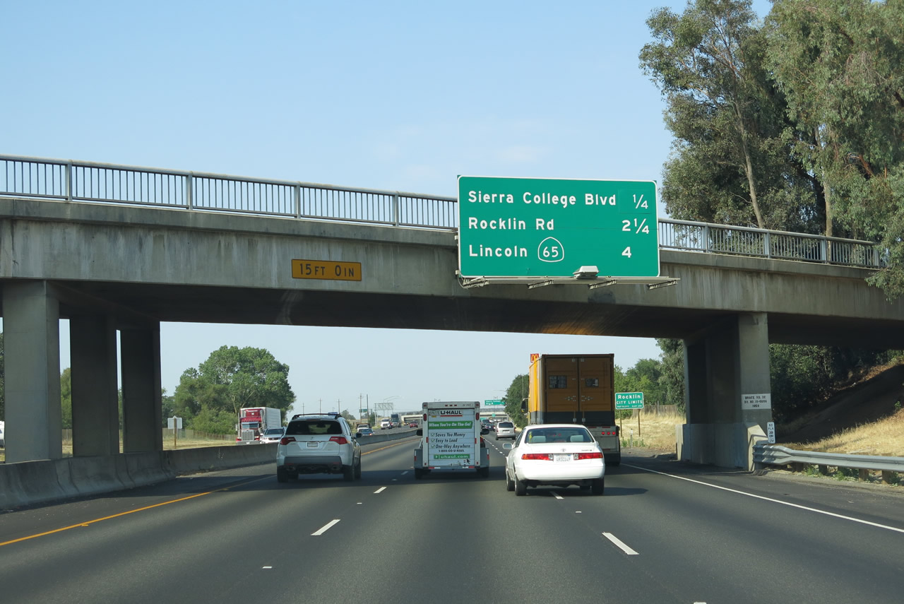 |
This mileage sign along Interstate 80 west provides the distance to the next three interchanges: Exit 109, Placer Route E-3/Sierra College Boulevard; Exit 108, Rocklin Road; and Exit 106, California 65 north to Lincoln and Marysville. Photo taken 07/02/13. |
 |
Interstate 80 leaves the town of Loomis and enters the city of Rocklin, which sits at an elevation of 274 feet. A rapidly growing city, Rocklin had a population of 56,974 as of the 2010 Census, an increase from 36,330 as of the 2000 Census. Rocklin was incorporated on February 24, 1893. Photo taken 07/02/13. |
 |
Use Exit 109 to Sierra College by using Placer Route E-3/Sierra College Boulevard south; the college is situated in the northwest quadrant of the intersection between north-south Sierra College Boulevard and east-west Rocklin Road. Sierra College Boulevard is part of a fairly long arterial route that begins as Hazel Avenue as U.S. 50 Exit 21 near Nimbus Dam and ends at east-west California 193 (Lincoln-Newcastle Highway) east of Lincoln. The portion in Sacramento County is designated as Hazel Avenue, and the portion in Placer is designated as Sierra College Boulevard. Photo taken 07/02/13. |
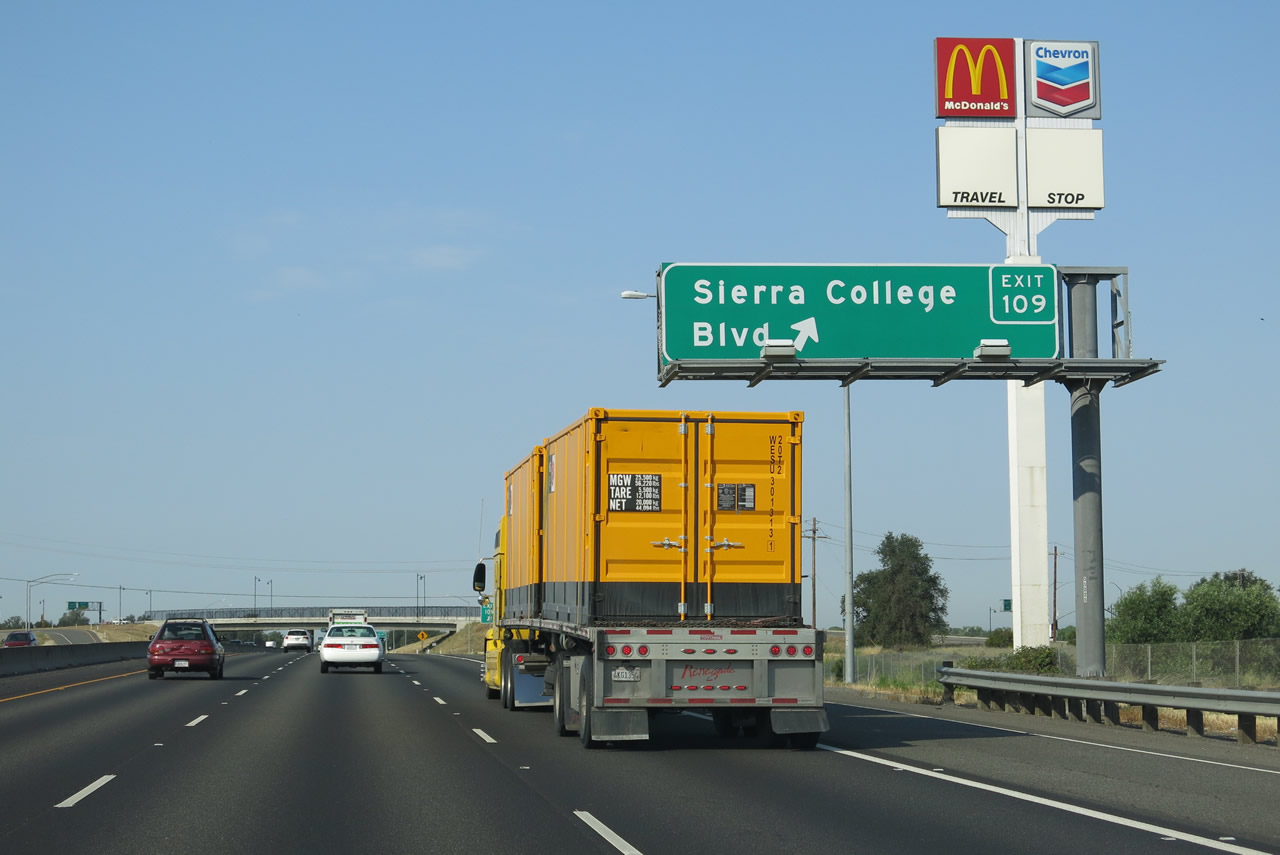 |
Westbound Interstate 80 meets Exit 109, Placer Route E-3/Sierra College Boulevard. Use Sierra College Boulevard north to Lincoln or south to Orangevale. Photo taken 07/02/13. |
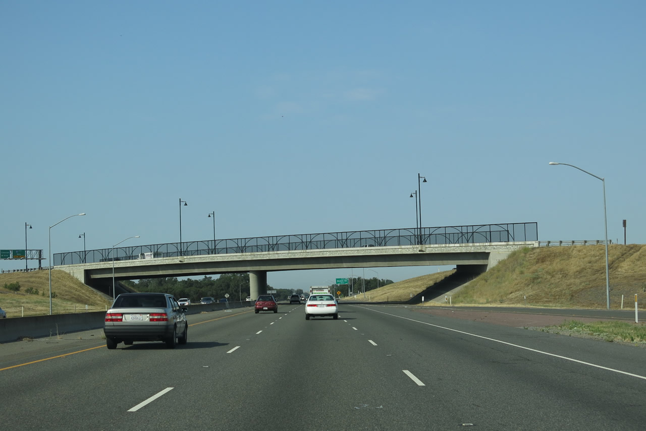 |
Interstate 80 passes under Sierra College Boulevard. Photo taken 07/02/13. |
 |
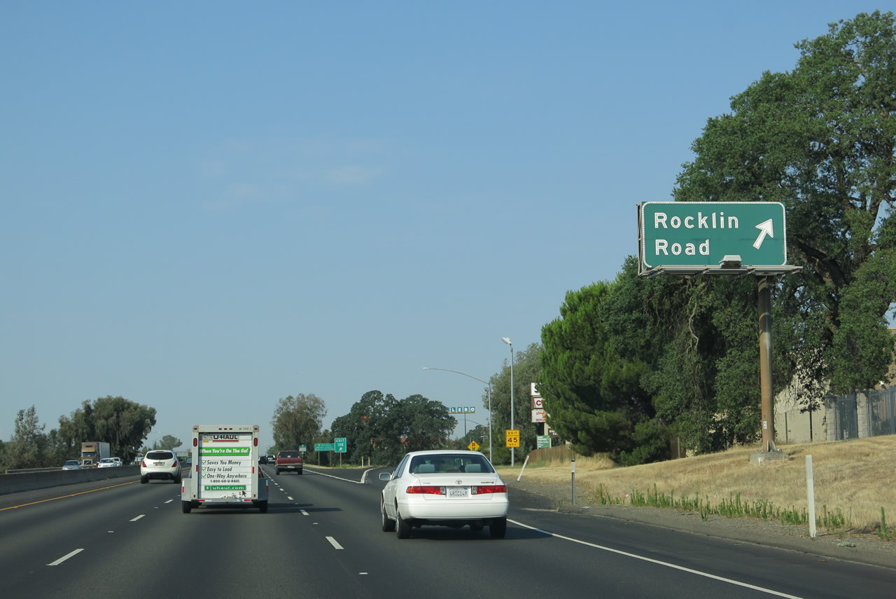
The next exit along Interstate 80 west is Exit 108, Rocklin Road (one mile). Traffic from Sierra College Boulevard merges back onto the freeway after this sign. Photo taken 07/02/13. |
 |
Most motorist services are available at Exit 108. Services become commonly available at most exits as we continue toward Sacramento. Photo taken 07/02/13. |
 |
Westbound Interstate 80 reaches Exit 108, Rocklin Road. Photo taken 07/02/13. |
 |
This Interstate 80 route marker is posted after the on-ramp from Rocklin Road. Photo taken 07/02/13. |
 |
The next exit along Interstate 80 west is Exit 106, California 65 north to Lincoln and Marysville (one mile). California 65, which is divided into two major segments, travels north from this interchange on an alignment roughly parallel to Historic U.S. 99E. (The other segment, in the southern San Joaquin Valley, connects California 99 near Oildale with California 198 near Exeter.) The state route is a freeway as it bypasses Roseville and Lincoln, then reverts to an expressway and eventually two-lane highway for the remaining distance to Marysville. California 65 ends at California 70 just south of Marysville. Photo taken 07/02/13. |
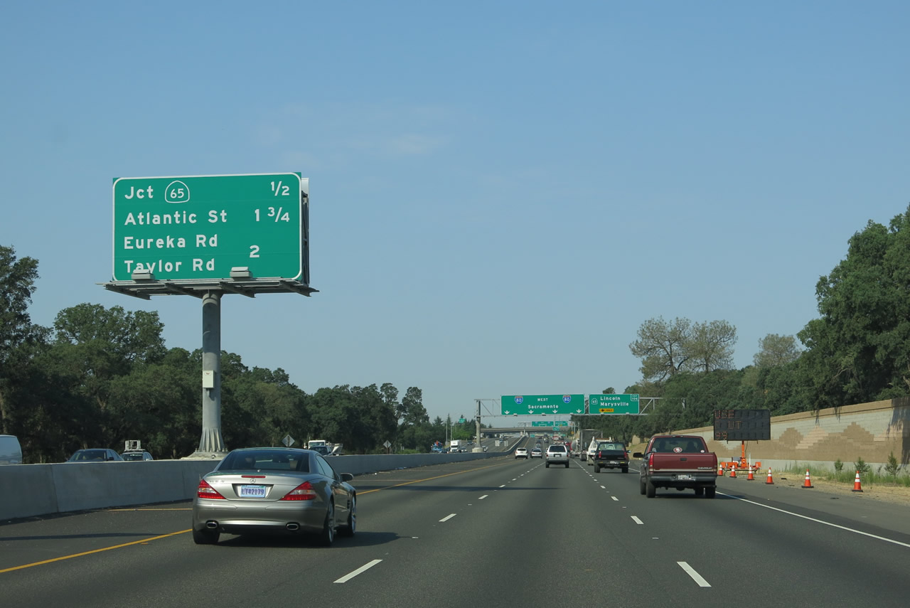 |
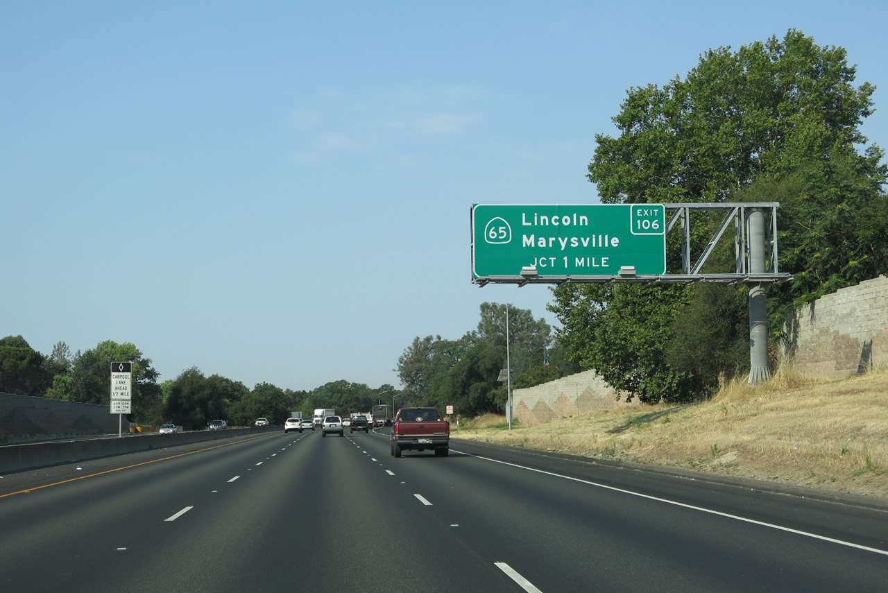
This mileage sign along Interstate 80 west provides the distance to the next three interchanges: Exit 106, California 65 north to Lincoln and Marysville; Exit 105B, Atlantic Street (Historic U.S. 40 west); and Exit 105A, Eureka Road and Taylor Road (Historic U.S. 40 east). Photo taken 07/02/13. |
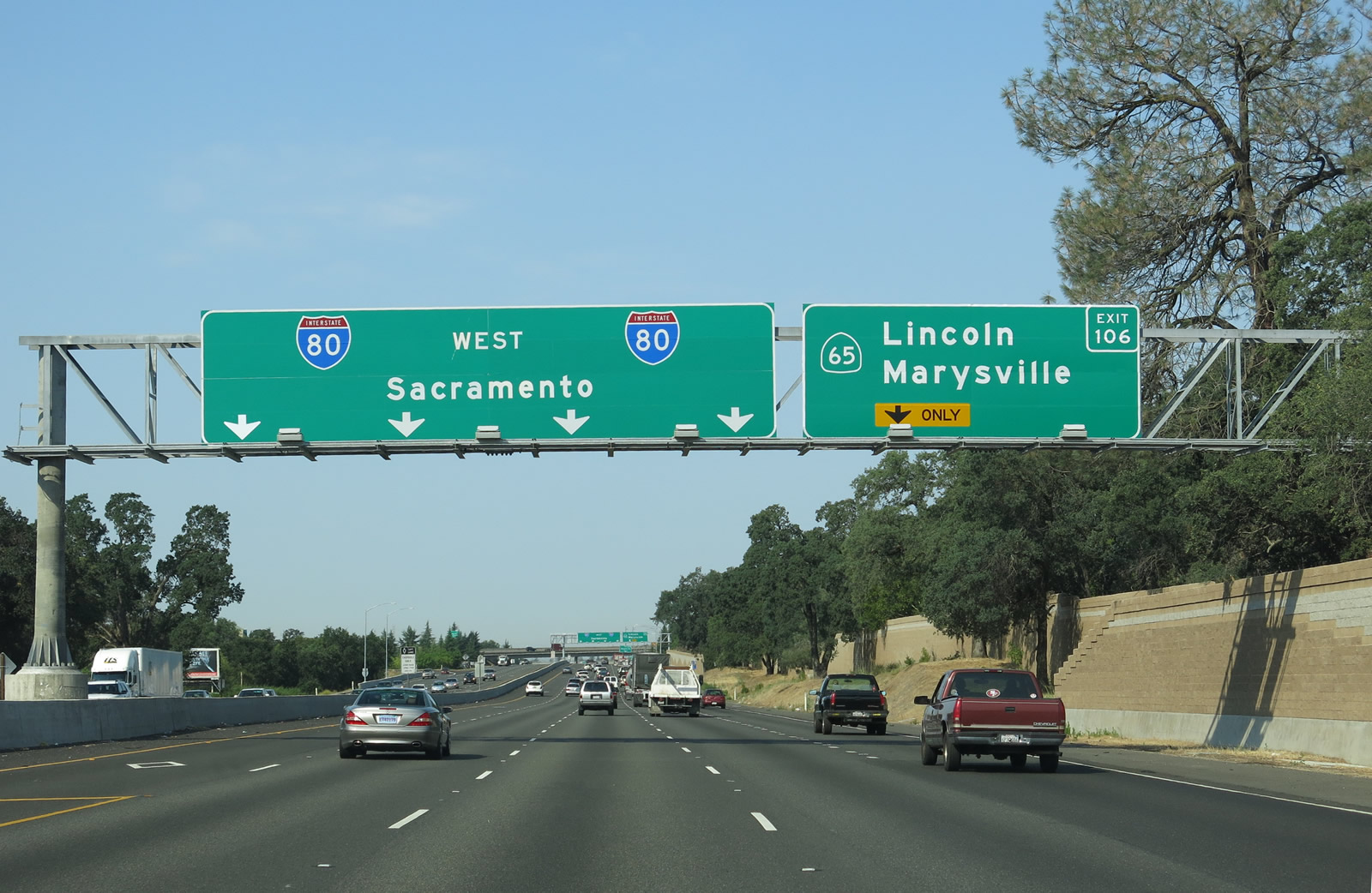 |
The right lane of Interstate 80 west becomes exit only for Exit 106, California 65 north to Lincoln and Marysville. The left four lanes will continue southwest toward Sacramento, with the left lane becoming a high occupancy vehicle (carpool) lane. Photo taken 07/02/13. |
 |
Westbound Interstate 80/Alan S. Hart Freeway reaches Exit 106, California 65 north to Lincoln and Marysville. The following exit will be Exit 105B, Atlantic Street. Photo taken 07/02/13. |
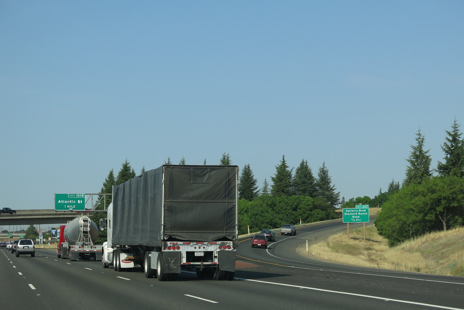 |
This view looks at the single-lane off-ramp from Interstate 80 west to California 65 as well as the Exit 105B overhead sign and bridge that carries traffic from Interstate 80 east to California 65 north. This interchange is a trumpet. Note that the first interchange on California 65 north is Exit 307, Galleria Boulevard and Stanford Ranch Road. The exit numbering (307) is based on an estimate of the number of miles from this point south to the southern terminus of the southern segment of California 65. However, most of this state route (between California 198 and Interstate 80) is unconstructed at this time. Photo taken 07/02/13. |
 |
Traffic from California 65 south merges with Interstate 80 west, creating a brief segment of six westbound lanes. At this point, Interstate 80 leaves Rocklin and enters the city of Roseville (population 118,788 as of 2010 Census and incorporated on April 10, 1909). Photo taken 07/02/13. |
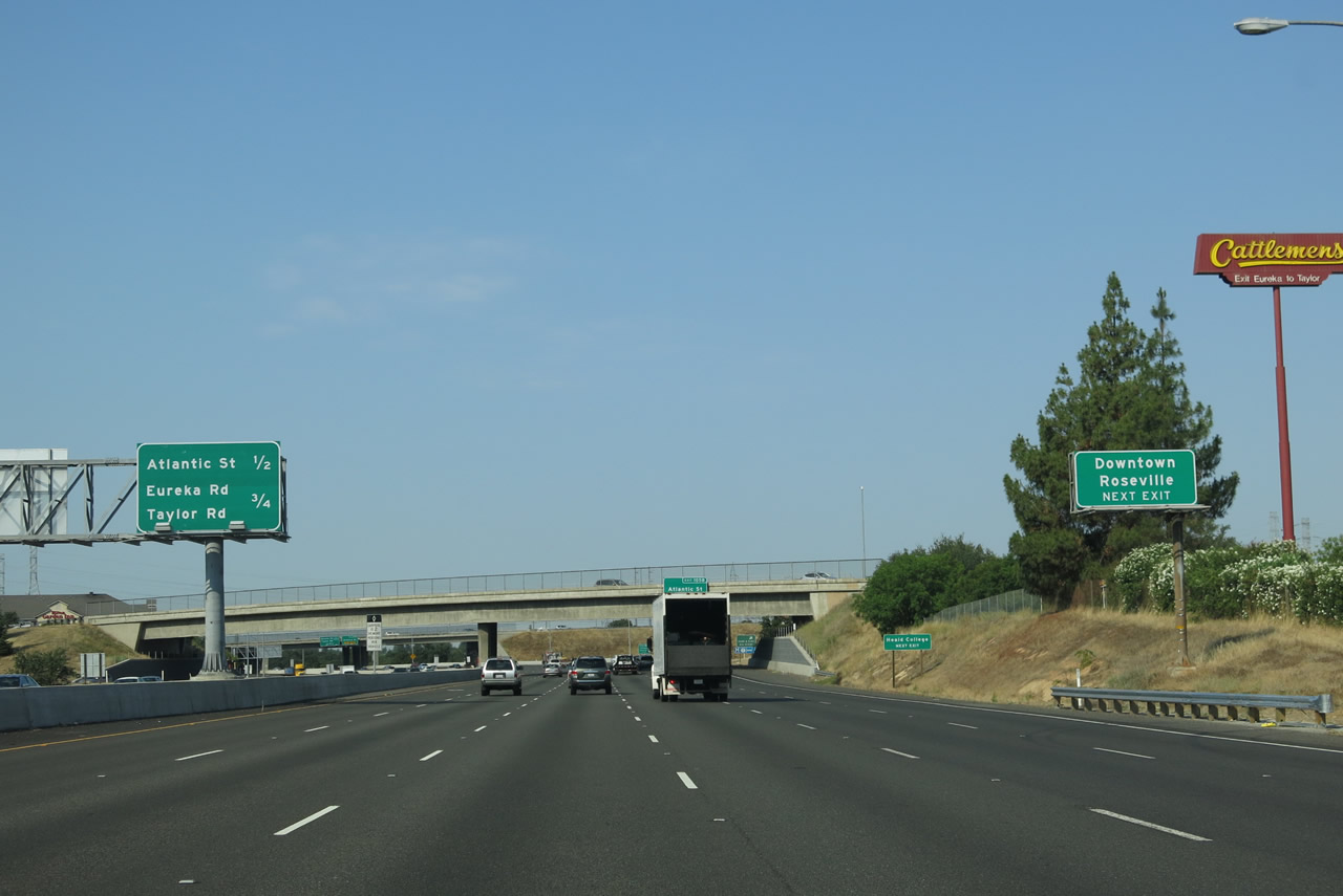 |
The next two exits along Interstate 80 west are Exit 105B, Atlantic Street and Exit 105A, Eureka Road and Taylor Road (Historic U.S. 40). Use Exit 105B to downtown Roseville. Photo taken 07/02/13. |
 |
The right lane of Interstate 80 west becomes exit only for Exit 105B, Atlantic Street. Photo taken 07/02/13. |
 |
Atlantic Street travels west via Historic U.S. 40 into downtown Roseville, becoming Vernon Street once in downtown Roseville. Historic U.S. 40 (Atlantic Street and Vernon Street) effectively functions as a business loop into downtown Roseville, with a connection back to Interstate 80 via Riverside Avenue at Exit 102. Historic U.S. 99E/Washington Boulevard (which was designated as California 256 before that route was decommissioned in 1994 and also signed as California 65 Business) meets U.S. 40/Vernon Street in downtown Roseville. Photo taken 07/02/13. |
 |
Interstate 80 west approaches Exit 105B, Atlantic Street and Exit 105A, Eureka Road and Taylor Road (Historic U.S. 40). While Exit 105B connects to Atlantic Street west and downtown Roseville, Exit 105A will loop onto Eureka Road southeast toward eastern Roseville and northern Folsom. Exit 105B also links with U.S. 40 northeast via Taylor Road. Photo taken 07/02/13. |
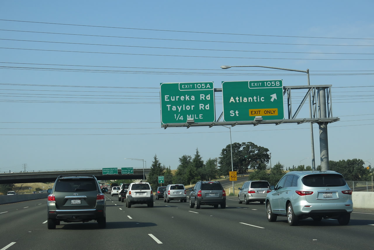 |
Westbound Interstate 80 meets Exit 105B, Atlantic Street. The following off-ramp is Exit 105A, Eureka Road southeast and Taylor Road northeast. Photo taken 07/02/13. |
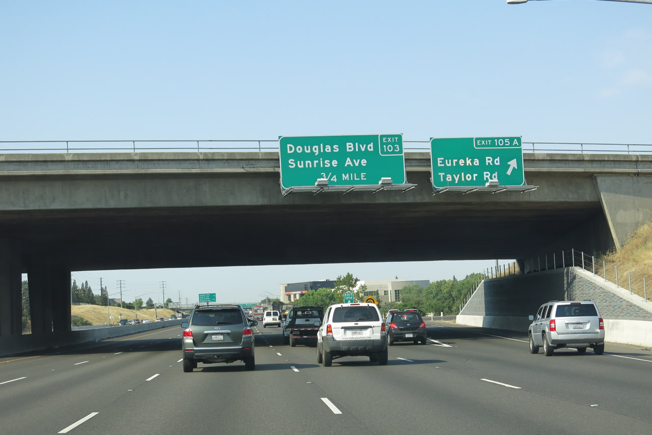 |
Immediately thereafter, Interstate 80 west meets Exit 105A, Eureka Road and Taylor Road. The following interchange is Exit 103, Douglas Boulevard and Sunrise Avenue. Photo taken 07/02/13. |
 |
This mileage sign along Interstate 80 west provides the distance to the next two interchanges: Exit 103, Douglas Boulevard and Sunrise Avenue and Exit 102, Historic U.S. 40-99E (Auburn Boulevard) and Riverside Avenue. Photo taken 07/02/13. |
 |
An Interstate 80 west reassurance shield is posted shortly thereafter. Photo taken 07/02/13. |
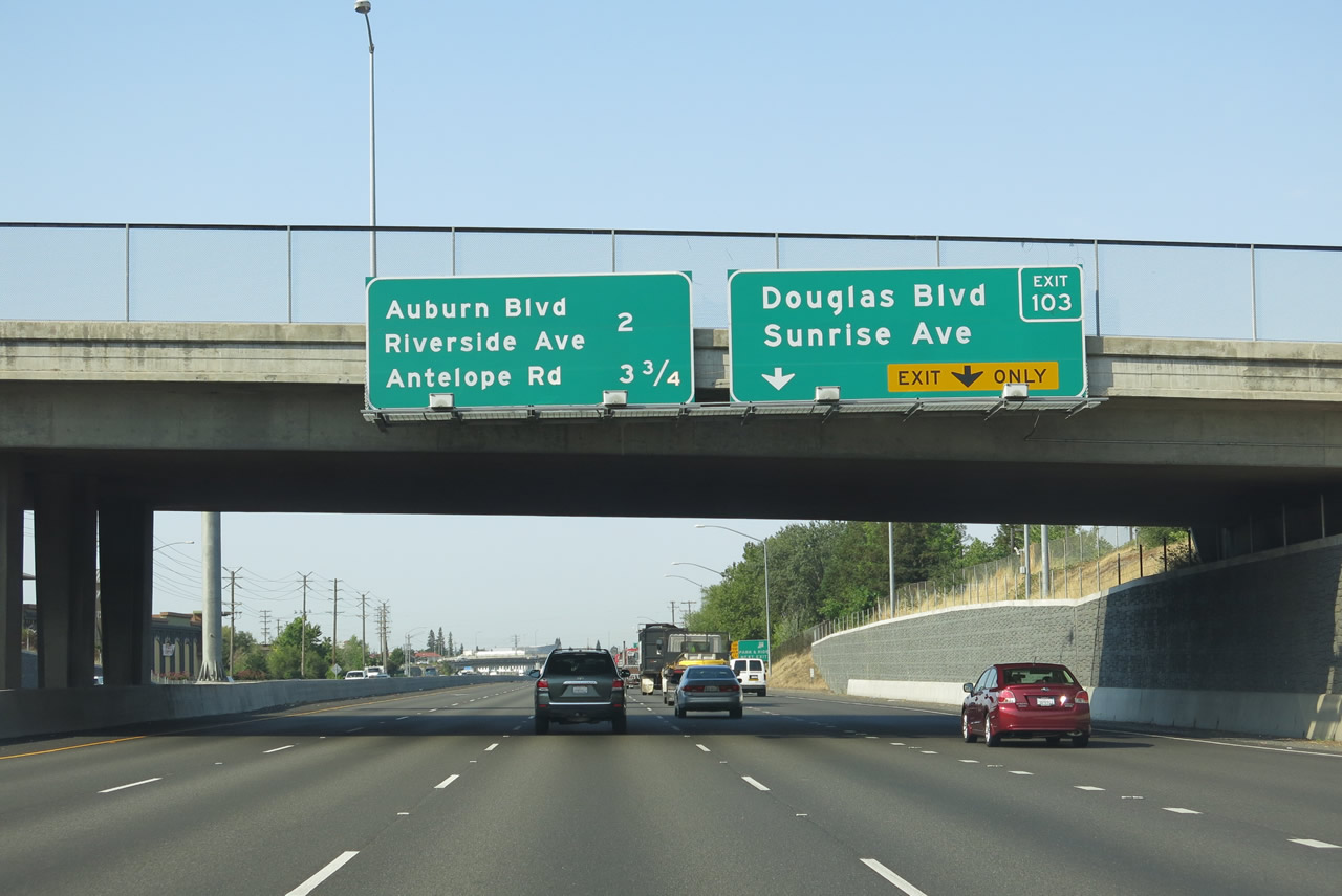 |
The right two lanes along Interstate 80 west connect to Exit 103, Douglas Boulevard and Sunrise Avenue. The following exit will be Exit 102, Auburn Boulevard south and Riverside Avenue north to downtown Roseville. Both Auburn Boulevard and Riverside Avenue are part of Historic U.S. 40-99E. These two Historic U.S. Highways will travel together along Auburn Boulevard from Roseville to Sacramento. Photo taken 07/02/13. |
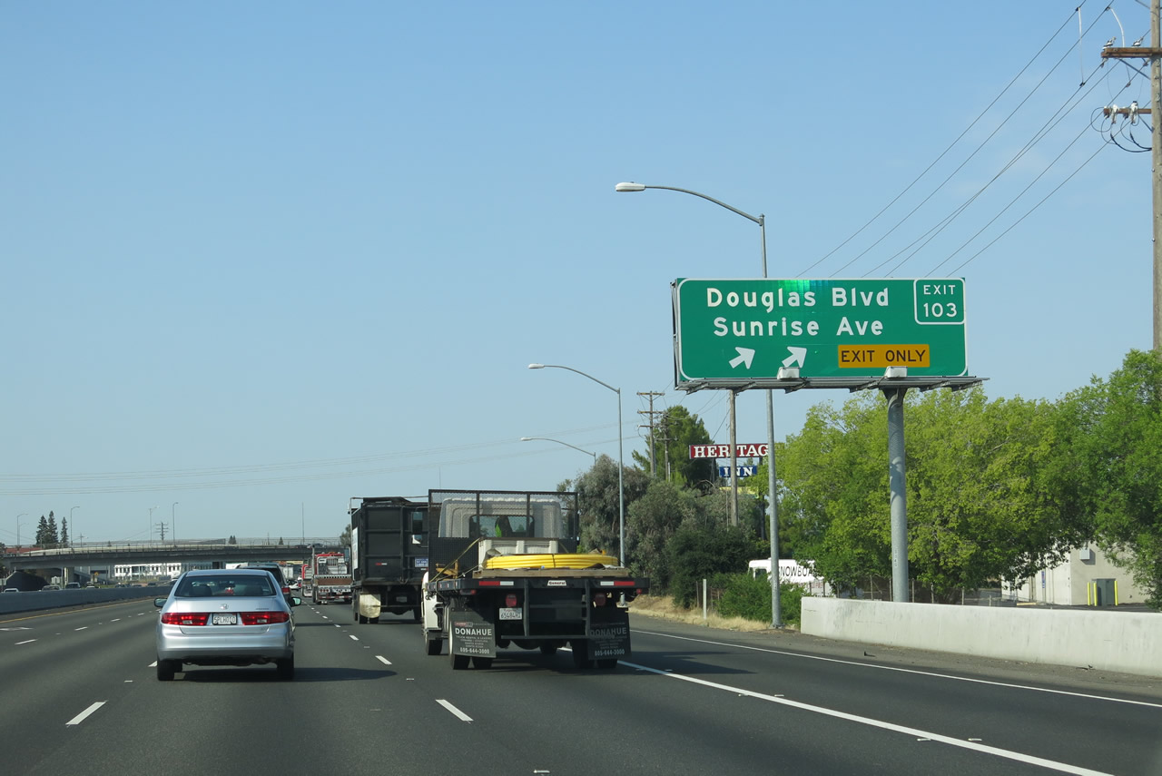 |
Westbound Interstate 80 meets Exit 103, Douglas Boulevard and Sunrise Avenue. Photo taken 07/02/13. |
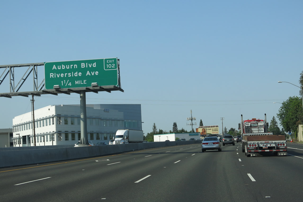 |
The next exit along Interstate 80 west is Exit 102, Historic U.S. 40-99E -- Auburn Boulevard south and Riverside Avenue north. Photo taken 07/02/13. |
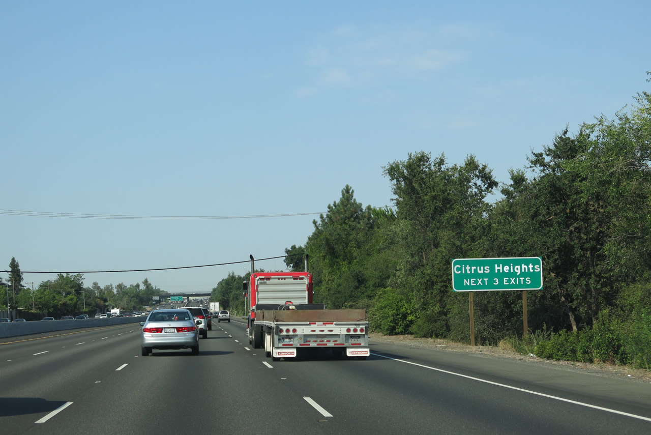 |
The next three exits along Interstate 80 west serve the city of Citrus Heights (incorporated January 1, 1997, with a population of 83,301 as of the 2010 Census). Photo taken 07/02/13. |
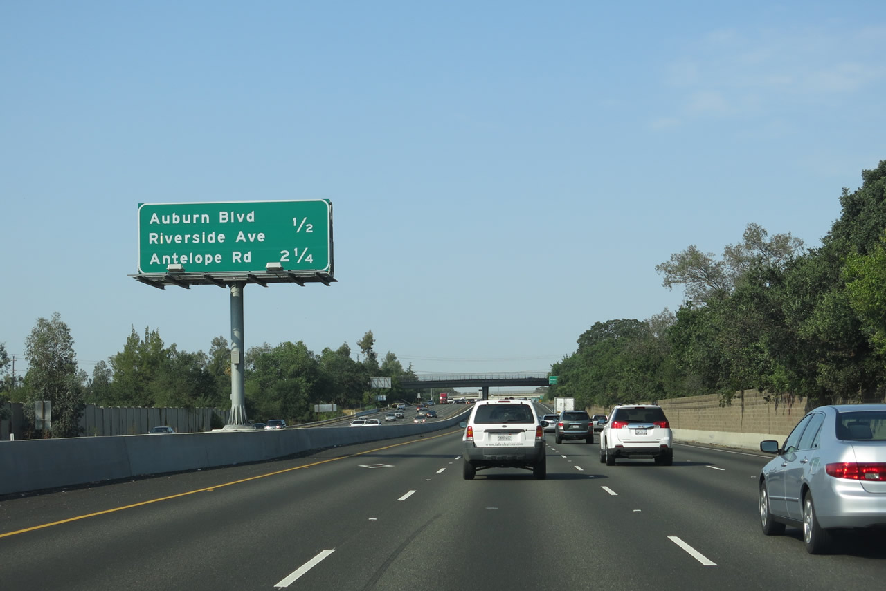 |
The next two exits along Interstate 80 west are Exit 102, Auburn Boulevard south and Riverside Avenue north and Exit 100, Antelope Road. Photo taken 07/02/13. |
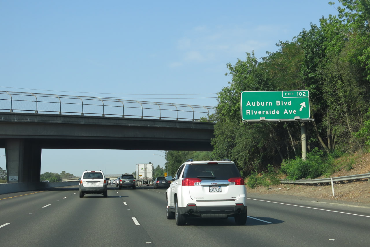 |
Westbound Interstate 80 meets Exit 102, Historic U.S. 40-99E -- Auburn Boulevard south and Riverside Avenue north. After this interchange, Interstate 80 leaves Placer and enters Sacramento County. Photo taken 07/02/13. |

Page Updated July 8, 2013.
|
About Contact Glossary |
In The News Testimonials Interstate Guide |
Social Media:
 |
|
© 2000-23 AARoads.com | All Rights Reserved | Privacy Policy / Terms of Use
|
||