|
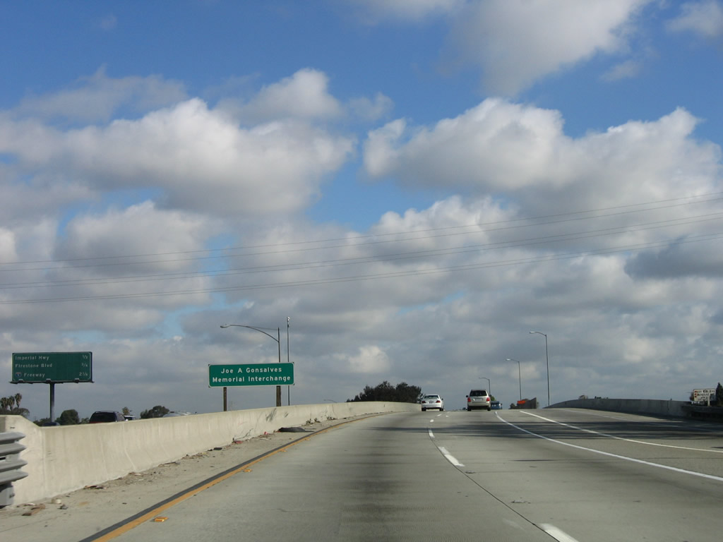
Another entrance to Interstate 105/Glenn Anderson Freeway west comes onto the freeway from Studebaker Road in city of Norwalk (population 103,298 as of the 2000 Census and incorporated on August 26, 1957). While plans originally called for a connection to Interstate 5 (Santa Ana Freeway) through Norwalk, that routing will not be built due to a variety of reasons: community opposition, cost, and technical difficulties to connect to Interstate 5 due to the older infrastructure on the Santa Ana Freeway. Photo taken 06/19/10. |
|
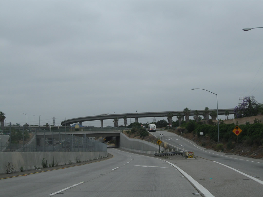
Leaving Studebaker Road, westbound Interstate 105/Glenn Anderson Freeway begins as a two-lane freeway. In the distance is the towering stack interchange with Interstate 605 (San Gabriel River Freeway). Photo taken 06/19/10. |
|
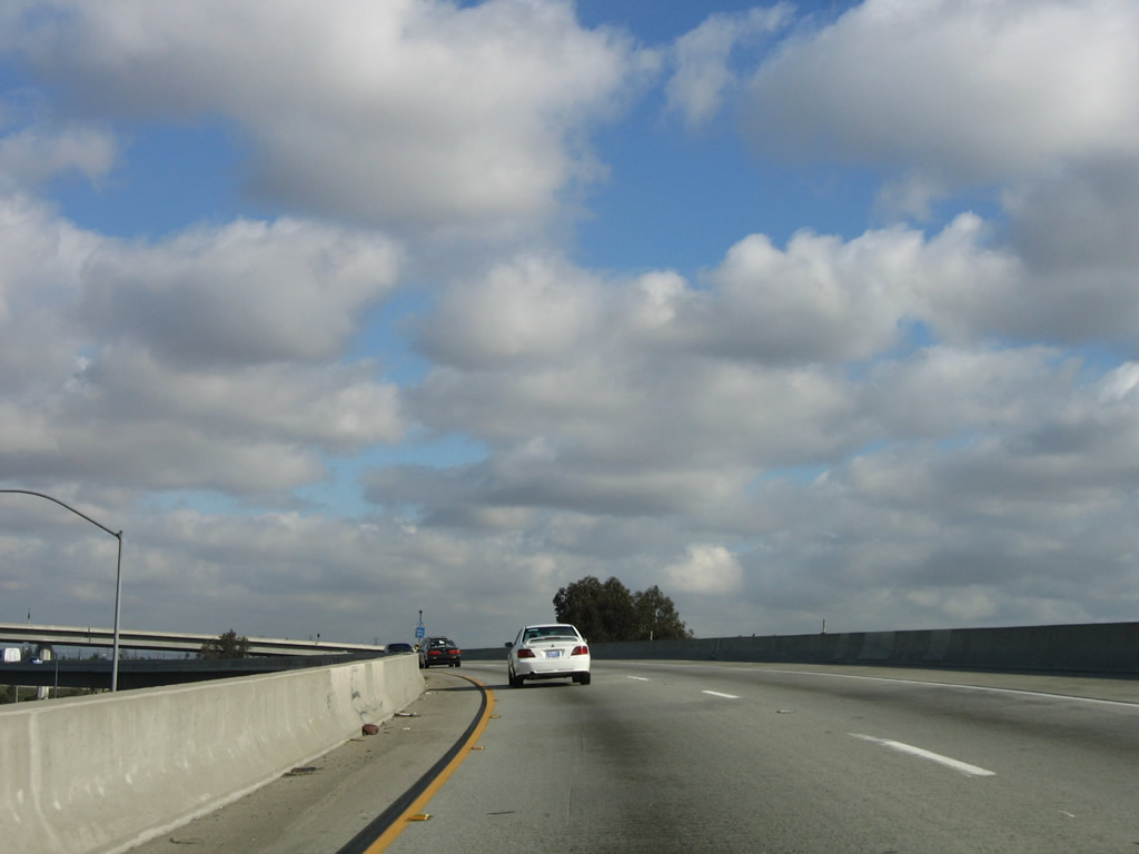
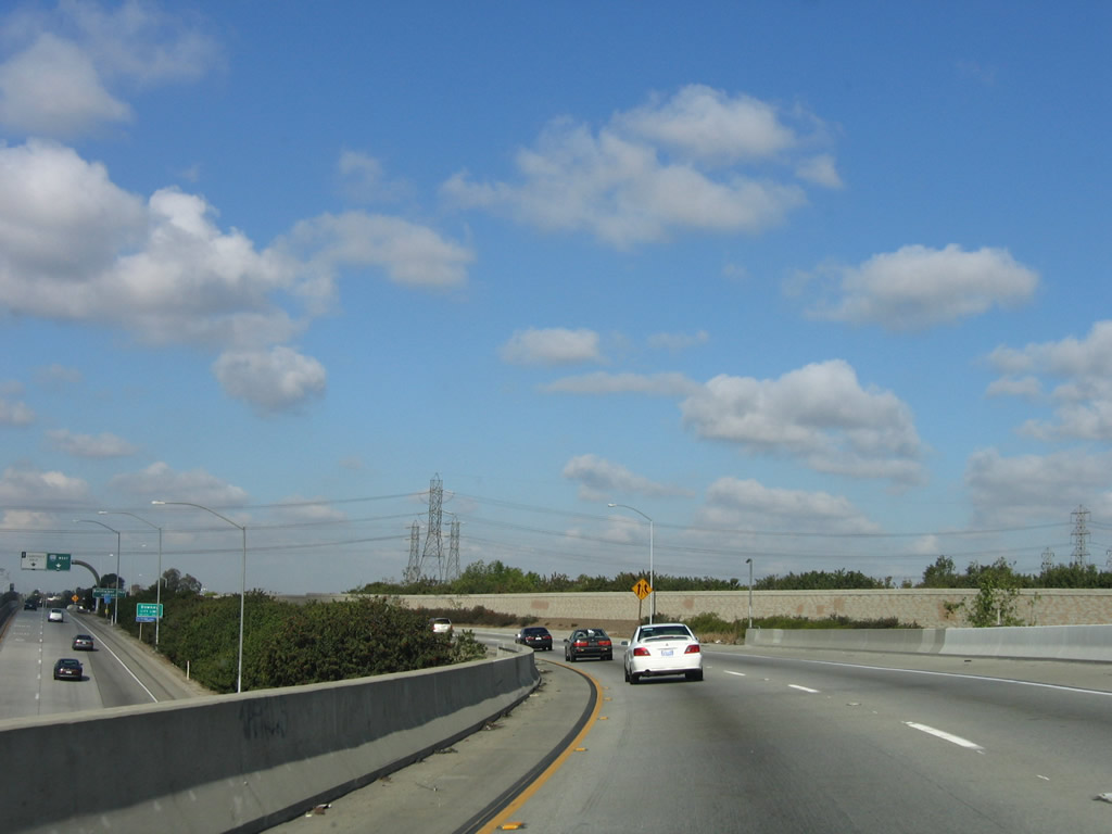
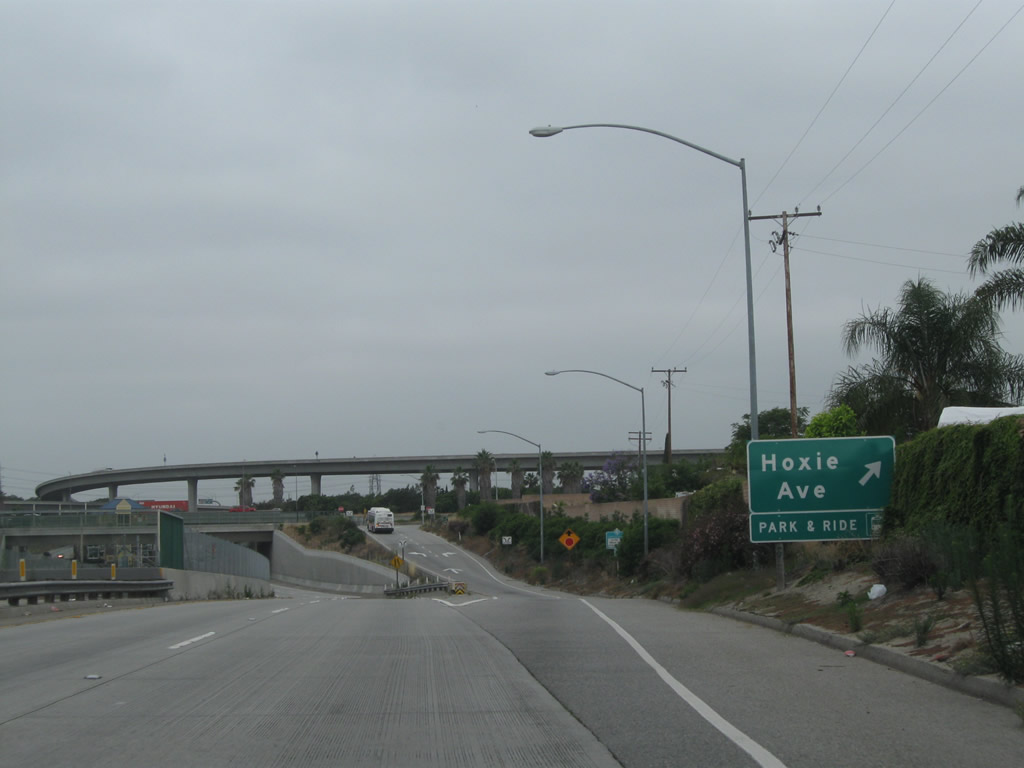
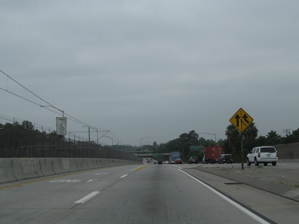
An interim exit along westbound Interstate 105/Glenn Anderson Freeway HOV lanes is Exit 18, Hoxie Avenue to the park and ride. Photo taken 06/19/10. |
|
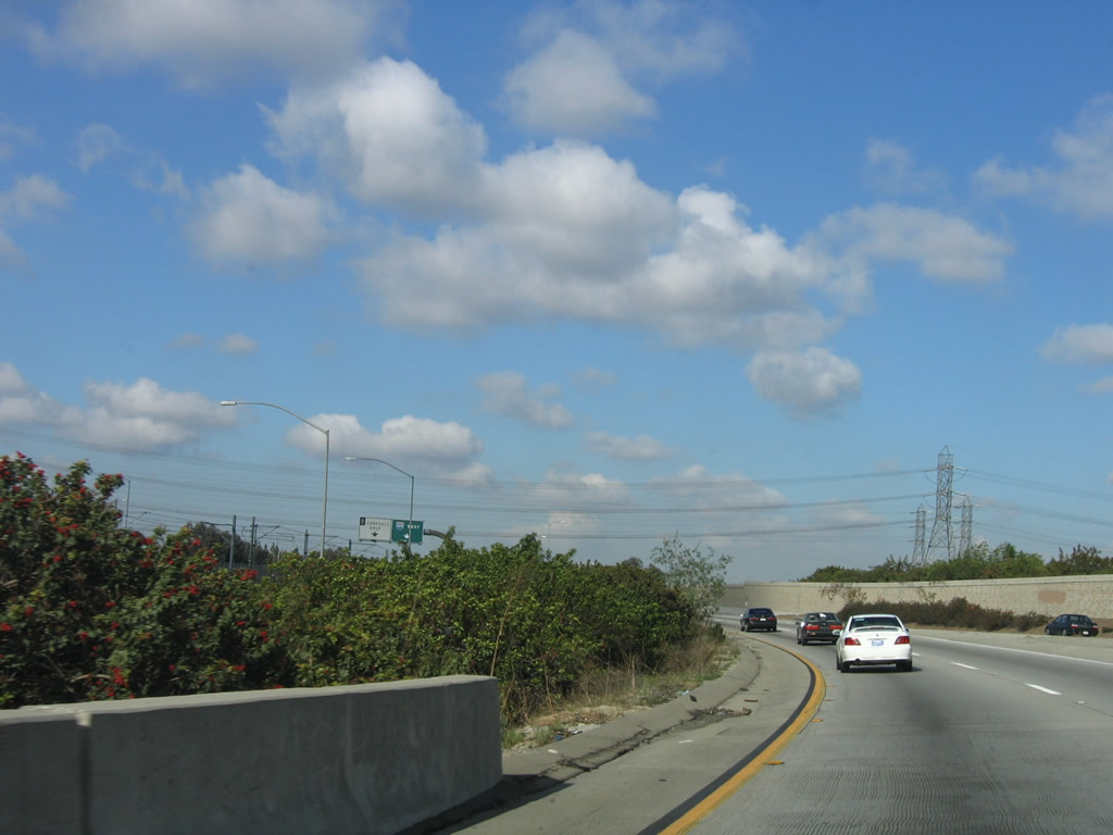
The Metro Green Line, which offers rapid transit service (light rail) in the median of Interstate 105, begins in Norwalk and commences its westbound journey toward El Segundo. The Green Line will remain in the median between Interstate 605 and Interstate 405 near Los Angeles International Airport (LAX). Photo taken 06/19/10. |
|
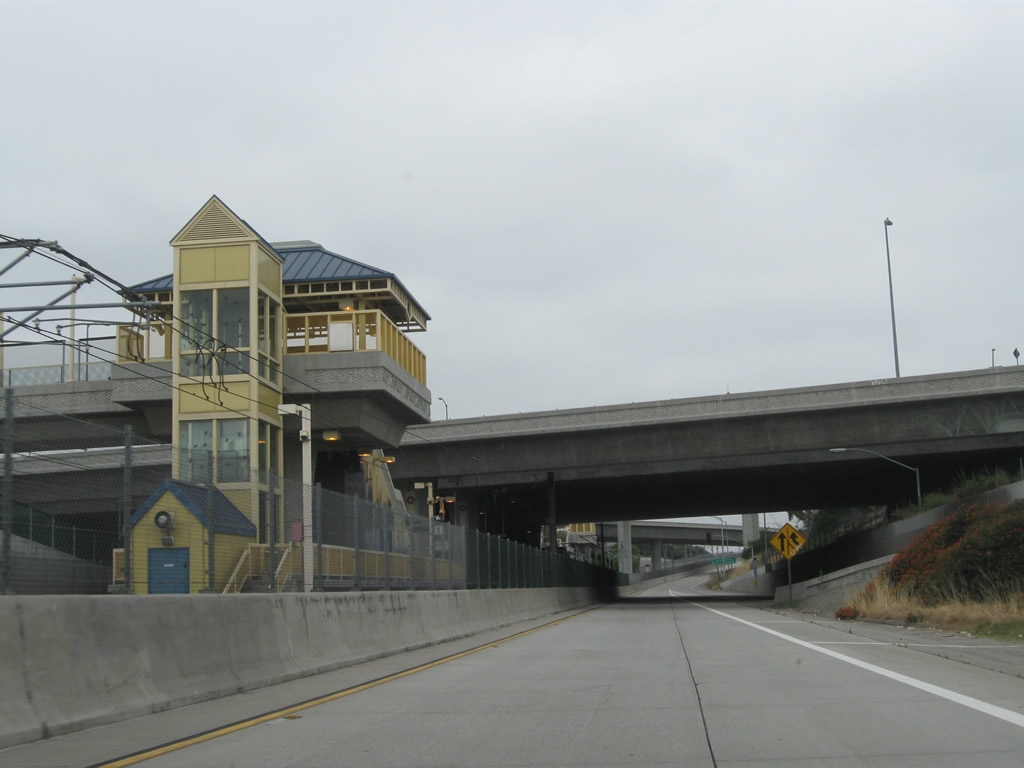
Passing under Hoxie Avenue, the Metro Green Line station comes into view above the freeway. Photo taken 06/19/10. |
|
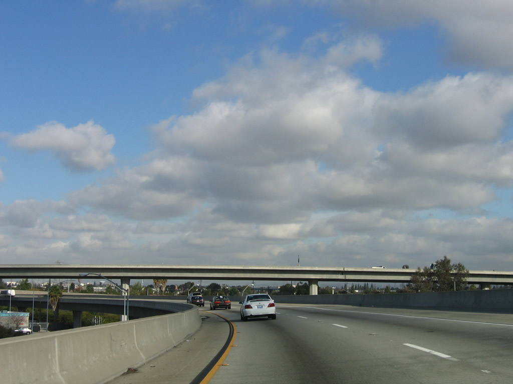
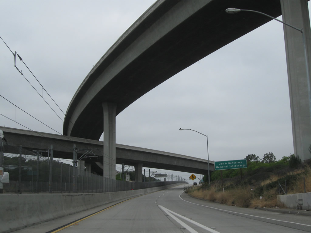
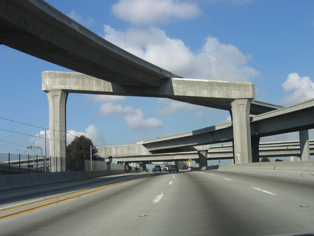
The transition ramps from Interstate 105 east to Interstate 605 north and from Interstate 605 north to Interstate 105 west soar over the HOV lanes of Interstate 105. Photo taken 06/19/10. |
|
Passing through the Interstate 605 interchange, Interstate 105 leaves Norwalk and enters the city of Downey (population 107,323 as of 2000 Census and incorporated on December 17, 1956). Photo taken 06/19/10. |
|
The next exit along Interstate 105 west is Exit 17, Bellflower Boulevard. Carpool traffic should stay in the left lane, while through traffic opting for the main lanes and all exits should stay right. Photo taken 06/19/10. |
|
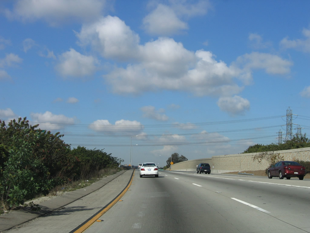
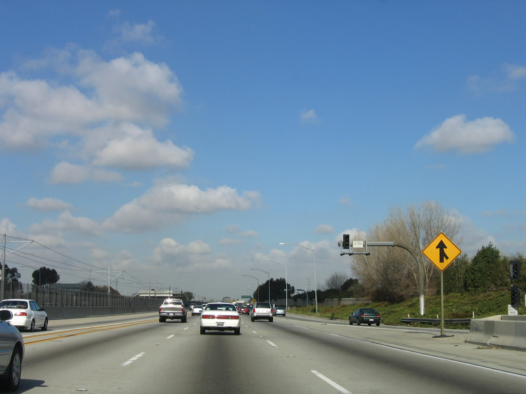
Soon thereafter, the HOV lanes merge from the left into the transition lanes that are incoming from Interstate 605. At this point, Interstate 105 truly begins with all traffic, including HOV's, cars, and trucks. Photo taken 06/19/10. |
|
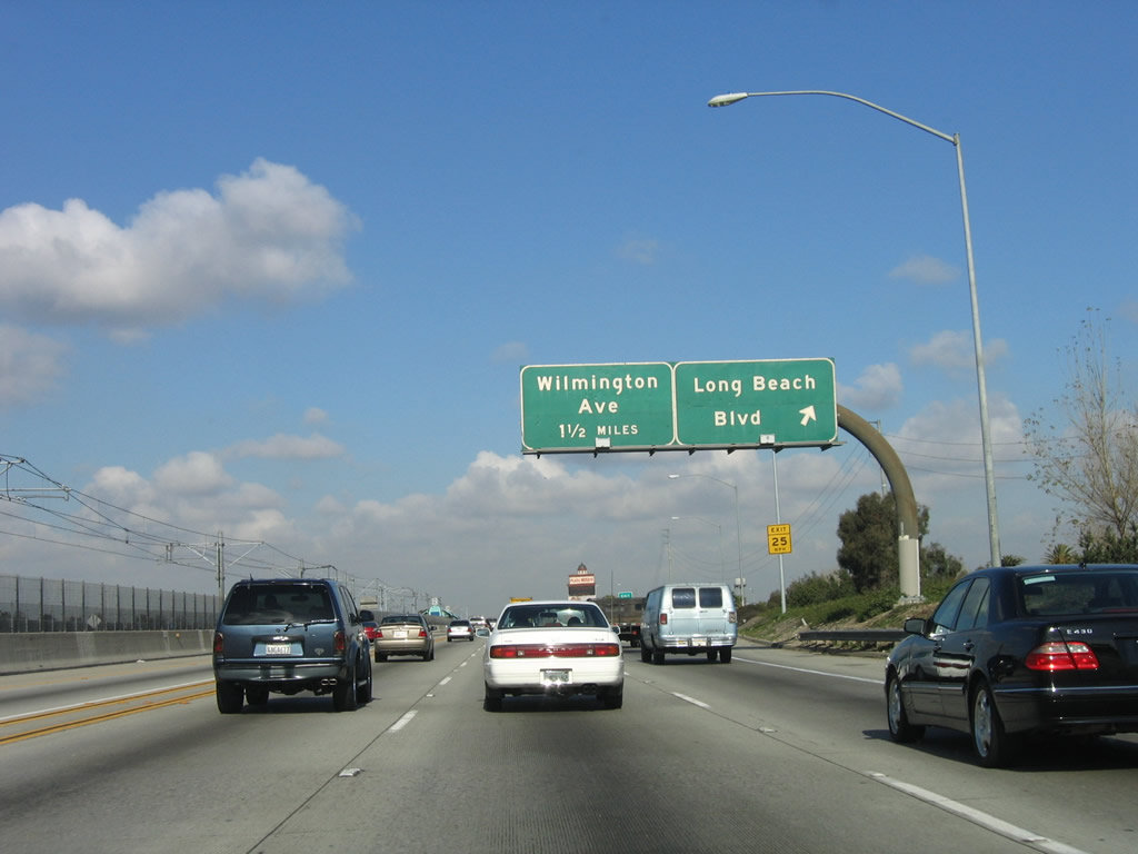
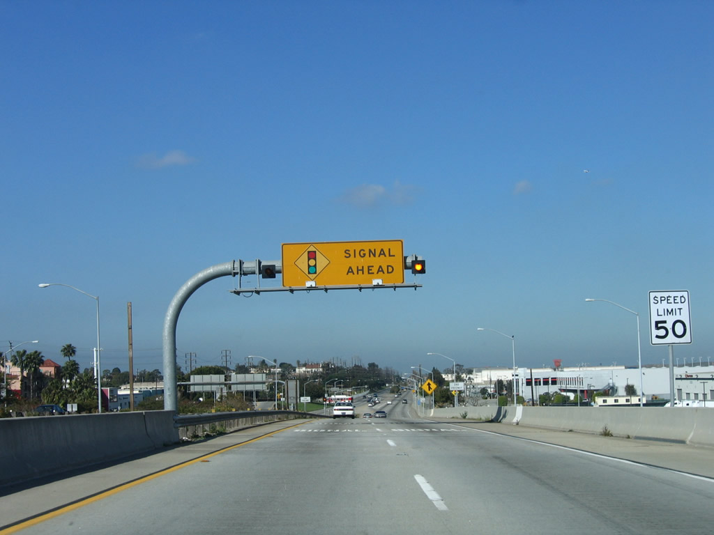
The next exit along Interstate 105 west is Exit 17, Bellflower Boulevard. Bellflower Boulevard roughly parallels California 19 (Lakewood Boulevard) through Bellflower, Lakewood, and Long Beach, and it is a good alternate route through those cities. Photo taken 03/18/06. |
|
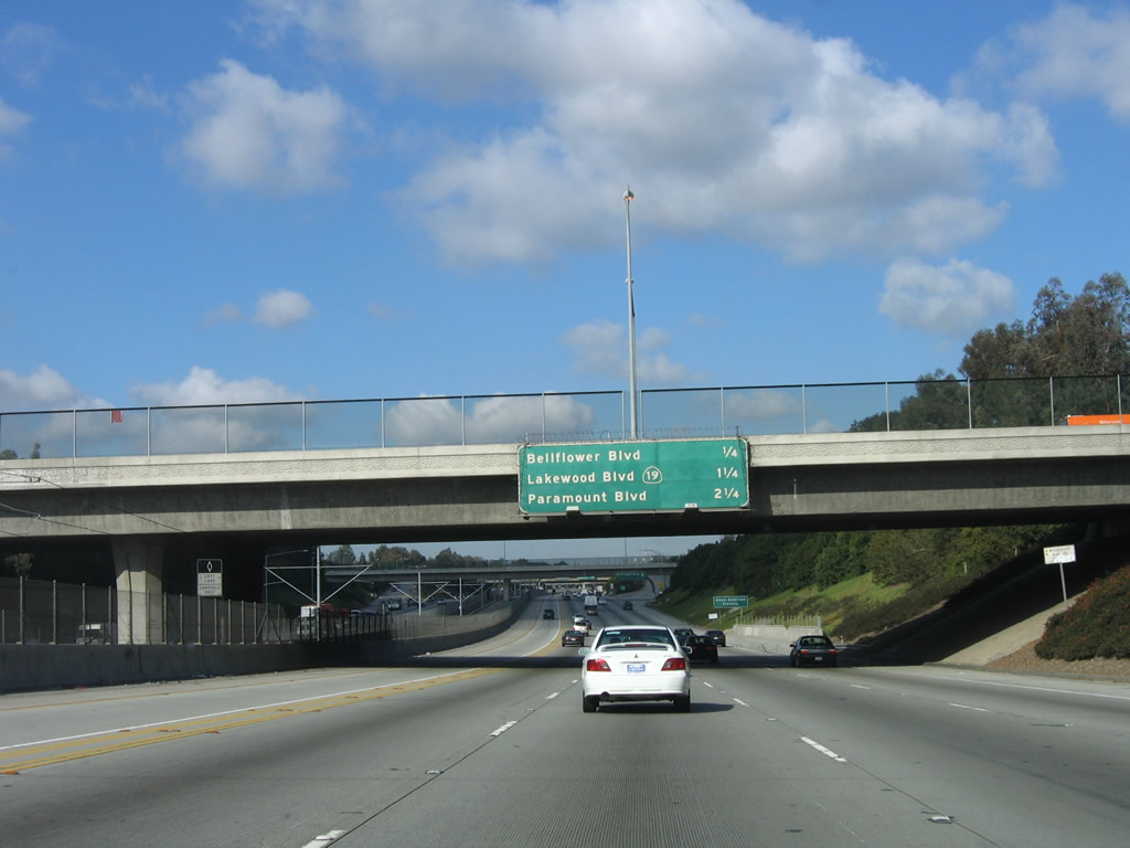
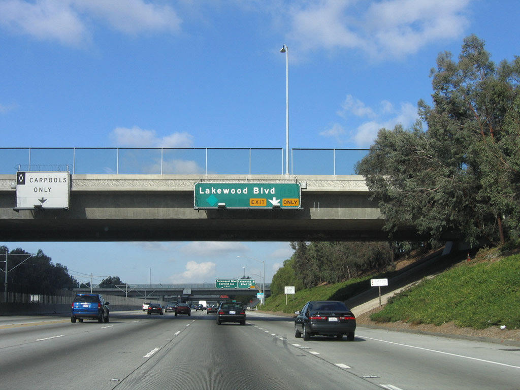
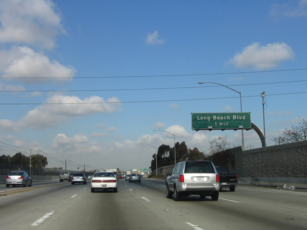
This mileage sign along Interstate 105/Glenn Anderson (Century) Freeway west provides the distance to Exit 17, Bellflower Boulevard; Exit 16, California 19 (Lakewood Boulevard); and Exit 15, Paramount Boulevard. Photo taken 03/18/06. |
|
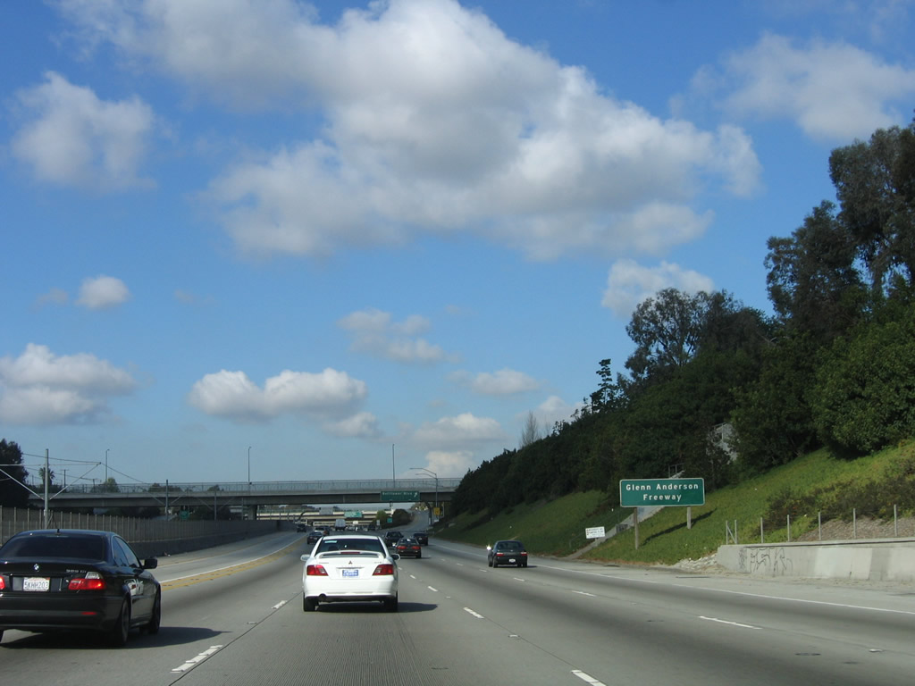
Interstate 105 is designated as the Glenn Anderson Freeway. When planned, Interstate 105 was to be named the Century Freeway, but it was dedicated in honor of Glenn Anderson, a local politician who was instrumental in getting the freeway built through the area. Anderson died in 1994, the year after the Interstate 105 freeway opened to traffic. Photo taken 03/18/06. |
|
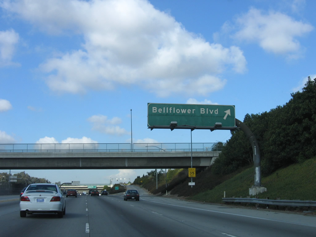
Westbound Interstate 105/Glenn Anderson (Century) Freeway reaches Exit 17, Bellflower Boulevard. Photo taken 03/18/06. |
|
|
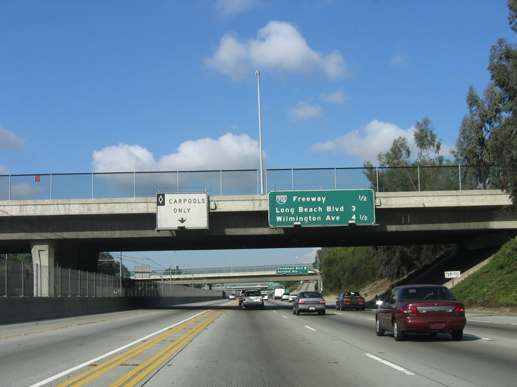
Two mileage signs -- one right after the other along The next exit along Interstate 105/Glenn Anderson (Century) Freeway west -- provide the distance to the next three exits: Exit 15, Paramount Boulevard (not listed for some reason on the second sign even though it is located prior to the exit ramp); Exit 13, Interstate 710 (Long Beach Freeway); and Exit 12, Long Beach Boulevard. Photos taken 06/19/10 and 03/18/06. |
|
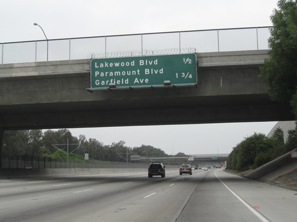
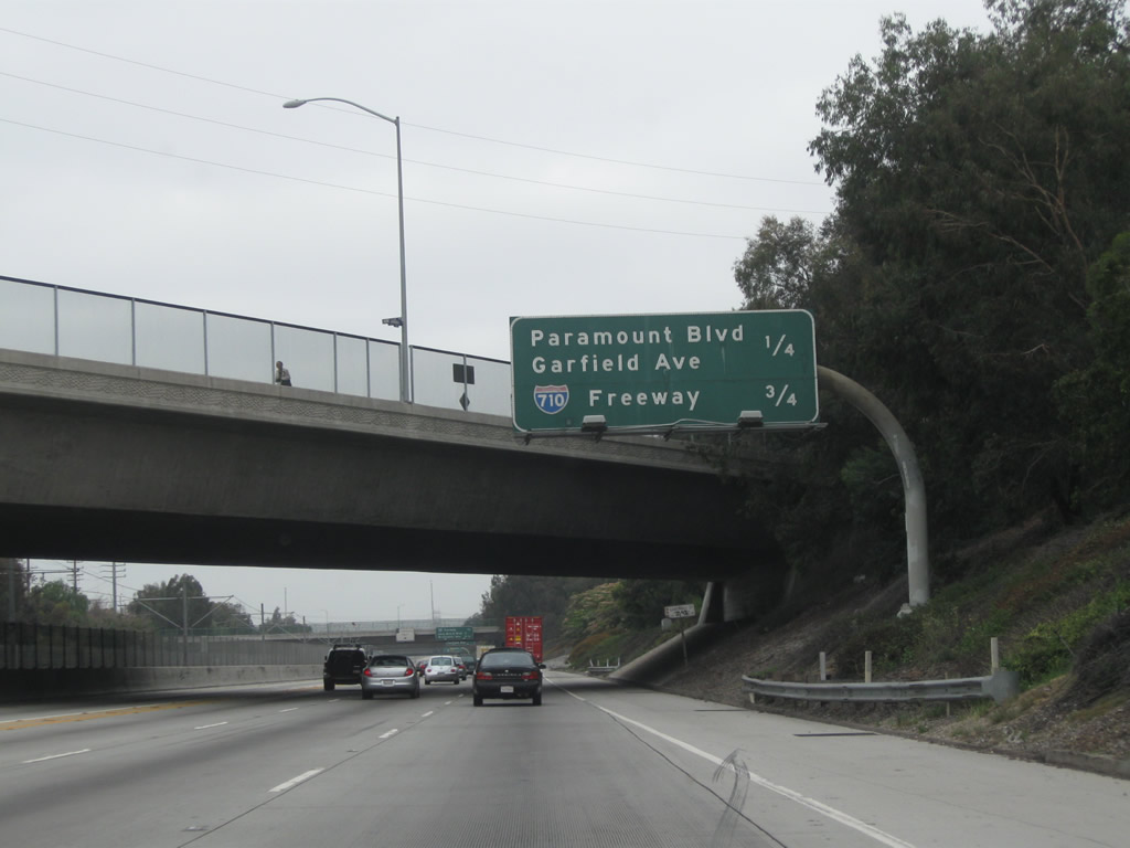
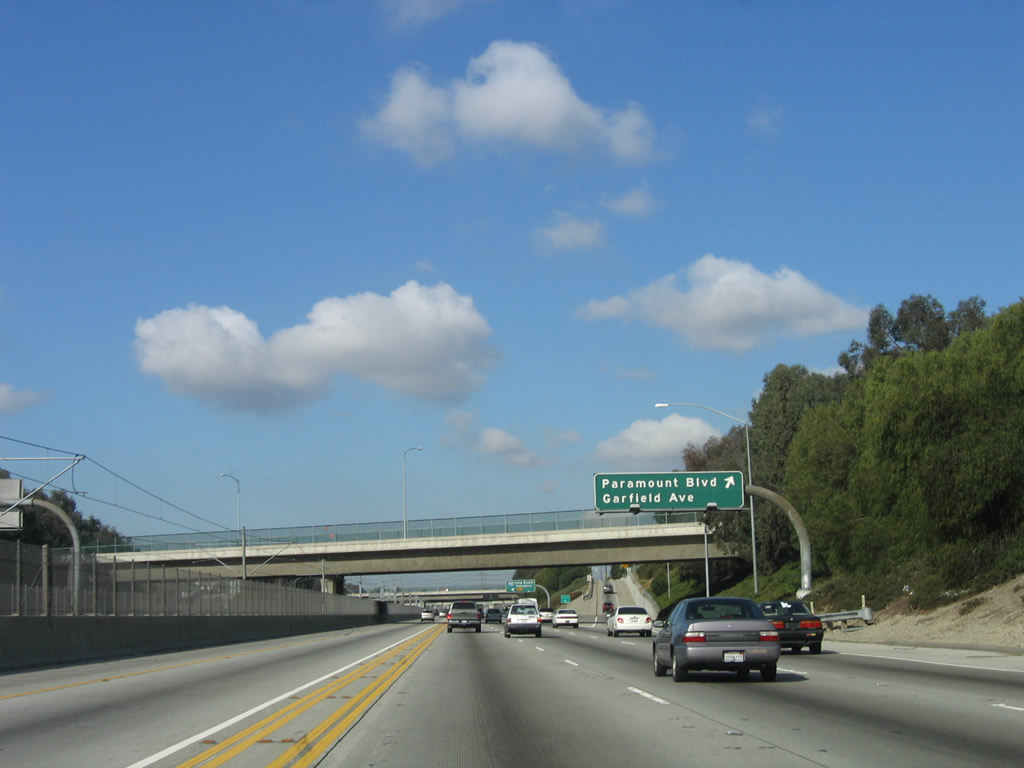
Westbound Interstate 105/Glenn Anderson (Century) Freeway reaches Exit 15, Paramount Boulevard/Garfield Avenue. Interstate 105 skirts the southern corner of the city of South Gate (population 96,375 as of the 2000 Census and incorporated on January 20, 1923), then cuts a corner of northern Paramount (population 55,266 as of the 2000 Census and incorporated on January 30, 1957). Photo taken 03/18/06. |
|
|
The next exit along Interstate 105/Glenn Anderson (Century) Freeway west is Exit 13, Interstate 710 (Long Beach Freeway). These two signs provide the lane allocations for Interstate 105 west and Interstate 710 north/south. Photos taken 03/18/06. |
|
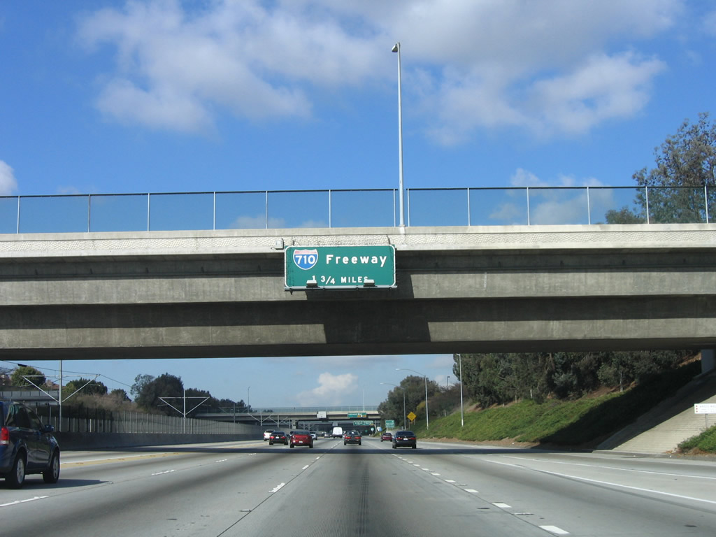
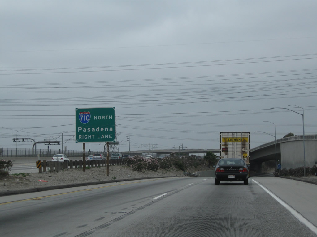
Westbound Interstate 105/Glenn Anderson Freeway reaches Exit 13, Interstate 710 (Long Beach Freeway). These reflective signs were installed around 2002. Interstate 710 leads north to Alhambra (a little shy of Pasadena, since the last leg of Interstate 710 is still incomplete) and south to downtown Long Beach and the Port of Los Angeles. Photo taken 03/18/06. |
|
|
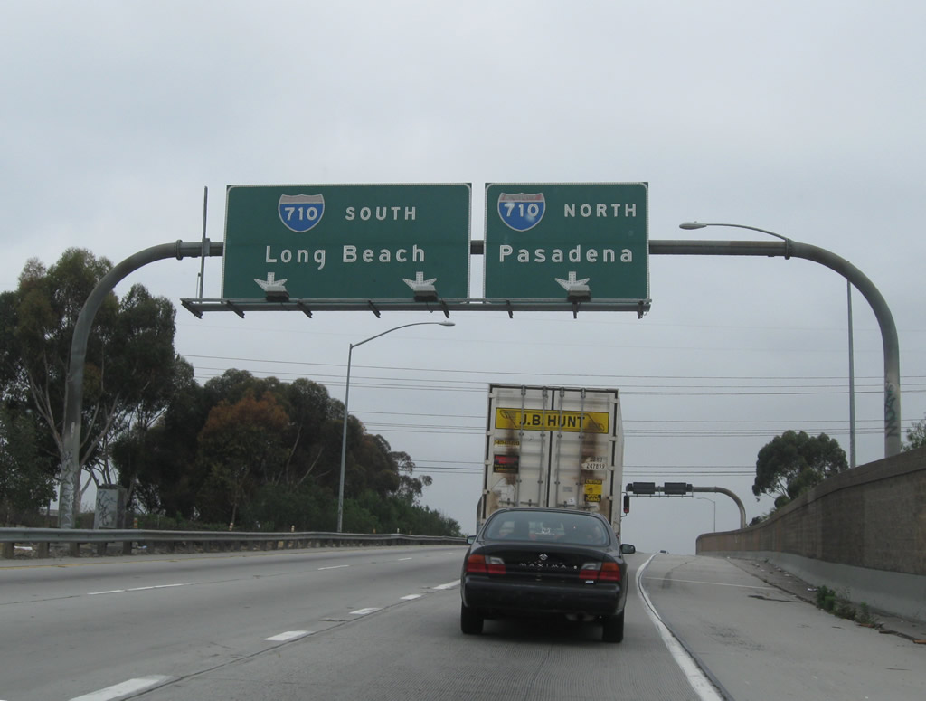
Once on the transition ramp, stay right for Interstate 710 north to Pasadena. Photos taken 03/18/06 and 06/19/10. |
|
The transition ramp to Interstate 710 splits. The left two lanes take aim toward Interstate 710 south to Long Beach, while the right lane connects to Interstate 710 north to Pasadena. Photo taken 06/19/10. |
|
|
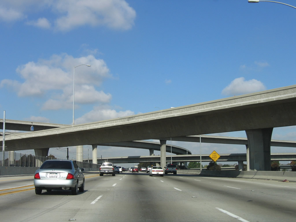
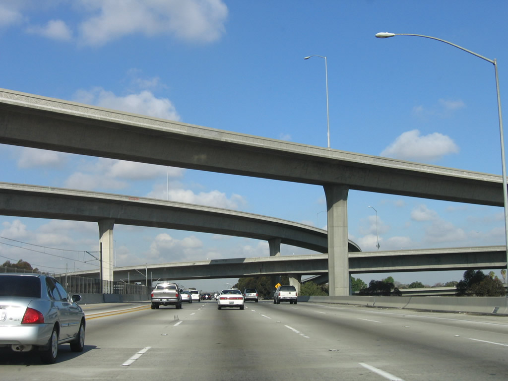
Interstate 105 passes through the massive sprawl of flyover ramps at the Interstate 710 stack interchange. Interstate 105 leaves Paramount and enters the city of Lynwood (population 69,845 as of 2000 Census and incorporated on July 21, 1921). Photos taken 03/18/06. |
|
Traffic from Interstate 710 merges onto Interstate 105/Glenn Anderson (Century) Freeway west. Photo taken 03/18/06. |
|
The next exit along Interstate 105/Glenn Anderson (Century) Freeway west is Exit 12, Long Beach Boulevard, one mile. Photo taken 03/18/06. |
|
This Interstate 105 west reassurance shield is posted prior to Exit 12, Long Beach Boulevard. Photo taken 03/18/06. |
|
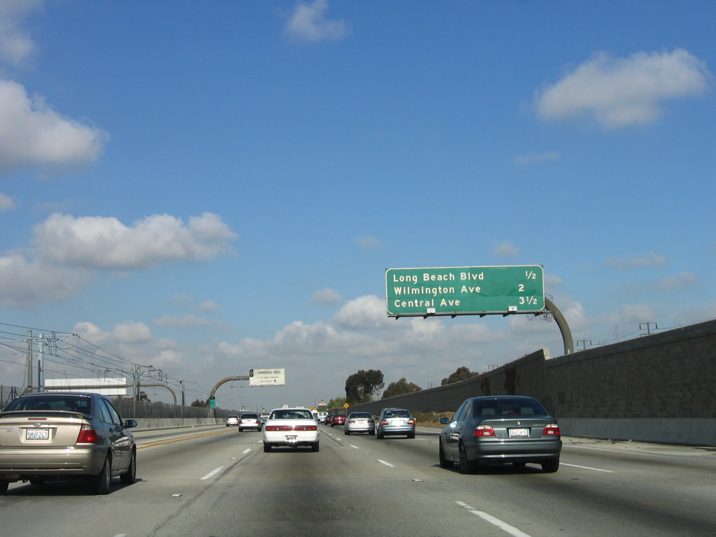
This mileage sign along Interstate 105/Glenn Anderson (Century) Freeway west provides the distance to Exit 12, Long Beach Boulevard; Exit 10, Wilmington Boulevard; and Exit 9, Central Avenue. Photo taken 03/18/06. |
|
Westbound Interstate 105/Glenn Anderson (Century) Freeway reaches Exit 12, Long Beach Boulevard. This city street parallels Interstate 710. Photo taken 03/18/06. |
|
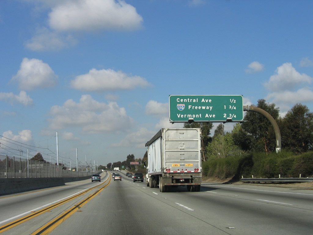
This mileage sign provides the distance to the next three exits from Interstate 105 west: Exit 10, Wilmington Avenue; Exit 9, Central Avenue; and Exit 7B, Interstate 110 (Harbor Freeway). Leaving the city of Lynwood at the Central Avenue interchange, Interstate 105 skirts the northern edge of unincorporated Willowbrook. Photo taken 03/18/06. |
|
Westbound Interstate 105/Glenn Anderson (Century) Freeway reaches Exit 10, Wilmington Avenue. Photo taken 03/18/06. |
|
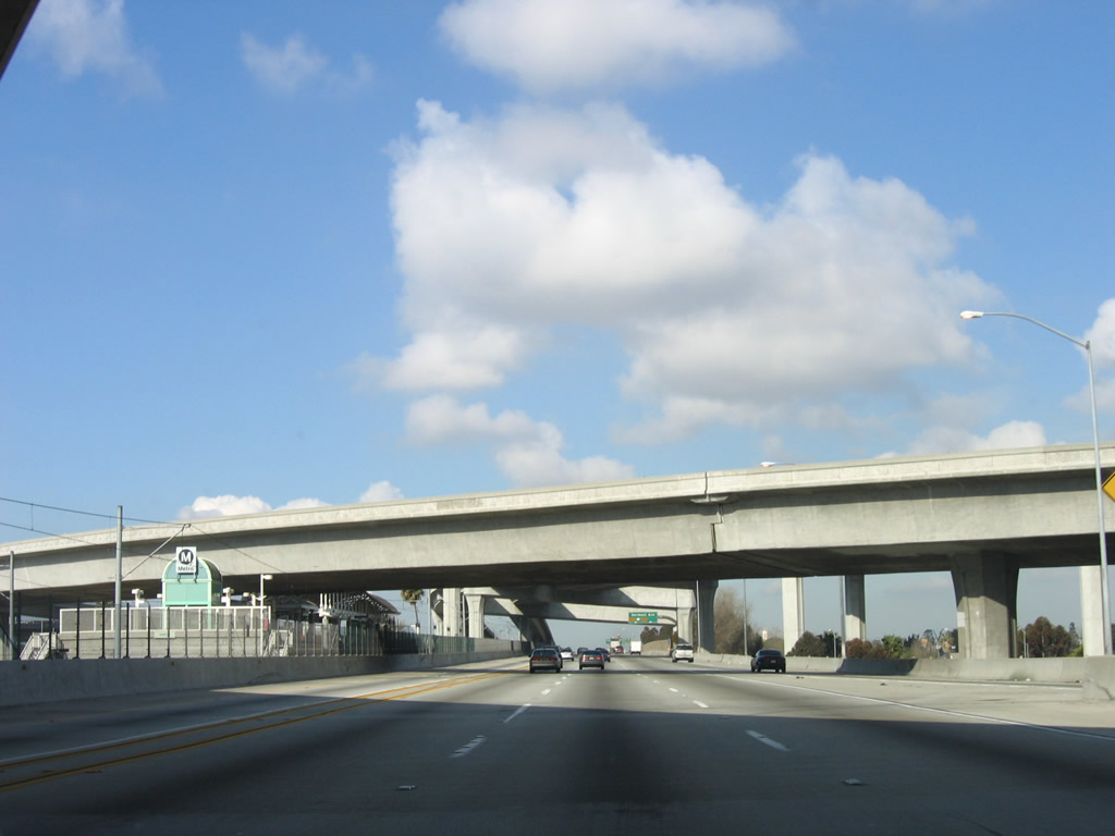
A Metro Green Line station is located at the interchange between Interstate 105 and Wilmington Avenue. Photo taken 03/18/06. |
|
This mileage sign for the next three exits along westbound Interstate 105/Century Freeway: Exit 9, Central Avenue; Exit 7B, Interstate 110 (Harbor Freeway); and Exit 7A, Vermont Avenue. At Exit 9, Interstate 105 leaves Willowbrook and enters the city of Los Angeles. Photo taken 03/18/06. |
|
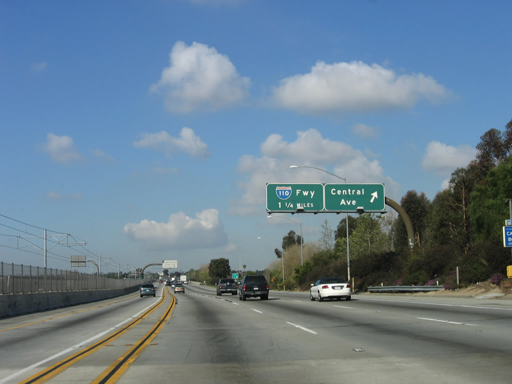
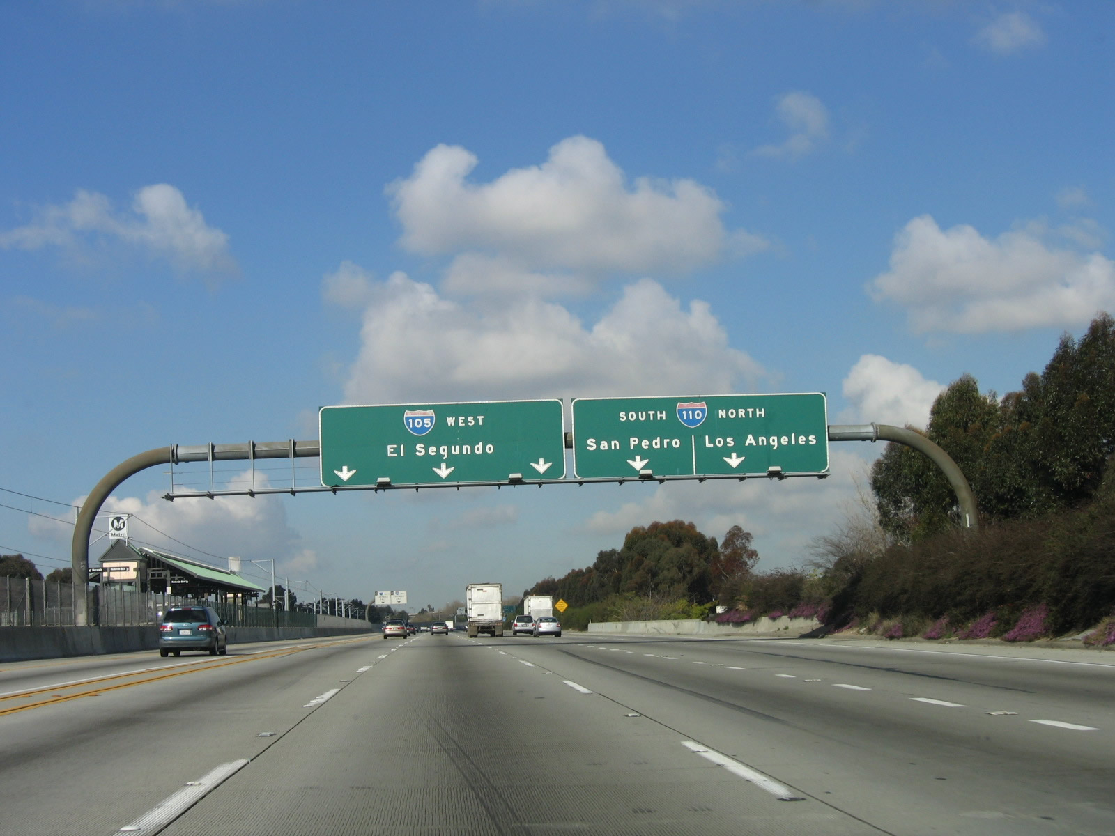
Westbound Interstate 105/Glenn Anderson (Century) Freeway reaches Exit 9, Central Avenue. The next exit is Exit 7B, Interstate 110. Interstate 110 is a major north-south freeway corridor that extends from San Pedro and the Port of Los Angeles in the south north to downtown Los Angeles. This section of freeway is called the Harbor Freeway and was formerly designated as U.S. 6 and California 11 until 1964 and solely as California 11 until 1981. At Interstate 10, the Harbor Freeway changes from Interstate 110 to California 110. The state route continues through downtown and then northeast along Arroyo Seco Parkway (Pasadena Freeway) to Pasadena. The segment of Arroyo Seco Parkway from downtown to Pasadena was formerly designated as U.S. 66 and California 11 until 1964; from 1964 until 1981, it was solely designated as California 11. Parallel Figueroa Street predates the Harbor Freeway and Arroyo Seco Parkway. Figueroa Street carried the various route designations (U.S. 6, U.S. 66, and California 11) prior to the freeway construction. Photo taken 03/18/06. |
|
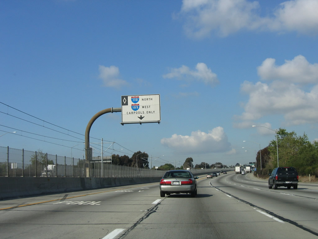
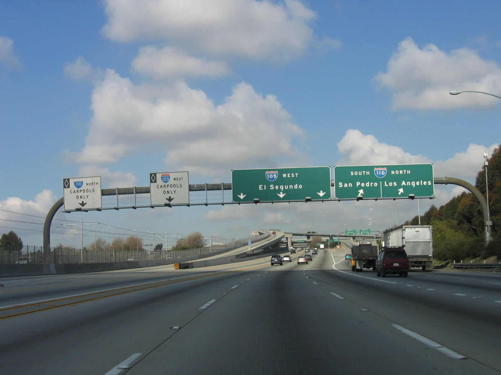
The carpool (HOV) lanes feature a direct ramp between Interstate 105 west and Interstate 110 north. Photo taken 03/18/06. |
|
The next exit along Interstate 105/Glenn Anderson (Century) Freeway west is Exit 7B, Interstate 110 (Harbor Freeway) north to downtown Los Angeles and south to San Pedro and the ports of Los Angeles and Long Beach. Note the control city of El Segundo (which later changes to LAX). Photo taken 03/18/06. |
|
Looking again at the carpool/high occupancy vehicle lanes, this sign advises of the lane allocation for Interstate 105 west and Interstate 110 north. Photo taken 03/18/06. |
|
Westbound Interstate 105 reaches Exit 7B, Interstate 110 (Harbor Freeway). A left exit links Interstate 105 west HOV lanes with Interstate 110 HOV lanes north. Although this interchange is very tall and impressive, its magnitude cannot be fully visualized from this direction. Interstate 110 (Harbor Freeway) passes through the bottom level of this stack interchange, and from there motorists can appreciate the magnitude of it. Photo taken 03/18/06. |
|
This view of the transition ramp from Interstate 105 west to Interstate 110 is seen from the main lanes of Interstate 105 west. Notably, Interstate 110 is signed for San Pedro along southbound and Los Angeles for northbound. This interchange is actually located within the city limits of Los Angeles, so it is a bit misleading to place that name on the sign. Also, San Pedro is part of Los Angeles and is not its own city. This is a rare example where Caltrans uses a community of a city on a green guide sign. San Pedro is popular as the starting point for many cruises and boat tours, such as those to the Catalina Islands. Perhaps it should say Downtown Los Angeles? Photo taken 03/18/06. |
|
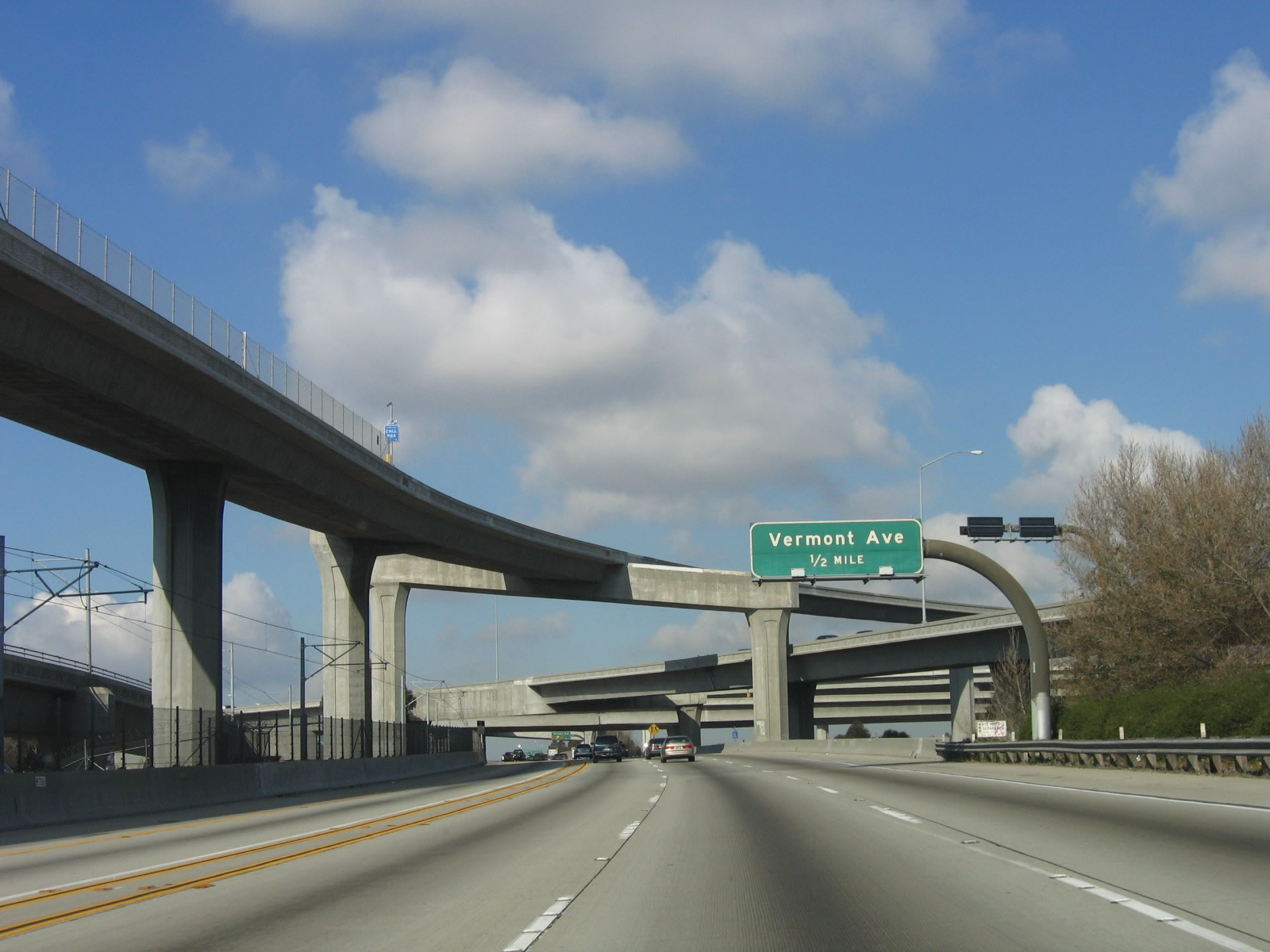
The next exit along Interstate 105/Century Freeway west is Exit 7A, Vermont Avenue. This sign is mounted within the massive Interstate 110 stack interchange. Interstate 105 forms the middle level of the five-level stack. Photo taken 03/18/06. |
|
After the interchange with Interstate 110, the next exit is Exit 7A, Vermont Avenue. Note the structure to the left, which supports the transition of high occupancy vehicle lanes between the two freeways. Photo taken 03/18/06. |
|
A Metro Green Line station is located within the maze of flyover ramps that constitute the interchange between Interstate 105 and Interstate 110. Photo taken 03/18/06. |
|
Another massive flyover ramp links back to Interstate 105 west and allows for Interstate 105 east HOV lanes to link to Interstate 110 HOV lanes north. Photo taken 03/18/06. |
|
The right lane of Interstate 105/Glenn Anderson (Century) Freeway west becomes exit only for Exit 7A, Vermont Avenue. Photo taken 03/18/06. |
|
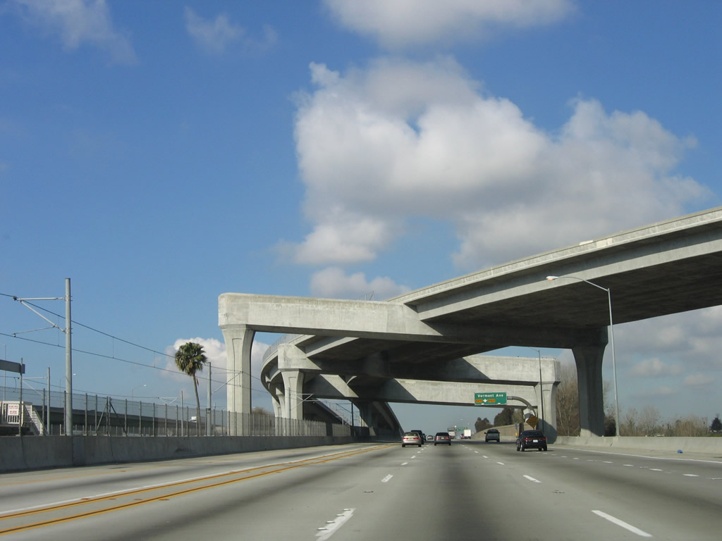
Westbound Interstate 105/Glenn Anderson (Century) Freeway reaches Exit 7A, Vermont Avenue. The next exit along Interstate 105 west is Exit 5, Crenshaw Boulevard (two miles ahead). At this point, Interstate 105 briefly leaves the city of Los Angeles and enters unincorporated Athens. Upon crossing Willow Place, Interstate 105 leaves Athens and enters the city of Hawthorne (population 84,112 as of 2000 Census, incorporated July 12, 1922). Photo taken 03/18/06. |
|
Another Metro Green Line station is located at the Vermont Avenue interchange. Photo taken 03/18/06. |
|
A dedicated radio station provides news and updates associated with Los Angeles International Airport (LAX). Although Interstate 105 does not go directly into the airport, it is considered a primary route to the airport. Photo taken 03/18/06. |
|
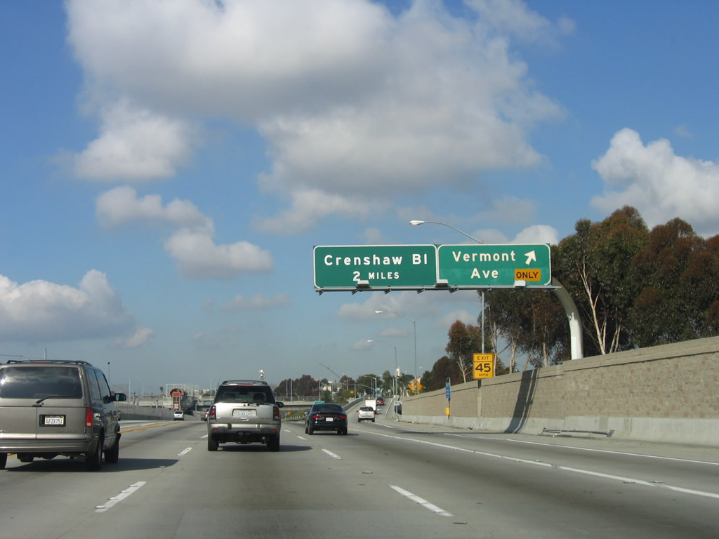
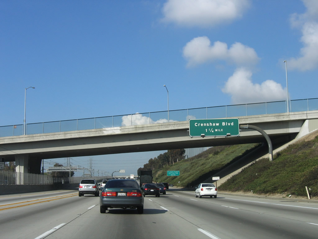
The next exit along westbound Interstate 105 is Exit 5, Crenshaw Boulevard. Photo taken 03/18/06. |
|
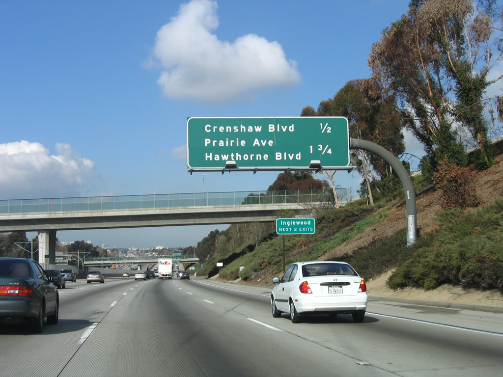
This mileage sign along Interstate 105/Glenn Anderson (Century) Freeway west provides the distance to Exit 5, Crenshaw Boulevard and Exit 3, Prairie Avenue and Hawthorne Boulevard. Both exits serve the city of Inglewood. Photo taken 03/18/06. |
|
The right lane becomes exit-only for Crenshaw Boulevard (Exit 5). Originating in Torrance, Crenshaw passes through a variety of communities before reaching Wilshire Boulevard north of Interstate 10 (Santa Monica Freeway). Photo taken 08/15/03. |
|
Westbound Interstate 105/Glenn Anderson (Century) Freeway reaches Exit 5, Crenshaw Boulevard, a two-lane exit. The next exit is Exit 3, Prairie Avenue and Hawthorne Boulevard. Photo taken 03/18/06. |
|
Another Metro Green Line station is located at the Crenshaw Boulevard. Photo taken 03/18/06. |
|
Interstate 105 remains mostly in Hawthorne, but to the north the freeway skirts the southern edge of the city of Inglewood (population 112,580 as of 2000 Census, incorporated February 14, 1908). Photo taken 03/18/06. |
|
This mileage sign along Interstate 105/Glenn Anderson (Century) Freeway west provides the distance to Exit 3, Prairie Avenue and Hawthorne Boulevard and Exit 2B, Interstate 405 (San Diego Freeway). Photo taken 03/18/06. |
|
This Interstate 105 west reassurance shield is posted after the on-ramp from Crenshaw Boulevard. Photo taken 03/18/06. |
|
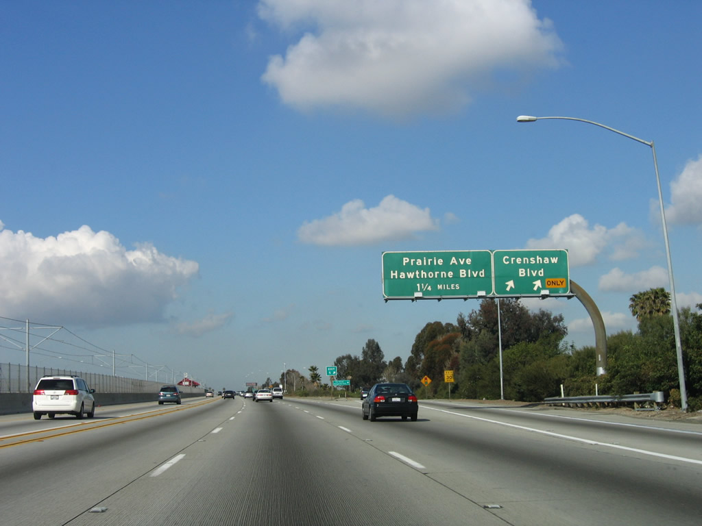
The right lane of Interstate 105 west becomes exit only for Exit 3, Prairie Avenue and Hawthorne Boulevard. Photo taken 03/18/06. |
|
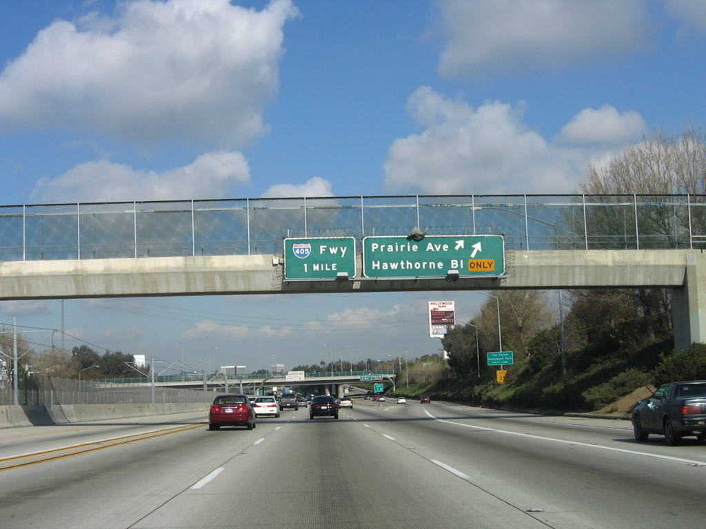
Westbound Interstate 105/Glenn Anderson (Century) Freeway reaches Exit 3, Prairie Avenue and Hawthorne Boulevard. To the south, Hawthorne Boulevard becomes part of the state highway system (California 107) after it crosses Interstate 405 (San Diego Freeway). Speaking of which, the next exit is Exit 2B, Interstate 405 (San Diego Freeway). At this interchange, Interstate 105 will leave Hawthorne and reenter Los Angeles. Photo taken 03/18/06. |
|
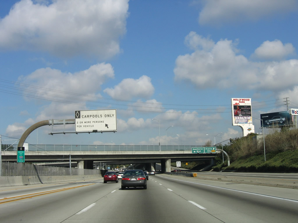
This view shows the off-ramp to Prairie Avenue and Hawthorne Boulevard. Unlike the interchange between Interstate 105 and Interstate 110, there is no direct carpool/high occupancy vehicle lane connection between Interstate 105 and Interstate 405. Therefore, carpools must exit the restricted left lanes here and cross the other travel lanes to reach the exit for Interstate 405. Photo taken 03/18/06. |
|
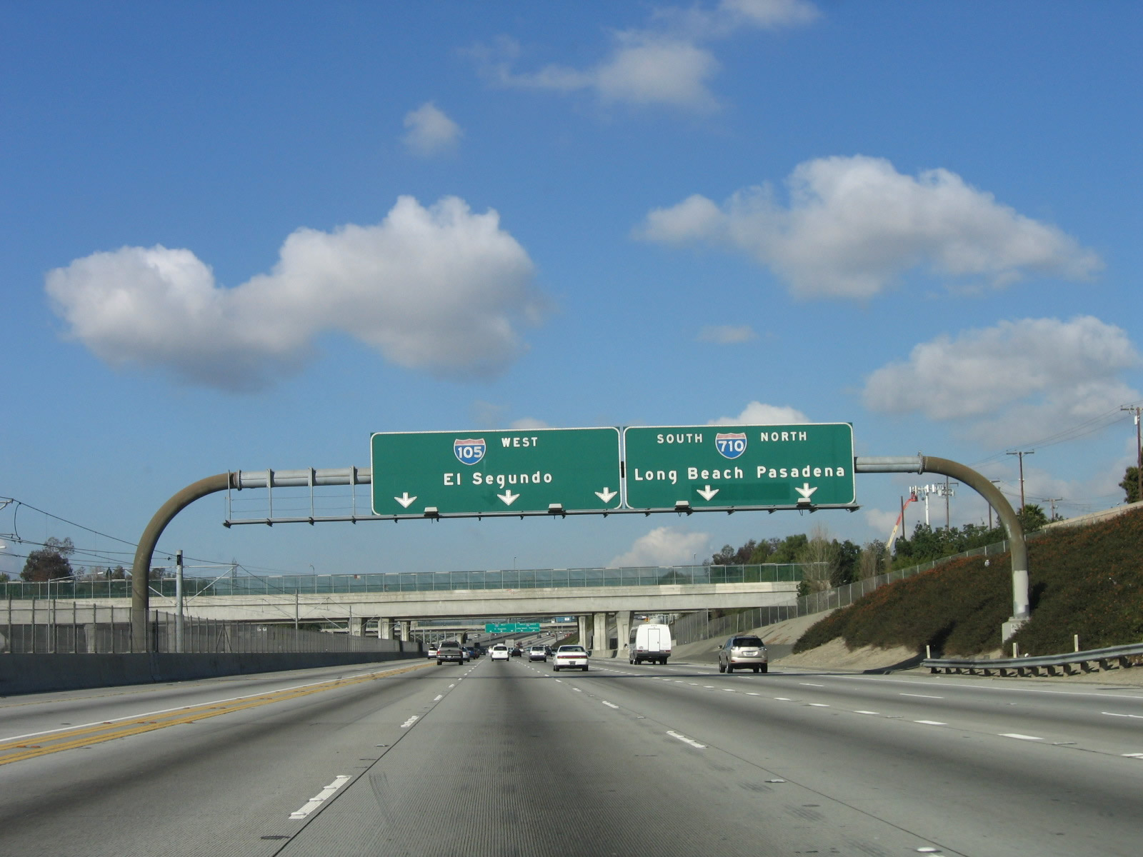
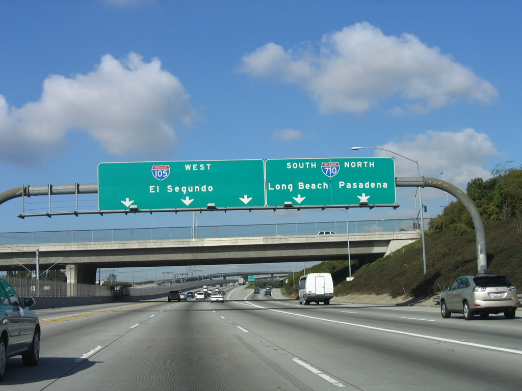
This overhead guide sign provides the lane allocation between Interstate 105 west and Interstate 405 north/south. Photo taken 03/18/06. |
|
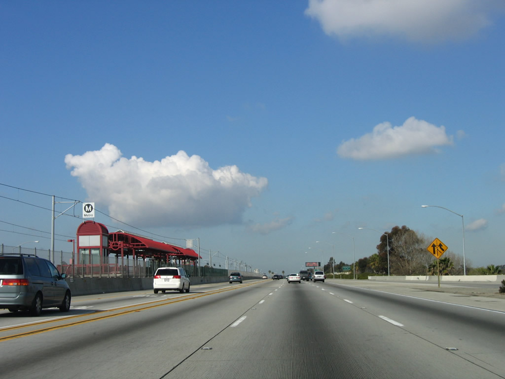
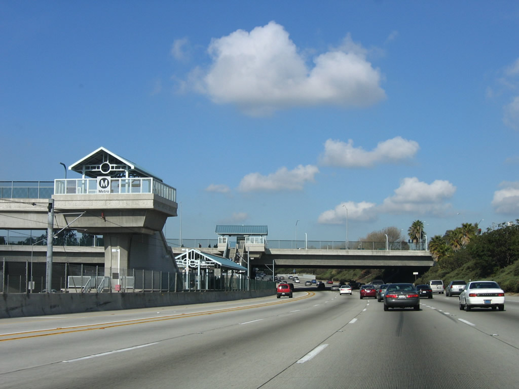
Another Metro Green Line station is located near the Prairie Avenue/Hawthorne Boulevard interchange. Photo taken 03/18/06. |
|
Westbound Interstate 105/Glenn Anderson (Century) Freeway reaches Exit 2B, Interstate 405 (San Diego Freeway). Interstate 405 travels north to San Fernando Valley and connects with northbound Interstate 5; it heads south toward Long Beach and Orange County. Note the control city; it used to be El Segundo and is now Los Angeles International (LAX) Airport. Photo taken 03/18/06. |
|
The interchange between Interstate 105 and Interstate 405, as noted by the green guide sign, is named after Sadao S. Munemori, who received the Medal of Honor in World War II. The designation is more meaningful than others since it has a very brief description of the accomplishments of Sadao S. Munemori. Photo taken 03/18/06. |
|
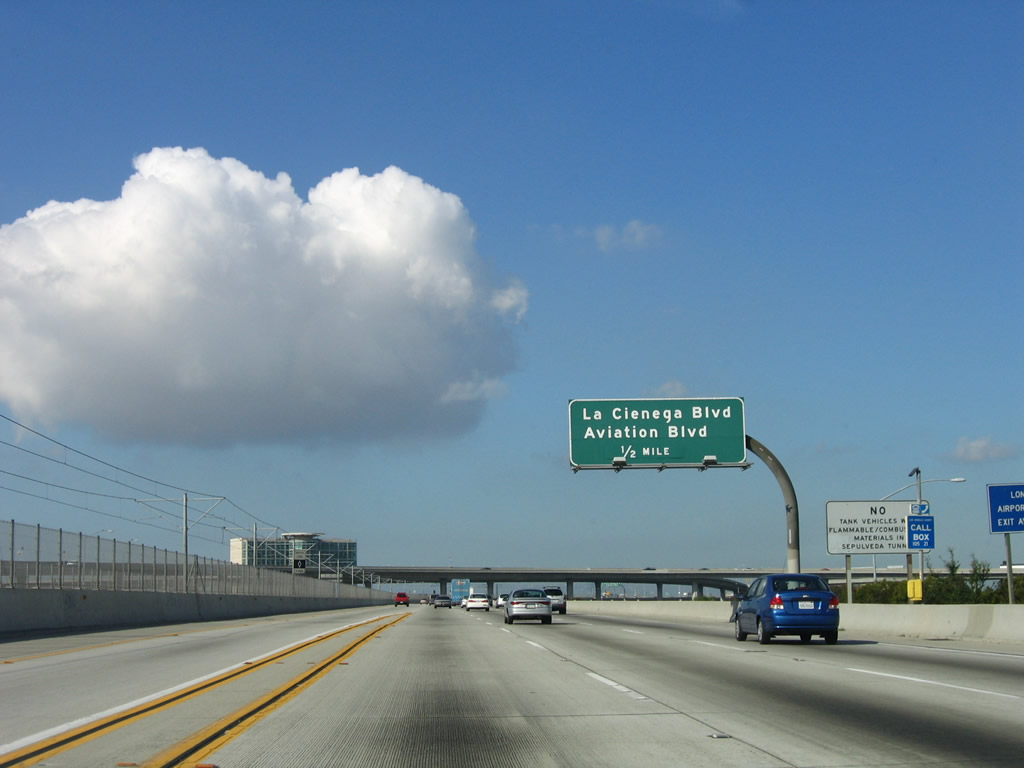
After the interchange with Interstate 405, the next exit is Exit 2A, La Cienega Boulevard/Aviation Boulevard. Note that the light rail, which has been located in the center median for the entire length Interstate 105 to this point, will soon drop to grade. The last half-mile or so of Interstate 105 is not paralleled by the light rail system. Also, the high occupancy vehicle lanes end near here too. Photo taken 03/18/06. |
|
Westbound Interstate 105 reaches Exit 2A, La Cienega Boulevard and Aviation Boulevard. La Cienega Boulevard runs north-south briefly in the shadow of Interstate 405, then splits north as Interstate 405 turns northwest toward Santa Monica. La Cienega Boulevard then becomes a pseudo-freeway after it splits away from Interstate 405 and follows the path of the unconstructed California 170/Laurel Canyon Freeway. After passing through the Baldwin Hills, La Cienega Boulevard links with Venice Boulevard and Interstate 10. North-south Aviation Boulevard parallels La Cienega Boulevard, and it passes through the eastern fringes of the airport property. Photo taken 08/15/03. |
|
The remaining distance of Interstate 105 is elevated and separated from the Metro Green Line. Photo taken 03/18/06. |
|
Los Angeles International Airport spreads out in front of westbound travelers as if on a canvas. The control tower and distinctive architecture are readily apparent on the final mile of Interstate 105. In fact, the first two of the remaining four exits (Nash Street and Northbound California 1) provide some access to the airport. Upon crossing Aviation Boulevard, Interstate 105 again leaves Los Angeles and enters the city of El Segundo (population 16,033 as of 2000 Census, incorporated January 18, 1917). Photo taken 03/18/06. |
|
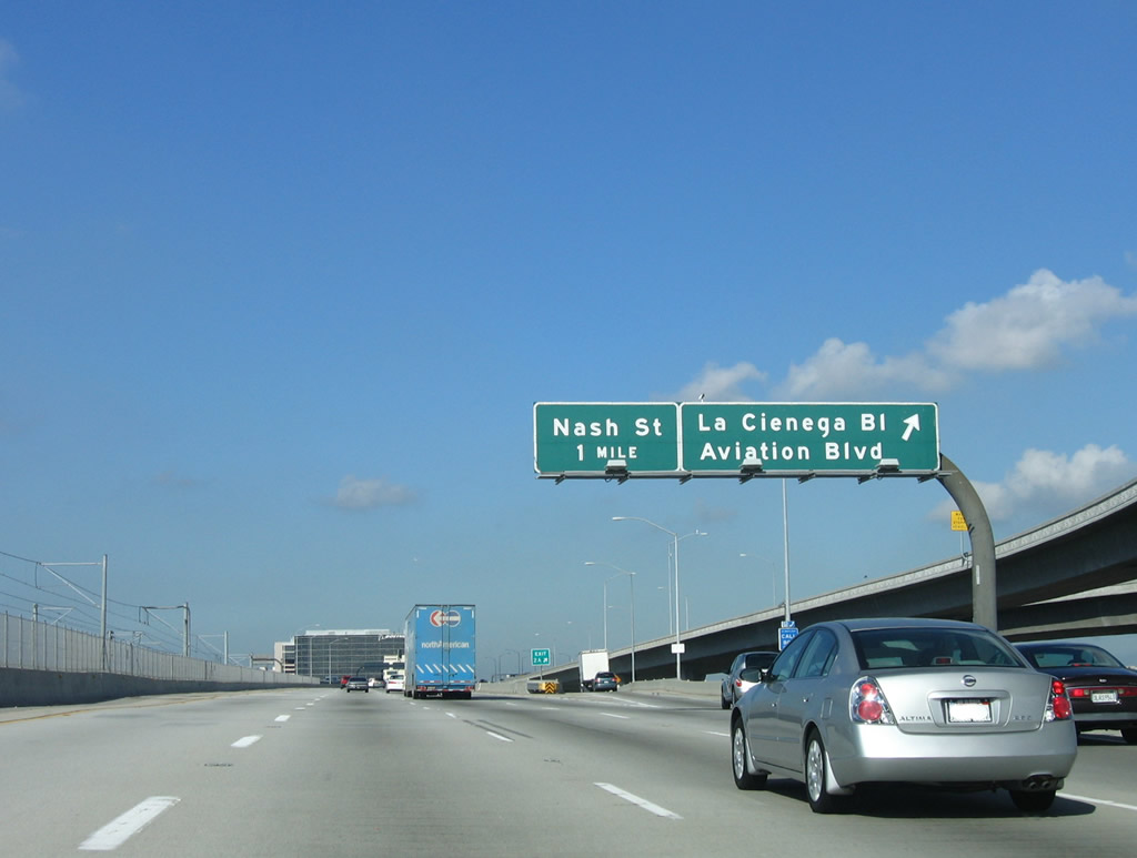
This mileage sign provides the distance to the final four exits along Interstate 105 west: Exit 1D, Nash Street; Exit 1C, California 1/Sepulveda Boulevard north; Exit 1B, California 1/Sepulveda Boulevard south; and Exit 1A, Imperial Highway (Left Exit). Photo taken 03/18/06. |
|
Westbound Interstate 105/Glenn Anderson (Century) Freeway reaches Exit 1D, Nash Street. The next exits are Exits 1C-B, California 1/Sepuvelda Boulevard. Although California 1 is the Pacific Coast Highway, it is not particularly close to the ocean along this stretch, preferring to remain east of the airport and passing through several major commercial properties en route to Santa Monica. Photo taken 03/18/06. |
|
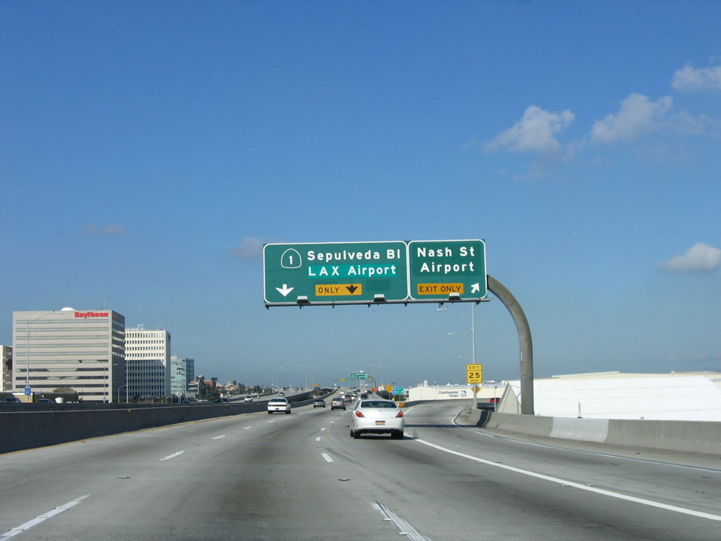
Now on a viaduct passing along the southern boundary of Los Angeles International Airport, westbound approaches the last three exits. The first exit is Exit 1C, northbound California 1/Sepuvelda Boulevard, which connects to the main airport entrance. The Sepulveda Tunnel, which passes under a runway, lies just north of Interstate 105 and may be accessed from Exit 1C. Photo taken 03/18/06. |
|
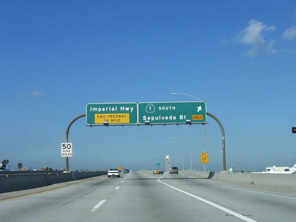
Westbound Interstate 105/Glenn Anderson (Century) Freeway reaches Exit 1B, California 1/Sepulveda Boulevard (Pacific Coast Highway) south. The left lanes default onto Exit 1A, Imperial Highway. Interstate 105 comes to its end in a quarter-mile, when the freeway ends. Photo taken 03/18/06. |
|
This is the gore point for Exit 1B, California 1 south. Photo taken 03/18/06. |
|
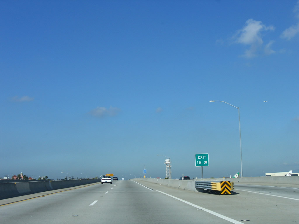
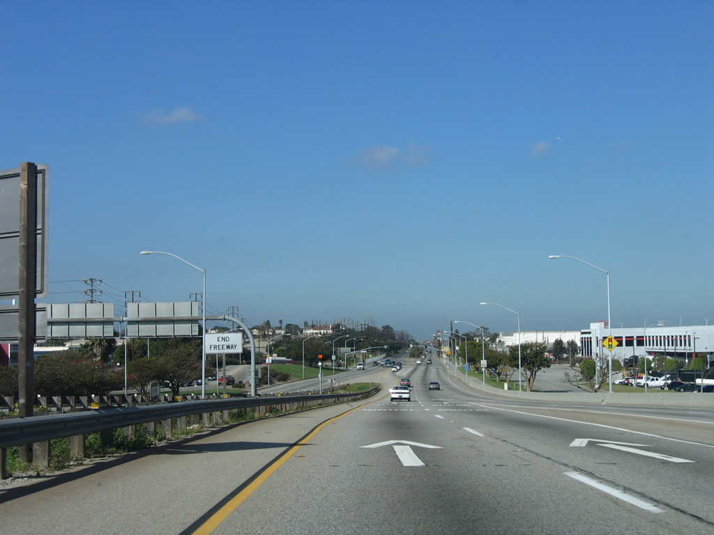
After passing California 1/Sepuvelda Boulevard, Interstate 105 descends from the viaduct and approaches its western end. Note the decrease in speed limit through here. A white, end freeway sign is located on the right shoulder immediately after the yellow overhead warning sign. There is no end Interstate 105 shield assembly here. Photo taken 03/18/06. |
Page Updated September 11, 2010.