

Interstate 280 North - San Francisco City / County
| Interstate 280 north | |
|---|---|
 |
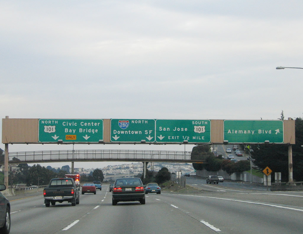
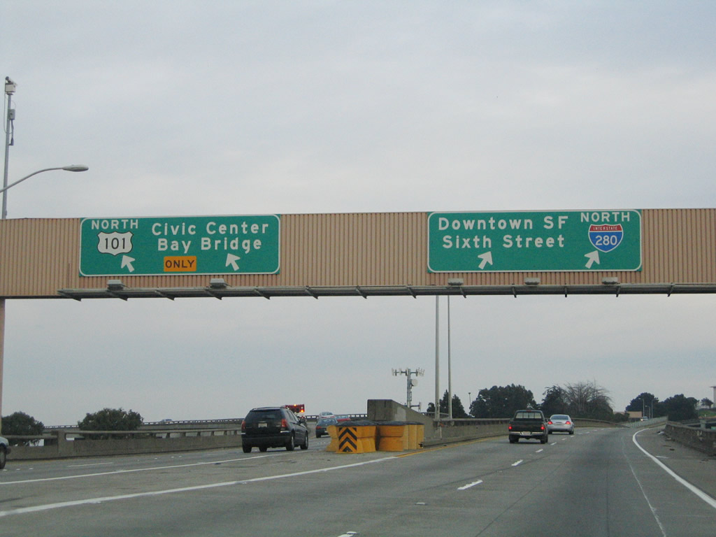
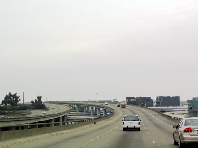
Now reaching the split, northbound California 1 takes the three left lanes, while northbound Interstate 280 takes the three right lanes. California 1 quickly reverts to a city street (19th Avenue), avoiding the city center but still carrying a great deal of traffic. Interstate 280, meanwhile, continues northeast toward U.S. 101 and the Embarcadero. Both routes now enter the city and county of San Francisco. The city of San Francisco is the only city-county combined jurisdiction in the state of California. Due to its location on a peninsula surrounded by the Pacific Ocean, Golden Gate, and San Francisco Bay, fog is common especially in summer months when colder oceanic area collides with hot dry air from inland (Central Valley). The city also sits near the San Andreas Fault, which spans the state of California and is capable of producing a large-scale earthquake. San Francisco was founded in 1776 and incorporated on April 15, 1850. The city is home to a large minority population (including immigrants) and is likely the most densely populated city in California. As of the 2000 Census, San Francisco was home to 776,733 people, but that figure has dropped per 2006 estimates (744,041 people per State & County QuickFacts for San Francisco City / County. Photo taken 11/26/04. |
 |
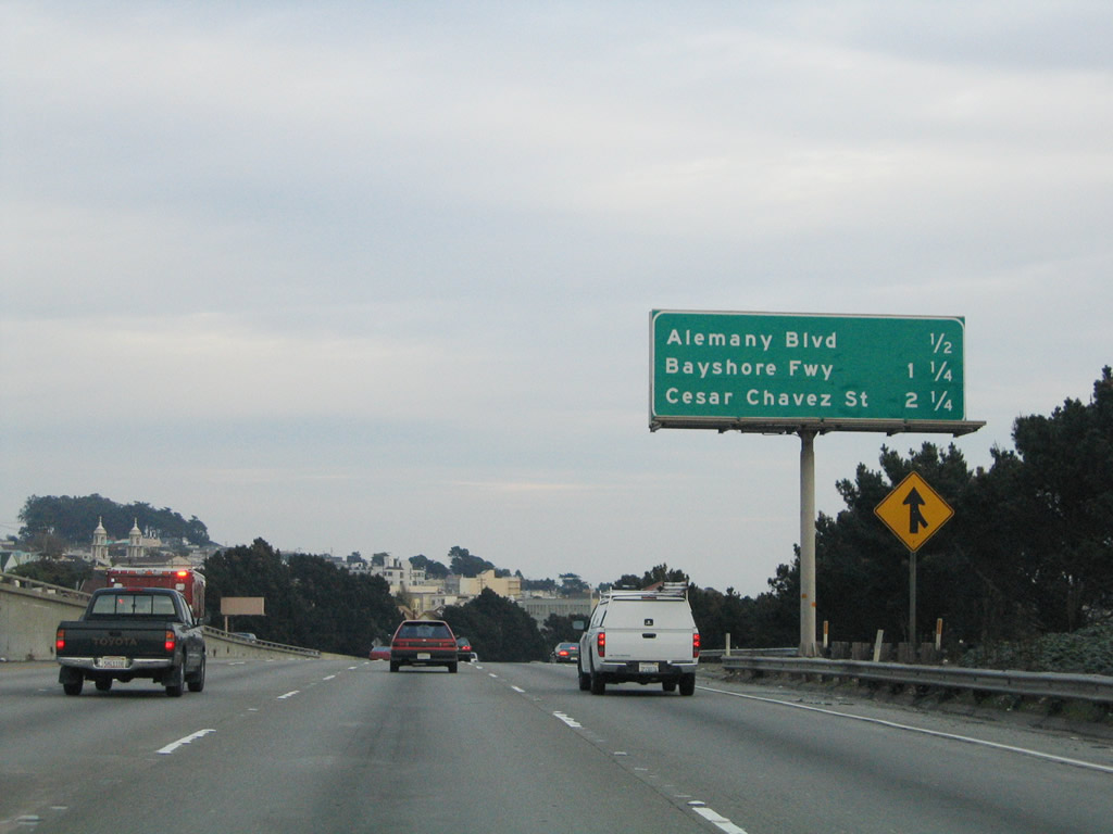
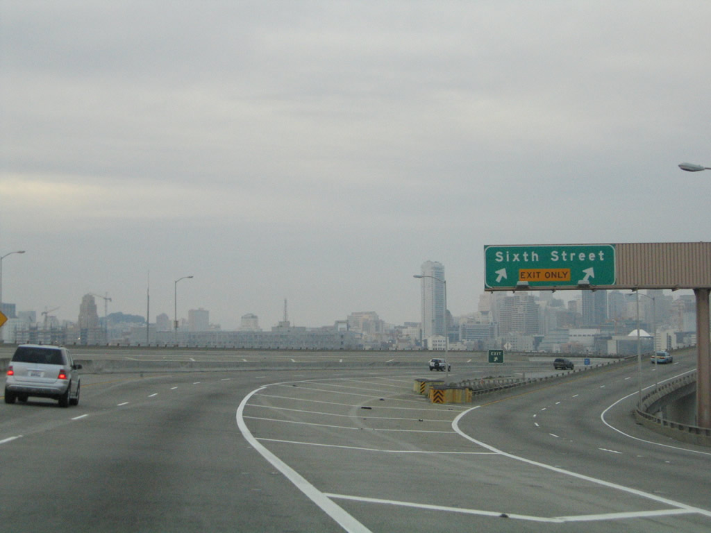
Now split from California 1, this mileage sign along northbound Interstate 280 provides the distance to Exit 51, Geneva Avenue/Ocean Avenue; Exit 52, San Jose Avenue/Bosworth Street; and Exit 53, Alemany Boulevard. Most of the button copy, non-reflective signs within San Francisco City / County have been replaced with reflective signs, as evidenced in the remaining signs along northbound Interstate 280. However, these signs were largely installed prior to the exit numbering directive from 2002. Photo taken 11/26/04. |
 |
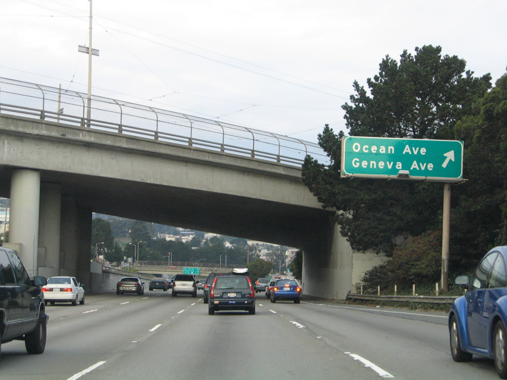
There is no connection from northbound Interstate 280 to southbound California 82, but traffic from California 82 (El Camino Real) merges onto northbound Interstate 280 near here. This marks the northern terminus of California 82. As a result of this, California 82 barely enters the City/County of San Francisco before coming to its end. Geneva Avenue leads southeast toward Brisbane, while Ocean Avenue leads northwest back toward California 1 and 19th Avenue. Photo taken 11/26/04. |
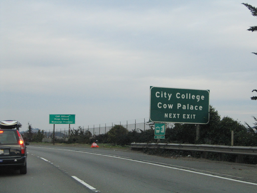 |
Use Exit 51 to the Cow Palace and San Francisco City College. Photo taken 11/26/04. |
 |
Northbound Interstate 280 reaches Exit 51, Geneva Avenue/Ocean Avenue. This exit leads to San Francisco City College, which is bounded on the south side by Ocean Avenue. The name implies that Ocean Avenue continues west all the way to the beach, but in reality it ends just before the ocean, terminating just east of California 35 (Skyline Boulevard) next Lake Merced. Through this stretch, Interstate 280 is angled on a northeastern trajectory. The freeway is closely paralleled by Alemany Boulevard (an exit for this route is just ahead), San Jose Avenue (which follows along the freeway until Exit 52, then turns north), and Mission Street (which also travels northeast, but avoids a direct interchange with Interstate 280). Photo taken 11/26/04. |
 |
San Jose Avenue connects with the Mission District, Mission Dolores, Eureka Valley/Dolores Heights, and Noe Valley. Bosworth Street turns northwest from its intersection with San Jose Avenue to enter Glen Park en route to Westwood Highlands. After changing its name to Oshaughnessy Boulevard, the street reaches Portola Drive and Twin Peaks. Alemany Boulevard, which is closely parallel to Interstate 280, actually overlays the freeway upon reaching that interchange. U.S. 101 is the Bayshore Freeway, the last freeway-to-freeway interchange along northbound Interstate 280. Photo taken 11/26/04. |
 |
Northbound Interstate 280 approaching Exit 52, San Jose Avenue/Bosworth Street. It sure would be nice if there were some consistency on the naming of these exits, since Bosworth Street is only present on one of the multiple advance signs for Exit 52. Photo taken 11/26/04. |
 |
Northbound Interstate 280 at Exit 52, San Jose Avenue/Bosworth Street. San Jose Avenue leads northeast toward Saint Luke's Hospital; Guerrero Street, Mission Street, and Van Ness Avenue all emerge from that area (around Cesar Chavez Street, formerly Army Street) to continue northbound. Photo taken 11/26/04. |
 |
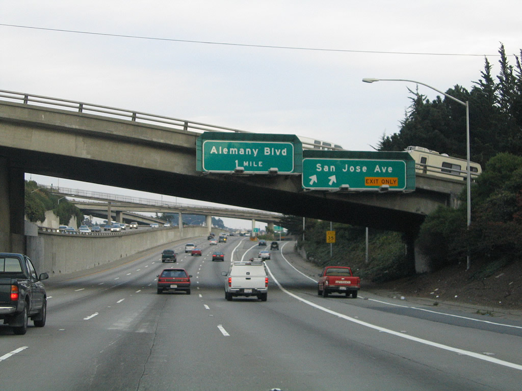
This mileage sign refers to U.S. 101 as the Bayshore Freeway rather than U.S. 101, even though most new reflective signs tend to de-emphasize the name of the freeway in favor of the numerical designation. The next exit is Exit 53, Alemany Boulevard, followed by Exit 54, U.S. 101 (Bayshore Freeway), and Exit 55, Cesar Chavez Street. Photo taken 11/26/04. |
 |
The Alemany Boulevard exit is 0.25 mile ahead on Interstate 280 (Southern Freeway) north. Photo taken 11/26/04. |
 |
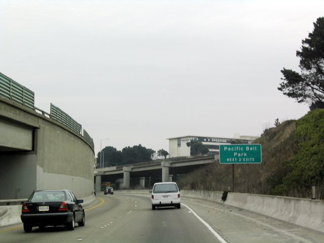
Oracle Park, home of the Major League Baseball San Francisco Giants, lies just beyond the north end of I-280. This stadium changed names several times due to mergers through the late 1990s and early/mid-2000s: Pacific Bell Ballpark, then SBC Ballpark, and then AT&T Park and now Oracle Ballpark. Photo taken 11/26/04. |
 |
In addition, Interstate 280 provides the most direct route from here to most San Francisco tourist attractions, including Chinatown, North Beach, and the Embarcadero (including Fisherman's Wharf and Pier 39). Photo taken 11/26/04. |
 |
Northbound Interstate 280 (Southern Freeway) reaches Exit 53, Alemany Boulevard. At this point, Interstate 280 enters the Alemany Maze Interchange, which features some interesting ramp connections between Interstate 280 and U.S. 101. Be sure to follow the signs closely. Note the left exit to U.S. 101 (Bayshore Freeway) north to Interstate 80 and the San Francisco-Oakland Bay Bridge. Only two through lanes will carry Interstate 280 north toward Oracle Ballpark and its eventual northern terminus at 5th Street. The freeway rests in the median of Alemany Boulevard briefly here, and Alemany Boulevard rejoins just prior to the U.S. 101 (Bayshore Freeway) interchange. Alemany Boulevard comes to its northeastern terminus at its intersection with Bayshore Boulevard (old U.S. 101) and Industrial Street. The next exit is U.S. 101, with left lanes accessing northbound and right lanes accessing southbound. Through traffic to Interstate 80 and the Bay Bridge should use U.S. 101 north rather than Interstate 280 north. Photo taken 11/26/04. |
 |
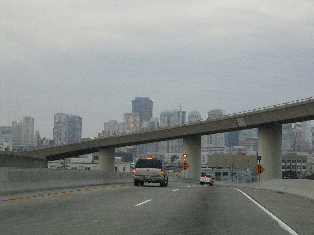
Immediately thereafter, northbound Interstate 280 (Southern Freeway) reaches Exit 54A, U.S. 101 (Bayshore Freeway) south. U.S. 101 follows the west shore of the bay, connecting cities such as South San Francisco, San Bruno, Burlingame, San Mateo, Belmont, San Carlos, Redwood City, Palo Alto, Mountain View, Sunnyvale, and Santa Clara before reaching San Jose, which features a larger population and greater land area than the city and county of San Francisco. Photo taken 11/26/04. |
 |
Having lost the right lane, northbound Interstate 280 now loses its left lane to the ramp for Exit 45B, U.S. 101 (Bayshore Freeway) north to downtown San Francisco. U.S. 101 follows the Bayshore Freeway/James Lick Skyway toward the Civic Center and central portion of San Francisco via Van Ness Avenue and the remnants of the Central Freeway. Interstate 280, meanwhile, continues northeast on a section of double-decked freeway that was damaged severely during the 1989 Loma Prieta Earthquake. In spite of its numbering, Interstate 280 does not meet Interstate 80, and some city street driving is required to reach the access ramp onto eastbound Interstate 80 at Fifth Street or Second Street and Bryant Street. Photo taken 11/26/04. |
 |
To approach Oracle (formerly Pacific Bell) Ballpark from the south, motorists may opt to use Exit 55/Cesar Chavez Street or Exit 56/Mariposa Street, then take 3rd Street north to the parking lots located southeast of the ballpark. Photo taken 11/28/03. |
 |
Immediately after passing the U.S. 101 interchange, northbound Interstate 280 becomes an elevated freeway, and the northbound lanes drop to the lower deck of a brief double-decked viaduct. With only two lanes, the freeway is very narrow, especially compared to the eight-lane sections between San Jose and the San Francisco city / county line. Somewhere within this viaduct section is the exit for Exit 55, Cesar Chavez Street. The exit ramp itself is actually a quarter-mile south of the street; the ramp winds its way down to Cesar Chavez Street. Photo taken 11/26/04. |
 |
The next exit along northbound Interstate 280 is Exit 55, Cesar Chavez Street (one-half mile). Photo taken 11/26/04. |
 |
Use Exit 55 (Cesar Chavez Street) to the Port of San Francisco, which is located along the bayfront. Photo taken 11/26/04. |
 |
The northbound lanes of Interstate 280 follow the lower deck of this double-deck structure for a mile or so northeast of the Alemany Maze interchange. The next exit is Exit 55, Cesar Chavez Street (right lane). Photo taken 11/26/04. |
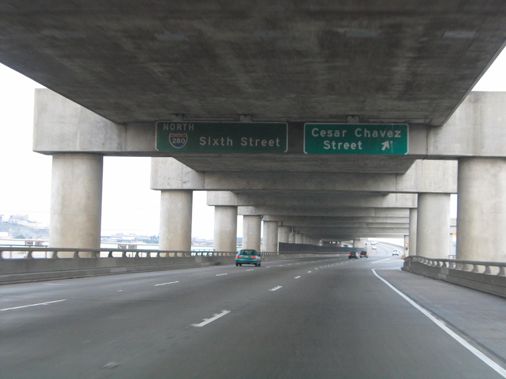 |
Northbound Interstate 280 reaches Exit 55, Cesar Chavez Street. The left three lanes continue north on Interstate 280, which will end at 5th Street and 6th Street south of downtown San Francisco. Photo taken 11/26/04. |
 |
The ramp to Cesar Chavez Street is two lanes wide, and after the gore point, the double-decker freeway section of Interstate 280 comes to an end. This section of freeway was repaired substantially after the Loma Prieta Earthquake of October 1989. Photo taken 11/26/04. |
 |
 |
Now on an elevated viaduct, Interstate 280 offers commanding views of the cityscape to the north. The downtown skyline, Bay Bridge, ballpark, and bay dominate the view. Photos taken 11/26/04 and 11/28/03. |
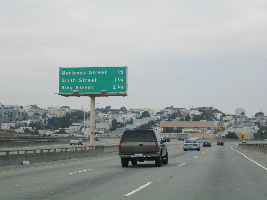 |
Mileage sign for Exit 56, Mariposa Street; Exit 57, 6th Street; and King Street (all traffic must exit onto King Street; the freeway ends at the intersection with 5th Street). Photo taken 11/26/04. |
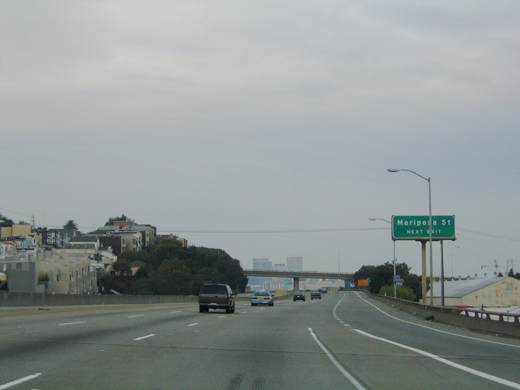 |
Interstate 280 remains above grade on a viaduct as it approaches Exit 56, Mariposa Street. This the last normal exit along northbound, and the Interstate 280 shield is the last reassurance shield. Photo taken 11/26/04. |
 |
This is the last reassurance shield for Interstate 280 north on the mainline. Photo taken 11/26/04. |
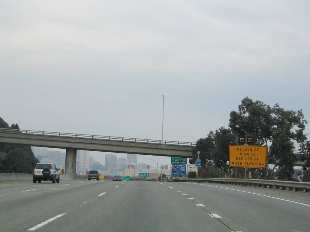 |
Exit 56/Mariposa Street provides access to the Giants' Lot B, adjacent to Oracle Park. During game events, the King Street access to the ballpark can result in congestion, so this sign advises motorists to use 6th Street during those times (especially for through traffic to downtown or the Embarcadero). Photo taken 11/26/04. |
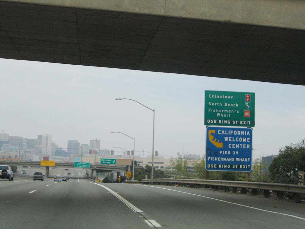 |
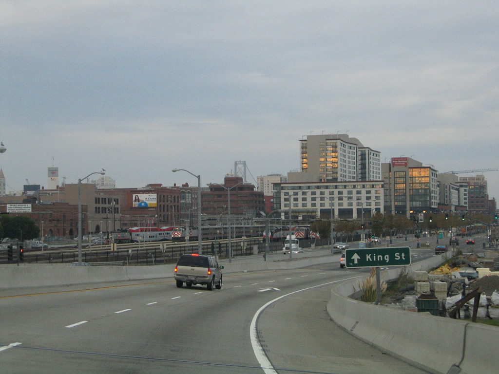
This sign advises motorists to take King Street (rather than 6th Street or 4th Street) to reach the many attractions and neighborhoods of San Francisco, including Fisherman's Wharf, Pier 39, the Embarcadero, Chinatown, and North Beach. If you stay on northbound Interstate 280, the freeway will automatically default onto northeastbound King Street, which in turn becomes the Embarcadero upon reaching the bayfront. Photo taken 11/26/04. |
 |
Northbound Interstate 280 reaches Exit 56, Mariposa Street. Photo taken 11/26/04. |
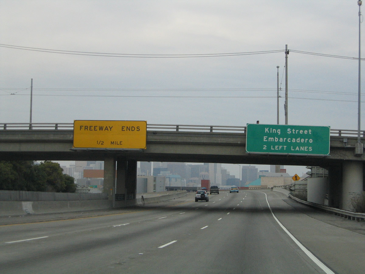 |
The freeway ends in one-half mile from here. The two left lanes default onto King Street, while the right lane exits onto northbound 6th Street (Exit 57). Photo taken 11/26/04. |
 |
Downtown San Francisco comes into view on Interstate 280 north. Photo taken 11/26/04. |
 |
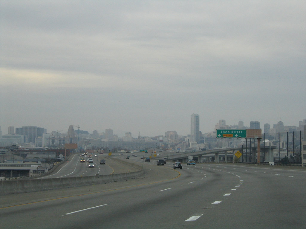
On a clear day, this view of downtown would be even more dramatic as we approach Exit 57, 6th Street. Photo taken 11/26/04. |
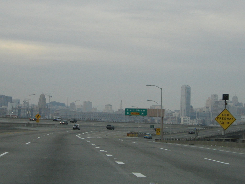 |
An end freeway 1/4 MILE sign is posted prior to Exit 57, Sixth Street. Photo taken 11/26/04. |
 |
Northbound Interstate 280 reaches Exit 57, Sixth Street. Through traffic is defaulted onto King Street, although it is not signed here. For travelers intending to reach Interstate 80, follow 6th Street north to Bryant, then left onto the access ramp. Interstate 280 ends only three block south and one block west of this ramp. Photo taken 11/26/04. |
 |
The mainline now becomes the King Street viaduct as it descends toward street level. The 6th Street ramp flies over the top of the mainline as seen in this photo. Photo taken 11/26/04. |
 |
This small roadside sign advises that Interstate 280 now becomes King Street. The viaduct descends to street level. Photo taken 11/28/03. |
 |
Reaching its northern terminus, Interstate 280 ends at this intersection with 5th Street. The ballpark is visible a couple blocks ahead on the right. There are no end shields present. Photo taken 11/26/04. |
 |
Although using 6th Street (Exit 57) was a slightly more direct route to the freeway, you can also reach the Bay Bridge (Interstate 80) and even U.S. 101 by turning left on 3rd Street (next signal) and making a right on Bryant Street, which has a ramp just past 2nd Street onto eastbound Interstate 80. If you want to reach U.S. 101, take 3rd Street north to Harrison, and turn left at the freeway entrance. Photo taken 11/26/04. |
 |
One block later, King Street intersects Third Street. Oracle Park, home of the San Francisco Giants, rests at the southeastern corner of this intersection. For parking, turn right on 3rd Street. For other attractions, take 3rd Street north if you want to reach South of Market, Chinatown, and the Financial District. Continue on King Street if you want to see the Embarcadero, Fisherman's Wharf, and other bayside areas. Photo taken 11/28/03. |

Page Updated February 24, 2008.
|
About Contact Glossary |
In The News Testimonials Interstate Guide |
Social Media:
 |
|
© 2000-23 AARoads.com | All Rights Reserved | Privacy Policy / Terms of Use
|
||