
Interstate 605 North - California 22 to Whittier Boulevard
| Interstate 605 north | |
|---|---|
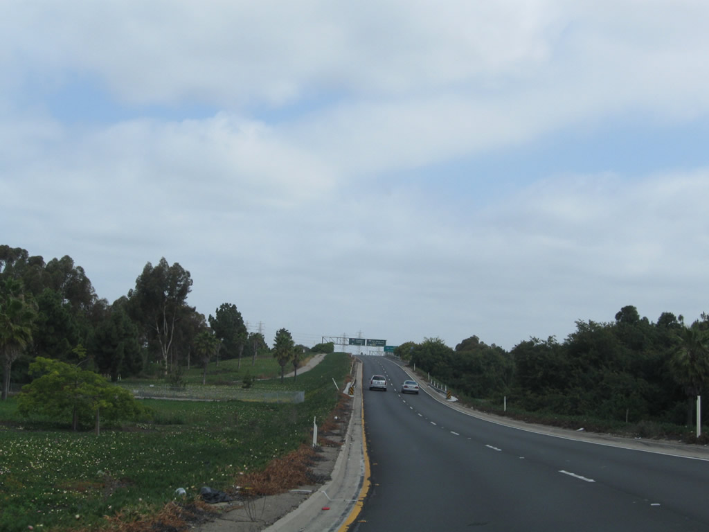 |
After the transition from California 22 (Seventh Street) east, Interstate 605 commences northward toward Duarte. The freeway has two northbound lanes initially, but the freeway soon merges with traffic from Interstate 405 to allow for four northbound lanes. Photo taken 05/02/10. |
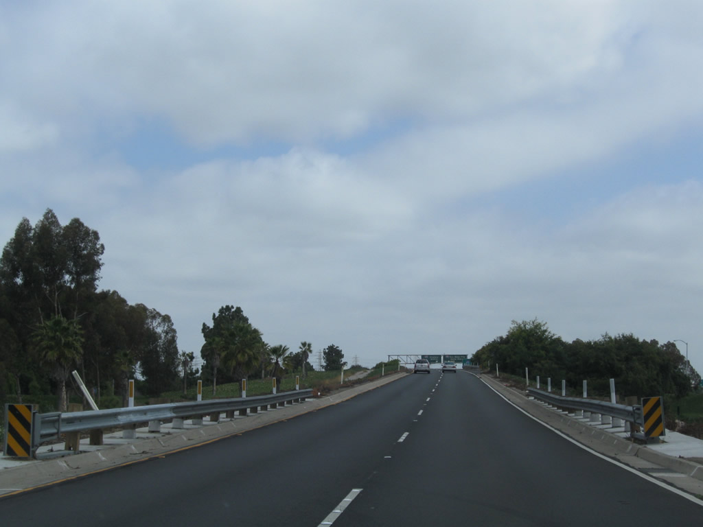 |
This short freeway connector is not quite Interstate standard, with limited or no shoulder. Photo taken 05/02/10. |
 |
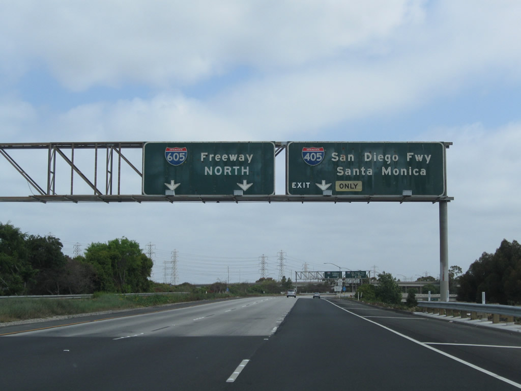
A roadside sign advises that the first exit along Interstate 605 north is Exit 1A, Interstate 405 (San Diego Freeway) north to Los Angeles International Airport, Santa Monica, and Sacramento. Photo taken 05/02/10. |
 |
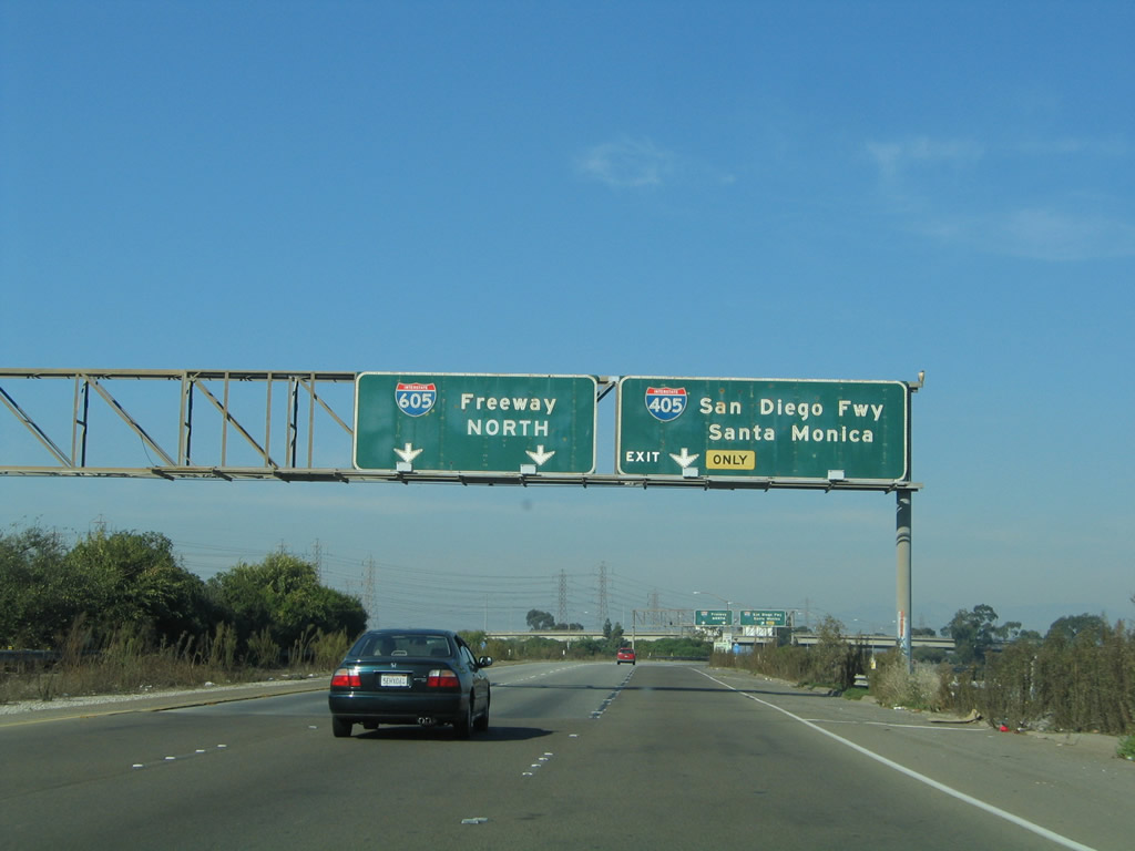 |
The right lane becomes exit only for Interstate 405 (San Diego Freeway) north to Los Angeles International Airport (LAX) and Santa Monica. The left two lanes continue north on Interstate 605 (San Gabriel River Freeway). Photos taken 05/02/10 and 11/13/05. |
 |
 |
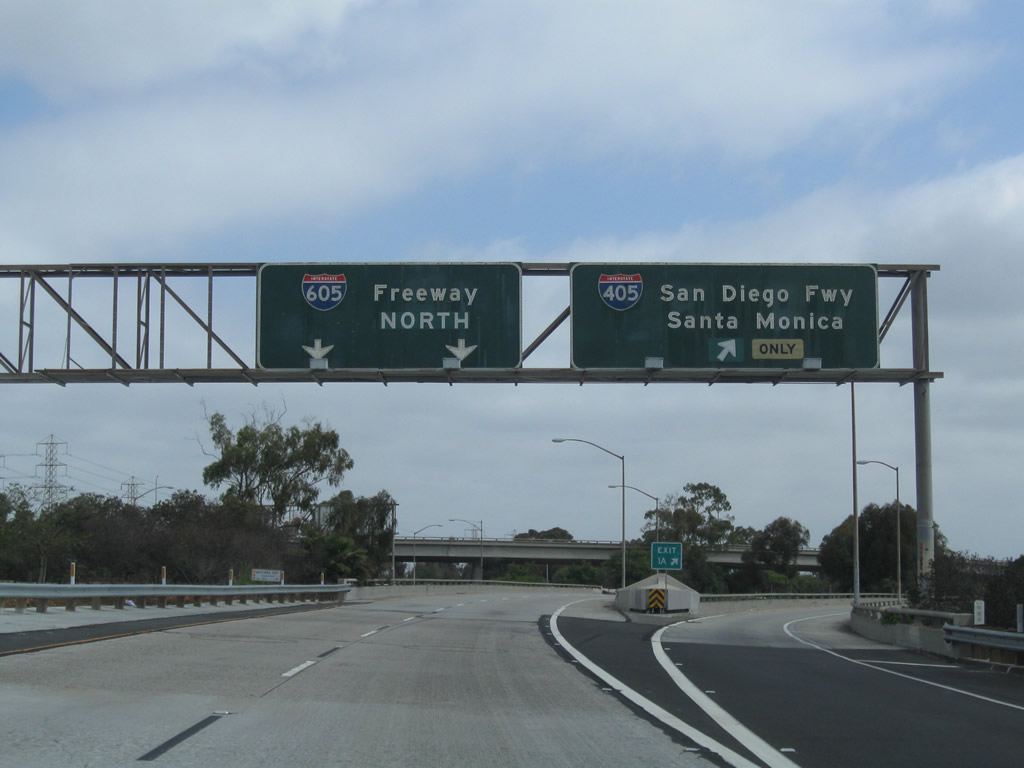
Northbound Interstate 605 (San Gabriel River Freeway) reaches Exit 1A, Interstate 405 (San Diego Freeway) north to Long Beach, LAX, Santa Monica, and points north. Photos taken 05/02/10 and 11/13/05. |
 |
 |
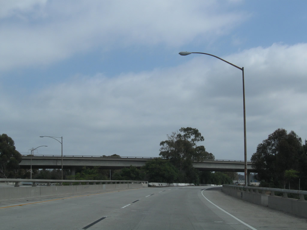
Two lanes carry Interstate 605 north over Interstate 405. Ahead, traffic from Interstate 405 north joins Interstate 605 north. Photos taken 05/02/10. |
 |
 |
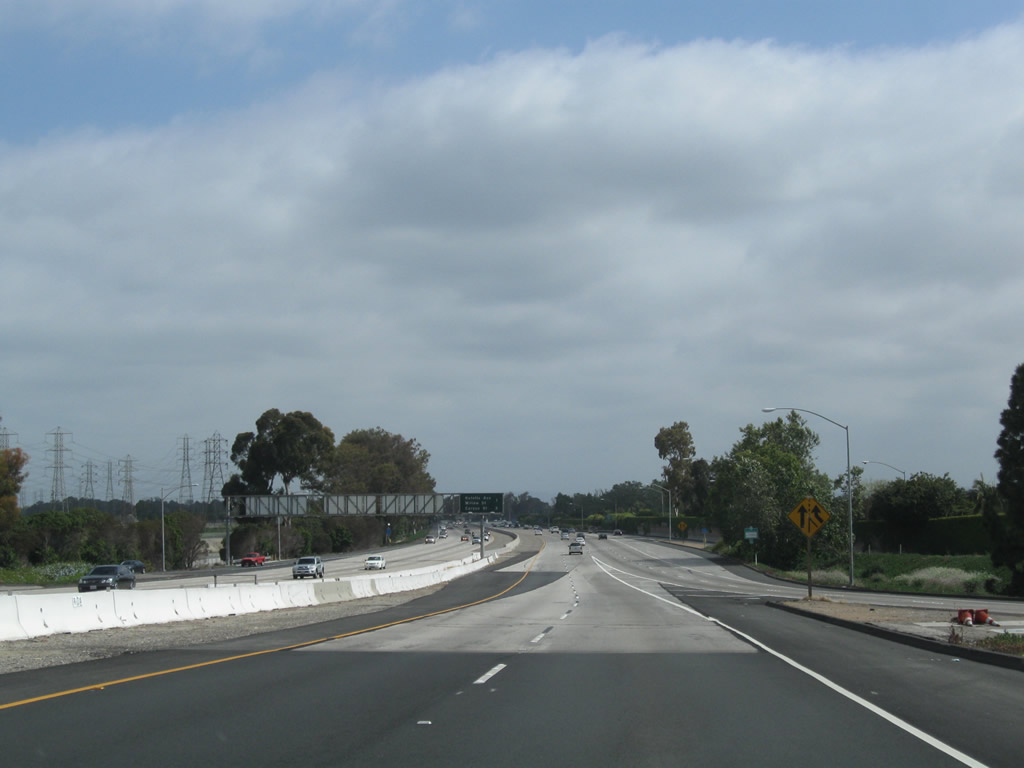
Cresting over Interstate 405's mainline, northbound Interstate 605 prepares to merge with incoming traffic from Interstate 405. The existing two lanes will become the two left lanes, and two new right lanes will merge onto the freeway ahead. Photos taken 05/02/10 and 11/13/05. |
 |
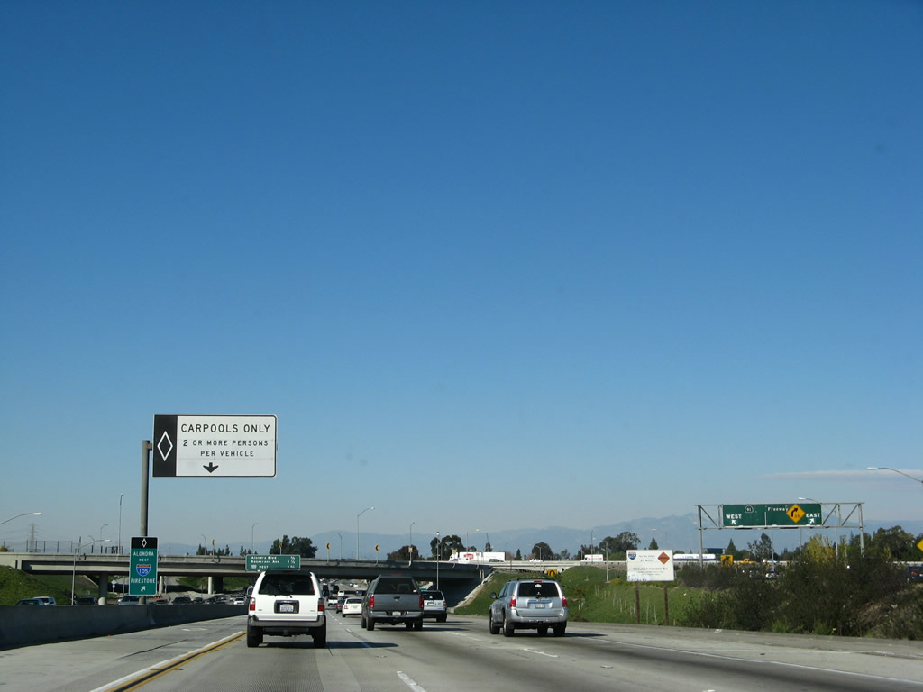
Shifting our focus for a moment, this view shows the transition ramp connecting Interstate 405 (San Diego Freeway) north from Exit 24 to Interstate 605 north. Interstate 605 begins in the city of Seal Beach at the California 22 interchange, but it immediately enters the city of Los Alamitos at the Interstate 405 interchange. The population of Los Alamitos was 11,536 people as of the 2000 Census. Photo taken 01/14/07. |
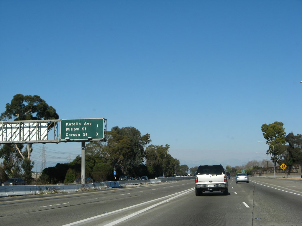 |
Back on the mainline, this interchange sequence sign provides the distance to the next two exits along Interstate 605 north: Exit 1B, Katella Avenue and Willow Street and Exit 3, Carson Street and Lincoln Avenue. Two new lanes merge in from the left; these two lanes come from California 22 in Seal Beach. Photo taken 01/14/07. |
 |
Interstate 605 is known as the San Gabriel River Freeway. Almost the entire length of the freeway closely parallels the San Gabriel River from Seal Beach north to Irwindale. Photo taken 01/14/07. |
 |
A new carpool (high occupancy vehicle) lane forms on the left side of the freeway; the right lane becomes exit only for Exit 1B, Katella Avenue and Willow Street. Photo taken 01/14/07. |
 |
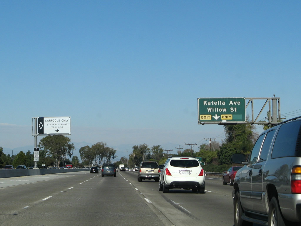
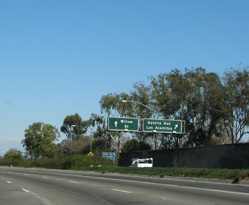
Use Katella Avenue east to unincorporated Rossmoor and the city of Los Alamitos. Use Willow Street west to the city of Long Beach. Photo taken 01/14/07. |
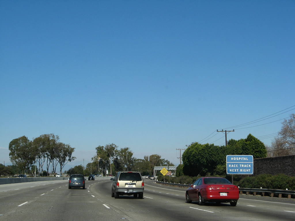 |
A hospital (via eastbound Katella Avenue) and race track are located at this interchange. Photo taken 01/14/07. |
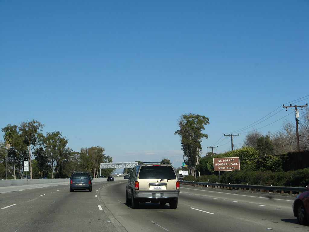 |
Exit 1B to Willow Street west leads motorists to El Dorado Regional Park. Operated by the city of Long Beach, the regional park provides a nature center, hiking, and golf course. Photo taken 01/14/07. |
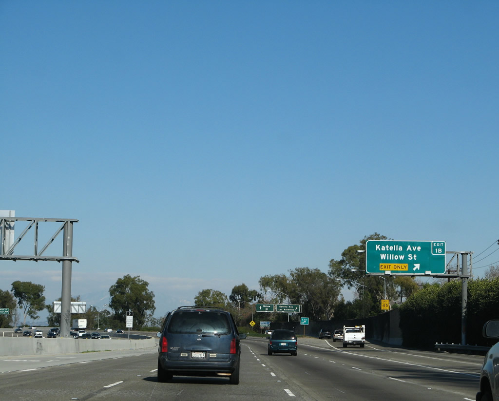 |
Northbound Interstate 605 (San Gabriel River Freeway) reaches Exit 1B, Katella Avenue and Willow Street. Photo taken 01/14/07. |
 |
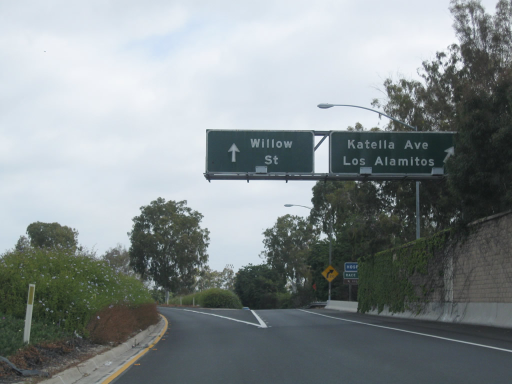 |
This view shows the signage on the off-ramp to Exit 1B as seen from the main lanes of Interstate 605 north. The first ramp connects to Katella Avenue east, and the second ramp loops onto Willow Street west. Photos taken 01/14/07 and 05/02/10. |
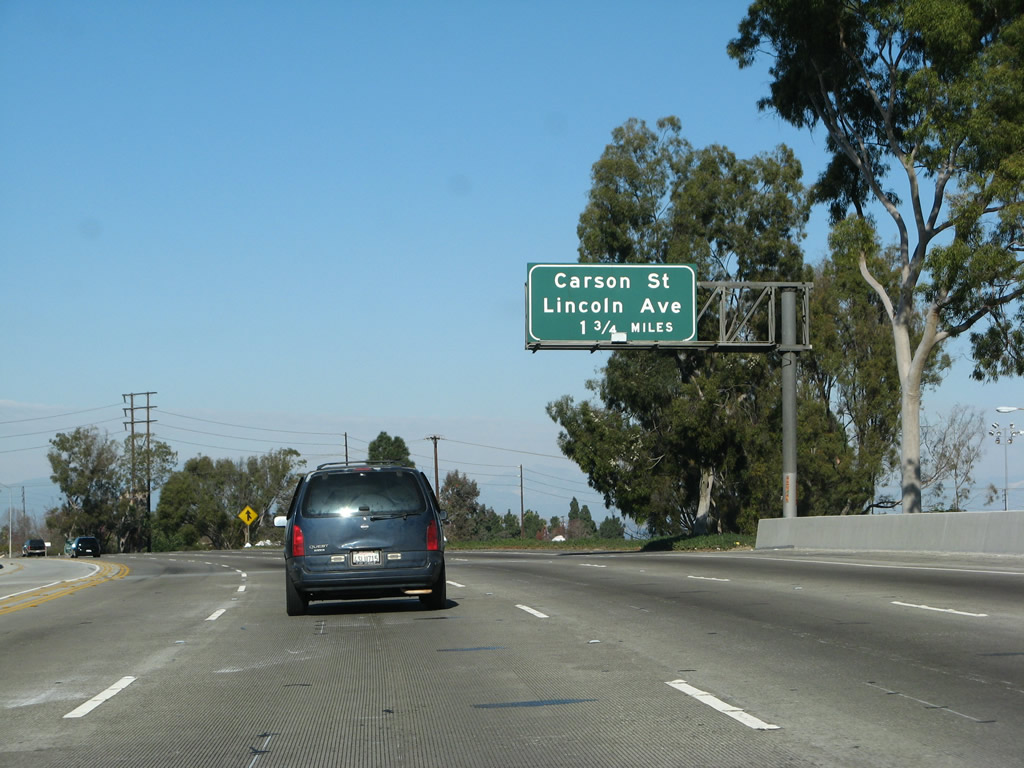 |
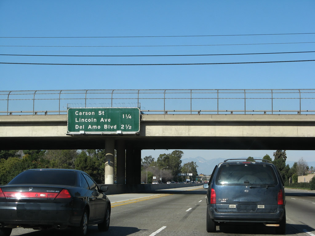
The next exit along Interstate 605 (San Gabriel River Freeway) north is Exit 3, Carson Street and Lincoln Avenue in Los Angeles County. Carson Street leads west into Long Beach and Lakewood, while Lincoln Avenue heads east into Orange County and Anaheim. Photo taken 01/14/07. |
 |
After the Katella Avenue and Willow Street interchange, Interstate 605 leaves Orange County and the city of Los Alamitos and enters Los Angeles County and the city of Long Beach. The second largest city in Los Angeles County, Long Beach is the largest city in California that is not a county seat. It is also home to one of the nation's largest ports at the Port of Long Beach. Incorporated in 1888, Long Beach had a population 461,522 of as of the 2000 Census. Many large city amenities and attractions are available in Long Beach, including the Aquarium of the Pacific, the Queen Mary (1936 ocean liner permanently docked at Long Beach), California State University, Long Beach (CSULB), and Walter Pyramid (home to CSULB's basketball teams). Photo taken 01/14/07. |
 |
This mileage sign along northbound Interstate 605 provides the distance to the next two exits: Exit 3, Carson Street and Lincoln Avenue and Exit 5A, Del Amo Boulevard. The southern two-thirds of Interstate 605 serves the Gateway Cities of southeastern Los Angeles County, which includes all cities and unincorporated areas along its corridor from Long Beach north to the City of Industry near the California 60 (Pomona Freeway) interchange. Photo taken 01/14/07. |
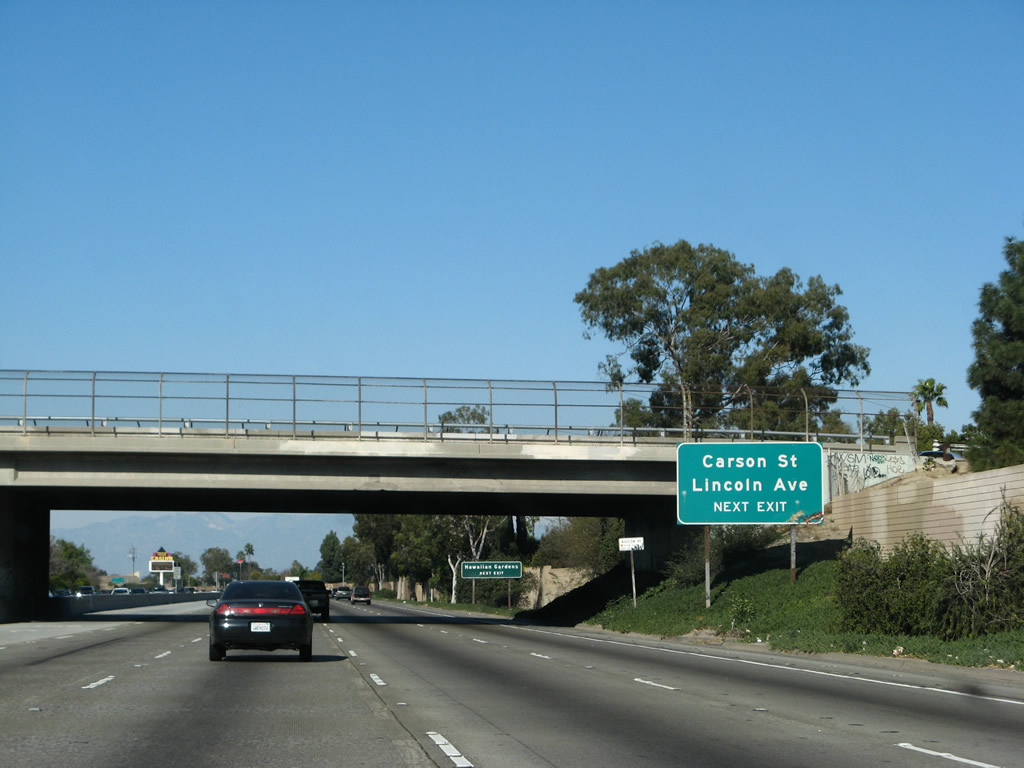 |
A roadside sign for Exit 3, Carson Street and Lincoln Avenue is posted shortly thereafter. Photo taken 01/14/07. |
 |
To the east via Carson Street is the city of Hawaiian Gardens, which consists of one square mile and was home to 14,779 people as of the 2000 Census. Hawaiian Gardens incorporated on April 9, 1964. Photo taken 01/14/07. |
 |
A variable message sign (VMS) provides travel times to Interstate 5 and Interstate 10. Photo taken 01/14/07. |
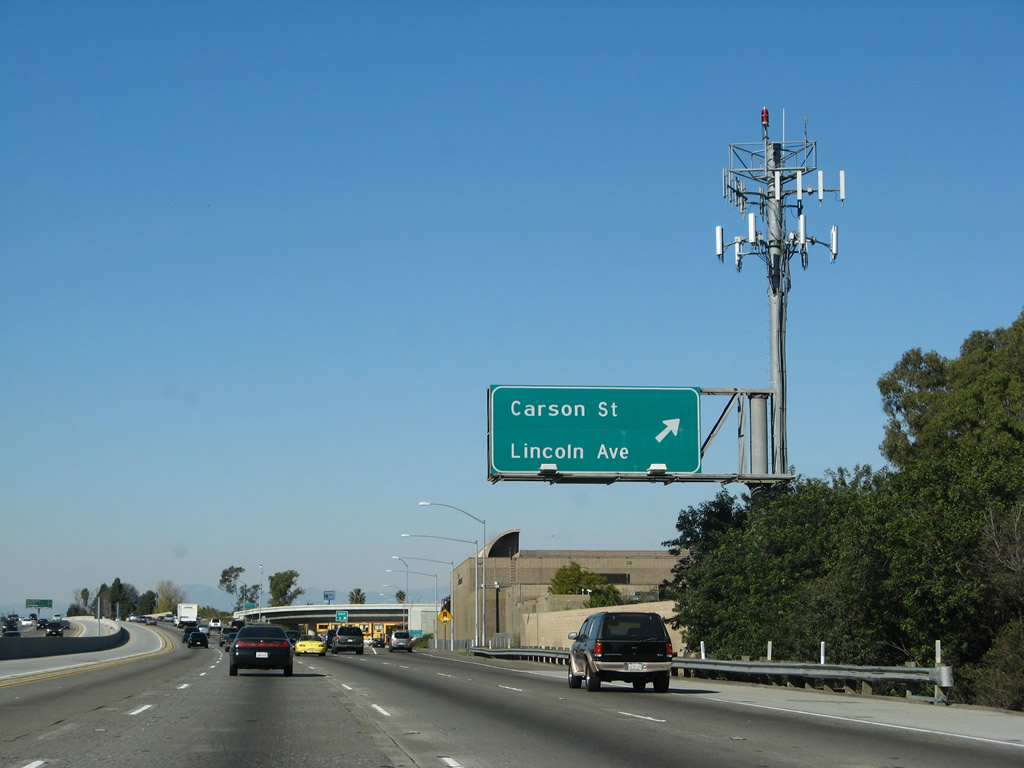 |
Northbound Interstate 605 reaches Exit 3, Carson Street and Lincoln Avenue. Note the unusual font used for this reflective sign that was installed in 2003. Photo taken 01/14/07. |
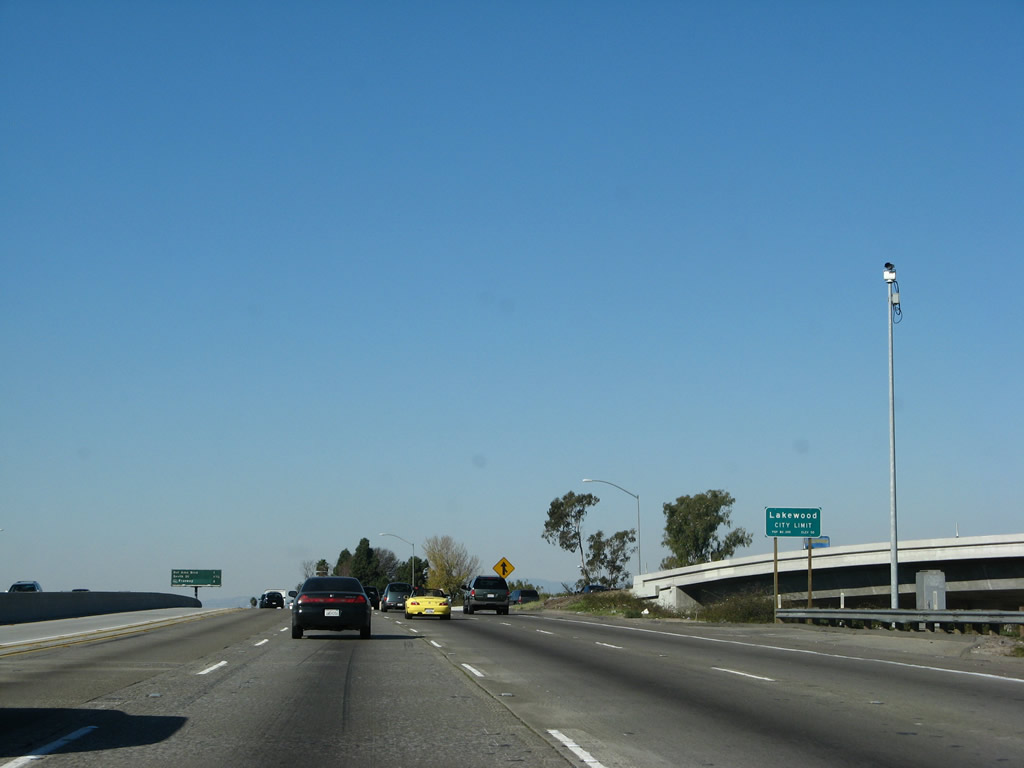 |
At Exit 3 (Carson Street and Lincoln Avenue), Interstate 605 leaves the city of Long Beach and enters the city of Lakewood. Home to 79,345 people as of the 2000 Census, Lakewood incorporated on April 16, 1954, during a period of heavy residential development between 1950 and 1960. Prior to this development, Lakewood was primarily agricultural. The first Denny's restaurant opened in Lakewood in 1959, and the restaurant chain has since established itself nationally. Photo taken 01/14/07. |
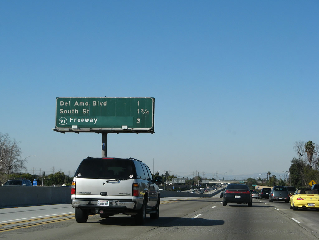 |
This mileage sign provides the distance to the next four exits along Interstate 605 north: Exit 5A, Del Amo Boulevard; Exit 5B, South Street; and Exits 7A-B, California 91 (Artesia Freeway). Photo taken 01/14/07. |
 |
Use either Exit 5A, Del Amo Boulevard or Exit 5B, South Street to the city of Cerritos. Photo taken 01/14/07. |
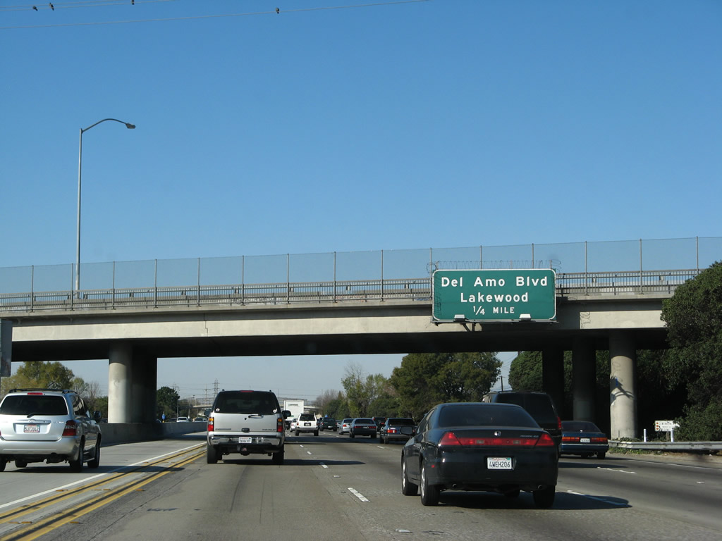 |
The next exit along Interstate 605 (San Gabriel River Freeway) north is Exit 5A, Del Amo Boulevard to the city of Lakewood. Photo taken 01/14/07. |
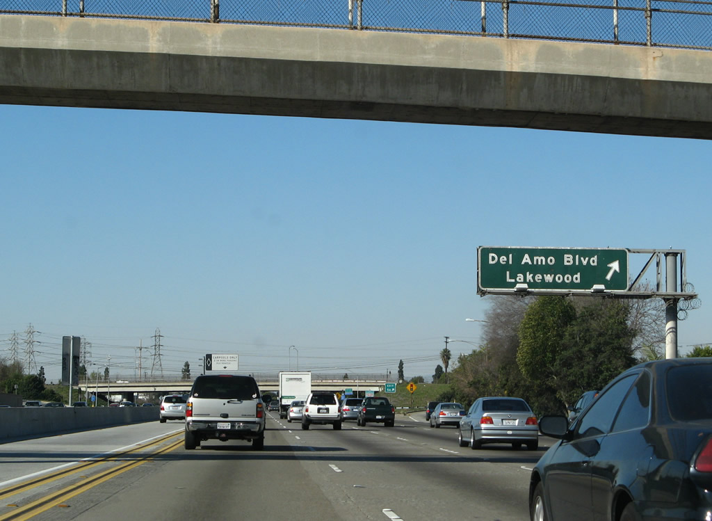 |
Northbound Interstate 605 reaches Exit 5A, Del Amo Boulevard. At this interchange, Interstate 605 leaves the city of Lakewood and enters the city of Cerritos. Incorporated on April 24, 1956, the city of Cerritos was at one time known as Dairy Valley (from April 24, 1956, until January 10, 1967) and was home to 51,488 people as of the 2000 Census. Photo taken 01/14/07. |
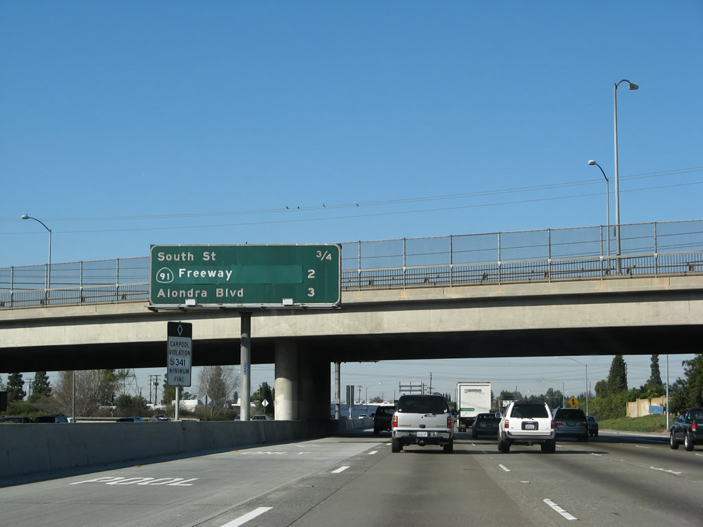 |
This mileage sign provides the distance to the next three exits along Interstate 605 (San Gabriel River Freeway) north: Exit 5B, South Street; Exit 7A, California 91 (Artesia Freeway); and Exit 7B, Alondra Boulevard. Photo taken 01/14/07. |
 |
A set of Southern California Edison 230kV power lines cross over Interstate 605. Photo taken 01/14/07. |
 |
The next exit along Interstate 605 north is Exit 5B, South Street, one-quarter mile. Photo taken 01/14/07. |
 |
Northbound Interstate 605 (San Gabriel River Freeway) reaches Exit 5B, South Street, in Cerritos. The next exit is Exit 7A, California 91 (Artesia Freeway). Photo taken 11/13/05. |
 |
This mileage sign provides the distance to the next three exits along Interstate 605 north: Exit 7A, California 91; Exit 7B, Alondra Boulevard; and Exit 9A, Rosecrans Avenue. Photo taken 11/13/05. |
 |
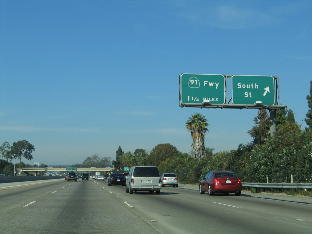
The next exit along Interstate 605 (San Gabriel River Freeway) north is Exit 7A, California 91 (Artesia Freeway). Photo taken 11/13/05. |
 |
Northbound Interstate 605 reaches Exit 7A, California 91 (Artesia Freeway). Photo taken 11/13/05. |
 |
This view shows the signage for the transition ramp to Exit 7A, California 91 (Artesia Freeway) and another entrance/exit to and from the HOV lanes as seen from the northbound Interstate 605 mainline. Photo taken 01/14/07. |
 |
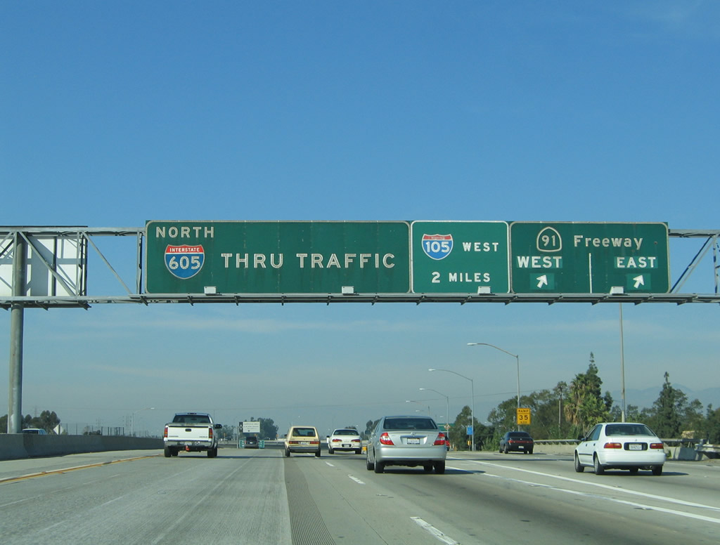
This mileage sign along northbound Interstate 605 provides the distance to the next three exits: Exit 7B, Alondra Boulevard; Exit 9A, Rosecrans Avenue; and Exit 9B, Interstate 105/Century (Anderson) Freeway west. Photo taken 01/14/07. |
 |
These three exits (Exit 7B, Alondra Boulevard; Exit 9A, Rosecrans Avenue; and Exit 9B, Interstate 105/Century (Anderson) Freeway west) all serve the city of Norwalk. Photo taken 01/14/07. |
 |
The next exit along Interstate 605 north is Exit 7B, Alondra Boulevard. Photo taken 01/14/07. |
 |
Another Interstate 605 (San Gabriel River Freeway) sign is posted after the California 91 on-ramp and prior to Exit 7B, Alondra Boulevard. Photo taken 01/14/07. |
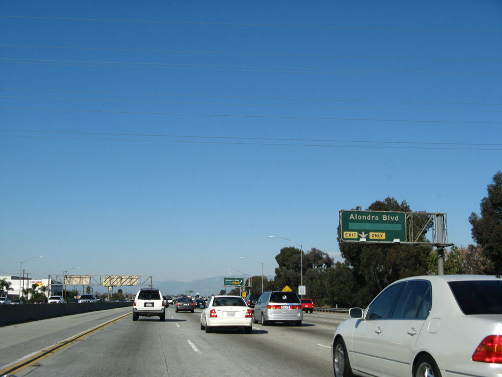 |
The right lane of Interstate 605 north becomes exit only for Exit 7B, Alondra Boulevard. Photo taken 01/14/07. |
 |
Northbound Interstate 605 reaches Exit 7B, Alondra Boulevard. At this interchange, Interstate 605 leaves the city of Cerritos and enters the city of Norwalk, which was home to 103,298 residents as of the 2000 Census. The city was incorporated in 1957, around the same time the Interstate 5 freeway was first built (as part of Bypass U.S. 101). Norwalk consists of 9.35 square miles. Photo taken 01/14/07. |
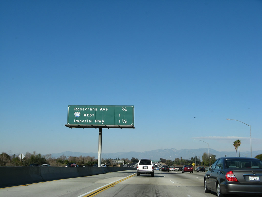 |
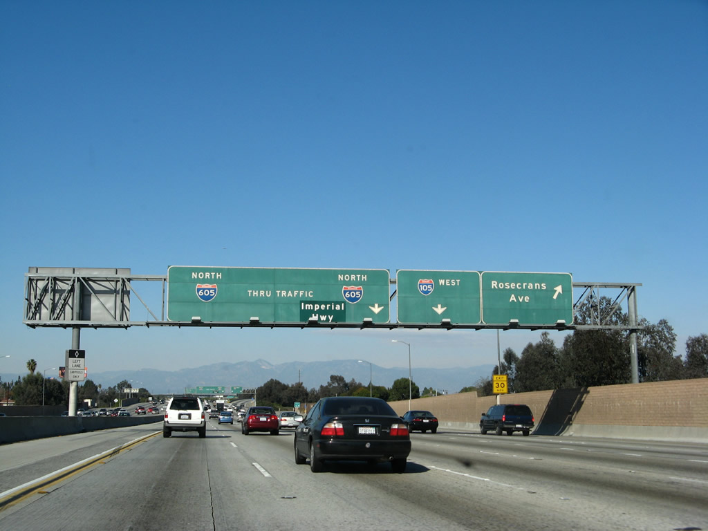
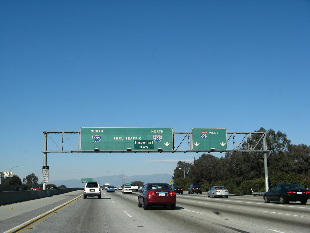
This mileage sign provides the distance to the next three exits along Interstate 605 north: Exit 9A, Rosecrans Avenue; Exit 9B, Interstate 105; and Exit 9C, Imperial Highway. Photo taken 01/14/07. |
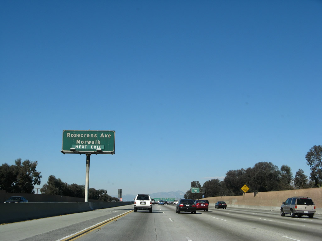 |
The next exit along Interstate 605 north is Exit 9A, Rosecrans Avenue to Norwalk. Photo taken 01/14/07. |
 |
While the next exit along Interstate 605 north is Exit 9A, Rosecrans Avenue, this sign advises of the third exit in sequence, which is Exit 9C, Imperial Highway. This sign indicates what would be Exit 9C, but we have passed neither Exit 9A (Rosecrans Avenue) nor Exit 9B (Interstate 105/Century Freeway). Photo taken 01/14/07. |
 |
Northbound Interstate 605 reaches Exit 9A, Rosecrans Avenue. The next exit is Exit 9B, Interstate 105/Century (Glenn Anderson) Freeway. Photo taken 01/14/07. |
 |
Immediately thereafter, Interstate 605 (San Gabriel River Freeway) north reaches Exit 9B, Interstate 105/Century (Glenn Anderson) Freeway. Interstate 105 is the last major freeway completed within Los Angeles County (it opened in 1994). It leads west from this exit to end at California 1 near Los Angeles International Airport. Originally, plans called for Interstate 105 to continue east to Interstate 5, but that connection was denied by the city of Norwalk. Photo taken 01/14/07. |
 |
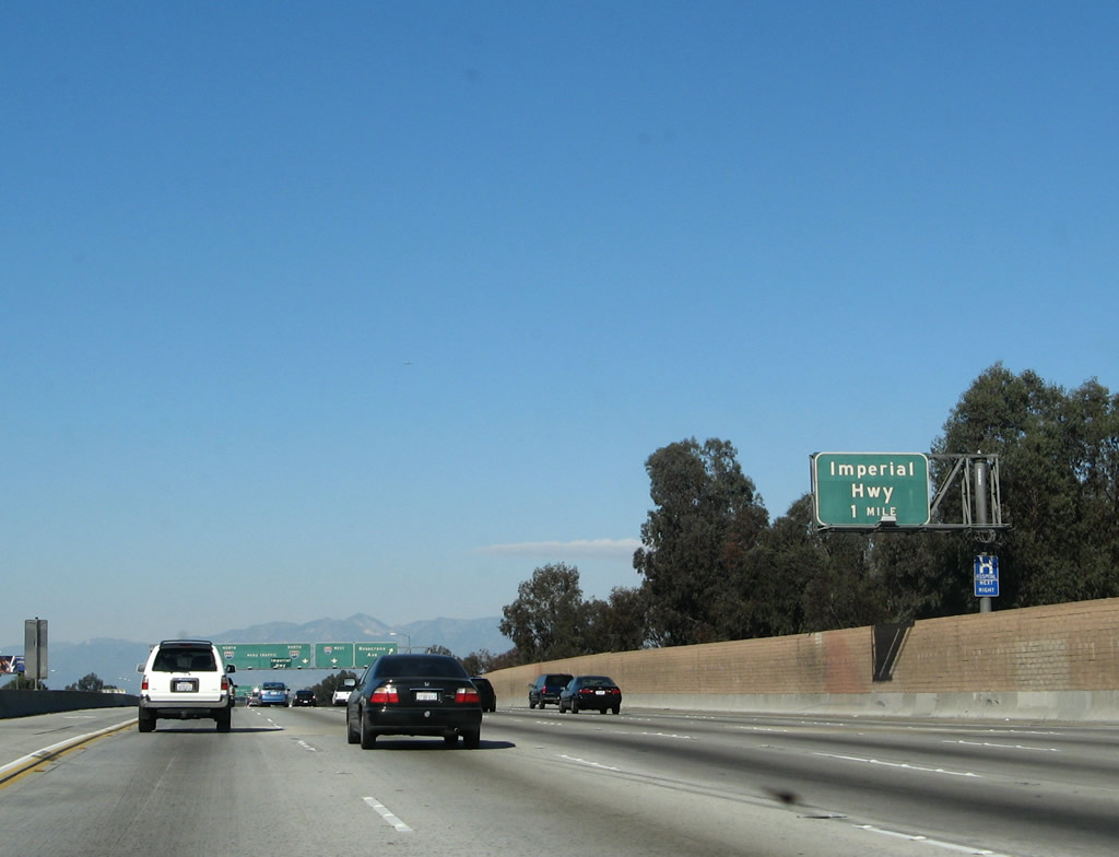
The next exit along Interstate 605 north is Exit 9C, Imperial Highway. Imperial Highway closely parallels Interstate 105/Century Freeway between Los Angeles International Airport and Norwalk. Photo taken 01/14/07. |
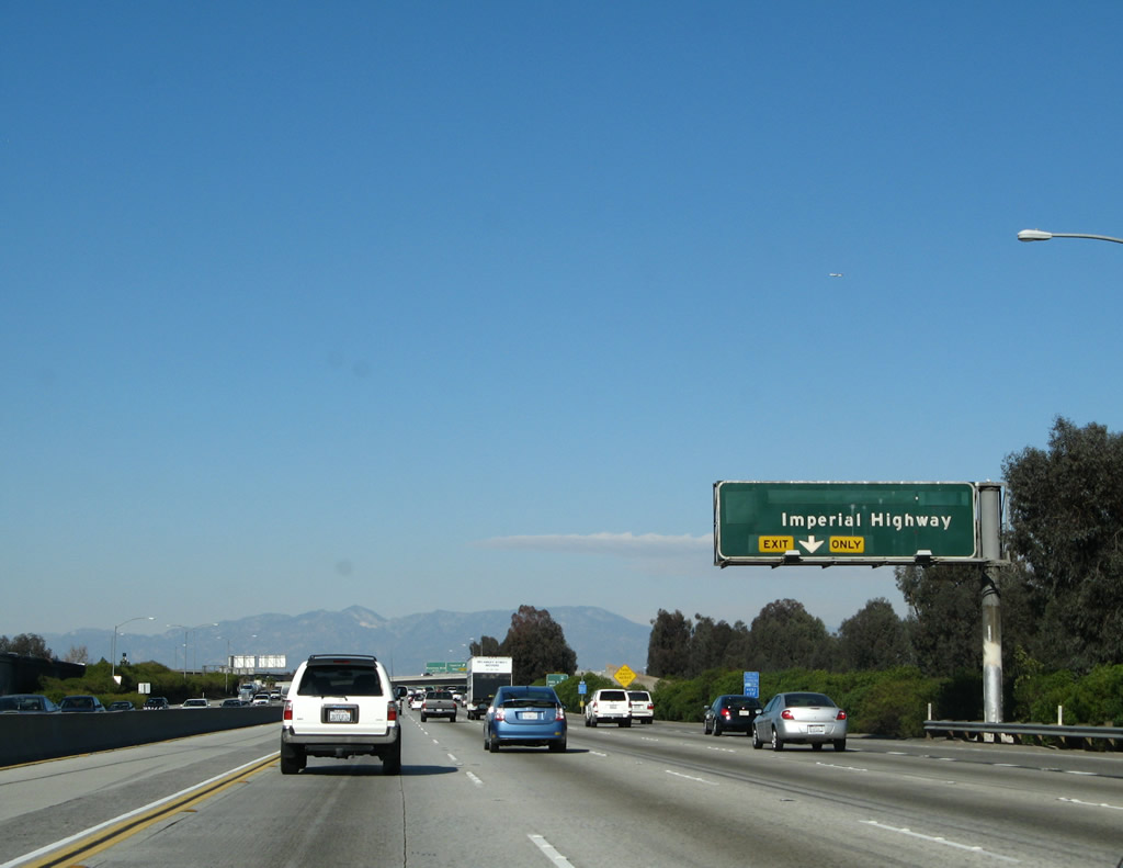 |
The right lane of Interstate 605 north becomes exit only for Exit 9C, Imperial Highway. Photo taken 01/14/07. |
 |
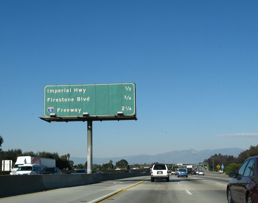
Northbound Interstate 605 reaches Exit 9C, Imperial Highway approaching Exit 10, Firestone Boulevard (former California 42). The sign is artificially tall and is not vertically centered because the California 42 shield was removed from it. Photo taken 01/14/07. |
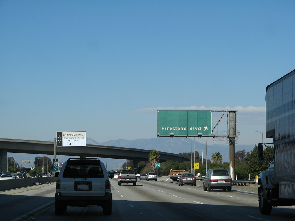 |
Northbound Interstate 605 (San Gabriel River Freeway) reaches Exit 10, Firestone Boulevard (former California 42). The old California 42 shield was scraped off both this sign and the sign in the previous photo. California 42 was legislatively decommissioned upon the completion of Interstate 105, but portions of it are still signed today. After this interchange, Interstate 605 north leaves the city of Norwalk and briefly enters the city of Downey. As of the 2000 census, the city of Downey had a total population of 107,323, incorporated on December 17, 1956, and consisted of 12.6 square miles. Photo taken 01/14/07. |
 |
This mileage sign provides the distance to the next two exits along Interstate 605 north: Exit 11, Interstate 5 (Santa Ana Freeway) and Exit 12, Telegraph Road. Photo taken 01/14/07. |
 |
One of the new "angular" reassurance shields for Interstate 605 is posted after the on-ramp from Firestone Boulevard. Photo taken 01/14/07. |
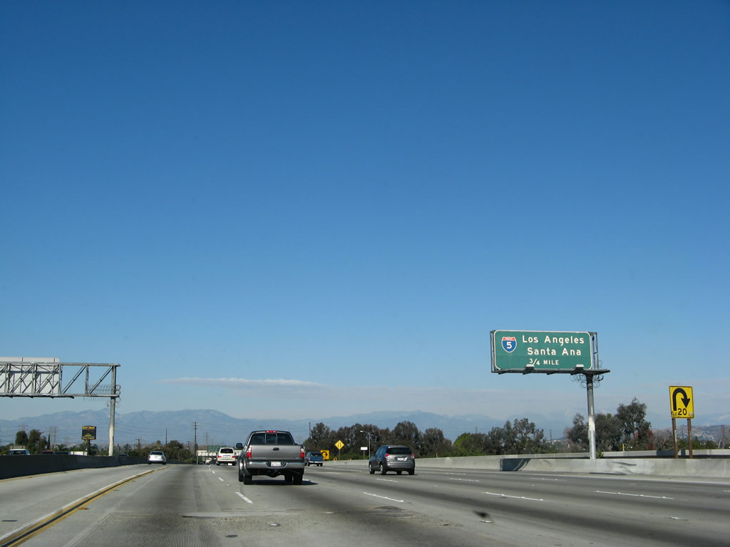 |
The next exit along Interstate 605 (San Gabriel River Freeway) north is Exit 11, Interstate 5 (Santa Ana Freeway). Photo taken 01/14/07. |
 |
Another interchange sequence sign is posted along Interstate 605 north: Exit 11, Interstate 5 (Santa Ana Freeway); Exit 12, Telegraph Road; and Exit 13, Slauson Avenue. Photo taken 01/14/07. |
 |
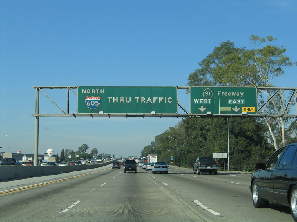
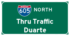
The right two lanes of Interstate 605 (San Gabriel River Freeway) north become exit only for Exit 11, Interstate 5 (Santa Ana Freeway). Note the use of "Thru Traffic" as a control city on the pull-through sign. These are some old signs, and they might date back to the original construction of this freeway. Photo taken 01/14/07. |
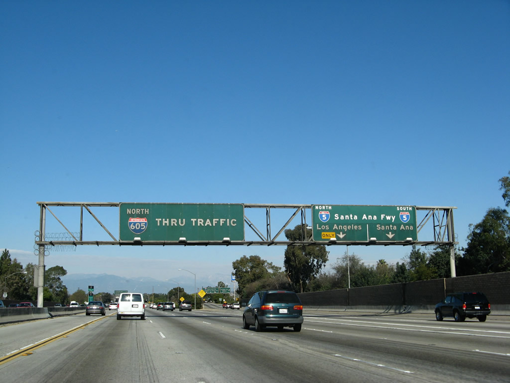 |
Northbound Interstate 605 (San Gabriel River Freeway) reaches Exit 11, Interstate 5 (Santa Ana Freeway). Interstate 5 travels northwest toward downtown Los Angeles and southeast into Norwalk and toward Orange County, Santa Ana, and San Diego. At this interchange, Interstate 605 leaves the city of Downey and enters the city of Santa Fe Springs. The population of Santa Fe Springs was 17,438 as of the 2000 Census, incorporated on May 15, 1957, and consisted of 8.9 square miles. Photo taken 01/14/07. |
 |
This view shows the signage for the transition ramp to Interstate 5 (Santa Ana Freeway). Photo taken 01/14/07. |
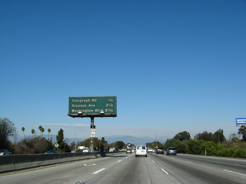 |
This mileage sign provides the distance to the next three exits along Interstate 605 (San Gabriel River Freeway) north: Exit 12, Telegraph Road; Exit 13, Slauson Avenue; and Exit 14, Washington Boulevard. Photo taken 01/14/07. |
 |
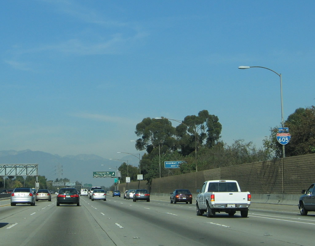
The next exit along Interstate 605 north is Exit 12, Telegraph Road. This interchange serves the city of Santa Fe Springs. Photo taken 11/13/05. |
 |
An Interstate 605 north reassurance shield is posted after the Interstate 5 on-ramp and prior to Exit 12, Telegraph Road. Photo taken 11/13/05. |
 |
Northbound Interstate 605 reaches Exit 12, Telegraph Road to Santa Fe Springs. Photo taken 11/13/05. |
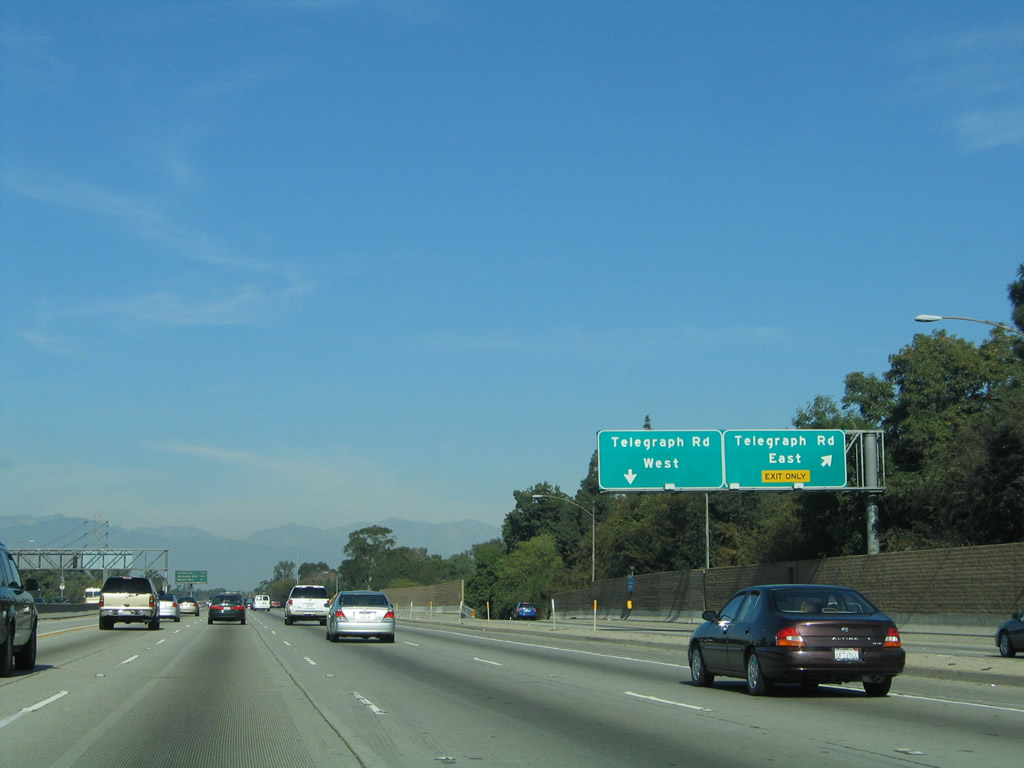 |
Looking at the off-ramp for Exit 12, the ramp splits to serve Telegraph Road east and then Telegraph Road west (via a loop ramp). Photo taken 11/13/05. |
 |
This mileage sign along Interstate 605 north provides the distance to the next three exits: Exit 13, Slauson Avenue; Exit 14, Washington Boulevard; and Exit 15, California 72/Whittier Boulevard. Photo taken 11/13/05. |
 |
This reassurance shield for Interstate 605 north is posted after the on-ramp from Telegraph Road (Exit 12). Photo taken 11/13/05. |
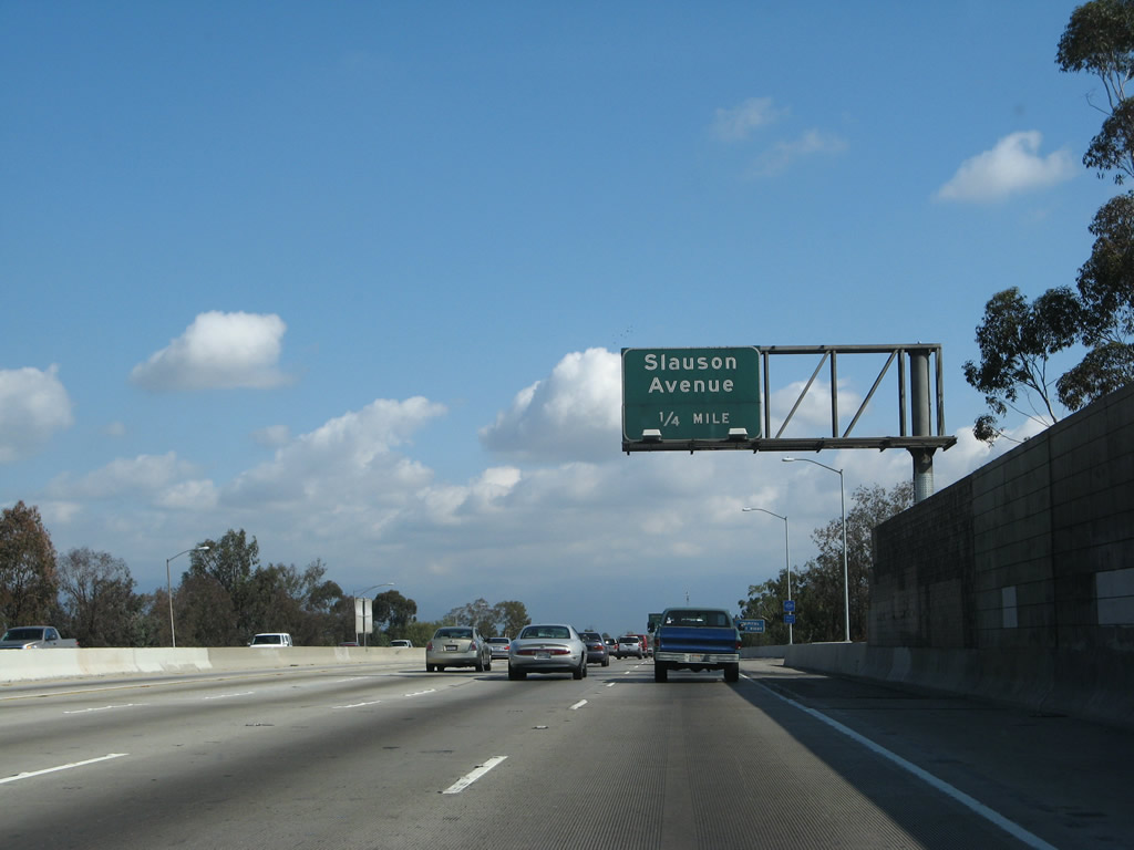 |
The next exit along Interstate 605 north is Exit 13, Slauson Avenue (one-half mile). Photo taken 09/29/07. |
 |
Northbound Interstate 605 (San Gabriel River Freeway) reaches Exit 13, Slauson Avenue. The next exit along Interstate 605 north is Exit 14, Washington Boulevard. Photo taken 01/14/07. |
 |
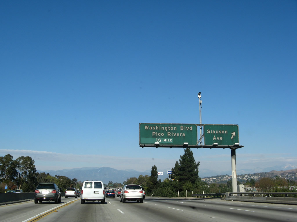
Washington Boulevard travels west to the city of Pico Rivera and east to the city of Santa Fe Springs. Photo taken 09/29/07. |
 |
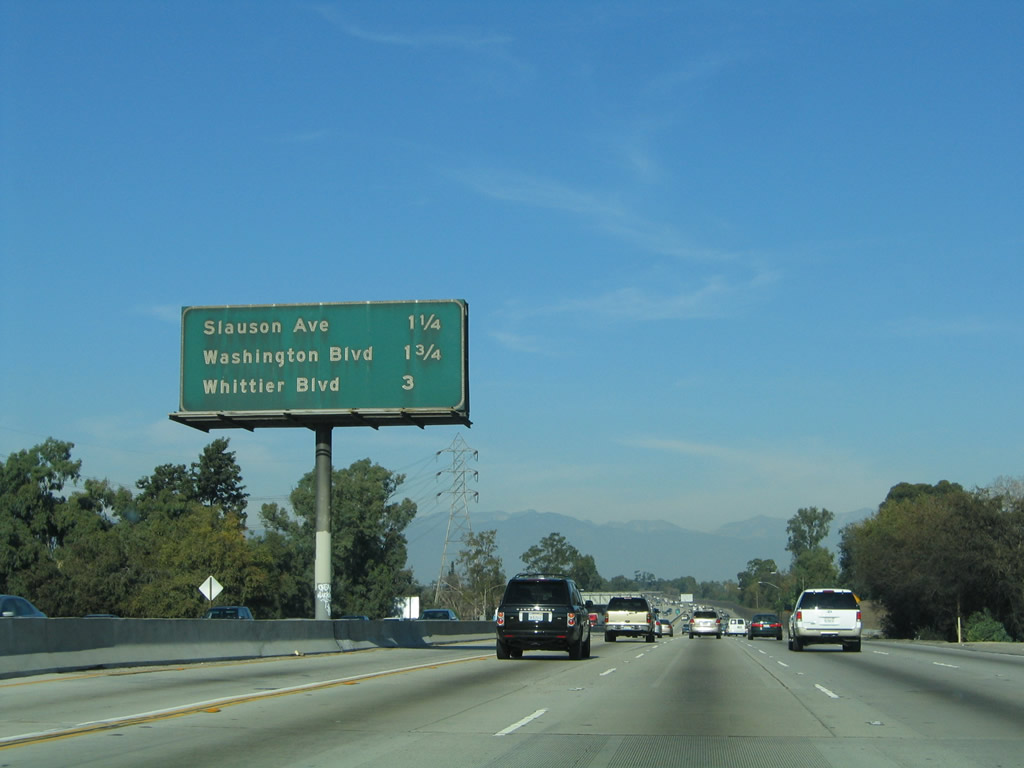
This mileage sign along Interstate 605 north provides the distance to the next three exits: Exit 14, Washington Boulevard; Exit 15, California 72/Whittier Boulevard; and Exit 16, Beverly Boulevard. Photo taken 11/13/05. |
 |
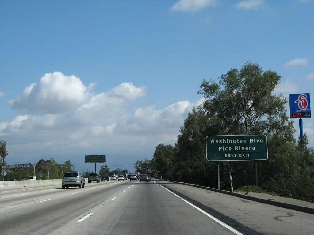
Northbound Interstate 605 reaches Exit 14, Washington Boulevard. At this interchange, Interstate 605 skirts along the eastern edge of the city of Pico Rivera. As of the 2000 Census, the city of Pico Rivera had a total population of 63,428 and was incorporated on January 29, 1958. The city was formed by a merger of the previously unincorporated communities of Pico (named for Pio Pico, the last Mexican-rule governor of California) and Rivera. Interstate 605 will again enter the city of Pico Rivera at Beverly Boulevard. Photo taken 09/29/07. |
 |
A collector distributor lane serves the off-ramp to Exit 14, Washington Boulevard. Photo taken 09/29/07. |
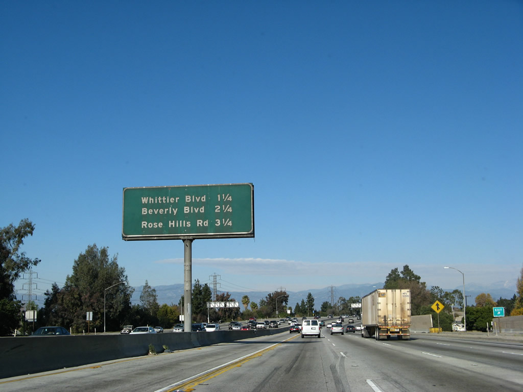 |
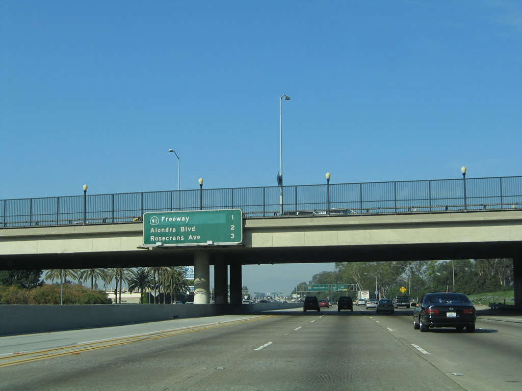
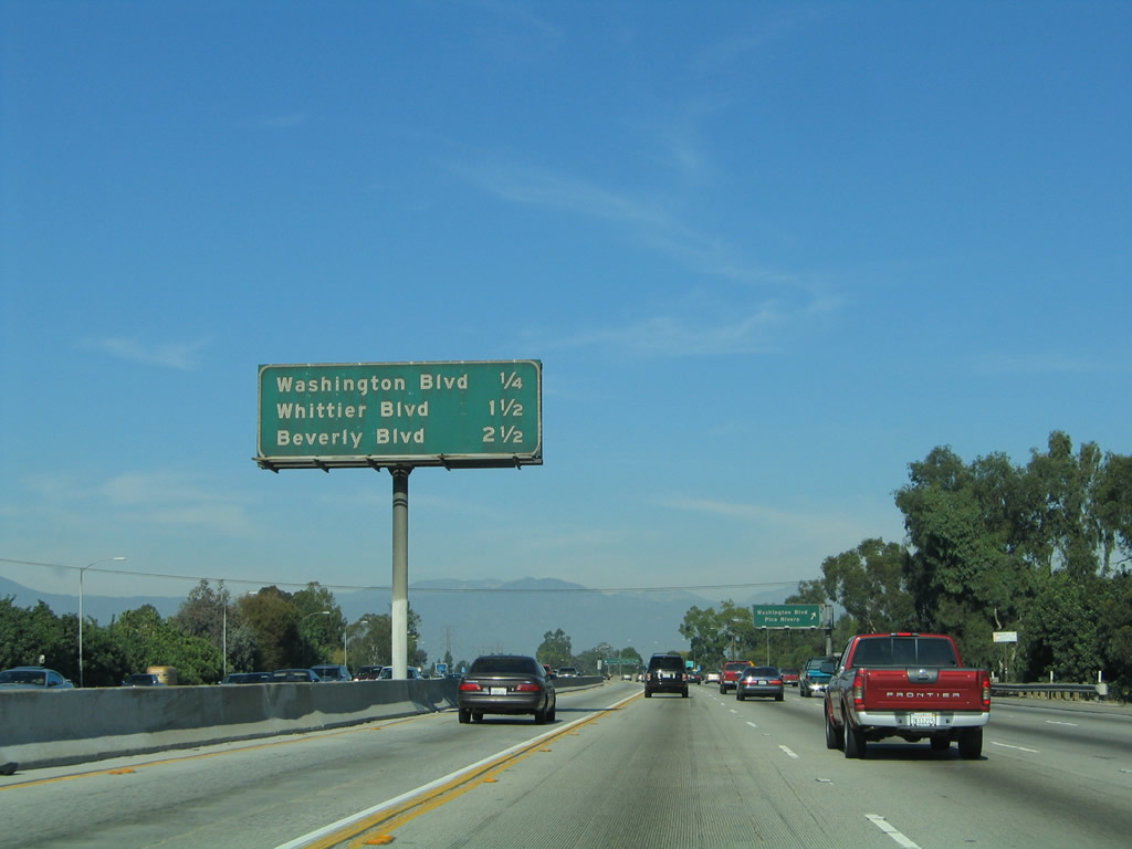
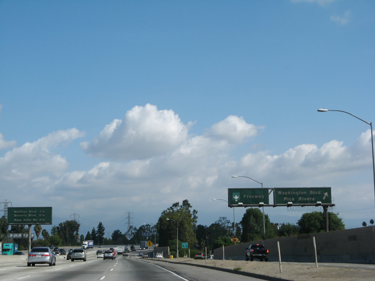
Another interchange sequence sign along Interstate 605 north provides the distance to the next three exits: Exit 15, California 72/Whittier Boulevard; Exit 16, Beverly Boulevard; and Exit 17, Rose Hills Road. Photo taken 09/29/07. |
 |
The next exit along Interstate 605 north is Exit 15, California 72/Whittier Boulevard to the city of Whittier. California 72 follows the historic route of El Camino Real and U.S. 101 through Whittier and La Habra. The state route currently begins at Interstate 605 and travels southeast through Whittier to its end at California 39 (Beach Boulevard) in La Habra. To the west, California 72 used to continue west along Whittier Boulevard into Pico Rivera, Montbello, and unincorporated East Los Angeles. However, both cities and Los Angeles County acted to decommission the state highway within their jurisdictions. Originally part of north-south U.S. 101, California 72 was created in 1964 with the elimination of U.S. 101 south of downtown Los Angeles. At its maximum extent, California 72 traveled southeast from Downey Road in East Los Angeles to Beach Boulevard (California 39) in La Habra. Downey Road was the selected northwestern terminus for California 72 because it was intended to connect to an unbuilt freeway (California 245) that was later supplanted by today's Interstate 710 (Long Beach Freeway). Photo taken 11/13/05. |
 |
At this point is an access to the high occupancy vehicle (HOV or carpool) lane. Photo taken 09/29/07. |
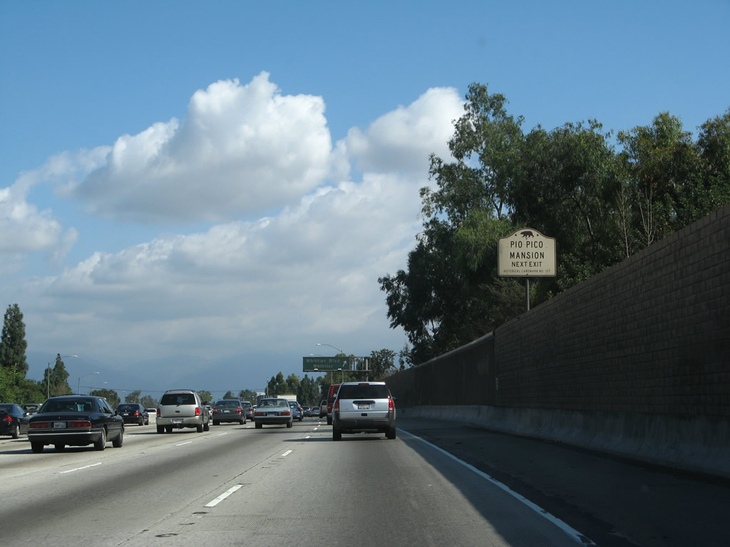 |
Use Whittier Boulevard west to Pio Pico Mansion. Pio Pico State Historic Park is the site of "El Ranchito," the final home of Pio Pico, who was the last Governor of California under Mexican rule. The mansion is located west of Interstate 605 on the eastern bank of the San Gabriel River, which Interstate 605 has followed since its inception in Seal Beach. Photo taken 09/29/07. |
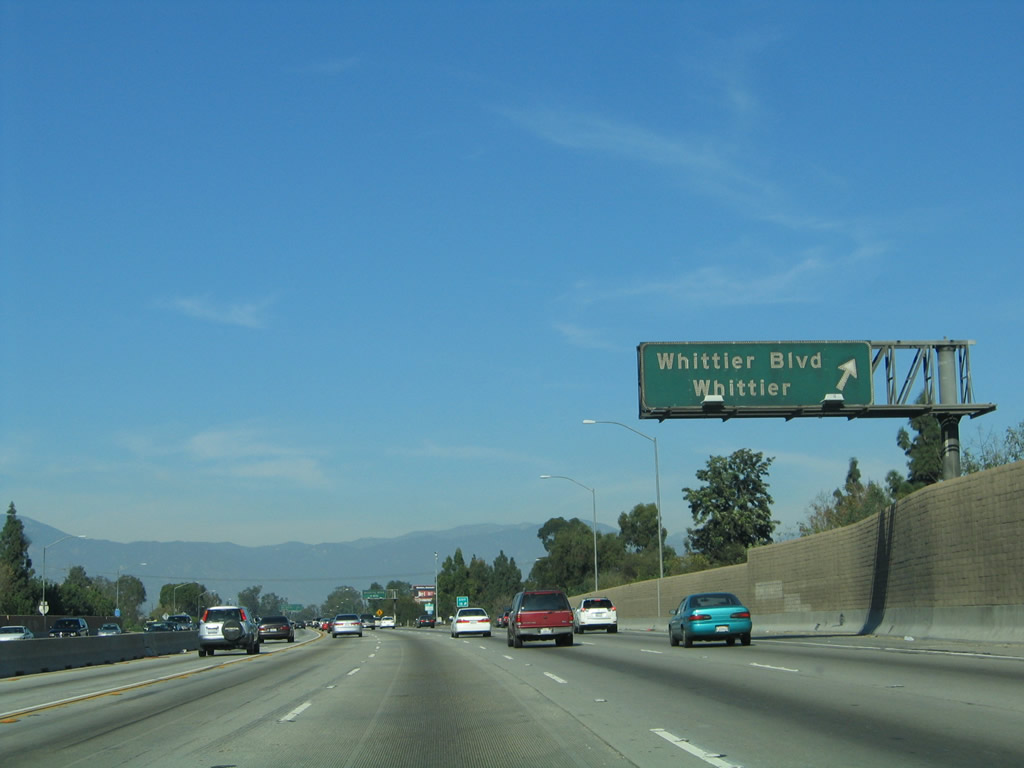 |
Northbound Interstate 605 (San Gabriel River Freeway) reaches Exit 15, California 72/Whittier Boulevard. At this interchange, Interstate 605 enters the city of Whittier. The city had a population of 83,680 people as of the 2000 Census, incorporated in 1898, and sits at an elevation of 367 feet. Interstate 605 separates the city from the San Gabriel River and the historic Pio Pico Mansion. Photo taken 11/13/05. |

Page Updated September 23, 2010.
|
About Contact Glossary |
In The News Testimonials Interstate Guide |
Social Media:
 |
|
© 2000-23 AARoads.com | All Rights Reserved | Privacy Policy / Terms of Use
|
||