Interstate 635 East - Texas
| Interstate 635 East | |
|---|---|
 |
This view looks east at IH 635's western end from the SH 121 ramp. IH 635 begins its 35-mile long journey around Dallas here. Photo taken 10/19/03. |
 |
Now in the suburb of Coppell, the freeway passes through wide open industrial areas built only in the mid and late 90s. The first exit headed eastbound is Royal Lane. Royal Lane is a major arterial in Dallas, and will appear again on IH 635 exit signs further east. Photo taken 10/19/03. |
 |
The first advance exit signage eastbound along IH 635 in Coppell, these signs - along with most through this stretch of freeway, were changed to use the new Clearview font in 2004. Photo taken 10/19/03. |
 |
A view of an eastbound 635 reassurance shield. As is obvious by the road's surroundings, the prairie foliage is very visible here. Large swaths of surburban sprawl are visible on each side of the freeway here. Photo taken 10/19/03. |
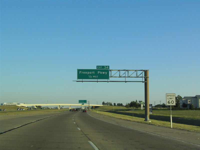 |
Freeport Pkwy is the next exit along IH 635 eastbound. Photo taken 10/19/03. |
 |
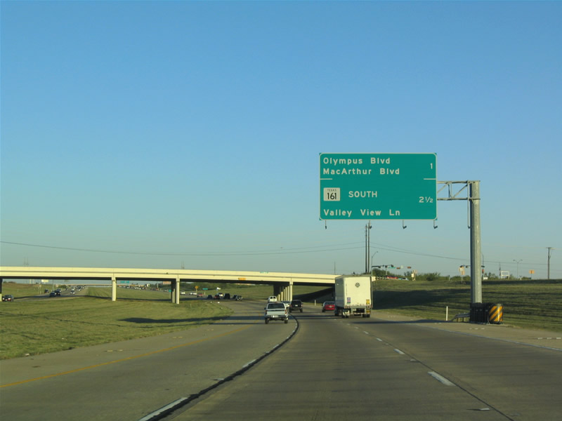
Another eastbound advance exit sign, headed into the suburb of Irving. The diamond at MacArthur Boulevard was extended to include Olympus Boulevard in 2002, to serve a large retail development. Photo taken 10/19/03. |
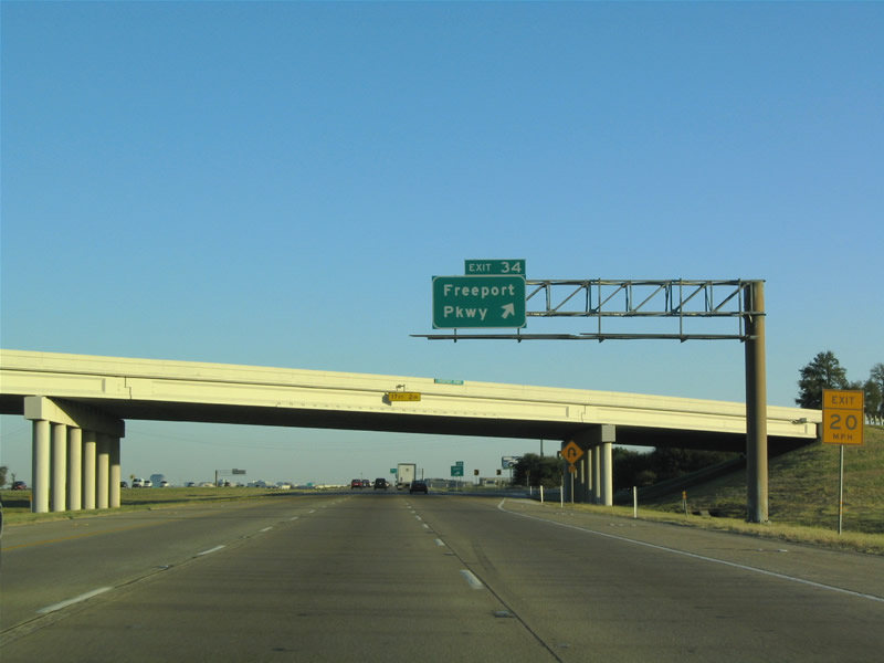 |
Eastbound at Freeport Pkwy. The exit is a folded diamond and was constructed in the late 90s. It serves, primarily, a large airport-area industrial park. Photo taken 10/19/03. |
 |
The next exit serves Belt Line Road. Belt Line Road forms a full loop around Dallas, and any "spoke" freeway, and in this case the loop, has an interchange with it. Photo taken 10/19/03. |
 |
Eastbound at Belt Line Road in Irving. IH 635 remains 6 lanes in this area and rarely backs up eastbound. Westbound towards the airport, is another story entirely. Photo taken 10/19/03. |
 |
More advance signage before Olympus/MacArthur. Note the very wide median here. This section of IH 635 is the newest constructed, and was completed aroun 1982. It is very open to expansion, but none is planned as of yet. Photo taken 10/19/03. |
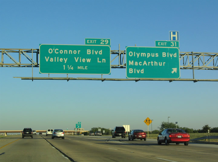 |
Eastbound IH 635 at Olympus/MacArthur. MacArthur Boulevard is one of the most important arterials in the large suburb of Irving, and connects to IH 30 and various state highways to the south. This exit also serves Valley Ranch, the large suburban development and Dallas Cowboys Training Camp. Photo taken 10/19/03. |
 |
A general view of IH 635 eastbound in North Irving. Mid-rise office blocks appear here. When this photo was taken, the PGBT did not extend to the north of IH 635 - it has since been connected northward, making the pictured sign outdated. Photo taken 10/19/03. |
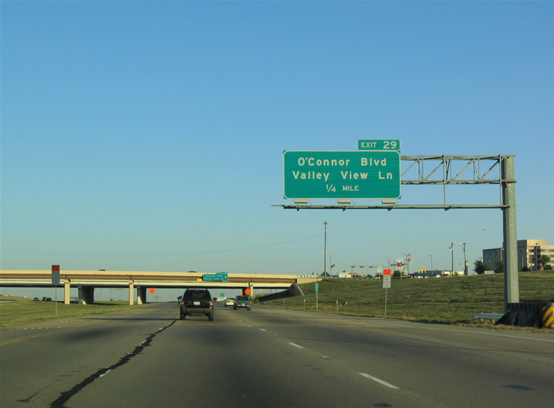 |
IH 635 eastbound before O'Connor/Valley View. Photo taken 10/19/03. |
 |
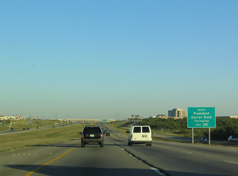
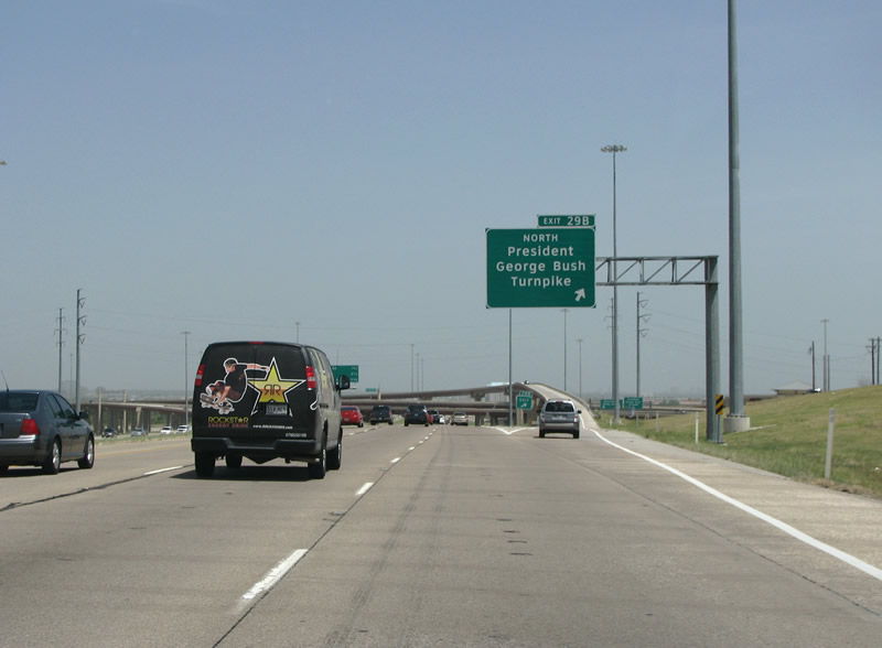
This view looks east at the PGBT south exit from IH 635 eastbound. Formerly, this exit was signed as O'Connor/Valley View. IH 635 largely replaced Valley View Lane through northern Dallas County. The PGBT continues south from here through Irving to end at SH 183. Photo taken 07/27/08. |
 |
IH 635 eastbound at its first major junction since beginning near the airport. The PGBT Interchange fully opened September 9, 2005 ' when the turnpike was extended northward. Before that, the interchange ramps sat incomplete for several years. The PGBT forms an outer loop of the northern suburban areas of Dallas. It is heavily patrolled by radar, as well. Photo taken 07/27/08. |
 |
This view looks east at the 635/PGBT interchange in north Irving. Traffic headed south on the turnpike must exit and stop to turn right, however traffic going north has a direct ramp connection. The stack is fairly high because the northbound turnpike consists of a long viaduct over river bottoms. Photo taken 07/27/08. |
 |
IH 635 eastbound before Luna Rd. The first mention of IH 35E is also seen here in North Irving. Note the 3-digit interstate in a 2-digit shield, common in the Dallas area. Photo taken 07/27/08. |
 |
IH 635 gains two lanes here from incoming PGBT traffic. Photo taken 07/27/08. |
 |
The IH 635 HOV Lane, which extends into Dallas far to the east, begins here near Luna Rd. Photo taken 07/27/08. |
 |
Eastbound at Luna Rd, the freeway is down to 4 lanes. IBM has a large office complex at this exit, and there is a large Omni Hotel to the south side of the road. This section of IH 635 was constructed in 1981-82 and there are still large wide open spaces to each side of the road. Photo taken 10/19/03. |
 |
Advance signage for the IH 35E interchange. Denton is the control point for IH 35E north, where it merges with IH 35W for the trek northward to Oklahoma. Photo taken 07/27/08. |
 |
This HOV lane entrance marks the western end of the 635 HOV lanes. Dallas got its first HOV lane on IH 30 in October of 1991, this 635 HOV lane began operation in 1996. Photo taken 07/27/08. |
 |
The freeway now enters the northern suburb of Farmers Branch, and the stack with IH 35E is very visible. Photo taken 10/19/03. |
 |
IH 635 eastbound at the northbound exit for IH 35E in Farmers Branch. Hazardous Cargo routes are signed on tabs above the overhead signs. Dallas' HC routes are well signed. Photo taken 07/27/08. |
| IH 635 eastbound at IH 35E, its parent route. This is IH 635's only interchange with IH 35E, as the southern loop became IH 20 after construction. The freeway drops to only two main lanes through the interchange, along with the HOV lane. Photo taken 07/27/08. | |
 |
A view of the IH 635/35E stack. The stack was built in 1966, and was updated in 1977 and 1981, the updating made the stack fairly confusing, and an upgrade design process is currently underway. Photo taken 10/19/03. |
 |
After the stack with IH 35E, the freeway gains two new travel lanes, and with the HOV has 10 main lanes. This is the oldest stretch of IH 635, and opened in March of 1967. The freeway enters the suburb of Farmers Branch here. Photo taken 07/27/08. |
 |
East of IH 35E, IH 635 gains two lanes on the left and two on the right. Eastbound traffic in the left lanes have access to the HOV lane here. Photo taken 07/27/08. |
 |
IH 635 eastbound at Josey Ln. Josey is a main route north through the suburbs of Carrollton and Farmers Branch. The arterial was recently extended all the way north to SH 121. Photo taken 07/27/08. |
 |
IH 635 eastbound at Webb Chapel Road, also a major arterial into Farmers Branch and Carrollton. The "H" hospital sign points drivers to the adjacent RHD Medical Center - renamed from "Robert H. Dedman Hospital" for obvious reasons. Photo taken 07/27/08. |
 |
IH 635 eastbound through Farmers Branch. The Joe Ratcliff walkway is the only dedicated pedestrian structure over 635. It was constructed in 1967 but did not receive a name until 2003. Photo taken 07/27/08. |
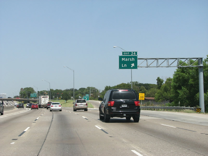 |
IH 635 eastbound at Marsh Ln. Marsh Ln provides access all the way southwards into Dallas and the Love Field area. This exit is notable in that it is residential, without any commercial strips at the interchange - rare on 635. Photo taken 07/27/08. |
 |
Advance signage along IH 635 eastbound for Midway Road / Welch Rd in Farmers Branch. Photo taken 07/27/08. |
 |
A state-name 635 shield and its hazardous cargo add-on are illuminated in the evening sunset. Photo taken 10/19/03. |

 |
 |
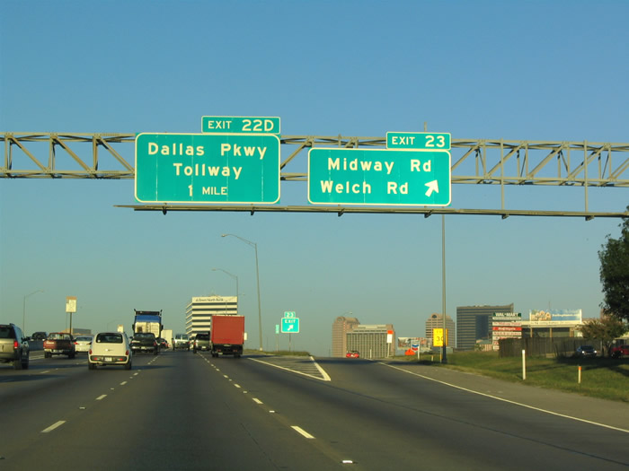
The Midway/Welch exit in Farmers Branch. Midway road runs northward and forms the border between Collin and Denton Counties. Welch Rd is a short arterial that connects 635 with a large industrial park area. Photos taken 10/19/03 & 07/27/08. |
 |
The 10-lane freeway briefly curves into the east as the Galleria skyline comes into view. Photo taken 07/27/08. |
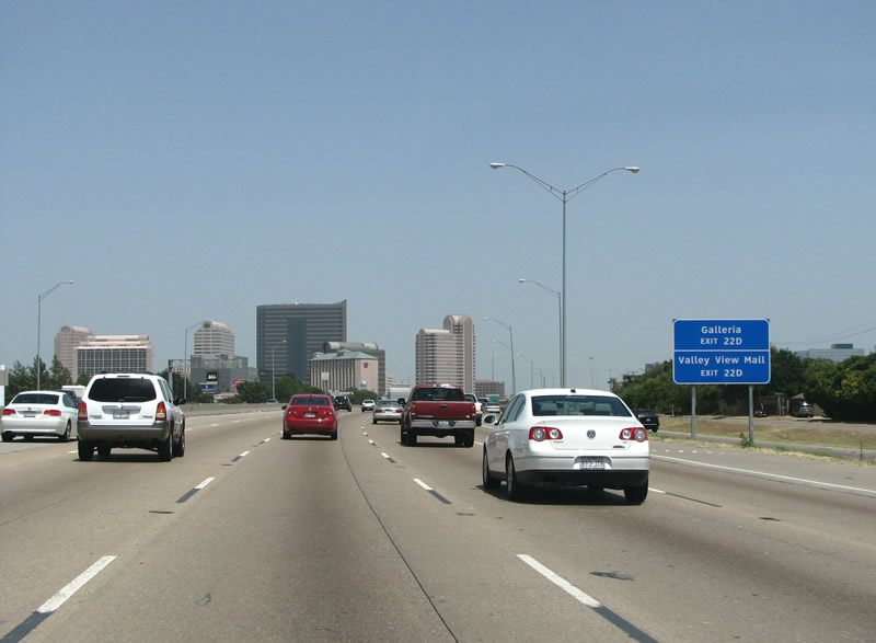 |
The Galleria is the area's largest mall, and is identical to one in Houston. The mall area features a large skyline with several high-end hotels and the Kinko's Corporate Headquarters. If you've ever seen the first traffic scene in the movie Office Space, it was filmed right here. Photo taken 07/27/08. |
 |
IH 635 eastbound at the Dallas North Tollway (DNT). The interchange is a substandard cloverleaf, rare in North Texas. Flyover ramps for frontage roads were added in 1984, but do not assist traffic on the main lanes. Dallas Parkway is the name for the Tollway's frontage roads north of 635. Photo taken 07/27/08. |
 |
A view looking eastbound at the Tollway Cloverleaf, with the access ramp to Dallas Parkway. Take the latter to access the Galleria area directly. Photo taken 07/27/08. |
 |
IH 635 eastbound at the northbound DNT loop ramp. The DNT northbound carries drivers to their identical brick homes in rapidly sprawling Collin County. Photo taken 07/27/08. |
 |
East of the Tollway IH 635 is 10 and 12 lanes wide. This begins the busiest stretch of roadway on the interstate, this portion opened in August 1967. Photo taken 07/27/08. |
 |
Preston Road is the first exit east of the DNT, and one of the busiest freeway/arterial junctions in North Texas. Photo taken 07/27/08. |
 |
IH 635 eastbound at SH 289, Preston Road. Before the DNT Preston was the major road northward into Collin and Grayson Counties. There is serious talk circulating at TxDot of truncating this state route to end here, but at this time it continues southward to Loop 12. Photo taken 07/27/08. |
 |
IH 635 eastbound at Hillcrest Road. Hillcrest is another important north/south arterial but is less congested than Preston. It's frequently used as an alternate route, and generally has little business or commercial zoning along its length. Photo taken 07/27/08. |
 |
This view looks at a VMS near the Hillcrest exit. Dallas area freeways are full of these variable message signs which indicate upcoming accidents or travel times to nearby freeways. Photo taken 07/27/08. |
 |
IH 635 reaches its northern apogee here before the Coit Road exit. This stretch of freeway is solid traffic during all weekday daylight hours, and well into the night. This photo was taken on a Sunday afternoon. Photo taken 07/27/08. |
 |
IH 635 enters a small valley here and the Park Central skyline comes into view. Park Central opened in the 1960s as one of Dallas' first suburban office districts. Today Park Central and nearby Medical Centers form an important regional economic engine. Photo taken 07/27/08. |
 |
Coit Road is a north/south arterial that begins here and runs northward into Collin County and north to US 380. This marks the beginning of the high-five reconstruction project. Photo taken 07/27/08. |
 |
IH 635 eastbound at Coit Road. The HOV lane separates from the main road here and contains a direct ramp to northbound US 75, as well as a continuation along IH 635 eastbound. Photo taken 07/27/08. |
 |
IH 635 eastbound at US 75. US 75 is the busiest freeway in DFW and is also the oldest. The interchange with IH 635 opened in 1968 as a partial cloverleaf, but was rebuilt in a project called the High-Five which opened in 2005. US 75 is known as Central Expressway locally, and it was rebuilt in the late 90s. The northbound control point of McKinney was changed from Sherman in 2007. Photo taken 07/27/08. |
 |
The high five is a 5 level stack where IH 635 and US 75 meet. It opened in 2005 and won several engineering awards and was completed ahead of schedule and under budget, a rare happening in roadway construction. It is the second largest construction project in Dallas history and the largest in terms of dollars spent. This view looks east along IH 635 at the stack, here on the second of five levels. Photo taken 07/27/08. |
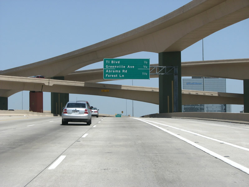 |
TI Boulevard is the next exit as seen on this sign amidst the white concrete of the high five. Photo taken 07/27/08. |
 |
This view has echoes of two mass transit options, with an HOV lane on the left and a rail line tab on the overhead signage. The DART rail red line runs under the freeway here and continues north far into Plano and Collin County. Photo taken 07/27/08. |
 |
IH 635 is 8 lanes through here, with four central HOV lanes. The high five interchange project persists far to the east of the actual US 75 junction. Photo taken 07/27/08. |
 |
TI Boulevard was originally a half diamond interchange for Floyd Road. The road was renamed after Texas Instruments which have their world headquarters immediately to the north of the exit. Photo taken 07/27/08. |
 |
Two lanes exit here at Greenville Avenue, which parallels Central Expressway from downtown northward. Greenville was the original route of US 75 north of town. Further south, the road forms the spine of an important bar district. This marks the eastern end of the high five project. From here to IH 30, this stretch of road opened in November 1968. Photo taken 07/27/08. |
 |
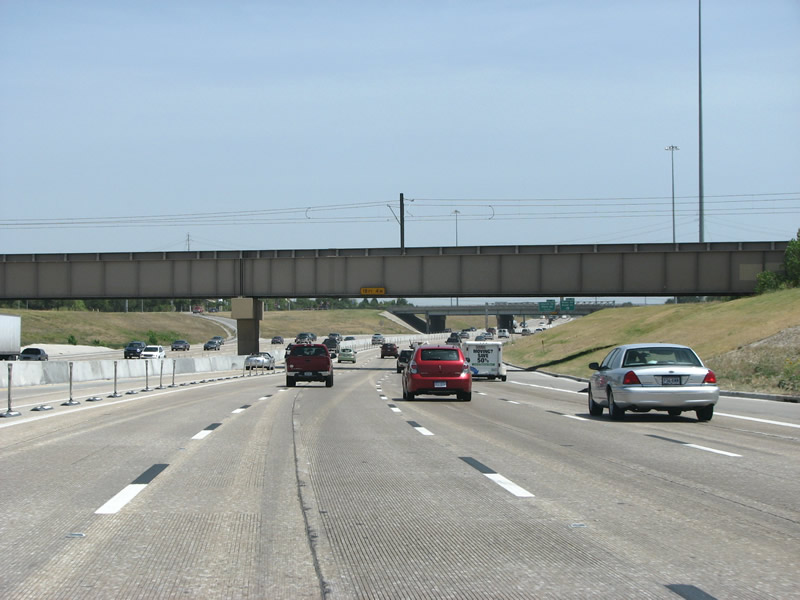
East of Greenville, IH 635 keeps 8 main lanes and 2 HOV lanes. The HOV lanes east of here did not open until 2008. Photo taken 07/27/08. |
 |
Abrams/Forest is the next exit, and the first in the neighborhood called Northeast Dallas. Abrams runs south and west almost to IH 30 and downtown, while Forest runs west of here and meets IH 635 again in Farmers Branch. Photo taken 07/27/08. |
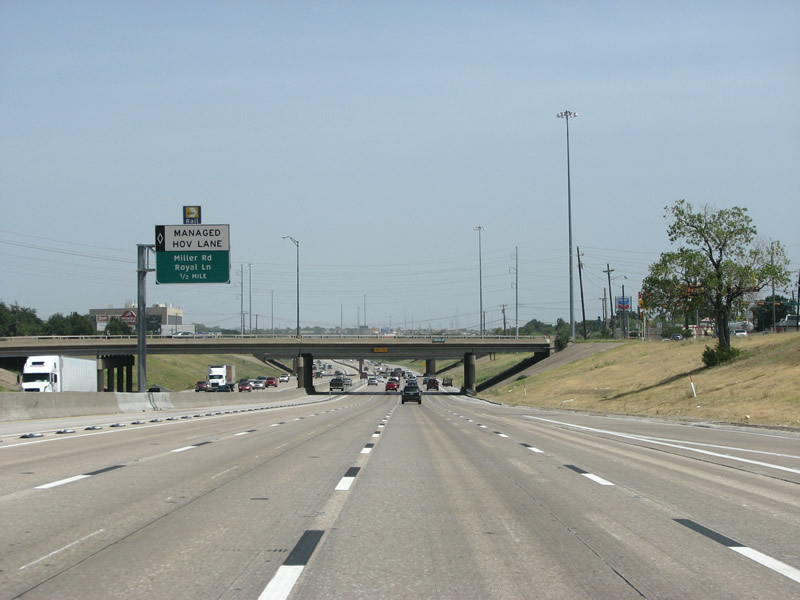 |
The HOV lane is now 'managed' and was built by Dallas' transit agency, DART. The blue rail line tab indicates that the upcoming exit connects to DART rail Blue Line, which runs from South Dallas north and east to the downtown area of Garland. Photo taken 07/27/08. |
 |
This HOV lane exit forms a new lane for southbound traffic, while traffic headed further south can stay in the lane. This design eliminates merge problems when traffic tries to the exit the HOV lane in heavy traffic. IH 635 is still signed as 'east' here, but that will change soon. Photo taken 07/27/08. |
 |
The Skillman/Audelia exit features a host of businesses and retail establishments, and is generally quite busy. Skillman Street was originally called Charles Lindbergh Boulevard, after the aviator. The road was renamed after a prominent family after Lindbergh's socialist leanings became unpopular in the 1930s. Photo taken 07/27/08. |
 |
IH 635 eastbound at Skillman/Audelia. The exit only lane is new, and was built so that HOV traffic merging from the left could get their own lane. Photo taken 07/27/08. |
 |
The freeway runs under the DART rail Blue Line here, there are stations located nearby to both sides of the upcoming exit. Photo taken 07/27/08. |
 |
Miller Road and Royal Lane both end here on the bridge. Royal forms an important route and meets 635 again far to the west of here near the airport. Miller runs east into Garland and through a large industrial area. This is the only folded diamond on 635, and was constructed this way because of the nearby rail line. Photo taken 07/27/08. |
 |
Church/Plano is the next junction, just east of Miller/Royal. Church Road is now just a small collector street, but Plano Road is an important north/south arterial that continues north to Plano. Part of it was once US 75, before Central Expressway was built. South of here, the road immediately enters Dallas' Lake Highlands neighborhood. Photo taken 07/27/08. |
 |
Walnut Hill/Kingsley/Jupiter forms the next exit, and the last in Dallas. Walnut Hill runs west from here as an east/west arterial through some of the city's most exclusive neighborhoods. It turns into Kingsley Road here, which runs east into Garland. Photo taken 07/27/08. |
 |
This section of road opened in the late 60s with 6 through lanes, but was almost immediately rebuilt with 8. It stayed in that configuration for about 30 years before the HOV lanes were added. Photo taken 07/27/08. |
 |
 |
Garland is one of DFW's largest suburbs and has about 220,000 residents. However, it has very little freeway mileage. It was one of the first suburbs to develop and saw a growth heyday in the late 1950s, and early 1960s. Today the large city only sees a paltry 4 exits on IH 635. Photos taken 07/27/08. |

Page Updated August 21, 2008.
|
About Contact FAQ |
Spotlights Testimonials Interstate Guide |
Social Media:
 |
|
© 2000-23 AARoads.com | All Rights Reserved | Privacy Policy / Terms of Use
|
||