
Interstate 5 California – North
Photos showing button copy guide signs, previous traffic patterns and interchange designs along Interstate 5 north through the Golden State.

An exit number sign was added in 2007 for Exit 18A but not for Exit 17B. 05/22/04

Button copy sign for Pacific Highway (old U.S. 101) on Interstate 5 north at Exit 18A. This sign was replaced by 2007. 05/22/04

Ground level sign for La Jolla Parkway on I-5 north. 05/22/04

Advance sign for Exit 26A on I-5 north. In 2005 the word "EAST" was covered up (probably to avoid confusion with La Jolla Parkway, which only travels west from this interchange). 05/22/04

Advance sign for Exit 26A on I-5 north. In 2005 the word "EAST" was covered up (probably to avoid confusion with La Jolla Parkway, which only travels west from this interchange). 05/22/04

Interchange sequence sign posted before the completion of the Local Bypass lanes at the I-5/805 merge for SR 56 east. 05/22/04

Button copy sign for Genesee Avenue (Exit 29) on I-5 north. 05/22/04

Interchange sequence sign posted before the completion of the Local Bypass lanes at the I-5/805 merge for SR 56 east. 05/22/04

The approach to the Sorrento Valley Road off-ramp changed with the opening of the Local Bypass lanes. 05/22/04

Interstate 5 north is six lanes now through the Sorrento Valley Road interchange (Exit 30). 05/22/04

This mileage sign was replaced in 2006 with the opening of the Local Bypass. 05/22/04
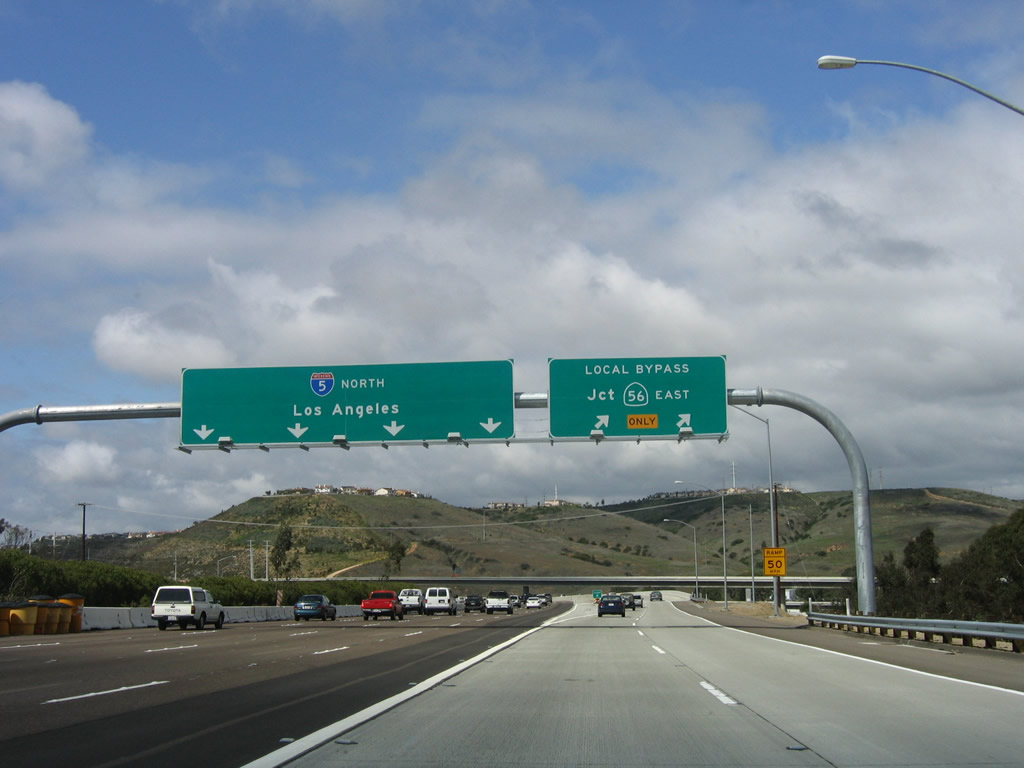
Interstate 5 north at the partition with the Local Bypass roadway for SR 56, around the time the project ended. 04/15/06

By 2008, the signage for SR 56 and Carmel Valley Road had changed. Exit numbers were added to the Carmel Valley Road off-ramp, and replacement pull-through signage was placed on the adjacent Local Bypass. 03/18/06

The exit to California 56 east prior to the opening of the Local Bypass. 05/22/04

The new ramp under construction at the I-5/805 merge is now part of a truck bypass/dual freeway that improved the flow for cars and trucks through the Interstate 5/805 merge. 05/22/04

Northbound during construction of the I-5/805 merge. 05/22/04

With the local bypass roadway to California 56 completed, a new reflective mileage sign was added. 03/24/06

Replaced interchange sequence sign beyond the I-5/805 merge northbound. 05/22/04

Construction continued beyond December 2008 to extend the carpool lane to Oceanside. 05/22/04

Prior to the completion of the Local Bypass in March 2006, this was how the exit to California 56 looked. California 56 was initially signed with a control city of "Local Access", as it was completed east to I-15 until 2004. 05/22/04

Nearing the interchange with Camel Valley on I-5 north. Much of this land was developed in accordance with the Carmel Valley and Torrey Hills Community Plans. 05/22/04

Prior to the completion of the Local Bypass, this photo shows how northbound Interstate 5 connected to California 56 off-ramp via Exit 33A. Note the previously unused bridge connector, which is now incorporated as part of the Local Bypass. 03/24/06
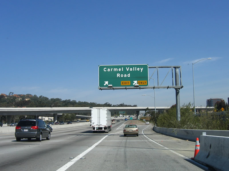
Carmel Valley Road served as a de facto California 56 until 2004, when the freeway link was completed. 03/24/06

By 2008, the signage for SR 56 and Carmel Valley Road had changed. Exit numbers were added to the Carmel Valley Road off-ramp, and replacement pull-through signage was placed on the adjacent Local Bypass. 03/24/06
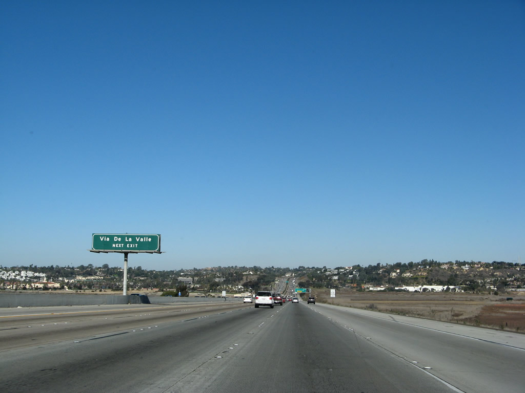
Button copy overhead for Via de la Valle on I-5 north. 01/14/07
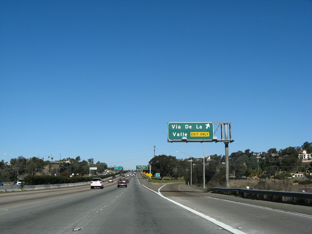
Button copy overhead for Via de la Valle on I-5 north. 01/14/07
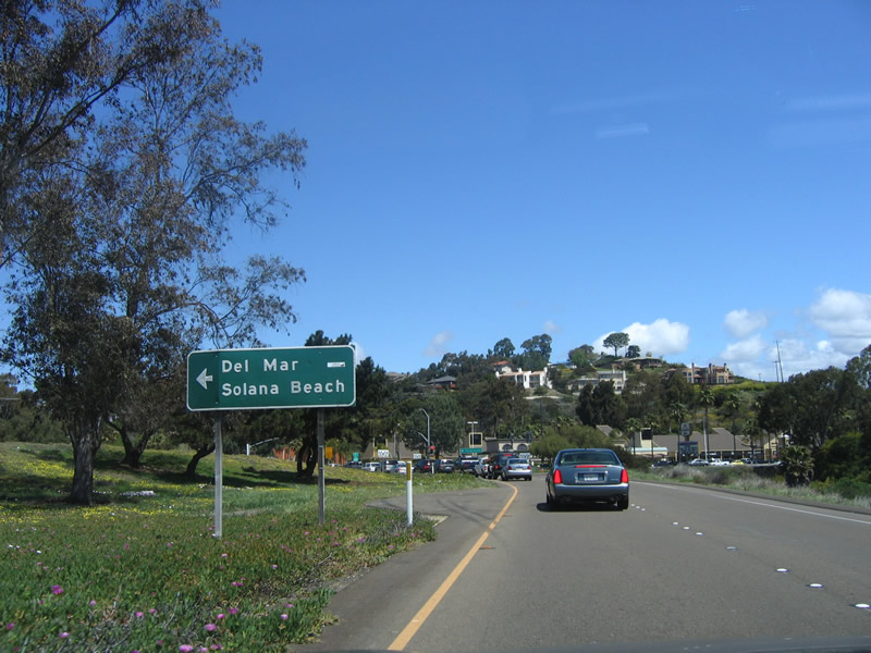
Replaced sign along the off-ramp (Exit 36) for Via de la Valley on I-5 north. 04/23/06. 03/24/06

Button copy sign for Lomas Santa Fe Drive. 01/14/07

A replacement made for this Exit 37 overhead between February and October 2009 moved Lomas one line above Santa Fe Drive. 02/13/09. 02/13/09

The signs here were replaced when the new auxiliary lane for the off-ramp was added as part of the project to install a high occupancy vehicle lane north to Manchester Avenue. 01/14/07

Button copy interchange sequence sign formerly posted 1.25 miles south of Exit 39. 05/22/04

I-5 north ahead of Manchester Avenue, prior to the HOV-lane extension completed in 2009. 10/07/06. 10/07/06

This sign was replaced when the high occupancy vehicle lane was extended north to near the off-ramp for Manchester Avenue. 01/14/07

This sign referenced that Interstate 5 entered the Cardiff-by-the-Sea community of Encinitas. When the city of Encinitas was formed, population and elevation numbers were removed from this sign. This is unusual, since most communities that are part of larger cities (such as La Jolla or Clairemont in San Diego) were not acknowledged with city limit signs such as this one. 05/22/04

The signs along this section of Interstate 5 were replaced in Spring 2006. 11/14/04
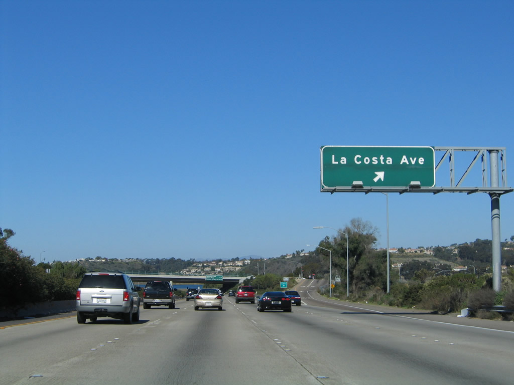
The signs along this section of Interstate 5 were replaced in Spring 2006. 11/14/04
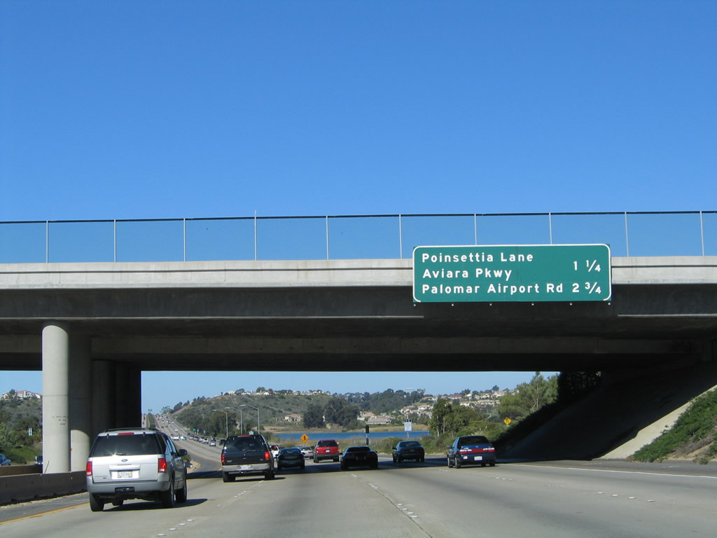
The signs along this section of Interstate 5 were replaced in Spring 2006. 11/14/04

The signs along this section of Interstate 5 were replaced in Spring 2006. 11/14/04

Exit number signs were added for Aviara Parkway and Poinsettia Lane in 2006. 05/22/04

Exit number signs were added for Aviara Parkway and Poinsettia Lane in 2006. 05/22/04
Photos by AARoads
Page Updated Sunday January 19, 2025.