Interstate 195 Rhode Island

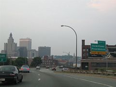
U.S. 6 joined Interstate 195 from Interstate 95 southbound at the eastbound beginning. The tandem proceeded northeast through downtown Providence toward the Providence River and East Providence, meeting Dyer Street at Exit 1. 06/26/05
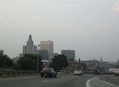
Ramps converged from Interstate 95 north, Interstate 95 south & U.S. 6 east, and Friendship Street north. The Downtown skyline came into view as Interstate 195 & U.S. 6 curved eastward. 06/26/05
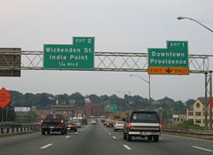
Interstate 195 & U.S. 6 eastbound turned eastward toward the Dyer Street off-ramp (Exit 1). Dyer Street transitions into Memorial Boulevard at the Crawford Street bridge. Memorial Boulevard carries U.S. 44 eastbound between Steeple and Crawford Streets alongside the Seekonk River. 06/26/05
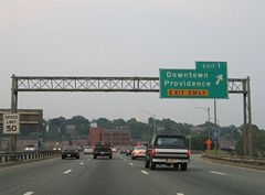
Exit 1 departed Interstate 195 & U.S. 6 eastbound for Dyer Street and Downtown Providence. Memorial Boulevard travels north and west along the river to U.S. 1 (Francis Street) and the Interstate 95 interchange with U.S. 6 & Rhode Island 10. 06/26/05
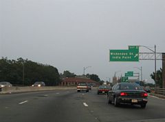
The freeway crossed the Providence River and quickly entered the Exit 2 interchange with Point and Wickenden Streets. Point Street spans the Providence River and passed under Interstate 195 & U.S. 6 between intersections with Water and Main Streets (U.S. 44 east & west). Wickenden Street continues Point Street east from the former freeway to Hope and Gano Streets. India Point Park lies south of Wickenden Street and Interstate 195. 06/26/05
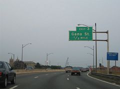
U.S. 1A & 44 eastbound joined Interstate 195 & U.S. 6 between Exits 2 and 4. The pair now continue along a couplet of Main Street to the new Interstate 195 & U.S. 6 ahead of India Point Park. 06/26/05
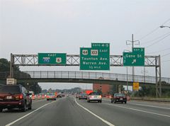
Exit 3 left the Interstate 195 & U.S. 1A-6-44 eastbound freeway at the former India Point Park pedestrian over crossing. The new Interstate 195 also sees a ramp onto India Street east for Gano Street and a new pedestrian overpass links India Point Park with East Street on the north side of I-195. 06/26/05
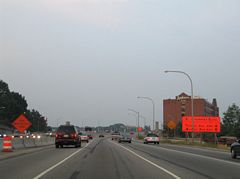
Interstate 195 & U.S. 1A-6-44 eastbound traveled the 1932-constructed Washington arch Bridge over the Seekonk River. The span was replaced in conjunction with the Interstate 195 relocation project by a new five-lane bridge. 06/26/05
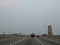
Interstate 195 & U.S. 1A-6-44 eastbound traveled the 1932-constructed Washington arch Bridge over the Seekonk River. The span was replaced in conjunction with the Interstate 195 relocation project by a new five-lane bridge. 06/26/05
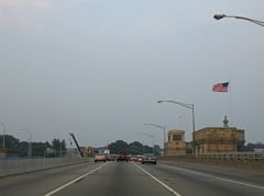
Additional view of the original Washington Bridge along Interstate 195 & U.S. 1A-6-44 eastbound. The westbound span carried four lanes in 2005, but was expanded to carry five overall lanes during the Iway project. The river represents the boundary between Providence and East Providence. Photos taken 06/26/05

Additional view of the original Washington Bridge along Interstate 195 & U.S. 1A-6-44 eastbound. The westbound span carried four lanes in 2005, but was expanded to carry five overall lanes during the Iway project. The river represents the boundary between Providence and East Providence. Photos taken 06/26/05
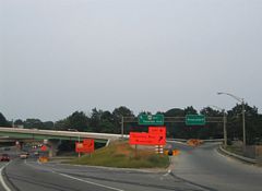
Exits 4 and 5 depart Interstate 195 & U.S. 1A-6 back to back at the east end of the Washington Bridge. Exit 4 partitions as well, with a flyover taking U.S. 44 onto Taunton Avenue and a southward ramp to Veterans Memorial Parkway. Veterans Parkway runs south along the Seekonk Riverfront to Squantum Woods State Park and Rhode Island 103 (Pawtucket Avenue) ahead of the community of Riverside. 06/26/05
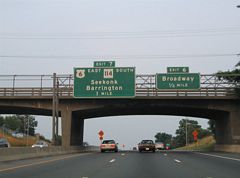
Sign changes made since 2006 amended the Exit 7 overhead to only display Rhode Island 114, as U.S. 6 now leaves I-195 at the realigned Warren Street off-ramp of Exit 8. 06/26/05
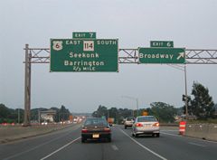
Replaced sign bridge that was posted at the Warren Street off-ramp to Broadway on I-195 & U.S. 1A-6 east. U.S. 1A shares a silent merge with Interstate 195 & U.S. 6 between Exits 2 and 8. 06/26/05
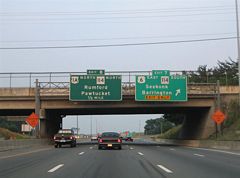
Sign changes made at the Pawtucket Avenue overpass shifted U.S. 6 from Exit 7 to the Exit 8 panel while replacing Rumford and Pawtucket with Pawtucket Avenue (U.S. 1A & RI 114 north) and Seekonk, MA for U.S. 6 east. 06/26/05
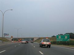
Exit 8 now represents the eastbound split of U.S. 6 east from I-195 north. Additional changes made here corrected R.I. 1A to U.S. 1A. U.S. 1A arcs northwest from the freeway through Rumford, east Pawtucket and South Attleboro, Massachusetts. 06/26/05
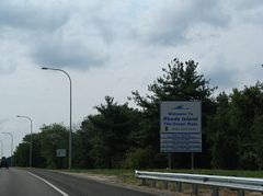
Replaced welcome to Rhode Island sign posted after the Warren Avenue underpass along I-195 west. 07/28/07
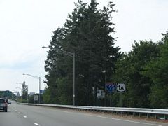
Pawtucket Avenue carries U.S. 1A south from Rumford to I-195 & U.S. 6 west. This shield assembly was updated by 2014 and now displays an R.I. 1A shield in place of U.S. 1A. 07/28/07
Photos by AARoads
Page Updated Friday January 24, 2025.


