
I-385 South Carolina
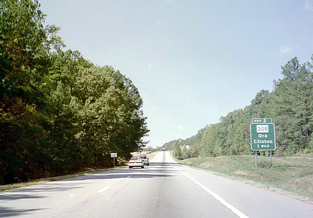
Original button copy sign posted one mile ahead of Exit 2 with S.C. 308. 10/15/01
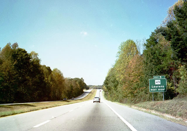
The sign replacement made for Exit 5 and S.C. 49 here replaced the verbiage of Next Right with an arrow. 10/15/01
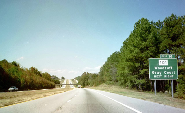
Former signage posted on I-385 north, one mile ahead of Exit 16 to S.C. 101 near Gray Court. 10/15/01
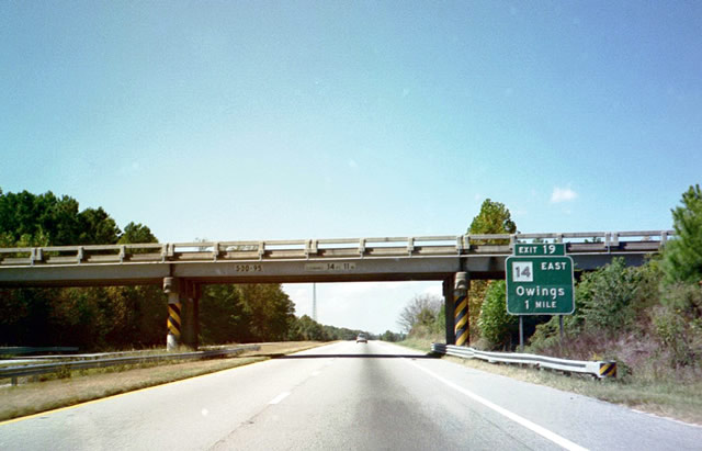
Friendship Church Road spanned Interstate 385 by this button copy sign posted for S.C. 14 east to nearby Owings. 10/15/01
S.C. 14 runs along old U.S. 276 north from U.S. 76 in Laurens to combine with I-385 at Exit 19. 10/15/01
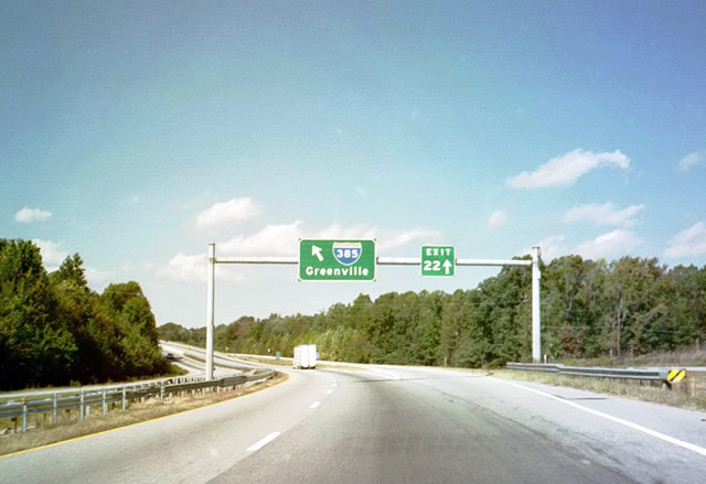
This sign bridge posted at Exit 22 was replaced with a conventional gore point sign. 10/15/01
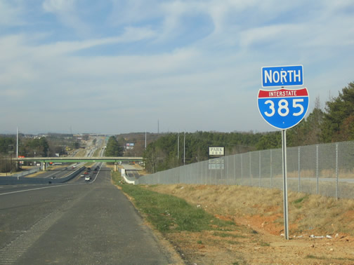
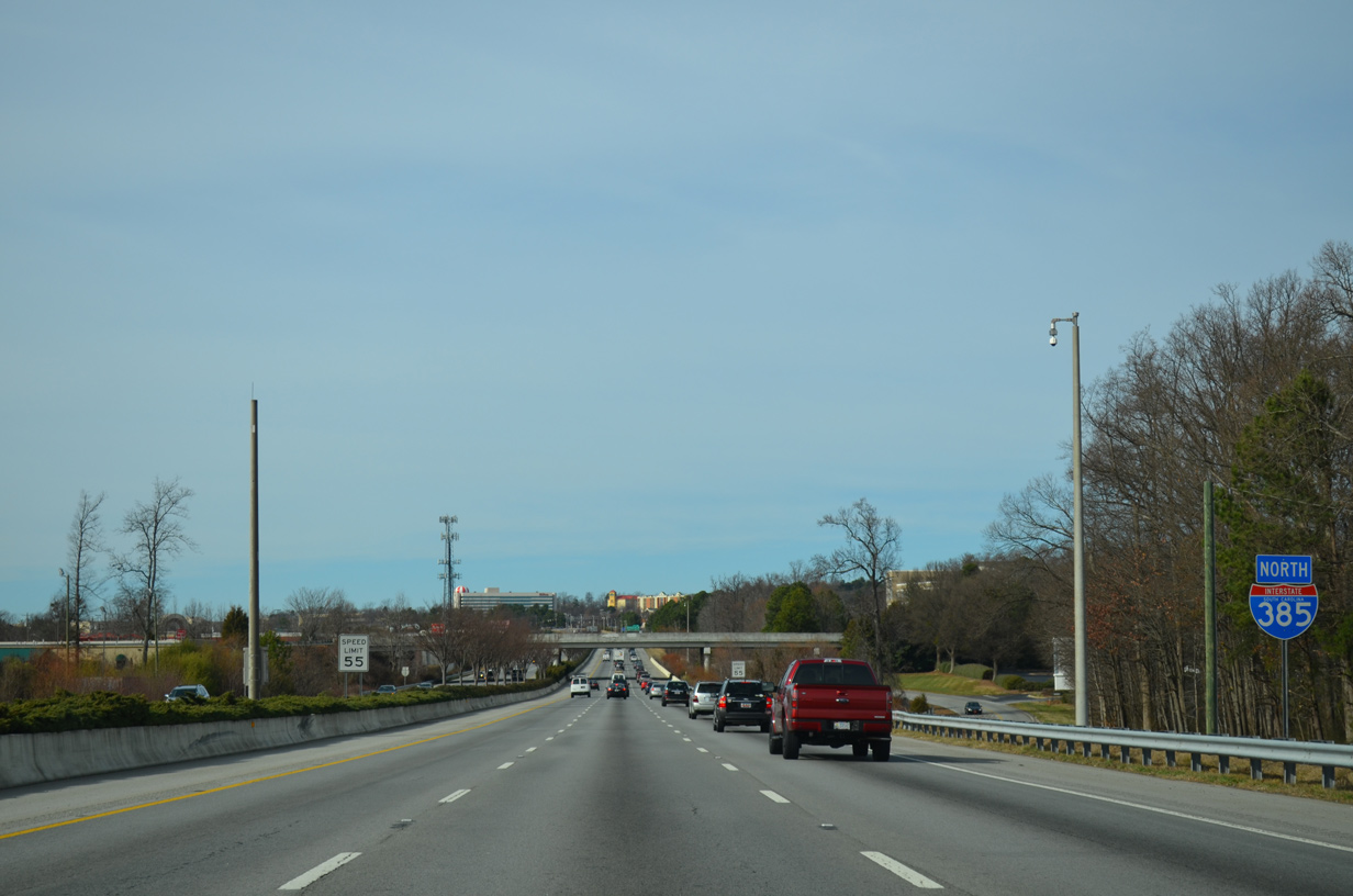
This 2003 installed reassurance shield for I-385 north was one of the first non-state named shields posted along an Interstate mainline in South Carolina. It was replaced by January 2016. 01/11/04
I-385 before the expansion to eight lanes. The Southern Connector opened to traffic on February 27, 2001, providing an alternate route to I-85 south for Anderson and Atlanta. 01/11/04
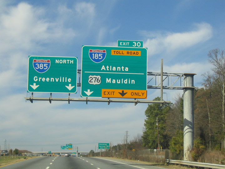
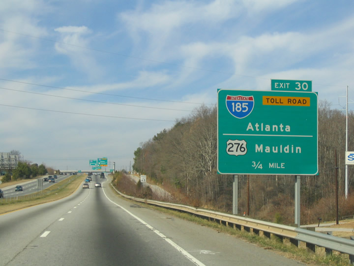
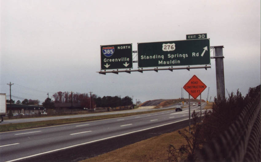
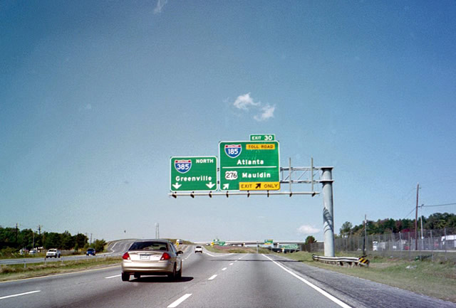
Sign changes made for Exit 30 coinciding with the 2005-07 expansion of I-385 included adding Anderson as a second control city for I-185 north. 01/11/04
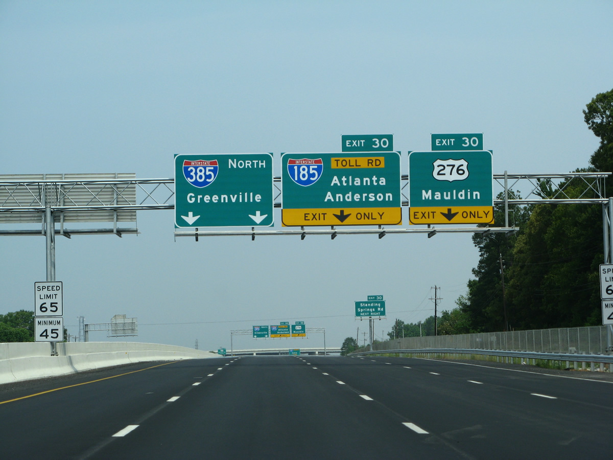
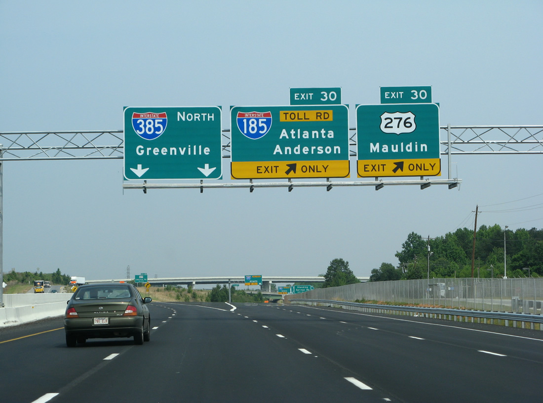
This set of signs was replaced with panels using Clearview font by December 2012 to reflect the addition of a third northbound through lane for Interstate 385. 05/31/07
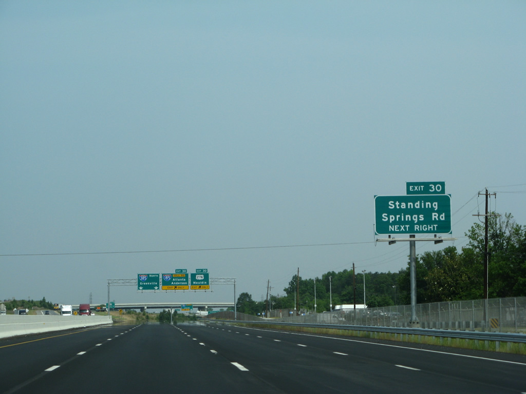
A sign replacement made in 2015 references E Standing Springs Road for Exit 30 and U.S. 276 north. 05/31/07
Prior to construction of the Southern Connector in 1998-99, the split of U.S. 276 west from I-85 north was a simply wye interchange. 12/08/99
The interchange with U.S. 276 was reconfigured to bring in Interstate 185 from the west. The toll road provides a circuitous bypass of Greenville for points south along I-85. 10/05/01
This view looks at the U.S. 276 and I-385 split prior to the six-laning completed in 2012. 05/31/07
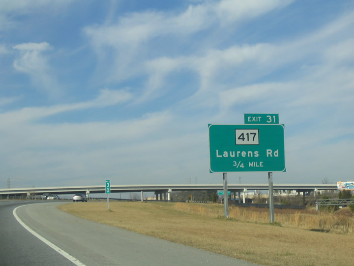
I-385 curves east from U.S. 276 onto what was originally known as the Golden Strip Freeway. This sign for S.C. 417 was replaced by an overhead during freeway widening. 01/11/04
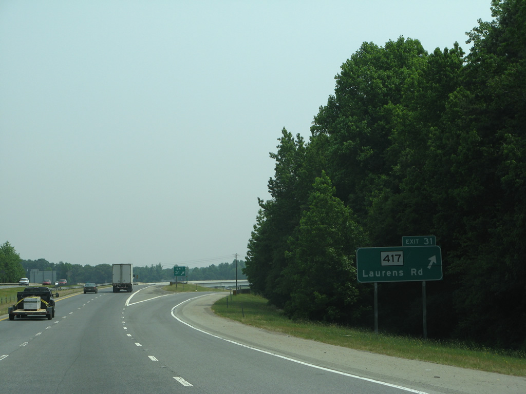
A concrete barrier takes the place of the grassy median in this scene now at the ramp departure of Exit 31 to S.C. 417 (Laurens Road). 05/31/07
The Southern Connector ends just beyond the S.C. 417 on-ramp. I-385 is a six lane concrete freeway here now. 05/31/07
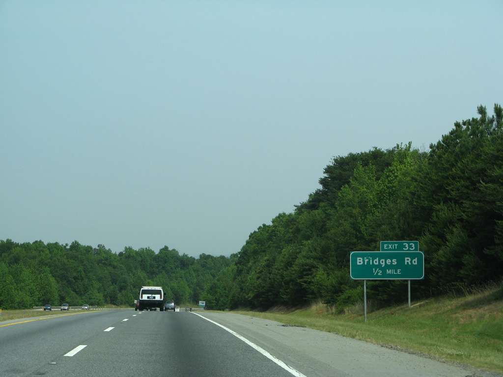
I-385 with just four lanes northbound ahead of Exit 33 with Bridges Road. 05/31/07
Passing through the diamond interchange (Exit 33) with Bridges Road before expansion of I-385. 05/31/07
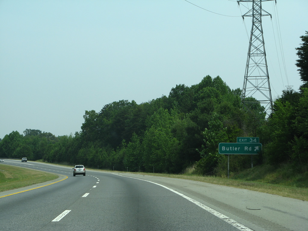
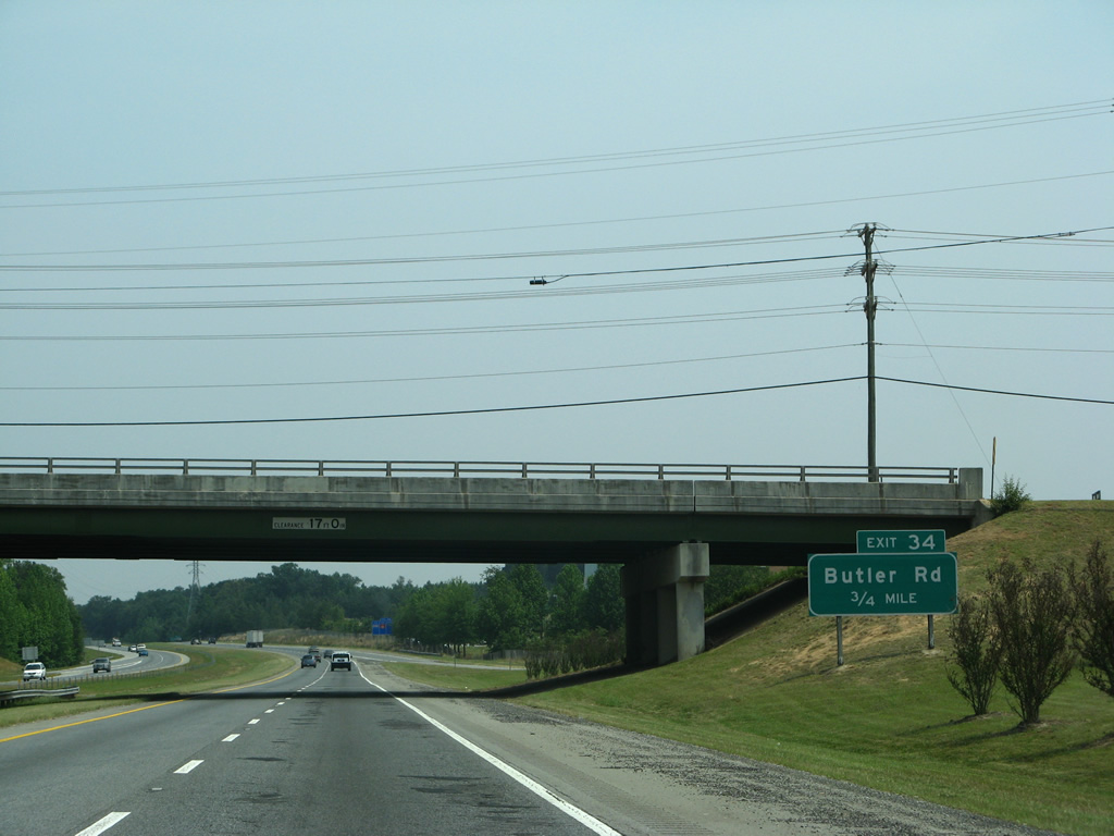
The 1985 rural design of I-385 at Exit 34. 05/31/07
I-385 north at Butler Road prior to the I-85/I-385 Gateway Project. 12/31/13
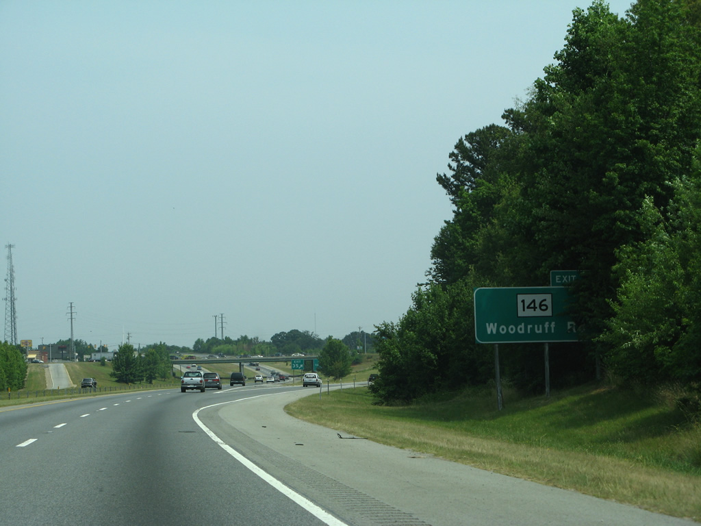
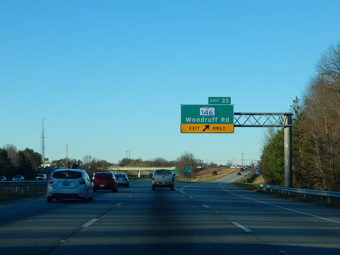
This ground level sign for S.C. 146 at Exit 35 was replaced with an overhead to reflect the lane drop at the north end of the 2012-widened section of I-385. 05/31/07
01/13/16
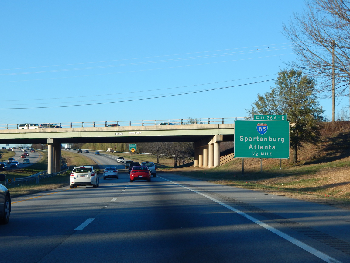
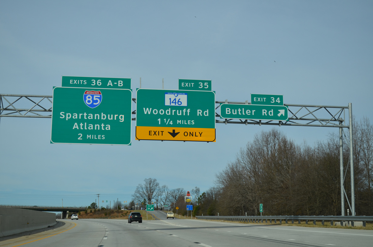
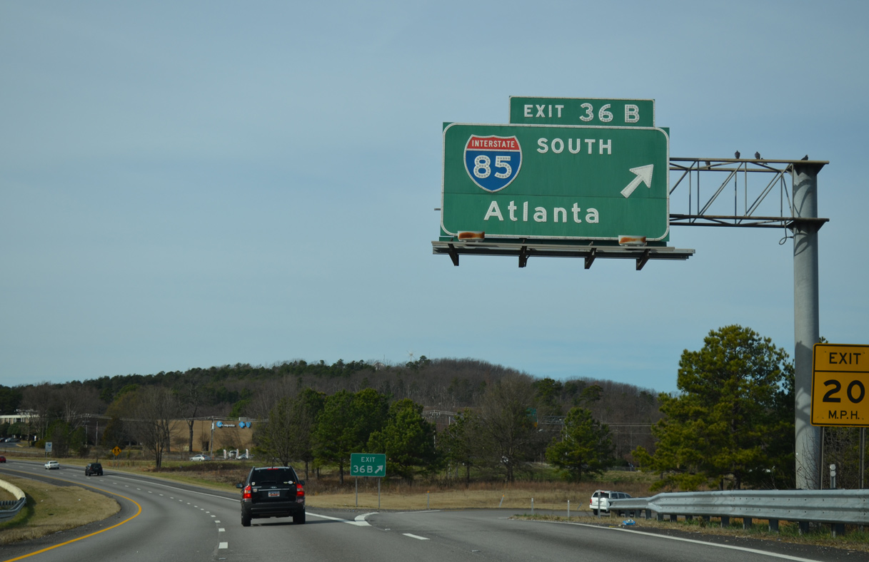
Woodruff Road spans I-385 a half mile south of Exit 36 for Interstate 85. 01/13/16
A historical look at button copy signs for I-85 at Exits 36A/B. I-385 was extended south from a trumpet interchange here to U.S. 276 at Mauldin with construction starting in 1978. 12/08/99
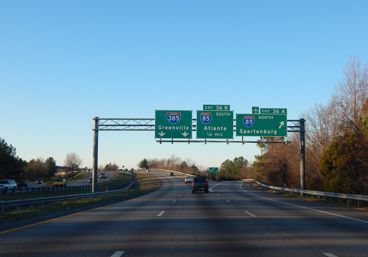
I-385 north at I-85 one month before the I-85/I-385 Gateway Project kicked off. 01/13/16
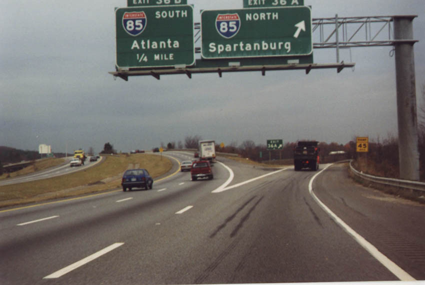
Original button copy sign posted at the loop ramp for I-85 south from I-385 north. Traffic joins a c/d roadway below running west to adjacent S.C. 146 (Woodruff Road). 05/31/07
This button copy sign for Interstate 85 south remained in service until the I-85 / 385 Gateway project got underway in 2016. 12/31/13
12/31/13
12/31/13
12/31/13
12/31/13
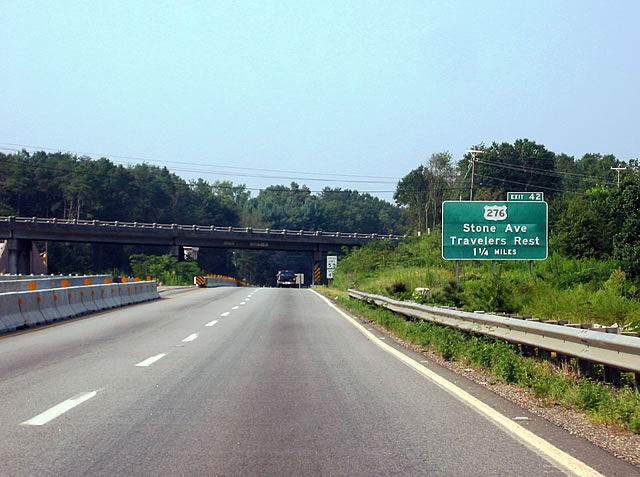
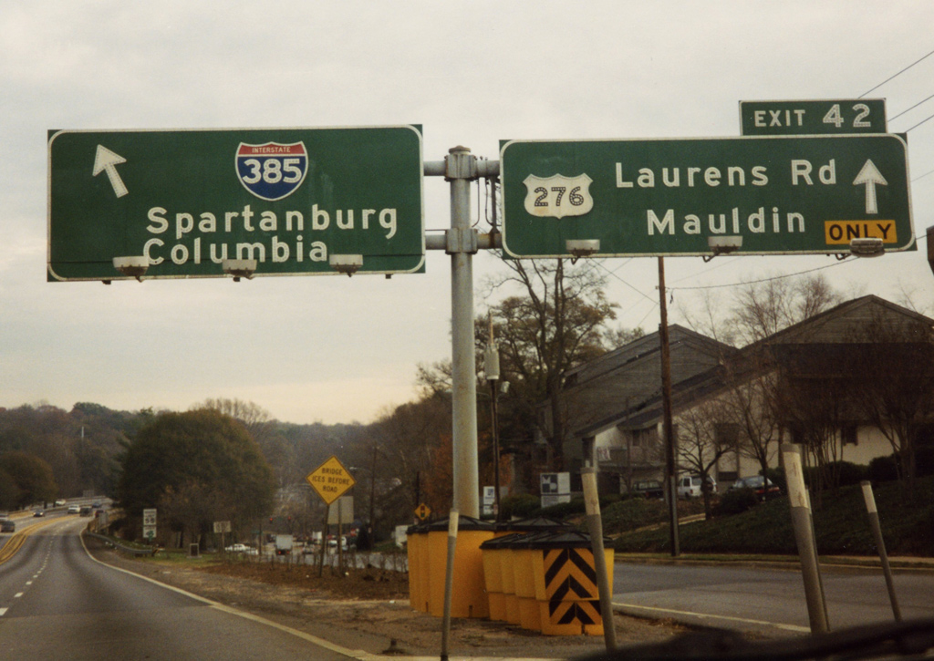
I-385 north ahead of the diamond interchange (Exit 42) with U.S. 276. This button copy sign, posted ahead of the replaced Keith Drive overpass, was removed during the 2001-04 widening project. 08/23/03
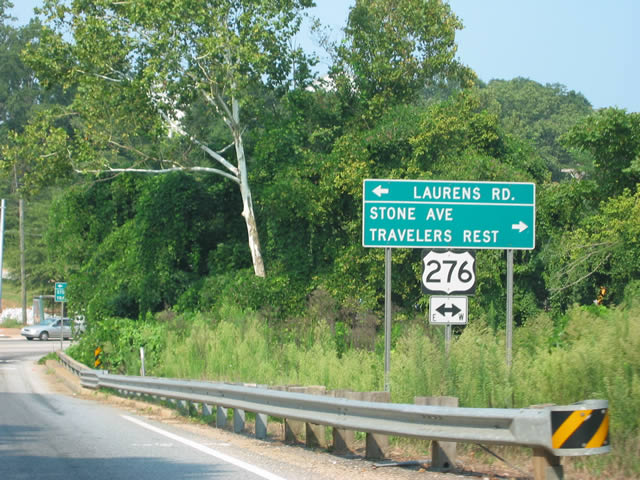
Another button copy sign that was formerly posted for U.S. 276 (Stone Avenue) on I-385 north. U.S. 276 travels just 106 miles between Mauldin and Cove Creek, North Carolina. The route locally joins Greenville with the city of Travelers Rest. 08/23/03
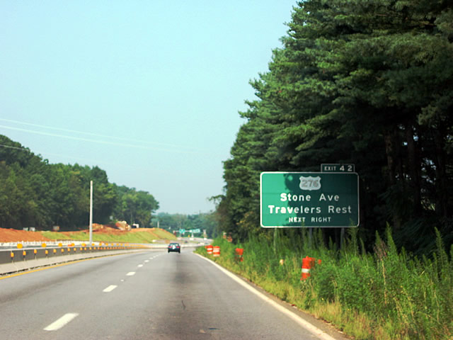
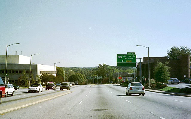
Looking at Interstate 385 north at Exit 42 when the freeway carried just four lanes. 08/23/03
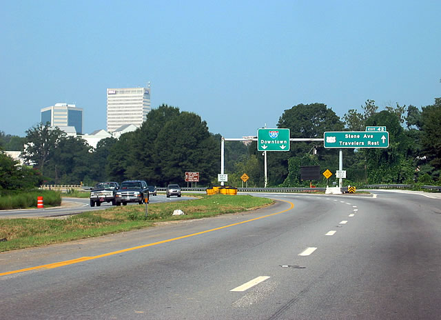
Exit 42 lowered to cross Richland Creek before intersecting U.S. 276. This sign assembly was removed when the ramp was widened to four lanes. 08/23/03
Business Spur I-385 (E North Street) lowered toward the diamond interchange (Exit 42) with U.S. 276 (E. Stone Avenue / Laurens Road). Posted at Boyce Avenue, this overhead was removed during widening. 10/15/01
I-385 south commences with three lanes here now, with this gore point shifted to the right. These signs likely predated the 1985-completion of the Golden Strip Freeway. 12/08/99
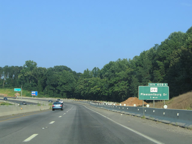
Former button copy sign posted ahead of the clovereaf interchange (Exits 40B/A) with S.C. 291 (Pleasantburg Drive). This sign was replaced during I-385 widening between 2001-04. 07/23/04
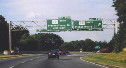
I-385 at Exits 40B/A when it was still just four lanes. S.C. 291 encircles Greenville for 11.4 miles between U.S. 25 (White Horse Road) and U.S. 276 (Poinsett Highway). 06/23/00
Photos by AARoads, Carter Buchanan (06/23/00, 01/11/04, 09/04/11, 01/13/16, 08/04/16)
Page Updated Friday January 24, 2025.