
Interstate 89 Vermont - South Archive
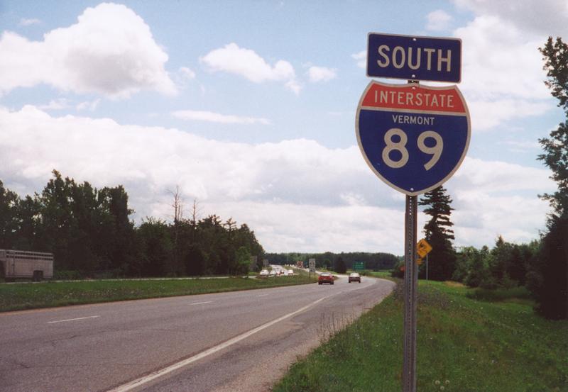
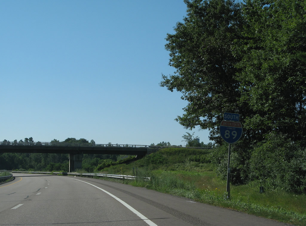
This state-named shield stood at the on-ramp from U.S. 2 (Williston Road) east onto Interstate 89 south. 07/23/00

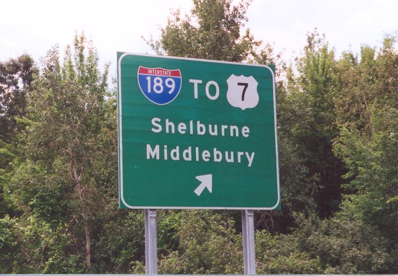
Guide signs for Interstate 189, a 1.49-mile freeway leading west to U.S. 7, were posted without tabs for Exit 13 until the sign replacement project completed by 2012. 08/02/07
This auxiliary guide sign touting the connections of I-189 west to U.S. 7 south for Vergennes and Rutland referenced the First Exit. The problem was that there is no second exit at I-189, as no connection was built to Kennedy Drive east or Dorset Street from I-89. 08/04/07
Sign changes made at Exit 13 replaced Middlebury with Rutland as the second control point for I-189 west to U.S. 7 south. I-189 was originally intended on ending at the Burlington Belt Line, a freeway proposed to lead north to Downtown and south to Shelburne. 07/23/00
This reassurance marker was simply removed during the resigning of I-89. It was posted ahead of the Kennedy Drive westbound on-ramp to Interstate 189. 08/04/07
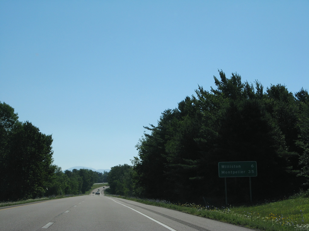
Interstate 89 curves east from I-189 toward the town of Williston (six miles) and Montpelier (35 miles). 08/04/07
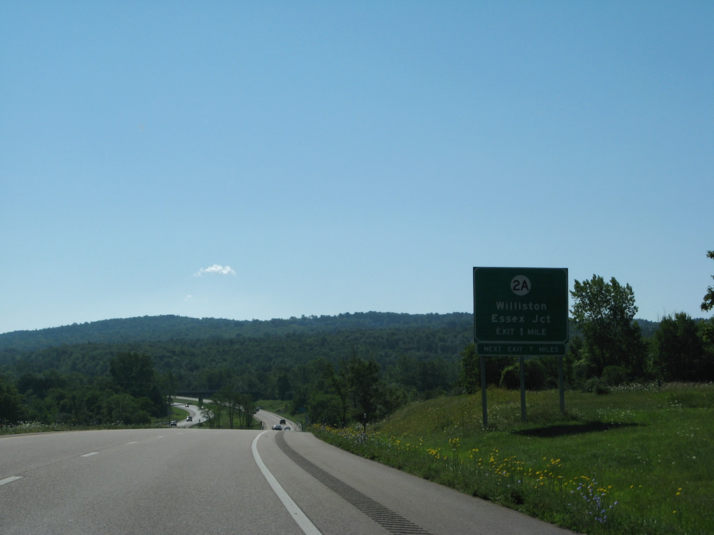
An older sign for Vermont 2A (St. George Road) in Williston was missing a tab for Exit 12. 08/04/07
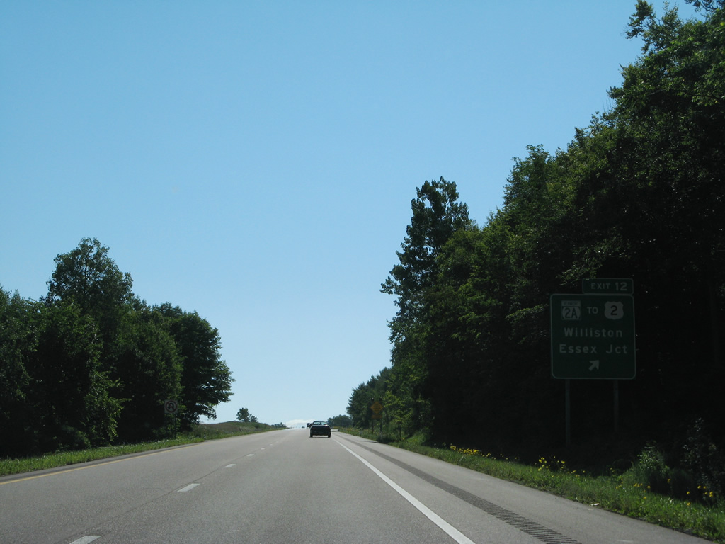
The Exit 12 sign posted at Vermont 2A was modified by 2007 to include the newer state route marker, but replaced by 2011. 08/04/07
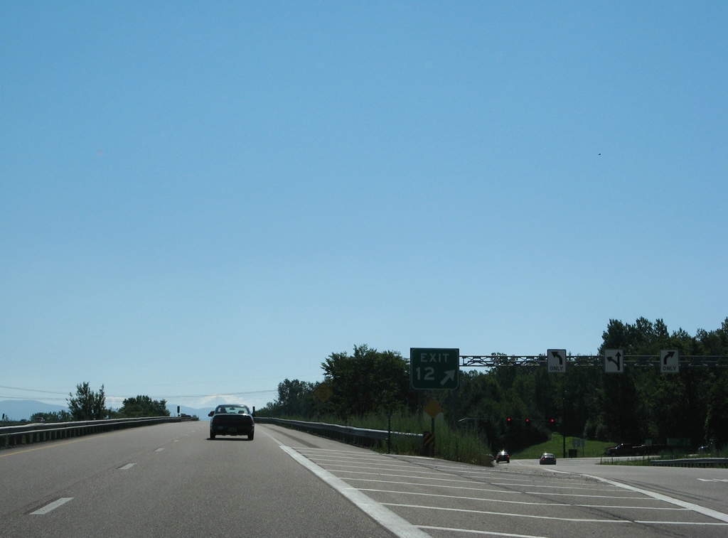
A sign bridge displaying turn lane signage above the Exit 12 off-ramp to VT 2A was replaced with a new assembly by 2011. VT 2A heads north to Essex Junction and south to VT 116 in St. George. 08/04/07

Interstate 89 progresses east from Exit 12 six miles to the Richmond town center. 08/04/07
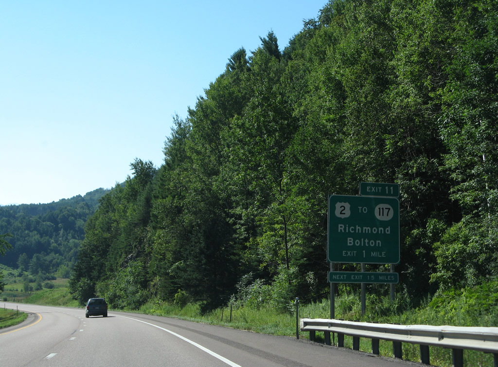
The lone Richmond interchange (Exit 11) joins Interstate 89 with U.S. 2 by VT 117 in one mile. 08/04/07
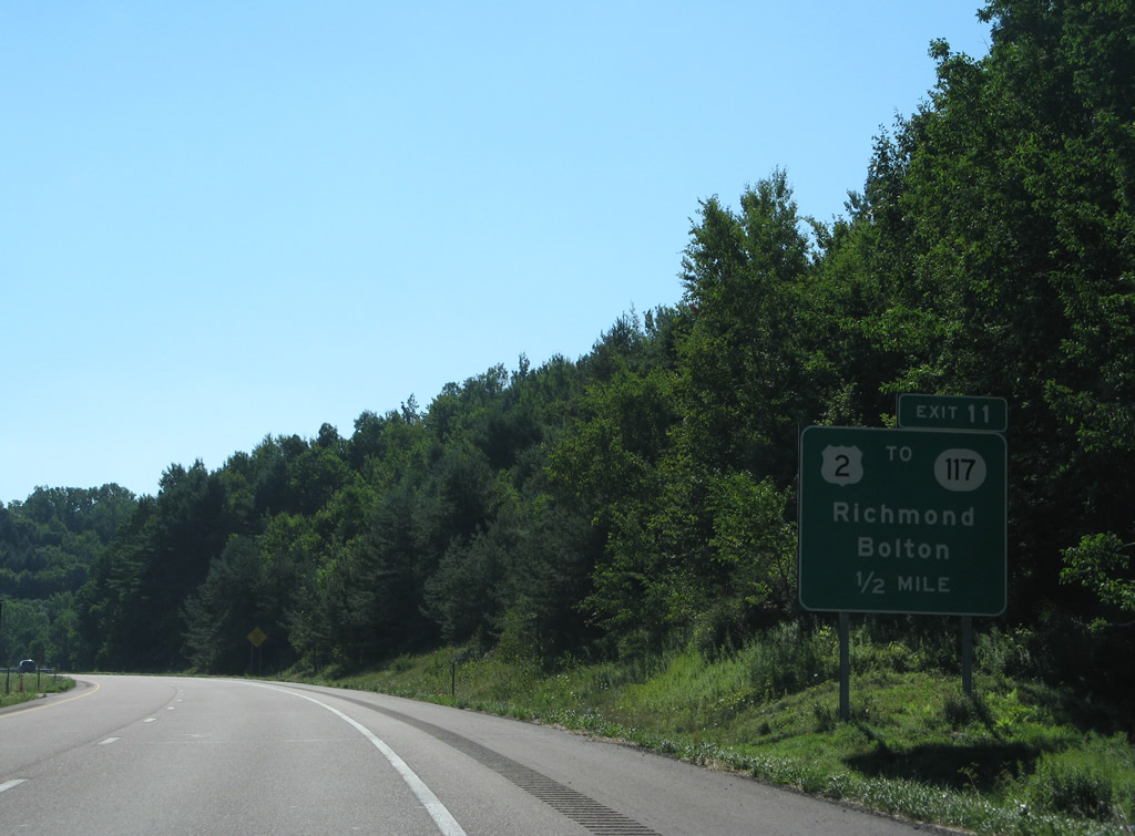
A look at the replaced half mile guide sign for the parclo interchange (Exit 11) with U.S. 2 in Richmond. 08/04/07
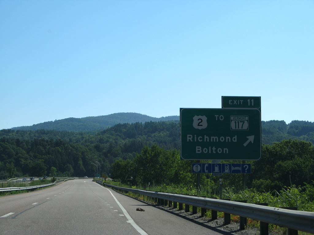
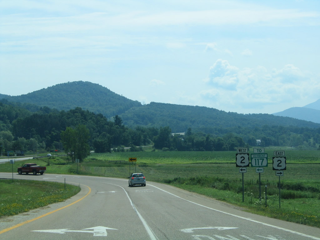
Exit 11 leaves I-89 south just beyond the Winooski River for U.S. 2 (West Main Street) to Vermont 117 north to Essex Junction. 08/04/07
U.S. 2 ventures east two miles to the Richmond town center and eight miles to the Bolton town center. 07/22/05
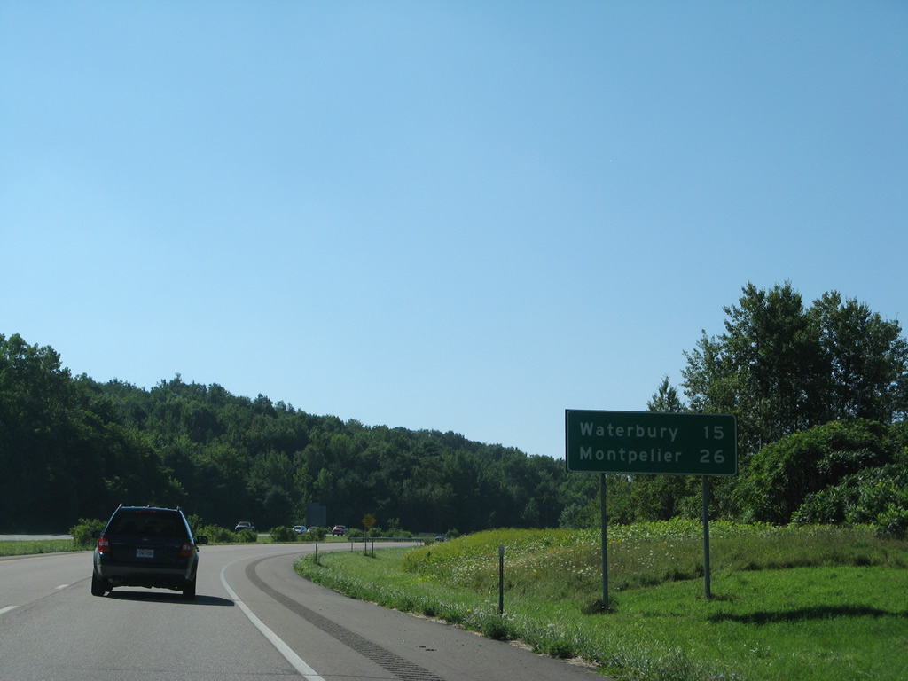
The replacement of this mileage sign posted at Richmond revised the figures down by one mile for both Waterbury and Montpelier. 08/04/07
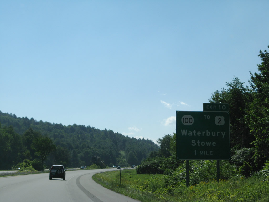
All signs for Exit 10 and Vermont 100 at Waterbury were replaced by 2011. 08/04/07
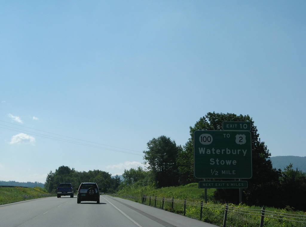
The folded cloverleaf interchange (Exit 10) with Vermont 100 lies just east of the roundabout joining the state route with U.S. 2 (Main Street) through the Waterbury business district. 08/04/07
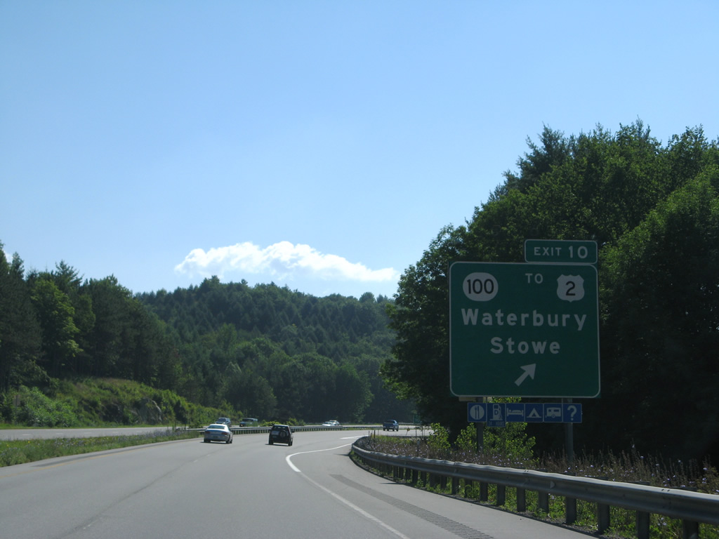
Vermont 100 travels a scenic route north from Exit 10 to Stowe and Morrisville and south from Waterbury to Waitsfield and Warren. 08/04/07

A metric united based distance sign was posted after Exit 10 for Middlesex and Montpelier. This was replaced with a new sign using English units. 08/04/07
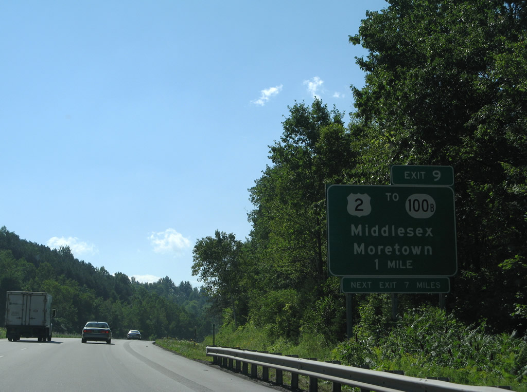
Interstate 89 travels by the Middlesex town center just past forthcoming Exit 9 with Center Road. 08/04/07
Photos by AARoads
References:
Page Updated Friday January 24, 2025.