
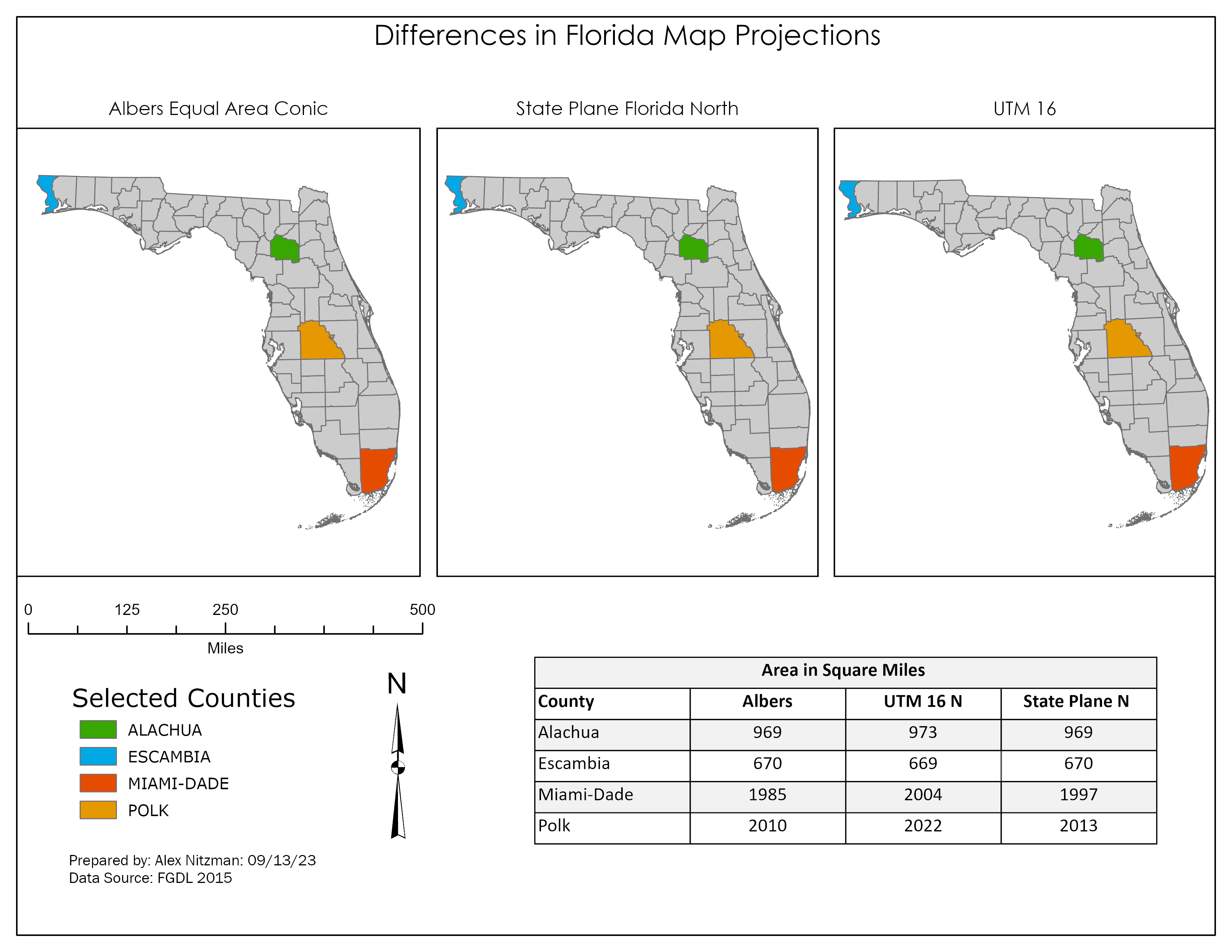
Map Projection Variation with Florida County data
This week's GIS lab delved into map projections, the manipulation of attribute data and the creation of a feature class out of selected data. We were tasked with taking a polygon shapefile of Florida's County Boundaries and reprojecting it from the original Albers Conical Equal Area (Albers) coordinate system to both the State Plane Coordinate System (State Plane Florida North) and the Universal Transverse Mercator (UTM 16 North) [...]