
This week’s GIS lab delved into map projections, the manipulation of attribute data and the creation of a feature class out of selected data. We were tasked with taking a polygon shapefile of Florida’s County Boundaries and reprojecting it from the original Albers Conical Equal Area (Albers) coordinate system to both the State Plane Coordinate System (State Plane Florida North) and the Universal Transverse Mercator (UTM 16 North) system.
Following the completion of that task, we were asked to compare the three maps to note any differences. The Albers and State Plane map projections were very similar, while the UTM projection was noticeably tilted more. Further analysis involved extracting the area in square miles in tables for four select counties across the state. When comparing them, Escambia was nearly identical in area on all three. Alachua was only four square miles larger on UTM 16 N as compared to the other two. More substantial differences were noted in Miami-Dade and Polk Counties, where the square mile numbers for UTM 16 N remained the highest.
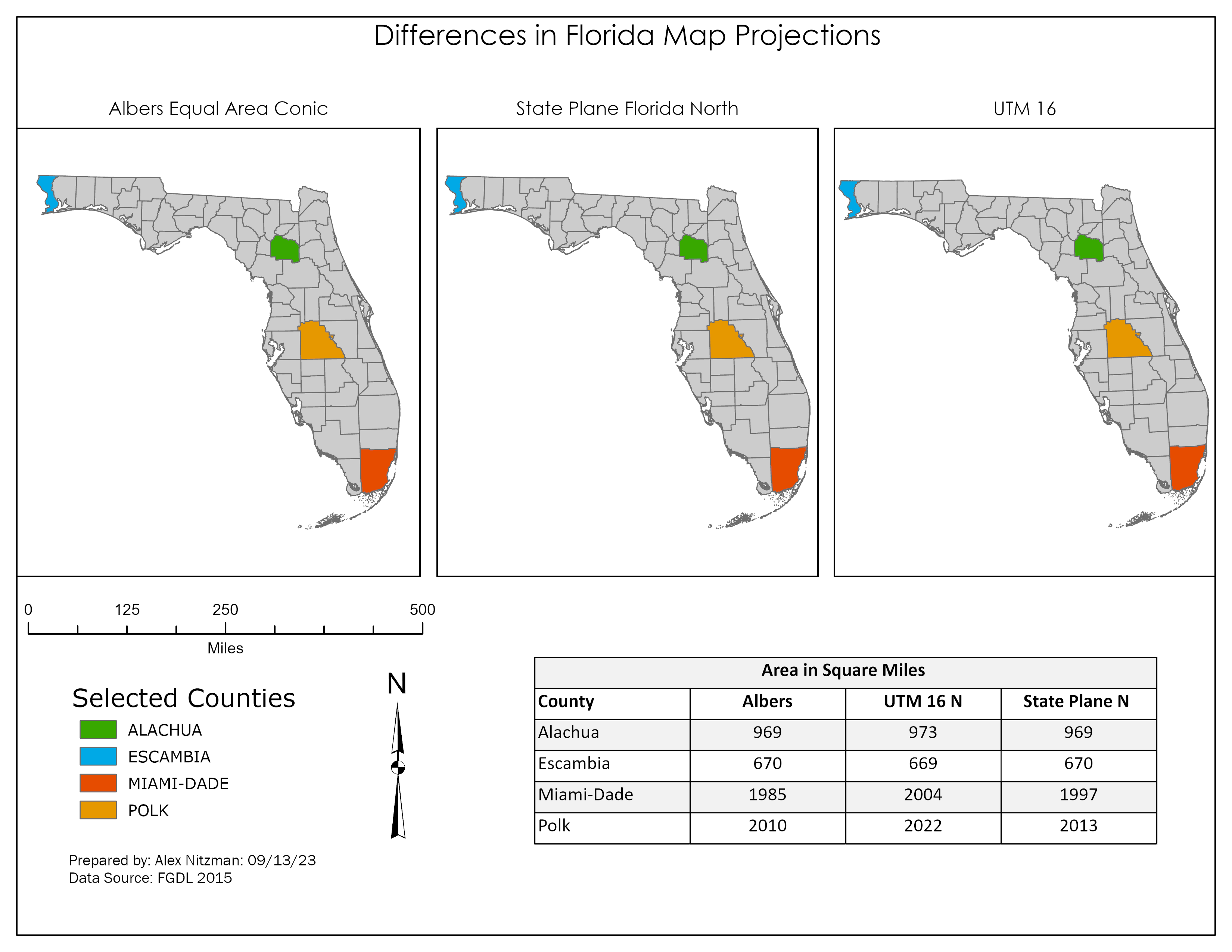
Final map showing Florida with a selected Counties layer in Albers, FL State Plane N and UTM 16 N
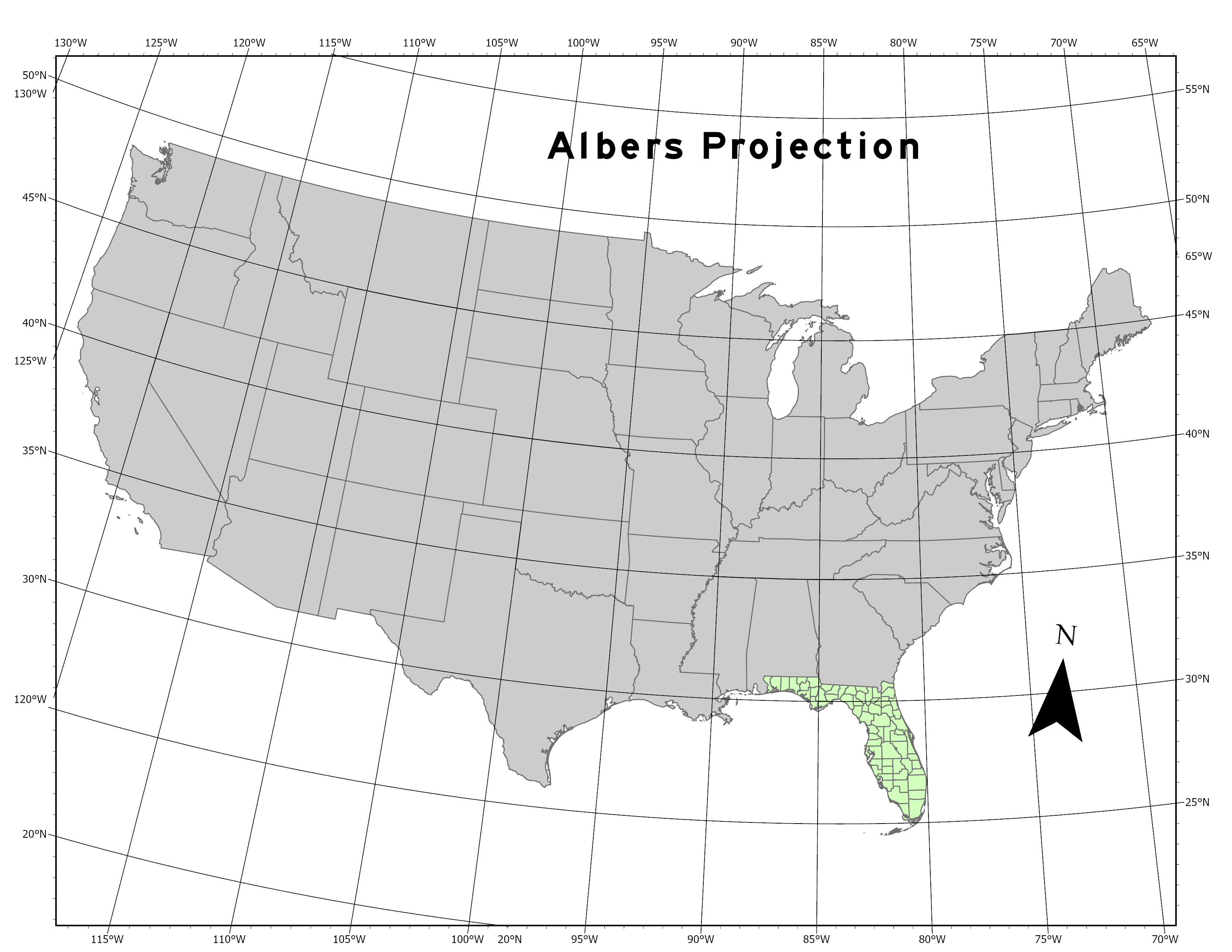
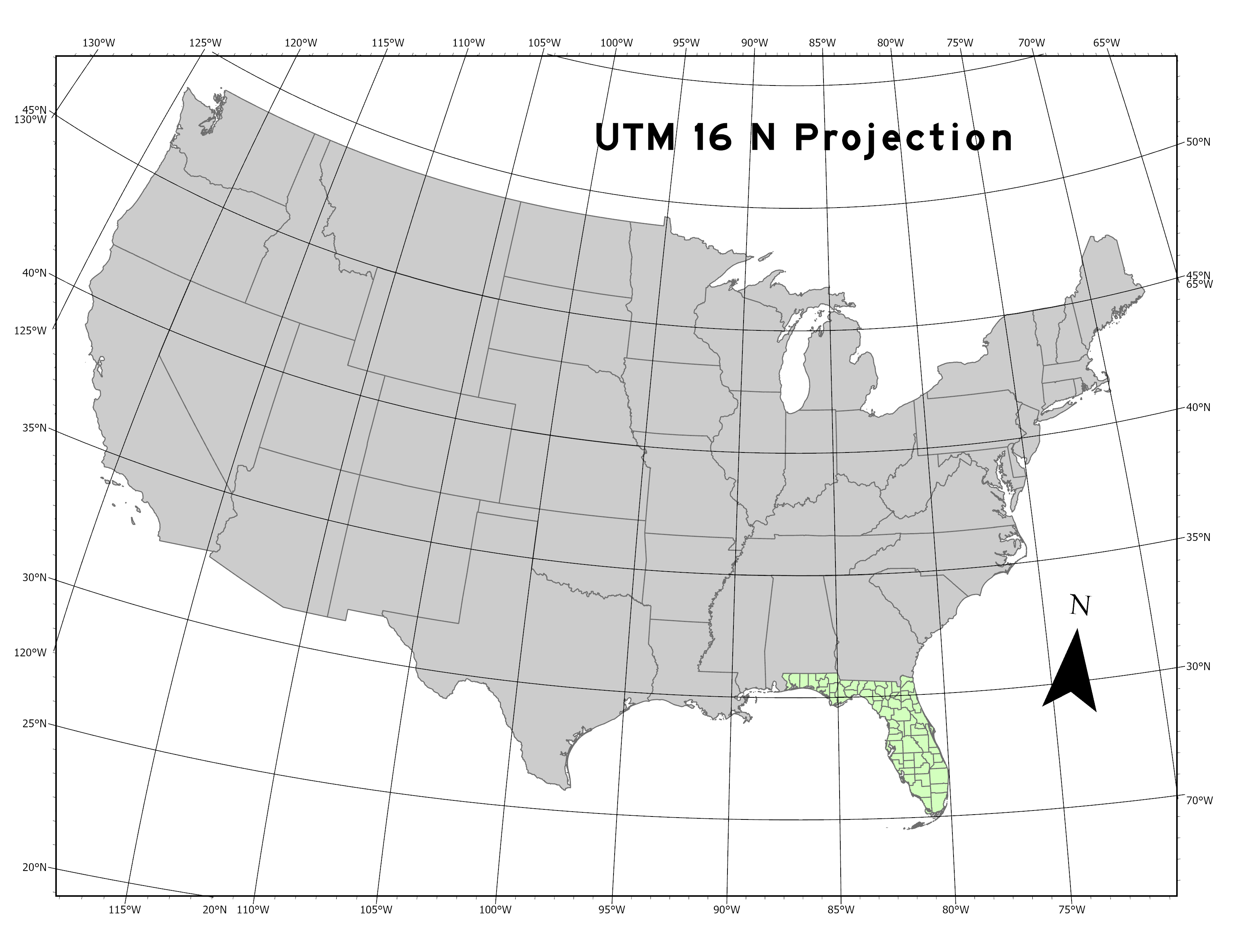
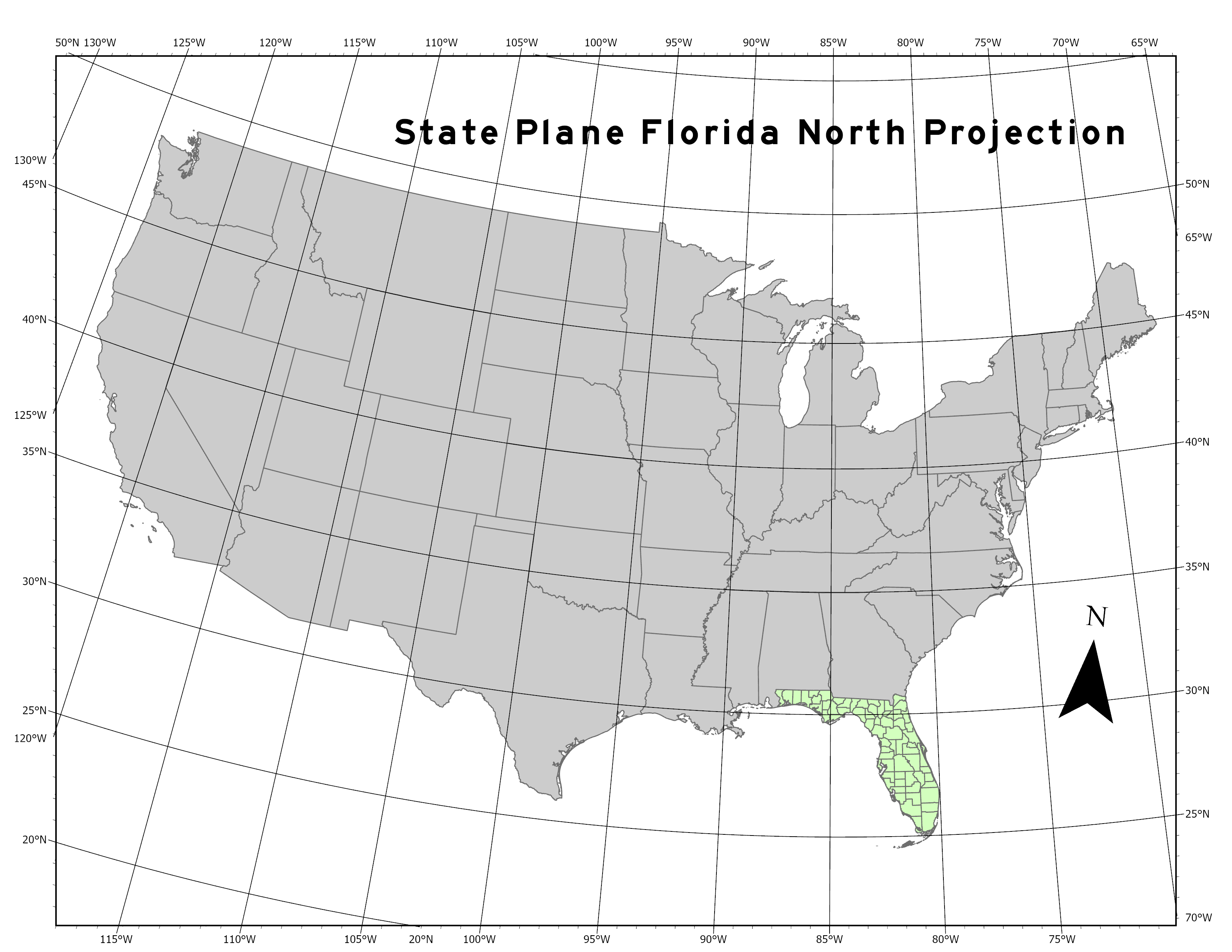
Our process summary included a section to report my results and conclusions. While I knew of the concept of projections from previous cartography work, I really did not know much about the origins of their geographic coordinate systems. So I devoted several hours of research, composing a word document on them for future reference. Followed this by practicing reprojection more and creating overview maps showing each of the three projections nationally with graticules.
With an understanding of their methodology, the differences in the three Florida County map projections become more clear. The original shape file uses the Albers coordinate system, which it turns out is optimal to use for east to west geographical areas located in the mid latitudes. More specifically, the coordinate system uses a two standard parallels to minimize distortion in the region between them. This results in spatial accuracy along the parallels and minimum distortion between them. However scale along the lines of longitude does not match the scale along the lines of latitude, resulting in the final projection not being conformal. Albers is best suited for projecting the entire state of Florida.
There are 60 UTM zones per hemisphere, each spanning 6° longitude with a central meridian located around 180 kilometers between the edges. Best suited for north-south regions, the scale error does not exceed 0.1% per zone. Error and distortion increases for regions that span more than one UTM zone. A UTM zone is not designed for areas spanning more than 20 degrees of latitude.
The Florida County boundaries layer projected in the lab uses Florida State Plane North, one of three zones assigned to the Sunshine State. This zone uses Lambert Conformal Conic projection, which is best for middle latitudes, as long as the range does not exceed 35°. Similar to Albers, Lambert portrays shape more accurately than area. Latitude spacing increases beyond the standard parallels, with minimal distortion near them. Scale is correct along the standard parallels, but reduced between them and increased beyond them.
The Florida Peninsula generally falls within Florida State Plane West or East. Alachua County represents the eastern extent of the North zone, so the area is accurate. Polk and Miami-Dade are located in the other zones, and therefore are scaled slightly higher due to being beyond the standard parallels for Florida State Plane North.
Florida State Plane East and West both use Transverse Mercator projection, as they have long north to south axes.

Leave A Comment