
some photos from my Sept. 2007 trip to the Great White North.
Here are days zero and one – I landed in Anchorage around 10pm so a few photos bleed back into the previous day, but in general they are of Day One and all the glories it contains.
Now 35% more bears.

Grim dawn weather in the southern-coast port town of Seward. The first day was pretty patchy, never getting any clearer than a moderate “partly cloudy”.

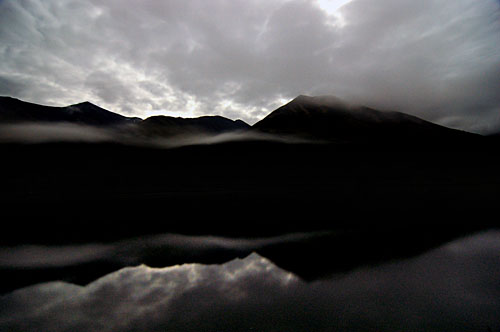
A lake, under morning fog.
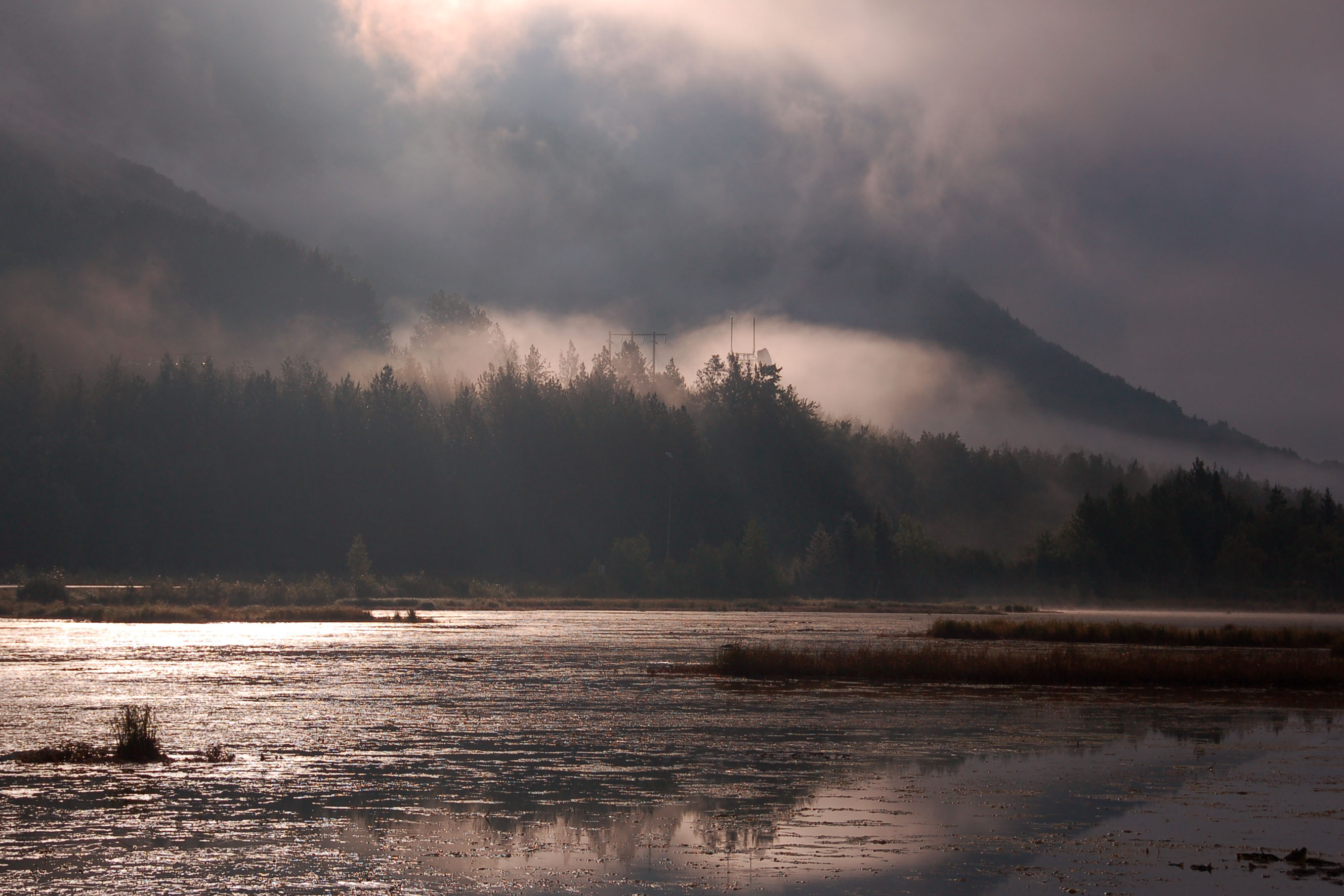
Fog, fog, fog. Dunno how the white balance came out to the proverbial rose-colored-glasses shade, but I sure as Hell kept it! Intersection of highways 1 and 9.
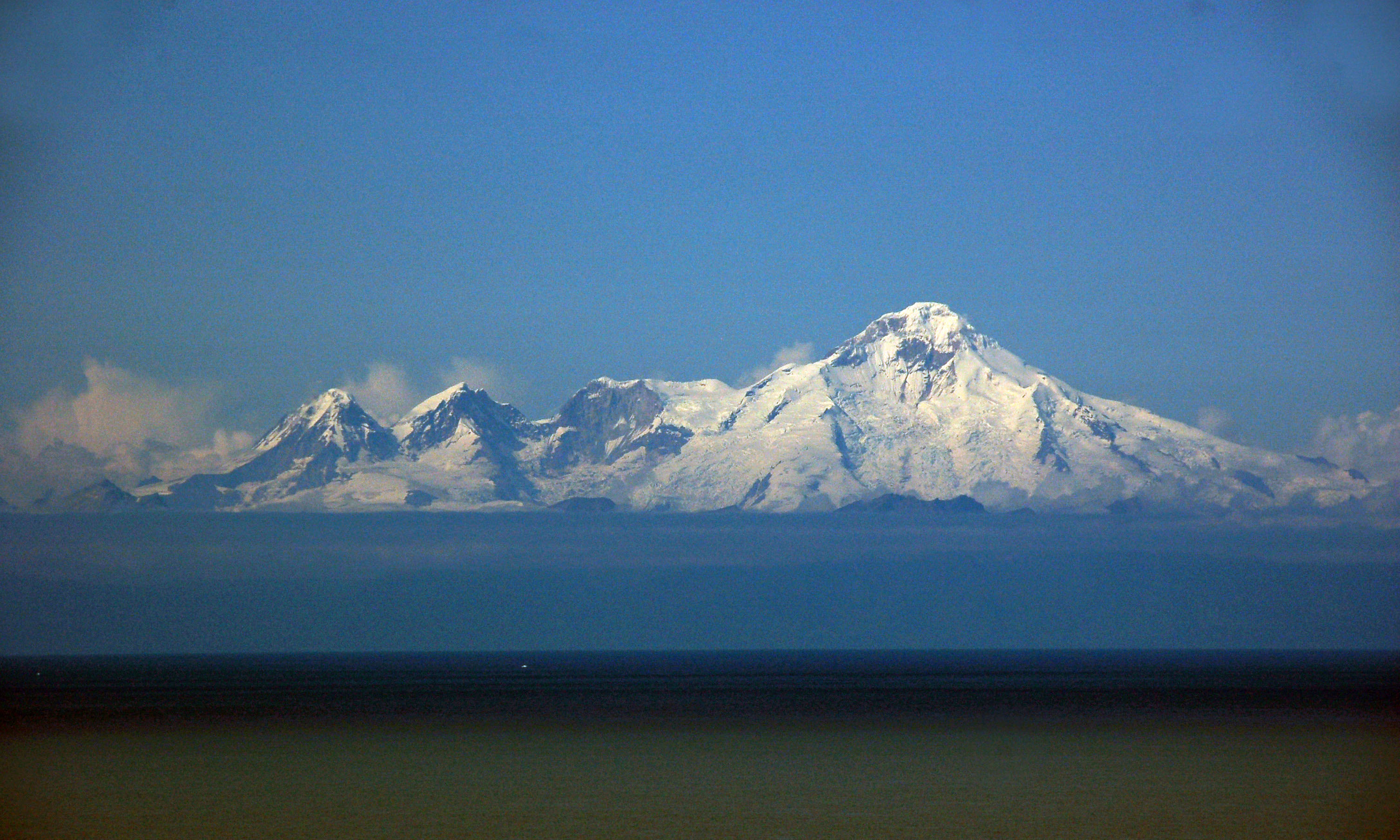
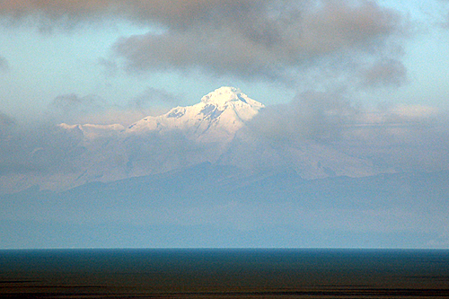
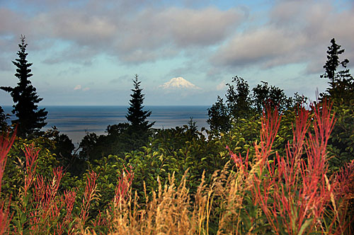
Mount Iliamna, across the Cook Inlet from highway 1 and civilization. This is actually our second view of it – once down the spur route to Homer, and once back up. The way back up yielded much, much clearer skies.
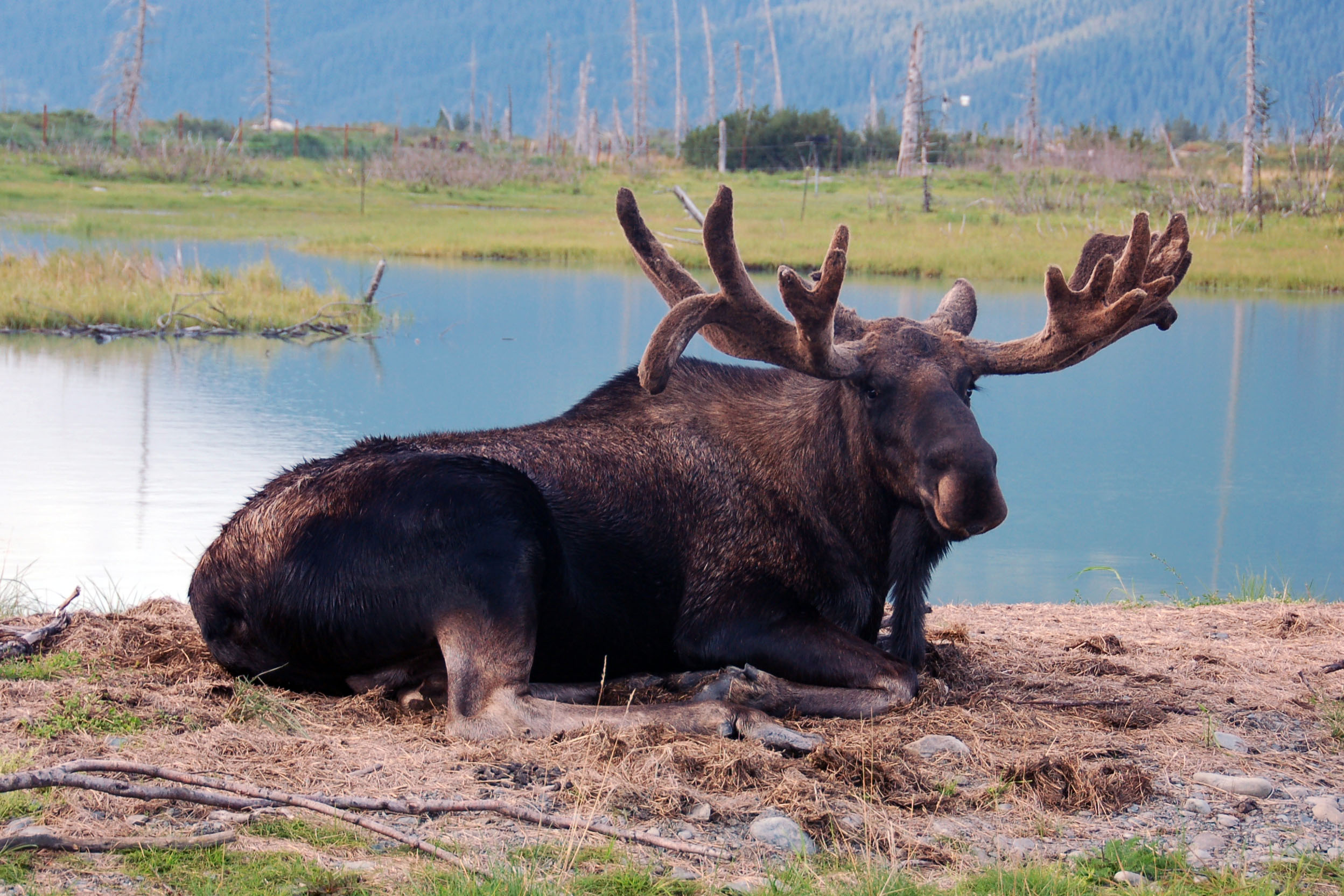
Moose! How did I get so close to a real, live moose?? Easy – he’s sitting in a wildlife preserve. There’s a fence, somewhere between observer and moose, but I conveniently shot through the openings.

BEAR!
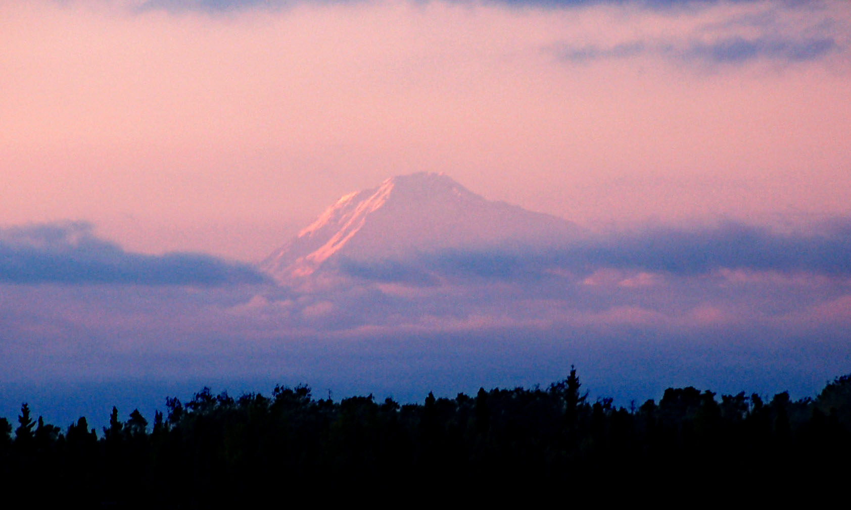
Mt. McKinley… 20,320 feet tall; the highest peak in North America – proudly making Mount Shasta look like an anthill since 200,000,000 B.C. About 160 miles away in this photo. Alas, this is the first, last, and only glimpse we’ll get of the peak. Non-cooperative weather intrudes as we get closer to it… from 30 miles away, all we’ll see (in the Day Two batch of photos!) is a quarter of the way up the side, barely half an edge in the ever-present fog. So take what you get: distant, nearly illusionary, glowing purple-red in the last rays of the setting sun.

I’m in your Alaska, photographing your highway signs.
Our first look at the scenery. Yep, I arrived just after midnight, and took this photo at something resembling 1.15 in the morning, on the highway heading south out of Anchorage toward Seward on highway 1. My task for the three days was to travel as many miles of paved highway in the state as I could… (there’s only like 2200 miles total! Most of the state is accessible only via ship, airplane, snowmobile, or moose!) I think I ended up rather successful, missing only highway 6 to Circle Hot Springs.

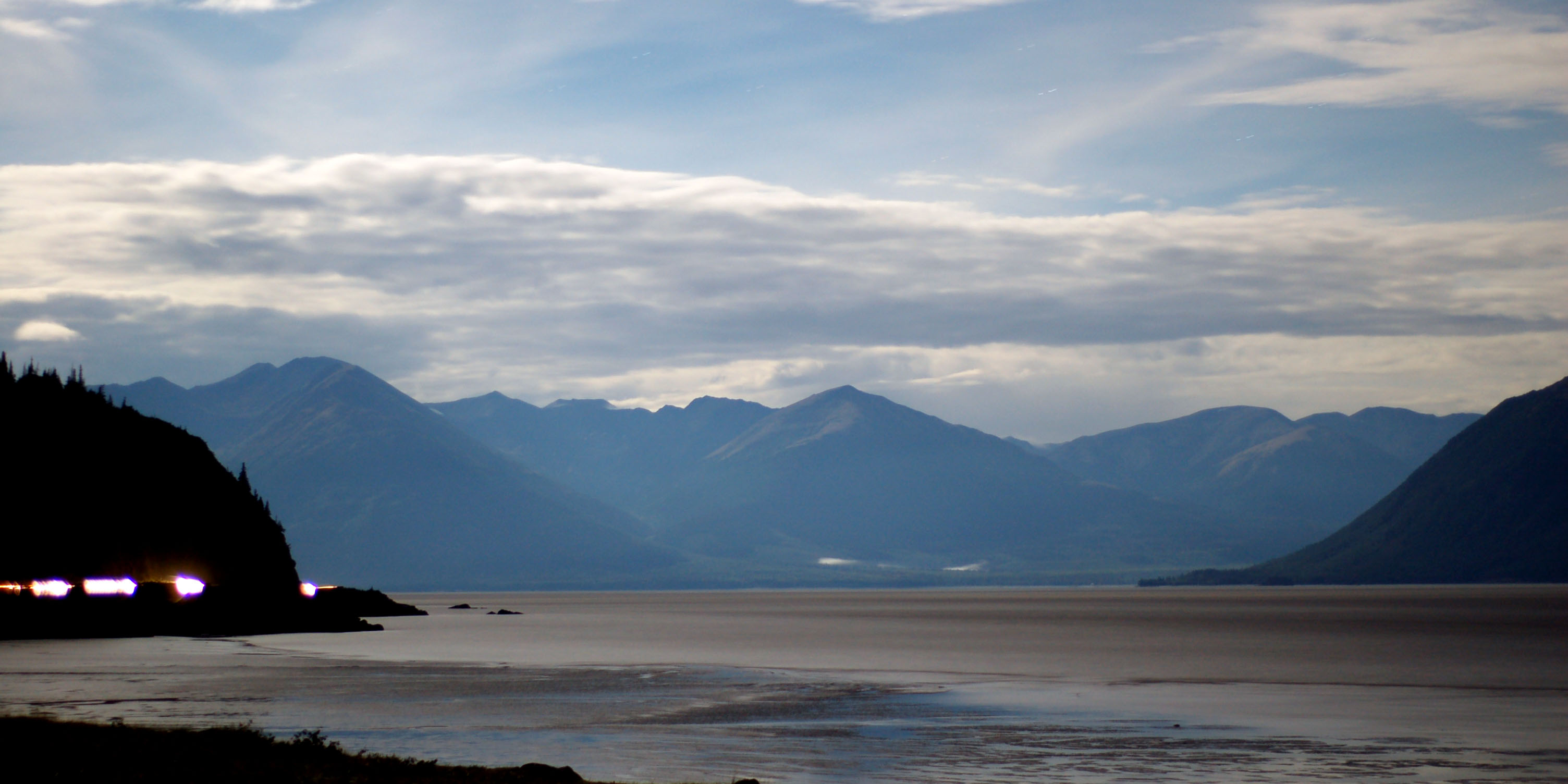
Looking back north; the light from beyond the cliff is the town of Anchorage. I wish I could claim that was a meteor to the left… it’s an airplane.
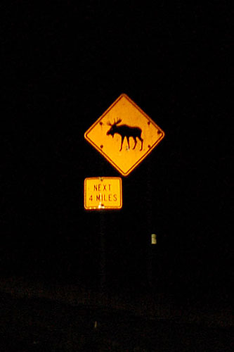
Occasional moose presence.
Foggy weather at this time of night.

When in doubt, name the road after an ever-present natural condition.

MOTHER OF GOD, IT’S A BEARMOOSE.

well, that settles that. Next week: is the Pope really Catholic??
Clearest skies we’ve had all morning.

Clearing fog in the morning.
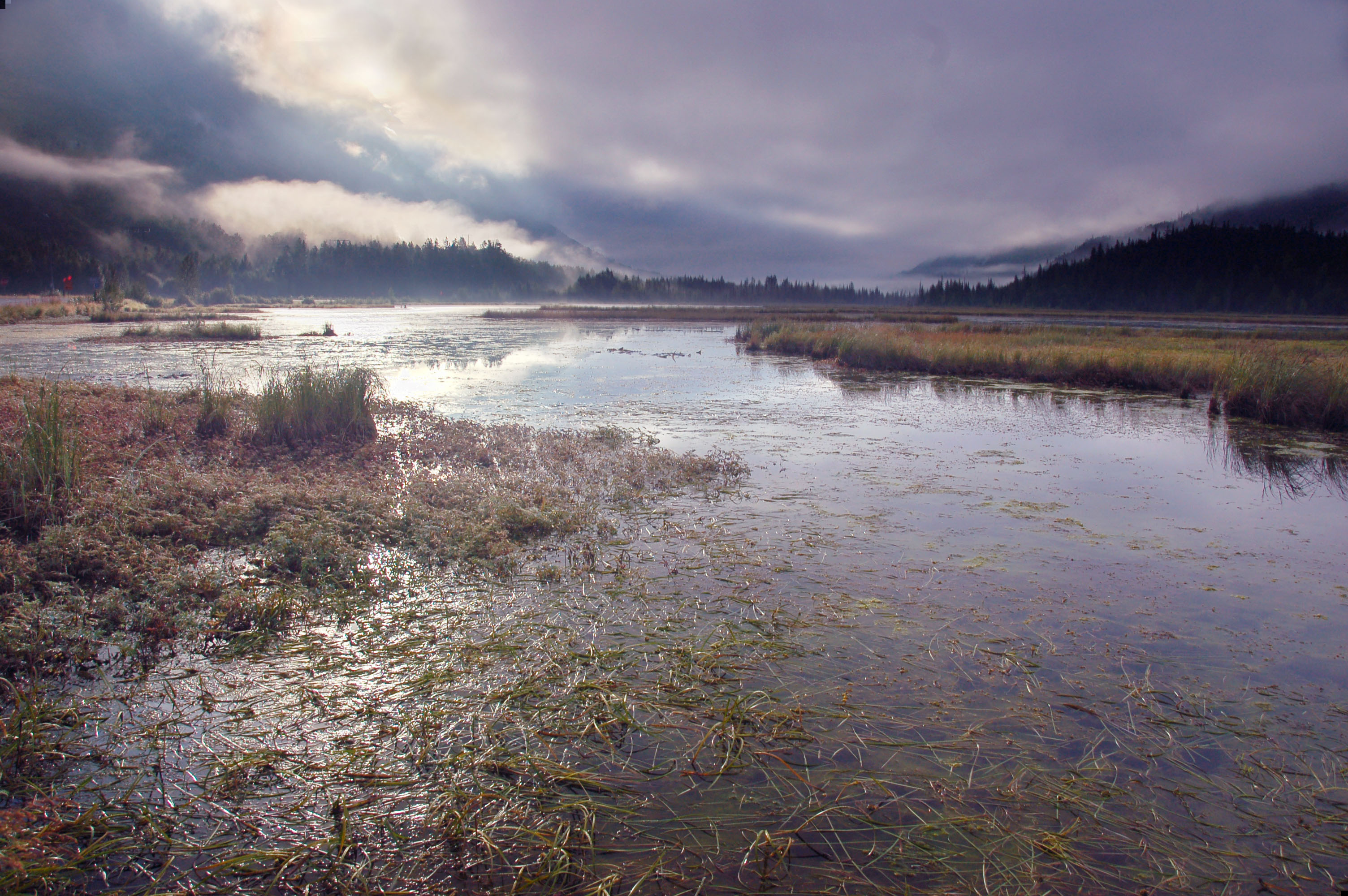
Another from the 1/9 junction, this one zoomed out a bit.

Soon enough, we’re back in the fog.

There’s only two real types of creatures in Alaska.

Moose come in a variety of sizes, to better serve the customer’s needs.
Apparently, this is not just a Texas problem.

I am pleased to announce that I now have done over 100 miles per hour in all fifty states.
Mount Iliamna, across the seas and the fog. There’s a sign pointing it out at this little pulloff. Oh hey, what’s the coolest thing about Alaskan roads? Turnouts every few hundred feet. And you can park in ’em. Overnight. Nobody cares. Hell, there are cars that seem to have last been moved sometime during the Nixon administration!
And Mount Redoubt. The two of them are about 50 miles away from this vantage point, and each is just a tad over ten thousand feet high. Oh and they’re both active volcanoes, because Alaska is danger like that.

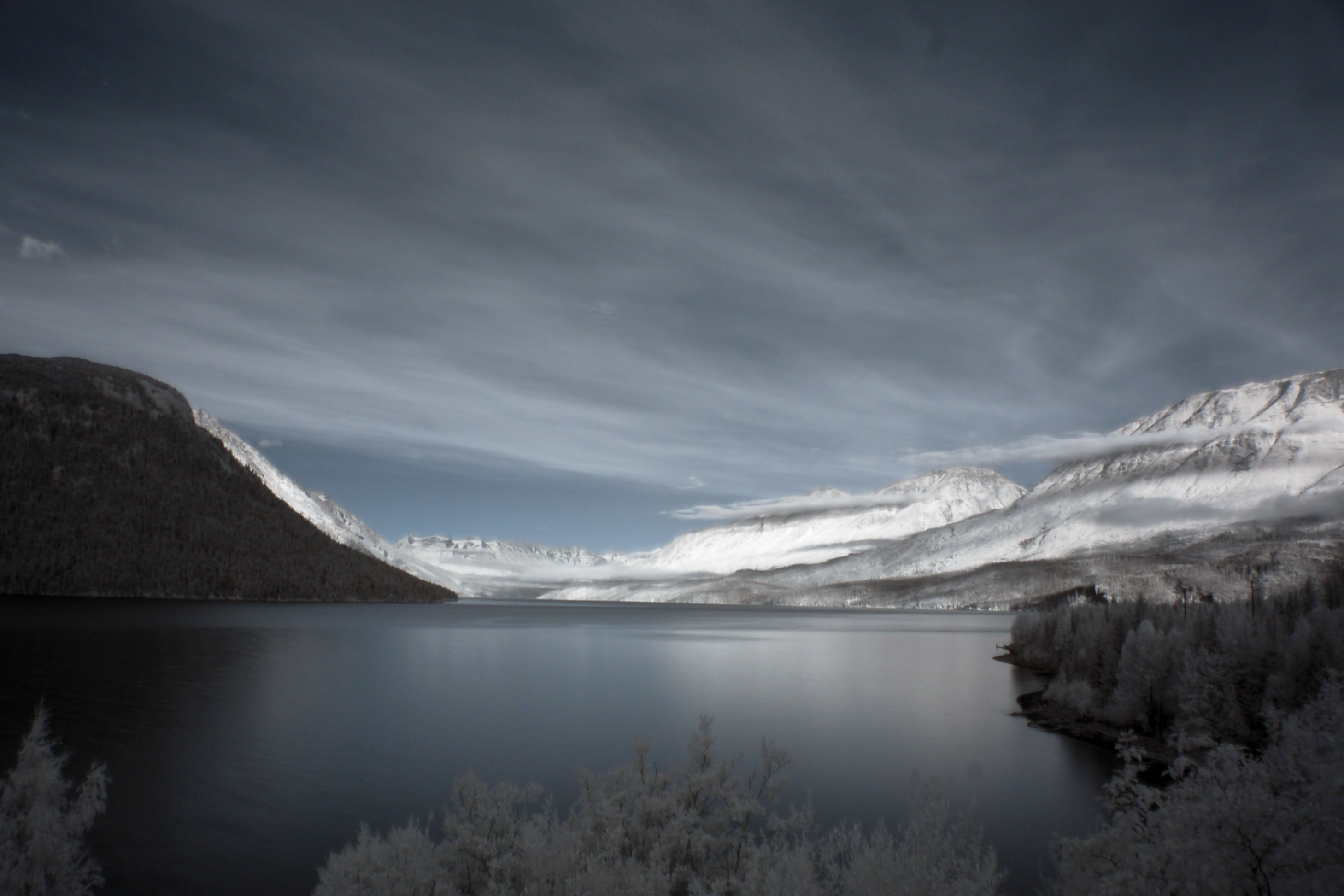
And one in infrared.

The little fishing village of Ninilchik, with Mount Redoubt in the background. Yep, the origin of the name is Russian. Ancient Ur-Soviets, older than communism itself, were the first Europeans to have come to Alaska, in the 1660s. Shrugging off the cold – hey, it’s warmer than Oymyakon, Siberia – they established a brisk trade in fish and furs before selling out to Seward and the Follies in 1867. 7.2 million dollars didn’t buy naming rights, though – we’re stuck with Ninilchik, mercifully, not Fishing Village Brought to You by Capital One.

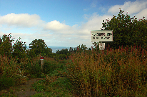
Sweet, an old white sign! Alaska, not only is it colossal and filled with large creatures… but there’s even old signs to be found! Best. State. Ever.

Mount Iliamna. The fog to the south (left in our photo) cleared out, revealing several other peaks in the mist. I’m not quite sure what to make of the dividing line about halfway up the mountain – darker below, lighter above. Some trick of atmospheric optics; it was exactly like that in real life. Trust me!

Holy crap, a Kelvin-Helmholtz Instability cloud. The distinctive sequence of vortices is caused by two layers of fluid (in this case, air) moving past, and interacting with, each other. The link I just provided has good explanations and a better example than mine here; my knowledge of fluid dynamics isn’t nearly complete enough that I can do more than point to the reference. This sort of spiral cloud is very, very short-lived. I grabbed this photo out the windshield; by the time I could’ve pulled over, it had dissipated. Searching for “wave cloud” or “Kelvin-Helmholtz cloud” on google yields some magnificent examples, far more impressive than this one. But hey, I saw this one in person, so I’ll take mine.

Nine-degree halo around the sun. By the way, for all of us enjoying the atmospheric phenomena… the second day in Alaska is gonna blow our rocks off. Stay tuned.

A land beyond the fog. We’ve reached the coastal town of Homer: end of the line for highway 1. The road into Homer descends about 2000 feet in the last six miles – this is a viewpoint from atop the hill, and yes, that is a sea of fog as the lowest layer, maybe 50-100 feet above the more traditional water-based sea. Furthermore, that is indeed another Kelvin-Helmholtz cloud at the bottom, vague and distorted.

Another one – same basic idea, but viewed at a slightly different angle, where the ocean breaks through the lowest layer of fog.

One more of the same theme.

A more traditional view, to give an appreciation of the distance to the zoomed-in three.

Why look at that, an old truss bridge. Surprisingly, Alaska is filled with them. This is on an old alignment of highway 1. Since we’re driving the spur to Homer, we may as well take the current road down and as many old alignments as we can find back.

And we’re actually back at the 1-9 junction. Totally different lighting and clouds from the morning. This time around, the fog is gone and we’ve got big, fluffy billowing cumuli.

Recognize this valley? Yep, same one that was rose-pink in the dawn… now, in mid-afternoon, clearing out.

And it gets seriously cloudy again.

But we get through it quickly. Looking back in the other direction; yes, that is rain to our south.

Plenty of clouds, and distant mountains too.
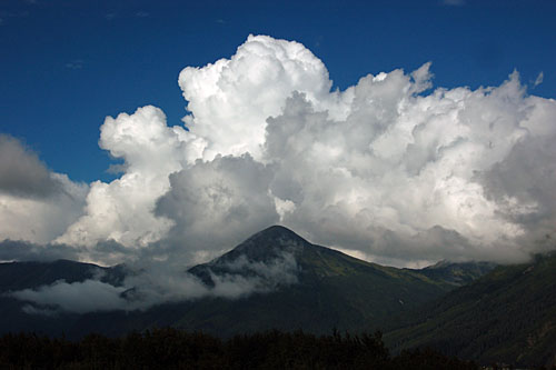
Cumulus clouds, everybody!

The tunnel to Whittier. This is a one lane tunnel that is shared between cars and the railroad… they open it for fifteen minutes in each direction, except when the train comes, in which case no car may use it. It was solely a rail tunnel until 2000, when the paving was added for cars. Whittier is, like so many other Alaska towns, a seaport – they had no real need for a vehicular land connection to Highway 1 and Anchorage and all; they’ve always done most of their business with Valdez and Cordova, by sea across Prince William Sound. But, here is a connection anyway, and thus I get to go to Whittier. Hooray.

Alas, there really isn’t much in Whittier, unless you want to take a monster cruise ship to Juneau or something… this is about the most photogenic that I could find, by strategically pointing the camera in the opposite direction to the harbor and the tourist shops and whatever else plagues the lower 48 and has found its way here. D’oh!
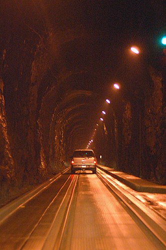
Back through the tunnel we go, then.

Glaciers! On the third day of Alaska, we’ll totally get our fill of the glaciers of Prince William Sound – for now, here is just a brief glimpse.

Our first rainbow! Somewhere in the distance it must be raining, even though nearby it is merely a heavy shade of partly cloudy.

A pair of musk oxen. Same wildlife preserve as the other creatures detailed above.

A large elk.

Another bear! This one is even conveniently passed out from drinking too much Jack Daniels, or whatever it is that bears drink to pass the time and endure the existential crisis of lacking opposable thumbs.

A handful of bison.
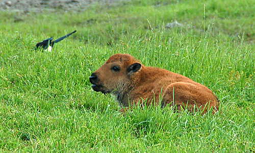
Bison calf – and a magpie going in head-first after a tasty meal.

Distant glaciers. Somewhere along highway 1, between the wildlife preserve and Anchorage.

More glaciers, two or three peaks over from the previous photo.

Truth in advertising.

Highway 1 heading north into shrouded mountains, with a paralleling bicycle trail.
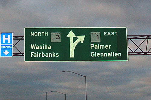
Before Wasilla became nationally famous, because you can see Russia from there!

Fairbanks, surprisingly not all that far. And yes, it is lighter than it was in the previous photo. That was due to overcast skies… also, it must be noted that at such northern latitudes, the sunset takes forever. What is a half-hour occurrence in a lower-48 place is well over two hours in Alaska.

Sunset, somewhere along the road between Anchorage and Fairbanks.
There’s nobody on the roads in Alaska. Especially when the sun sets, and most decisively on the highways that take three hundred miles to get to the next major city.

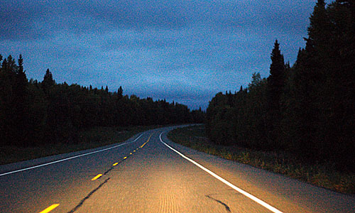
Night, for real… about ten o’clock is when it gets dark, and this is into September. During the summer, it’s light all around the clock.
Gooddness, that’s it… for day one. Coming soon … days two and/or three!

Beautiful. Makes me want to go up that way sometime after I get a vehicle that can handle that long of a trip.
I just put about 9000 miles into a beater 1989 Escort (206… make that 215000 miles!) I am considering doing the Alaska Highway with it!
Beautiful photo and love how you explain what you are viewing. It was almost like I was traveling with you when going though them. I live in North Carolina and probably will never get to Alaska, so thank you so much for sharing them. It is a magnificent state that I would love to visit someday!
Richard
Epic. Absolutely brilliantly epic. You have taken excellent quality photos! I plan on visiting Alaska someday.
I have pictures of Kodiak, before the earthquake. Husband was stationed at the Naval Station in the 1960’s . Took pictures while there.
R. Maag