
Situated in southwest Georgia is the mid-sized city of Albany. The city is the largest west of Interstate 75 and south of Columbus, and is also home to one of two freeways in far southwest Georgia that are not part of an Interstate highway.
The freeway, known as the Liberty Expressway (though not signed as such), carries in part U.S. 19, U.S. 82, Georgia 3, Georgia 300, and Georgia 520 (Georgia GRIP Corridor Z). It bypasses downtown Albany and the commercial strips of U.S. 19 Business (Olgethorpe Boulevard) & 82 Business (Slappey Drive), and also provides a truck route for through traffic between Columbus and Interstate 75.
While the road is similar in scope to the Bainbridge Bypass, with diamond interchanges, older concrete bridges (both span the Flint River too), the Liberty Expressway does include full shoulders and a 65 MPH speed limit for part of its route.
Let’s dodge some rain drops and take a look…

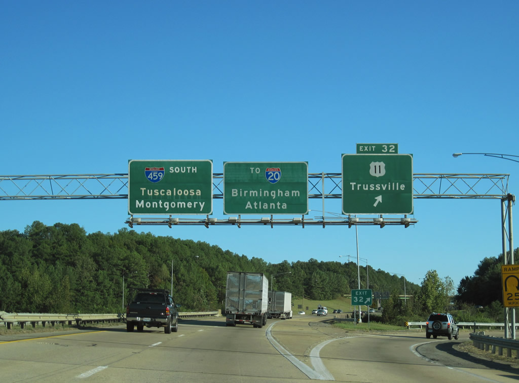
U.S. 82 & Georgia 520 turn onto the Liberty Expressway at the trumpet interchange with Dawson Road. An Interstate 75 shield appears, even though the freeway is 45 miles to the east. Dawson Road meanwhile travels southeast into downtown Albany.
Traveling east on the Liberty Expressway, after U.S. 19 & Georgia 3 merge on from Slappey Boulevard. All Georgia 520 shields are signed in green to reflect the highway’s status as Georgia GRIP Corridor Z.

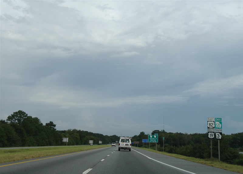
U.S. 82 & Georgia 520 leave the Liberty Expressway for Clark Avenue. U.S. 19 & Georgia 3-300 continue south to the three-quarter cloverleaf interchange with Olgethorpe Avenue (U.S. 82 Business & Georgia 520 Business). U.S. 82 follows a bypass route to the north of the older Olgethorpe Avenue.

The Liberty Expressway features a sequential-based exit numbering system that begins at the U.S. 19 & Georgia 3-300 interchange with Georgia 133 (Moultrie Road). Georgia 133 travels southeast from Albany to Moultrie and to the nearby Marine Corps Logistics Base. Note the Marines symbol situated next to the Georgia 133 shield on the overhead.

The Liberty Expressway exit numbers begin at Georgia 133, but the freeway itself does not commence until after the traffic light with Worth Street. Worth Street represents the frontage road along the west side of U.S. 19, while a commercial establishment lies to the east of the signal.
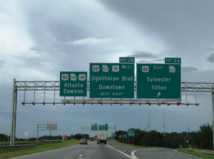
U.S. 19 & Georgia 3-300 transition into freeway and quickly interchange with U.S. 19 Business-82 Business and Georgia 520 Business. The business trio follow Olgethorpe Boulevard west to Albany State University, the Albany Civic Center, and downtown.

U.S. 19-82 & Georgia 3-520 span the Flint River and then next meet Georgia 91 & 133 (N. Jefferson Street). Georgia 91 and 133 share pavement southward through downtown.

U.S. 19 & Georgia 3 leave the Liberty Expressway for Slappey Boulevard north for Americus, and eventually Atlanta! As for the name, Slappey Boulevard is perhaps named after Albany-native and 1920 MLB player John Slappey.

The Liberty Expressway draws to a close at the trumpet interchange with Dawson Road. Dawson Road is simply signed as “Downtown Albany” here. U.S., 82 & Georgia 520 continue northwest to Dawson and Columbus.
I didn’t catch how locals pronounce the word Albany, so I will assume it’s the same as New York’s Albany. However I’ve heard it referred to on The Weather Channel before as Al-Ban-ee instead of All-ben-e. Please post a comment if you know the correct pronunciation. :o)
And that’s a wrap…


love that groovy Georgia font!
The pronunciation is “Al-bun-nee”, but here in GA, especially in south GA, “All-benny” is used quite a bit.
Interestingly enough, the quickest route to ATL is not US 19, but instead GA 300 (GA-FL Pkwy) to I-75.
Also note that US 19 from the FL line to Griffin is a GRIP corridor (EDS-19).
The Liberty Expressway is the only place where GA has the right-tabbed exit number placards, but if GDOT decides to do an massive sign replacement, then it would likely be with the standard GDOT BGS design as you see on the interstates and other exit-numbered freeways.
all-benny
You missed the full Clover Leaf interchange at Liberty Expressway and GA-133. For some reason GDOT is building new exit ramps, removing the Clover.
You can view it on Google Earth..
ive always pronounced it all–bunneee idk why?