
State Route 6 - Steese Highway

Steese Highway branches northeast from SR 2 (Elliott Highway) at Fox in the Fairbanks metropolitan statistical area as State Route 6. SR 6 extends Steese Highway 144.55 miles to the community of Circle along the Yukon River.
SR 6 (Steese Highway) leaves the Fairbanks area at Cleary Summit (el. 2,233 feet). Continuing along a winding course north, Steese Highway runs along Cleary Creek into the unincorporated community of Chatanika. Turning northeast across Poker Flat, SR 6 parallels the Chatanika River to Sourdough Camp. Gaining elevation to as much as 3,000 feet above sea level, the state route shifts northward adjacent to Mc Manus Creek to Twelvemile Summit.
South of Table Mountain and Pinell Mountain, SR 6 follows Twelvemile Creek and then Birch Creek. Steese Highway reaches 3,500 feet in elevation east of Porcupine Dome before making a gradual descent out of the mountains to Central. Straddling the foothills of the East Chazy Mountains, the highway leads north to cross Birch Creek into the census designated place of Circle. SR 6 concludes at River Street north and Willow Street south just off the Yukon River.
 East
East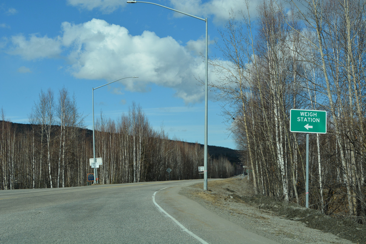
The Fox Weigh Station operates within the northern quadrant of the intersection joining SR 2 (Elliott Highway) and SR 6 (Steese Highway) at Fox.
05/08/23
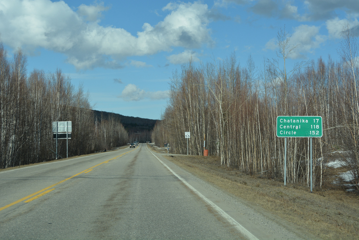
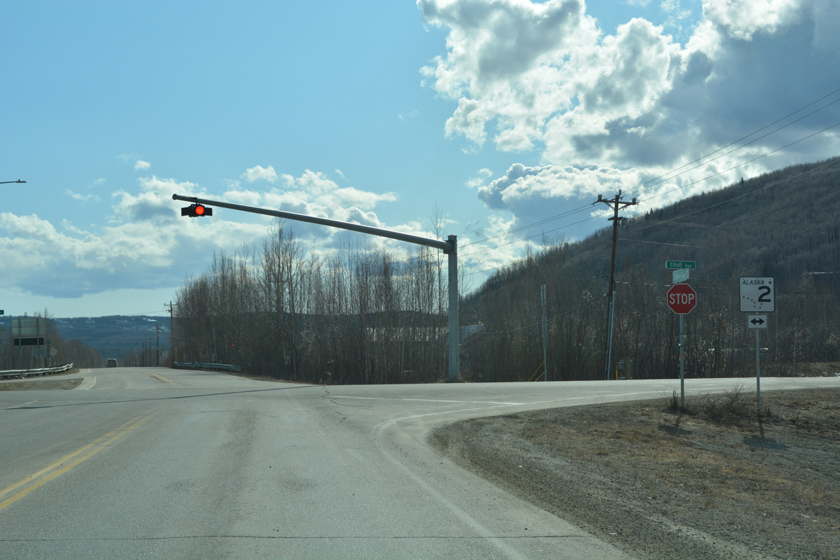
There is no confirming marker posted for SR 6 eastbound beyond SR 2 (Elliott Highway). A distance sign follows 16.3 miles ahead of Chatanika Lodge, 111 miles from Central and 144 miles from Central.
05/08/23
West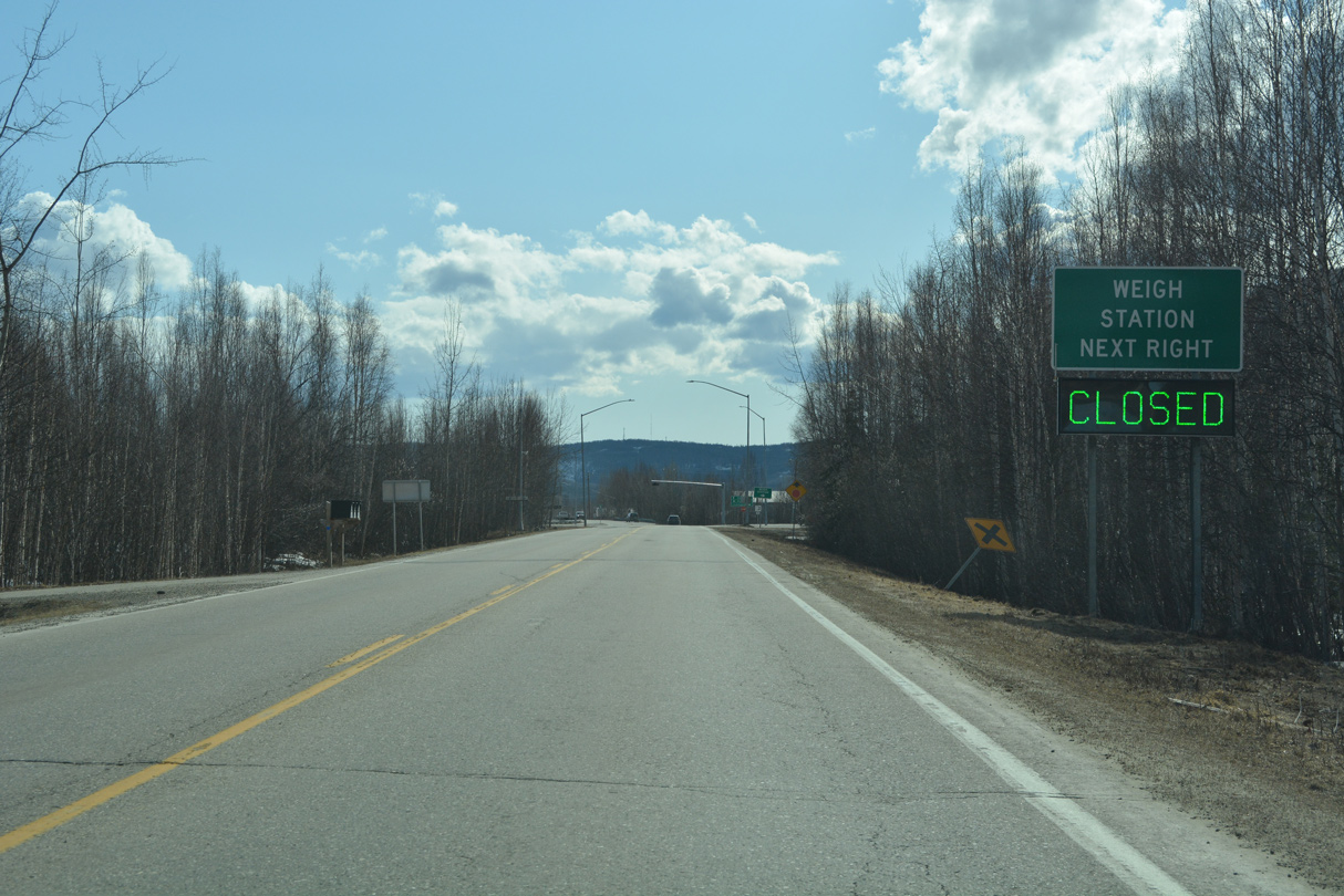
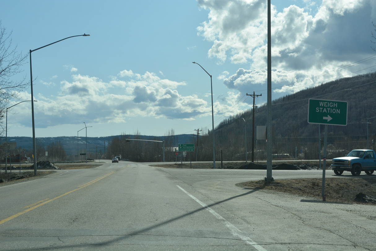
SR 6 (Steese Highway) west concludes at SR 2 (Elliott Highway) and Old Steese Highway) adjacent to the Fox Weigh Station.
05/08/23
Commercial trucks along both SR 2 (Elliott Highway) and SR 6 (Steese Highway) are required to stop at the Fox Weigh Station when in operation.
05/08/23
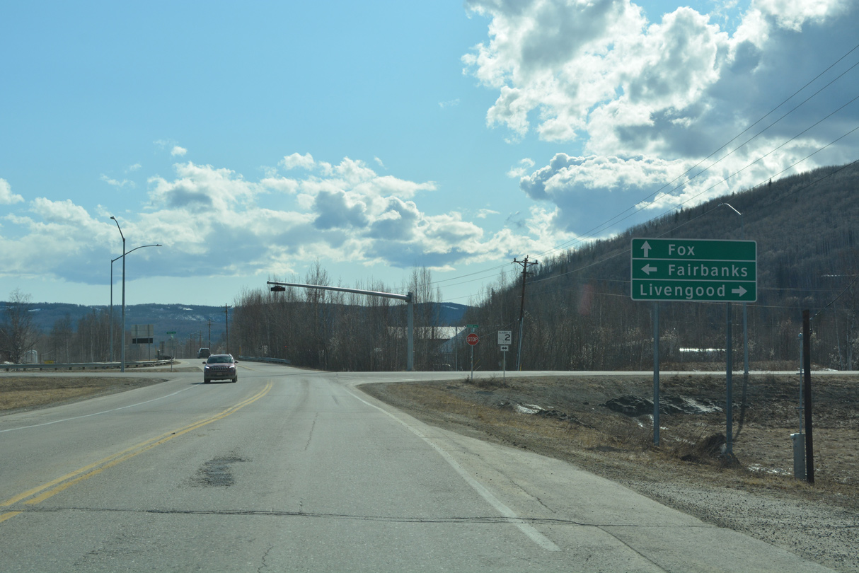
Steese Highway continues south from SR 6 along SR 2 to Richardson Highway in Fairbanks. SR 2 north follows Elliott Highway 68.06 miles to SR 11 (Dalton Highway) in the census designated place of Livengood.
05/08/23
SR 2 (Elliott Highway) travels 145.27 miles west from SR 6 at Fox to Manley Hot Springs. Heading south into Fairbanks, SR 2 (Steese Highway) expands to an expressway.
05/08/23
Photo Credits:
- Alex Nitzman: 05/08/23
Connect with:
Page Updated Tuesday June 13, 2023.