
State Route 96
Arizona 96 is a short route that connects Bagdad to Hillside. The road is only connected to the rest of the state highway system by Arizona 97, itself a short connecting road between Arizona 96 and U.S. 93.
Arizona 96 was commissioned on December 16, 1962 to connect the then-new mine at Bagdad to the rail yard at Hillside. The road continues, as Yavapai County Route 15, to meet Arizona 89. The road was added to the State Highway System at the request of Yavapai County, because of mining activity in Bagdad and travel to commercial activities in Prescott.
Originally, Yavapai County requested the continuation of Arizona 96 to U.S. 89, however, the Highway Commission rejected this request due to concerns about funding for maintenance.
The section from Bagdad to Arizona 97 was reconstructed in 1977 to eliminate sharp curves.
The 2005 State Highway System log showed Arizona 96 erroneously ending at Arizona 97. Subsequent State Highway logs have corrected this issue.
 West
West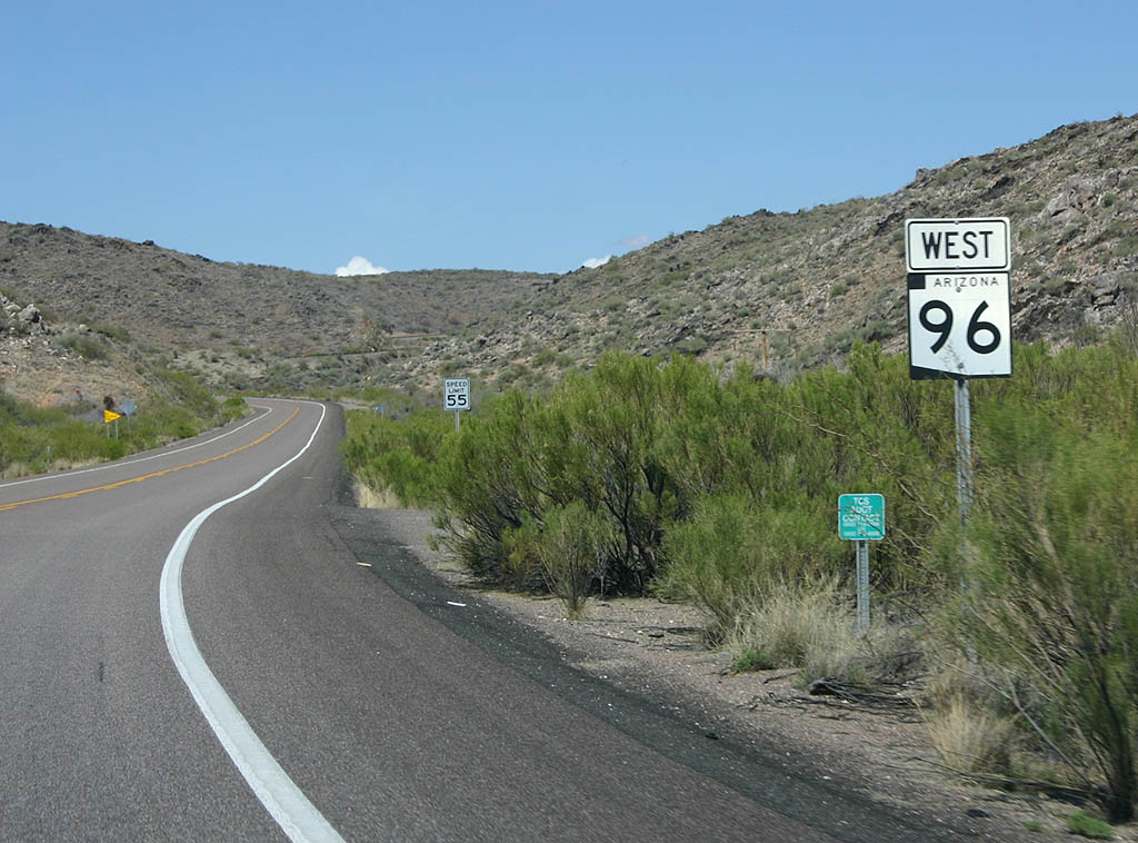
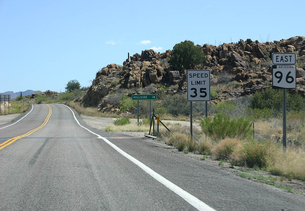
Perspective of Westbound SR 96 after meeting Arizona 97. At this point, it is four miles to Bagdad.
03/25/07
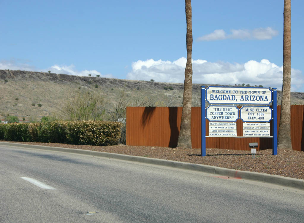
Bagdad is a mining town, owned by Phelps Dodge, the owners of the Bagdad Mine. Bagdad is one of the last two company towns left in Arizona, and life in the small town revolves around the mine.
03/25/07
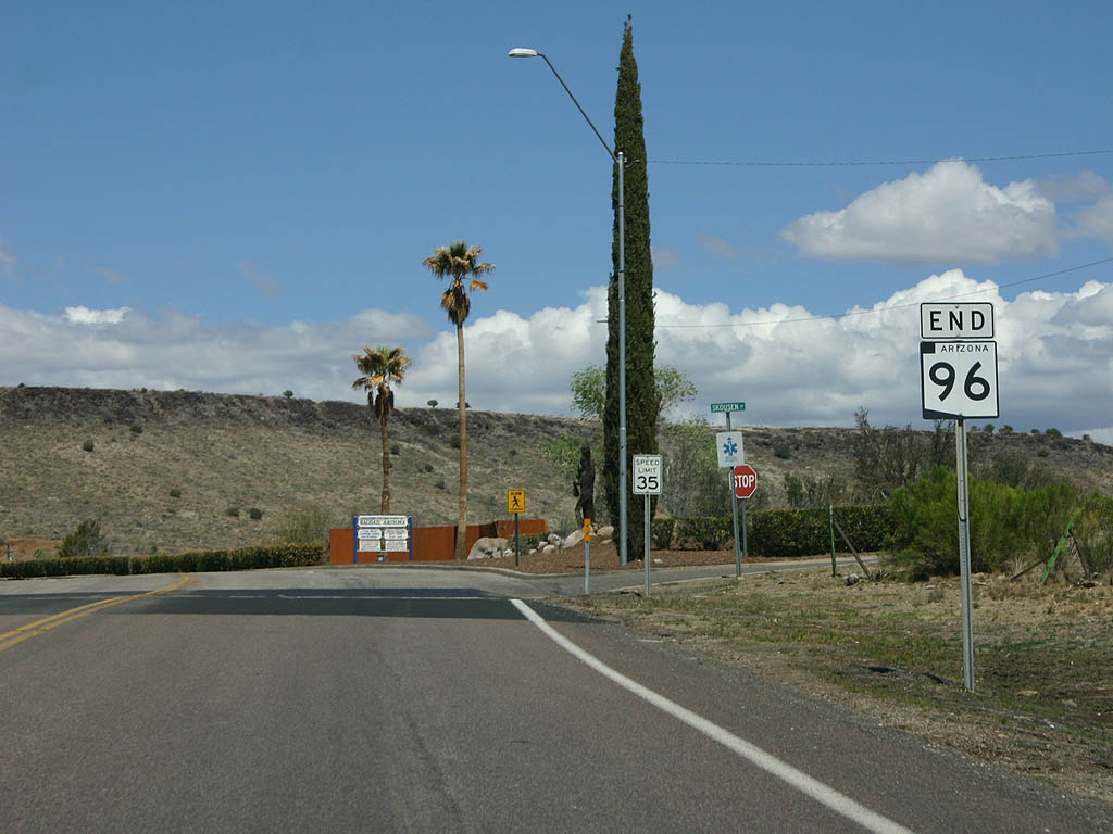
SR 96 ends at the town limits of Bagdad. In the 2005 state highway log, however, the first four miles of SR 96 are no longer part of the state highway system, leading AARoads to wonder what the status of this road is.
03/25/07
East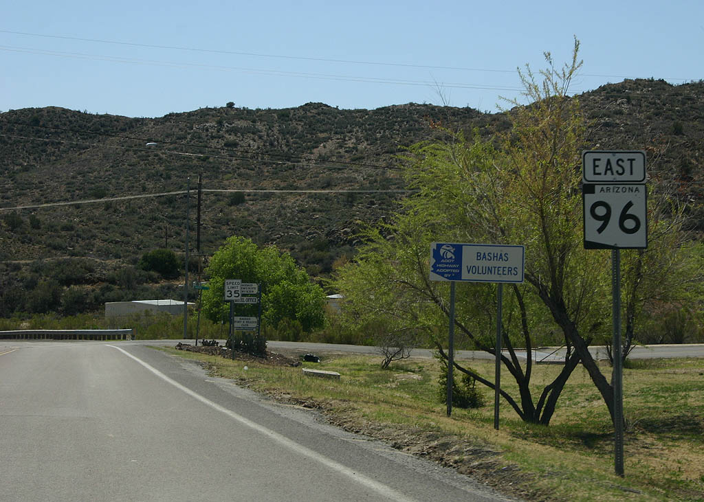
The first reassurance marker on SR 96 eastbound is located just outside the town of Bagdad.
03/25/07
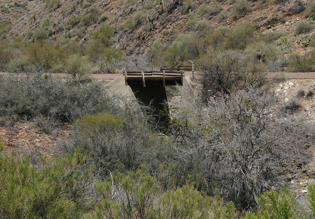
For the first five miles of SR 96 eastbound, an older alignment can be seen on the opposite side of the canyon. This bridge is a remnant of that alignment, the original one of SR 96.
03/25/07

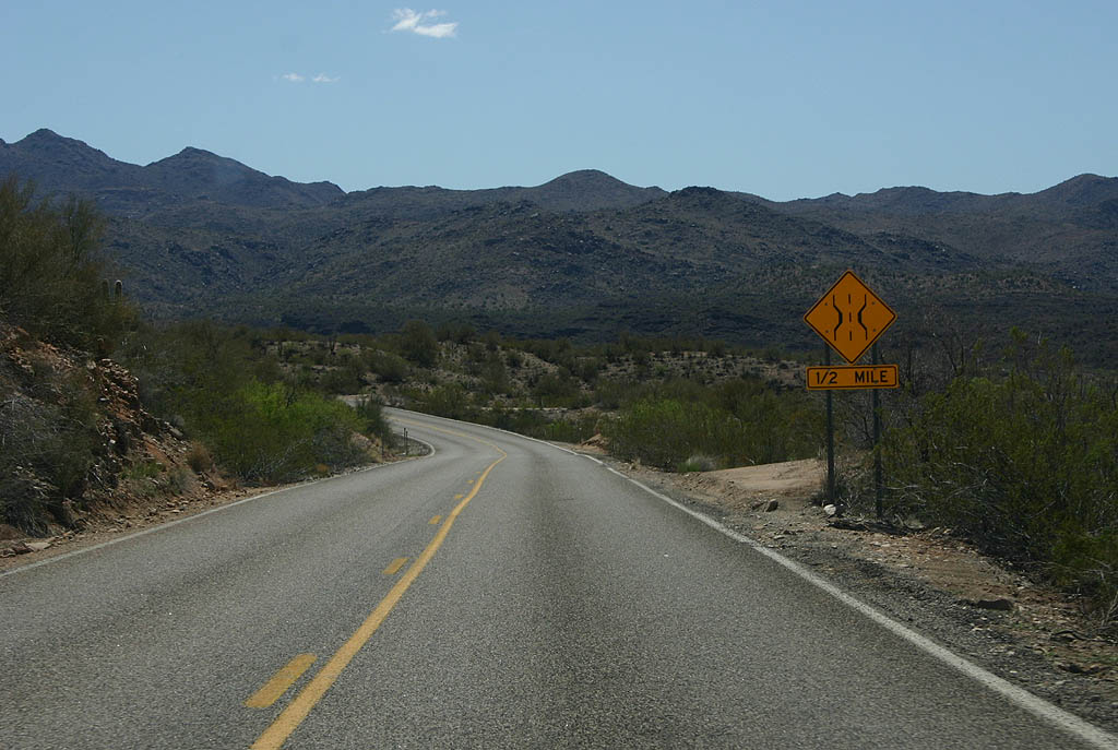
Advance signage for SR 97, 1/2 mile.
03/25/07
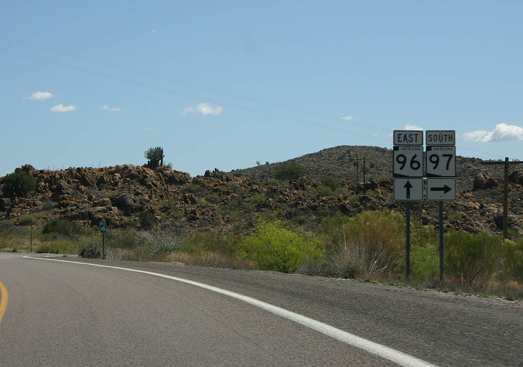
SR 97 departs from SR 96 here, to travel west to reach U.S. 93.
03/25/07
In the 2005 Arizona state highway log, SR 96 actually begins at SR 97, making this the first official trailblazer shield. The only town located near SR 96 is Hillside, located 18 miles ahead.
03/25/07
SR 96 is a narrow road, virtually unchaged since it was paved. This sign is advance warning of the Santa Maria River bridge ahead.
03/25/07
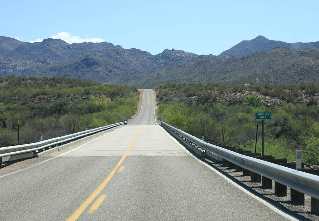
This narrow bridge over the Santa Maria River dates back to 1939, before this road was a state highway.
03/25/07
SR 96 now follows Quail Spring Wash away from the Santa Maria River.
03/27/07
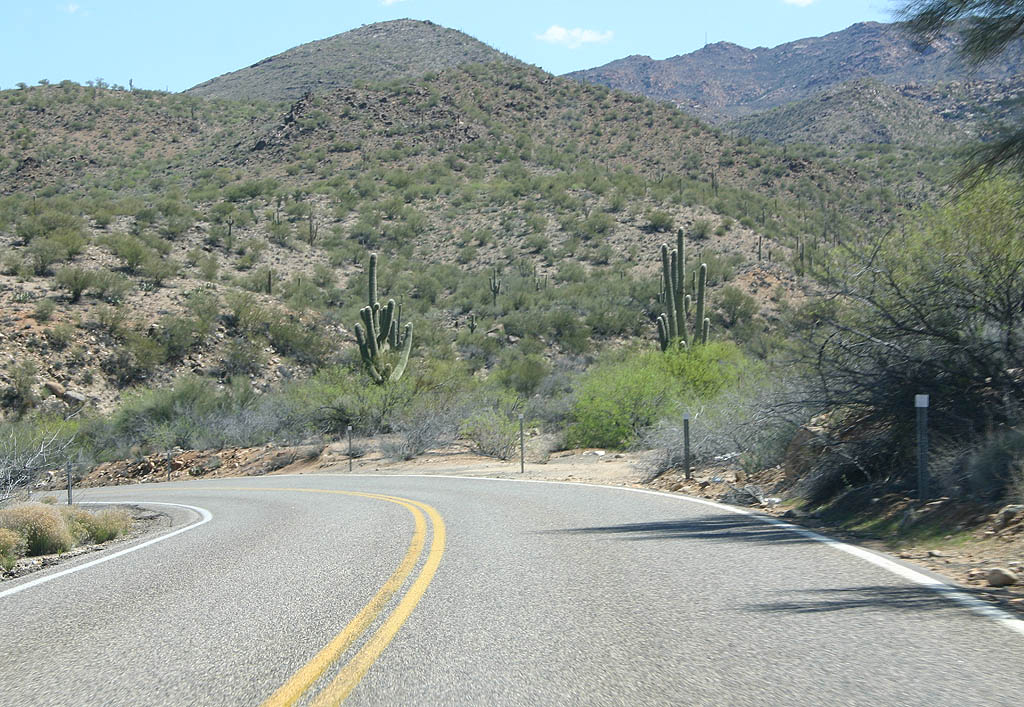
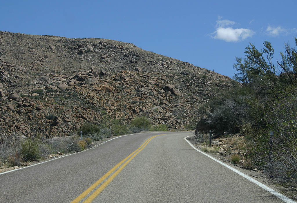
Sharp turns are not uncommon along SR 96. The road is basically a paved dirt road, without banked curves or wide shoulders.
03/25/07
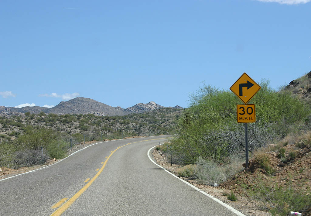
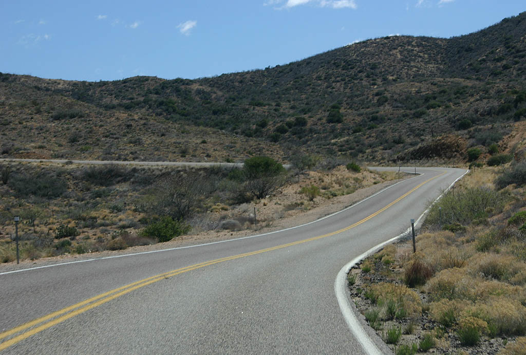
SR 96 climbs the hills above Quail Spring Wash as it heads east towards Hillside.
03/25/07
USGS maps refer to SR 96 as the Lawler Grade. The road now winds around Tank Wash as it continues toward Hillside. In 1998, an average of 600 cars travelled this isolated stretch of state highway.
03/25/07
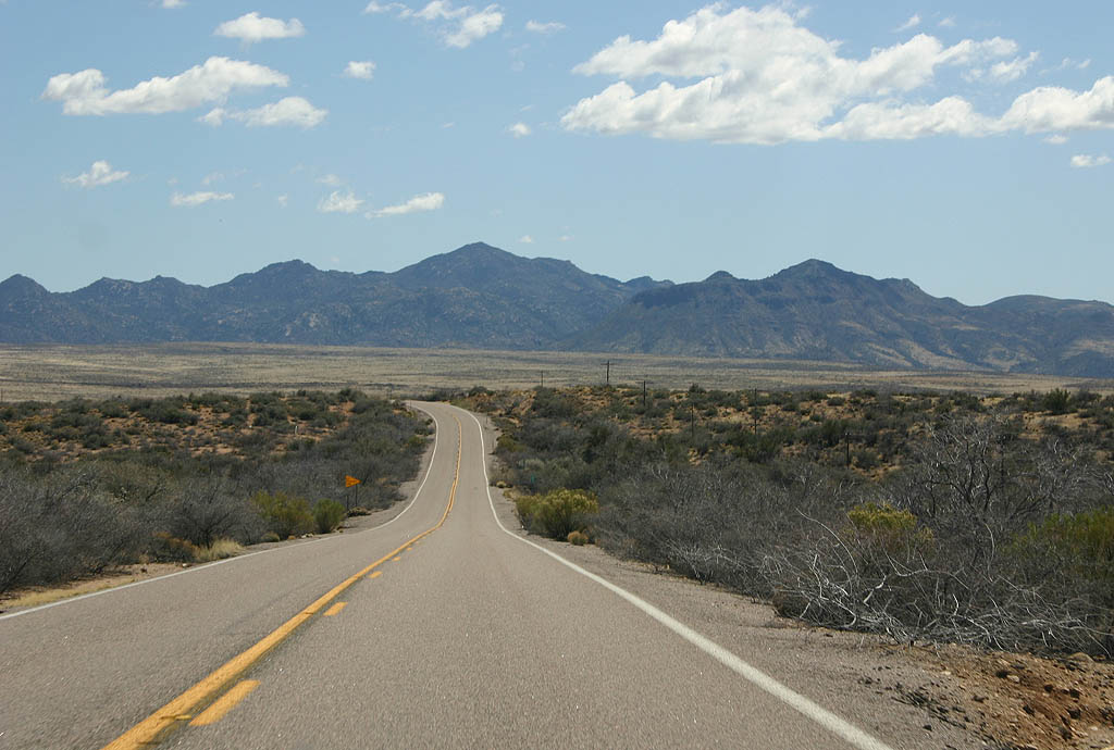
The desert opens up as SR 96 approaches its end near Hillside.
03/25/07
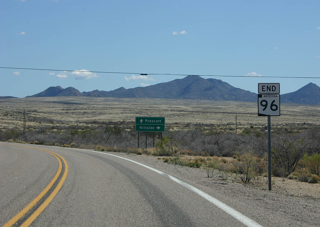
SR 96 ends here, just before the T junction to Hillside. The road does not actually enter the town of Hillside, which is a railroad junction along the Burlington Northern Santa Fe Rail line.
03/25/07
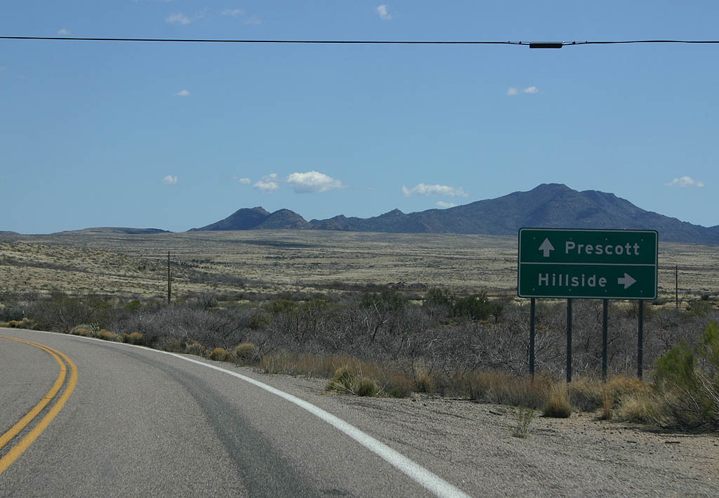
East of here, the road continues as Yavapai County Route 15. Continue east on the county road to reach Arizona 89 and Prescott, or turn at the T intersection to reach Hillside.
03/25/07
References:
- Minutes of the State Highway Commission. 10/23/1962, Arizona Highway Commission.
- Minutes of the State Highway Commission. 12/16/1962, Arizona Highway Commission.
- Right Of Way Map D-13-T-388. Arizona Department of Transportation
Photo Credits:
- Kevin Trinkle: 03/25/07, 03/27/07
Connect with:
Page Updated Tuesday February 14, 2012.