
Belt Parkway

The Belt Parkway system in New York City encircles Brooklyn and Queens along the Shore, Southern, Laurelton and Cross Island Parkways. Beginning at the Gowanus Expressway (Interstate 278), Shore Parkway represents the first leg of Belt Parkway. Shore Parkway runs along The Narrows and Gravesend Bay through the Bay Ridge and Bath Beach neighborhoods of southwest Brooklyn. The parkway continues east near Coney Island and Sheepshead Bay to Gateway National Recreation Area and Jamaica Bay.
Once at the merge with Conduit Avenue and split with Nassau Expressway, Shore Parkway transitions into Southern Parkway. Belt Parkway parallels NY 878 north of John F. Kennedy International Airport (JFK), from Howard Beach to Locust Manor and Laurelton. East at Laurelton, Belt Parkway continues along Laurelton Parkway northeast to Southern State Parkway, one of three limited access roads spurring east from New York City onto Long Island.
Belt Parkway changes again, following Cross Island Parkway on the northern course through Cambria Heights and Bellerose, and along the Queens and Nassau County line. Cross Island Parkway turns northwest at the exchange with the Grand Central Parkway (GCP) through Alley Pond Park. Beyond the GCO, Belt Parkway provides the most direct route for passenger vehicles between I-495 (Long Island Expressway) and I-295 (Throgs Neck Bridge) for interests between Long Island and the Bronx. Belt Parkway concludes where Cross Island Parkway meets Interstate 678 (Whitestone Expressway / Bronx Whitestone Bridge).
Construction of the 36 mile long Belt Parkway route commenced in 1934 with all but two miles of the highway finished on June 29, 1940. Costing a total of $30 million, the parkway system fully opened to traffic in May of 1941 with completion of the gap at Sheepshead Bay. There local residents fought the parkway under the premise that it would separate their neighborhood.1
The Belt Parkway name is used overall along the Shore, Southern and Laurelton Parkway segments through Brooklyn and south Queens. Cross Island Parkway remains the primary name along its segment. Each section retained its unique name until the 1970s.1
For a time 15.6 miles of Belt Parkway were considered for inclusion in the Interstate system. Announced in March 1971 by then Governor Nelson Rockefeller, upgrades of the parkway to a ten-lane freeway with four truck/bus lanes was proposed for the highway between the Verrazzano-Narrows Bridge (I-278) and Nassau Expressway (NY 878). Estimated to cost $213 million, the upgrade would have filled the void created by the cancellation of the Bushwick and Cross-Brooklyn Expressways for I-78. However as was the case with many other projects in the 1970s, upgrading Belt Parkway met stiff opposition from residents along the corridor who cited pollution and traffic congestion issues in their defense.1
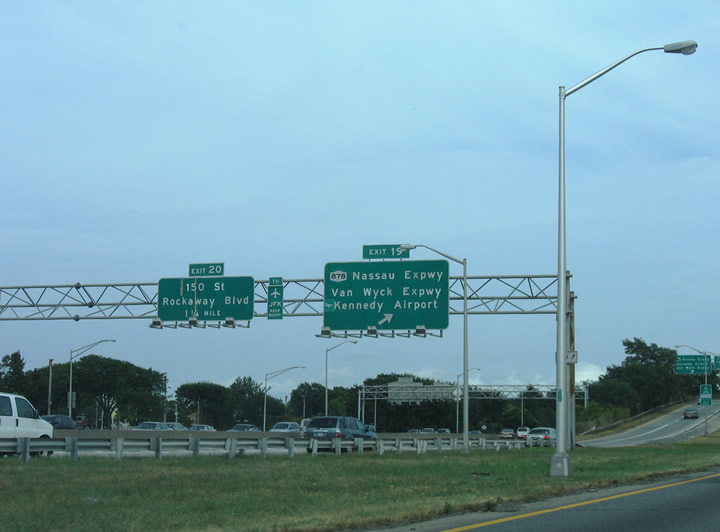
NY 27 (Conduit Avenue) accompanies Belt Parkway along the frontage road system from Cross Bay Boulevard east to Sunrise Highway at Laurelton. The two highways run side by side east to ramps for NY 878 (Nassau Expressway) eastbound at Exit 19.
08/29/05
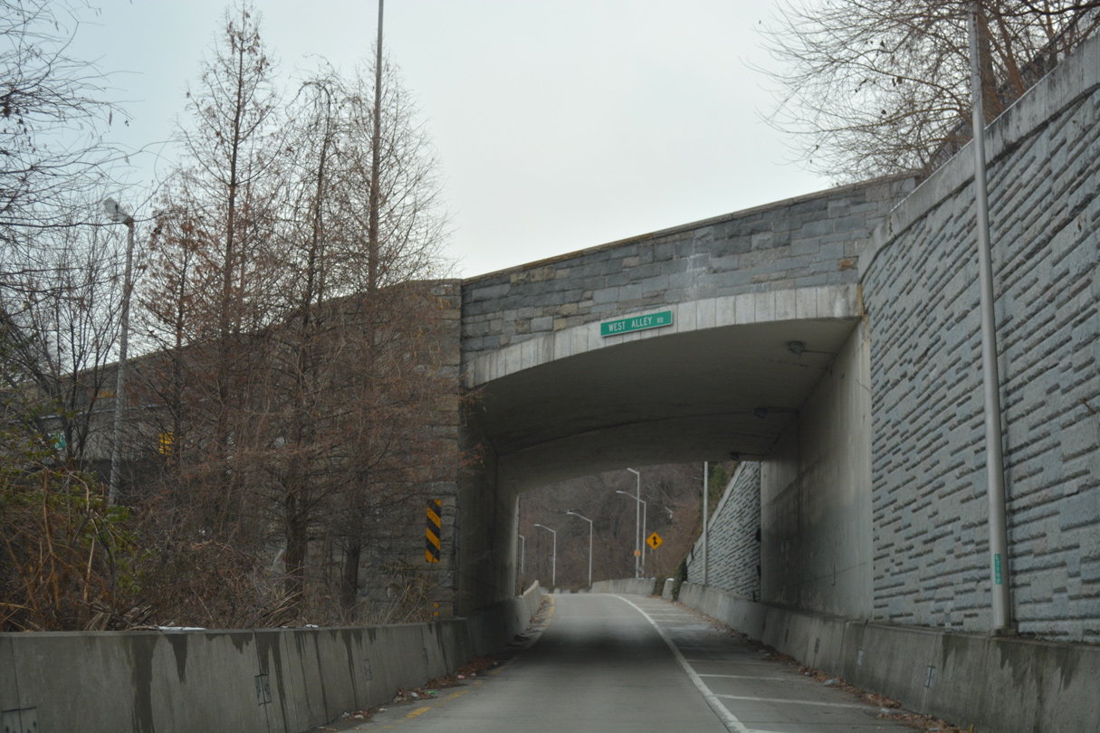
The ramp from I-495 (Long Island Expressway) east to Cross Island Parkway south narrows below W Alley Road. An entrance ramp from W Alley Road merges ahead by Alley Pond Park.
12/17/17
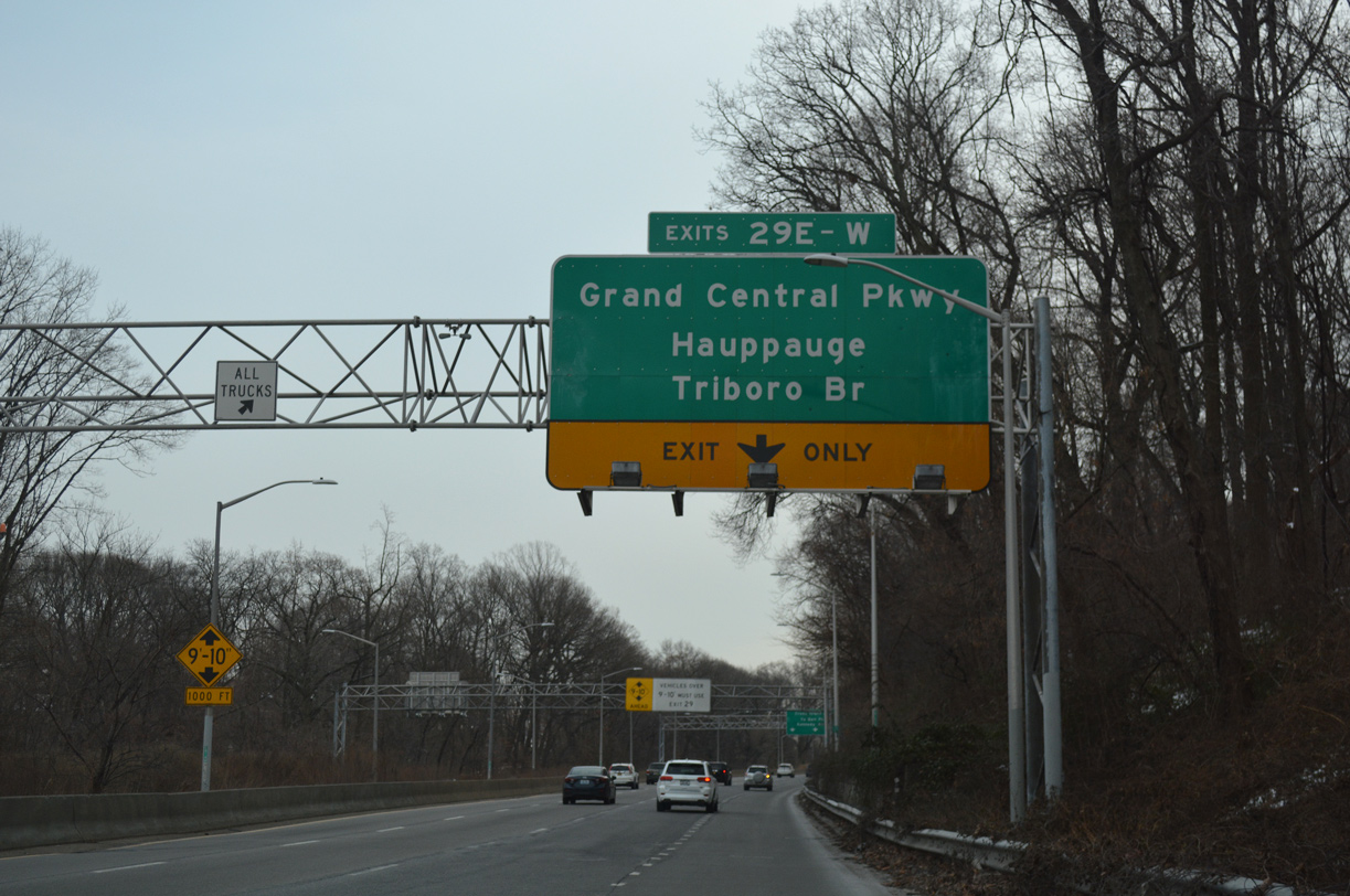
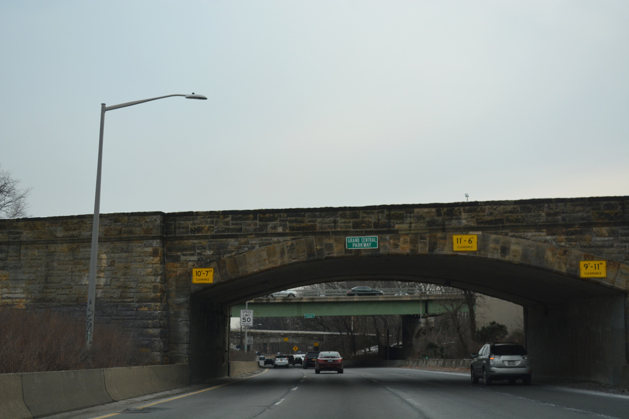
Cross Island Parkway runs through Alley Pond Park south from the L.I.E. to Grand Central Parkway (Exits 29E/W).
12/17/17
Grand Central Parkway travels west across Queens to the Kew Gardens Interchange with I-678 (Van Wyck Expressway) and Jackie Robinson Parkway and east to Northern State Parkway in Nassau County.
12/17/17
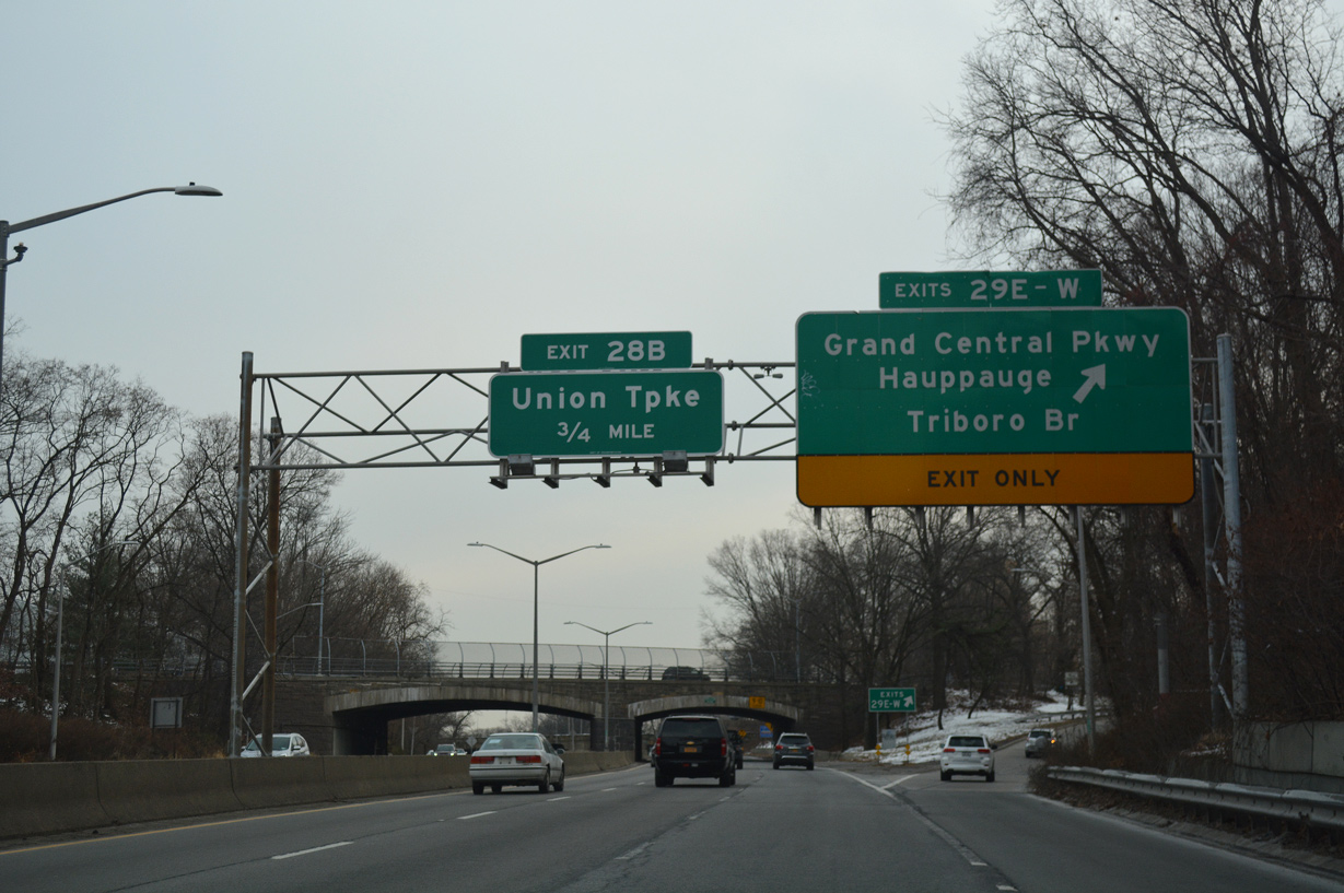
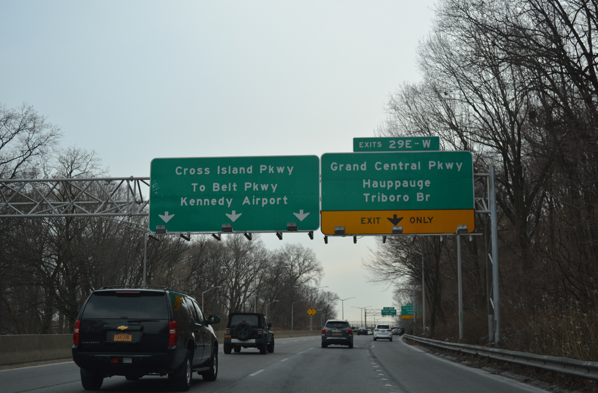
Traffic to both directions of Grand Central Parkway departs in unison from Cross Island Parkway south at Exit 29.
12/17/17
C/d roadways accompany Grand Central Parkway through the directional cloverleaf interchange with Cross Island Parkway.
12/17/17
Right in right out (RIRO) ramps connect Cross Island Parkway with 243rd Street south of Union Turnpike next.
12/17/17
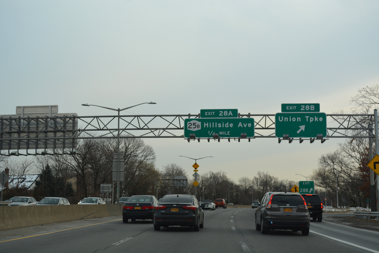
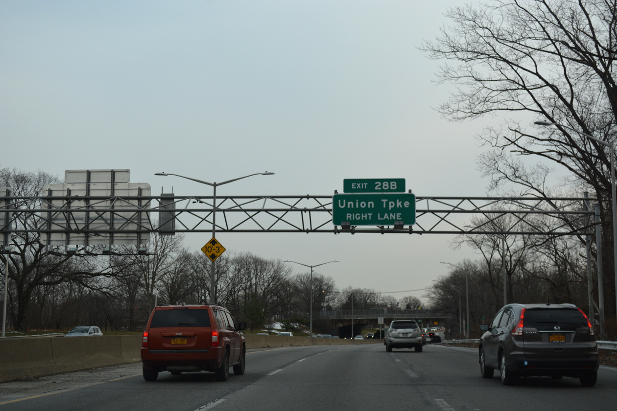
Exit 28B leaves Cross Island Parkway for Union Turnpike at the Bellerose neighborhood of east Queens.
12/17/17
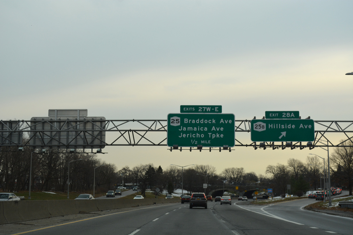
NY 25B (Hillside Avenue) branches east from NY 25 (Braddock Avenue) to a diamond interchange (Exit 28A) with Cross Island Parkway. NY 25B continues east through Bellerose and North New Hyde Park in Nassau County.
12/17/17
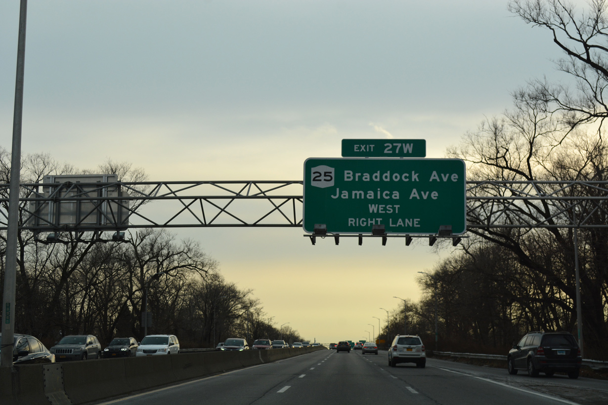
NY 25 shifts southward along Braddock Avenue to Jamaica Avenue adjacent to the ramps with Cross Island Parkway at Exit 27W.
12/17/17
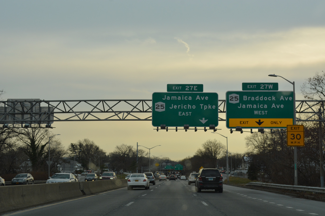
A half diamond interchange (Exit 27W) joins Cross Island Parkway south with NY 27 (Braddock Avenue) west. A folded diamond interchange (Exit 27E) follows with Jamaica Avenue east.
12/17/17
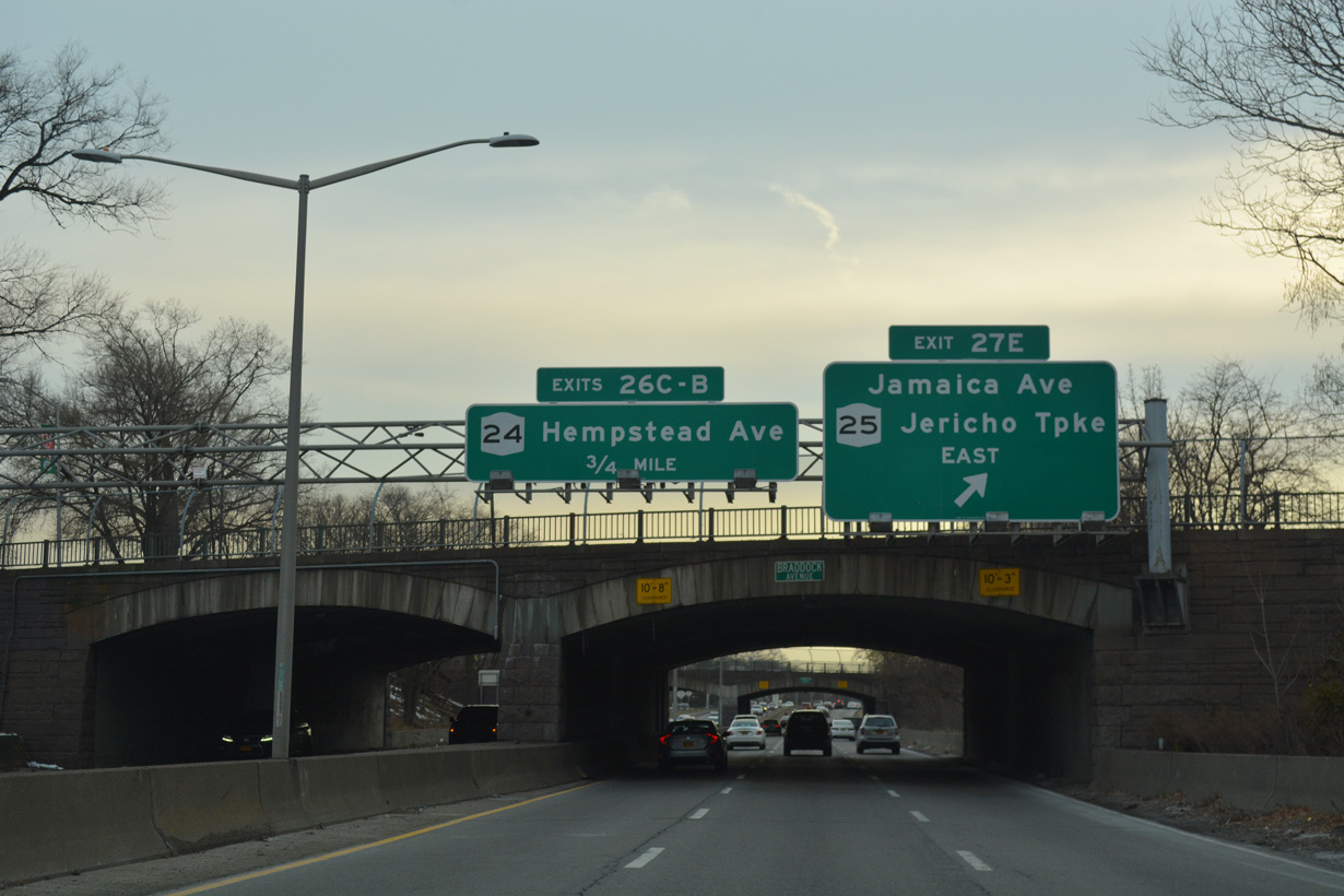
NY 25 (Jamaica Avenue) runs along the New York city line east to New Hyde Park. Following Jericho Turnpike, the state route continues to Garden City Park and the village of Mineola.
12/17/17
Cross Island Parkway enters Nassau County through western reaches of the Floral Park village limits.
12/17/17
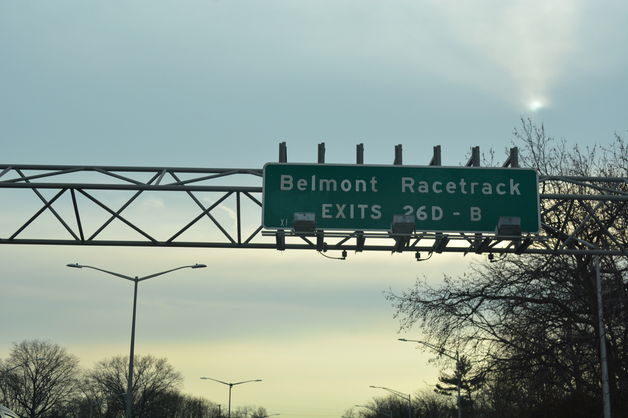
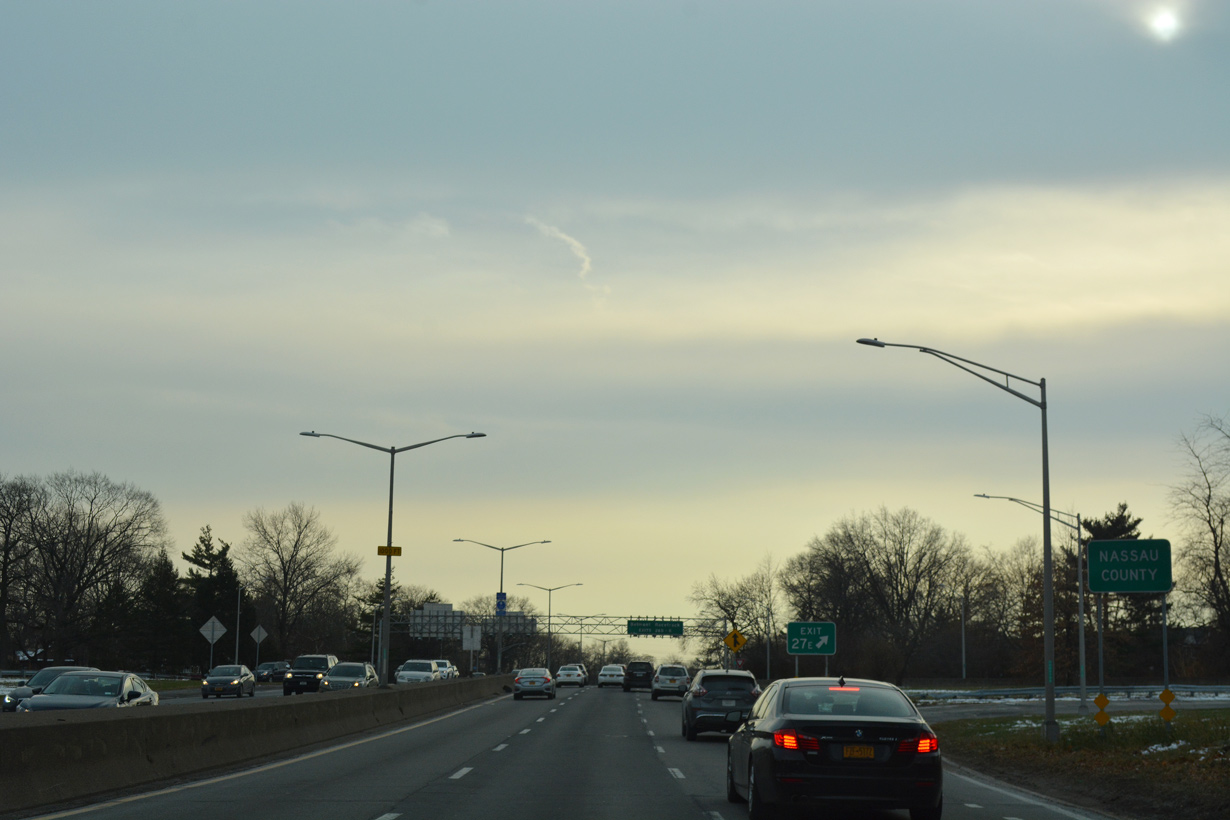
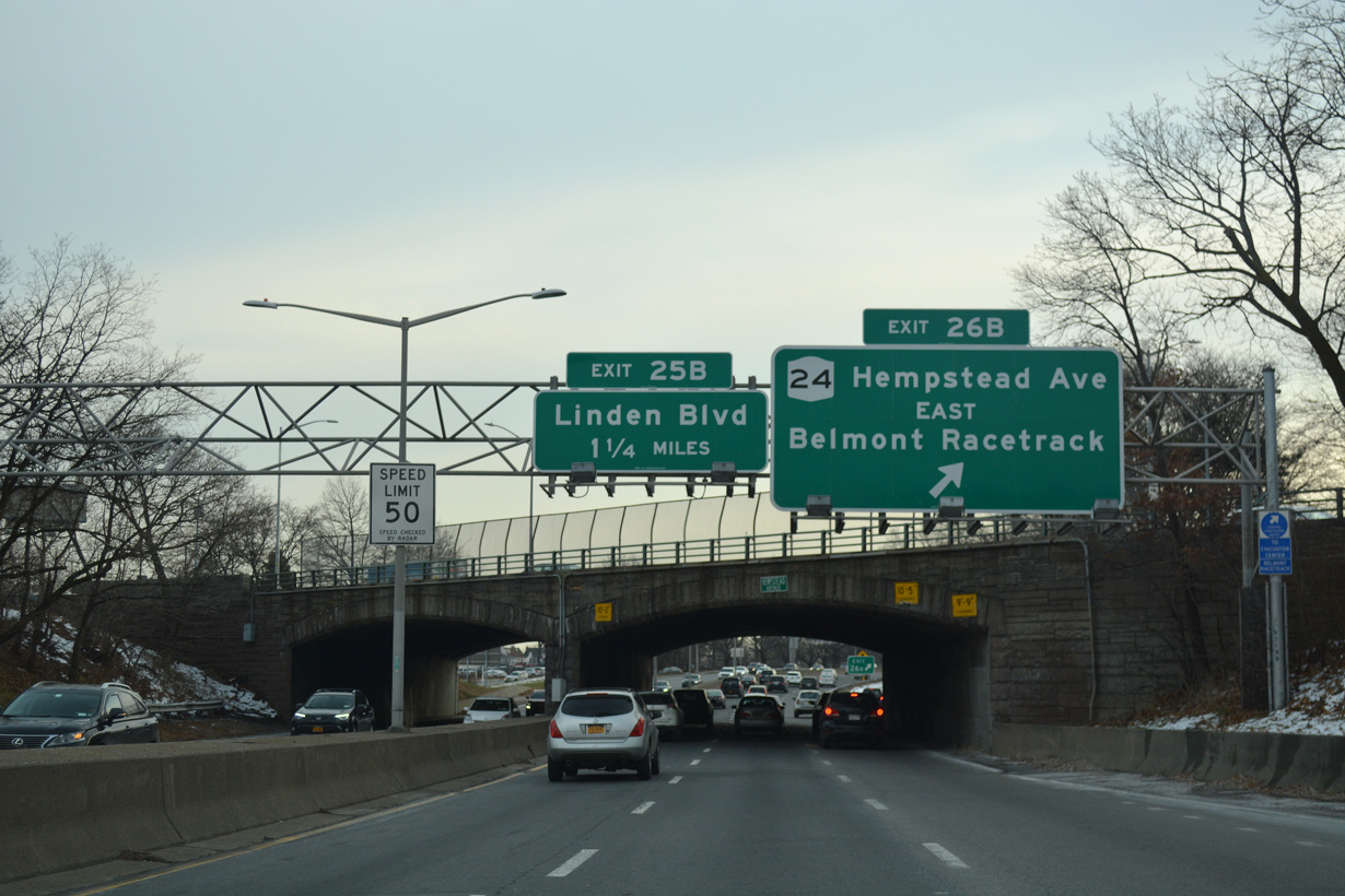
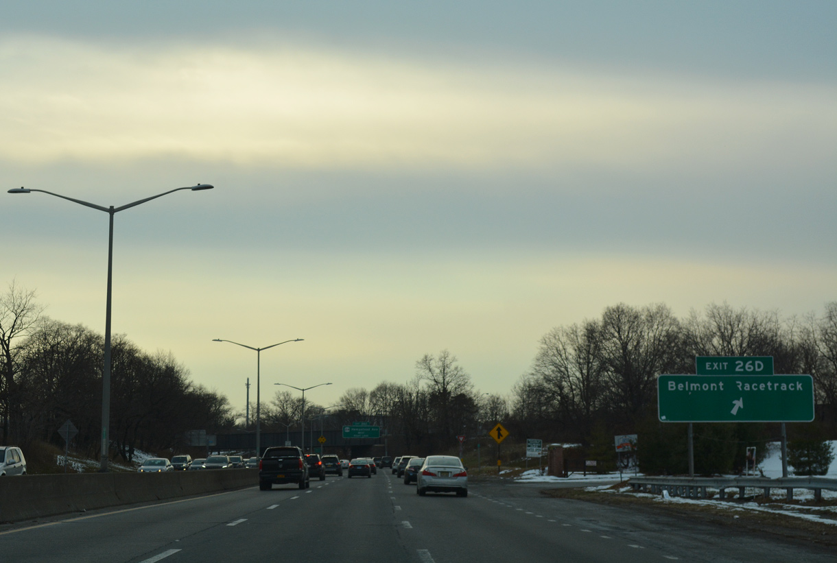
Belmont Park Racetrack lies along the east side of Cross Island Parkway between Exit 26D and Exit 26B with NY 24 (Hempstead Avenue).
12/17/17
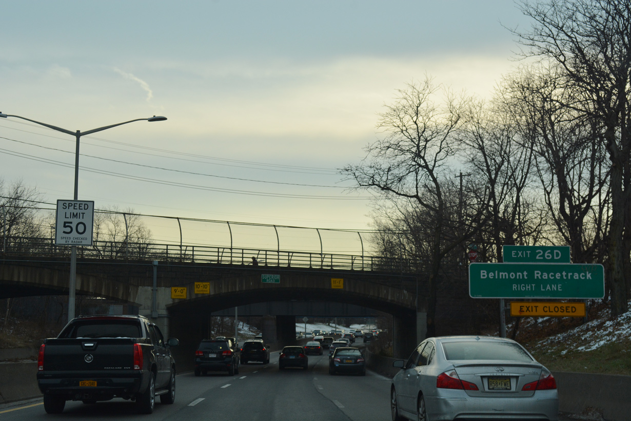
Superior Road and the Long Island Railroad (LIRR) span Cross Island Parkway ahead of the folded diamond interchange (Exit 26D) with Belmont Park Road.
12/17/17
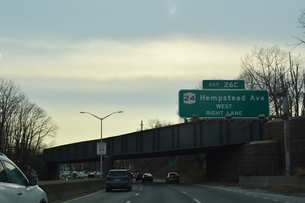
NY 24 angles southeast from Jamaica Avenue through Queens Village along Hempstead Avenue to Cross Island Parkway at Exits 26C/B.
12/17/17
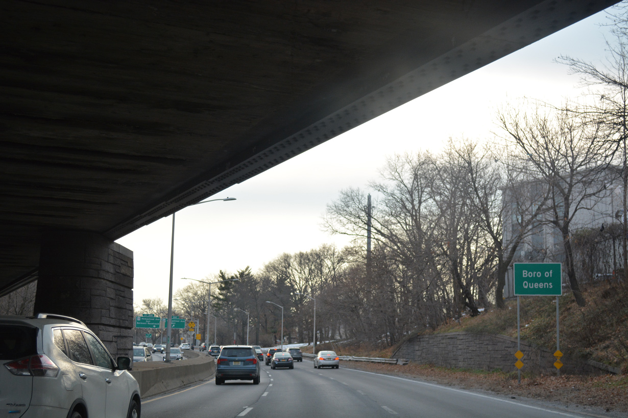
Cross Island Parkway reenters New York City just ahead of the cloverleaf interchange (Exits 26C/B) with NY 24.
12/17/17
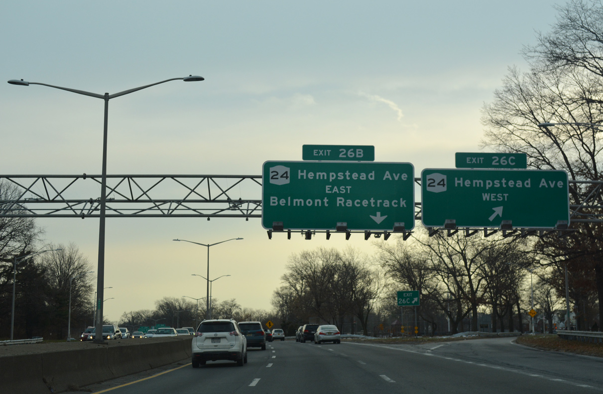
Exit 26C connects with 224th Street south to NY 24 (Hempstead Avenue). NY 24 concludes 1.81 miles to the northwest at the intersection of Hollis Court Boulevard, NY 25 (Hillside Avenue) and the Clearview Expressway (I-295) in Queens Village.
12/17/17
NY 24 (Hempstead Avenue) runs along the south side of Belmont Park to Elmont and Hempstead in Nassau County.
12/17/17
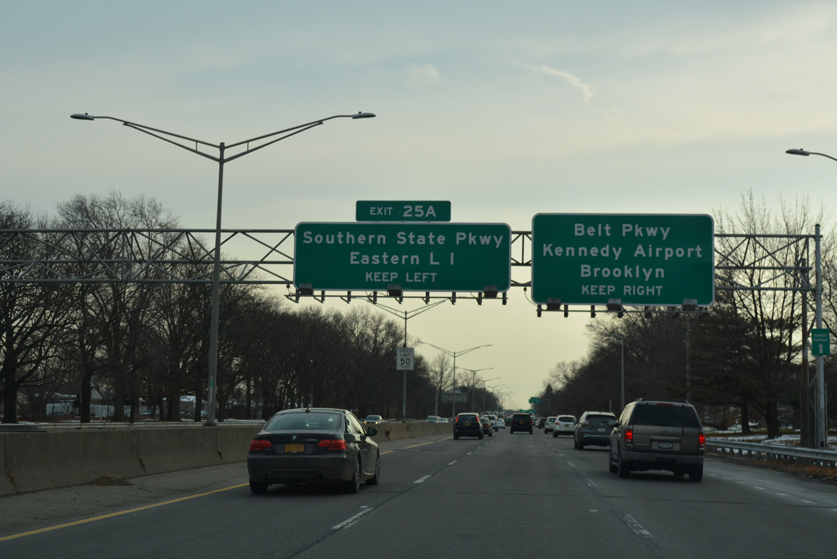
Cross Island Parkway advances south along the Queens / Nassau County line to Southern State Parkway (Exit 25A).
12/17/17
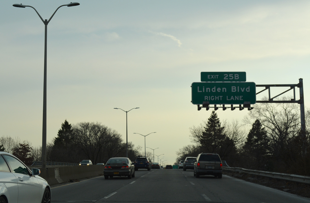
A parclo interchange (Exit 25B) joins Cross Island Parkway with Linden Boulevard south of 115th Avenue / Dutch Broadway.
12/17/17
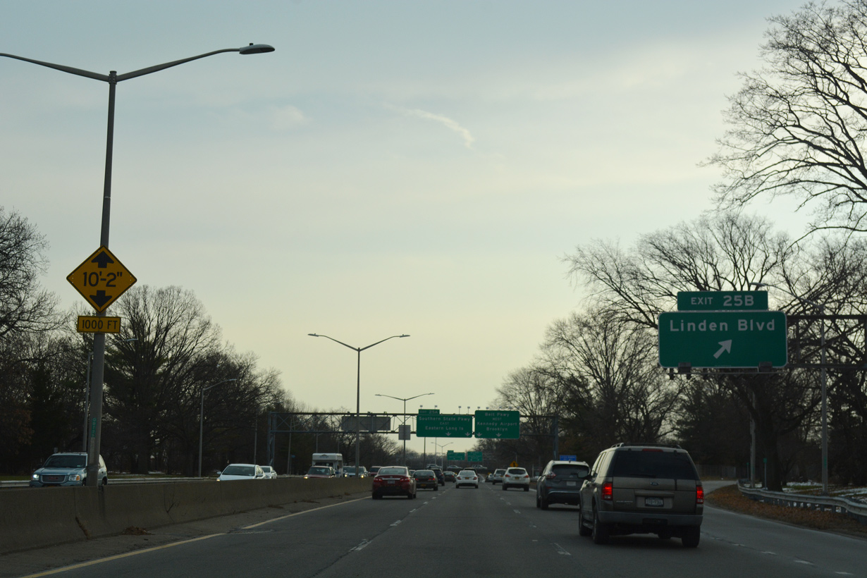
Exit 25B departs Cross Island Parkway south onto 234th Street ahead of Linden Boulevard in the Cambria Heights neighborhood.
12/17/17
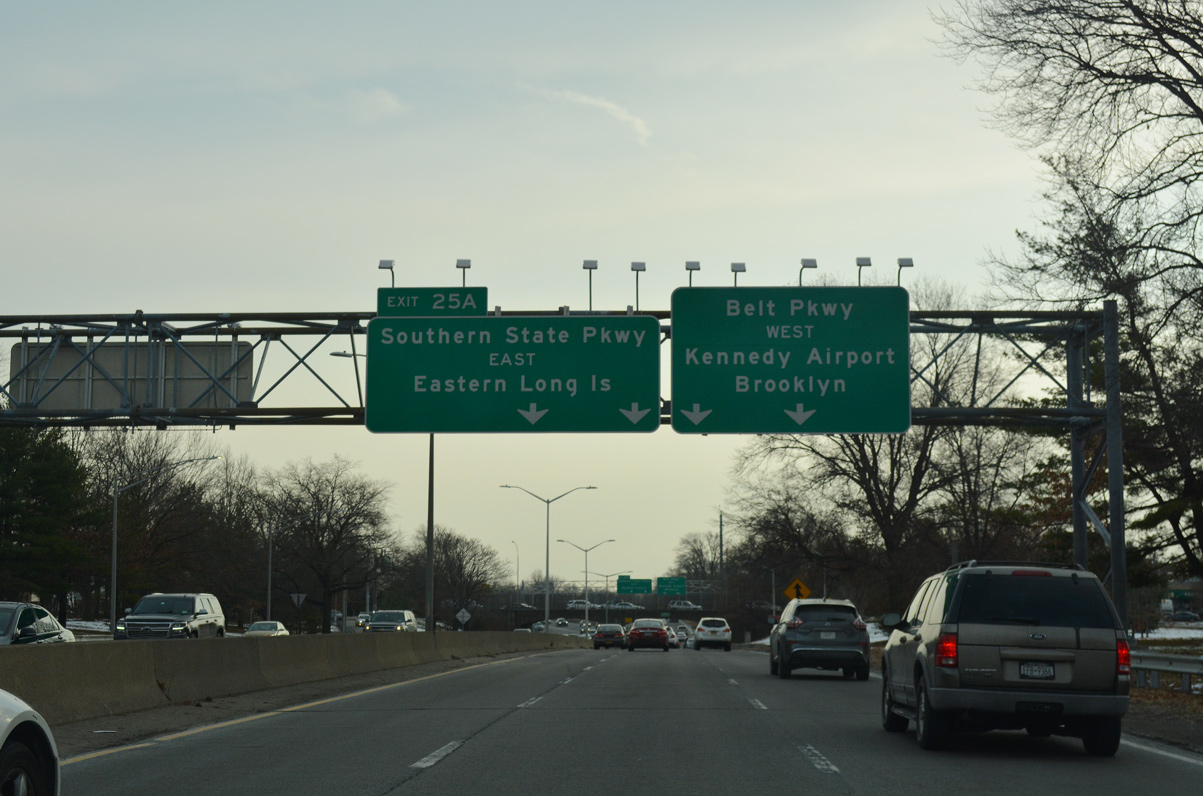
Southern State Parkway (Route 908M) stems east from Cross Island Parkway / Belt Parkway from Left Exit 25A to Hempstead, Wantagh and Islip.
12/17/17
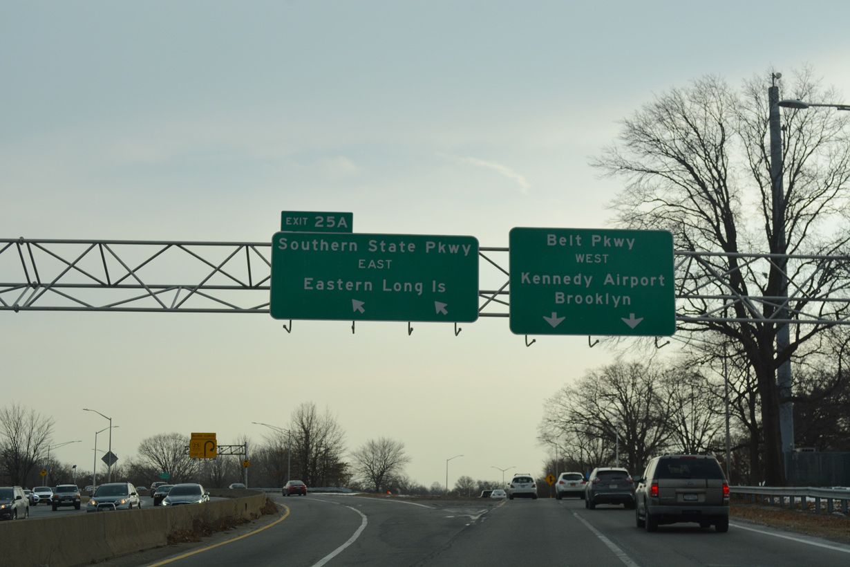
Cross Island Parkway becomes Belt Parkway south from the trumpet interchange (Exit 25A) with Southern State Parkway. Southern State Parkway comprises one of three limited access routes from Queens east onto Long Island.
12/17/17
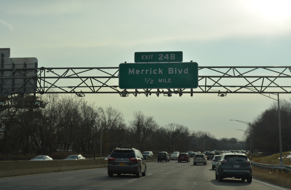
Belt Parkway angles southwest a half mile to Merrick Boulevard (Exit 24B) at Laurelton in Queens.
12/17/17
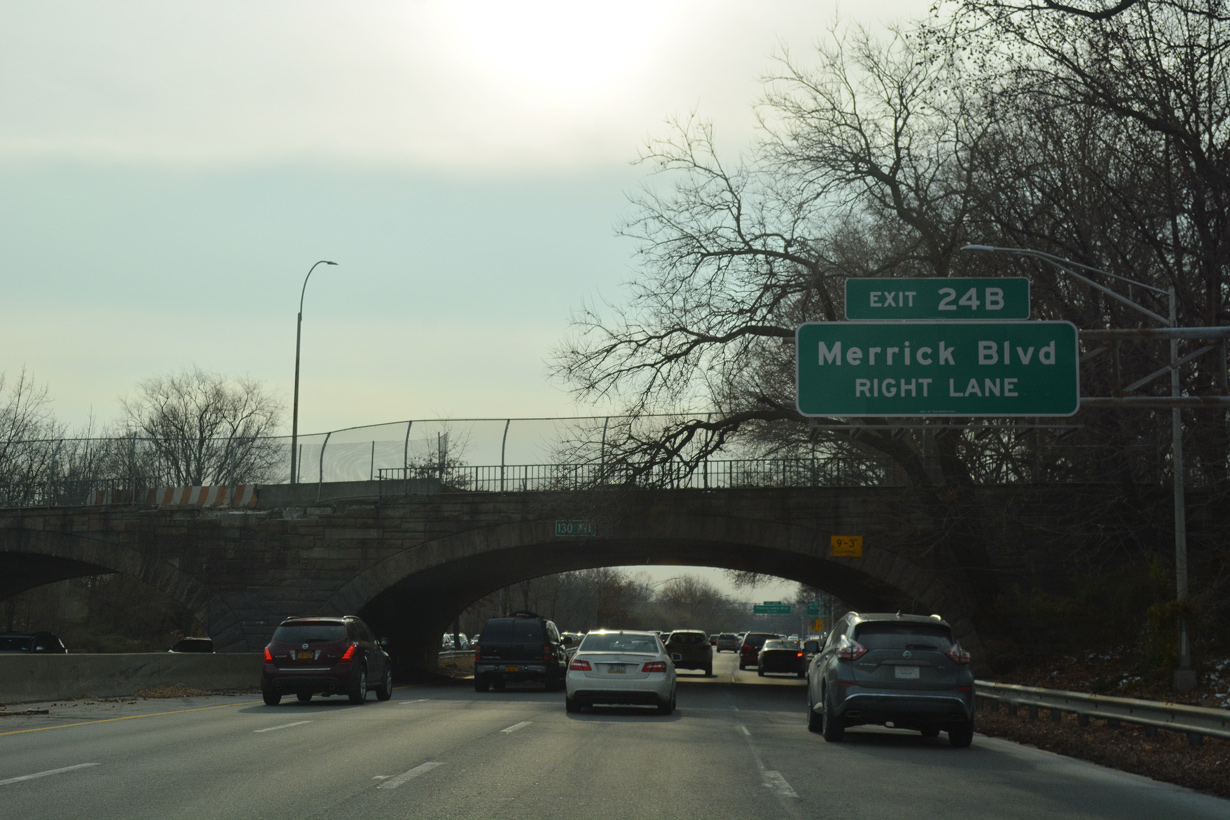
Slip ramps at Exit 24B connect Belt Parkway westbound with the Laurelton Parkway service road ahead of Merrick Boulevard.
12/17/17
Merrick Boulevard meanders northwest from Laurelton to St. Albans and Jamaica and southeast into the village of Valley Stream.
12/17/17
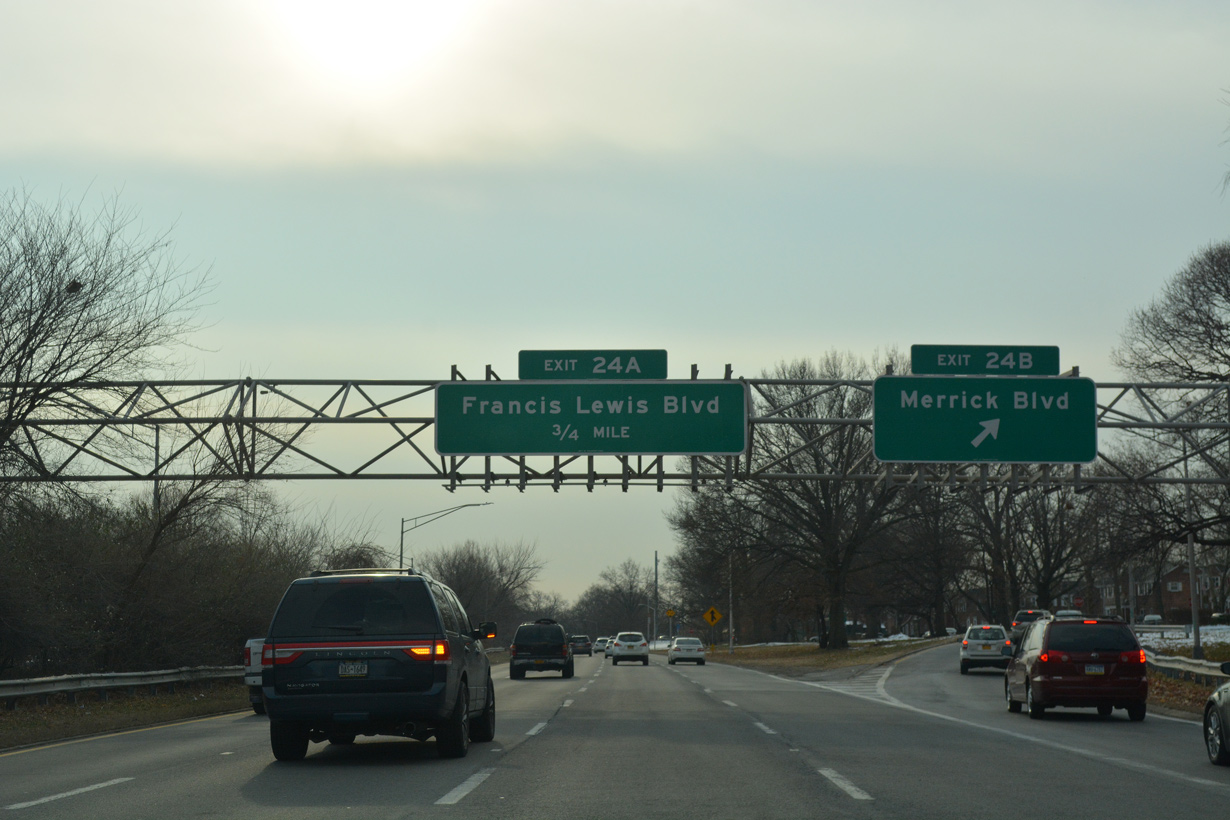
Exit 24A follows for the Laurelton Parkway service road north to Francis Lewis Boulevard.
12/17/17
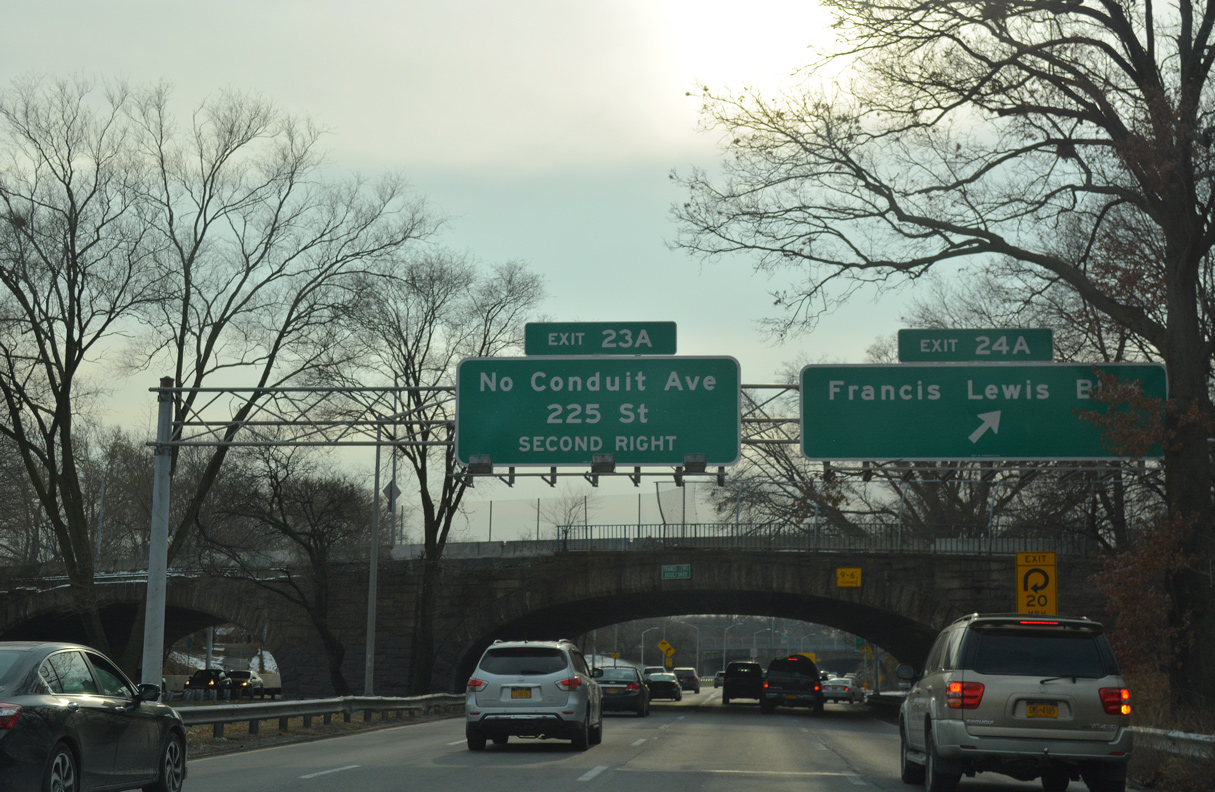
Francis Lewis Boulevard crosses Belt Parkway southeast from Laurelton into the Rosedale neighborhood.
12/17/17
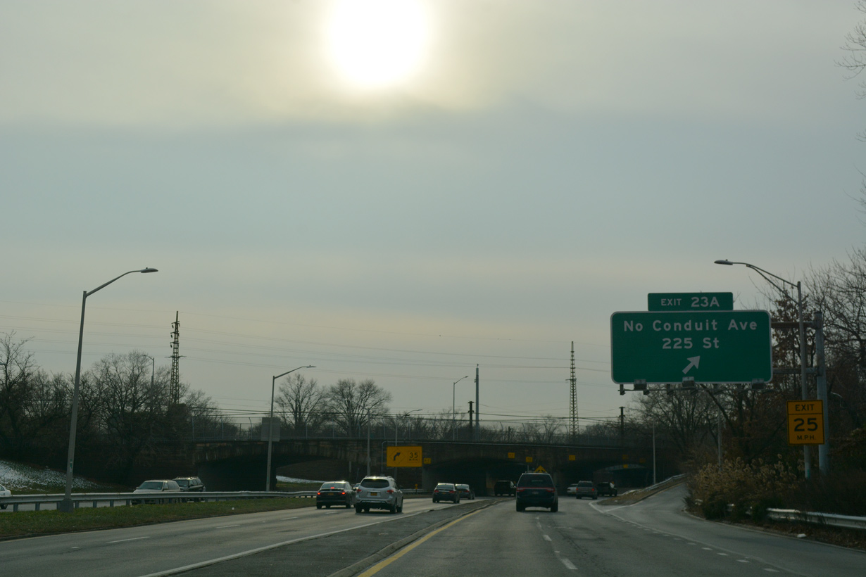
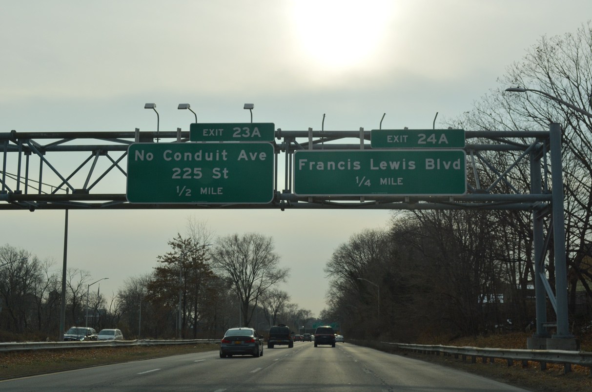
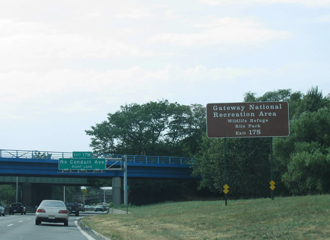
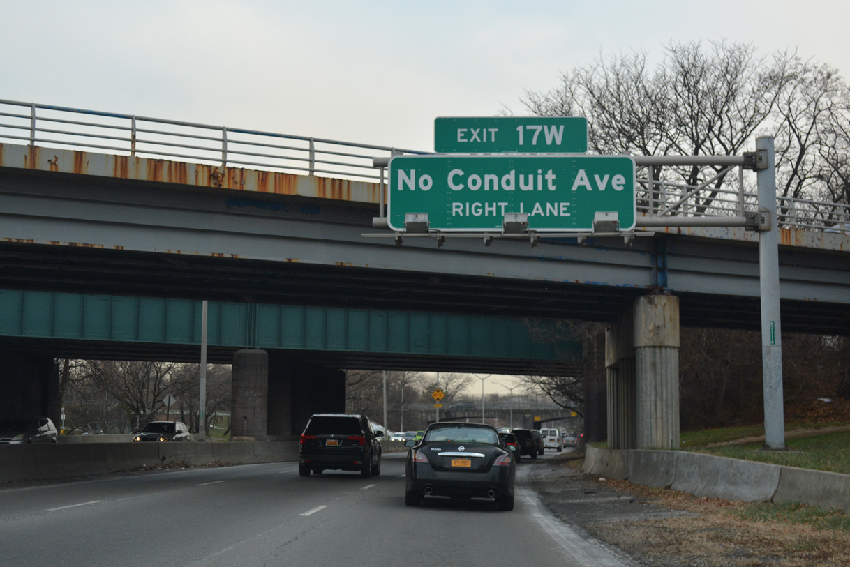
Belt Parkway turns east alongside Conduit Avenue (NY 27) at Exit 23A. NY 27 westbound follows N Conduit Avenue.
12/17/17
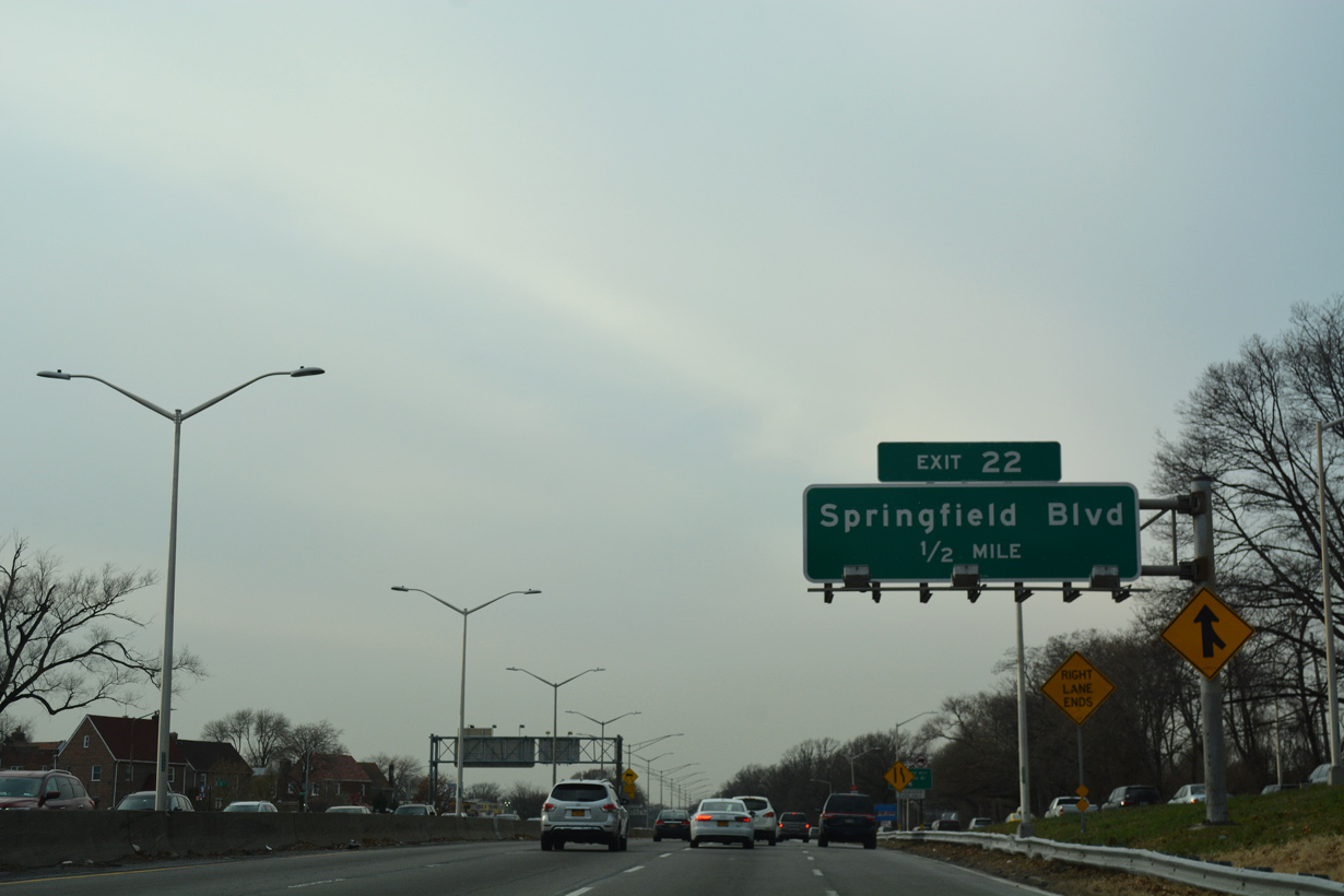
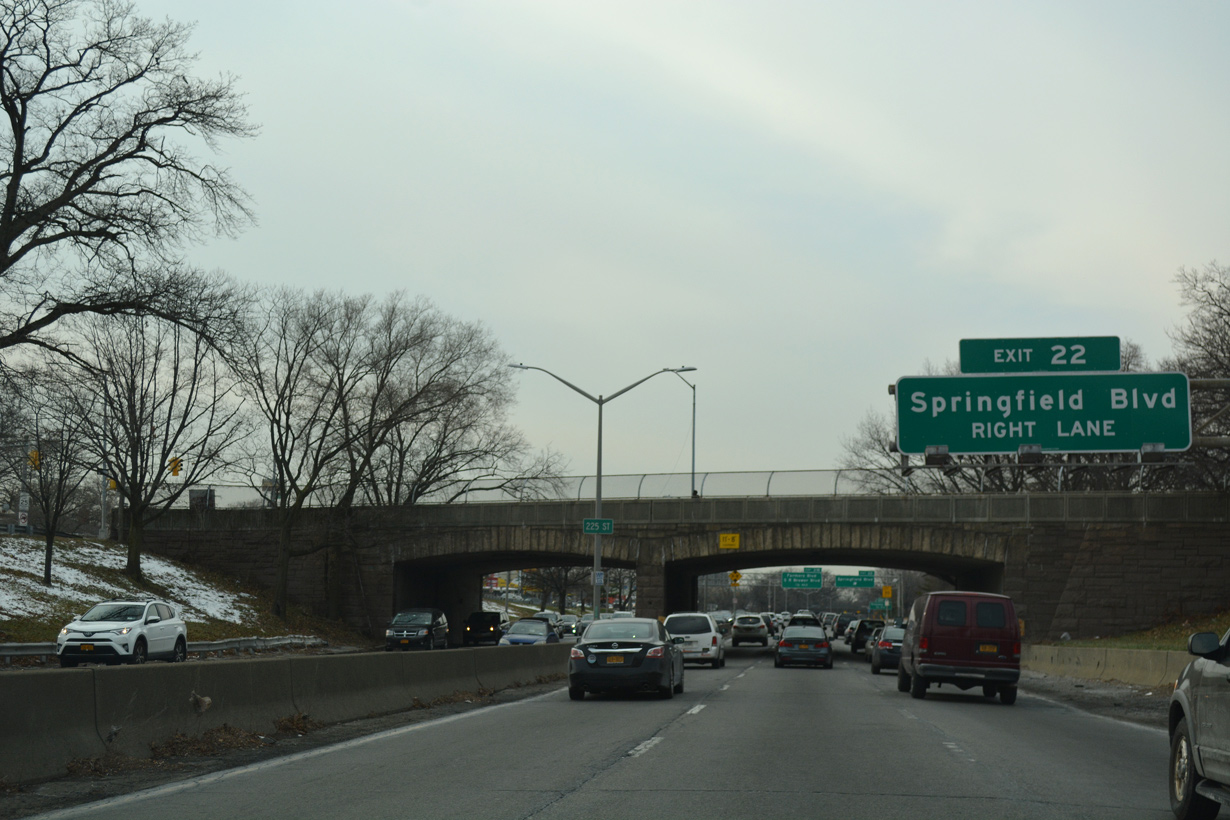
Running between N and S Conduit Avenue (NY 27), Belt Parkway continues west a half mile to Exit 22 for Springfield Boulevard.
12/17/17
Springfield Boulevard is an urban arterial south to Brookville and north to Laurelton and St. Albans in Queens.
12/17/17
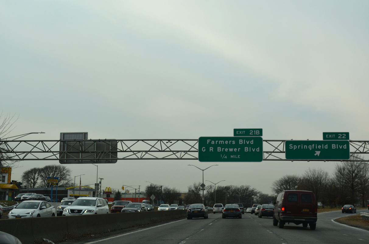
Exit 22 joins NY 27 (N Conduit Avenue) west beyond 225th Street. Exit 21B connects with N Conduit Avenue just after the Springfield Boulevard overpass.
12/17/17
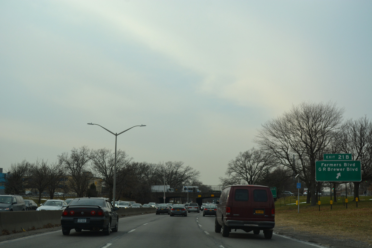
N Conduit Avenue leads west from Exit 21B to Farmers Boulevard and Guy R. Brewer Boulevard at the Springfield Gardens community.
12/17/17
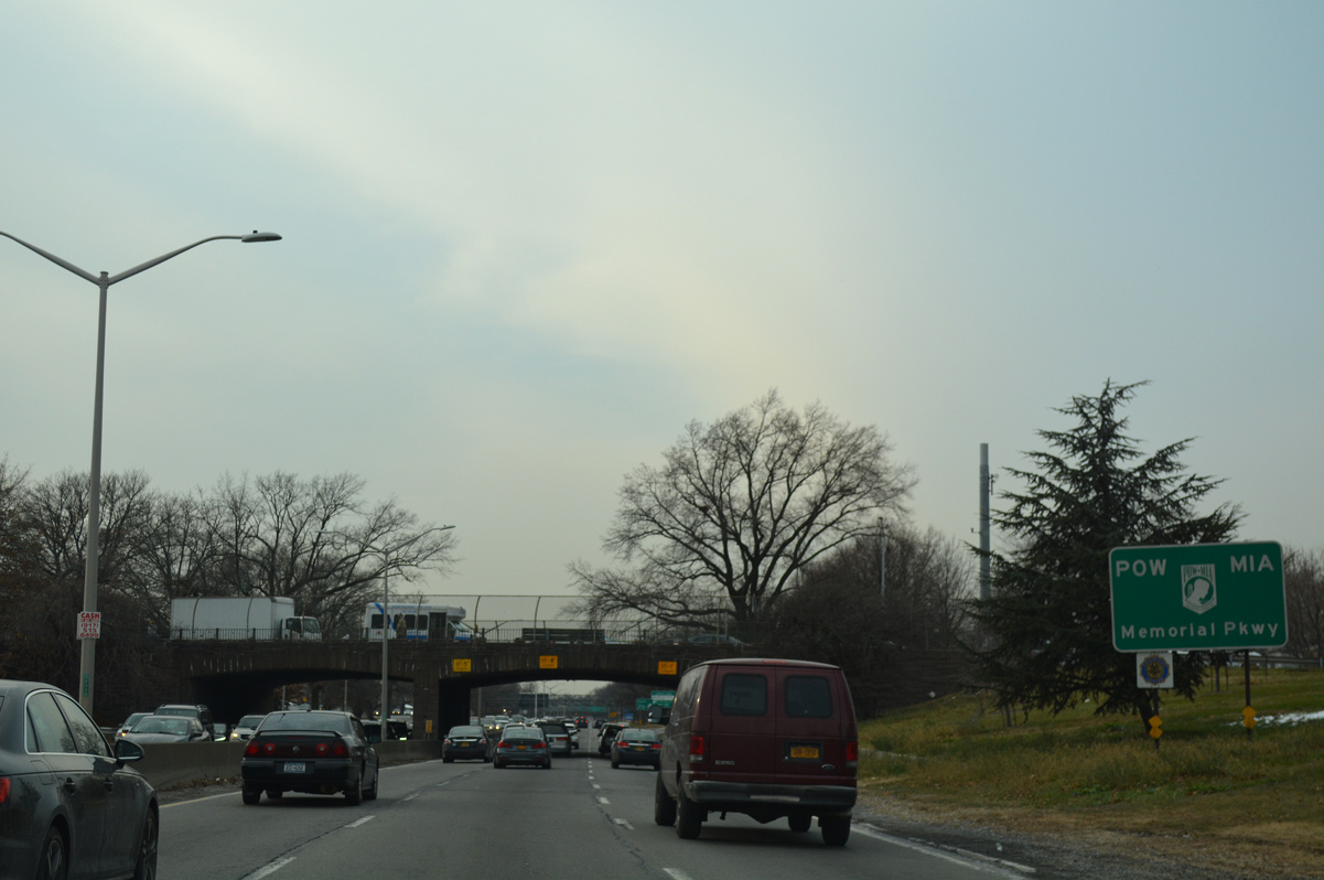
Belt Parkway is also the POW MIA Highway.
12/17/17
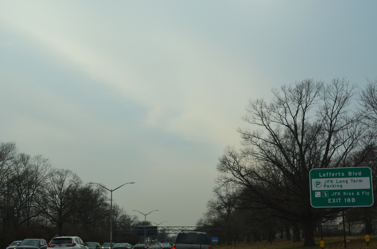
Belt Parkway passes north of John F. Kennedy International Airport (JFK) between JFK Expressway (Exit 20) and Lefferts Boulevard (Exit 18B).
12/17/17
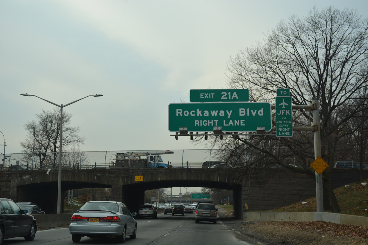
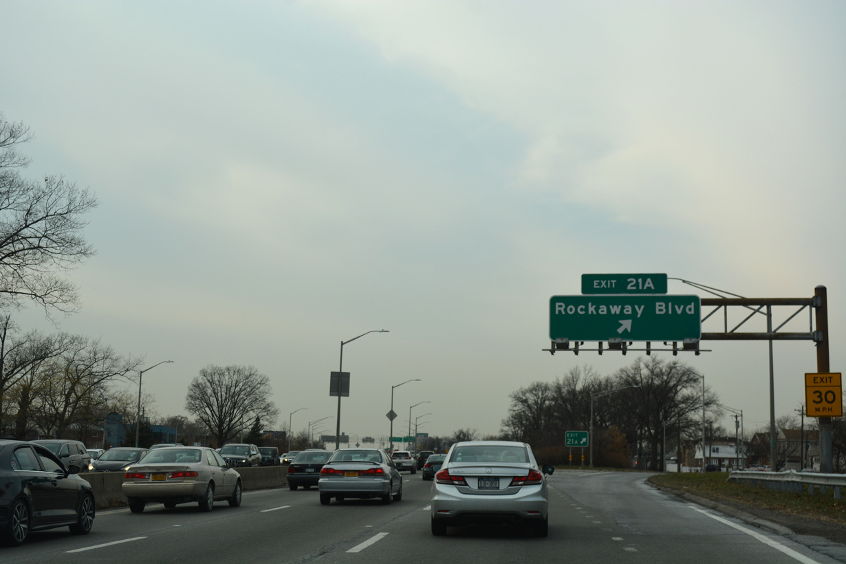
The ensuing off-ramp (Exit 21A) departs for Rockaway Boulevard to Springfield Gardens and South Jamaica.
12/17/17
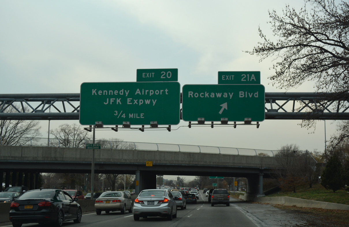
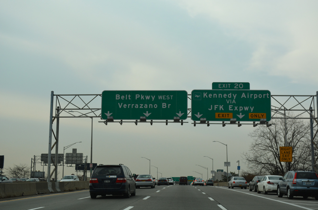
JFK Expressway spurs south to the passenger terminal of John F. Kennedy International Airport (JFK) from a wye interchange (Exit 20) with Belt Parkway westbound.
12/17/17
Rockaway Boulevard branches north from NY 878 (Nassau Expressway) to Baisley Pond Park and west to South Ozone Park and Ozone Park.
12/17/17
JFK Expressway is a locally maintained limited access highway winding south to 150th Avenue, S Cargo Road the Van Wyck Expressway.
12/17/17
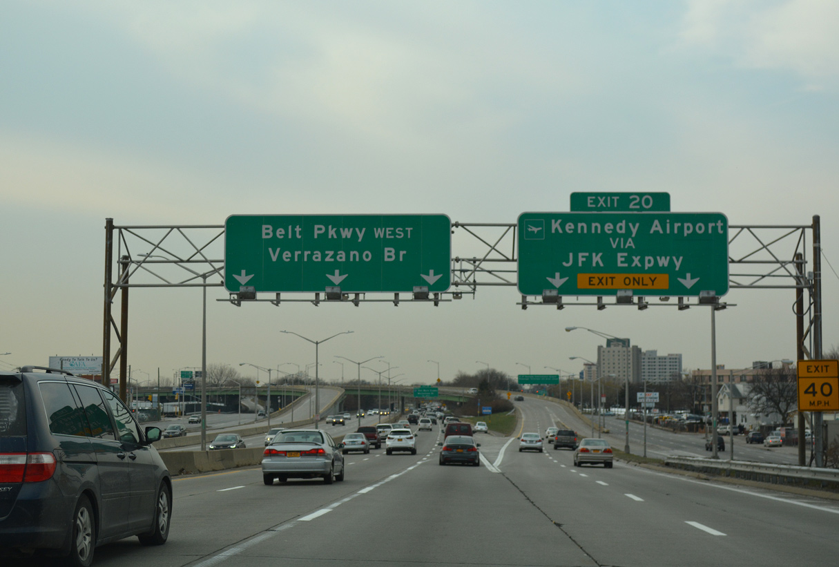
Three lanes proceed west from the separation with JFK Expressway (Exit 20) toward Brooklyn. NY 878 (Nassau Expressway) parallels Belt Parkway to the south.
12/17/17
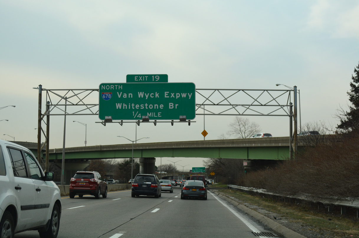
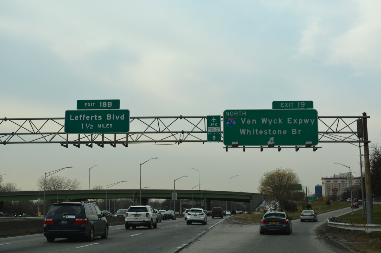
The exchange joining Belt Parkway west with Interstate 678 connects with the Van Wyck Expressway northbound only. The southbound ramp is accessible from NY 27 (N Conduit Avenue).
12/17/17
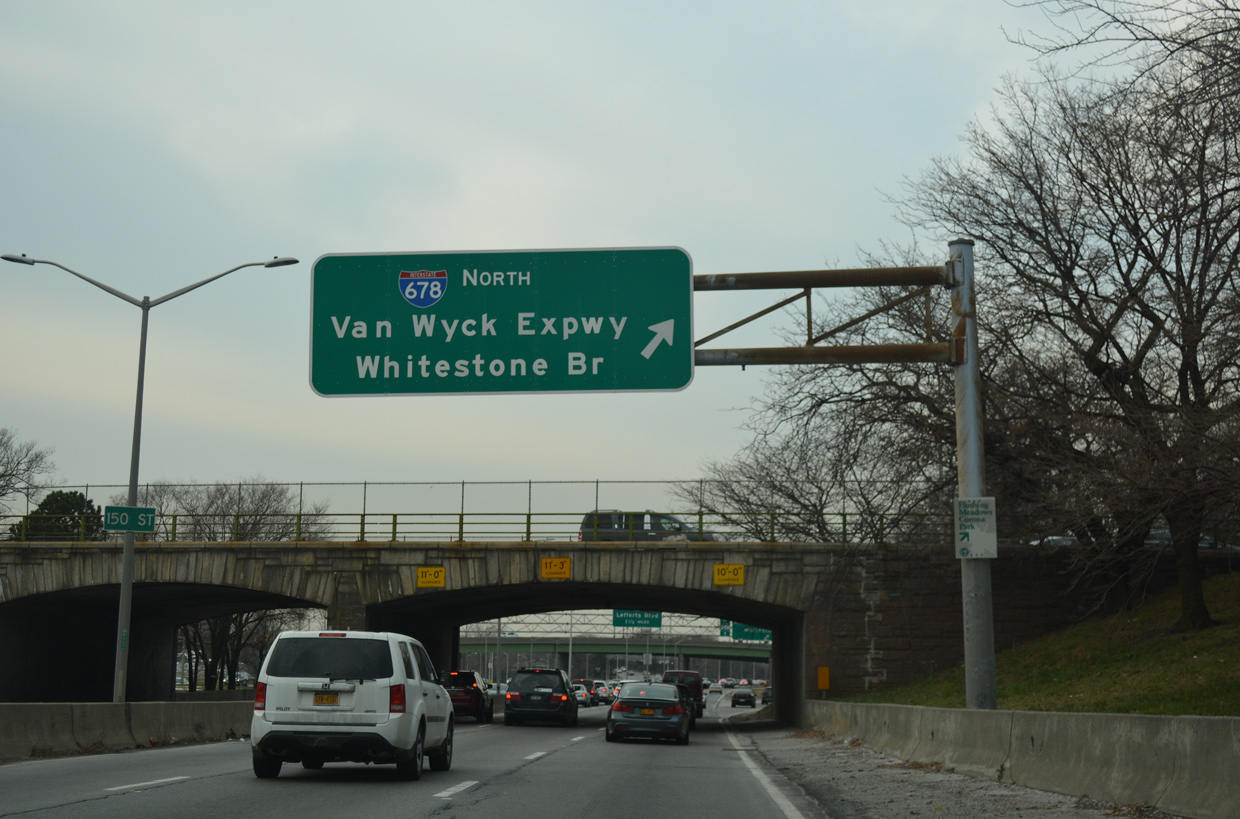
Exit 19 partitions from Belt Parkway west at the 150th Street overpass. Interstate 678 extends north from John F. Kennedy International Airport (JFK) to Flushing Meadows Corona Park, College Point and the Whitestone Bridge to the Bronx.
12/17/17
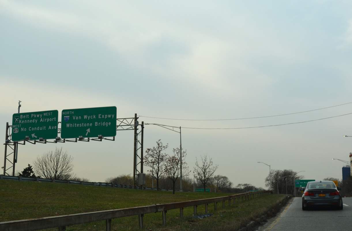
Nassau Expressway's westbound roadway extends only as far as the ramps for I-678 (Van Wyck Expressway) north, NY 27 (N Conduit Avenue) north and Belt Parkway west.
12/17/17
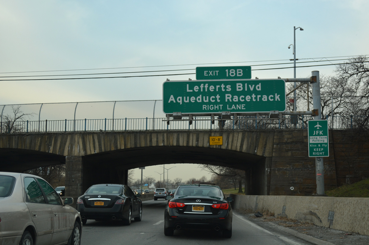
Belt Parkway advances west from the exchange with I-678 and the 130th Street over crossing to Exit 18B for Lefferts Boulevard and Aqueduct Race Track.
12/17/17
A slip ramp joins Belt Parkway westbound with NY 27 (N Conduit Avenue) ahead of Lefferts Boulevard. Lefferts Boulevard travels north from the JFK Airport long term parking area across the parkway into the South Ozone Park and South Richmond Hill neighborhoods.
12/17/17
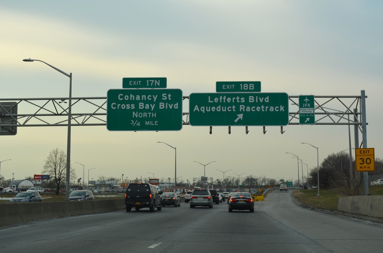
Forthcoming Cross Bay Boulevard extends north from Liberty Avenue in Ozone Park as Woodhaven Boulevard to Woodhaven and Forest Park in Queens.
12/17/17
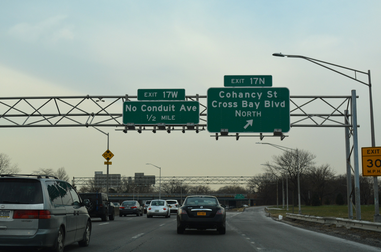
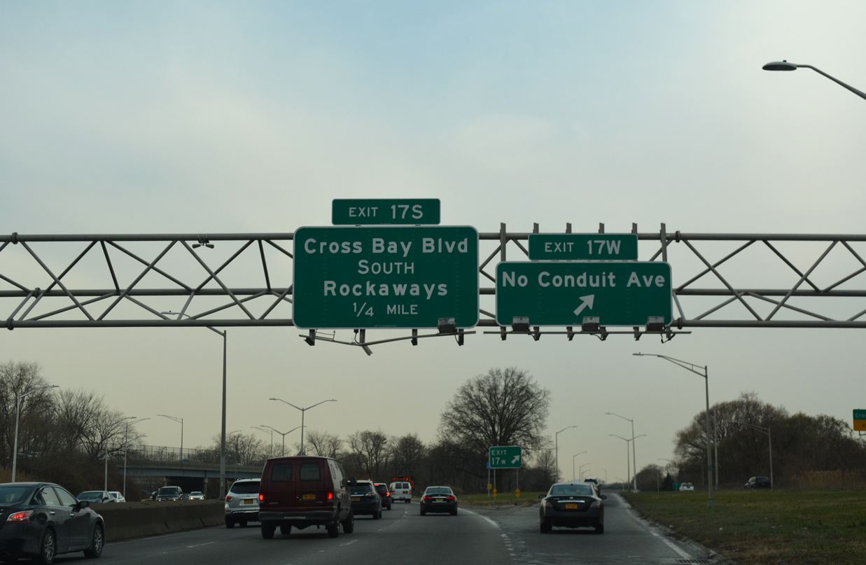
Departing the parkway next is Exit 17N for Cohancy Street and Cross Bay Boulevard north via NY 27 (N Conduit Avenue) west. Cohancy Street spans Belt Parkway south into Old Howard Beach.
12/17/17
Cross Bay Boulevard follows a causeway south of Howard Beach across Jamaica Bay to Broad Channel and Seaside. Coastal areas between the two communities are a part of Gateway National Recreation Area and Jamaica Bay Wildlife Refuge.
08/29/05
12/17/17
Exit 17N leaves Belt Parkway west for NY 27 (N Conduit Avenue) ahead of Cohancy Street. Cross Bay Boulevard constitutes an urban arterial south to Howard Beach and Rockaway Beach.
12/17/17
NY 27 (N Conduit Avenue) branches northwest from Belt Parkway at Exit 17N. Conduit Avenue connects with Atlantic Avenue in 2.3 miles at Cypress Hills. NY 27 shifts west onto Linden Boulevard through East New York in three quarters of a mile.
12/17/17
References:
- Belt Parkway. NYCRoads.com.
Photo Credits:
- AARoads: 08/29/05
- Alex Nitzman: 12/17/17
- ABRoads: 12/17/17
Connect with:
Page Updated Monday March 16, 2020.