
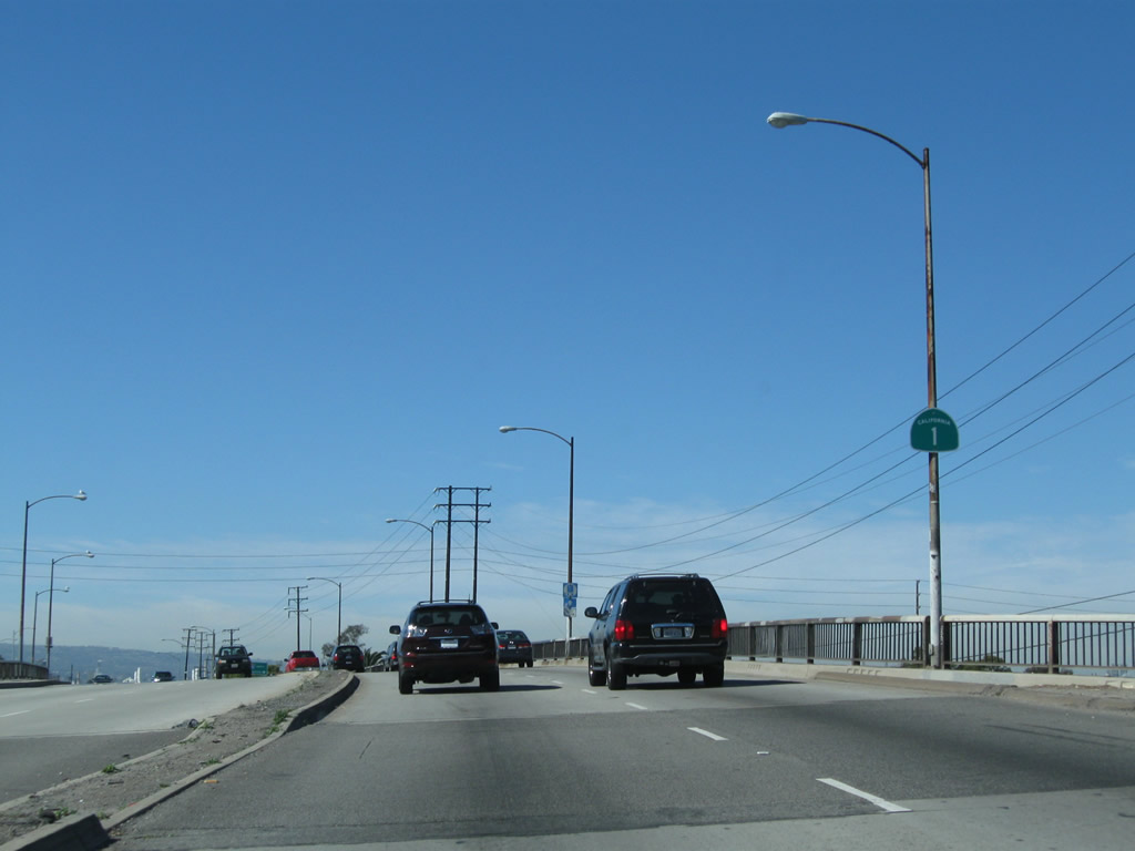
State Route 1 North - Long Beach
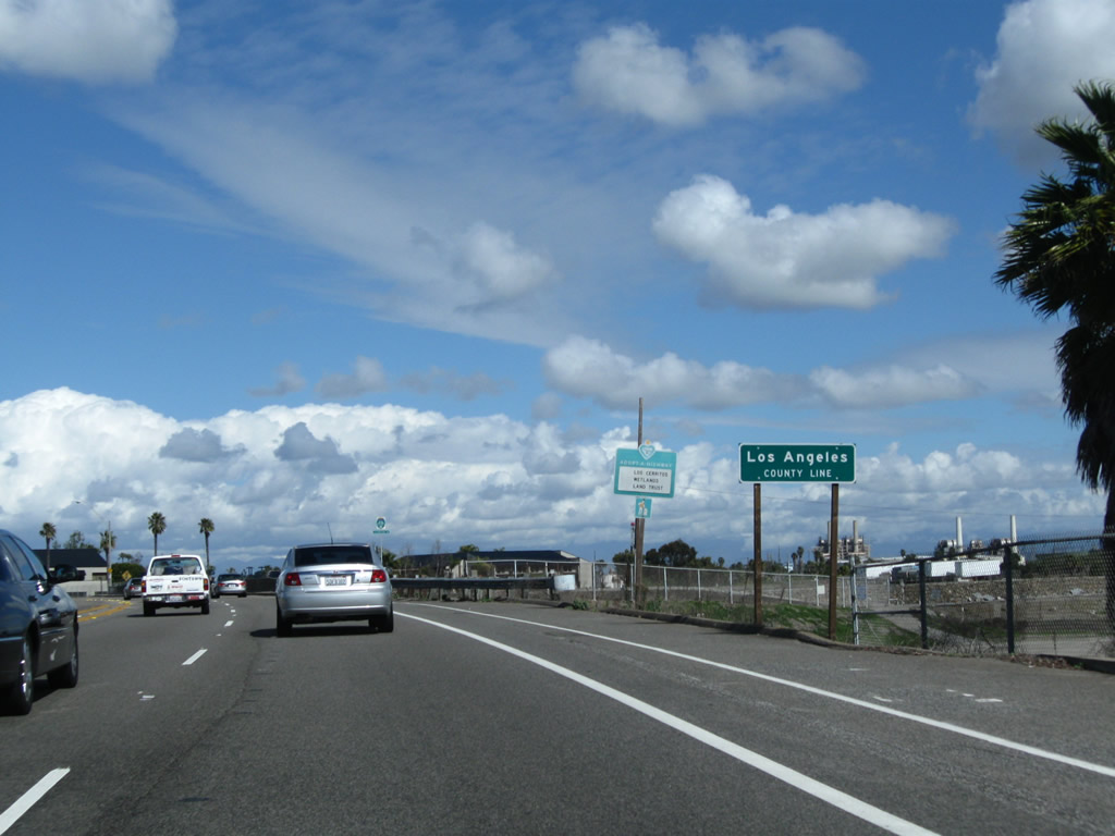
North beyond First Street in Seal Beach, California 1 leaves Orange County and enters Los Angeles County and the city of Long Beach.
02/26/11
Long Beach employes a unique marker for its bicycle route system. Long Beach Bike Route 85 travels north along the San Gabriel River bike path.
02/26/11
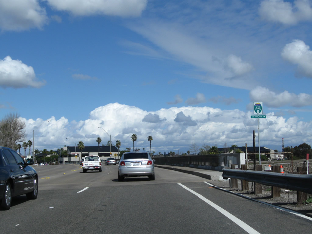
A 1931 bridge carries California 1 over the San Gabriel River. This bridge was widened to its current width in 1962.
02/26/11
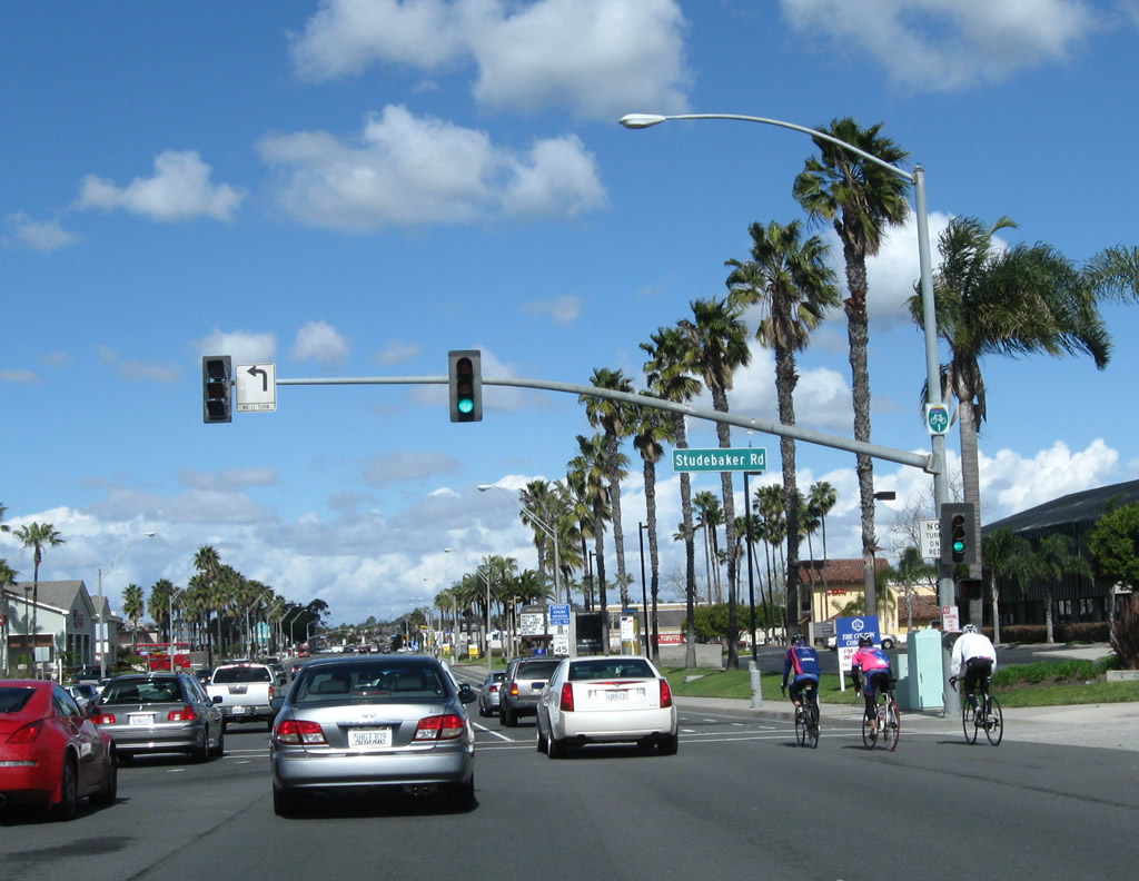
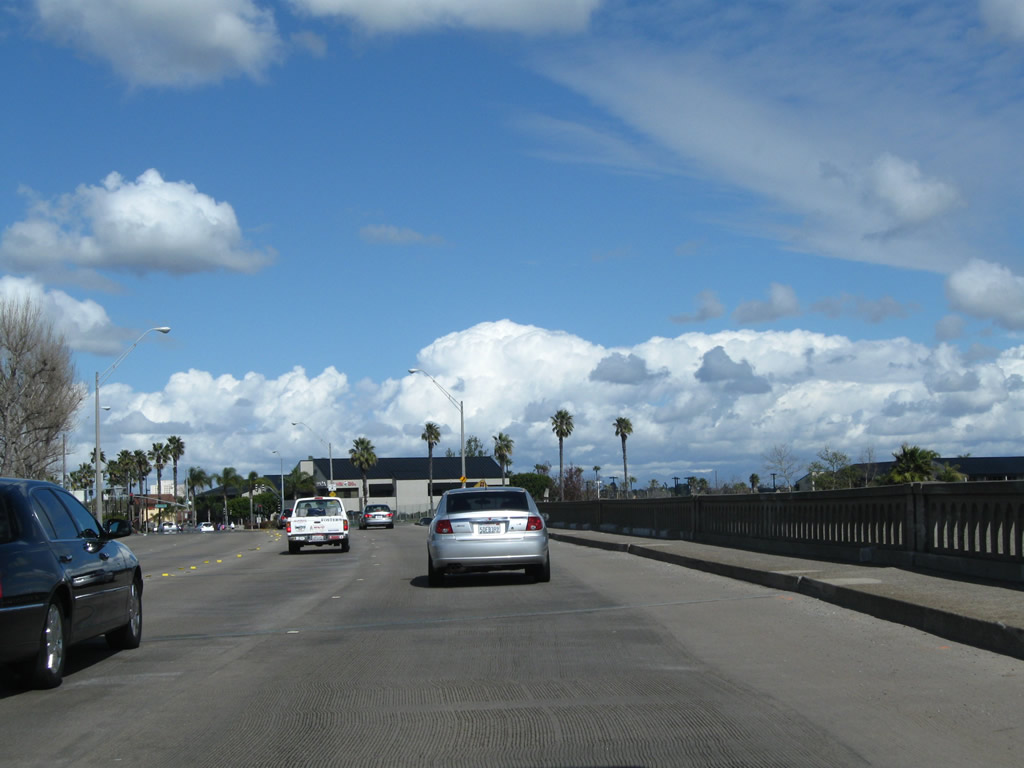
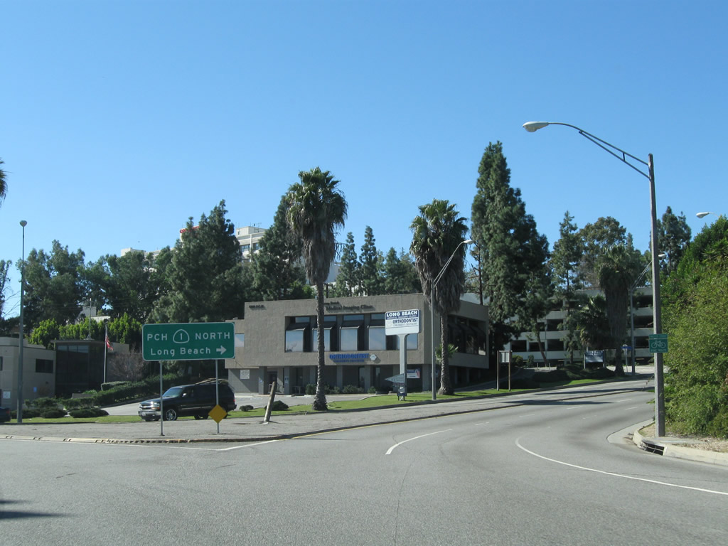
Northbound SR 1 meets Studebaker Road at this intersection. This section is not contiguous with the main section of Studebaker Road, which SR 1 connects to via Second Street east. Studebaker Road proceeds north from Second Street to S R22 east, I-605 north, and Interstate 405. The Long Beach Bike Route 1 signs are much more common than state route reassurance shields along SR 1 in Long Beach.
02/26/11
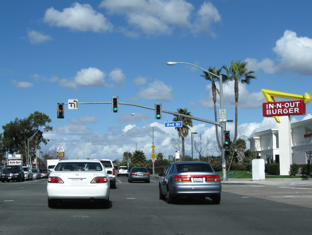
Northbound California 1 meets Second Street, which travels east to connect to Studebaker Road north.
02/26/11
Long Beach Bike Route 1 basically follows the route of California 1 through Long Beach.
02/26/11
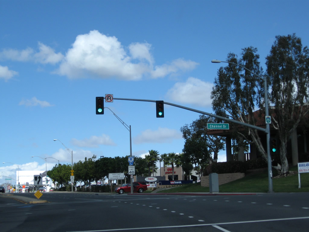
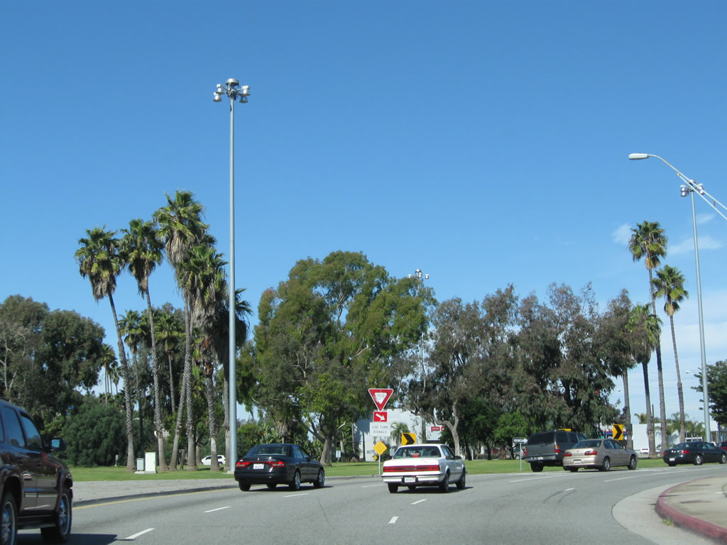
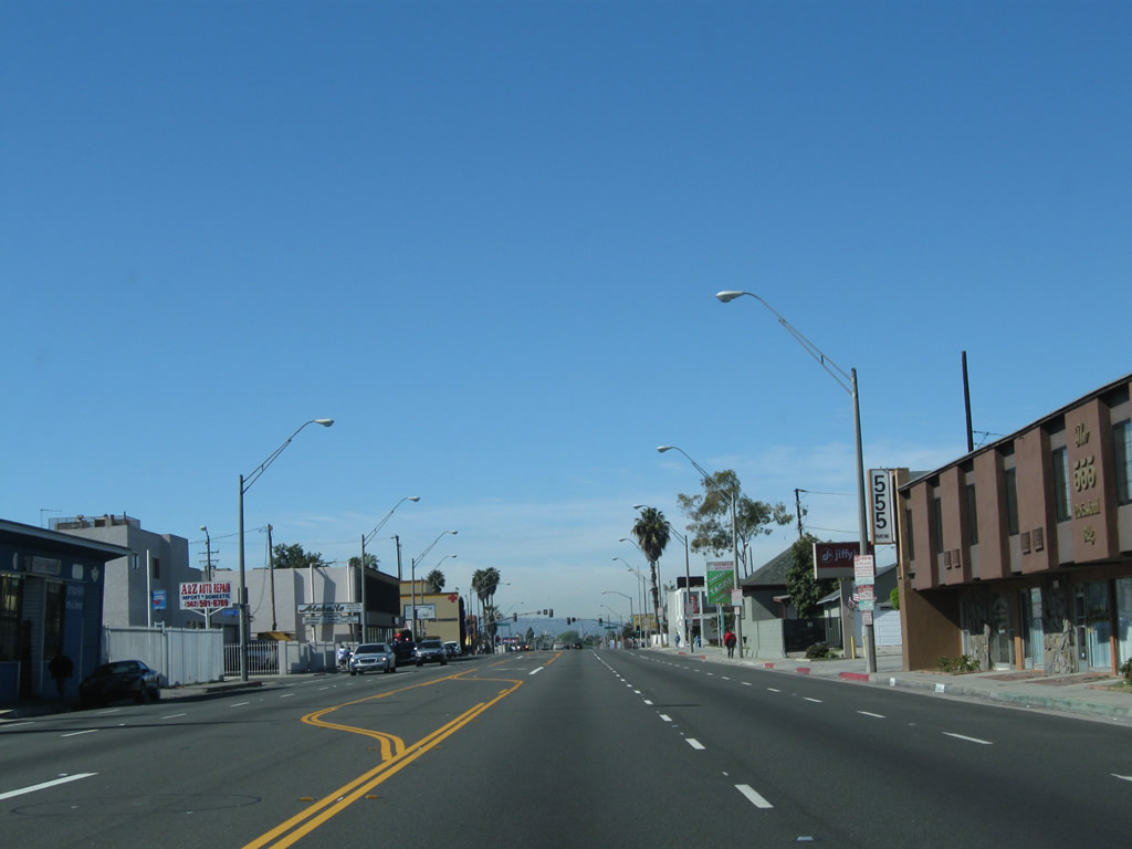
Northbound California 1 meets Channel Drive. The next turnoff connects California 1 north to California 22 east to Garden Grove.
02/26/11
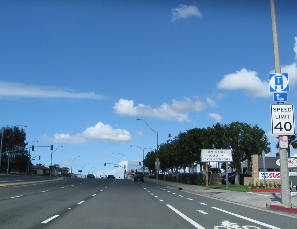
A truck regulation sign is the only indication that California 1 north is approaching California 22. Forthcoming Bellflower Boulevard provides a cutoff to California 22 east.
02/26/11
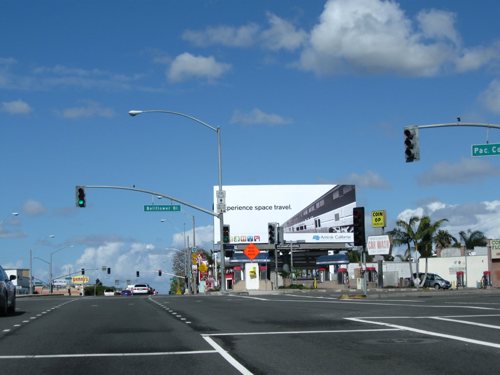
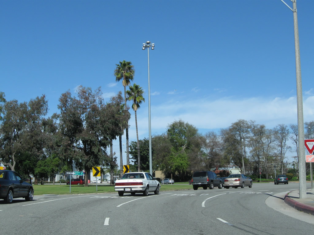
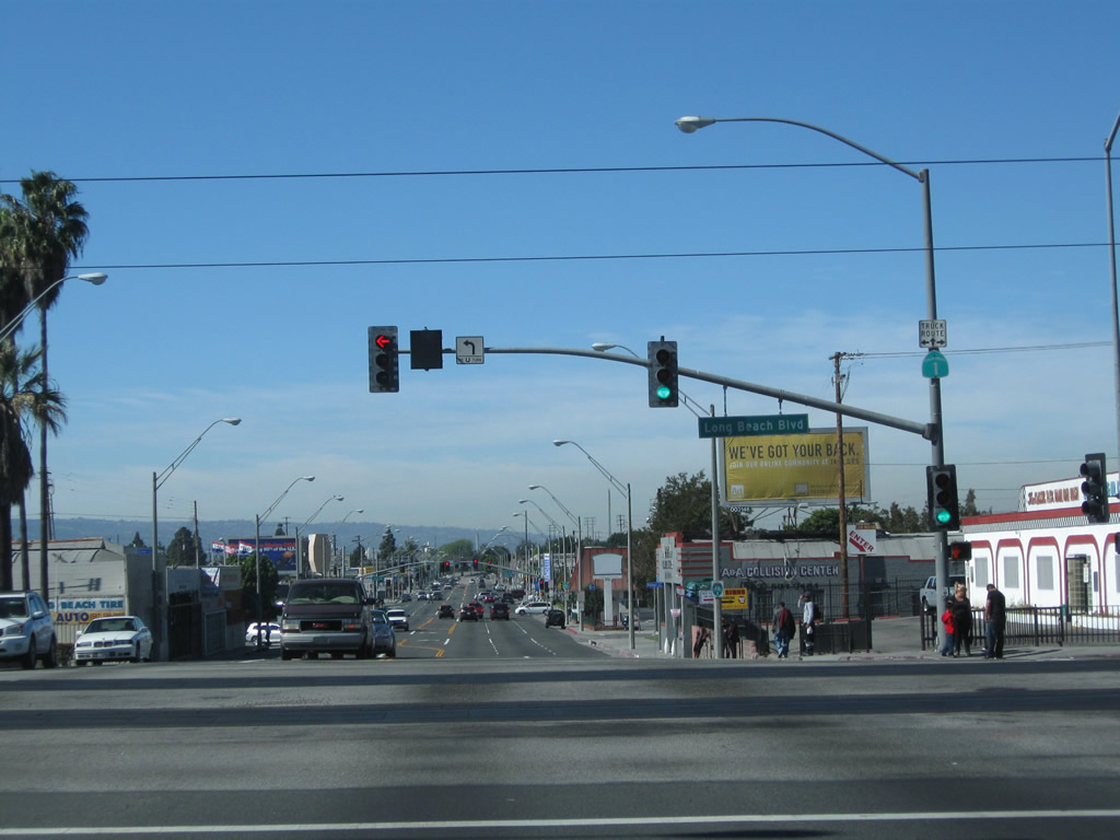
Bellflower Boulevard north to links with California 22 (Seventh Street) east to Interstate 405 and Garden Grove.
02/26/11
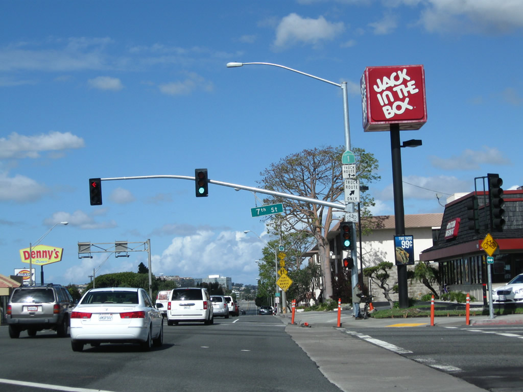
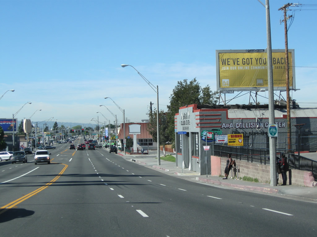
Beginning from SR 1 along 7th Street, SR 22 (Seventh Street) extends east from Long Beach to Garden Grove and Santa Ana before ending at SR 55 in Orange.
02/26/11
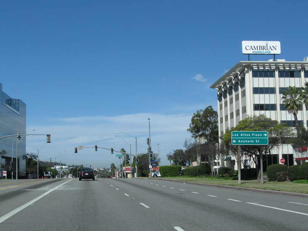
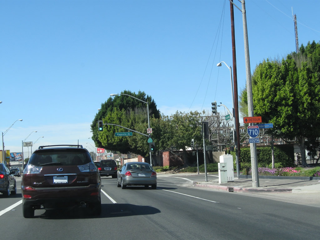
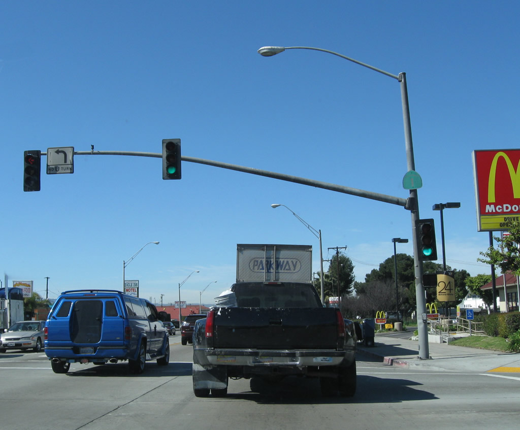
![Leaving the intersection with California 22 (Seventh Street) in the city of Long Beach, northbound California 1 (Pacific Coast Highway [PCH]) proceeds northwest past California State University at Long Beach. The university campus is generally located east of California 1, south of Interstate 405, and north of California 22.](../../ca/001/ca-001_nb_long_beach_089.jpg)
Leaving the intersection with California 22 (Seventh Street) in the city of Long Beach, northbound California 1 (Pacific Coast Highway [PCH]) proceeds northwest past California State University at Long Beach. The university campus is generally located east of California 1, south of Interstate 405, and north of California 22.
02/13/11
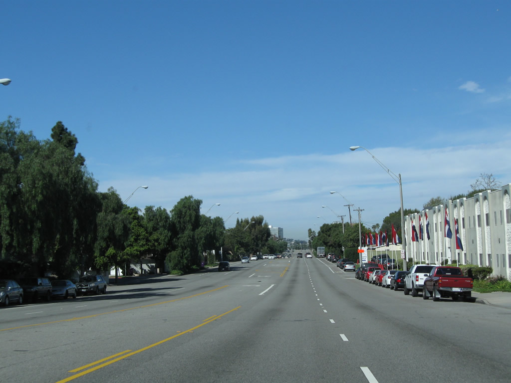
Many students of California State University at Long Beach live in Long Beach and other nearby communities.
02/13/11
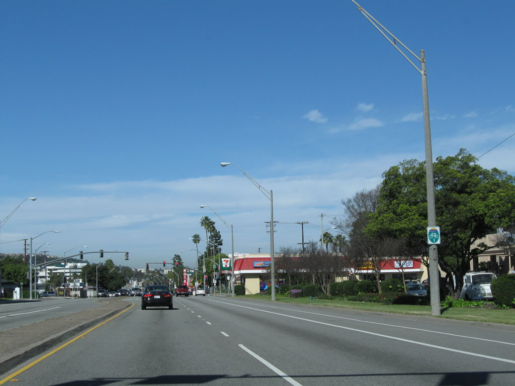
The next intersection along California 1 north is with Anaheim Street. On the southwest side of California 1 is a municipal golf course.
02/13/11
Long Beach city bike route signs mark major bike routes through the city. The Pacific Coast Highway route is aptly designated as Bike Route 1. Signs for the bike route are posted, even though a reassurance shield for California 1 should be here and is missing.
02/13/11
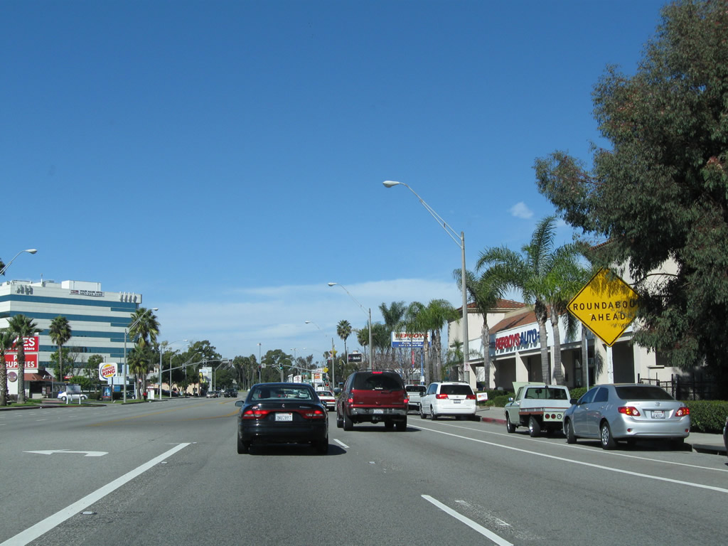
After the Clark Avenue intersection, a large sign is posted advising motorists of the upcoming Los Alamitos Traffic Circle, which was built in 1930 and converted to a modern style roundabout in 1993.
02/13/11
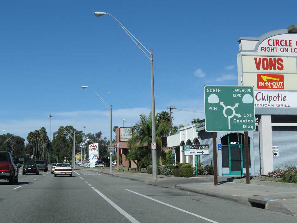
After the traffic signal with Ximeno Avenue, this diagrammatic sign indicates the movements available when using the Los Alamitos Traffic Circle. Proceeding north through the traffic circle, the first right connects to Los Coyotes Diagonal, followed by California 19 (Historic U.S. 91 / Lakewood Boulevard) north and California 1 (Pacific Coast Highway) west.
02/13/11
First intersecting Outer Traffic Circle, northbound California 1 (Pacific Coast Highway) enters Los Alamitos Traffic Circle. Several high mast lights are located within the turf traffic circle.
02/13/11
The City of Long Beach maintains the landscaping within the traffic circle, while the state maintains the roadway passing through the circle. Contrary to popular belief, this traffic circle did not serve as the historic termini for U.S. 6 and U.S. 91; that distinction is reserved for the intersection between Pacific Coast Highway and Atlantic Avenue west of here.
02/13/11
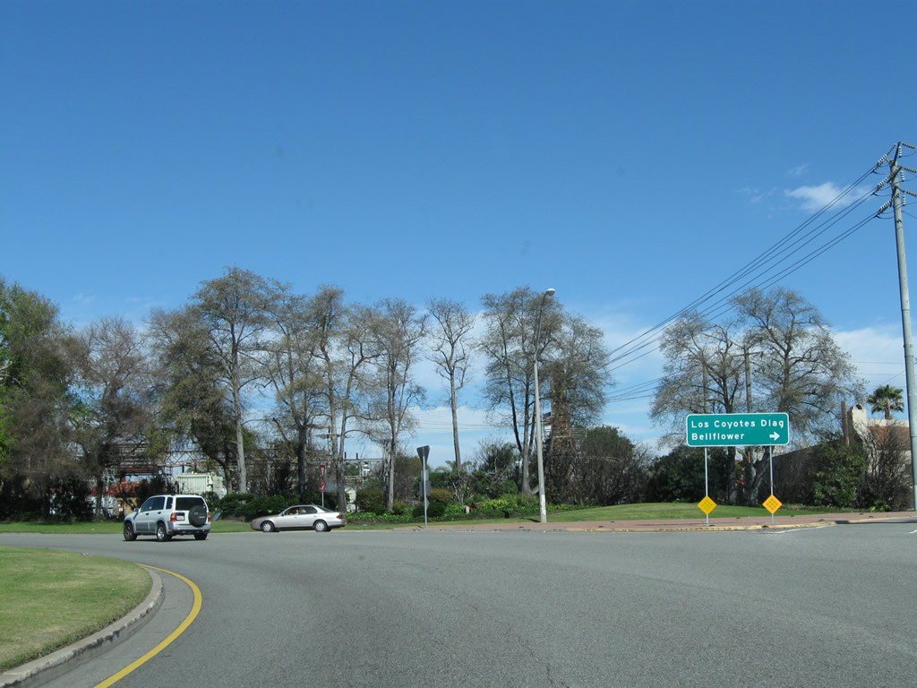
Within Los Alamitos Traffic Circle, the first right connects to Los Coyotes Diagonal, which travels northeast to Bellflower. The second right connects to California 19 (Lakewood Boulevard) north to Downey.
02/13/11
California 19, which follows Lakewood Boulevard and Rosemead Boulevard between California 1 and Interstate 210, is a piecemeal route with various sections decommissioned to local control. The section of Lakewood Boulevard within Long Beach city limits was transferred to the city, and most signage for California 19 has been removed as a result. At this point, Historic U.S. 91 comes from the north via Lakewood Boulevard to join California 1 northwest.
02/13/11
California 1 north and U.S. 91 south historically overlapped west between Los Alamitos Traffic Circle and Atlantic Avenue until 1964, when U.S. 91 was decommissioned. U.S. 91 may have continued all the way to the Long Beach Freeway (former California 15 and former California 7).
02/13/11
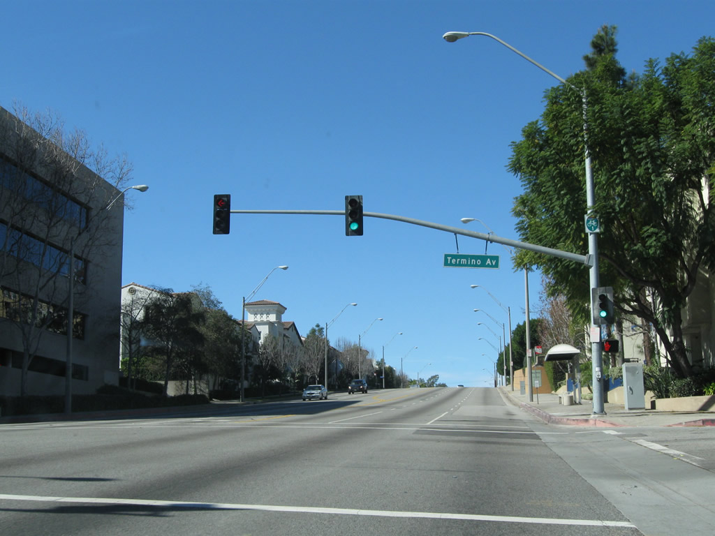
Northbound California 1 (and southbound Historic U.S. 91) rises to meet Termino Avenue at this traffic signal in Long Beach.
02/13/11
Reservoir Drive angles northwest from SR 1 northbound as a cut off to Redondo Avenue. West from Reservoir Drive to a point ahead of Cherry Drive, SR 1 is the dividing line between the city of Long Beach to the south and the city of Signal Hill to the north. Signal Hill, an enclave which is entirely surrounded by the city of Long Beach, was incorporated on April 22, 1924, and had a population of 9,333 as of the 2000 Census.
02/13/11
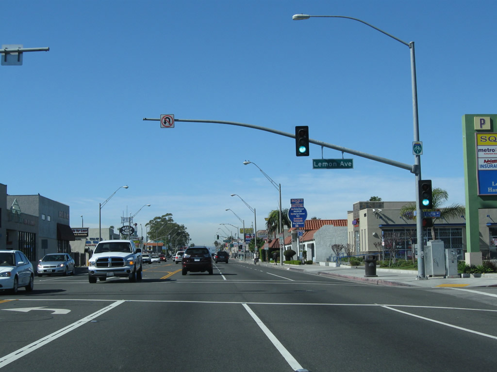
California 1 (Pacific Coast Highway) proceeds west from the intersection with Orange Avenue and Alamitos Avenue in Long Beach to Lemon Avenue.
02/13/11
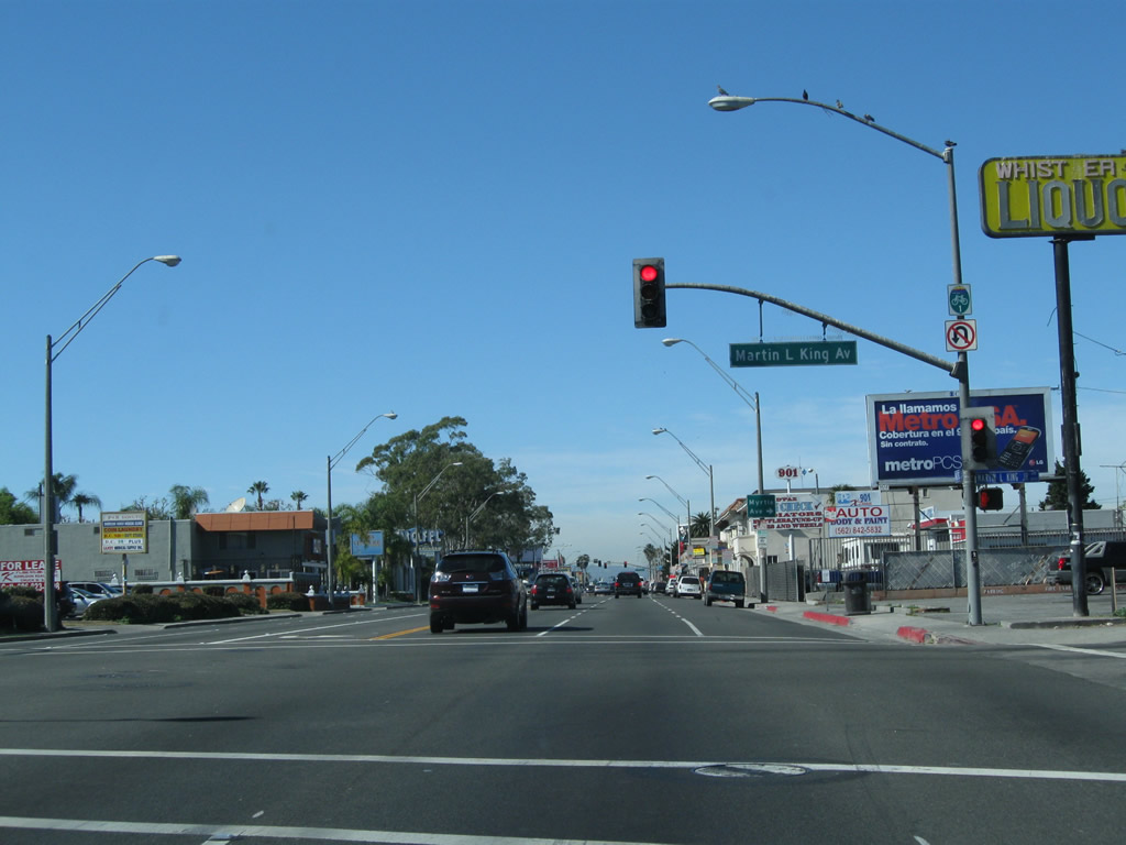
California 1 (Pacific Coast Highway) intersects Martin Luther King, Jr. Avenue next to Long Beach Polytechnic High School.
02/13/11
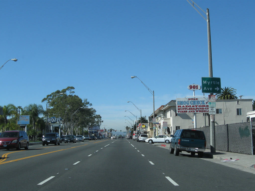
The next right turn connects to Myrtle Avenue.
02/13/11
Historic U.S. 91 ended at Atlantic Avenue from 1932 until its elimination in 1964. The U.S. highway followed SR 1 (Pacific Coast Highway) east to the Los Alamitos Traffic Circle, turned north via Lakewood Boulevard to Carson Street, then turned east on Carson Street, which changes into Lincoln Avenue and eventually entered the Santa Ana Canyon on a route closely paralleled by SR 91 on the Riverside Freeway.
02/13/11
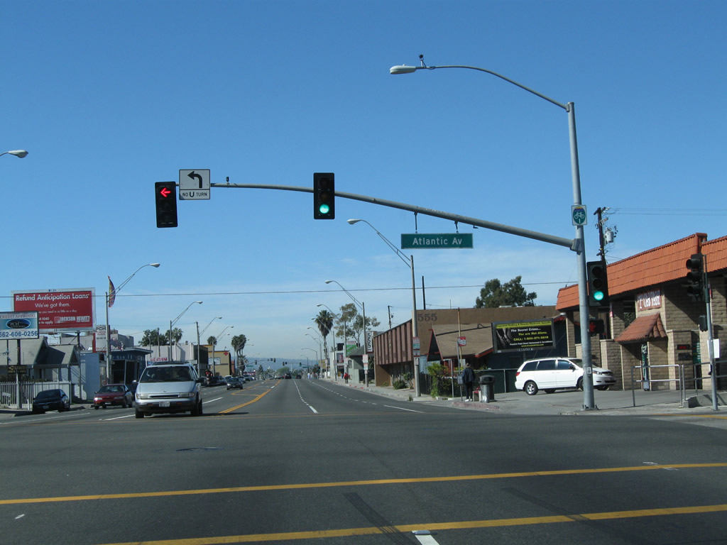
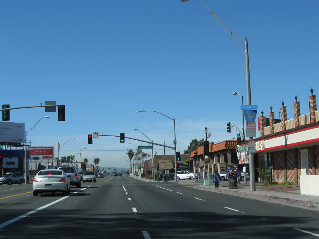
Atlantic Avenue heads south to Downtown Long Beach and waterfront attractions. This intersection also represents the former west end of U.S. 6. Formerly a transcontinental route, U.S. 6 overlapped with SR 1 west to Figueroa Street, and later the Harbor Freeway, before turning north toward Downtown Los Angeles and points northeast.
02/13/11
Pacific Coast Highway continues west from Atlantic Avenue through Long Beach. While U.S. 6 is not acknowledged with historic markers in Long Beach, there is a plaque commemorating the route located near the Long Beach Convention Center in Downtown Long Beach.
02/13/11
Westbound California 1 meets Long Beach Boulevard at this traffic signal. The Metro Blue Line uses the median of Long Beach Boulevard for its light rail service that connects Union Station in downtown Los Angeles with a terminal in downtown Long Beach.
02/13/11
A bike route sign is posted rather than a California 1 route marker after Long Beach Boulevard.
02/13/11
An Interstate 710 trailblazer is posted on northbound (westbound) California 1 prior to the signalized intersection with Magnolia Avenue.
02/13/11
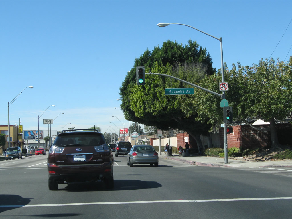
A California 1 reassurance shield is posted on the traffic signal pole at the point where Pacific Coast Highway meets Magnolia Avenue in Long Beach.
02/13/11
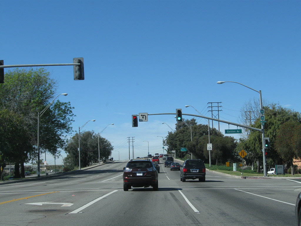
Northbound California 1 meets Golden Avenue at this traffic signal. Turn right here to connect to Long Beach Bike Route 7, which follows the Los Angeles River. It might be a coincidence that Long Beach's Bike Route 7 more or less follows Interstate 710, which was formerly known as California 7.
02/13/11
SR 1 gains elevation to cross over the Los Angeles River leading into the cloverleaf interchange with Interstate 710. Built as SR 15 and renumbered as SR 7 in 1964, the Long Beach Freeway was designated as I-710 in 1983 once the route was added to the Interstate Highway System. I-10 is an important truck route connecting the Ports of Long Beach and Los Angeles with I-10 and I-5.
02/13/11
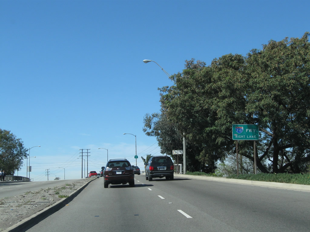
A California 1 reassurance shield is posted on the bridge that carries Pacific Coast Highway over the Los Angeles River. Despite its name, the Pacific Coast Highway stays pretty far inland, avoiding downtown Long Beach and the ample beach strand that gives Long Beach its name. Take Interstate 710 south to downtown, the beach, and waterfront attractions (including the Aquarium of the Pacific and Queen Mary).
02/13/11
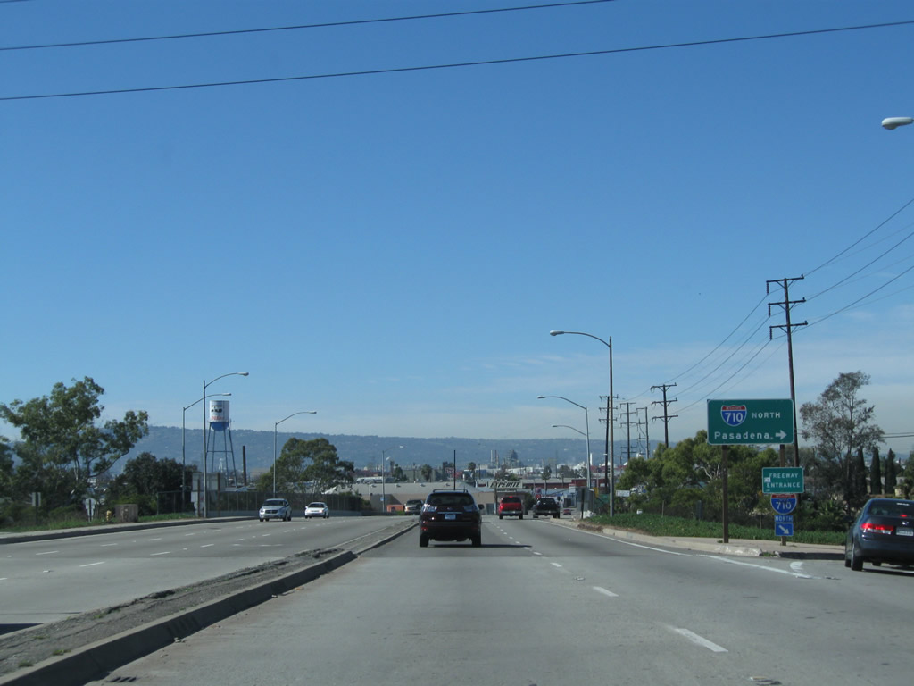
Northbound California 1 meets Interstate 710 (Long Beach Freeway) north to Los Angeles.
02/13/11
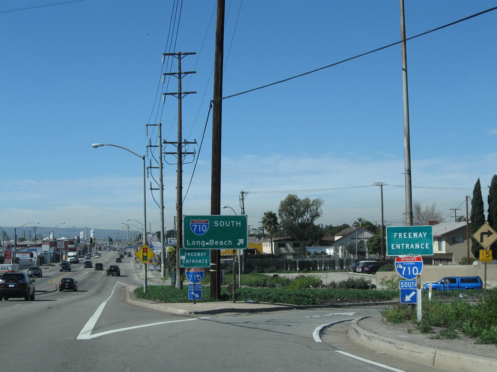
A loop ramp connects California 1 north with Interstate 710 south to the Port of Long Beach, Queen Mary, and Downtown Long Beach.
02/13/11
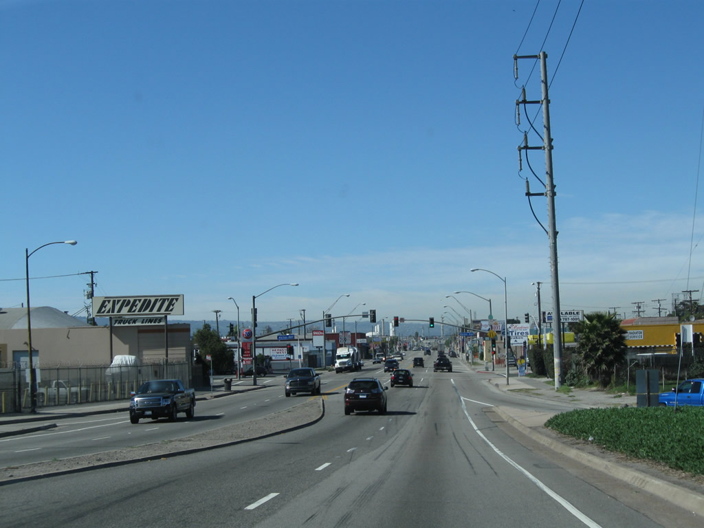
The next signalized intersection along California 1 west is with Harbor Avenue.
02/13/11
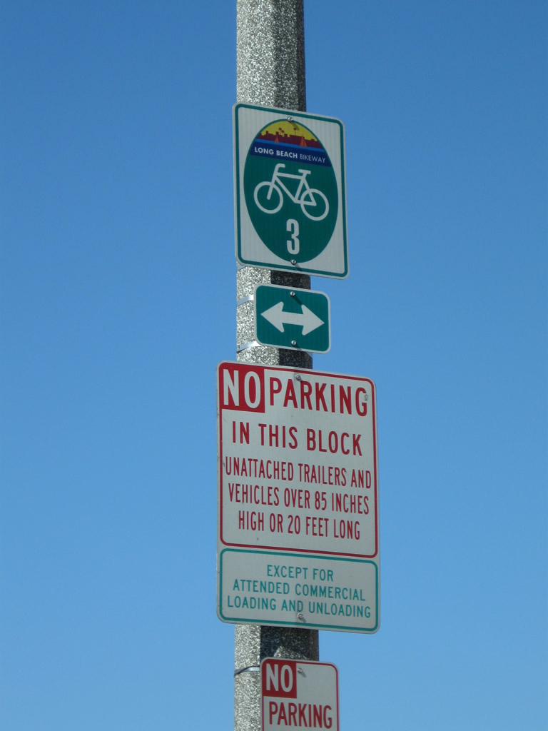
This Long Beach Bikeway Route 3 is posted on northbound California 1 prior to the intersection with Santa Fe Avenue.
02/13/11
Northbound California 1 meets Santa Fe Avenue at this traffic signal.
02/13/11
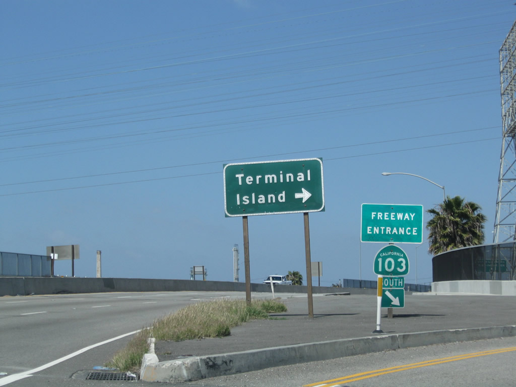
![Pacific Coast Highway [PCH] advances west by the Westside neighborhood in Long Beach to a cloverleaf interchange with SR 103 (Terminal Island Freeway).](../../ca/001/ca-001-n-at-ca-103-1.jpg)
Pacific Coast Highway [PCH] advances west by the Westside neighborhood in Long Beach to a cloverleaf interchange with SR 103 (Terminal Island Freeway).
05/02/10
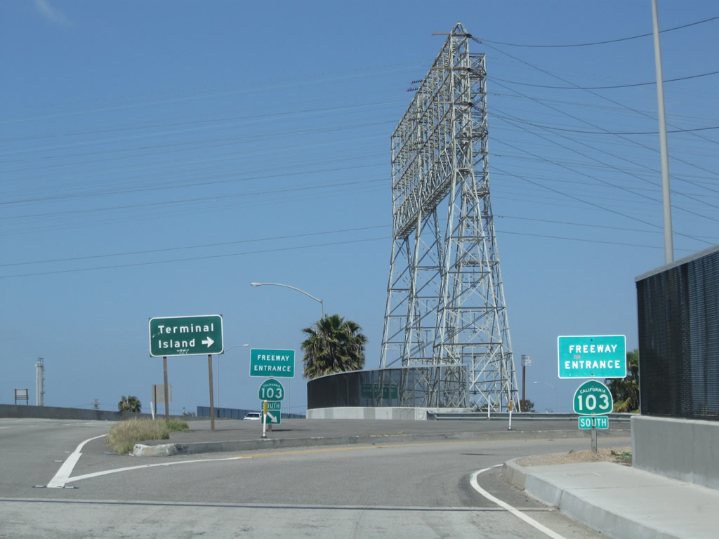
California 1 (Pacific Coast Highway) passes over California 103 (Terminal Island Freeway) on a bridge built in 1948. The Terminal Island Freeway is an example of older freeway infrastructure that has not been extensively modified since its original construction.
05/02/10
The Terminal Island Freeway curves southwest through industrial areas of Long beach to combine with SR 47 ahead of the Commodore Schuyler F. Heim Bridge onto Terminal Island. SR 47/103 overlap south to Ocean Boulevard and I-710 west of the Long Beach International Gateway bridge.
05/02/10
Photo Credits:
- Andy Field: 05/02/10, 02/13/11, 02/26/11
Connect with:
Page Updated Sunday January 03, 2016.