
State Route 39

California 39 is two-part route with a gap in the middle and a closed section at the northern end (in Angeles National Forest). The longest continuously signed segment connects California 1 with California 72 along Beach Boulevard, a four- to six-lane city street that begins in Huntington Beach at California 1 and continues north via Westminster, Anaheim, and Buena Park until its end at La Habra (just after California 72). Grand plans from the mid-1960s called for construction of a freeway along California 39 (Beach Boulevard), but those plans were never realized. Today, the highway functions as a very busy urban arterial through Orange County.
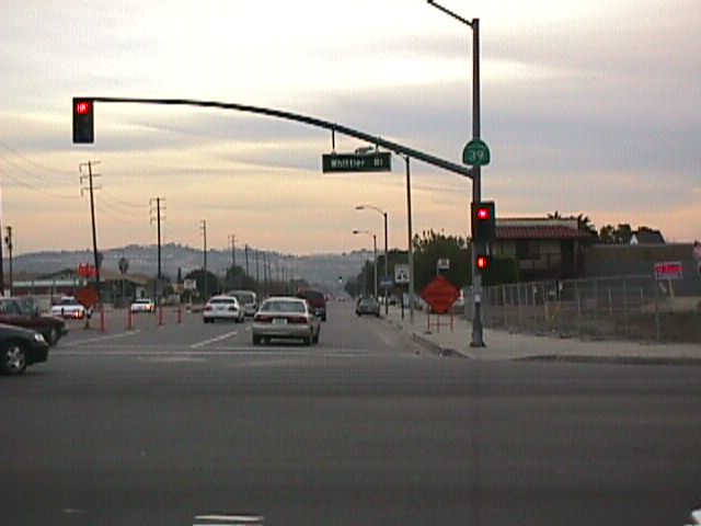
Nearing the Orange-Los Angeles County Line, California 39 meets California 72 (former U.S. 101)/Whittier Boulevard in La Habra. At Whittier Boulevard, California 39 turns east until its intersection with Harbor Boulevard, where the state route currently ends. Historically, this is the point where U.S. 101 used to turn south along Harbor Boulevard toward Anaheim and Santa Ana. This is also the point where California 39 is supposed to turn left (north) onto Harbor Boulevard into the Puente Hills toward Rowland Heights in Los Angeles County. According to the legislative definition of California 39, plans call for the route to take the following route from La Habra north to West Covina: Beach Boulevard north, Whittier Boulevard east, Harbor Boulevard north, Fullerton Road north, Colima Road west, and Azusa Avenue north. The Harbor Boulevard segment from La Habra north to Rowland Heights was improved in 1992 for a wider, straighter route. However, state route shields were not erected at the time this new alignment opened. It is unclear when, if ever, the Puente Hills gap of California 39 will be signed.
In addition to the Harbor Boulevard route, access from La Habra to Hacienda Heights can also be achieved via Hacienda Road or via Los Angeles County Route N-8 along Colima Road and Azusa Avenue. (Colima Road was named after Tomas Sanchez de Colima, a rancher from the Mexican state of Colima who owned much of the land through which the road passes.1) California 39 resumes at Interstate 10 in West Covina along Azusa Avenue, and it continues from that point north into the mountains, terminating at Crystal Lake Recreation Area. The highway used to continue north to the Angeles Crest Highway, California 2, but it was cut off by a landslide in 1978, and it has not been reopened since.
Reopening of State Route 39 was considered for 2015-2018, but by 2012 Caltrans, deemed it too risky for endangered wildlife (Sahugan, 2012):
A landslide swept away the highest part of the road in 1978, cutting it off from Angeles Crest Highway. Since then, that last stretch of asphalt has been roamed by Nelson's bighorn sheep, creatures fully protected under state law. Caltrans concluded that it would be cost-prohibitive to re-engineer that 4.4-mile gap and legally risky to try because it cannot guarantee that the sheep would not be killed in the process. As a result, the highway has become what Caltrans spokesman Patrick Chandler described as 'essentially a 27-mile-long cul-de-sac.'
While it was unlikely that this abandoned segment would reopen someday, Caltrans publicly announced in late January 2012 that it intended to abandon State Route 39 north of Azusa and transfer it to Los Angeles County or the Forest Service for ongoing maintenance.
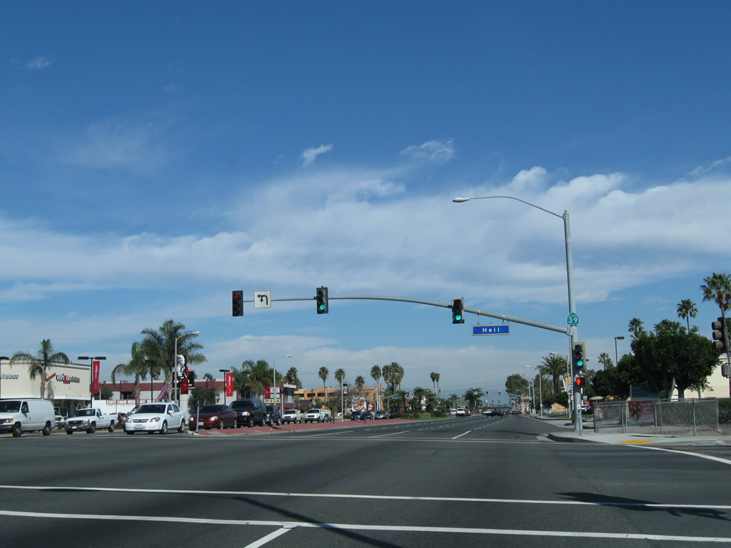
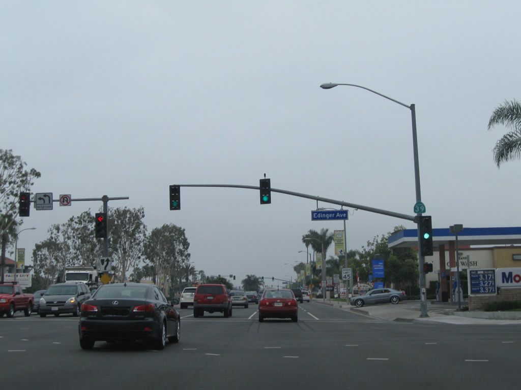
Within the city of Huntington Beach, northbound California 39 (Beach Boulevard) meets Heil Avenue at this traffic signal. A California 39 reassurance shield is posted on the mast arm of the traffic signal.
02/13/11
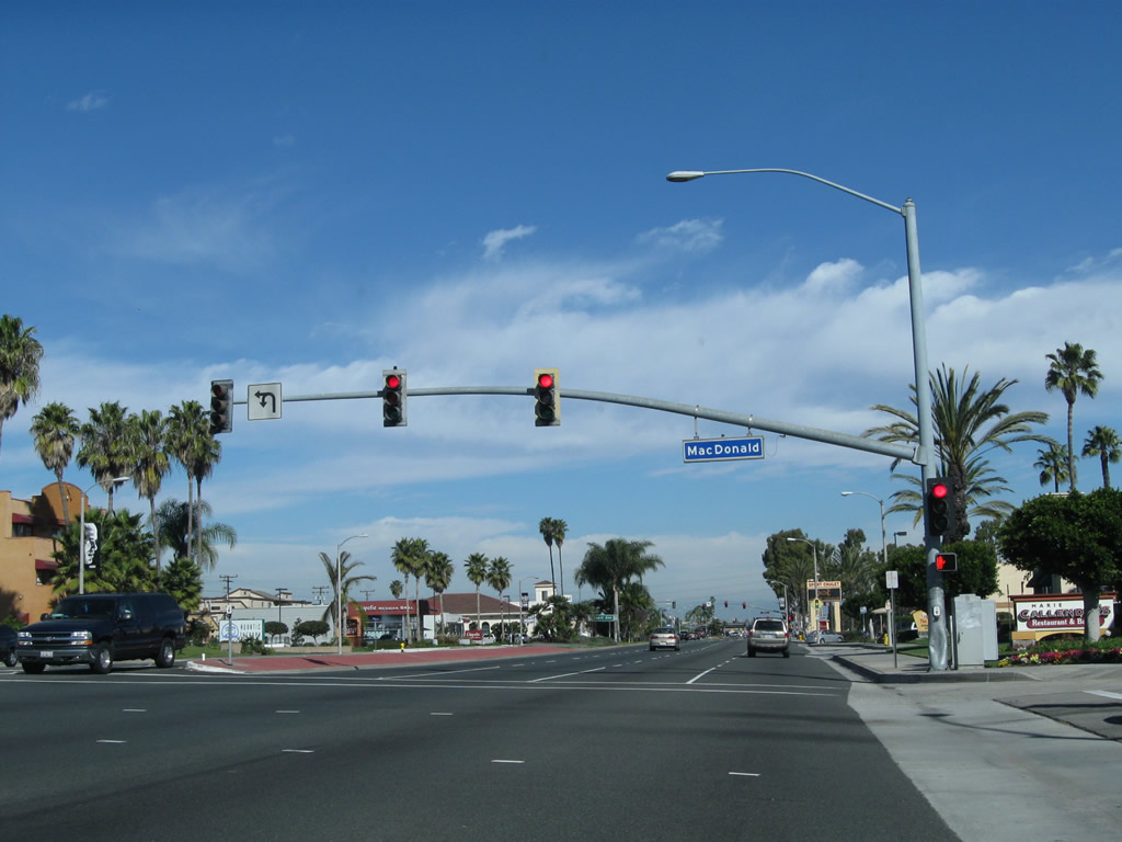
Shortly thereafter, California 39 (Beach Boulevard) meets MacDonald Avenue at this traffic signal. The next signalized intersection is with Stark Street.
02/13/11
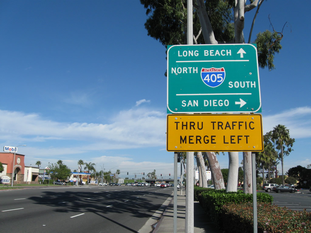
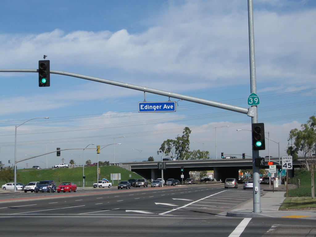
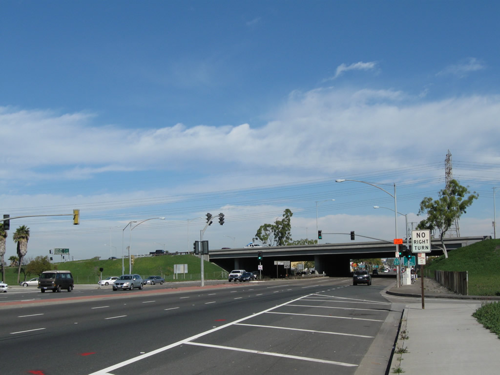
Northbound California 39 (Beach Boulevard) approaches its cloverleaf interchange with Interstate 405 (San Diego Freeway). The design of this interchange intended for direct connections with no stopping between all directions. The next intersection is with Edinger Avenue; turn right (east) on Edinger Avenue to the on-ramp for Interstate 405 south (east).
02/13/11
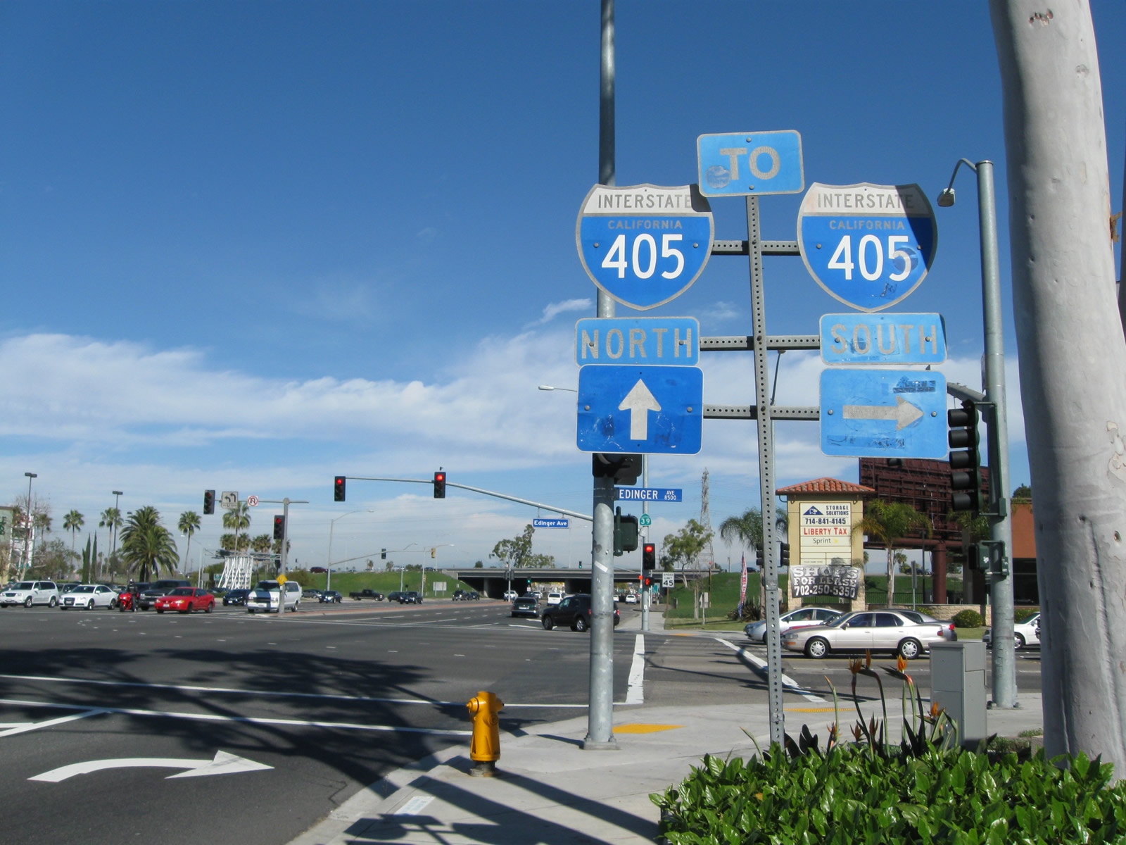
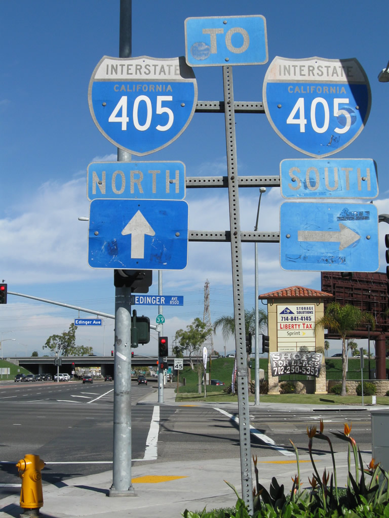
A set of fairly old Interstate 405 trailblazers is located at the intersection of California 39 (Beach Boulevard) and Edinger Avenue. Turn right here for the on-ramp for Interstate 405 south (east). Continue forward (and stay right) on California 39 for the loop ramp to Interstate 405 north (west).
02/13/11
Interstate 405 travels southeast to Irvine and San Diego.
02/13/11
Another California 39 reassurance shield is posted on the traffic signal mast arm at the intersection between Beach Boulevard and Edinger Avenue.
02/13/11
Entering the cloverleaf interchange, traffic from Interstate 405 south joins California 39 north at the merge visible here. Three through lanes carry California 39 north from Huntington Beach into Westminster.
02/13/11
A street level California 39 reassurance shield is posted after the off-ramp from Interstate 405 south merges onto mainline California 39 north.
02/13/11
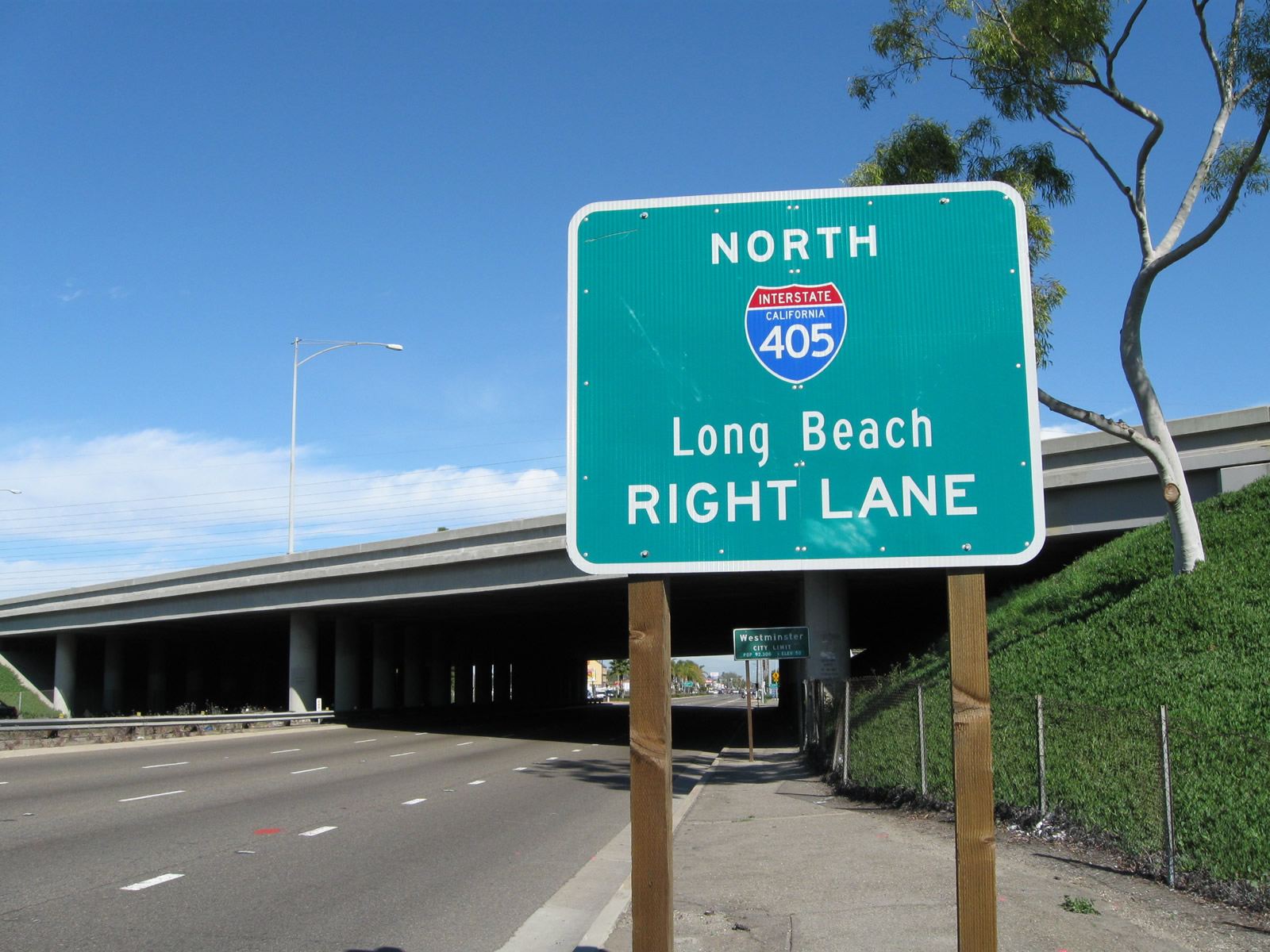
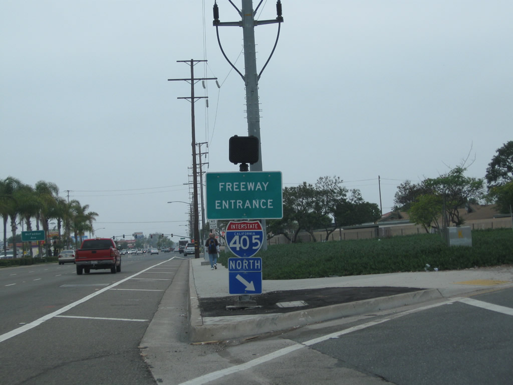
The next right turn connects California 39 (Beach Boulevard) north with Interstate 405 (San Diego Freeway) north (west) to Long Beach, Santa Monica, and points north via Interstate 5 (including Bakersfield and Sacramento). California 39 leaves Huntington Beach and enters the city of Westminster, "Where Business Succeeds in the OC" (population 88,207 as of the 2000 Census and incorporated on March 27, 1957).
02/13/11
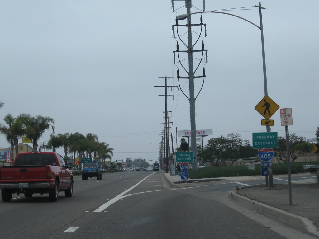
After passing under the Interstate 405 mainline, northbound California 39 (Beach Boulevard) meets the on-ramp to Interstate 405 (San Diego Freeway) north. A pair of freeway entrance shield assemblies flank the on-ramp. Ahead, California 39 proceeds north into Westminster. Photos taken 07/10/10
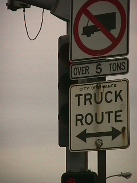
Further north but still in Orange County, this old truck route sign was placed by the Automobile Club of Southern California (ACSC, a branch of the national American Automobile Association/AAA). In the early days of California roads, many regulatory and guide signs were placed by the ACSC rather than the state. This sign is one of few remaining ACSC sign still in use along California 39 in La Habra.
July 1999
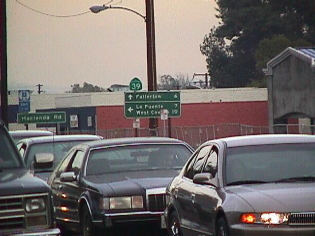
This view shows California 39 (Whittier Boulevard) north prior to the break in its route. Through traffic may take either Hacienda Road north into La Habra Heights or Harbor Boulevard north into Rowland Heights. Los Angeles County N-8 (La Mirada Boulevard and Colima Road) also provides a good alternate route to cover the gap between the north and south segments of California 39.
July 1999
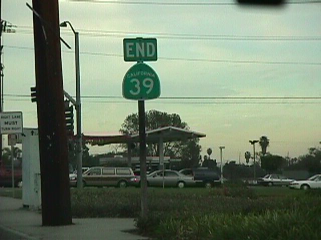
Northbound California 39 ends just beyond its junction with California 72 (Whittier Boulevard).
July 1999
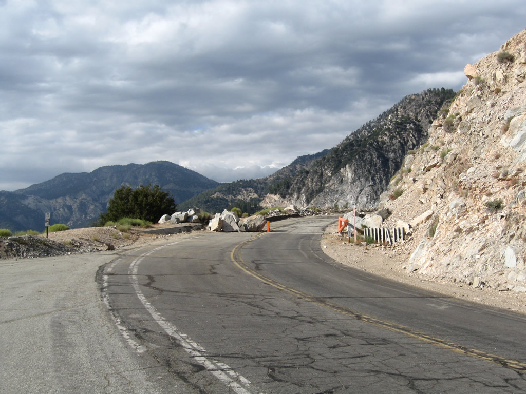
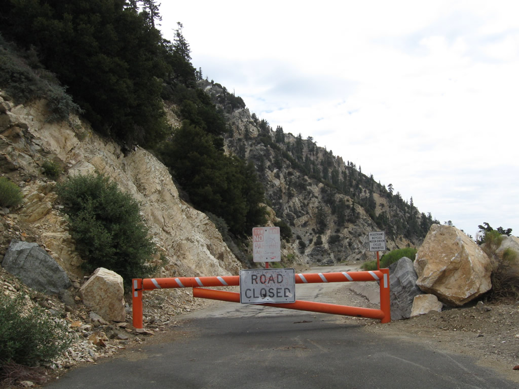
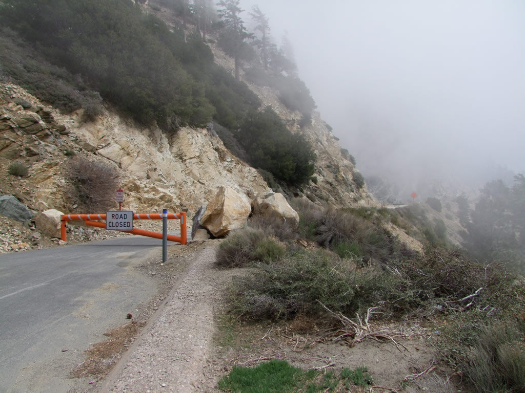
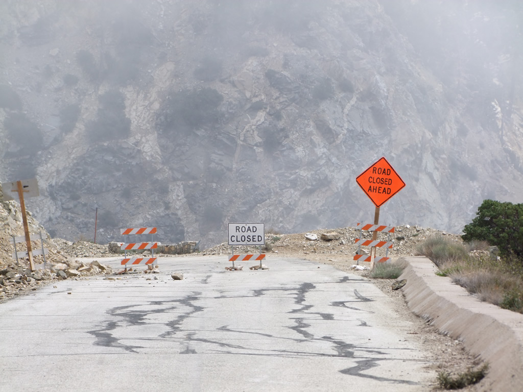
Since 1978, the section of California 39 between Crystal Lake and Islip Saddle has been closed to through traffic. A gate blocks vehicular access into the closed section of state route. Plans call for reopening this section of highway after 2015 contingent upon funding availability.
08/22/09
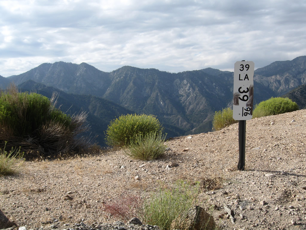
Just prior to the closure gate is this California 39 postmile marker (Los Angeles County, Mile 39.96).
08/22/09
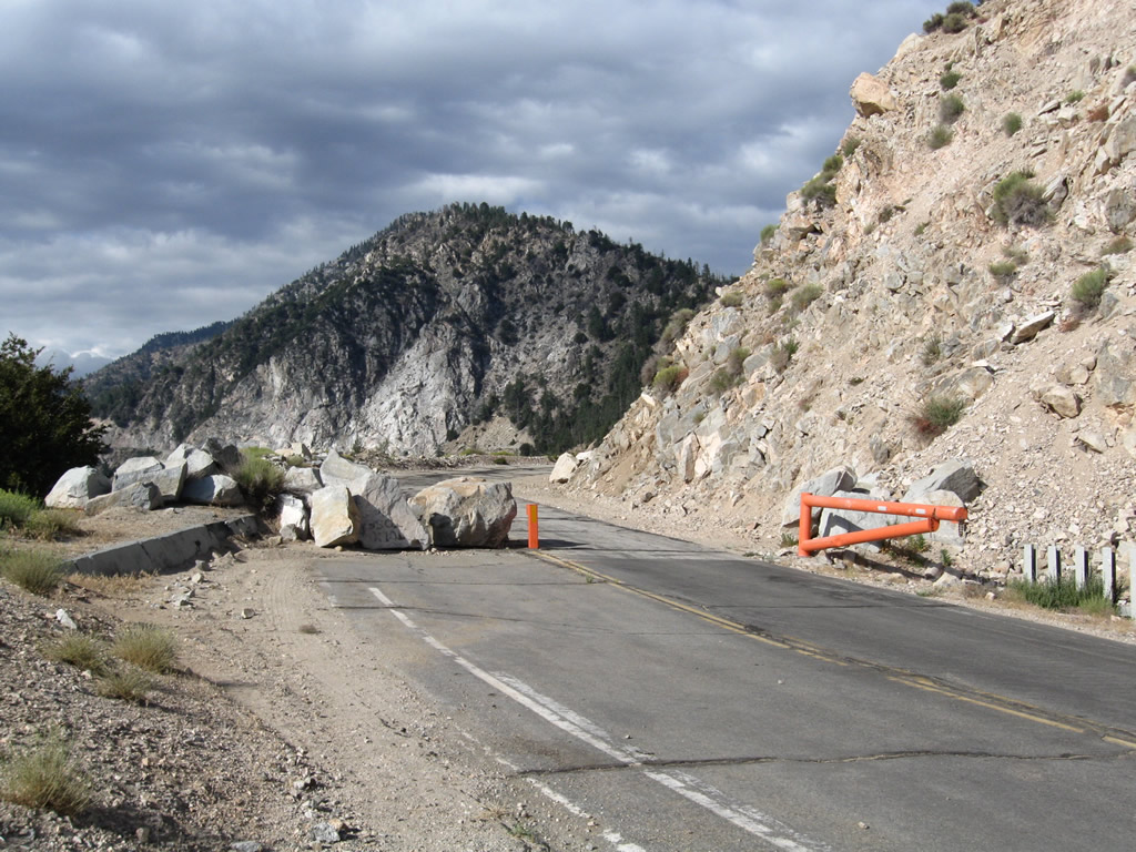
Fallen rocks and the orange gate prevent access to the closed segment of state route.
08/22/09
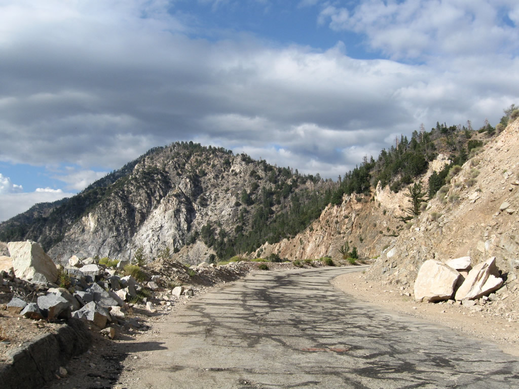
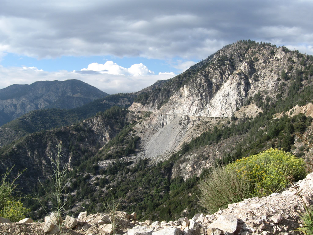
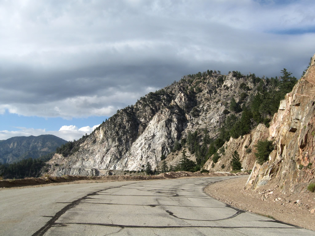
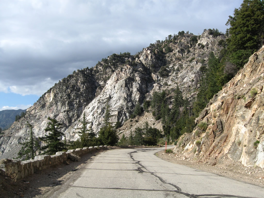
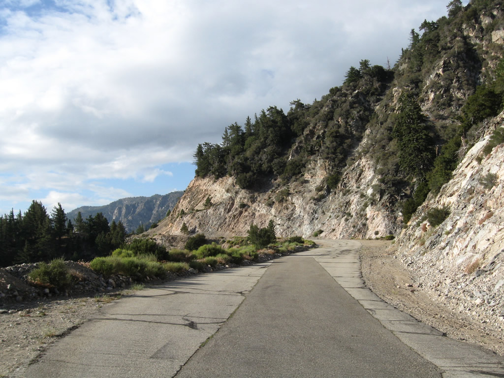
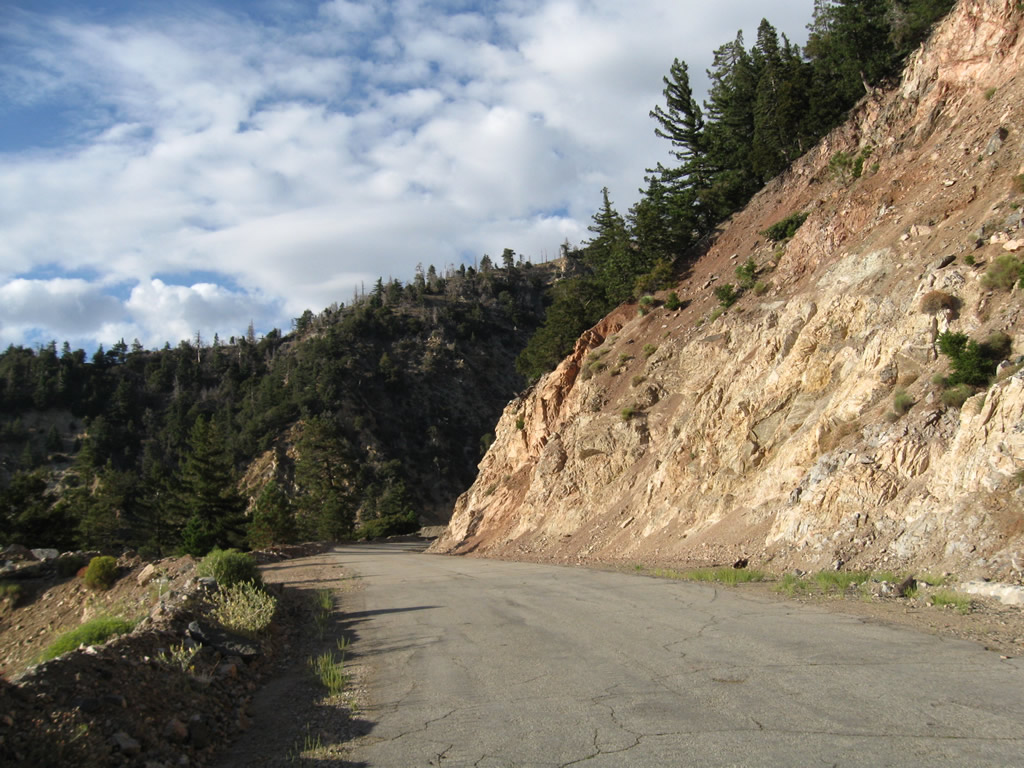
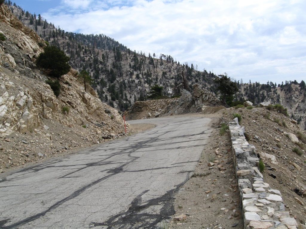
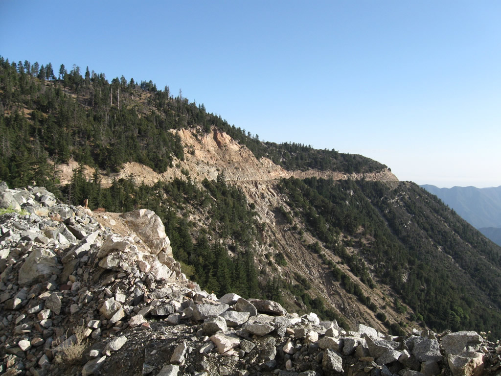
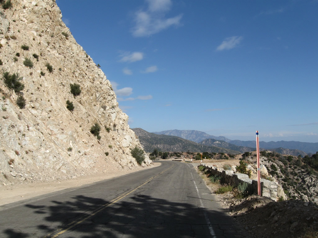
Scenic mountain vistas abound at every turn of northbound California 39. However, the closed segment of state route is prohibited for vehicle use.
08/22/09
Along northbound California 39, the dangerous rocks that might fall are on the right side, while the precipitous cliff down is on the left side.
08/22/09
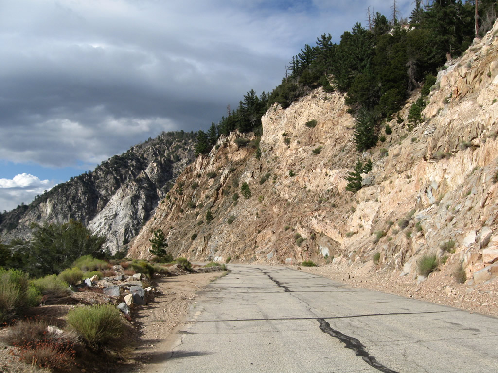
The former state highway is strewn with rocks and other debris.
08/22/09
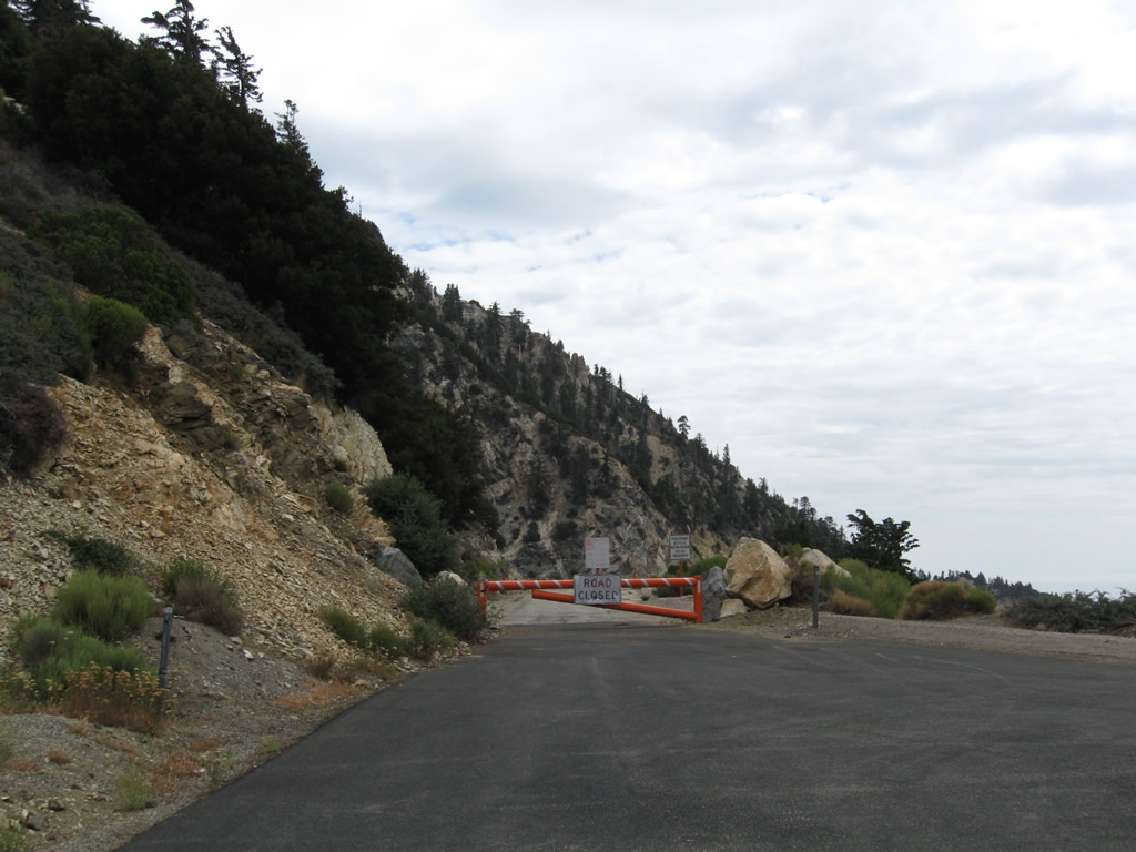
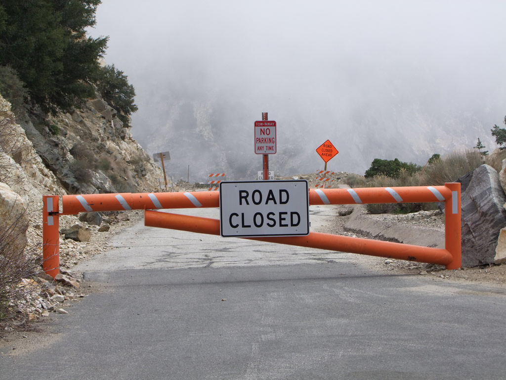
The first four miles of California 39, between the junction with California 2 at Islip Saddle and a point near Crystal Lake and Falling Springs, have been closed since in 1978 due to rockslides. This barricade blocks vehicular entry onto California 39.
08/22/09
05/21/10
A barricade blocks vehicular entry onto the abandoned section of California State Route 39.
08/22/09
05/21/10
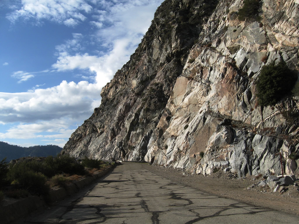
The abandoned section of California State Route 39.
08/22/09
A gate blocks access from the open section of California 39 to the closed section.
08/22/09
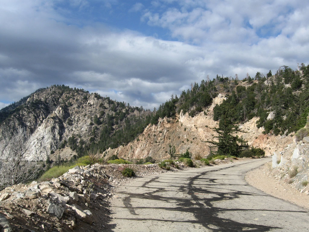
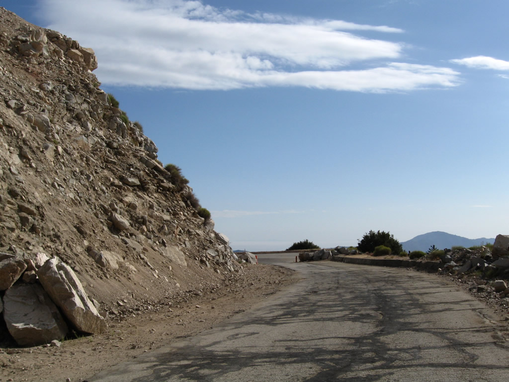
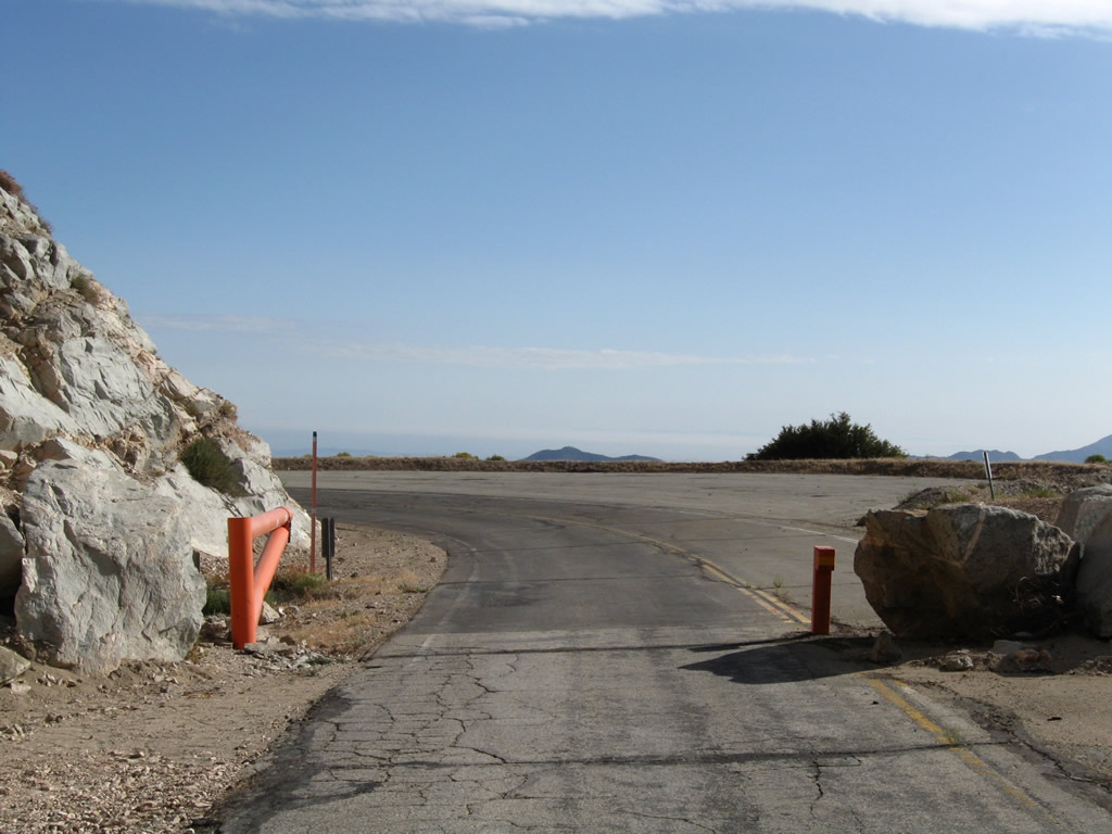
Approximately four miles south of Islip Saddle, California 39 resumes as a traversable state route. The highway will curve east a bit to meet the Crystal Lake turnoff, then proceed south into San Gabriel en route toward Azusa. The route from Crystal Lake south to San Gabriel Reservoir is a steep descent along a winding, curbing highway. California 39 does not carry through traffic due to its truncated northern terminus.
08/22/09
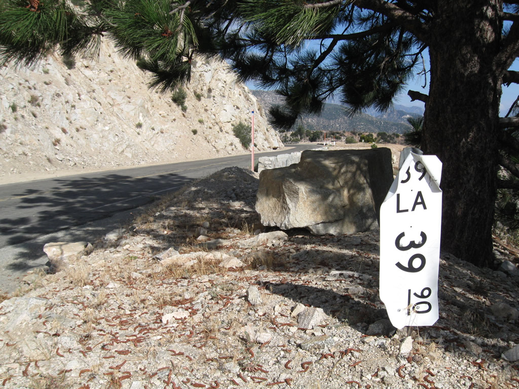
A California 39 postmile (Los Angeles County, Mile 39.90) is found along southbound soon after the southern gate near Crystal Lake.
08/22/09
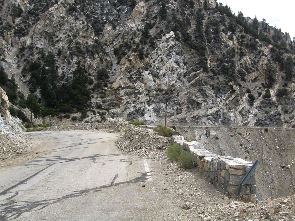
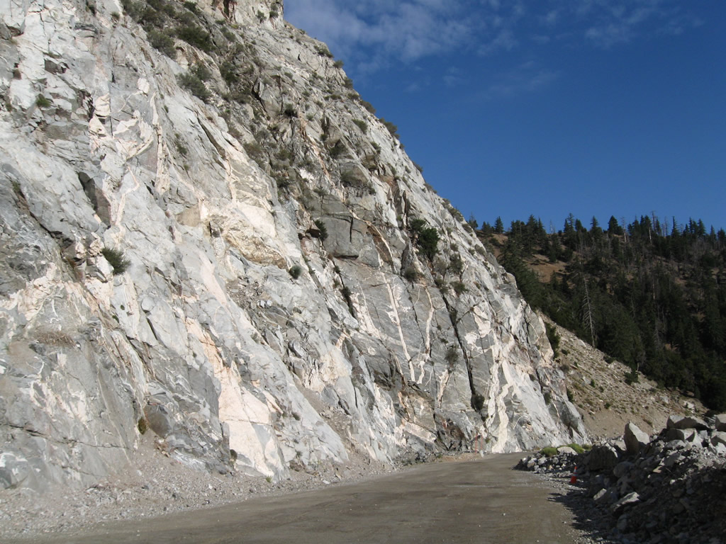
To prevent erosion, segments of California 39 were shored with retaining walls.
08/22/09
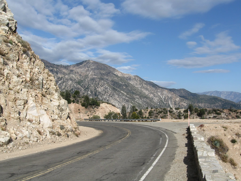
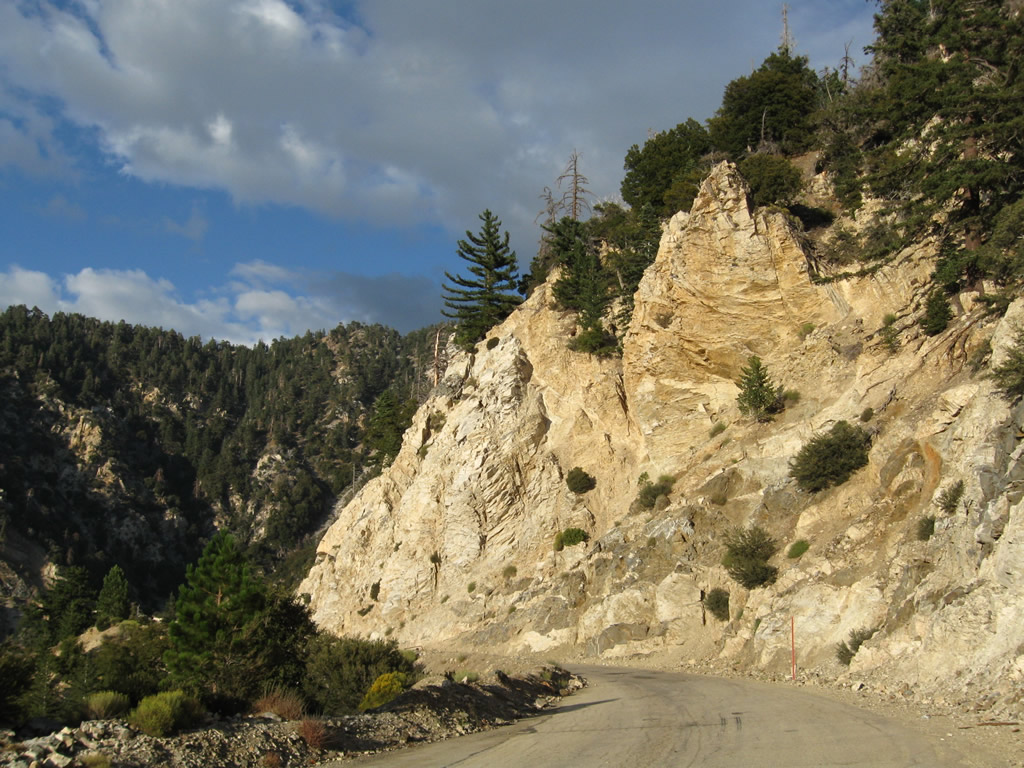
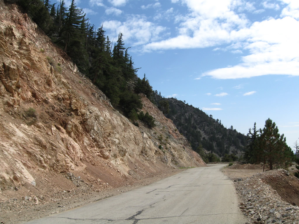
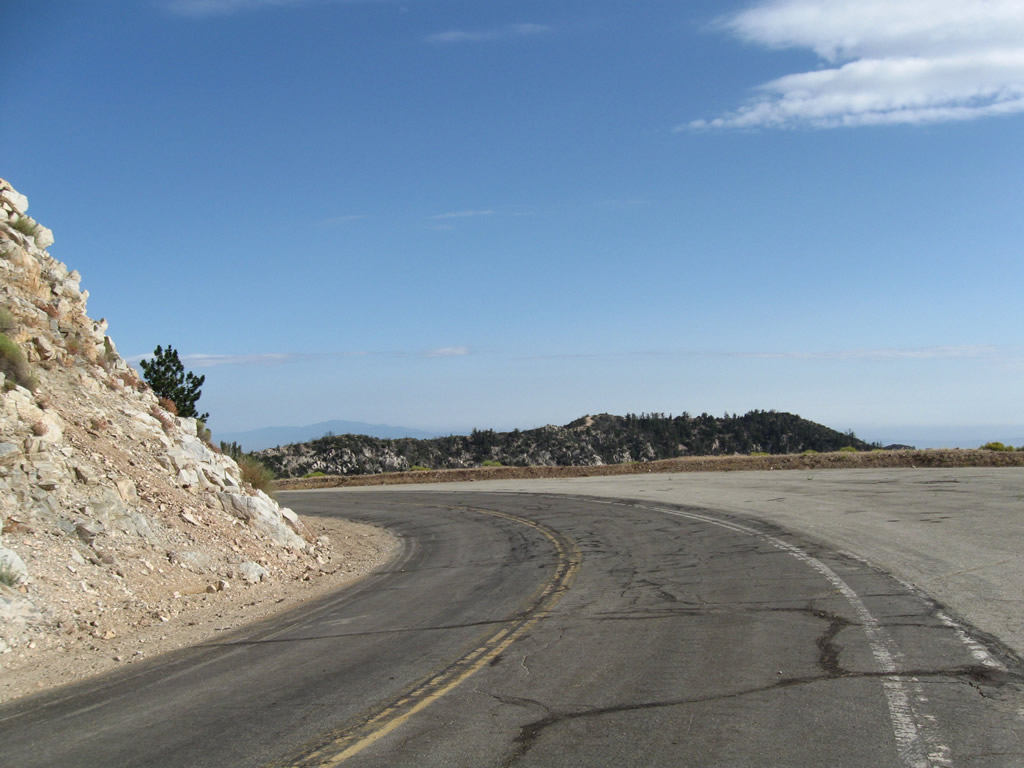
Views of the surrounding San Gabriel Mountains make this stretch of California 39 scenic with beautiful vistas.
08/22/09
Much further south, Beach Boulevard meets Whittier Boulevard (California 72) in La Habra. California 39 proceeds south from here toward Huntington Beach.
July 1999
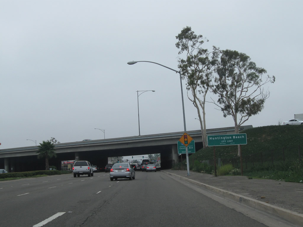
Some distance even further south, California 39 meets Interstate 405 at a cloverleaf interchange. At this point, California 39 leaves Westminster and enters the city of Huntington Beach, "Surf City USA." Huntington Beach had a population of 192,620 as of the 2000 Census and was incorporated on February 17, 1909. This city limits sign is posted immediately after the ramp from Interstate 405 north to California 39 south merges onto southbound Beach Boulevard.
07/10/10
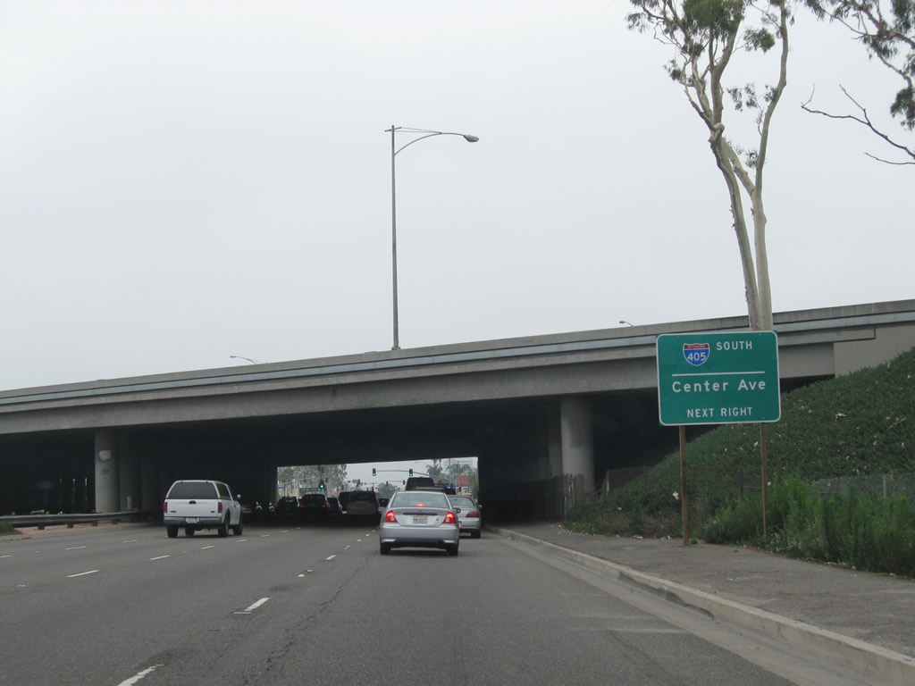
Prior to passing under the Interstate 405 mainline, a sign advises that the next intersection will be with Center Avenue. Turn right on Center Avenue to connect to Interstate 405 south to Irvine and San Diego.
07/10/10
Leaving the Interstate 405 interchange and after the traffic signal with Center Avenue, southbound California 39 (Beach Boulevard) meets Edinger Avenue. A California 39 south reassurance shield is posted on the overhead mast arm.
07/10/10
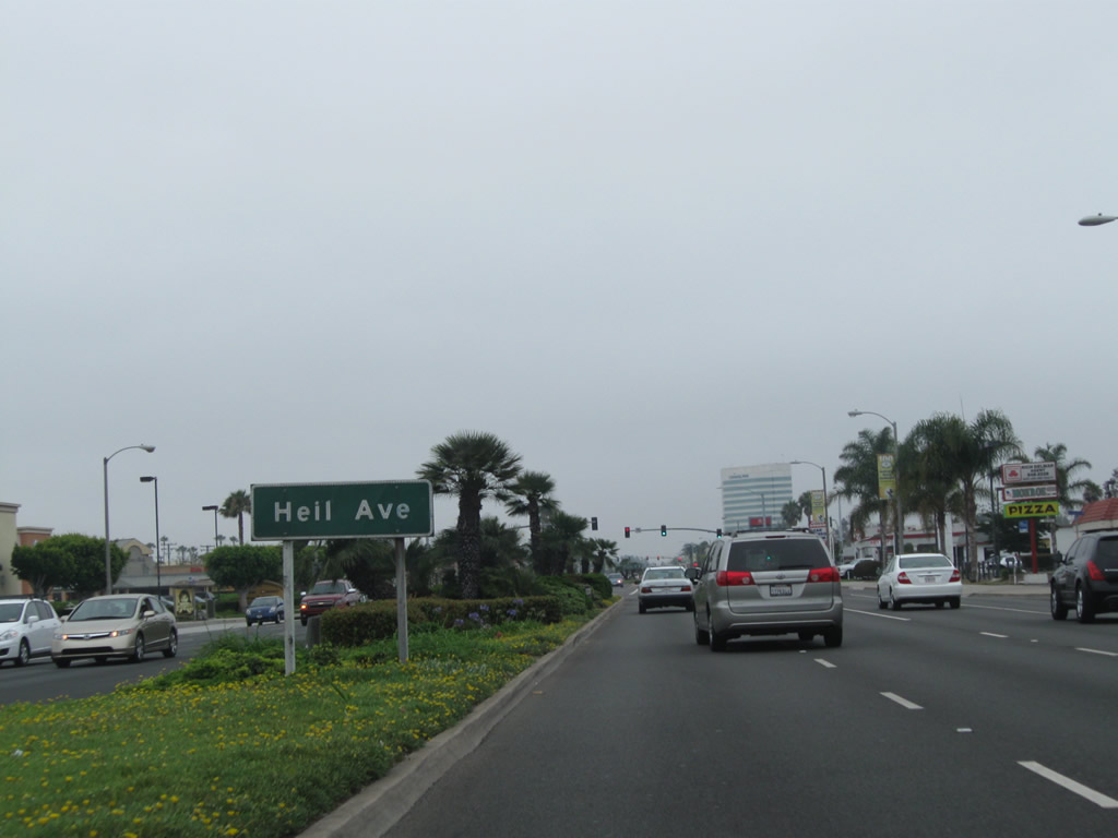
Southbound California 39 (Beach Boulevard) approaches Heil Avenue.
07/10/10
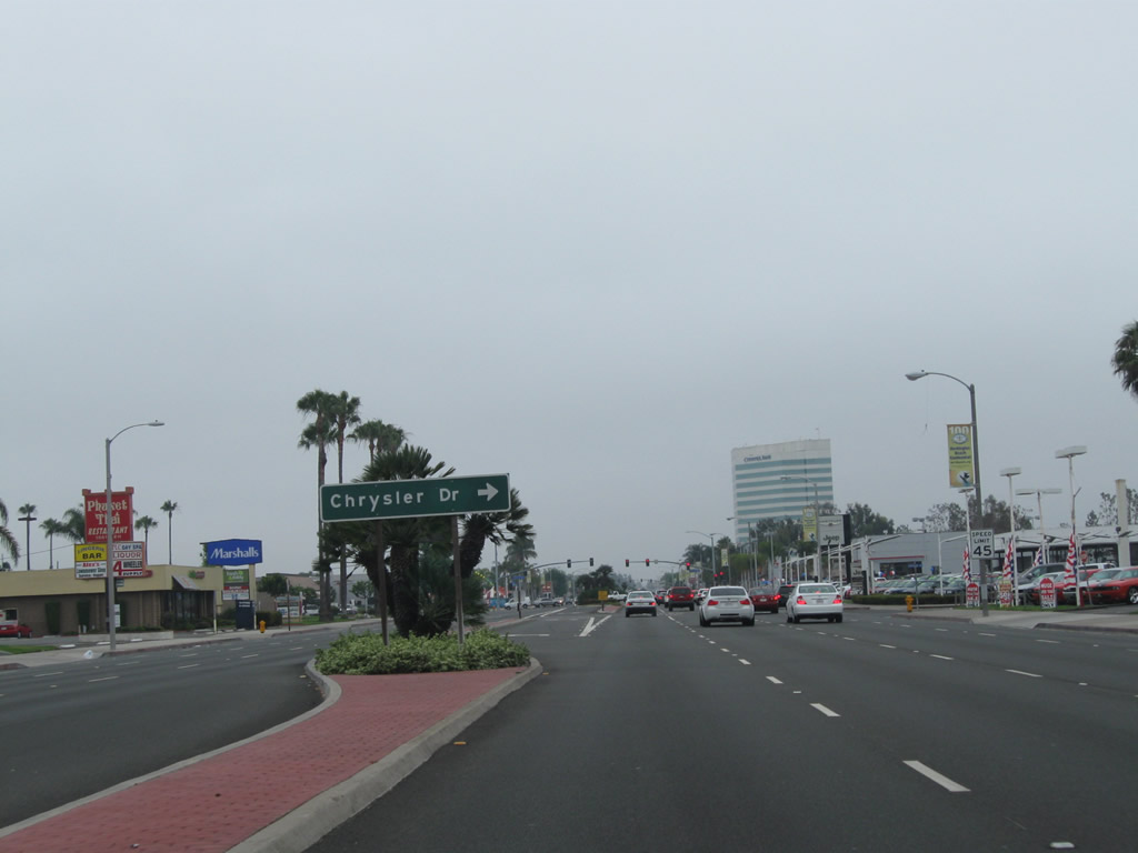
Shortly after the Heil Avenue intersection, California 39 south approaches Chrysler Drive. This road is located next to a Chrysler car dealership, hence the street name.
07/10/10
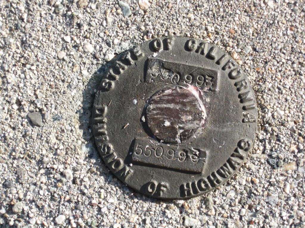
This California Division of Highways marker is embedded in poured concrete at the top of a retaining wall that dates to the original construction of San Gabriel Canyon Road. It is located just south of the closed section of California 39, near Crystal Lake.
08/22/09
References:
1 - Email from Mark Ryan dated April 2006.
Sahagun, L. (2012, January 29). Caltrans wants to abandon cliff-hanging Highway 39: To avoid closure of the popular San Gabriel Mountains route, Caltrans has asked the U.S. Forest Service or L.A. County to take it over, but neither wants it. Los Angeles Times. http://www.latimes.com/news/local/la-me-caltrans-highway39-20120129,0,2515708.story
Photo Credits:
- Andy Field: July 1999, 08/22/09, 07/10/10, 02/13/11
- Martin Grahl: 05/21/10
Page Updated Monday February 06, 2012.