
State Route 47 North

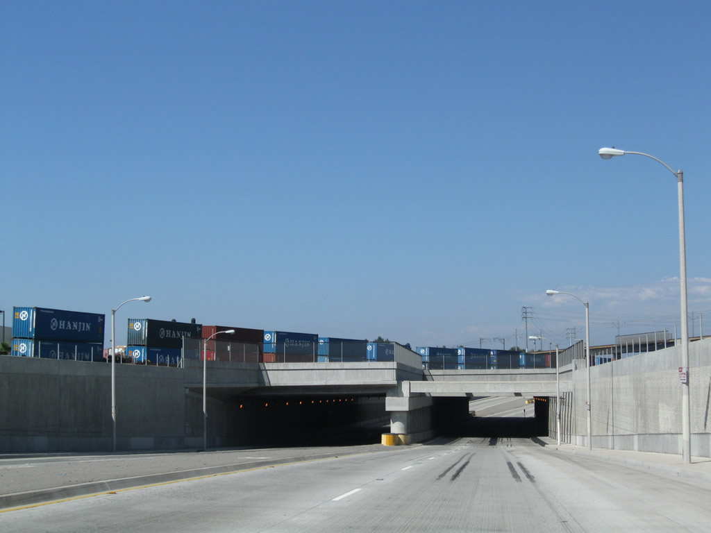
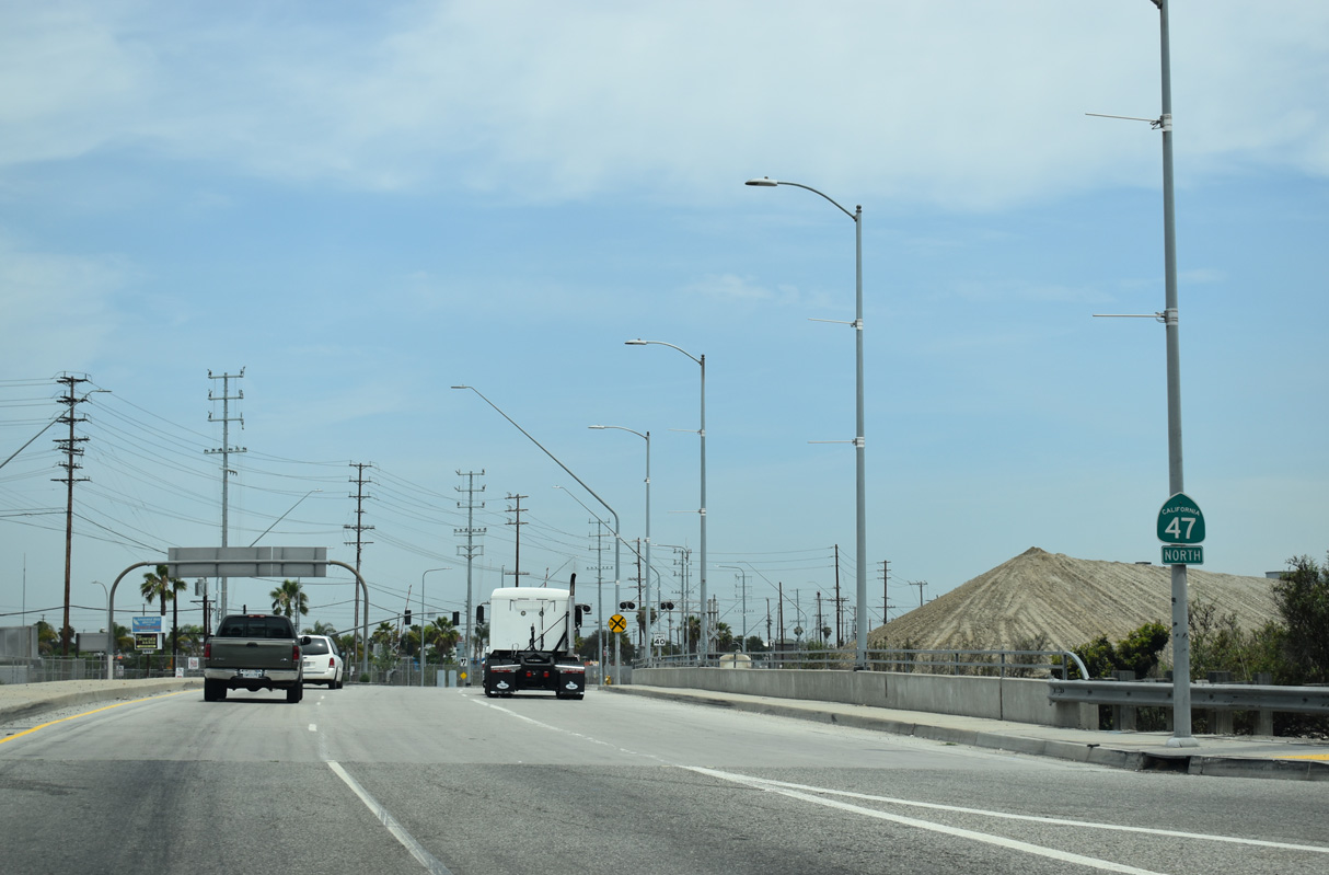
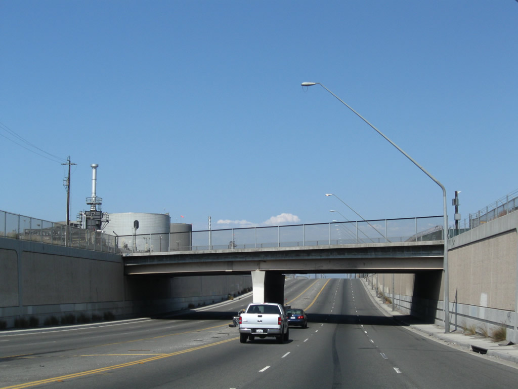
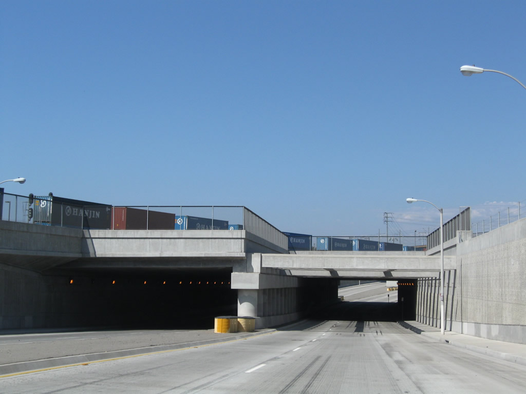
SR 47 (Alameda Street) north passes under the Alameda Corridor that carries rail traffic from the Ports of Los Angeles and Long Beach north to the Union Pacific Railroad mainline near downtown Los Angeles. This project was built as part of the Alameda Corridor, which was constructed in phases between 1997 and 2002. - 09/28/2008
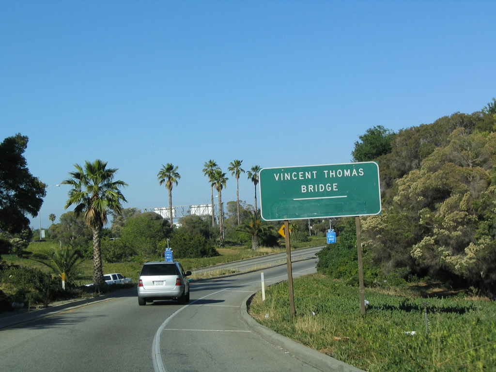
Leaving San Pedro "A Whale of a Town", SR 47 heads east to the Vincent Thomas Bridge between San Pedro and the Port of Los Angeles on Terminal Island. Older guide signs for the bridge once referenced the toll rate. Tolls for the crossing were eliminated in 2000.
05/30/04
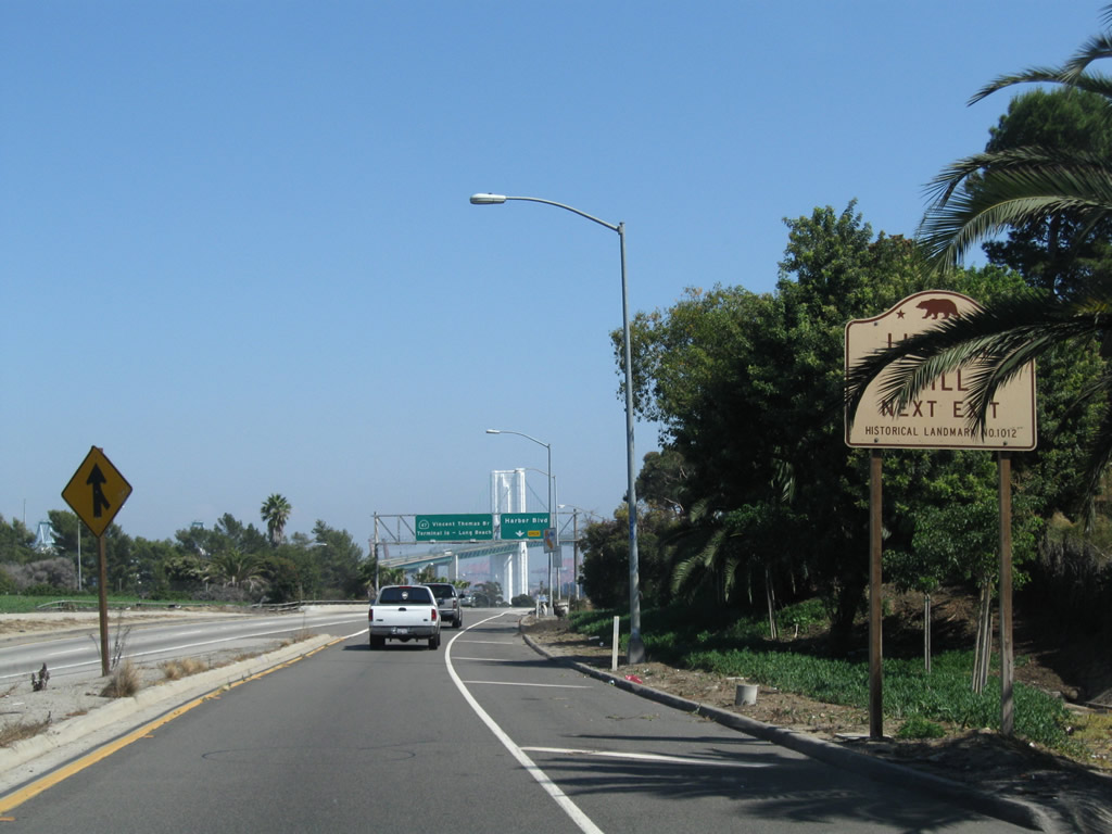
Significant in the history of labor and unions is Liberty Hill. A historical marker noting the significance of a labor strike from 1923 that helped to bring better working conditions for port workers during the 1920s is located at the intersection of 5th Street and Harbor Boulevard.
09/28/08
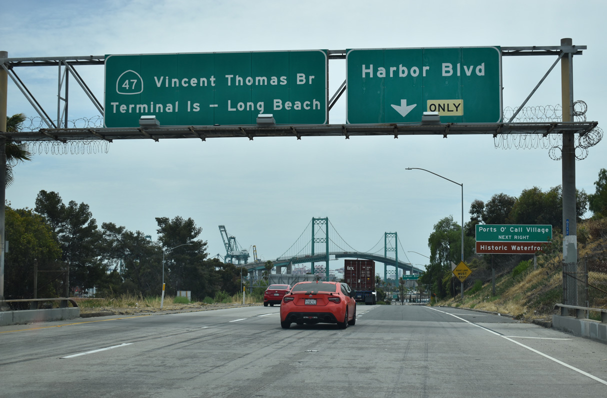
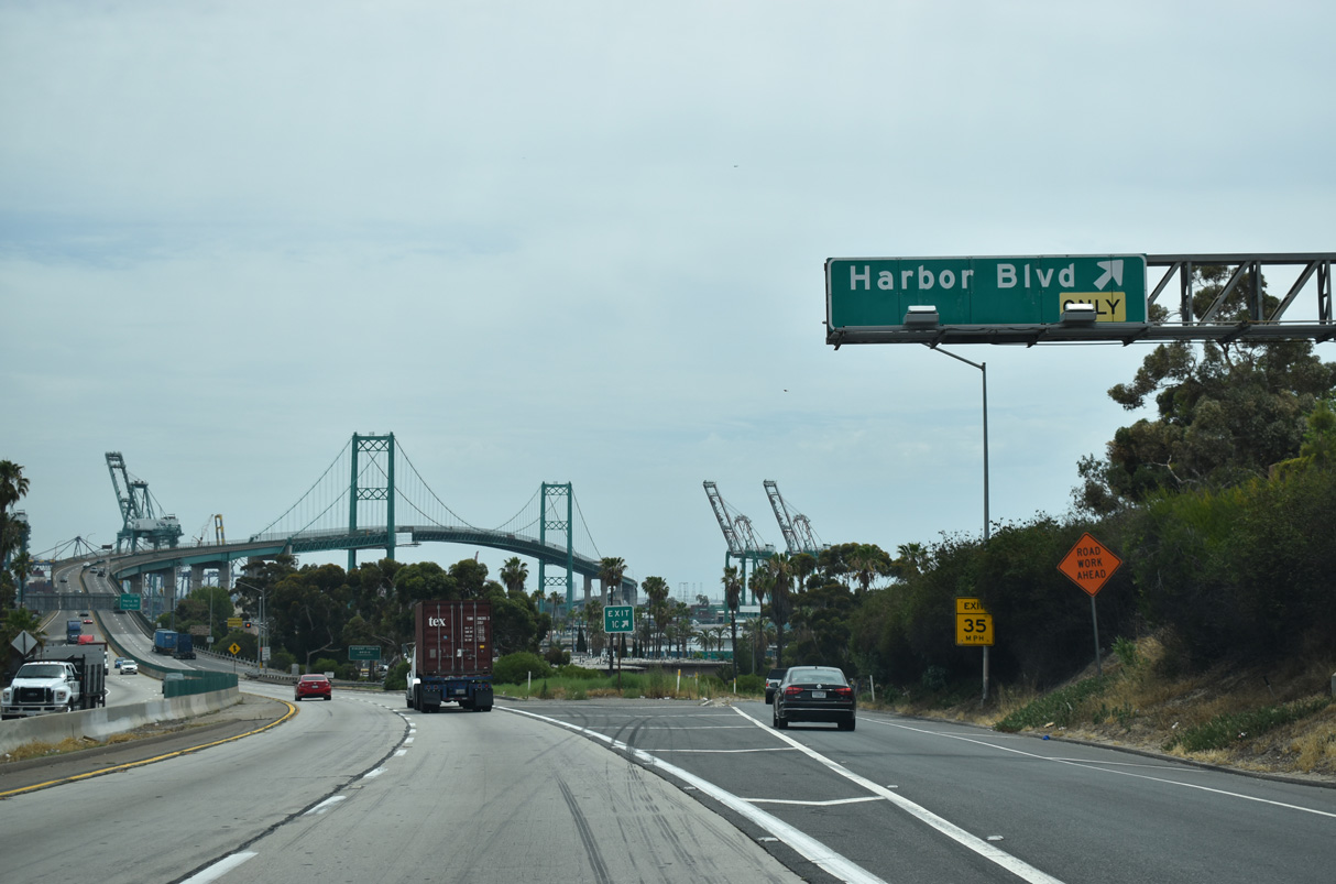
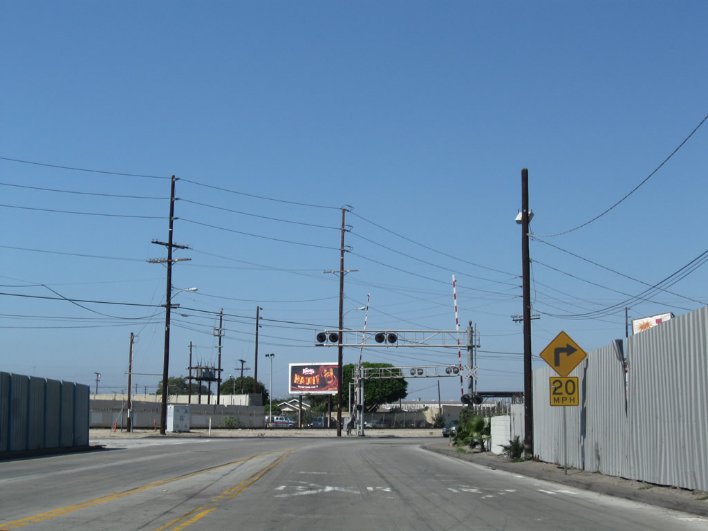
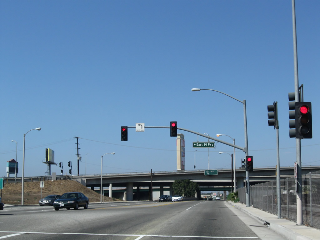
SR 47 (Seaside Freeway) spans Pacific Avenue ahead of Exit 1 C to Harbor Boulevard in San Pedro.
07/09/18
Harbor Boulevard extends south Front Street and port facilities on Smith Island to the San Pedro business district and the Port of Los Angeles at 22nd Street.
07/09/18
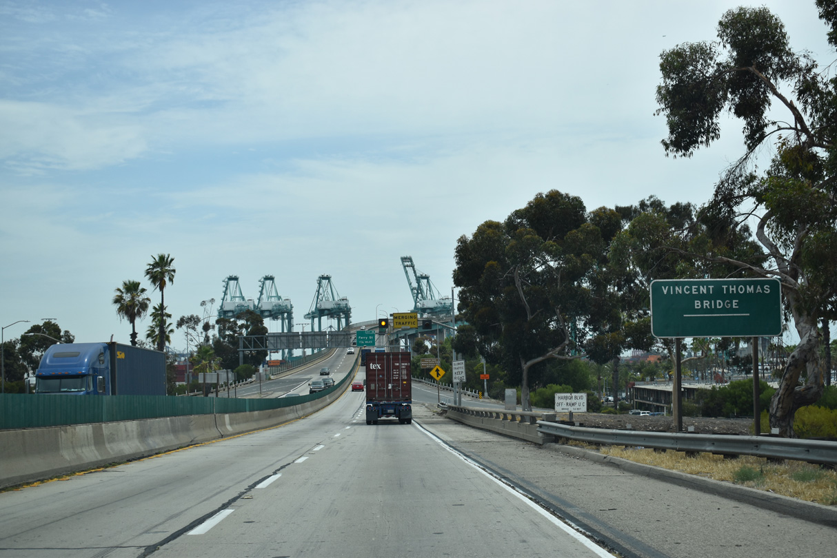
Ramps with Harbor Boulevard tie into the western approach of the Vincent Thomas Bridge.
07/09/18
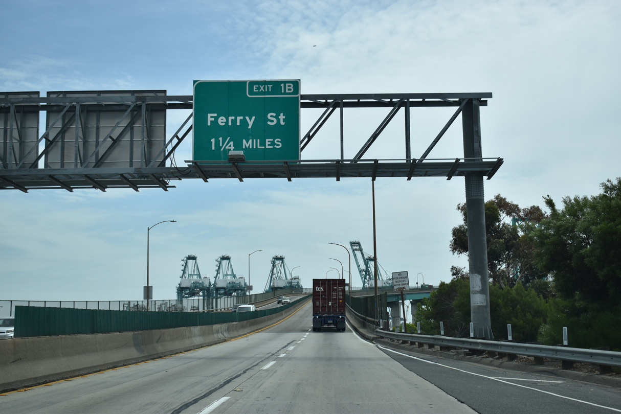
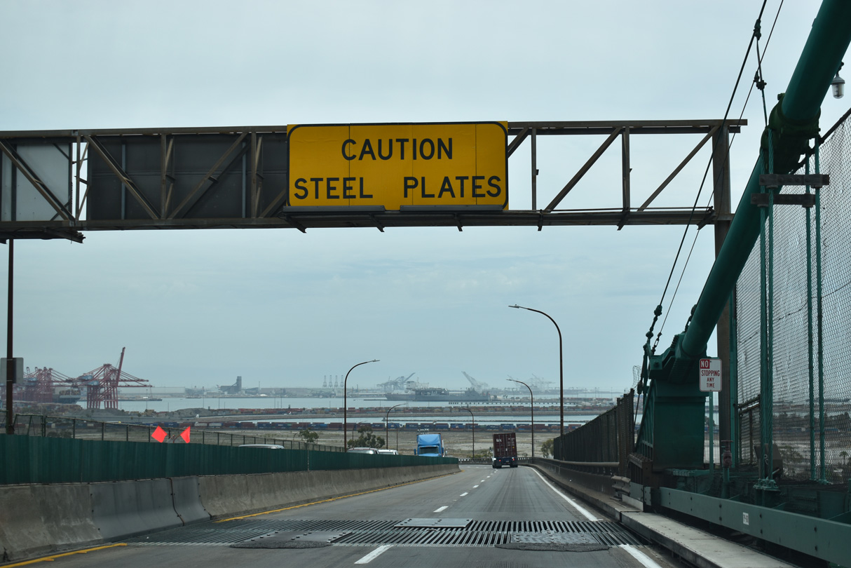
Exit 1 B departs from the east end of the Vincent Thomas Bridge to Ferry Street on Terminal Island in the Port of Los Angeles.
07/09/18
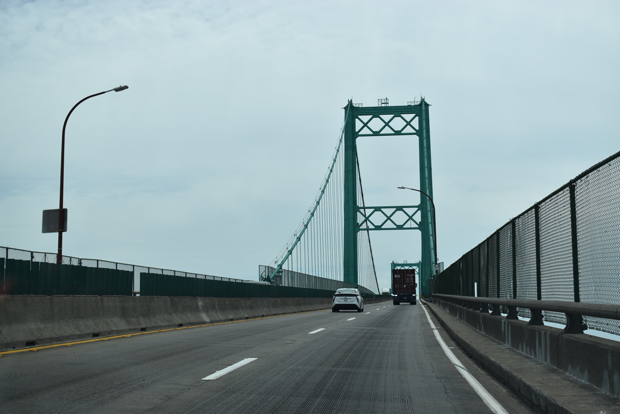
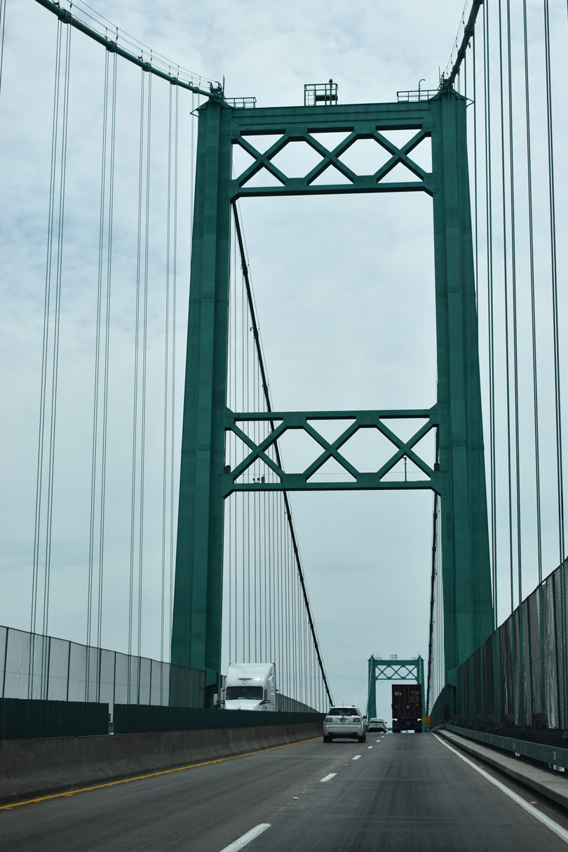
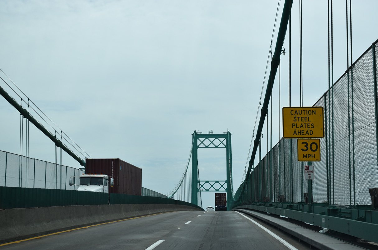
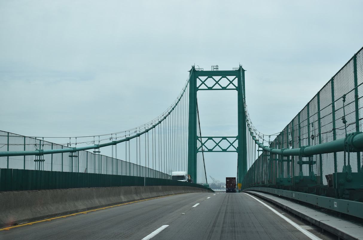
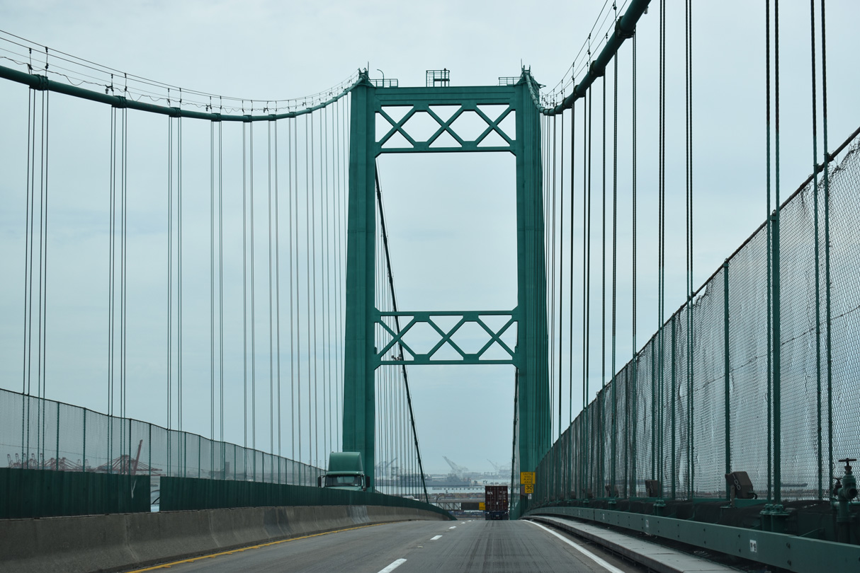
The Vincent Thomas Bridge spans Los Angeles Channel within the city of Los Angeles from Smith Island at San Pedro east onto Terminal Island.
07/09/18
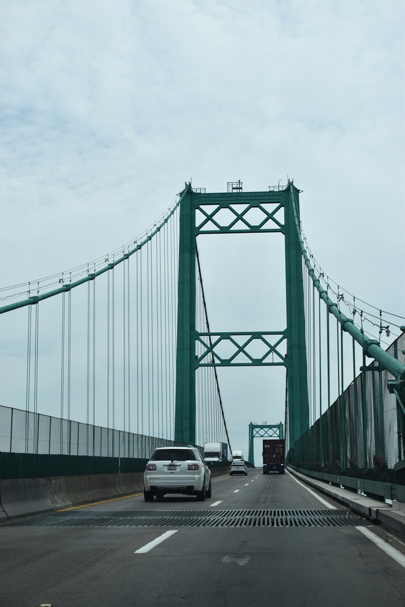
Replacing passenger and car ferries, the Vincent Thomas Bridge opened to traffic on November 15, 1963.
07/09/18
According to the San Pedro community webpage, "San Pedro's Golden Gate" was the first suspension bridge to be built on pilings. Tolls were collected from the time of opening in 1963 until 2000, when it was one of two remaining Southern California toll bridges (the other was the San Diego-Coronado Bridge, which ceased toll collection in June 2002).
07/09/18
Statistically speaking, the Vincent Thomas bridge "required 92,000 tons of Portland cement; 13,000 tons of lightweight concrete; 14,100 tons of steel; and 1,270 tons of suspension cable." (The bridge) is designed to withstand winds of 90 miles per hour, double that required by code. The overall length of the bridge is 6,050 feet, with a main suspension span of 1,500 feet and 500-foot spans on either side. The towers are 365 feet high."1
07/09/18
The suspension bridge is named for former State Assemblyman Vincent Thomas, a legislator who championed the bridge's construction and was present to open the crossing to traffic in 1963. The bridge was constructed at a time when the Port of Los Angeles and Port of Long Beach were still growing and gaining traffic volume, so its importance grew as it served more trucks and commercial traffic associated with the port.
07/09/18
The Vincent Thomas Bridge has appeared in many movies, since it is the closest suspension bridge to Hollywood. The Nicholas Cage and Angelina Jolie movie, "Gone in Sixty Seconds," has a chase scene that shows Cage flying over a traffic jam on the bridge.
07/09/18
Despite its freeway status, the Vincent Thomas Bridge is too narrow to be Interstate-standard.
07/09/18
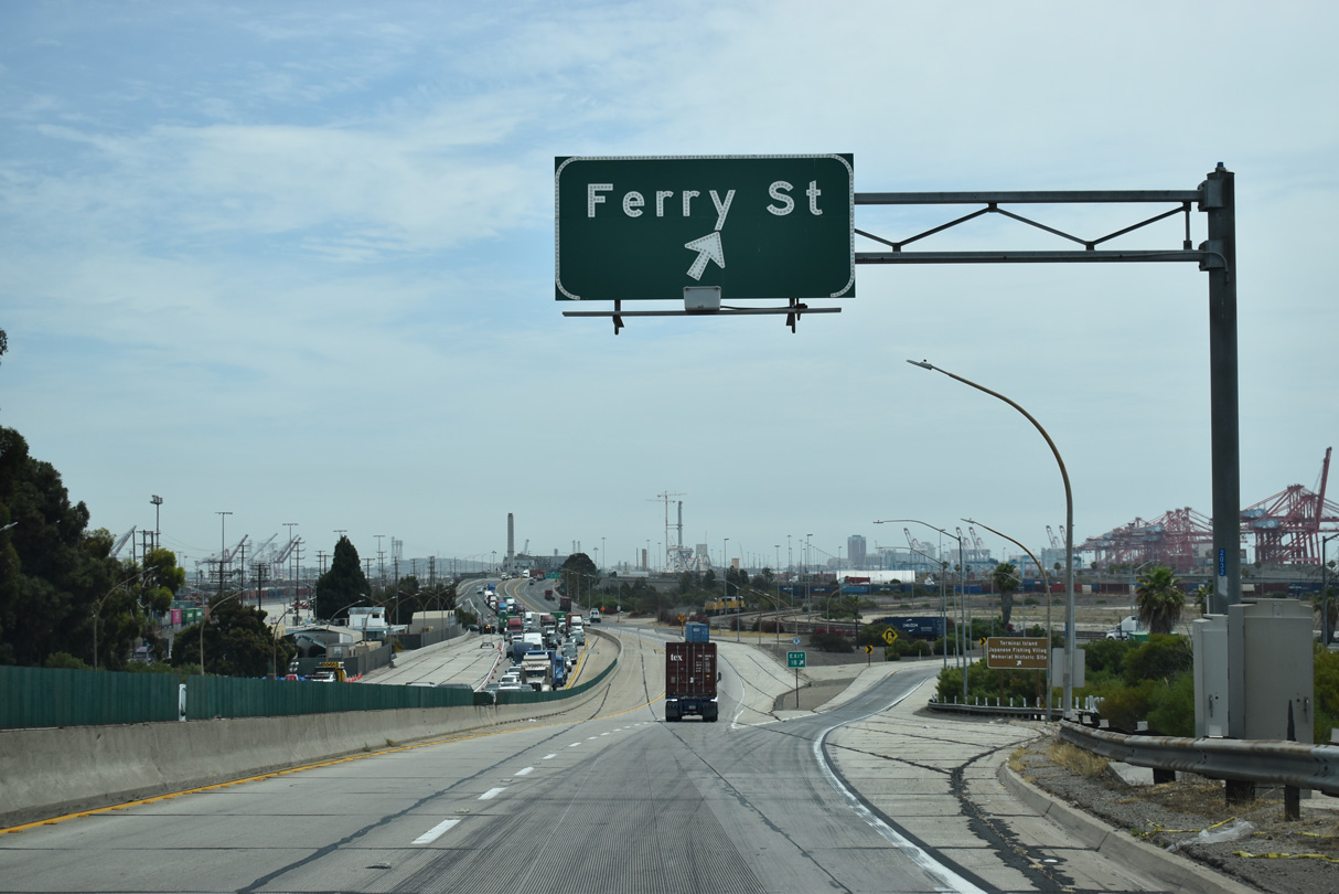
Exit 1 B loops away from SR 47 (Seaside Freeway) to Ferry Street on Terminal Island. Ferry Street leads south to Terminal Way.
07/09/18
The Vincent Thomas Bridge toll plaza was located east of the span at Exit 1 B. Large areas of concrete remain from the toll collection point as does the Caltrans Terminal Island Maintenance Station on the north side.
07/09/18
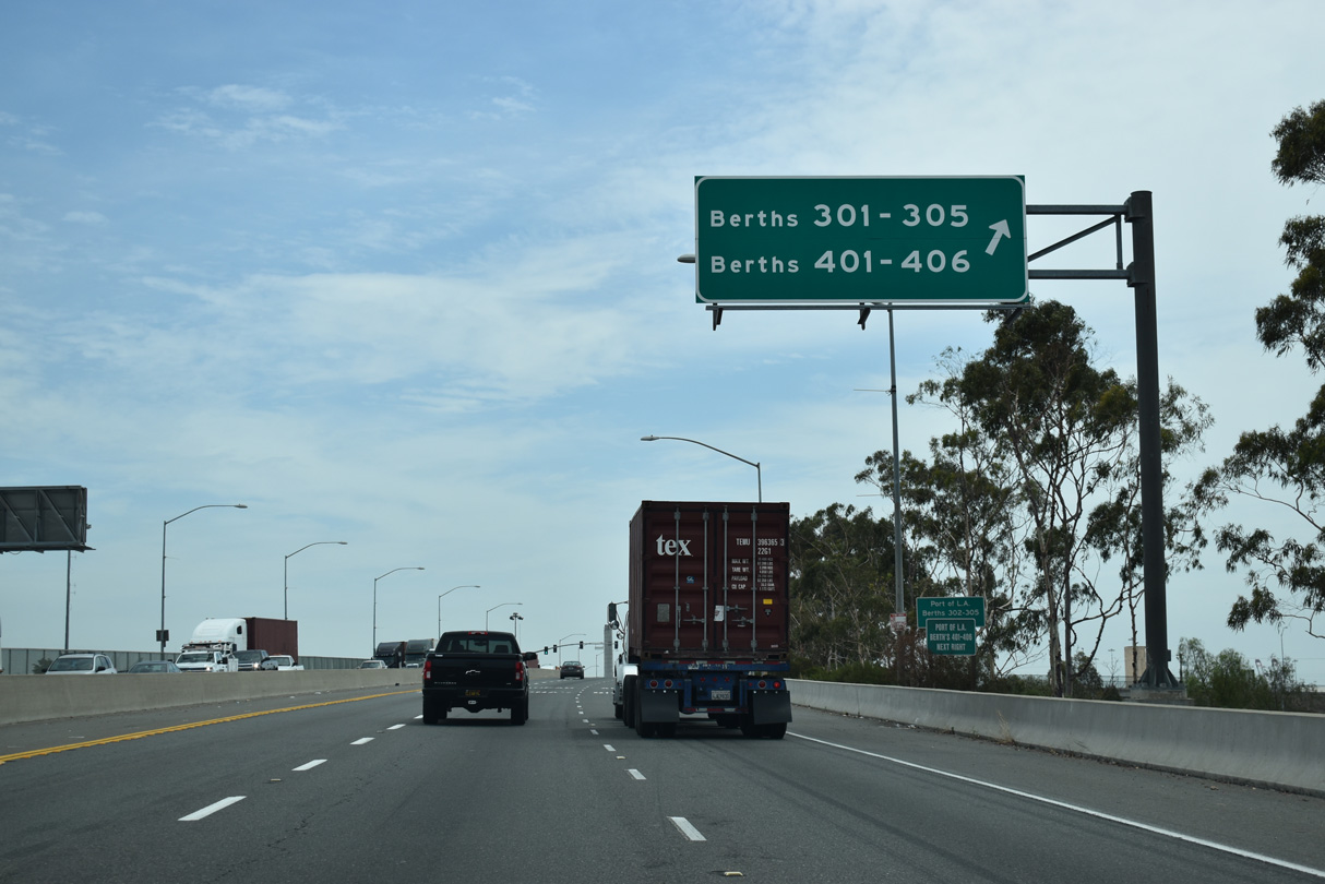
Continuing east from Ferry Street, SR 47 (Seaside Avenue) next intersects Navy Way south to Port of Los Angeles Berths 301-305 and Berths 401-406.
07/09/18
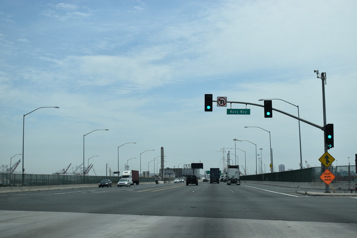
Navy Way stems south from the traffic light with SR 47 (Seaside Avenue) to Terminal Way and port facilities along San Pedro Bay.
07/09/18
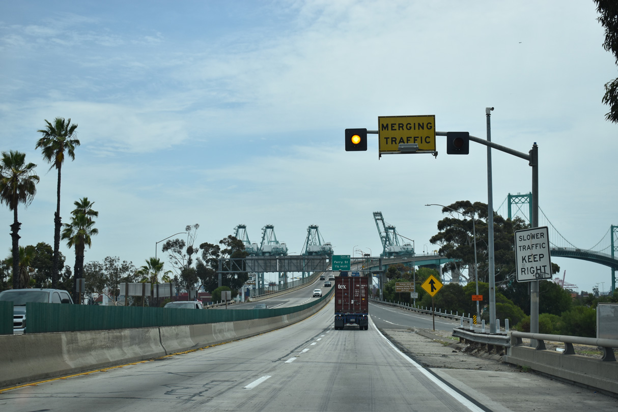
East beyond Navy Way, SR 47 leave the city of Los Angeles and enters the city of Long Beach east. Interstate 710 (Long Beach Freeway) next overtakes the freeway mainline from SR 47 (Ocean Boulevard) east to Downtown Long Beach and north to Pasadena.
07/09/18
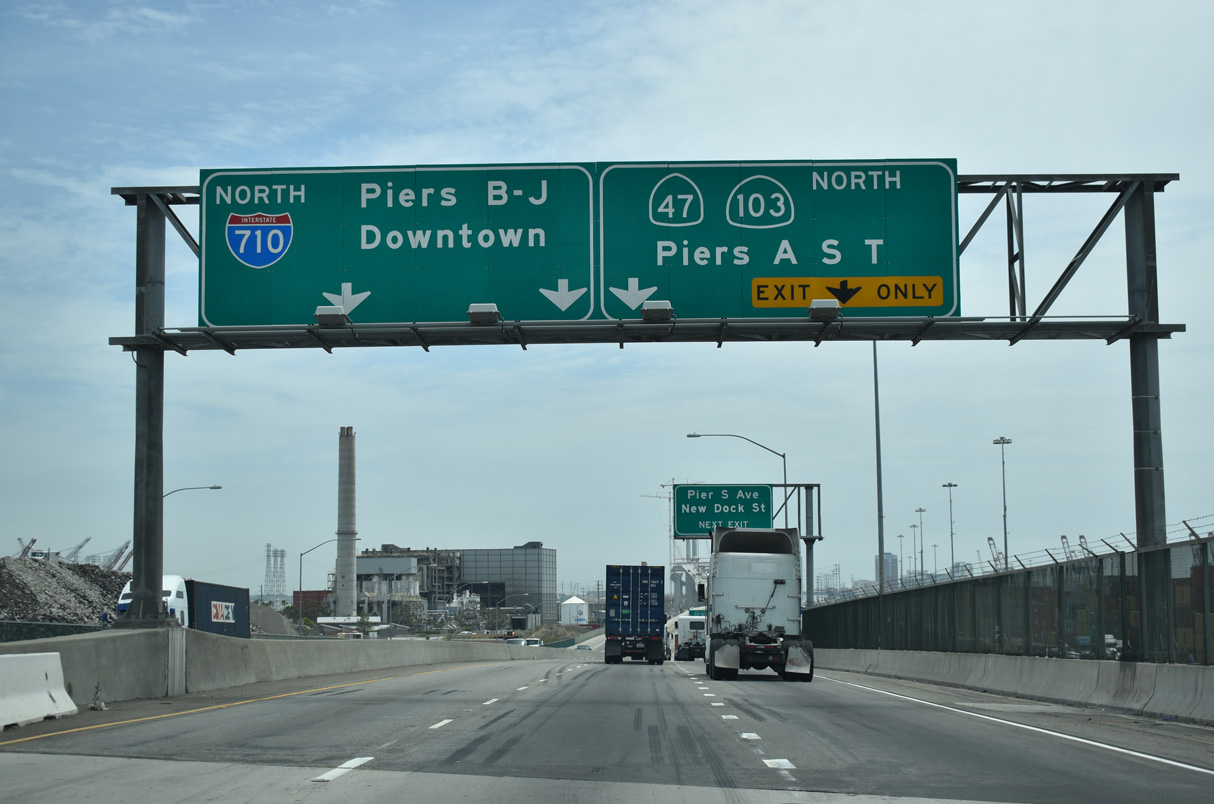
SR 47 (Ocean Boulevard) separates with I-710 at the split diamond interchange with Pier S Avenue and SR 103 (Terminal Island Freeway) north.
07/09/18
The interchange joining Ocean Boulevard / Interstate 710 and SR 47-103 (Terminal Island Freeway) was built in 2007.
07/09/18
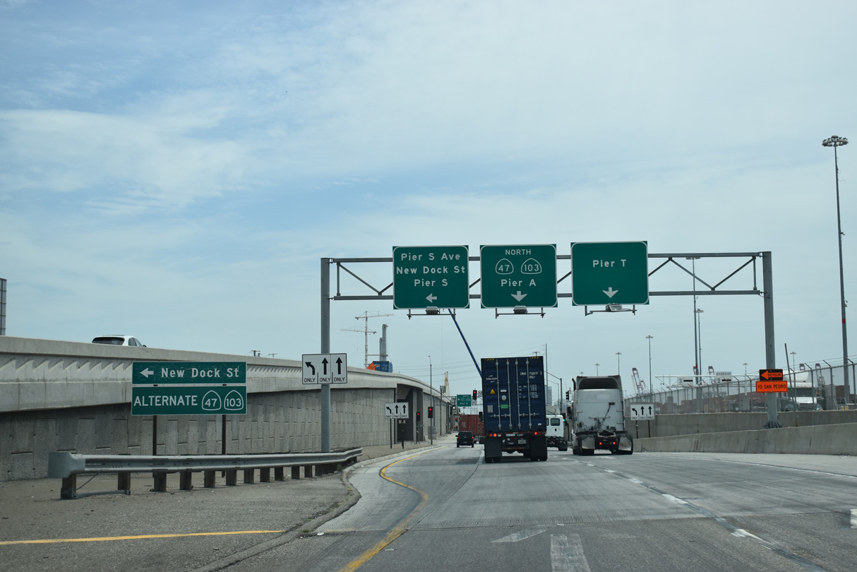
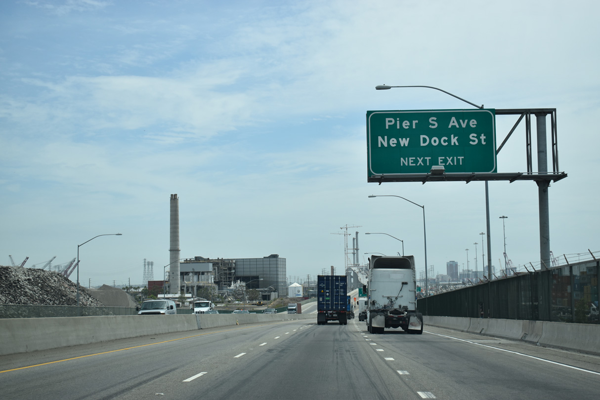
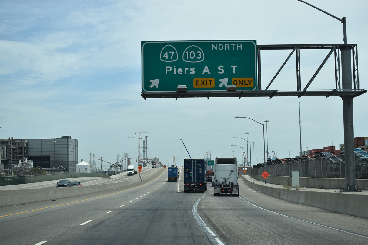
SR 47 intersects S Pier Avenue north to various container terminals within the Port of Los Angeles and Port of Long Beach.
07/09/18
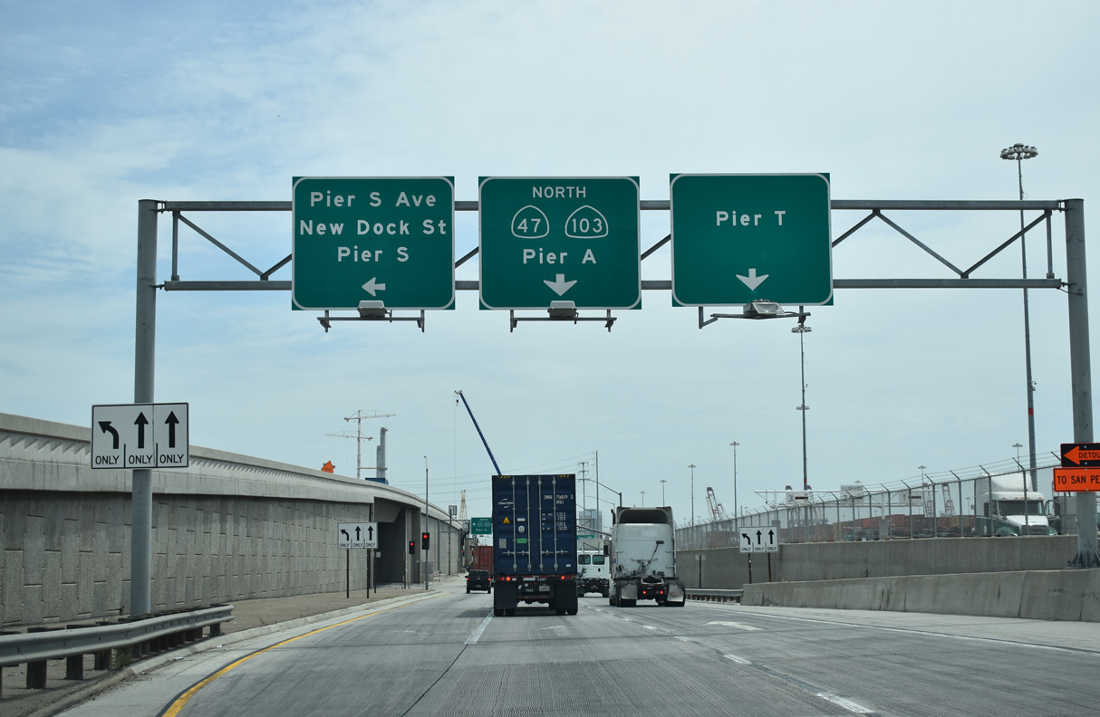
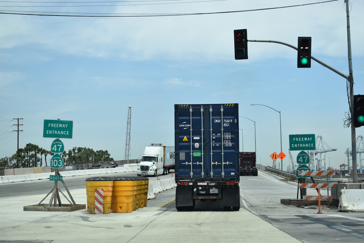
SR 47 overlaps with SR 103 north along the Terminal Island Freeway, which extends north through the Port of Los Angeles and industrial areas to Willow Street in Long Beach.
07/09/18
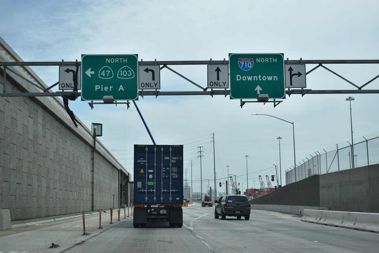
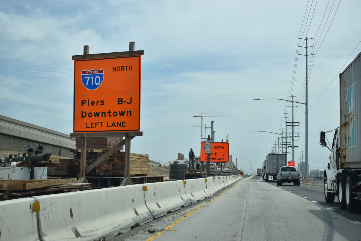
The entrance ramp from the south end of Terminal Island Freeway to I-710 also connects with Pier T Avenue for Piers B through J and Pier T.
07/09/18
Interstate 710 ascends across the East Channel over the Long Beach International Gateway bridge to the Queen Mary, Aquarium of the Pacific, and Long Beach Cruise Ship Terminal.
07/09/18
Beyond the overpass for Interstate 710, SR 47/103 intersect the north frontage road for Ocean Boulevard where the Terminal Island Freeway begins north.
07/09/18
Coordinated by Alameda Corridor Transportation Authority, the Port Access Expressway project replaced the previous lift bridge crossing Cerritos Channel. The replacement Commodore Schuyler F. Heim Bridge is a concrete, seven-lane wide span. The original lift bridge along the Terminal Island Freeway here opened to traffic on January 10, 1948.
07/09/18

The Henry Ford Bridge, a lift bridge along the Alameda Corridor, spans Cerritos Channel along the west side of the Commodore Schuyler F. Heim Bridge. The Alameda Corridor carries freight from the Ports of Los Angeles and Long Beach north to large railyards near Downtown Los Angeles.
07/09/18
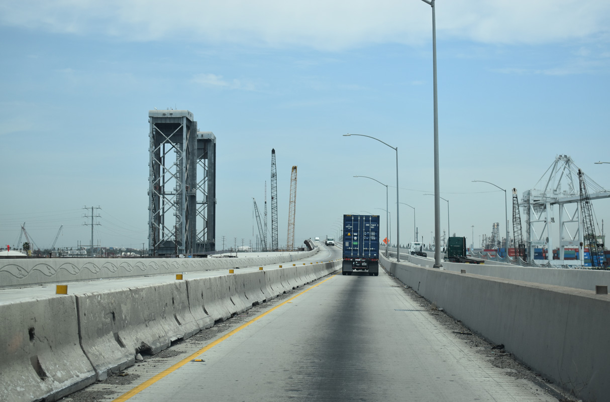
SR 47-103 (Terminal Island Freeway) north leave Long Beach and enter the city of Los Angeles after departing from Terminal Island. The adjacent Ports of Los Angeles and Long Beach feature massive container yards with towering cranes designed to lift cargo from ships and transfer them to holding areas until trucks or rail can transport the freight to the appropriate market.
07/09/18
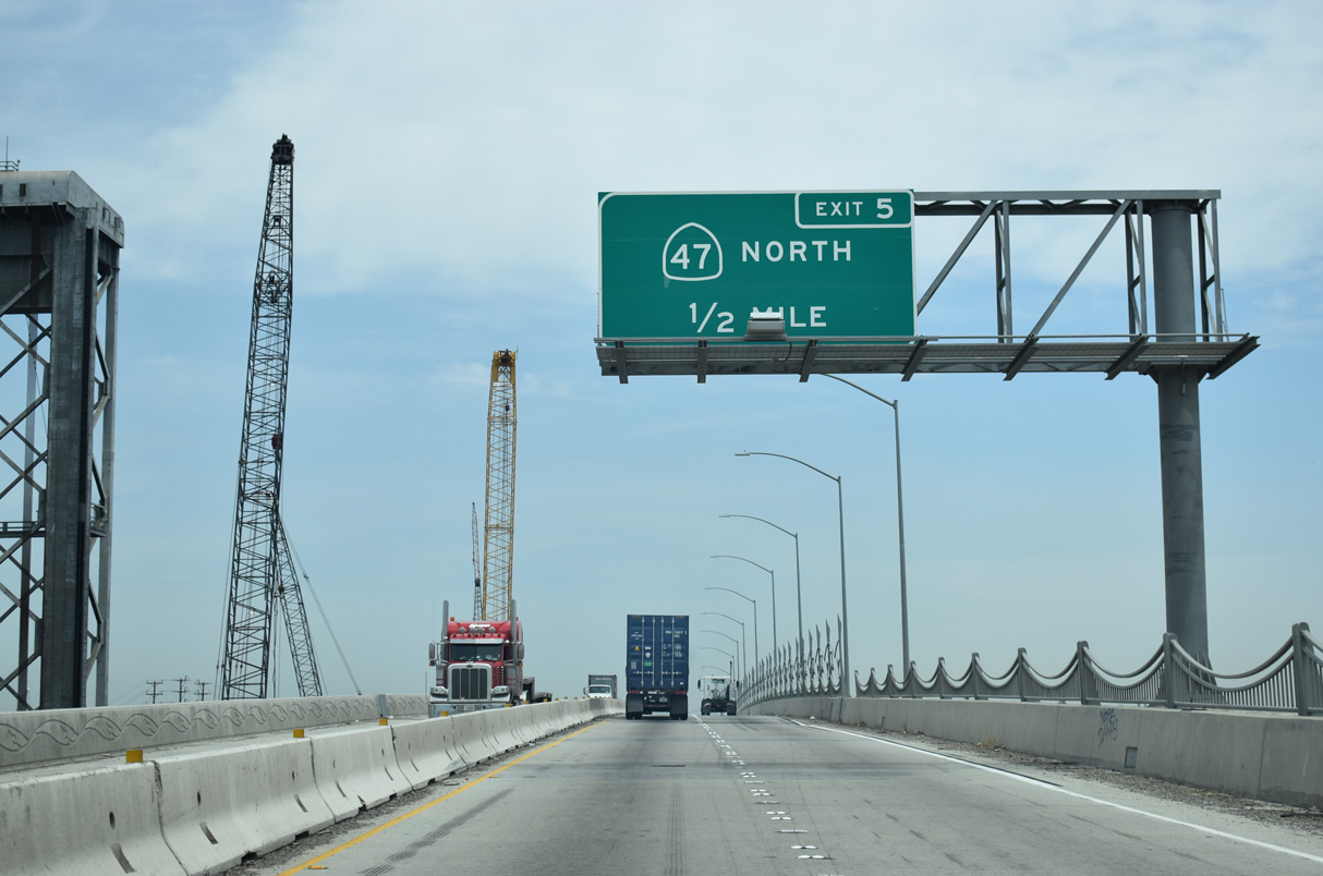
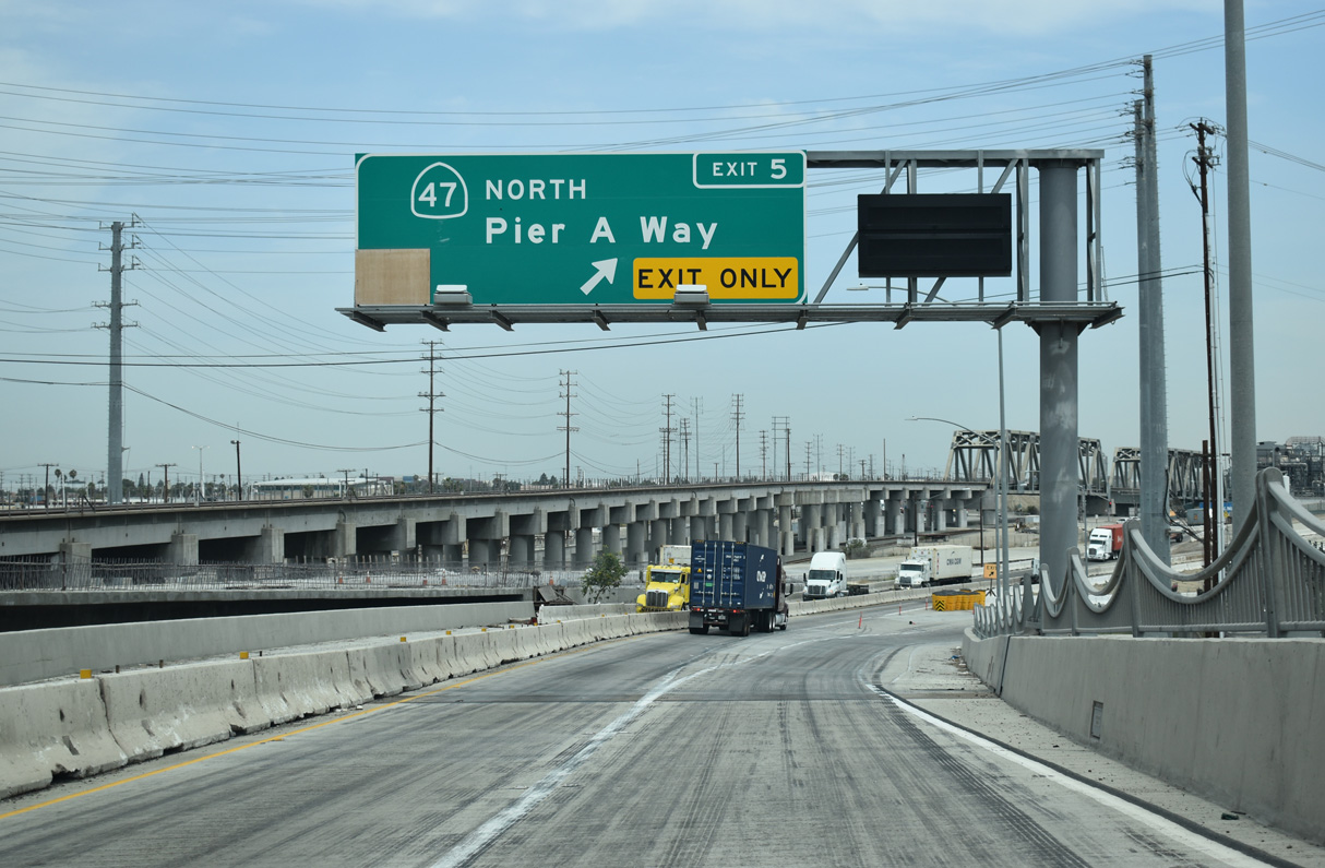
SR 47 branches northwest from SR 103 (Terminal Island Freeway) onto Henry Ford Avenue at Exit 4. Henry Ford Avenue intersects Pier A Way before crossing Dominguez Channel ahead of Anaheim Street at the Wilmington neighborhood in Los Angeles.
07/09/18
SR 47 continues north along the Alameda Corridor to I-405 (San Diego Freeway) by Lincoln Village. SR 103 (Terminal Island Freeway) turns northeast by an oil refinery complex to SR 1 (Pacific Coast Highway).
07/09/18
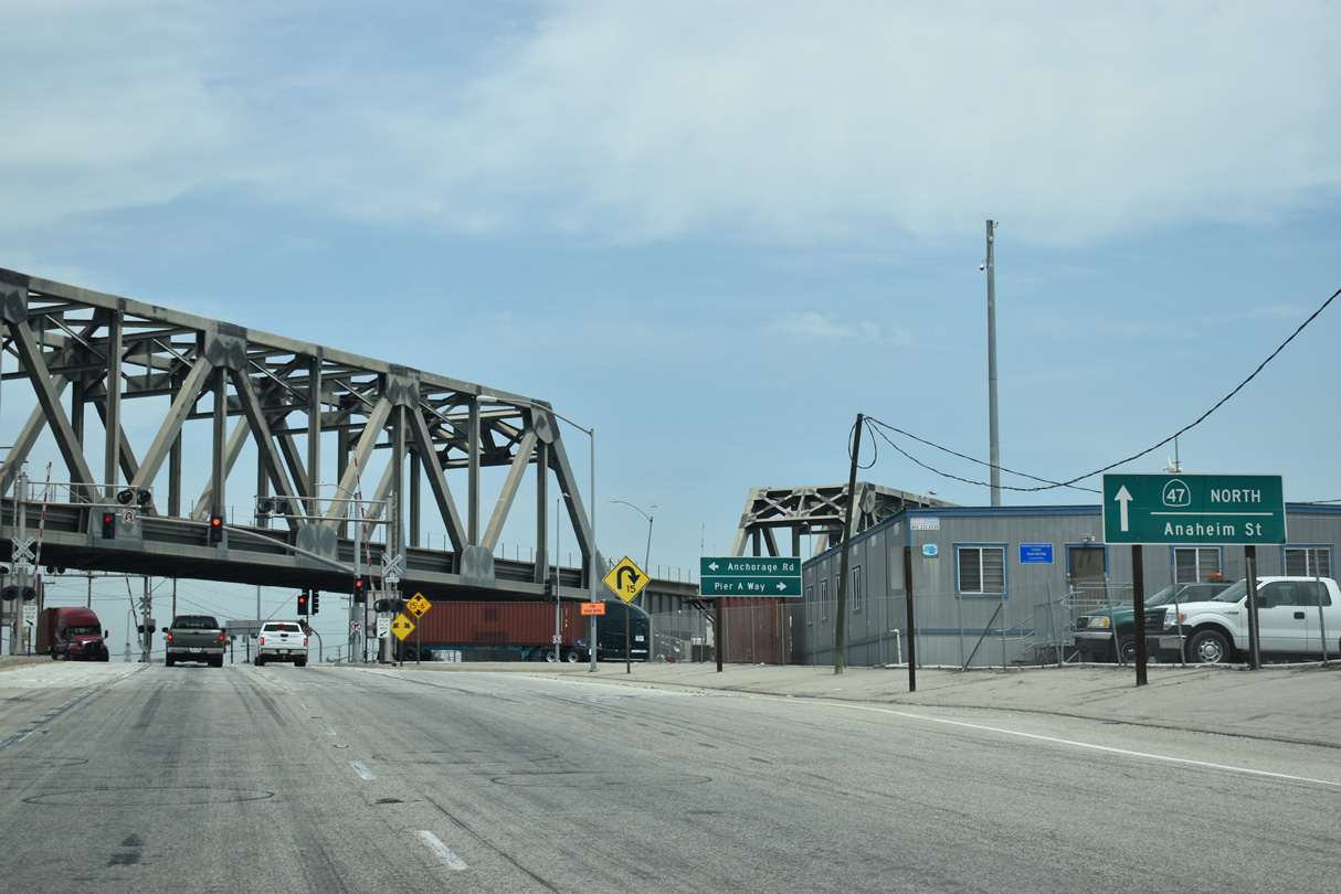
Lowering to grade level, northbound SR 47 (Henry Ford Avenue) continues with two lanes below the Terminal Island Freeway to the signalized intersection with Pier A Avenue east and Anchorage Road south.
07/09/18
The alignment taking SR 47 north along Henry Ford Avenue was meant to be temporary pending completion of the Port Access Expressway.
07/09/18
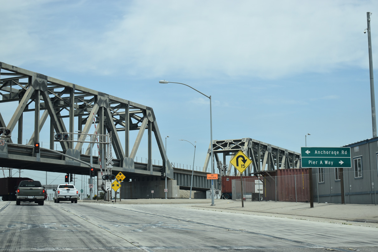
Pier A Way heads east between an oil refinery complex and the Port of Long Beach Pier A.
07/09/18
SR 47 (Henry Ford Avenue) proceeds north from Pier A Avenue across Dominguez Channel. The channel flows south into the Consolidated Ship Channel, which opens into the East Basin by Terminal Island.
07/09/18
Another railroad meets SR 47 at this at-grade crossing. One of the needs of the replacement Port Access Expressway would be to eliminate at-grade crossings along this stretch of Henry Ford Avenue, as well as create a reliable alternate route for trucks on roads other than I-710 and I-110.
09/28/08
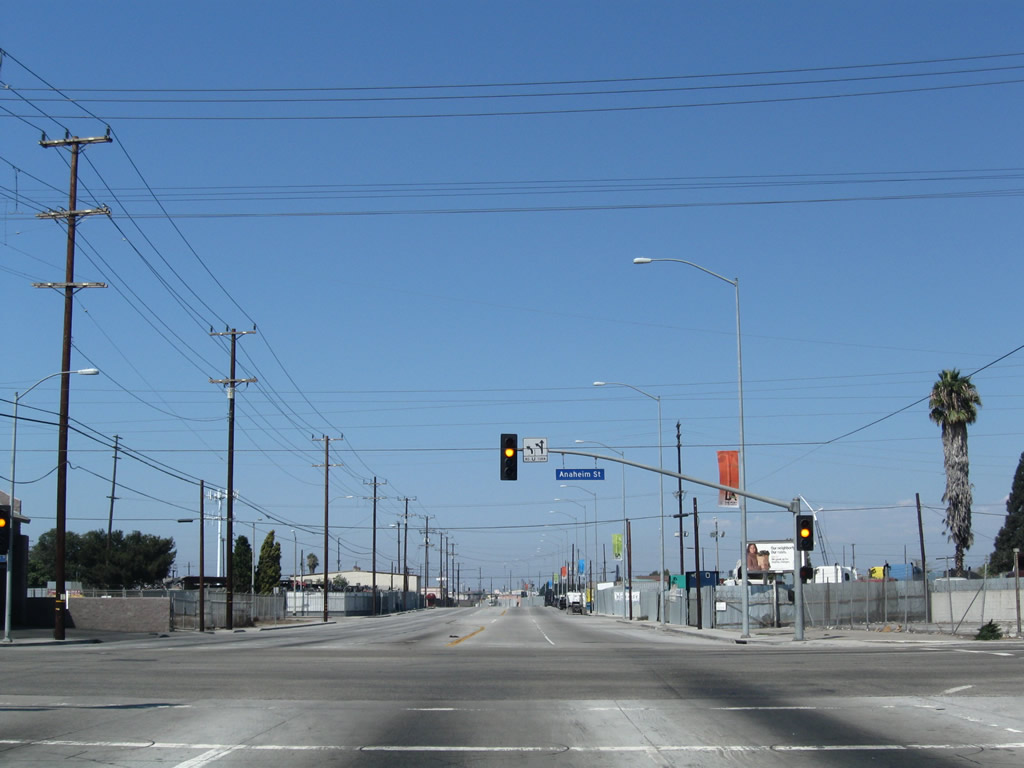
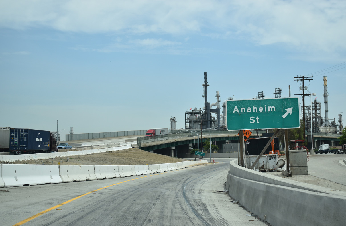
Anaheim Street crosses SR 47 (Henry Ford Avenue) west from industrial areas of Long Beach to Wilmington in Los Angeles.
09/28/08
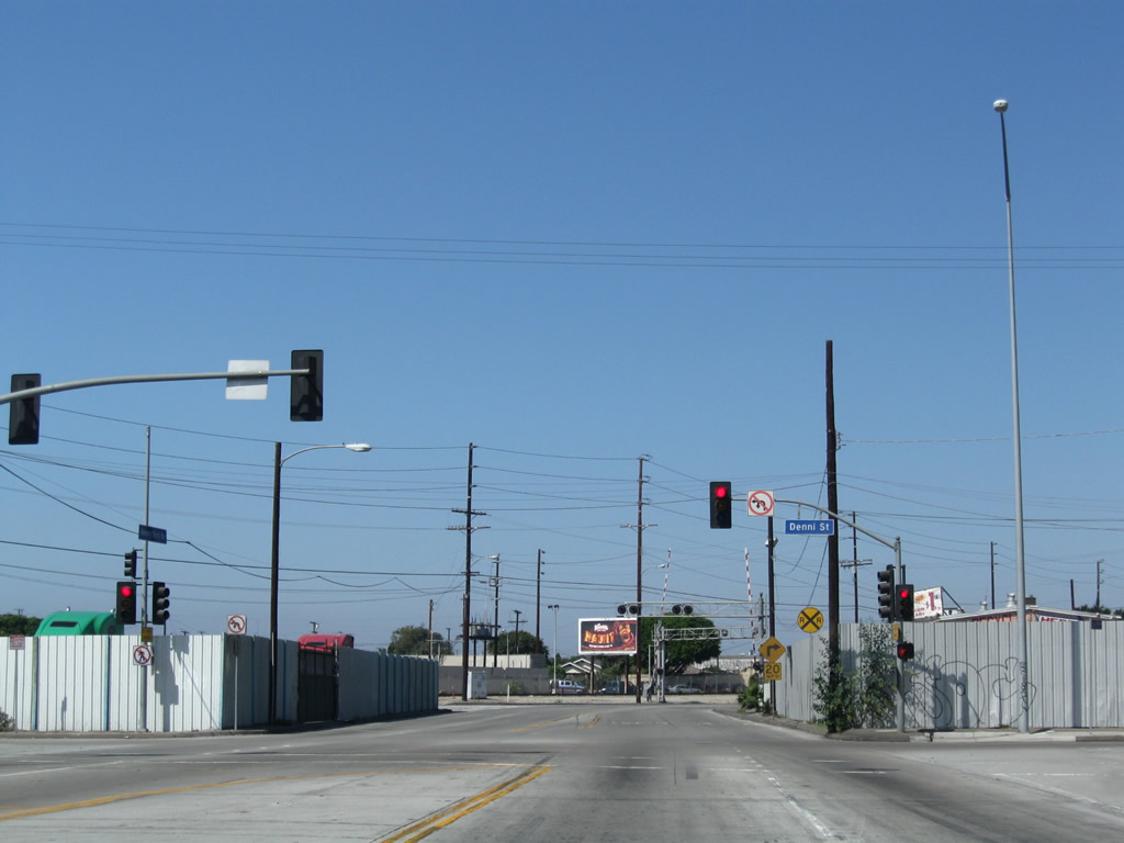
North of Anaheim Street, Henry Ford Avenue continues by additional industrial development with large storage areas and cargo businesses to the signalize at Denni Street.
09/28/08
SR 47 overtakes Alameda Street north from Henry Ford Avenue. Alameda Street was widened and improved to facilitate cargo movement between the ports and Interstate 405.
09/28/08
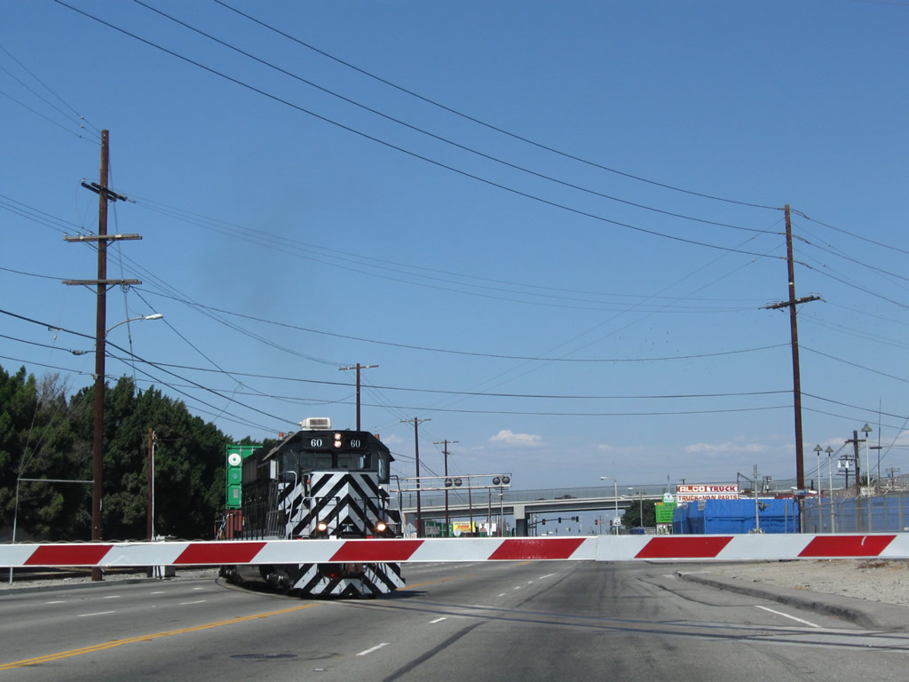
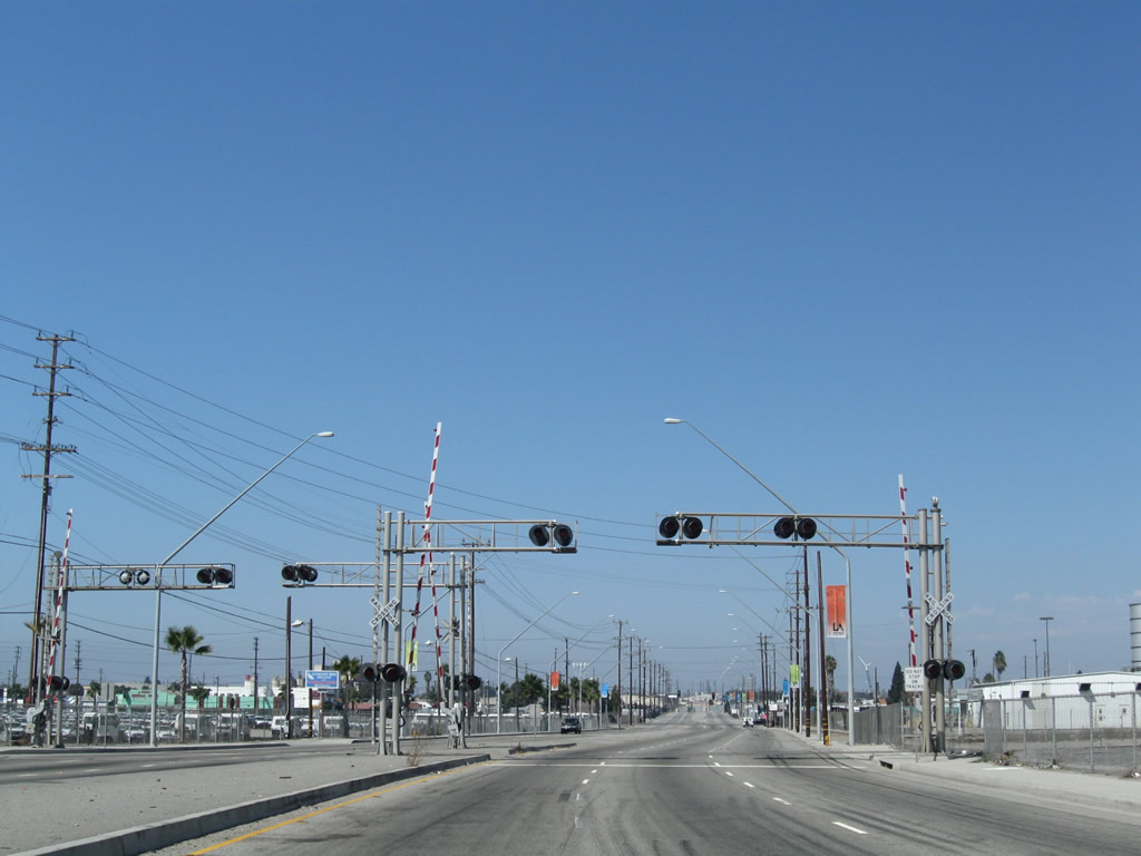
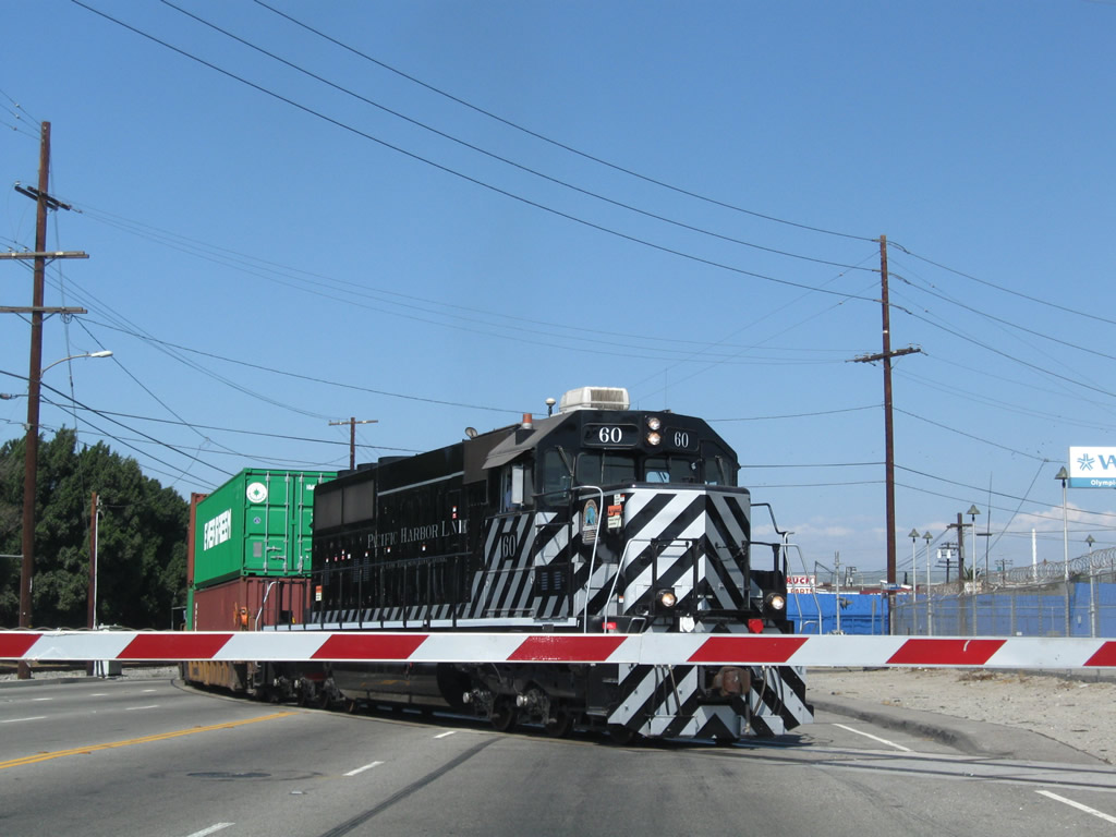
Another railroad line crosses Alameda Street at-grade by Robidoux Street. The locomotive in view was labeled as being part of the Pacific Harbor Line with low emissions.
09/28/08
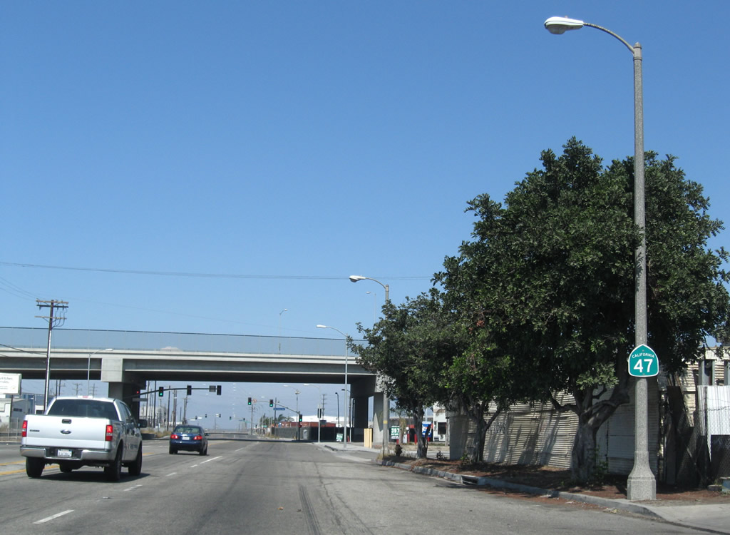
Although signed as a state route, Alameda Street is not currently maintained by Caltrans. This reassurance shield precedes Mauretania Street and the grade separation of SR 1 (Pacific Coast Highway).
09/28/08
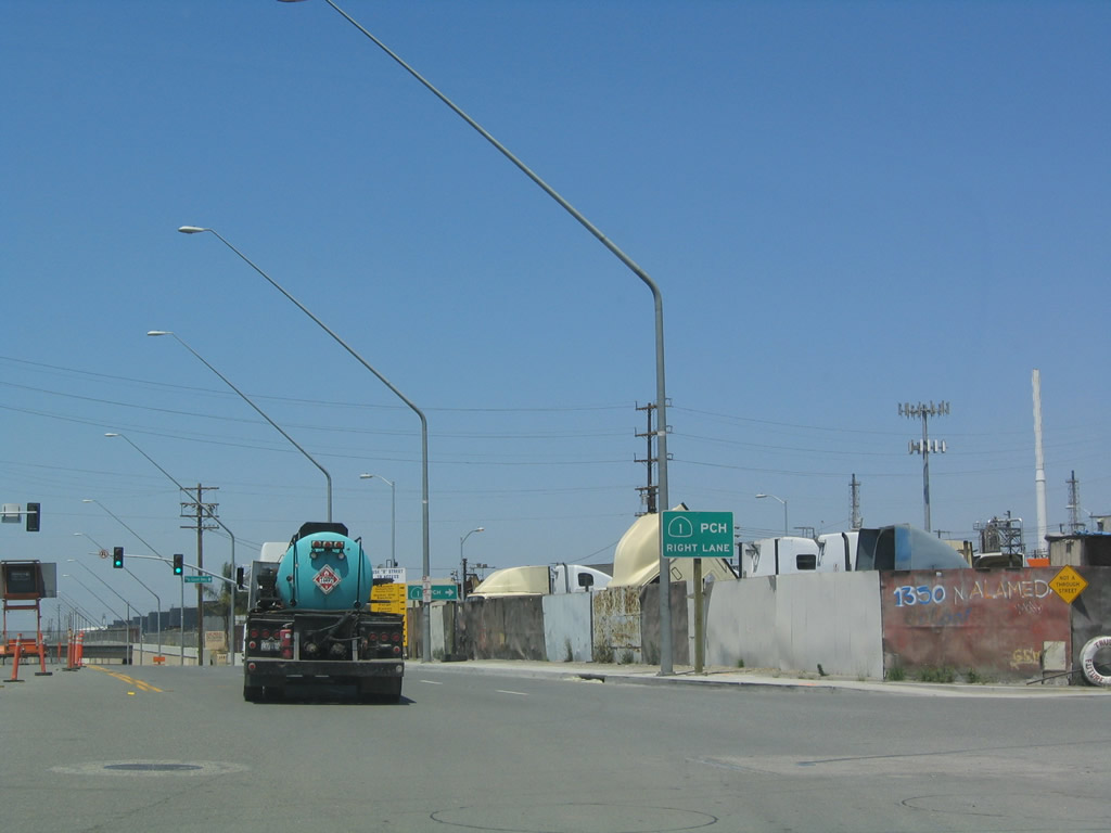
The viaduct taking SR 1 (Pacific Coast Highway) over Alameda Street was built in 2004 as part of the Alameda Corridor project. A service road named Pacific Coast Highway spurs east below the elevated roadway from a signalized intersection with SR 47.
09/28/08
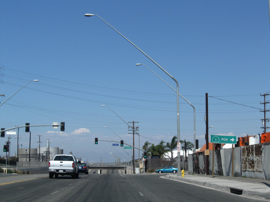
O Street connects Alameda Street with SR 1 (Pacific Coast Highway). SR 1 runs west to Torrance and Lomita and east to Long Beach.
05/30/04
09/28/08
Maintaining six overall lanes, Alameda Street drops below a railroad bridge north of O Street.
09/28/08
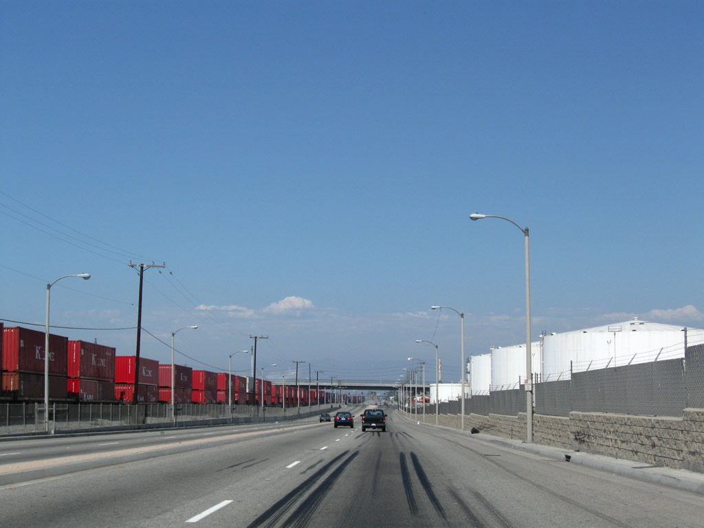
SR 47 runs between the Alameda Corridor and Tesoro Los Angeles Refinery along a controlled access section of Alameda Street north to Sepulveda Boulevard.
09/28/08
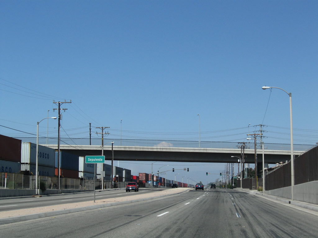
A viaduct takes Sepulveda Boulevard over Alameda Street east from between the Tesoro Carson Refinery and Los Angeles Refiner.
09/28/08
A four lane access road connects Alameda Street with Sepulveda Boulevard east to Willow Street and the north end of SR 103 (Terminal Island Freeway) or west to Torrance.
09/28/08
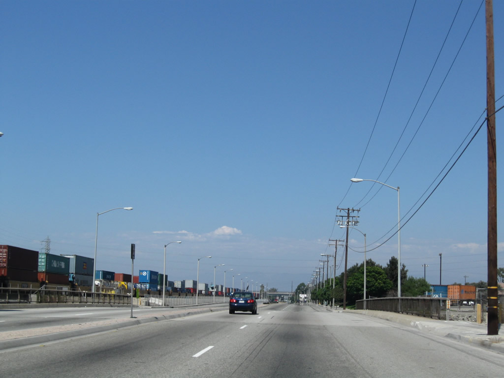
Crossing Dominguez Channel, Alameda Street north leaves Los Angeles and enters the city of Carson. With the city of motto of "Future Unlimited", Carson had a population 91,714 as of the 2020 Census, and incorporated on February 20, 1968.
09/28/08
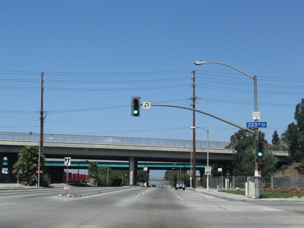
A viaduct takes 223rd Street over Alameda Street beyond this signalized intersection with the access road joining the two urban arterials.
09/28/08
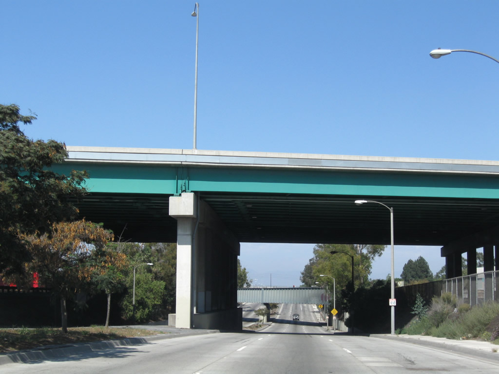
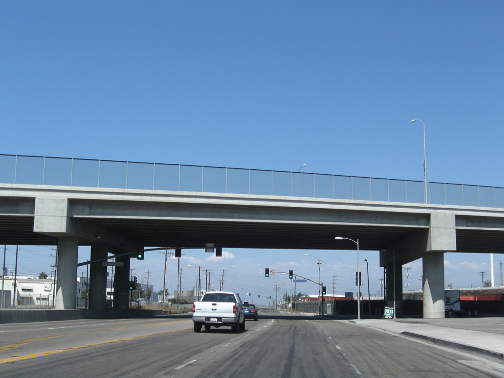
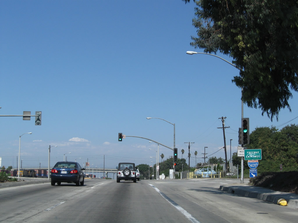
Interstate 405 (San Diego Freeway) spans Alameda Street across a high viaduct paralleling 233rd Street to the north.
09/28/08
A railroad bridge to the Union Pacific Railroad Intermodel Container Transfer Facility passes over Alameda Street north of I-405.
09/28/08
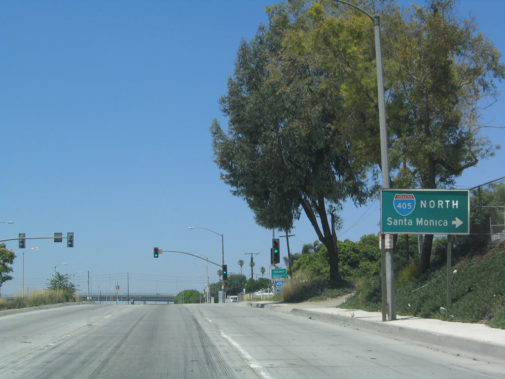
An entrance ramp joins Alameda Street with Interstate 405 north directly. Access to the San Diego Freeway southbound from SR 47 requires using E 223rd Street.
05/30/04
Interstate 405 travels northwest to Los Angeles International Airport (LAX), Inglewood and Santa Monica.
09/28/08
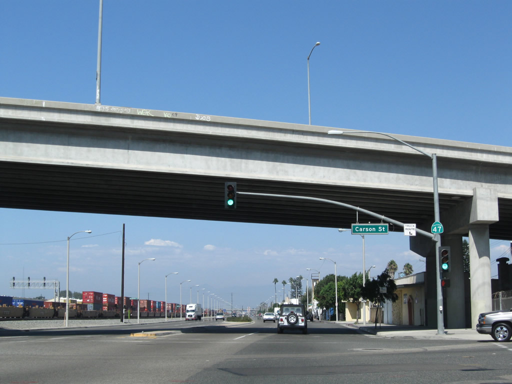
Alameda Street north meets Carson Street at a grade separated intersection.
09/28/08
A series of streets named after United States Presidents tie into Alameda Street from the adjacent Dominguez neighborhood.
09/28/08
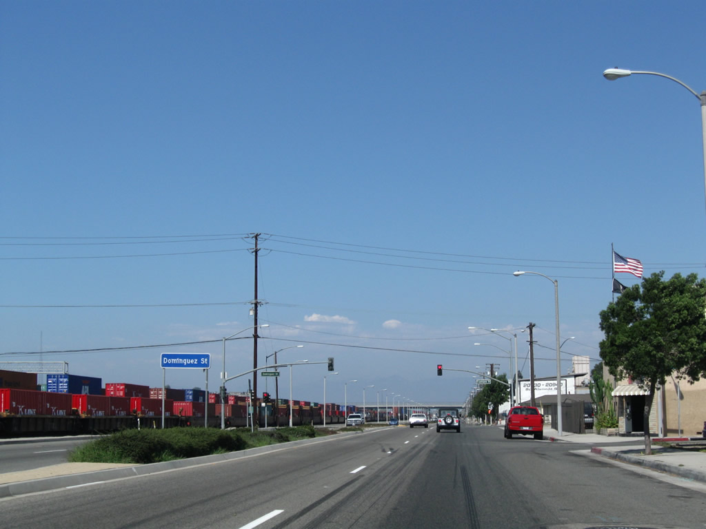
Dominguez Street stems east from Alameda Street to Santa Fe Avenue by an area of distribution centers and warehouses. A discontinous section of Dominguez Street lies west of the parallel Amameda Corridor.
09/28/08
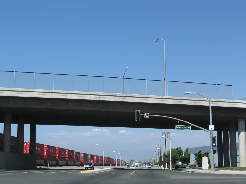
Alameda Street leaves the city of Carson and enters unincorporated Rancho Dominguez at the grade separated intersection with Del Amo Boulevard.
09/28/08
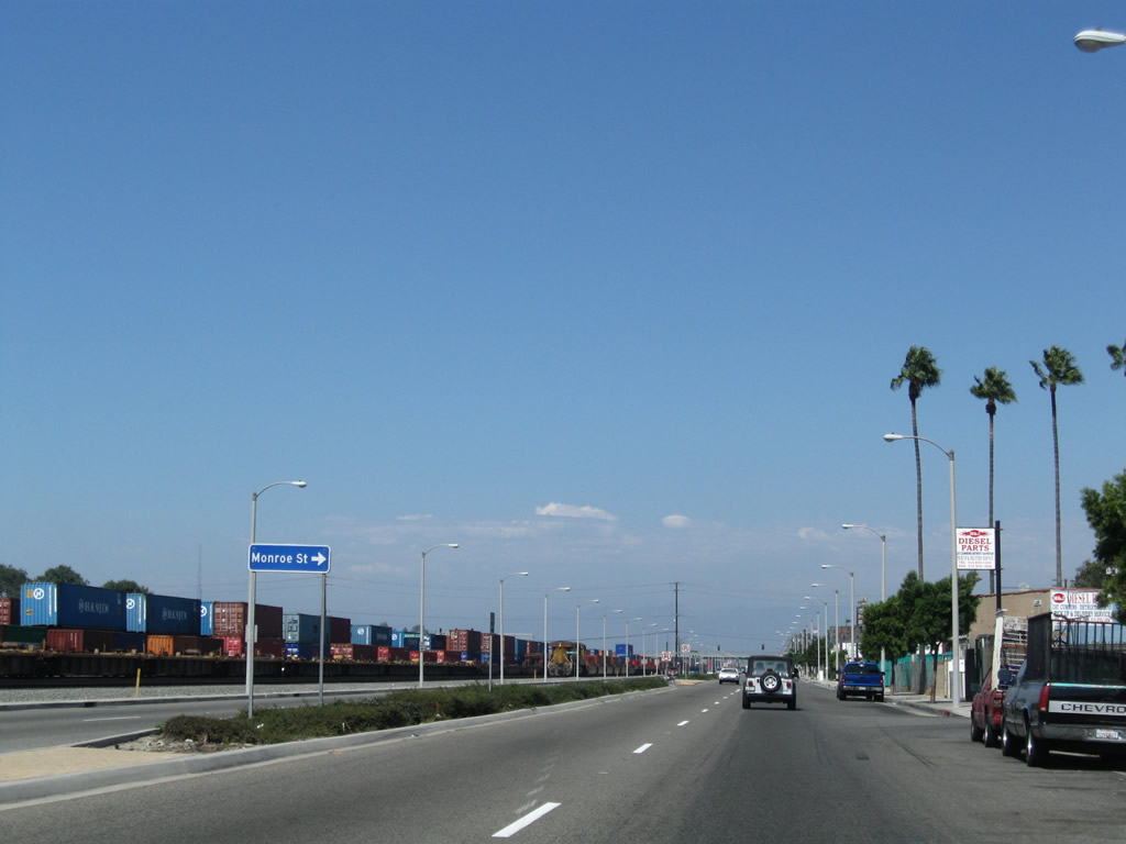
Santa Fe Avenue shifts westward to pass just east of SR 47 (Alameda Street). The northern section of the arterial branches northeast from a wye intersection with Alameda Street to industrial areas across Compton Creek.
09/28/08
The SR 47 reassurance marker at Santa Fe Avenue in Rancho Dominguez was removed by 2021.
09/28/08
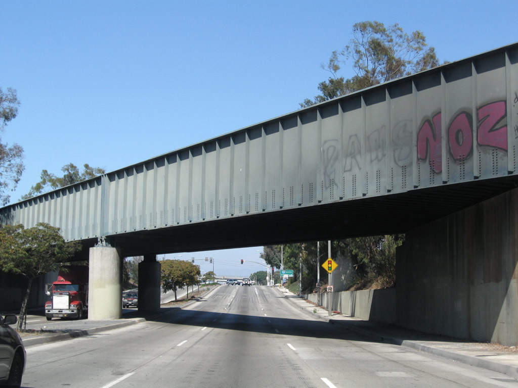
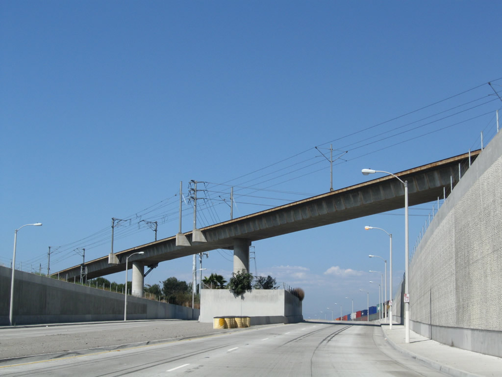
Alameda Street passes under a massive viaduct built in 2004 to support the Alameda Corridor and Union Pacific Railroad.
09/28/08
SR 47 next passes under the Metro Blue Line, which provides a light rail connection between Union State in Downtown Los Angeles and Long Beach at Long Beach Boulevard and First Street just north of the convention center.
09/28/08
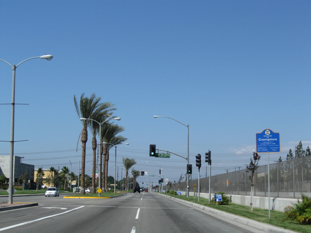
Paralleling the Union Pacific Railroad and Compton Creek, SR 47 (Alameda Street) proceeds north past Homestead Place into the city of Compton. Incorporated May 11, 1888, Compton had a population of 95,740 as of the 2020 Census.
09/28/08
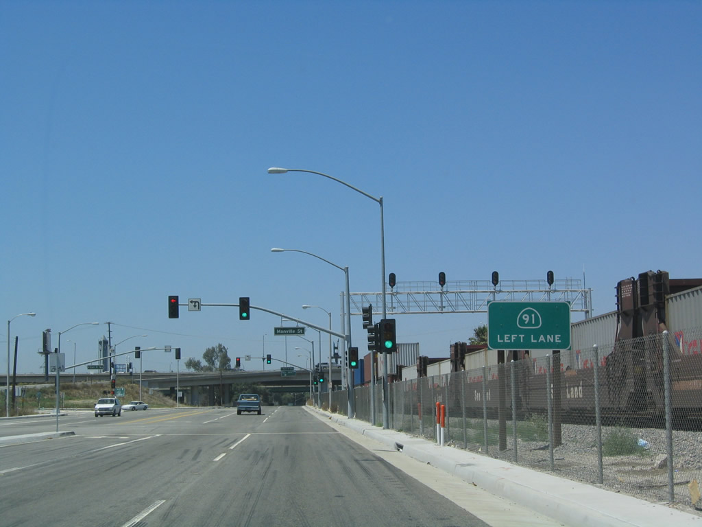
Manville Street ties into SR 47 (Alameda Street) just ahead of the ramps with SR 91 (Gardena Freeway) eastbound.
05/30/04
A flyover ramp links Alameda Street with SR 91 (Gardena Freeway) eastbound to Anaheim and Riverside directly.
09/28/08
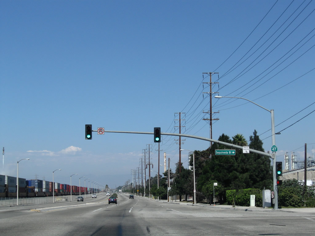
The succeeding left turn from Alameda Street north is for the access road to Artesia Boulevard. Artersia Boulevard connects with SR 91 (Gardena Freeway) west at Acacia Avenue.
09/28/08
Alameda Street spans Compton Creek below the elevated lanes of the Gardena Freeway.
09/28/08
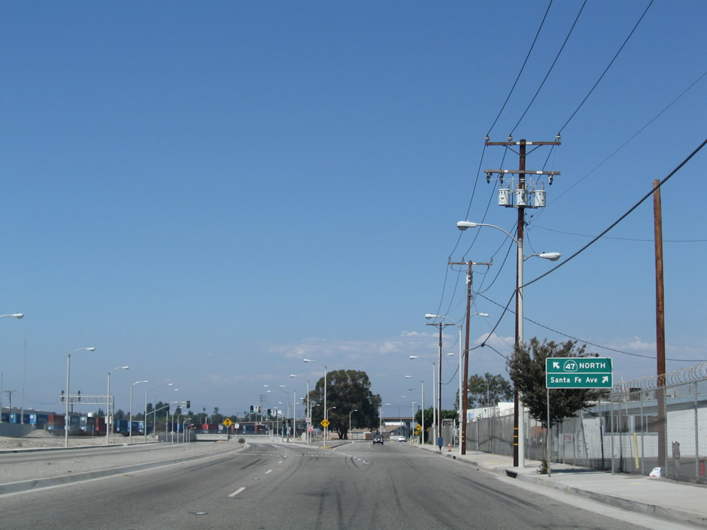
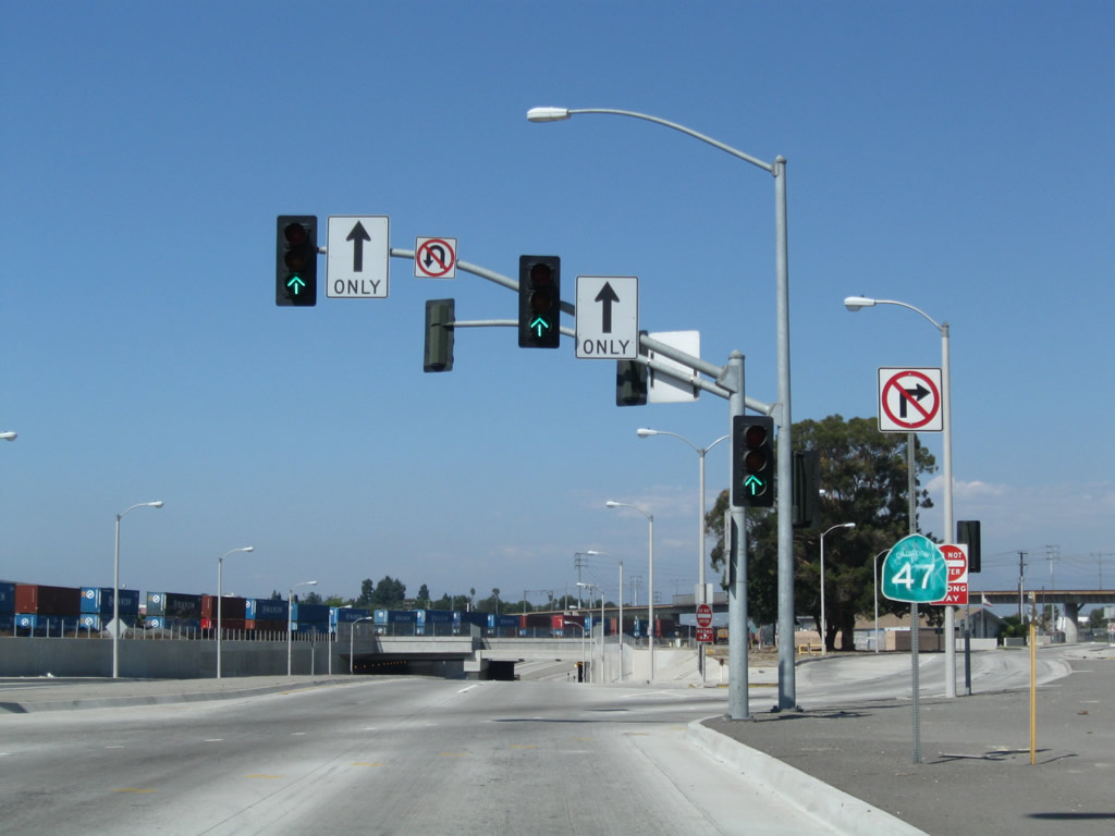
The California State Route 47 designation along Alameda Street ends at the grade separation with SR 91. Artersia Boulevard spans the arterial to the immediate north.
09/28/08
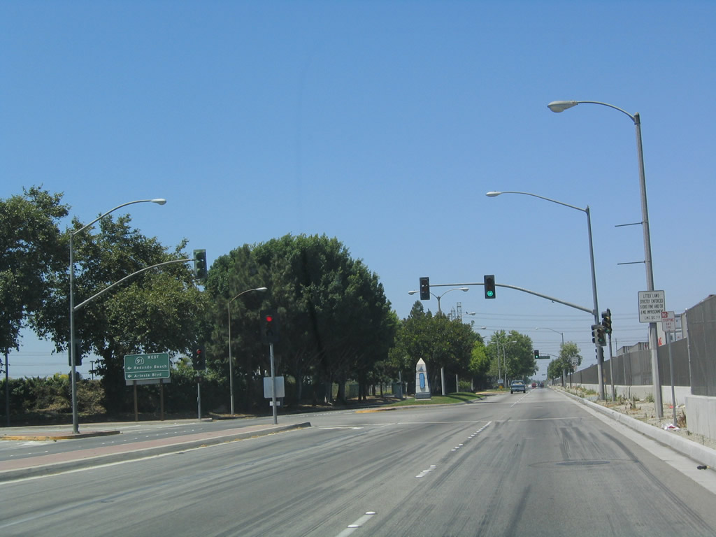
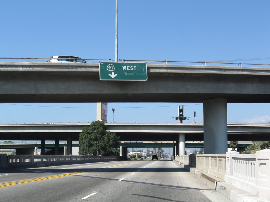
Trucks are assumed to use the Gardena Freeway from Alameda Street here to deliver cargo. West from Compton, SR 91 travels toward Manhattan Beach and Redondo Beach.
05/30/04
A large big box retail complex lines the west side of Alameda Street north of Artersia Boulevard in Compton.
09/28/08
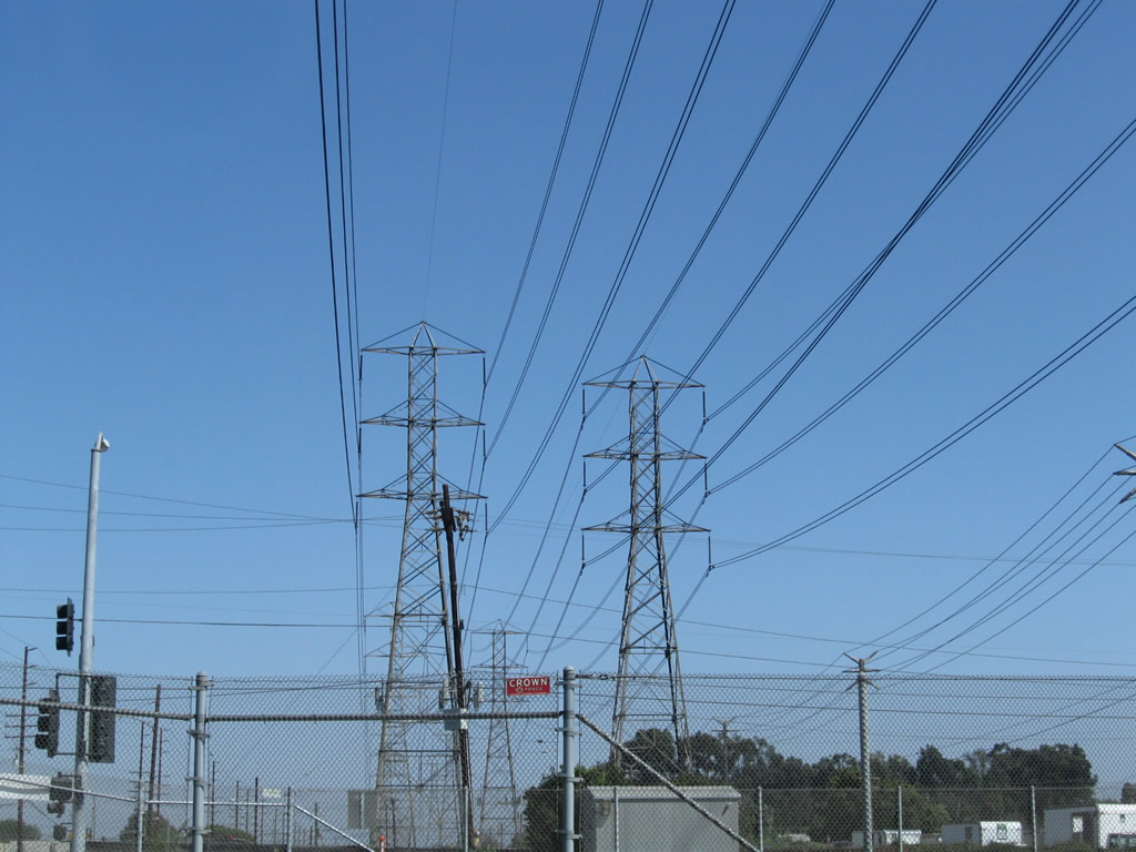
A set of Southern California Edison power lines cross over Alameda Street and the adjacent Alameda Corridor / Union Pacific Railroad by Greenleaf Boulevard.
09/28/08
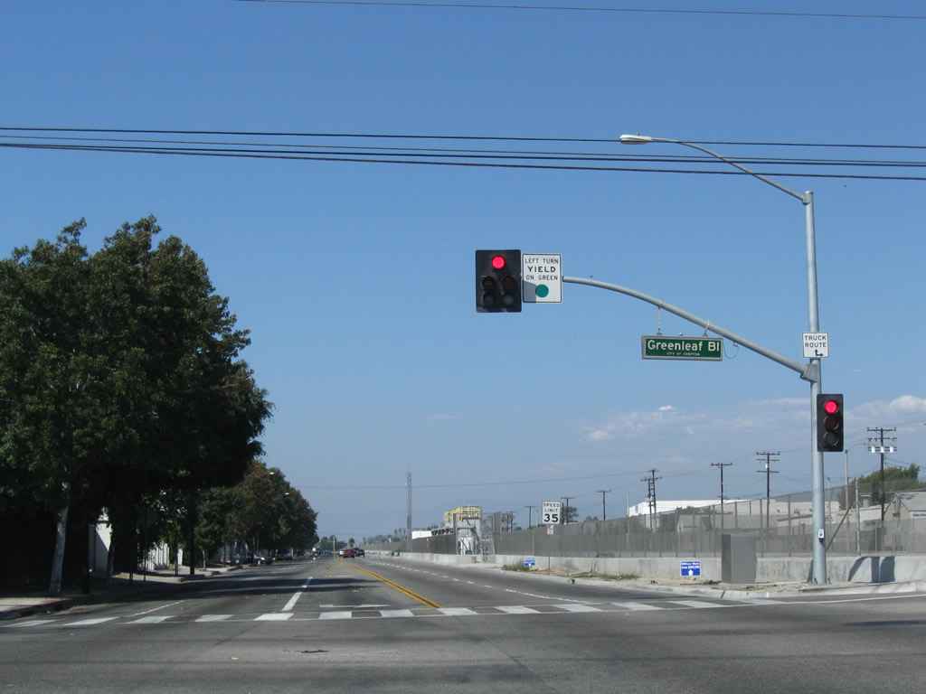
Northbound Alameda Street at Greenleaf Boulevard. In an effort to reduce noise and traffic congestion due to the major Union Pacific Railroad alignment through Compton, the Alameda Corridor project lowered the tracks into a trench that extends from just north of SR 91. This allows for minimal impacts for traffic.
09/28/08
References:
- San Pedro: Vincent Thomas Bridge History. http://www.sanpedro.com/sp_point/vtbrdg.htm
- Schuyler Heim Bridge Replacement and SR-47 Expressway Project Record of Decision, August 2009. http://www.dot.ca.gov/dist07/resources/envdocs/docs/SR47_ROD_Final.pdf
Photo Credits:
- Andy Field: 05/30/04, 09/28/08, 07/09/18
Connect with:
Page Updated Friday August 01, 2025.