
State Route 54
California 54 is a two-part route: (1) western segment, a freeway the Filipino-American Highway (originally called the South Bay Freeway) between Interstate 5 and California 125 and (2) eastern segment from California 94 to El Cajon.
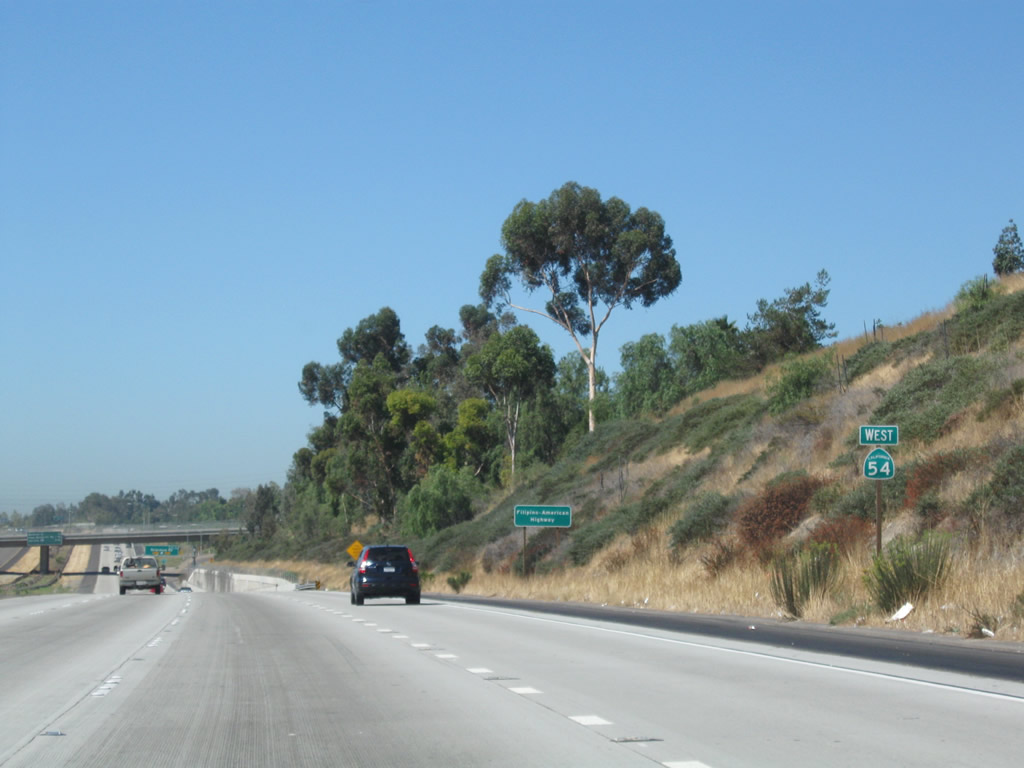
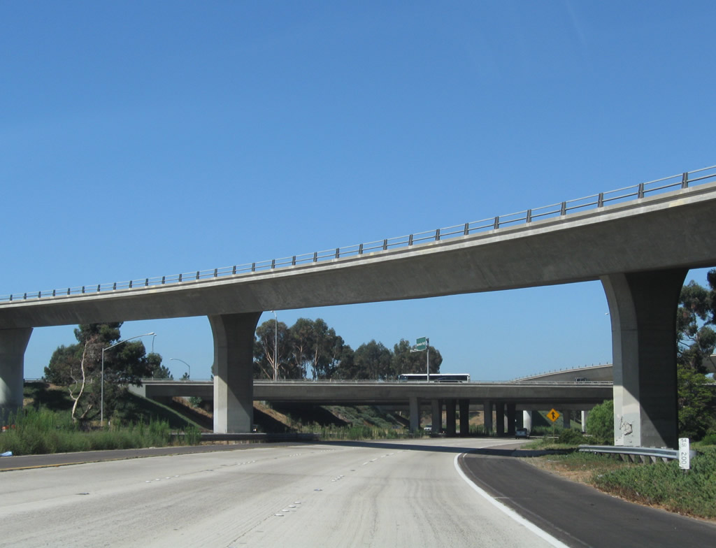
The western segment of California 54 is a freeway. With the completion of the final freeway segment connecting California 54 to California 125, the California 54 freeway was renamed the Filipino-American Highway on October 6, 2007. California 54 straddles the Sweetwater River between Interstate 5 and Interstate 805 (separating National City and Chula Vista), then turning northeasterly toward the Paradise Hills community of San Diego and the unincorporated community of Bonita. The freeway is a full freeway all the way to the newly opened section of California 125 near the Jamacha Road interchange (San Diego County Route S-17). It is arguable as to whether California 54 merges with California 125 between the South Bay Expressway toll road and Jamacha Road. A gap in the route currently exists between the Jamacha Road interchange and California 94; the gap is signed as San Diego County Route S-17 and is locally maintained.
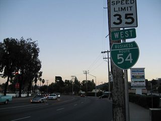
The eastern segment of California 54 is a conventional highway between California 94 and the El Cajon City Limits. Prior to 1999, the state route continued all the way to Interstate 8 via California 54 Business along Jamacha Road and N 2nd Street. This segment was decommissioned as part of a statewide effort to relinquish local city streets within the state highway system to the appropriate municipality. Signage for the business route is maintained by El Cajon.
The two sections of California 54 are proposed to be connected by an expressway or freeway roughly parallel to Jamacha Road (San Diego County Route S-17), but such a highway is not even in preliminary planning stages at this time. In addition, a new expressway or freeway for California 54 to bypass El Cajon to the east is planned, but such a route has not been identified.
California State Route 54 Guides
SR 54 Business - El Cajon - 13 photos
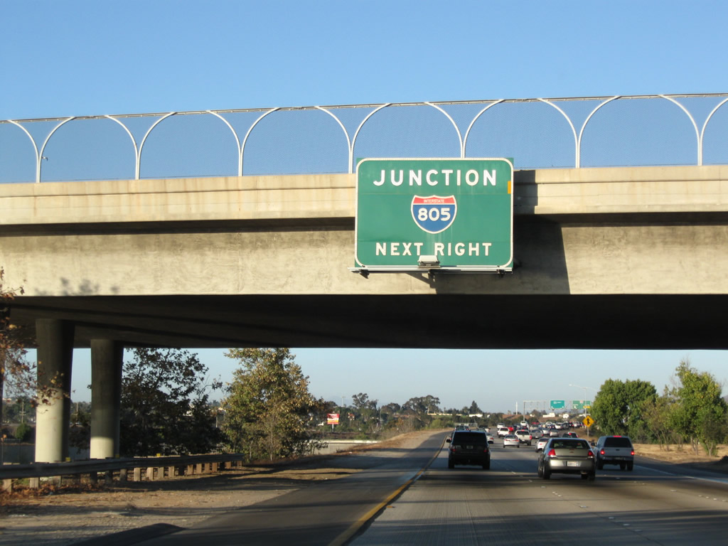
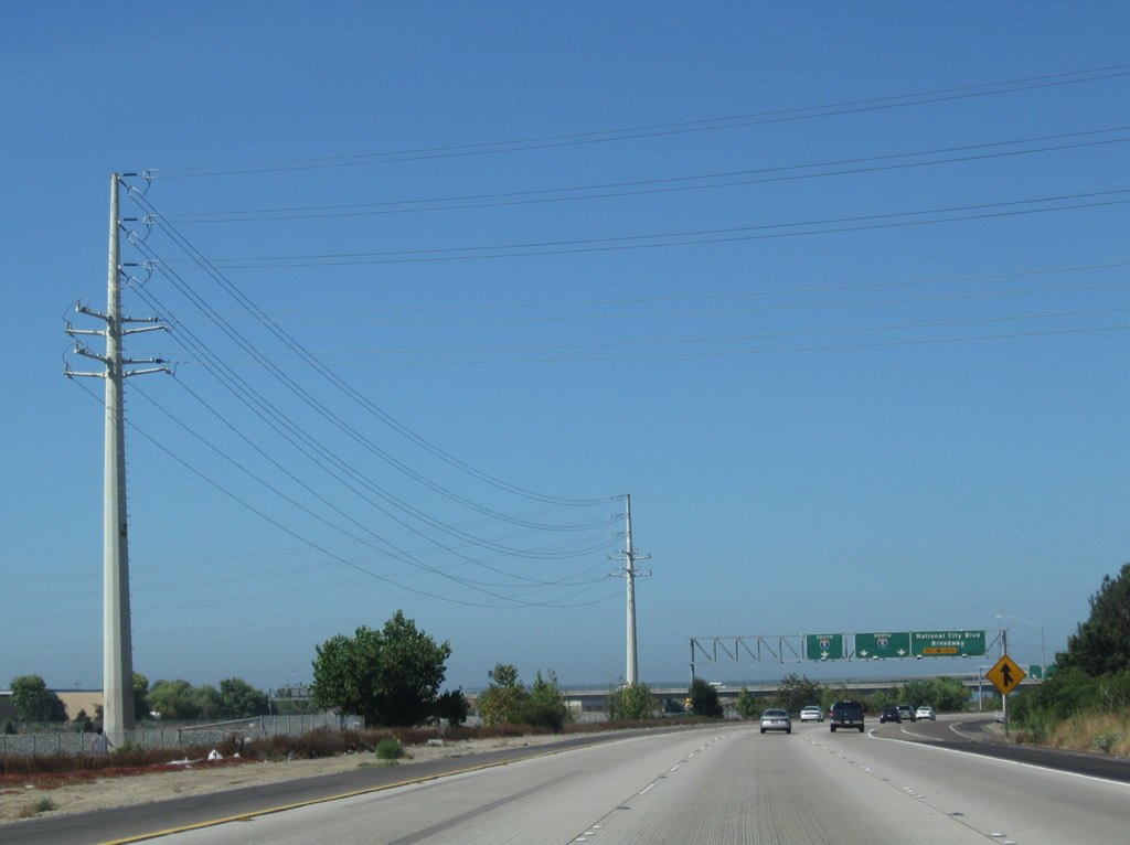
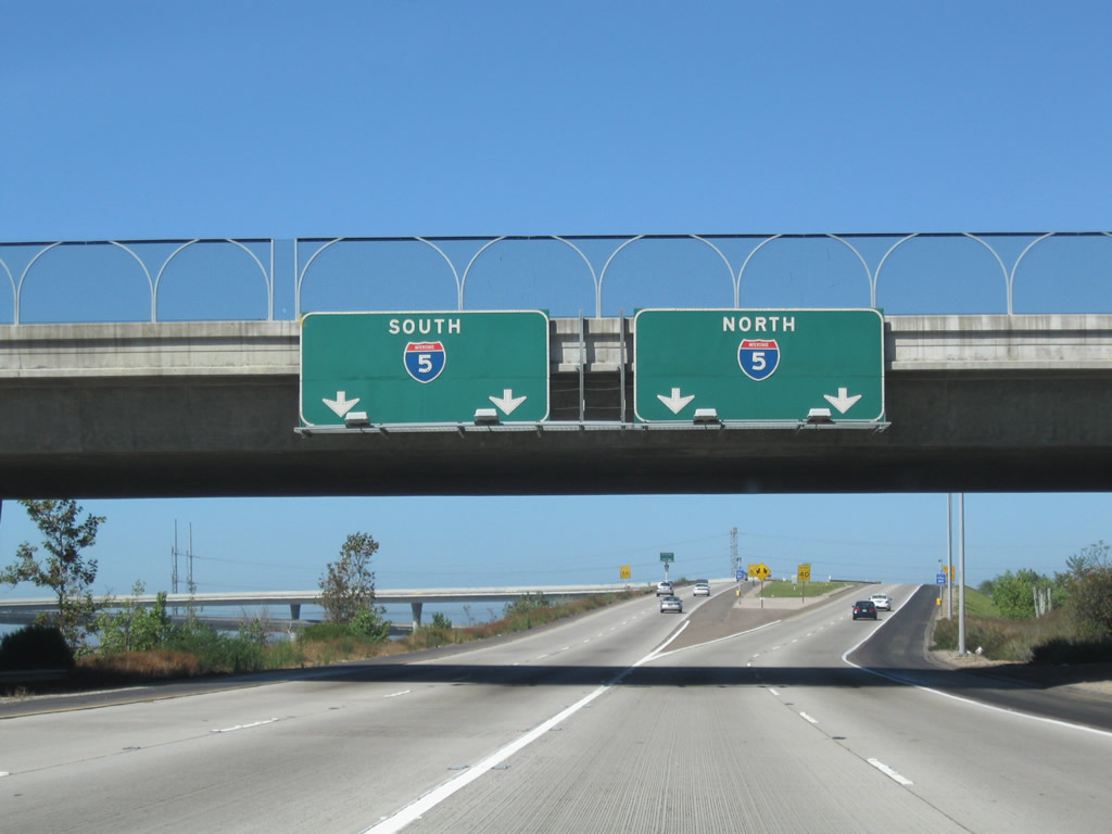
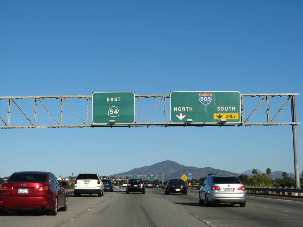
Turning from San Diego County S-17/E Street, the on-ramp north connects to both Interstate 5 (Montgomery Freeway) north and California 54 (Filipino-American Highway).
01/18/09
The left two lanes connect to Interstate 5 north, while the right lane links to California 54 east.
01/18/09
Staying right to connect with California 54 east, the single-lane ramp is at a different elevation from the ramp to Interstate 5 north.
01/18/09
The ramp from E Street joins the ramp from Interstate 5 north.
01/18/09
Two lanes connect Interstate 5 (Montgomery Freeway) south with California 54 (Filipino-American Highway) east. Below the interchange, the Sweetwater River courses between the two directions of California 54 freeway.
03/23/06
The two lanes will merge into one lane before connecting with the oncoming traffic from Interstate 5 north.
12/02/07
Unlike westbound California 54, there is no access from California 54 east to Old U.S. 101 (Broadway). Use Exit 1 to make connections to the local street grid in National City and Chula Vista. Perspectives show the freeway's beginning from the transition ramps from Interstate 5 south and north.
12/02/07
01/19/09
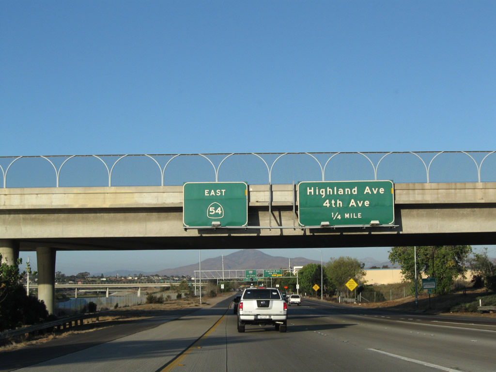
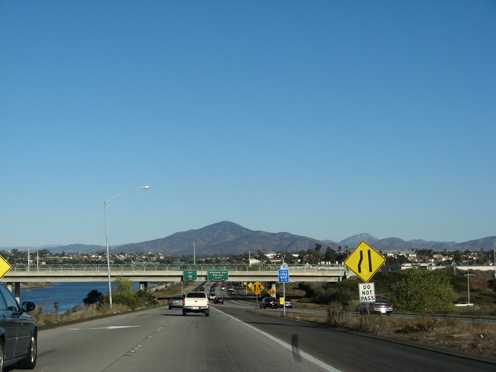
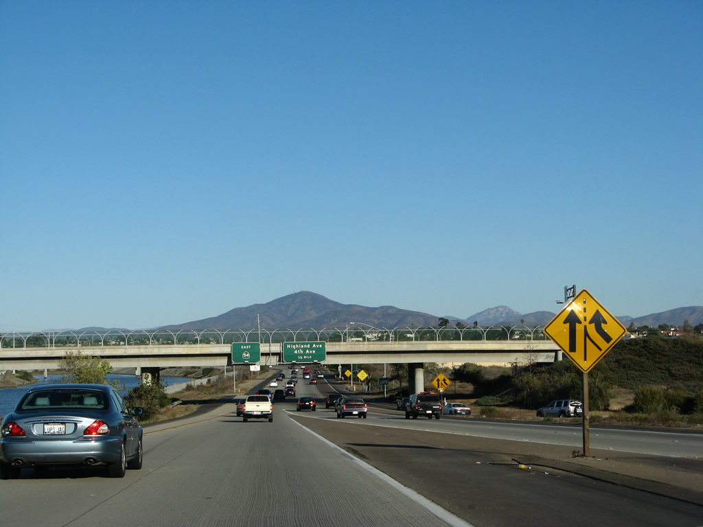
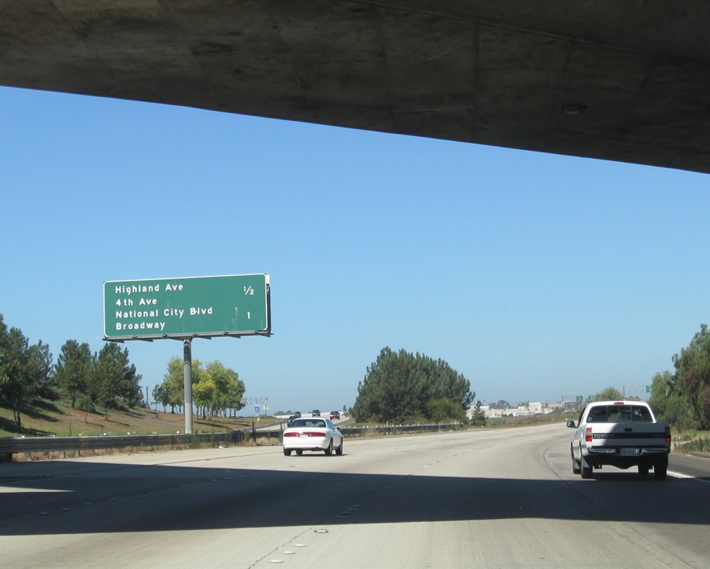
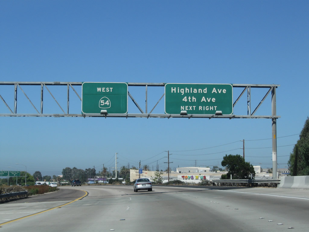
The first exit along California 54 (Filipino-American Highway) east is Exit 1, Highland Avenue north to National City and Fourth Avenue south to Chula Vista. California 54 more or less follows the city limits between National City and Chula Vista between Interstate 5 and Interstate 805. National City is home to 54,260 people according to the 2000 Census and consists of 9.2 square miles.
08/21/08
The right lane of eastbound California 54 (Filipino-American Highway) becomes exit only for Exit 1, Highland Avenue north and Fourth Avenue south. Chula Vista is estimated to have 201,210 people (as of 2003), and demographic estimates suggest that it will continue to grow at a high rate, especially as more residential properties are developed in the eastern part of the city (in the Eastlake and Otay Ranch communities).
08/21/08
Eastbound California 54 (Filipino-American Highway) reaches Exit 1, Highland Avenue north to National City and Fourth Avenue south to Chula Vista.
08/21/08
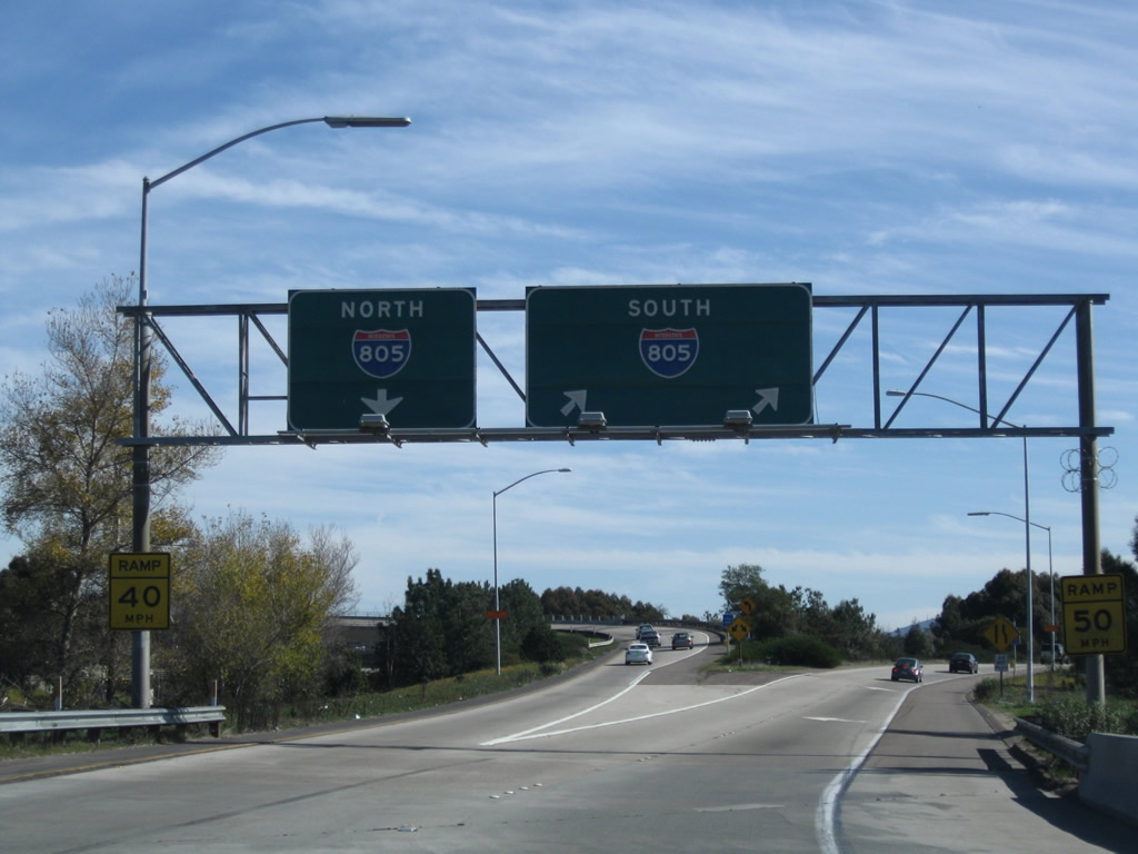
The next exit along California 54 east is Exit 2, Interstate 805.
08/21/08
The right two lanes connect to Interstate 805; the right lane becomes exit only for Interstate 805 (Dekema Freeway) south to Chula Vista and the International Border. To the north, Interstate 805 travels toward North Park, Mission Valley, Serra Mesa, Clairemont Mesa, and Sorrento Valley.
08/21/08
12/02/07
Eastbound California 54 (Filipino-American Highway) reaches Exit 2, Interstate 805. The left three lanes continue east on California 54; the through lanes were reconfigured to accommodate more traffic in 2008.
08/21/08
This view shows the signage for the transition ramp onto Interstate 805 north and south from eastbound California 54, both from the main lanes and from the transition ramp.
12/02/07
01/18/09
Eastbound California 54 approaches the Interstate 805 overpass and interchange. Traffic will merge into California 54 from the right.
03/23/06
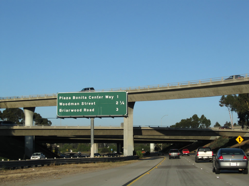
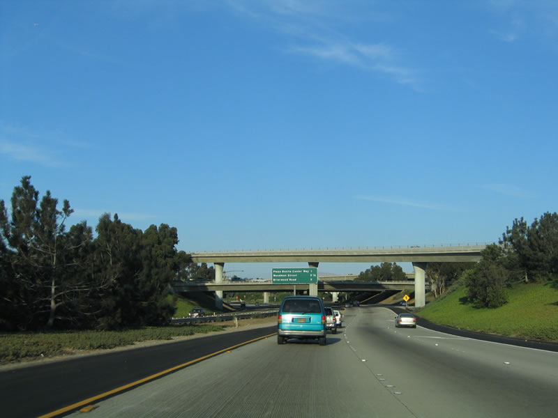
This mileage sign along California 54 east provides the distance to Exit 3, Plaza Bonita Center Way and Reo Drive; Exit 4, Woodman Street; and Exit 5, Briarwood Road.
08/21/08
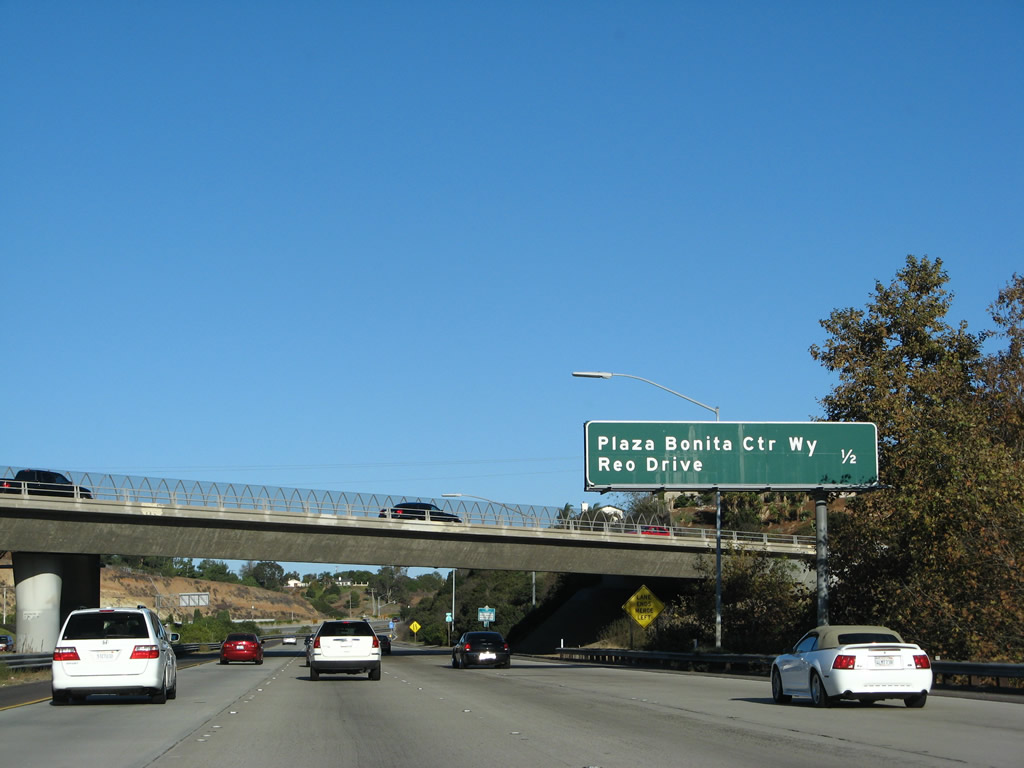
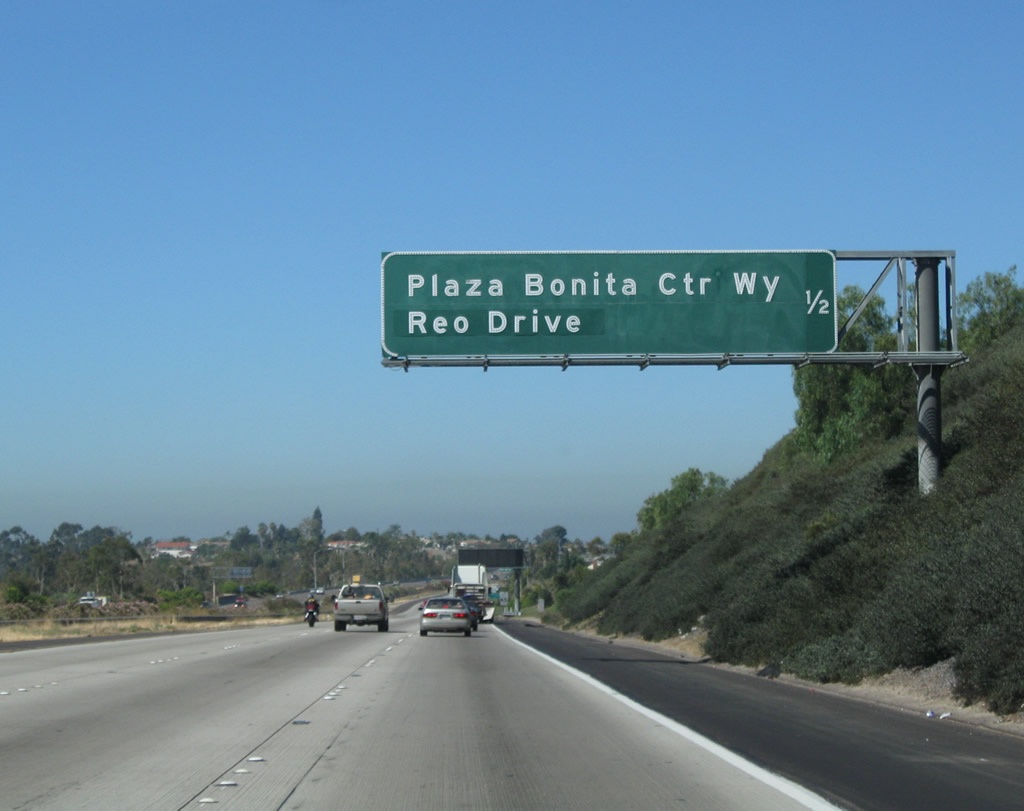
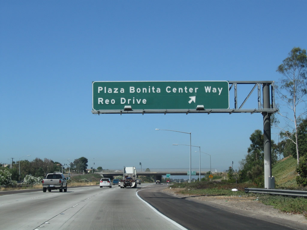
Eastbound California 54 approaches Exit 3, Plaza Bonita Center Way and Reo Drive, one-half mile. This overpass is for Sweetwater Road, which passes from the north side of the freeway to the south side of the freeway.
12/02/07
This reassurance shield for California 54 east was added in the mid-2000s.
03/23/06
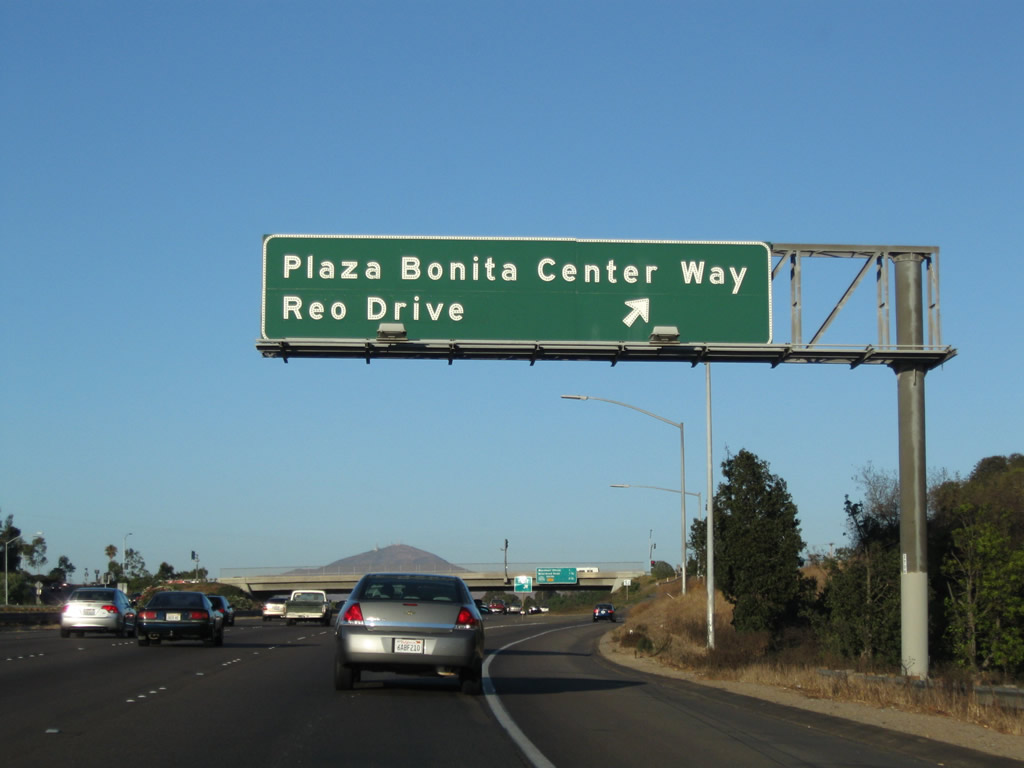
Eastbound California 54 reaches Exit 3, Plaza Bonita Center Way/Reo Drive. Plaza Bonita Center Way leads south to connect with Sweetwater Road, while Reo Drive leads north into Paradise Hills, a community of San Diego.
08/21/08
On on the off-ramp for Exit 3, turn left to follow Reo Drive north or turn right to follow Plaza Bonita Center Way south to Sweetwater Road.
08/21/08
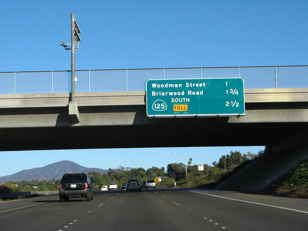
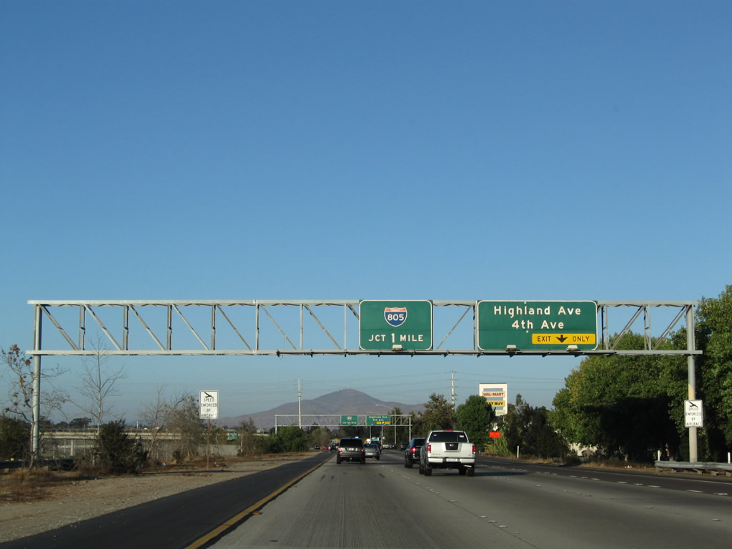
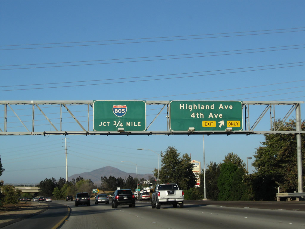
This mileage sign along California 54 east provides the distance to the next three exits: Exit 4, Woodman Street; Exit 5, Briarwood Road; and Exit 6, California 125 (South Bay Expressway) south. The mileage sign was replaced in 2007 with the opening of the southern extension of California 125; previously, the sign also included the distance to Exit 7, Jamacha Boulevard and Paradise Valley Road.
12/02/07
03/23/06
A California 54 east reassurance shield is posted after the Reo Drive on-ramp and prior to the Woodman Street interchange.
03/23/06
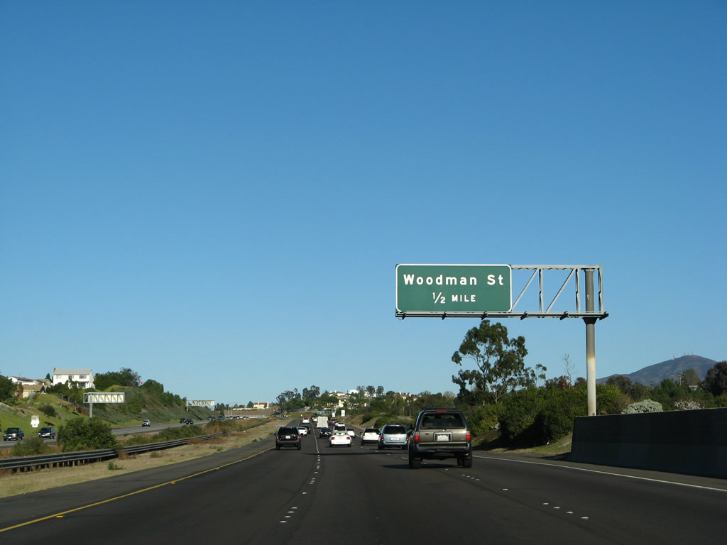
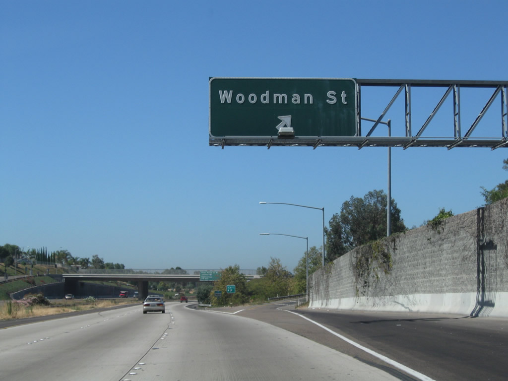
The next exit along California 54 (Filipino-American Highway) is Exit 4, Woodman Street, one-half mile.
12/02/07
Eastbound California 54 reaches Exit 4, Woodman Street. Woodman Street only heads north into Paradise Hills.
12/02/07
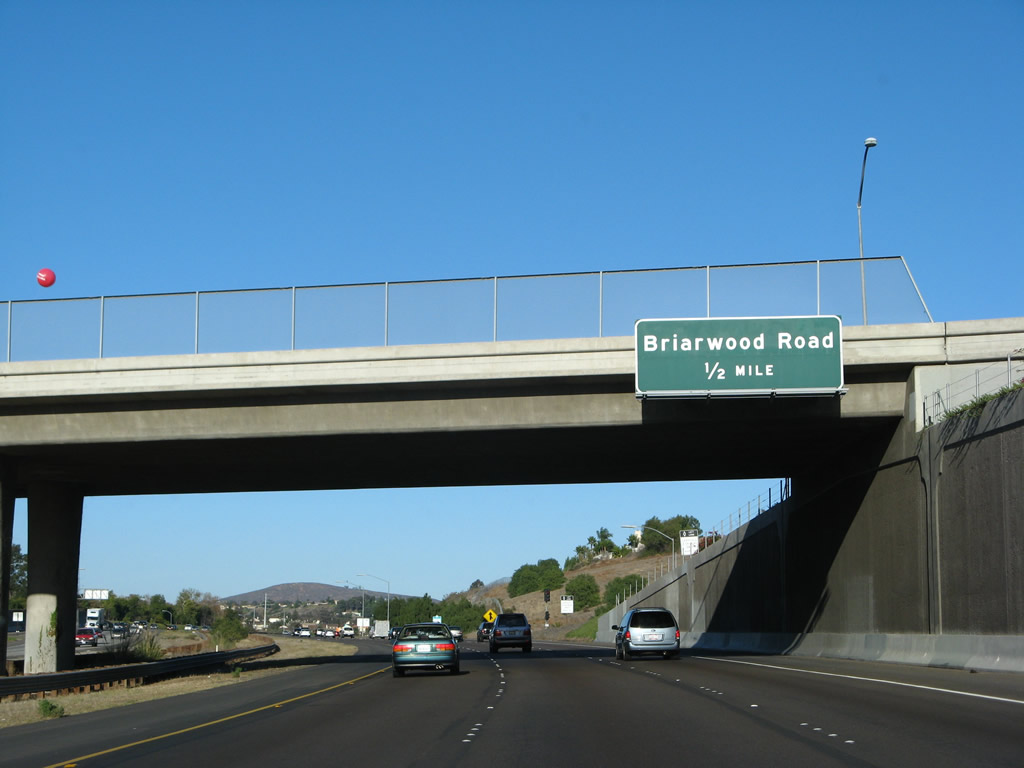
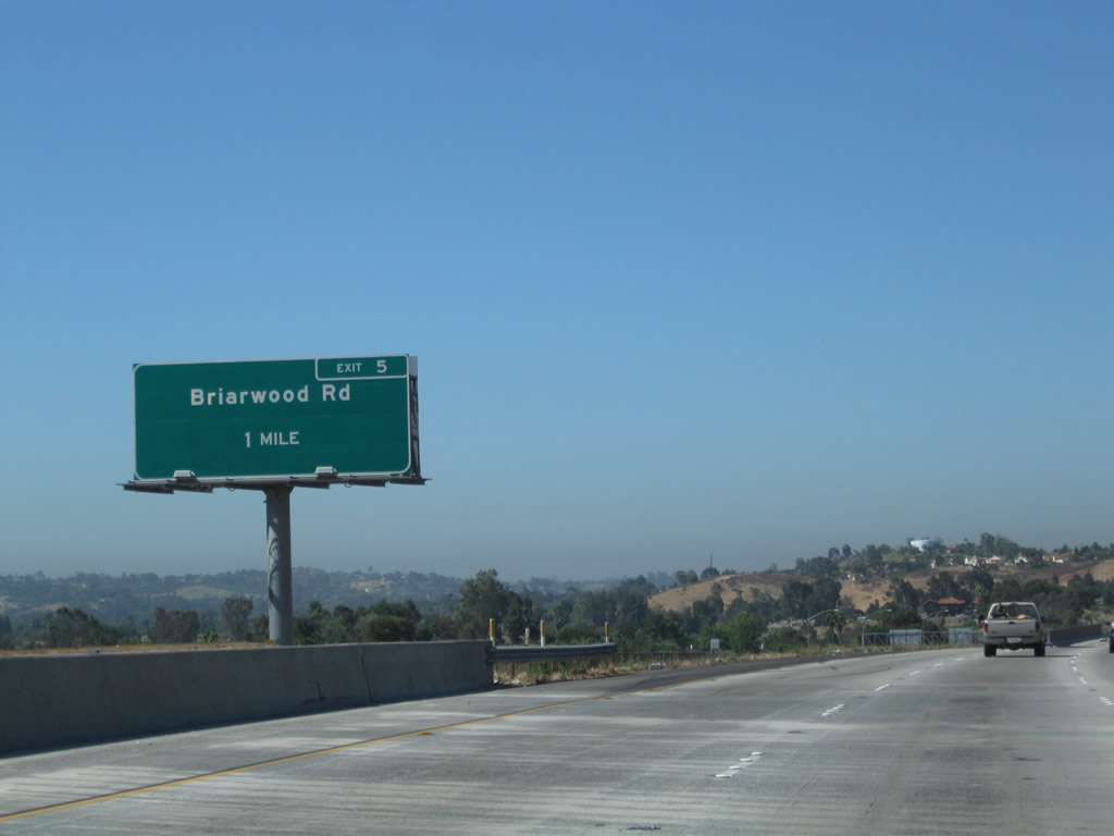
The next exit along eastbound California 54 is Exit 5, Briarwood Road, one-half mile (the sign is posted on the Woodman Street overpass). This exit leads north into Paradise Hills and south into central Bonita.
12/02/07
Another California 54 reassurance shield is posted between Woodman Street and Briarwood Road.
12/02/07
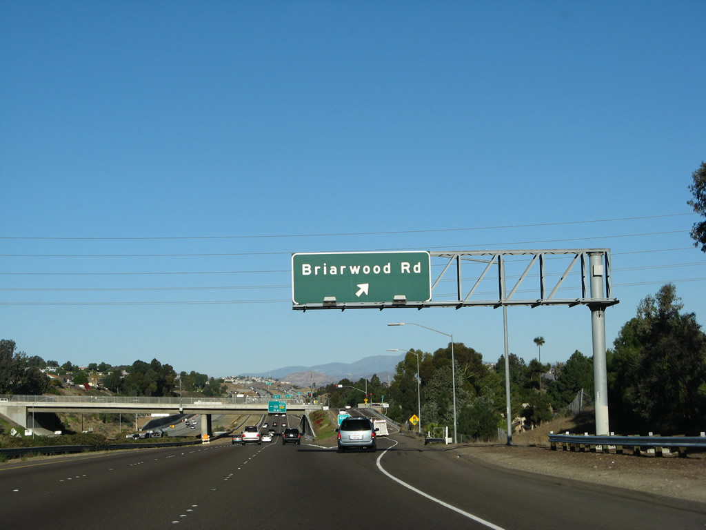
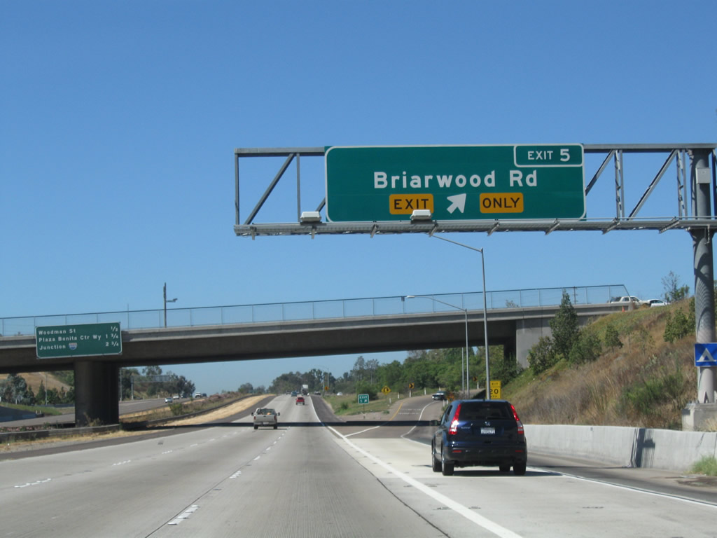
Eastbound California 54 (Filipino-American Highway) reaches Exit 5, Briarwood Road.
12/02/07
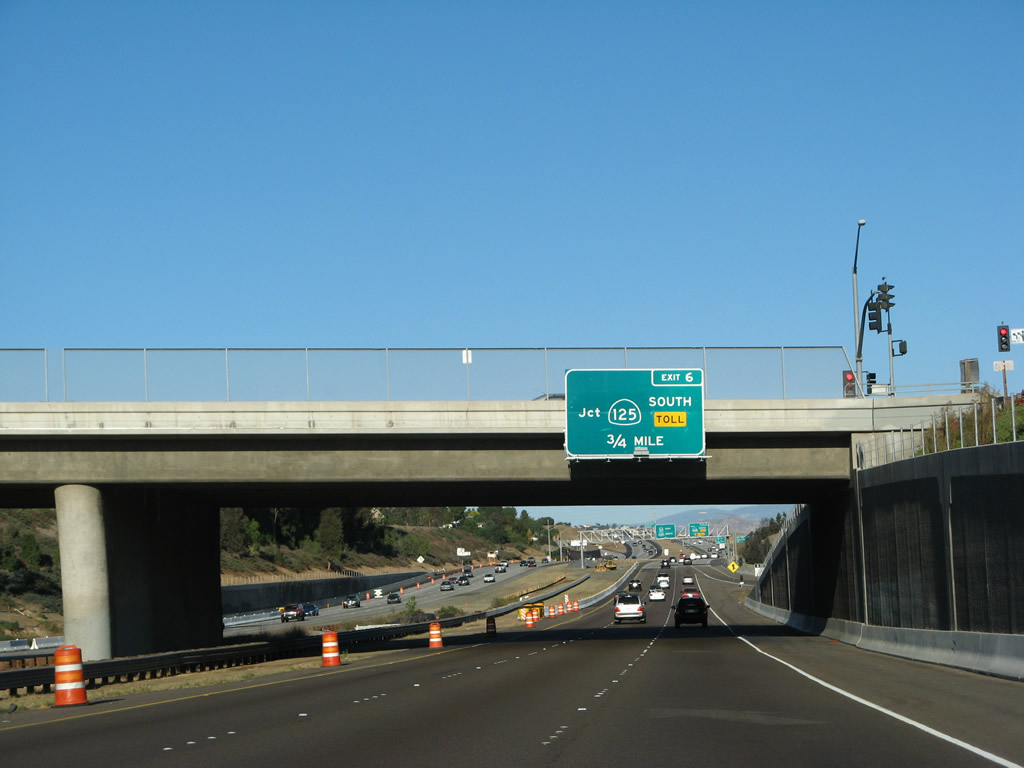
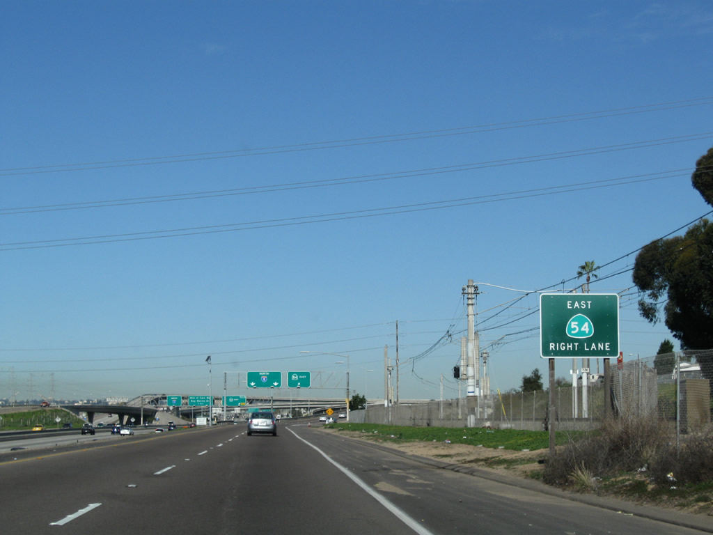
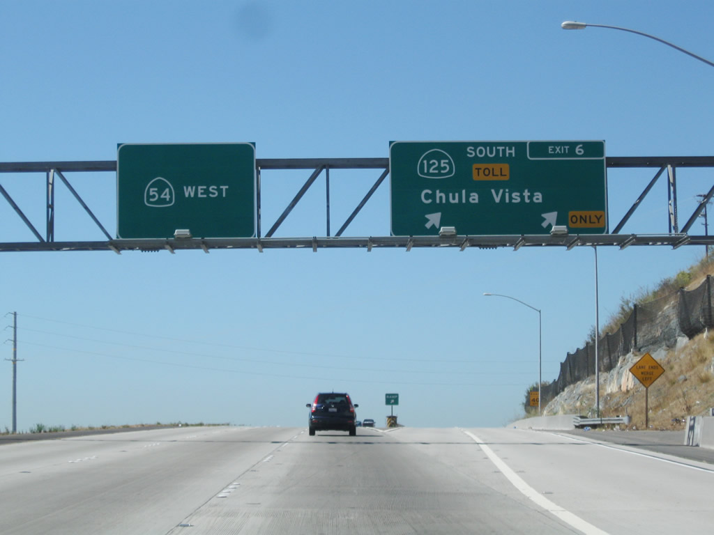
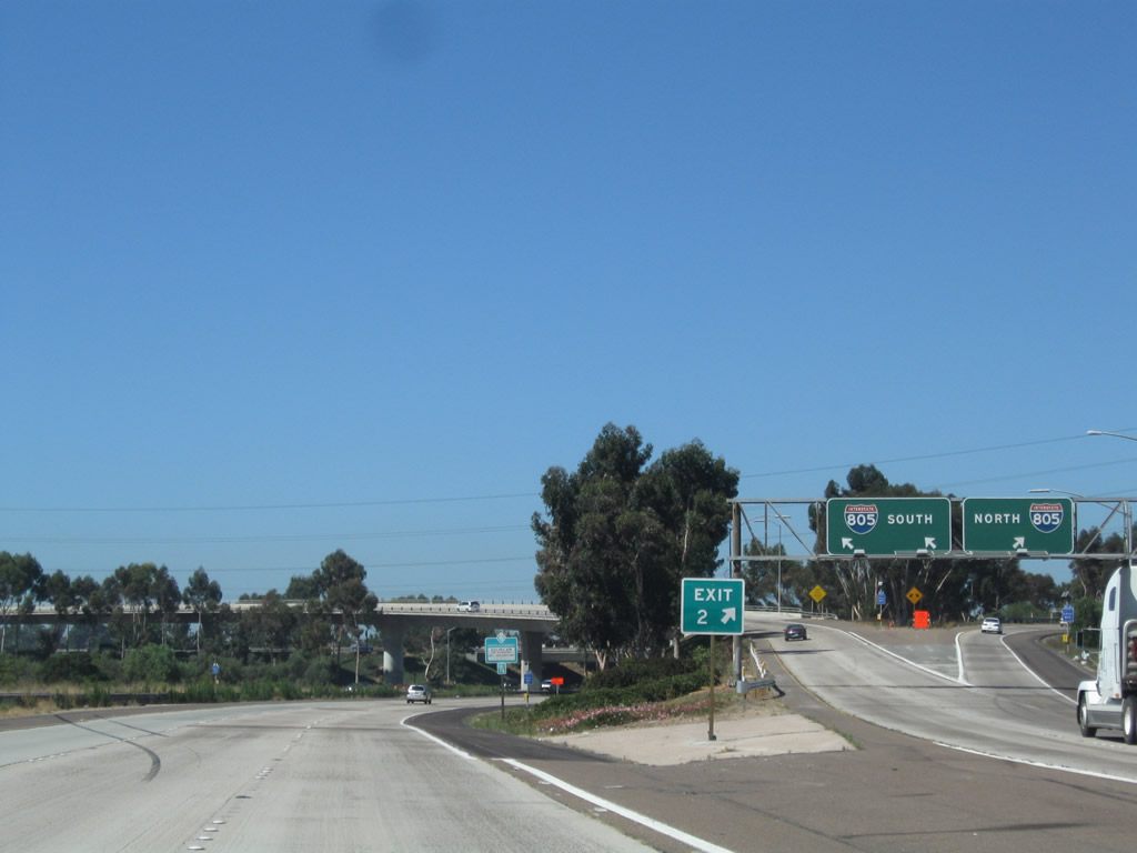
The next exit along eastbound California 54 is Exit 6, Toll California 125 south to Chula Vista (Eastlake and Otay Ranch) and the Otay Mesa International Border Crossing. There is no direct access to Sweetwater Road, despite the former presence of a traffic signal near this location. To Sweetwater Road, use either Exit 5 or Exit 7.
12/02/07
The right lane of California 54 (Filipino-American Highway) east drops at Exit 6 for California 125 south.
12/02/07
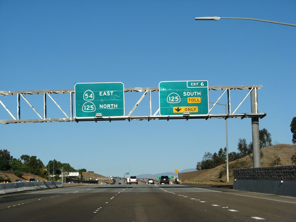
The left three lanes of California 54 (Filipino-American Highway) continue east on California 54 and connect to California 125 north to La Mesa, El Cajon, and Santee.
12/02/07
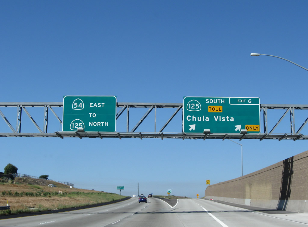
Eastbound California 54 (Filipino-American Highway) reaches Exit 6 for SR 125 (South Bay Expressway) south to Chula Vista and the International Border. The left three lanes continue east to California 125 north.
07/12/09
Two lanes carry the transition ramp from California 54 (Filipino-American Highway) east to Toll California 125 south. The freeway interchange is situated adjacent to Sweetwater Dam.
12/02/07
07/12/09
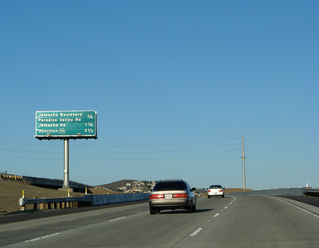
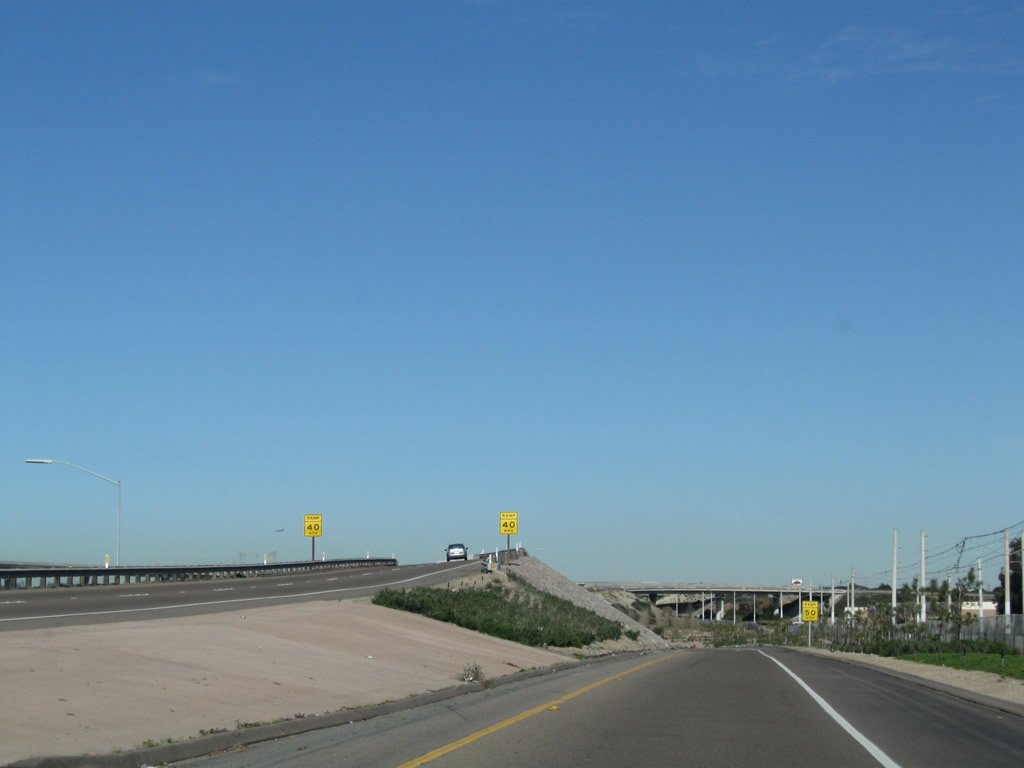
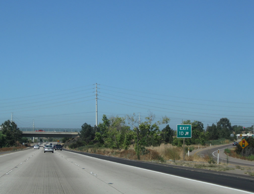
The next exit along eastbound California 54 is California 125's Exit 12, San Diego County S-17 (Jamacha Boulevard) east and Paradise Valley Road. The other exits listed on this interchange sequence sign are found along California 125 north as it passes through unincorporated Spring Valley.
12/02/07
California 54 passes over the California 125 interchange. In the distance, traffic from California 125 north will merge onto California 54 east.
12/02/07
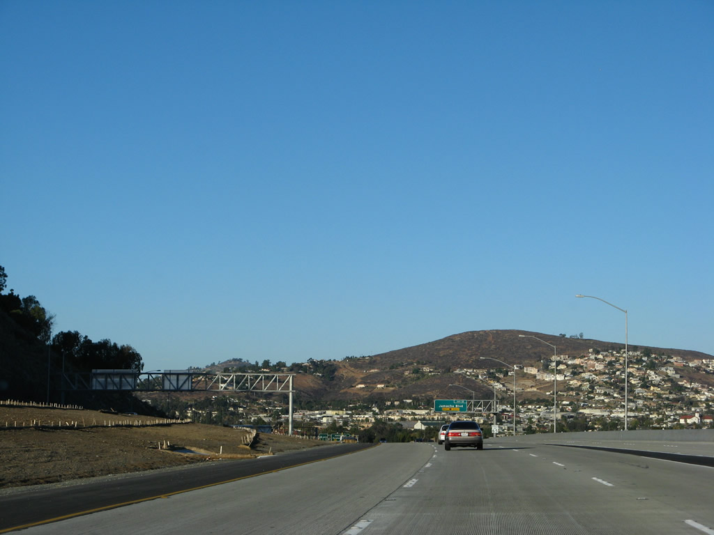
California 54 ends as California 125 traffic merges onto the freeway. There is no end shield. The next exit is Exit 12, Jamacha Boulevard.
12/02/07
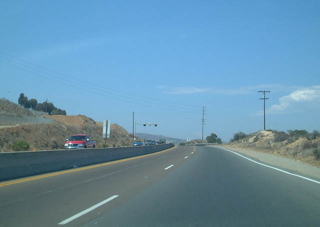
This view shows California 54 east after the Sweetwater Road traffic signal.
07/27/02
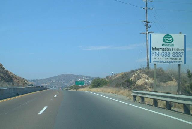
A California 125 Corridor information signage was placed along eastbound California 54 between Sweetwater Road and Jamacha Boulevard to advise motorists of changing conditions along the then-future freeway corridor.
07/27/02
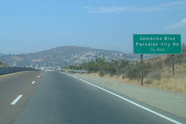
The next exit along California 54 was former Exit 7, Jamacha Boulevard and Paradise Valley Road (this is now Exit 12 for California 125). This sign was placed when the transition between eastbound California 54 and northbound California 125 was completed in Spring 2002; it was gone by 2007 once California 125's southern extension was completed.
07/27/02
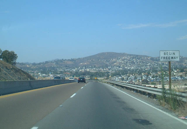
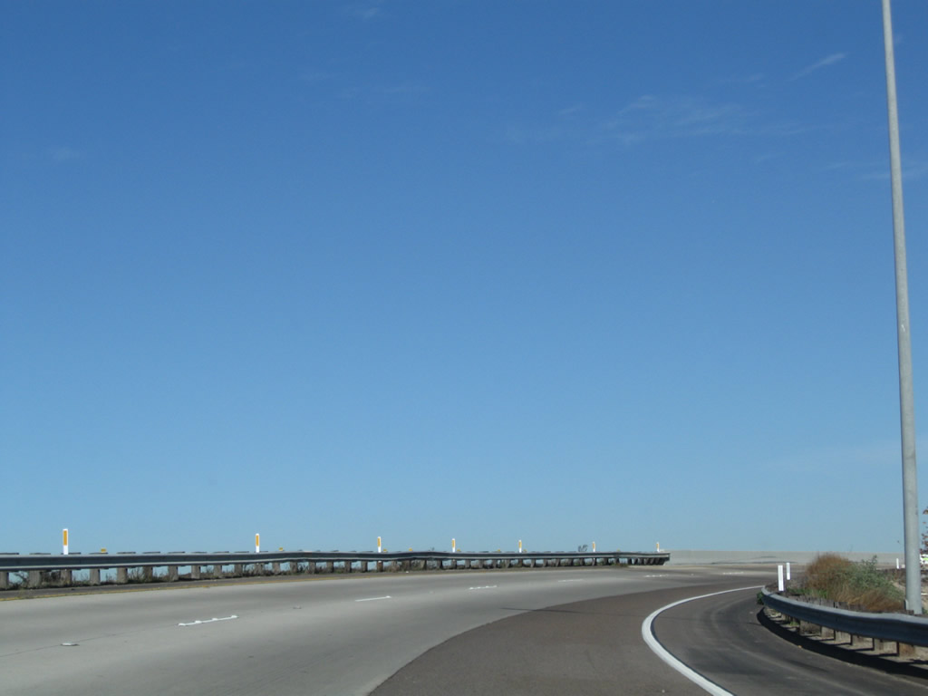
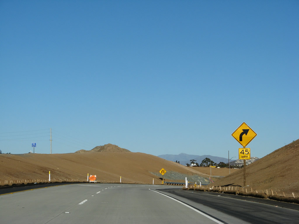
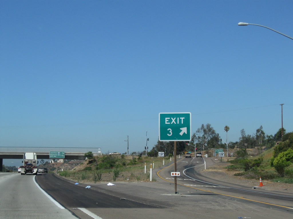
Eastbound California 54 enters Spring Valley. This narrow expressway segment has since been upgraded to full freeway status, but at the time this picture was taken, California 54 only resumed its freeway status at this point, just before the Jamacha Boulevard interchange.
07/27/02
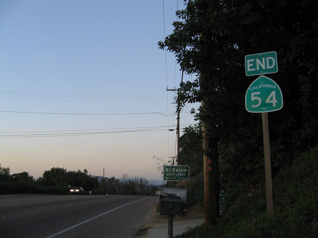
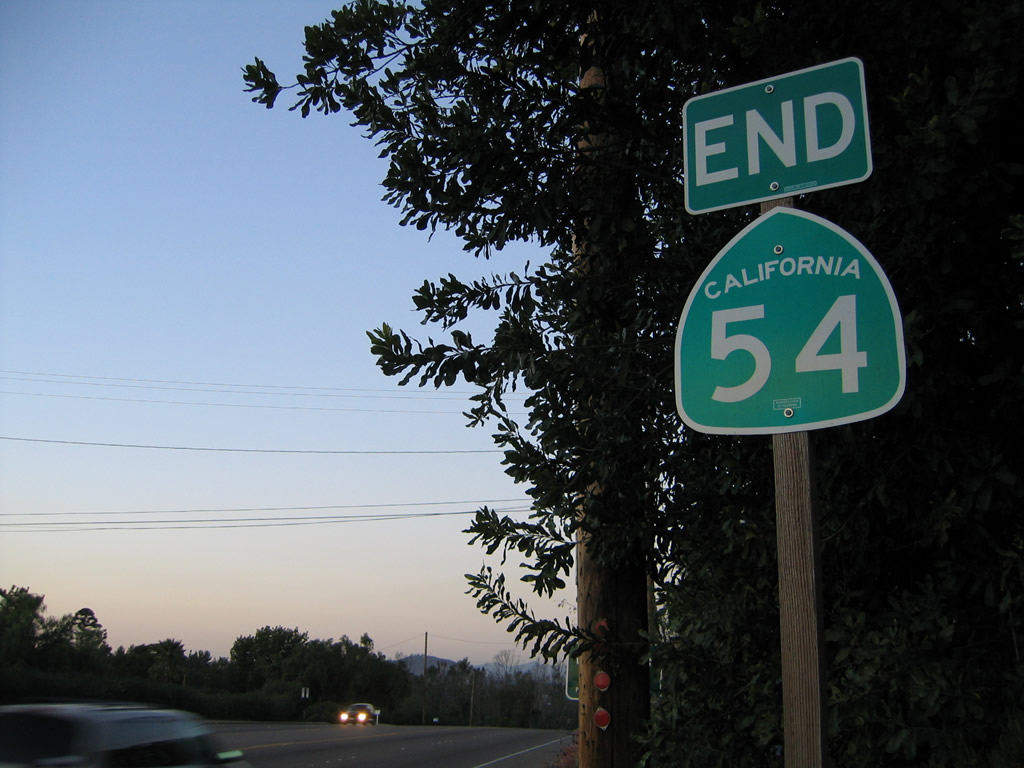
End Eastbound California 54 at the El Cajon City Limits. Prior to 1999, California 54 used to continue into El Cajon via Second Street to end at Interstate 8. However, the route was truncated when the section of Second Street within El Cajon was downloaded to the city.
11/06/04
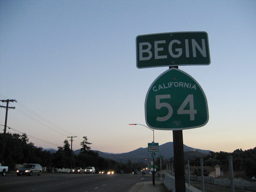
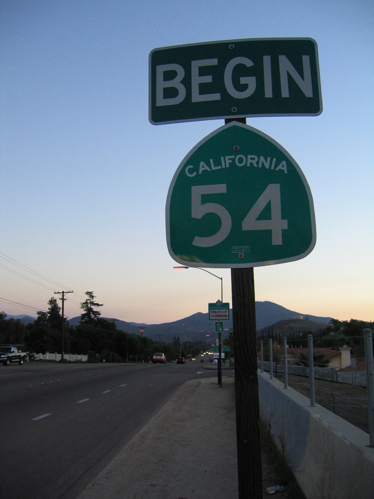
Begin westbound California 54 upon leaving the city of El Cajon. This is the end of California 54 Business and the beginning of California 54.
11/06/04
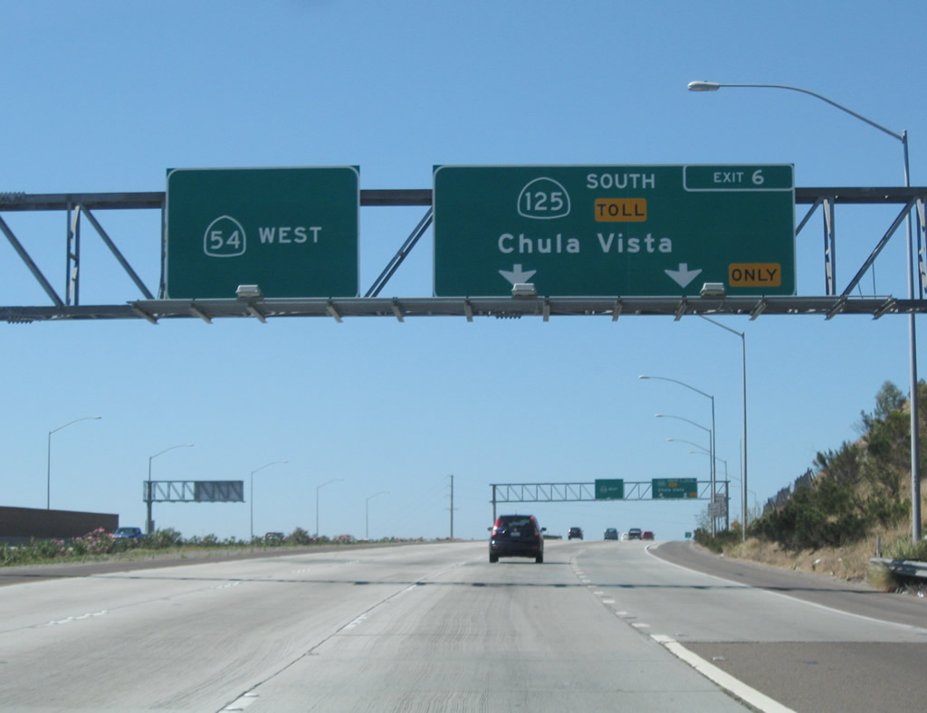
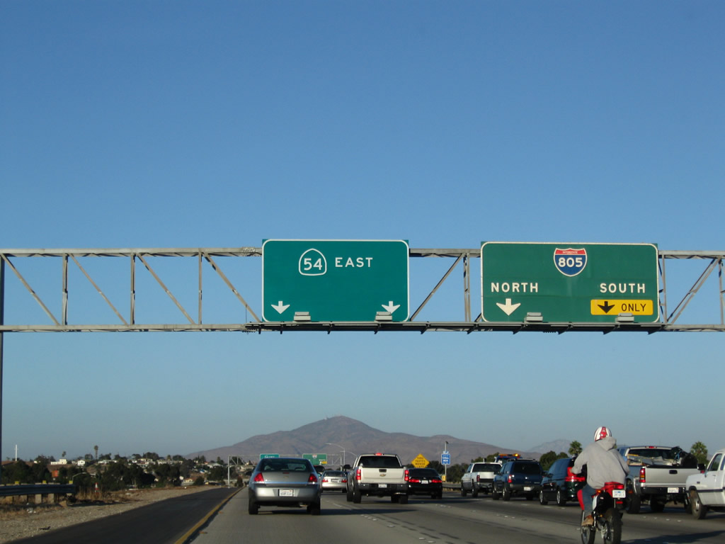
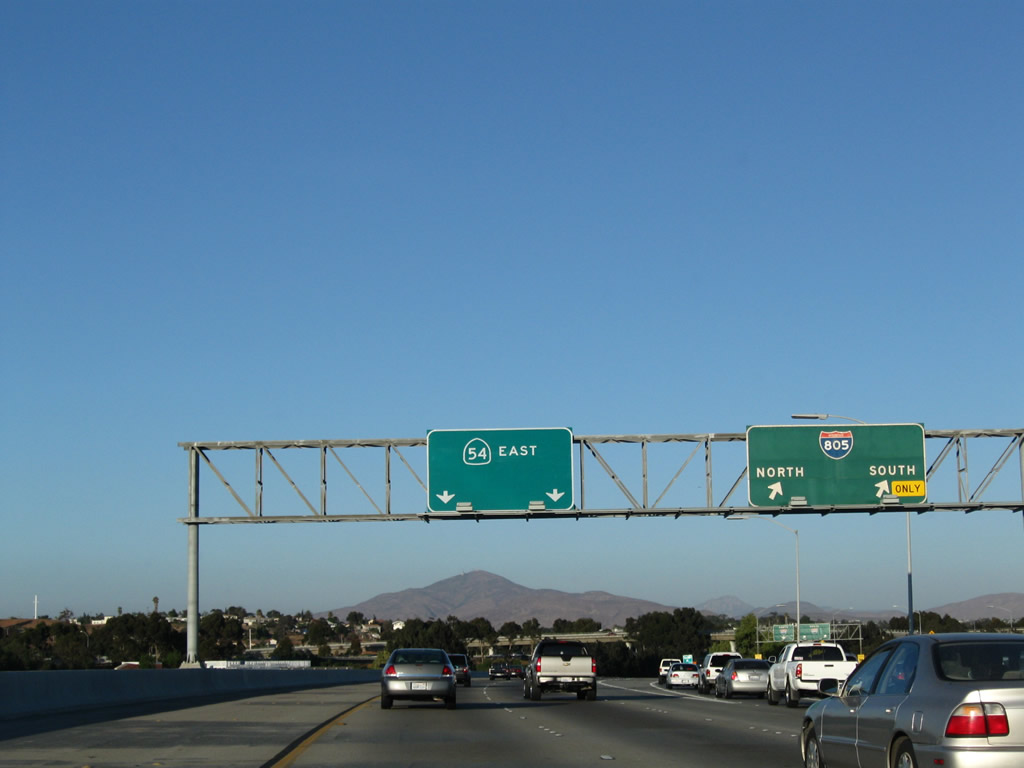
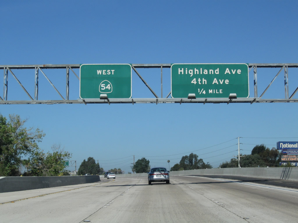
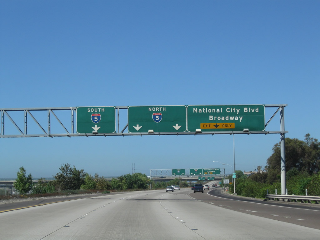
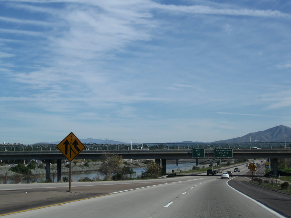
This guide sign provides the lane allocation for California 54 west (Exit 11) and California 125 south (signed as California 54's Exit 6). Use California 54 west to National City and northern/western Chula Vista. Use California 125 south to eastern Chula Vista and the international border crossing at Otay Mesa.
08/23/10
Westbound California 54 and southbound California 125 split at this point. The left three lanes continue west on California 54 (via Exit 11), and the right two lanes continue south on California 125 (South Bay Expressway) south (via Exit 6).
08/23/10
After separating from California 125 at Exit 6, the next exit along westbound California 54 is Exit 5, Briarwood Road (one mile).
08/23/10
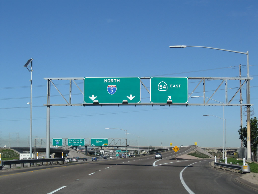
Traffic from California 125 north merges onto California 54 west. Under construction for several years in the early to mid 2000s, the interchange between California 54 and California 125 was fully opened to traffic in late 2007.
08/23/10
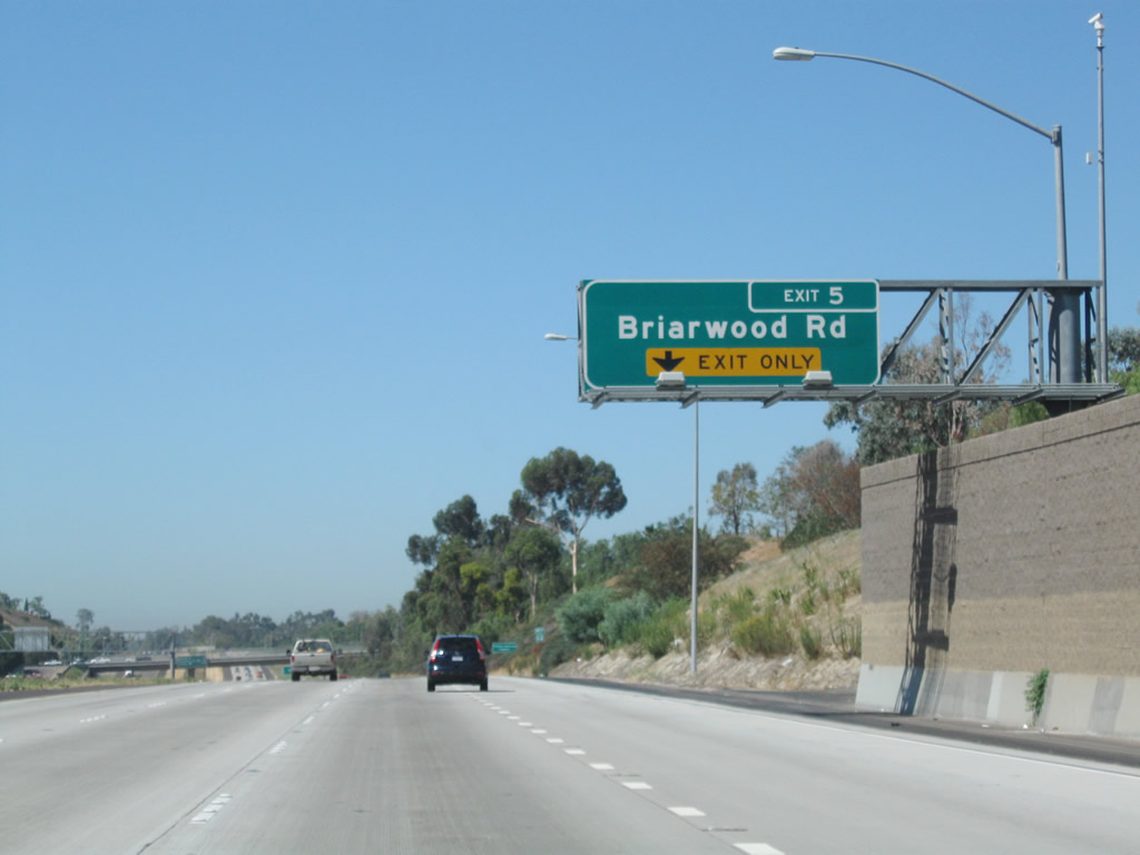
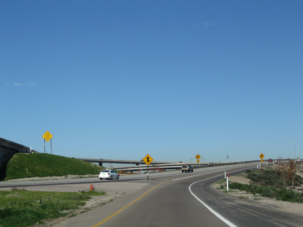
The new right lane of California 54 west becomes exit only for Exit 5, Briarwood Road. This exit serves the unincorporated community of Bonita.
08/23/10
A California 54 west reassurance shield is posted prior to the off-ramp to Exit 5, Briarwood Road to Bonita.
08/23/10
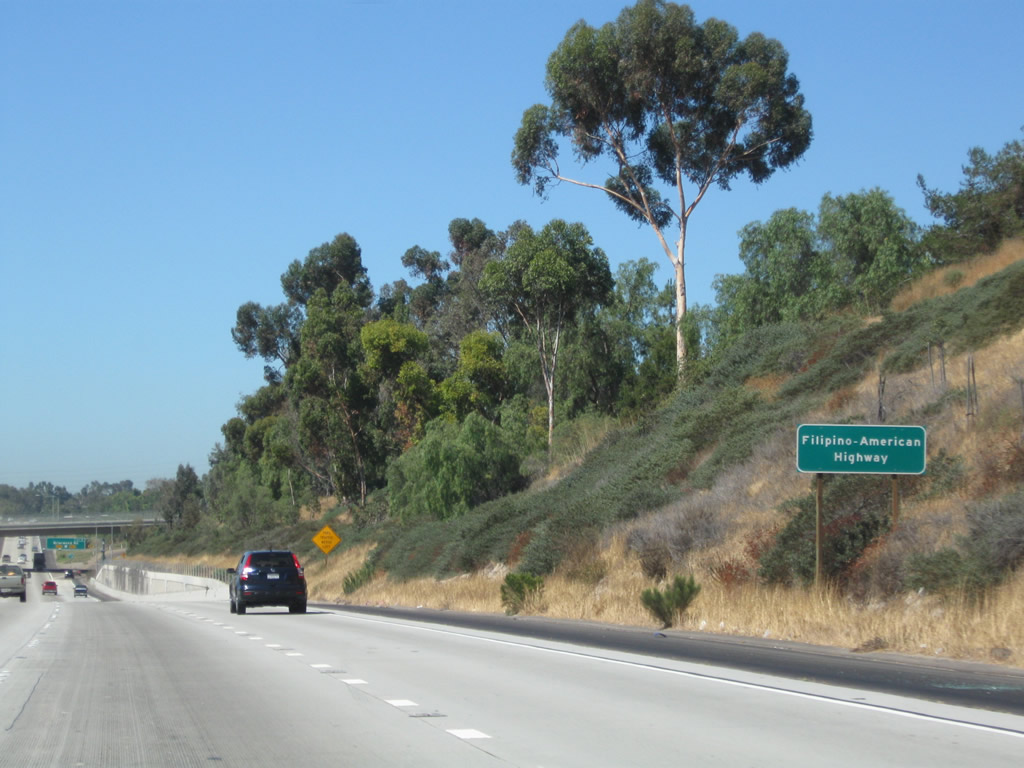
Owing to the area's large Filipino-American community, California 54 is also designated as the Filipino-American Highway between California 125 and Interstate 5.
08/23/10
Westbound California 54 (Filipino-American Highway) reaches Exit 5, Briarwood Road to Bonita (south) and the Paradise Hills community of San Diego (north).
08/23/10
![This mileage sign along California 54 west provides the distance to the next three exits: Exit 4, Woodman Street; Exit 3, Plaza Bonita Center Way and Reo Drive; and Exit 2, Interstate 805 (Jacob Dekema [Inland] Freeway).](../../ca/054/ca-054_wb_exit_004_01.jpg)
This mileage sign along California 54 west provides the distance to the next three exits: Exit 4, Woodman Street; Exit 3, Plaza Bonita Center Way and Reo Drive; and Exit 2, Interstate 805 (Jacob Dekema [Inland] Freeway).
08/23/10
A California 54 west reassurance shield is posted after the Briarwood Road interchange.
08/23/10
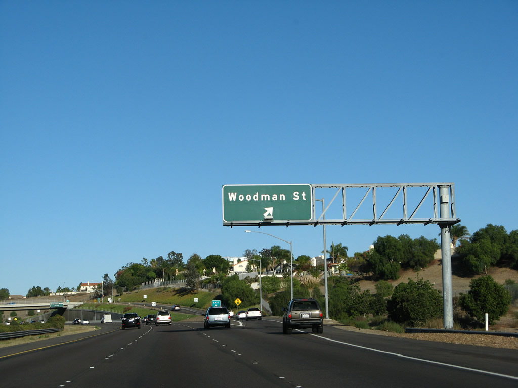
Westbound California 54 reaches Exit 4, Woodman Street north to Paradise Hills. This interchange serves as the southern terminus of Woodman Street.
08/23/10
![Passing under Woodman Street, this mileage sign along California 54 west provides the distance to the next three exits: Exit 3, Plaza Bonita Center Way and Reo Drive; Exit 2, Interstate 805 (Jacob Dekema [Inland] Freeway); and Exit 1D, Highland Avenue north and Fourth Avenue south.](../../ca/054/ca-054_wb_exit_003_01.jpg)
Passing under Woodman Street, this mileage sign along California 54 west provides the distance to the next three exits: Exit 3, Plaza Bonita Center Way and Reo Drive; Exit 2, Interstate 805 (Jacob Dekema [Inland] Freeway); and Exit 1D, Highland Avenue north and Fourth Avenue south.
08/23/10
A California 54 west reassurance shield is posted after the Woodman Road interchange.
08/23/10
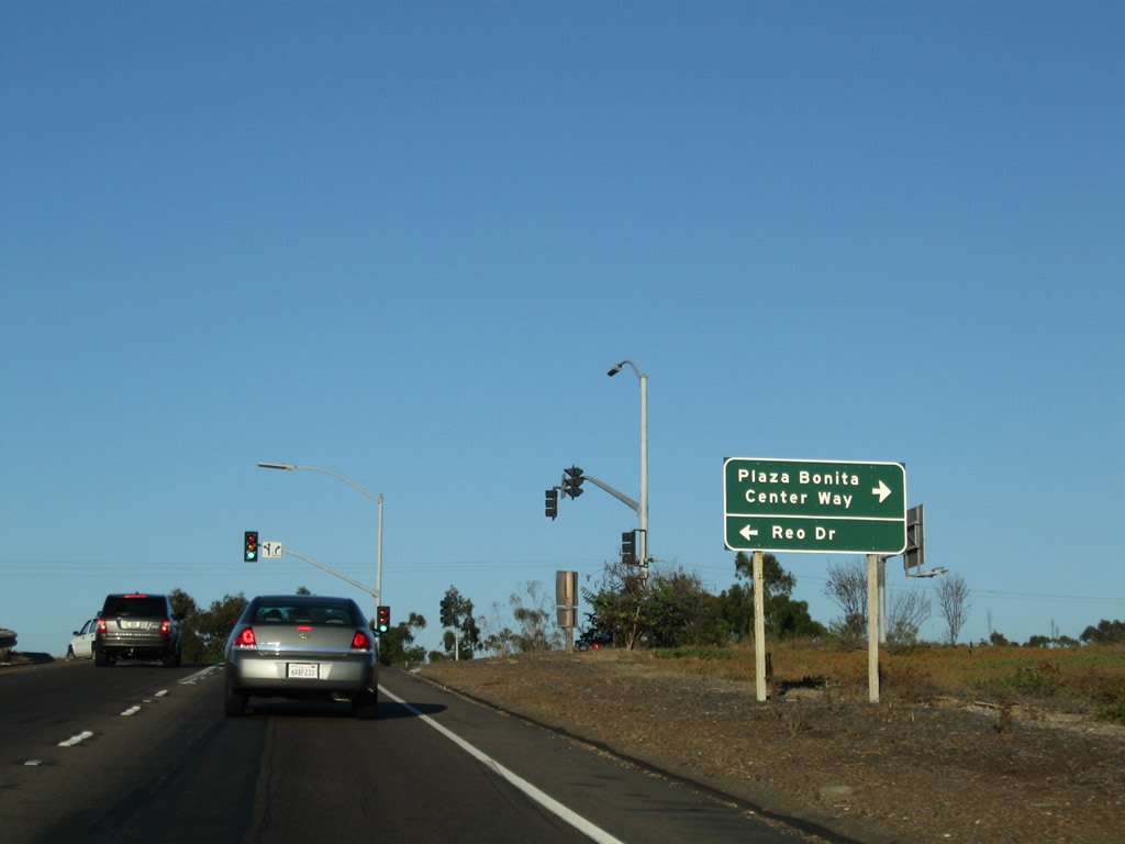
The next exit along California 54 west is Exit 3, Plaza Bonita Center Way south and Reo Drive north. Plaza Bonita is a shopping center situated on the southeastern quadrant of the Interstate 805 and California 54 interchange.
08/23/10
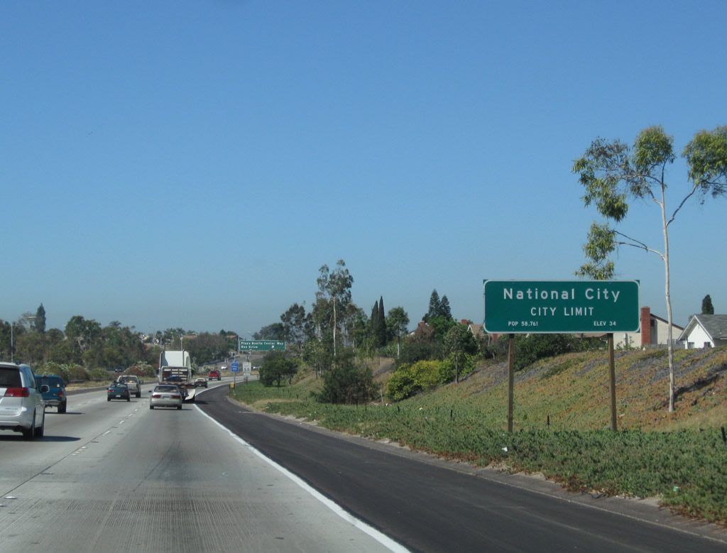
California 54 enters the city of National City(founded on July 7, 1868 and incorporated on September 17, 1887). National City had a population of 54,260 as of the 2000 census.
08/23/10
Westbound California 54 (Filipino-American Highway) reaches Exit 3, Plaza Bonita Center Way south and Reo Drive north. This is the first of several interchanges to serve the city of National City.
08/23/10
The only exit numbers posted along this segment of California 54 were installed at the gore point as of 2010.
08/23/10
![Passing under the Plaza Bonita Center Way and Reo Street overpass, this mileage sign along California 54 west provides the distance to the next two exits: Exit 2, Interstate 805 (Jacob Dekema [Inland] Freeway) and Exit 1D, Highland Avenue north and Fourth Avenue south.](../../ca/054/ca-054_wb_exit_002_01.jpg)
Passing under the Plaza Bonita Center Way and Reo Street overpass, this mileage sign along California 54 west provides the distance to the next two exits: Exit 2, Interstate 805 (Jacob Dekema [Inland] Freeway) and Exit 1D, Highland Avenue north and Fourth Avenue south.
08/23/10
A California 54 west reassurance shield is posted after the Reo Street interchange.
08/23/10
![The next exit along California 54 west is Exit 2, Interstate 805 (Jacob Dekema [Inland] Freeway) north to the city of San Diego communities of Mid-City, North Park, Mission Valley, and University City and south to Chula Vista and the International Border at San Ysidro.](../../ca/054/ca-054_wb_exit_002_03.jpg)
The next exit along California 54 west is Exit 2, Interstate 805 (Jacob Dekema [Inland] Freeway) north to the city of San Diego communities of Mid-City, North Park, Mission Valley, and University City and south to Chula Vista and the International Border at San Ysidro.
08/23/10
![Westbound California 54 reaches Exit 2, Interstate 805 (Jacob Dekema [Inland] Freeway). California 54 proceeds west for the final distance through National City to meet Interstate 5 near the bayshore.](../../ca/054/ca-054_wb_exit_002_05.jpg)
Westbound California 54 reaches Exit 2, Interstate 805 (Jacob Dekema [Inland] Freeway). California 54 proceeds west for the final distance through National City to meet Interstate 5 near the bayshore.
08/23/10
Once on the transition ramp to Exit 2, Interstate 805, the left two lanes connect to Interstate 805 south, while the right lane connects to Interstate 805 north.
08/23/10
California 54 passes through the Interstate 805 interchange. The first ramp overhead connects California 54 west with Interstate 805 south. Then California 54 passes under Interstate 805's main lanes.
08/23/10
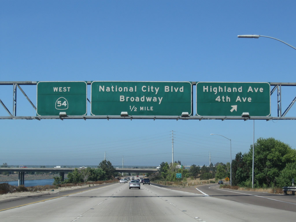
As we leave the Interstate 805 interchange, this mileage sign along California 54 west provides the distance to the final two exits that serve local streets: Exit 1D, Highland Avenue north and Fourth Avenue south and Exit 1C, Historic U.S. 101/Broadway south and National City Boulevard north.
08/23/10
The next exit along California 54 west is Exit 1D, Highland Avenue north to National City and Fourth Avenue south to Chula Vista.
08/23/10
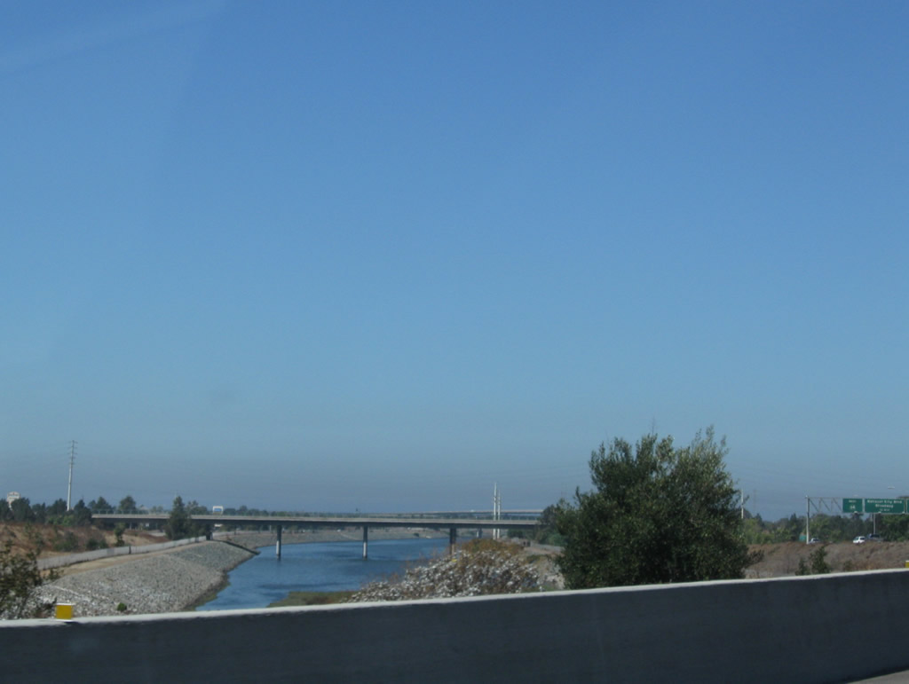
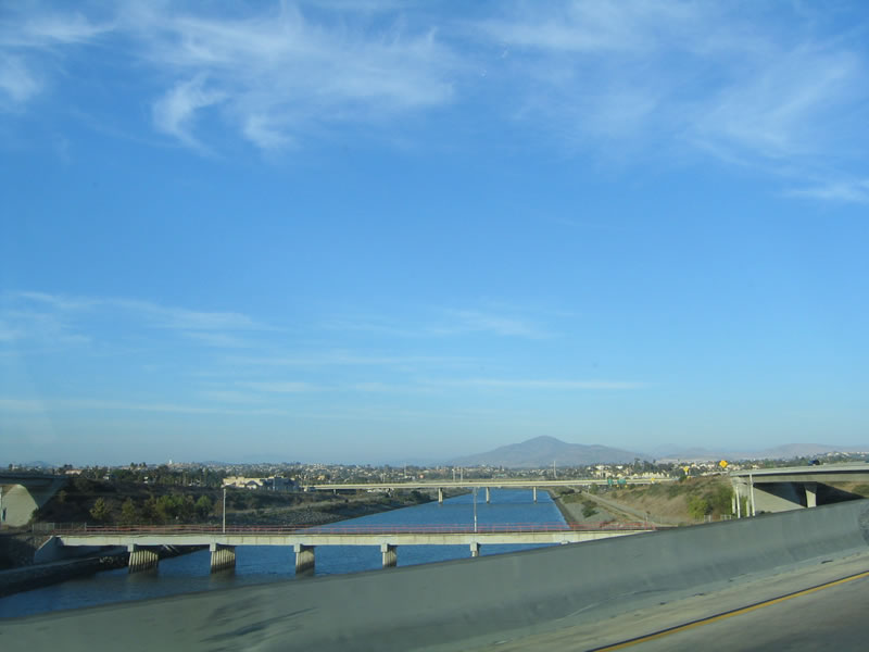
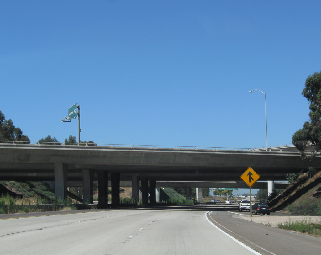
The Sweetwater River, which has paralleled California 54 since the California 125 through the community of Bonita, finds its way into the median of the California 54 freeway. The eastbound lanes stay on the southern bank of the river, while the westbound lanes take the northern bank. The river flows west into San Diego Bay.
08/23/10
California 54 west approaches Exit 1D, Highland Avenue north to National City and Fourth Avenue south to Chula Vista.
08/23/10
Westbound California 54 reaches Exit 1D, Highland Avenue north to National City and Fourth Avenue south to Chula Vista.
08/23/10
The Highland Avenue and Fourth Avenue interchange is a standard diamond, but the Sweetwater River through the median of the freeway makes it an extra wide interchange.
08/23/10
California 54 passes under Highland Avenue and Fourth Avenue.
08/23/10
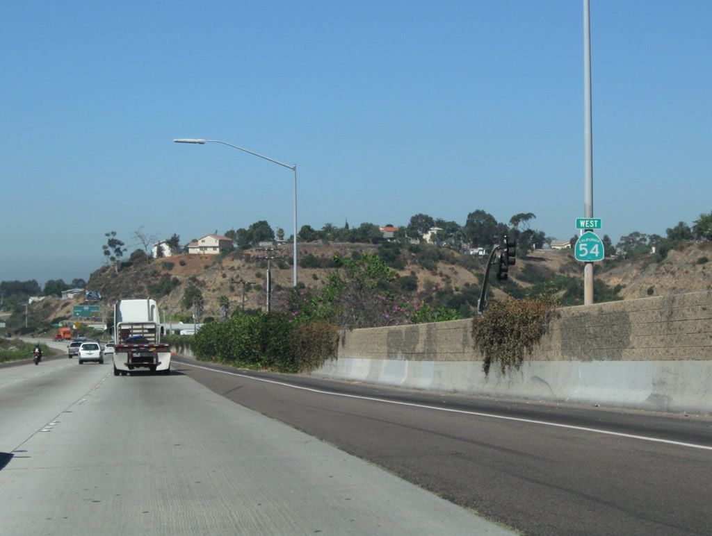
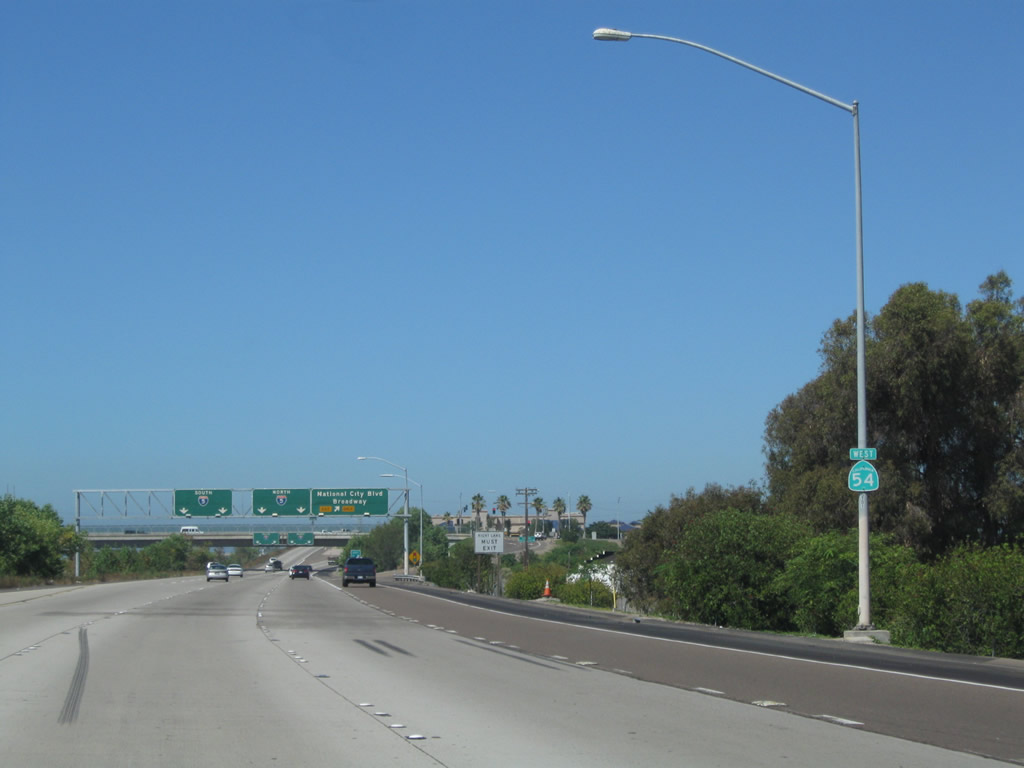
Relocated 69kV San Diego Gas & Electric power lines cross over the freeway.
08/23/10
The right lane of California 54 west becomes exit only for Exit 1C, National City Boulevard north and Broadway south. These two streets are both part of the historic route U.S. 101 took through National City and Chula Vista, respectively.
08/23/10
A final California 54 west reassurance shield is posted between the on-ramp from Highland Avenue and the off-ramp to U.S. 101/National City Boulevard north and U.S. 101/Broadway south.
08/23/10

Westbound California 54 reaches Exit 1 C for National City Boulevard (Historic U.S. 101) north and Broadway south. U.S. 101 predates I-5 as the main coastal north-south highway through San Diego. Beginning at the San Ysidro international border crossing with Mexico, U.S. 101 followed Beyer Boulevard, Broadway, National City Boulevard, Civic Center Drive, Harbor Drive, Pacific Highway, Mission Bay Drive, Gilman Drive, North Torrey Pines Road, and Camino del Mar from San Ysidro north to Del Mar.
08/23/10
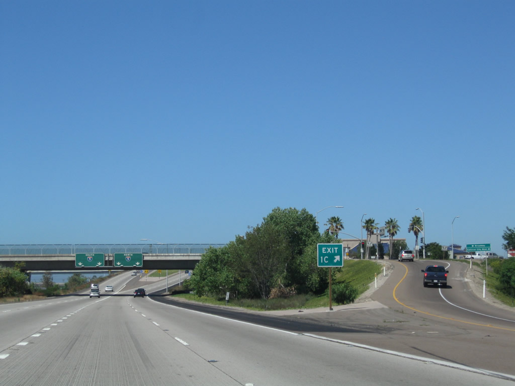
Exit 1C (for National City Boulevard north and Broadway south) is signed with an exit number at the gore point. For departing traffic, note that there is no direct connection back onto California 54 west.
08/23/10
Passing under the U.S. 101 bridge, westbound California 54 prepares to split. The left two lanes connect to Interstate 5 (Montgomery Freeway) south to San Ysidro and Imperial Beach; the righ two lanes connect to Interstate 5 (Montgomery Freeway) north to downtown San Diego.
08/23/10
Westbound California 54 splits: stay left for Exit 1A, Interstate 5 (Montgomery Freeway) south to San Ysidro and Imperial Beach or stay right for Exit 1B, Interstate 5 (Montgomery Freeway) north to downtown San Diego. No end shield is posted here.
08/23/10
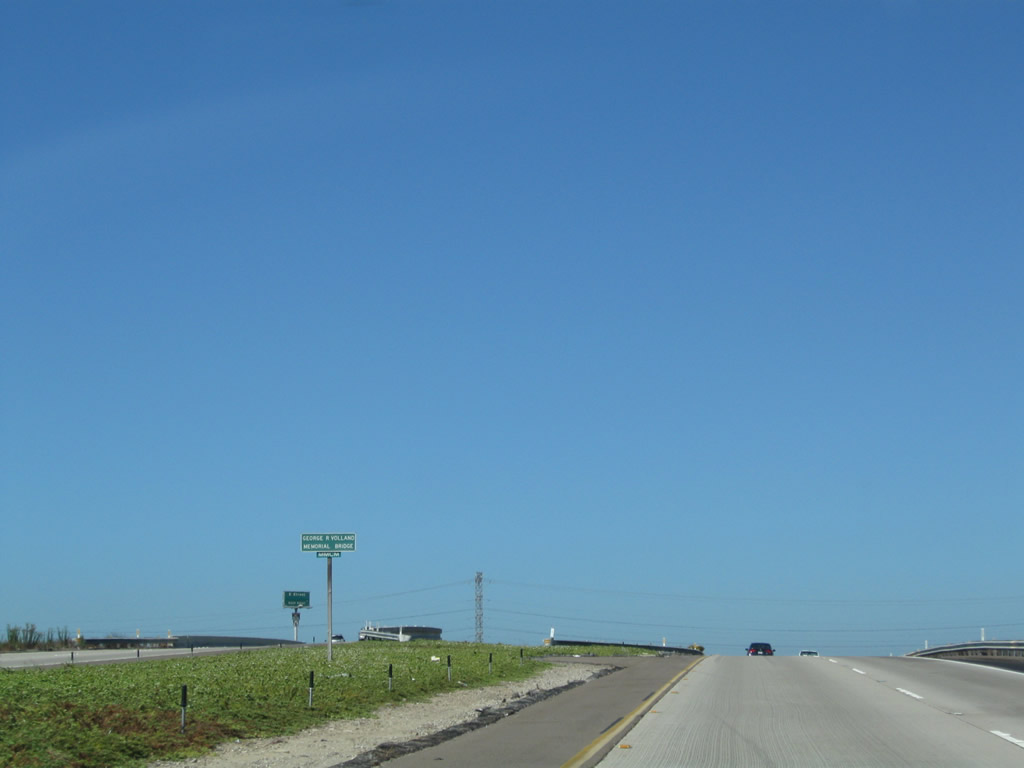
The bridge that carries California 54 west to Interstate 5 south (via Exit 1A) is designated the George R. Volland Memorial Bridge.
08/23/10
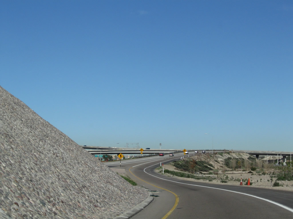
Rock artwork offers urban relief in the interchange pocket between the transition ramp from California 54 west to Interstate 5 north (via Exit 1B). Below, multiple lanes of Interstate 5 hustle by as traffic California 54 west prepares to merge into this major freeway.
08/23/10

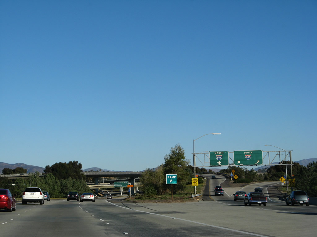
Signage for California 54 from northbound Plaza Bonita Center Way.
07/30/02
Photo Credits:
- Andy Field: 07/27/02, 07/30/02, 11/06/04, 03/23/06, 12/02/07, 08/21/08, 01/18/09, 01/19/09, 07/12/09, 08/23/10
Connect with:
Page Updated Tuesday August 05, 2025.