
State Route 96
Closely following its namesake river through the Siskiyou Mountains, SR 96 is the Klamath River Highway. The state route meanders from SR 299 in Willow Creek in the south to a point north of Yreka, joining with Interstate 5 following a curving arc. - 05/25/2008
California 96 follows the Trinity and Klamath Rivers on its course from Willow Creek (California 299) north to Interstate 5 near Hornbrook. Staying within these rivers' valleys, the highway serves recreational areas within the Klamath National Forest as well as the Hoopa Valley Indian Reservation, Weitchpec, Orleans, Clear Creek, Seiad Valley and Hamburg. A portion of the route is designated as the State of Jefferson Scenic Highway.
The Randolph Collier Rest Area lies between Interstate 5 and the Klamath River at the east end of California 96. The facility serves travelers along both routes, and is the first for southbound motorists entering California from Oregon. Randolph Collier was a state senator and chairman of the California Senate Transportation Committee, who was instrumental in crafting the Collier–Burns Highway Act of 1947. This act established a role for the state in constructing urban freeways, increased gasoline and vehicle registration fees that were allocated to a highway revenue fund, and set a 55:45 ratio of state highway construction funds split between the southern half and northern half of the state respectively. Counties also received a guaranteed minimum amount of funding for road systems as part of the act.1 As a result of this historic act, which ushered in a new era of rural highway and urban freeway construction, Mr. Collier became known as the "Father of the California Freeways." Both this rest area and the Collier Tunnel on U.S. 199 are named in his honor.
Eastbound SR 96 at SR 263 (Historic U.S. 99). The 1931 bridge visible to the right carried U.S. 99 over the Klamath River.
05/25/08

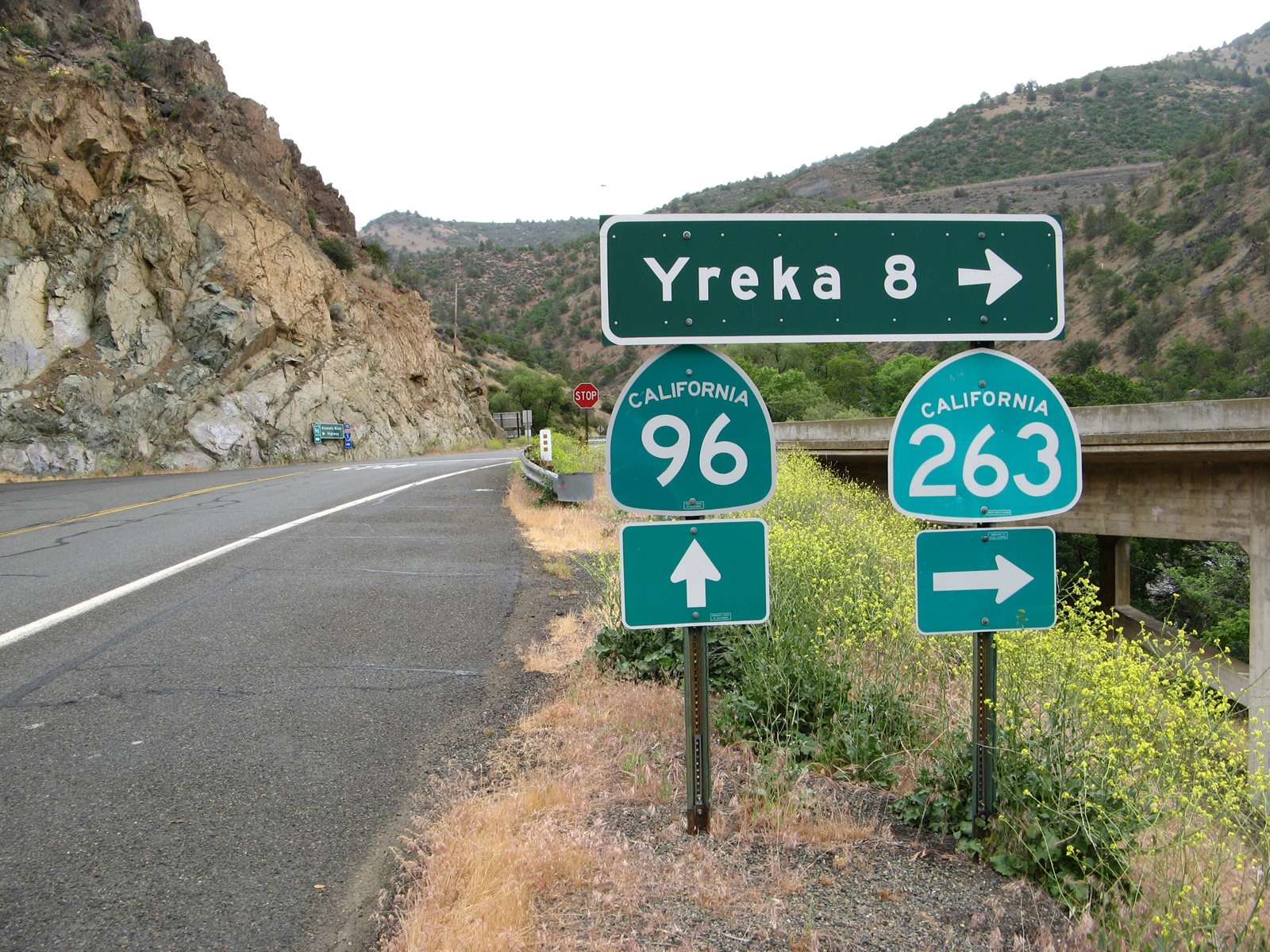
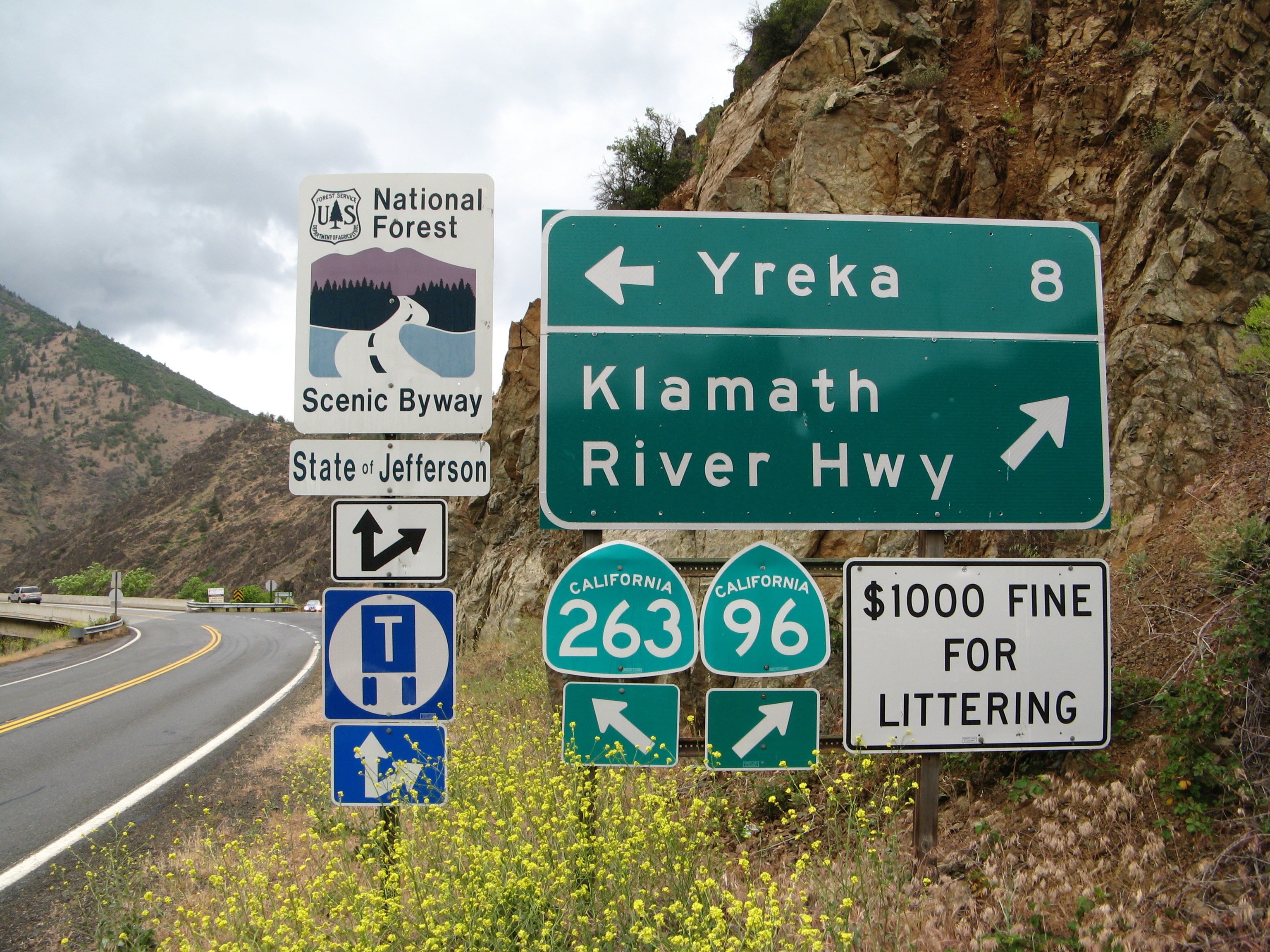
Through traffic on SR 96 east stops at the intersection with SR 263 (Historic U.S. 99).
05/25/08
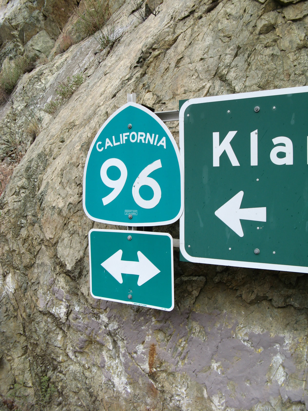
Shields for SR 96 and SR 263 mounted into a cliff face at the intersection of the two state routes. SR 96 continues north to I-5.
05/25/08
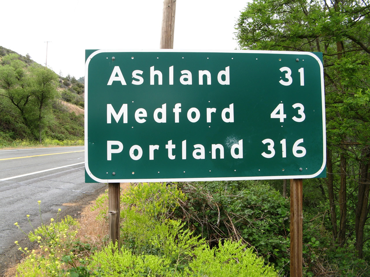
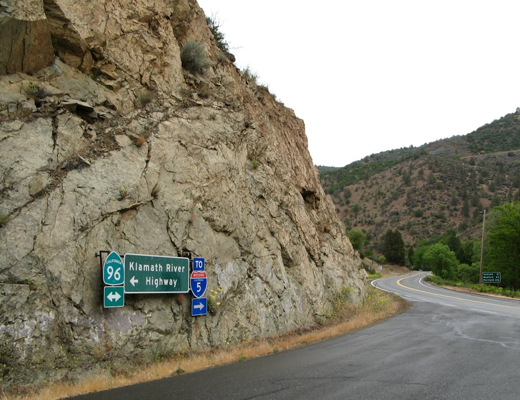
Distance sign for Ashland, Medford, and Portland, Oregon via Interstate 5 north, posted after SR 263 on SR 96 eastbound.
05/25/08
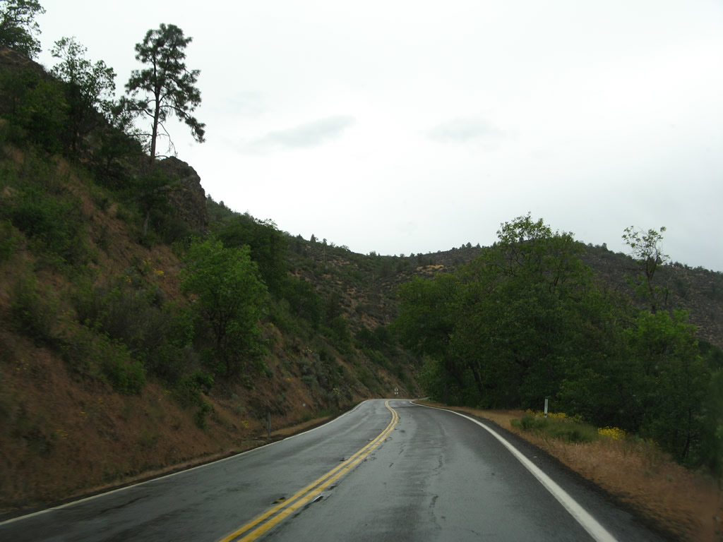
SR 96 runs along the Klamath River northward 2.3 miles to I-5 by Sharps Gulch.
05/25/08
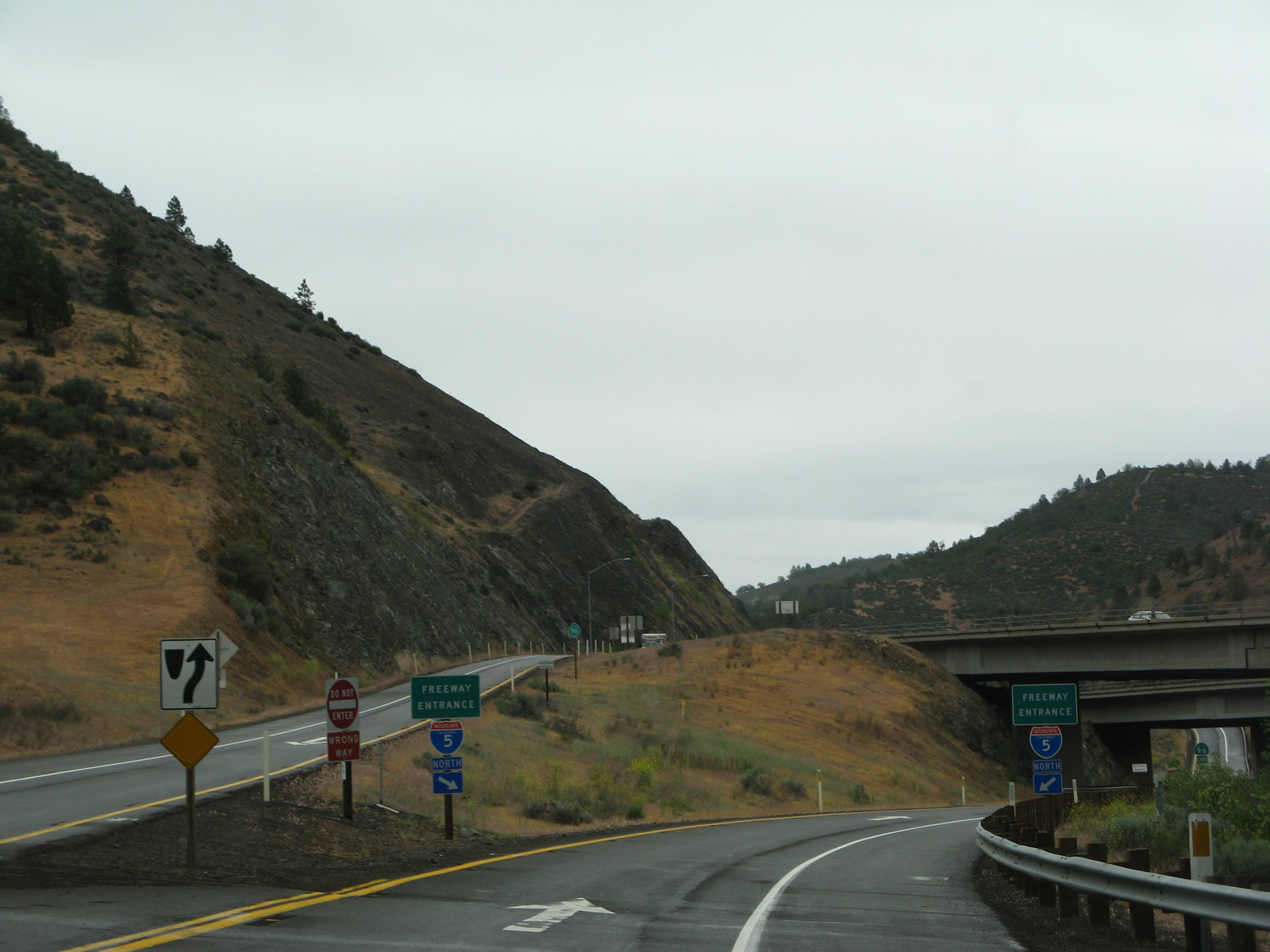
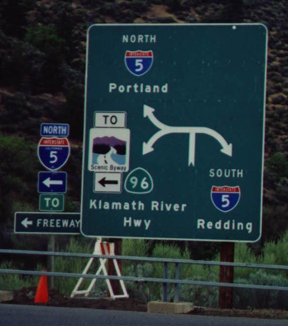
Anderson Grade Road spans the Klamath River, linking SR 96 east with I-5 south and the adjacent Randolph Collier Rest Area. SR 96 concludes at a wye interchange with I-5 north to Ashland and Portland, Oregon.
05/25/08
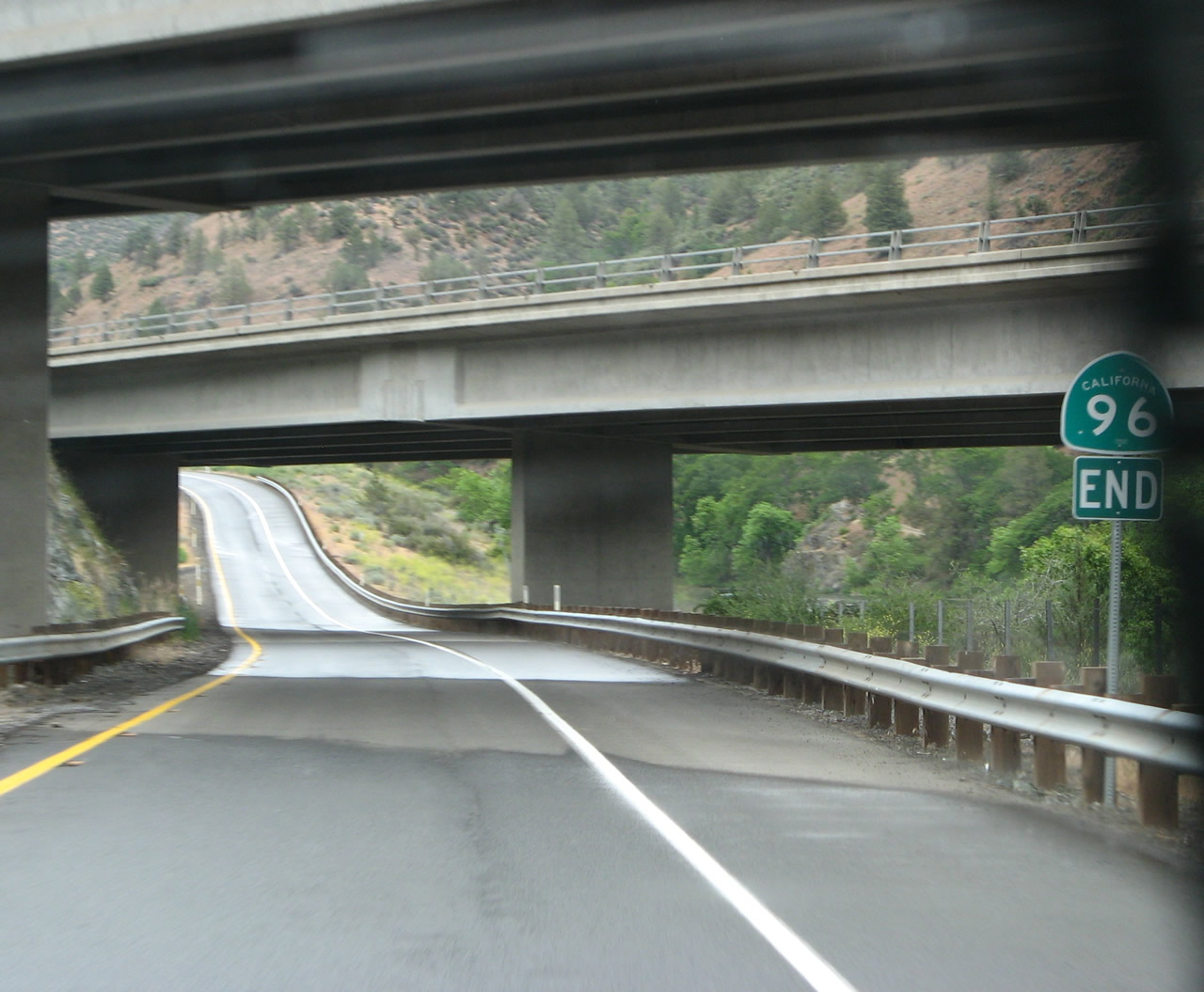
An end SR 96 shield stands along the transition ramp to northbound Interstate 5.
05/25/08
SR 96 branches west from I-5 and proceeds 2.3 miles south to intersect SR 263 (Historic U.S. 99). The State of Jefferson Scenic Byway overlays both state routes leading south and west. The state of Jefferson is an old proposal to carve a new state from the southern counties of Oregon and the northern counties of California. While this proposal never became a reality, it is a part of this region's history, especially since the areas of southern Oregon and extreme northern California have more in common than with either Portland or Los Angeles.
05/25/08
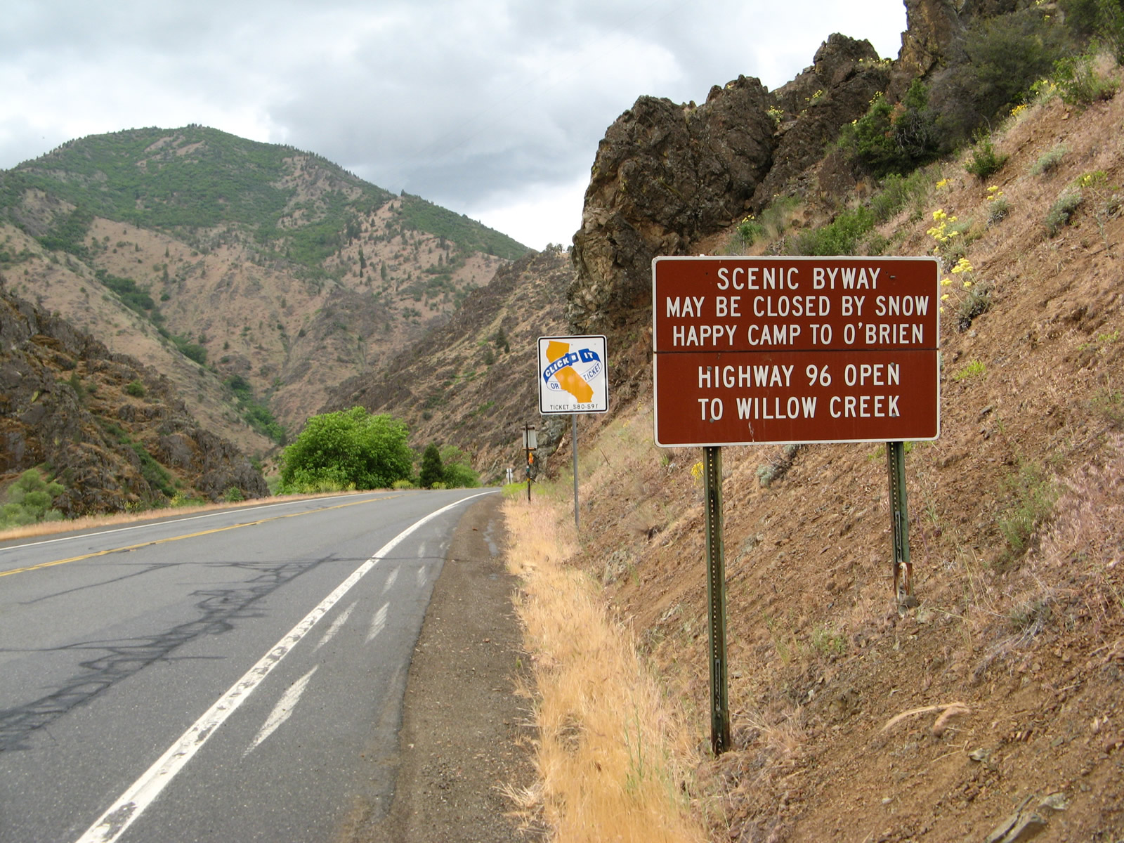
SR 96 proceeds alongside the Klamath River from SR 263 toward Willow Creek. The scenic byway may close from time to time due to weather.
05/25/08

The Randolph Collier Rest Area hosts a small welcome center, which has maps, tourist brochures, and other information for Siskiyou County, with volunteers staffing the facility.
05/25/08
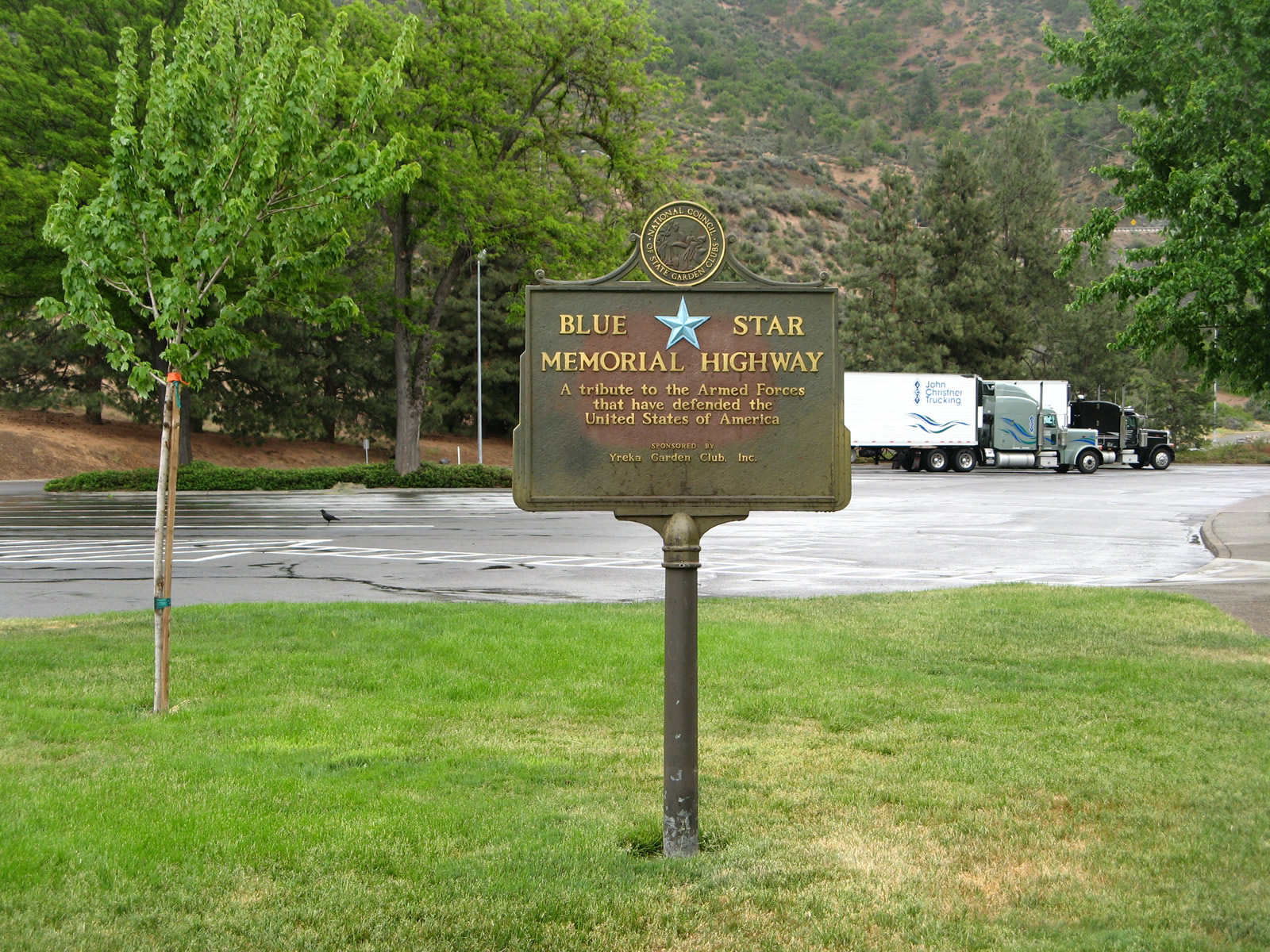
Within the Randolph Collier Rest Area, a Blue Star Memorial Highway marker honors those who served in the Armed Forces while defending the United States of America. The Yreka Garden Club posted the sign.
05/25/08

A plaque by the restroom building honors Randolph Collier, who passed away in 1983.
05/25/08

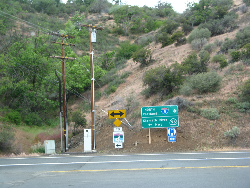
Guide sign and shield assembly directing travelers from the Randolph Collier Rest Area back to Interstate 5 or to SR 96 (State of Jefferson Scenic Byway) west.
05/25/08
February 1999
Anderson Grade Road connects I-5 north at Exit 786 with both the Randolph Collier Rest Area and SR 96 (Klamath River Highway) west. SR 96 east merges directly onto I-5 north nearby.
05/25/08
References:
- Statewide Transportation Planning in California: Past Experience and Lessons for the Future.
http://www.uctc.net/papers/658.pdfBrown, Jerry. Institute of Transportation Studies, University of California, Los Angeles, November 13, 2000.
Photo Credits:
- Andy Field: 05/25/08
- Jerry Mullady: February 1999
Connect with:
Page Updated Thursday April 02, 2015.