
State Route 99 North - Tulare to Selma
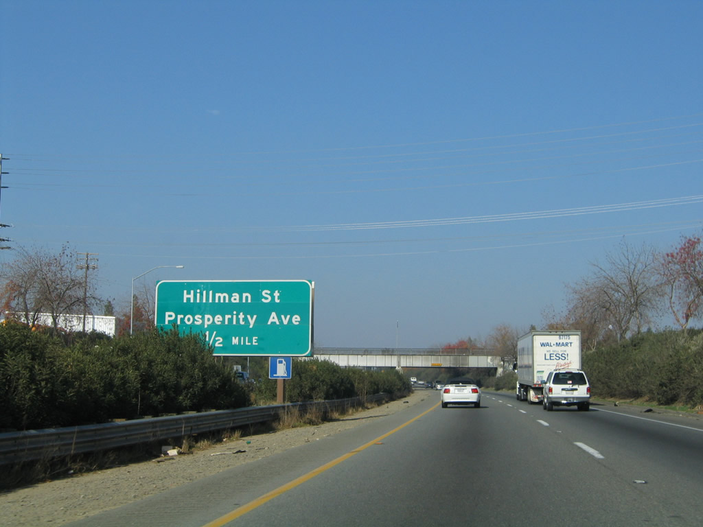
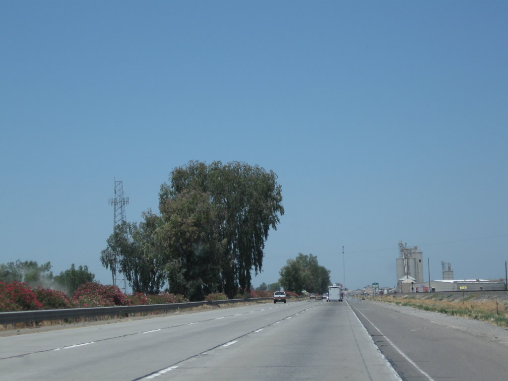
The next exit along California 99 north is Exit 88, Hillman Street and Prosperity Avenue, one-half mile. Prosperity Avenue parallels California 137 (Tulare Avenue), which is located to the south.
11/25/04
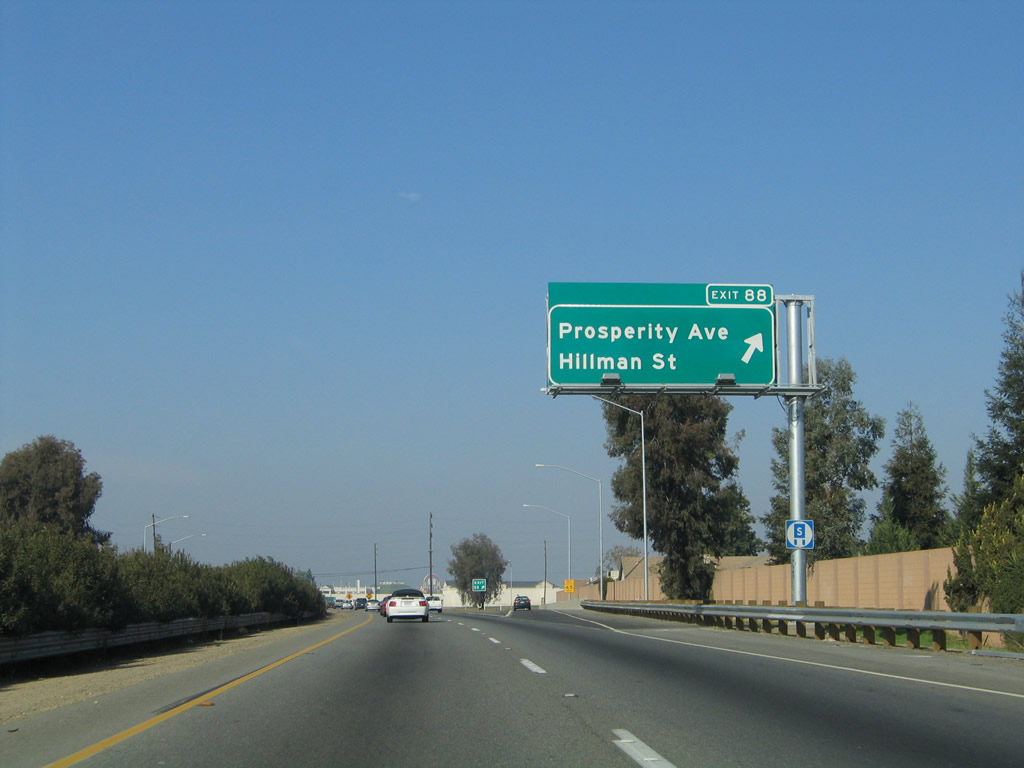
Northbound California 99 reaches Exit 88, Hillman Street and Prosperity Avenue.
11/25/04
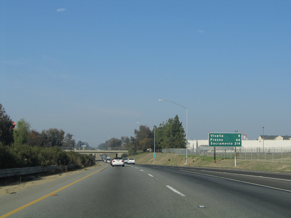
This mileage sign along California 99 north provides the distance to Visalia (eight miles), Fresno (44 miles), and Sacramento (214 miles).
11/25/04
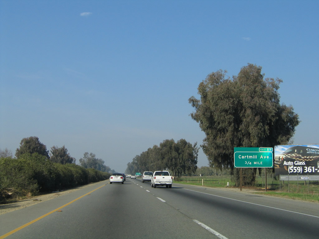
The next exit along California 99 north is Exit 89, Cartmill Avenue in Tulare.
11/25/04
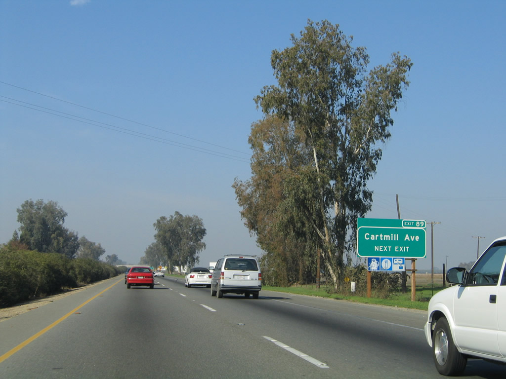
Cartmill Avenue travels west to meet California 99 Business (J Street) in northern Tulare and east to California 63.
11/25/04
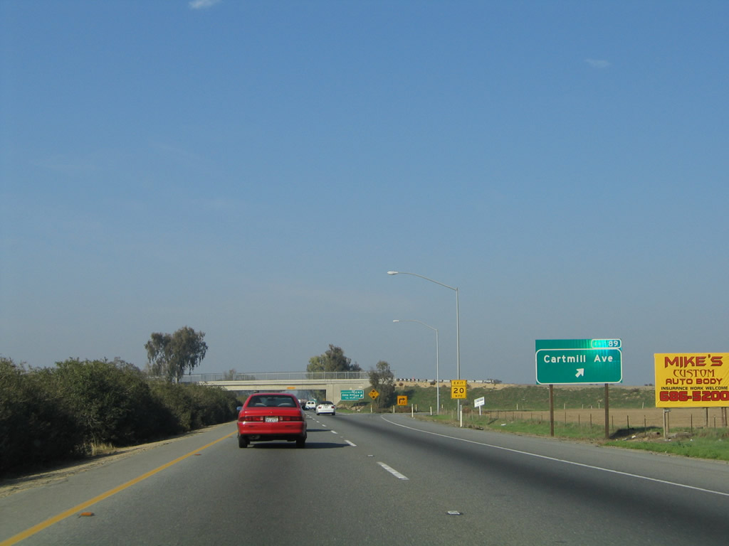
Northbound California 99 (Golden State Highway) reaches Exit 89, Cartmill Avenue in Tulare.
11/25/04
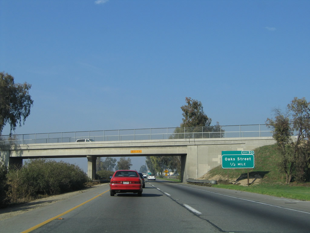
The next exit along California 99 north is Exit 90, Oaks Street (0.50 mile). Soon after this interchange, traffic from California 99 Business (J Street) will merge back onto California 99 north from the left.
11/25/04
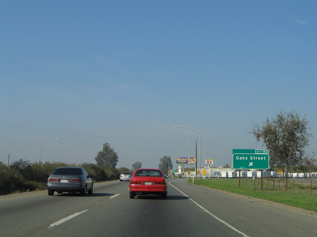
Northbound California 99 meets Exit 90, Oaks Street. This interchange, in conjunction with Exit 91, more or less serves as the northern terminus of the business route through the city of Tulare.
11/25/04
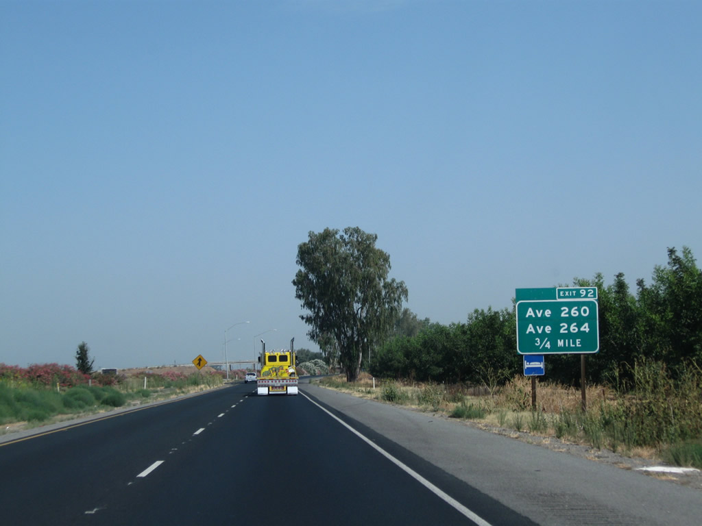
The next exit along California 99 (Golden State Highway) north is Exit 92, Avenue 260 and Avenue 264 (0.75 mile). Looking ahead on the left, traffic from California 99 Business will merge onto the freeway.
07/30/11
Traffic from California 99 Business (J Street), which is also signed as Historic U.S. 99, rejoins the northbound California 99 freeway.
07/30/11
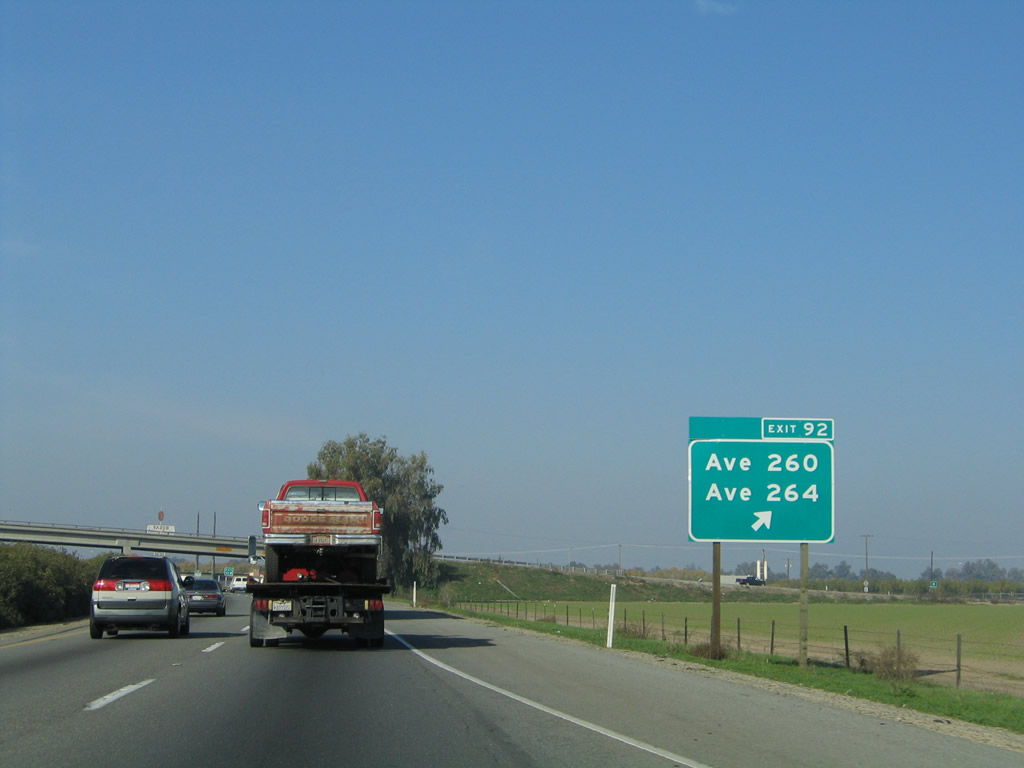
Northbound California 99 meets Exit 92, Avenue 260 and Avenue 264. This exit connects to the site of Tagus, located off old U.S. 99 (frontage road on west side of freeway adjacent to railroad tracks).
11/25/04
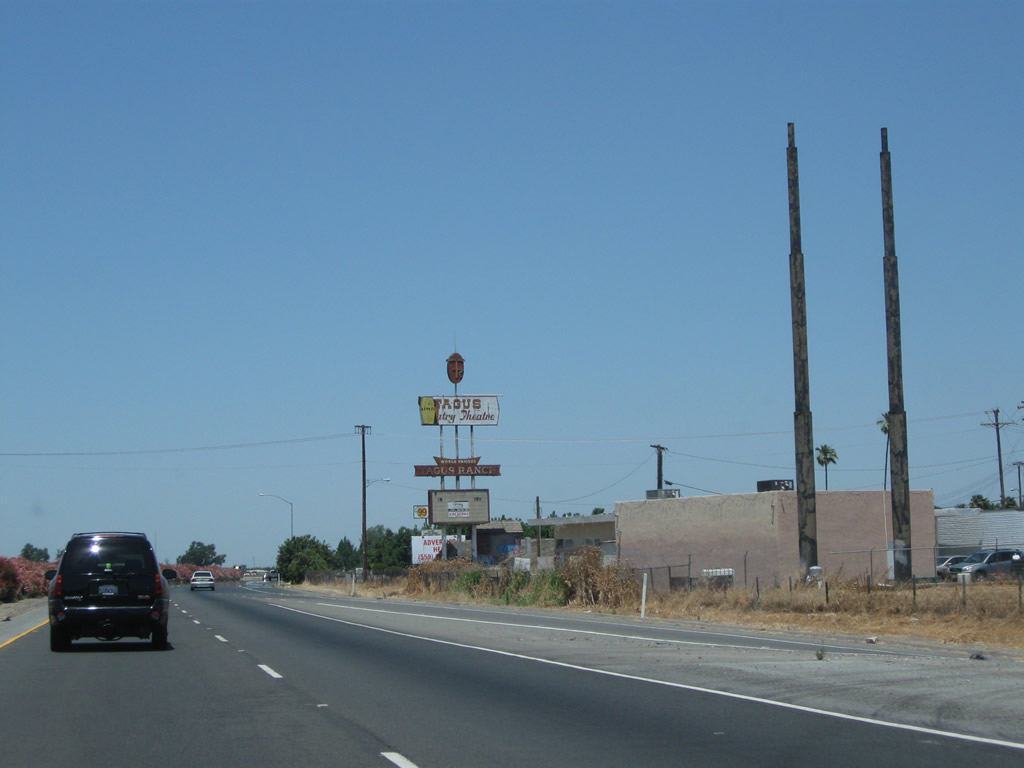
The remains of roadside business in Tagus are apparent from the northbound lanes.
06/19/10
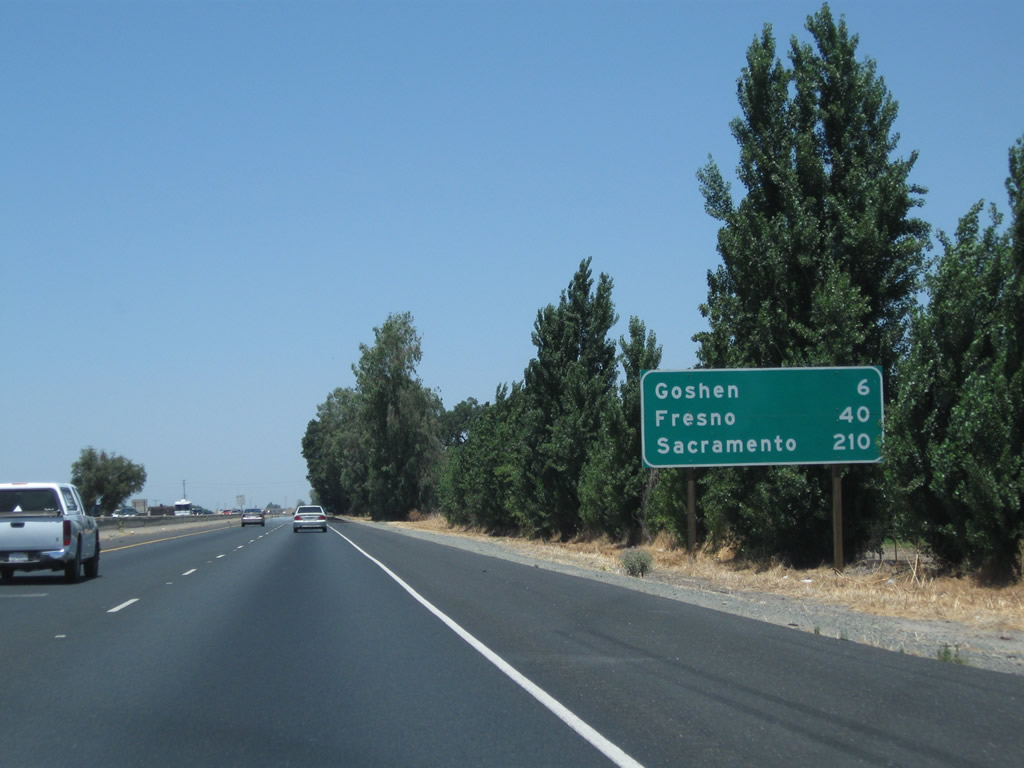
This mileage sign along California 99 (Golden State Highway) north provides the distance to Goshen (six miles), Fresno (40 miles), and Sacramento (210 miles).
06/19/10
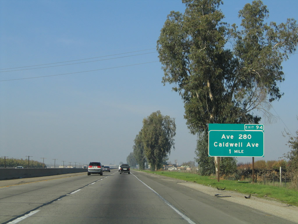
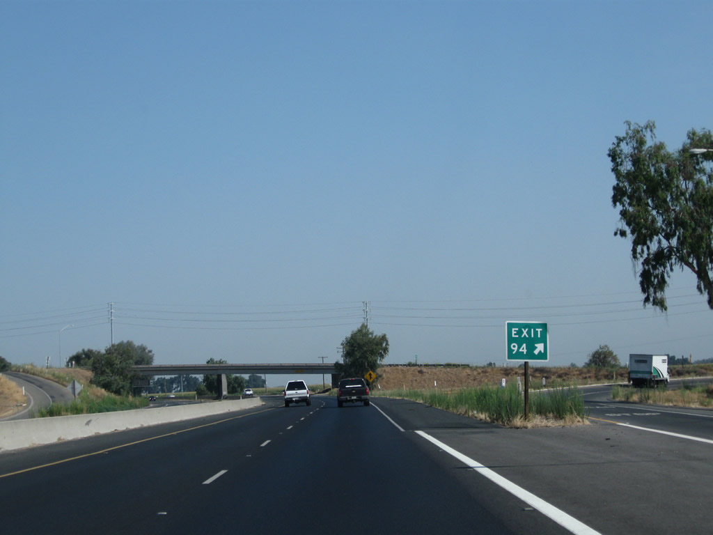
The next exit along California 99 north is Exit 94, Avenue 280, which is also known as Caldwell Avenue (one mile). Caldwell Avenue roughly parallels California 198. To the west, it changes into Houston Avenue upon entering Kings County, connecting to the city of Lemoore and the California 41 corridor.
11/25/04
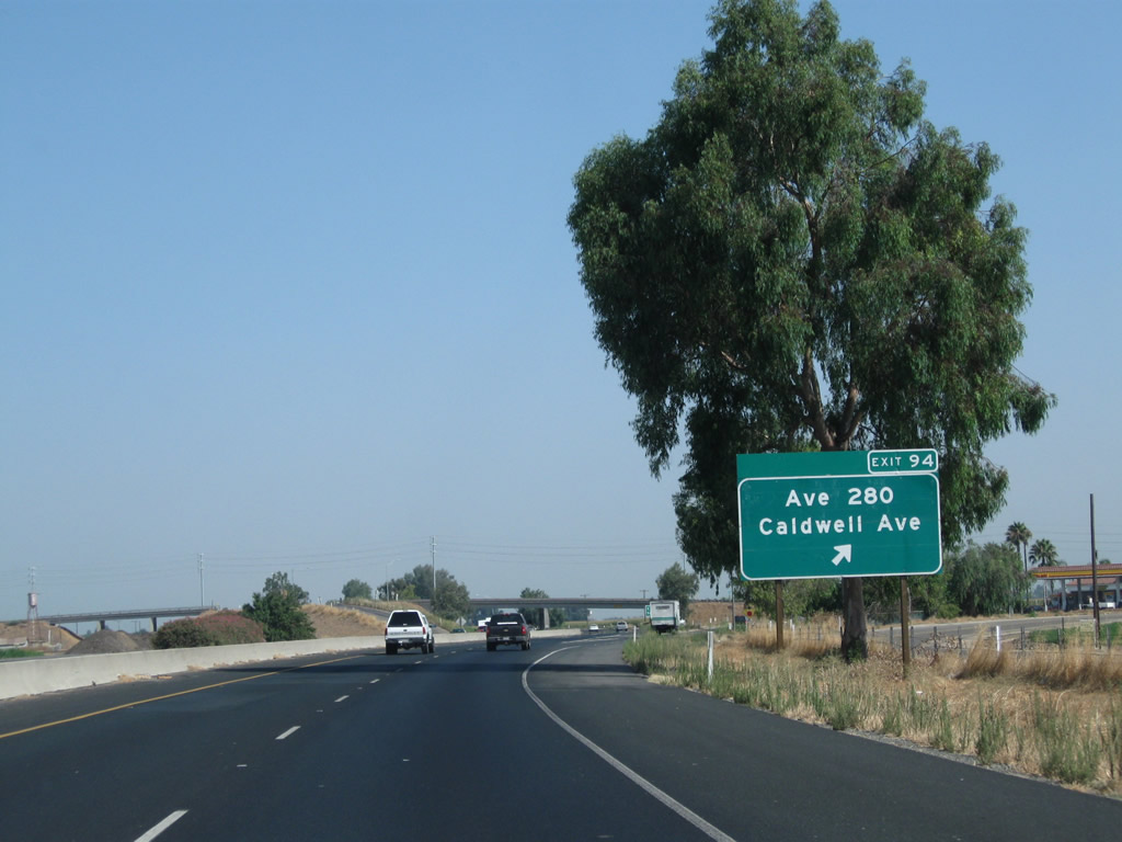
Northbound California 99 meets Exit 94, Avenue 280 (Caldwell Avenue). To the east, Caldwell Avenue (Avenue 280) connects to the California 63 corridor near Farmersville and Exeter.
07/31/11
When California began its modern exit numbering program in 2002, some of the first exit numbering signs were posted in Kern and Tulare Counties along California 99 and Interstate 5. By 2009, nearly every sign along California 99 in the southern San Joaquin Valley had been converted to reflective standards with exit numbers on appropriate advance guide signs as well as gore points such as this one at Exit 94 in Tagus.
07/31/11
This California 99 north reassurance shield is posted after the on-ramp from Avenue 280 (Caldwell Avenue).
06/19/10
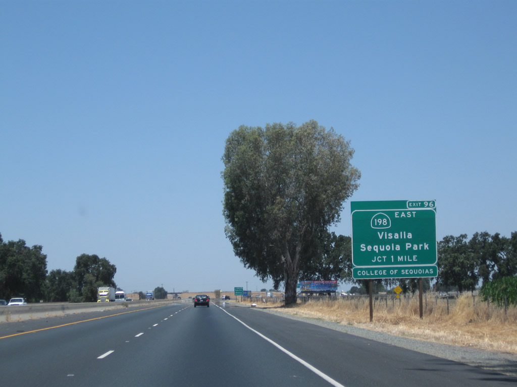
The next exit along California 99 (Golden State Highway) north is Exit 96, California 198 east (one mile), followed by Exit 97, which connects to California 198 west. California 198 leads east into Visalia, culminating its journey upon reaching Sequoia National Park and Kings Canyon National Park. The state route ends in the national parks, and it does not cross the Sierra Nevada.
06/19/10
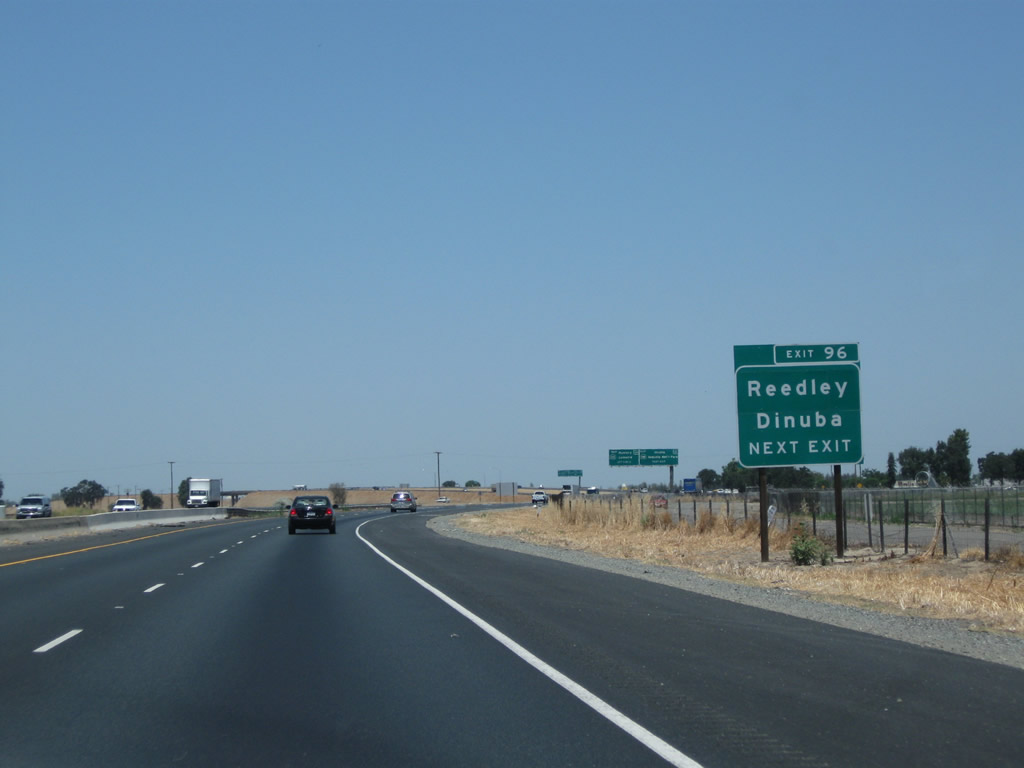
Use California 198 east to Visalia, Farmersville, Lemon Cove, and Three Rivers. To Dinuba and Reedley, use California 198 east to Tulare County J-19 (Plaza Drive) north (Exit 102).
06/19/10
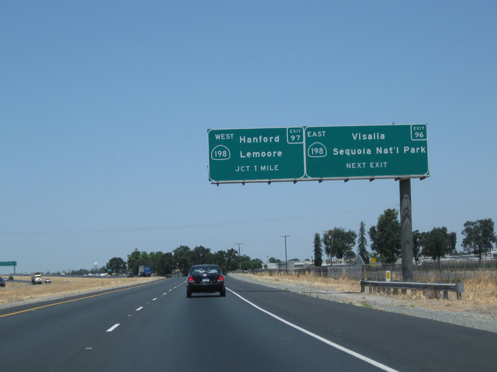
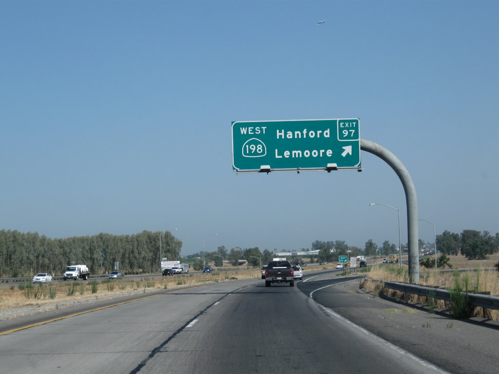
California 99 north approaches Exit 96, California 198 east to Visalia and Sequoia National Park (next right). California 198 is a freeway from California 99 east to near Exeter (near where it meets California 65). The second off-ramp (Exit 97) connects California 99 north to California 198 west to Hanford, Lemoore, and Coalinga.
06/19/10
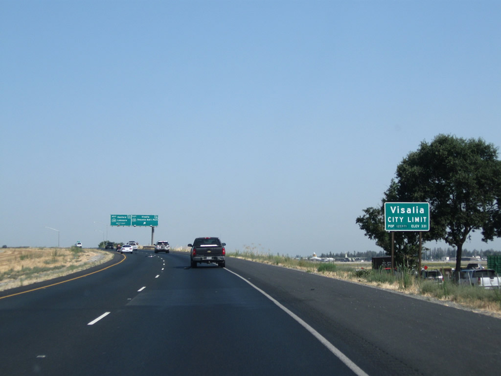
The city of Visalia was incorporated on February 27, 1874, and had a population of 124,442 as of the 2010 Census. Visalia ("Gateway to the Sequoias") is the seat of Tulare County and is situated a bit east of the California 99 corridor, unlike most other cities in the San Joaquin Valley. Like most cities in the southern San Joaquin Valley, Visalia is semi-arid, seeing an average of only 10.88 inches of rain each year. Take California 198 east to downtown Visalia.
07/31/11
Northbound California 99 (Golden State Highway) meets Exit 96, California 198 east to Visalia and Exeter. Stay in the right lane for the connection to Exit 97, California 198 west to Hanford and Lemoore.
07/31/11
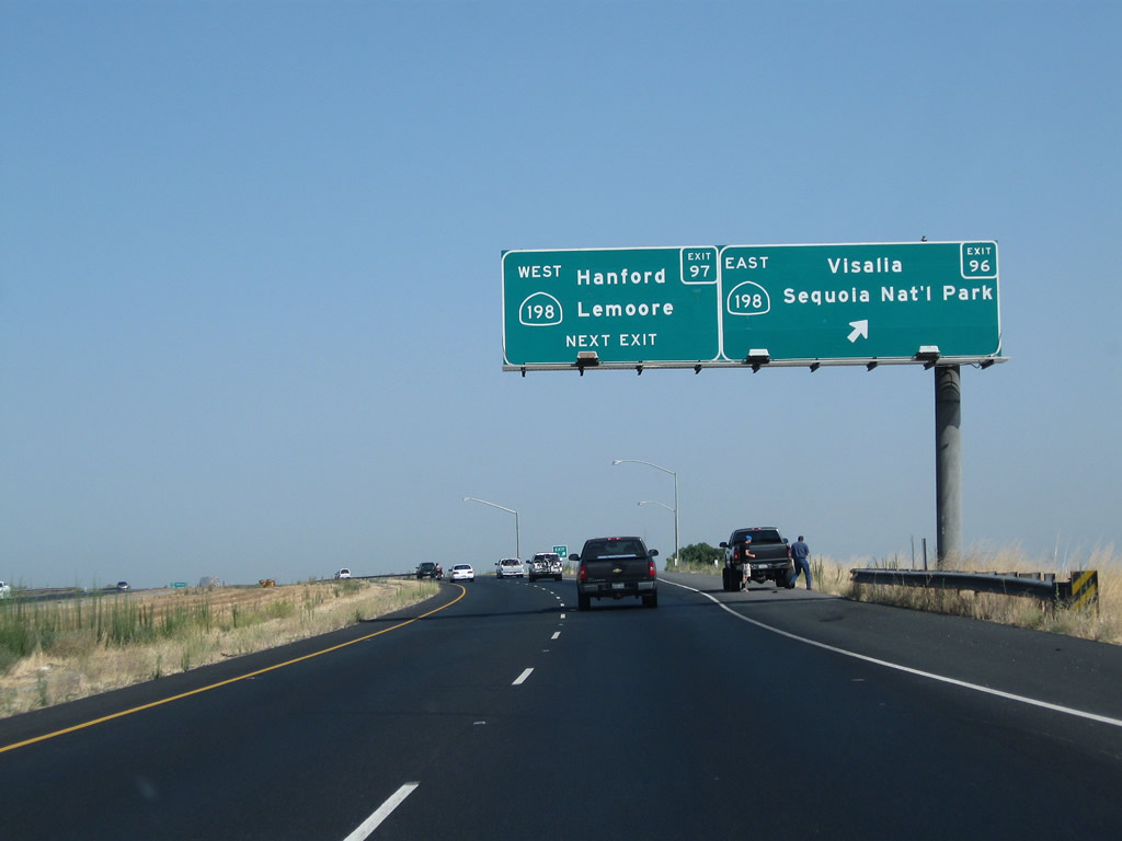
Immediately thereafter, northbound California 99 (Golden State Highway) meets Exit 97, California 198 west to Hanford, Lemoore, and Coalinga. Between Hanford and Lemoore, California 198 is at freeway standards. However, the sections of California 198 that connect to California 99 in the east and Interstate 5 in the west are not freeway standard. It will be interesting to see if the Hanford-Lemoore freeway would be connected the Visalia freeway in the future. California 198 is a fairly long trans-valley route, extending west all the way to U.S. 101 at San Lucas.
07/31/11
A California 99 north reassurance shield is posted after the on-ramp from California 198.
06/19/10

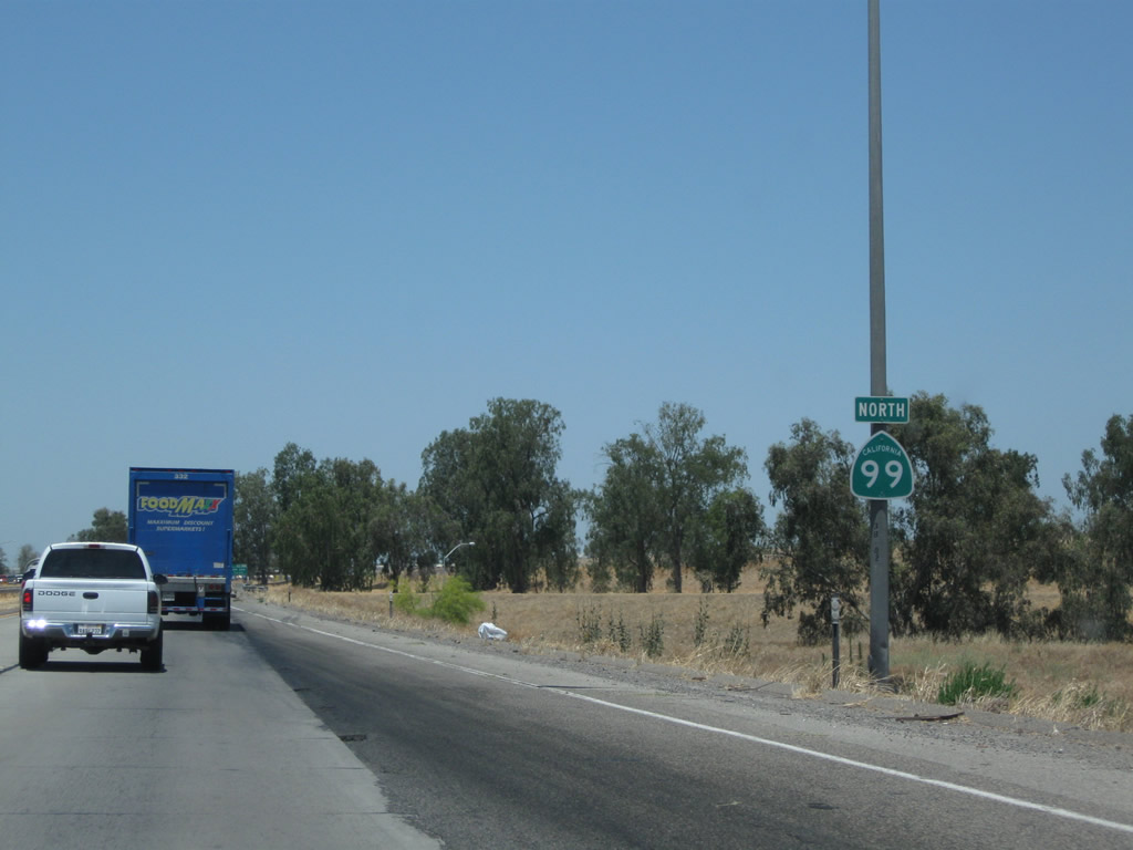
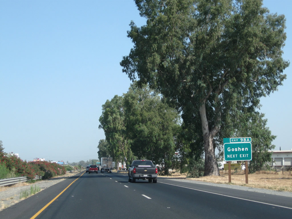
The next exit along California 99 is Exit 98A, Tulare County J-32 (Goshen Avenue).
06/19/10
Tulare County J-32 is an east-west county route that generally follows Avenue 304 (Goshen Avenue) between California 99 in Goshen and California 63 (Court Street) in Visalia. As there is no access to westbound Avenue 304 from Exit 98A, the technical west end of CR J-32 is at the Betty Drive interchange. But exit here for the best route to CR J-32 east.
06/19/10
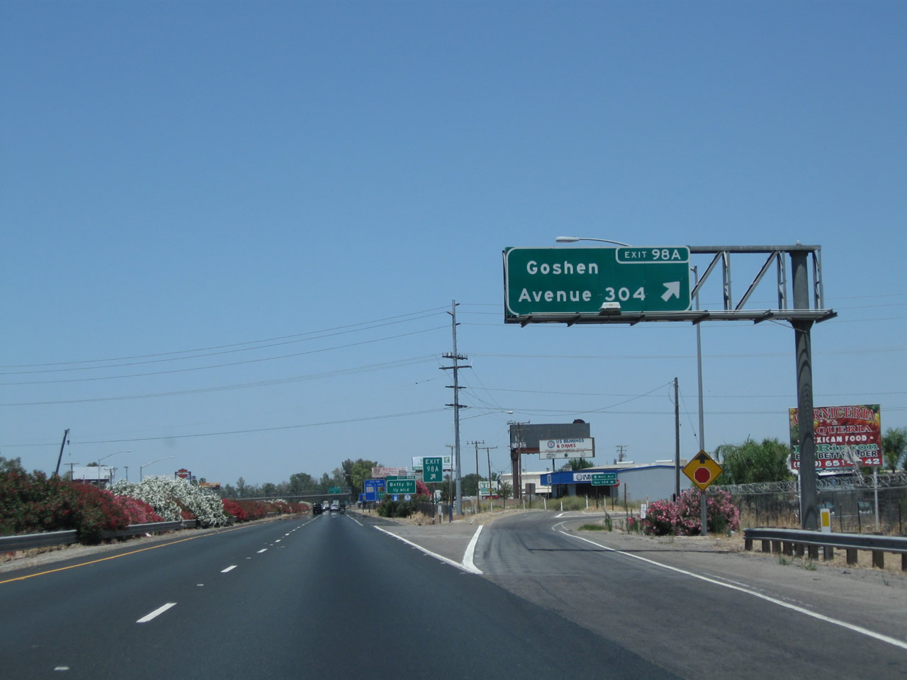
Northbound California 99 (Golden State Highway) meets Exit 98A, Tulare County J-32 (Goshen Avenue) east to Goshen and Visalia. While California 198 provides a freeway connection from California 99 to Visalia, Tulare County J-32 follows a rural road into the seat of Tulare County. This exit serves the community of Goshen (population 3,006 as of 2010 Census), which lies along the east side of California 99.
06/19/10

The next exit along California 99 is Exit 98B, Tulare County J-32 (Elder Avenue).
06/19/10
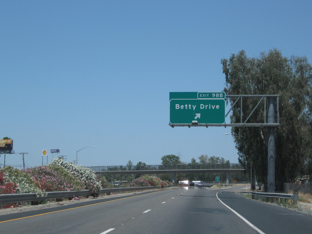
Northbound California 99 (Golden State Highway) reaches Exit 98B, Betty Drive and Elder Street in Goshen.
06/19/10

The Betty Drive pedestrian bridge was under construction in 2004 and completed soon afterward. The gore point is located near the pedestrian bridge before the freeway drops below grade to pass under Betty Drive itself.
06/19/10

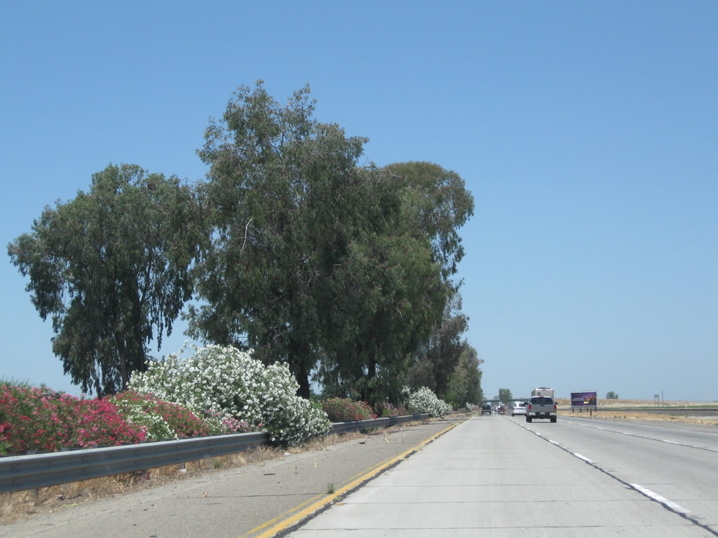
Colorful oleander lines California 99 as the freeway dives below Betty Drive in Goshen.
06/19/10
After passing under Betty Drive, California 99 expands to three northbound lanes.
06/19/10
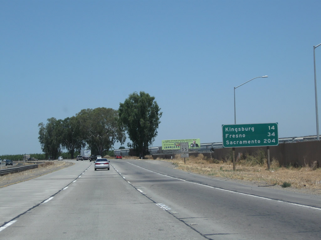
Leaving Goshen, this mileage sign along California 99 (Golden State Highway) north provides the distance to Kingsburg (14 miles), Fresno (34 miles), and Sacramento (204 miles).
06/19/10
Between Goshen and Traver, California 99 carries three northbound lanes. Oleander and eucalyptus trees are the primary landscaping feature on the freeway, while farms and ranches dot the landscape beyond the freeway corridor.
06/19/10
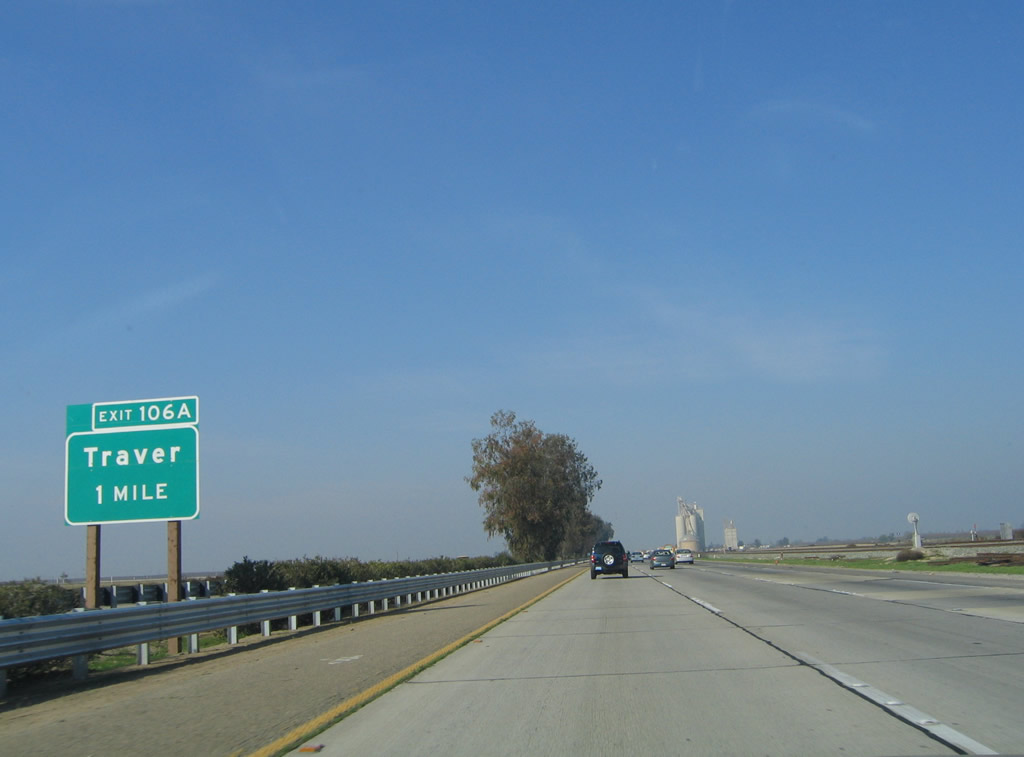
The next exit along California 99 north is Exit 106A, Sixth Street (Old U.S. Highway 99) north to Traver.
11/25/04
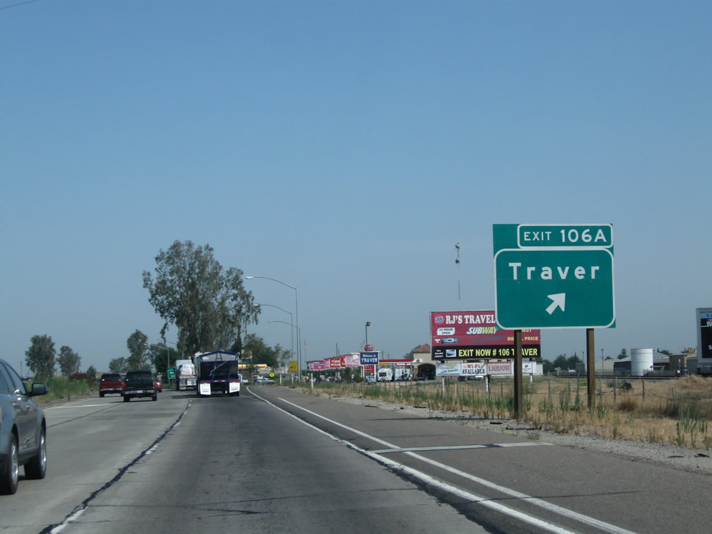
Northbound California 99 meets Exit 106A, Sixth Street (Old U.S. Highway 99) north to Traver. The unincorporated community of Traver is located on the east side of freeway adjacent to the railroad.
07/31/11
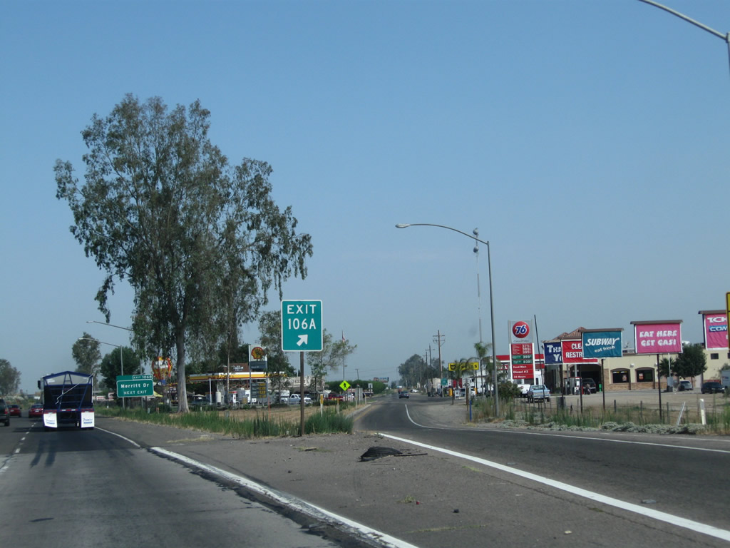
Motorist services such as food and gas are available at Exit 106A.
07/31/11
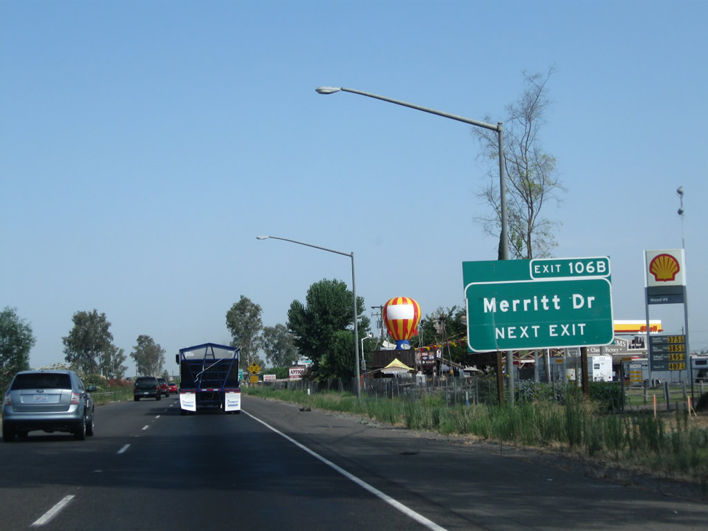
The next exit along California 99 (Golden State Highway) north is Exit 106B, Merritt Drive (next right).
06/19/10
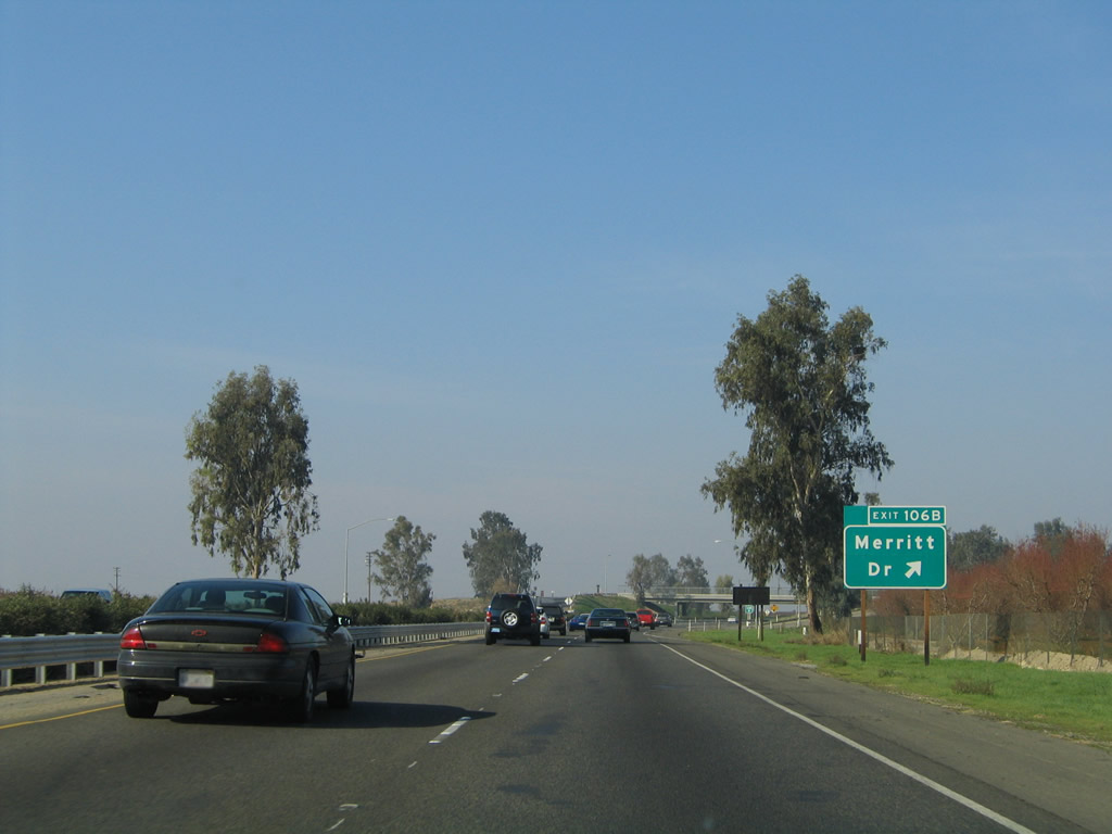
Northbound California 99 meets Exit 106B, Merritt Drive. Note the exit number assembly used for this sign, which was posted in 2003. The next exit is three miles ahead (Exit 109, Tulare County J-38/Avenue 384).
11/25/04
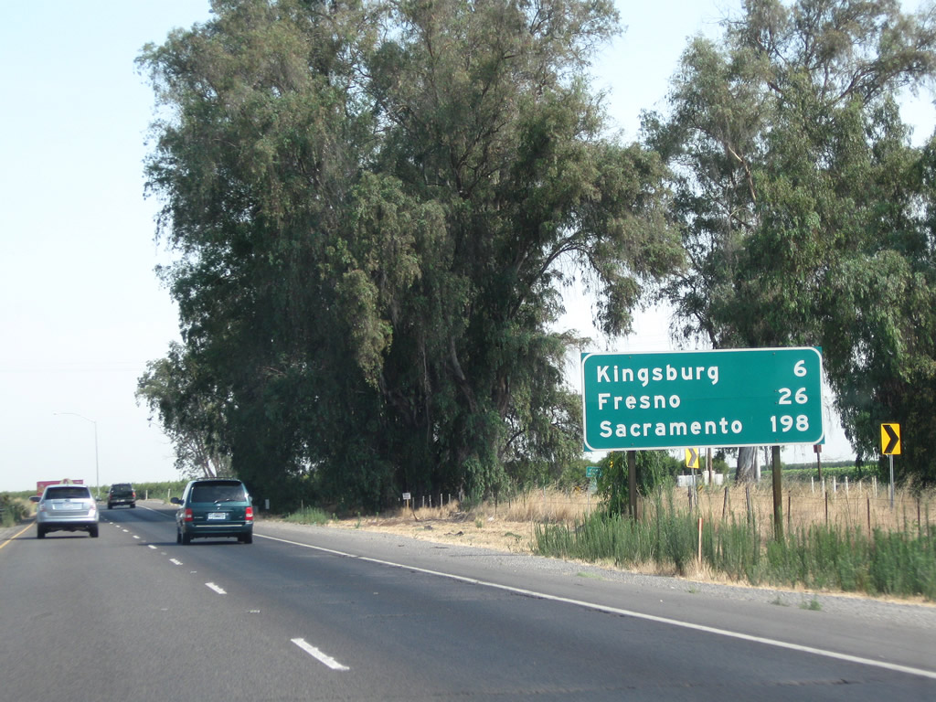
This mileage sign along California 99 (Golden State Highway) north provides the distance to Kingsburg (six miles), Fresno (26 miles), and Sacramento (198 miles). The button copy sign was replaced by a nearly identical ("carbon copy") reflective sign.
07/31/11

Exit 109 leads to the Chester H. Warlow Roadside Safety Rest Area. This rest area features restrooms, water, vending machines, pet exercise area, and parking. To access the rest area, use Exit 109 and turn right and then left into the facility.
07/31/11
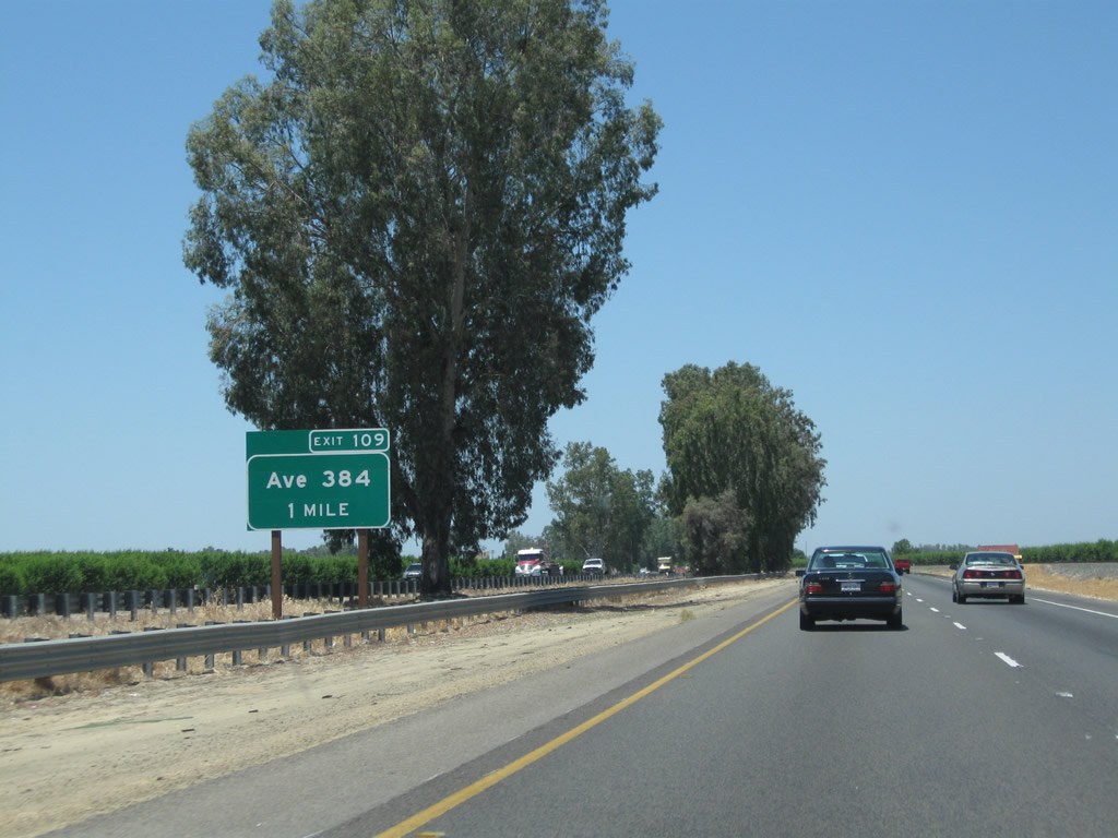
The next exit along California 99 north is Exit 109, Tulare County J-38 (Dodge Avenue) and Rest Area (one mile).
06/19/10
California 99 continues to follow the railroad as it passes through northern Tulare County. This picture shows a relatively new sign placed for Tulare County J-38 (Dodge Avenue). CR J-38 is an east-west county route that begins at Exit 109 and proceeds east to end at California 63 and California 201 in Calgro.
06/19/10
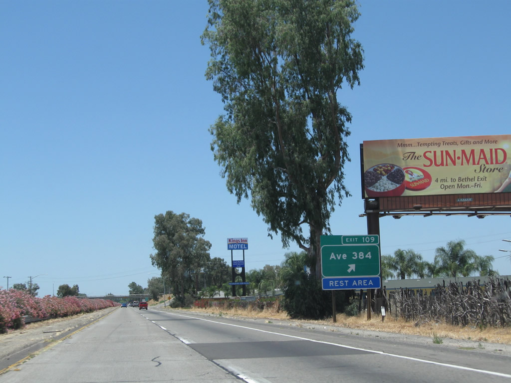
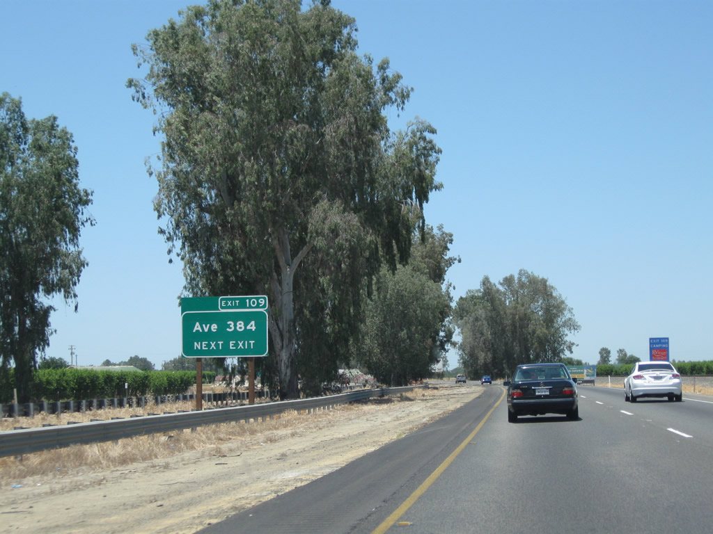
Northbound California 99 meets Exit 109, Tulare County J-38 (Avenue 384) and Rest Area. Note the billboard advertising the Sun-Maid Raisins Visitors Center, which is located four miles ahead in Fresno County at Exit 114, Bethel Avenue.
07/31/11
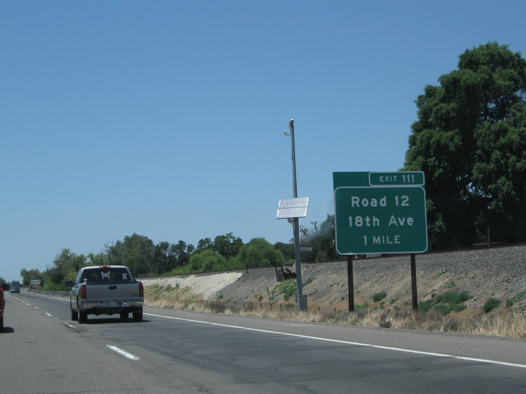
The last Tulare County exit is Exit 111, Road 12 south and 18th Avenue (Mendocino Avenue) north to Kingsburg. This is the first of two interchanges that serve the city of Kingsburg.
06/19/10

The next two exits serve the city of Kingsburg. Former U.S. 99 Business used to begin at this interchange. Starting in Kingsburg, the business route followed the old alignment of U.S. 99 beginning at Exit 111 near the Tulare-Fresno County Line. U.S. 99 Business then traveled north through Kingsburg (Simpson Street / Davis Avenue), Selma (Front Street, with Whitson Avenue as an alternate), Fowler (Golden State Boulevard / 8th Street) and Fresno. The northern terminus of U.S. 99 Business in Fresno could have been the point where Golden State Boulevard merges onto California 99 (near the California 41 interchange at Exit 132A, Ventura Avenue) or at Exit 136 by following G Street, Divisadero Street, and Thorne Avenue.
07/31/11
Northbound California 99 meets Exit 111, Road 12 south and 18th Avenue (Mendocino Avenue) north to Kingsburg. After passing through Kingsburg, 18th Avenue turns into Mendocino Avenue en route to Parlier.
07/31/11
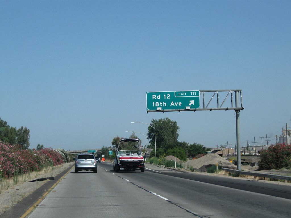
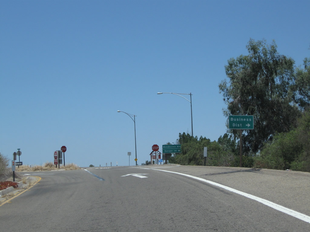
Signage along the off-ramp at Exit 111 to Road 12 south and 18th Avenue (Mendocino Avenue) north to Kingsburg. Although 18th Avenue north leads into the Kingsburg business district, this route is not an officially recognized business loop of California 99. To the old alignment of U.S. 99 (Golden State Boulevard), continue straight ahead onto Davis Avenue, which connects to the south end of Golden State Boulevard, a very long, old expressway that predates the freeway alignment of U.S. 99. This was a very long business route leading north from Kingsburg to Fresno, but no signs remain in place today for the former business loop. For old highway buffs, it is fun to drive this old expressway as it still has many of the older stylings that harken back to a different era of highway building.
06/19/10
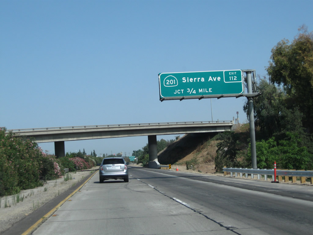
The next exit along California 99 north is Exit 112, California 201 (Sierra Street) east and Sierra Street west (to Conejo Avenue west) (three-quarters of a mile). California 201 travels east from this interchange to California 245 near Woodlake via Culter and Yettem. This sign is actually located within Tulare County, but the actual interchange is located in Fresno County.
07/31/11
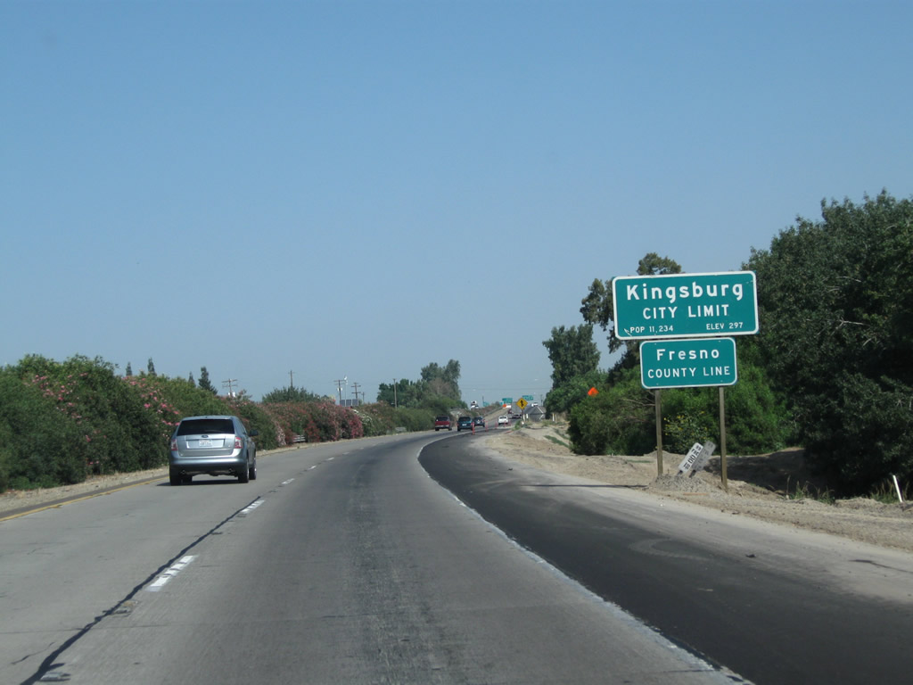
California 99 leaves Tulare County and enters Fresno County and the city of Kingsburg. Fresno County is one of the more populous counties in California, with 930,450 residents as of the 2010 Census. The county spans the Central Valley (San Joaquin Valley), with both Interstate 5 and California 99 crossing the county from south to north. Kingsburg, the first city along California 99 in Fresno County, had a population of 11,382 as of the 2010 Census and was incorporated on May 29, 1908.
07/31/11
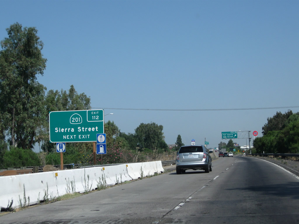
California 201 is a short east-west state route that begins here at this interchange and travels east through Kingsburg to Dinuba, Orosi, and Yettem before ending at California 245 north of Woodlake.
07/31/11
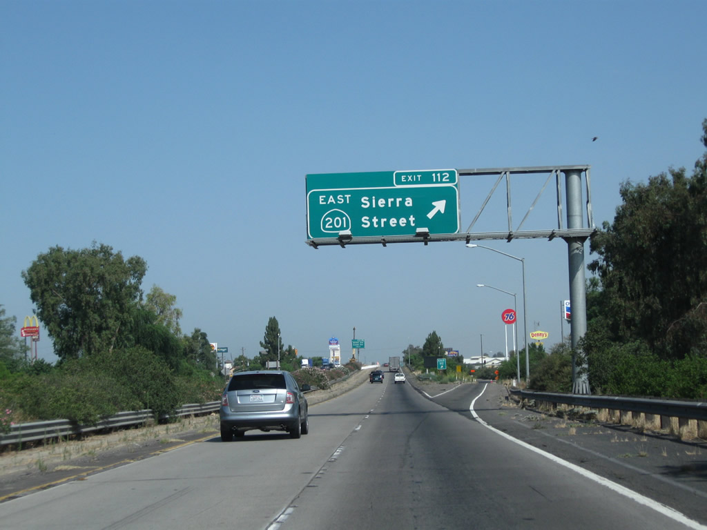
Northbound California 99 (Golden State Highway) meets Exit 112, California 201 (Sierra Street) east to Kingsburg and Sierra Street west to Conejo Avenue en route to Conejo and California 43.
07/31/11
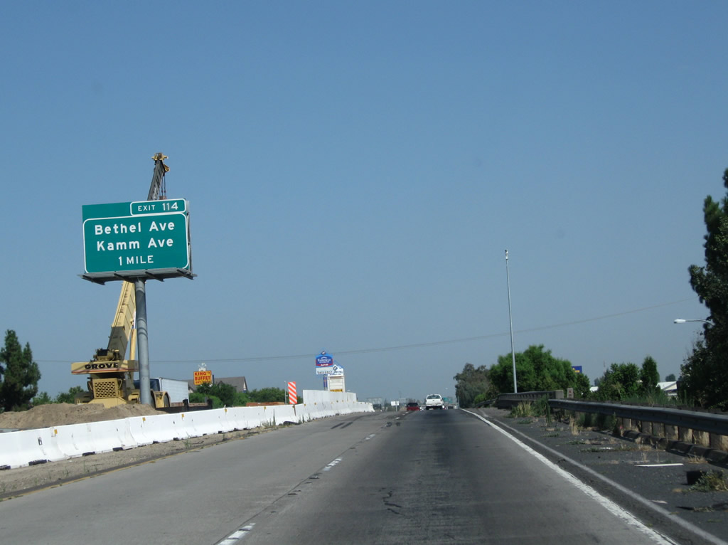
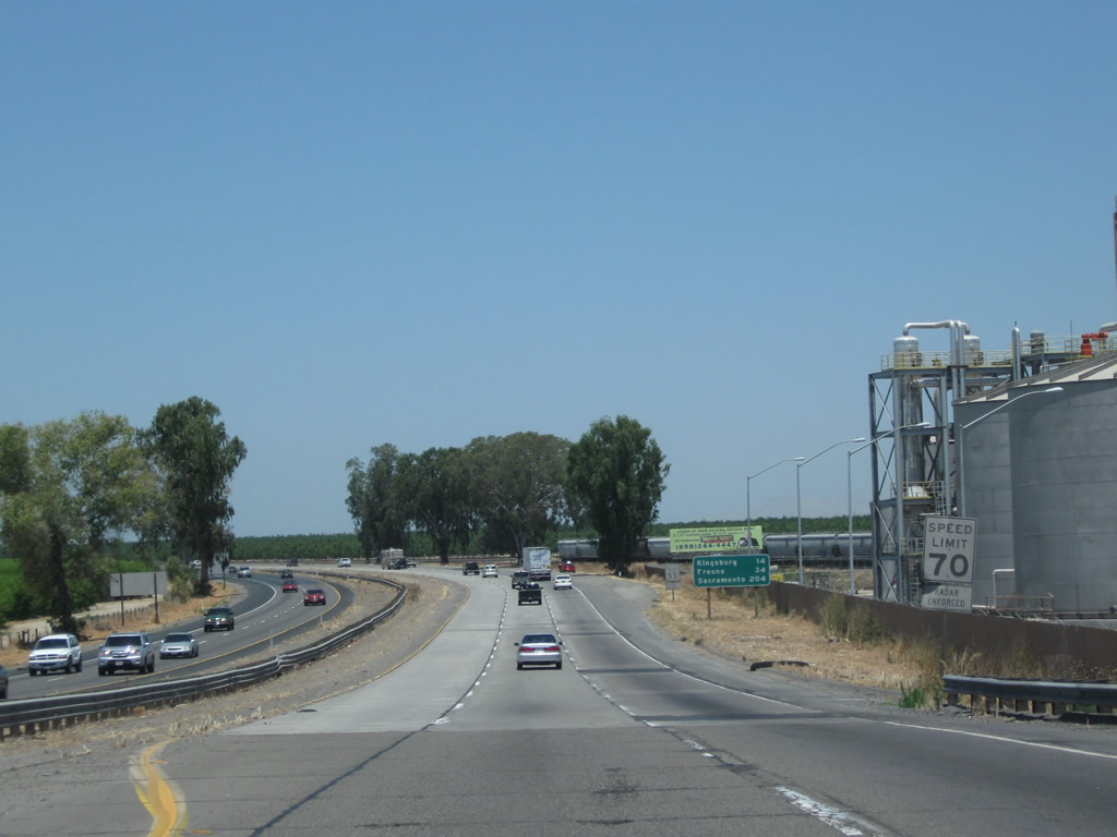
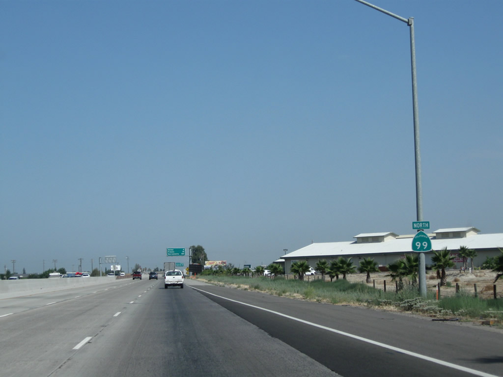
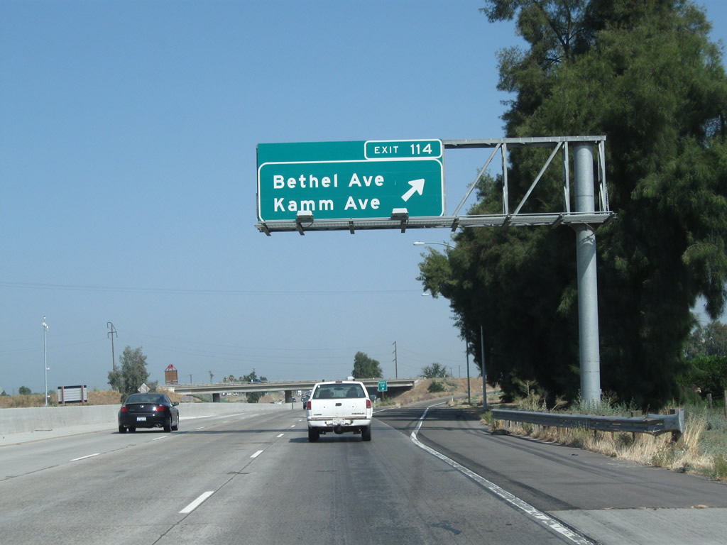
The next exit along California 99 north is Exit 114, Bethel Avenue and Kamm Avenue. Bethel Avenue travels north to the Sun-Maid Growers Visitor Center. This part of the Central Valley is famous for its raisins, which are dried grapes. Kamm Avenue is an east-west highway that meets Bethel Avenue at this interchange.
07/31/11
Upon crossing over California 201 (Sierra Street), California 99 north widens to three lanes. Plans call for all of California 99 in the San Joaquin Valley to be widened to three lanes in each direction; construction efforts are visible on the bridge over Sierra Street.
07/31/11
This California 99 north reassurance shield is posted after the on-ramp from California 201 (Sierra Street). Ahead, the next exit is to Bethel Avenue and Kamm Avenue.
07/31/11
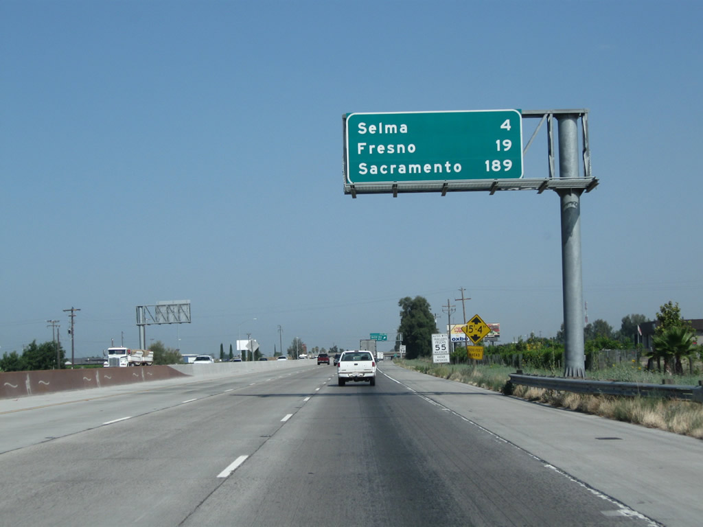
This mileage sign along California 99 north provides the distance to Selma (four miles); Fresno (19 miles); and Sacramento (189 miles).
07/31/11
Northbound California 99 (Golden State Highway) meets Exit 114, Bethel Avenue and Kamm Avenue.
07/31/11

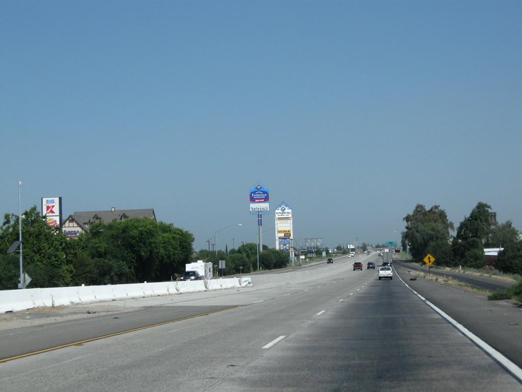
The next exit along California 99 north is Exit 115, Fresno County Route J-40 (Mountain View Avenue). Note the freeway expansion that resulted in an additional left lane through here; it was added between 2004 and 2011.
07/31/11
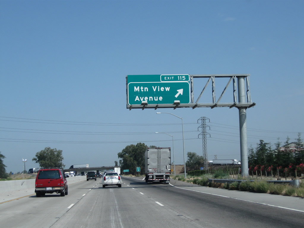
Northbound California 99 meets Exit 115, Fresno County Route J-40 (Mountain View Avenue). J-40 is an east-west, mostly unsigned county route that extends from California 99 Exit 115 east to Dinuba, ending at California 63 in Orosi. To the west, use Mountain View Avenue to California 43 (Central Valley Highway), California 41, and Caruthers.
07/31/11
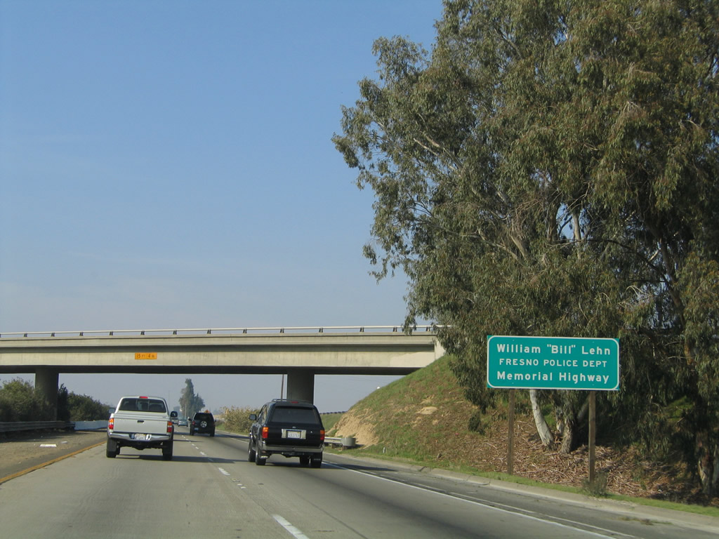
This section of California 99 is dedicated to Fresno Police Officer William Lehn.
08/15/03
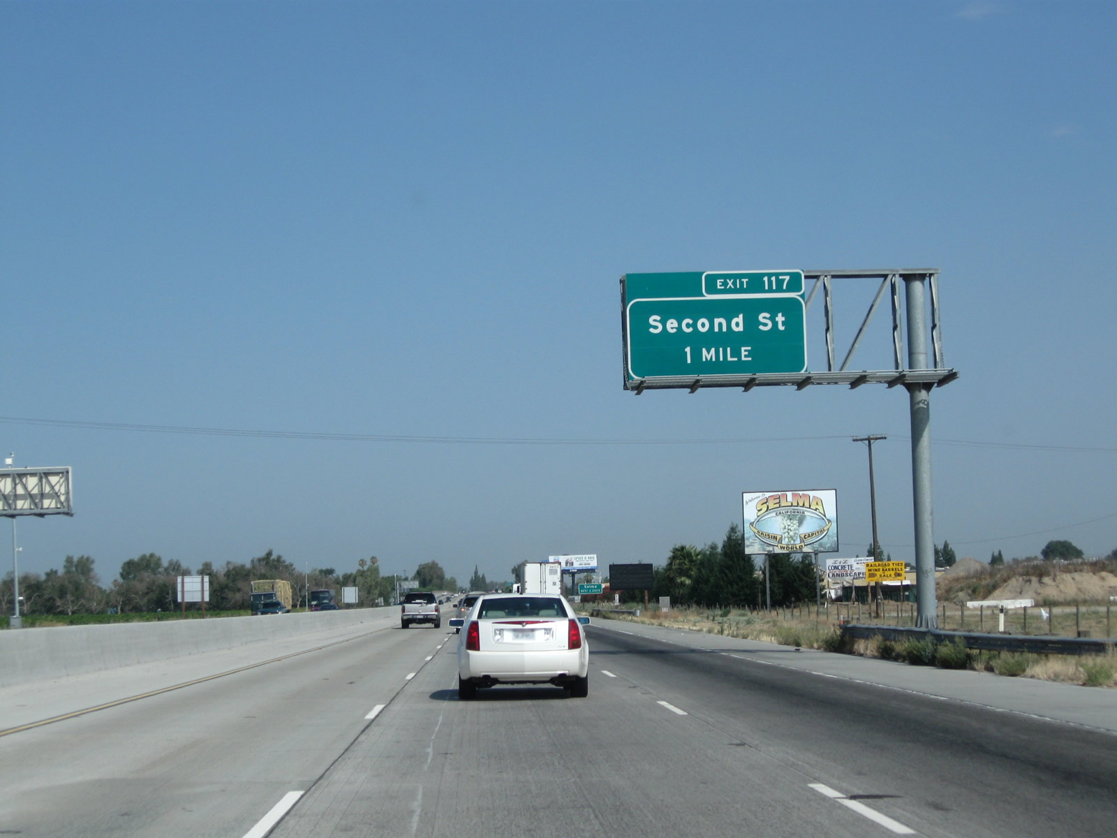
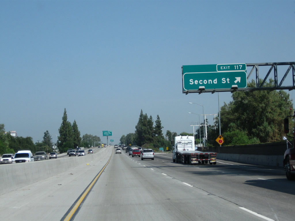
The next exit along California 99 north is Exit 117, Second Street (one mile). This is the first of two interchanges that serve the city of Selma, which is noted on the billboard as being the "Raisin Capital of the World."
07/31/11
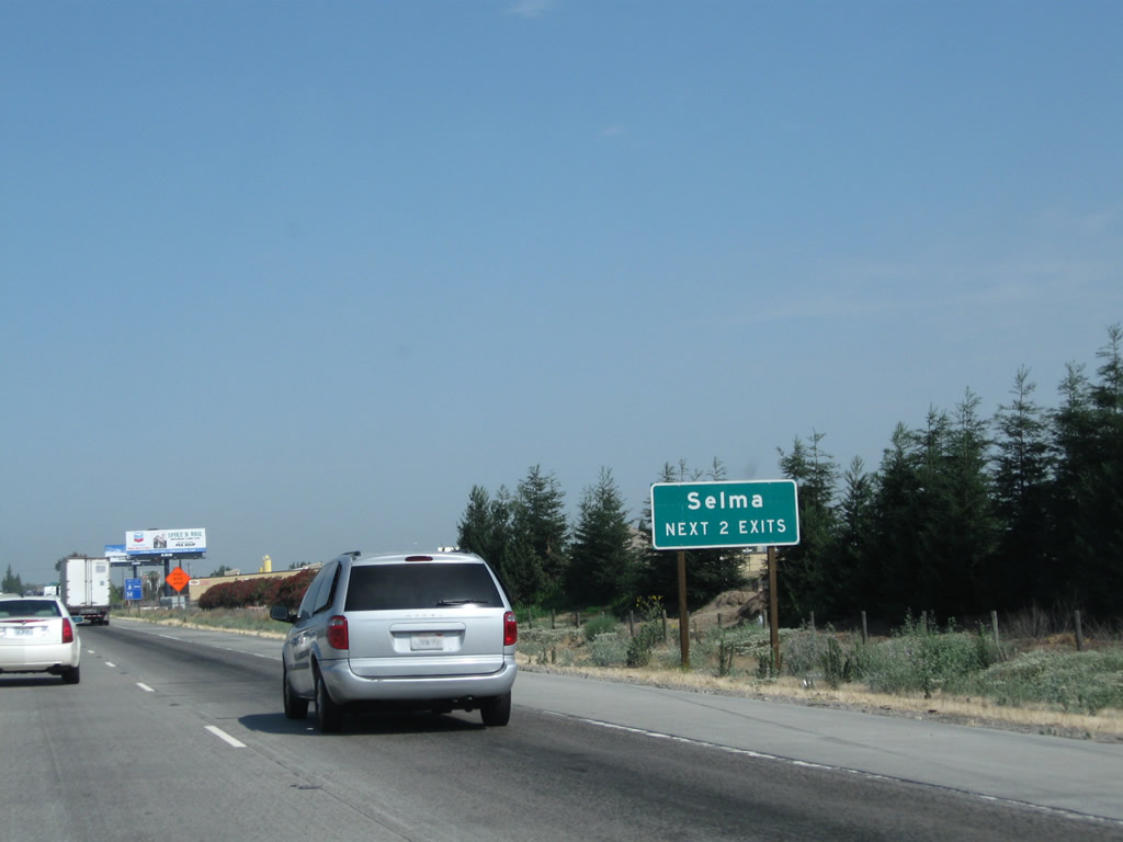
Both Exit 117, Second Street and Exit 118, Floral Avenue and California 43 (Highland Avenue) will serve the city of Selma.
07/31/11
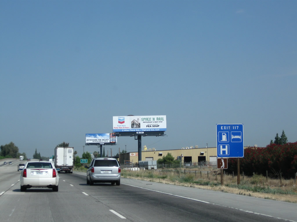
Most motorist services (gas, lodging, hospital, and golf course) are available at Exit 117, Second Street in Selma.
07/31/11
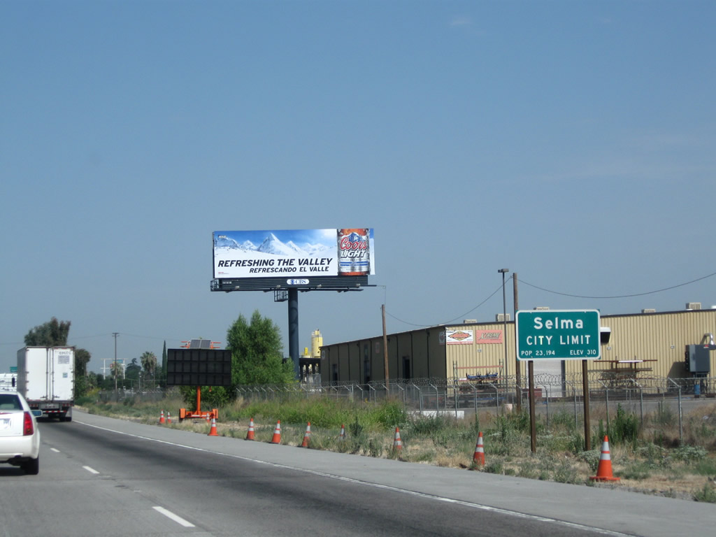
California 99 enters the city of Selma, the "Raisin Capital of the World." Selma had a population of 23,219 as of the 2010 Census and was incorporated on March 15, 1893.
07/31/11
Northbound California 99 reaches Exit 117, Second Street, which serves the city of Selma. Use Second Street southwest to Nebraska Avenue west en route to Monmouth or northeast to connect to McCall Avenue north to Clotho.
07/31/11

The next exit along California 99 north is Exit 118, Floral Avenue east/west, California 43 (Highland Avenue) south, and Highland Avenue north. Floral Avenue travels east to Selma and west to Monmouth. California 43 (Highland Avenue) travels south to Hanford and Corcoran. Highland Avenue continues north of this interchange to end at Dinuba Avenue. To Old U.S. 99/Golden State Boulevard, follow Highland Avenue north.
07/31/11
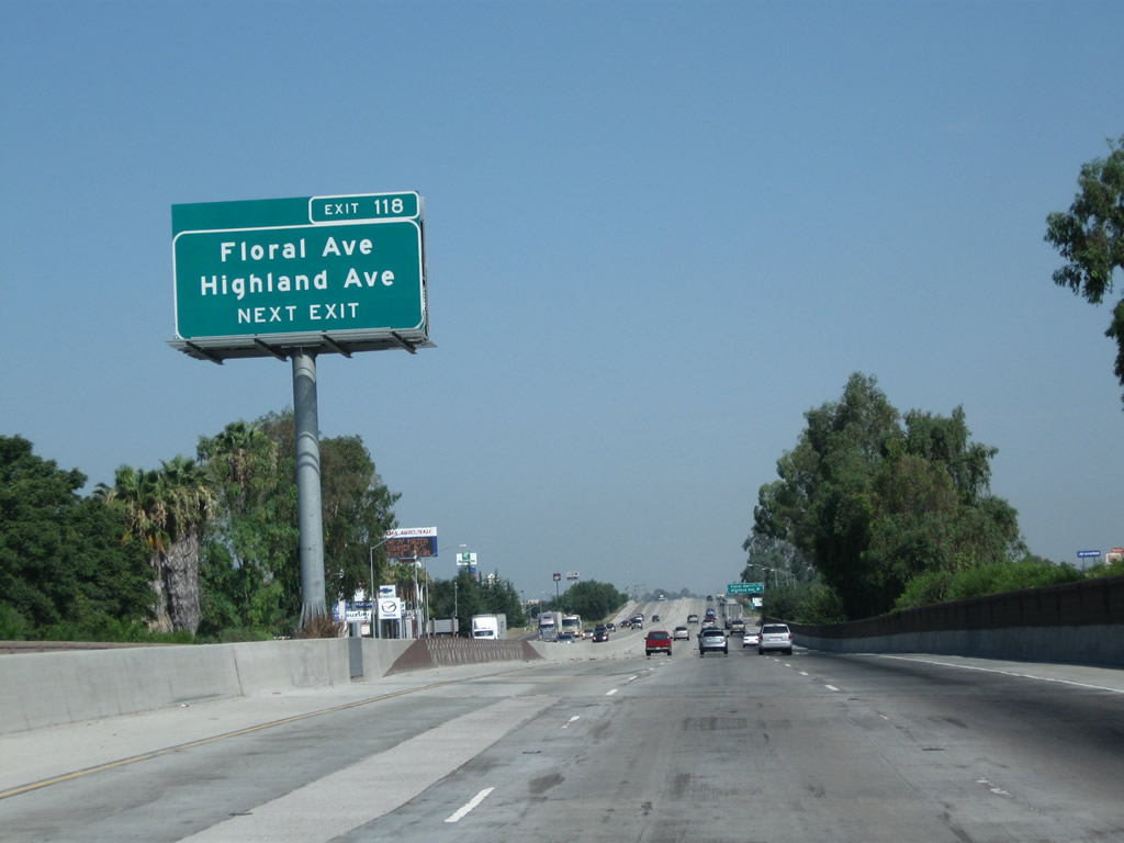
California 43 is not signed from northbound California 99 since it is an illogical connection to connect to another state highway traveling south. However, this important state highway (generally known as the Central Valley Highway) begins at California 119 (Taft Highway) and travels north through Shafter, Wasco, Corcoran, and Hanford before culminating here in Selma. The upcoming interchange features most motorist services, including gas, food, and lodging.
07/31/11
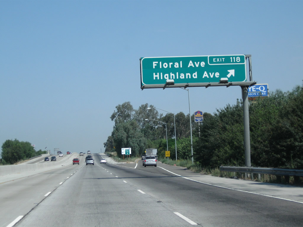
Northbound California 99 (Golden State Highway) reaches Exit 118, Floral Avenue east to Selma, Floral Avenue west to Selma Airport and California 41, California 43 (Highland Avenue) south to Hanford, and Highland Avenue north to Old U.S. 99/Golden State Boulevard and Dinuba Avenue.
07/31/11
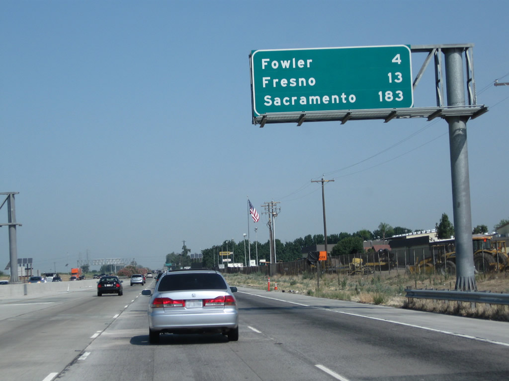
Leaving the California 43 interchange behind, this mileage sign along California 99 north provides the distance to Fowler (four miles), Fresno (13 miles), and Sacramento (183 miles). When the third lane was added through this area between Selma and Fowler, this sign was elevated and moved onto a sign bridge.
07/31/11
Photo Credits:
- Andy Field: 08/15/03, 11/25/04, 06/19/10, 07/30/11, 07/31/11
Connect with:
Page Updated Friday February 24, 2012.