
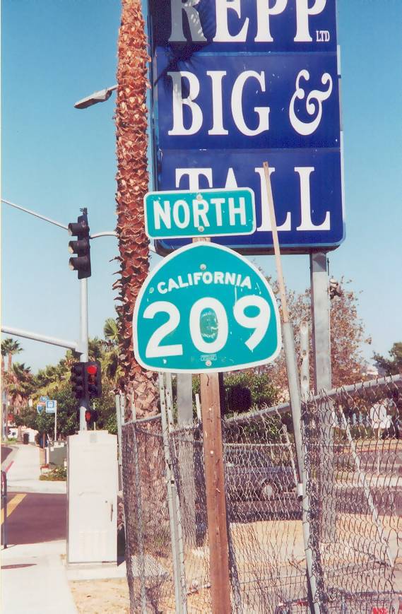
Former State Route 209
California 209 was decommissioned in May 2001 as part of a statewide shedding of non-freeway, urban surface streets that were previously part of the state highway system. Other routes that suffered the same fate include California 54 (Second Street) in El Cajon, California 274 (Balboa Avenue) in San Diego, and California 2 in Beverly Hills. These routes are no longer within the state highway system and are now locally maintained, usually by the city in which the former route is vacated. California 209 used to include all or parts of Camino del Rio West, Rosecrans Street, Canon Street, Catalina Boulevard, and Cabrillo Memorial Drive as it wound its way southwest from the Interstate 5/Interstate 8 interchange toward Cabrillo National Monument at the tip of Point Loma. As of October 2002, California 209 was still well-signed for its entire length, but as the city of San Diego took ownership of the route and made it city standard, the remaining shields and signs that referencing the 209 designation were removed.
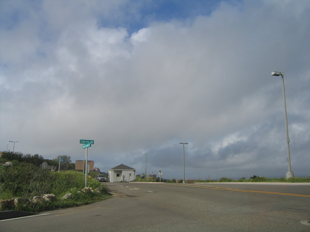
State Route 209 formerly began along Cabrillo Memorial Drive north beyond the main parking lot of Cabrillo National Monument. This view is at the intersection of Cabrillo Memorial Drive and Cabrillo Road just south of the entrance station and fee booth for the national monument.
02/19/05
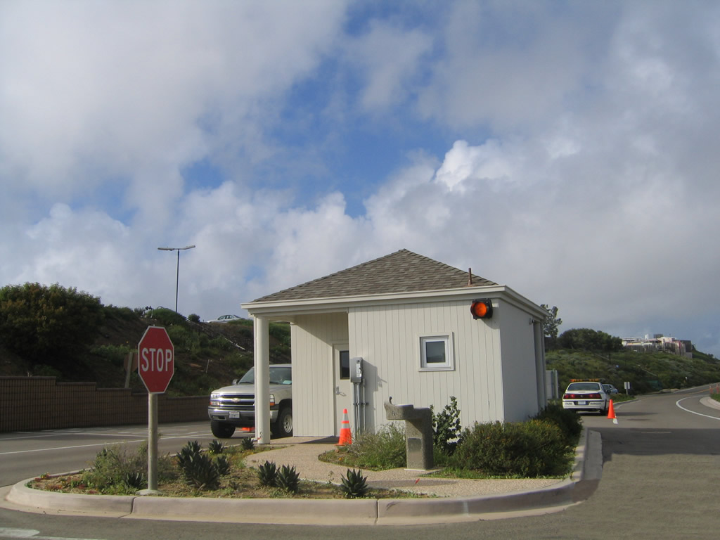
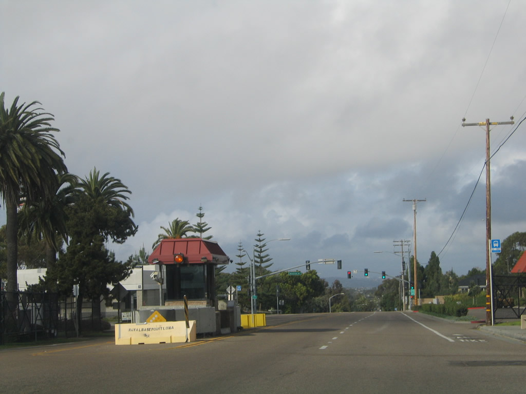
The fee station for the national monument is located in the middle of Cabrillo Memorial Drive. The monument is located at the tip of Point Loma in San Diego.
02/19/05
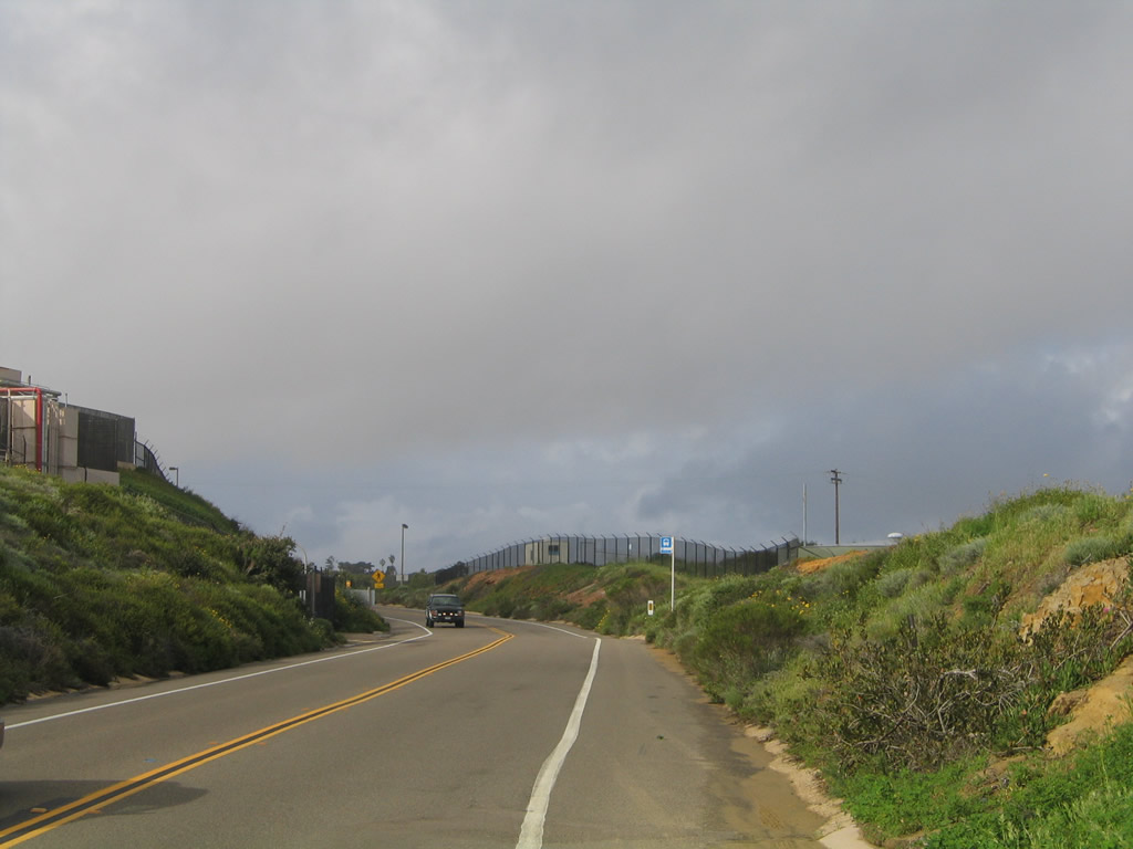
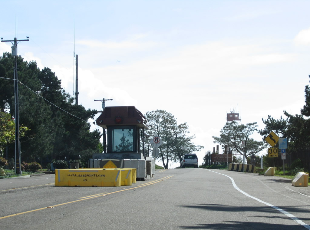
The initial section of Cabrillo Memorial Drive is surrounded by the Fort Rosecrans Military Reservation, and access through the reservation is limited to certain hours (south of Mills Street). A gate is located south of Mills Street to regulate traffic flow into the reservation.
02/19/05
Removed by June 2009, this was the first shield for northbound California 209 in Fort Rosecrans Military Reservation. Some of the facilities in this military reservation include communications equipment and a large national cemetery. Due to security requirements, the military imposes a nightly curfew on the segment of California 209 that passes through the military reservation: unauthorized traffic is not allowed after dusk beyond a military checkpoint just south of Mills Street.
02/19/05
Passing through the military installation is a cemetery on the east side of Cabrillo Memorial Drive.
02/19/05
Leaving Fort Rosecrans Military Reservation, California 209 shifted from Cabrillo Memorial Drive to Catalina Drive at this point. A guard house is located at the point where the state route left the military area with restricted hours of access and becomes a city street from here northward.
02/19/05
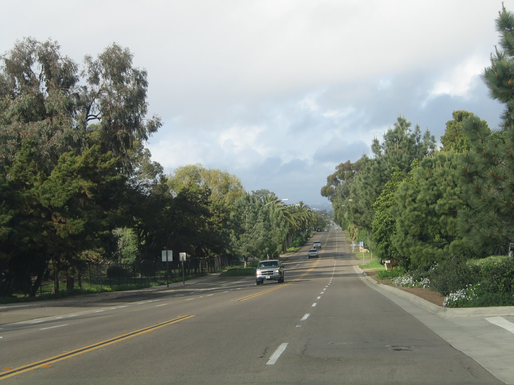
Old SR 209 continued as Catalina Boulevard along a stretch maintained by the city of San Diego. The four lane boulevard passes by Point Loma Nazarene University to the east.
02/19/05
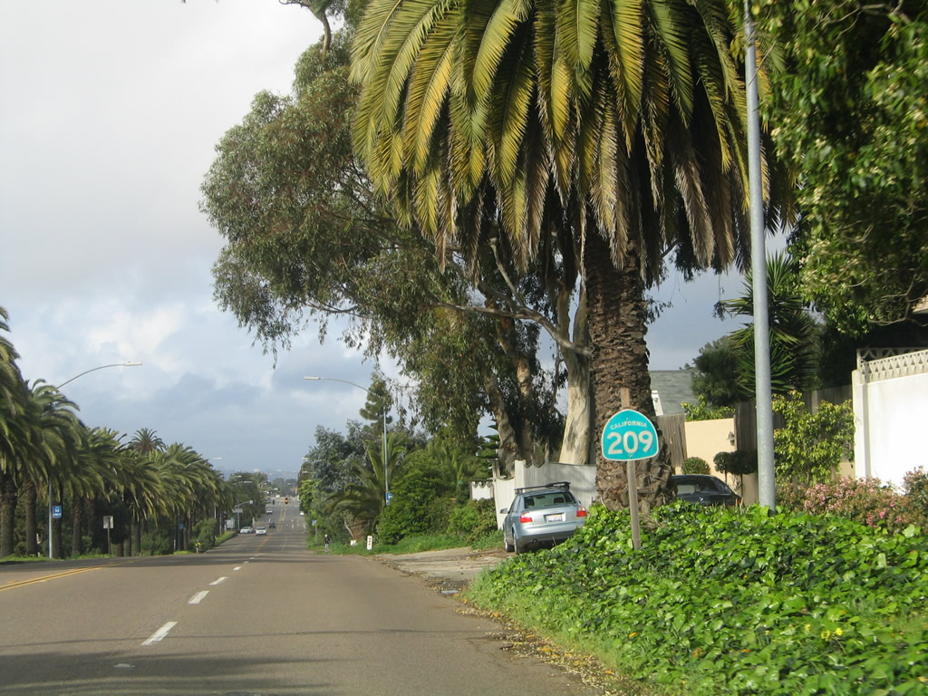
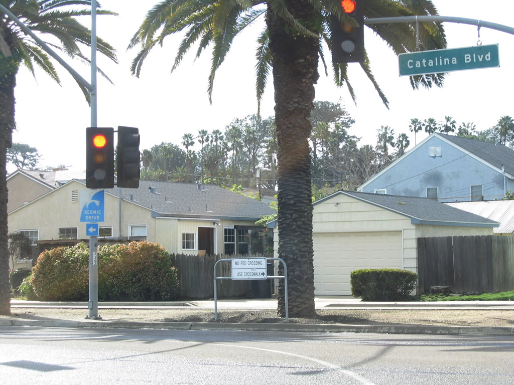
This reassurance shield for California 209 was posted near Point Loma Nazarene University along northbound Catalina Boulevard.
02/19/05
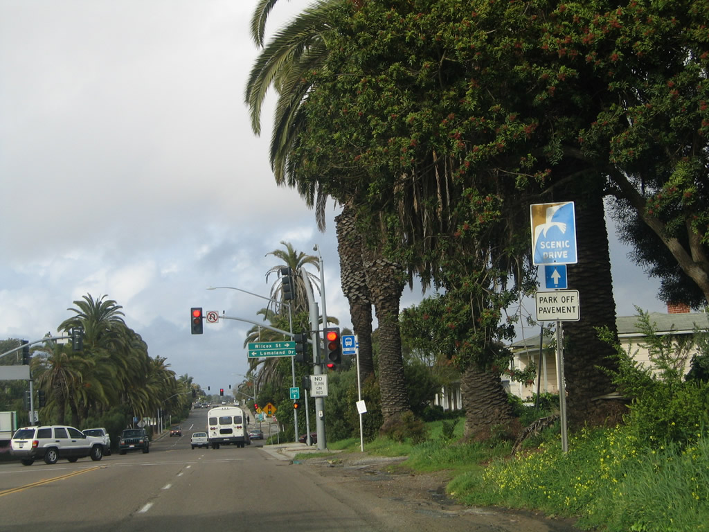
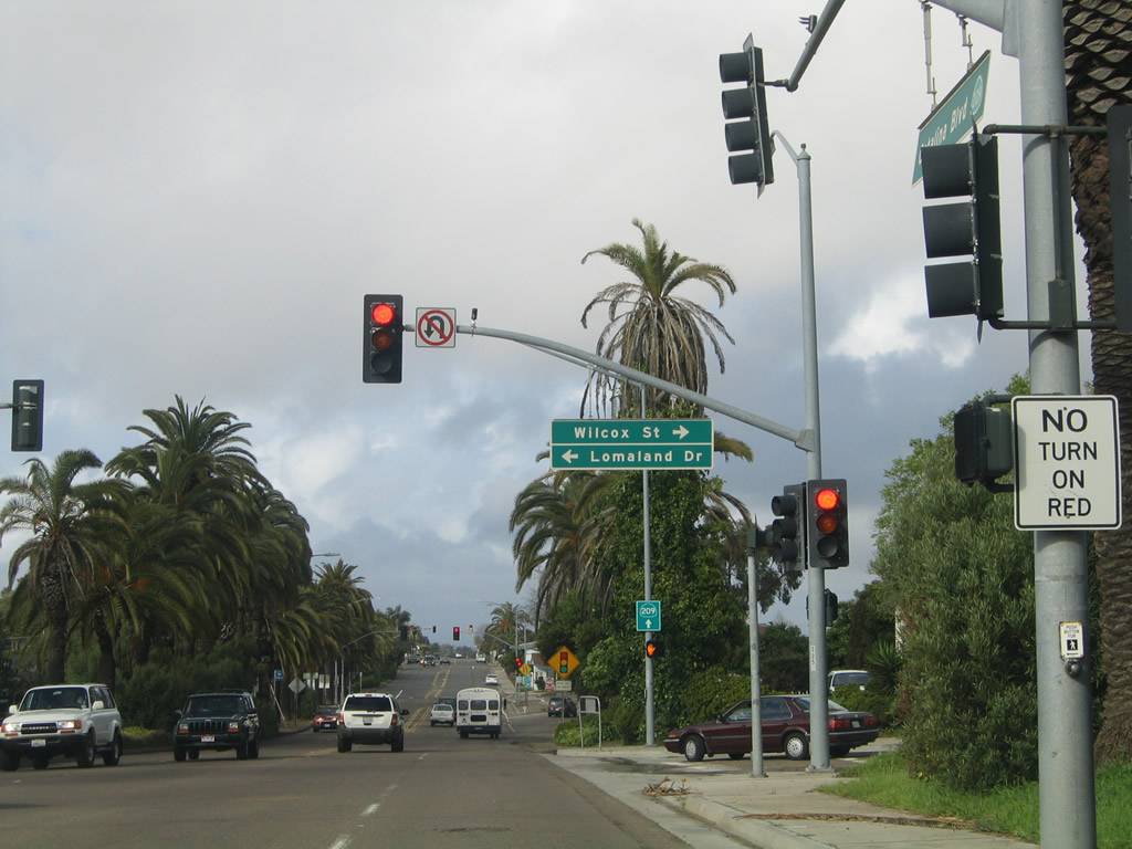
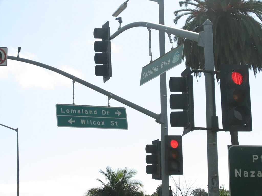
Northbound Catalina Boulevard meets Lomaland Drive and Wilcox Street at this traffic signal.
02/19/05
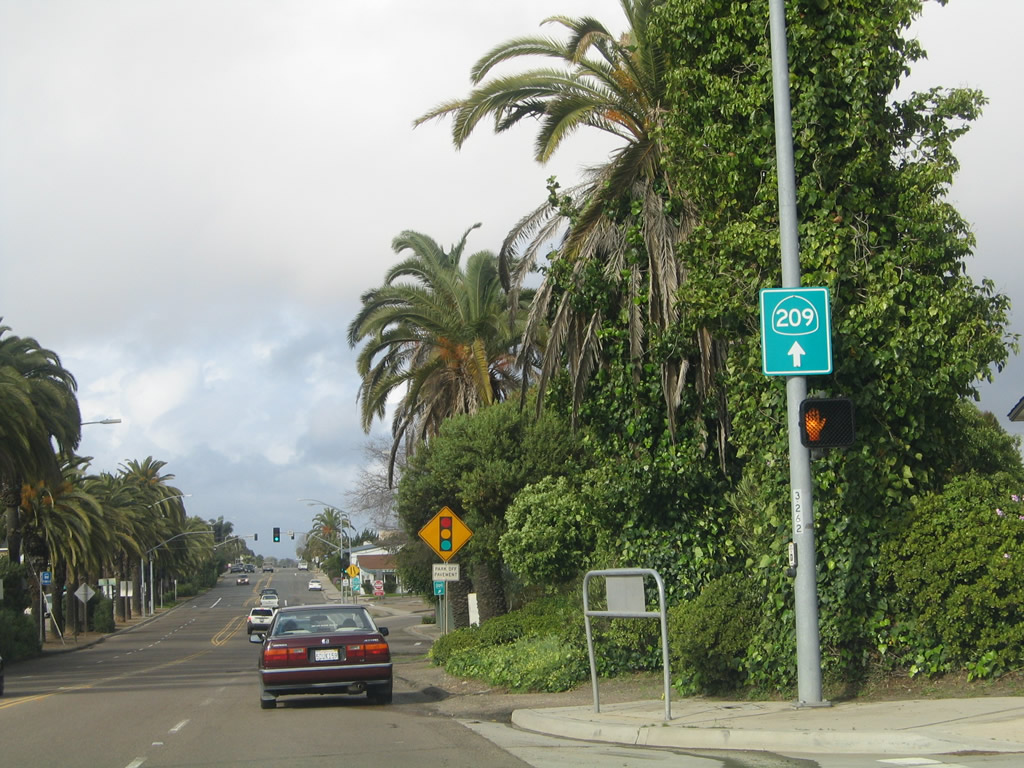
Installed by the city of San Diego, a SR 209 trailblazer was posted along Catalina Boulevard north at Wilcox Street.
02/19/05
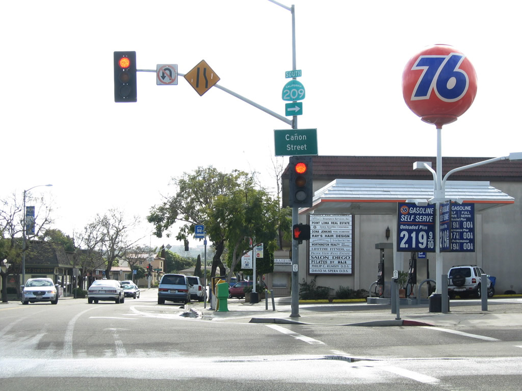
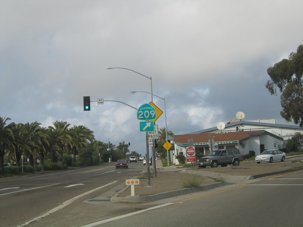
While Catalina Boulevard continues north toward Interstate 8, SR 209 used to turn northeast onto Canon Street.
02/19/05
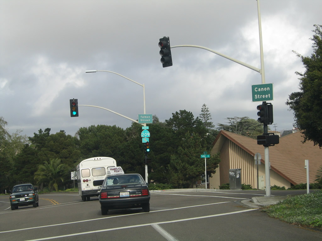
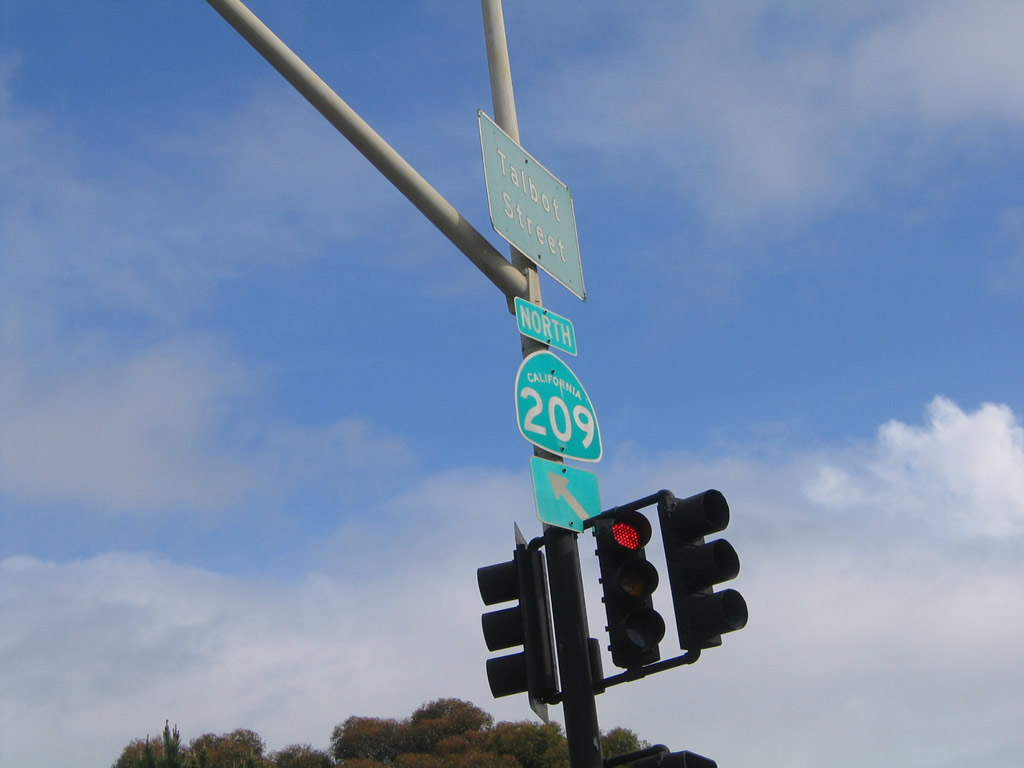
Canon Street angles northeast from Catalina Boulevard to a signalized intersection with Talbot Street.
02/19/05
Canon Street has two lanes between Catalina Boulevard and Rosecrans Street near Shelter Island. Point Loma Avenue stems northwest to Sunset Cliffs and Ocean Beach while Canon Street turns southeast toward Roseville.
02/19/05
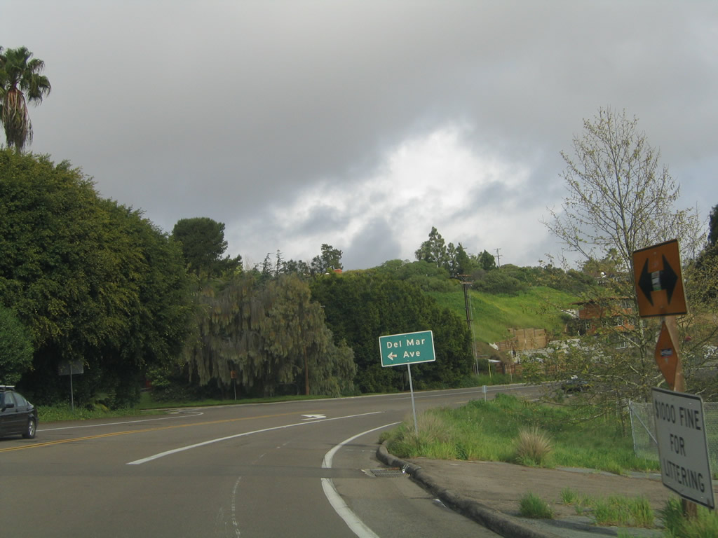
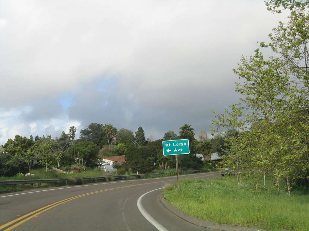
The next intersection along Canon Street (old SR 209) north is with Del Mar Avenue north to Chatsworth Boulevard and west to Sunset Cliffs and Ocean Beach.
02/19/05
Canon Street proceeds southeast into the Roseville neighborhood of the Point Loma community and passes by Cabrillo Recreation Center ahead of Rosecrans Street.
02/19/05
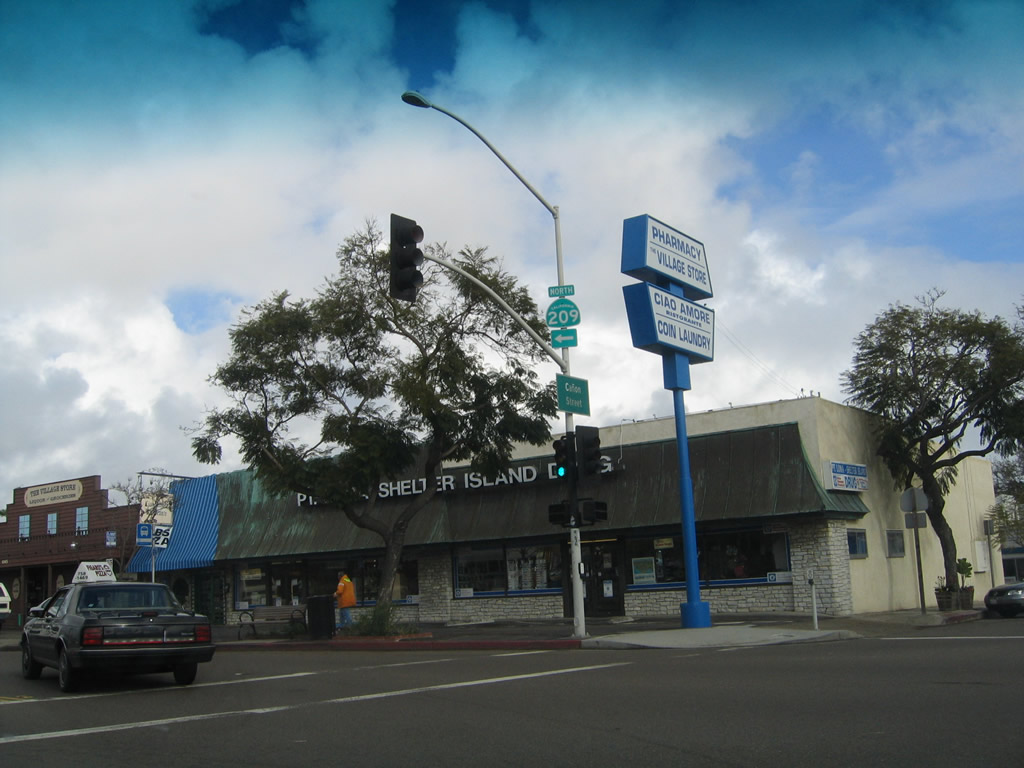
SR 209 turned northeast from Canon Street onto Rosecrans Street in Roseville.
02/19/05
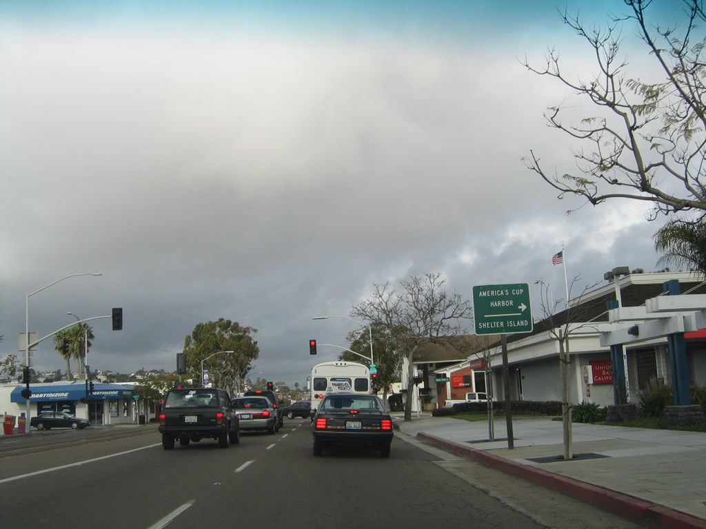
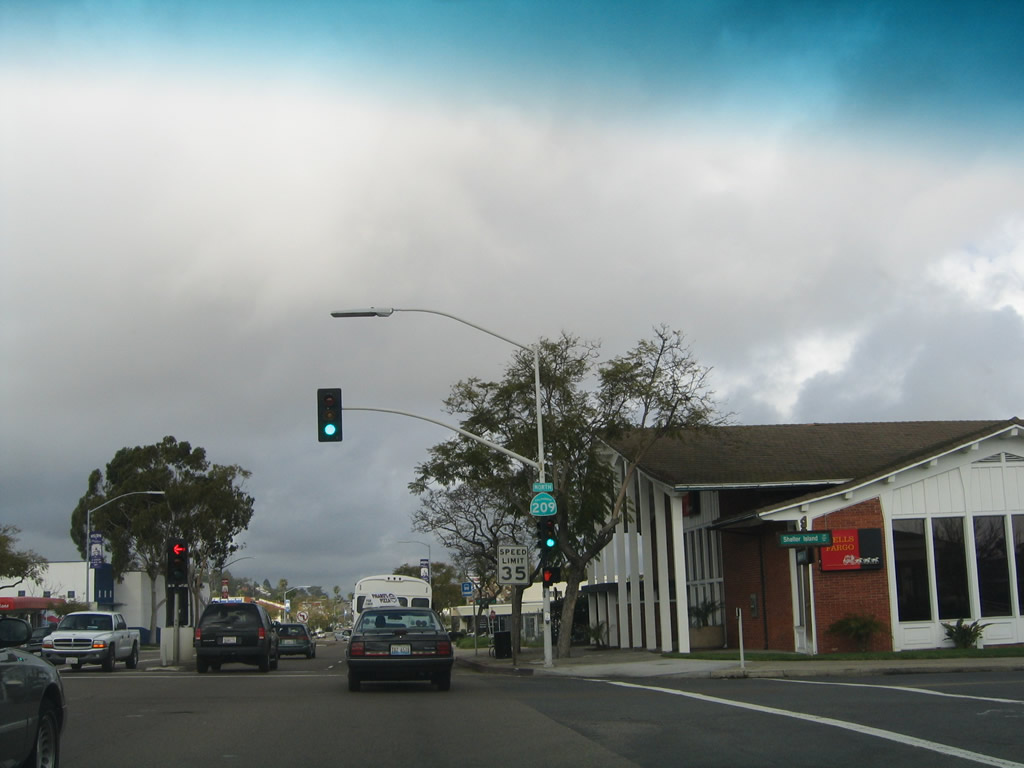
Two blocks north from Canon Street, Rosecrans Street intersects Shelter Island Drive. Shelter Island spurs southeast to Shelter Island, including the Kona Kai Resort, America's Cup Harbor, and San Diego Yacht Club.
02/19/05
Former reassurance marker for SR 209 north posted at Rosecrans Street and Shelter Island Drive.
02/19/05
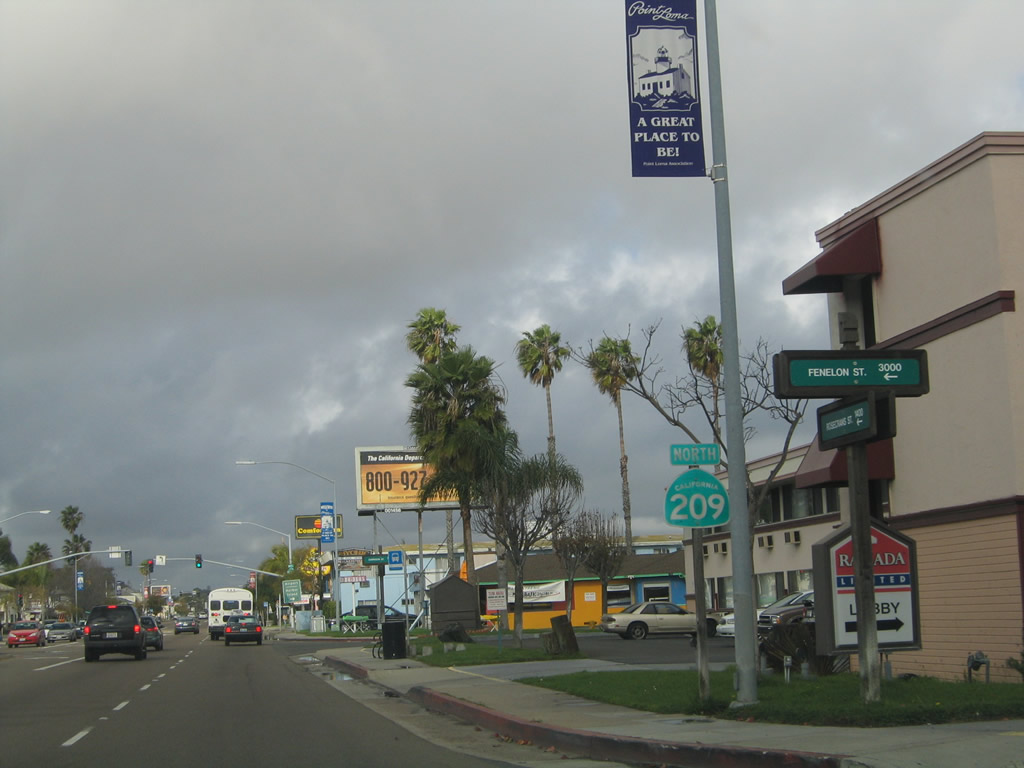
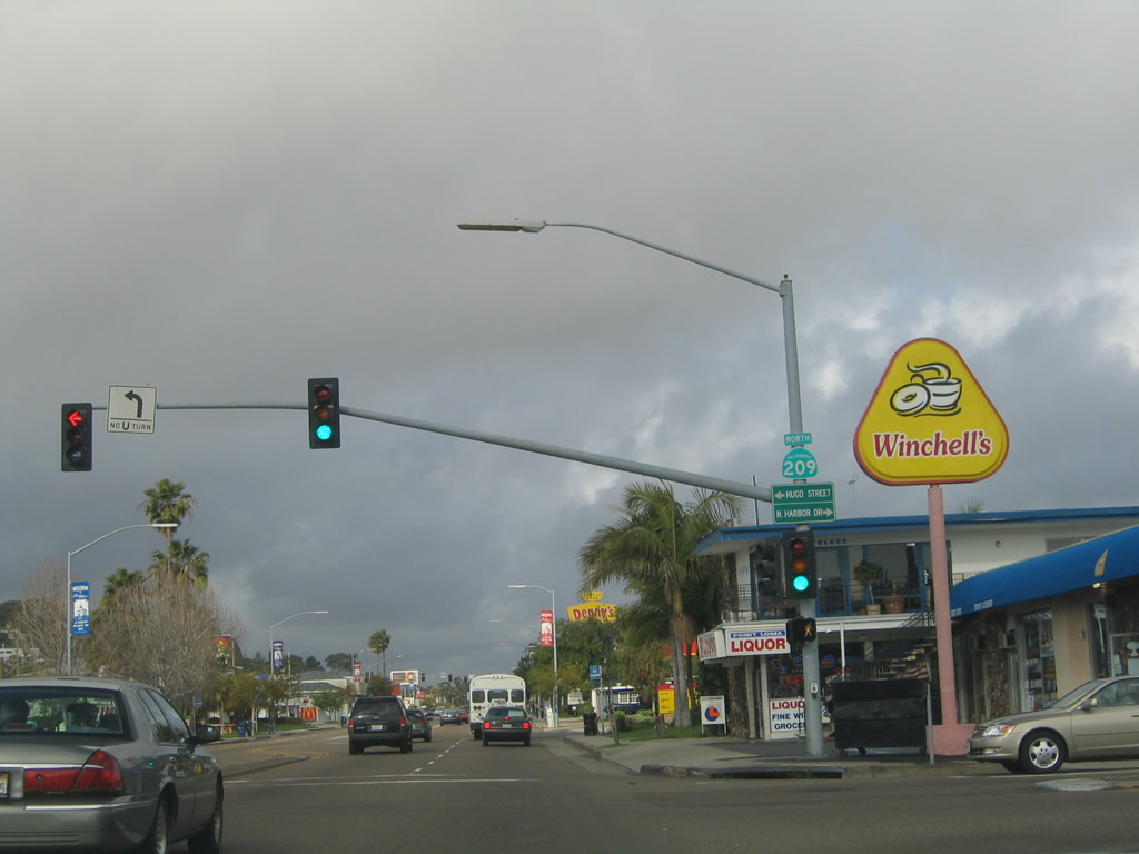
Four blocks north of Shelter Island Drive, another SR 209 shield assembly was posted at Fenelon Street.
02/19/05
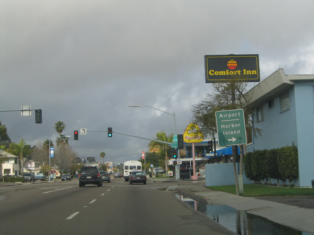
Harbor Drive begins east at Rosecrans Street and heads past San Diego International Airport (SAN) before turning south past the Embarcadero to Downtown. At Seaport Village, Harbor Drive turns southeast past the San Diego Convention Center along an old alignment of U.S. 101 into National City.
02/19/05
A California 209 north shield was posted on the traffic signal mast arm at the intersection between Rosecrans Street and Harbor Drive.
02/19/05
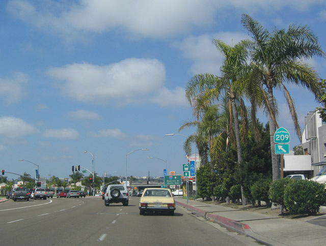
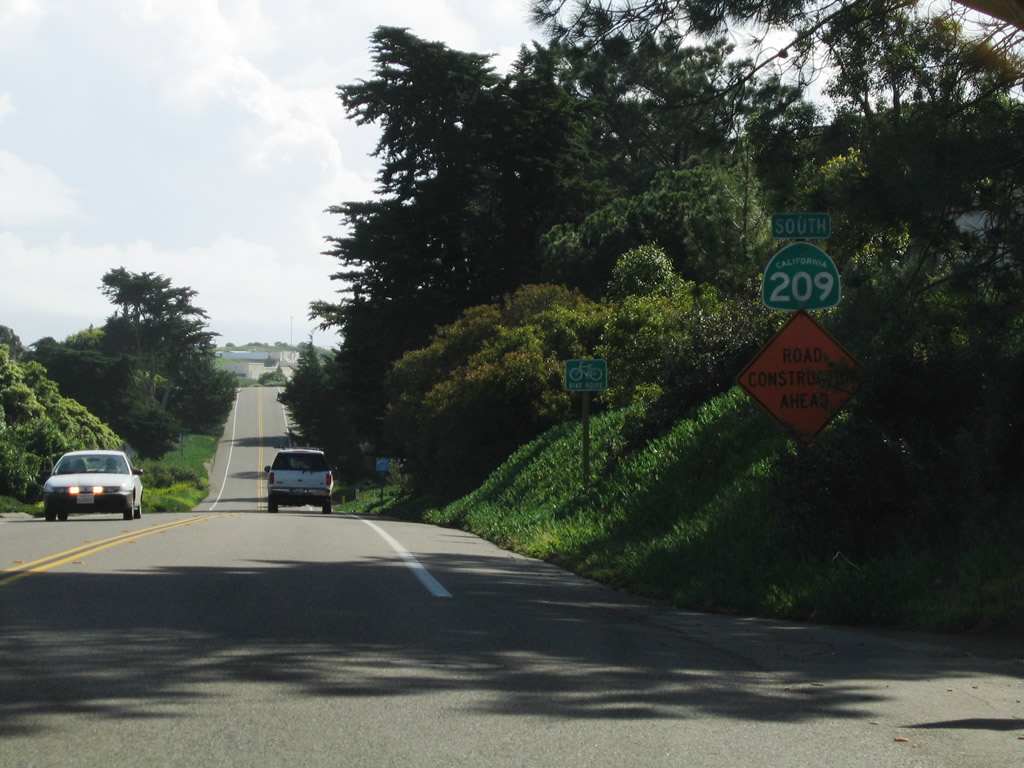
Rosecrans Street expands to a six lane commercial boulevard north through the Midway-Sports Arena area. This SR 209 shield preceded Midway Drive.
09/10/00
Trailblazers for I-5/8 formerly posted along Rosecrans Street north after Midway Drive.
09/10/00
Camino del Rio W overtakes Rosecrans Street as the route of former SR 209 from Sports Arena Boulevard northward to the exchange joining I-5/8.
05/22/04
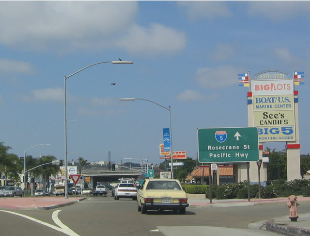
There is no direct ramp from Camino del Rio W north onto Interstate 5 south. Instead traffic along SR 209 was directed to use Rosecrans Street east to Pacific Highway south.
05/22/04
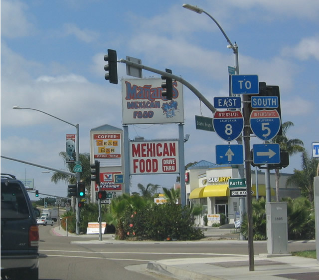
Camino del Rio W (old SR 209) north at Kurtz Street.
05/22/04
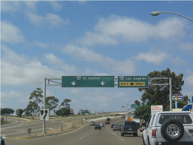
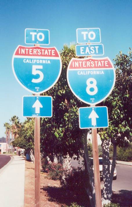
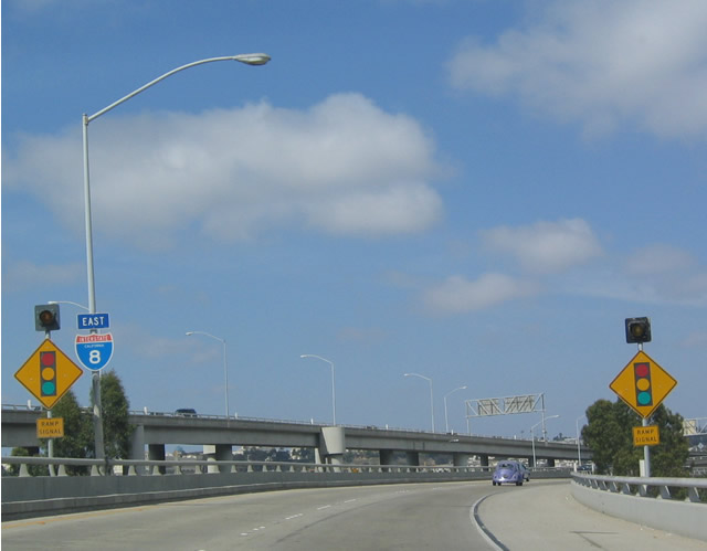
Camino del Rio W north ties into the systems interchange joining Intersate 5 and I-8 (Ocean Beach Freeway).
05/22/04
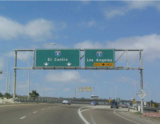
State Route 209 ended with ramps joining Interstate 8 east toward El Cajon and I-5 north to Carlsbad and Oceanside.
05/22/04
The entrance ramp from Camino del Rio W north joins Interstate 8 east across from the flyover from I-5 south.
05/22/04
The trailblazer for SR 209 on Nimitz Boulevard south at Rosecrans Street in Roseville was gone as of 2008.
02/19/05
Southbound Rosecrans Street in the Roseville neighborhood of San Diego where SR 209 turned northwest onto Canon Street.
02/19/05
Leaving Roseville, westbound Canon Street passes by several Spanish revival homes before entering a small canyon.
02/19/05

Canon Street (old SR 209) carries two lanes through a picturesque canyon with limited development on either side of the former state route.
02/19/05
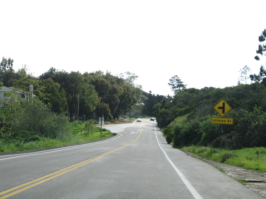
Westbound Canon Street at Ullman Street.
02/19/05
Turning south from Point Loma Avenue, Canon Street advances to traffic lights at Talbot Street.
02/19/05
A California 209 reassurance marker formerly posted along Canon Street south between Talbot Street and Catalina Boulevard.
02/19/05
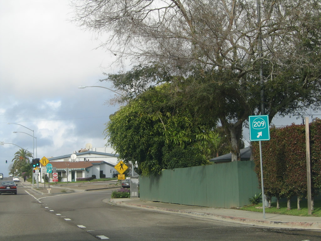
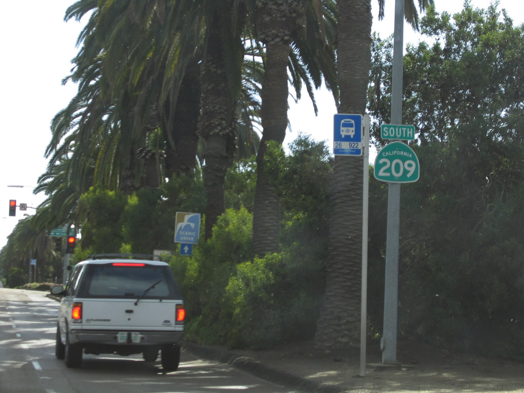
SR 209 shifted southward onto Catalina Boulevard from Canon Street.
02/19/05
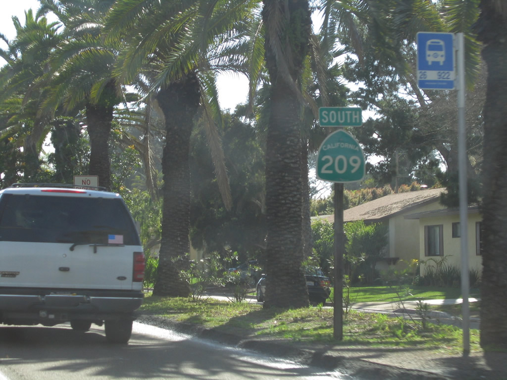
Catalina Boulevard south ahead of Wilcox Street east and Lomaland Drive west.
02/19/05
Lomaland Drive connects Catalina Boulevard (old SR 209) with Point Loma Nazarene University.
02/19/05
Another California 209 south reassurance shield was posted beyond Lomaland Drive.
02/19/05
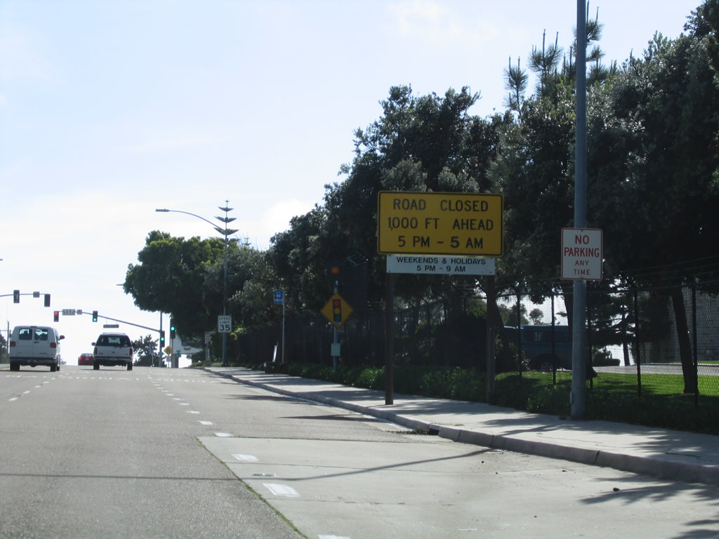
SR 209 extended south from Catalina Boulevard into Fort Rosecrans Military Reservation. Gates are locked between 5:00 p.m. and 5:00 a.m. weekdays, with longer hours of closure on weekends.
02/19/05
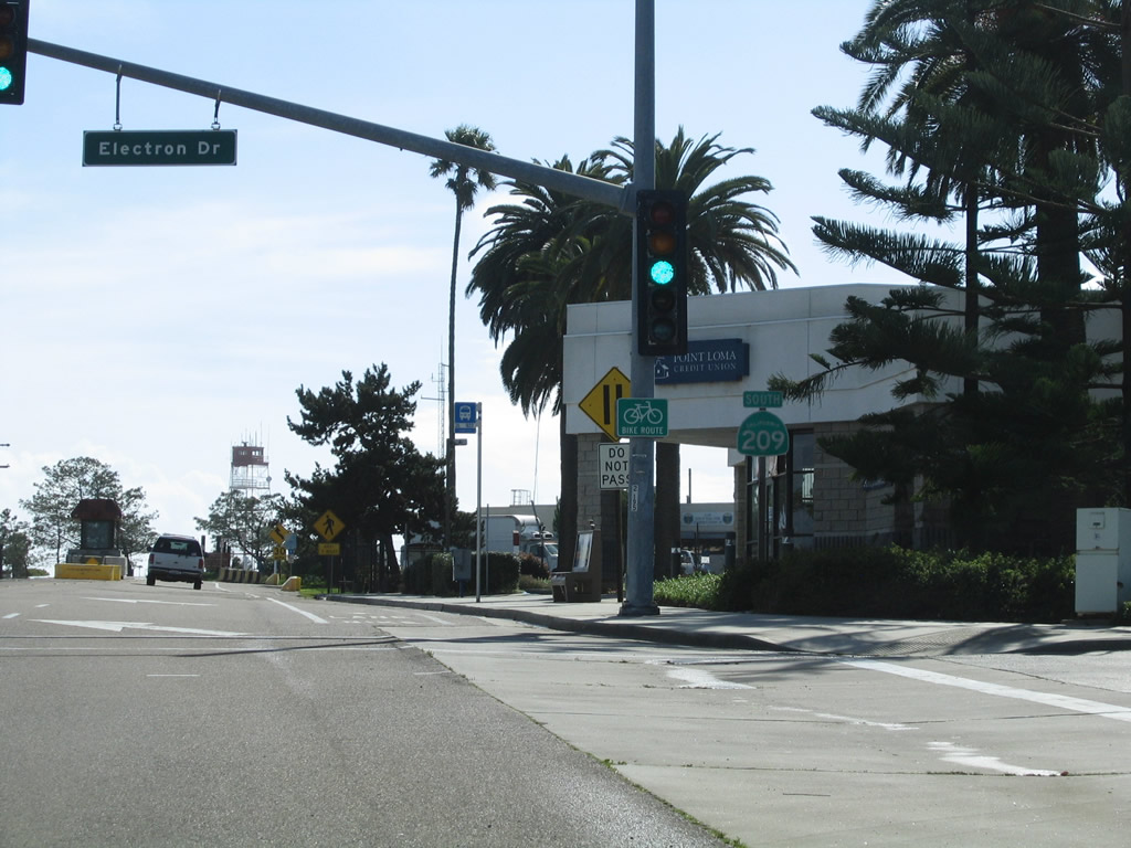
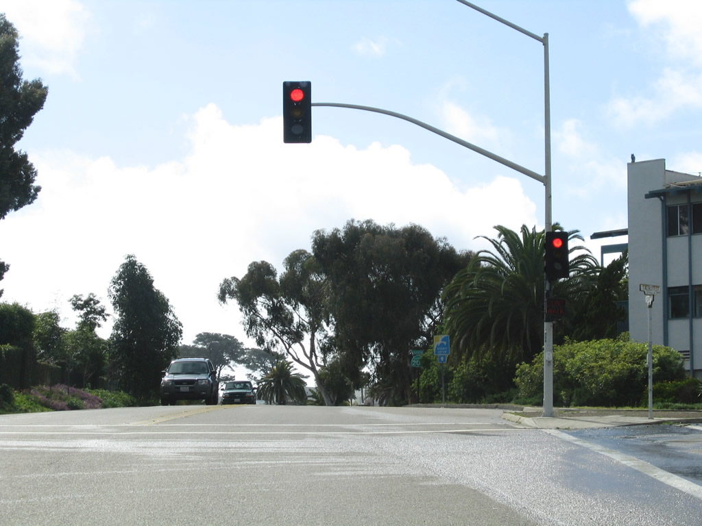
Southbound Catalina Boulevard meets Electron Drive at this traffic signal.
02/19/05
Entering the reservation, Catalina Boulevard changes names to Cabrillo Memorial Drive.
02/19/05
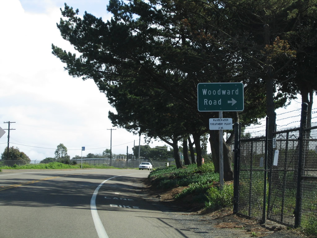
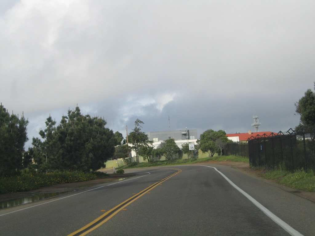
Cabrillo Memorial Drive runs south through Fort Rosecrans Military Reservation with two lanes to Woodward Road.
02/19/05
An SR 209 reassurance shield followed Woodward Road along southbound Cabrillo Memorial Drive.
02/19/05
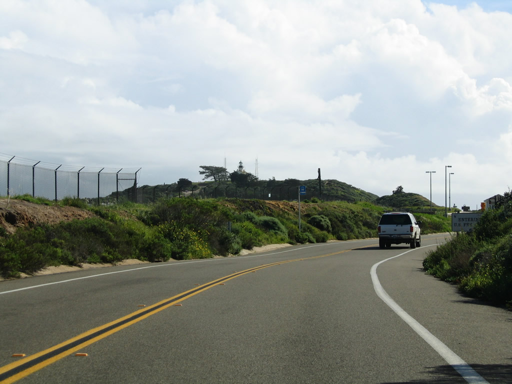
The lighthouse at Cabrillo National Monument comes into view along Cabrillo Memorial Drive south beyond Fort Rosecrans National Cemetery.
02/19/05
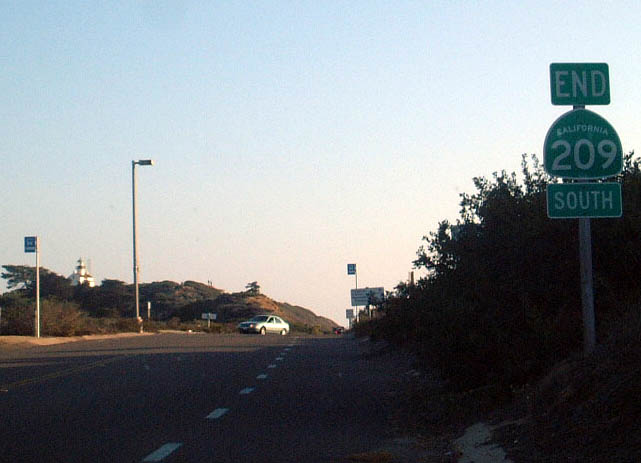
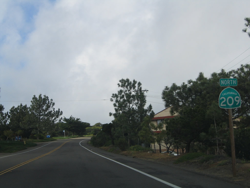
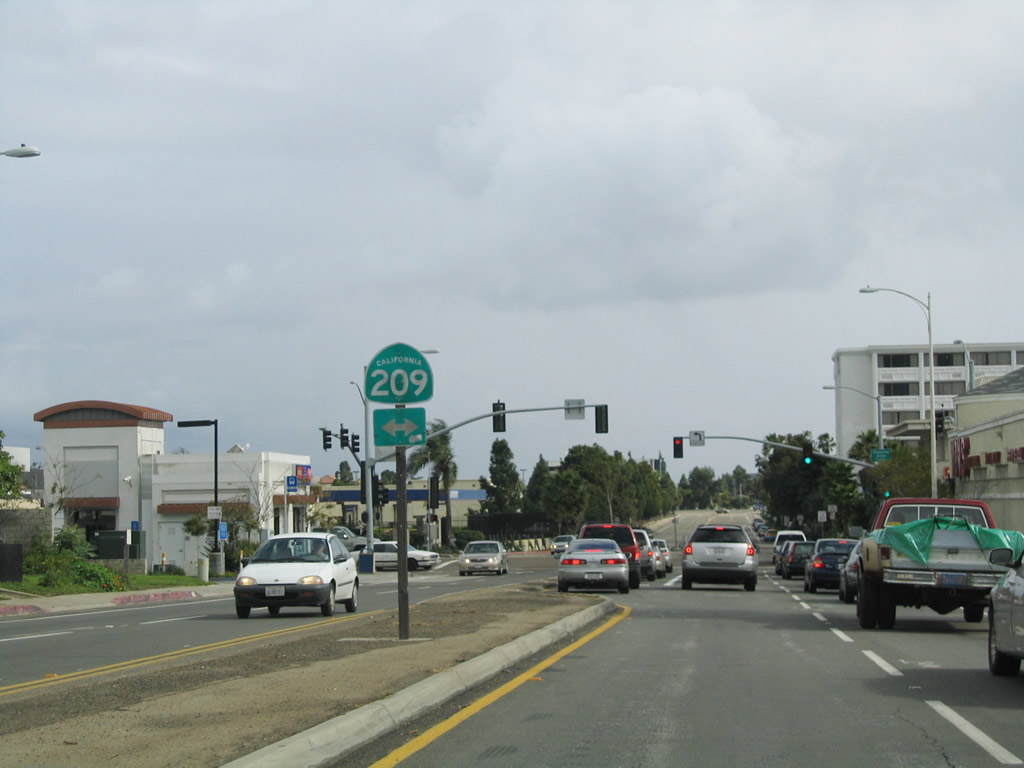
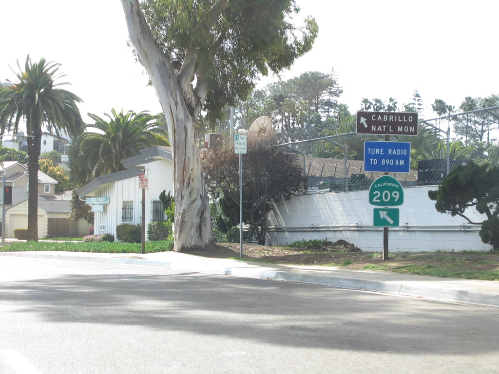
An end California 209 south shield assembly was posted at the entrance to Cabrillo National Monument within the Fort Rosecrans Military Reservation. This shield assembly was located just before the turnoff to the Point Loma Wastewater Treatment Facility t.
10/26/02
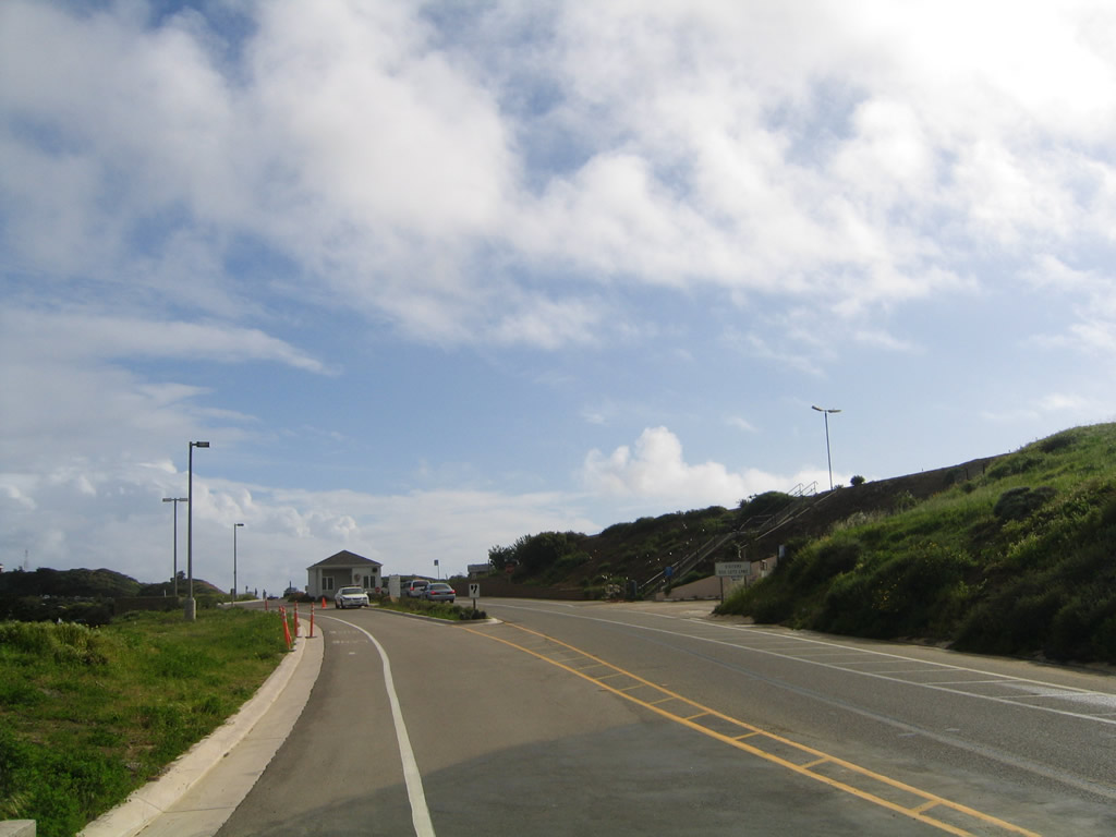
The end shield for SR 209 on Cabrillo Memorial Drive was gone by 2005. A fee station follows for admission into Cabrillo National Monument.
02/19/05
Photo Credits:
- Andy Field: 09/10/00, 10/26/02, 05/22/04, 02/19/05
Connect with:
Page Updated Thursday June 11, 2009.