
State Route 237
California 237 is the South Bay Freeway in the San Francisco Bay Area. The freeway connects California 85 and U.S. 101 with Interstate 880 and Interstate 680. California 237 begins in Mountain View, passes through Sunnyvale, Santa Clara, and San Jose, then ends in Milpitas.
Prior to its conversion to freeway standards, California 237 used to be an at-grade highway named "Mountain View-Alviso Road." At the U.S. 101 (Bayshore Freeway) and Mathilda Avenue, California 237 passes by the offices of many defense contractors, such as Lockheed Martin. Large satellite dishes are located on the grounds of some of these Facilities, and the radar equipment can be seen on the north side of California 237. The last two sections of California 237 to be upgraded to freeway status were (from least to most recent upgrade) were from Great America Parkway- Lafayette Street to Zanker Road, and from Middlefield Road to Maude Avenue. Prior to the conversion, those intersections were all signalized. The section between Interstate 880 and Interstate 680 remains signalized today.
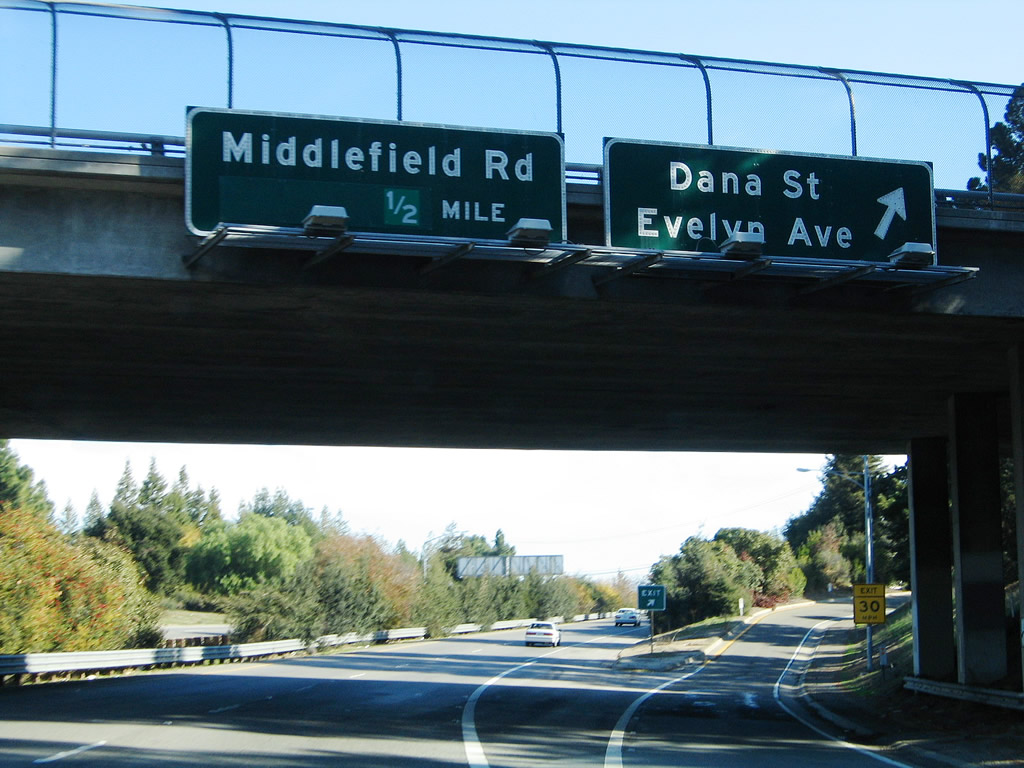
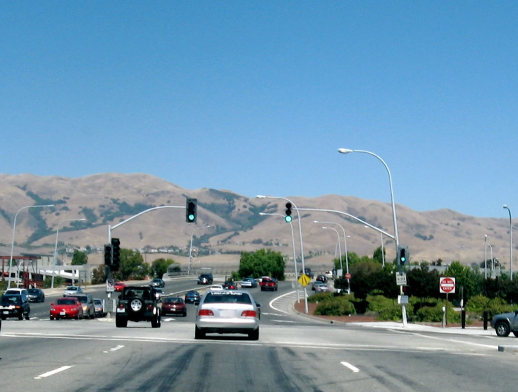
After the on-ramp from U.S. 101 (Bayshore Freeway) interchange (Exit 1A), the next exit along California 237 (South Bay Freeway) is Exit 1B, Dana Street and Evelyn Avenue. The freeway begins in the city of Mountain View, which is home to 70,708 people as of the 2000 Census, sits at an elevation of 105 feet, and consists of 12.2 square miles.
11/29/04
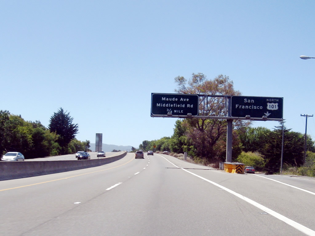
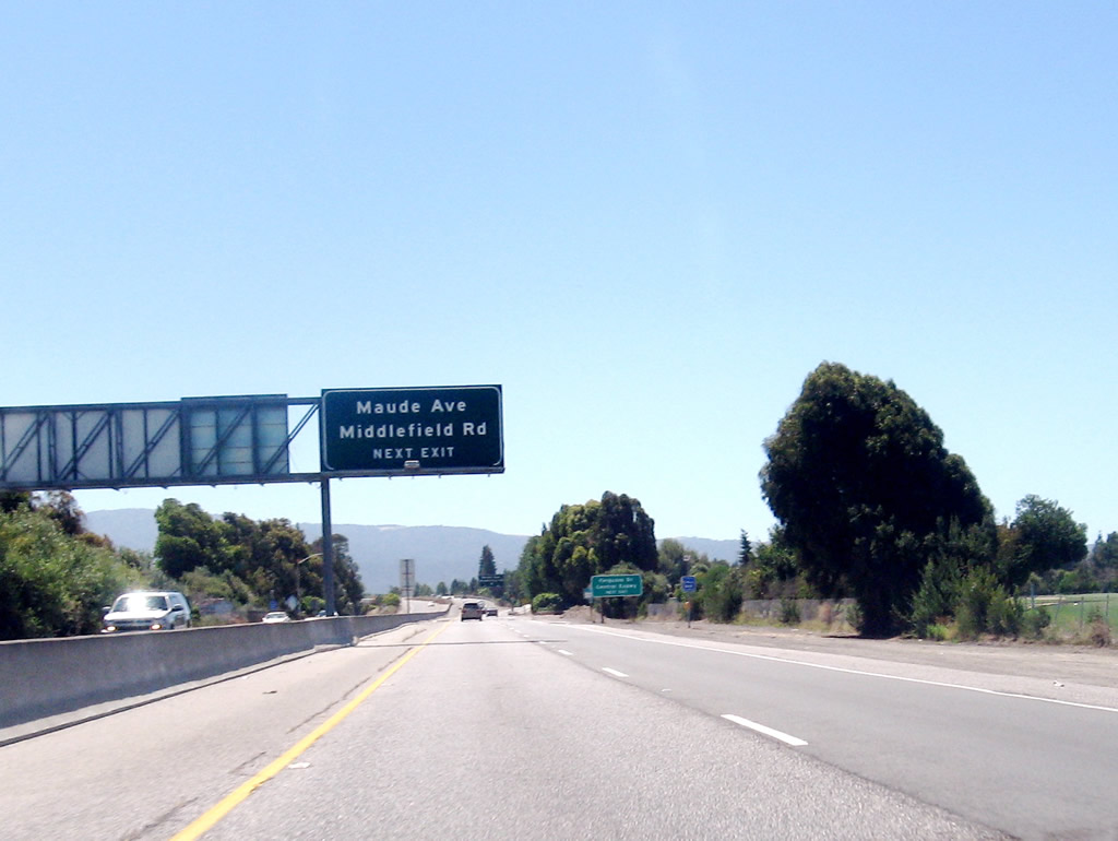
The next exit along California 237 (South Bay Freeway) is Exit 2, Middlefield Road and Maude Avenue.
11/29/04
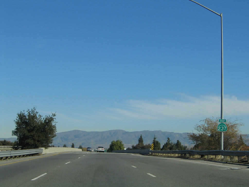
This California 237 east reassurance shield is posted after the on-ramp from Dana Street.
11/29/04
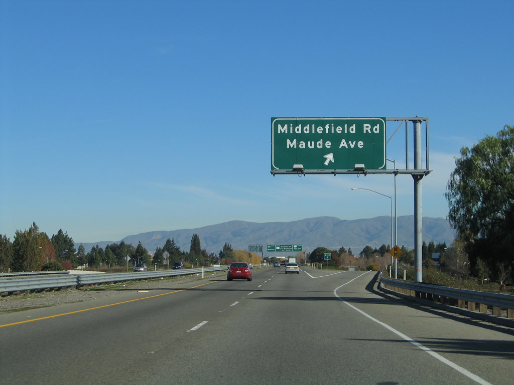
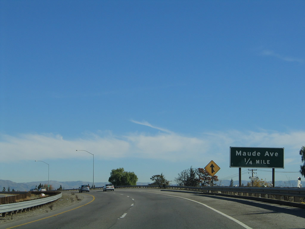
Eastbound California 237 (South Bay Freeway) reaches Exit 2, Middlefield Road and Maude Avenue.
11/29/04
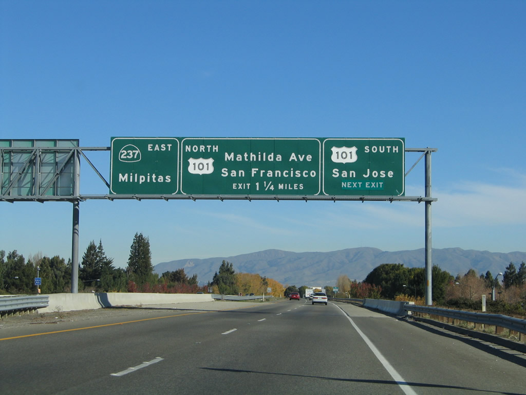
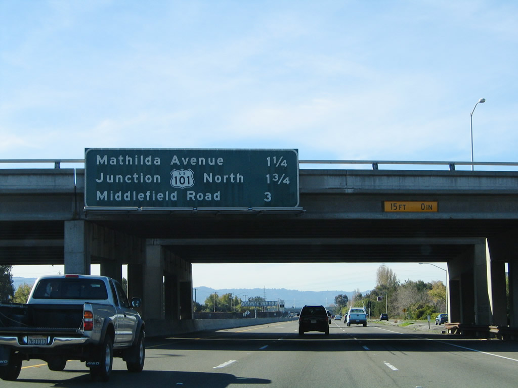
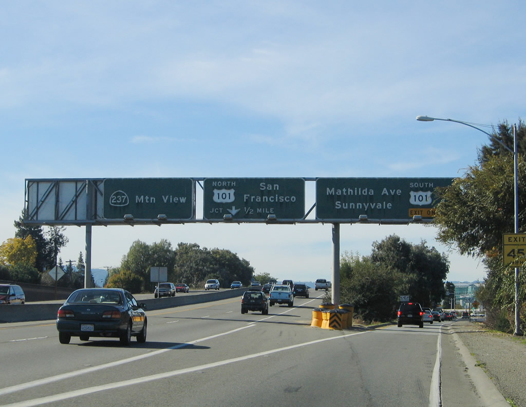
The next exit along California 237 (South Bay Freeway) is Exit 3A, U.S. 101 (Bayshore Freeway) south to San Jose and Los Angeles, followed by Exit 2B, Mathilda Avenue to Sunnyvale.
11/29/04
At this interchange, California 237 will leave Mountain View and enter the city of Sunnyvale, the "Heart of Silicon Valley," is situated between Los Altos and Santa Clara. The city is home to 131,760 people as of the 2000 Census and consists of 22.6 square miles. Sunnyvale incorporated in 1912 after being settled in the late 1800s.
09/20/07
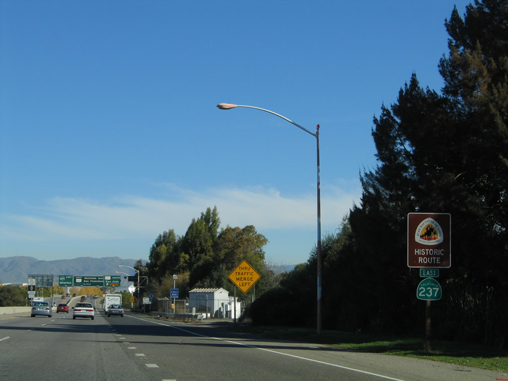
Another California 237 east shield assembly is posted along with a historic Juan Bautista de Anza route shield after the on-ramp from Middlefield Road and Maude Avenue. The U.S. 101 interchange can be seen in the distance.
11/29/04
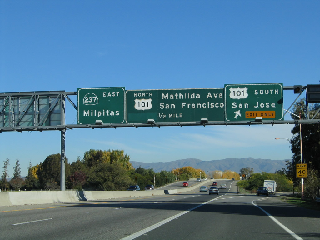
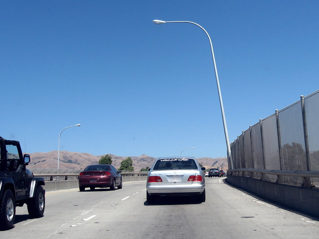
Eastbound California 237 (South Bay Freeway) reaches Exit 3A, U.S. 101 (Bayshore Freeway) south to San Jose and Los Angeles. The next exit is Exit 3B, Mathilda Avenue. Exit at Mathilda Avenue to make a U-turn onto California 237 west to connect with U.S. 101 (Bayshore Freeway) north. Don't be fooled by the signs; there is no direct connection between California 237 east and U.S. 101 north.
11/29/04
1950s-era bridge rail lines eastbound California 237 as the freeway passes over U.S. 101 (Bayshore Freeway).
09/20/07
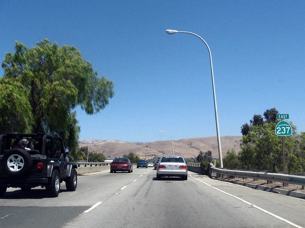
A California 237 east reassurance shield is posted after the transition ramp from U.S. 101 south to California 237 east. Access to California 237 east from U.S. 101 north is provided via Mathilda Avenue. A few defense contractor satellite dishes can be seen in the background of this photo.
09/20/07
Eastbound California 237 (South Bay Freeway) reaches Exit 3B, Mathilda Avenue to U.S. 101 (Bayshore Freeway) north (via a U-turn onto California 237 west).
09/20/07
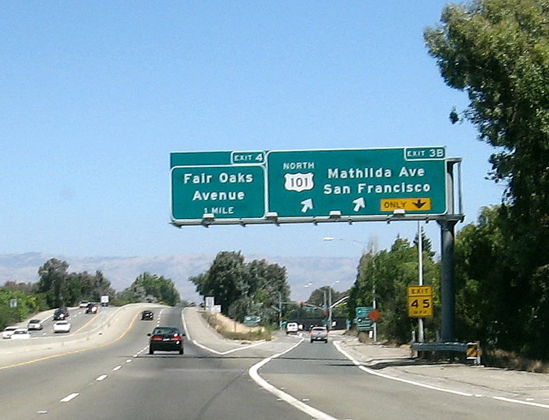
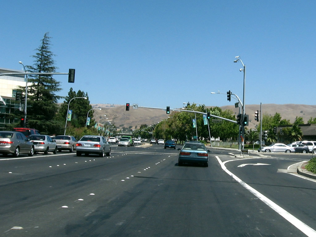
The next two exits along eastbound California 237 (South Bay Freeway) are Exit 4, Fair Oaks Avenue and Exit 5, Santa Clara County G-2 (Lawrence Expressway). Both exits serve the city of Sunnyvale.
09/20/07
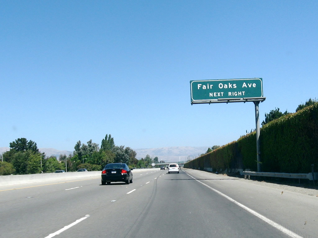
Fair Oaks Avenue is a north-south street that interchanges with U.S. 101 Exit 395 and eventually connects with Sunnyvale-Saratoga Road.
09/20/07
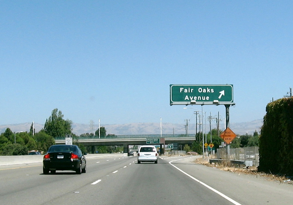
Eastbound California 237 (South Bay Freeway) reaches Exit 4, Fair Oaks Avenue to Sunnyvale.
09/20/07
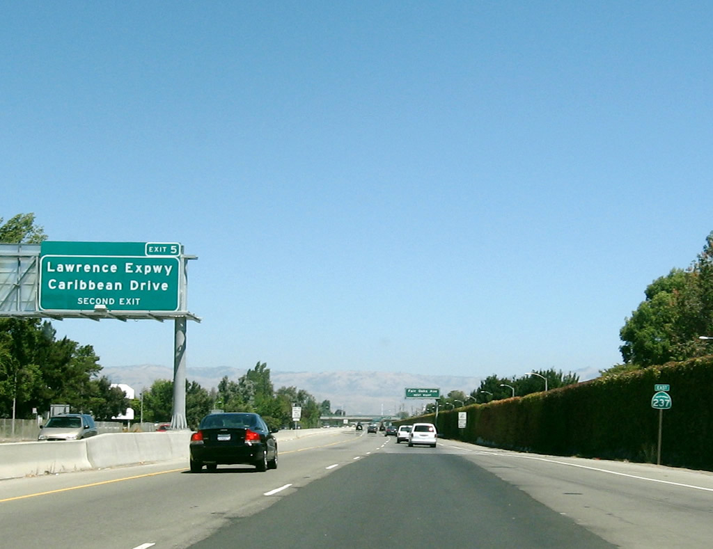
Passing under Fair Oaks Avenue, the next interchange along eastbound California 237 is Exit 5, Santa Clara County G-2 (Lawrence Expressway) and Caribbean Drive north to the Twin Creeks Sports Complex and Sunnyvale Baylands Park.
09/20/07
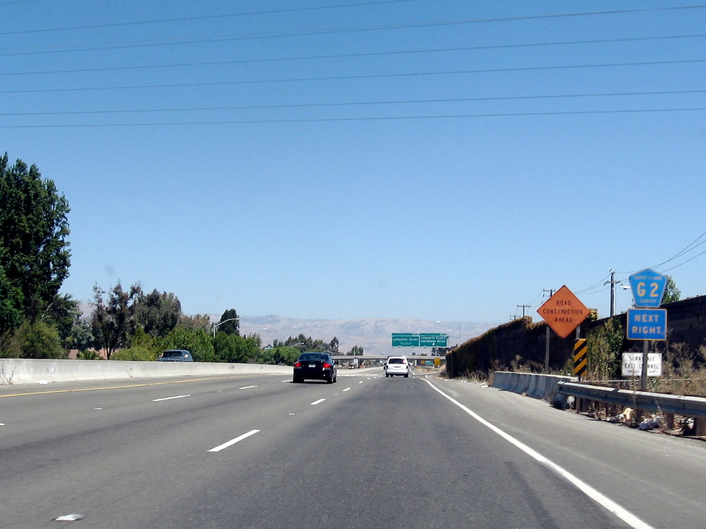
An auxiliary shield assembly for Santa Clara County G-2, which follows the Lawrence Expressway south from this interchange through Sunnyvale to Santa Clara, is posted on California 237 east prior to Exit 5.
09/20/07
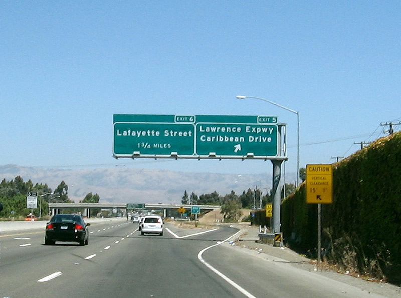
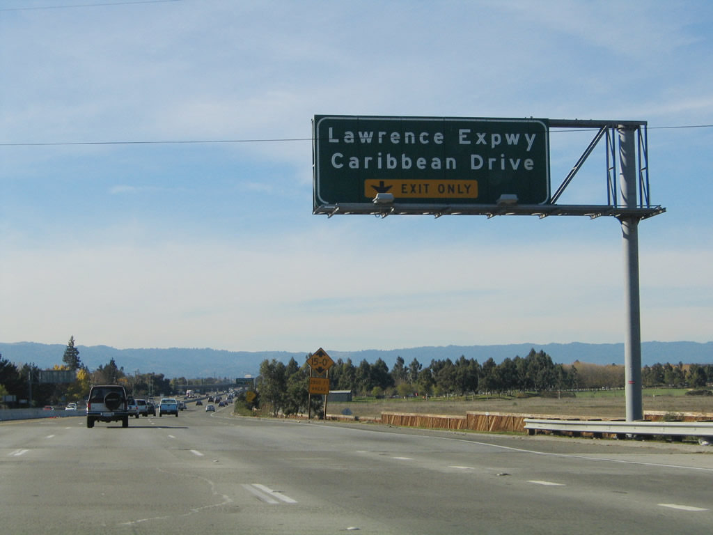
Eastbound California 237 meets Exit 5, Santa Clara County G-2 (Lawrence Expressway) and Caribbean Drive. The next exit is Exit 6, Lafayette Street.
09/20/07
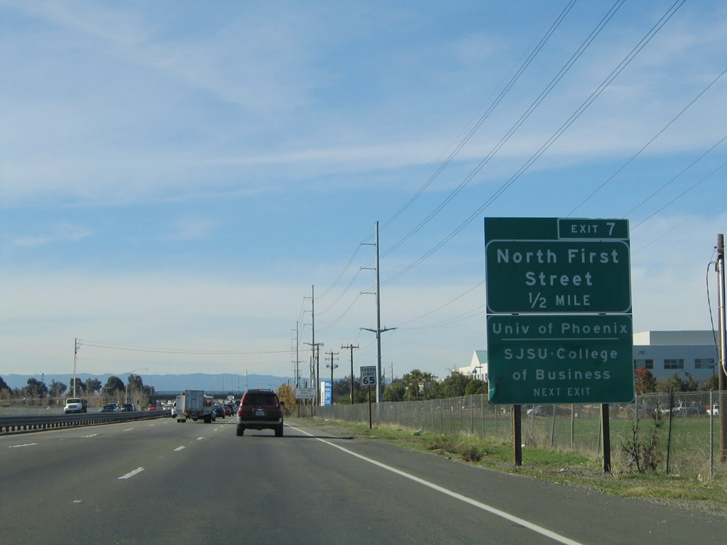
This original porcelain enamel interchange sequence sign provides the distance to the next three exits along California 237 east: Exit 6, Lafayette Street and Great America Parkway; Exit 7, North First Street; and Exit 8, Zanker Road.
09/20/07
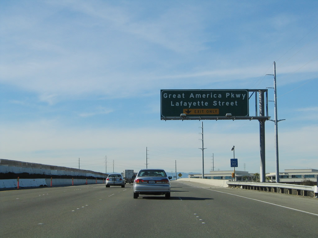
The right lane of California 237 east becomes exit only for Exit 6, Lafayette Street and Great America Parkway.
09/20/07
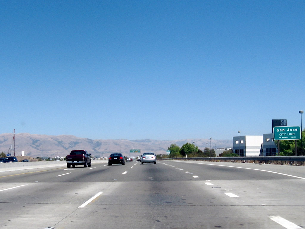
At this point, California 237 leaves the city of Sunnyvale and enters the city of San Jose, which is home to 894,943 people as of the 2000 Census. Founded on November 29, 1777, and incorporated on March 27, 1850, San Jose is the third largest city in California (behind Los Angeles and San Diego). San Jose consists of 178.2 square miles and sits at an elevation of 85 feet. Rainfall in San Jose is much less than San Francisco due to its location at the south end of the San Francisco Bay and enclosure within mountains. The average annual precipitation is 14.4 inches.
09/20/07
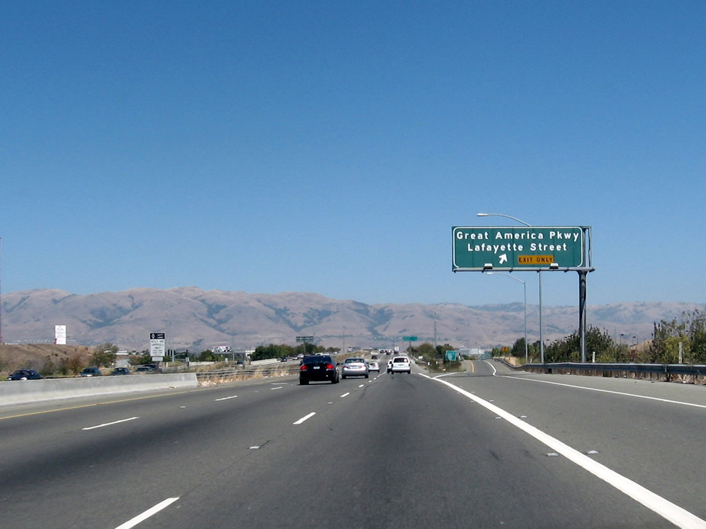
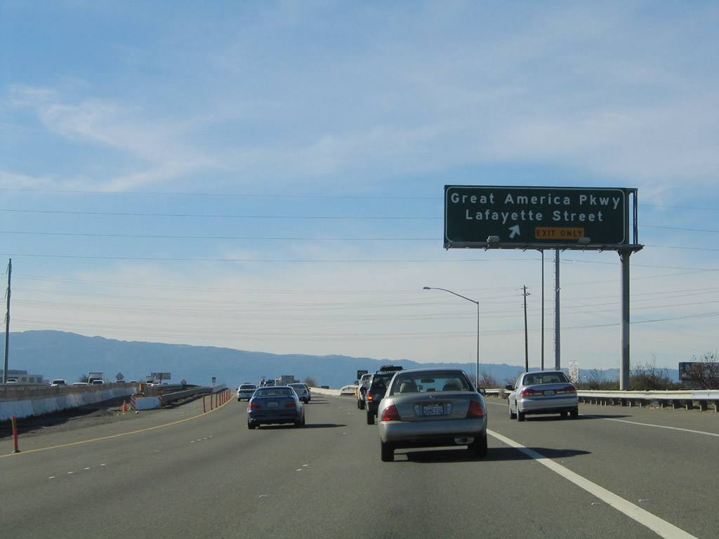
Eastbound California 237 reaches Exit 6, Lafayette Street and Great America Parkway.
09/20/07
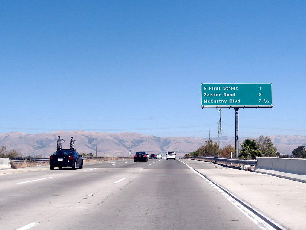
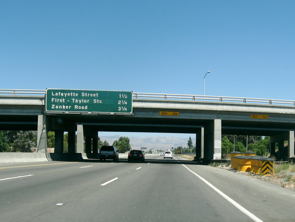
This interchange sequence sign provides the distance to the next three exits along California 237 east: Exit 7, North First Street; Exit 8, Zanker Road; and Exit 9A, McCarthy Boulevard and Cypress Street.
09/20/07
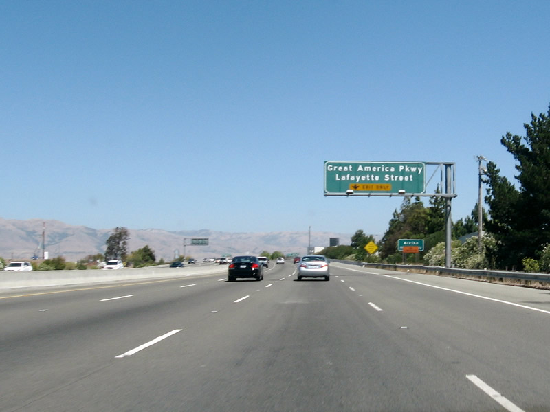
California 237 passes over Lafayette Street; in the distance, a new right lane merges onto California 237 east from Lafayette Street and Great America Parkway.
09/20/07
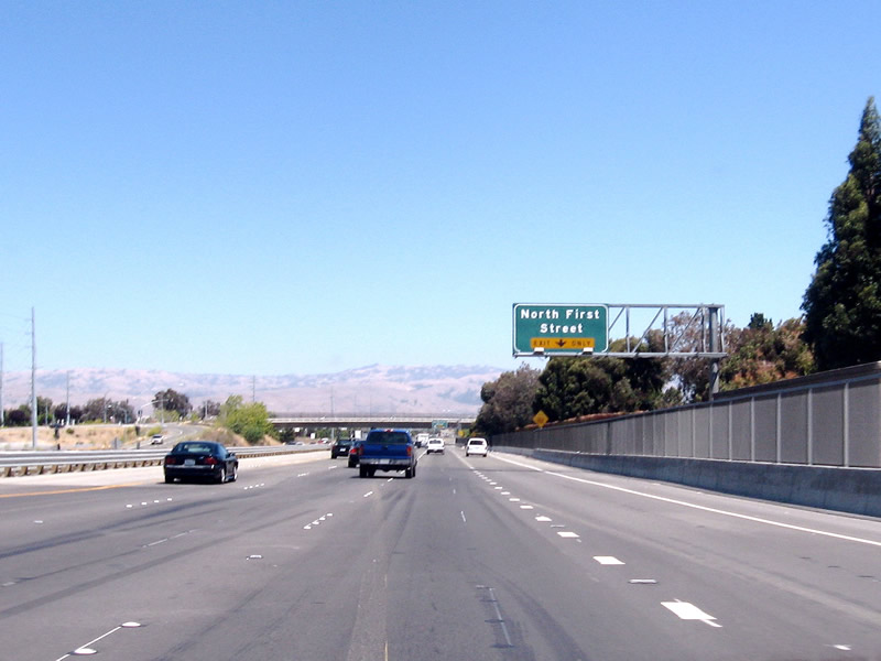
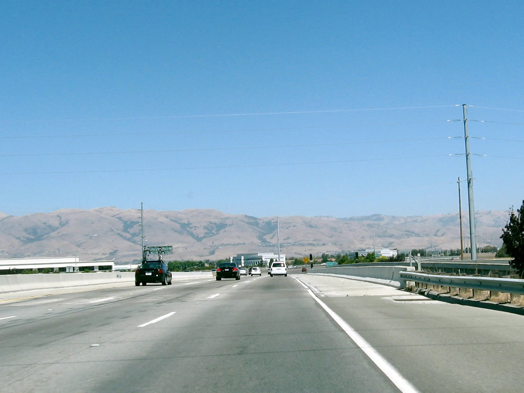
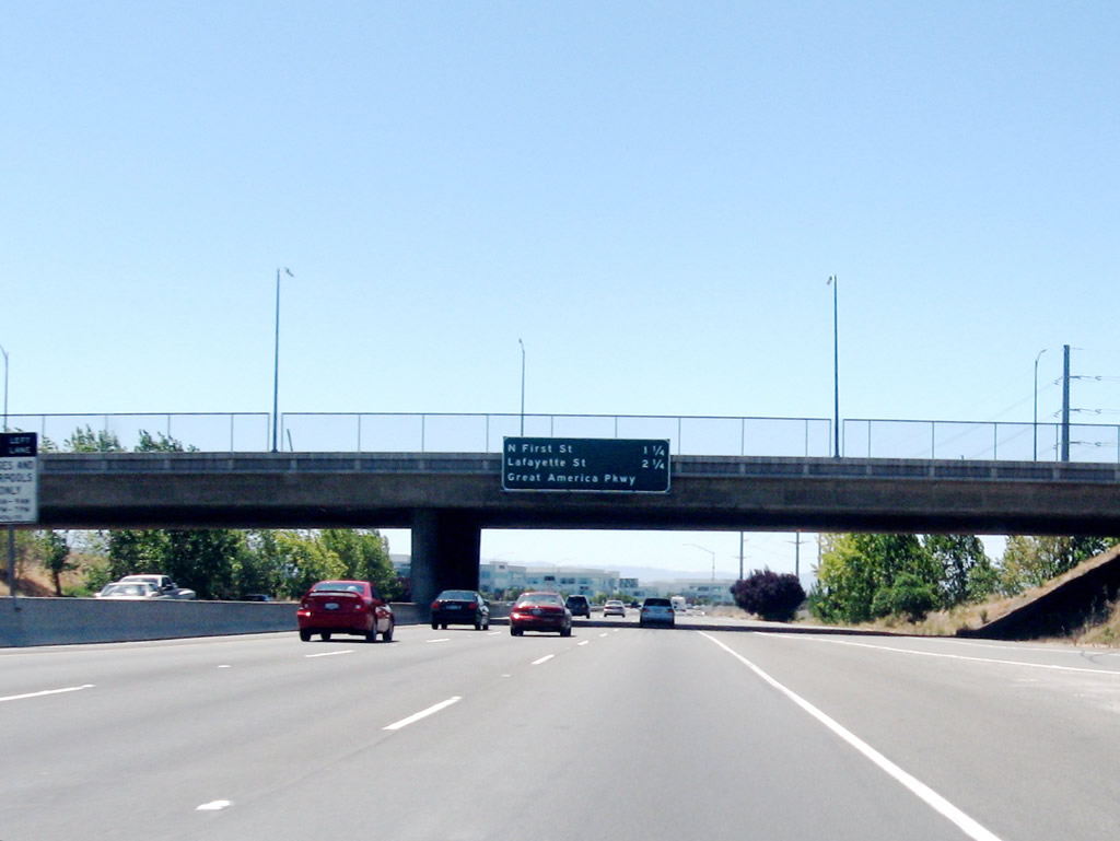
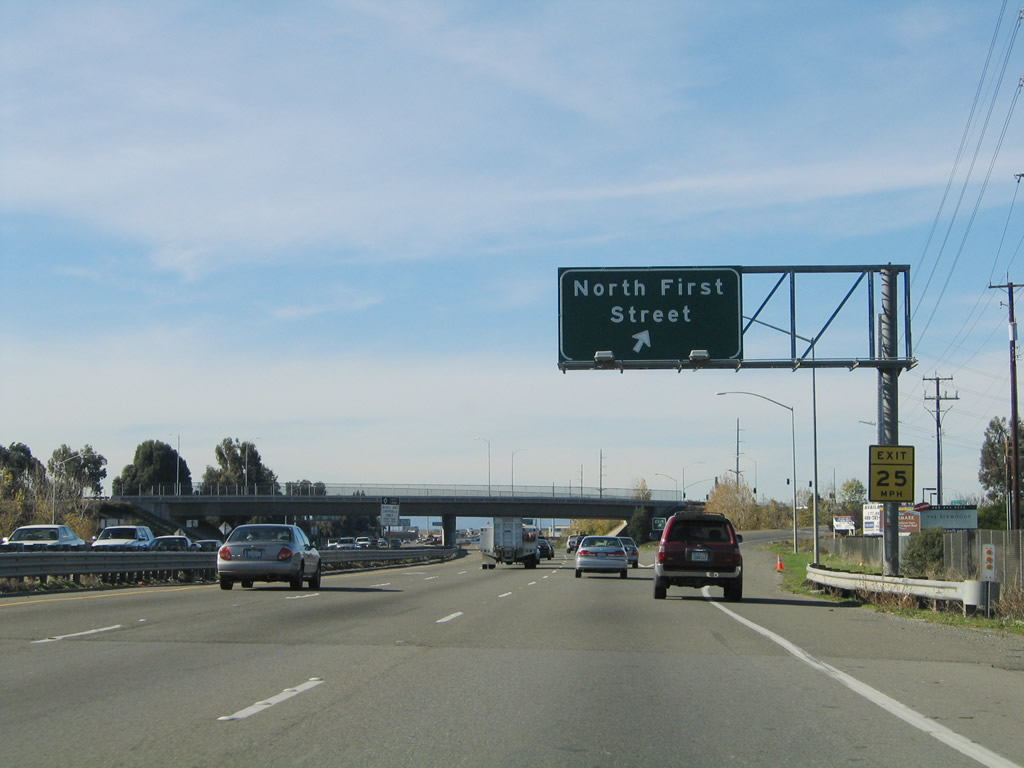
The new right lane becomes exit only for North First Street, which travels south toward downtown San Jose on an alignment generally parallel to the Guadalupe River.
09/20/07
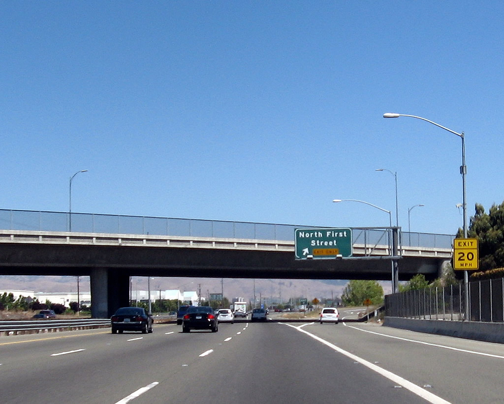
Eastbound California 237 (South Bay Freeway) reaches Exit 7, North First Street.
09/20/07
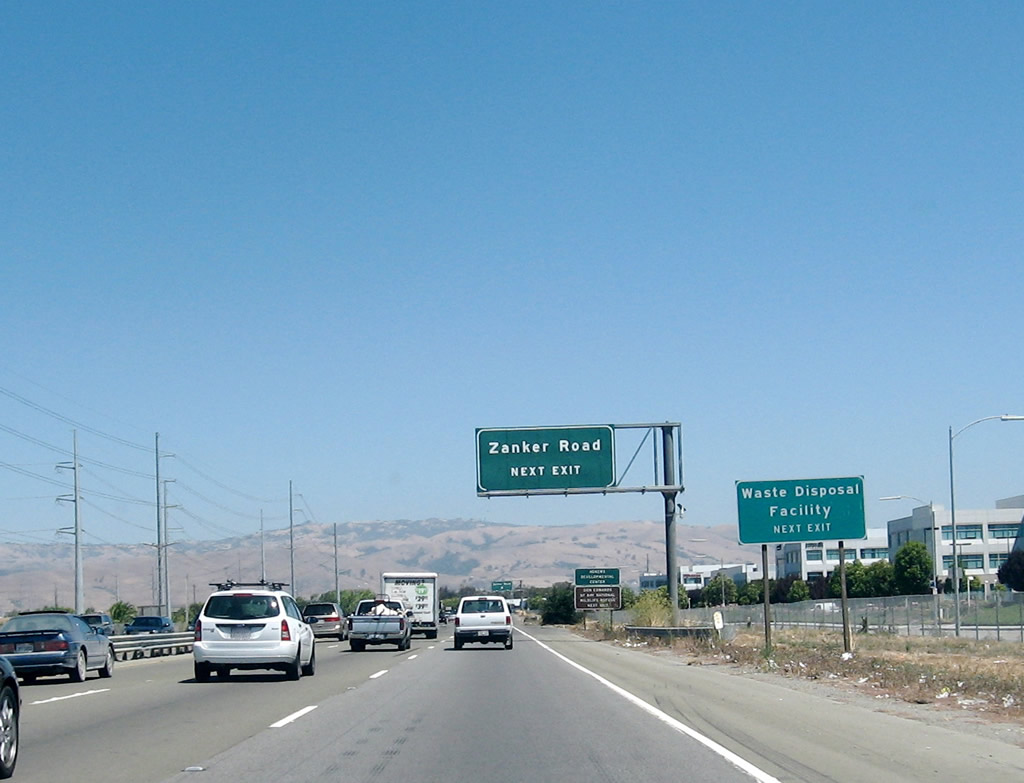
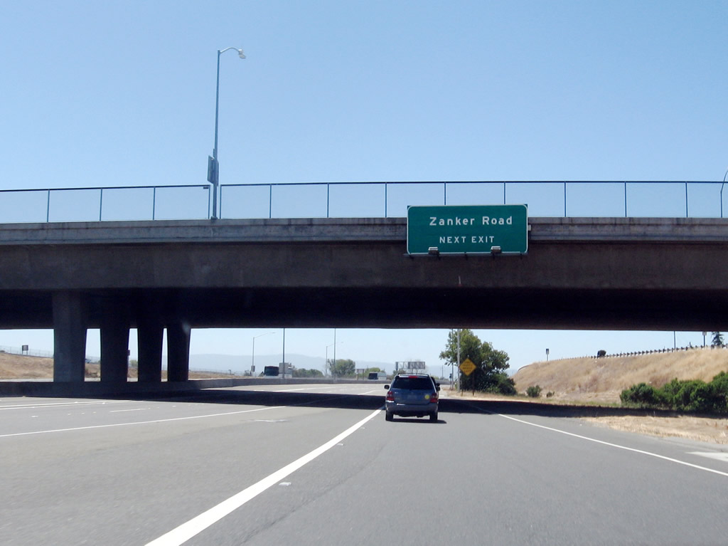
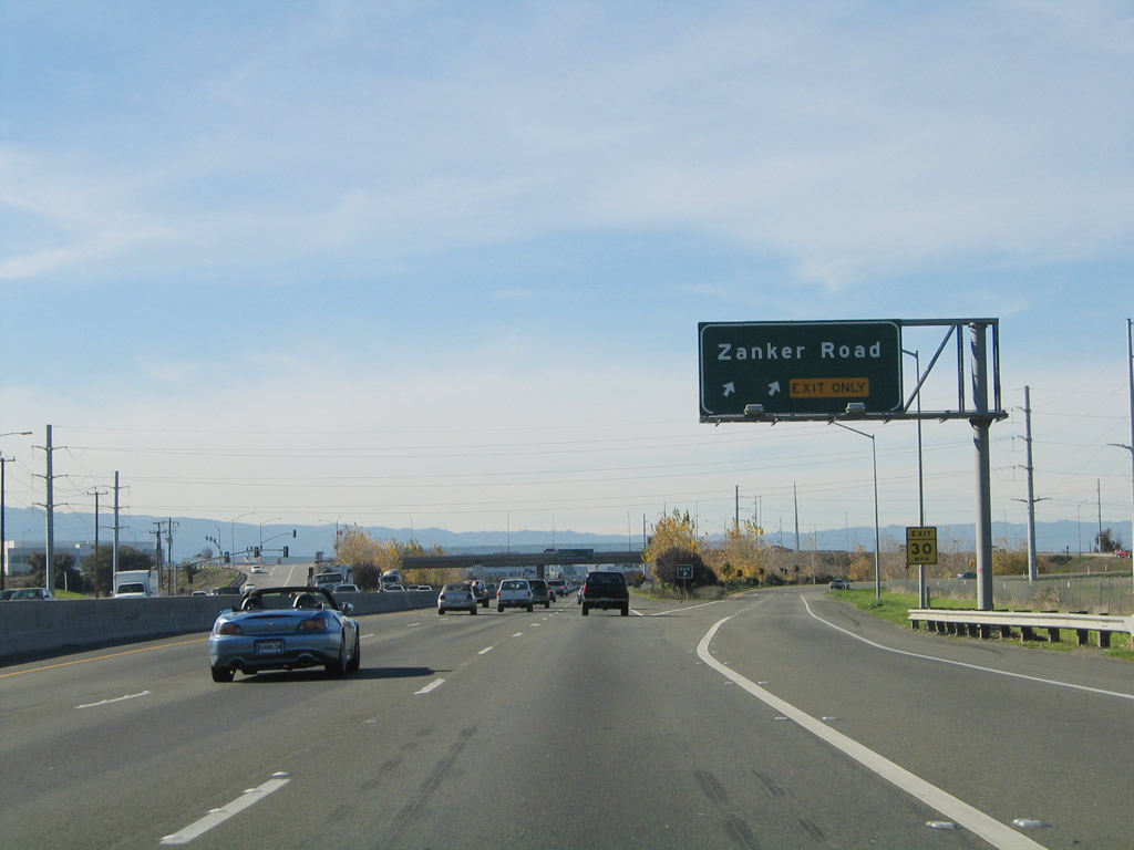
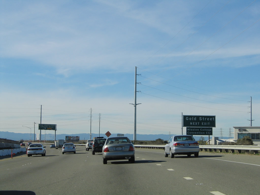
The next exit along California 237 east is Exit 8, Zanker Road.
09/20/07
Eastbound California 237 reaches Exit 8, Zanker Road south to Agnews Developmental Center and eventually downtown San Jose. Zanker Road and North First Street generally parallel each other.
09/20/07
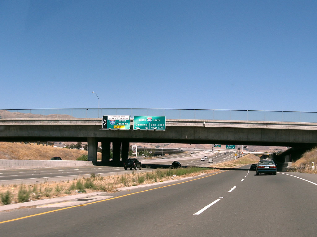
This interchange sequence sign provides the distance to the next three exits along California 237 east: Exit 9A, McCarthy Boulevard and Cypress Street; Exit 9B, Interstate 880 (Nimitz Freeway) north to Oakland; and Exit 9C, Interstate 880 (Nimitz Freeway) south to San Jose.
09/20/07
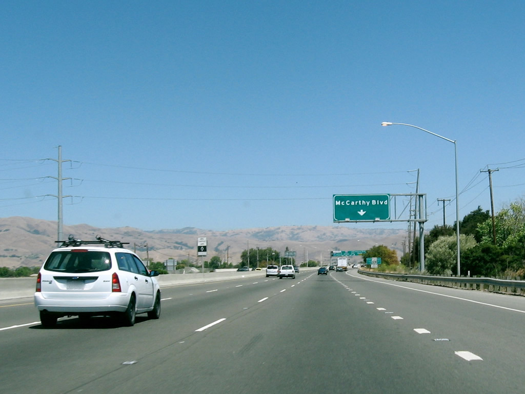
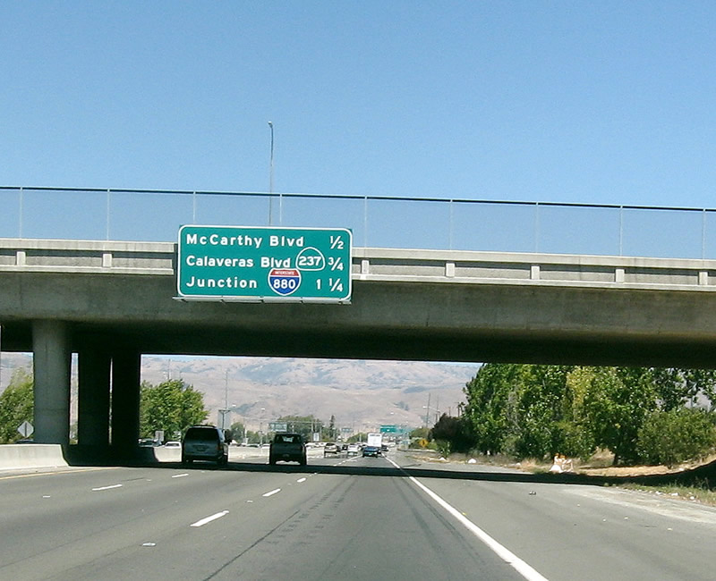
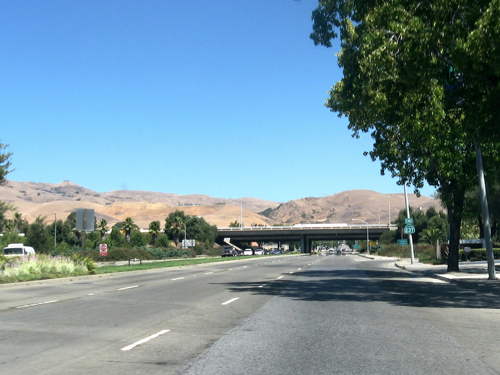
The right lane of California 237 east becomes exit only for Exit 9A, McCarthy Boulevard and Cypress Street. California 237 leaves San Jose and enters the city of Milpitas. Situated on Interstate 680, Interstate 880, and California 237, Milpitas is known as the "Crossroads of Silicon Valley" with its freeway access. Home to 62,698 people as of the 2000 Census, Milpitas was incorporated as a city on January 26, 1954, as it was threatened with potential annexation by the city of San Jose.
09/20/07
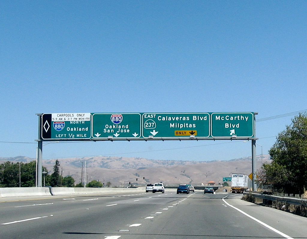
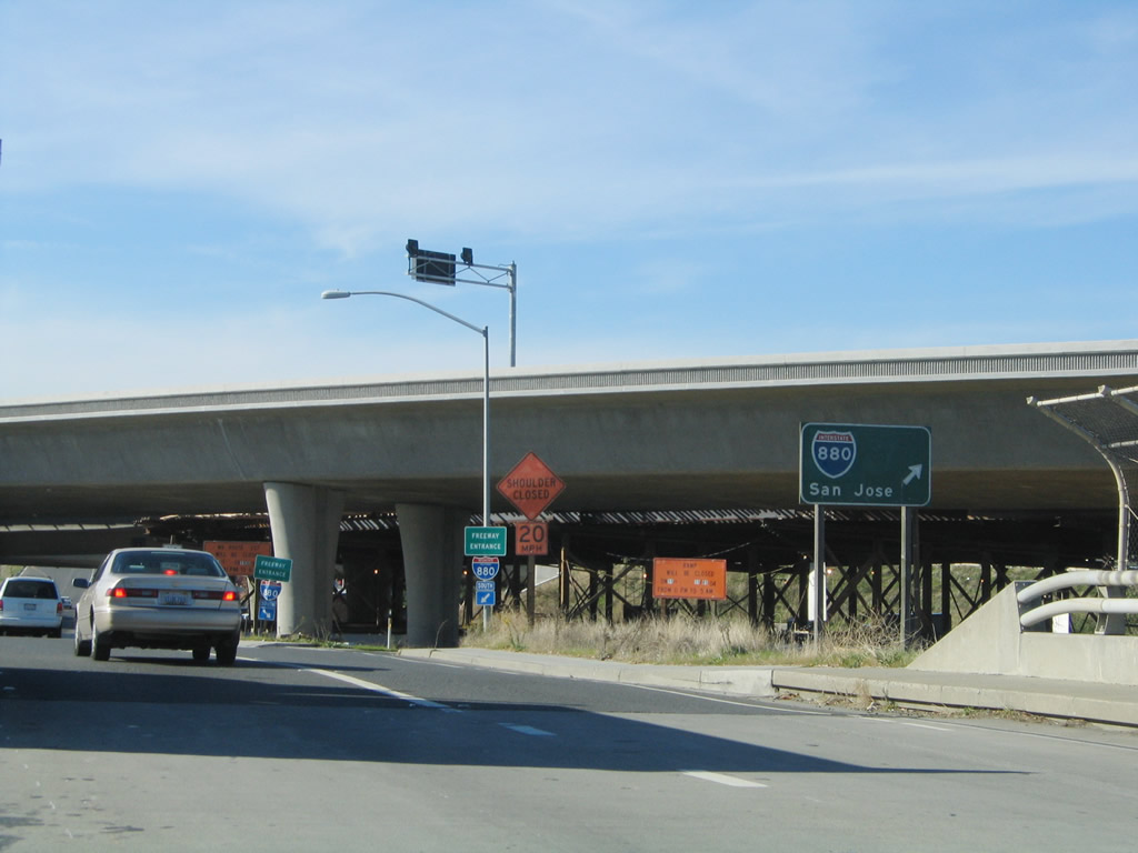
Eastbound California 237 (South Bay Freeway) reaches Exit 9A, McCarthy Boulevard and Cypress Street. The next two exits (Exit 9B, Interstate 880 (Nimitz Freeway) north to Oakland and Exit 9C, Interstate 880 (Nimitz Freeway) south to San Jose) are left exits, while the right two lanes continue east on California 237 (Calaveras Boulevard).
09/20/07
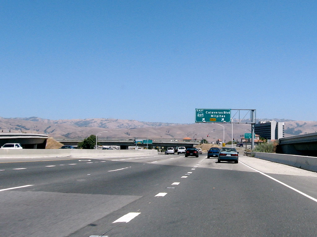
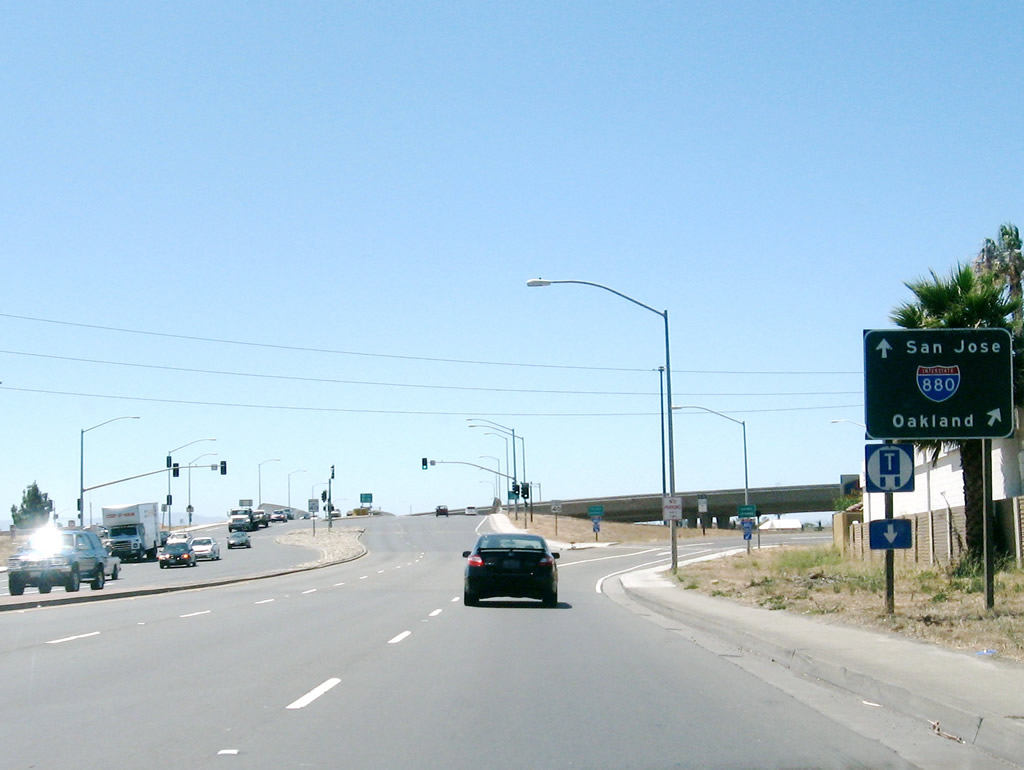
The left three lanes depart California 237 and transition to Interstate 880. (This is Exit 9B, Interstate 880 (Nimitz Freeway) north to Oakland and Exit 9C, Interstate 880 (Nimitz Freeway) south to San Jose). The right two lanes continue east on California 237 (Calaveras Boulevard); the freeway will soon come to an end.
09/20/07
Exit 9 B departs next for Interstate 880 south to San Jose.
09/20/07
Exit 9 C follows for Interstate 880 north to Oakland with an additional ramp for high occupancy vehicles.
09/20/07
An on-ramp from McCarthy Boulevard joins California 237 east. A traffic signal ahead marks the end of the freeway. From here, California 237 will shift onto Calaveras Boulevard east.
09/20/07
After the traffic signal with the off-ramp from Interstate 880 south, eastbound California 237 crosses over Interstate 880 (Nimitz Freeway), a loop ramp offers a third connection to Interstate 880 north (right exit).
09/20/07
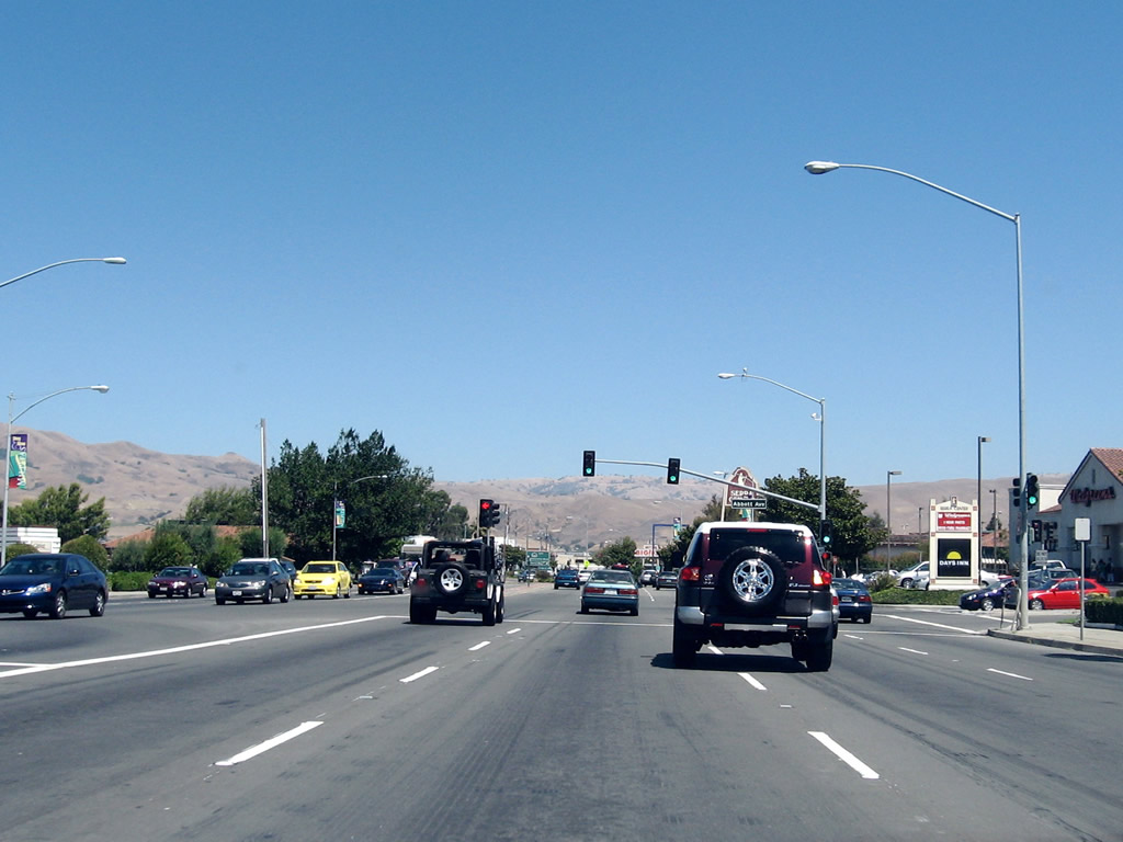
After the Interstate 880 interchange, eastbound California 237 follows Calaveras Boulevard, which is a surface street with four to eight lanes of travel. Shopping centers are located on either side of the state route. Here, California 237 east approaches Abbott Avenue in Milpitas.
09/20/07
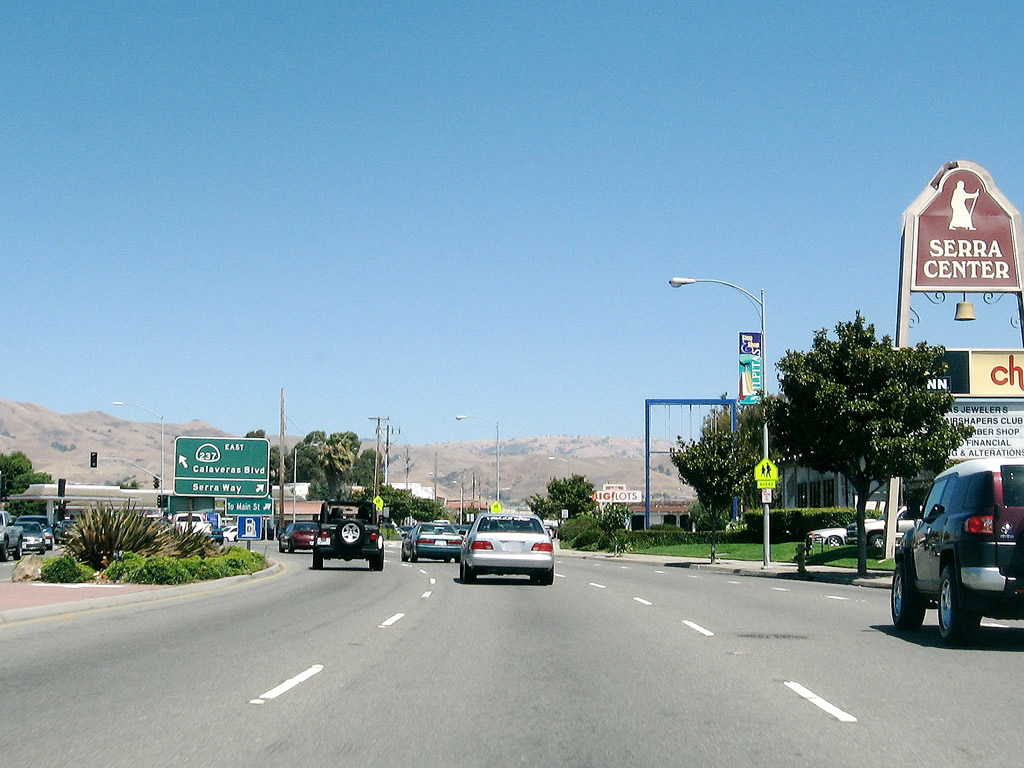
Eastbound California 237 (Calaveras Boulevard) turns northeast at the intersection with Serra Way.
09/20/07
The next traffic signal is a connection with Serra Way.
09/20/07
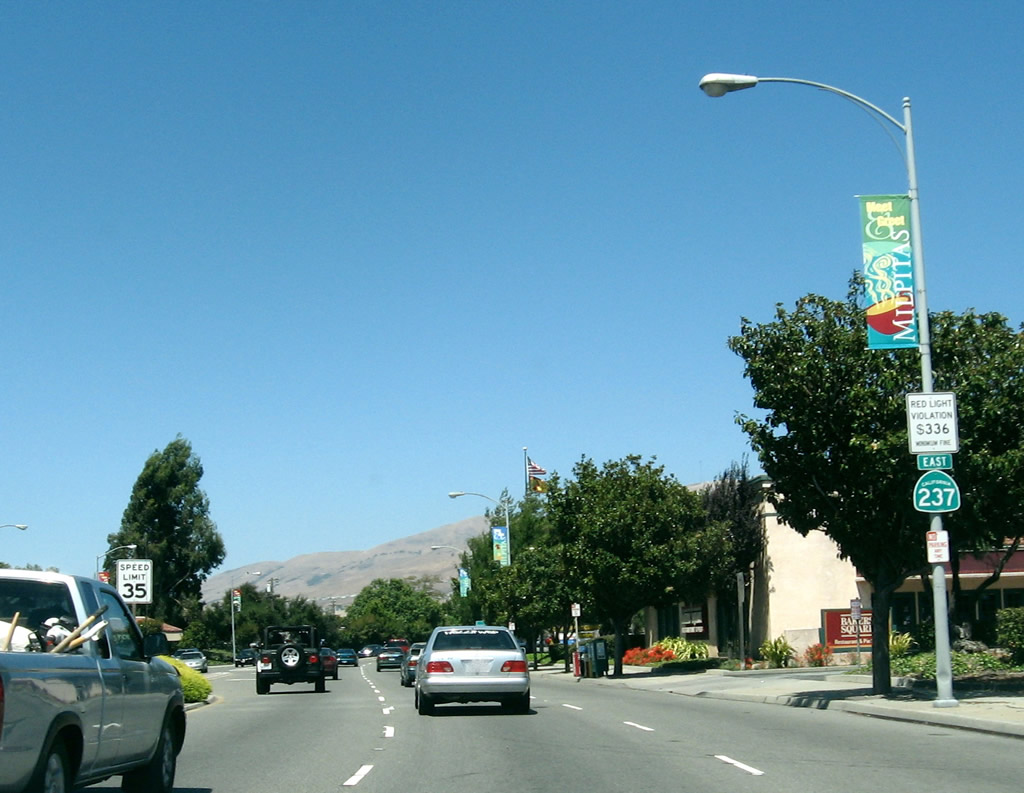
A California 237 east shield assembly is posted shortly after Serra Way on eastbound Calaveras Boulevard.
09/20/07
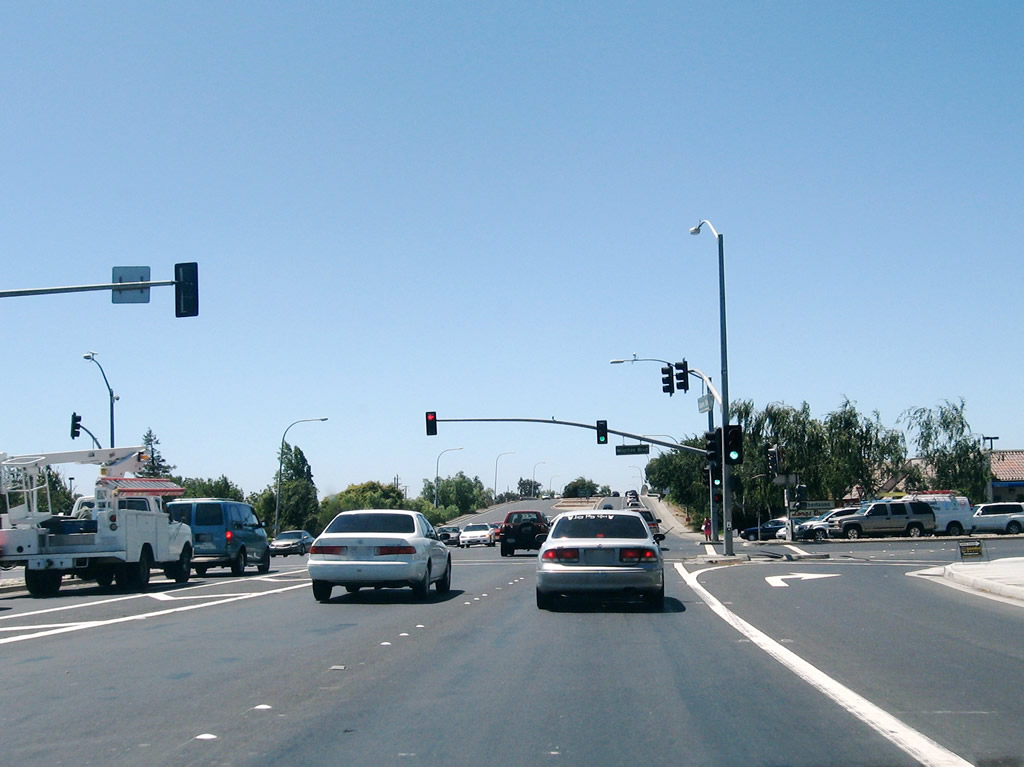
Eastbound California 237 (Calaveras Boulevard) meets Abel Street at this major traffic signal. From here, California 237 crosses over the Union Pacific Railroad tracks on this viaduct.
09/20/07
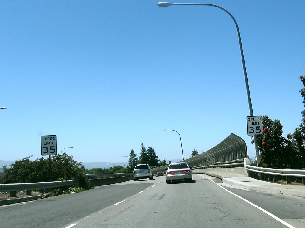
The bridge over the Union Pacific Railroad yard carries two lanes in each direction and limited shoulders. A curve in the roadway limits sight distance on California 237 east.
09/20/07
Another California 237 east shield assembly is posted after the railroad viaduct.
09/20/07
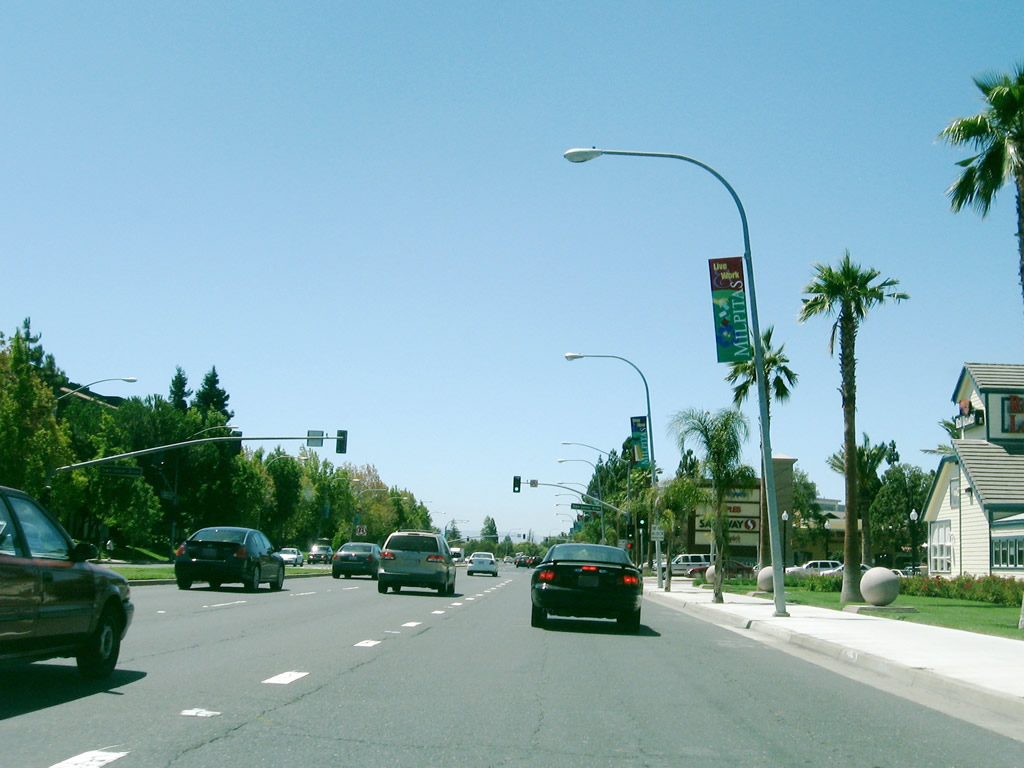
Eastbound California 237 (Calaveras Boulevard) approaches Milpitas Boulevard. This section of Calaveras Boulevard has a more residential feel, although businesses and commercial activities abound on both sides of the highway. The Milpitas library, civic center, and town center are all located on the north side of Calaveras Boulevard.
09/20/07
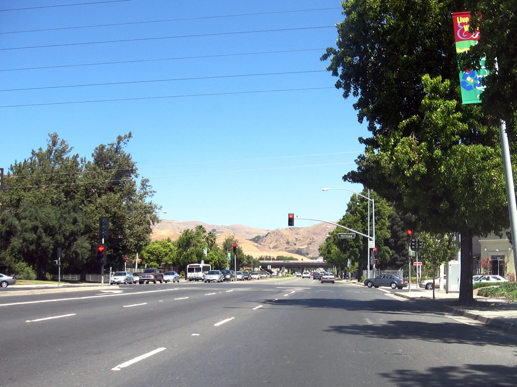
After the Town Center area, eastbound California 237 approaches Hillview Drive, which is the final traffic signal prior to reaching Interstate 680.
09/20/07
An end California 237 shield is posted after Hillview Drive and prior to the Interstate 680 interchange (Exits 11A-B). Calaveras Boulevard continues east through Milpitas, then enters Ed R. Levin County Park before turning north toward Calaveras Reservoir.
09/20/07
Westbound California 237 at the traffic signal for the Town Center commercial area. The civic center is located on the north side of Calaveras Boulevard.
09/20/07
Westbound California 237 (Calaveras Boulevard) meets Milpitas Boulevard at this traffic signal.
09/20/07
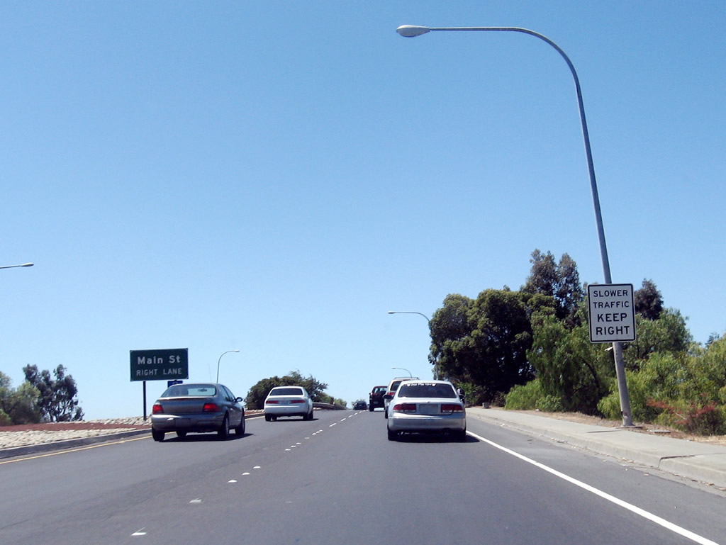
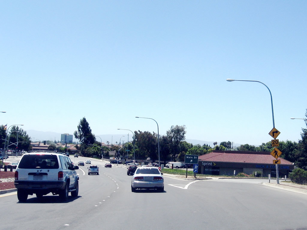
A ramp connects westbound California 237 to Main Street (unsigned Exit 10) beyond the bridge spanning the Union Pacific Railroad.
09/20/07
California 237 (Calaveras Boulevard) west crosses over the Union Pacific Railroad yard on this bridge.
09/20/07
Westbound California 237 (Calaveras Boulevard) reaches Exit 10, Main Street. Despite the exit ramp, this is not the start of the California 237 freeway (at least not yet).
09/20/07
After the Abel Street, Serra Way, and Abbott Avenue traffic signals, westbound California 237 approaches Interstate 880 (Nimitz Freeway). The first ramp (Exit 9C) connects to Interstate 880 north to Oakland. The next exit is a loop ramp to Interstate 880 south to San Jose.
09/20/07
Westbound California 237 next reaches Exit 9B, Interstate 880 south to San Jose.
11/29/04
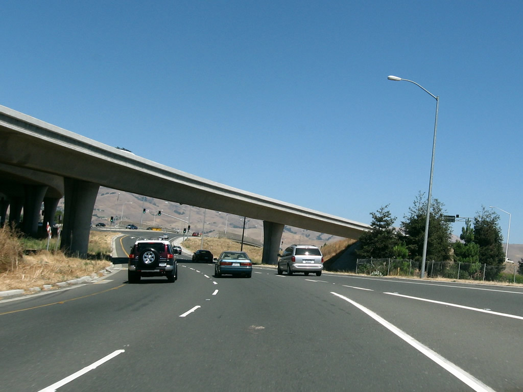
Passing under the transition ramps from California 237 east to Interstate 880 north (which were under construction back in 2004 but are complete as of 2008), westbound California 237 changes into a freeway configuration. Bear right at this point to connect to Exit 9A, McCarthy Boulevard and Cypress Street.
11/29/04
Although there are no overhead signs for it, the right lanes depart onto Exit 9A, McCarthy Boulevard and Cypress Street.
09/20/07
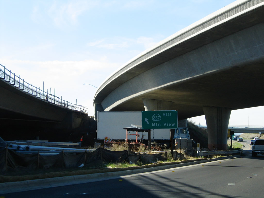
A California 237 west freeway entrance shield is posted along the mainline to signify the shift from Calaveras Boulevard onto the South Bay Freeway.
11/29/04
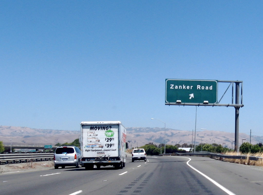
The next exit along California 237 west is Exit 8, Zanker Road.
09/20/07
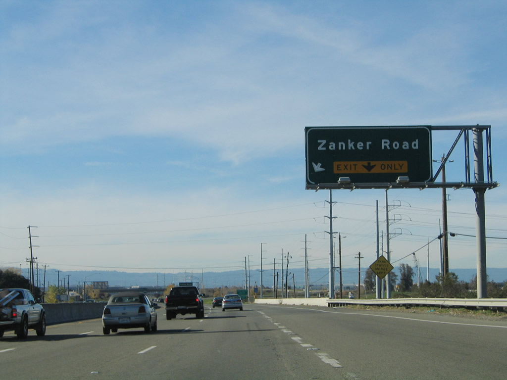
After the on-ramp from McCarthy Boulevard, the right lane becomes exit only for Exit 8, Zanker Road. Ahead, California 237 crosses Coyote Creek and departs the city of Milpitas and enters the city of San Jose, which is home to 894,943 people as of the 2000 Census. Founded on November 29, 1777, and incorporated on March 27, 1850, San Jose is the third largest city in California (behind Los Angeles and San Diego). San Jose consists of 178.2 square miles and sits at an elevation of 85 feet. Rainfall in San Jose is much less than San Francisco due to its location at the south end of the San Francisco Bay and enclosure within mountains. The average annual precipitation is 14.4 inches.
11/29/04
Westbound California 237 (South Bay Freeway) reaches Exit 8, Zanker Road.
11/29/04
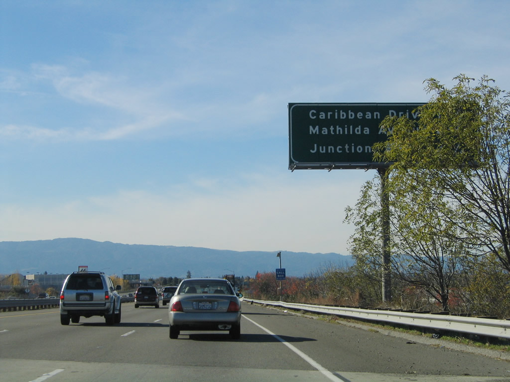
The next three exits along California 237 west are Exit 7, North First Street; Exit 6, Great America Parkway and Lafayette Street; and Exit 5, Santa Clara Route G-2 (Lawrence Expressway) south and Caribbean Drive north.
09/20/07
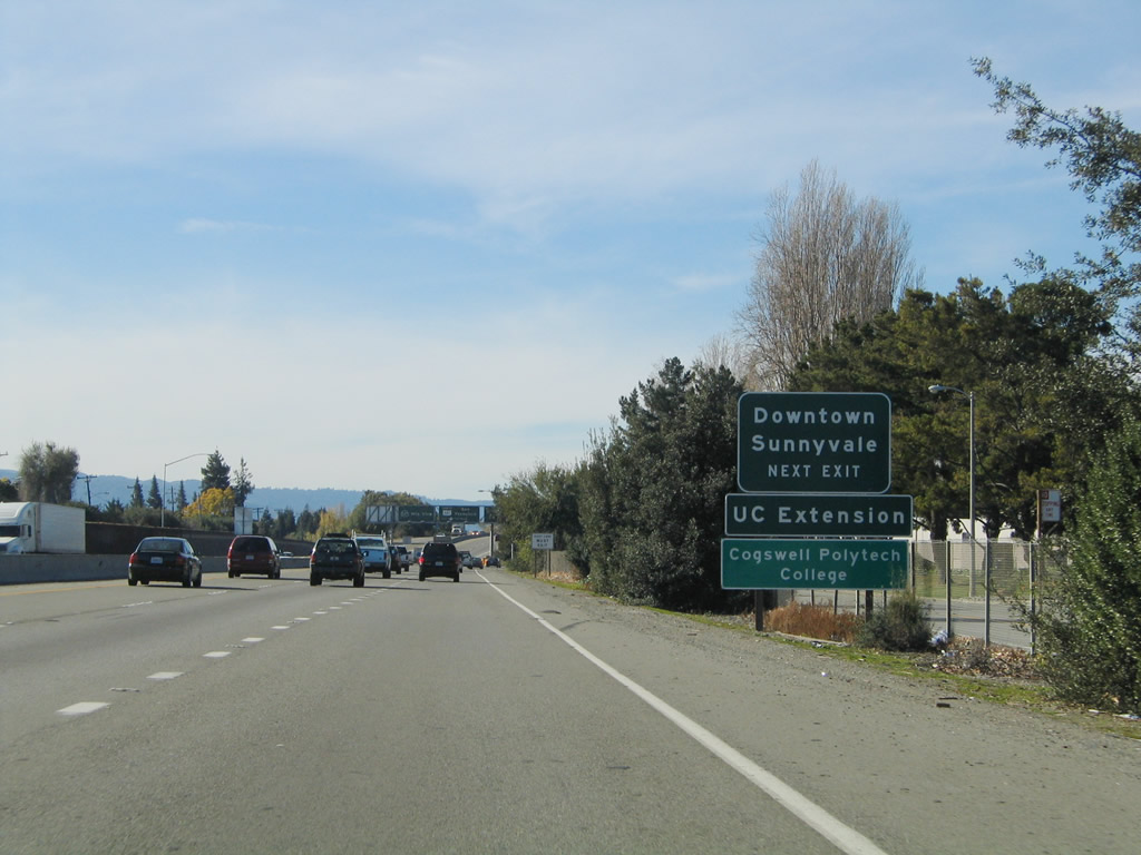
An auxiliary Exit 7 sign is posted on westbound California 237. Use North First Street south to the Guadalupe Light Rail Corridor, operated by the Santa Clara Valley Transportation Authority (VTA), the government organization that operates the mass transit service in Santa Clara County (buses and light rail), administers the transportation sales tax money in Santa Clara County, is the lead agency for implementing both the transportation improvements funded by the sales tax money and other highway improvements throughout the county, and performs the remaining functions of a typical regional transportation agency or council of governments, such as managing the Congestion Management Program and issuing guidelines for how traffic studies in the county should be performed.
11/29/04
Westbound California 237 reaches Exit 7, North First Street south, which eventually finds its way to downtown San Jose.
11/29/04
The next exit along California 237 west is Exit 6, Great America Parkway and Lafayette Street. Use Great America Parkway south into the city of Santa Clara and to Mission College and Paramount's Great America amusement park.
11/29/04
Use Exit 6 to Gold Street north and Lafayette Street south.
11/29/04
Westbound California 237 reaches Exit 6, Great America Parkway and Lafayette Street.
11/29/04
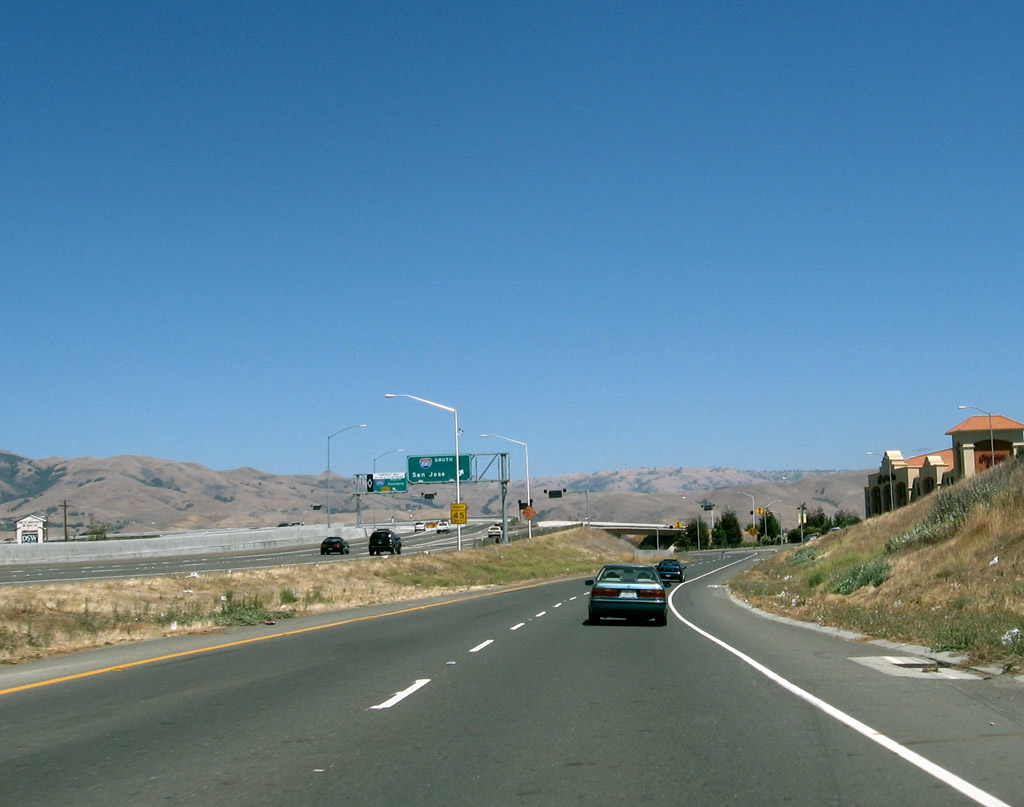
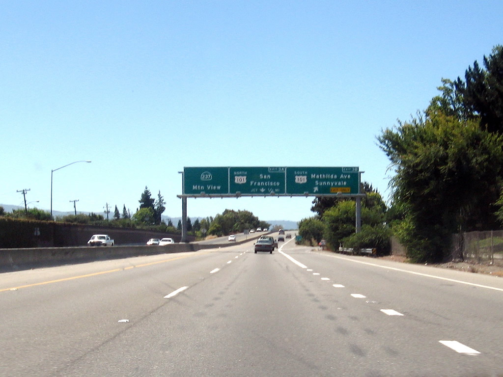
The next three exits along California 237 west are Exit 5, Santa Clara Route G-2 (Lawrence Expressway) south and Caribbean Drive north; Exit 3B, Mathilda Avenue to U.S. 101 (Bayshore Freeway) south; and Exit 3A, U.S. 101 (Bayshore Freeway) north.
11/29/04
Use Santa Clara Route G-2 (Lawrence Expressway) south to Sunnyvale, Santa Clara, and western San Jose. This major arterial connects California 237, U.S. 101, and California 9.
11/29/04
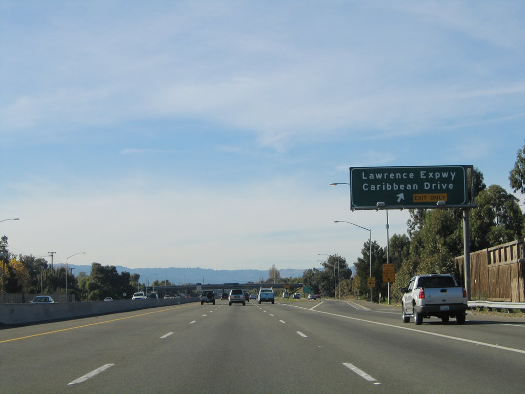
Westbound California 237 (South Bay Freeway) reaches Exit 5, Santa Clara Route G-2 (Lawrence Expressway) south and Caribbean Drive north.
11/29/04
The next three exits along California 237 west are Exit 3B, Mathilda Avenue to U.S. 101 (Bayshore Freeway) south; Exit 3A, U.S. 101 (Bayshore Freeway) north; and Exit 2, Middlefield Road and Maude Avenue.
11/29/04
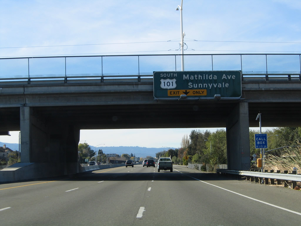
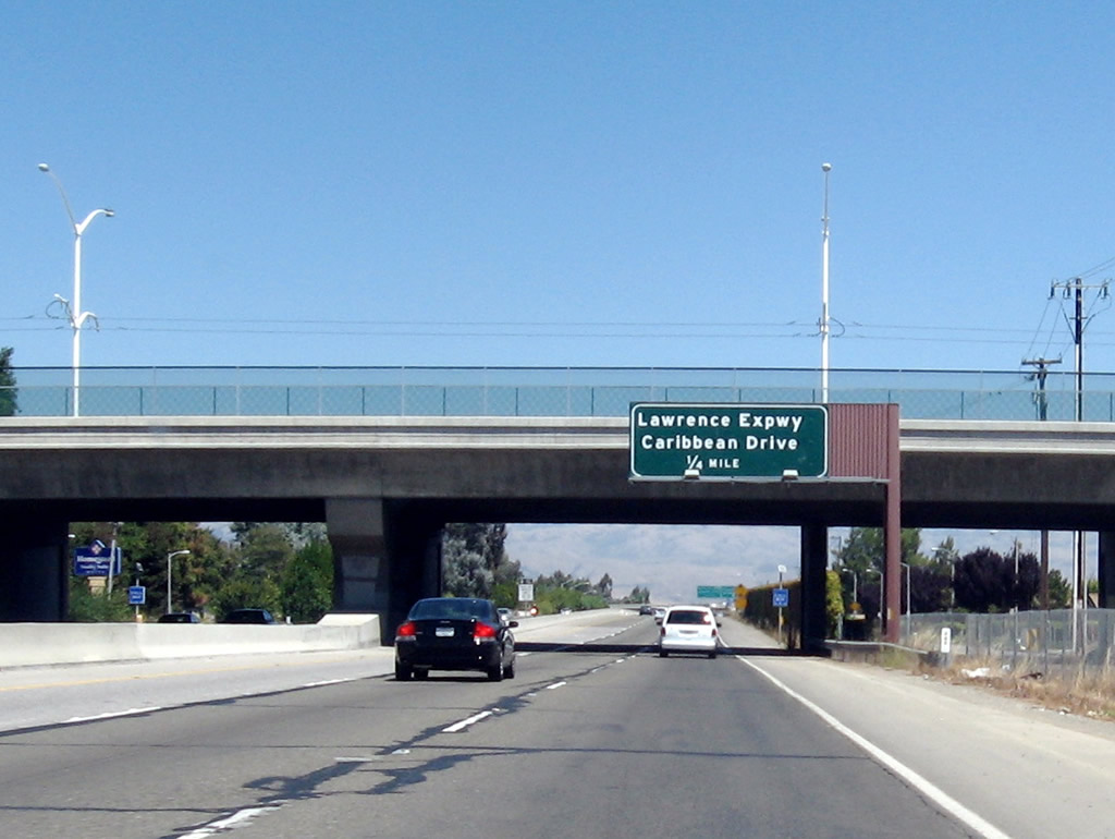
The right lane of California 237 west becomes exit only for Exit 3B, Mathilda Avenue to U.S. 101 (Bayshore Freeway) south as the South Bay Freeway passes under Fair Oaks Avenue. There is no access from California 237 west to Fair Oaks Avenue or Java Drive.
11/29/04
Use Exit 3B, Mathilda Avenue to downtown Sunnyvale. The city of Sunnyvale is known as the "Heart of Silicon Valley" and is situated between the cities of Los Altos and Santa Clara. The city is home to 131,760 people as of the 2000 Census and consists of 22.6 square miles. Sunnyvale incorporated in 1912 after being settled in the late 1800s.
11/29/04
Westbound California 237 reaches Exit 3B, Mathilda Avenue to U.S. 101 (Bayshore Freeway) south. The next exit is Exit 3A, U.S. 101 (Bayshore Freeway) north to San Francisco.
09/20/07
The porcelain enamel signs at Exit 3 B were replaced between 2004 and 2007.
11/29/04
The next exit along California 237 west is Exit 3A, U.S. 101 (Bayshore Freeway) north.
09/20/07
California 237 west enters the city of Mountain View, which is home to 70,708 people as of the 2000 Census, sits at an elevation of 105 feet, and consists of 12.2 square miles. The next exit is Exit 2, Middlefield Road and Maude Avenue.
09/20/07
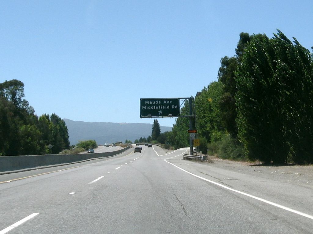
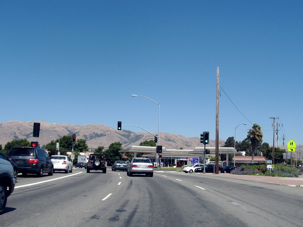
Westbound California 237 reaches Exit 2, Middlefield Road and Maude Avenue.
09/20/07
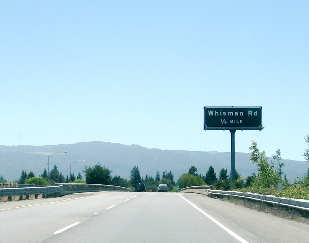
The next exit along California 237 west is Exit 1C, Dana Street and Whisman Road.
09/20/07
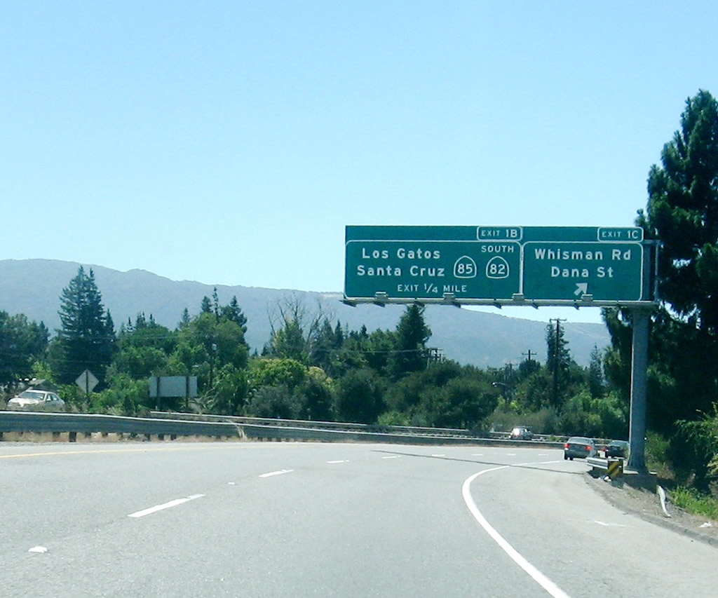
Westbound California 237 reaches Exit 1C, Dana Street and Whisman Road. The next interchange connects California 237 to California 85/(Stevens Creek Freeway) south and California 82 (El Camino Real).
09/20/07
Immediately thereafter, California 237 west connects to Exit 1B, California 85 south to Gilroy and California 82 (El Camino Real) southeast to Sunnyvale.
09/20/07
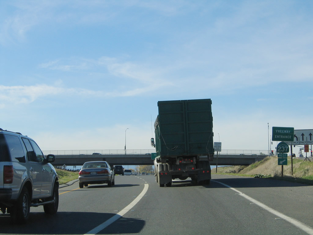
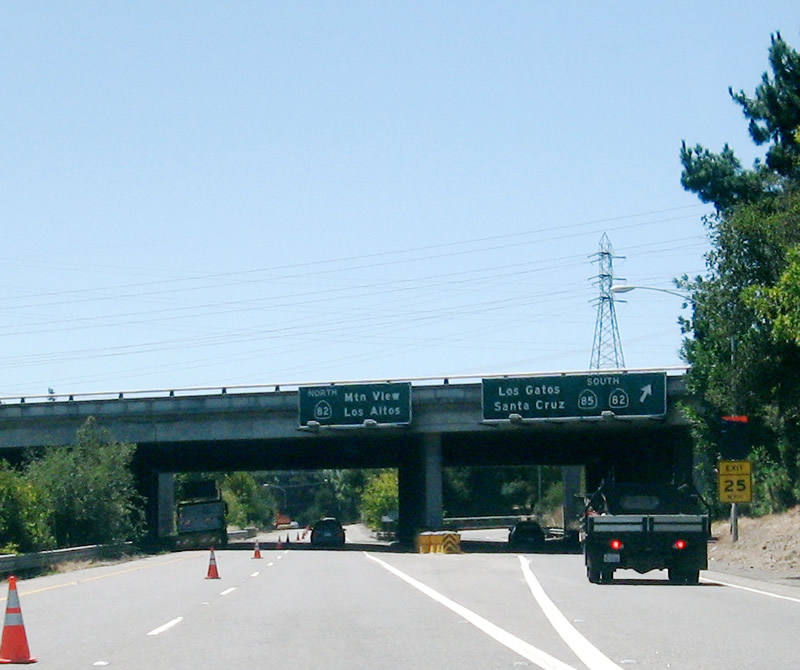
Westbound California 237 (Mountain View-Alviso Road) comes to an end as the freeway approaches California 82 (El Camino Real) at the traffic signal ahead.
09/20/07
Photo Credits:
- Andy Field: 11/29/04
- Jeff Waller: 09/20/07
Connect with:
Page Updated Friday February 29, 2008.