
State Route 238

California 238 is Mission Boulevard between Interstate 680 Fremont and the Interstate 580-Interstate 238 interchange in Hayward. This route was considered for upgrading to an expressway or freeway bypass, but the Hayward bypass project is dead, and the right of way will be sold by Caltrans. Now plans call for improvements along Mission Boulevard and Foothill Boulevard to improve mobility. At its junction with Interstate 580, California 238 becomes Interstate 238, and as a freeway, Interstate 238 connects to Interstate 880. The state route is signed north-south in its entirety.
Interstate 238 is the only freeway segment built of a much longer corridor. The legislative route 238 is assigned to California 238 from Interstate 680 north to Interstate 580, Interstate 238 from Interstate 580 to Interstate 880, and unconstructed California 238 from Interstate 880 to California 61.
The first segment is signed California 238 and follows Mission Boulevard and Foothill Boulevard from Interstate 680 north to Interstate 580. Historically, plans called for Mission Boulevard to be bypassed by a freeway on an alignment in the foothills; however, local opposition, lawsuits, and funding concerns delayed action on this route. By 2005, plans were to sell the right of way previously acquired for this new alignment and use the proceeds from the land sales to improve existing road facilities. These funds would construct a new grade separation at the junction of California 92-185-238 intersection in downtown Hayward and add more lanes to the corridor. However, these improvements will not result in a limited access route.1
The middle segment is the freeway section. It is mostly four lanes wide, but it is planned for widening in the coming years through the same 238 project designed to improve the surface street through Hayward. The freeway is often very congested to the point that it is stop and go for the entire length of the freeway depending on the direction of the rush hours. The freeway closely parallels east-west Lewelling Boulevard.
The third segment was conceived to connect Interstate 880 and Interstate 580 with the often-proposed but never-constructed Southern Crossing. The Southern Crossing, which appears on several mid-1960s General Drafting and Gousha maps, would have had approaches from Interstate 238 and Interstate 980; the freeways would have converged at a point near Oakland International Airport on a new alignment of California 61 that likely would have been built on fill or causeway. The Southern Crossing, which does not have a state route designation, would then cross the bay, connecting with unconstructed California 230, Interstate 380, and U.S. 101 near San Francisco International Airport.
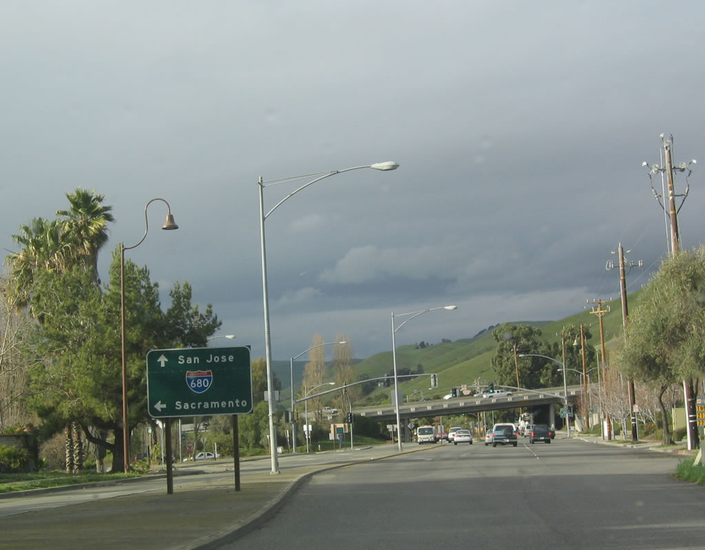
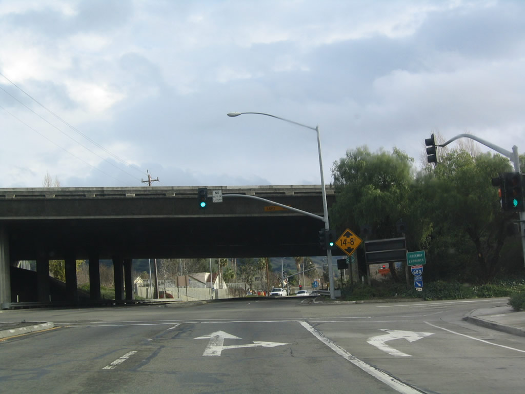
Northbound Mission Boulevard approaches Interstate 680 in the Mission San Jose neighborhood of the city of Fremont. At this interchange, Mission Boulevard becomes part of California 238 north to Union City and Hayward. A park and ride is situated on the east side of Mission Boulevard. The first turn is to Interstate 680 north to Sacramento at the traffic signal.
12/29/04
After the traffic signal for the connection to Interstate 680 north, the next left turn connects to Interstate 680 south to San Jose (after passing under Interstate 680).
12/29/04
A zero postmile paddle for California 238 is posted on northbound Mission Boulevard at the Interstate 680 interchange next to the park and ride. This marks the southern terminus of California 238.
12/29/04
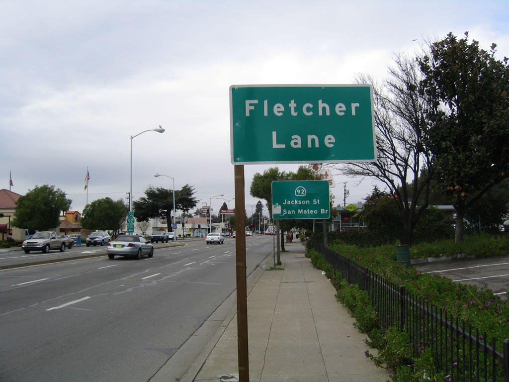
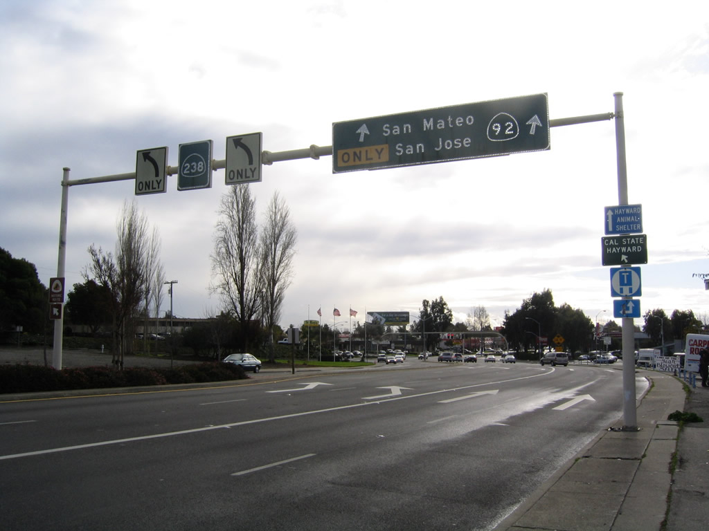
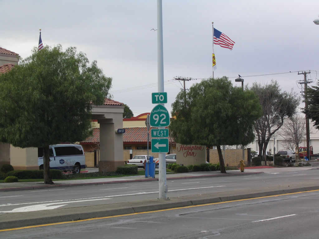
One block before the busy California 92-185-238 intersection (Five Corners), Fletcher Lane offers the only connection from California 238 north to California 92 west. All traffic to California 92 should turn left on Fletcher Lane, then turn north on Watkins Street to Jackson Street.
12/29/04
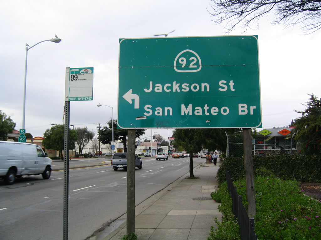
A trailblazer guide sign for California 92/Jackson Street west to the San Mateo-Hayward Bridge is posted on northbound California 238 prior to the left turn to Fletcher Lane. A trailblazer for California 92 is posted in the median.
12/29/04
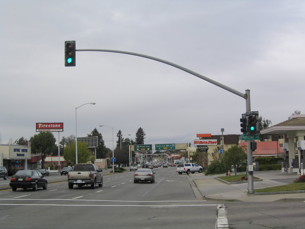
Northbound California 238 (Mission Boulevard) meets Fletcher Lane at this signalized intersection. The Five Corners intersection can be seen in the distance; a left turn onto California 92 is not permitted at this intersection.
12/29/04
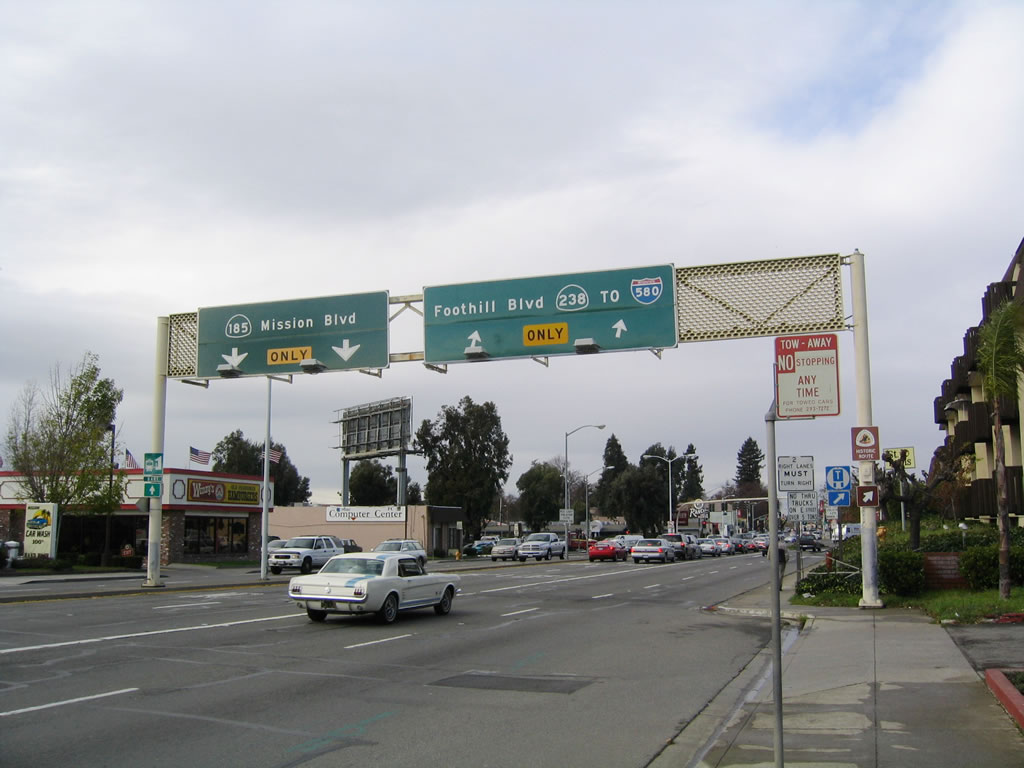
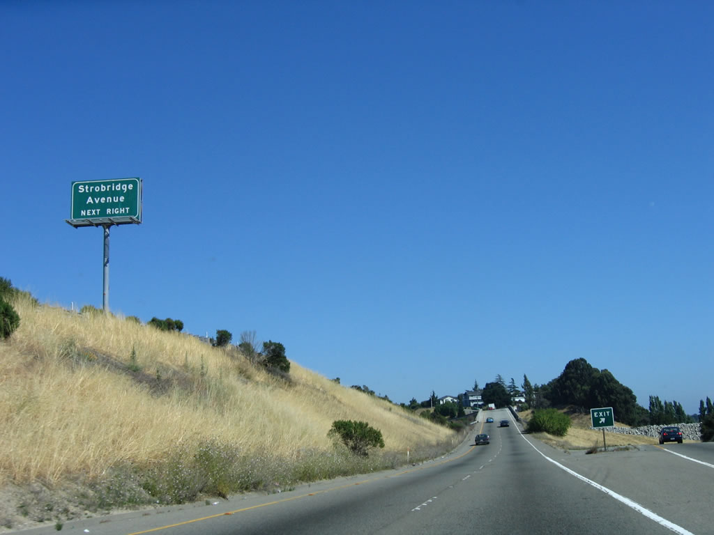
Shortly thereafter, northbound California 238 splits with California 185. The left two lanes will follow Mission Boulevard and California 185 north, while the right two lanes continue north on California 238 (Foothill Boulevard) to meet Interstate 580 in unincorporated Alameda County.
12/29/04
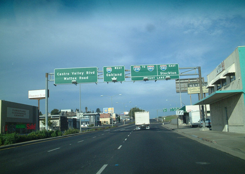
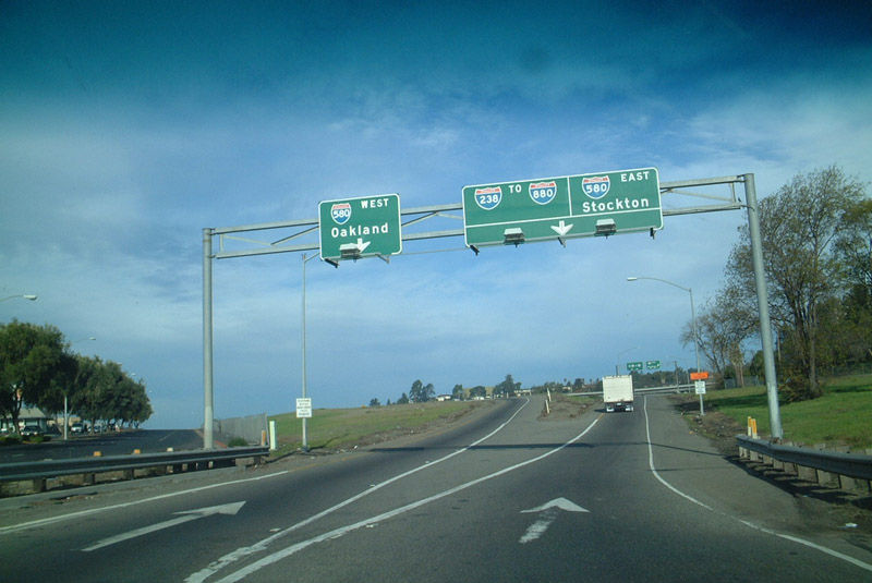
California 238 leaves Hayward as a surface street and promptly assumes a freeway configuration upon leaving the downtown area. As noted on this overhead sign, this is the first indication that what once was California 238 is now Interstate 238, and traffic must stay right to remain on that highway. An Interstate 880 shield almost always accompanies signage for Interstate 238, since that is the primary destination for travelers on northbound Interstate 238. Other options are to eastbound Interstate 580 toward Dublin (junction with Interstate 680) and westbound Interstate 580 (which actually heads northwesterly from here) to Oakland. Through traffic in the left lane defaults onto a connector ramp to Castro Valley Road and Mattox Boulevard.
12/27/01
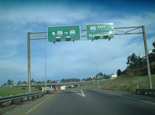
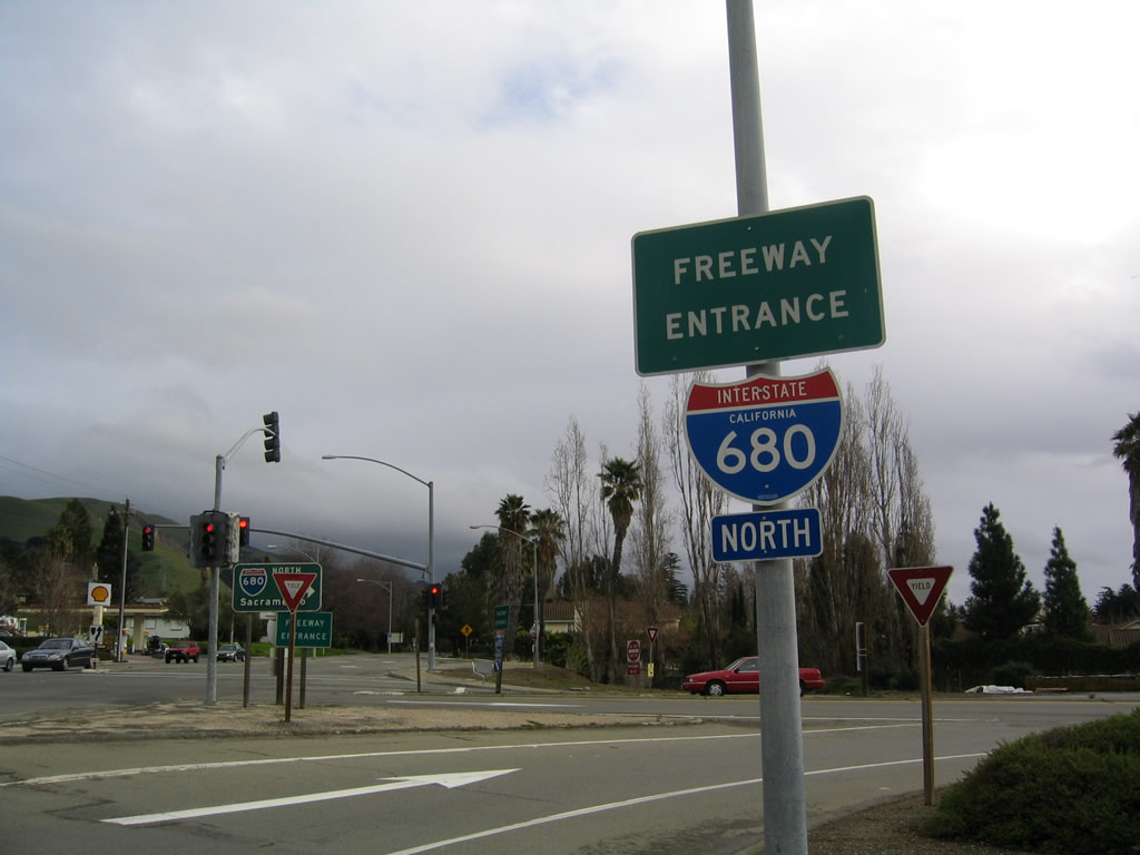
After the ramp to Castro Valley Road and Mattox Boulevard exit left, this sign greets motorists with a choice between Interstate 580 westbound and Interstate 238 northbound/Interstate 580 eastbound. Through traffic on Interstate 238 must remain in the right lane. Note the use of Stockton as the control city for Interstate 580, rather than Livermore or Tracy.
12/27/01
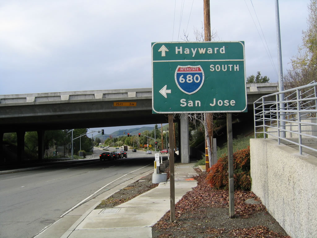
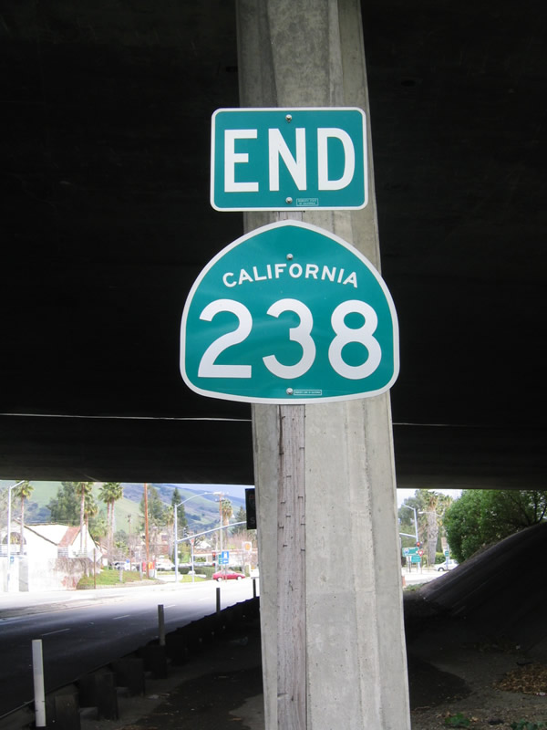
The next sign on northbound California 238 is the final split between Interstate 580 and Interstate 238. This marks the northern terminus of California 238 and the southern terminus of Interstate 238. Yes, even the Interstate route is signed north-south.
12/27/01
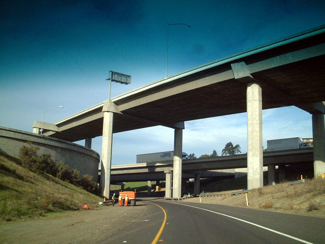
Taking the ramp from SR 238 (Foothill Boulevard) north onto Interstate 238 west through the multi level interchange with I-580.
12/27/01
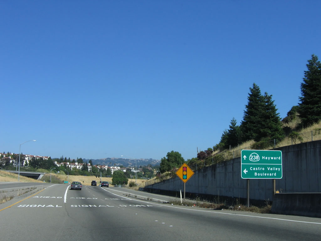
California 238 begins on the off-ramp from Interstate 580 east. The ramp splits, with the right lane following Interstate 238 north (west) to Interstate 880, while the left two lanes continue south on California 238 (Foothill Boulevard) into the city of Hayward.
07/05/06
After the split with Interstate 238, the ramp carrying California 238 south briefly parallels Interstate 580 east before entering Hayward.
07/05/06
Traffic from Interstate 238 south merges onto California 238. The first traffic signal on southbound California 238 is with Castro Valley Boulevard.
07/05/06
After the Castro Valley Boulevard intersection, California 238 enters the city of Hayward, which is known as the "Heart of the Bay." Encompassing 62.55 square miles, Hayward is the third largest city in the East Bay (only after Oakland and Fremont). Total population as of the 2000 Census was 140,030. Hayward was incorporated as a town in 1876 and as a city on September 18, 1928.
07/05/06
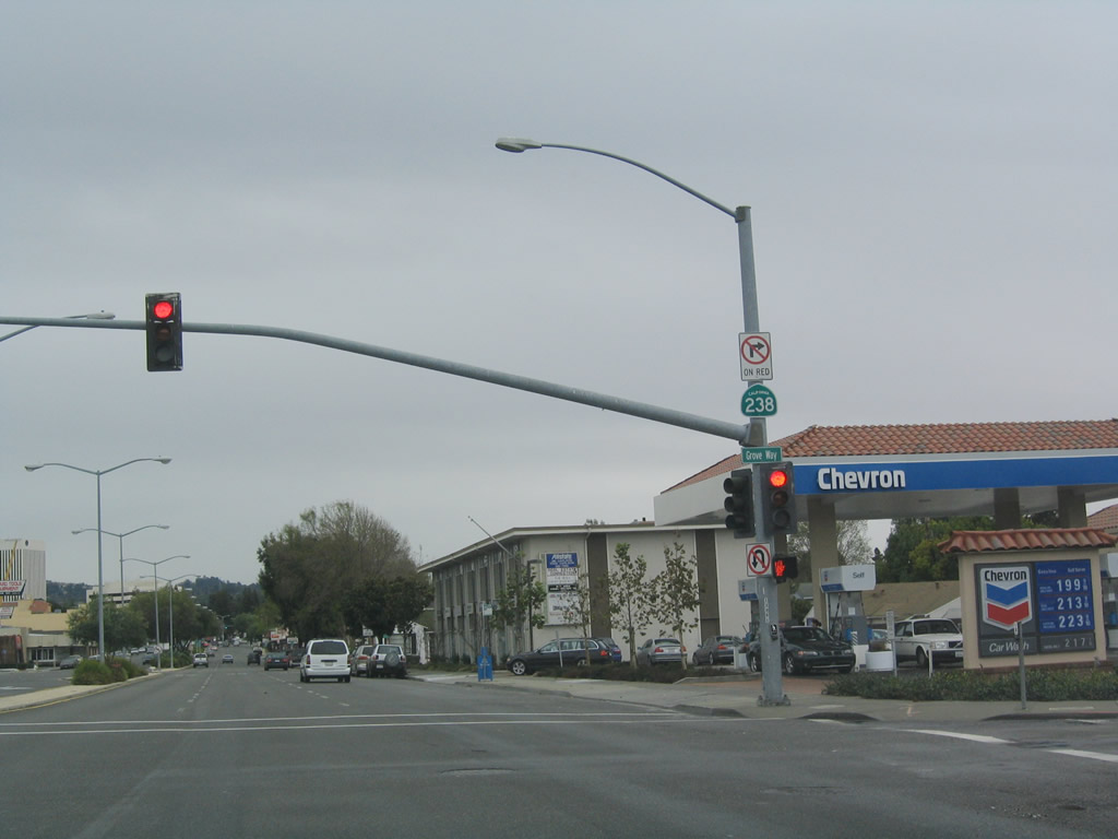
The next traffic signal on southbound California 238 (Foothill Boulevard) is with Grove Way.
12/30/04
After the A Street intersection, southbound California 238 (Foothill Boulevard) approaches California 92/Jackson Street west and California 185 (Mission Boulevard) north. The left two lanes of California 238 will turn left onto Mission Boulevard south for the continuation of the state route, while the two right lanes will transition directly onto California 92 west to the San Mateo-Hayward Bridge.
12/30/04
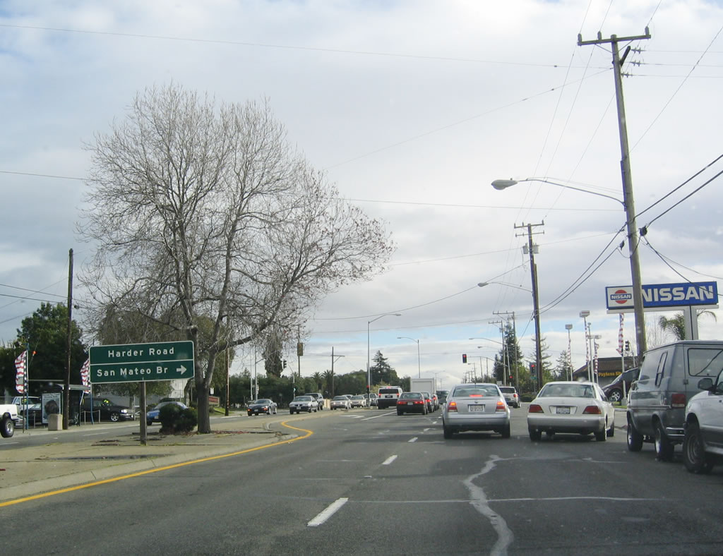
After the California 92-185-238 intersection in downtown Hayward, California 238 (Mission Boulevard) travels south through Hayward toward Fremont. After Carlos Bee Boulevard (to California State University-East Bay), southbound California 238 approaches Harder Road west to California 92/Jackson Street and east to the university.
12/29/04
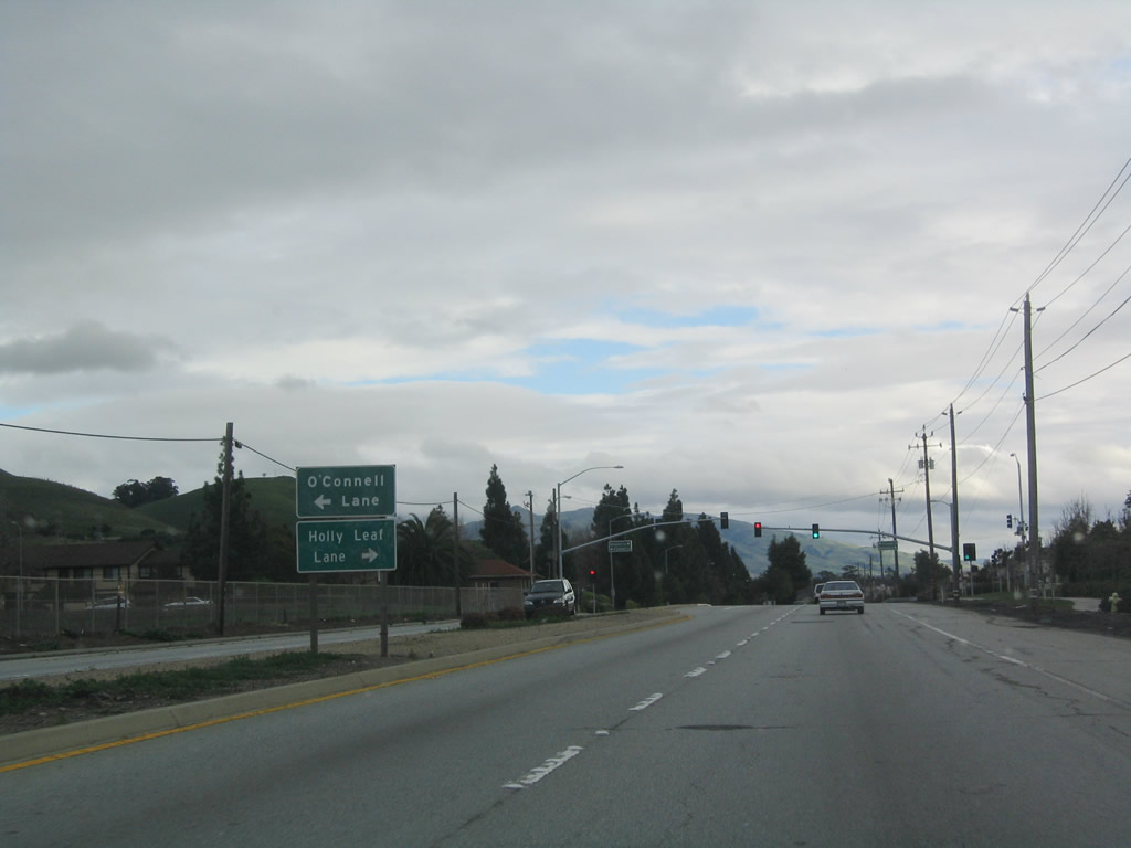
A bit further south, California 238 leaves Hayward and enters Union City, which was incorporated as a general law city on January 13, 1959, and is home to 70,300 people as of the 2000 Census. At this intersection, a left turn connects to O'Connell Lane east to the Masonic Home for Adults, while a right turn connects to residential areas via Holly Leaf Lane.
12/29/04
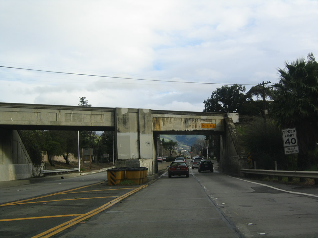
Now in the city of Fremont and prior to the California 84 (Niles Canyon Road) intersection, California 238 (Mission Boulevard) passes under the former Southern Pacific Railroad tracks, which now carries the Niles Canyon Railway for scenic steam train tours through Niles Canyon. Ahead, California 84 departs to the east into Niles Canyon. California 84 west and California 238 south briefly merge to cross Alameda Creek, then split at Mowry Avenue.
12/29/04
California 238 south and California 84 west pass under the Union Pacific Railroad tracks, which also pass into Niles Canyon. In the distance, the two routes divide at the Mowry Avenue traffic signal.
12/29/04
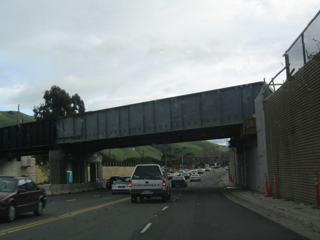
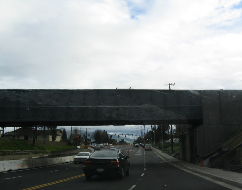
After the Stevenson Boulevard intersection near Fremont Central Park, southbound California 238 (Mission Boulevard) passes under the Union Pacific Railroad on this 1921 viaduct. Note that this stretch of California 238 is original concrete.
12/29/04
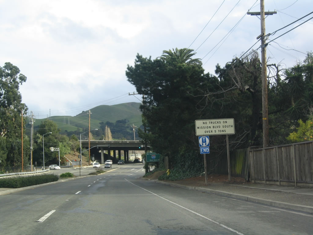
Turning a bit to the southeast, California 238 approaches Interstate 680. At this interchange, California 238 will end, and Mission Boulevard continues as a local street to Mission San Jose and Ohlone College. Trucks are restricted south of Interstate 680, so through traffic should use the freeway.
12/29/04
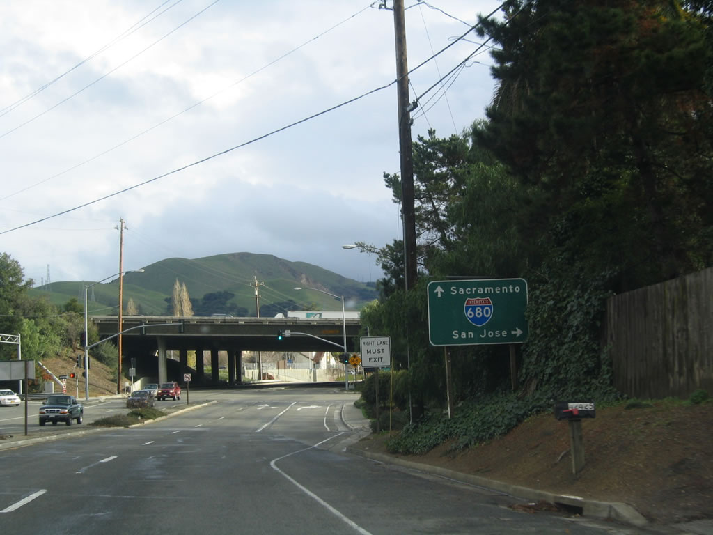
The first ramp from California 238 (Mission Boulevard) south connects to Interstate 680 south to San Jose, while the second right turn will connect to Interstate 680 north to Pleasanton, Walnut Creek, Concord, Fairfield, and Sacramento.
12/29/04
Southbound California 238 meets Interstate 680 south at this ramp.
12/29/04
An end California 238 shield is posted in the shadow of the Interstate 680 overpass.
12/29/04
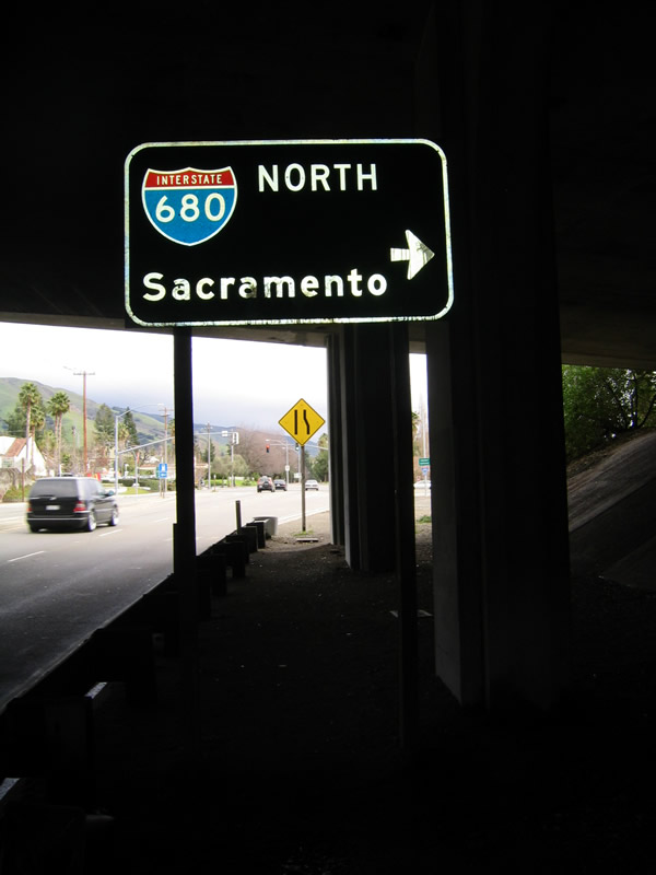
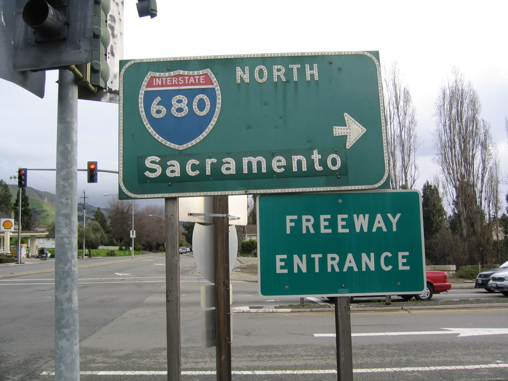
The second right turn connects to Interstate 680 north to Pleasanton, Walnut Creek, Concord, Fairfield, and Sacramento. Continue straight ahead to follow Mission Boulevard into Mission San Jose.
12/29/04
Freeway entrance shields adorn the ramp from California 238 south to Interstate 680 north. The control city for Interstate 680 is currently Sacramento, but it has changed since earlier days, perhaps Concord or Vallejo?
12/29/04
References:
- Alameda County transportation Authority: State Route 238 Improvements web page. http://acta.abag.ca.gov/1986_measure_b/PDFs/Route_238_Corridor_Improvement_Project_MB_238.pdf
Photo Credits:
- Andy Field: 12/27/01, 12/29/04, 12/30/04, 07/05/06
Connect with:
Page Updated Monday September 24, 2007.