
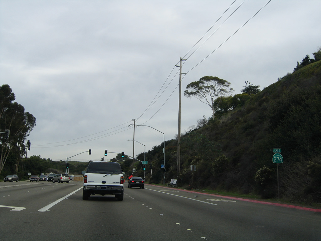
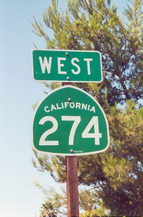
State Route 274
Former California 274 was Balboa Avenue, entirely within the City of San Diego, between Interstate 5 and Interstate 15 through Pacific Beach, Clairemont Mesa, and Kearny Mesa. It was decommissioned in May 2001. As of August 2003, California 274 remained as a signed route, but only a few signs on intersecting freeway routes remained by June 2007. Straggler shields were eventually removed.
- Around 1971. California 274 commissioned.
- February 24, 1998. Parts of the California 274, Interstate 15, and Murphy Canyon Road interchange complex swallowed by an El Ni-o sinkhole. This sinkhole, which was centered near the ramp from eastbound California 274 to southbound Interstate 15, measured 550 feet long. In addition to highway damage, underground utilities were also ruined. A clogged storm drain during a heavy rainstorm caused the sinkhole. Rushing water from the storm drain undermined the soil beneath the entrance ramp.
- May 5, 1998. Balboa Avenue reopened for the first time since February floods, allowing Tierrasanta residents direct access to the Kearny Mesa area.
- May 30, 1998. Interchange between Interstate 15 and California 274 reopened.
- August 22, 1998. Final utility and interchange repair work completed. Murphy Canyon Road reopened for first time since February, to the delight of San Diego Chargers officials (the practice field for the Chargers lies just south of the interchange). Caltrans announces plans for over $600,000 in landscaping for the interchange and surrounding area.
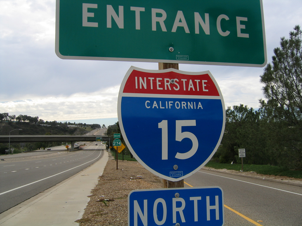
- Summer 1999. California 274 decommissioned in the state legislative books, but route remains signed.
- May 2001. The San Diego City Council votes to accept California 274 (and California 209) into the city's street inventory, thus ending California 274 as a state route. However, signs still remained as of October 2002 but were largely gone by 2006.
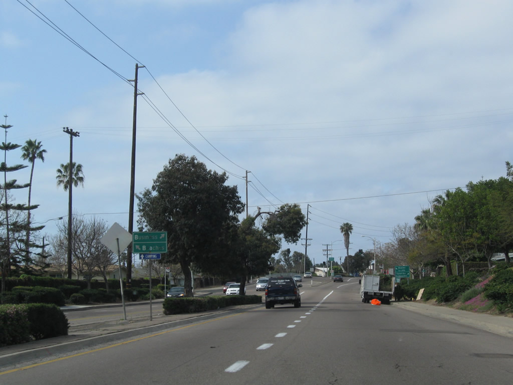
Garnet Avenue travels east through community of Pacific Beach within the city of San Diego to the former beginning of SR 274 at Historic U.S. 101 and Mission Bay Drive (old Business Loop I-5). This guide sign was replaced around 2006.
10/28/04
SR 274 followed Balboa Avenue east from Garnet Avenue to the Clairemont community while MIssion Bay Drive connects with I-5 north to La Jolla, Carmel Valley and Oceanside and I-5 south to Downtown, Chula Vista, and the international border with Mexico.
10/24/09
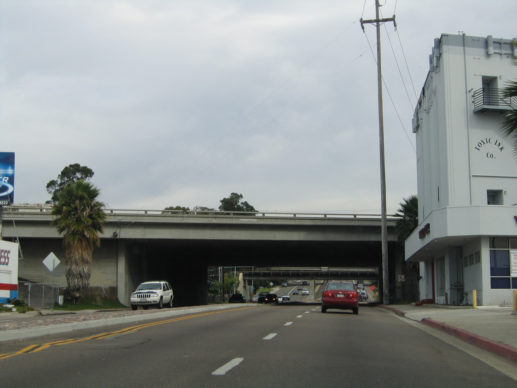
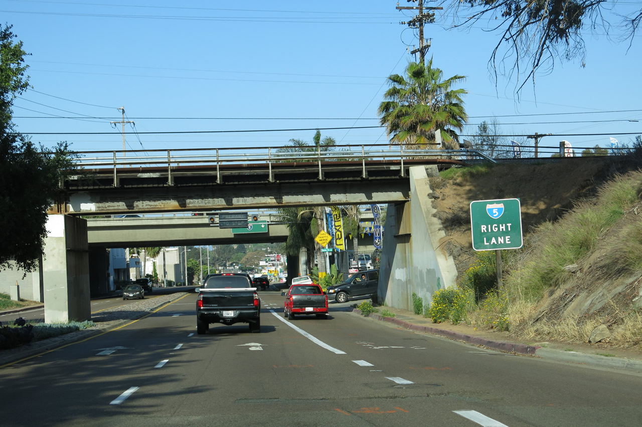
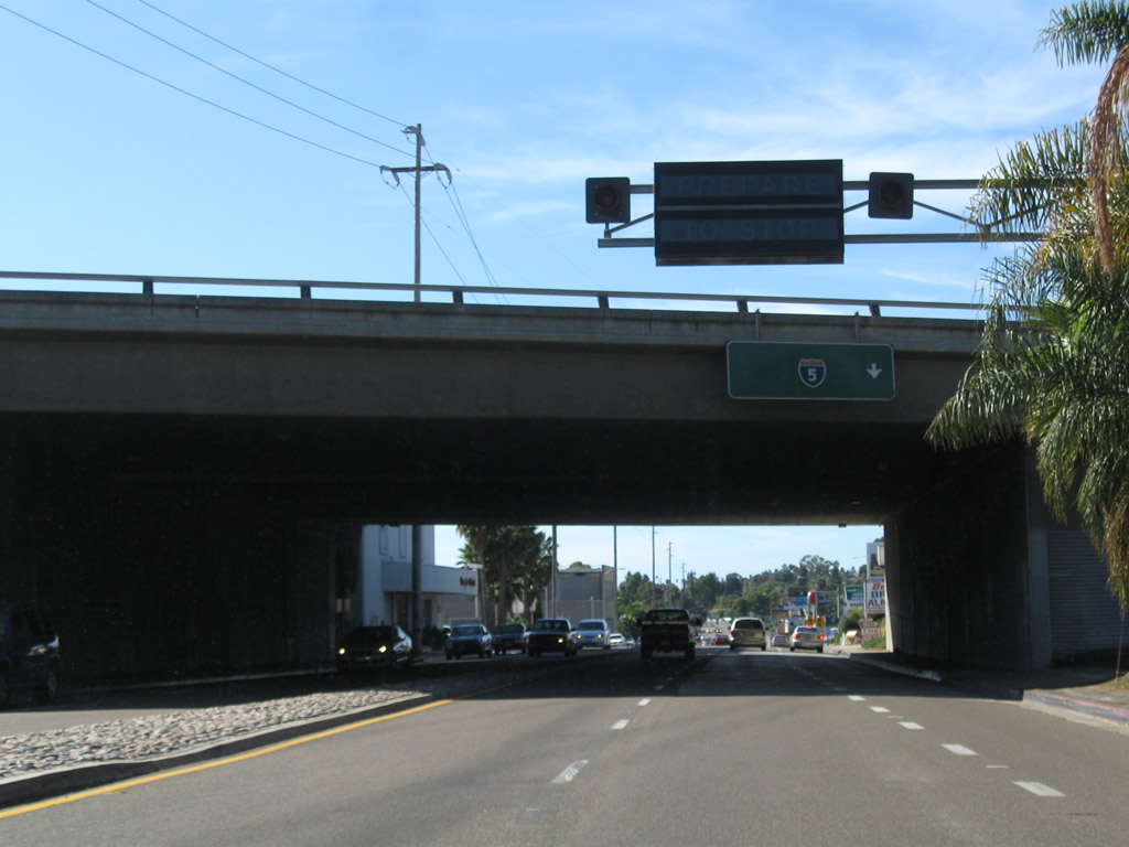
Garnet Avenue (old SR 274) passes under Interstate 5 without direct access.
11/05/04
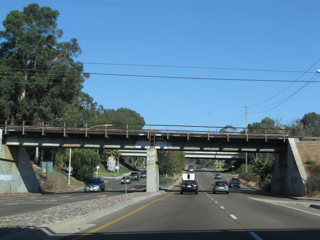
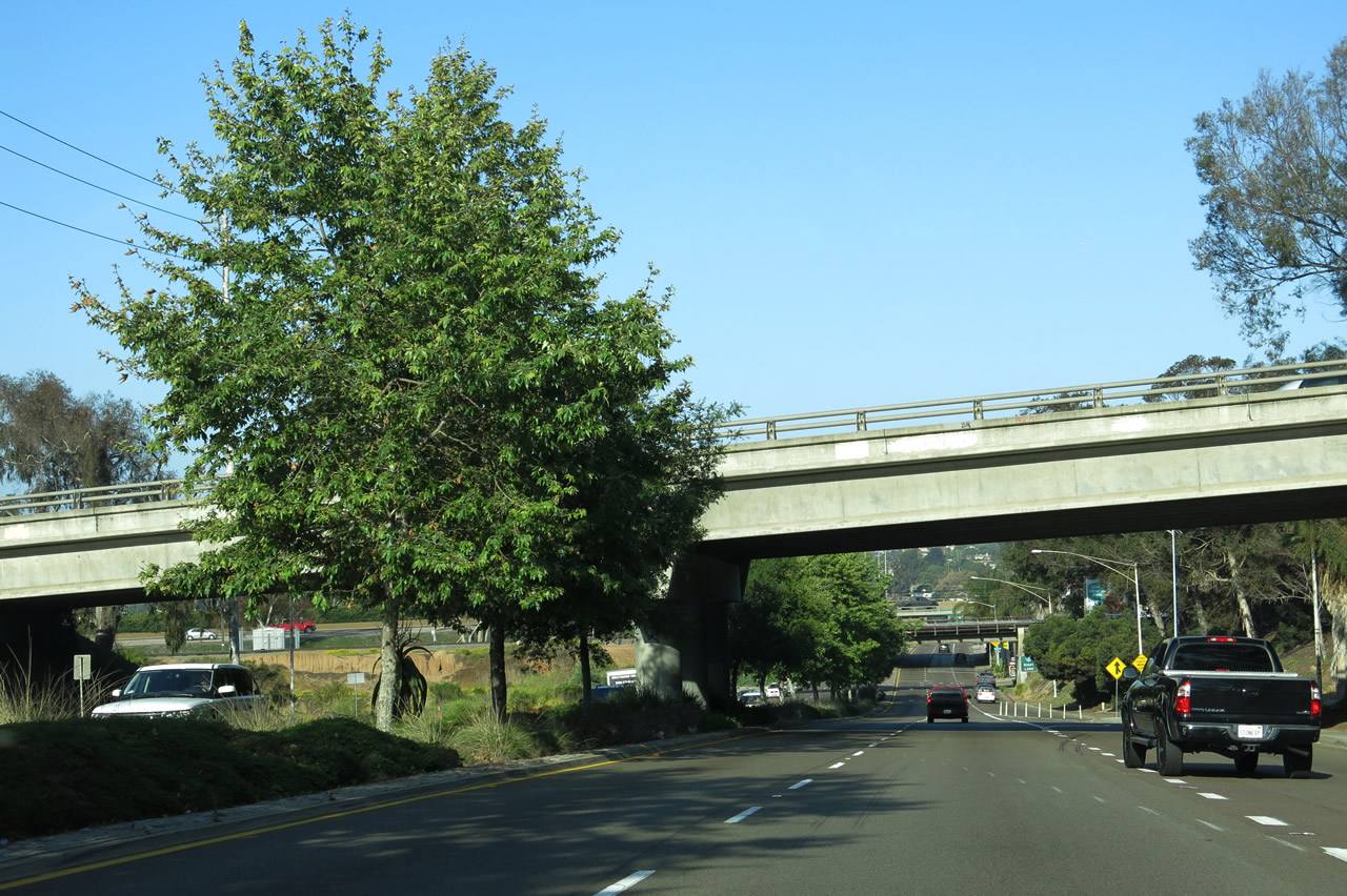
As traffic from northbound Interstate 5 merges onto eastbound Balboa Avenue on the right, Balboa Avenue passes under the San Diego Northern Railway and the Blue Line.
10/25/09
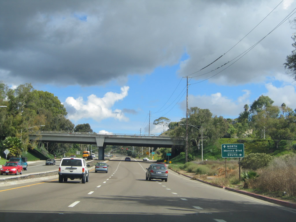
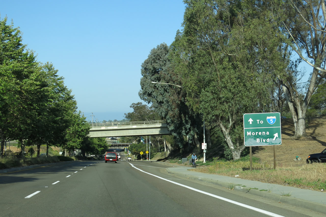
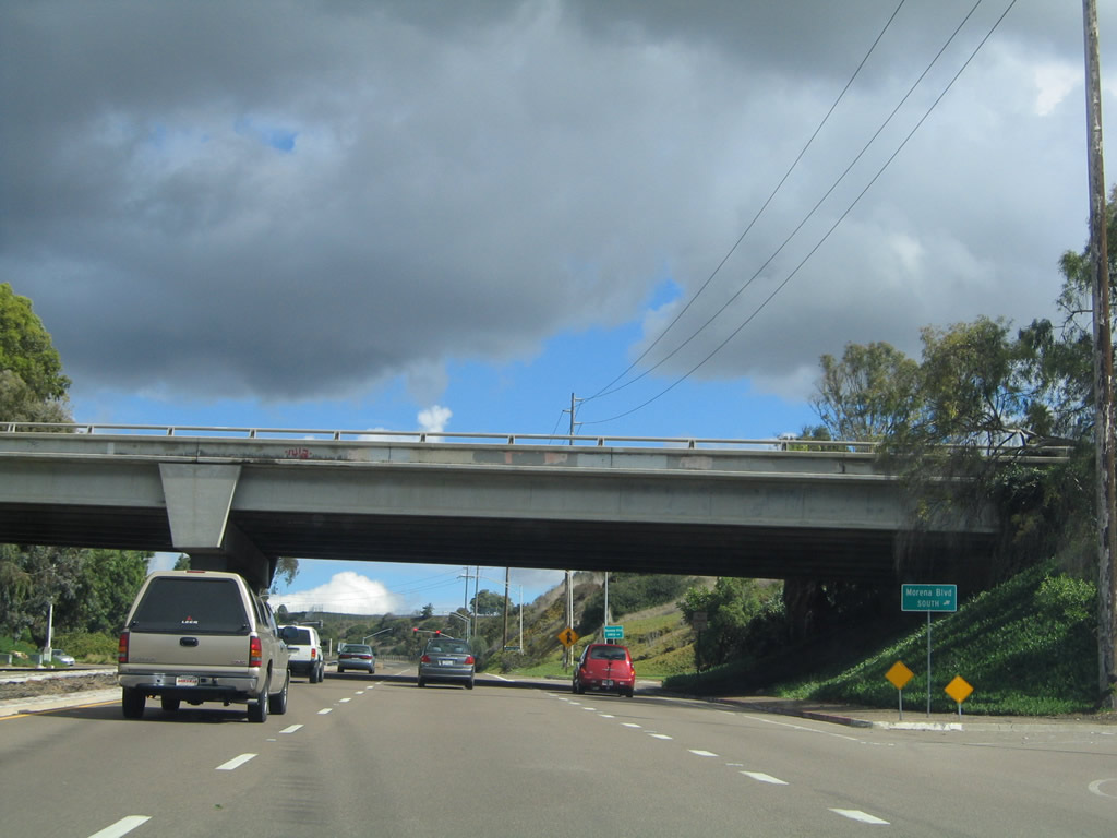
A parclo interchange joining Balboa Avenue with Morena Boulevard north to the Bay Ho neighborhood and south to the Bay Park neighborhood follows.
10/28/04
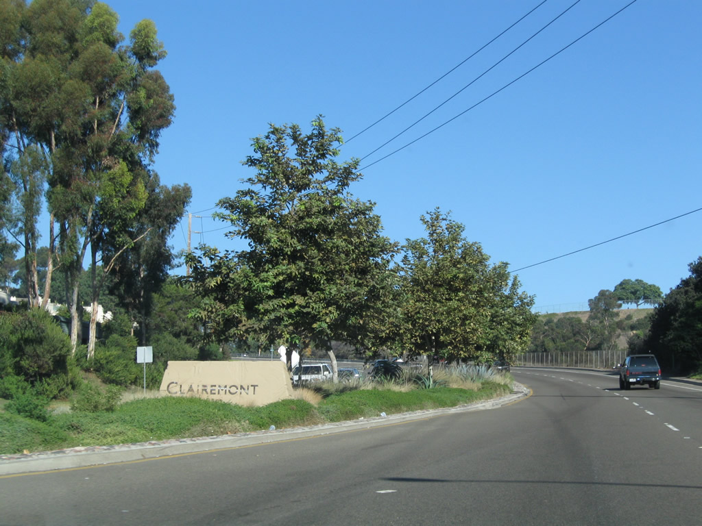
Balboa Avenue enters the community of Clairemont.
10/25/09
The first California 274 east reassurance shield posted along Balboa Avenue preceded the signalized intersection with Moraga Avenue.
11/05/04
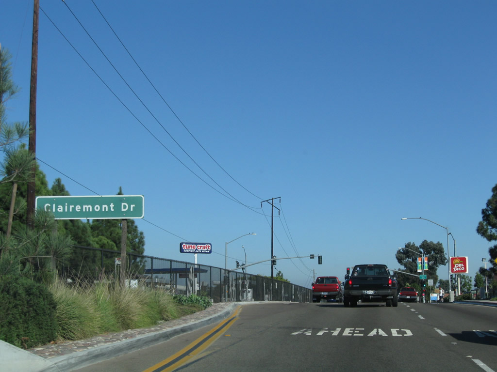
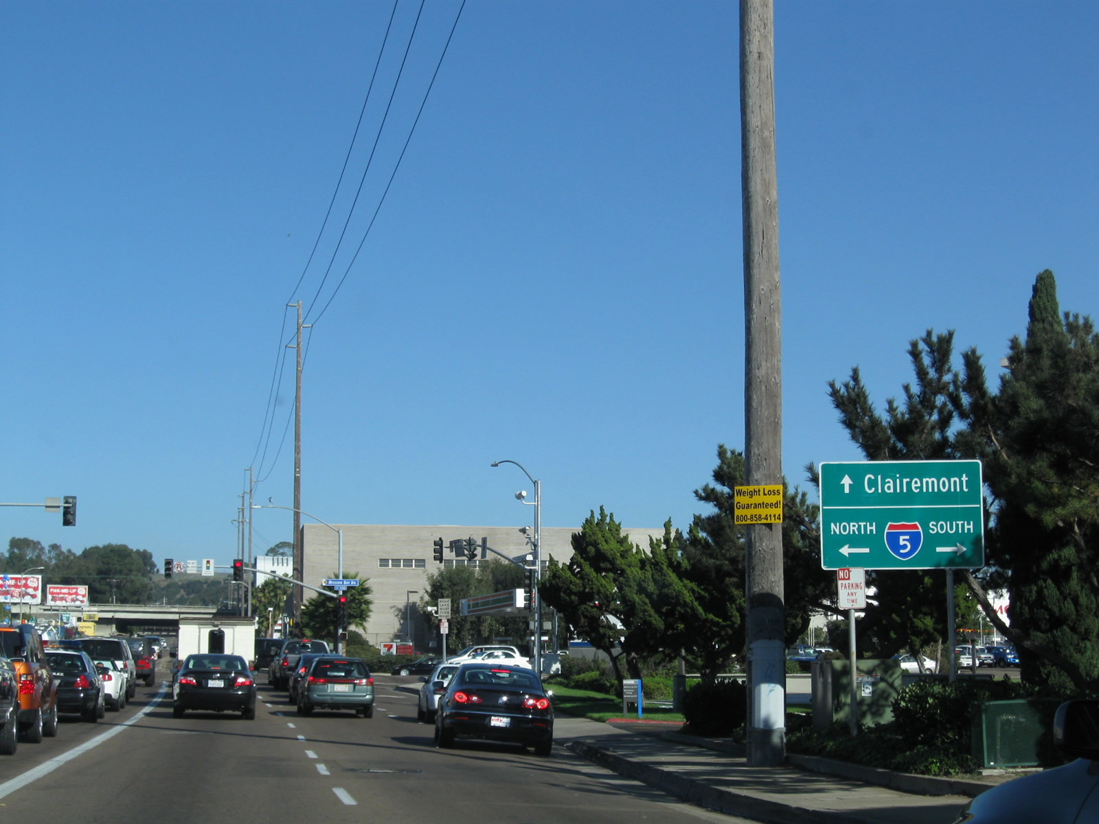
Eastbound Balboa Avenue (old California 274) approaches Clairemont Drive. Turn left (north) to the Clairemont Town Center and right to return to Interstate 5 via Bay Park.
10/25/09
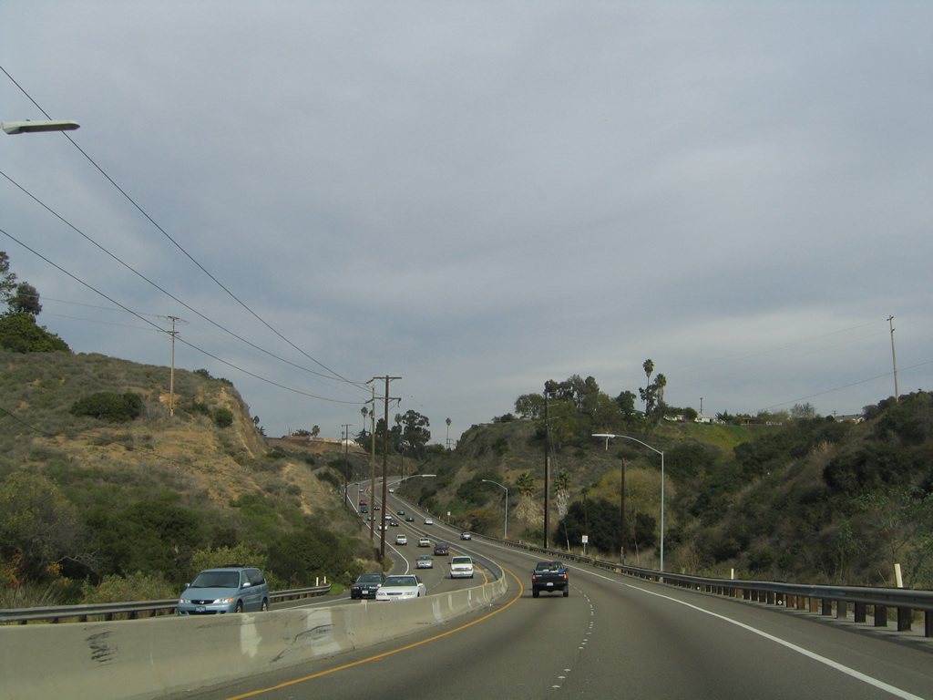
Through the dedicated open space of Tecolote Canyon, Balboa Avenue assumes the appearance of an expressway. The former state route was repaved in 1999, prior to the relinquishment of Balboa Avenue to the city. Most streets maintained by the City of San Diego do not use raised pavement markers (Botts Dots) to delineate lanes. The use of Botts Dots through Tecolote Canyon clearly shows that the road was built to Caltrans rather than City standards.
11/05/04
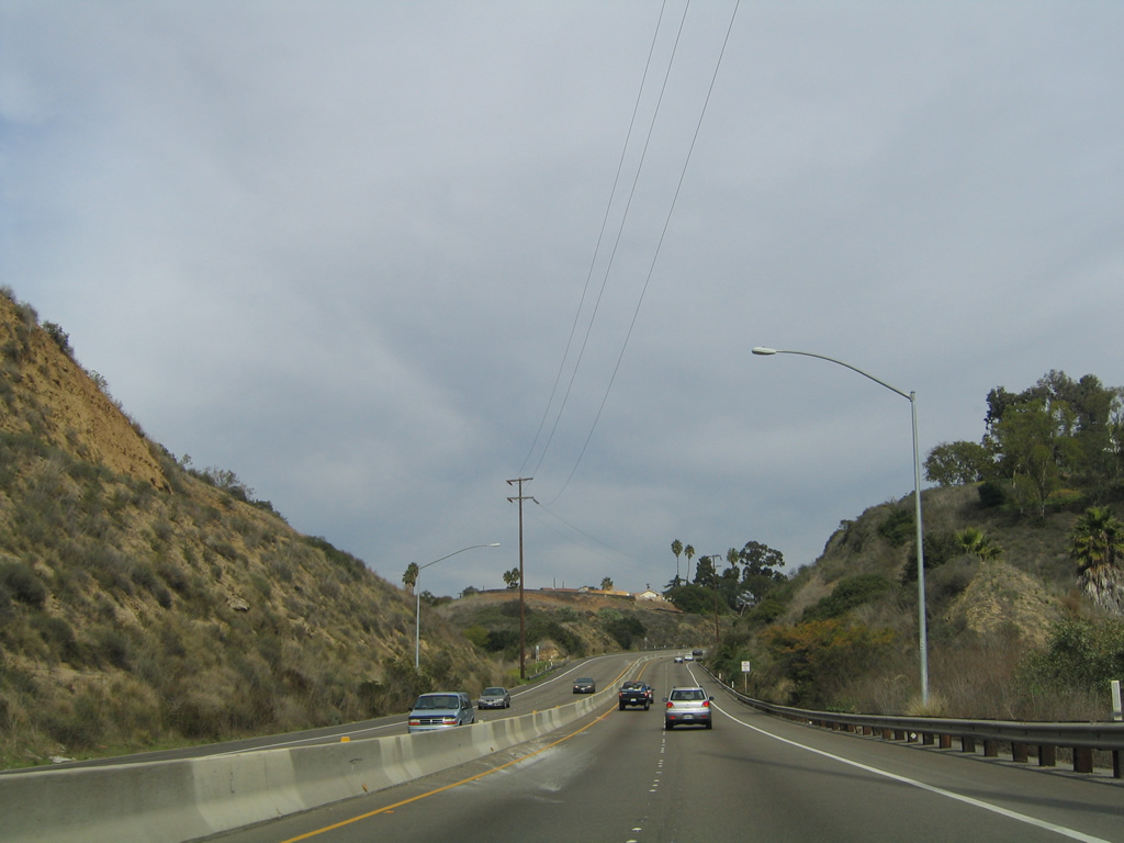
Tecolote Canyon Natural Park is a finger canyon located within the Clairemont community of the city of San Diego. Balboa Avenue passes through the northern end of the canyon before ascending back to Clairemont Mesa.
11/05/04
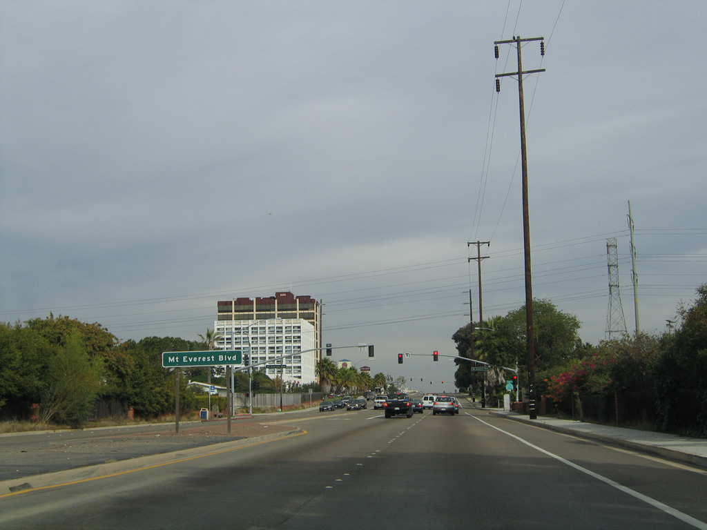
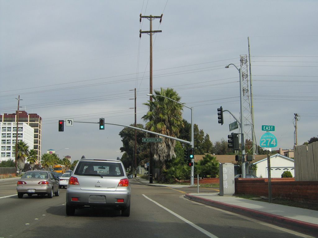
Reentering a commercial and residential area, eastbound Balboa Avenue (old California 274) next meets Mount Everest Boulevard.
11/05/04
Removed in 2005, a California 274 east reassurance shield was previously posted on Balboa Avenue prior to Mount Everest Boulevard.
11/05/04
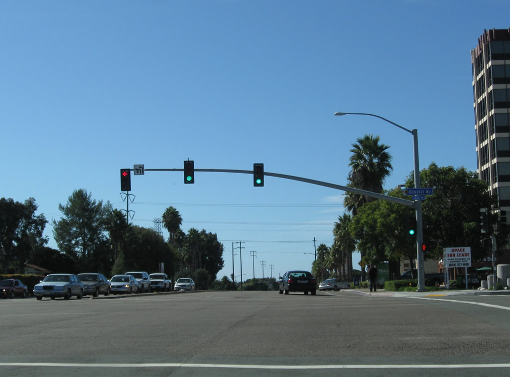
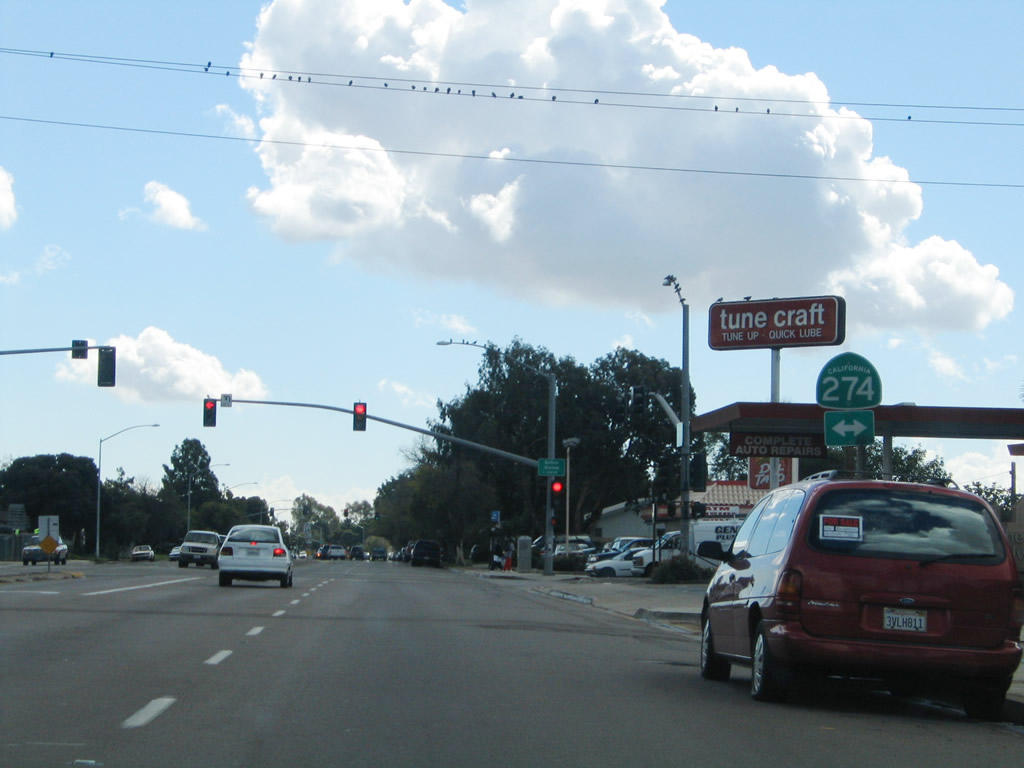
A California 274 trailblazer was posted on the traffic signal mast arm at Genesee Avenue and Balboa Avenue.
11/05/04
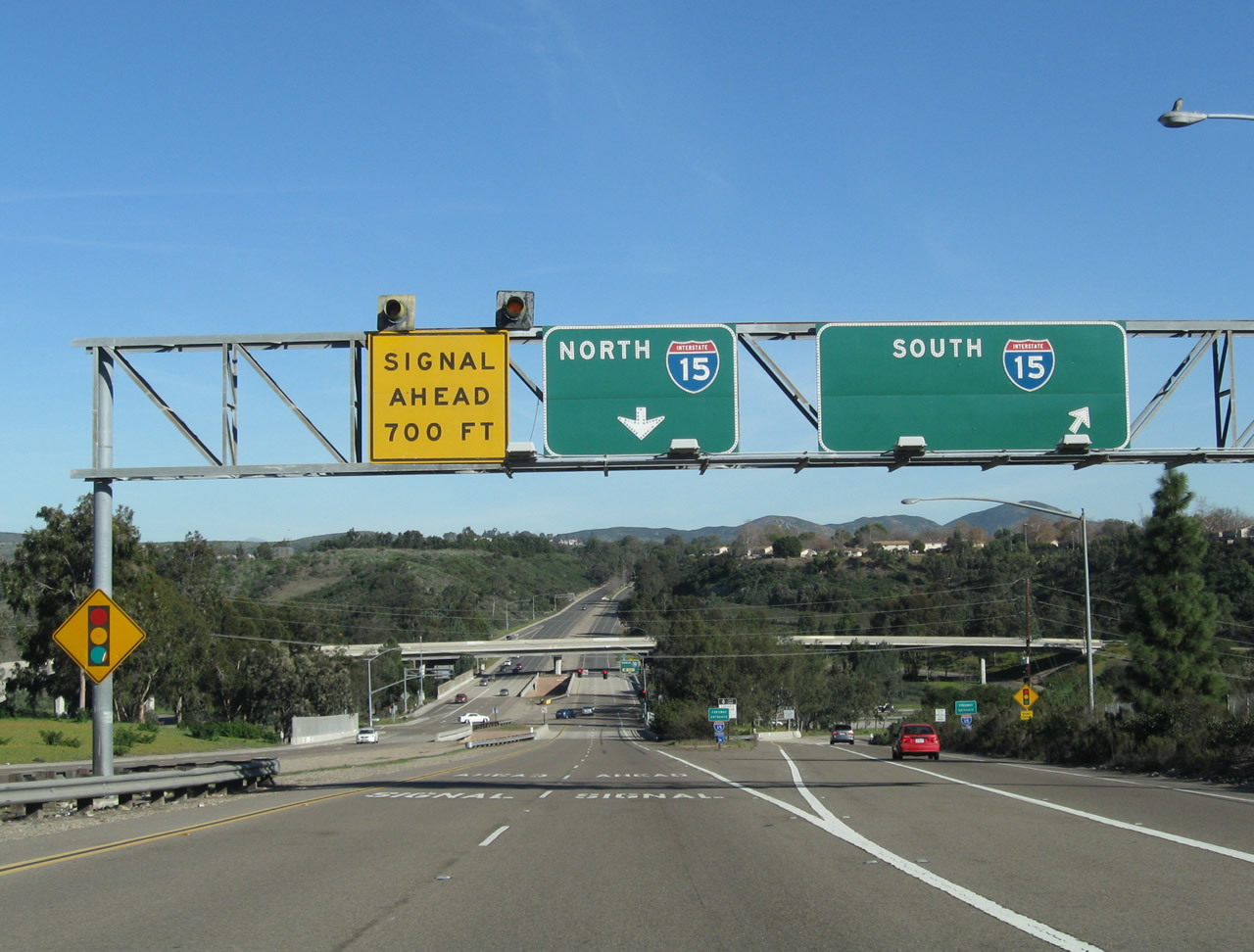
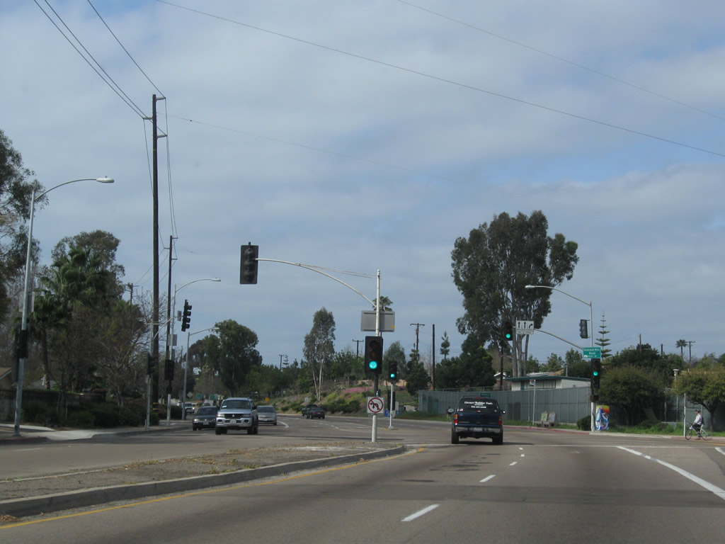
East of Genesee Avenue, Balboa Avenue (old California 274) widens to three eastbound lanes with additional auxiliary lanes for turning. This section of Balboa Avenue can be extremely busy, especially during commuting hours. The traffic signal ahead serves a connection to Mount Alifan Drive south and Mount Abernathy Drive north.
11/05/04
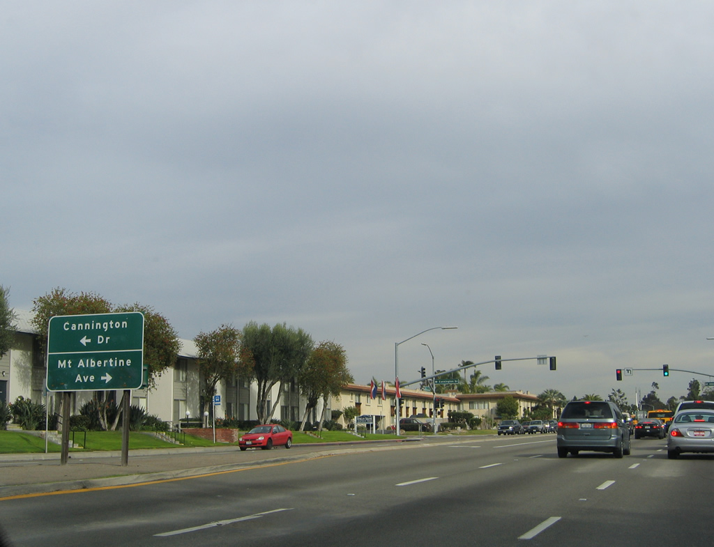
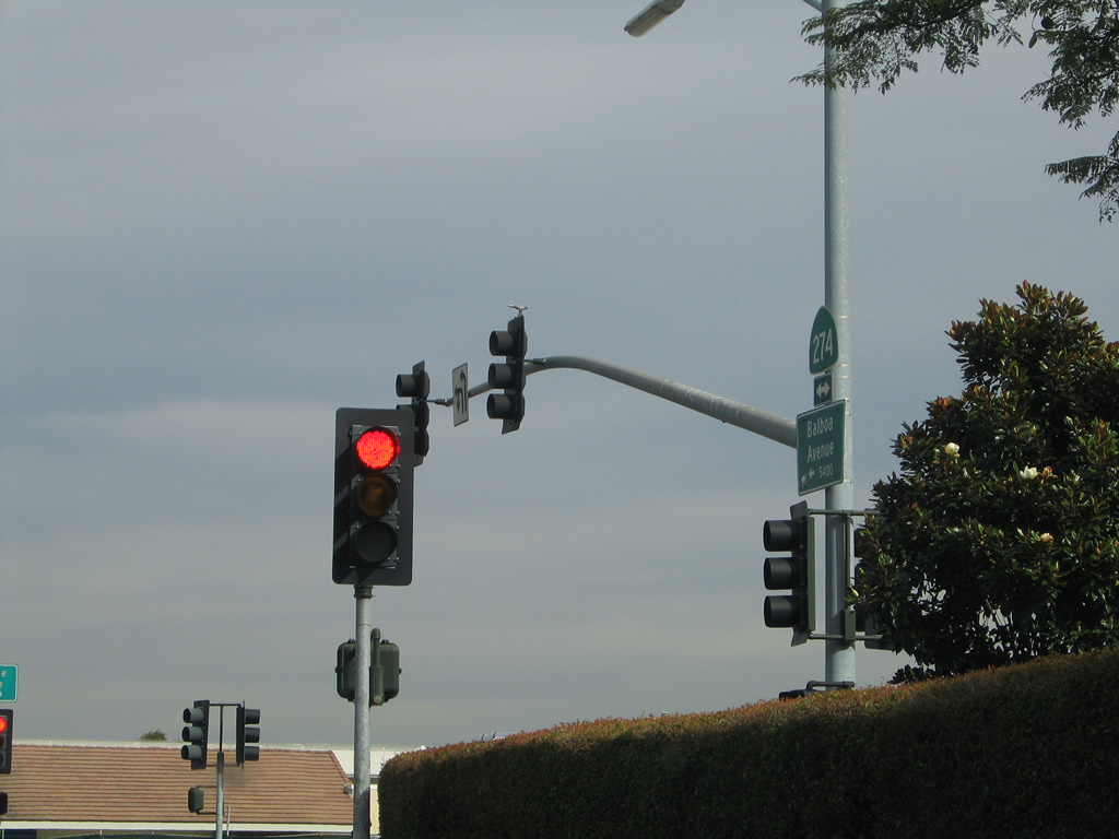
The next traffic signal along eastbound Balboa Avenue (old California 274) is with Cannington Drive north and Mount Albertine Avenue south.
11/05/04
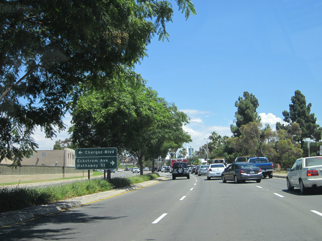
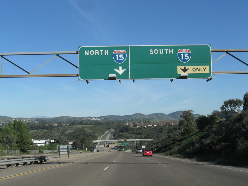
Eastbound Balboa Avenue (old California 274) advances to Charger Boulevard north, Eckstrom Avenue east, and Hathaway Street south.
08/18/12
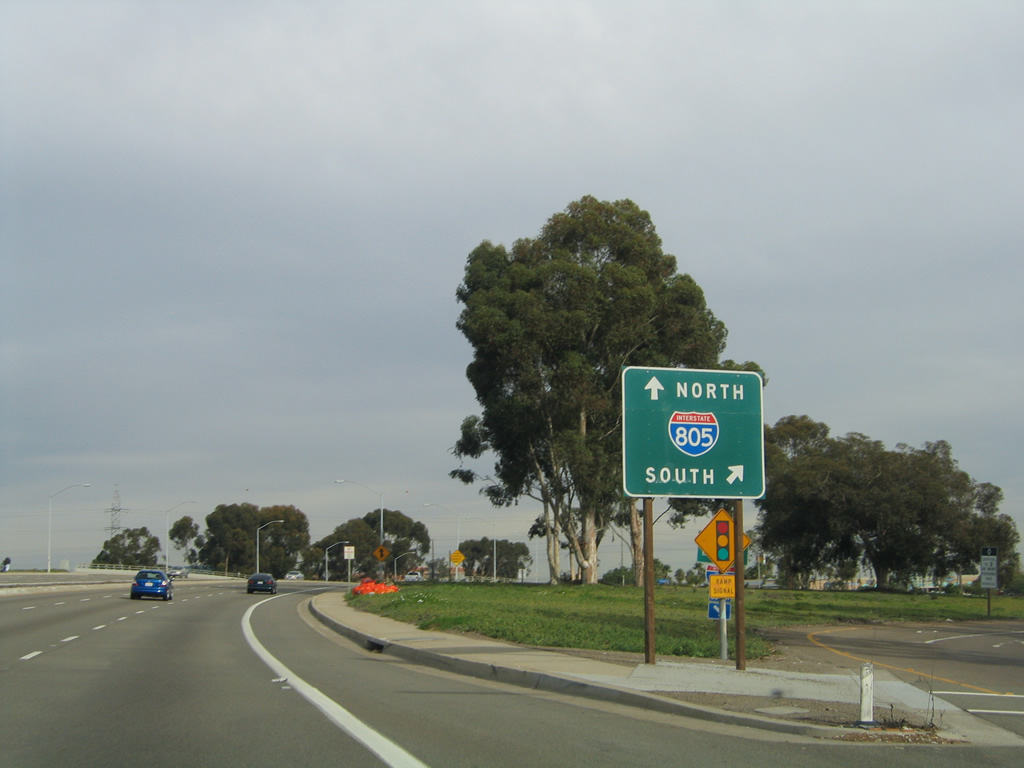
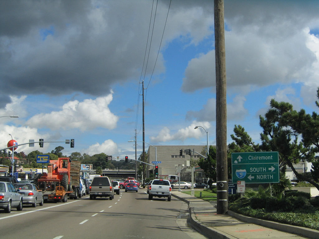
Balboa Avenue enters a cloverleaf interchange with Interstate 805 (Dekema Freeway) east of Charger Boulevard. I-805 travels south to Mission Valley, North Park, National City, Chula Vista, and the International Border at San Ysidro.
11/05/04
Eastbound Balboa Avenue (old California 274) at the loop ramp for Interstate 805 north. Still in the city limits of San Diego, eastbound Balboa Avenue leaves the community of Clairemont and enters the community of Kearny Mesa.
11/05/04
After Ruffner Street, the next major intersection along eastbound Balboa Avenue (old California 274) is with Convoy Street.
11/05/04
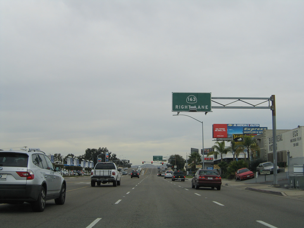
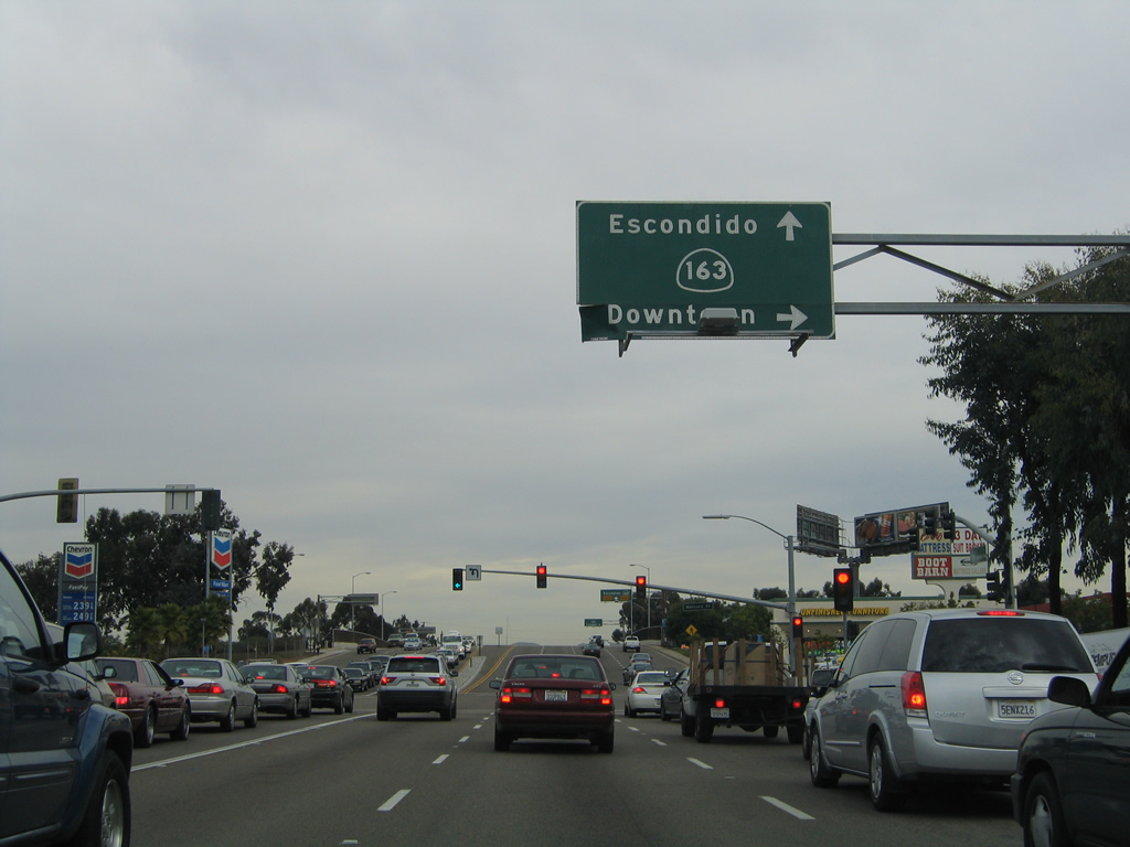
Continuing east, Balboa Avenue (old California 274) approaches the turn off for Mercury Street south to California 163 (Cabrillo Freeway) south to Downtown.
11/05/04
The entrance ramp for SR 163 south for Balboa Avenue connects with th Cabrillo Freeway from Armour Street east at Mercury Street south.
11/05/04
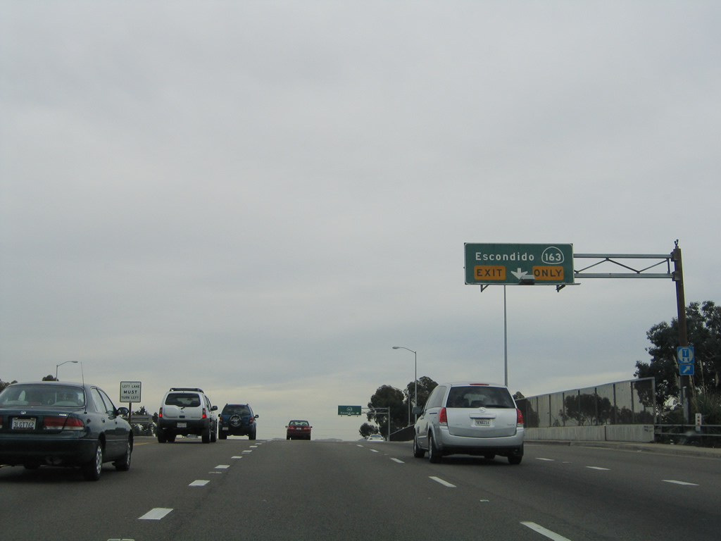
Spanning California 163, an auxiliary lane extends from Mercury Street to the entrance ramp for the Cabrillo Freeway north.
11/05/04
The left lane of Balboa Avenue eastbound becomes a turn lane to Kearny Villa Road northeast beyond the loop ramp for California 163 (Cabrillo Freeway) north.
11/05/04
The confirming marker for SR 274 east of SR 163 appeared at the intersection with Kearny Villa Road.
11/05/04
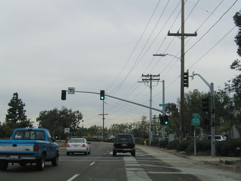
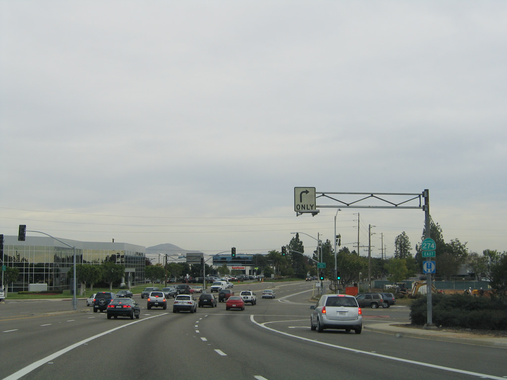
SR 274 was also marked along Balboa Drive east at Pennisi Driveway.
11/05/04
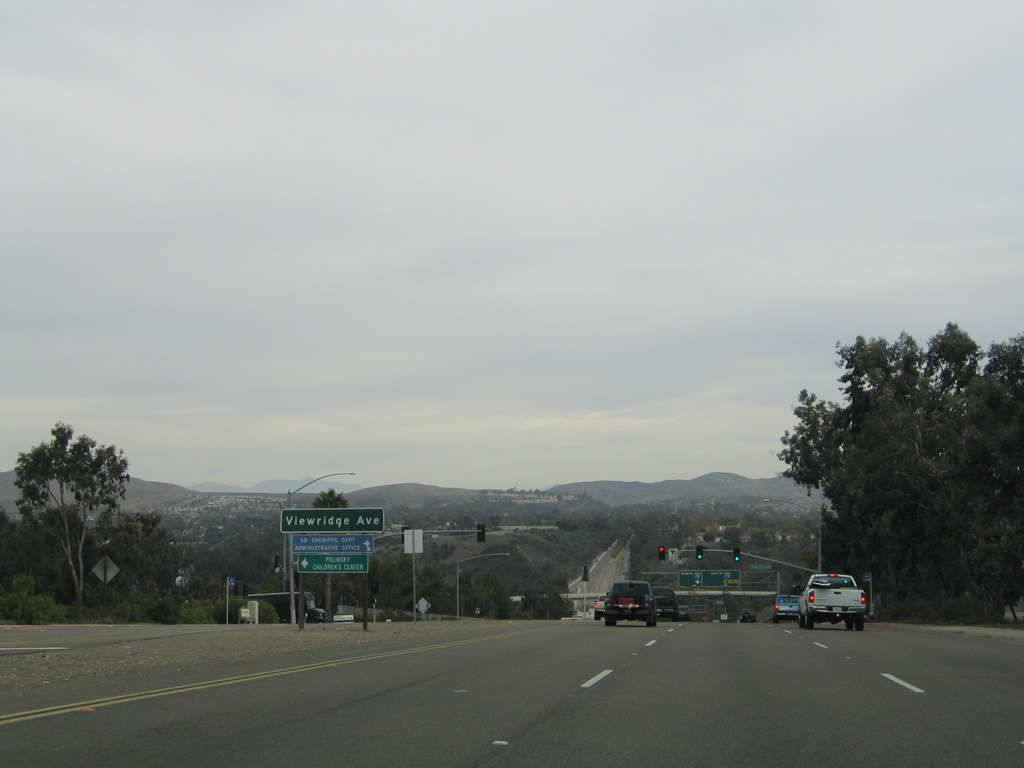
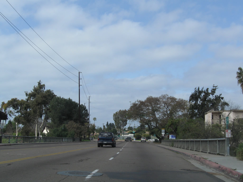
Murphy Canyon comes into view as Balboa Avenue lowers east to Viewridge Avenue.
11/05/04
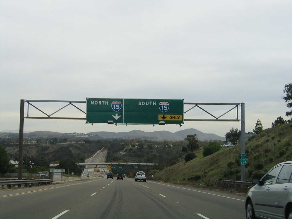
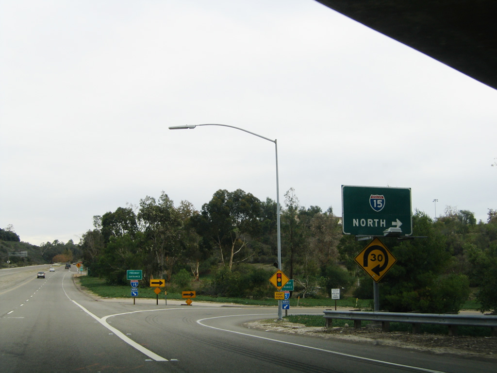
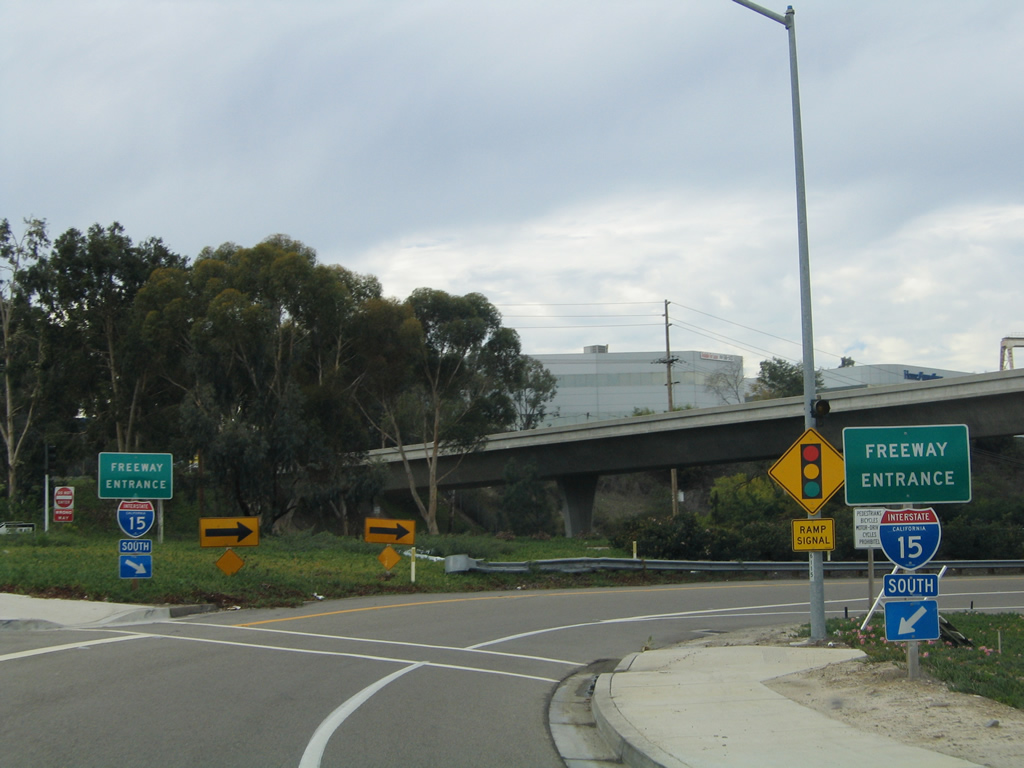
Balboa Avenue meets Interstate 15 (Escondido Freeway) at a cloverstack interchange in Murphy Canyon.
11/05/04
The SR 274 shield posted ahead of the ramp to Interstate 15 south was removed by 2005.
01/14/11
The entrance ramp from Balboa Avenue east onto I-15 south was catastrophically damaged by a sinkhole in the Winter of 1997-1998. The voluminous El Nino rains of 1997 backed up a Caltrans storm drain, which in turn caused a sinkhole in the southwest quadrant of this interchange. This resulted in sections of SR 274 and ramps connecting it with I-15 to collapse into the saturated ground. The sinkhole and road repair took over six months to complete.
01/14/11
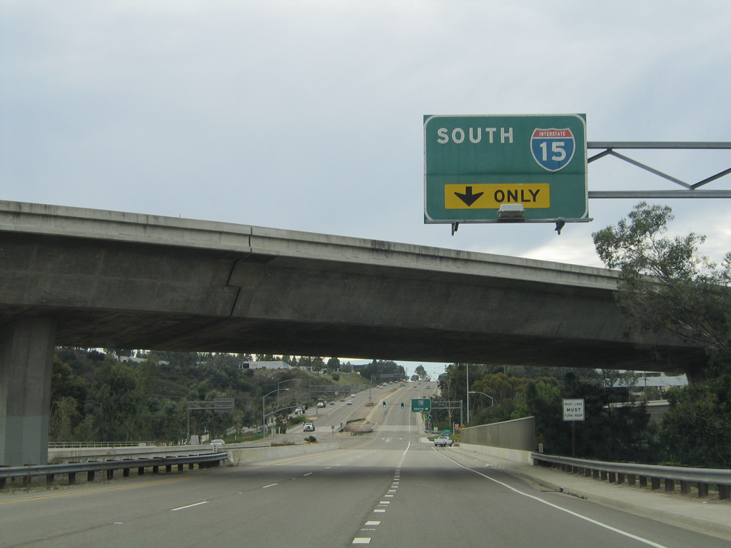
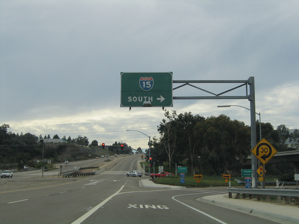
A freeway entrance shield is posted for Interstate 15 south.
01/14/11
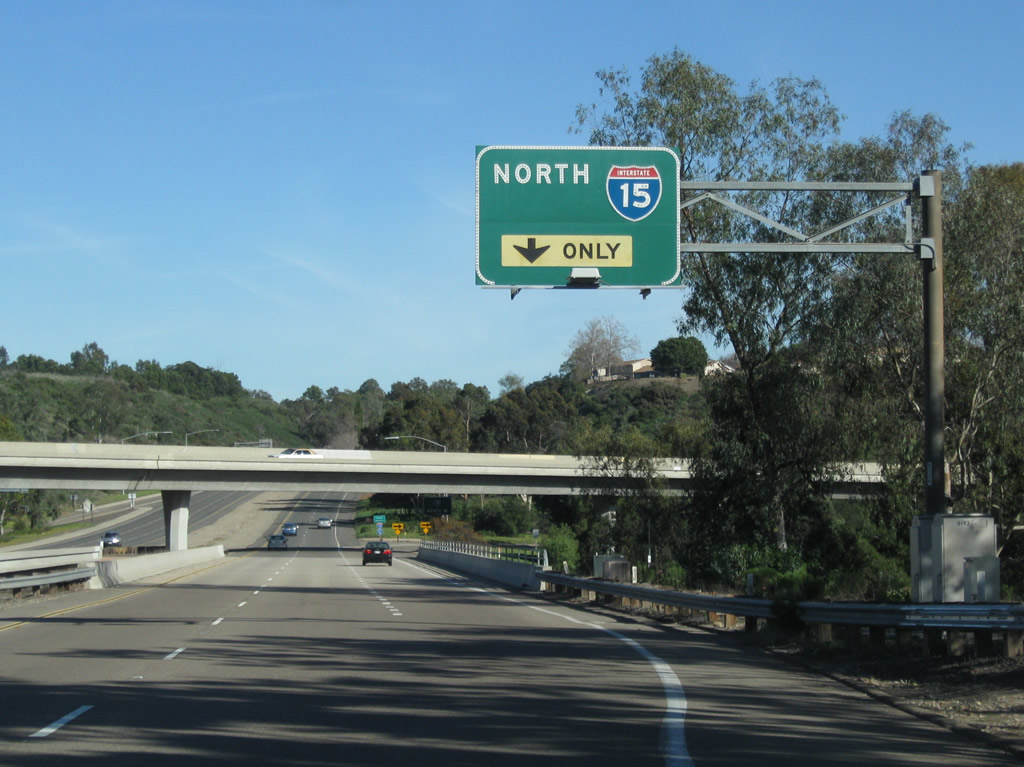
A flyover ramp carries traffic from Interstate 15 north to Balboa Avenue (old California 274) west.
01/14/11
Eastbound Balboa Avenue (old California 274) meets the loop ramp to Interstate 15 north to Mira Mesa, Scripps Ranch, Rancho Bernardo and Escondido.
11/05/04
01/14/11
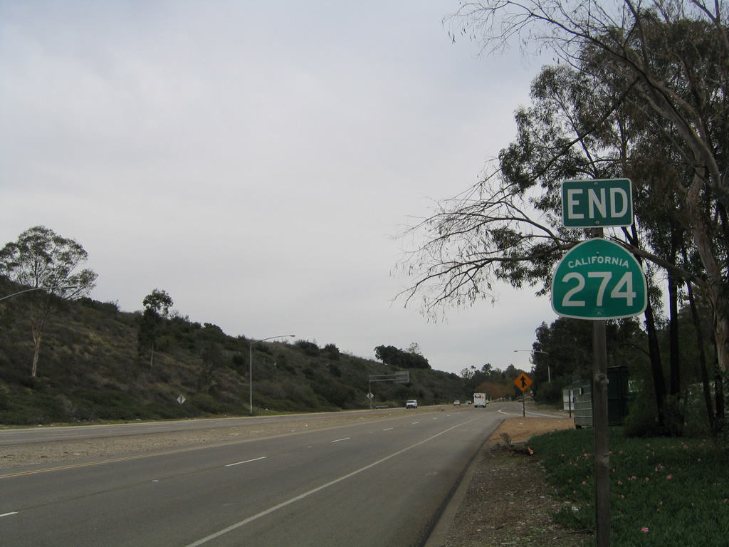
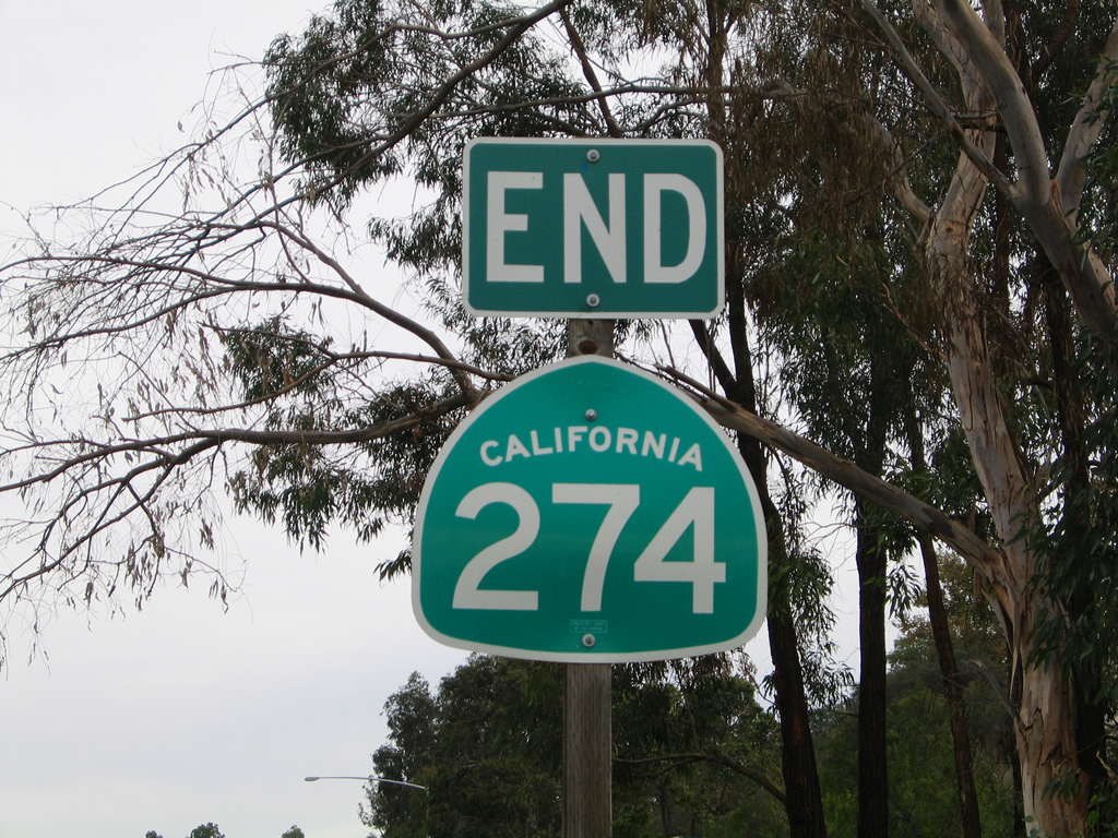
An end shield for California 274 east was previously posted after the exchange with Interstate 15. Continuing east, Balboa Avenue transitions directly onto Tierrasanta Boulevard, which serves the community of Tierrasanta. Tierrasanta Boulevard is not a through route and thus does not serve through traffic.
11/05/04
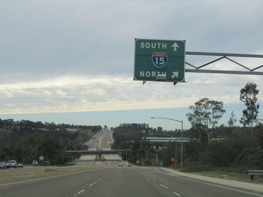
Westbound Tierrasanta Boulevard from Tierrasanta becomes Balboa Avenue (old California 274) through Kearny Mesa at the cloverstack interchange with Interstate 15.
11/05/04
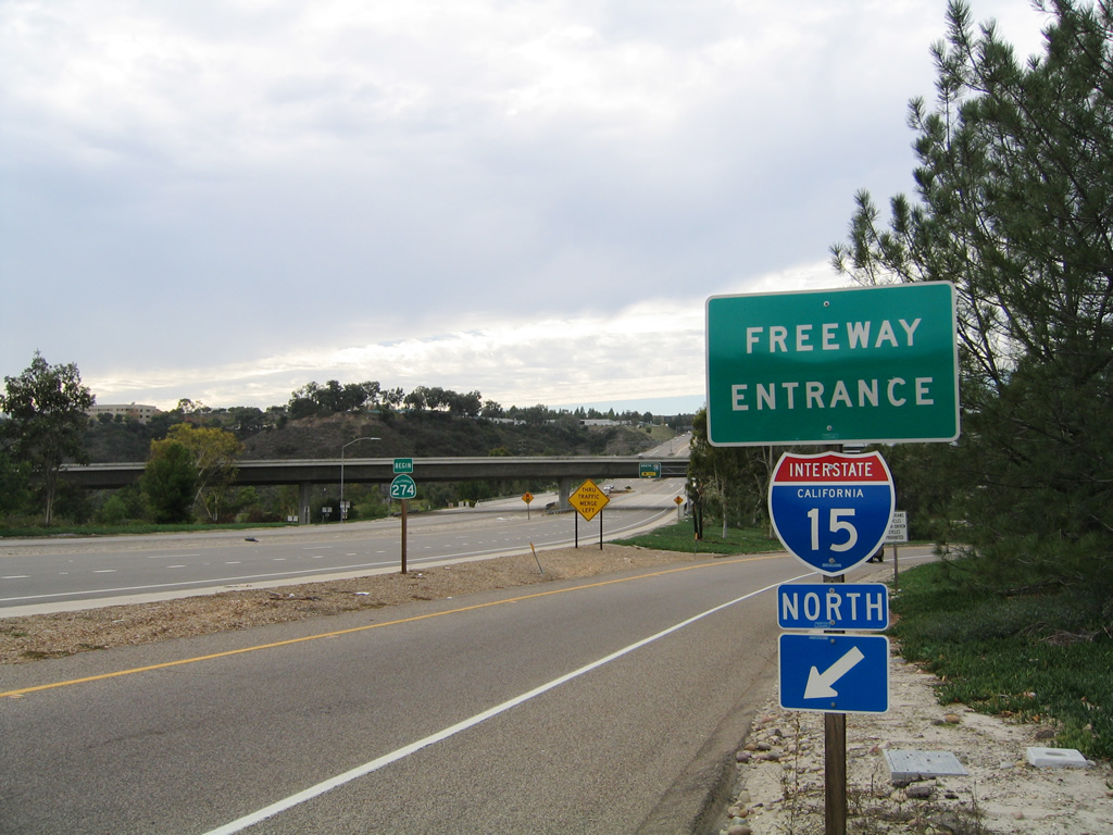
The entrance ramp joining Balboa Avenue west with Interstate 15 (Escondido Freeway) north to Riverside.
11/05/04
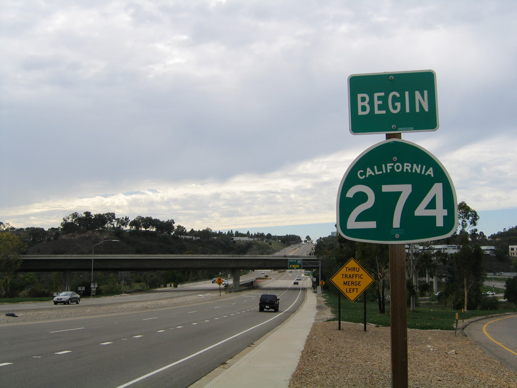
A rare begin shield was posted for California 274 for from around 1999 until 2005.
11/05/04
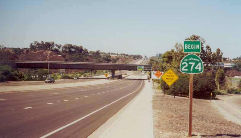
This begin shield for SR 274 was placed around the same time that the city of San Diego took over ownership of this route.
09/30/00
Balboa Avenue passes under the flyover ramp that connects Interstate 15 with old SR 274 west. This ramp was built partially with funds from General Dynamics, a large aerospace defense industry contractor that had large labor pools in the 1980s. A large General Dynamics facility used to be located in Kearny Mesa, and commuters would use the connection to get to work. Today, the General Dynamics facility is located where the San Diego Spectrum is located.
11/05/04
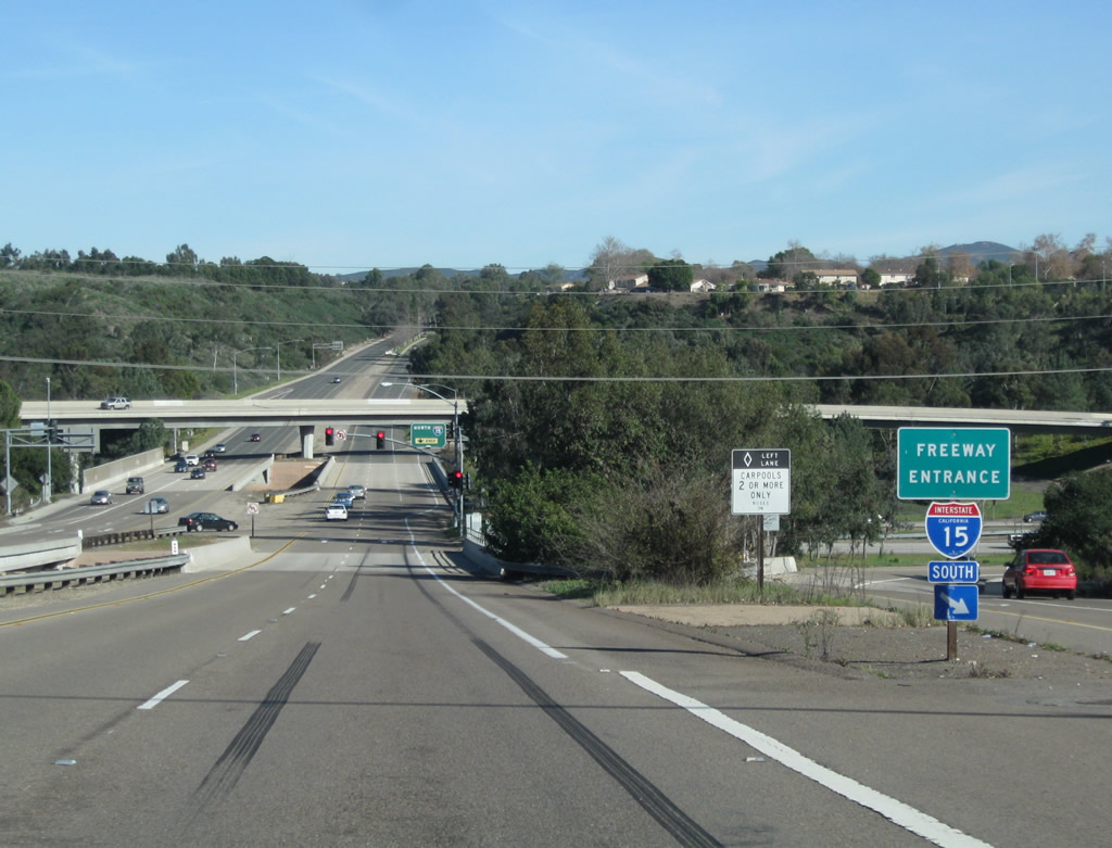
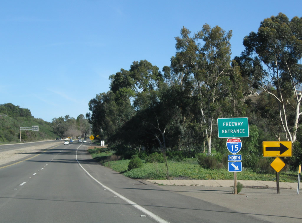
A loop ramp joins Balboa Avenue west with Interstate 15 south.
11/05/04
Freeway entrance shields for Interstate 15 south.
11/05/04
This was the confirming marker for SR 274 posted west of Interstate 15.
09/30/00
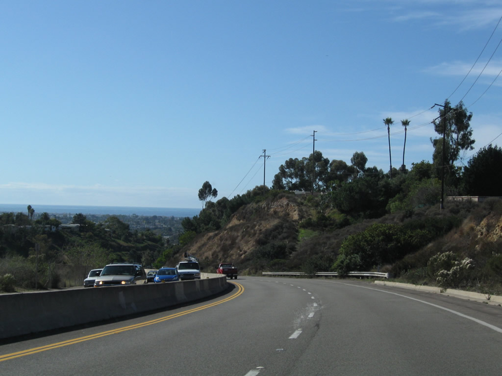
West of Interstate 805 and the signalized intersection with Cannington Drive and Mount Albertine Avenue, Balboa Avenue passes through commercial areas at the community of Clairemont.
11/13/11
Westbound Balboa Avenue at Mt. Alifan Drive and Mt. Abernathy Avenue, where a remnant "WEST" banner from a removed SR 274 shield remained.
11/13/11
After passing by a major shopping area, westbound Balboa Avenue meets Genesee Avenue, which leads north to University City and Torrey Pines Mesa and southeast to Serra Mesa.
11/13/11
Between Genesee Avenue and Clairemont Drive, Balboa Avenue updated into an expressway where the roadway traverses Tecolote Canyon.
11/13/11
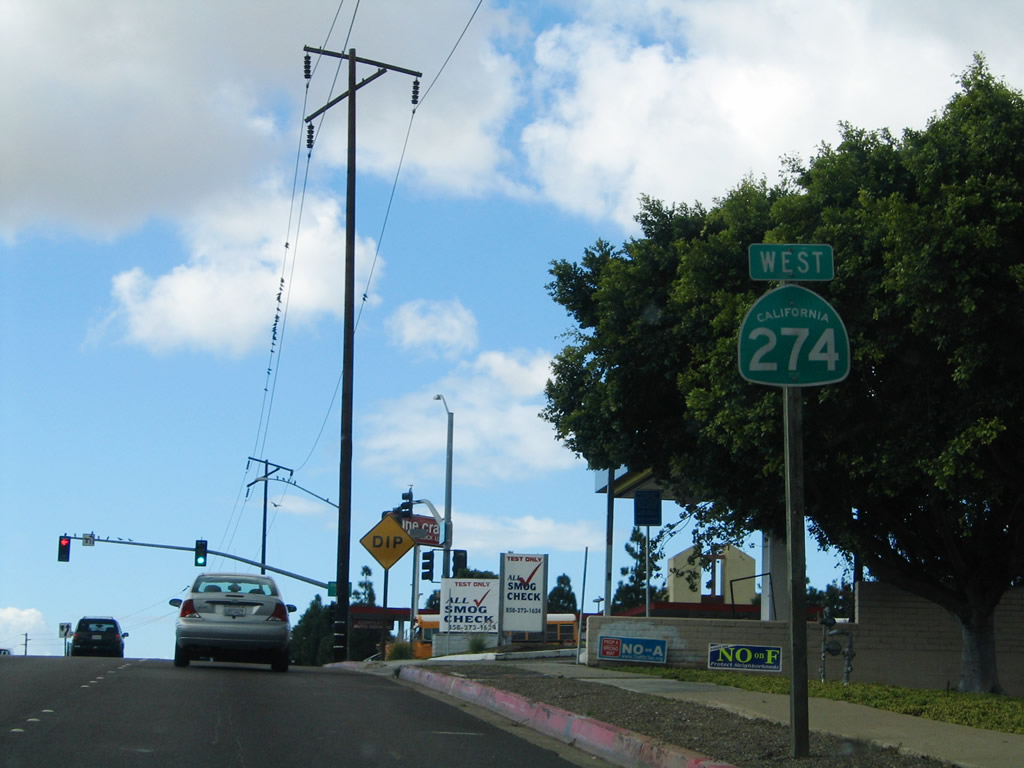
An SR 274 west reassurance shield was previously posted near the rim of Tecolote Canyon, prior to Clairemont Drive.
10/28/04
Westbound Balboa Avenue meets Clairemont Drive at this signalized intersection.
11/13/11
Gone by 2006, this trailblazer for California 274 was formerly posted along southbound Clairemont Drive at Balboa Avenue.
10/28/04
Balboa Avenue descends toward Pacific Beach from Clairemont Drive west into Rose Canyon.
11/13/11
A barrier median separates the two directions of traffic on Balboa Avenue through Rose Canyon, which is comparable to an expressway. Toward the bottom of the hill is the signalized intersection with Moraga Avenue. Botts Dots were in use in 2004 but gone by 2011, consistent with Caltrans vs. City of San Diego roadway marking standards.
11/13/11
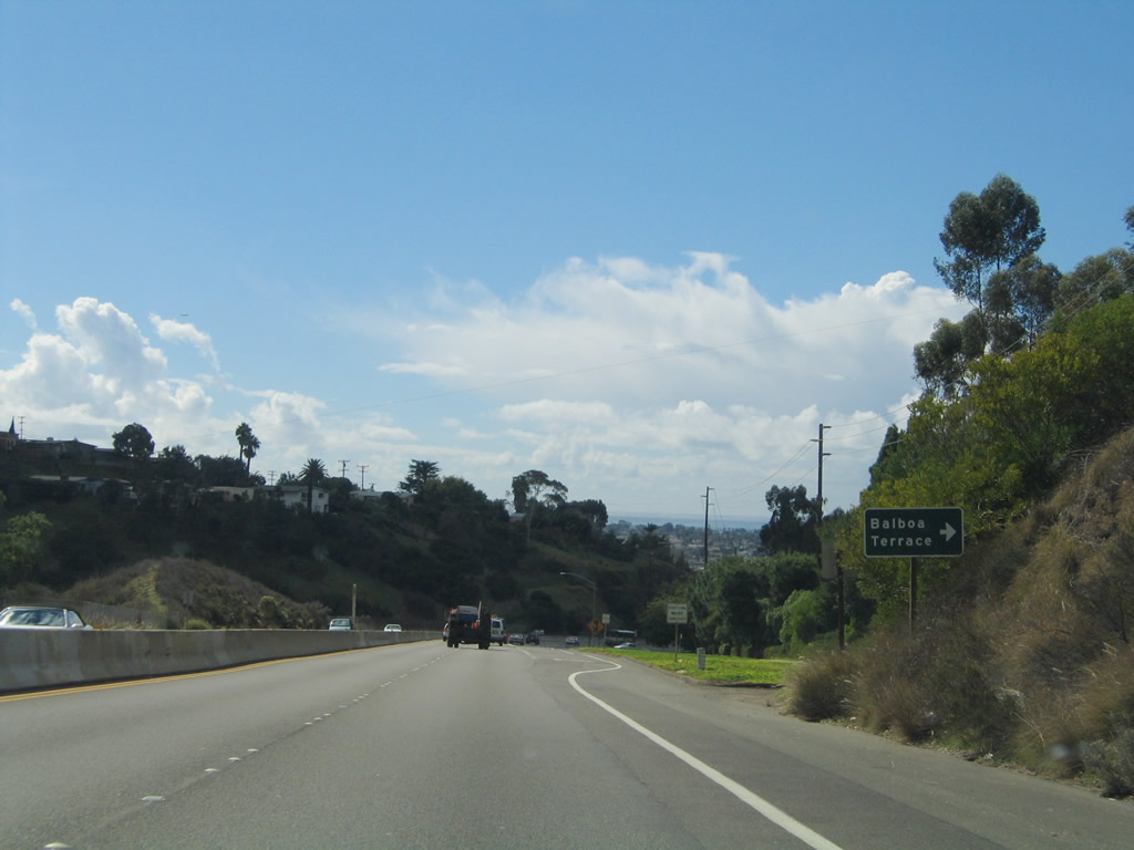
A right turn connects westbound Balboa Avenue (old California 274) with Balboa Terrace, which provides residential access on the north side of the route.
10/28/04
Westbound Balboa Avenue meets Moraga Avenue at this signalized intersection.
11/13/11
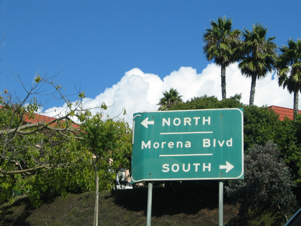
Balboa Avenue enters a parclo intercahnge with Morena Boulevard to the west of Moraga Avenue. The oldest alignment of Historic U.S. 101 turns from Morena Boulevard onto westbound Balboa Avenue/Garnet Avenue at this exchange.
04/19/13
A loop ramp joins Balboa Avenue west with Morena Boulevard. Ahead, Balboa Avenue transitions onto Garnet Avenue (Historic U.S. 101). This historic highway, when originally routed through San Diego, followed Morena Boulevard, Garnet Avenue, Cass Street, Turquoise Street, and La Jolla Boulevard through Pacific Beach into La Jolla.
04/19/13
Button copy sign posted along the ramp from westbound Balboa Avenue to Morena Boulevard. The arterial heads north to Bay Ho and south to Bay Park and the Morena district.
10/28/04
The ramp from Morena Boulevard adds an auxiliary lane along Garnet Avenue west to the loop ramp for Interstate 5 south and Mission Bay Drive north to I-5 north.
04/19/13
The overhead for Interstate 5 on Garnet Avenue was altered from displaying all southbound I-5 traffic in the right lane and northbound I-5 traffic in the middle lane.
11/13/11
Westbound Garnet (Balboa) Avenue reaches the loop for Interstate 5 south after passing under the freeway and by businesses.
05/02/13
Interstate 5 (San Diego Freeway) travels south from Garnet Avenue and Pacific Beach to Downtown San Diego.
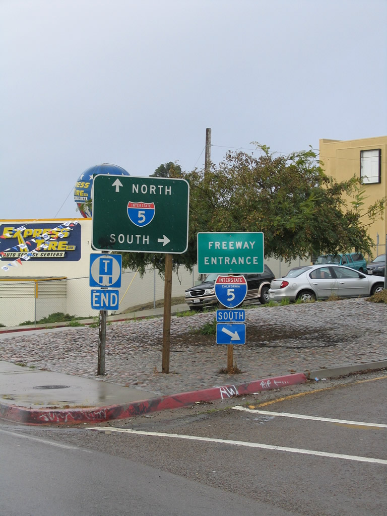
02/19/05
SR 274 formerly ended along Garnet Avenue west at Mission Bay Drive (old Business Loop I-5). Mission Bay Drive runs south to Mission Bay Park and north onto I-5 ahead of La Jolla and Carmel Valley. A later alignment of Historic U.S. 101 passed through Rose Canyon en route to La Jolla turns north here. The original old U.S. 101 proceeds west on Garnet Avenue.
11/13/11
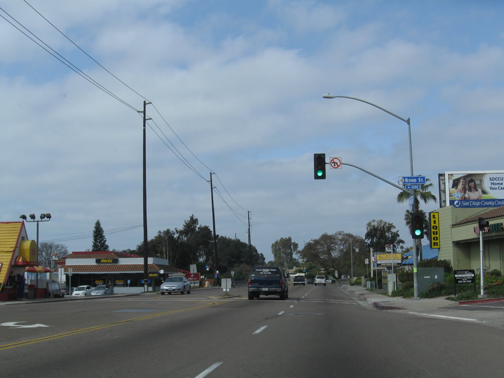
Westbound Garnet Avenue proceeds into Pacific Beach from Mission Bay Drive (Historic U.S. 101) ahead of the signal with Bond Street.
03/25/10
Garnet Avenue passes over Rose Creek.
03/25/10
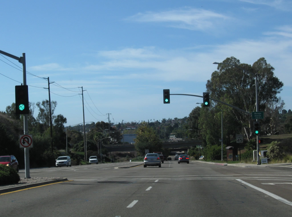
Westbound Garnet Avenue meets Soledad Mountain Road at this traffic signal.
03/25/10
Garnet Avenue splits with Balboa Avenue at the ensuing traffic light west from Soledad Mountain Road.
03/25/10
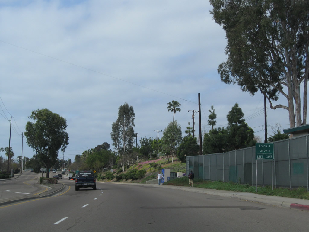
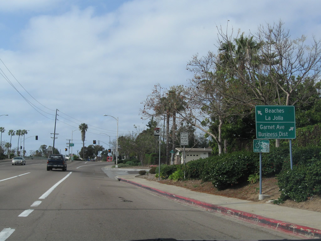
Through traffic to La Jolla and the beaches is advised to use Balboa Avenue while Garnet Avenue west continues to the Pacific Beach Business District.
03/25/10
Photo Credits:
- Andy Field: 09/30/00, 10/28/04, 11/05/04, 02/19/05, 10/24/09, 10/25/09, 03/25/10, 01/14/11, 11/13/11, 08/18/12, 04/19/13, 05/02/13
Connect with:
Page Updated Wednesday June 26, 2013.