
State Highway 13
Colorado State Highway runs 128.07 miles from Rifle in Garfield County, to the Wyoming state line well north of Craig. Prior to 1984, SH 13 was cosigned entirety with SH 789, the Mexico-Canada Highway. Wyoming Highway 789 is still signed north from Moffat County, Colorado.
Heading north through Rifle, SH 13 begins at I-70 and bypasses the city center along an overlap with U.S. 6 west to the Rifle Bypass. However maintenance changes turned back all but 0.222 miles of SH 13 (Route 013C) between the dumbbell interchange at Exit 90 and U.S. 6 at 1st Street in Rifle. U.S. 6 was also made discontinuous with the relinquishment of 1.035 miles between Route 006L at the west split with SH 13 and Route 006D at the east Rifle city line.
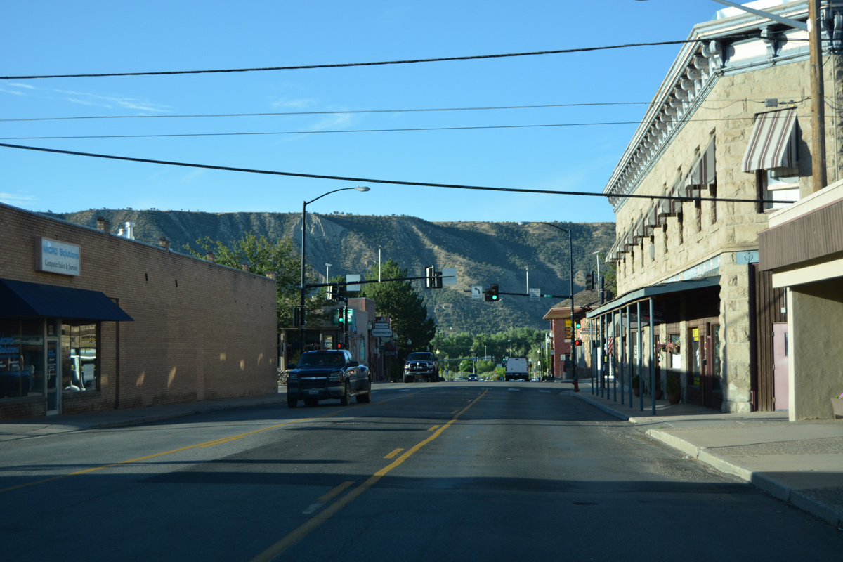
Railroad Avenue (old SH 13) south in Downtown Rifle. - 08/11/2016
Beyond Rifle, SH 13 (Route 013A) follows Government Creek north to SH 325, then northwest between the Roan Cliffs and Grand Hogback ridge to Rio Blanco. SH 325 spurs 11.40 miles north to Rifle Gap State Park and Rifle Falls State Park. Rifle Gap State Park features the Rifle Gap Reservoir, which was constructed by the U.S. Bureau of Reclamation in 1968 in a valley formed by East Rifle Creek and West Rifle Creek. The 325 acre reservoir covers an area formerly occupied by the ranching settlement of Austin, which is now under water. Formed in 1966, Rifle Falls State Park is home to a "cascading triple waterfall" that is the focal point of the park. The falls, which produce a great deal of spray, are accessible via the Coyote Trail.
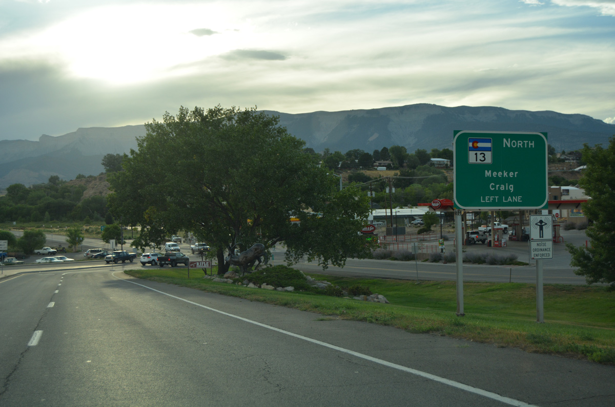
Traveling north along Sheep Creek and Grand Hogback ridge, SH 13 intersects the end of SH 64 at Powell Park, where it turns east to Meeker. A winding course north to Ninemile Gap continues the highway northeast to Axial Basin and Hamilton. Beyond the Williams Fork Mountains, SH 13 was relocated westward onto an alignment closer to the Yampa River and Big Bottom, from a route to Craig South Highlands and Ramsey Street into Craig. Heading into Craig, SH 13 overlaps with U.S. 40 along Victory Way to Downtown, where the two shift to a one way couplet to SH 13 north on Yampa Avenue. The remainder of SH 13 (Route 013B) traverses rural hills north to Fortification and Baggs, Wyoming.
 North
North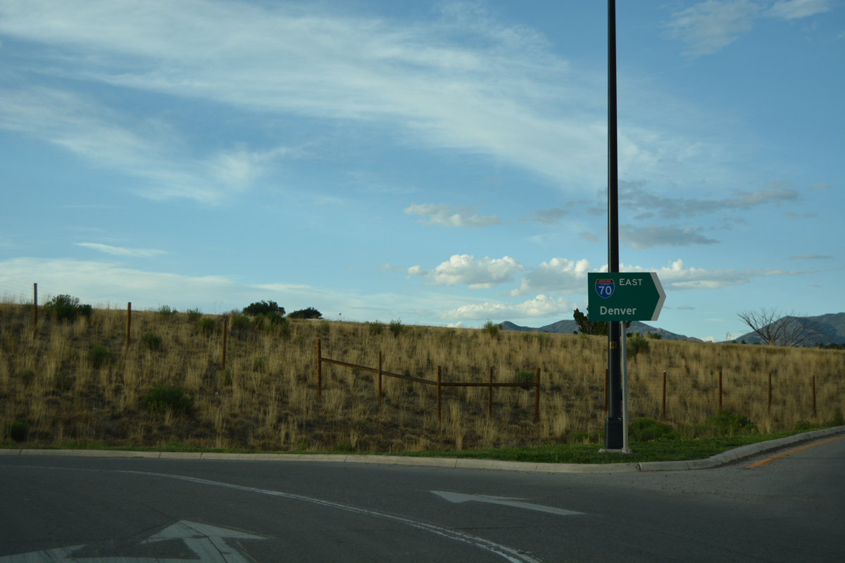
Interstate 70 passes through south Rifle en route to Silt, Glenwood Springs, Eagle and Denver.
08/10/16
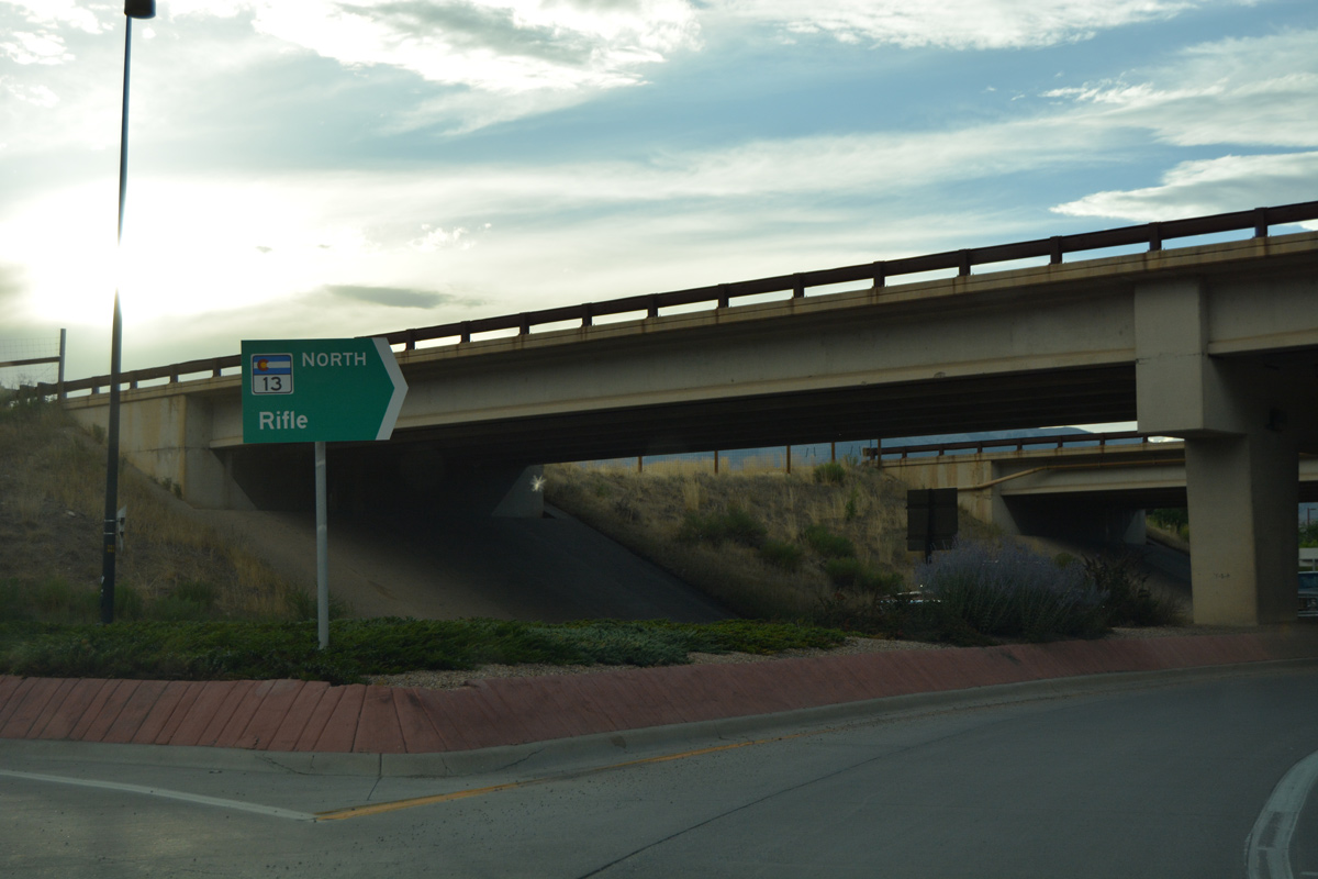
Back to back roundabouts take motorists north along SH 13 from 7th Street and Airport Road to the south side ramps with Interstate 70.
08/10/16
Motorists joining I-70 west reach Parachute in 16 miles and Grand Junction in 62 miles.
08/10/16
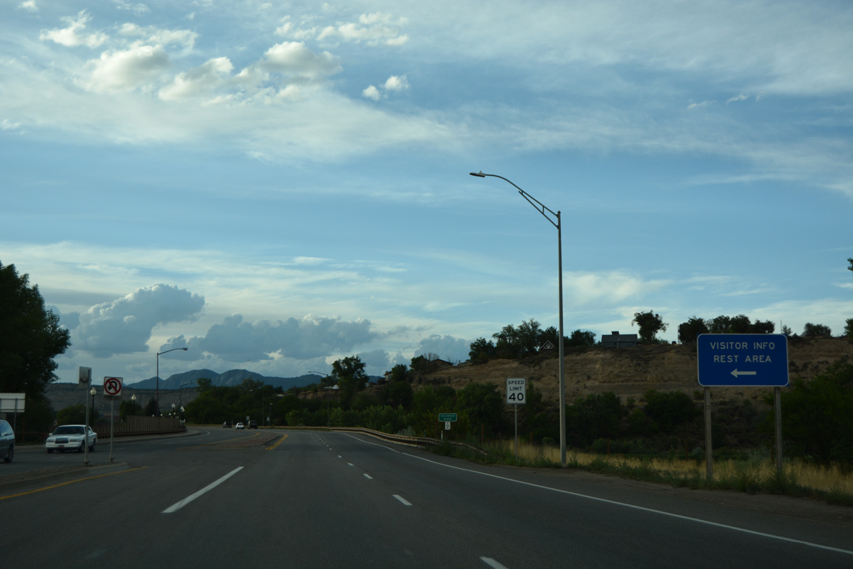
Lions Park Road spurs west to a CDOT maintained rest area along. The rest area serves I-70.
08/10/16
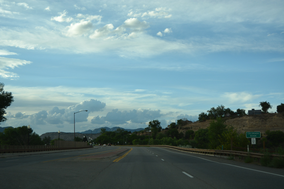
Continuing north, SH 13 spans the Colorado River and the adjacent Union Pacific Railroad line.
08/10/16
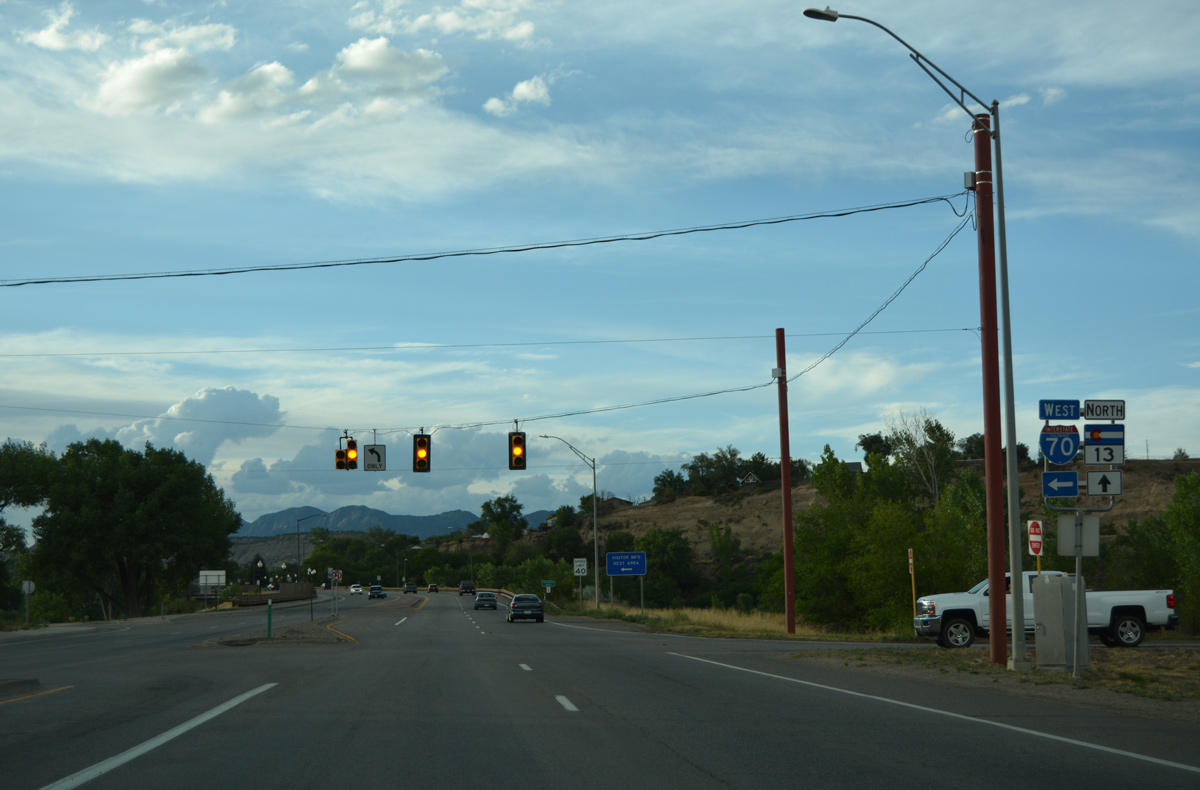
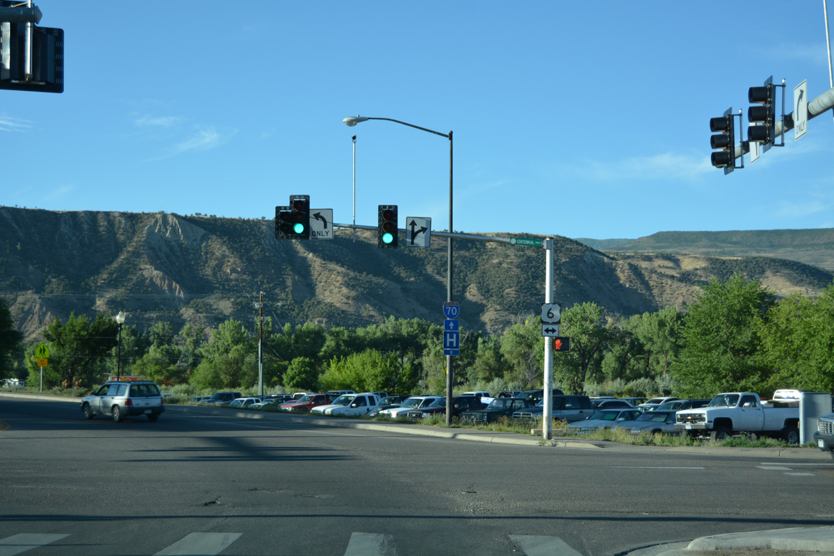
SH 13 curves west to briefly parallel U.S. 6 (Centennial Parkway). Forthcoming Whitewater Avenue connects with the US highway east.
08/10/16

U.S. 6 runs east along the UP Railroad to Antlers and the city of Silt.
08/10/16
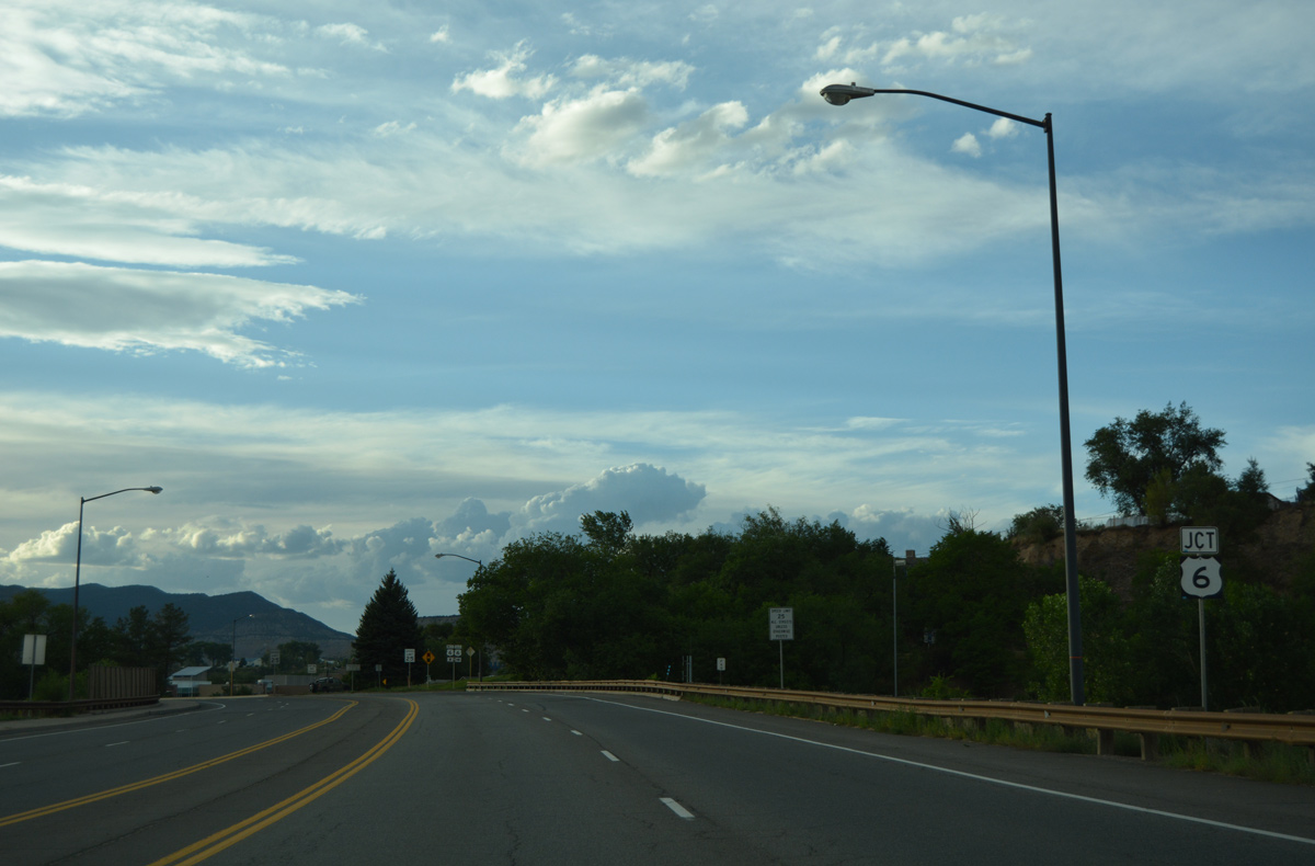
SH 13 was relocated to bypass Rifle along a combination of U.S. 6 (Centennial Parkway) west and the Rifle Bypass. The alignment allows trucks en route to Meeker and Craig to avoid Downtown Rifle.
08/10/16
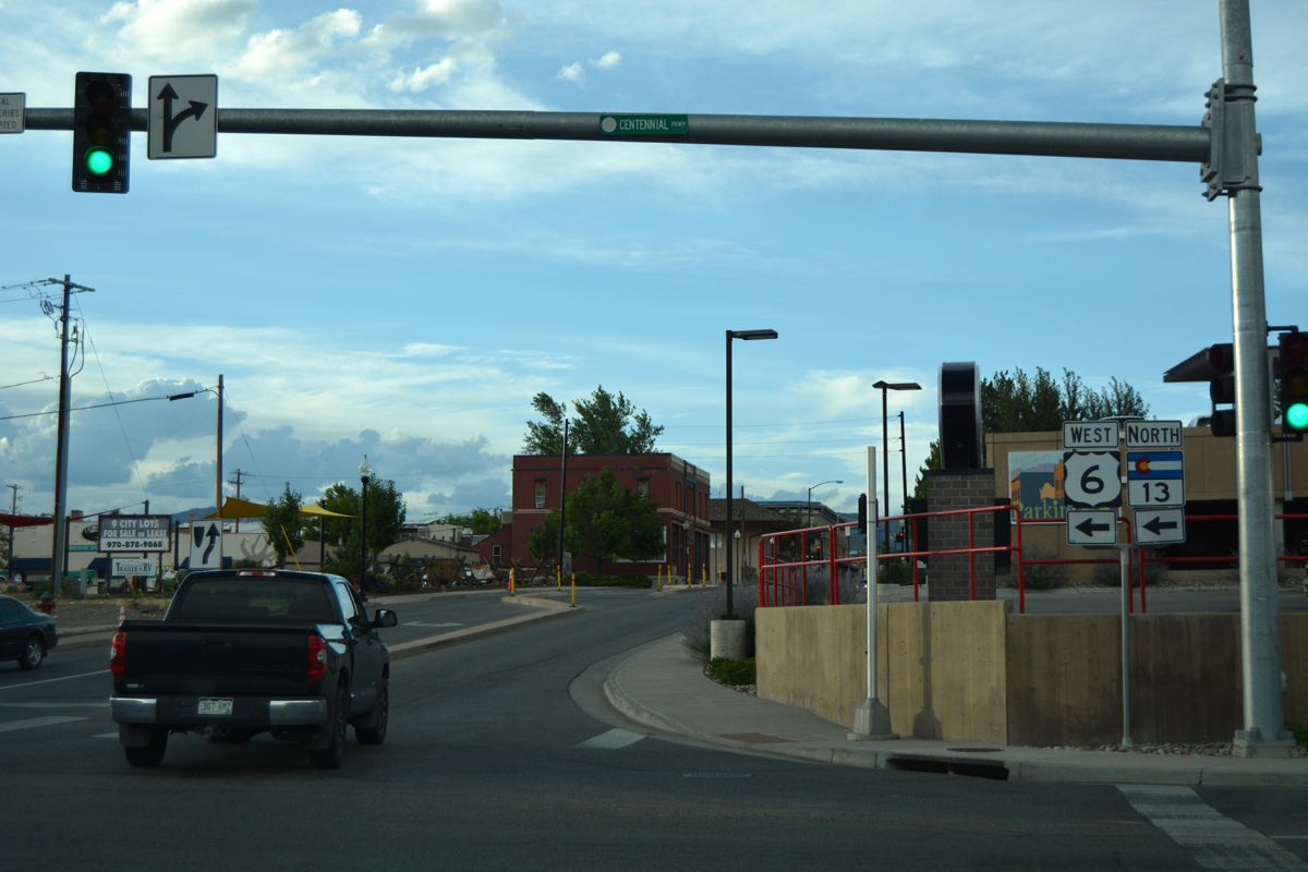
U.S. 6 west and SH 13 north overlap for 0.7 miles. Railroad Avenue stems north through Downtown along the old alignment.
08/10/16
South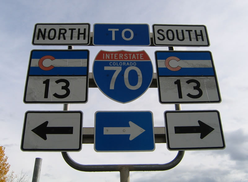
These shields for SH 13 and Interstate 70 were found at the exit from the CDOT rest area located along the south banks of the Colorado River in Rifle. A change made here by 2012 eliminated the left turn for SH 13 north. That movement is now made via a U-turn at the adjacent signal for I-70 west.
10/18/04
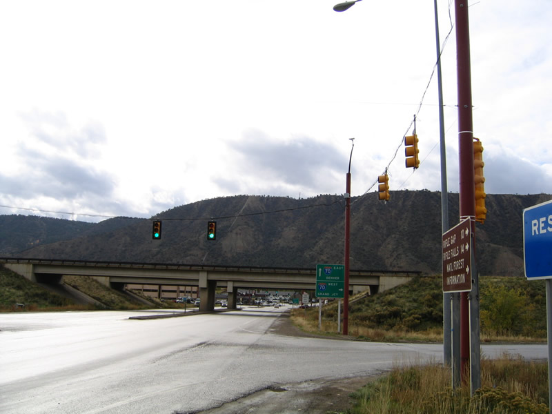
Originally, SH 13 ended at U.S. 6 (Centennial Parkway) in Rifle. The extension south to Interstate 70 was completed by 1977.1
10/18/04
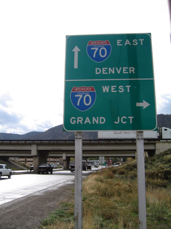
Interstate 70 extends west to Grand Junction and east to Denver. The freeway travels through some of the most scenic territory to be found along the Interstate Highway System.
10/18/04
Railroad Avenue north at 3rd Street. 3rd Street is part of the historic alignment of U.S. 6 through Rifle. U.S. 6 followed the street west from Whiteriver Avenue to 2nd Street.
08/10/16
Railroad Avenue north at 5th Street. 5th Street represents the north end of Downtown Rifle.
08/10/16

Southbound Railroad Avenue (old SH 13) at 3rd Street in Downtown Rifle.
08/11/16
Railroad Avenue exits Downtown Rifle at the east split of U.S. 6 (Centennial Parkway) and SH 13. SH 13 turns south here to cross the Colorado River and meet Interstate 70.
08/11/16
References:
- Colorado Highways: Routes 1 to 19.
http://www.mesalek.com/ colo/r1-19.html#13
Photo Credits:
- ABRoads: 08/10/16, 08/11/16
- AARoads: 10/18/04
Connect with:
Page Updated Saturday January 23, 2021.