
Hernando County Road 572

14.82 miles in length, County Road 572 follows a combination of Elgin Boulevard and Powell Road across Hernando County. The route weaves through northern reaches of Spring Hill, widening to a four lane arterial by the Sterling Hill community before reducing back to two lanes above the Suncoast Parkway. East from Spring Hill, County Road 572 follows Powell Road across a mix of forest and ranch land to Spring Lake.
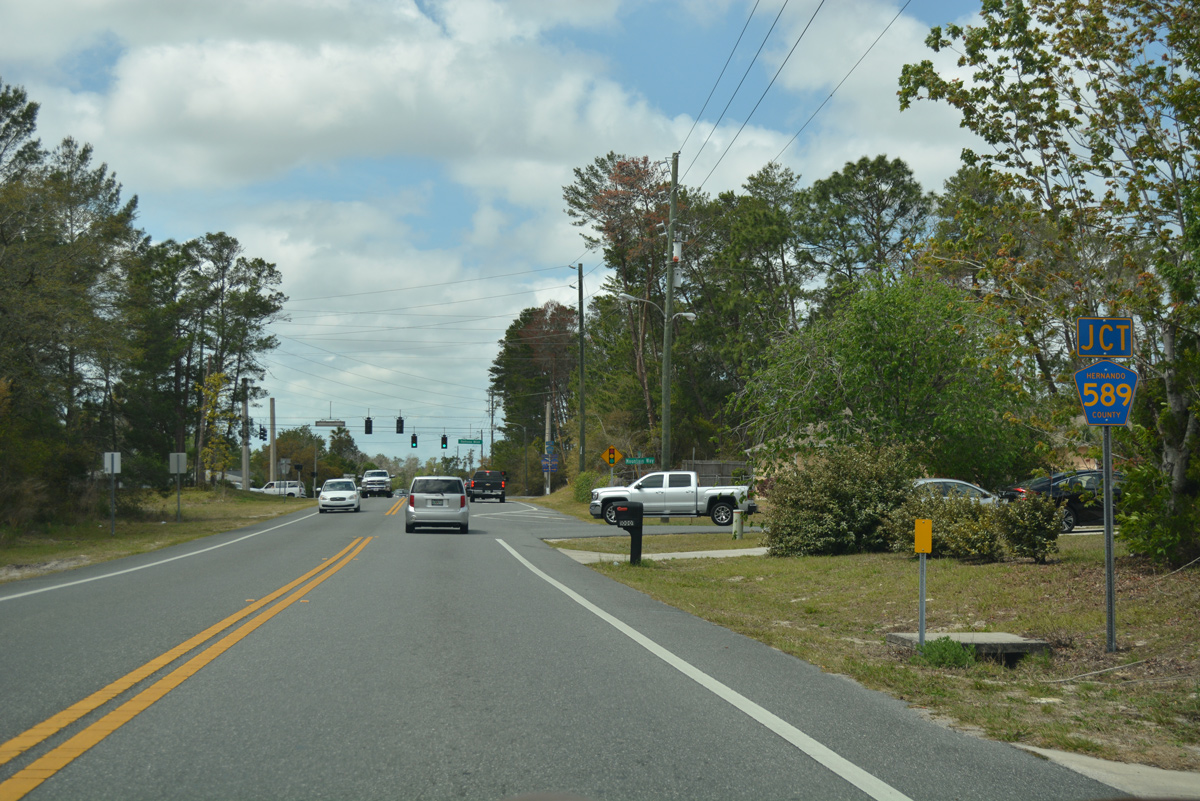
The first reassurance marker for County Road 572 appears as Elgin Boulevard leaves the intersection with Deltona Boulevard (CR 589).
02/15/14
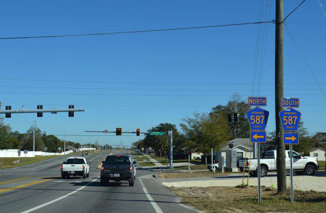
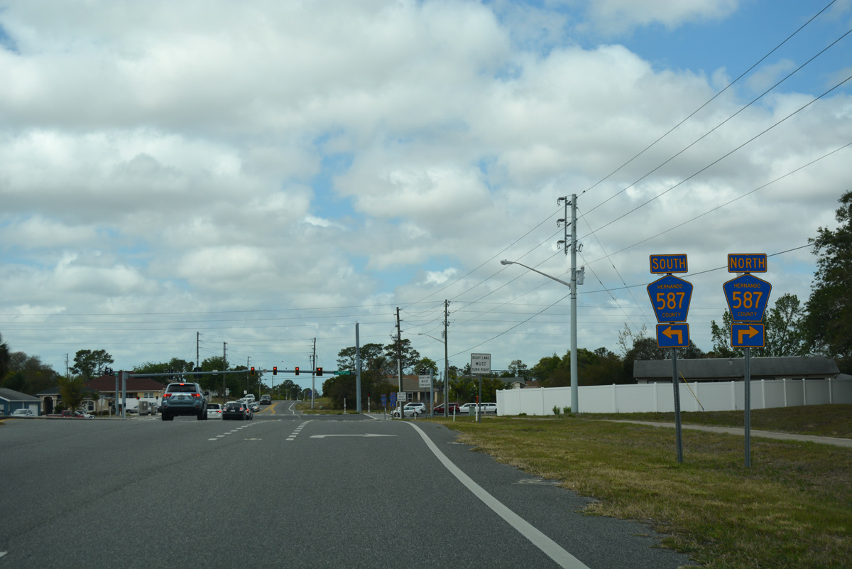
Elgin Boulevard bends southward ahead of County Road 587 (Mariner Boulevard).
02/15/14
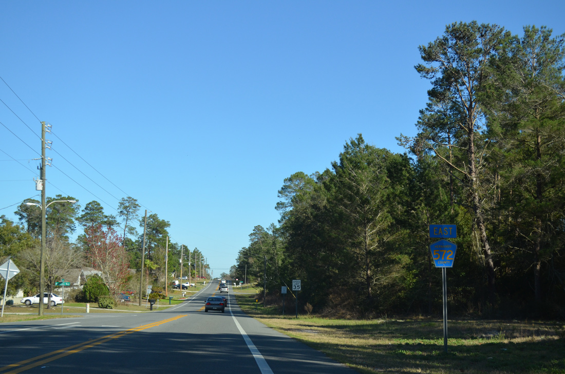
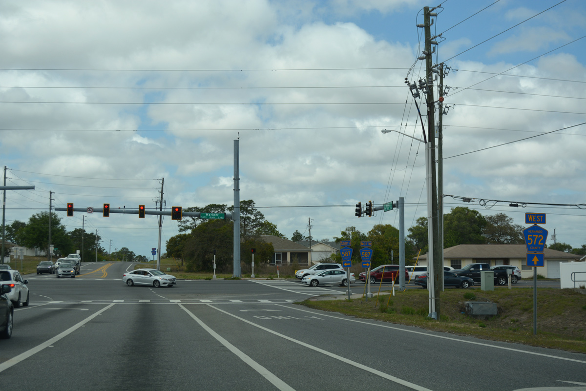
County Road 572 was widened to four lanes from Mariner Boulevard eastward to Lauren Drive in 2011.
02/15/14
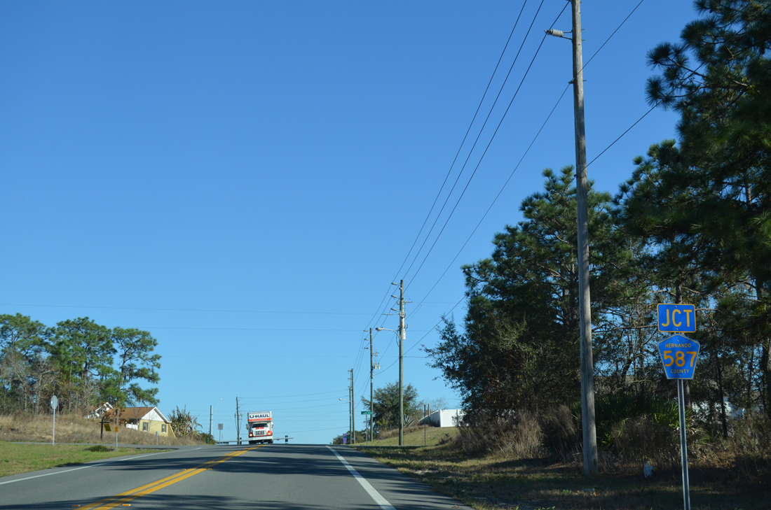
Traveling 7.87 miles, County Road 587 constitutes a main arterial route through Spring Hill, leading north to SR 50 and south to County Line Road (CR 578).
02/15/14
Continuing east along Hernando County Road 572 (Elgin Boulevard) from Mariner Boulevard.
02/15/14
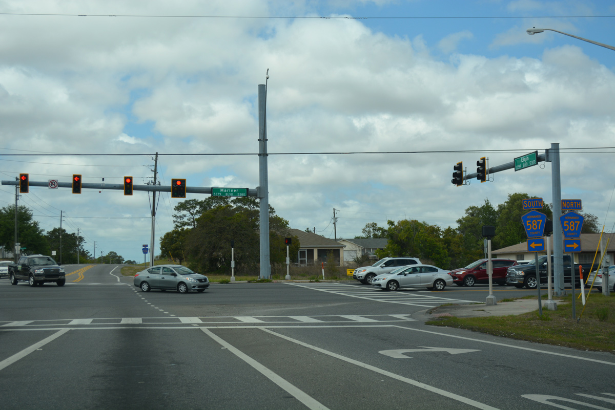
Landover Boulevard previously intersected Elgin Boulevard south of Willow Sink. The road loops south to cross Mariner Boulevard before returning north parallel to CR 587, intersecting CR 572 again at this traffic light. The northern portion of the boulevard follows an S-shaped alignment with two additional intersections at Mariner Boulevard.
02/15/14
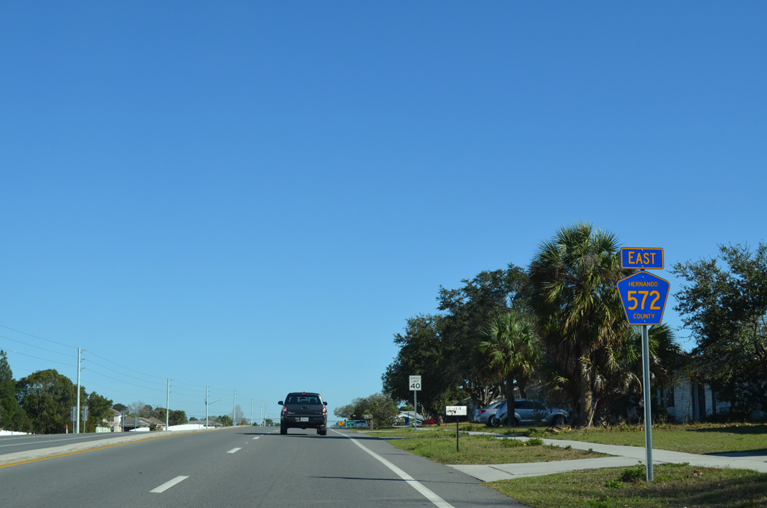
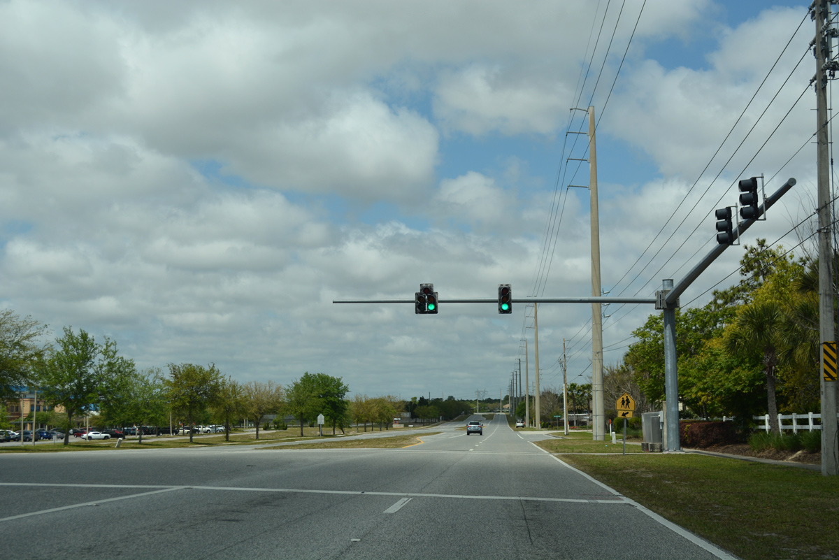
A short distance east of Landover Boulevard and this shield assembly, Elgin Boulevard passes under a transmission line corridor into the Sterling Hill area.
02/15/14
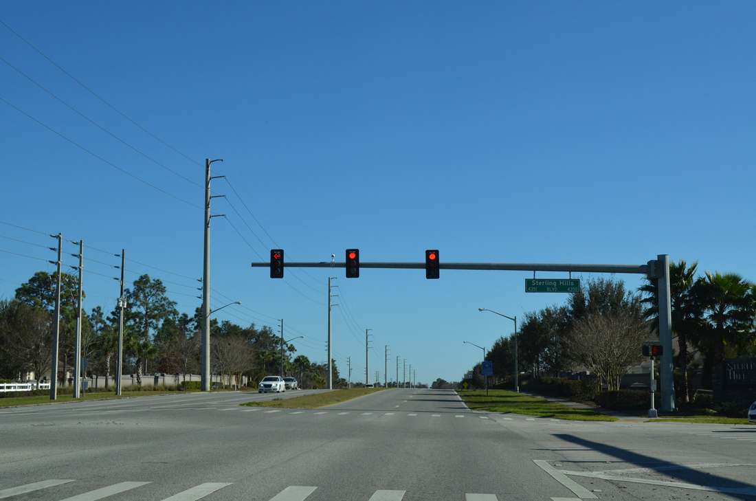
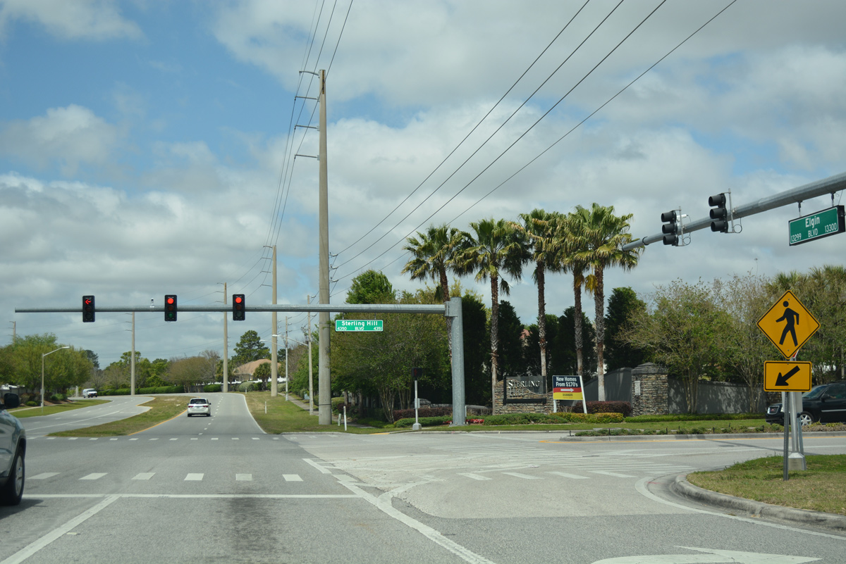
Sterling Hill Boulevard circles east and west of County Road 572 (Elgin Boulevard) as the main connector road to the Sterling Hill subdivisions.
02/15/14
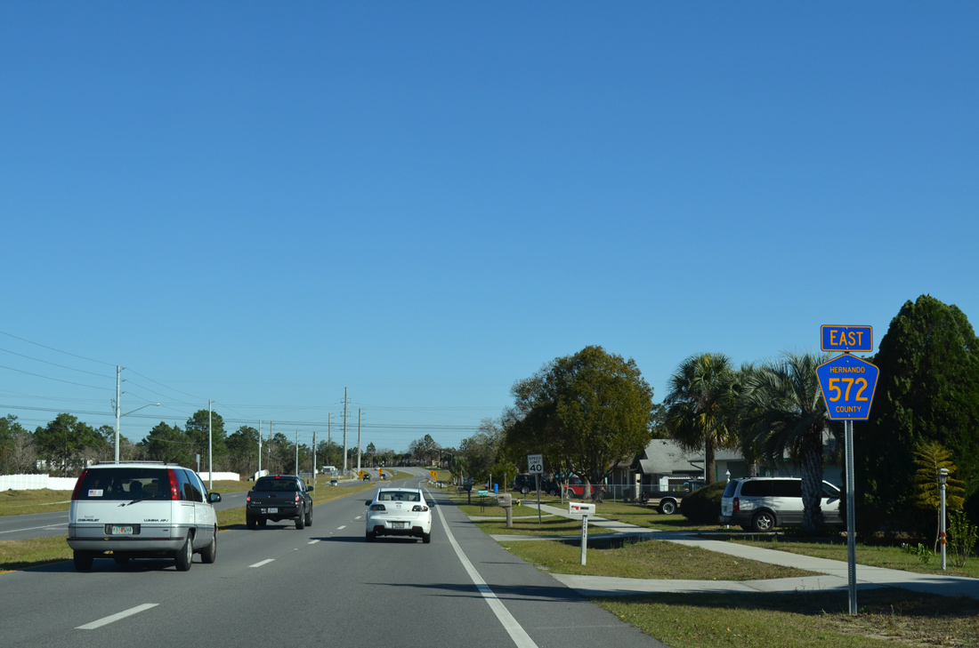
A reassurance shield is posted where a Junction shield assembly should be for forthcoming County Road 585 (Barclay Avenue).
02/15/14
Barclay Avenue doubles as Hernando County Road 585 north to SR 50 (Cortez Boulevard) and south to Spring Hill Drive (CR 574) along the east side of Spring Hill.
02/15/14
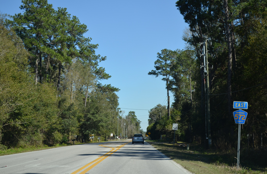
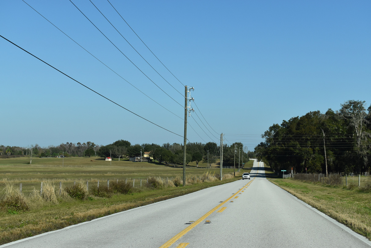
Heading east from Powell and U.S. 41, Powell Road enters a forested area west of Powell Station.
02/17/14
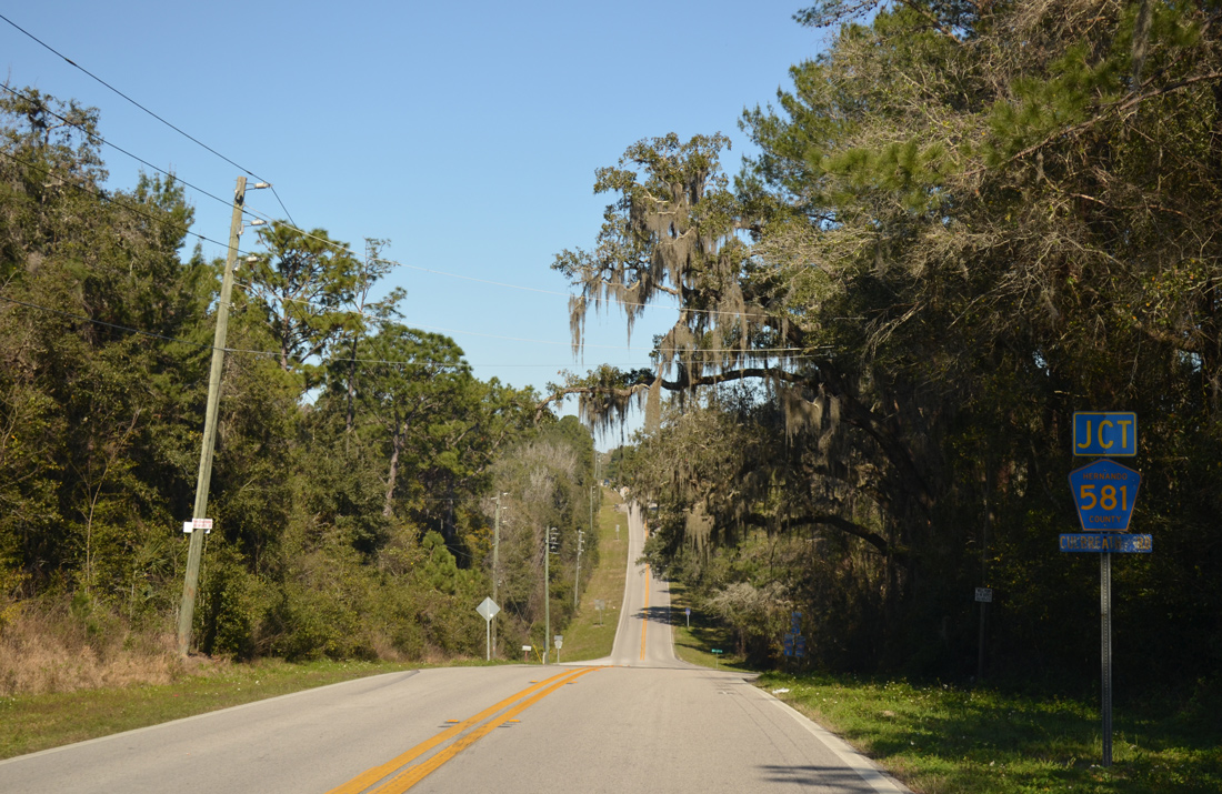
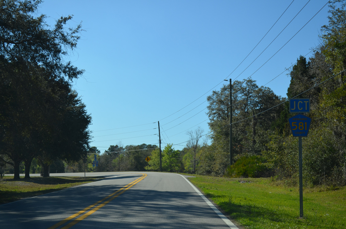
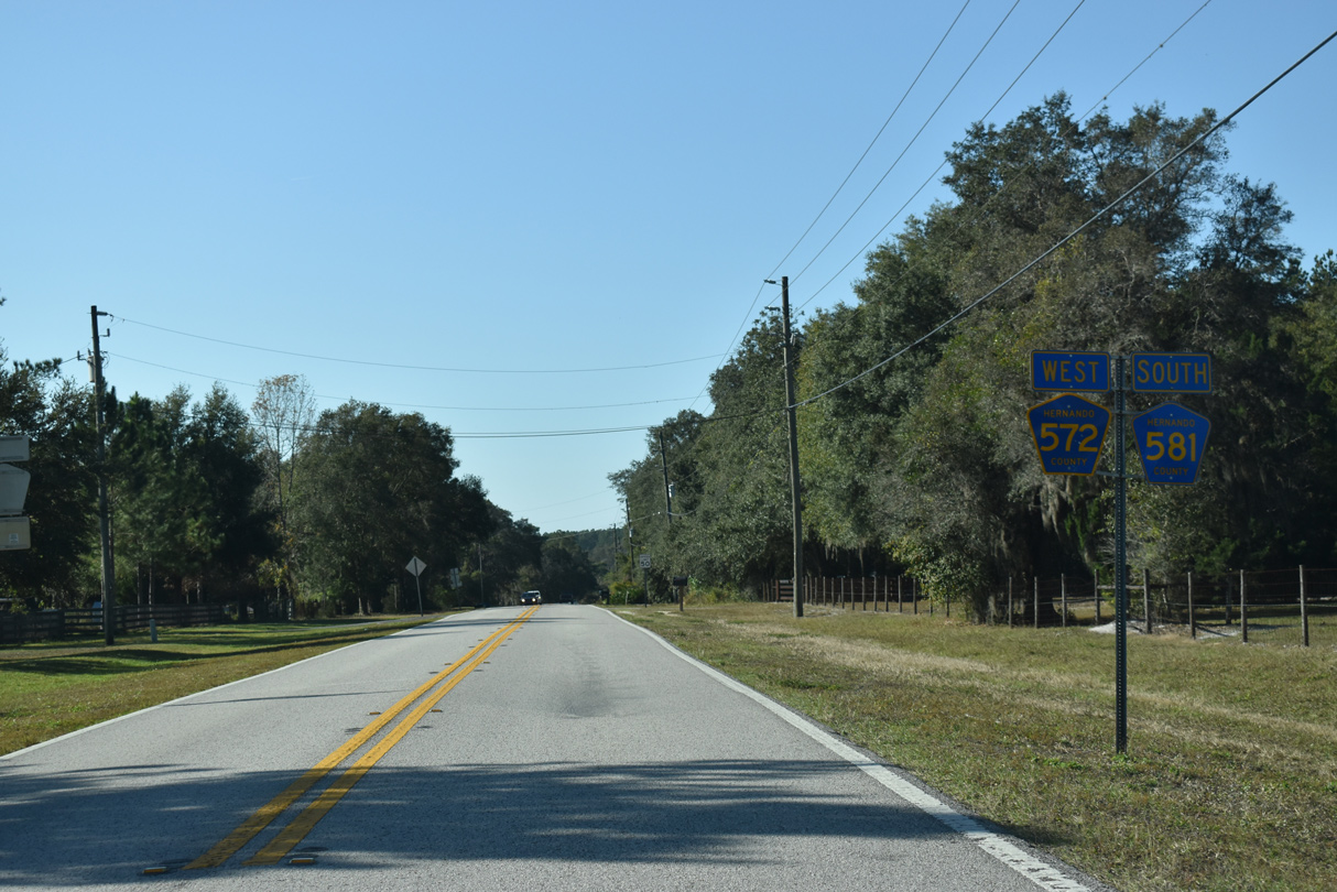
Hernando County Road 572 (Powell Road) snakes its way east from a CSX Railroad crossing to intersect County Road 581 (Culbreath Road) south.
02/17/14
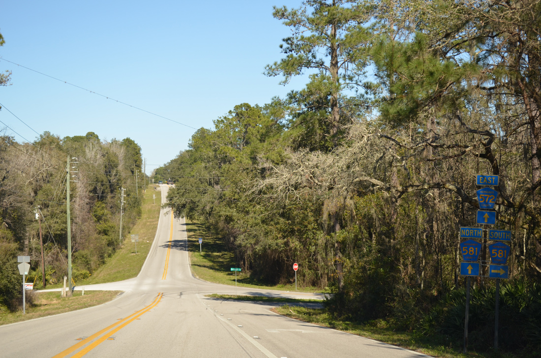
Hernando County Road 581 follows Culbreath Road south 4.13 miles to the Pasco County line. CR 581 continues from there to Darby and SR 52.
02/17/14
 East
East  North
North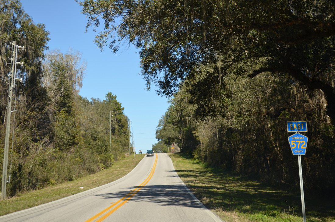
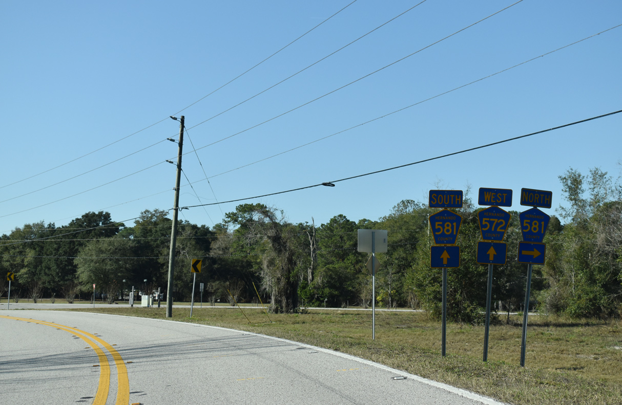
An implied overlap takes County Road 581 north alongside County Road 572 east for 0.50 miles. CR 581 is however omitted from the eastbound assembly.
02/17/14
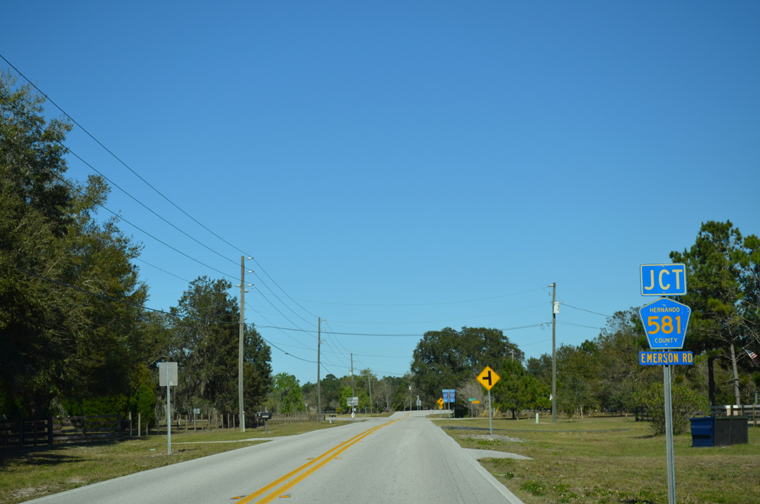
County Road 581 branches north from Powell Road via Emerson Road to the county seat.
02/17/14
Powell Road turns back to the east beyond the split with County Road 581 (Emerson Road) north.
02/17/14
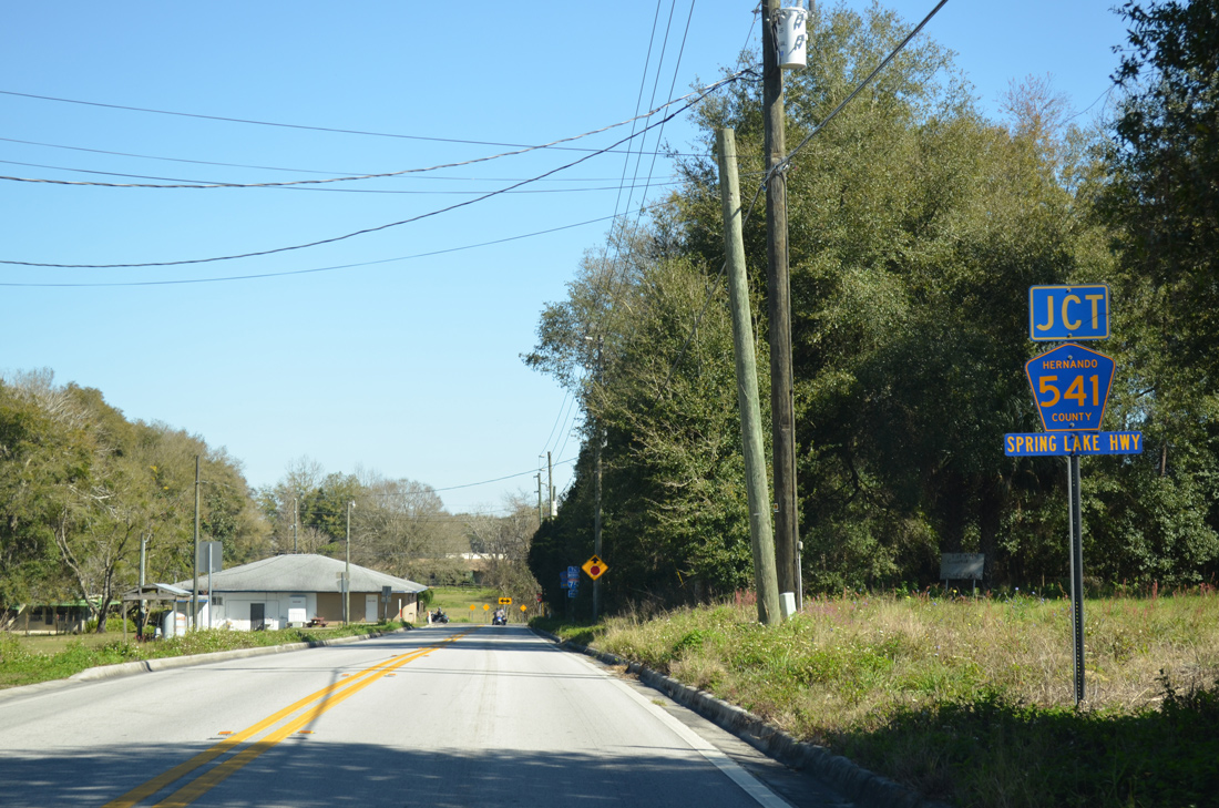
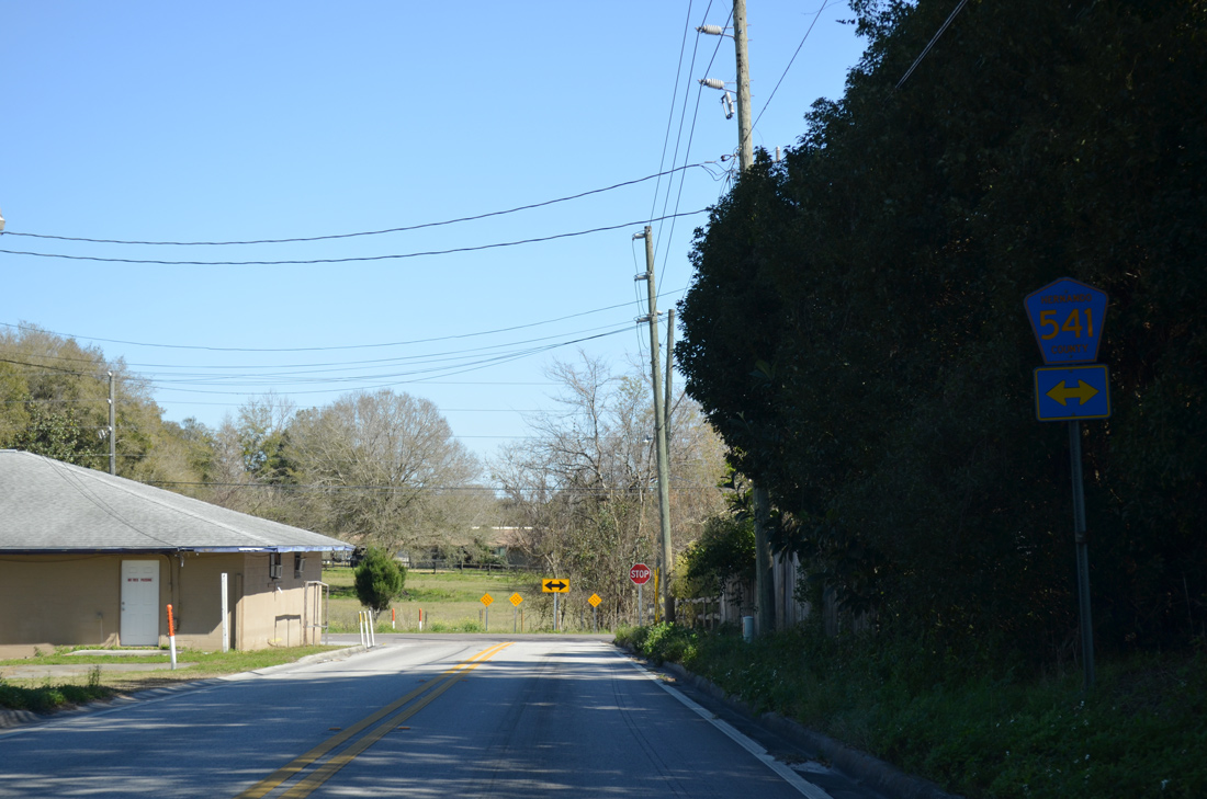
County Road 572 east lowers toward County Road 541 (Spring Lake Highway).
02/17/14
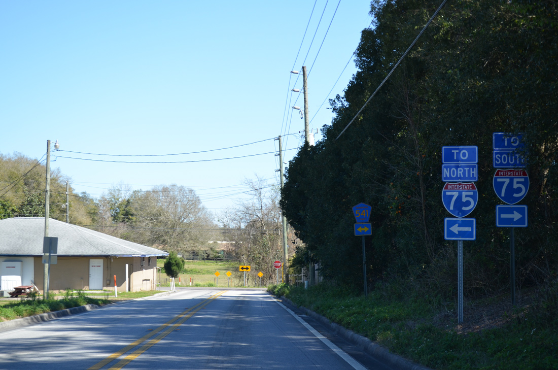
A pair of trailblazers direct motorists bound for Interstate 75 onto CR 541 north to U.S. 98 south for I-75 north and CR 541 south to CR 41 south in Pasco County for I-75 south.
02/17/14
CR 541 (Spring Lake Highway) leads due north 2.25 miles from Spring Lake to U.S. 98/SR 50 (Cortez Boulevard) opposite CR 484 (Mondon Hill Road) west. CR 541 navigates along a rural course southward into Pasco County, turning east as CR 41 to I-75 en route to Dade City.
02/17/14
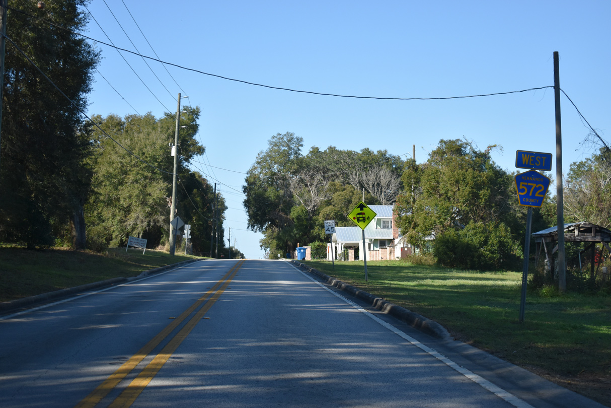
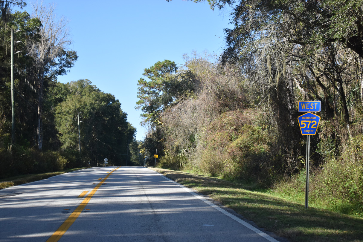
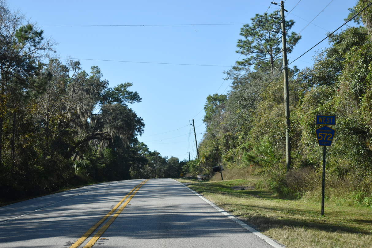
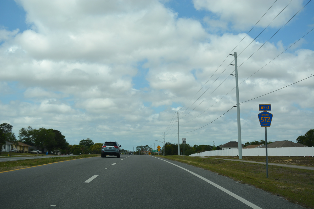
CR 572 begins westbound along Powell Road from CR 541 (Spring Lake Highway) at Spring Lake.
12/13/21
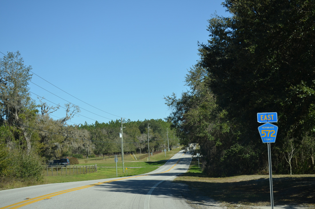
County Road 572 (Powell Road) shifts northward 0.75 miles before resuming a westward heading.
12/13/21
A CR 572 reassurance marker appears west of Cedar Lane north and Goldsmith Road south.
12/13/21

Powell Road west ahead of Batten Road.
12/13/21
Powell Road meets CR 581 (Emerson Road) north, 2.1 miles west of Cedar Lane. The junction shield for CR 581 was removed by 2016.
02/17/14
CR 581 (Emerson Road) runs south from U.S. 98/SR 50A (Jefferson Street) in Brooksville to an overlap with CR 572 west.
12/13/21
CR 581 south is fully signed on the 0.50 mile long overlap with CR 572 (Powell Road) west. The eastbound overlap is not signed as well.
12/13/21
CR 572 (Powell Road) straddles southern reaches of the Brooksville city limits west from CR 581.
12/13/21
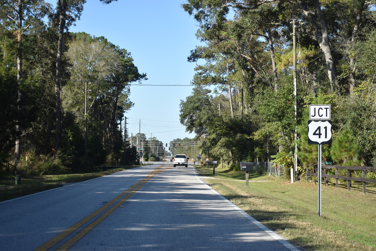
CR 572 converges with U.S. 41 (Broad Street) at Powell.
12/13/21
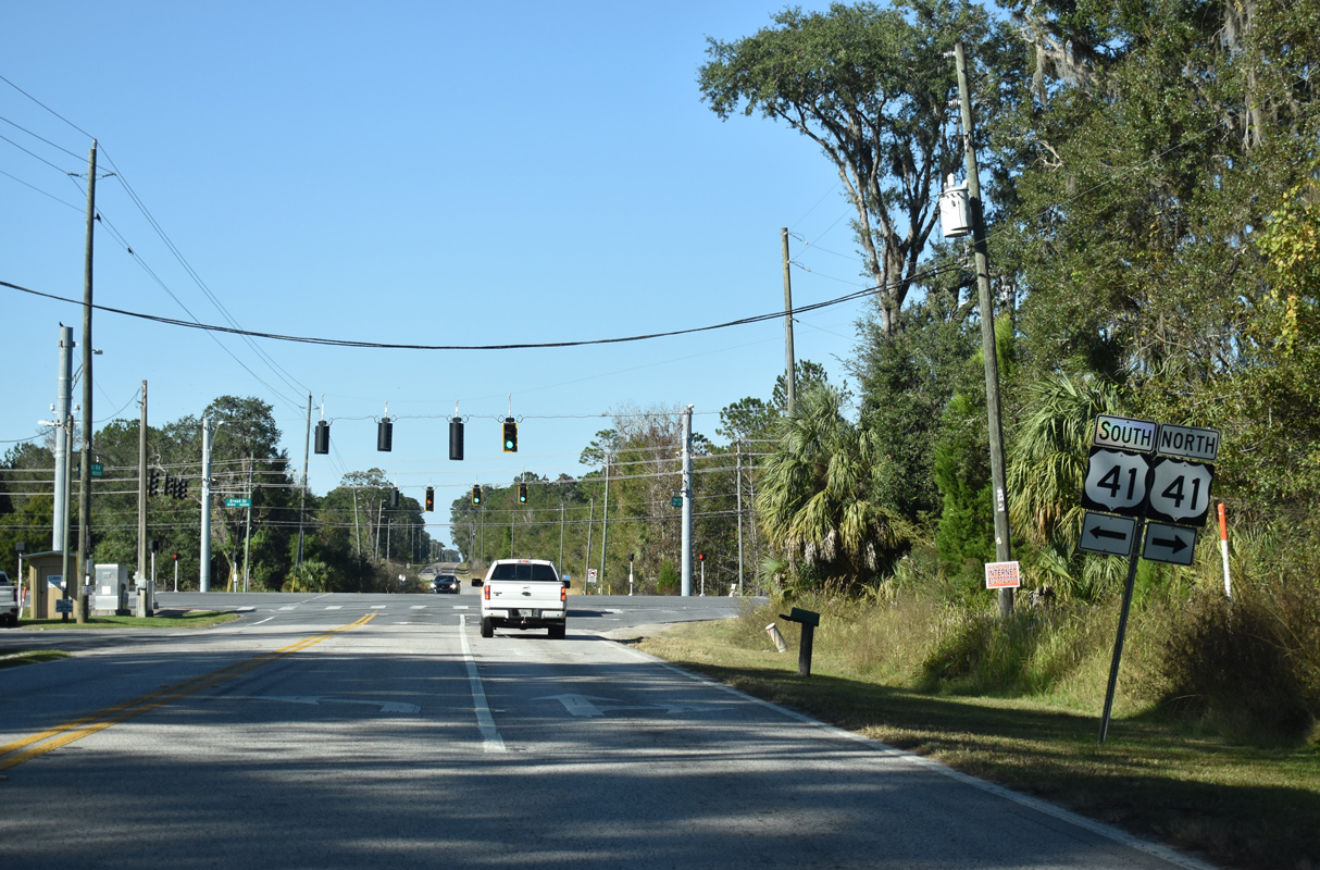
U.S. 41 (Broad Street) runs northeast to Downtown Brooksville and southwest to Masaryktown and Land O's Lakes in Pasco County.
12/13/21
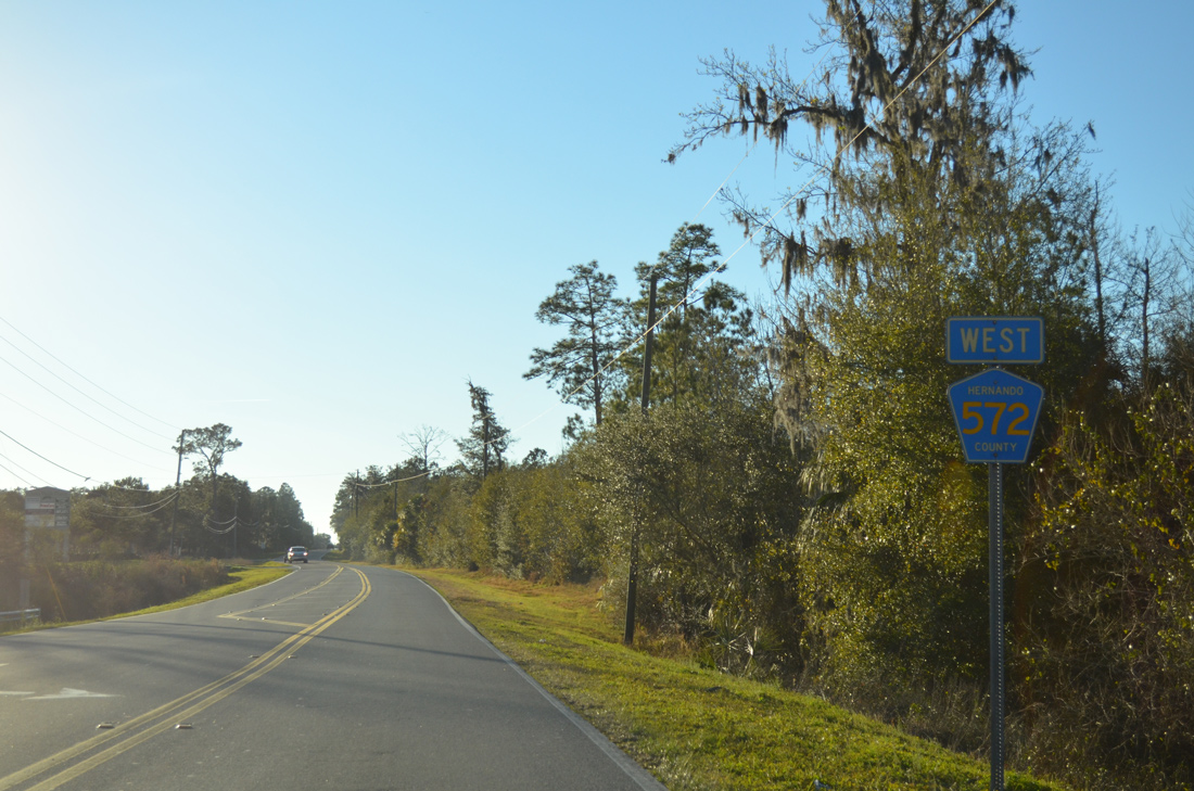
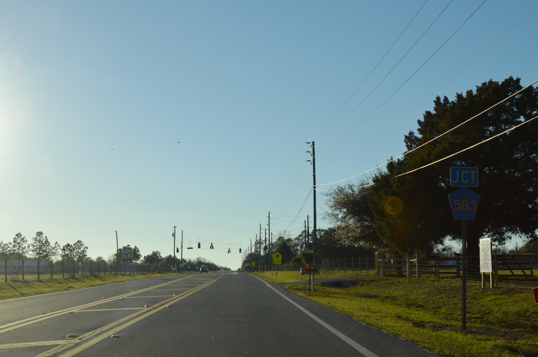
Advancing west from U.S. 41 (Broad Street), County Road 572 traverses ranch land to County Road 583 (California Street).
02/15/14
The northern most of three County Road 583 segments, Hernando County Road 583 follows California Street south 0.75 miles to CR 574 (Spring Hill Drive) at Brooksville - Tampa Bay Regional Airport (BKV).
02/15/14
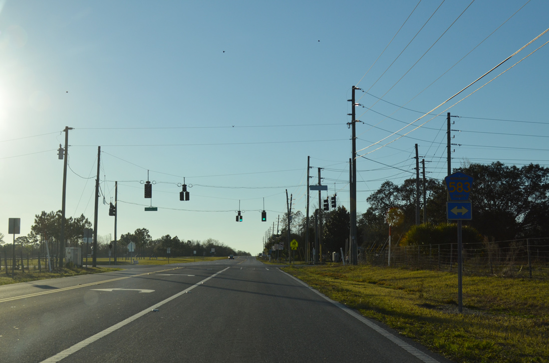
North from Powell Road, CR 583 (California Street) continues to Wiscon and SR 50 (Cortez Boulevard).
02/15/14
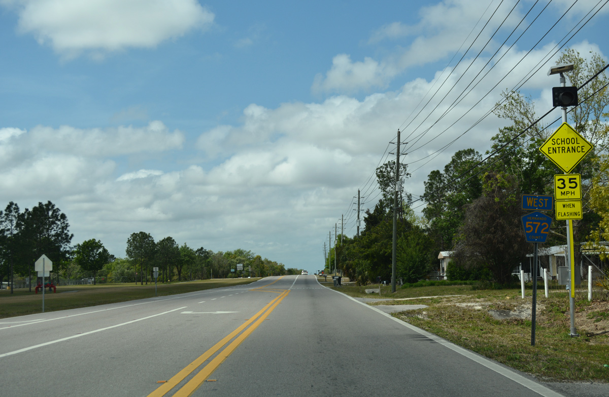
Powell Road becomes more suburban as County Road 572 progresses toward Spring Hill after County Road 583.
03/26/18
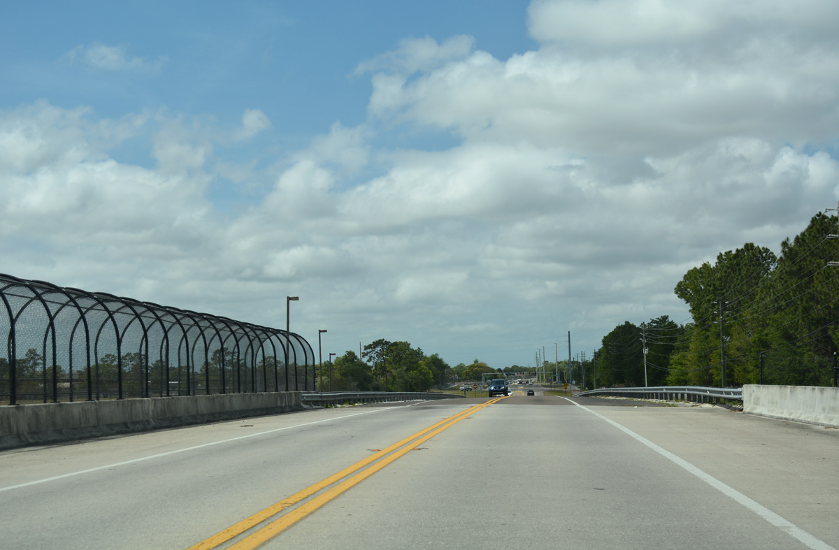
County Road 572 (Powell Road) passes over the Suncoast Parkway (SR 589). SR 589 meets CR 574 (Spring Hill Drive) a short distance southward.
03/26/18
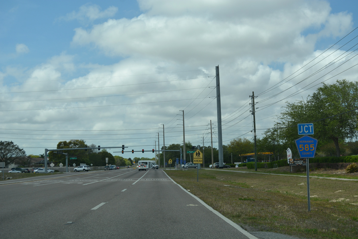
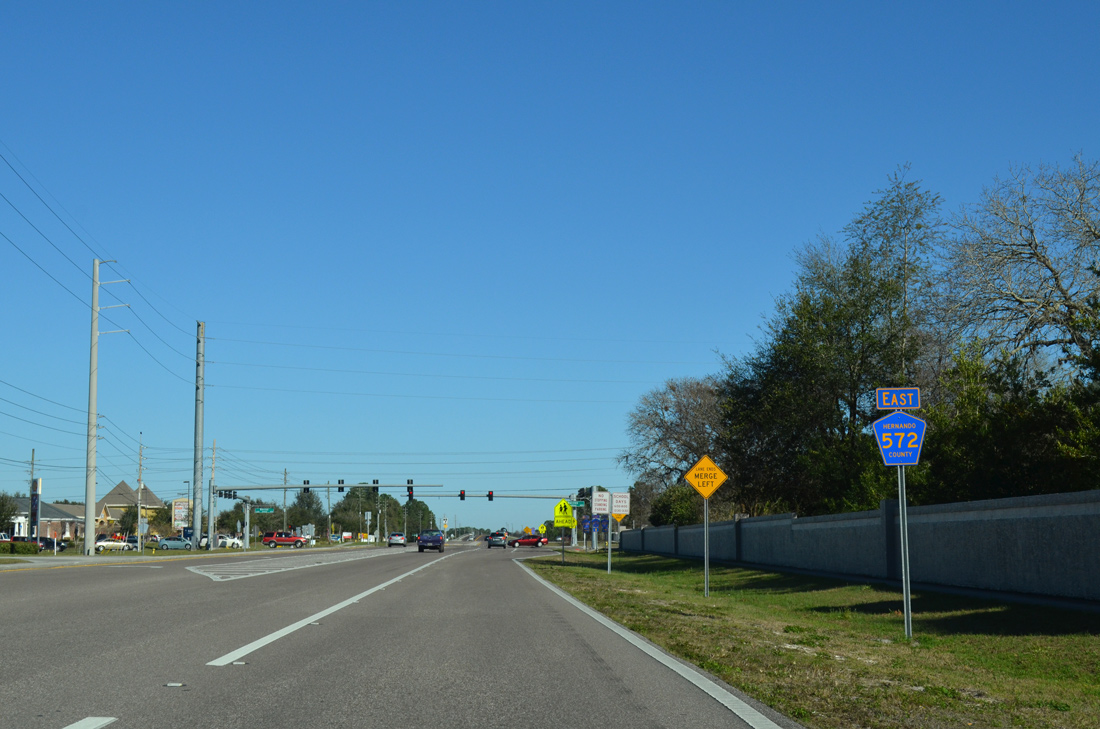
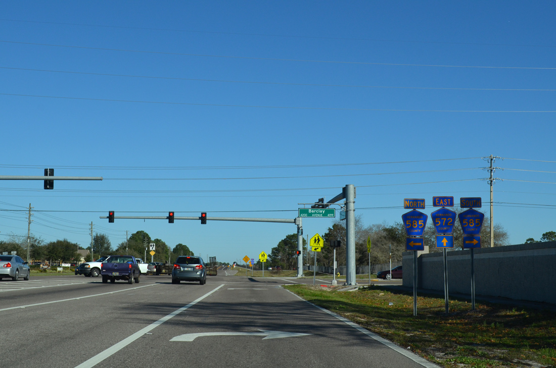
A short distance west of the Suncoast Parkway and south of Silverthorn Country Club is the intersection joining CR 572 (Powell Road) with Barclay Avenue (CR 585).
03/26/18
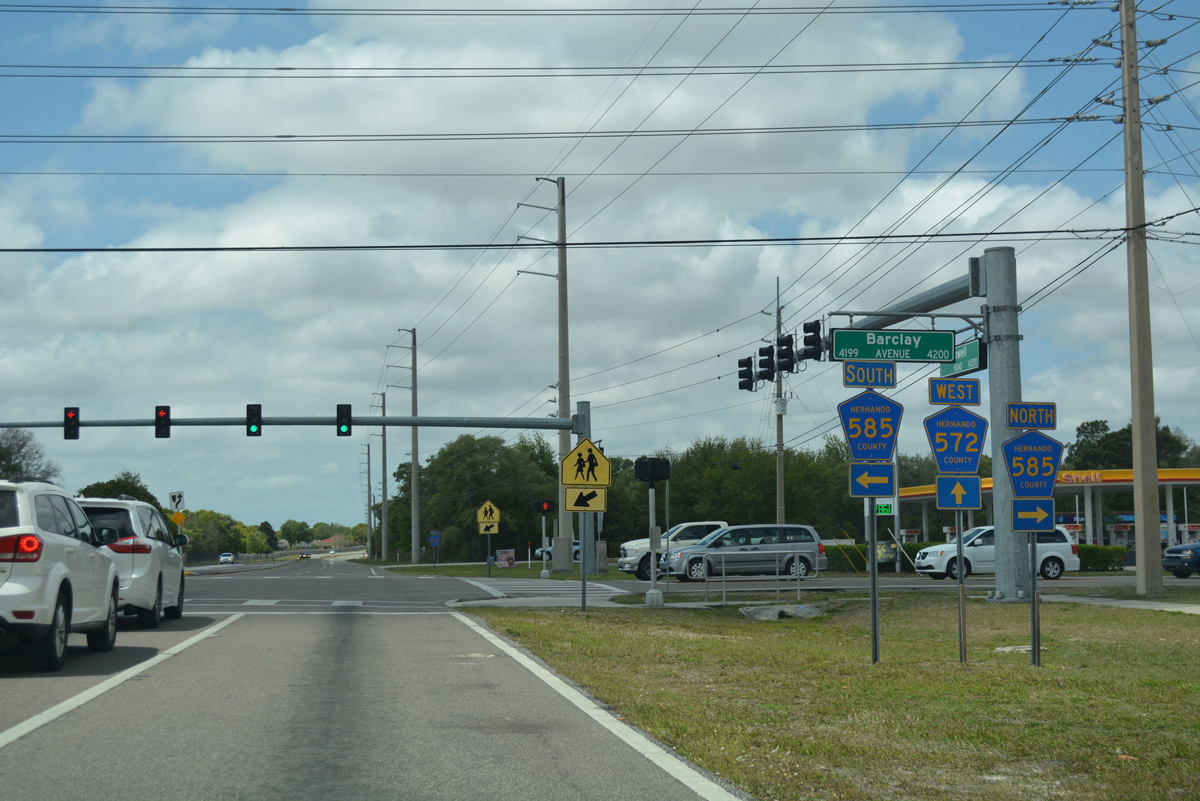
CR 585 (Barclay Avenue) travels north to SR 50 and south to County Line Road (CR 578), parallel to Suncoast Parkway.
03/26/18
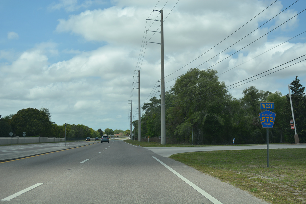
Powell Road transitions to Elgin Boulevard west of County Road 585 through Spring Hill.
03/26/18
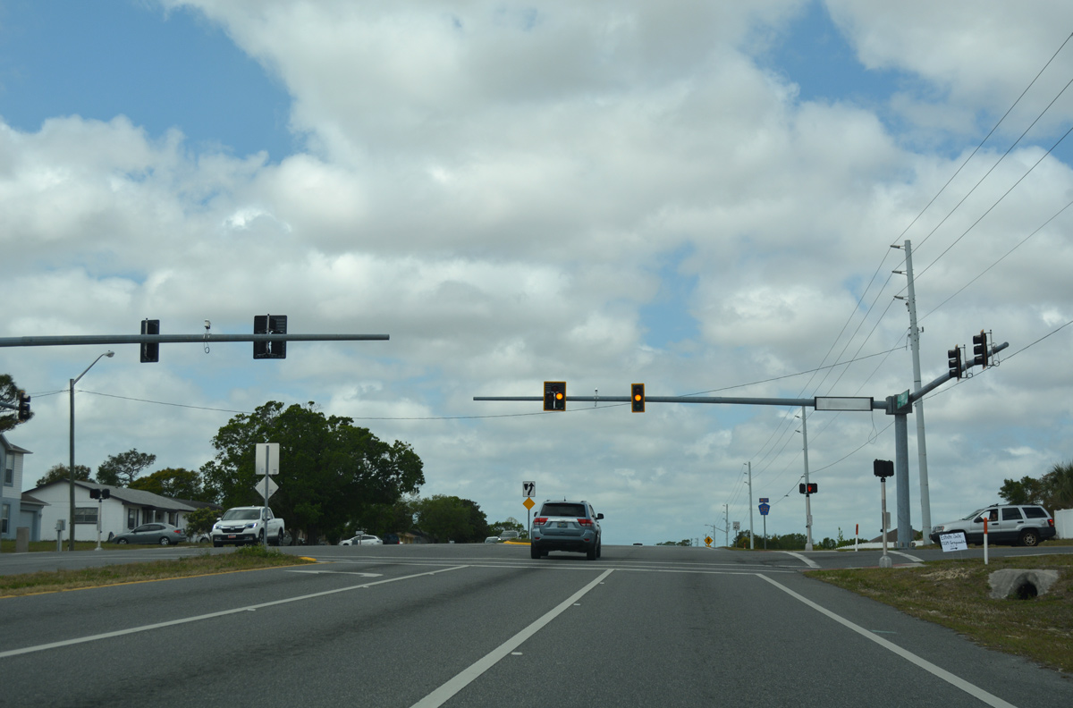
Elgin Boulevard curves northwest through the Sterling Hill community, intersecting the entrance to the Challenger K8 School at this traffic light.
03/26/18
Sterling Hill Boulevard loops east from Elgin Boulevard and returns to Sterling Hill neighborhoods south and west of CR 572.
03/26/18
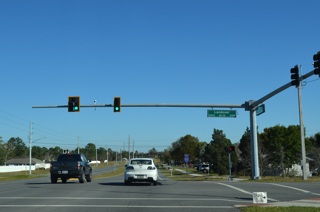
The ensuing signal along Elgin Boulevard in Spring Hill connects CR 572 with Landover Boulevard.
03/26/18
Reassurance marker for County Road 572 posted west of Landover Boulevard.
03/26/18
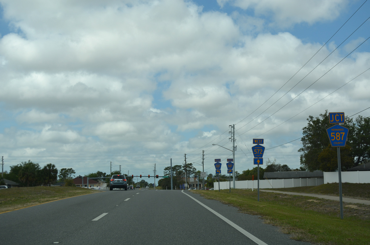
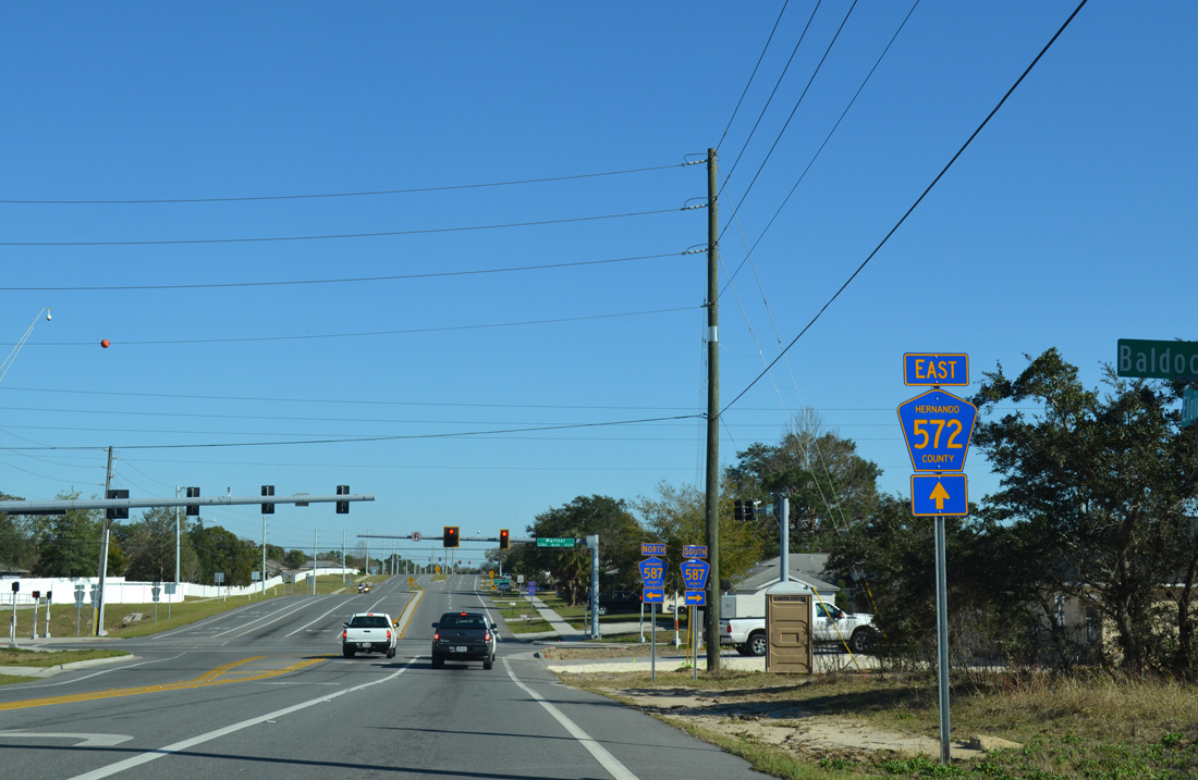
An array of shield assemblies precede the intersection joining County Road 572 (Elgin Boulevard) with 587 (Mariner Boulevard). Mariner Boulevard is one of the two main north-south arterials through Spring Hill.
03/26/18
A 7.87 mile long route, CR 587 follows Mariner Boulevard south to County Line Road (CR 578) and north to SR 50 (Cortez Boulevard) at Western Way Shopping Center.
03/26/18
County Road 572 (Elgin Boulevard) reduces to two lanes west of County Road 587 (Mariner Boulevard).
03/26/18
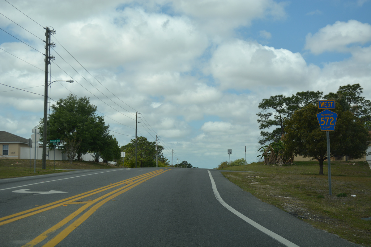
A second reassurance marker for CR 572 west stands after CR 587 at Colchester Avenue.
03/26/18
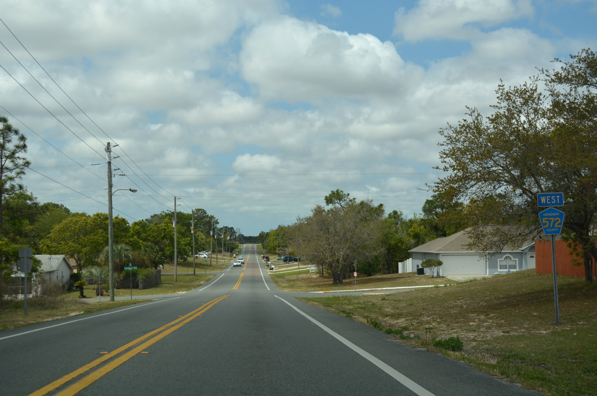
Approaching CR 589 (Deltona Boulevard) on CR 572 (Elgin Boulevard) westbound by the Oak Hills Country Club.
03/26/18
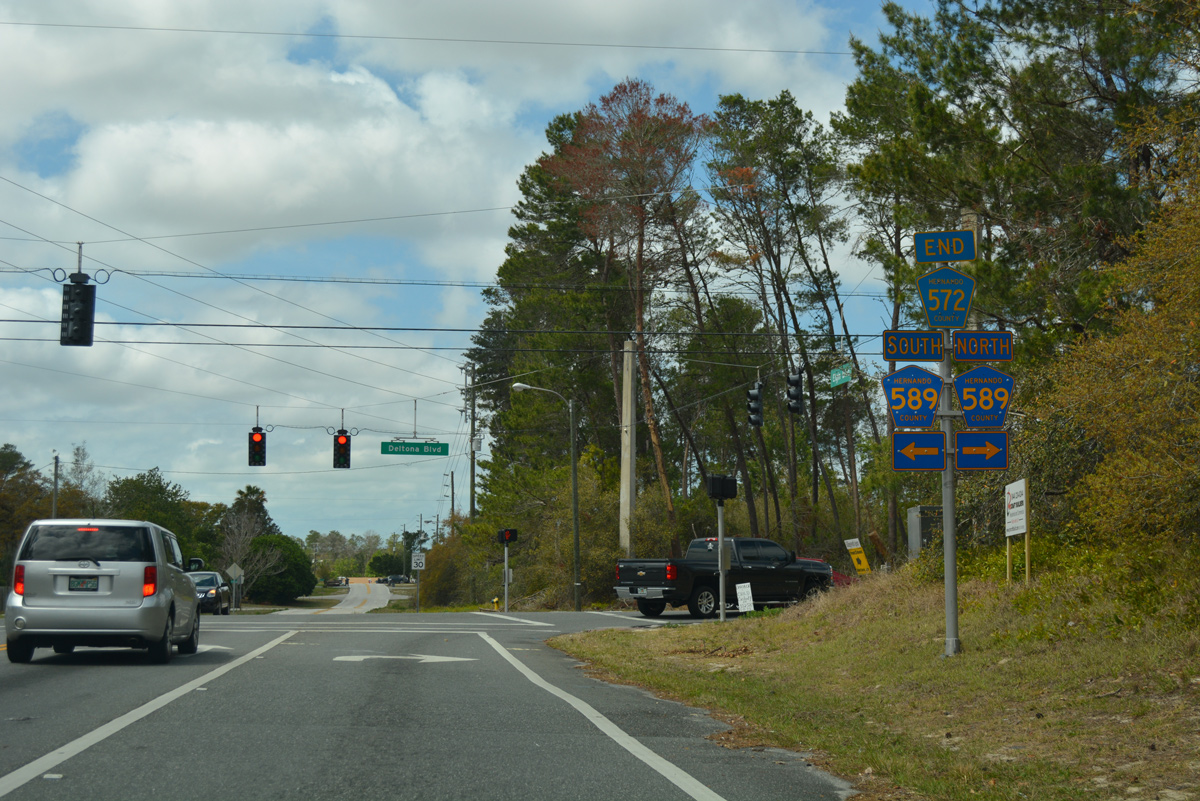
An end shield marks the conclusion of CR 572 west at CR 589 (Deltona Boulevard). Elgin Boulevard extends a short distance west as a residential street to Freeport Drive. CR 589 winds 5.31 miles north from CR 574 (Spring Hill Drive) to nearby SR 50 (Cortez Boulevard).
03/26/18
Photo Credits:
- ABRoads: 02/15/14, 02/17/14
- Alex Nitzman: 03/26/18, 12/13/21
Connect with:
Page Updated Monday December 13, 2021.