
State Road 291 North

 North
North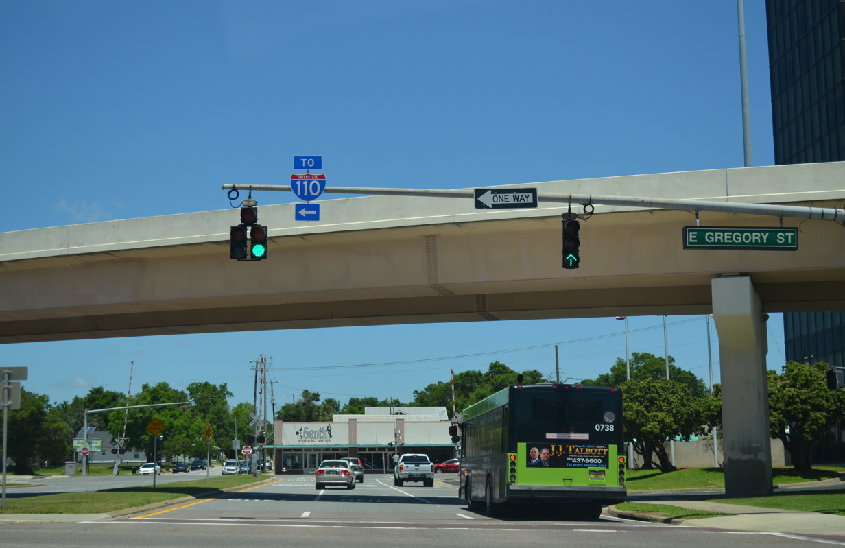
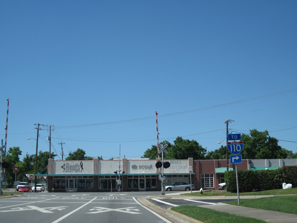
Alcaniz Street northbound at Gregory Street (U.S. 98 Business west) and the hidden beginning of SR 291 north. SR 291 follows the next block of Alcaniz Street to Wright Street east.
05/15/14
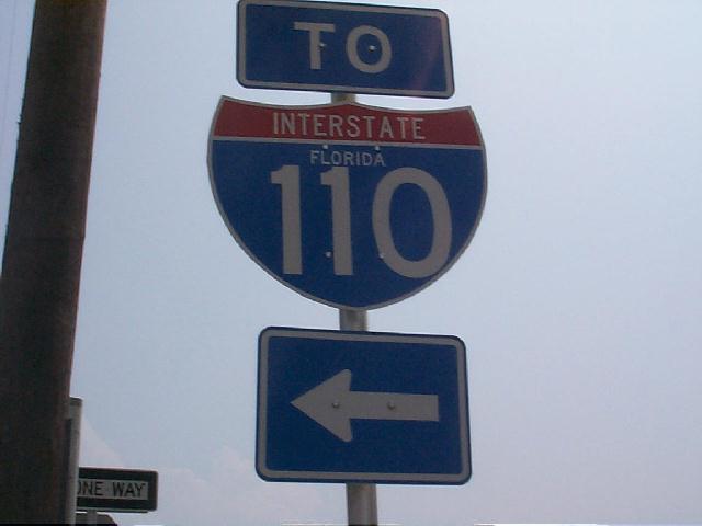
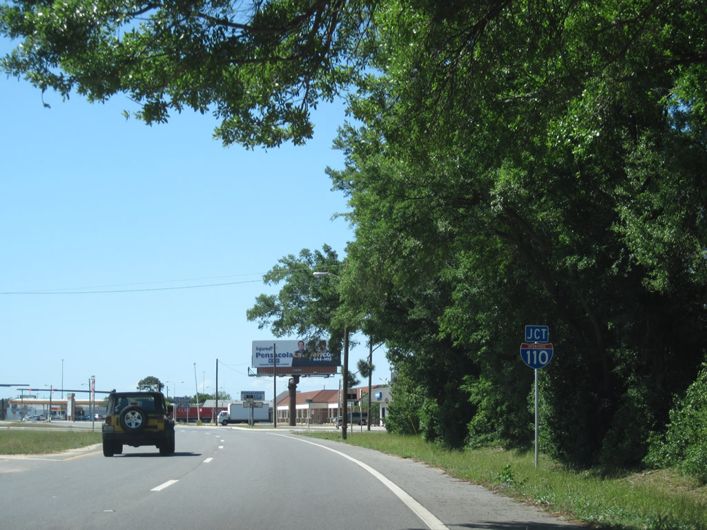
An Interstate 110 trailblazer directs motorists onto Wright Street east from Alcaniz Street. SR 291 splits into a one way street couplet using Davis Street (north) and Alcaniz Street (south) from here to Cerventes Street (U.S. 90/98).
04/25/10
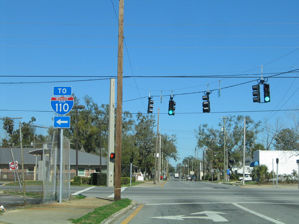
SR 291 makes an unsigned turn onto Davis Street as Wright Street continues alongside a CSX Railroad line to U.S. 98 (Ninth Avenue). An Interstate 110 trailblazer was once posted within the median of Wright Street at Davis. It was removed by 2002.
08/27/99
04/25/10
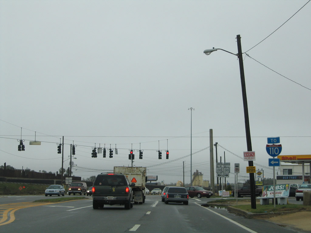
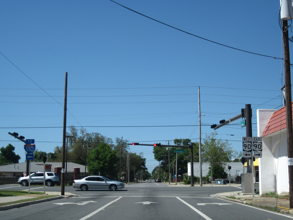
Five blocks into Davis Street, unsigned SR 291 intersects U.S. 90/98 (Cervantes Street). U.S. 98 is absent from the U.S. 90 shield assembly for Cervantes Street. This omitting occurs somewhat frequently for the U.S. 90/98 overlap in Pensacola.
An Interstate 110 state-named shield installed in 2002, the last for I-110 in Florida, was replaced by 2008.
01/31/06
04/25/10
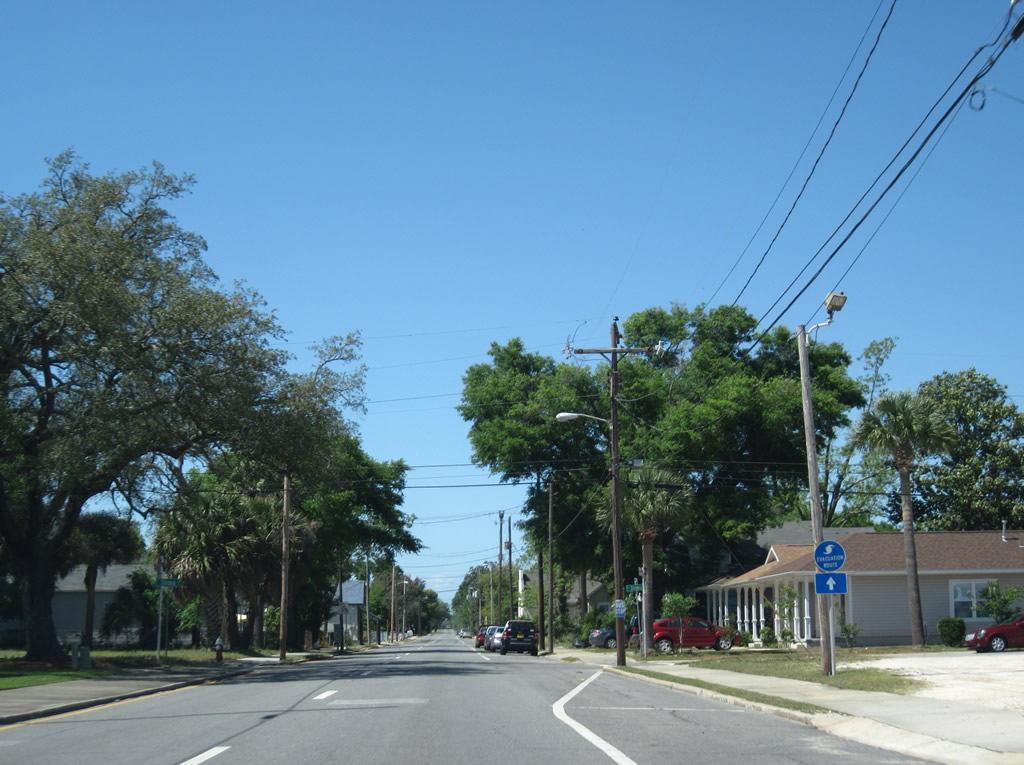
SR 291 remains unsigned north from Cerventes Street through the Pensacola street grid. A hurricane evacuation route is the only indication of the Davis Street status.
04/25/10
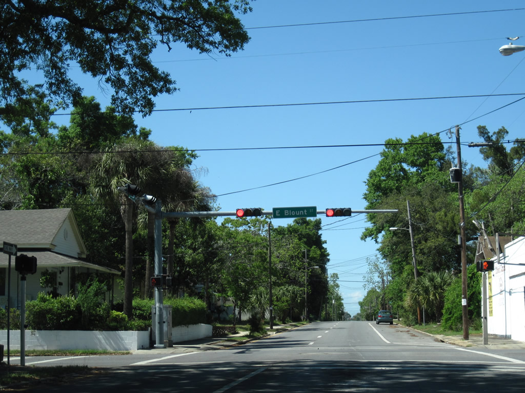
Blount Street meets Davis Street (SR 291) at the next traffic light.
04/25/10
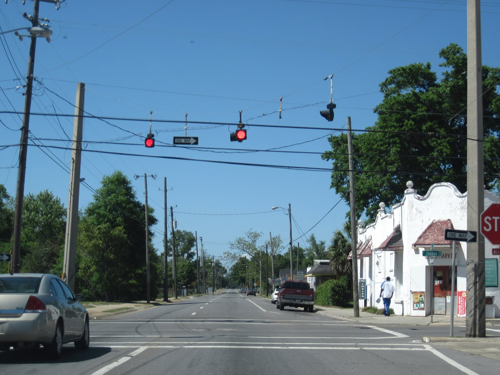
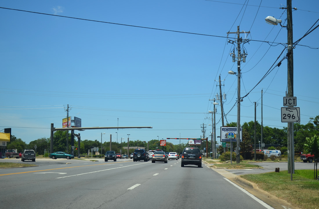
Jordan and Maxwell Streets constitute a one way street couplet linking Interstate 110 with A Street to the west and SR 289 (Ninth Avenue) to the east.
04/25/10
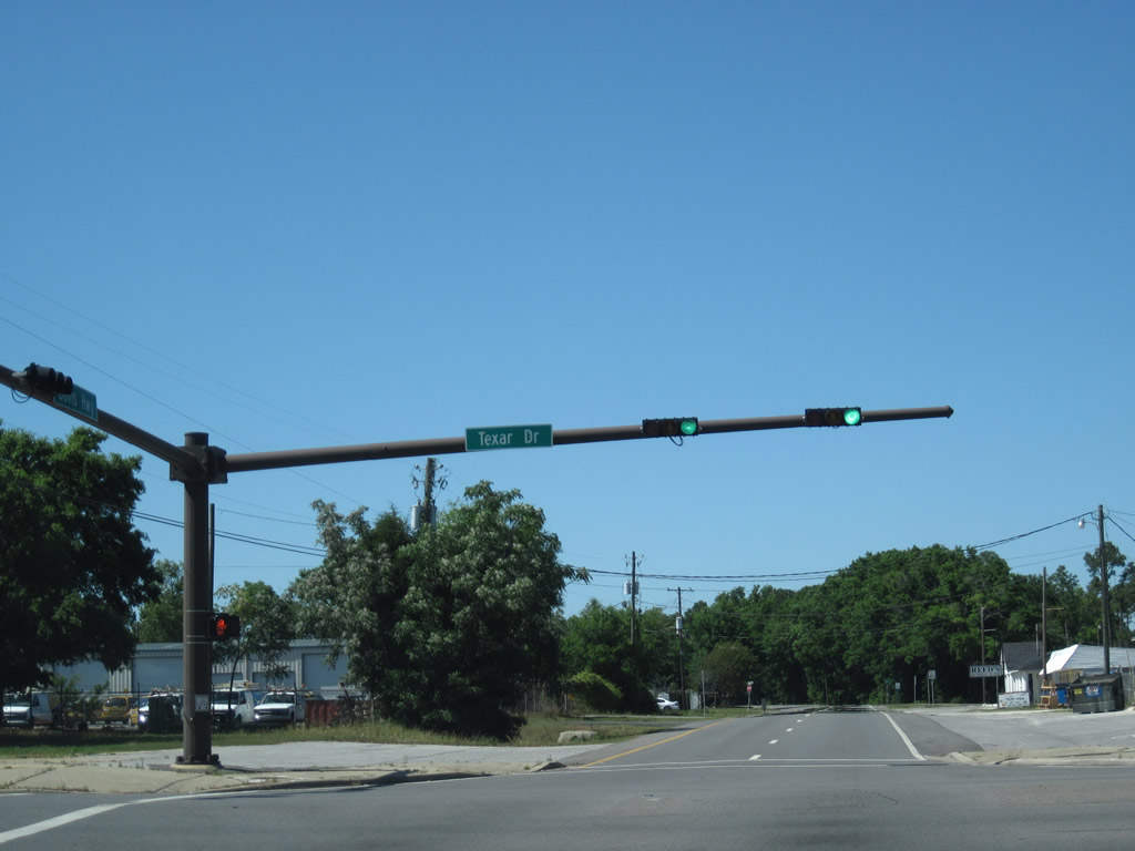
While signs are posted for SR 291 along Texar Drive (SR 752) at Davis Street, SR 291 continues as an unsigned route north. SR 752 travels just 1.18 miles as a connector between SR 295 (Fairfield Drive) and Ninth Avenue in Pensacola.
04/25/10
The couplet of SR 291 combines to form Davis Highway ahead of the northbound on-ramp to Interstate 110.
04/25/10
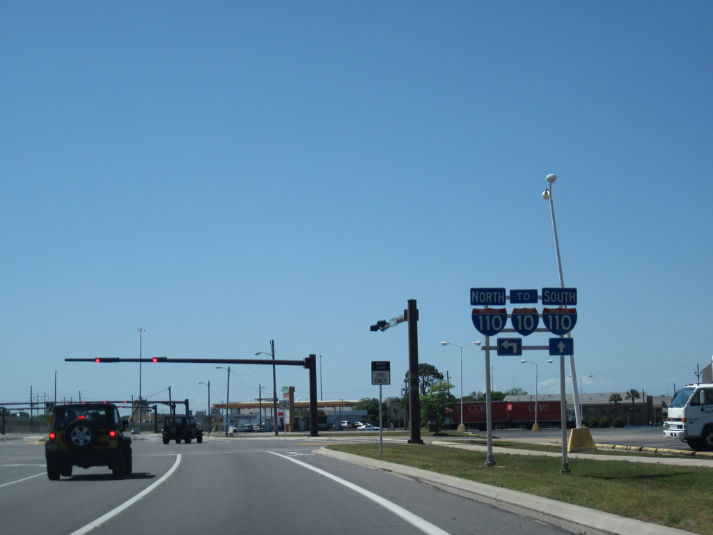
Expansion of Interstate 110 between 2002 and 2009 included the addition of a new ramp to the freeway from Davis Highway directly. This ramp offset congestion at the nearby ramp from SR 295 onto I-110 north.
04/25/10
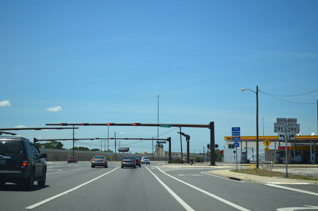
Before and after looks at the intersection of SR 291 (Davis Highway) with SR 295 (Fairfield Drive). SR 295 constitutes a busy arterial route linking I-110 with West Pensacola, Warrington and Pensacola Naval Air Station to the southwest. Motorists on SR 291 north originally had to turn onto SR 295 south briefly for Interstate 110, adding to the congestion of three signals in a row.
02/02/06
05/27/13
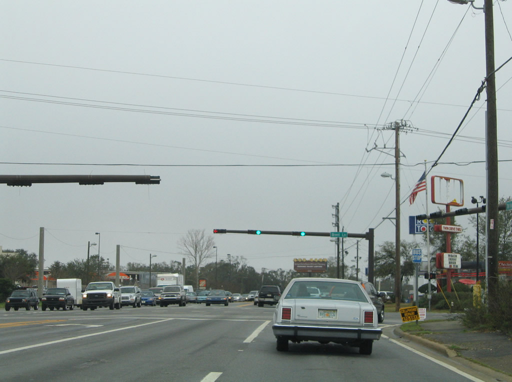
Continuing north along Davis Highway toward SR 296 (Brent Lane). Brent Lane sees a diamond interchange (Exit 5) with Interstate 110 just west of SR 291.
05/27/13
No shields for SR 296 are posted at Brent Lane along Davis Highway north. State Road 296 follows a circuitous route 9.6 miles from U.S. 90 (Mobile Highway) near Saufley Field to Cerventes Street near Bayou Texar in Pensacola.
02/02/06
The first shield for SR 291 north appears after SR 296 (Brent Lane), 4.3 miles after the state road began.
04/11/12
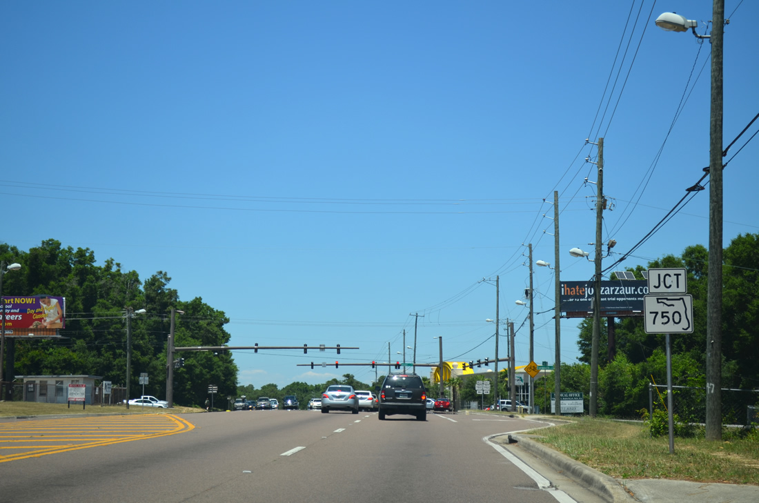
Next in line for northbound drivers along SR 291 (Davis Highway) is SR 750 (Airport Boulevard). SR 750 was extended west from SR 289 (Ninth Avenue) to U.S. 29 in a mileage swap with Escambia County in exchange for all of State Road 290 (Olive Road) to the north in 2011.
05/27/13
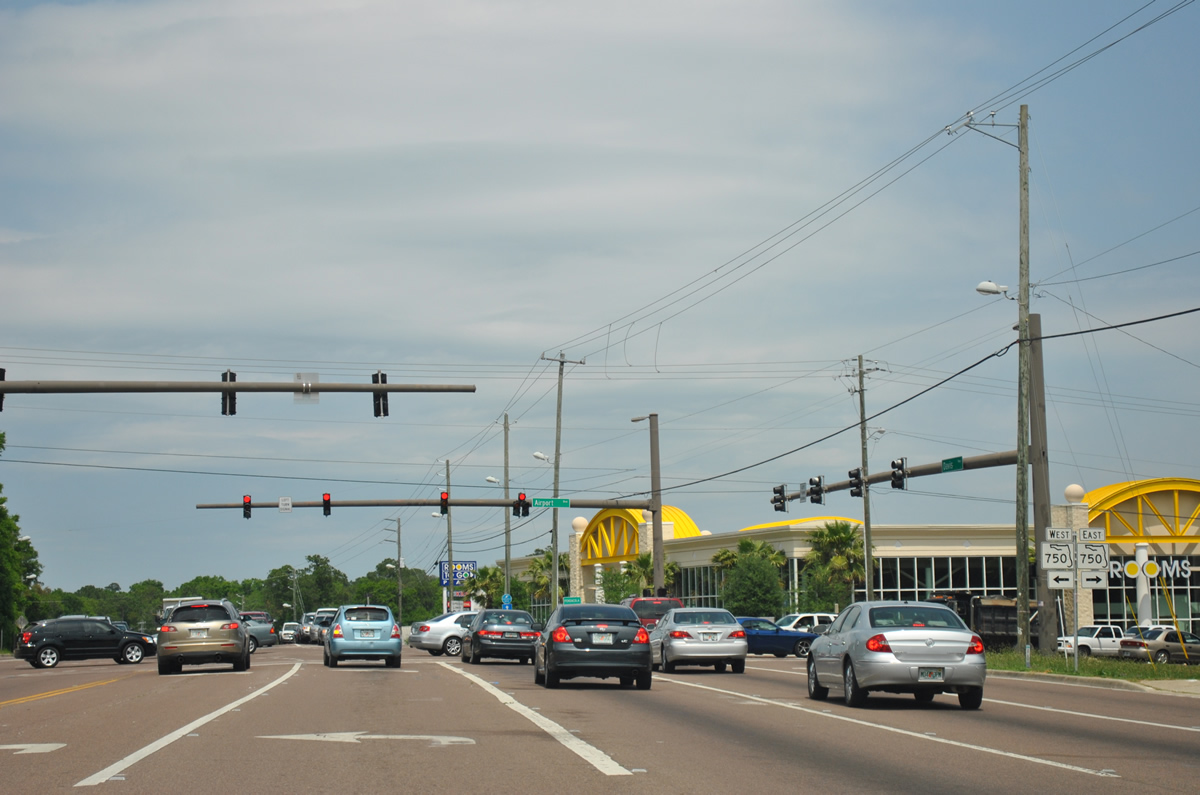
SR 750 follows Airport Boulevard east to Cordova Mall and the terminal of Pensacola International Airport (PNS). Westward the arterial sees a 2009-opened diamond interchange with Interstate 110.
04/11/12
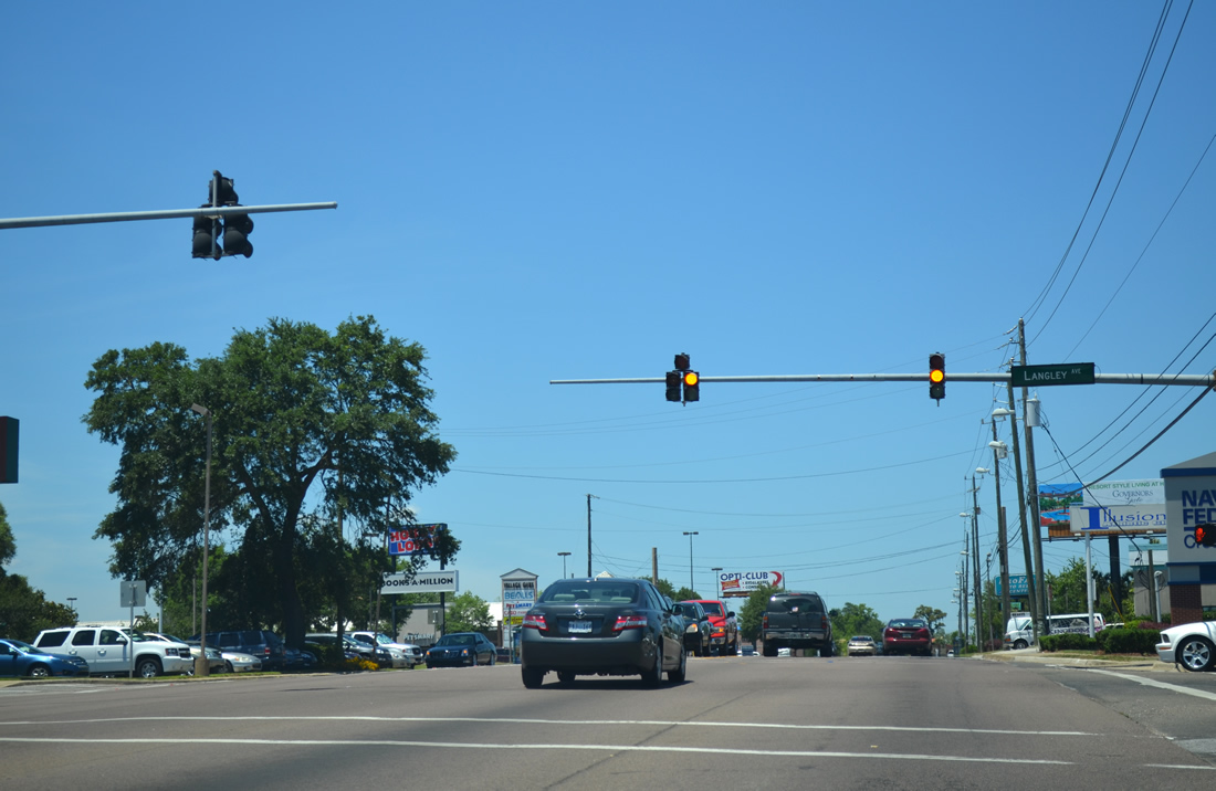
Langley Avenue stems east from SR 291 and Pensacola Square shopping center as a residential through road to Ninth Avenue, Scenic Heights, and U.S. 90 (Scenic Highway). The road ended just shy of Davis Highway until 1996.
05/27/13
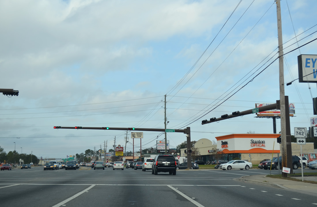
SR 742 shield posted ahead of Burgess Road along Davis Highway north. Burgess Road was a part of State Road 742 before it was relocated wholly onto Creighton Road to the north. Burgess Road ends at Plantation Road to the west, but until November 2004, it continued west across Interstate 110.
05/27/13
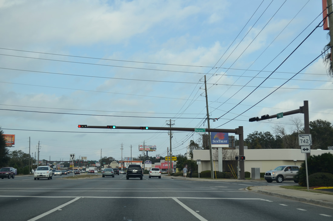
Davis Highway was expanded to six lanes from Schubert Drive to University Drive in 2006 as part of the overall I-10/110 project. New signals and signs were installed along the arterial, including shields for SR 742 at Burgess Road. Burgess Road originally carried SR 742 east to Lanier Drive, where the route turned north to join Creighton Road.
12/15/12
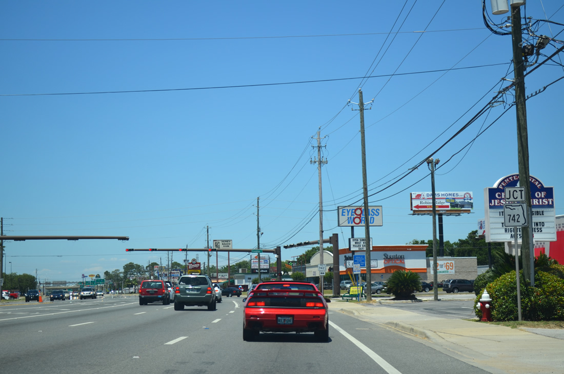
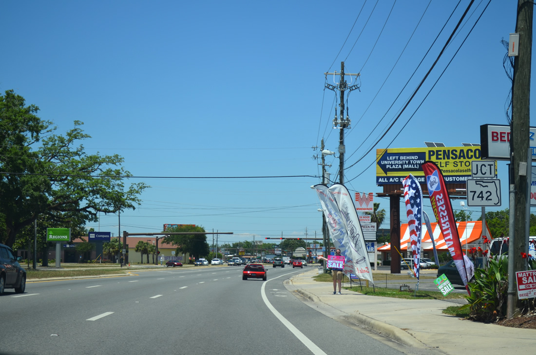
A short distance north of Burgess Road is the actual route of SR 742. SR 742 stretches 8.8 miles from U.S. 29 near Ensley to U.S. 90 in Pensacola.
05/27/13
Creighton Road leads west across Interstate 110 to Hillburn Road as SR 742 and east to Scenic Heights and an end at U.S. 90 (Scenic Highway) near Gull Point.
12/15/12
University Town Plaza lines the west side of SR 291 (Davis Highway) from Creighton Road to Interstate 10. A forthcoming traffic light with Bloodworth Lane provides the only entrance to the retail area from SR 291 north.
05/27/13

Ramps for Interstate 10 follow the signal at Bloodworth Lane from the right side of SR 291 north.
05/27/13
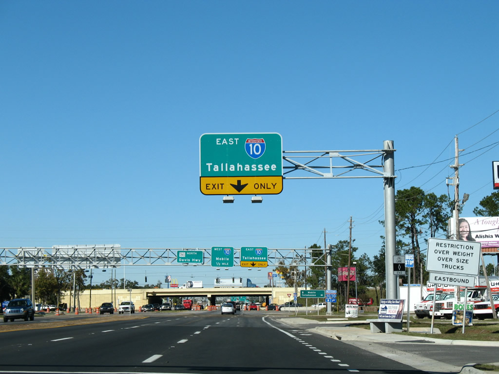
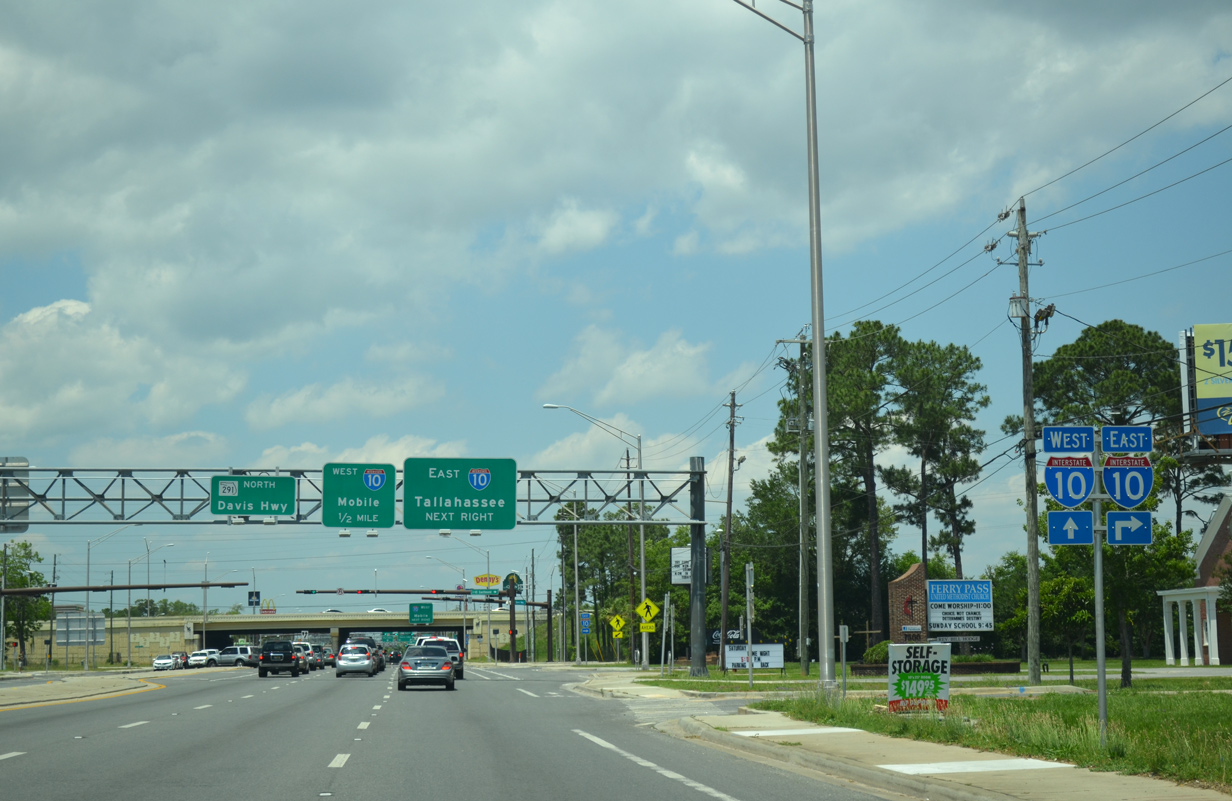
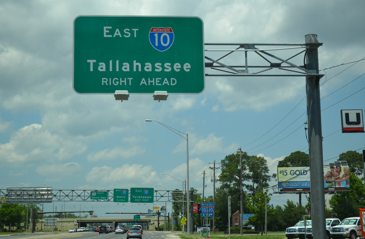
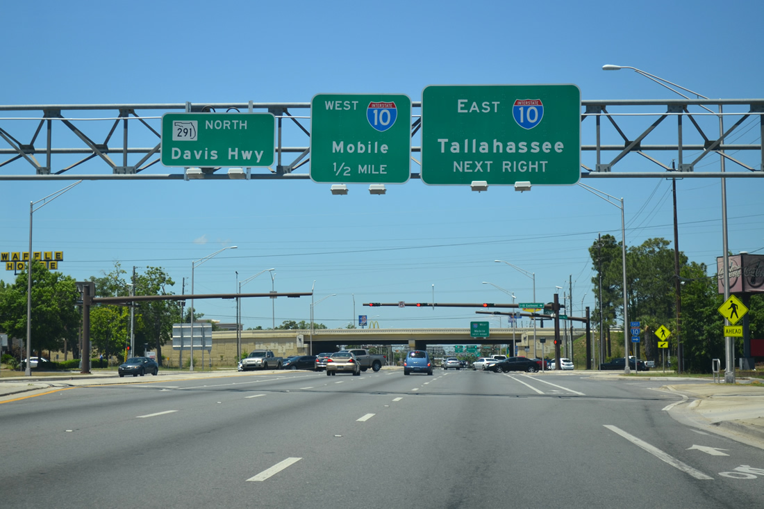
Work associated with the Interstate 10 widening of 2002-08 included expansion of Davis Highway to six overall lanes below I-10. Construction also expanded the off-ramps to SR 291 to two lanes. Northbound motorists to Interstate 10 east depart first for Milton and Tallahassee.
11/22/06
05/17/14
Forthcoming Interstate 10 travels 362 miles in Florida, from Pensacola to Jacksonville and 2,460 miles overall to Santa Monica, California.
05/17/14

Within the Pensacola area, I-10 doubles as a commuter route west to Nine Mile Road (Exit 5) and east to SR 281 (Exit 22). Upgrades at the parclo interchange with SR 291 improved the traffic flow for commuters to and from Davis Highway.
11/22/06
05/27/13
A loop ramp facilitates the movements from SR 291 north onto Interstate 10 west to Mobile, Alabama.
05/17/14
Drivers joining Interstate 10 west from SR 291 north form a collector distributor roadway to the adjacent trumpet interchange with Interstate 110 south. Mobile is 53 miles to the west.
05/27/13
Signs bridges were added to Davis Highway in 2002 to Olive Road (former State Road 290) and the split with University Parkway. A continuous right turn lane commences from I-10 to Northcross Lane and Olive Road.
05/27/13
Northcross Lane joins Davis Highway with the adjacent Northcross Village shopping center and Gregg Road.
05/17/14
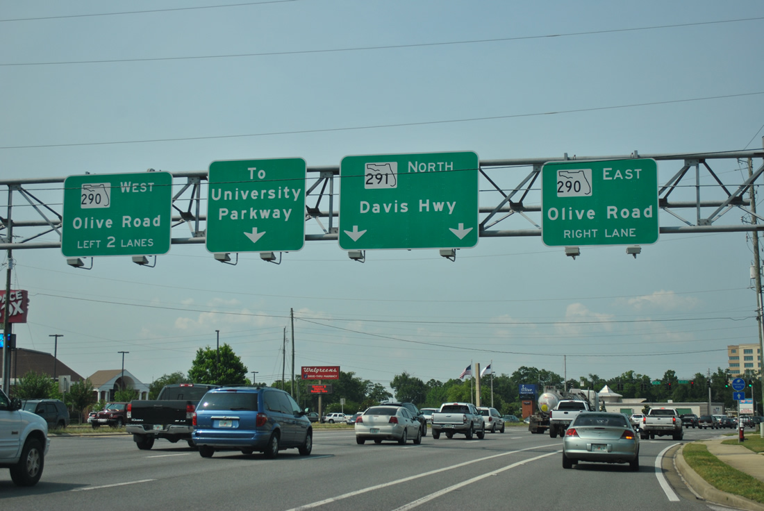
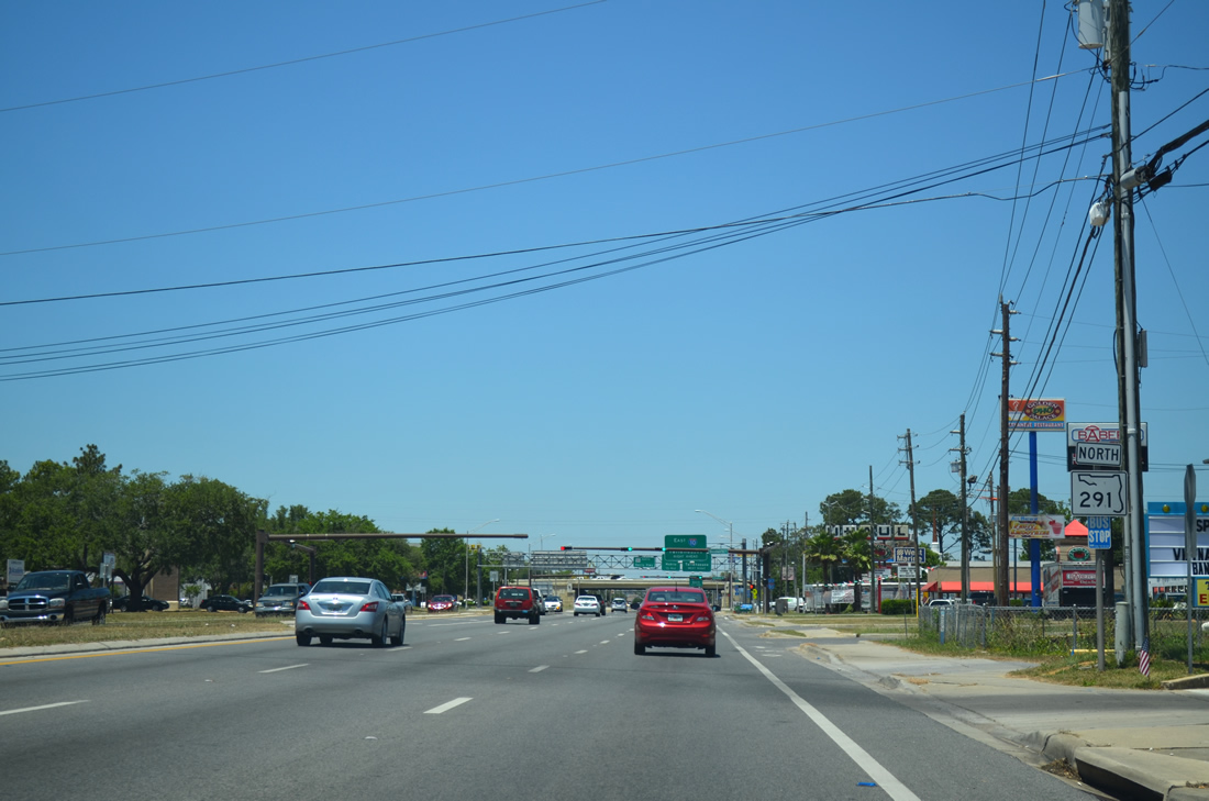
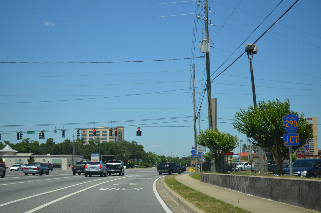
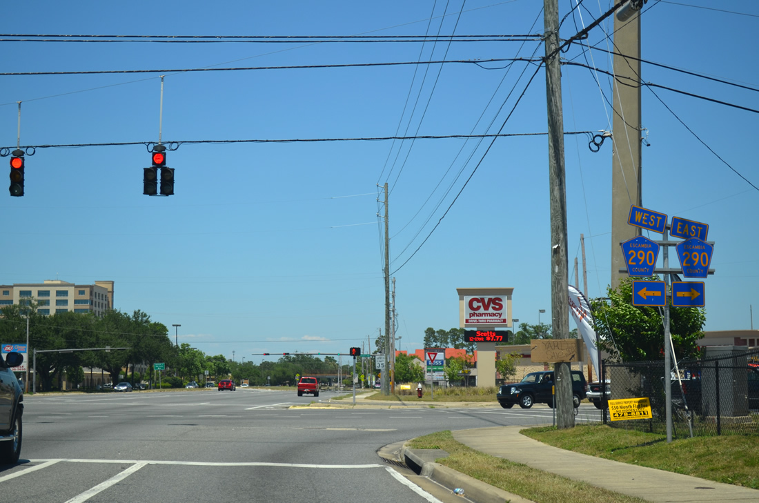
A second set of overheads precede Olive Road along SR 291 (Davis Highway). Olive Road was a part of SR 290 until June 30, 2011, when the state road was turned over to the county. The county road is unsigned along the Olive Road mainline on the trek between Palafox Street (CR-95A) and Scenic Highway (U.S. 90).
05/25/12
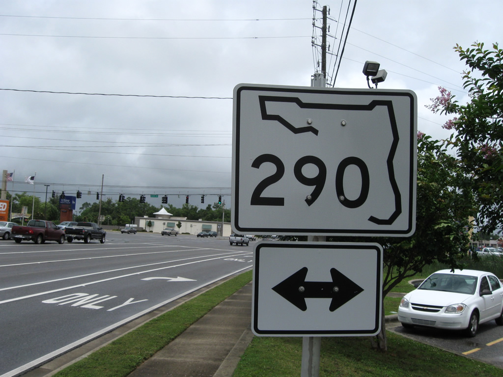
Two sets of ground level shields for SR 290 were posted ahead of Olive Road as well. Olive Road provides a useful alternative to Interstate 10 between Davis Highway and U.S. 90 at Macky Bay.
05/23/09
05/27/13
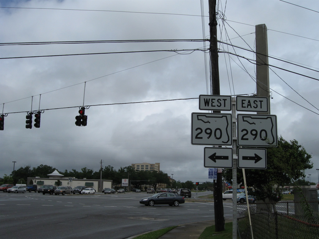
SR 290 followed all 5.48 miles of Olive Road until its decommissioning in 2011. SR 289 (Ninth Avenue) still ends at the County Road 290 to the east.
05/23/09
05/27/13
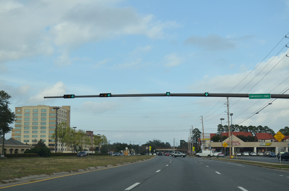
University Parkway splits from SR 291 ahead of West Florida Hospital. The four lane divided parkway leads north through Ferry Pass to the University of West Florida campus.
12/15/12
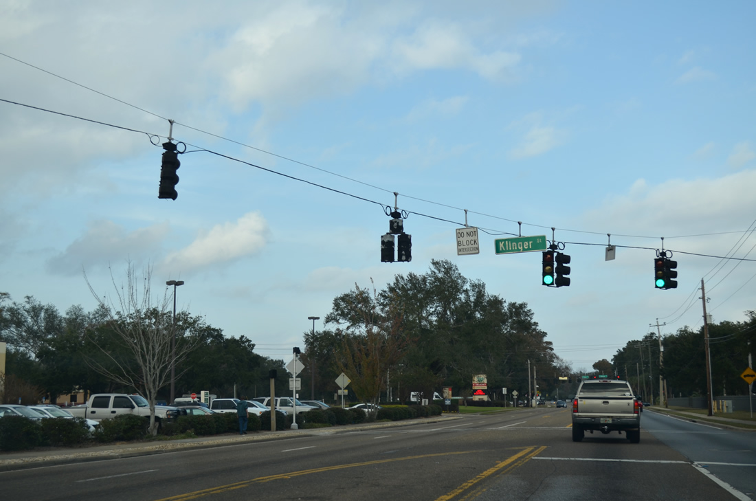
Klinger Street sees a traffic light with Davis Highway to serve an adjacent elementary school across from the hospital.
12/15/12
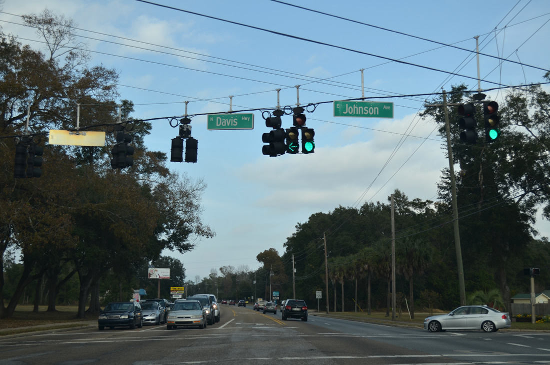
Johnson Avenue lines the north side of West Florida Hospital as a through road to Jernigan Road. Eastward, the avenue continues to Olive Road near its end at Scenic Highway.
05/27/13
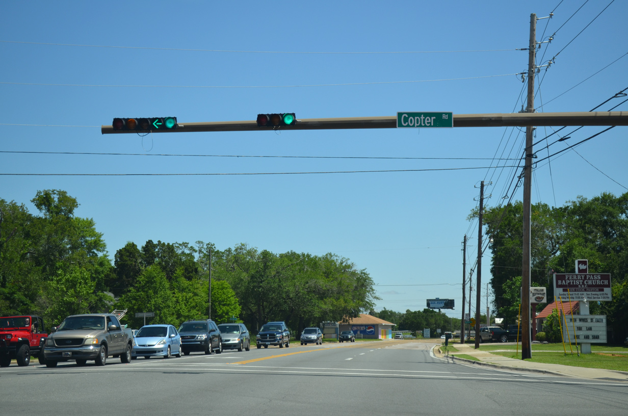
Copter Road veers southward from U.S. 90 (Nine Mile Road) to intersect Davis Highway ahead of Ellyson Industrial Park. The east-west road used to be a part of County Road 498 as it connected Nine Mile Road with Ellyson Field, the former Naval Reservation.
05/15/14
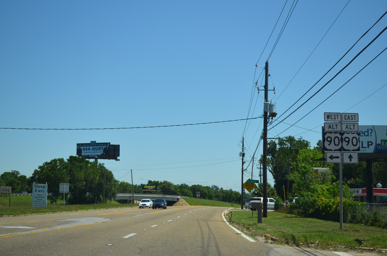
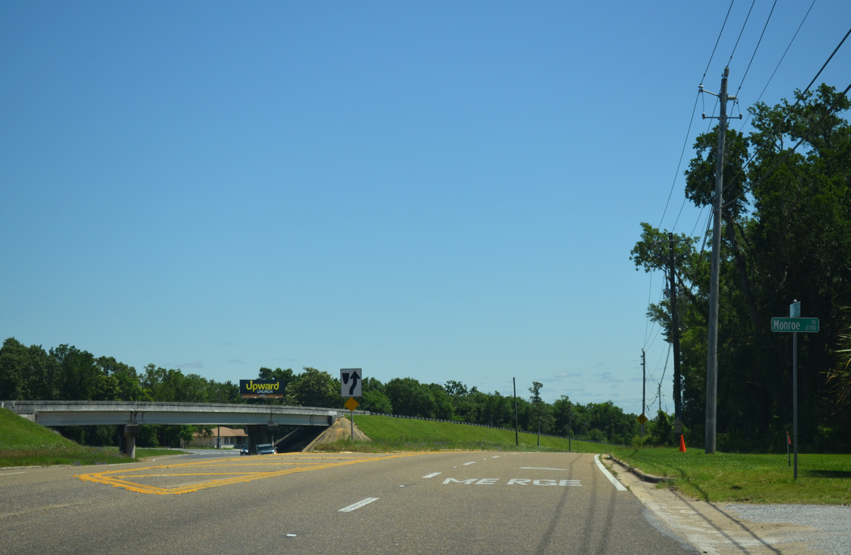
Davis Highway reduces to a single lane ahead of the wye interchange with U.S. 90 Alternate (Nine Mile Road).
05/15/14
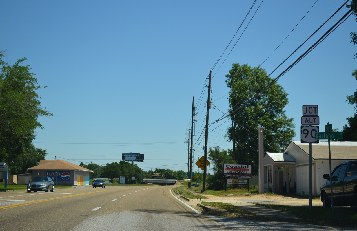
Brewster Road connects Davis Highway north with U.S. 90 Alternate (Nine Mile Road) west. Mobile remains as a control city for the U.S. 90A west end with U.S. 90 at Beulah.
05/15/14
Nine Mile Road constitutes a busy commercial corridor with four overall lanes west from Davis Highway to Ensley and Pine Forest.
05/15/14
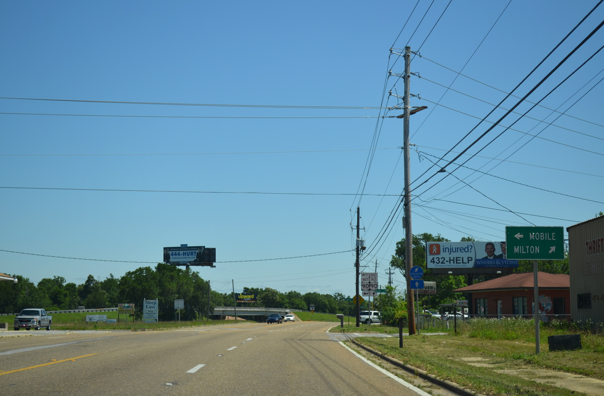
SR 291 north defaults onto U.S. 90 Alternate (Nine Mile Road) eastbound ahead of Campus Drive to UWF and U.S. 90 (Scenic Highway).
05/15/14
Photo Credits:
- ABRoads: 05/23/09, 04/25/10, 04/11/12, 05/25/12, 05/15/14, 05/17/14
- Alex Nitzman: 08/27/99, 01/31/06, 02/02/06, 11/22/06, 12/15/12, 05/27/13
- Alex Nitzman, Justin Cozart: 11/22/06
Connect with:
Page Updated Monday November 17, 2014.