
Interstate 10

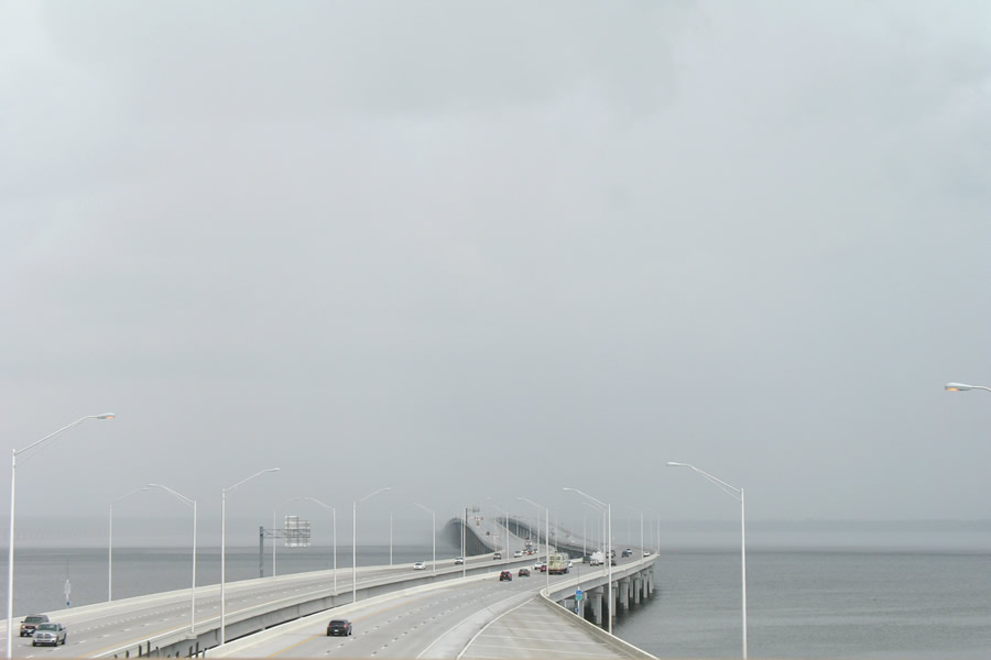
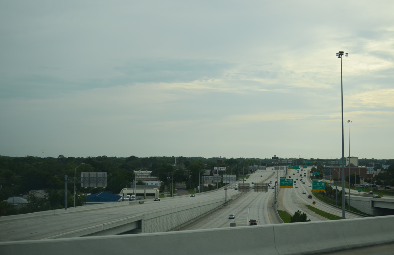
Looking eastward from the U.S. 90 (Scenic Highway) overpass at the Escambia Bay Bridges during an approaching thunderstorm. - 08/01/2008
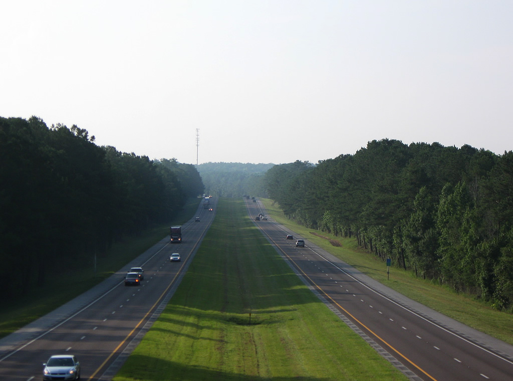
Interstate 10 enters Florida via the Perdido River near Pensacola and ends at Interstate 95 in downtown Jacksonville. The majority of the freeway is rural with just four lanes. Through Pensacola, the freeway expands to six overall lanes, with auxiliary lanes added between U.S. 29 and SR 297. I-10 also expands to six overall lanes through Tallahassee, and from the First Coast Expressway (SR 23) eastward to Downtown Jacksonville. The entire 362.82 mile route was open to traffic in 1978.
Interstate 10 Florida Guides
East
Escambia County - 37 photos
Santa Rosa County - 29 photos
Okaloosa / Walton Counties - 38 photos
Holmes / Washington Counties - 27 photos
Jackson / Gadsden Counties - 54 photos

Leon County - 26 photos
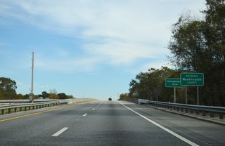
Jefferson / Madison Counties - 43 photos
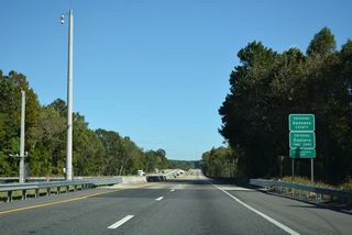
Suwannee, Columbia, Baker Counties - 66 photos
Jacksonville / Duval County - 64 photos
West
Jacksonville - 58 photos

Baker, Columbia, Suwannee Counties - 68 photos
Madison / Jefferson Counties - 50 photos
Leon County - 32 photos
Gadsden / Jackson Counties - 50 photos
Washington / Holmes Counties - 20 photos
Walton / Okaloosa Counties - 27 photos
Santa Rosa County - 25 photos
Escambia County - 40 photos
Interstate 10 was proposed from Pensacola, to Tallahassee, and then on to Jacksonville as part of the original Interstate plan authorized by the Federal Highway Act of 1956. Preexisting U.S. 90 to the north, and U.S. 98 along the coast prompted many residents at the time to suggest a central route for the new Interstate. Many believed that a major route close to the coast would provide easy access to beaches and tourist areas and would be better for the local economy than a route further inland.
While campaigning for governor in 1964, Haydon Burns promised to do all he could to route Interstate 10 as far to the south as possible. When Burns tried to act on this promise however, he was met with heavy opposition both from the Air Force and from the Federal Highway Administration (FHWA). The southern route would traverse the main section of Eglin Air Force Base and would require the re-location of important military centers. A southern route for the Interstate would create dangers to motorists from bombing ranges and test facilities. Northern towns on U.S. 90 even suggested that a southern route for the interstate would face attacks from enemy submarines off the coast.
Eventually, a northern route for Interstate 10 was chosen close to U.S. 90 - missing the main portion of Eglin A.F.B. Another small route change occurred when the proposed route was changed to bypass Tallahassee to the north, in order to miss the bulk of the Apalachicola National Forest.1 A previous decision by the Federal Bureau of Public Roads in October 1958 rejected plans to route Interstate 10 through the city of Tallahassee and the Pensacola central business district. Federal officials determined that there would insufficient interstate traffic service rendered to justify the costly right-of-way acquisition ("Federal Officials", 1958).
Interstate 10 completion2:
- 1961 - Sanderson to Jacksonville
- 1963 - Winfield (Exit 301) to Sanderson
- 1967 - Alabama state line to State Road 87 (Exit 31)
- 1968 - State Road 87 (Exit 31) to Mossy Head (Exit 70)
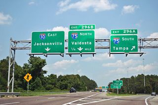
- 1969 - Falmouth (Exit 275) to Interstate 75 (Exit 296)
- 1970 - Mossy Head (Exit 70) to DeFuniak Springs (Exit 85)
- 1973 - DeFuniak Springs (Exit 85) to Caryville (Exit 104)
- 1973 - Drifton (Exit 225) to Falmouth (Exit 275)
- 1974 - Capitola (Exit 209) to Drifton (Exit 225)
- 1977 - Chipley (Exit 120) to Kynesville (Exit 130)
- 1977 - Oakdale (Exit 142) to Midway (Exit 192)
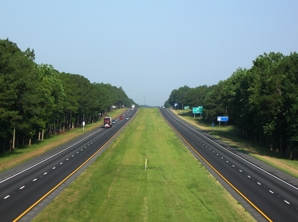
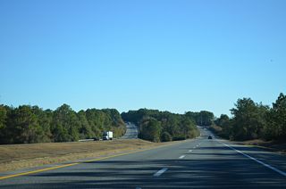
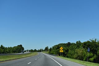
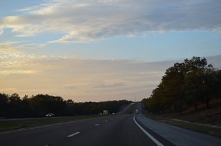
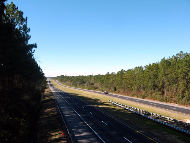
Westerly view of Interstate 10 between the County Road 280A overpass and U.S. 331 (Veterans Memorial Boulevard) in south DeFuniak Springs. - 07/03/2009
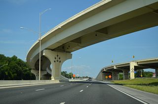
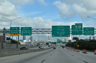
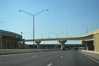
Interstate 10 at the Big I Interchange with I-95 between the Mixon Town and Riverside neighborhoods in Jacksonville, Florida. - 07/03/2009
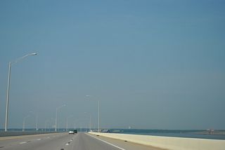
Interstate 10 Escambia Bay Bridges
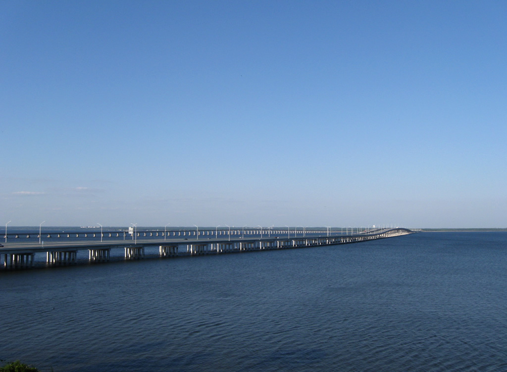
An eastward view of Interstate 10 spreading across Escambia Bay. - 09/27/2008
For an in depth look at the Escambia Bay Bridges and the events that led to their collapse and replacement, see the Escambia Bay Bridge guide.
State Road 8
SR 8 is the state road counterpart for all 372.26 miles of Interstate 10 throughout Florida.
 scenes
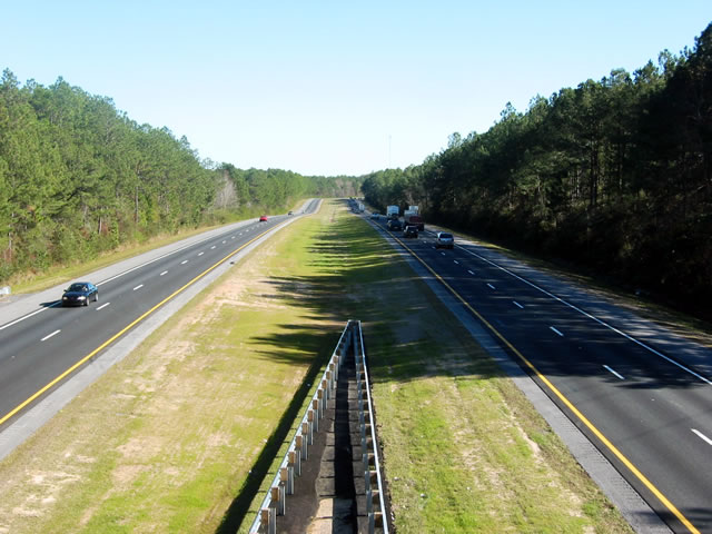
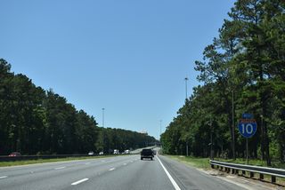
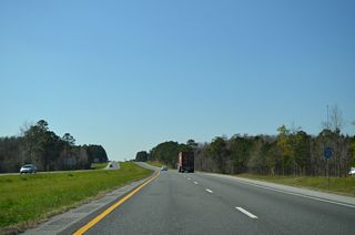
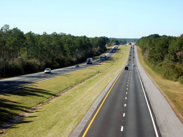
View of Interstate 10 from the Beulah Road (CR 99) overpass between mileposts one and two. Interstate 10 enters Florida with four lanes of freeway and pine forest frontage.
12/20/03
Westward view of the final mile of Interstate 10 from CR 99 (Beulah Road). I-10 departs the Sunshine State across the Perdido River into Alabama. A welcome center follows on the otherwise 18 mile exit less stretch.
12/20/03
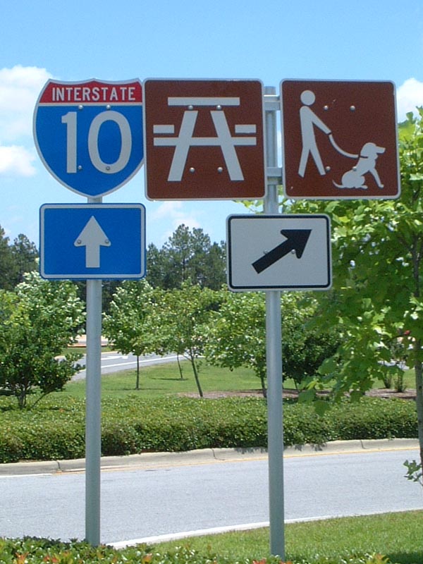
Interstate 10 shield posted within the parking area of the Florida Welcome Center. Free orange or grapefruit juice and Official Highway Maps are offered to motorists at the tourist information center.
06/23/01
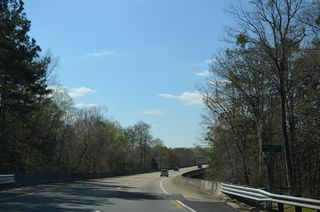
CR 280 (Bob Sikes Road) passes over Interstate 10 near Pleasant Ridge in Walton County. This view looks east at the freeway toward DeFuniak Springs.
07/03/09
CR 286 (Blueberry Drive) northbound on the approach to Interstate 10 (Exit 158) at Osochi. Blueberry Drive widens to four lanes through a diamond interchange with the freeway.
07/22/04
Interstate 10 shield assembly posted ahead of the eastbound on-ramp to Tallahassee, Lake City, and Jacksonville on CR 286 (Blueberry Drive) northbound.
07/22/04
The eastbound ramp onto Interstate 10 leaves CR 286 north. I-10 crosses the Chattahoochee River into Gadsden County just east of Exit 158.
07/22/04
Hammond Boulevard north at Interstate 10 east at Marietta in Jacksonville.
06/16/16
Crossing over I-10, Hammond Boulevard advances north to the westbound on-ramp for Baldwin, MacClenny and Lake City.
06/16/16
Hammond Boulevard was expanded into a four lane boulevard during work to construct a new parclo interchange (Exit 355) with I-10 between October 2013 and June 2016.
06/16/16
References:
- Cozart, Justin: Northern Florida (tropicalturnpikes.com).
- Florida's Interstates - A Half Century of Progress. Florida Department of Transportation, web page.
References
Federal Officials Kill Interstate Road Plan (1958, October 28). St. Petersburg Times, 7-A.
Photo Credits:
- Alex Nitzman: 12/20/03, 07/22/04
- AARoads: 06/23/01
- Brent Ivy: 07/03/09
- ABRoads: 06/16/16
Connect with:
Page Updated Friday October 21, 2022.