
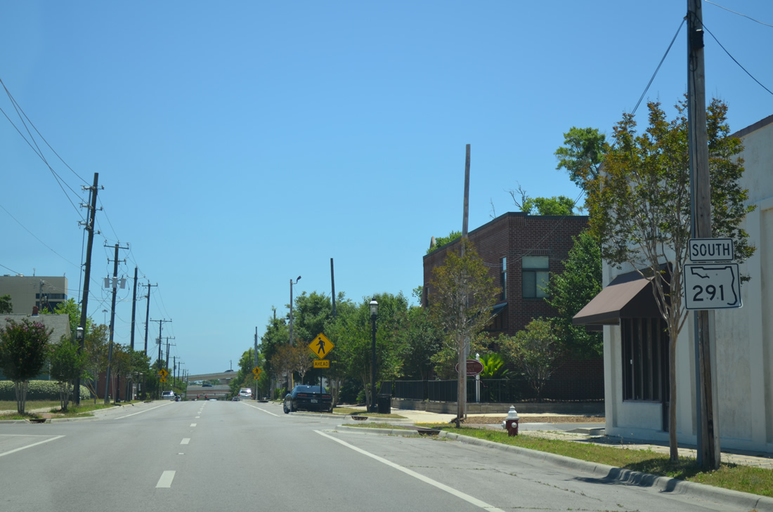
State Road 291 South

 South
South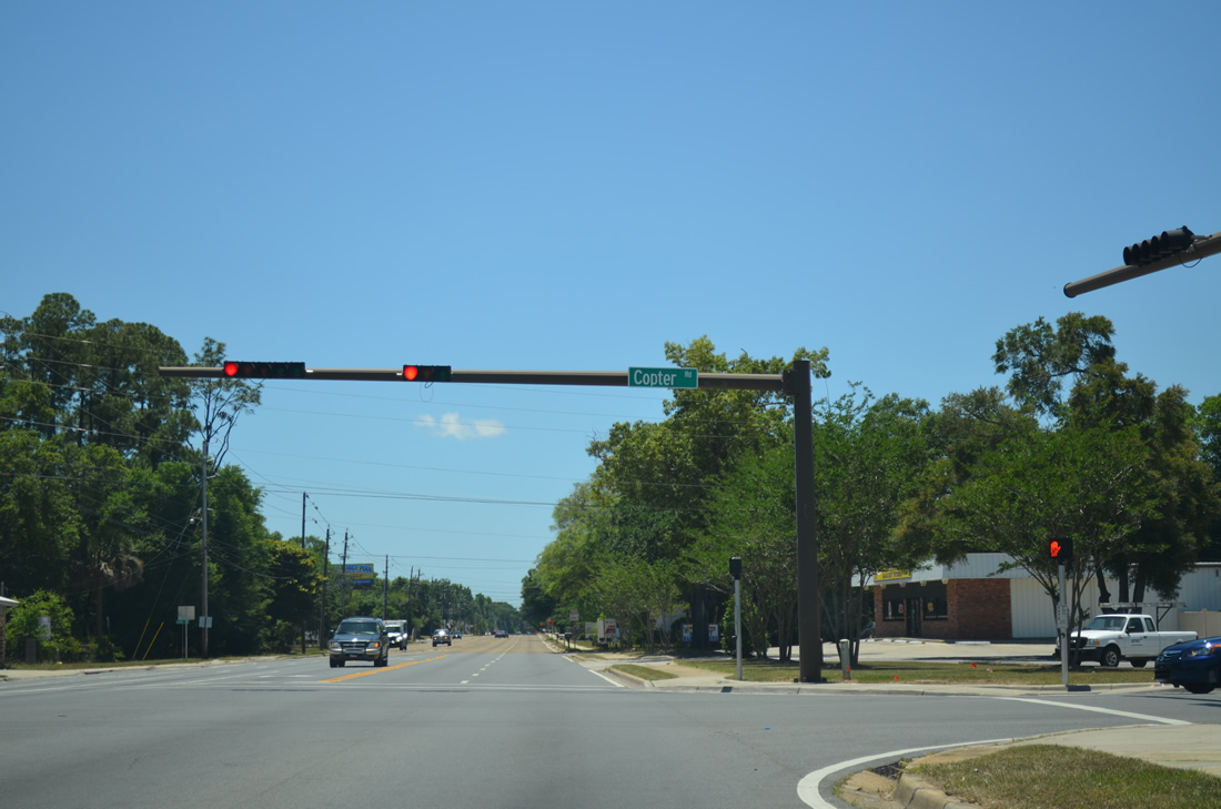
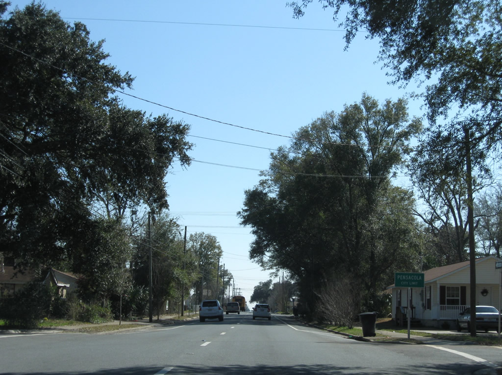
A short distance south of the split with Nine Mile Road west is the signalized intersection with Copter Road. Copter Road spurs east from U.S. 90 Alternate (Nine Mile Road) to Elyson Industrial Park. The local road was County Road 498 originally.
05/27/13
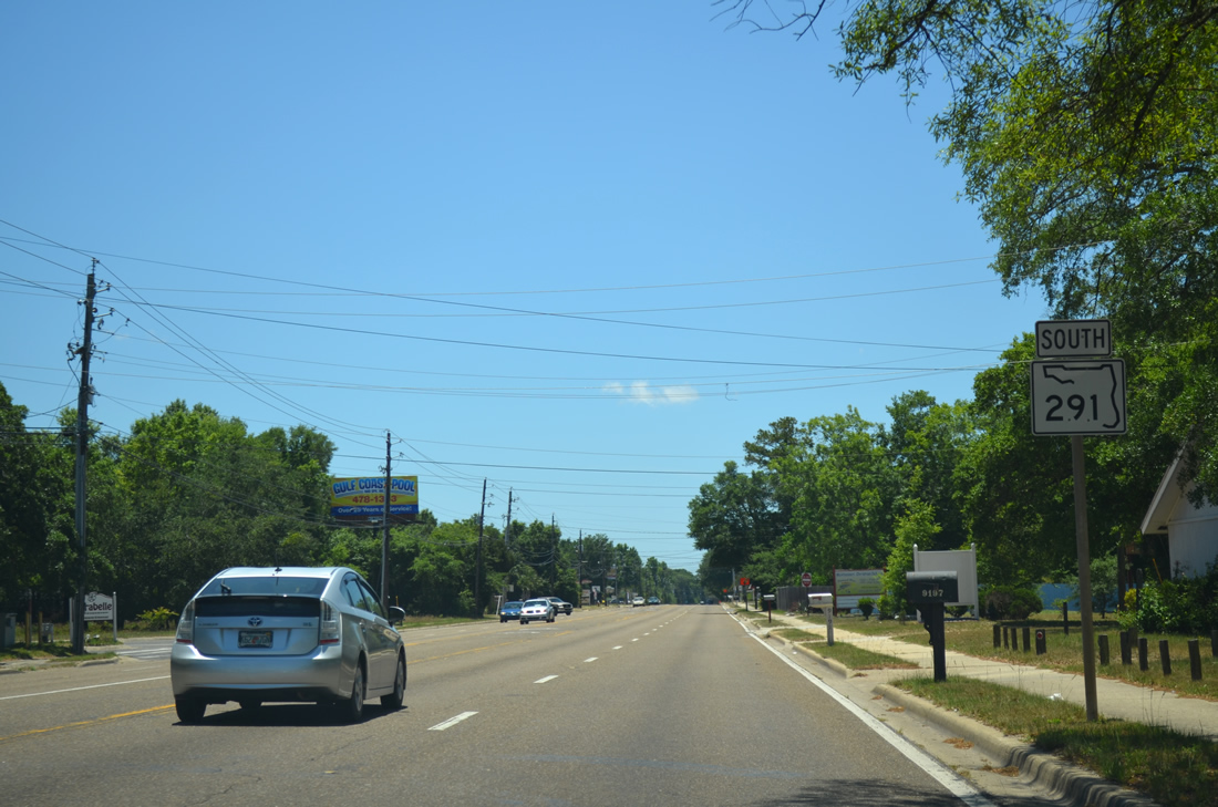
The first shield of SR 291 south to appear along Davis Highway lies south of Copter Road.
05/27/13
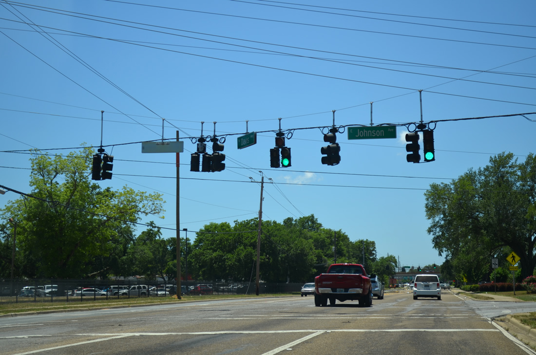
Johnson Avenue provides a residential through road west to Jernigan Road and east to Olive Road near Escambia Bay. The road also serves adjacent West Florida Hospital.
05/27/13
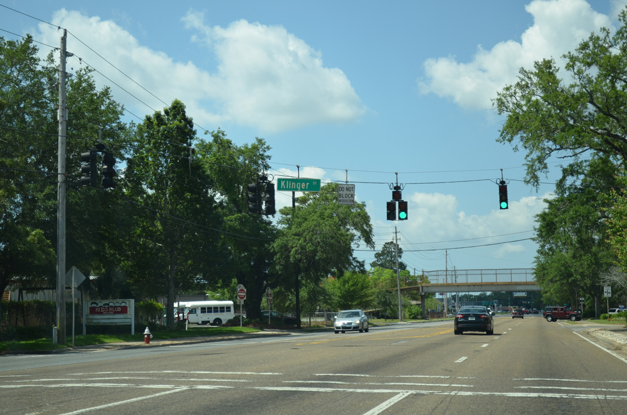
A signalized intersection follows on SR 291 south at the main entrance to West Florida Hospital and Klinger Street, a residential side street.
05/17/14
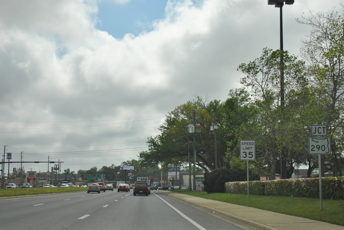
University Parkway and SR 291 (Davis Highway) combine just south of West Florida Hospital. Just beyond there is the intersection with Olive Road. Olive Road was State Road 290 until June 30, 2011, when the state swapped maintenance of the roadway with Escambia County in exchange for an extension of State Road 750 west to U.S. 29.
03/20/12
05/27/13
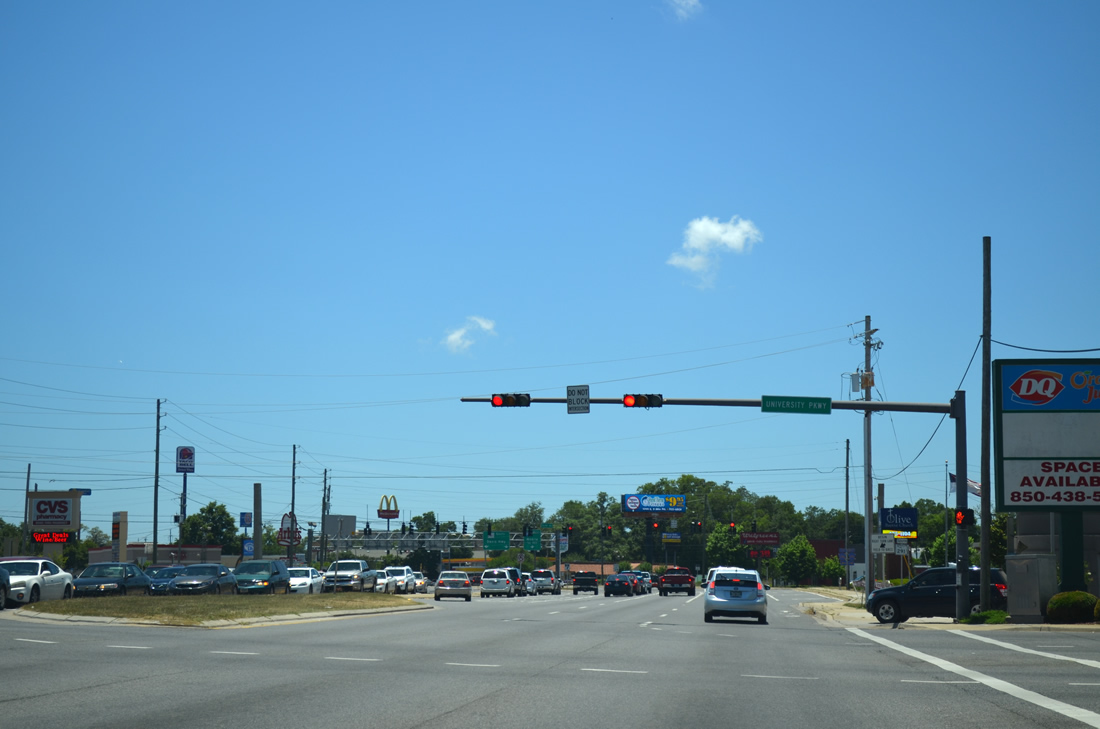
University Parkway constitutes a four lane divided highway northward to the University of West Florida campus. The arterial doubles as commuter route to Nine Mile Road (U.S. 90 Alternate) from Interstates 10 and 110.
05/27/13

Entering the busy intersection with Olive Road (former SR 290) along SR 291 (Davis Highway) south.
03/20/12
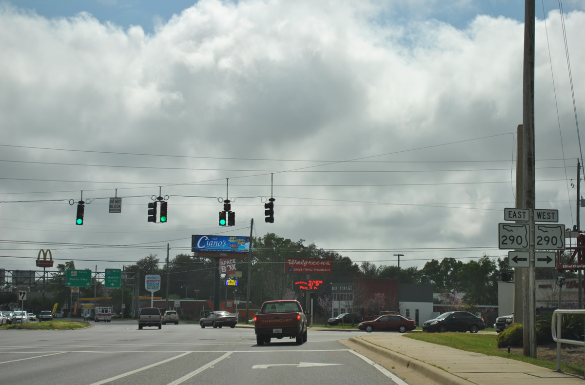
Olive Road, former SR 290, travels west to Palafox Street (County Road 95A) and Ensley and east to U.S. 90 (Scenic Highway) off Macky Bay.
03/20/12
05/17/14
A 2002 reconstruction project of Davis Highway between Olive Road and former University Mall resulted in the installation of two new sign bridges for the interchange with Interstate 10. The arterial was expanded to six overall lanes between former SR 290 and the parclo interchange with I-10 (Exit 13).
03/20/12
A 2013 project expanded the ramp for Interstate 10 west to two lanes, resulting in a sign changes along SR 291 south.
05/17/14
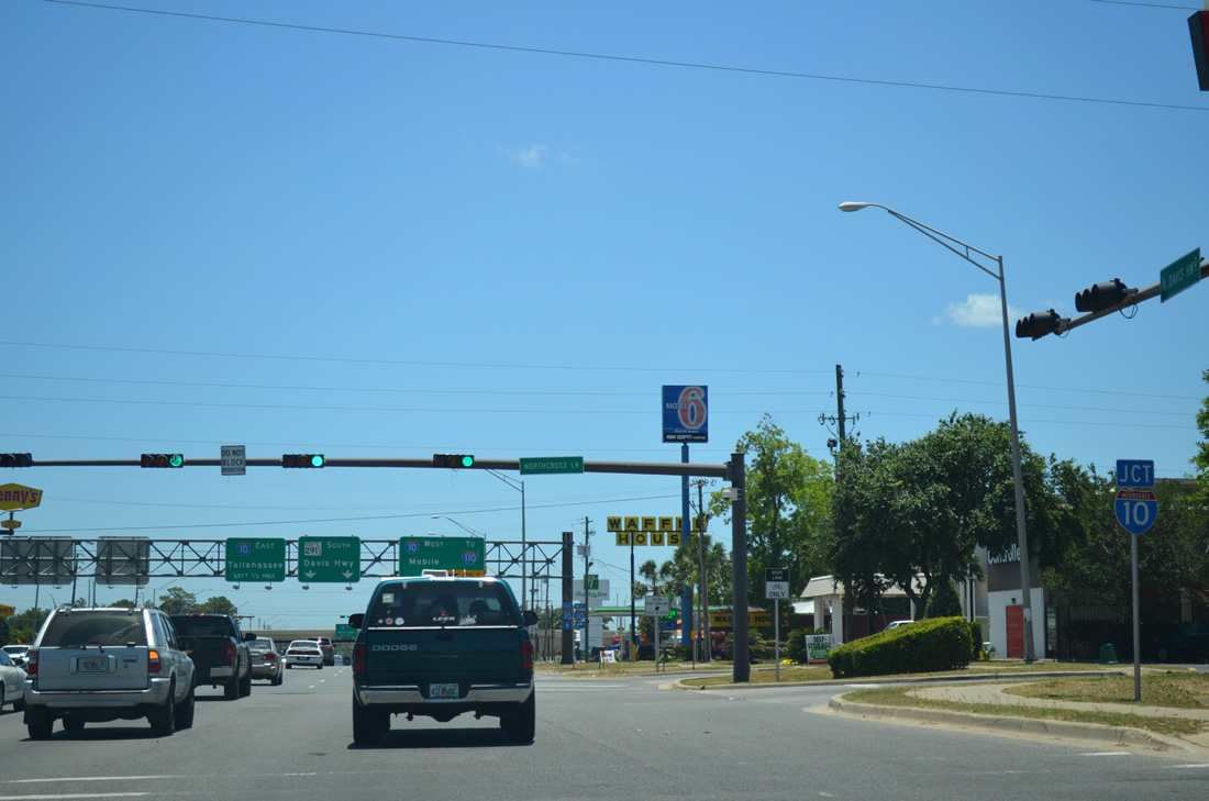
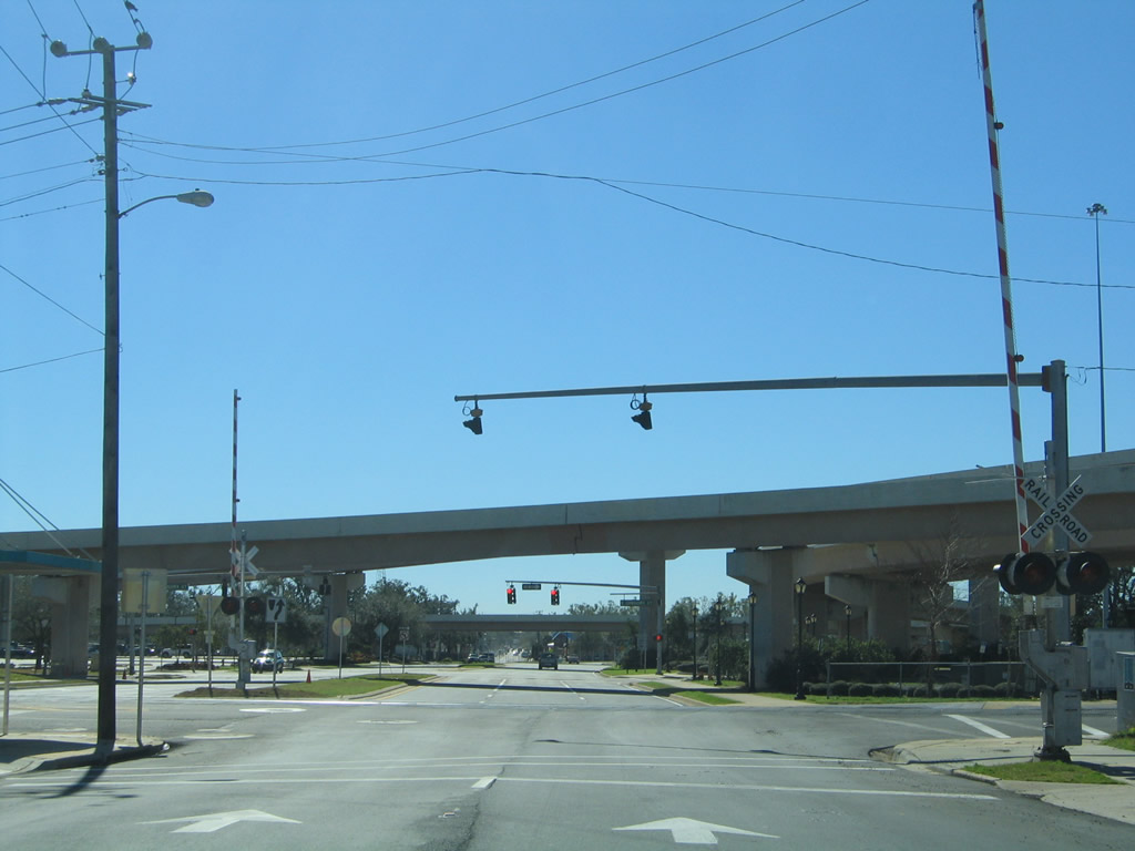
A signalized intersection with Northcross Lane serves a number of adjacent businesses before SR 291 (Davis Highway) meets Interstate 10.
05/27/13
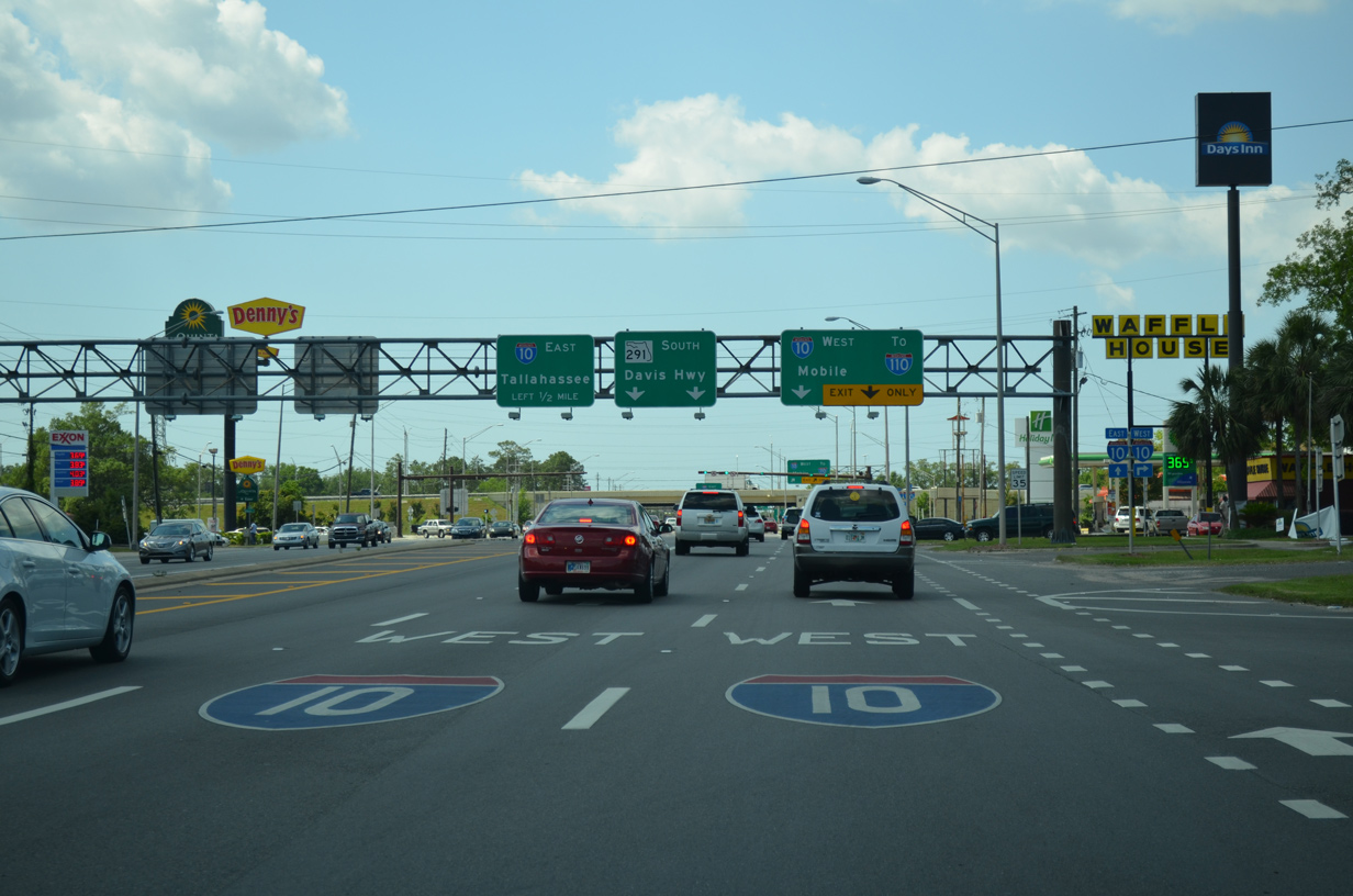
A set of painted shields accompany the 2013-lane reconfiguring along SR 291 south at Interstate 10. The number two lane is now optional for both Davis Highway south and I-10.
05/17/14
A new ramp opened in 1998 to augment some of the congestion from SR 291 south onto Interstate 10 west ahead of I-110. Expansion of I-10 between 2002 and 2008 added a collector distributor roadway for the 1998 ramp west to I-110 south, separating that movement from a new flyover onto I-110 south from the I-10 westbound mainline.
08/01/06
Further work during the 2002-08 project along Davis Highway widened the arterial to six through lanes below I-10 by expanding the southbound roadway with a dedicated lane for Interstates 10 west and 110 south.
05/17/14
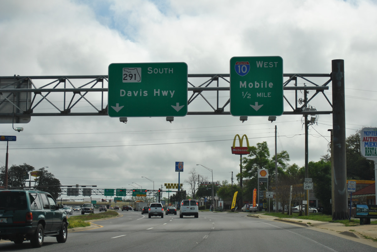
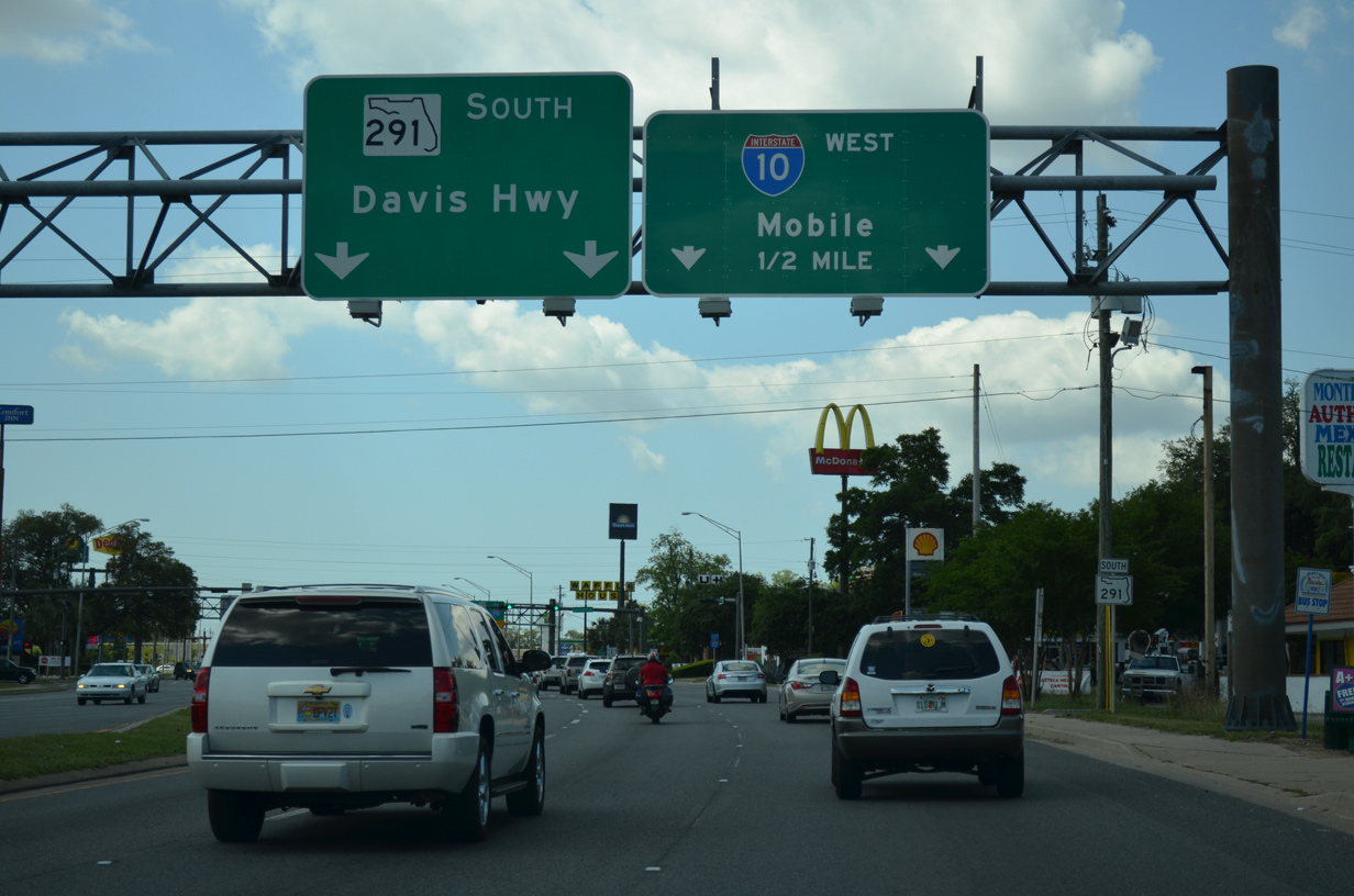
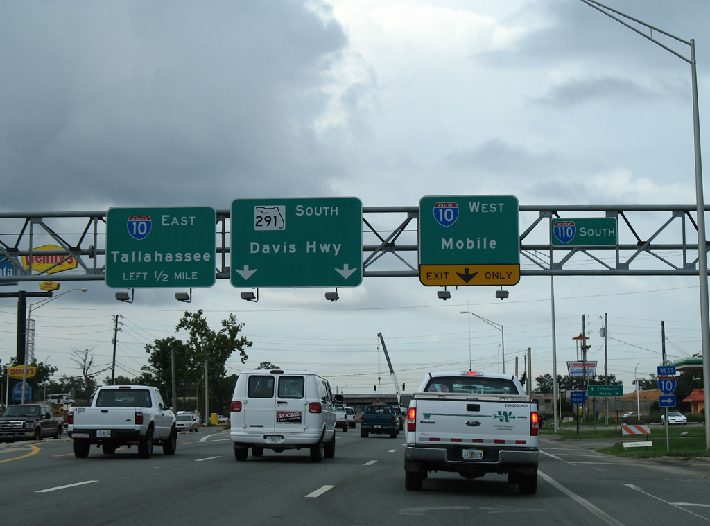
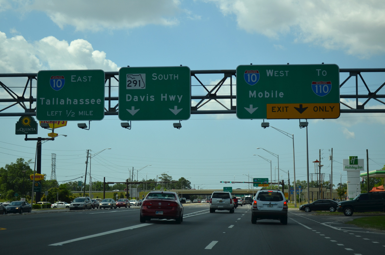
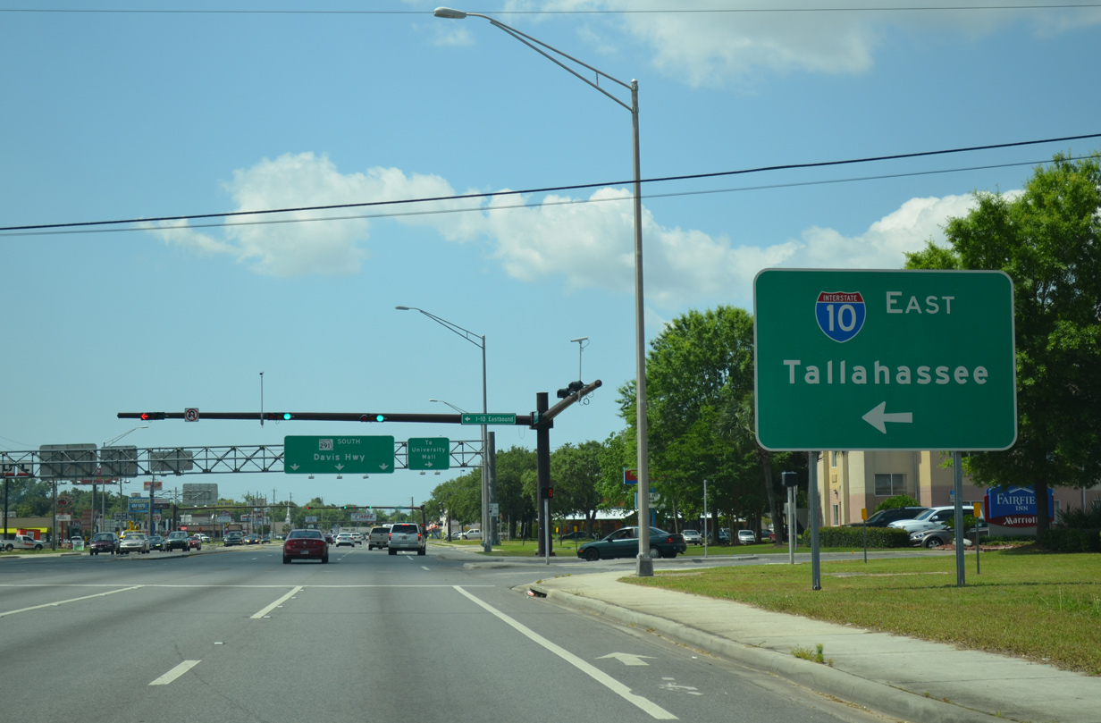
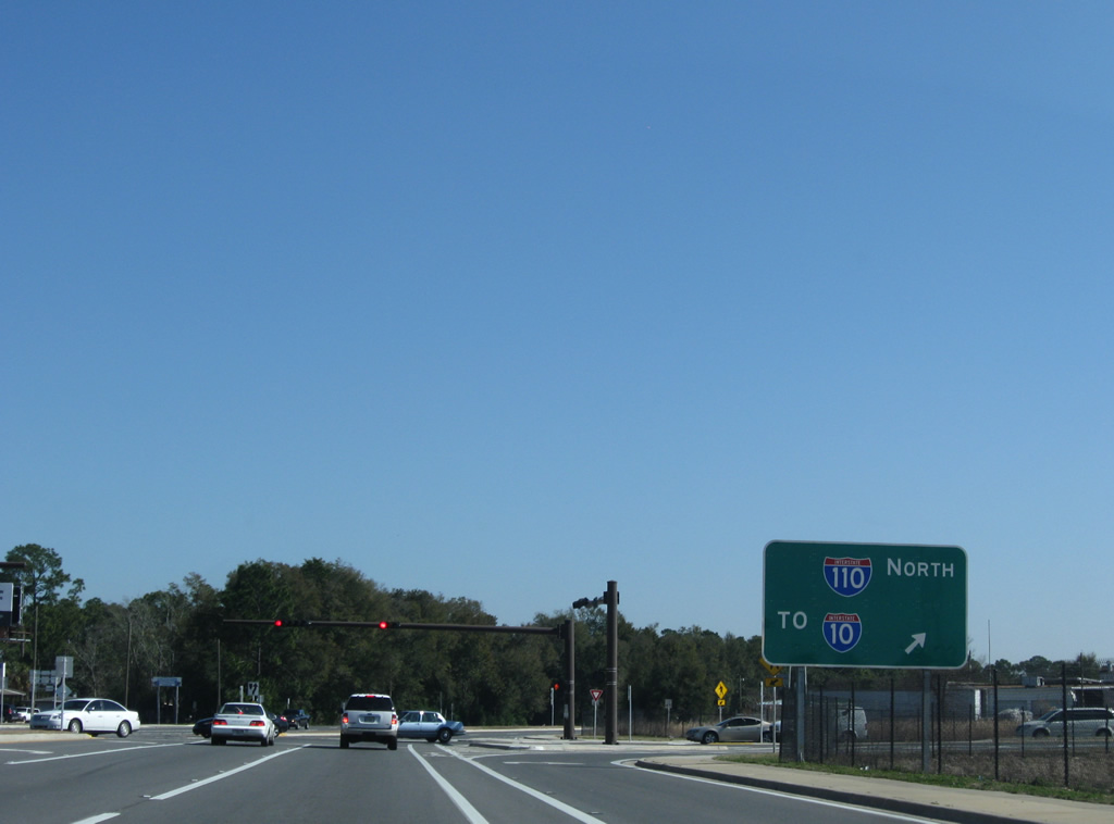
A two lane ramp departs SR 291 (Davis Highway) southbound for Interstate 10 west to Mobile and Interstate 110 south to Pensacola. Many commuters depart SR 291 here for I-110.
05/27/13
05/17/14
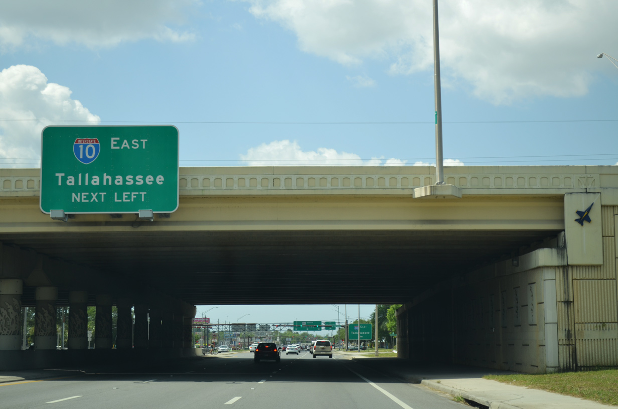
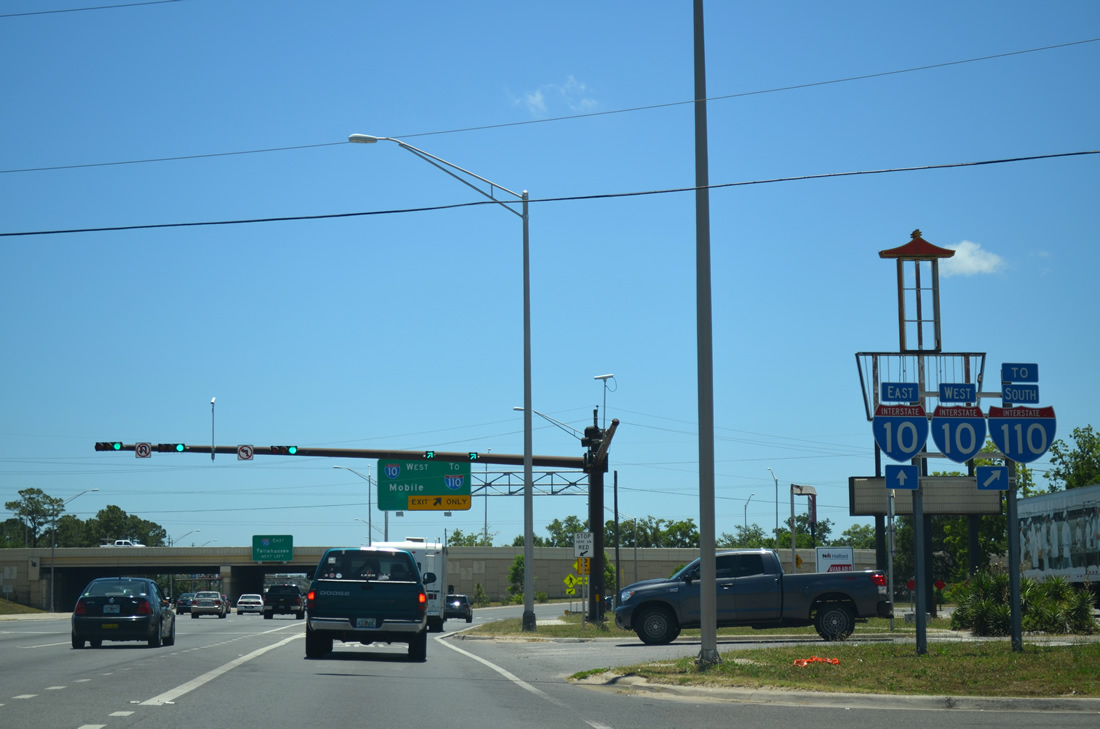
Continuing south through the folded diamond interchange with I-10 on SR 291. I-10 continues four miles to U.S. 90 (Scenic Highway) before crossing Escambia Bay to Santa Rosa County.
05/17/14
Tallahassee is a 188 mile drive along Interstate 10 east from Davis Highway.
05/17/14
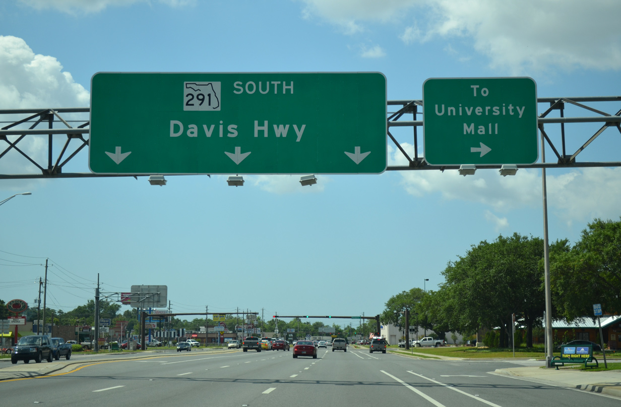
Just southwest of Interstate 10 was University Mall. Heavily damaged by Hurricane Ivan in 2004, all tenants left the retail center because of roof and water damage except for the anchor stores. The mall was rebranded as University Town Plaza by its owner and the two anchor stores remain in operation to this day.
Pictured here is a sign bridge at the first of three entrances to the facility from Davis Highway south.
05/17/14
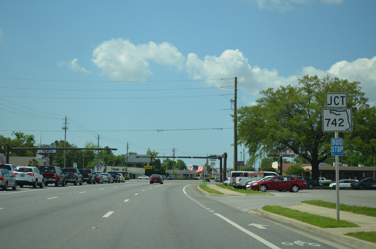
SR 742 (Creighton Road) crosses paths with SR 291 (Davis Highway) southeast of University Town Plaza. The east-west arterial runs west across I-110 to Burgess Road and east to SR 289 (Ninth Avenue) in northeast Pensacola.
05/17/14
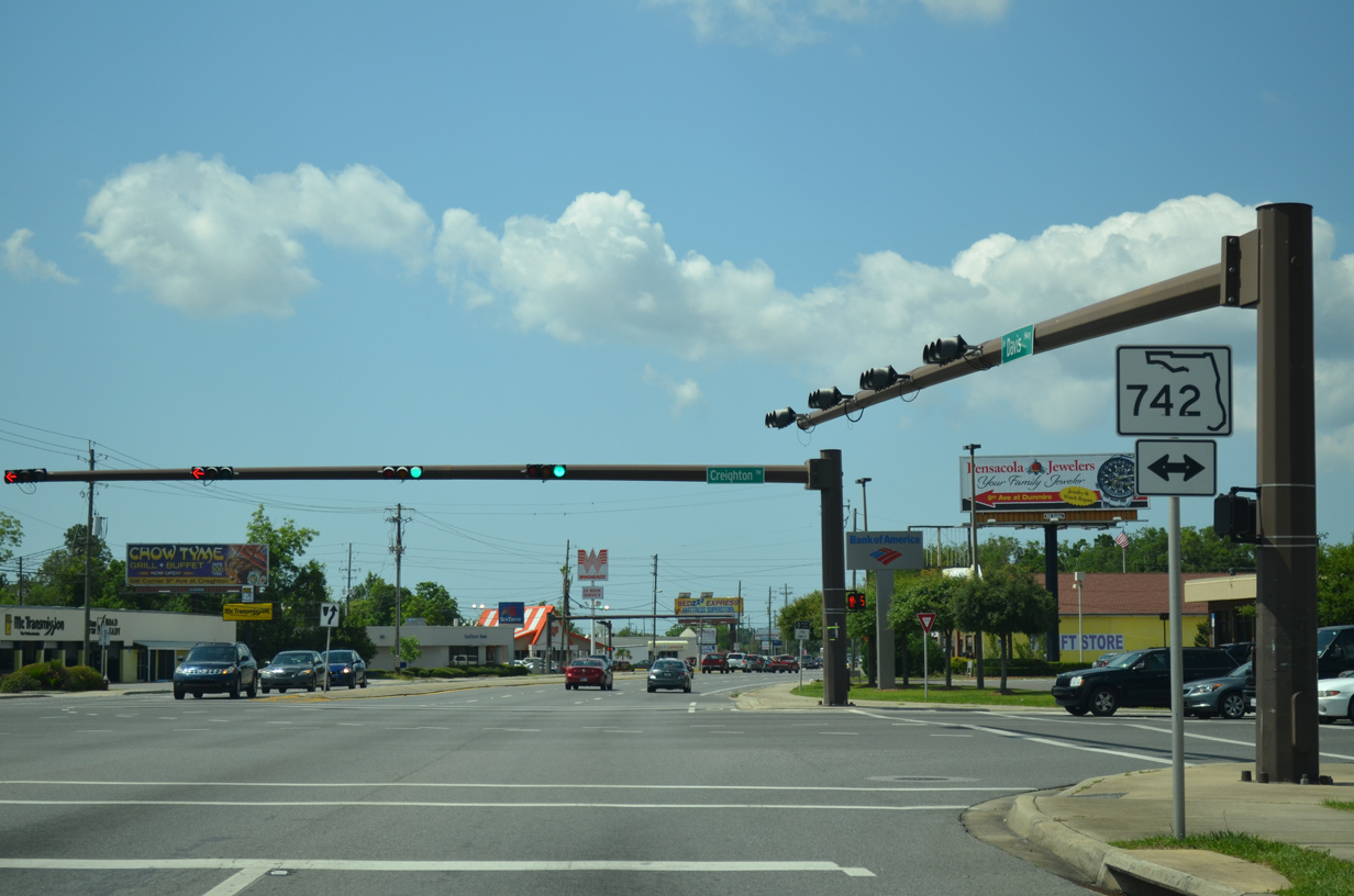
A 6.89 mile route, SR 742 travels west to U.S. 29, just south of I-10 (Exit 10) and east to U.S. 90 (Scenic Highway) near Gull Point off Escambia Bay.
05/17/14
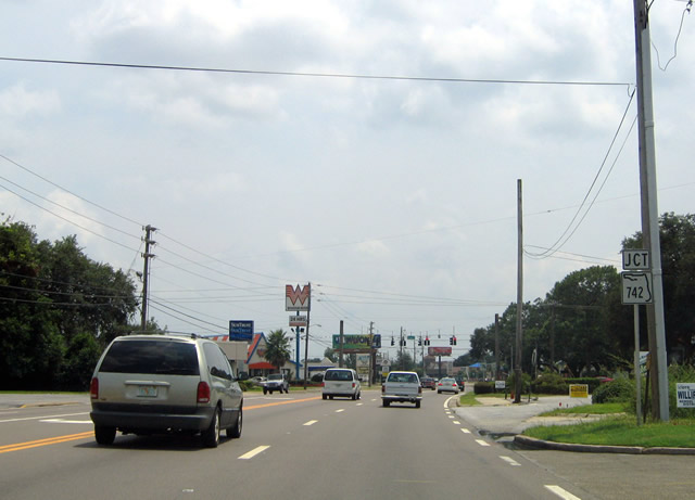
Expansion of Creighton Road to a five lane arterial from the former University Mall area to SR 289 (Ninth Avenue) was completed by 1996. This work was done in anticipation of the eventual relocation of State Road 742 north from Burgess Road. For a period of time, two segments of SR 742 were signed, both on Creighton and Burgess Roads from east of I-110 to Lanier Driver. This scene looks at the four lane version of Davis Highway ahead of Burgess Road.
07/19/04
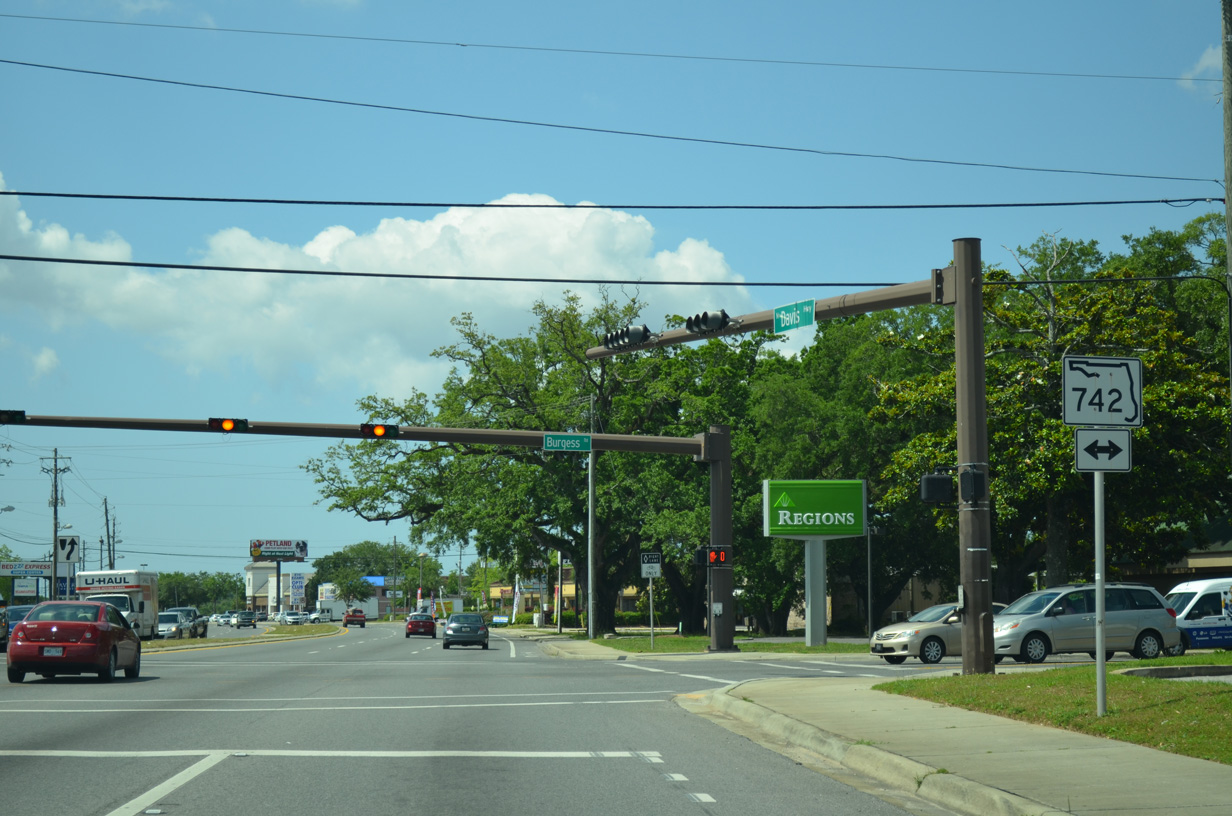
A SR 742 assembly remains in place along SR 291 south at Burgess Road, despite the decommissioning of this stretch of roadway. Burgess Road leads west to Plantation Road and east to Lanier Drive.
05/17/14
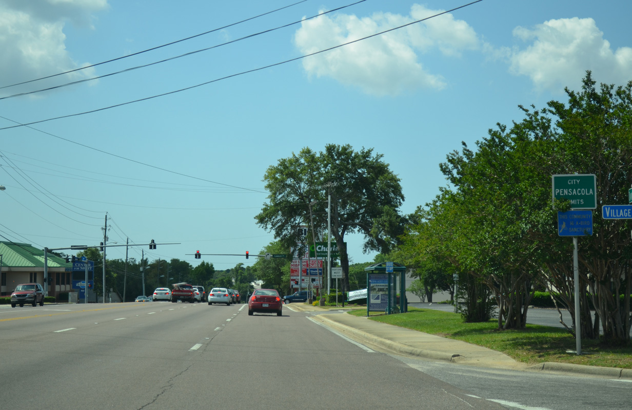
Davis Highway enters a notch of Pensacola south of Village Oaks Drive by Pensacola Square Shopping Center and Carpenter Creek.
05/17/14
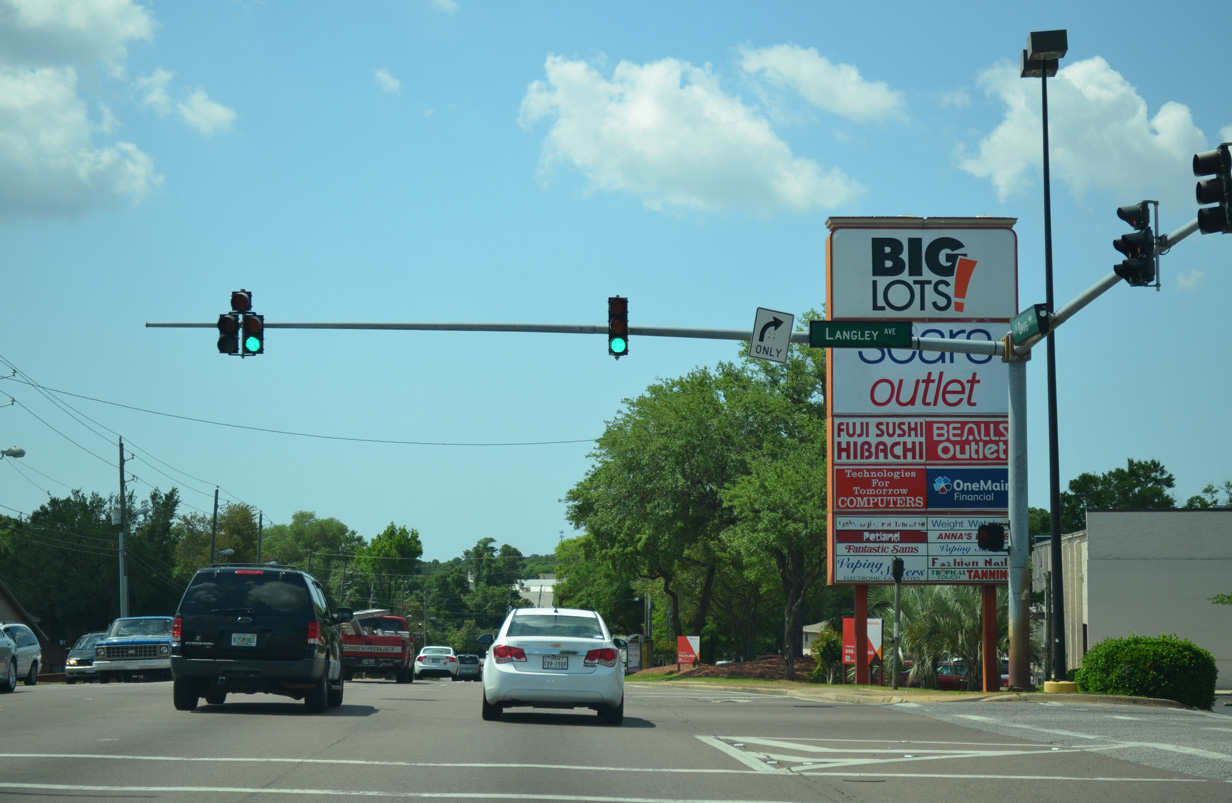
Langley Avenue ties into Davis Highway opposite Pensacola Square Shopping Center. The east-west avenue provides a through route to Ninth Avenue and the Scenic Heights area by U.S. 90. The road was extended west to SR 291 in 1996.
05/17/14
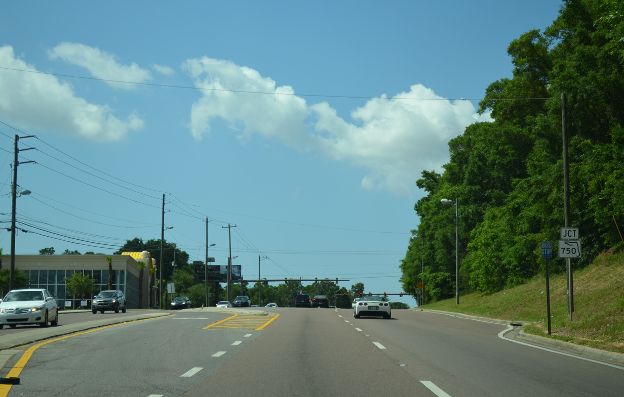
Approaching SR 750 (Airport Boulevard) along SR 291 south. Airport Boulevard leads west to a 2009-opened interchange with Interstate 110, U.S. 29 and W Street (CR 453).
05/17/14
SR 750 was extended west from SR 289 to U.S. 29 in 2011. The state road provides a direct link to Pensacola International Airport (PNS) east of 12th Avenue.
05/17/14
SR 291 leaves the city limits of Pensacola and the intersection with SR 750 (Airport Boulevard) by this reassurance shield.
11/17/12
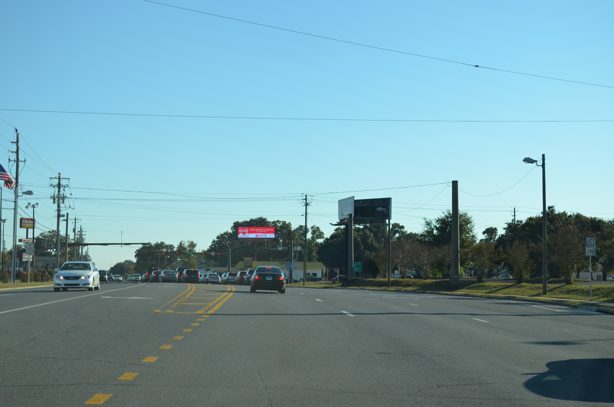
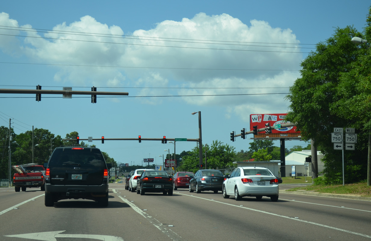
Approaching the busy intersection with SR 296 (Brent Lane) on Davis Highway southbound. SR 296 meets Interstate 110 directly west of SR 291.
11/17/12
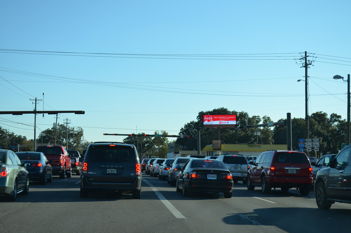
Brent Lane carries SR 296 west from Davis Highway and Interstate 110 to U.S. 29 and Beverly Parkway west. Eastward, SR 296 becomes Bayou Boulevard at Carpenter Creek en route to the Cordova Mall area and Bayou Texar in Pensacola.
11/17/12
Expansion of Interstate 110 between 2002 and 2009 included the revamp of the diamond interchange between the freeway and SR 295 (Fairfield Drive). Part of the work included construction of a new ramp onto I-110 north from Davis Highway southbound. This eliminated the left turn from SR 295 north onto I-110 north, allowing for longer turn lanes for Davis Highway.
02/23/10
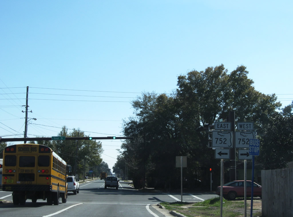
SR 291 splits into a one way street couplet of Dr. Martin Luther King, Jr. Boulevard (south) and Davis Street (north) at Hart Drive after the I-110 on-ramp. SR 752 (Texar Drive) a short route from Fairfield Drive and U.S. 29 to the west and SR 289 (9th Avenue) to the east, crosses the state road next.
02/23/10
Martin Luther King, Jr. Boulevard formally enters the city limits of Pensacola at Leonard Street.
02/23/10
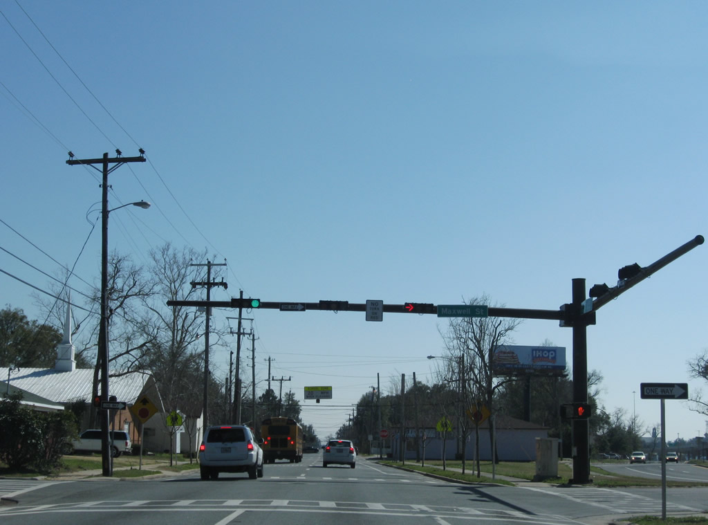
Maxwell Street flows west from 12th Avenue and the Clubbs neighborhood to a half diamond interchange with Interstate 110 north adjacent to SR 291 south.
02/23/10
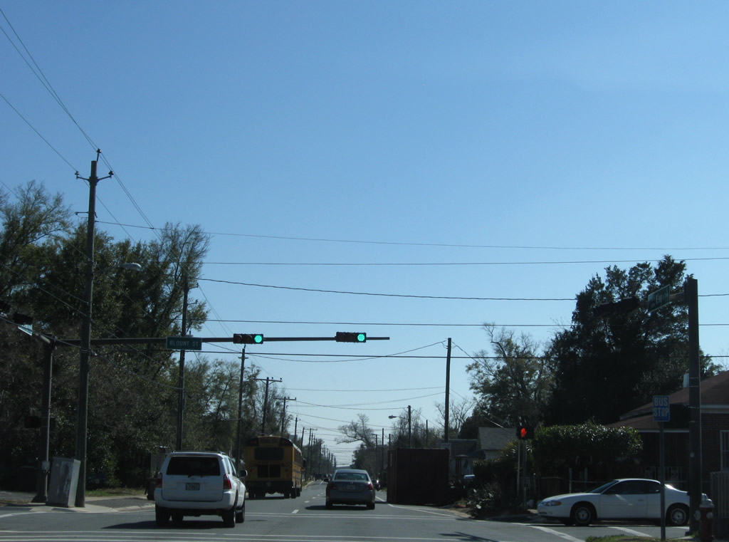
Blount Street heads east from A Street under the Interstate 110 viaduct to intersect SR 291 (Dr. Martin Luther King, Jr. Boulevard) south at this traffic light. The street continues east to Bayview Park along Bayou Texar.
02/23/10

An overhead precedes the SR 291 junction with U.S. 90/98 (Cerventes Street). U.S. 90/98 overlap east to Ninth Avenue and west to Pace Boulevard.
02/23/10
The final shield of SR 291 south follows Cerventes Street.
05/27/13
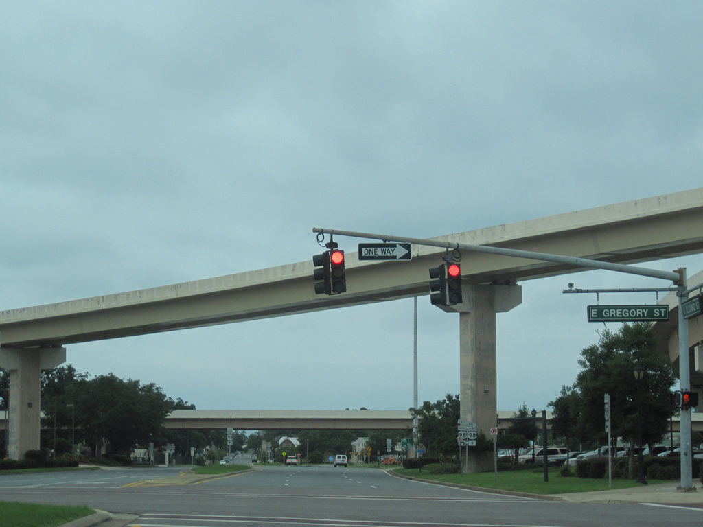
Southbound SR 291 (Alcaniz Street) intersects Wright Street at a CSX Railroad crossing. Wright Street carries SR 291 northbound one block east to Davis Street north. There are no signs for SR 291 posted here or at Gregory Street however.
01/31/06
SR 291 ends at the U.S. 98 Business westbound turn from Gregory Street to Alcaniz Street. The business route turns west in two blocks for Garden Street and the central business district. Flyover ramps associated with Interstate 110 travel overhead.
08/30/10
Photo Credits:
- Alex Nitzman: 07/19/04, 01/31/06, 08/01/06, 03/20/12, 05/27/13
- ABRoads: 02/23/10, 08/30/10, 11/17/12, 05/17/14
Connect with:
Page Updated Wednesday November 19, 2014.