
State Road 292
Beginning at the intersection of Perdido Key Drive and Gongora Drive, State Road 292 connects Perdido Key with Pensacola. A mileage swap with Escambia County in 2019 dropped the western 6.20 miles of the state road to Alabama Route 182 at the state line for a 2.59 mile section of County Road 99 and a future interchange joining it with Interstate 10. Route markers for SR 292 was removed by Fall 2019 at the state border.
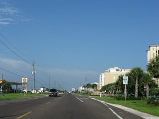
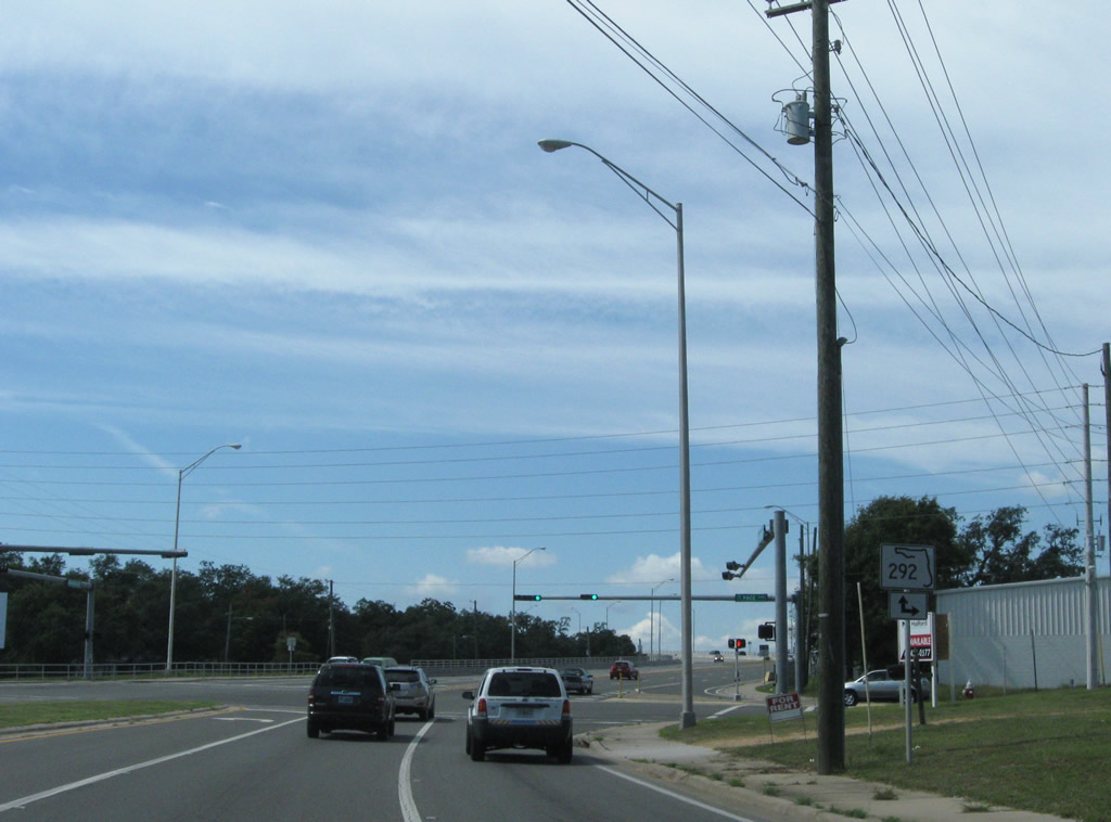
Perdido Key Drive lead the state road eastward along Perdido Key by a number of condominium towers and through Perdido Key State Park. Intersecting Johnson Beach Road, SR 292 curved north to the Escambia County mainland at Gulf Beach. The state road resumes across the 1974-built Theo Baars Bridge spanning the Intracoastal Waterway. SR 292 becomes Sorrento Road from Gulf Beach Highway (CR 292A) by Big Lagoon State Park, to Blue Angel Parkway (SR 173). SR 292 overtakes Gulf Beach Highway from CR 292A near Pleasant Grove, advancing eastward by a network of residential streets along Bayou Grande into unincorporated Warrington.
Barrancas Avenue curves northeast from Navy Boulevard (SR 295) as a multi-lane arterial, carrying SR 292 into Pensacola. A new high-level bridge was constructed for SR 292 across Bayou Chico in 1998, realigning Barrancas Avenue away from a draw span over the water to the southeast. Pace Boulevard continues SR 292 north from Barrancas Avenue to U.S. 29 near Brent. This includes a nine block overlap with U.S. 98 between Garden and Cerventes Streets in the Pensacola city limits. SR 292 overall measures 17.44 miles.
Florida State Road 292 Guides
East / North - 31 photos
West / South - 35 photos
 scenes
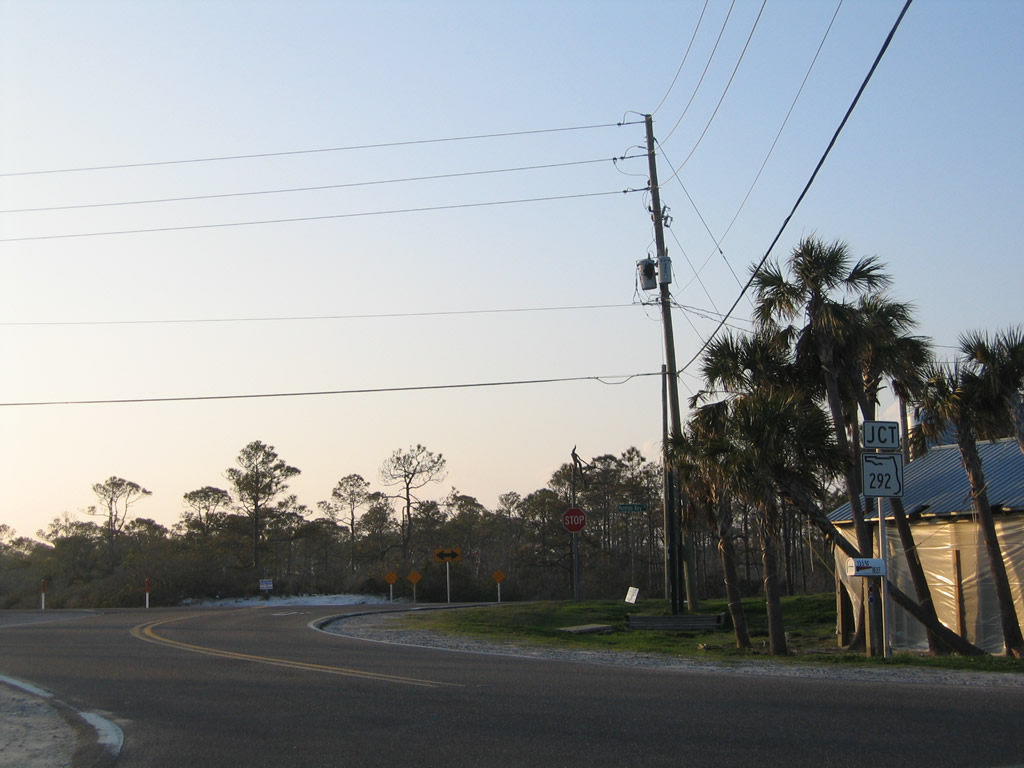
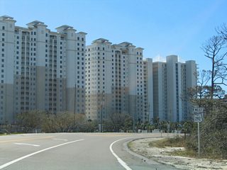
Johnson Beach Road spurs east from SR 292 (Perdido Key Drive) to a number of condominium high rises and the entrance to the Gulf Islands National Seashore Perdido Area on Perdido Key. This scene looks at the west end of the roadway at SR 292.
01/31/06

Barrancas Avenue veers southwest from U.S. 98 Business (Garden Street) to intersect SR 292 at its turn from Pace Boulevard onto the Bayou Chico Bridge.
10/01/09
SR 292 overtakes Barrancas Avenue west to Warrington. Pace Boulevard continues south to a cul-de-sac, superseding the original Barrancas Avenue alignment to the east. Stub ends remain from the former draw bridge over Bayou Chico along old SR 292.
10/01/09
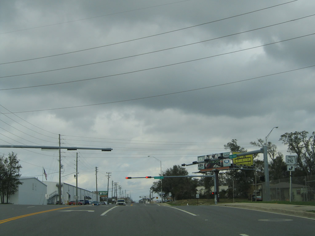
Pace Boulevard north at the intersection with SR 292 (Bayou Chico Bridge) east and Barrancas Avenue west. SR 292 joins Pace Boulevard from here to Brent.
01/31/06
Photo Credits:
- Alex Nitzman: 01/31/06
- ABRoads: 10/01/09
Connect with:
Page Updated Tuesday May 12, 2020.