
Interstate 5 South - Portland

Interstate 5 southbound in Multnomah County travels through the city of Portland.
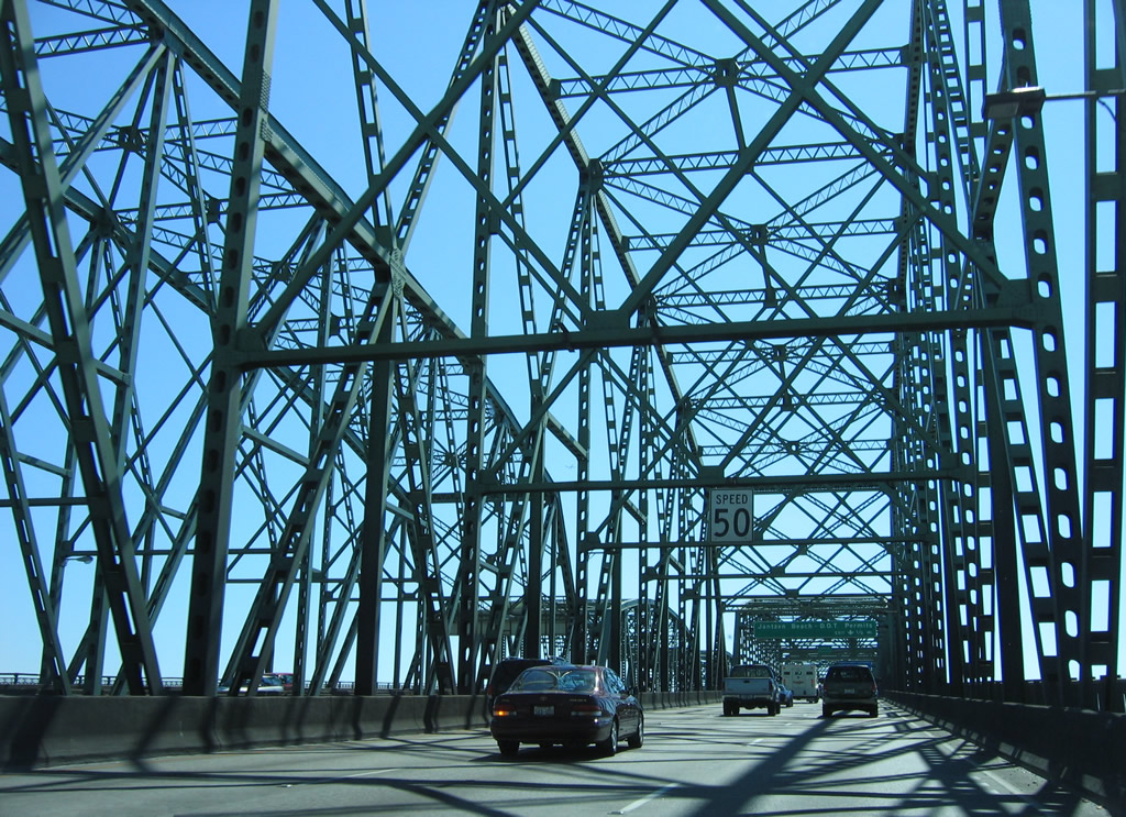
Entering Oregon, Interstate 5 southbound advances with three lanes on the Interstate Bridge. Speed limits are just 50 mph across the draw bridge that opened in 1958.
08/27/06
A folded diamond interchange (Exit 308) joins I-5 with Hayden Island Drive and Tomahawk Island Drive just beyond the south end of the Interstate Bridge on Hayden Island.
08/27/06
Arriving at the city of Portland, Interstate 5 crosses over Friendly Reach along the Columbia River onto Hayden Island.
08/27/06
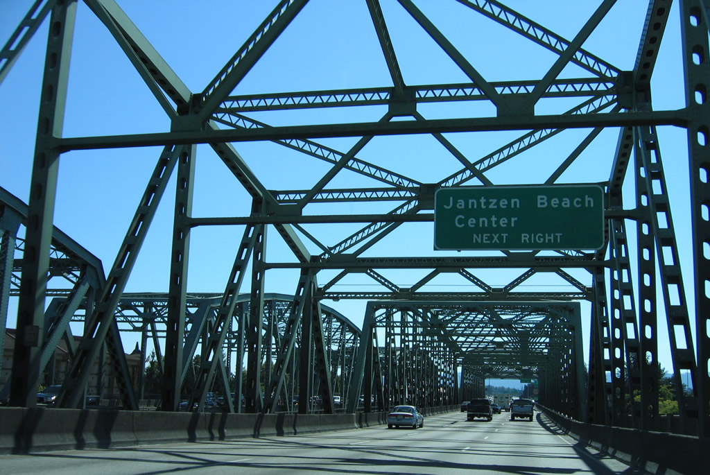
Located west of Exit 308 on Hayden Island is the Jantzen Beach Center. Since Oregon has no sales tax, the big box retail center is popular with customers from Washington.
08/27/06
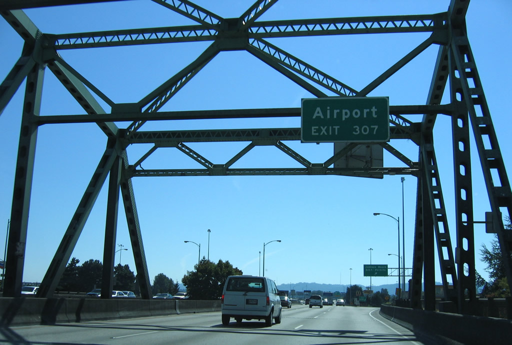
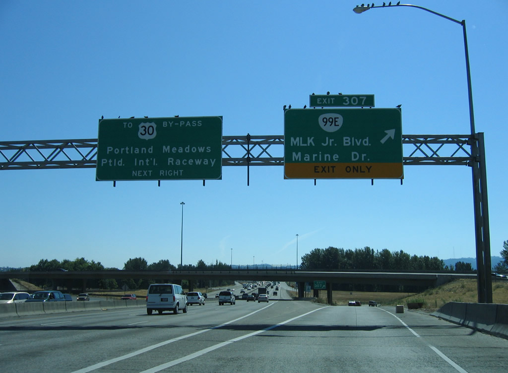
Travelers bound for Portland International Airport (PDX) that did not either take Washington State Route 14 east or I-205 south from I-5 south are directed onto OR 99E south to U.S. 30 Bypass east from Exit 307.
08/27/06
Tomahawk Island Drive stems east from the exchange with Hayden Island to the marinas on Tomahawk Island. Beyond Jantzen Beach Center, Hayden Island Drive extends west to the undeveloped portion of the island.
08/27/06
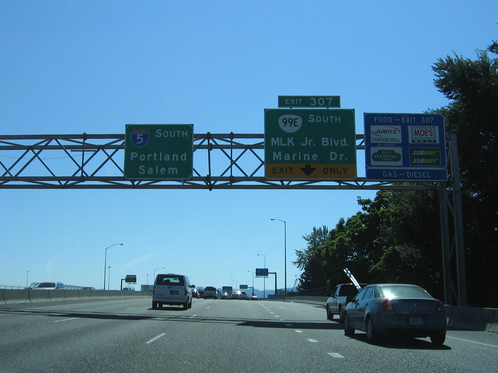
Interstate 5 spans North Portland Harbor south from Hayden Island to Exit 307 with OR 99E (Martin Luther King, Jr. Boulevard) south and unsigned OR 120 (Marine Drive) west.
08/27/06
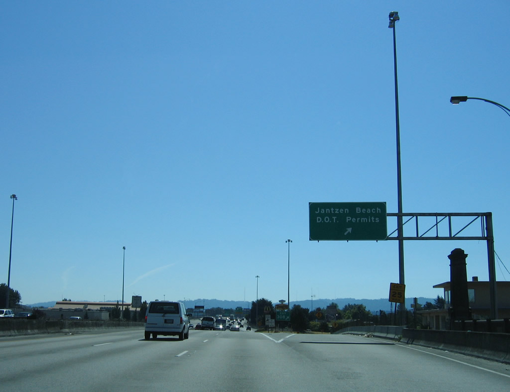
A single lane ramp serves both OR 99E south and Marine Drive west at Exit 307. Marine Drive serves the Portland Metro Expo Center at West Delta Park. East Delta Park lines the east side of Interstate 5, south of Martin Luther King, Jr. Boulevard.
08/27/06
OR 99E travels 2.25 miles southeast to U.S. 30 Bypass (Lombard Street) through the East Columbia neighborhood. There OR 99E becomes locally maintained en route to Division Street east of the city center. As is no direct access from I-5 south, motorists are directed to U.S. 30 Bypass via Denver and Interstate Avenues south from Exit 306.
08/27/06
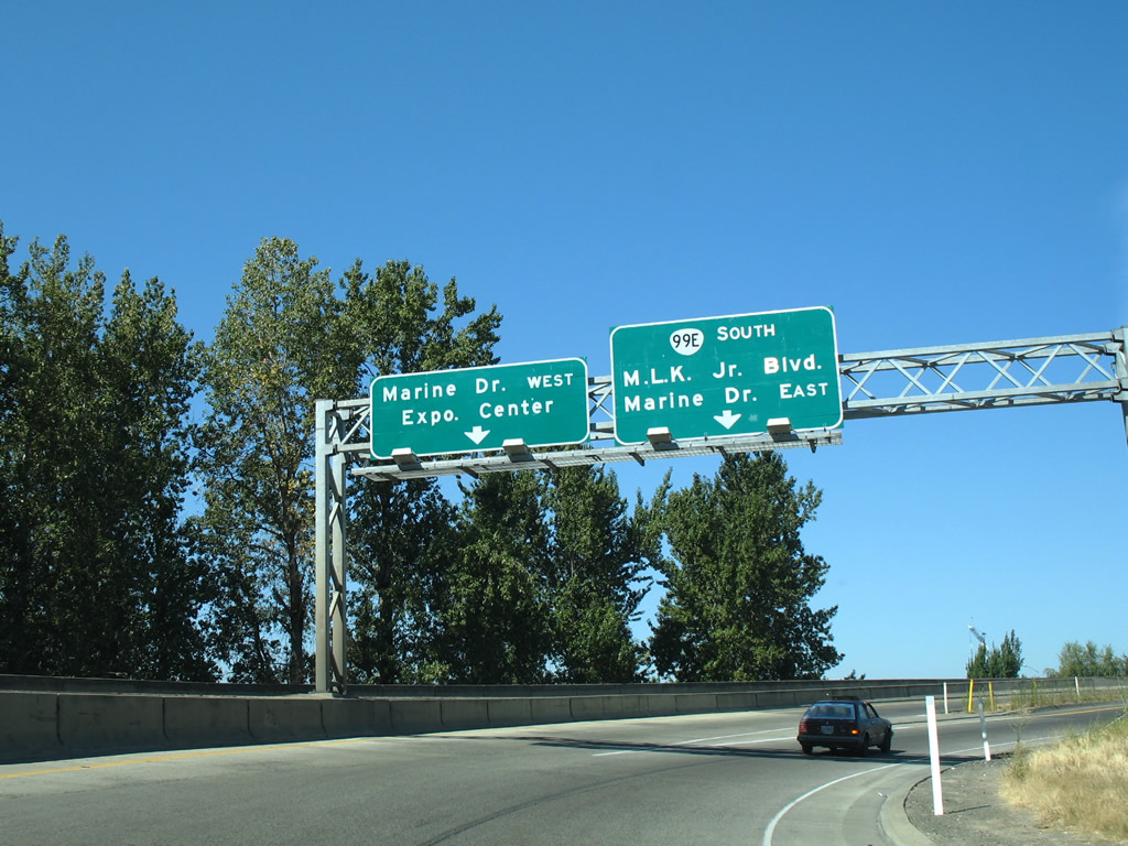
Marine Drive lines North Portland Harbor west to North Portland and industrial areas on Pearcy Island. East from Exit 307, Marine Drive heads to Faloma and Broughton Beach.
08/27/06
Exit 307 ties into Marine Drive across from the northbound entrance ramp onto Hayden Island. Marine Drive splits with OR 99E (MLK, Jr. Boulevard) east of the exchange.
08/27/06
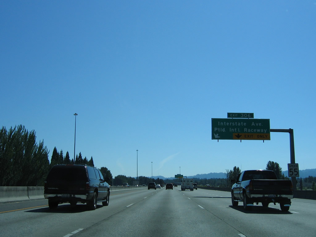
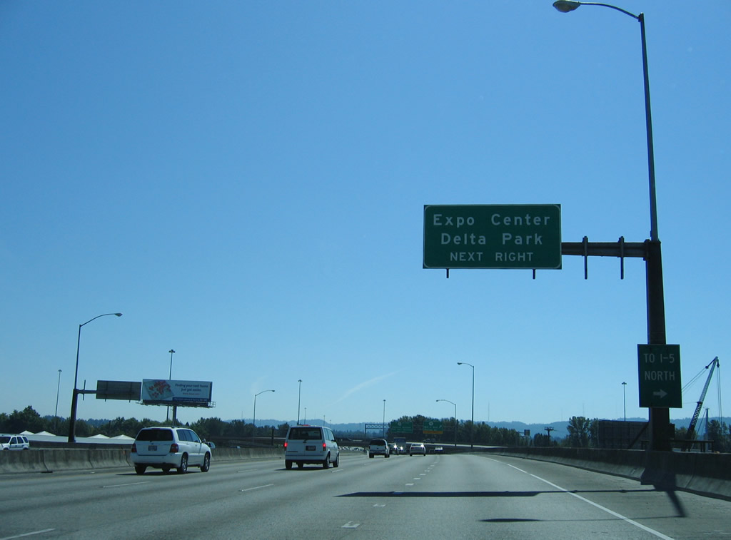
Continuing south, I-5 runs along West Delta Park to Portland International Raceway and Denver Avenue (former OR 99W). Denver Avenue branches southwest from Exit 306 to the Kenton neighborhood of Portland, becoming Interstate Avenue south of Columbia Boulevard.
08/27/06
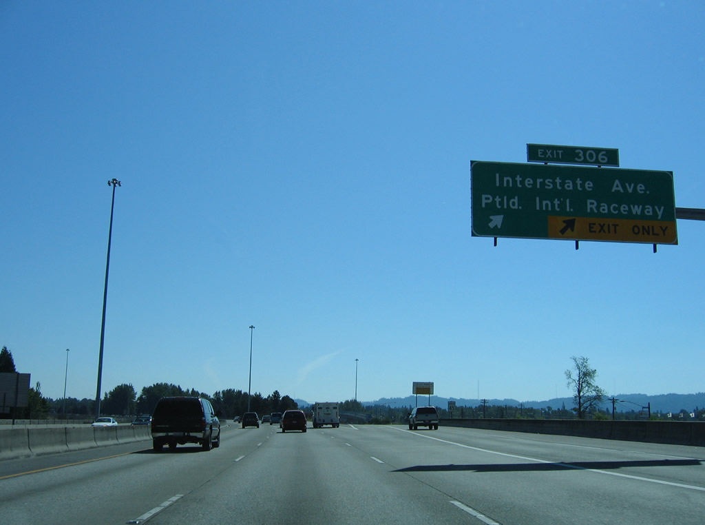
Denver Avenue (former OR 99W) separates from I-5 south at a wye interchange (Exit 306). A parclo interchange nearby joins Denver Avenue with Victory Boulevard and Expo Road at Portland International Raceway. Interstate Avenue (former U.S. 99W) parallels I-5 (Minnesota Freeway) south through Arbor Lodge and Overlook.
08/27/06
Southbound confirming marker for Interstate 5 posted at the Victory Boulevard underpass.
08/27/06
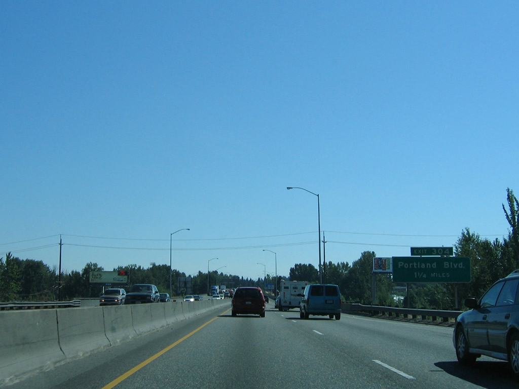
Progressing south to Exit 304 (Rosa Parks Way / Portland Boulevard), Interstate 5 crosses Columbia Slough.
08/27/06
A wye interchange connects Interstate 5 north with Columbia Boulevard south of Columbia Slough.
08/27/06
The diamond interchange (Exit 304) with Rosa Parks Way follows the partial exchange with U.S. 30 Bypass (Lombard Street) on I-5 south. Rosa Parks Way meets Interstate Avenue (old U.S. 99W) two blocks to the west and continues from there to Willamette Boulevard. Willamette Boulevard winds westward along Mocks Crest to the University of Portland.
08/27/06
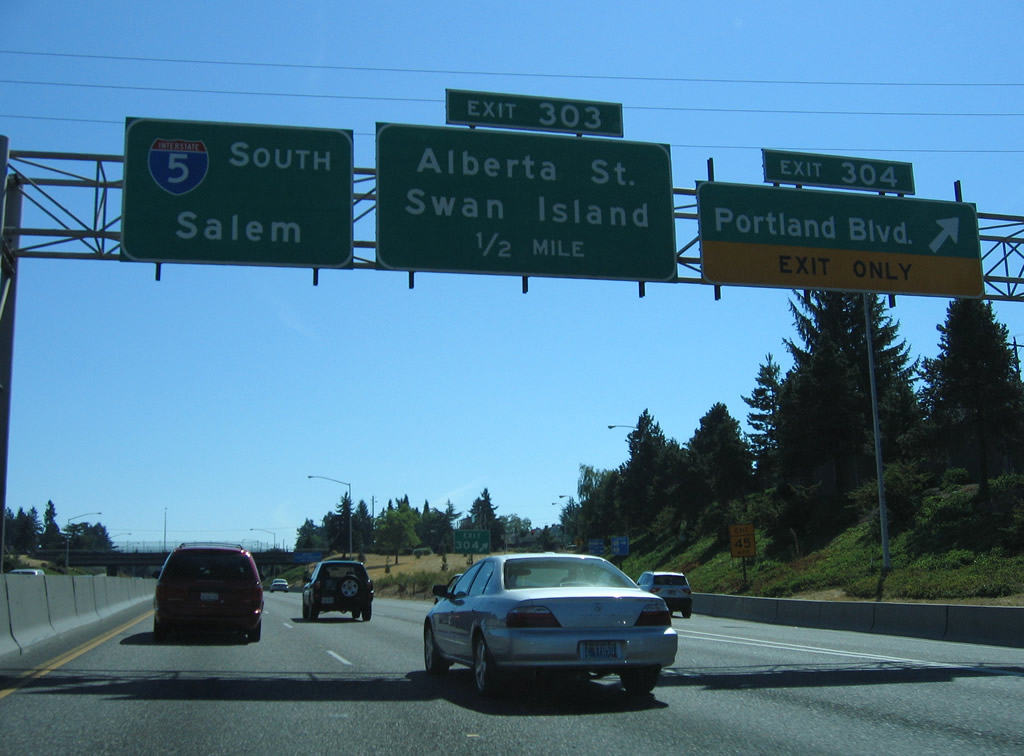
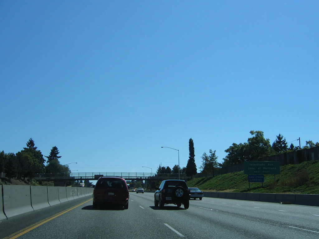
Exit 304 leaves I-5 south for Rosa Parks Way (former Portland Boulevard) ahead of the split diamond interchange (Exit 303) with Alberta Street. Rosa Parks Way runs east through the Piedmont neighborhood to Martin Luther King, Jr. Boulevard (OR 99E).
08/27/06
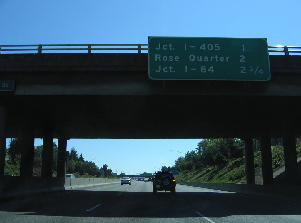
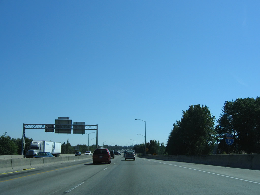
I-405 (Stadium freeway) begins one mile south of the Rosa Parks Way overpass.
08/27/06
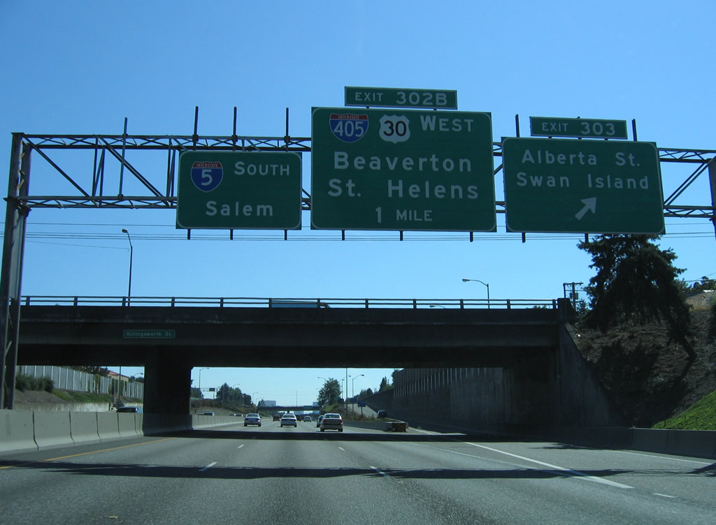
Exit 303 joins a collector distributor roadway alongside Minnesota Avenue ahead of Alberta Street. Alberta Street links with Interstate Avenue between Killingsworth and Going Streets at the Overlook community. Going Street is the main route to industrialized Swan Island.
08/27/06
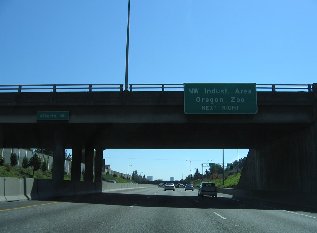
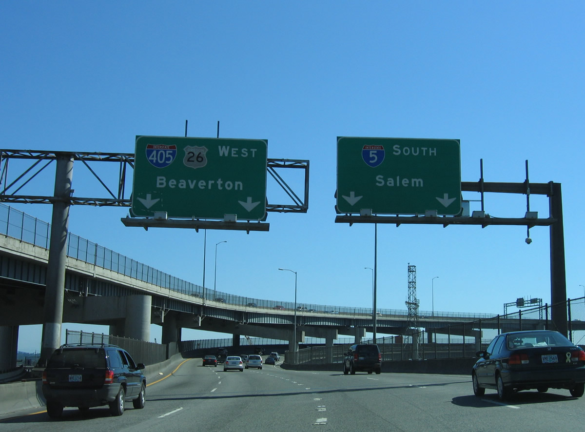
Interstate 405 combines with U.S. 30 west across the Fremont Bridge over the Willamette River. U.S. 30 partitions with the Stadium Freeway at Exit 3 through the Northwest Industrial Area. Interests to Oregon Zoo are directed onto I-405 south to U.S. 26 (Sunset Highway) west.
08/27/06
Minnesota Avenue, which Interstate 5 replaced when it was built through north Portland, runs along the west side of the c/d roadway at Exit 303.
08/27/06
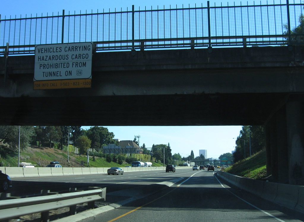
Truckers bound for U.S. 26 (Sunset Highway) west are advised of the hazardous materials prohibition through the East Vista Ridge Tunnel with this sign at the Skidmore Street overpass.
08/27/06
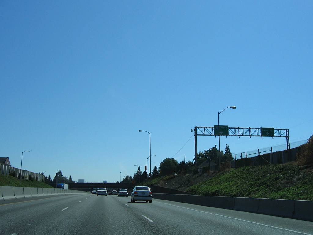
Interstate 5 on the Minnesota Freeway runs between the Overlook and Boise neighborhoods of Portland.
08/27/06
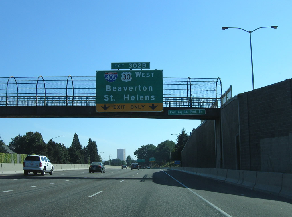
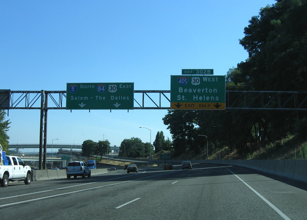
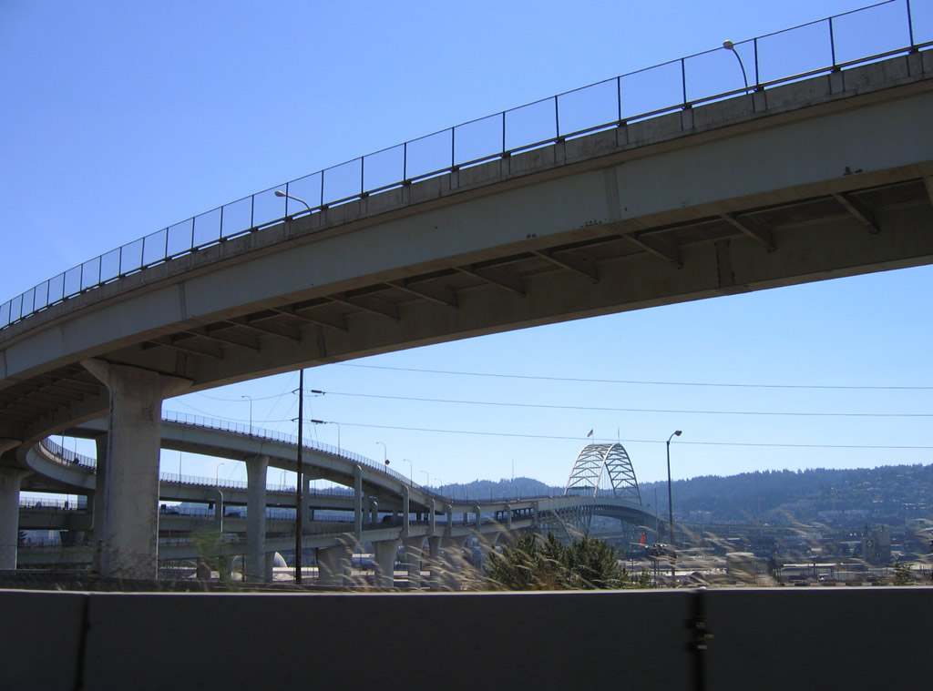
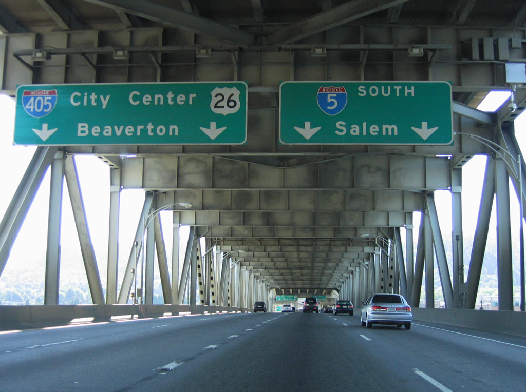
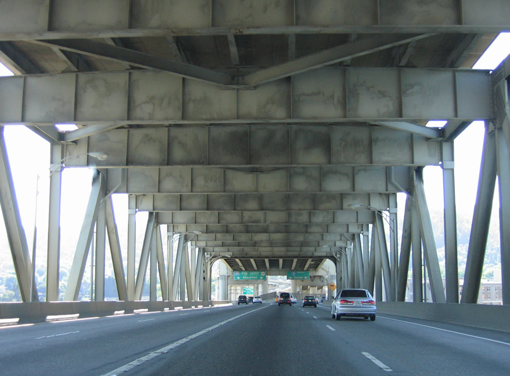
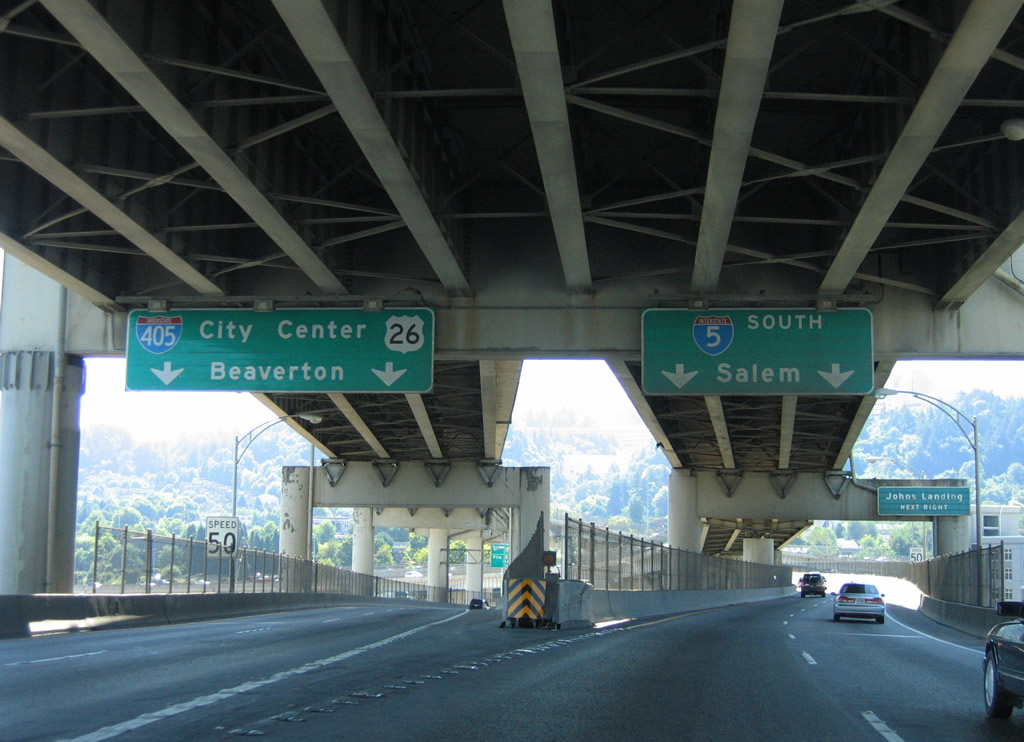
Two lanes depart for I-405/U.S. 30 south at Exit 302 B a quarter mile after the Failing Street Pedestrian Bridge. Encircling the Portland central business district, I-405 connects with U.S. 30 northwest to St. Helens and U.S. 26 west to Beaverton.
08/27/06
A directional T interchange (Exit 302 B) joins I-5 with I-405/U.S. 30 and the Kerby Avenue connector. U.S. 30 joins I-5 south to Interstate 84 east at Exit 301.
08/27/06
Ramp stubs remain on both flyover ramps to I-405 for the Kerby Avenue connector. The Stadium Freeway spurs east from I-5/U.S. 30 to Kerby Avenue at Gantenbein Avenue. Part of the cancelled Rose City Freeway northeast to the unconstructed Prescott Freeway, the freeway spur provides local access to the Boise section of the city from the Fremont Bridge.
08/27/06
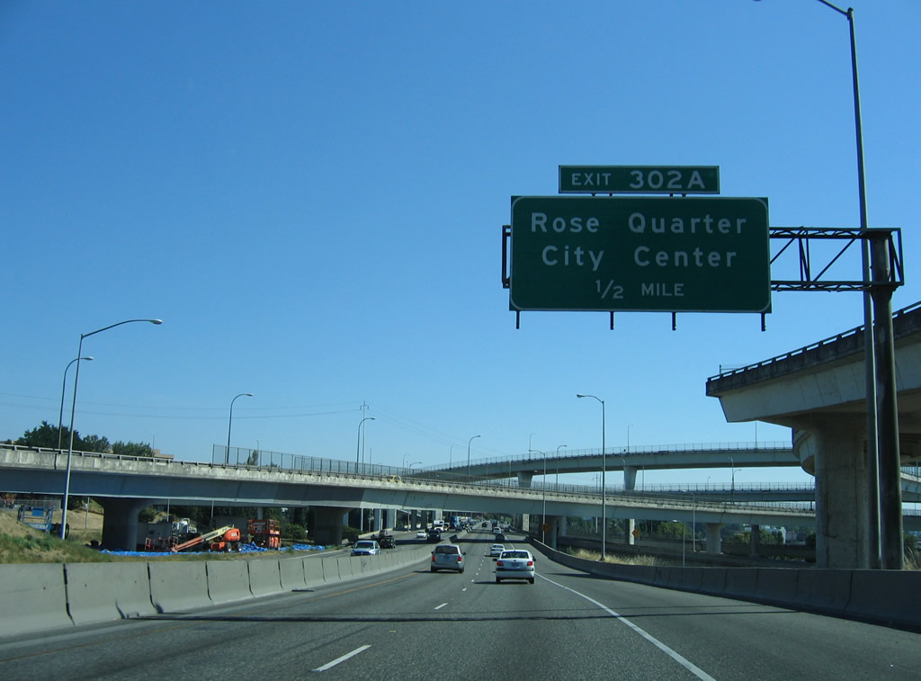
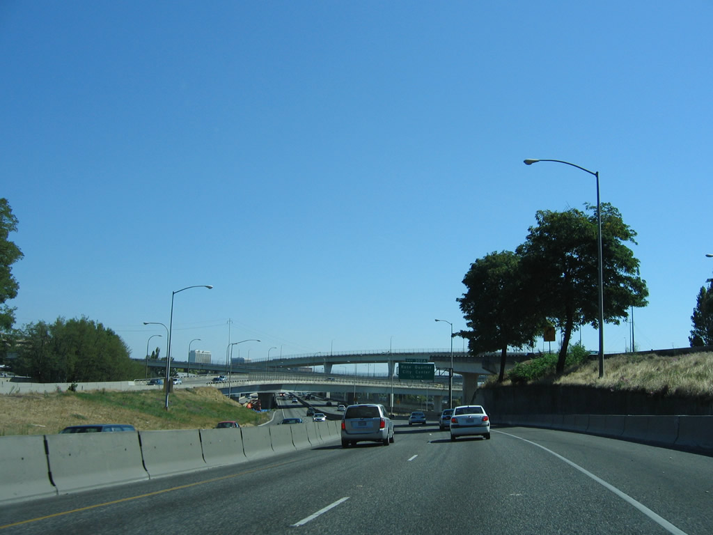
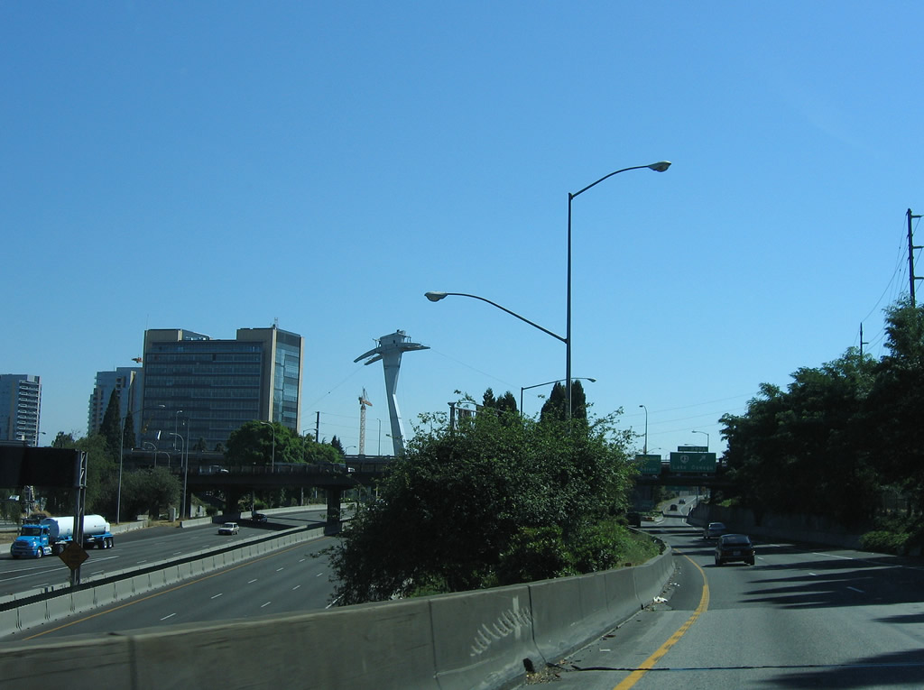
Exit 302 A connects I-5/U.S. 30 south to Broadway west at the Rose Quarter. Portland's Rose Quarter includes the Moda Center and Veterans Memorial Coliseum. Moda Center opened in 1995 as the home of the Portland Trailblazers. The Western Hockey League Portland Winterhawks split their home games between the two arenas.
08/27/06
The Fremont Bridge opened to traffic on November 11, 1973.
08/27/06
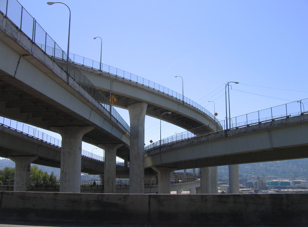
Flyovers link I-5/405 above two bridges on the Stadium Freeway mainline that link with Kirby Avenue. The stadium freeway derives its name from Providence Park, which was formerly named Civic Stadium ("Providence Park", 2006).
08/27/06
 East
East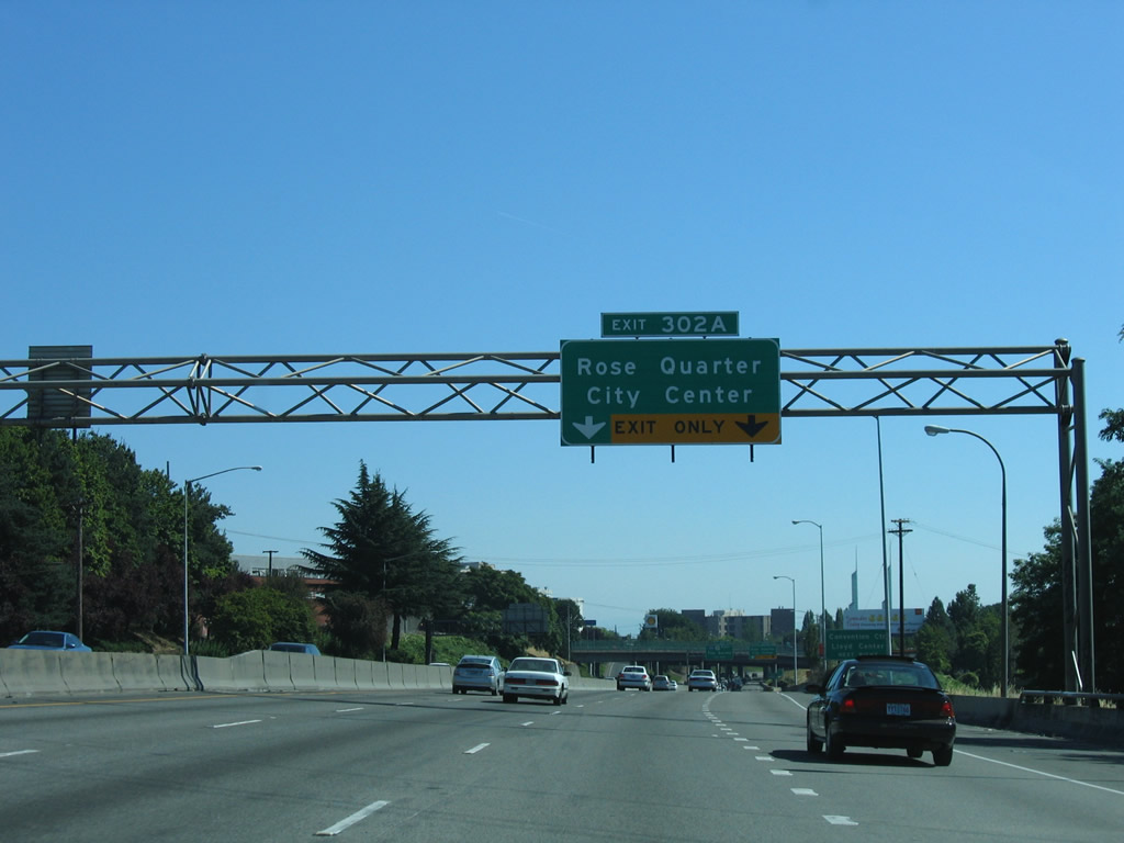
The entrance ramp bringing U.S. 30 eastbound onto I-5 expands southbound to four lanes ahead of the split diamond interchange (Exit 302 A) with the couplet of Broadway west and Weidler Street east.
08/27/06
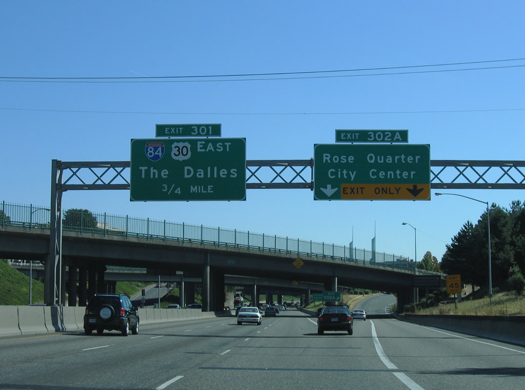
I-5/U.S. 30 overlap 0.75 miles south to Exit 301 and Interstate 84. Points of interest for Exit 302 A include the Oregon Convention Center and Lloyd Center shopping mall.
08/27/06
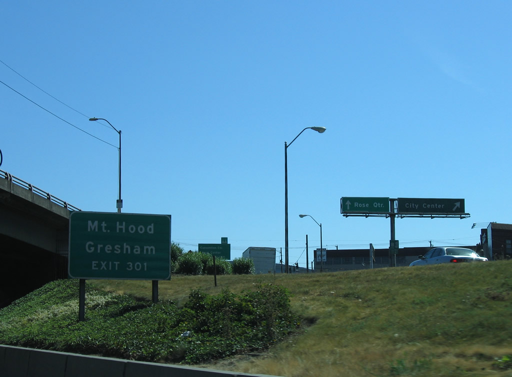
Exit 302 A separates into ramps for Broadway west to the Broadway Bridge (former OR 99W) and the Portland city center, and Vancouver Street south to Moda Center. I-84/U.S. 30 join Portland with the eastern suburb of Gresham.
08/27/06
Similar to the configuration in Seattle where Pine Street and Boren Avenue intersect above the freeway, Interstate 5 in Portland passes under the intersection of Williams Avenue and NE Broadway.
08/27/06
Spires of the Oregon Convention Center appear along the east side of the Interstate 5 where the entrance ramp from Wheeler Avenue and Winning Way adds an auxiliary lane to Exit 301 for I-84/U.S. 30 east.
08/27/06
I-84/U.S. 30 overlap for the majority of the route east through the scenic Columbia River Gorge. The Dalles lies 83 miles to the east of Portland.
08/27/06
Overall, Interstate 84 travels 779 miles between Portland, Oregon and I-80 at Echo, Utah. The freeway connects Pendleton, Boise and Ogden, Utah.
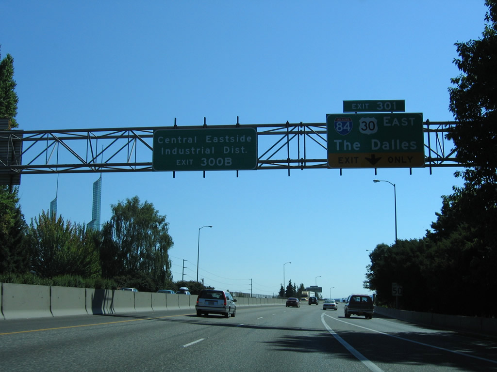
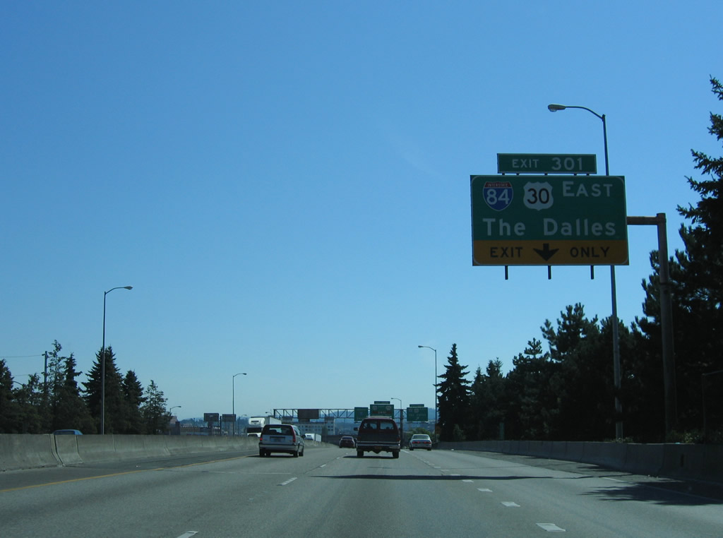
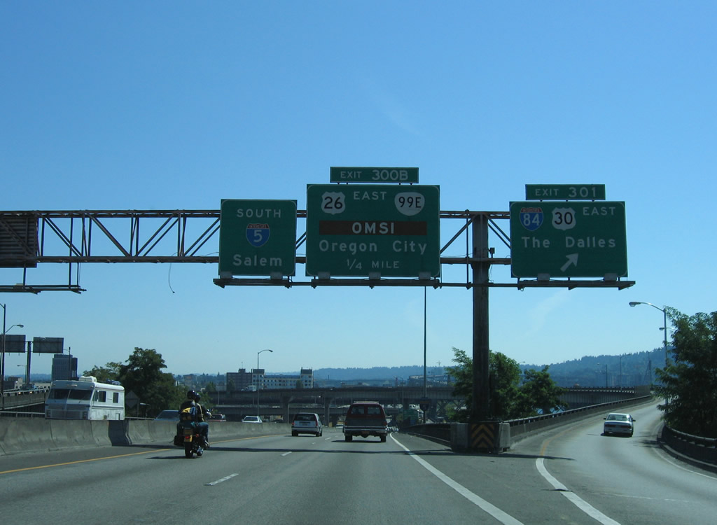
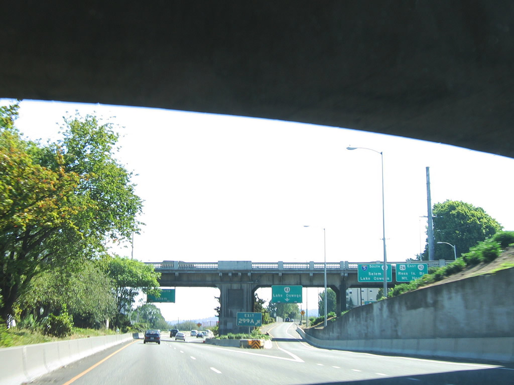
Leaving from within the exchange at Exit 301 is Exit 300 B, a lengthy c/d roadway south to the Morrison Bridge west and Belmont Street east to OR 99E.
08/27/06
I-5 lowers from the viaduct that started at Multnomah Street to grade level south of the Burnside Bridge. The freeway parallels the Willamette River directly from I-84 to the Marquam Bridge. A stub on the flyover from Exit 301 is from a removed ramp between Interstate Avenue at the Steel Bridge. A stub also exists on ramp from the Banfield Expressway to I-5 north that once connected with Glisan Street. These ramps were removed after 1990.
08/27/06
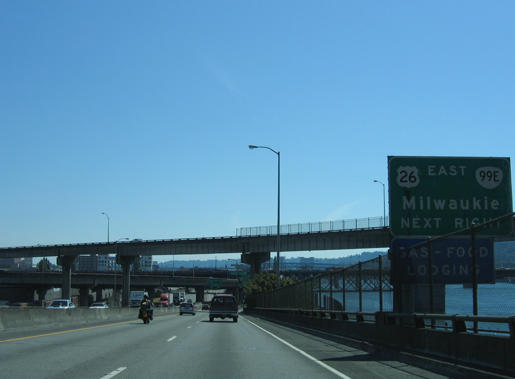
There is no direct connection to U.S. 26 from I-5 south. Instead travelers are directed along Martin Luther King, Jr. Boulevard (OR 99E) to Powell Boulevard at the east end of the Ross Island Bridge. OR 99E leads southeast from there to the city of Milwaukie.
08/27/06
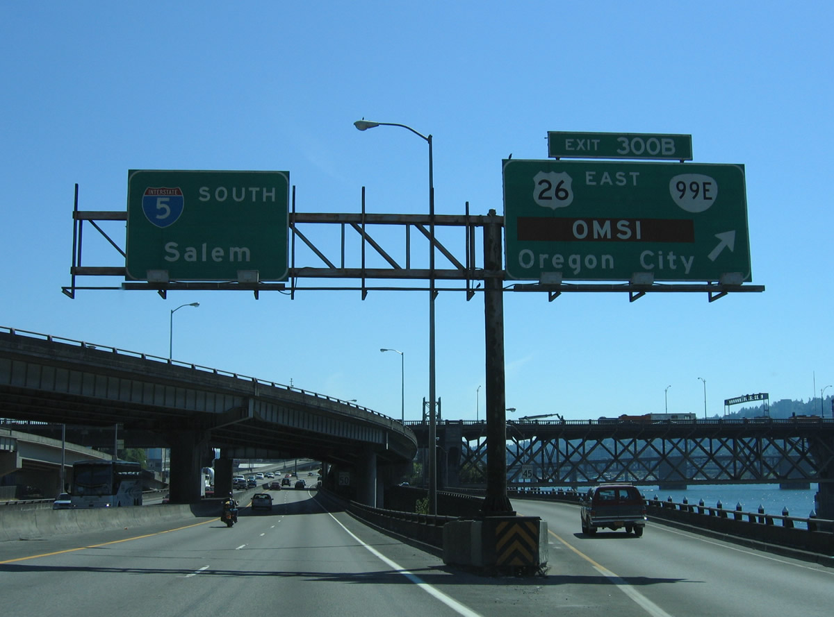
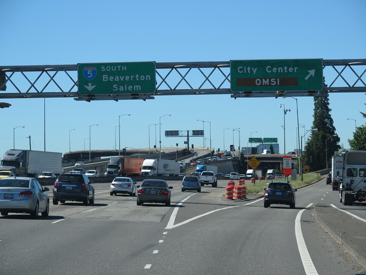
Exit 300 B leaves I-5 south ahead of the Burnside Bridge (former U.S. 30 Business). Interests to Oregon Museum of Science and Industry (OMSI) are directed onto OR 99E south to Clay Street west. OR 99E continues southeast to Oregon City via McLoughlin Boulevard.
08/27/06
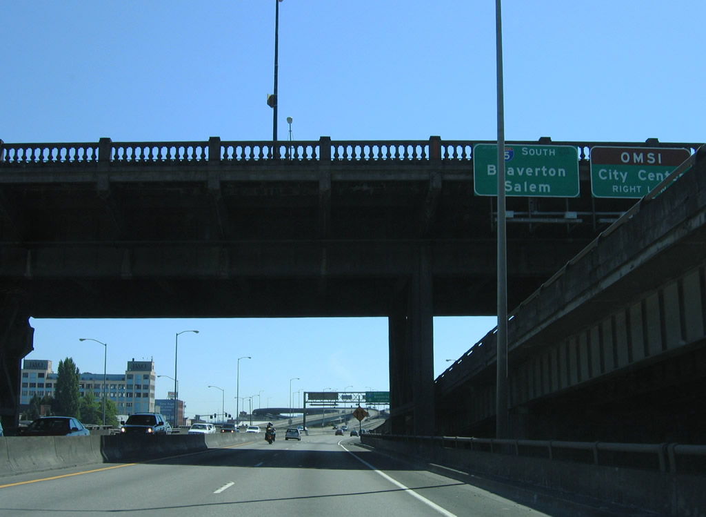
The flyover from I-84 west onto I-5 south includes a slip ramp to Exit 300 B for the Morrison Bridge and OR 99E. OR 99E next meets Interstate 5 south at Salem.
08/27/06
South of the Burnside Bridge is the directional interchange with the Morrison Bridge. The Morrison Bridge spans the Willamette to Naito Parkway (former OR 99W) and Washington Street west at Downtown Portland.
06/24/15
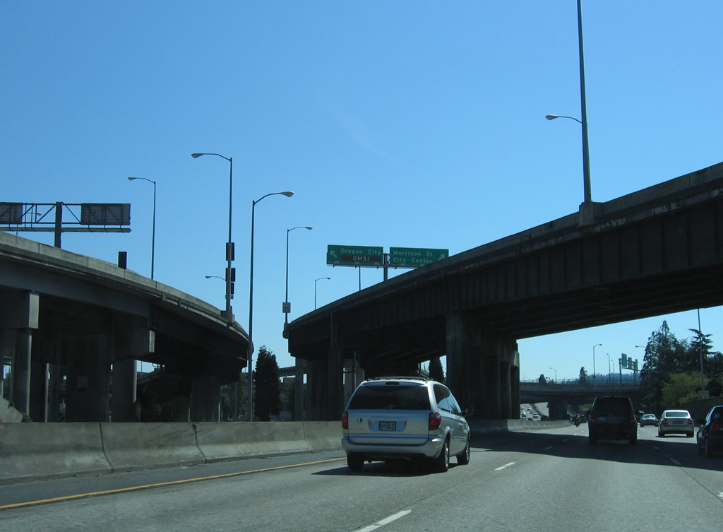
Exit 300 B partitions above I-5 for the Belmont Street viaduct east to OR 99E (Martin Luther King, Jr. Boulevard south / Grand Avenue north) at the Buckman section of Portland, and the Morrison Bridge west to the city center.
08/27/06
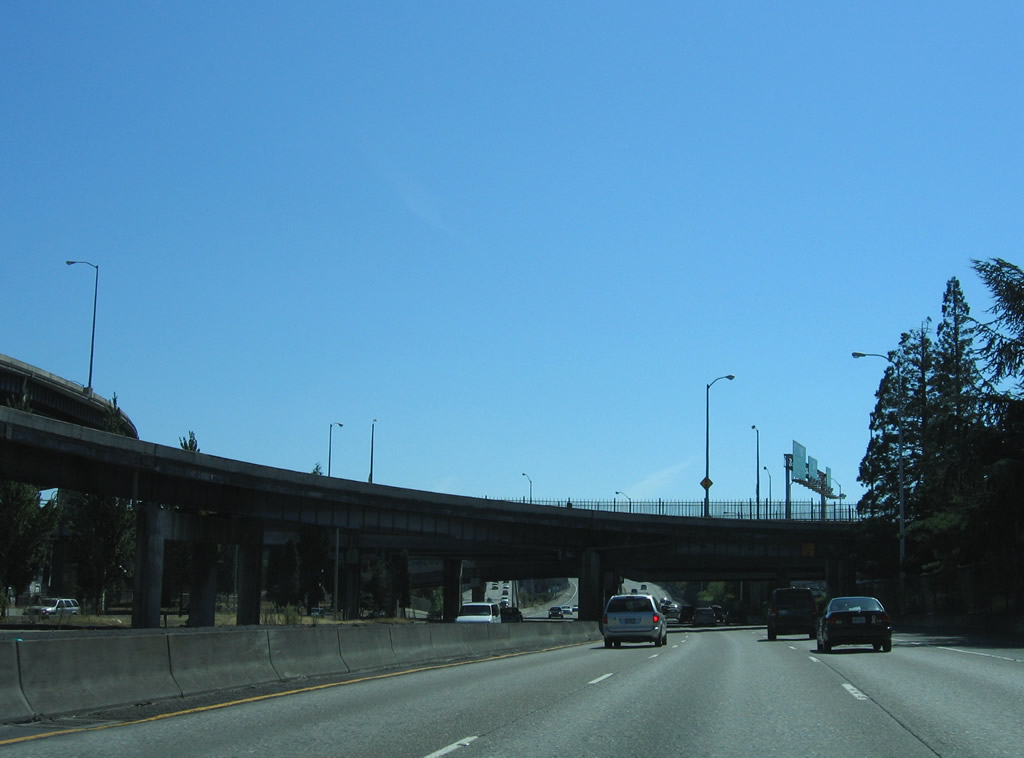
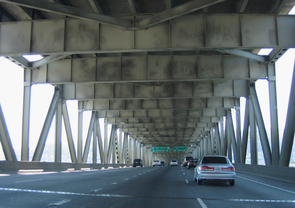
Traveling under the Morrison Bridge ramps on I-5 south. The Morrison Bridge was built in 1958 and the ramps to Interstate 5 were added in 1961.
08/27/06
Leading south to the Marquam Bridge, ramp stubs remain both sides of I-5 southbound roadway for the unconstructed Mount Hood Freeway. The unbuilt freeway was a proposed realignment of U.S. 26 east along Division Street to the Richmond neighborhood, and along Powell Boulevard through South Tabor.
08/27/06
I-5 south crosses the Willamette River and meets I-405 (Stadium Freeway) at the west end of the Marquam Bridge. The mainline departs southward ahead of Harbor Drive as Interstate 405 takes over from the left to encircle the city center.
08/27/06
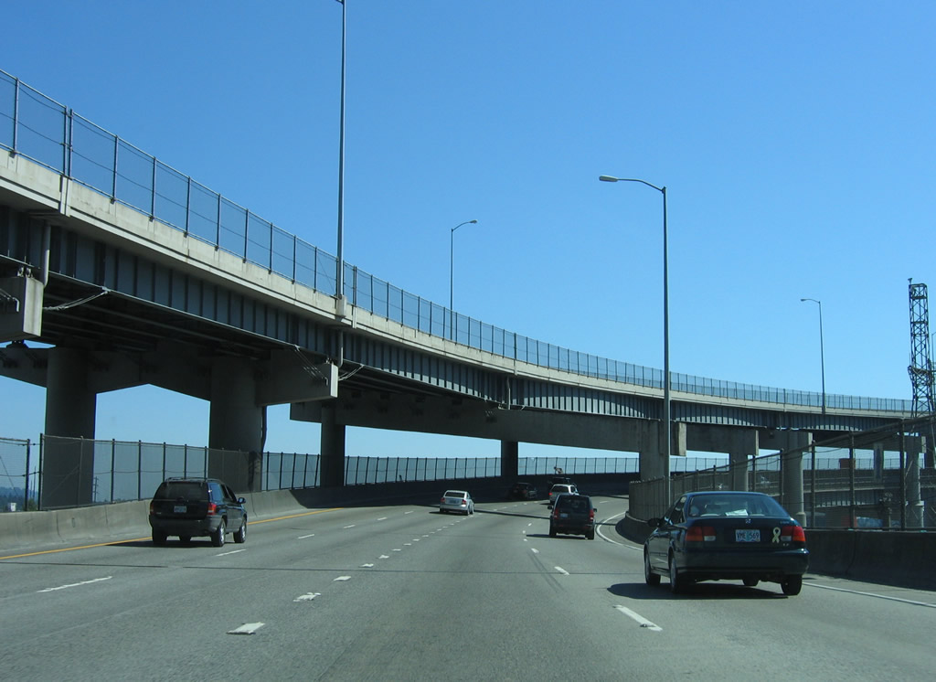
Interstate 5 south utilizes the lower deck of the Marquam Bridge. Named after Philip Marquam (1823-1912), an Oregon state legislator and real estate developer, the 1,043 foot long span passes 130 feet above the Willamette River ("Marquam Bridge", 2010).
08/27/06
Constructed at a cost of $14 million, the Marquam Bridge opened in October 1966 ("Marquam Bridge", 2010).
08/27/06
Two lane ramps seprate for I-405 (Stadium Freeway) north to U.S. 26 (Sunset Highway) and I-5 south to Tigard and Salem. The left exit for Interstate 405 is a result of plans bringing the Mount Hood Freeway onto the left side of the Marquam Bridge.
08/27/06
A three-wye interchange joins the south end of the Marquam Bridge with Interstate 405 (Stadium Freeway) north.
08/27/06
U.S. 26 joins I-405 nearby to cnnect with the freeway on Sunset Highway west to Beaverton, Hillsboro and the Oregon coast.
08/27/06
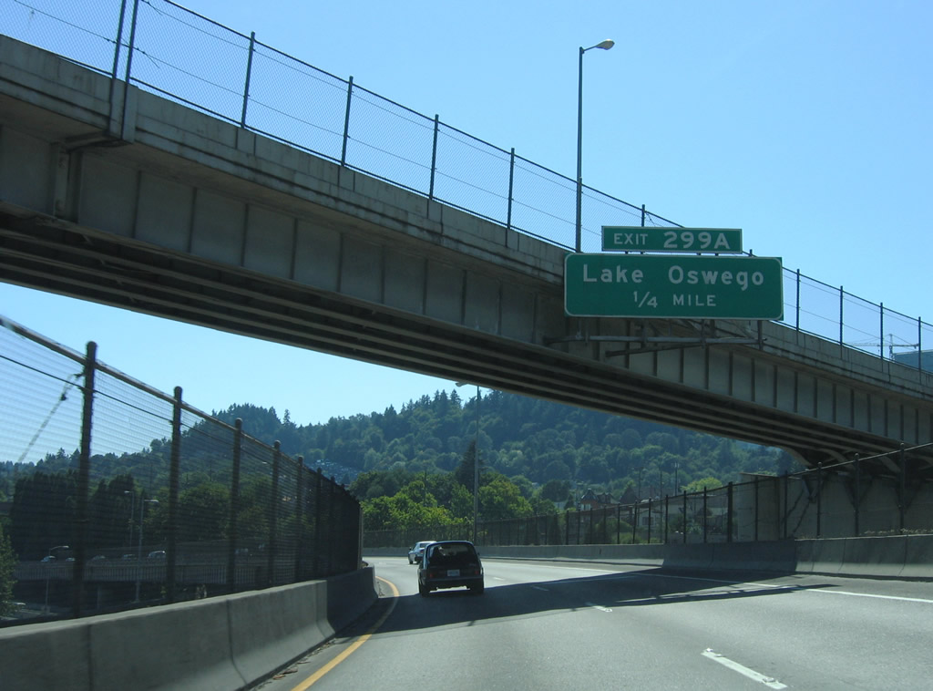
Turning southward, Interstate 5 overtakes S Harbor Drive and I-405 ahead of the Ross Island Bridge (U.S. 26). Exit 299 A departs ahead of Harbor Drive onto parallel OR 43 (SW Hood Avenue). OR 43 runs 11.68 miles south to Lake Oswego and West Linn.
08/27/06
Harbor Drive appears to the left where Interstate 5 lowers to Exit 299 A. OR 43 follows a couplet alongside I-5 at Johns Landing.
08/27/06
Exit 299 A departs from I-5 south below Kelly Avenue (OR 43 north), adjacent to the ramp forming OR 43 south from the Ross Island Bridge westbound.
08/27/06
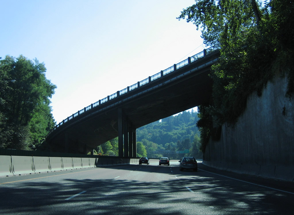
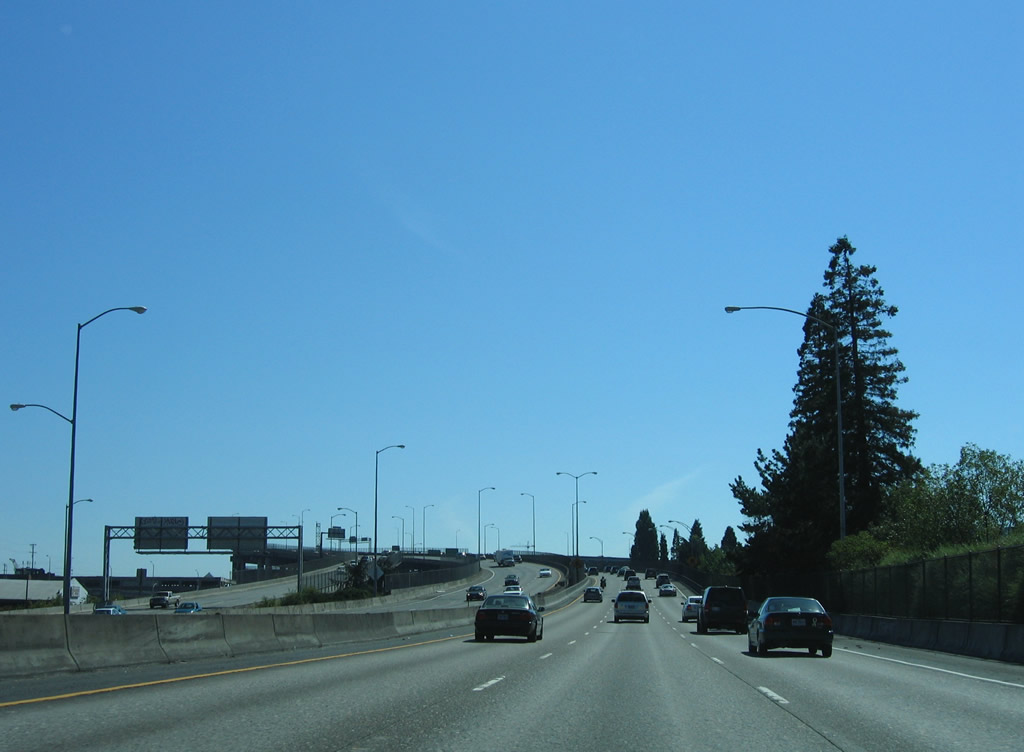
Interstate 5 navigates through a series of S-curves from OR 43 (Hood Avenue) to South Burlingame. This stretch of roadway precedes the locally known "Terwilliger Curves" portion of freeway.
08/27/06
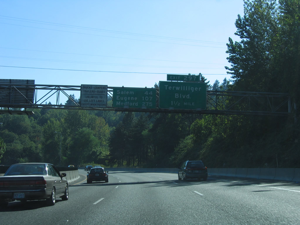
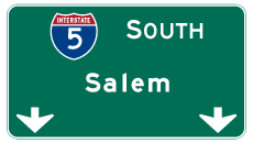
The succeeding exit from I-5 south is for Terwilliger Boulevard. Beyond Portland, Interstate 5 travels to the capital city of Salem, Eugene and Medford.
08/27/06
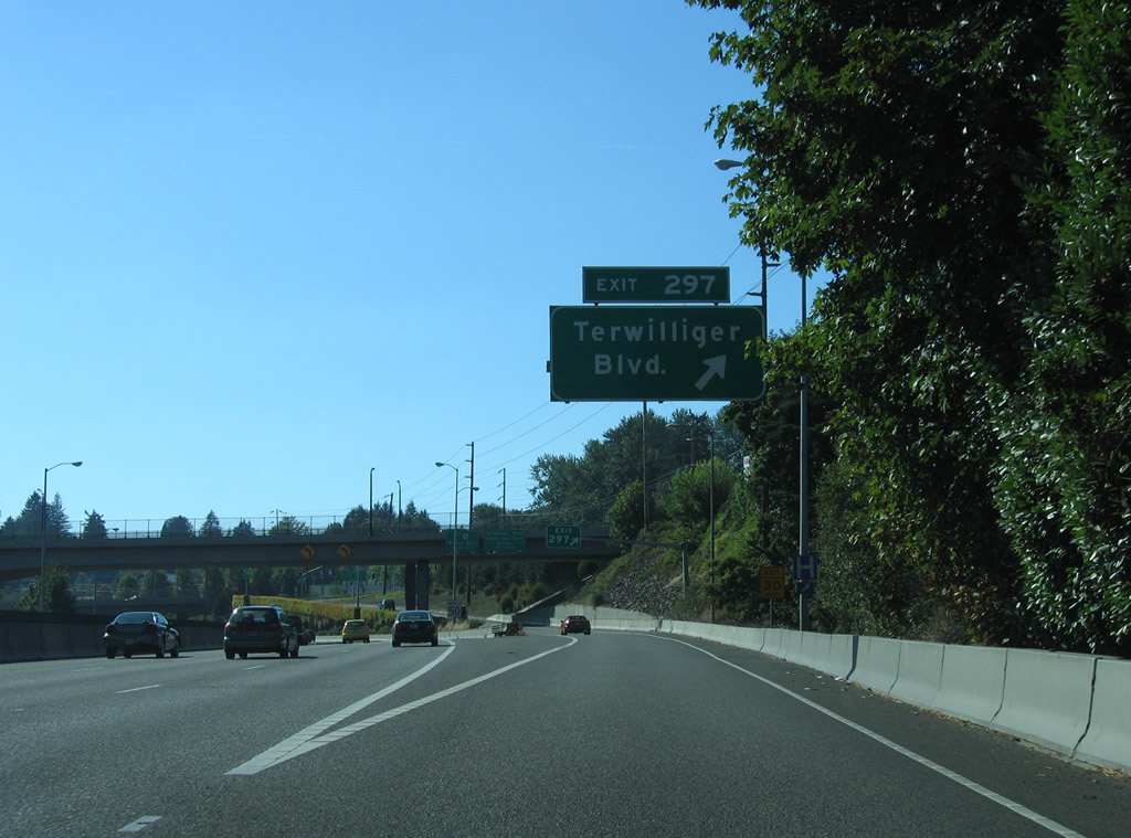
Exit 297 departs Interstate 5 south for Barbur Boulevard (OR 99W) at Bertha Boulevard. Heading south to South Burlingame and Lewis and Clark College and north to Hillsdale and Capitol Highway (OR 10), Terwilliger Boulevard intersects Barbur Boulevard to the east.
08/27/06
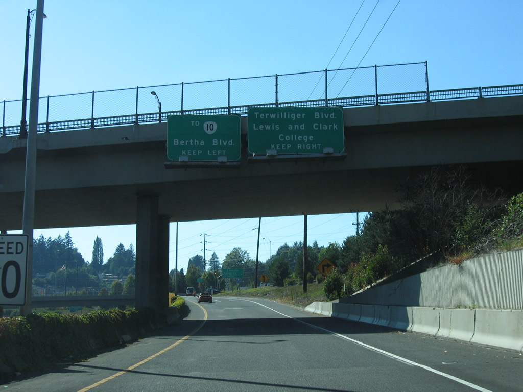
Exit 297 splits into lanes for Barbur Boulevard west to Capitol Hill, Bertha Boulevard north to Hillsdale and Barbor Boulevard east to Terwilliger Boulevard.
08/27/06
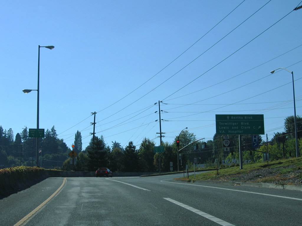
OR 10 is a 18.55 mile long route stretching west from the U.S. 26 (Ross Island Bridge) interchange with Naito Parkway to OR 219 west of Farmington (Oregon Route 10, 2023). OR 10 is locally maintained along Capitol Highway west from Barbur Boulevard to Bertha Boulevard, where it turns onto Beaverton-Hillsdale Highway.
08/27/06
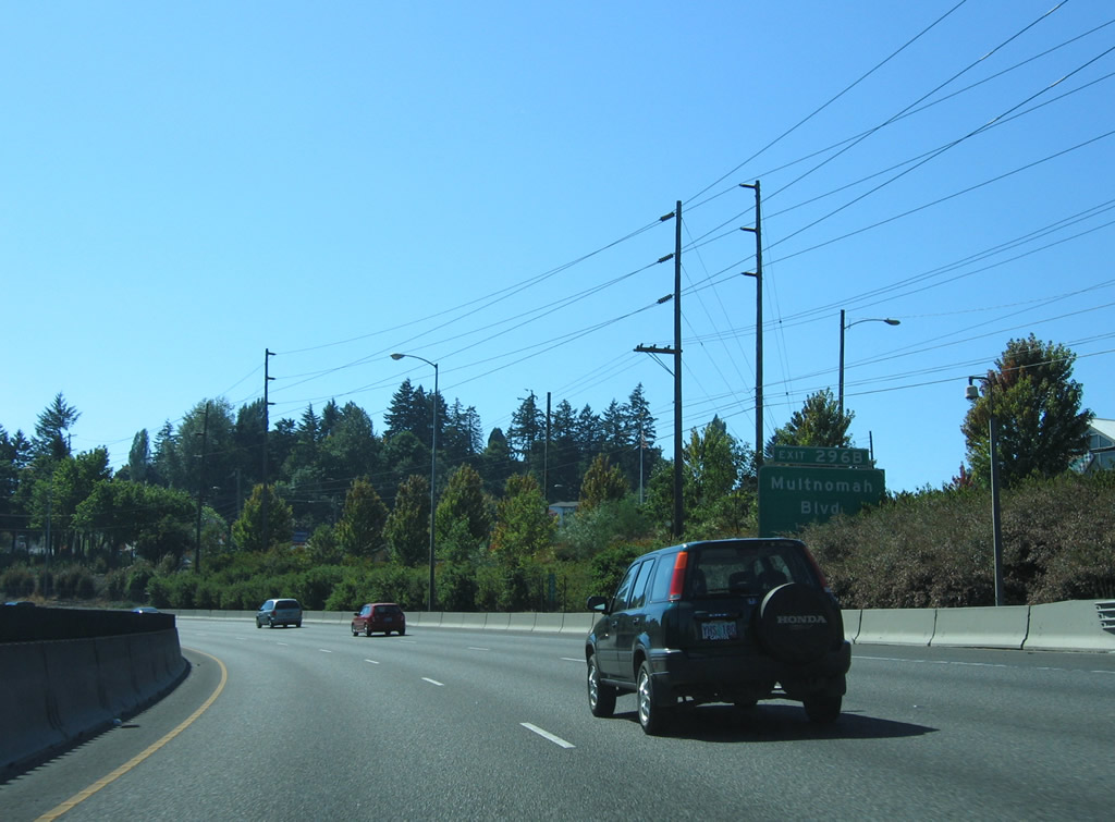
A wye interchange (Exit 296 B) follows on I-5 southwest with Multnomah Boulevard west. Multnomah Boulevard leads west to the Maplewood and Ashcreek neighborhoods of Portland.
08/27/06
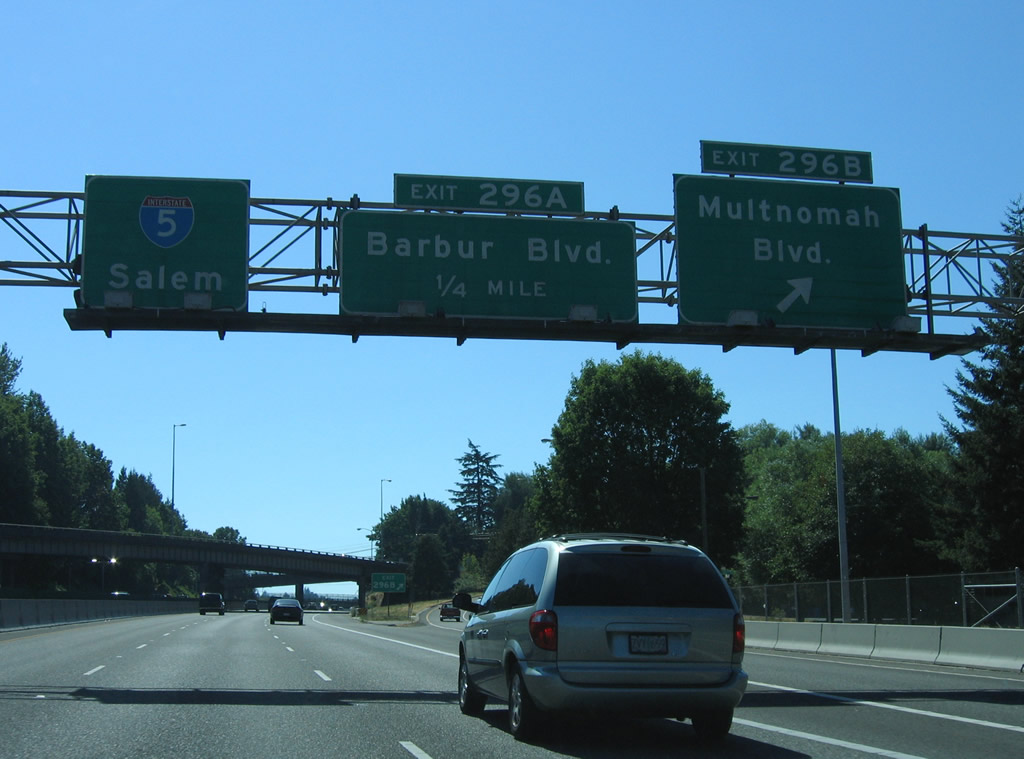
Exit 296 B passes west under SW 19th Avenue and Barbur Boulevard (former OR 99W) before forming Multnomah Boulevard. Exit 296 A provides direct access to parallel Barbur Boulevard at SW 24th Avenue.
08/27/06
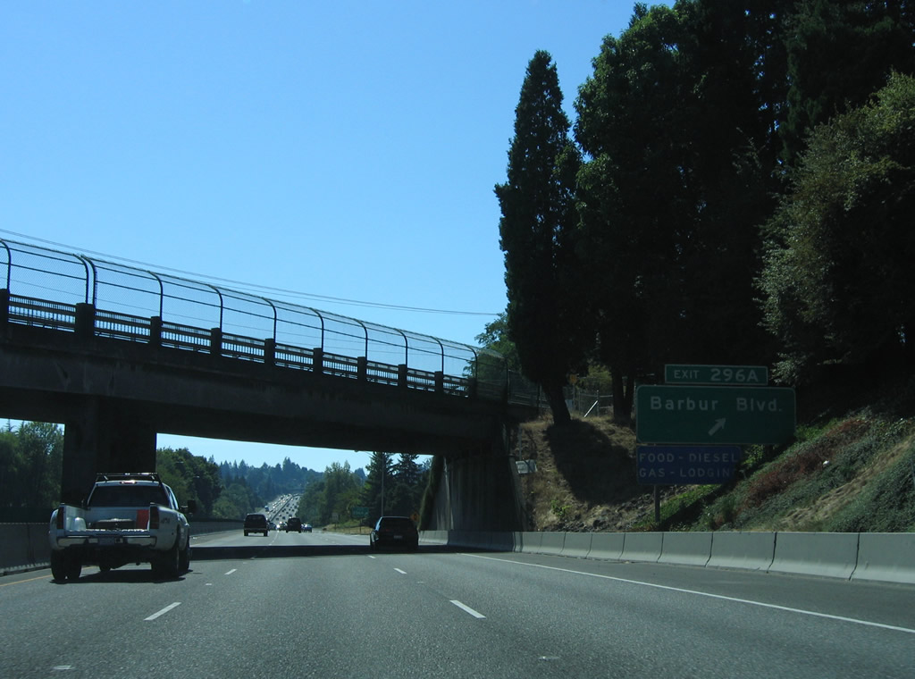
A pair of loop ramps a Exit 296 join Interstate 5 and Barbur Boulevard at Spring Garden Street. OR 99W remains parallel to I-5 along a commercial arterial to Crestwood and West Portland Park.
08/27/06
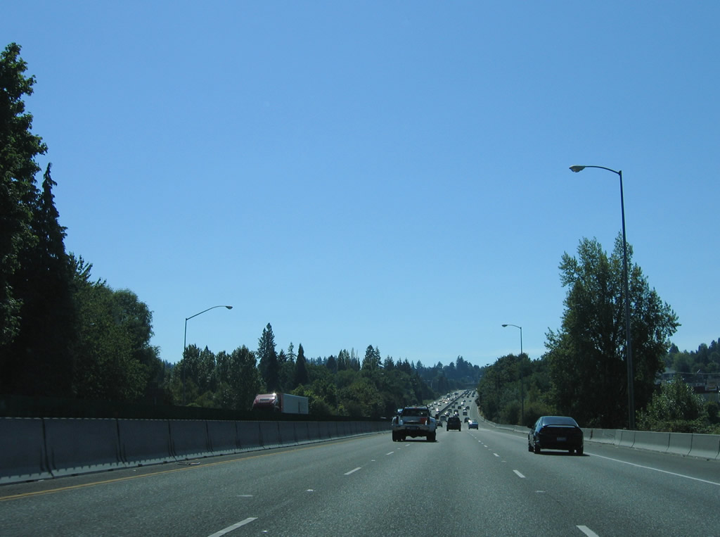
The six lanes of Interstate 5 travel between the Multnomah and Markham neighborhoods of southwest Portland.
08/27/06
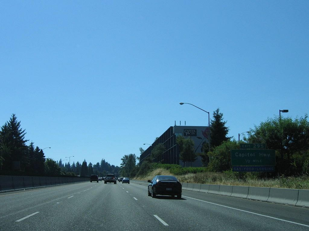
Capitol Highway, the same roadway that was a part of OR 10 at Hillsdale, converges with Interstate 5 at Exit 295.
08/27/06
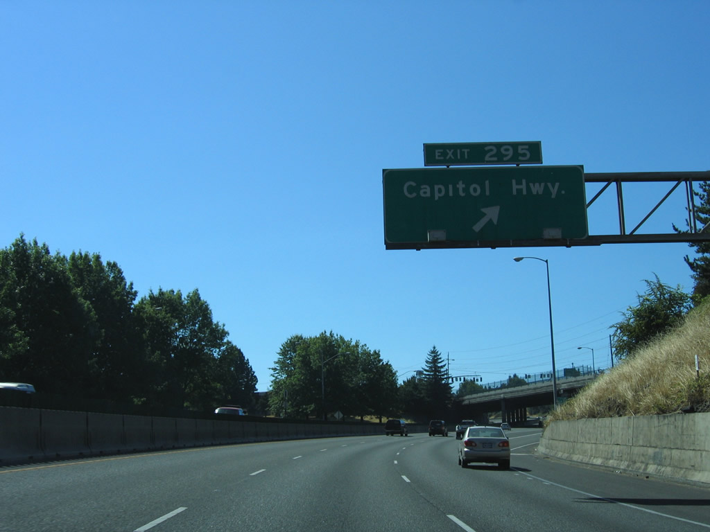
Exit 295 joins Interstate 5 south with Taylors Ferry Road west of Capitol Highway at Crestwood. Capitol Highway continues south of the freeway to become SW 49th Avenue at the Far Southwest neighborhood.
08/27/06
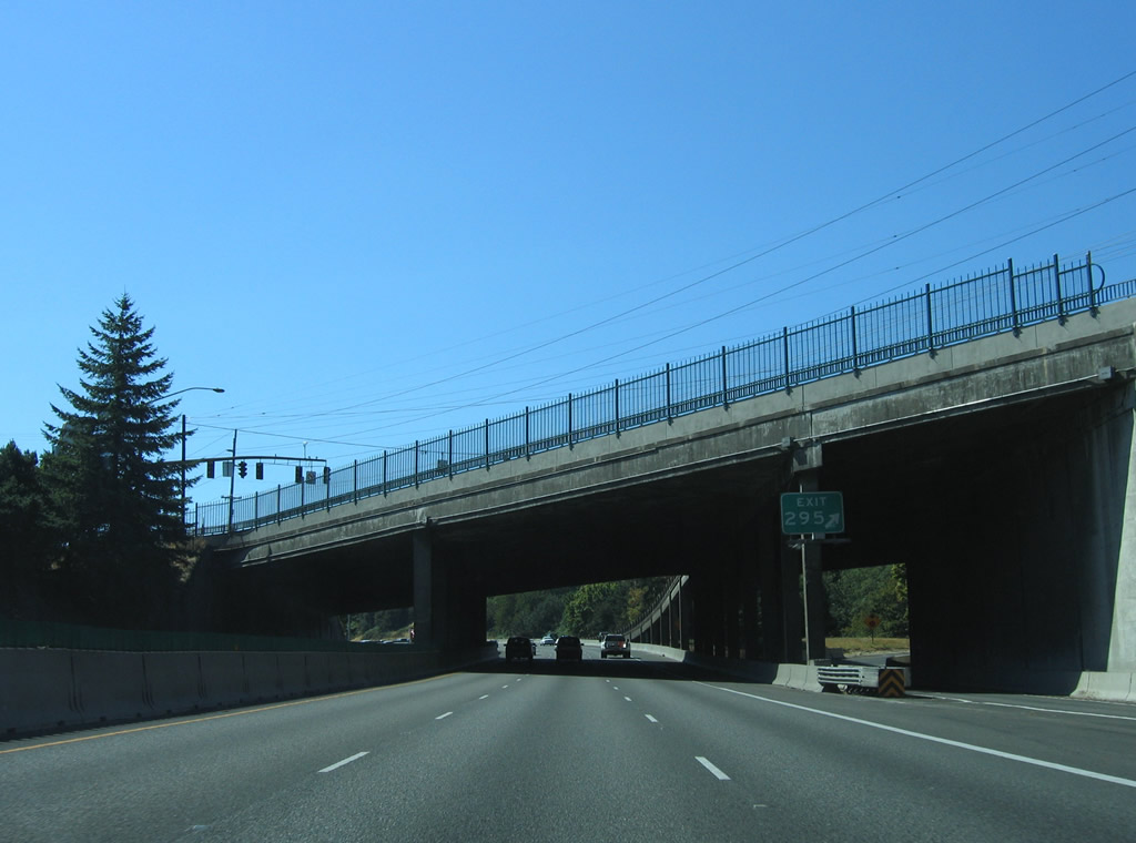
Barbur Boulevard (old OR 99W) and Capitol Highway intersect on overpasses above Interstate 5. Exit 295 constitutes a southbound off-ramp and northbound return ramp.
08/27/06
Advancing toward the Portland city line, Interstate 5 meets Barbur Boulevard (OR 99W) a final time at Exit 294.
08/27/06
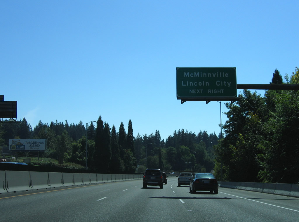
OR 99W leads southwest to OR 18 at McMinnville. OR 18 travels west from there 53.05 miles to U.S. 101 north of Lincoln City.
08/27/06
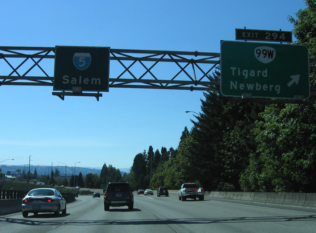
The wye interchange at Exit 294 overlays a half diamond interchange with Interstate 5 north. OR 99W follows Pacific Highway southwest through Tigard to Sherwood and Newberg.
08/27/06
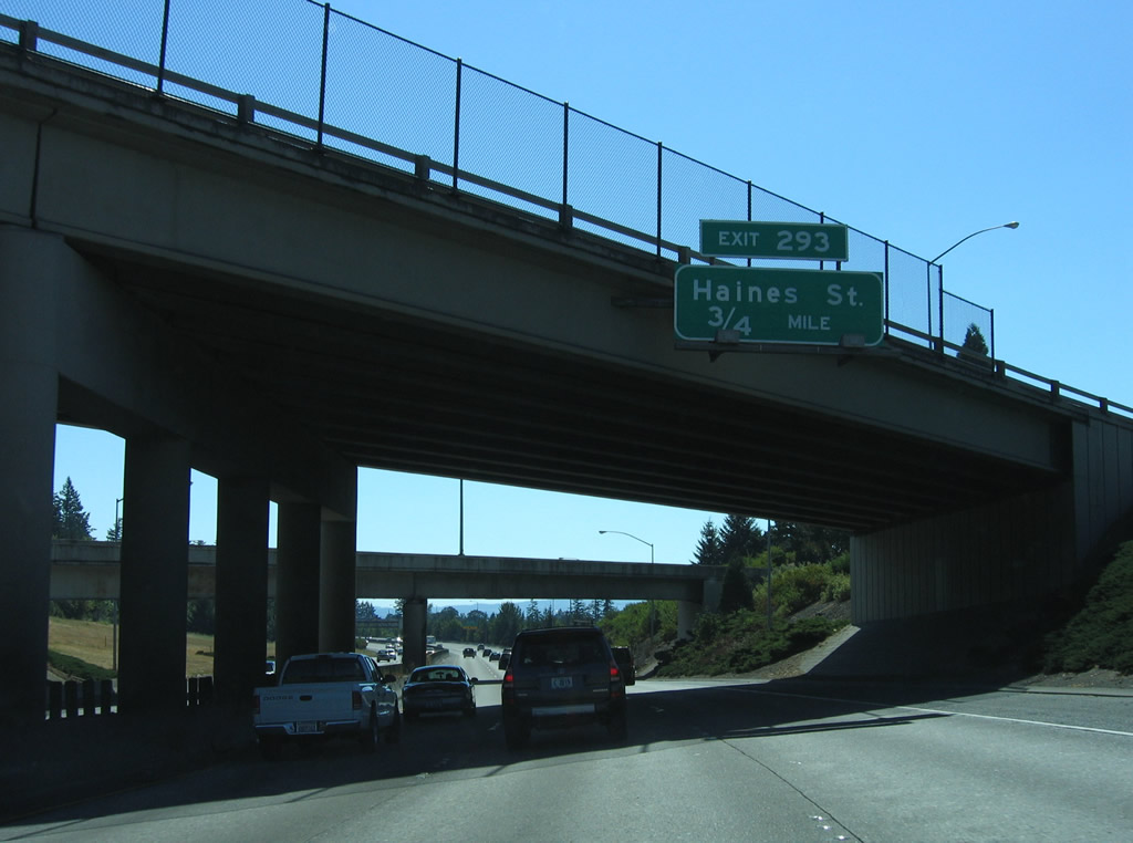
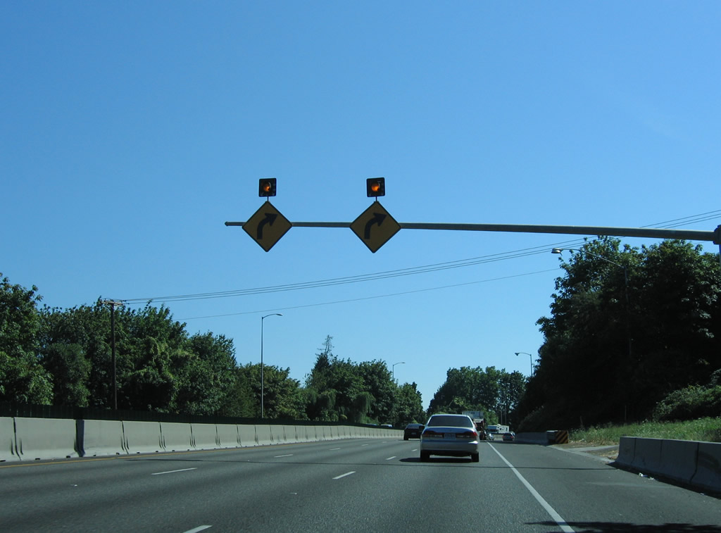
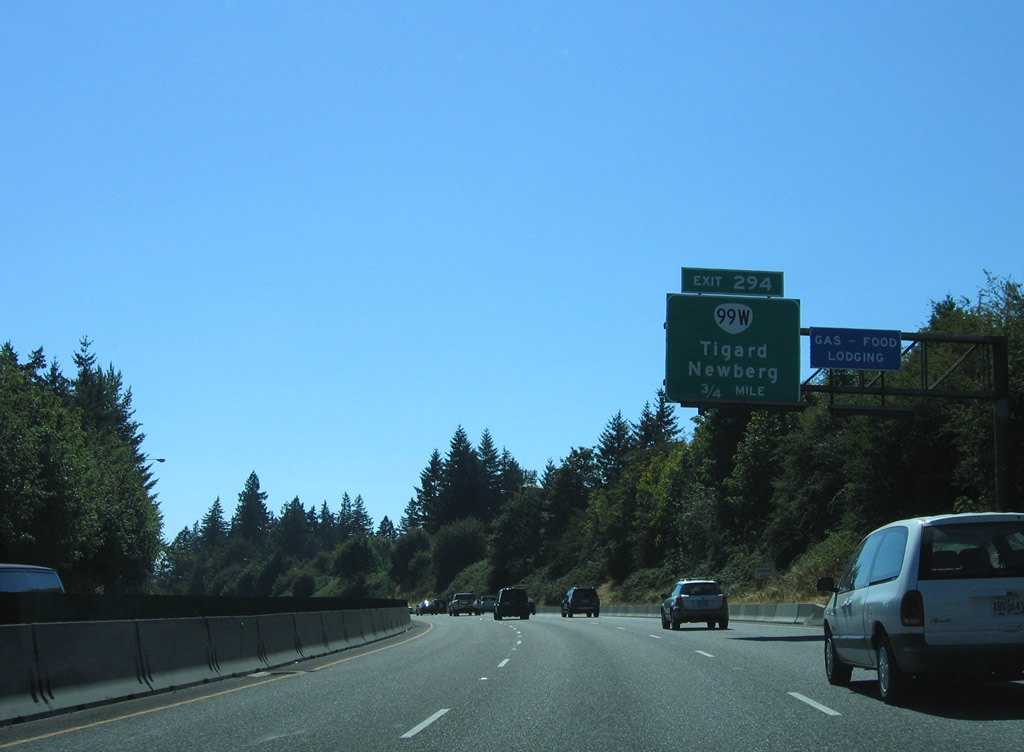
Curving southward again, Interstate 5 proceeds 0.75 miles to Exit 293 with SW 68th Avenue and Dartmouth Street in the city of Tigard.
08/27/06
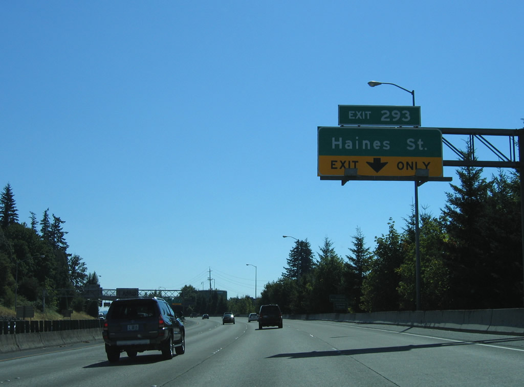
The on-ramp from OR 99W and SW 64th Avenue forms an auxiliary lane on I-5 south to the parclo interchange at Exit 293. Interstate 5 leaves the city of Portland and enters Washington County here.
08/27/06

References:
Providence Park. (2006, October 14) In https://en.wikipedia.org/w/index.php?title=Providence_Park&oldid=81330639
Marquam Bridge. (2010, June 3) In Wikipedia. https://en.wikipedia.org/w/index.php?title=Marquam_Bridge&oldid=365885754
AARoads Wiki. (2023, September 9). Oregon Route 10. AARoads Wiki. Retrieved August 23, 2025, from https://wiki.aaroads.com/wiki/Oregon_Route_10
Photo Credits:
- AARoads: 08/27/06
- Andy Field: 06/24/15
Connect with:
Page Updated Wednesday August 23, 2023.