
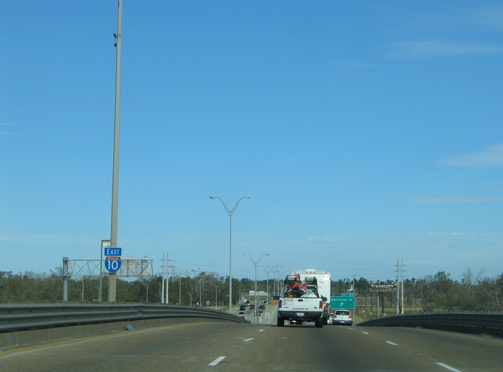
Interstate 10 East - Lake Charles / Calcasieu Parish

 East
East
01/15/06
01/15/06
01/15/06
01/15/06
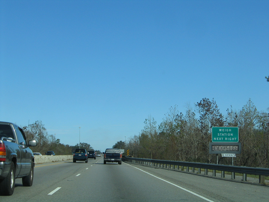
U.S. 90 branches north from I-10 east to LA 109, 4.87 miles into Calcasieu Parish.
10/22/03
10/22/03
LA 109 stems north from U.S. 90 nearby, 39.96 miles to Starks and LA 27 south of Singer.
10/22/03
10/22/03
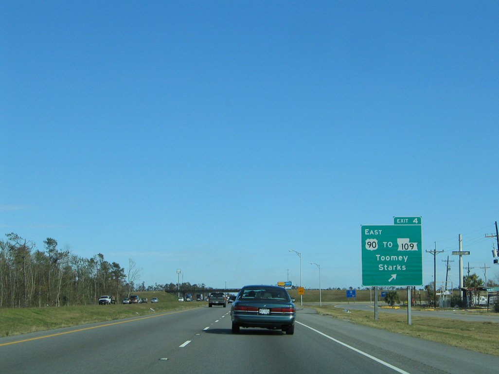
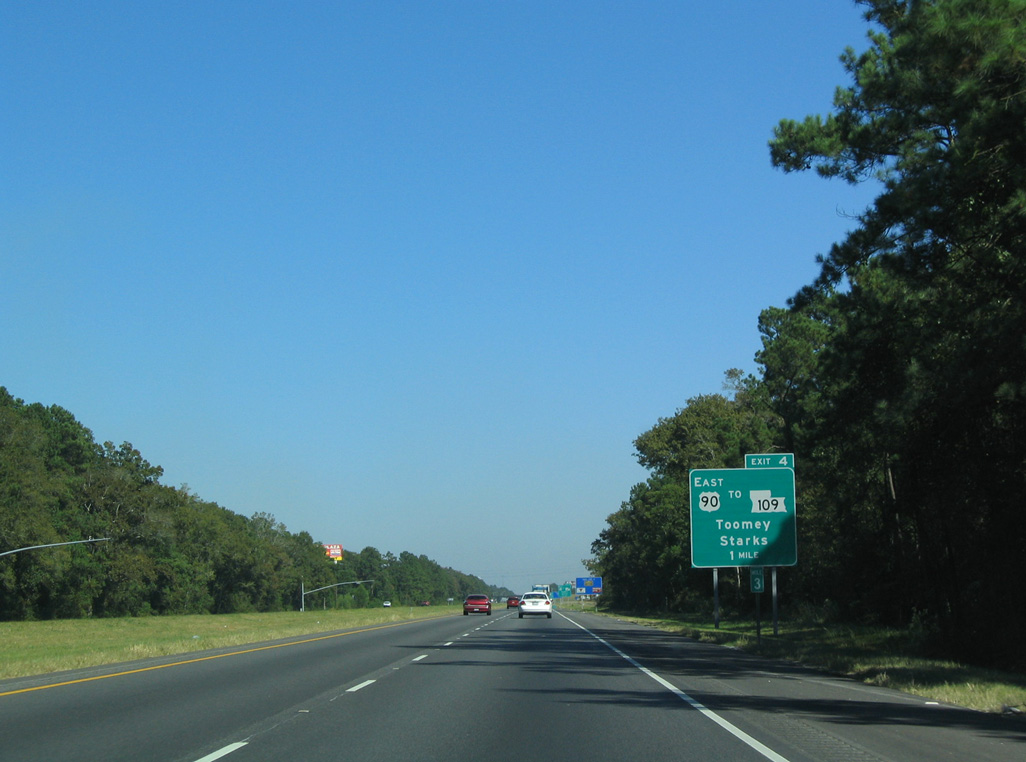
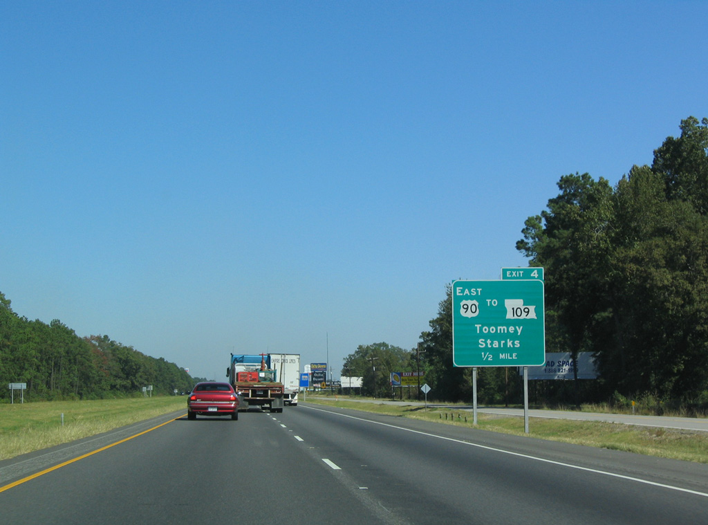
U.S. 90 parallels I-10 east from Exit 4 at Toomey 4.39 miles to LA 3063 (West Street) in the town of Vinton.
01/15/06
01/15/06
East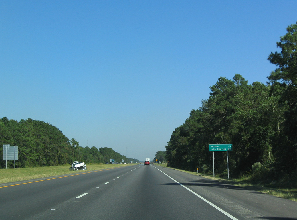
10/22/03
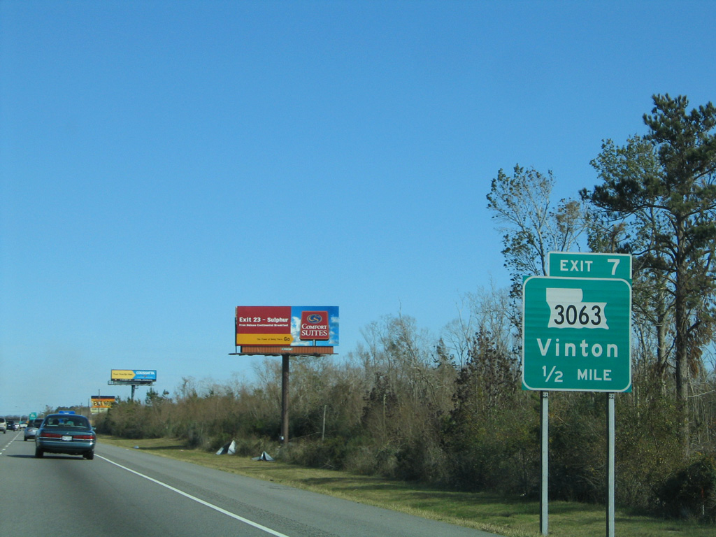
LA 3063 (West Street) connects I-10 with Vinton at Exit 7.
01/15/06
01/15/06
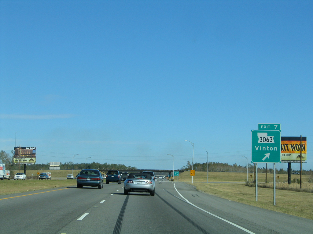
LA 3063 forms an L-shaped route 4.87 miles west from Interstate 10 to LA 109.
01/15/06
01/15/06
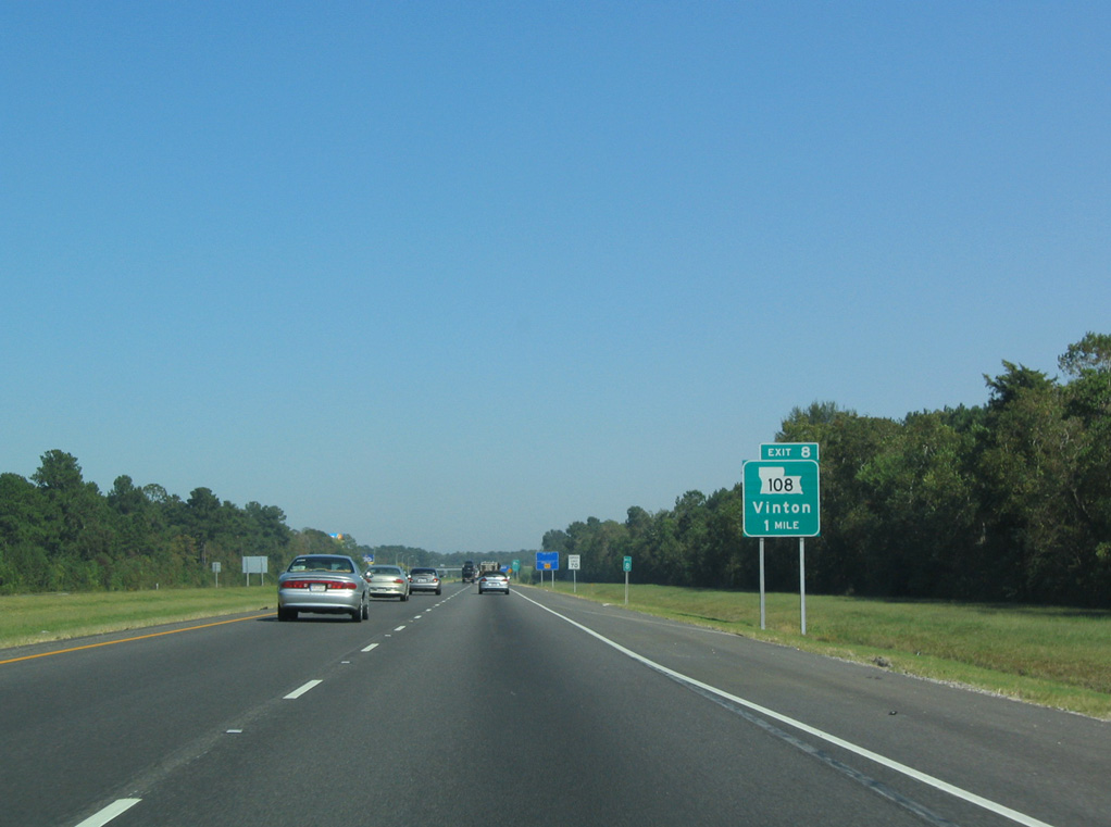
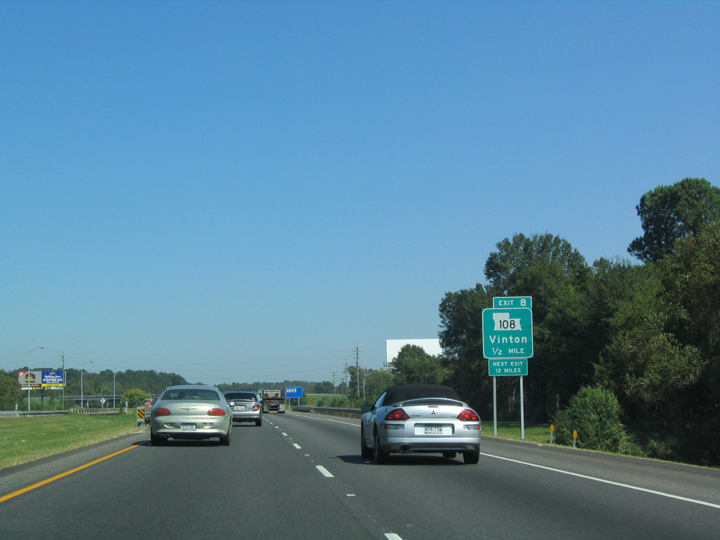
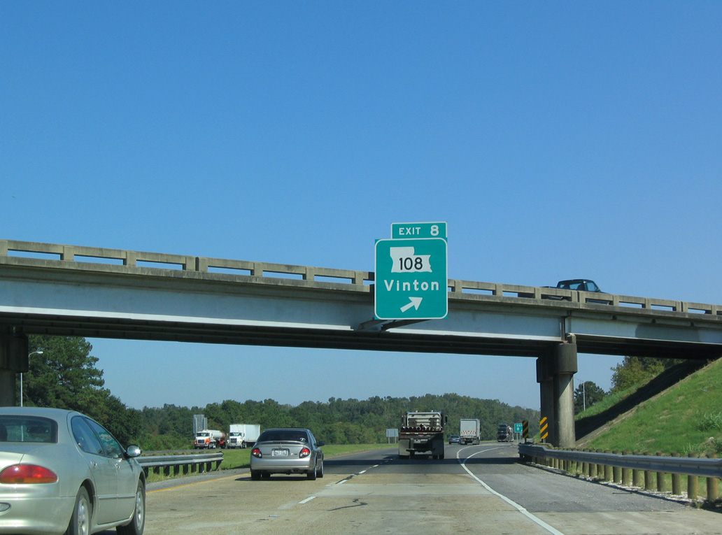
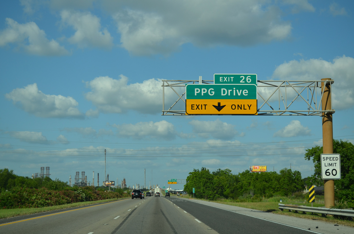
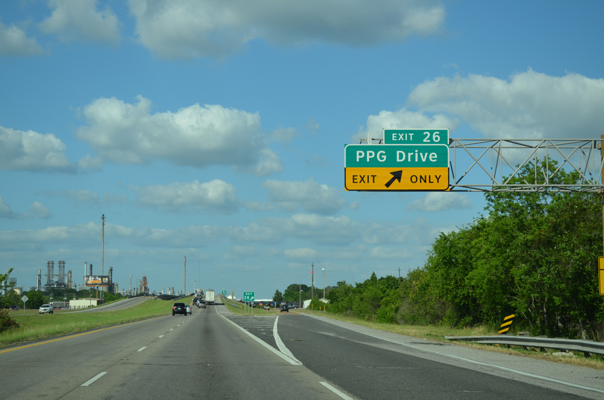
LA 108 travels 14.95 miles east from I-10 at Exit 8 to LA 27 south of Carlyss.
10/22/03
10/22/03
10/22/03
Gum Cove Road extends 0.23 miles north from the parclo interchange (Exit 8) with LA 108 to Center Street in Vinton.
10/22/03
10/22/03
01/15/06
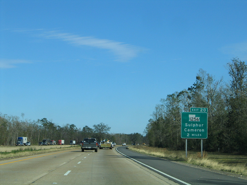
Interstate 10 enters the city of Sulphur at Exit 20 with LA 1256 (Ruth Street) south.
01/15/06
01/15/06
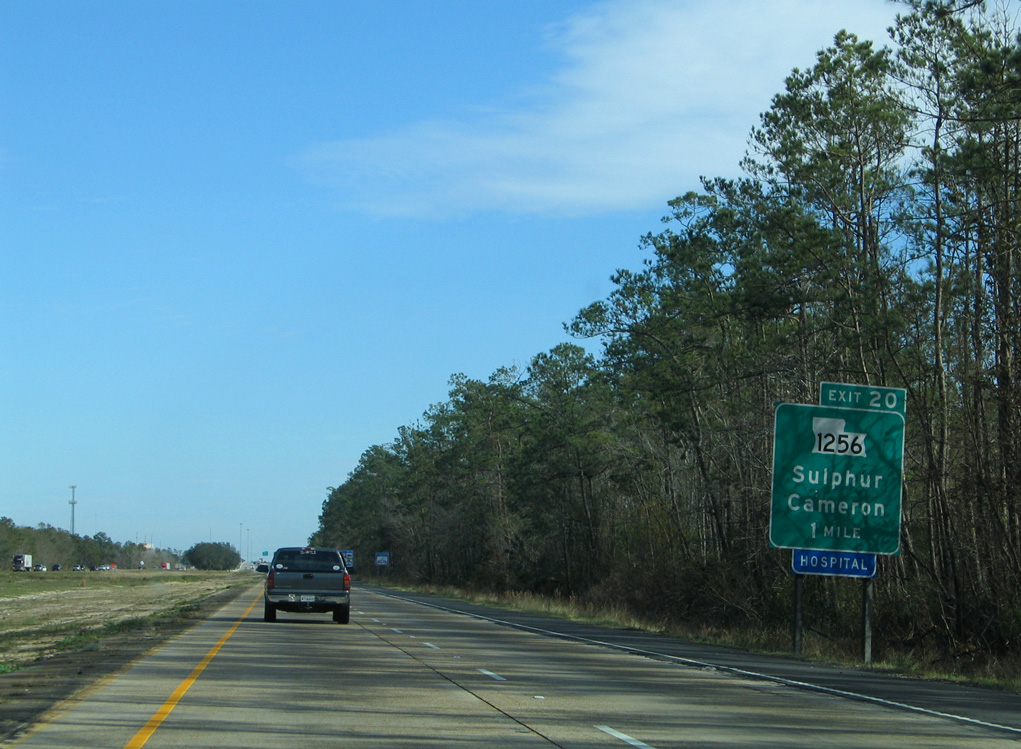
Exit 20 is the first of three interchanges along I-10 for Sulphur. Ruth Street at Exit 20 was previously LA 27 and then LA 27 Business.
01/15/06
01/15/06
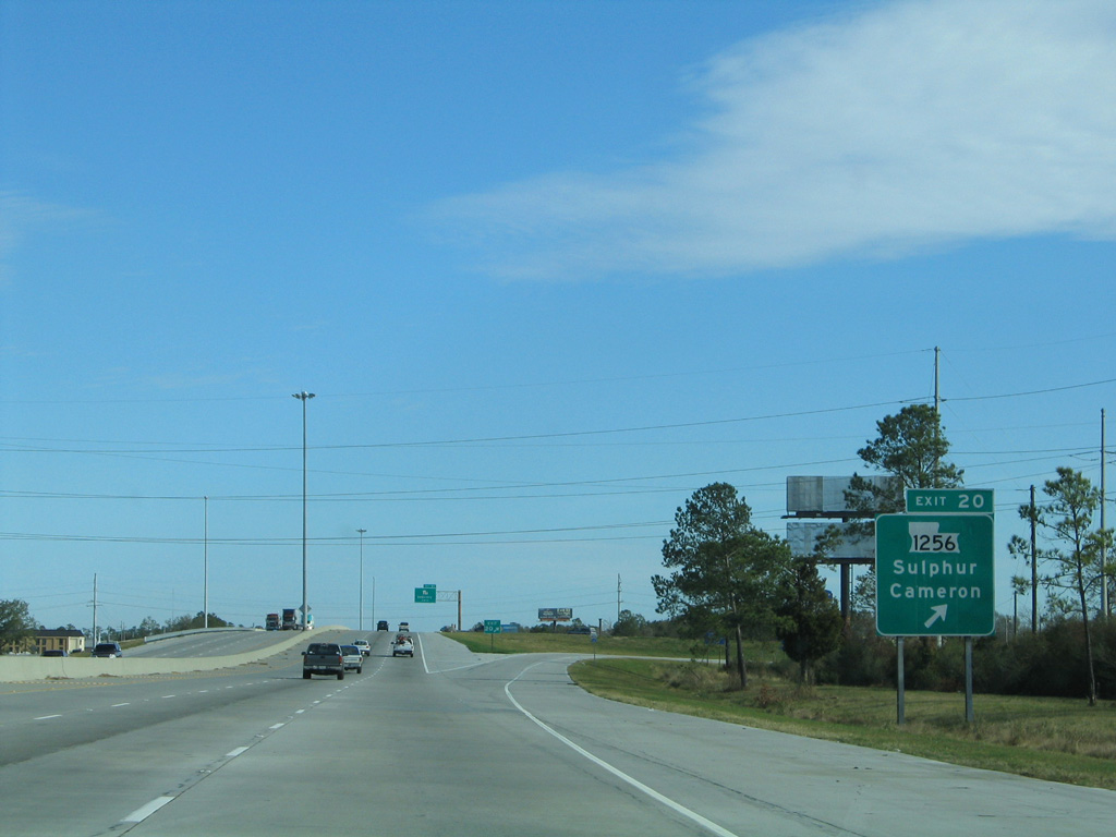
A 2.30 mile long route, LA 1256 provides a cutoff from I-10 east to LA 27 south ahead of Carlyss.
01/15/06
01/15/06
Interstate 10 east from the parclo interchange (Exit 20) with LA 1256 (Ruth Street) was expanded to six lanes in 2003/04.
01/15/06
01/15/06
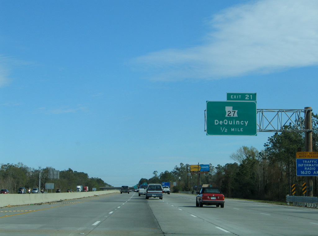
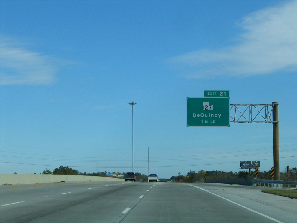
LA 27 is a 132.71 mile long highway north to U.S. 171/190 at DeRidder, south to Holly Beach and Cameron, and east to LA 14 near Holmwood.
01/15/06
01/15/06
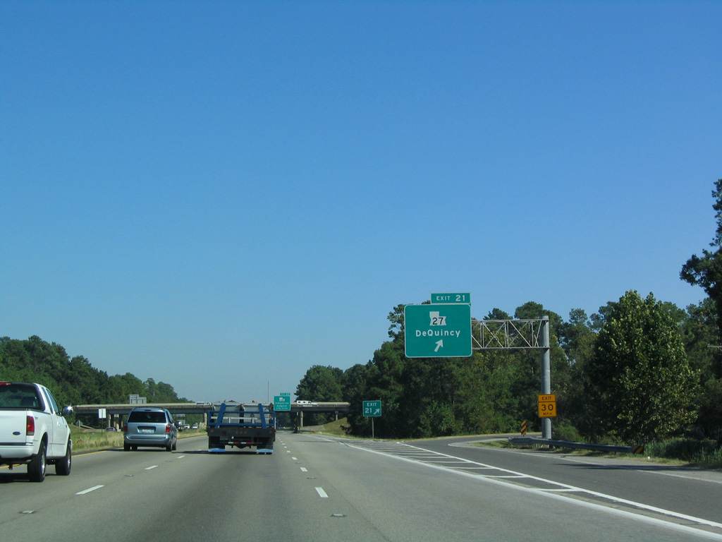
LA 27 (Beglis Parkway) runs north from LA 108 to a diamond interchange (Exit 21) with I-10 in Sulphur and LA 12 at DeQuincy.
10/22/03
10/22/03
01/15/06
05/19/14
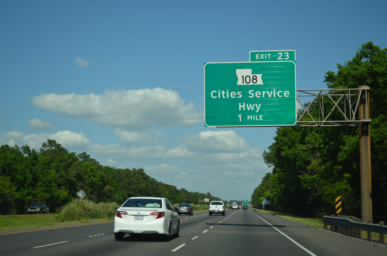
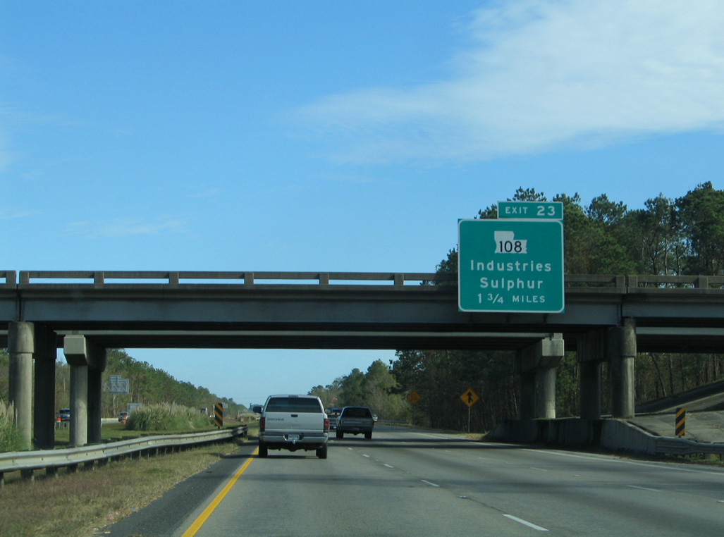
LA 108 returns to Interstate 10 on the east side of Sulphur at Exit 23.
05/19/14
05/19/14
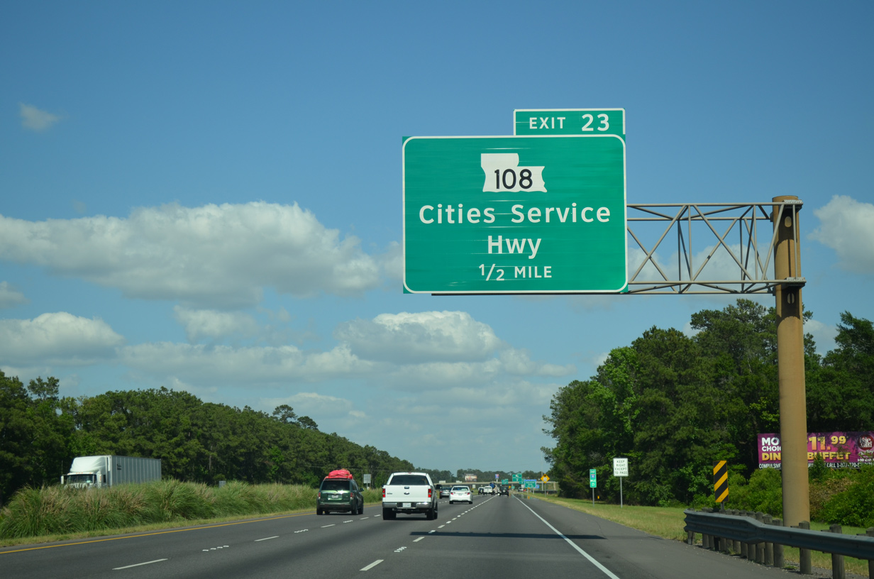
The 24.84 mile route of LA 108 concludes north of I-10 at U.S. 90 near the Maplewood community.
05/19/14
05/19/14
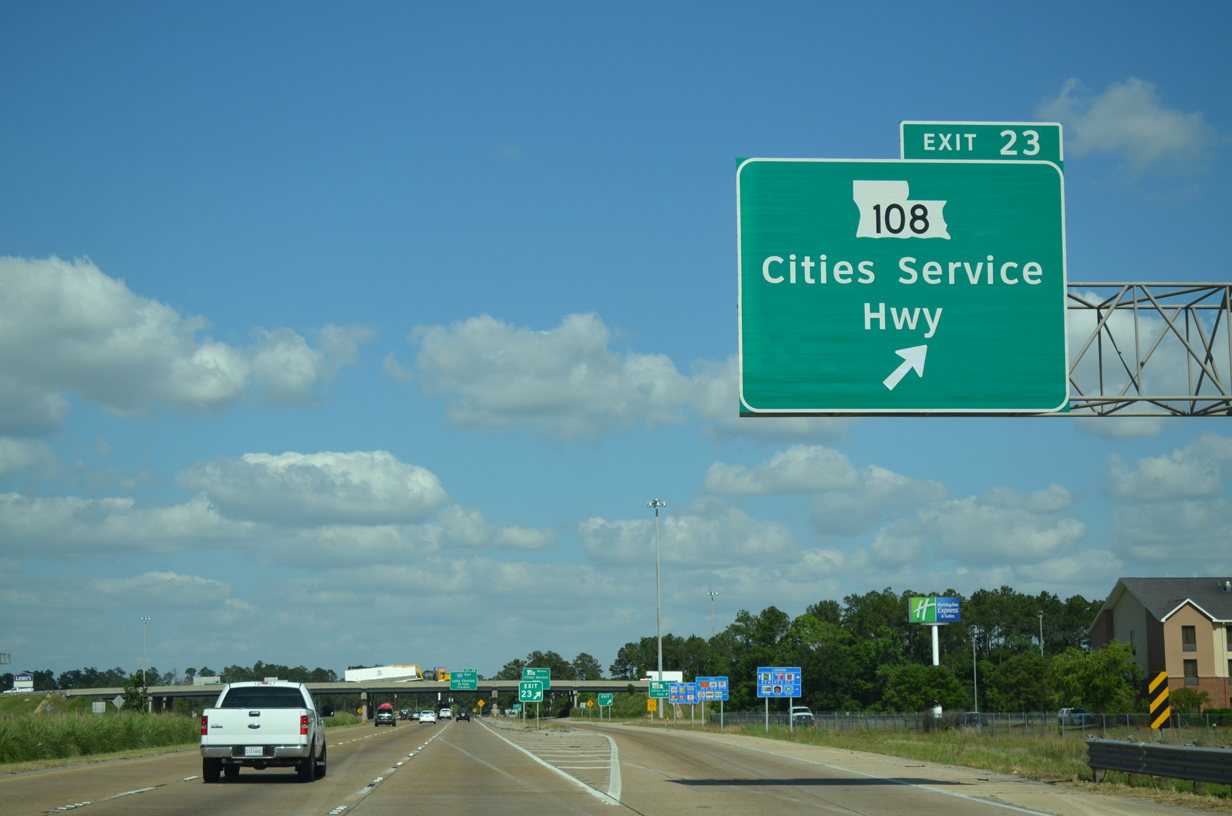
A c/d roadway separates at Exit 23 for the cloverleaf interchange with LA 108 (Cities Service Highway).
05/19/14
05/19/14
05/19/14
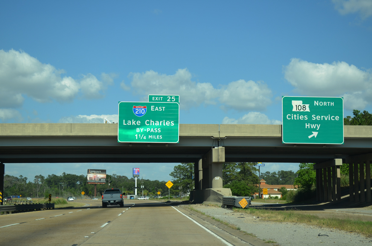
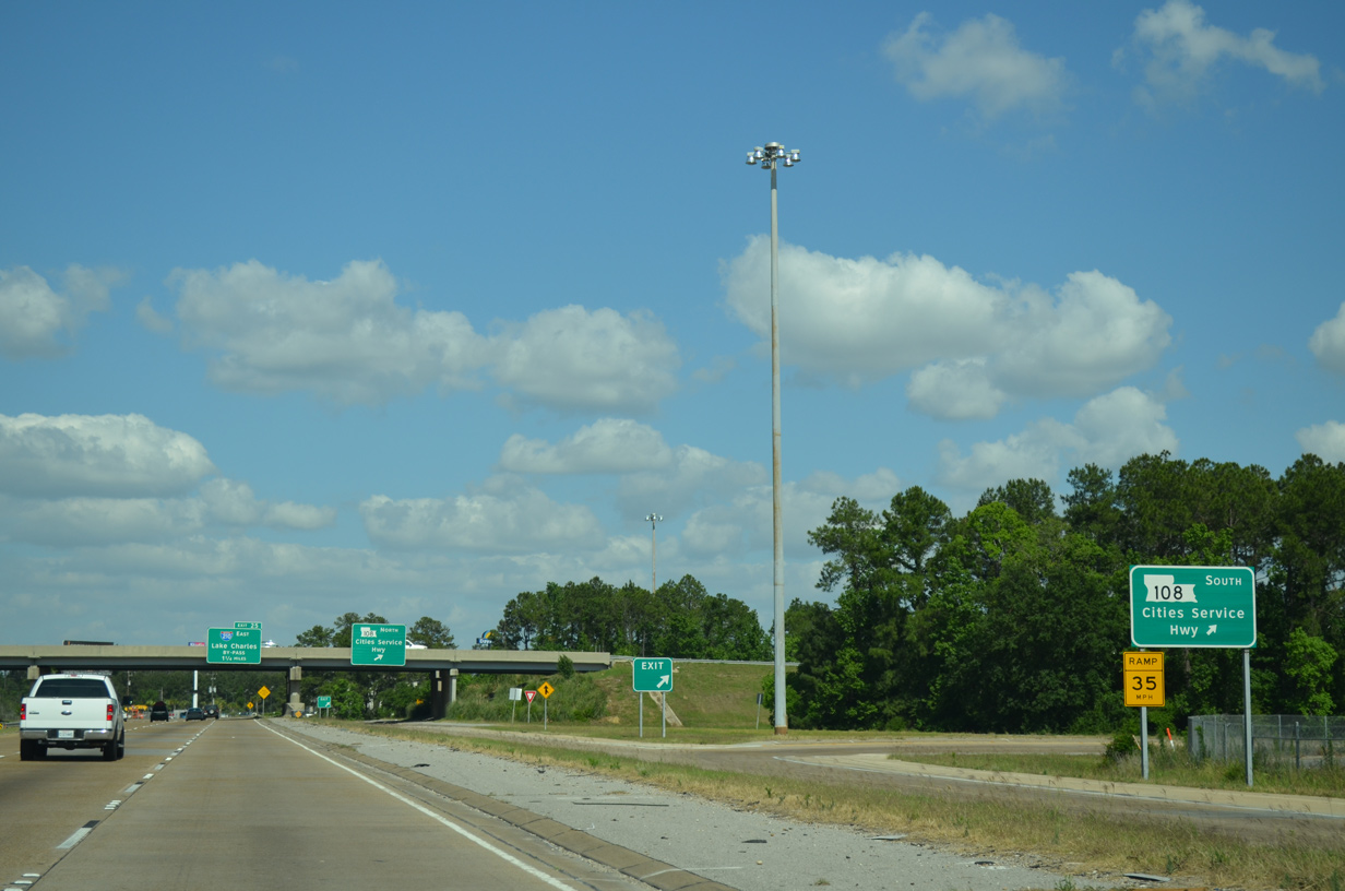
Angling northeast from LA 108, Interstate 10 proceeds 1.25 miles to a directional T interchange (Exit 23) with I-210.
05/19/14
05/19/14
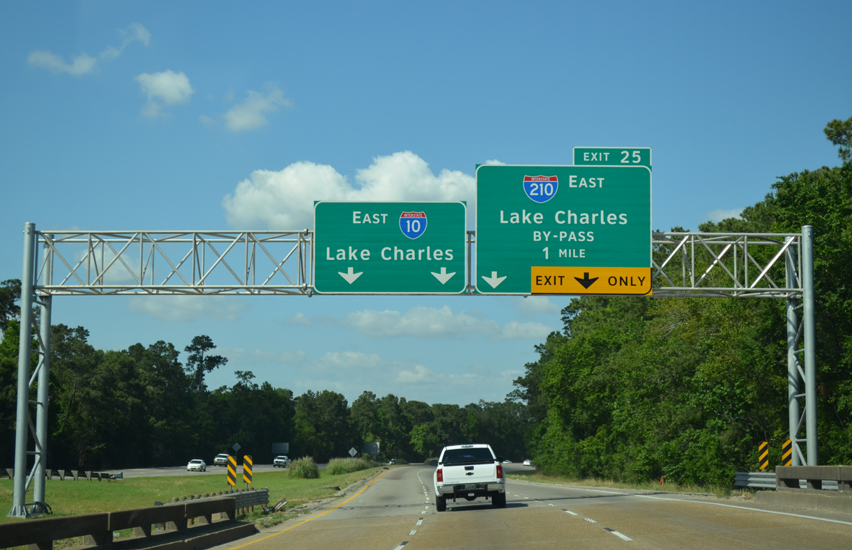
The Lake Charles Bypass loops south across Prien Lake and east to Chennault International Airport (CWF).
05/19/14
05/19/14
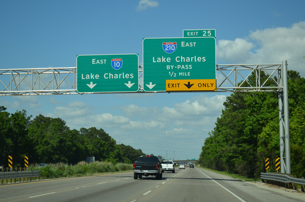
Interstate 210 constitutes a 12.74 mile urban loop.
05/19/14
05/19/14
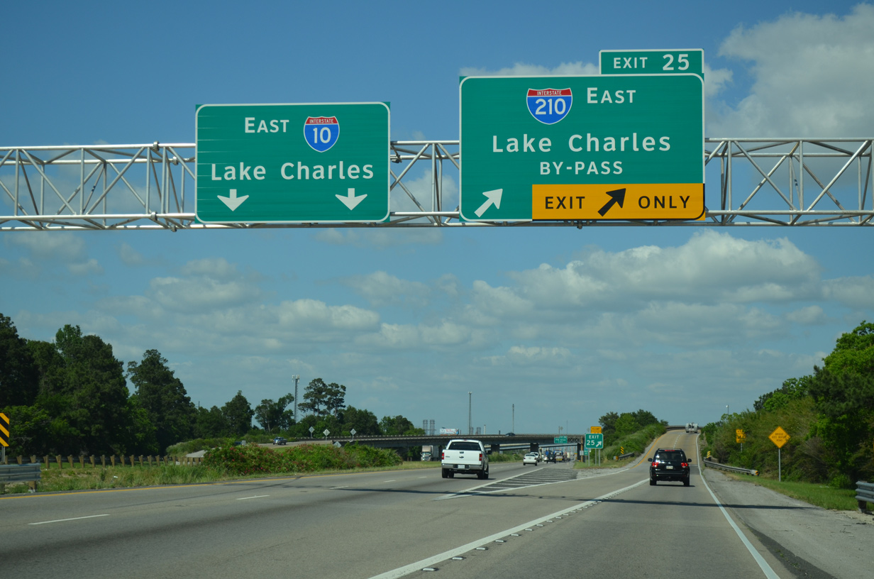
05/19/14
01/15/06
05/19/14
05/19/14
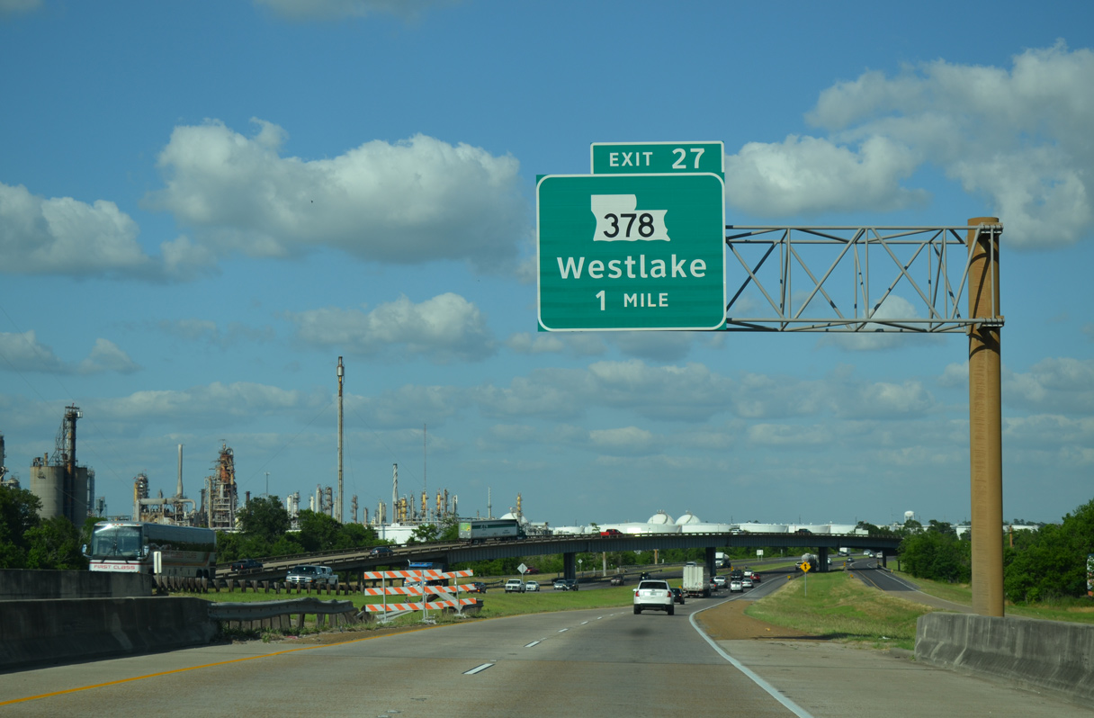
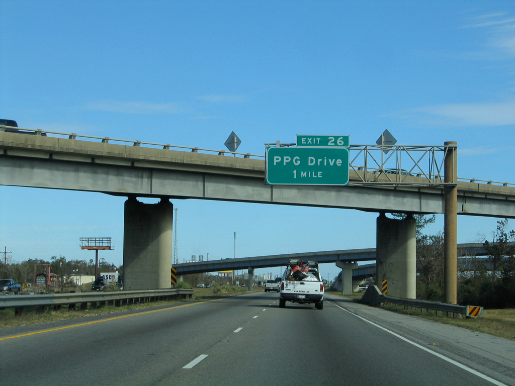
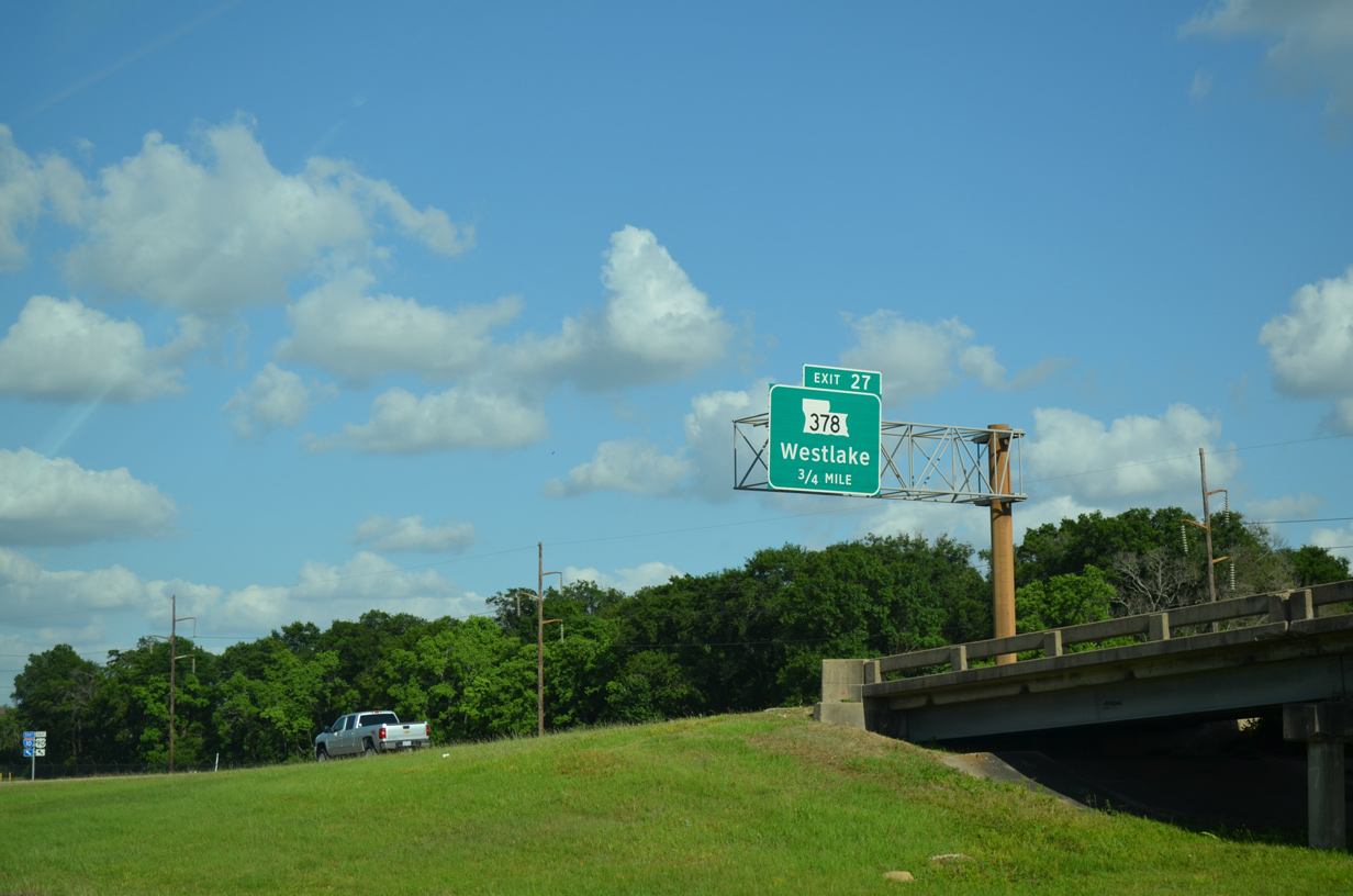
LA 378 (Sampson Street) stems north from a folded diamond interchange (Exit 27) with I-10 into the city of Westlake.
05/19/14
05/19/14
U.S. 90 converges with I-10 at a wye interchange east from Napoleon Street in Sulphur.
05/19/14
05/19/14
East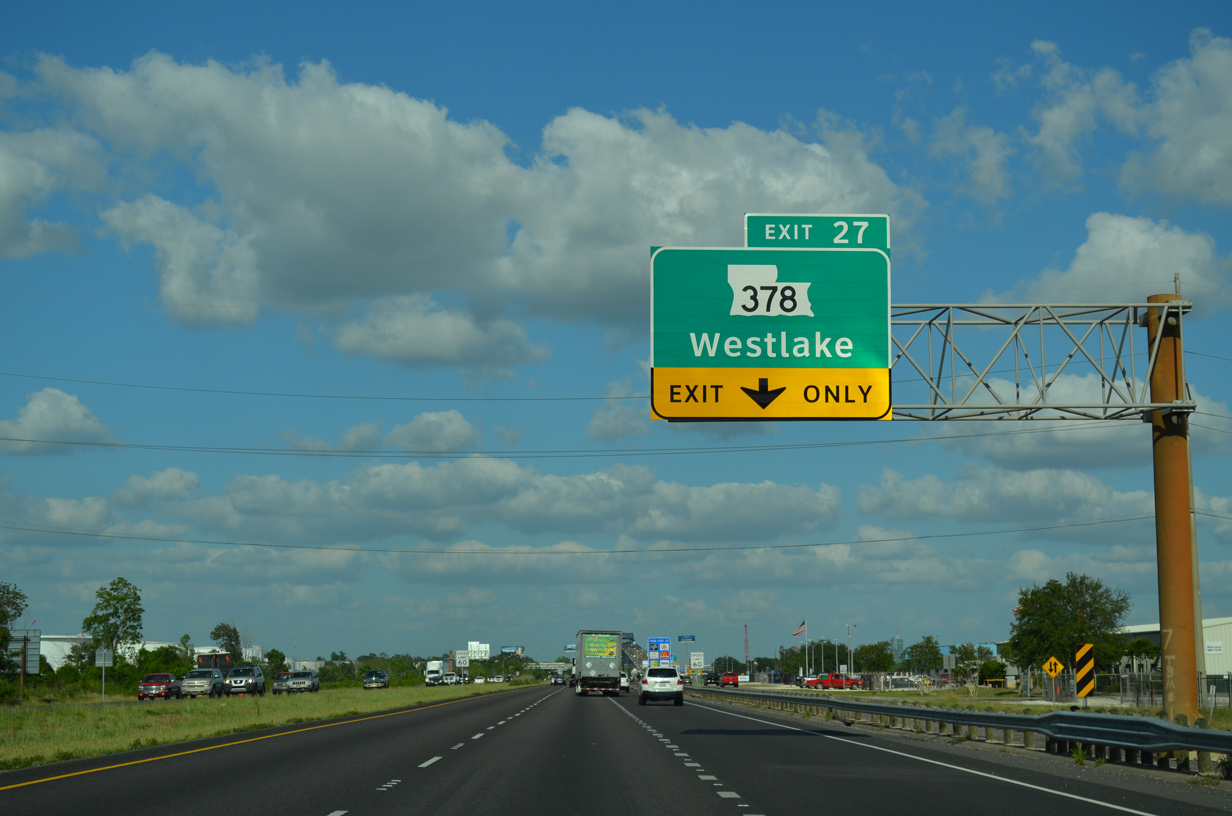
Auxiliary lanes accompany both sides of Interstate 10 between U.S. 90 and Exit 27 with LA 378.
05/19/14
05/19/14
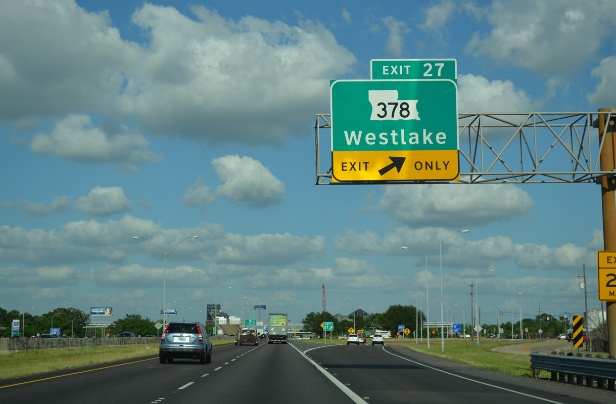
Louisiana Highway 378 is an 8.00 mile loop north from Westlake to Sam Houston Jones State Park and east to U.S. 171 at Moss Bluff.
05/19/14
05/19/14
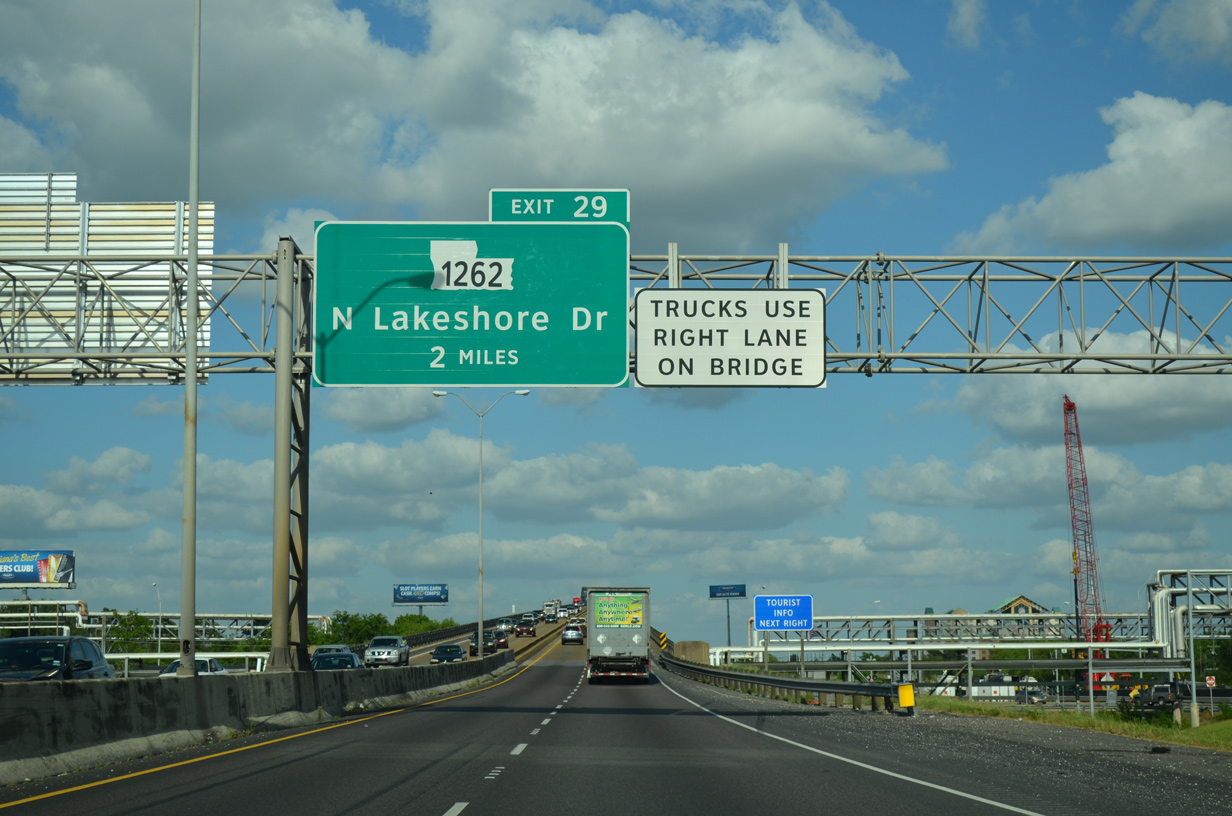
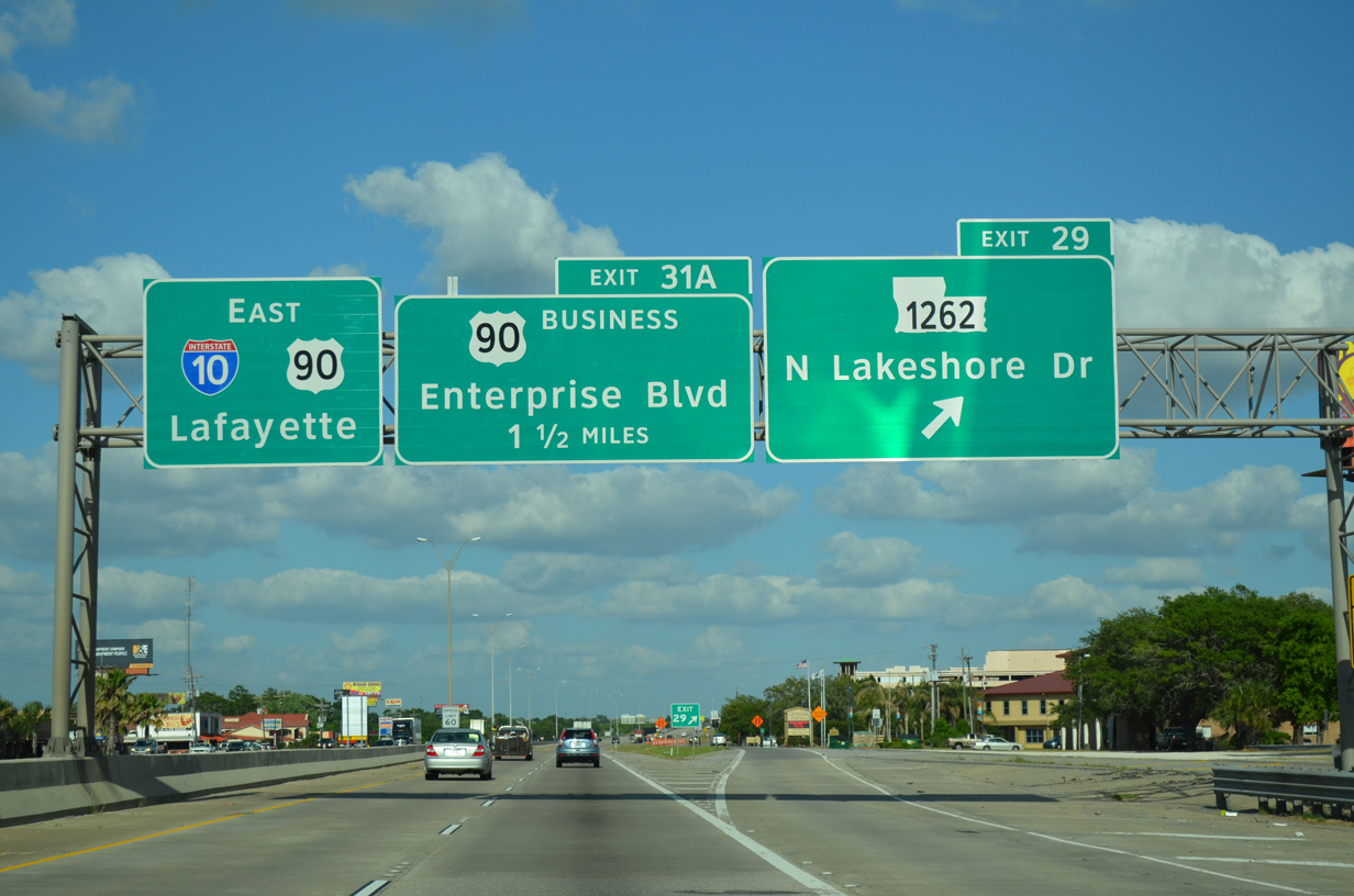
Exit 29 follows Calcasieu River Bridge with N Lakeshore Drive and LA 1262 south into Downtown Lake Charles.
05/19/14
05/19/14
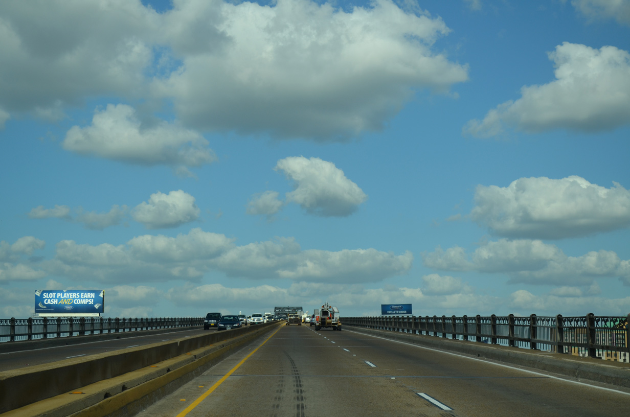
The high rise bridge taking I-10/U.S. 90 across the Calcasieu River and Lake Charles was built in 1952.1
05/19/14
05/19/14
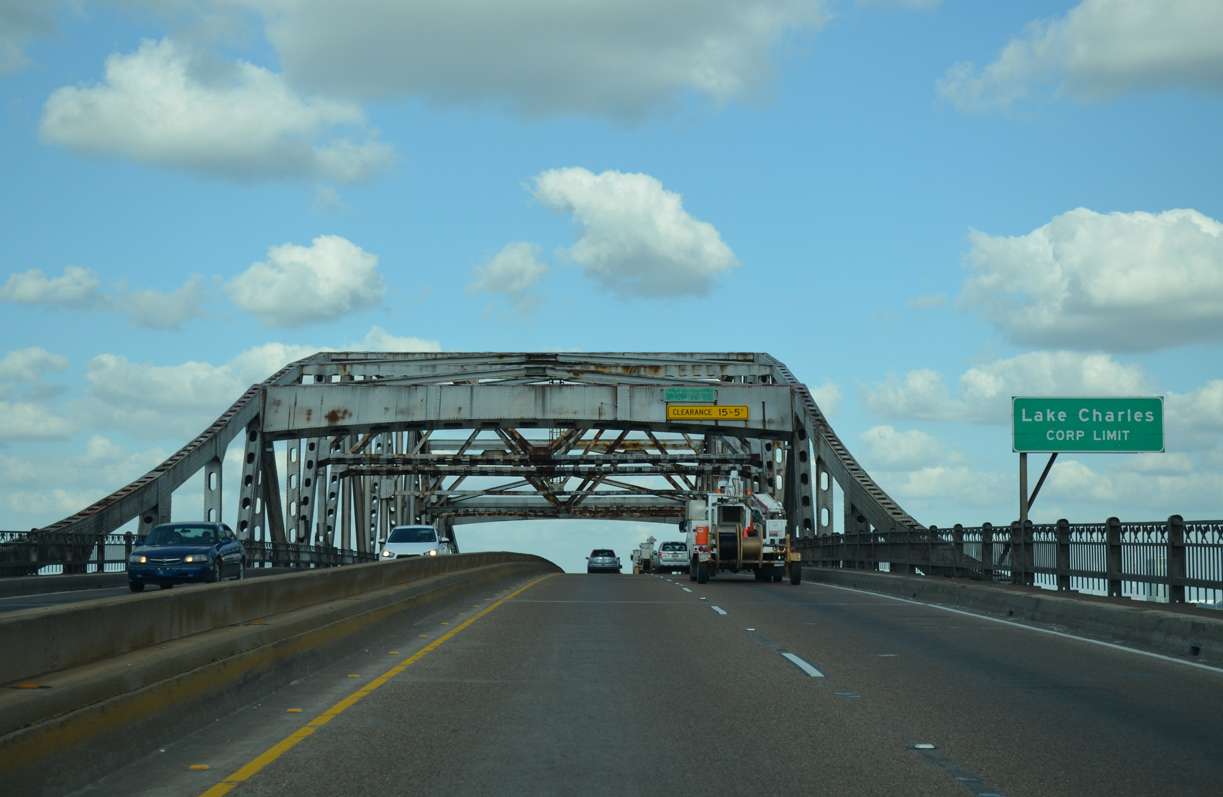
The 6,607 foot long through truss bridge over the Calcasieu River crests at 134.5 feet.1
05/19/14
05/19/14
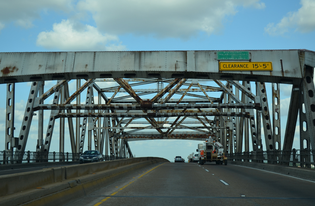
A placard on the Calcasieu River Bridge superstructure reads "Built under the administration of Gov. Earl K. Long."
05/19/14
05/19/14
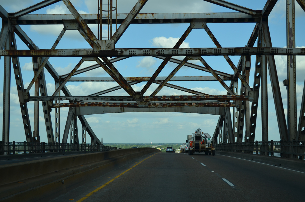
The Calcasieu River Bridge accommodates just four lanes across a 52.5 foot wide deck.1
05/19/14
05/19/14
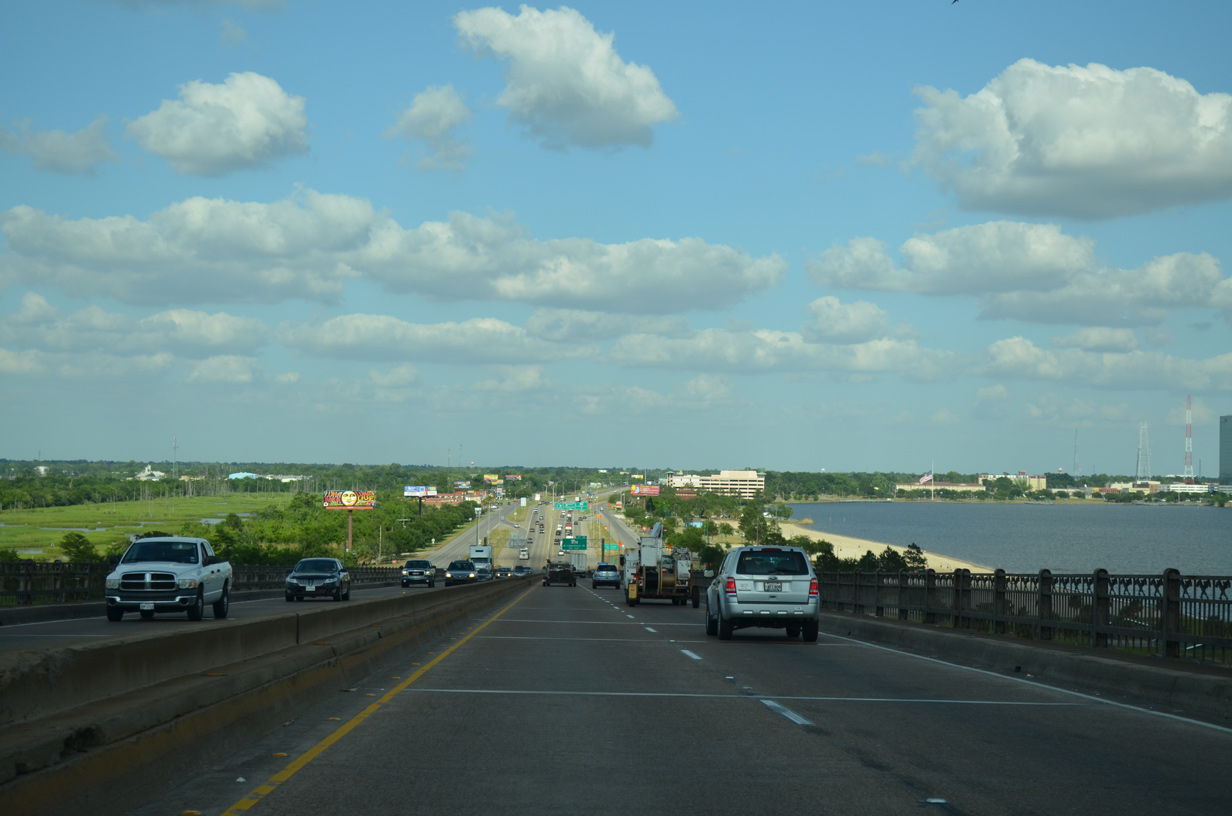
I-10/U.S. 90 lower onto a narrow strip of land between Lake Charles and the Calcasieu River.
05/19/14
05/19/14
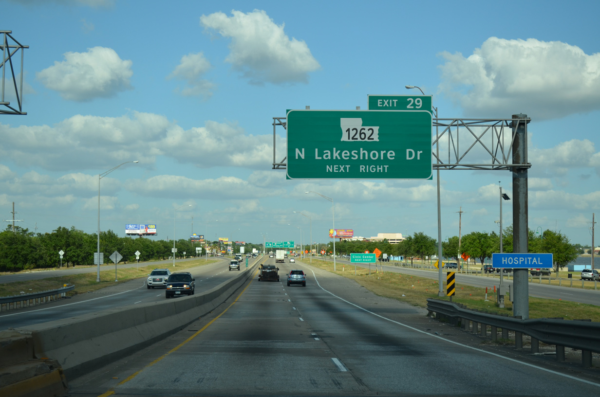
LA 1262 was designated over 0.52 miles of LA 385 south from I-10 to Broad Street and Lakeshore Drive in Downtown. LA 385 was truncated to the Ryan Street bridge over a coulee south of Clarence Street.
05/19/14
05/19/14
LA 1262 spurs south along Veterans Memorial Boulevard to Lake Charle Civic Center.
05/19/14
05/19/14
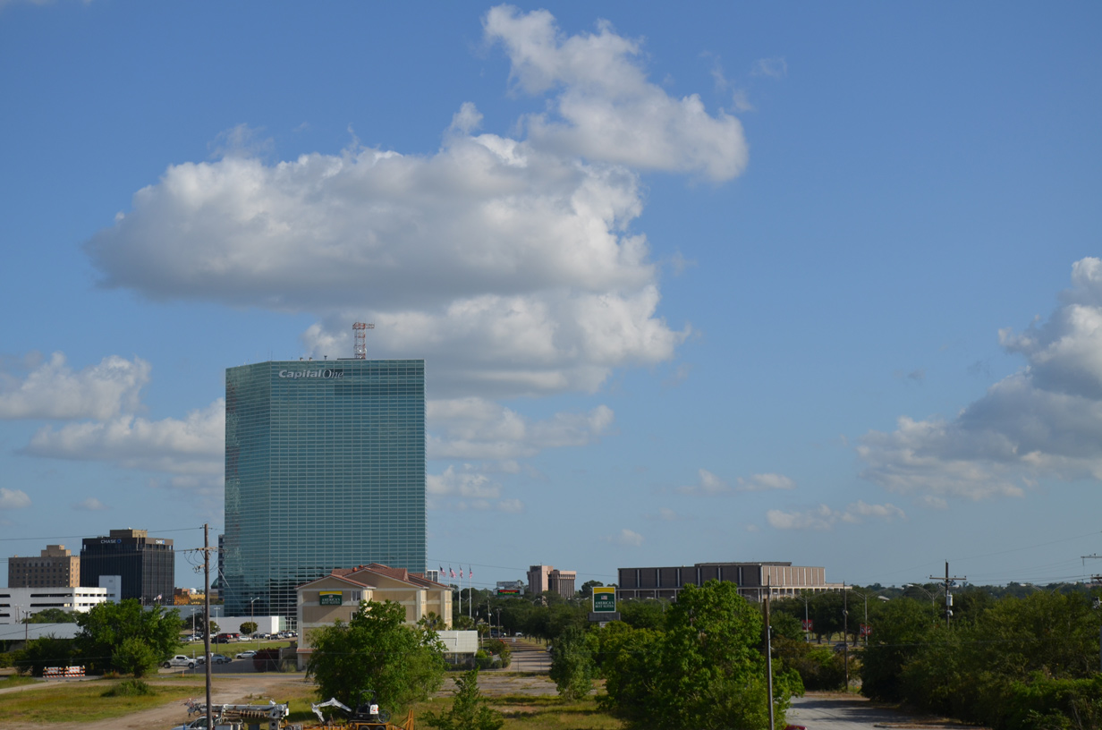
Downtown Lake Charles
05/19/14
05/19/14

Confirming markers for I-10/U.S. 90 posted beyond the N Lakeshore Drive entrance ramp and LA 1262 were replaced with a bridge ices before road sign.
01/15/06
01/15/06
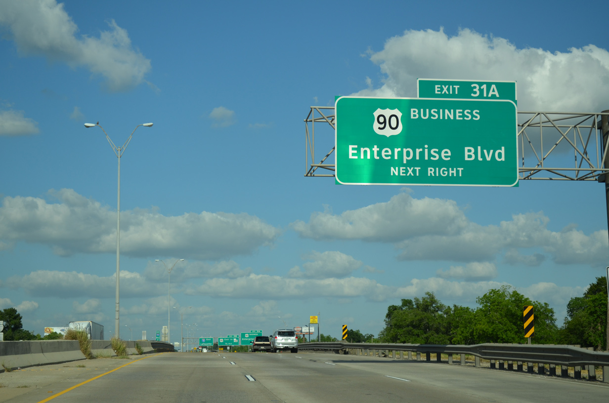
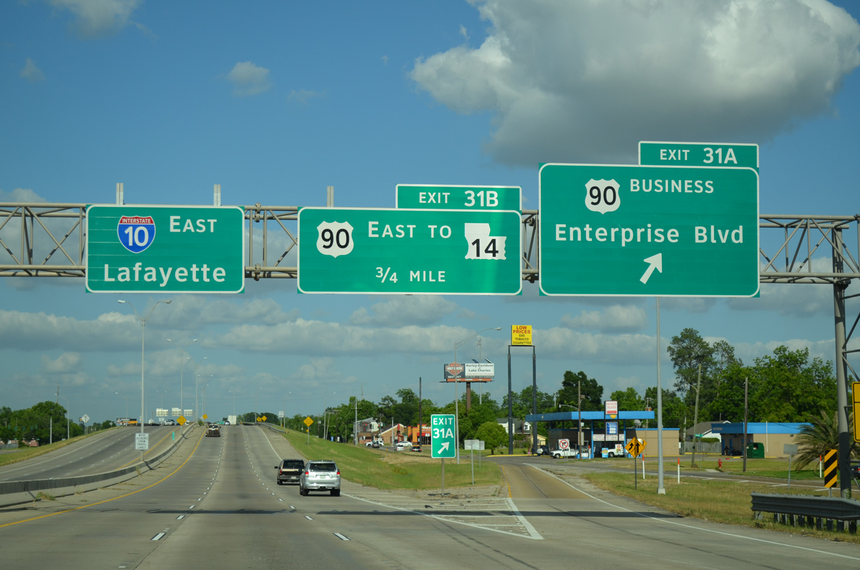
U.S. 90 Business forms a 3.21 mile loop from I-10/U.S. 90 at Exit 31A and U.S. 90 (Fruge Street) at Pamco Road and I-210.
05/19/14
05/19/14
05/19/14

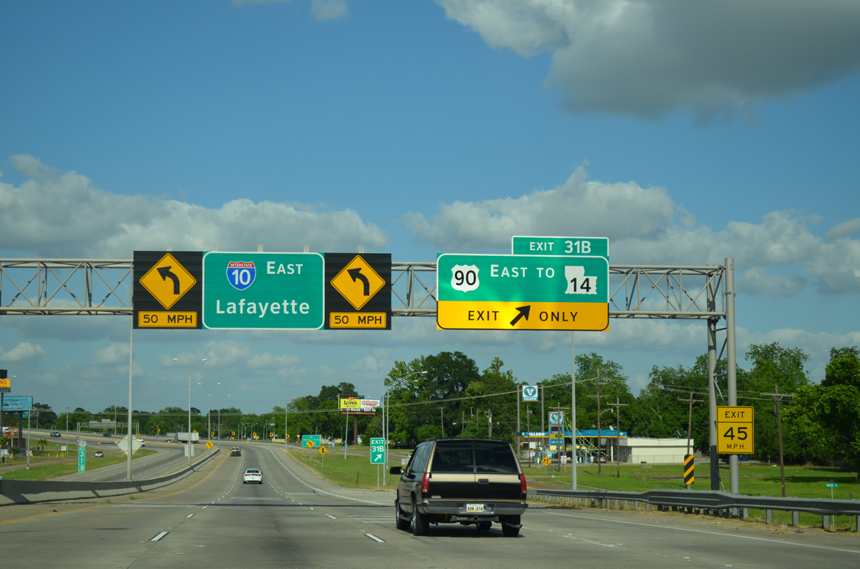
U.S. 90 splits with I-10 east for Fruge Street at Exit 31B.
05/19/14
05/19/14
U.S. 90 (Fruge Street) connects with the north end of LA 14 and south end of U.S. 171 at Martin Luther King Highway.
05/19/14
05/19/14
East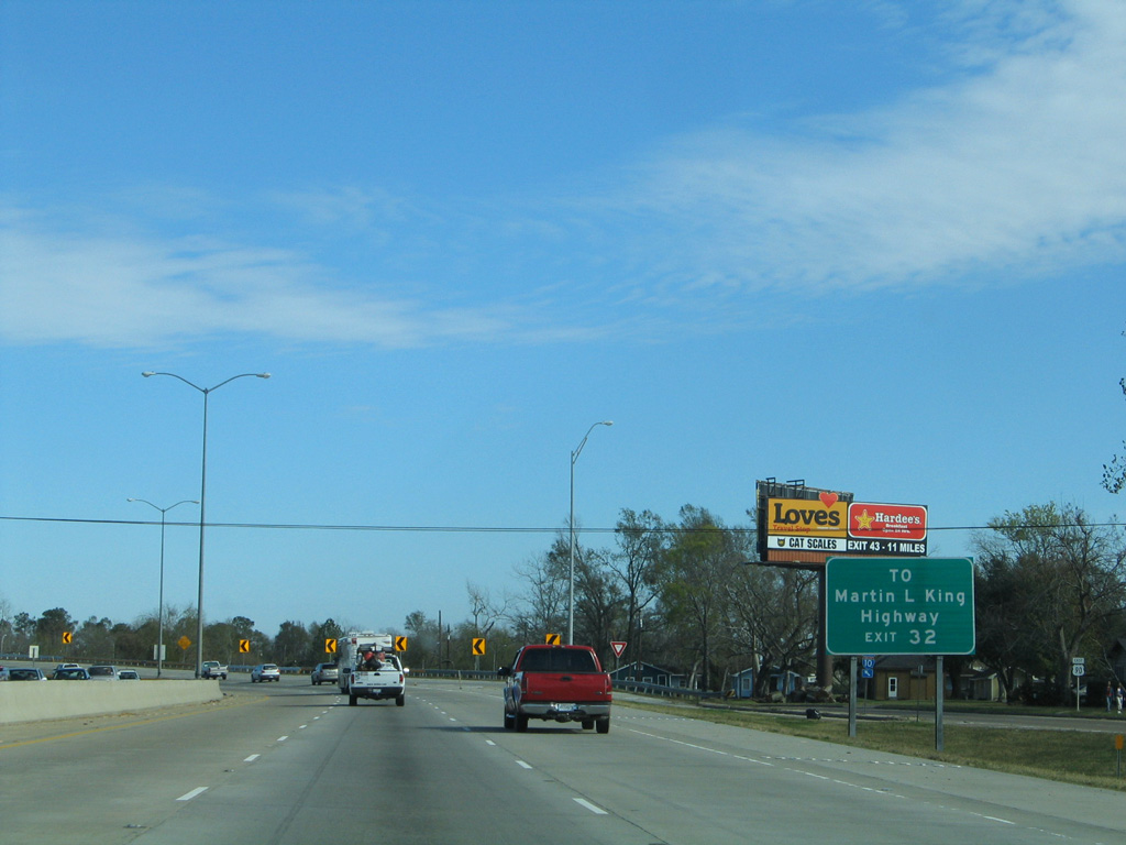
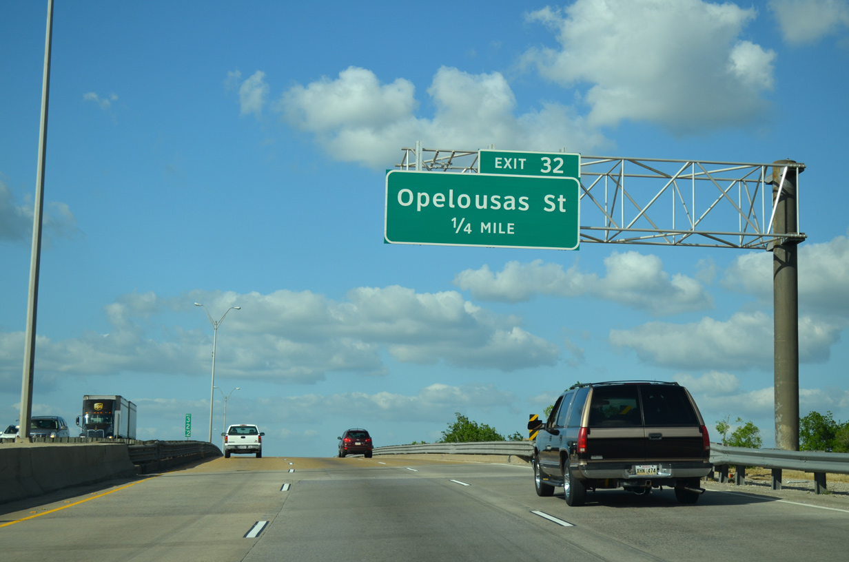
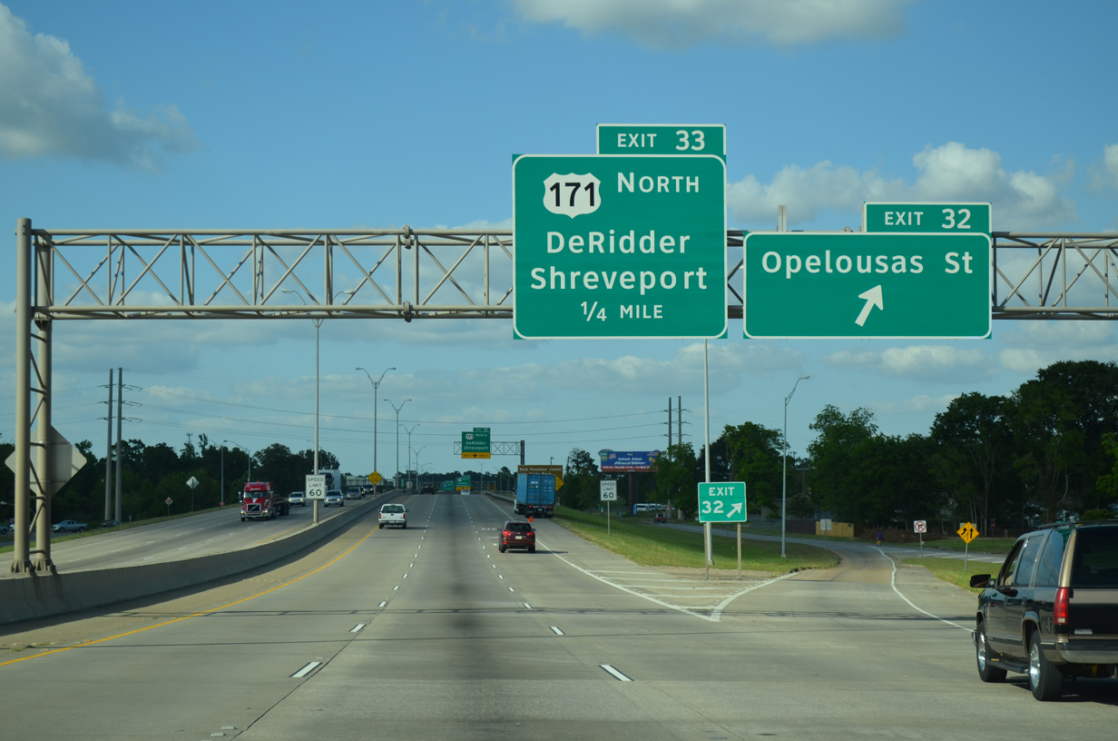
Opelousas Street intersects Martin Luther King Highway just east of forthcoming Exit 32.
01/15/06
01/15/06
05/19/14
A reassurance marker posted along the viaducts spanning a Union Pacific Railroad yard was removed in early 2014.
01/15/06
01/15/06
05/19/14
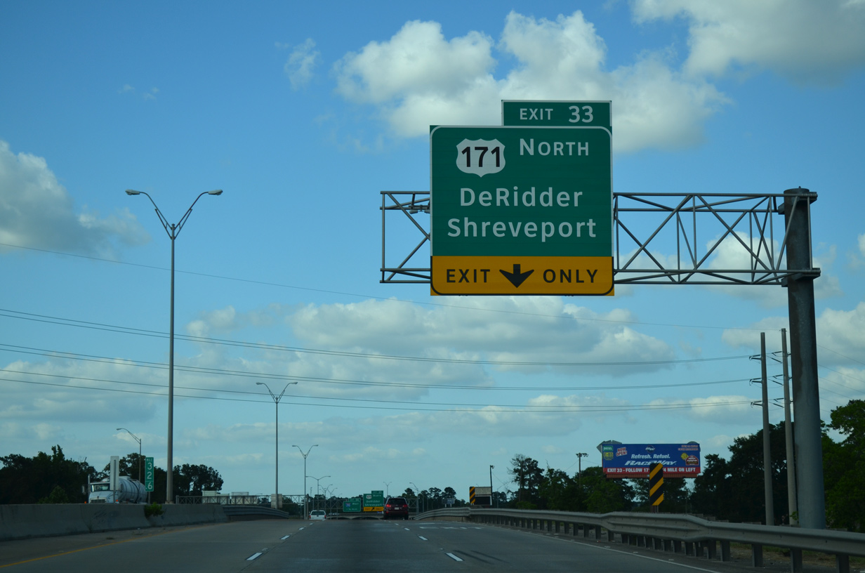
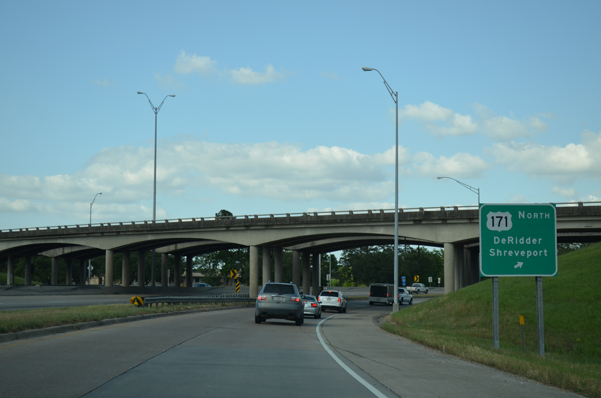
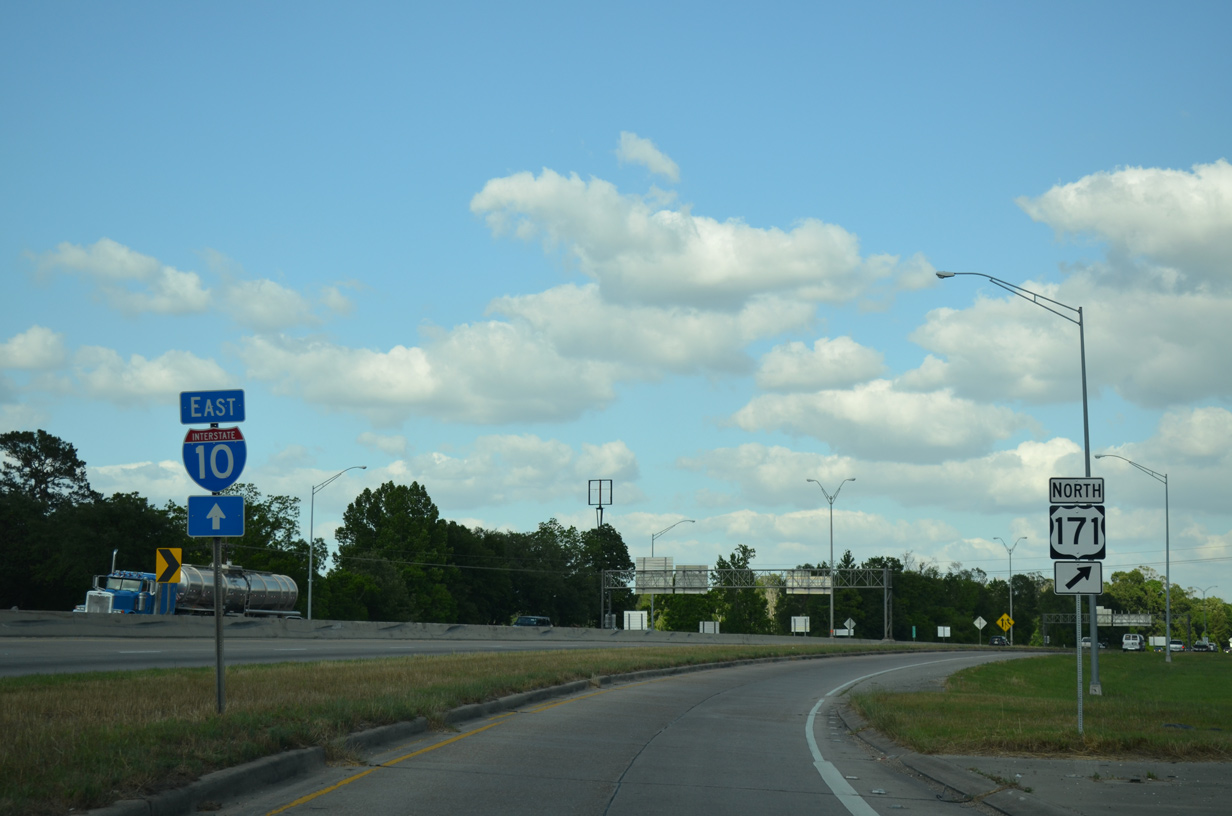
A three-quarter cloverleaf interchange joins I-10 east with U.S. 171 (Martin Luther King Highway) northbound at Exit 33.
05/19/14
05/19/14
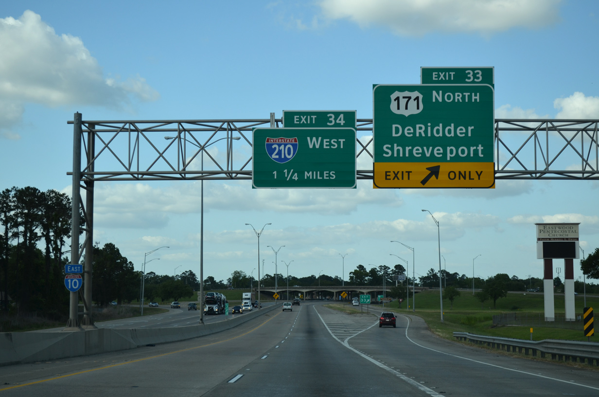
U.S. 171 heads 41.82 miles north from U.S. 90 in Lake Charles to LA 26 at DeRidder and 177.43 miles overall to U.S. 79/80 in Shreveport.
05/19/14
05/19/14
05/19/14
05/19/14

Interstate 210 returns to I-10 at Exit 34 east of Kayouche Coulee
05/19/14
05/19/14
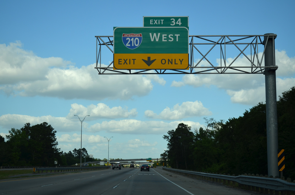
I-210 heads south from Exit 34 to Chennault International Airport (CWF) and LA 14 to LA 27 and Cameron Parish.
05/19/14
05/19/14
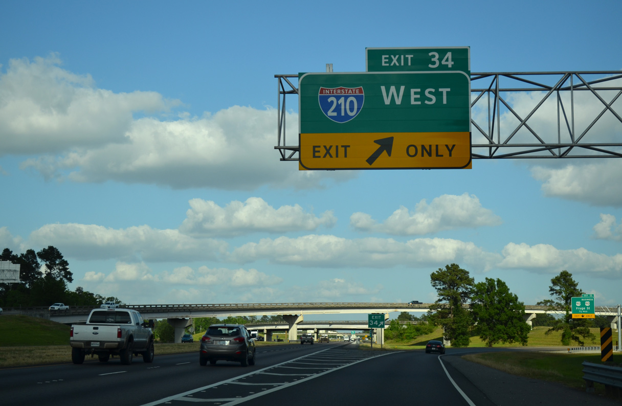
Interstate 210 west begins at a directional T interchange (Exit 34) with I-10.
05/19/14
05/19/14
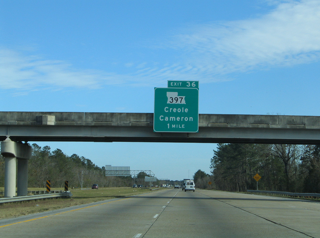
Leaving Lake Charles, I-10 next meets LA 397 at Chloe.
01/15/06
01/15/06
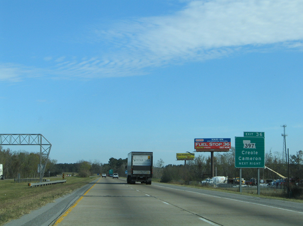
LA 397 (Ward Line Road) leads 6.23 miles south from the parclo interchange at Exit 36 to LA 14 toward Cameron.
01/15/06
01/15/06
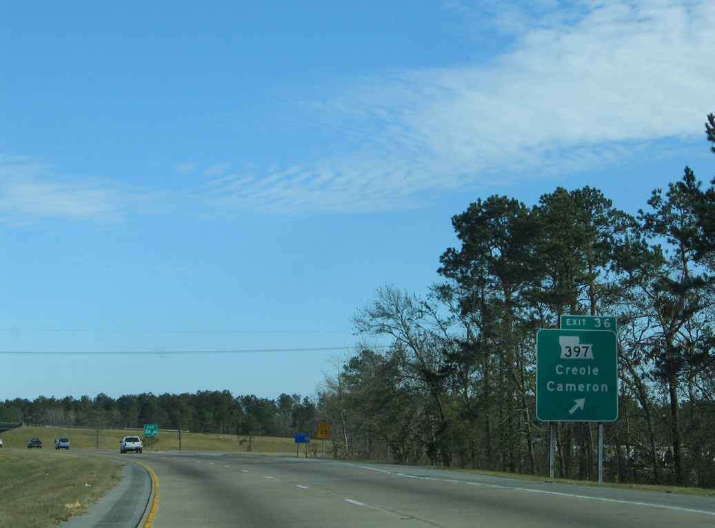
Creole is an unincorporated community along LA 82 near the Gulf of Mexico.
01/15/06
01/15/06
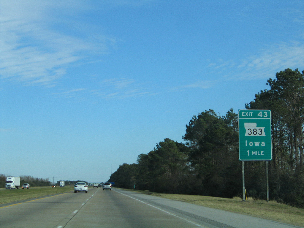
LA 383 meets Interstate 10 at a diamond interchange (Exit 43) in the town of Iowa.
01/15/06
01/15/06
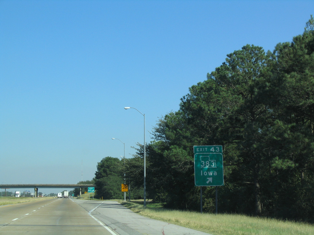
LA 383 travels 25.73 miles north from U.S. 90 in Iowa to U.S. 190 at Kinder.
10/22/03
10/22/03
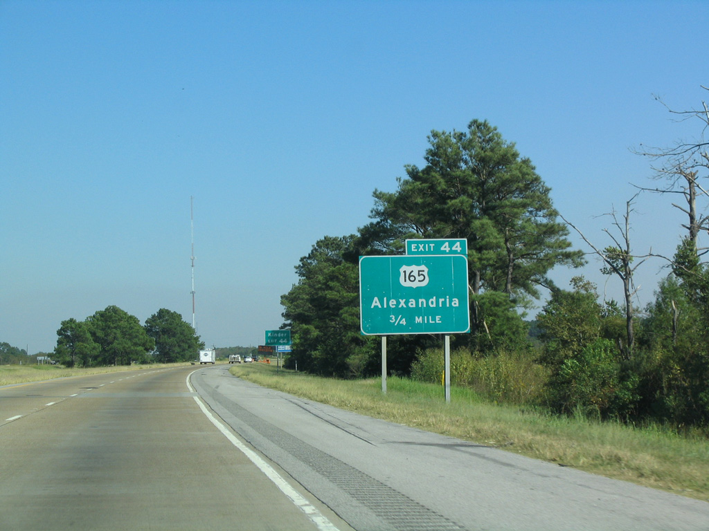
U.S. 165 originates at U.S. 90 just south of Exit 44.
10/22/03
10/22/03

U.S. 165 bee lines northeast from Interstate 10 to U.S. 190 in the town of Kinder.
01/15/06
01/15/06

Regionally, U.S. 165 joins the Louisiana Gulf Coast with Alexandria and Monroe.
10/22/03
10/22/03


References:
- I0010 over CALCASIEU RIVER, RR, STS, Calcasieu Parish, Louisiana. http://bridgereports.com/1227964 BridgeReports.com
Photo Credits:
- Alex Nitzman: 01/15/06, 05/19/14
- AARoads: 10/22/03
- ABRoads: 10/22/03, 05/19/14
Connect with:
Page Updated Thursday August 27, 2020.