
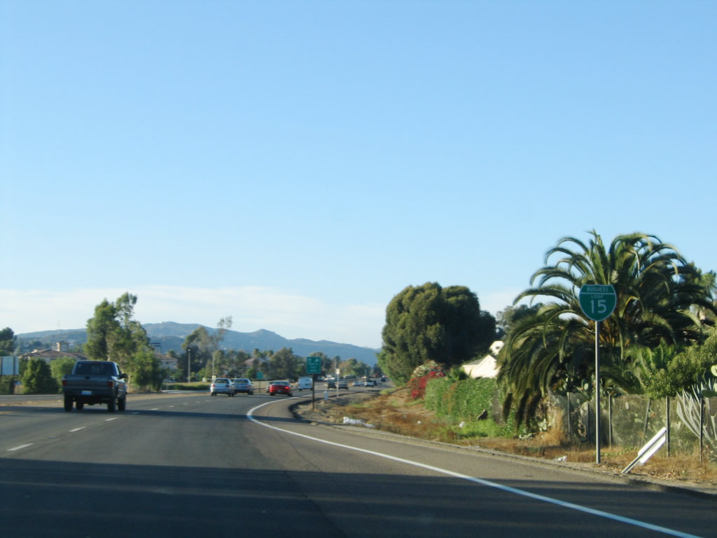
Business Loop I-15 - Escondido

Business Loop I-15 in Escondido follows Old U.S. Highway 395 between Exits 28 and 34 along Centre City Parkway. Bypassing Downtown to the west, the entire route is a four-lane, divided arterial.
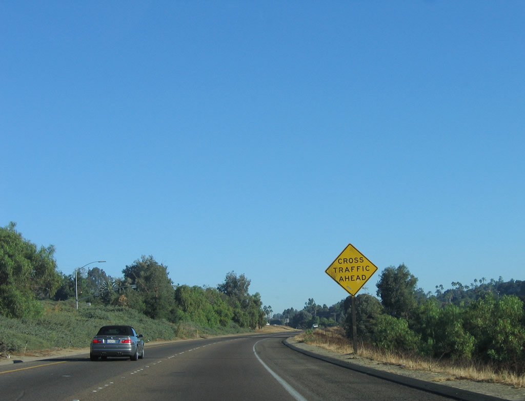
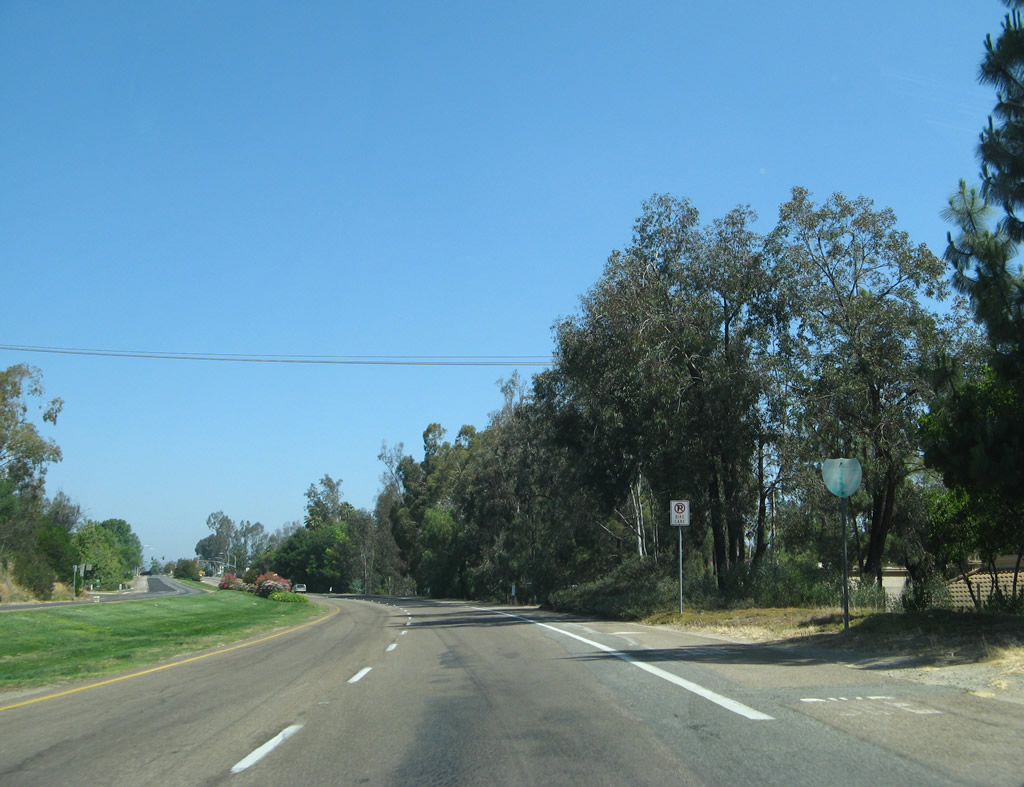
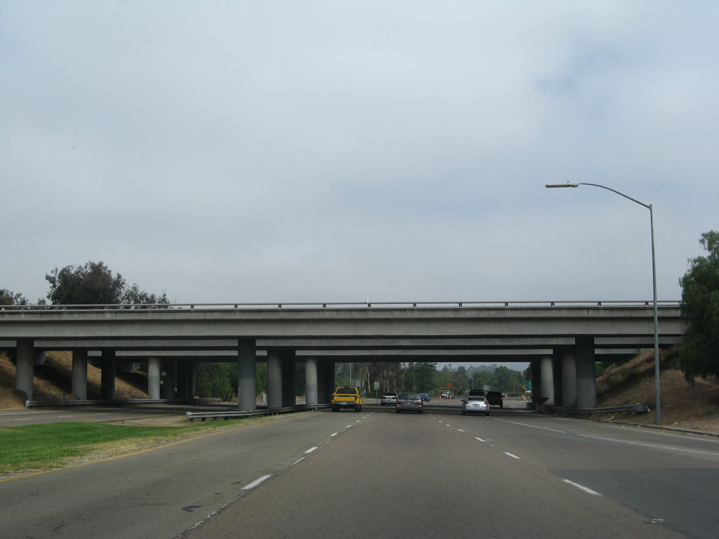
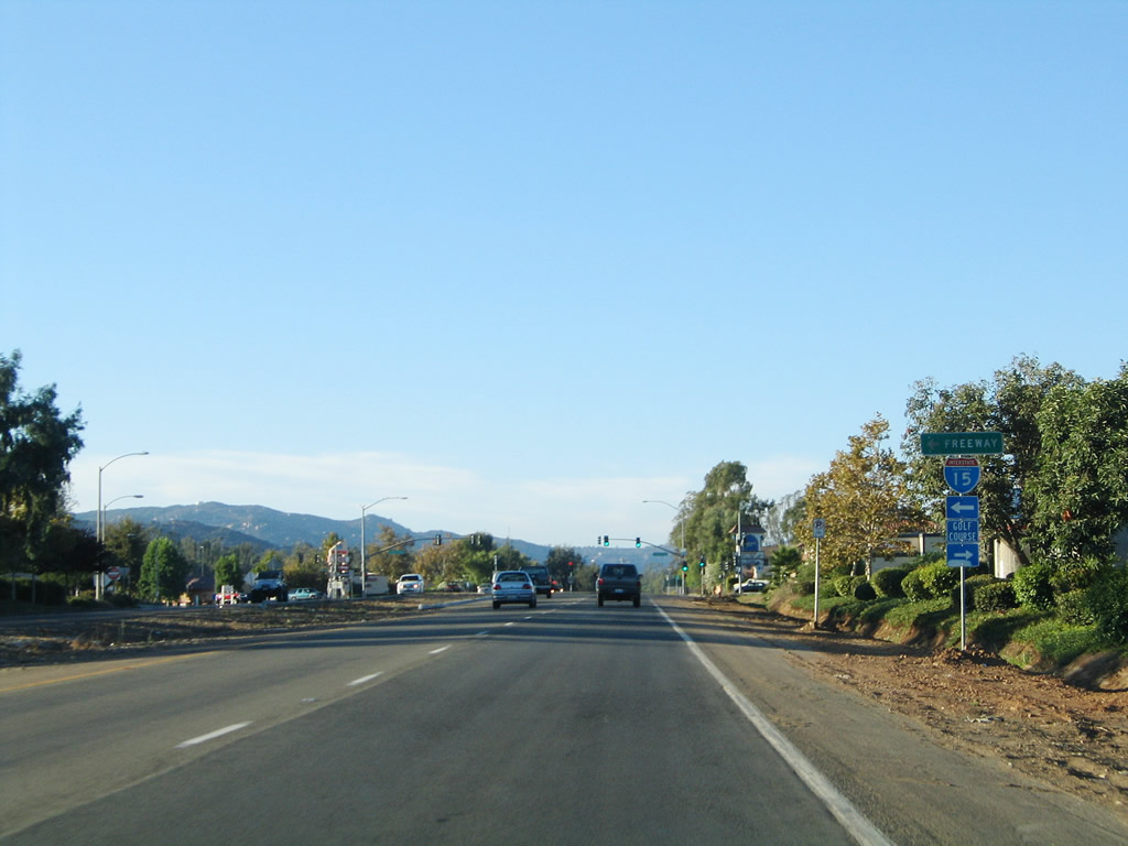
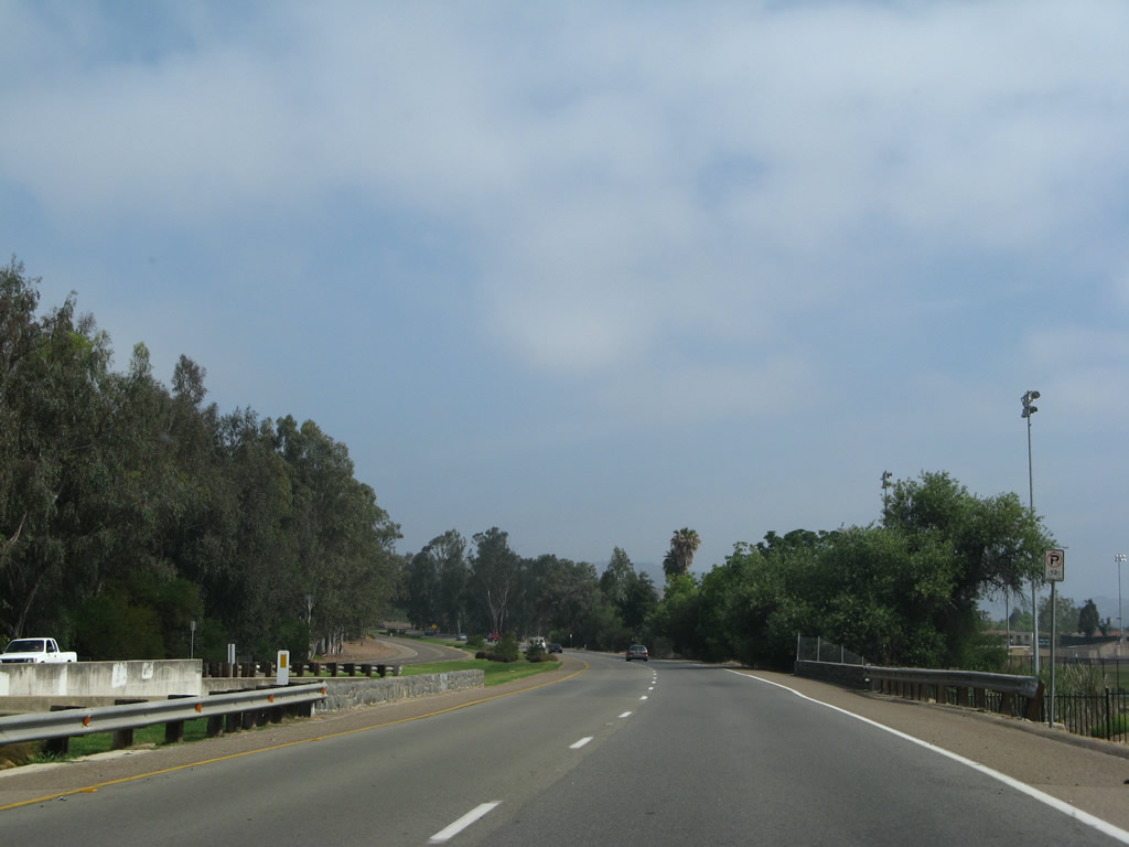
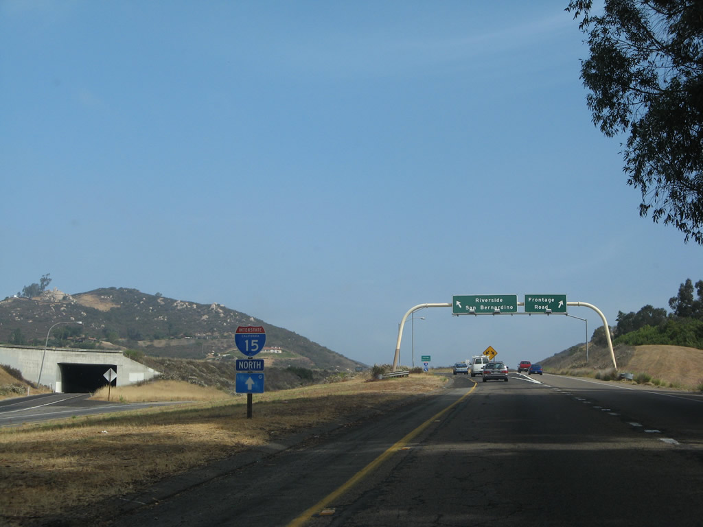
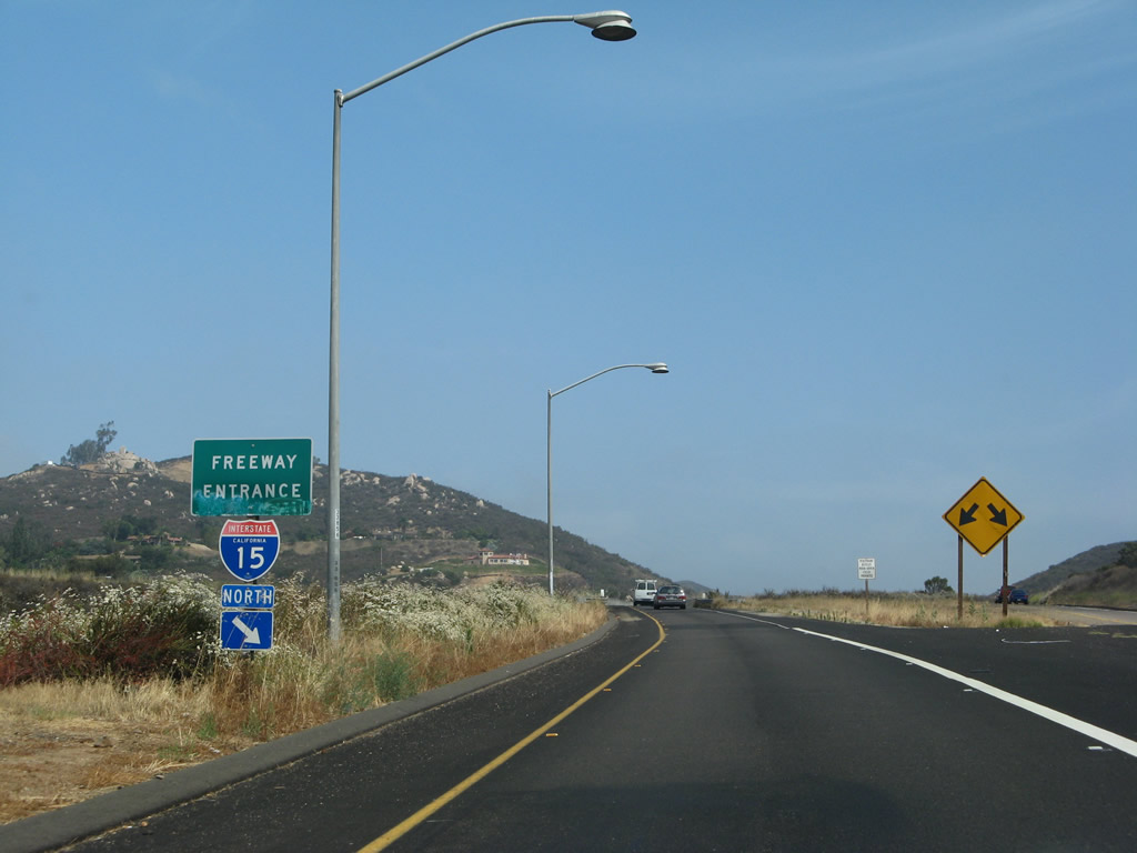
Business Loop I-15 (Centre City Parkway) separates from I-15 north with limited access for 0.6 miles.
10/13/05
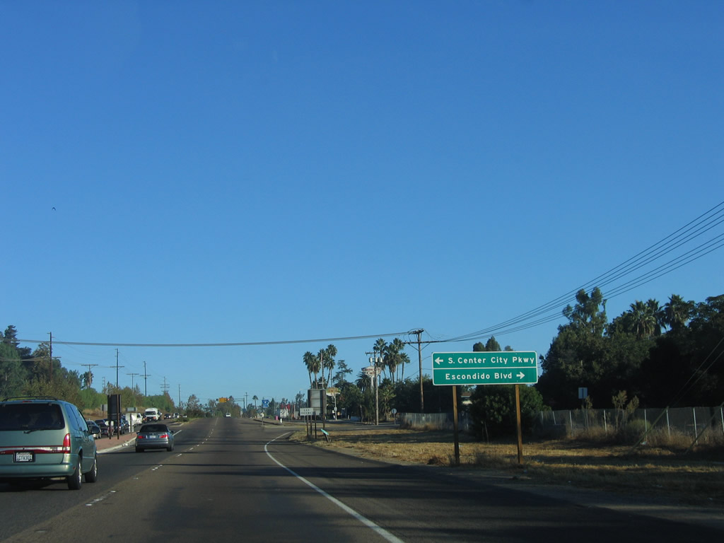
An access road llinks Centre City Parkway with S Centre City Parkway and S Escondido Boulevard, frontage roads for Business Loop I-15. Escondido Boulevard is the original route of U.S. 395 through Escondido; Centre City Parkway was built as the expressway bypass of Downtown Escondido.
10/13/05
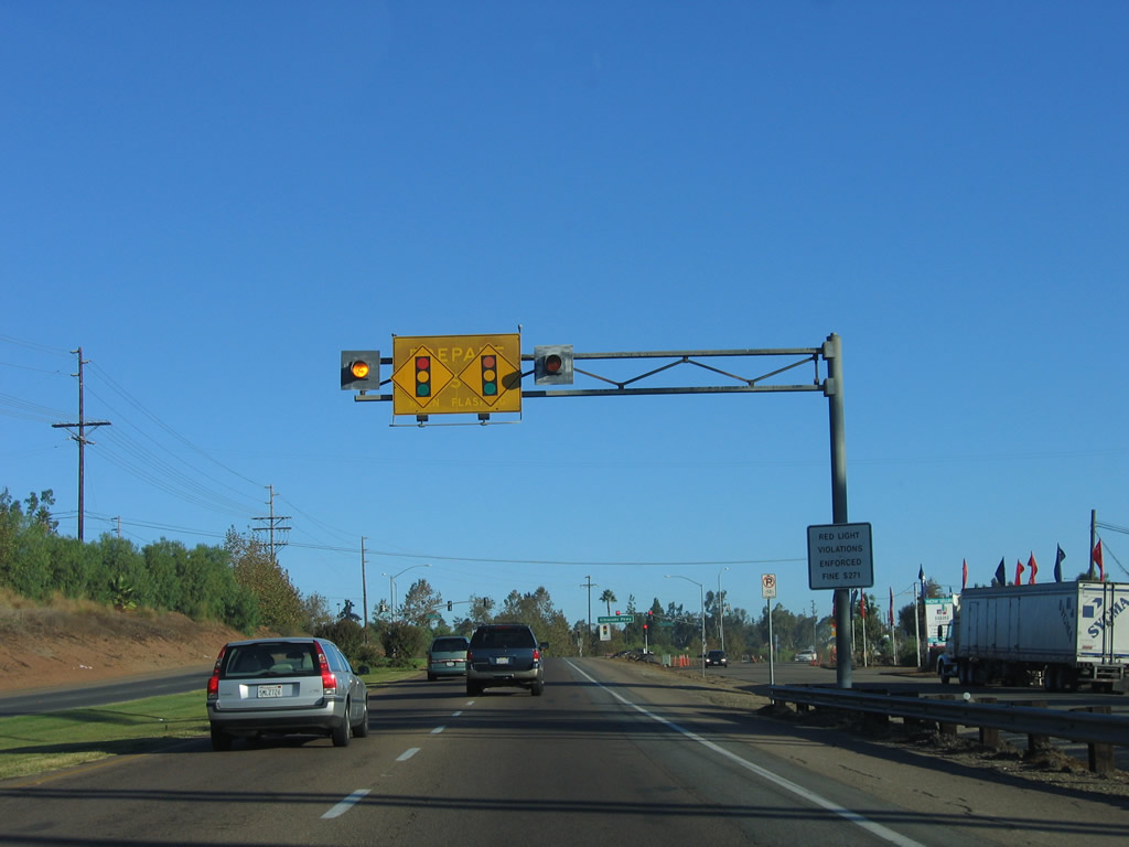
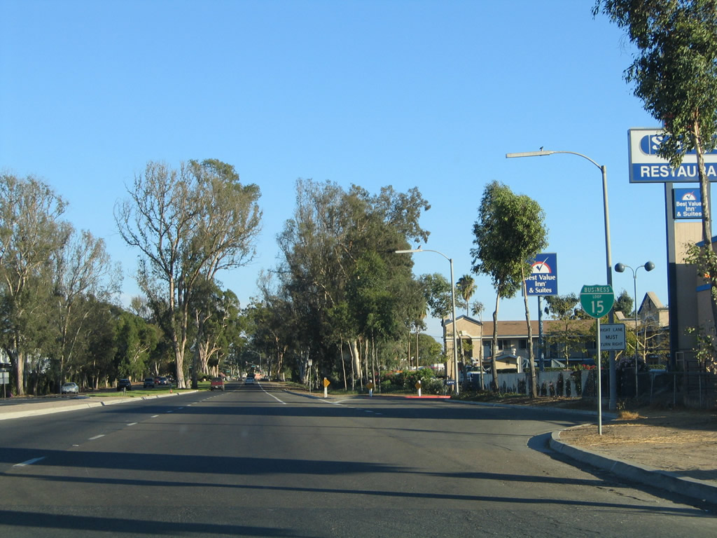
What was the first business loop route marker preceded the intersection with Escondido Boulevard. The shield was removed by 2012.
06/24/07
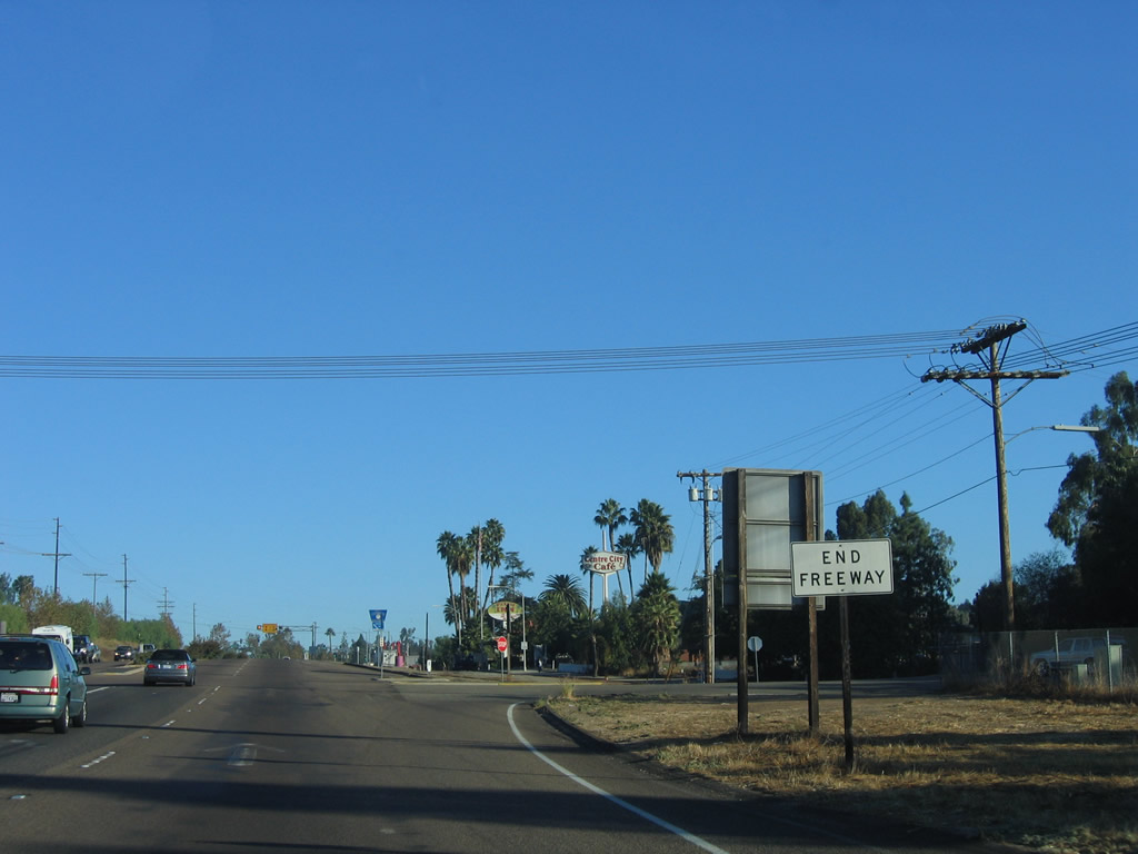
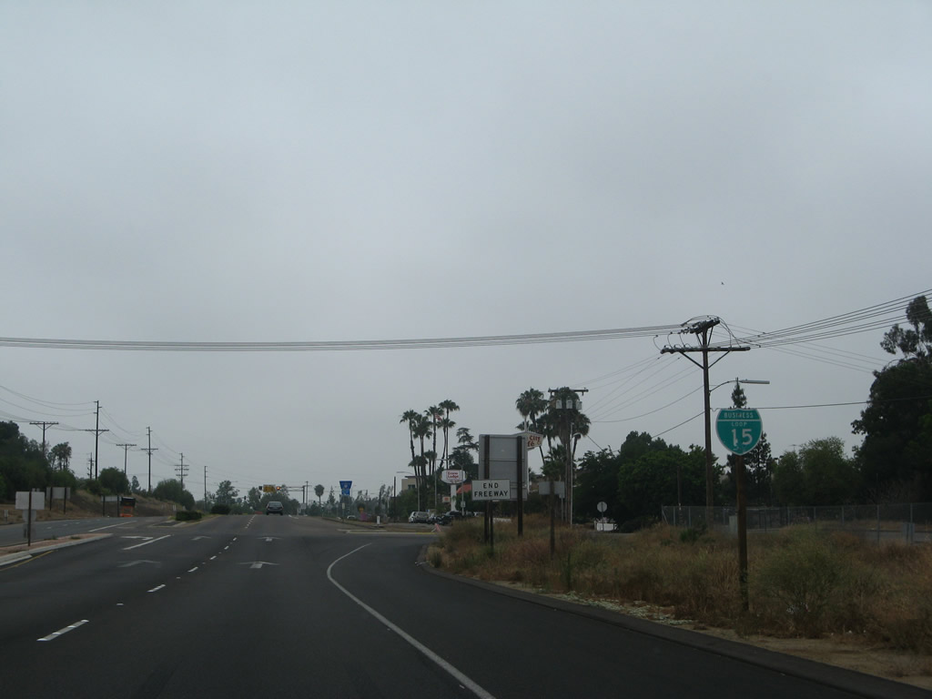
An end freeway sign appears at the intersection for S Centre City Parkway and Escondido Boulevard. Business Loop I-15 continues north as a controlled-access arterial with residential and business access off the service road system.
10/13/05
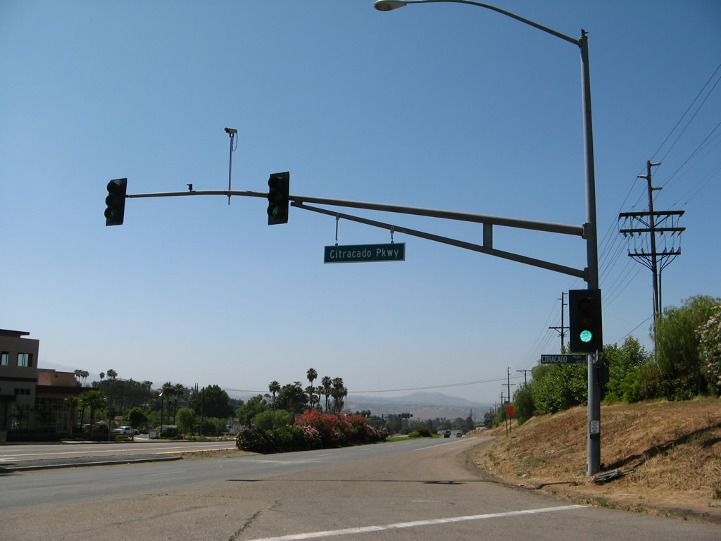
The first traffic signal along Business Loop I-15 north is with Citracado Parkway.
10/13/05
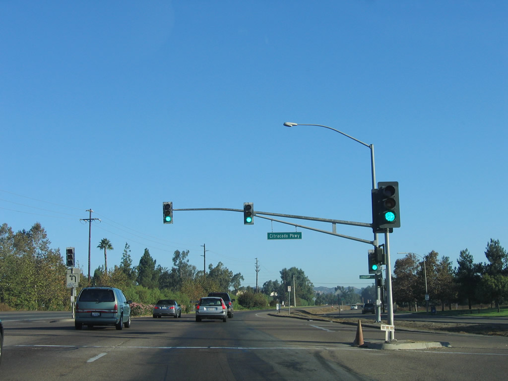
Citracado Parkway runs northwest to Interstate 15 at Exit 29 and Felicita Road. A second section of the parkway encircles the western edge of Escondido between Greenwood Place and Mission Road. A gap remains between the two sections as of 2025.
10/13/05
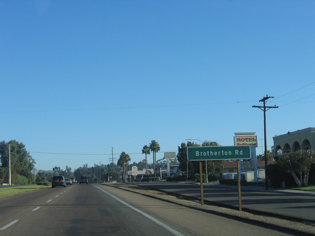
The next intersection along Business Loop I-15 (Centre City Parkway) north is with Brotherton Road.
10/13/05
S Escondido Boulevard diverges from Business Loop I-15 (Centre City Parkway) north of Brotherton Road.
06/07/08
The reassurance marker for Business Loop I-15 posted after the separation with S Escondido Boulevard was removed by 2011.
06/07/08
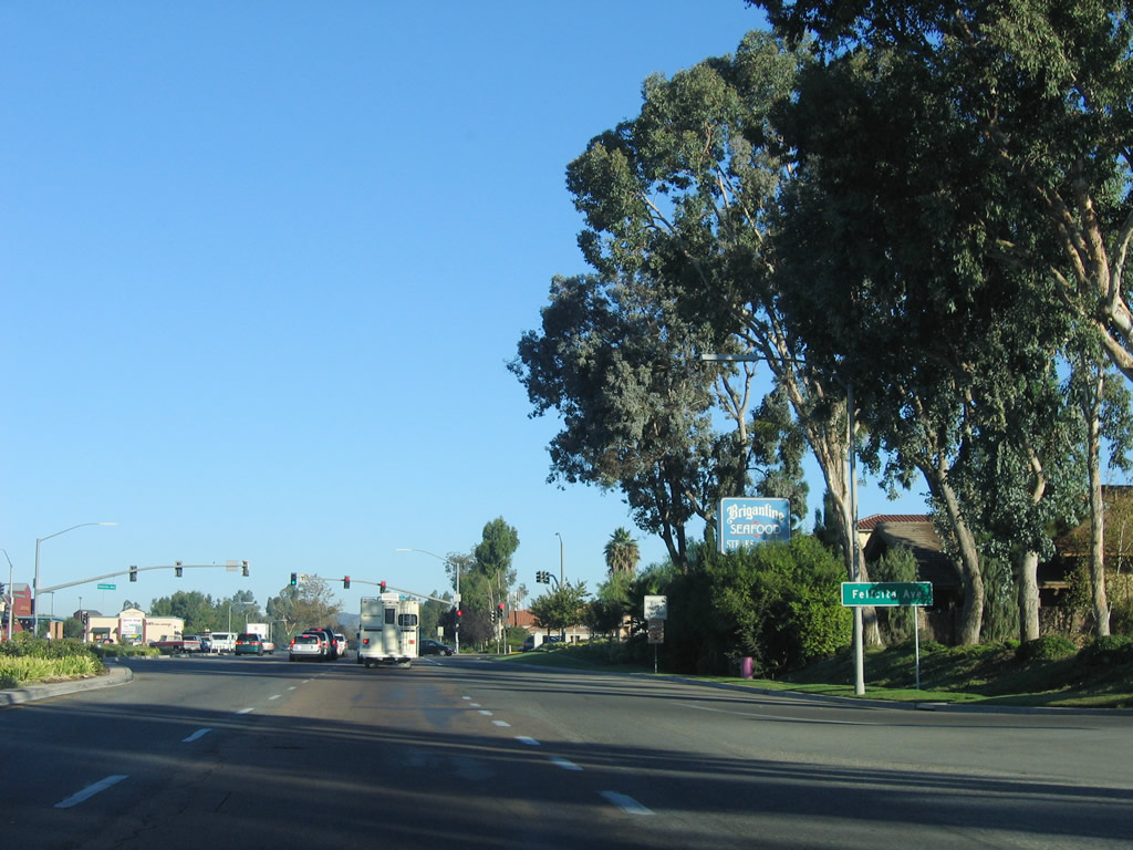
The ensuing traffic light beyond the signalized entrance to Felicita Town Center retail plaza operates at Felicita Avenue.
10/13/05
The Business Loop I-15 shield posted north of Felicita Avenue was replaced by 2019 and subsequently removed by 2021.
06/07/08
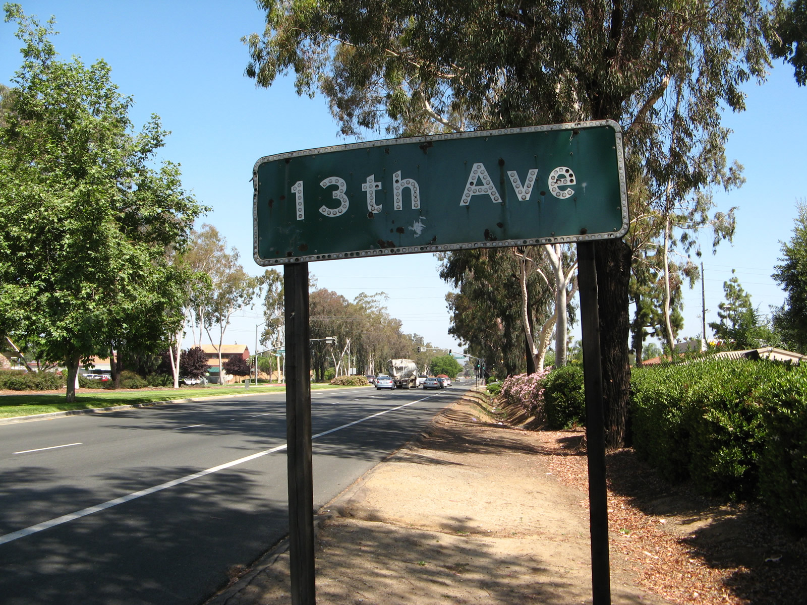
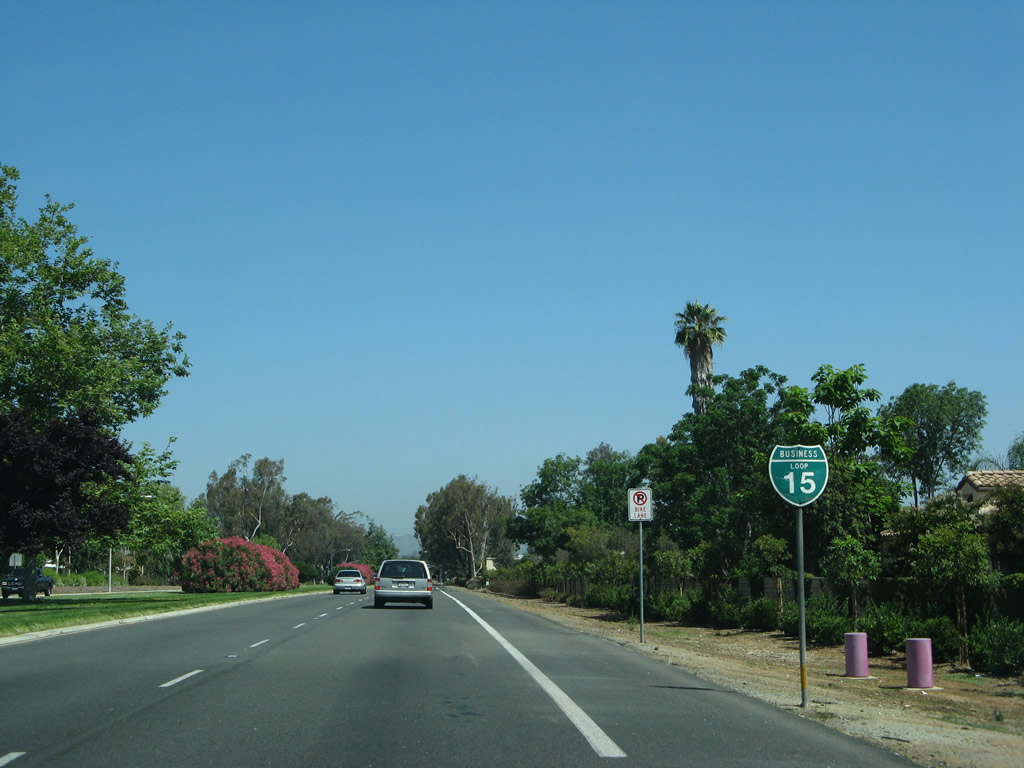
The button copy sign for Thirteenth Avenue along Centre City Parkway north was removed by 2012. A replacement was finally added further south in 2019.
06/07/08
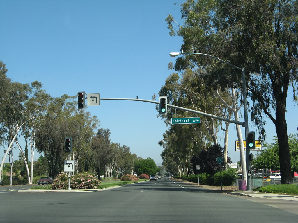
Northbound Business Loop I-15 (Centre City Parkway) meets Thirteenth Avenue at this traffic signal. The reassurance marker posted afterward was removed by 2012.
10/13/05
A turf median separates the roadways along Centre City Parkway between 13th and 9th Avenues. 9th Avenue west connects Business Loop I-15 with Interstate 15 across from Auto Park Way.
06/24/07
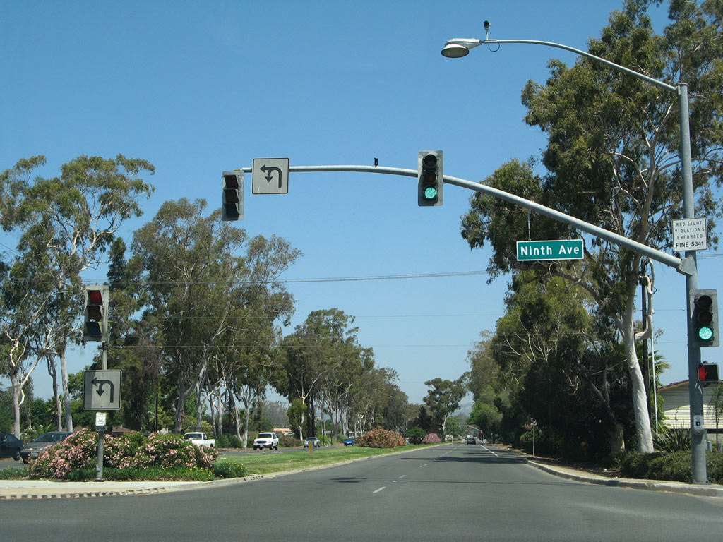
Ninth Avenue heads east from the signalized interection with Business Loop I-15 (Centre City Parkway) to Chestnut Street.
06/07/08
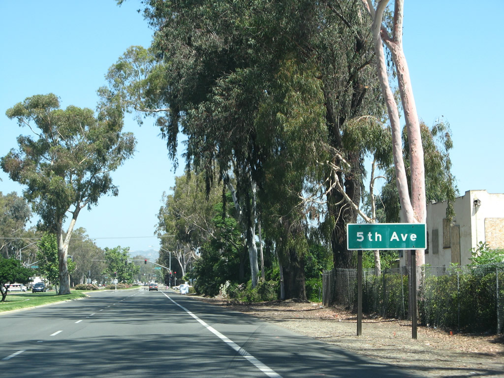
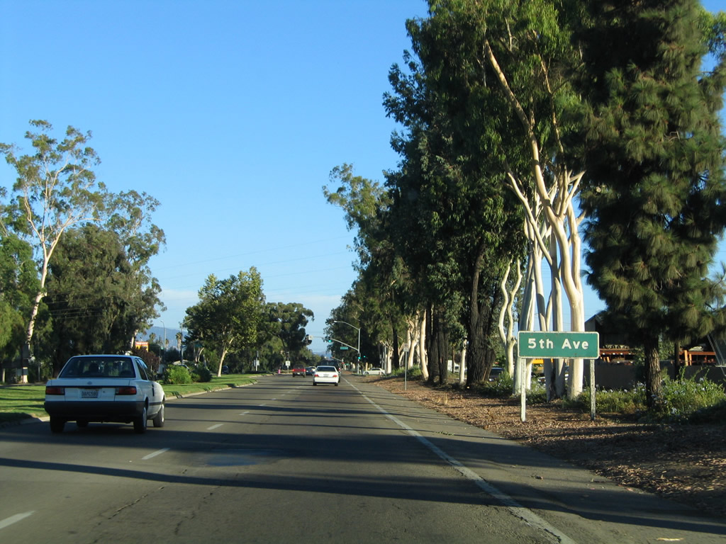
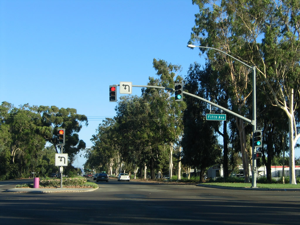
The next intersection along northbound Business Loop I-15 (Centre City Parkway) is with Fifth Avenue.
06/07/08
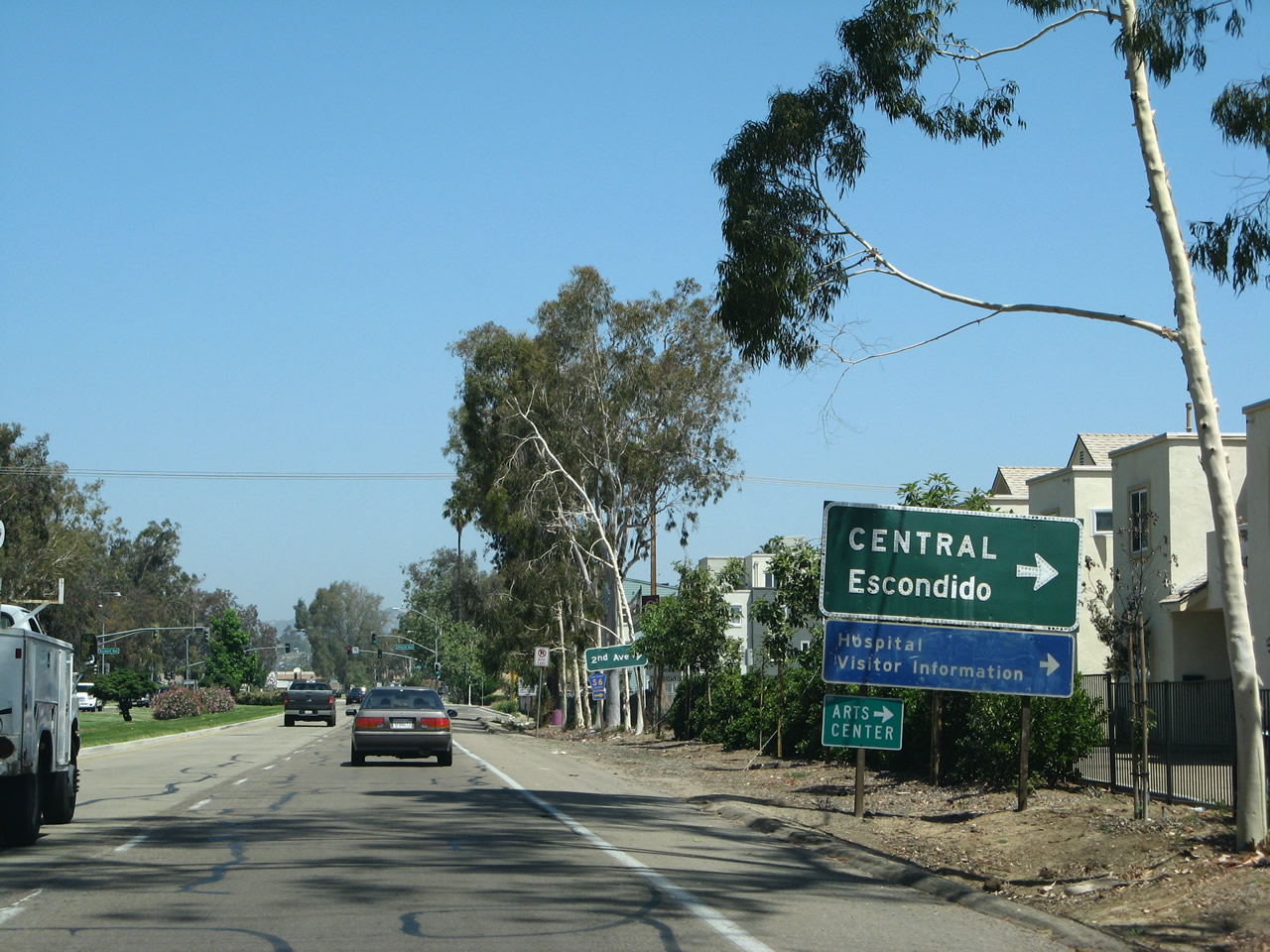
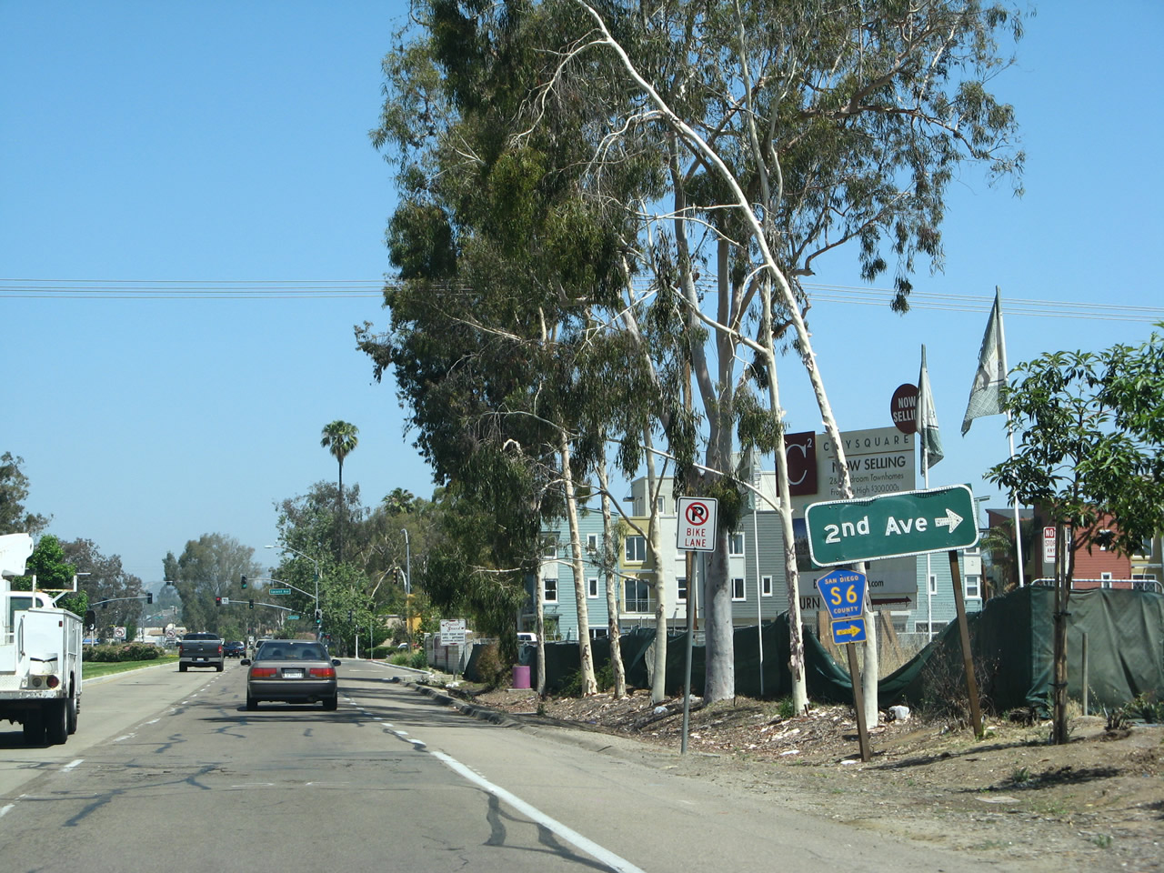
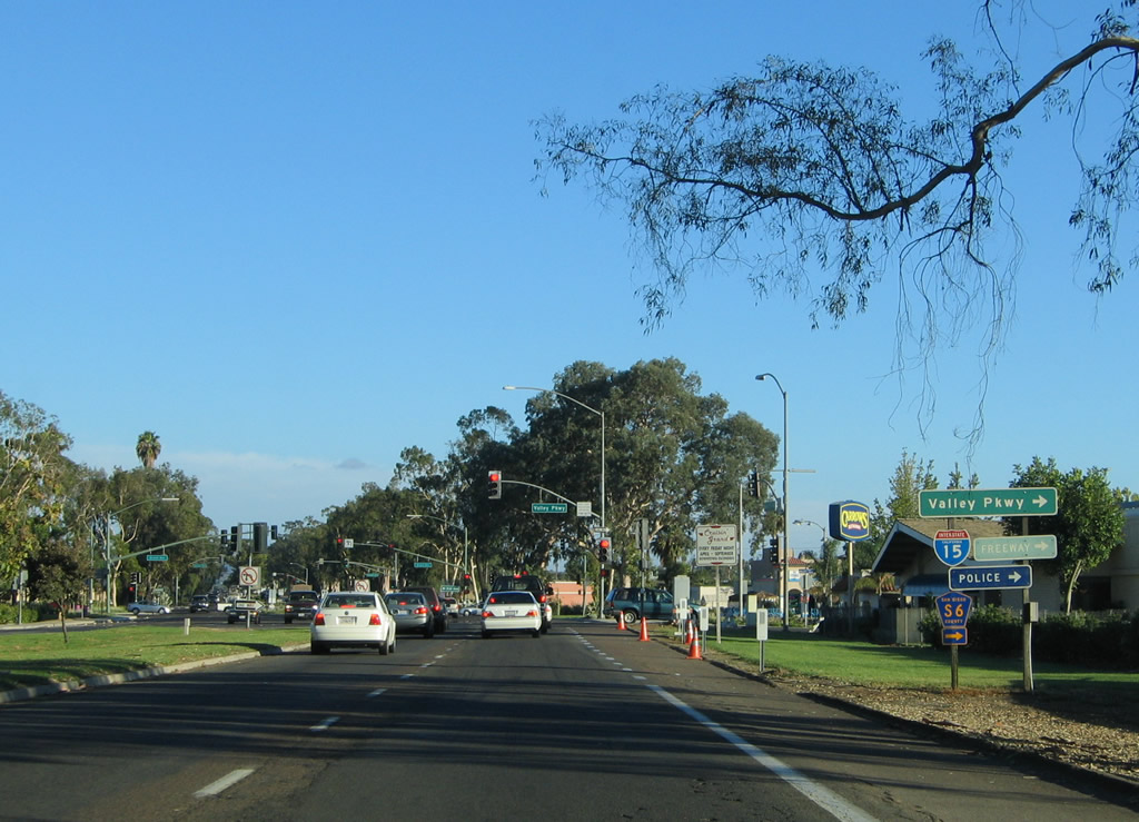
2nd Avenue (San Diego County Route S-6) constitutes the major connector from Business Loop I-15 to Downtown Escondido. Points of interest for the city center include the California Center for the Arts, the civic center and a visitors information center. This button copy sign was repalced by 2012.
06/07/08
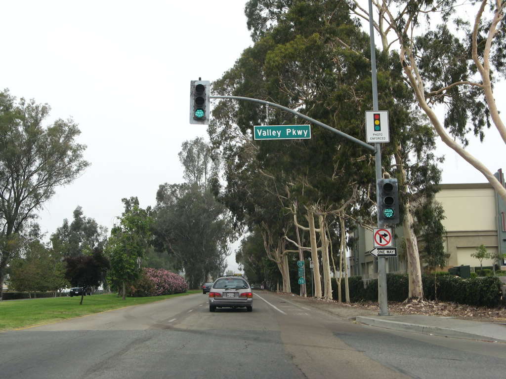
San Diego County Route S-6 partitions along the couplet of 2nd Avenue eastbound and Valley Parkway westbound through Downtown Escondido. CR S-6 travels northeast from Escondido toward Valley Center, Pala and ultimately Palomar Mountain.
06/07/08
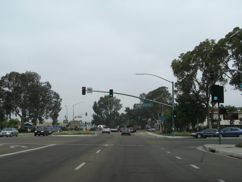
Grand Avenue is a divided main street through Downtown Escondido that features on-street parking, easy access to shops, and walkable amenities.
06/24/07
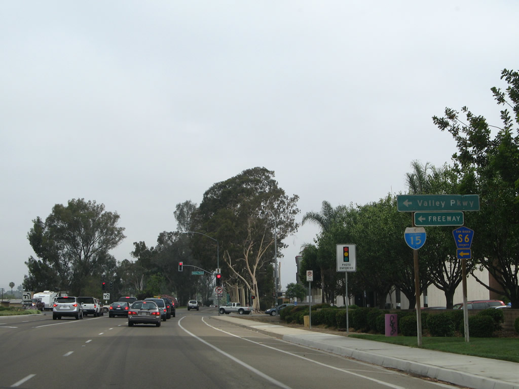
San Diego County Route S-6 (Valley Parkway) westbound leads to Interstate 15 at Exit 31. County Route S-6 becomes Del Dios Highway as it crosses the hills between Escondido and Del Mar/Solana Beach on a southwesterly trajectory. It ends at Coast Highway 101 (CR S-21 / Old U.S. 101) just west of the Del Mar Fairgrounds.
06/24/07
Eucalyptus trees were planted at the time the Centre City Parkway was constructed. This was a standard Caltrans landscaping feature of 1950s and 1960s-era expressways and freeways. Since Business Loop I-15 was formerly U.S. 395, plantings of eucalyptus trees along Centre City Parkway still remain, especially just north of Valley Parkway.
06/24/07
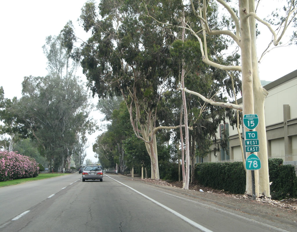
The trailblazer for SR 78 and confirming marker for Business Loop I-15 north posted after San Diego County Route S-6 (Valley Parkway) were removed by 2009.
06/24/07
A pair of older bridges carries Business Loop I-15 over channelized Escondido Creek. Taken down by 2017, a relic of its former role as U.S. 395 was a Route 395 postmile that remained after Centre City Parkway was decommissioned as a state route and turned over to the city of Escondido.
06/07/08
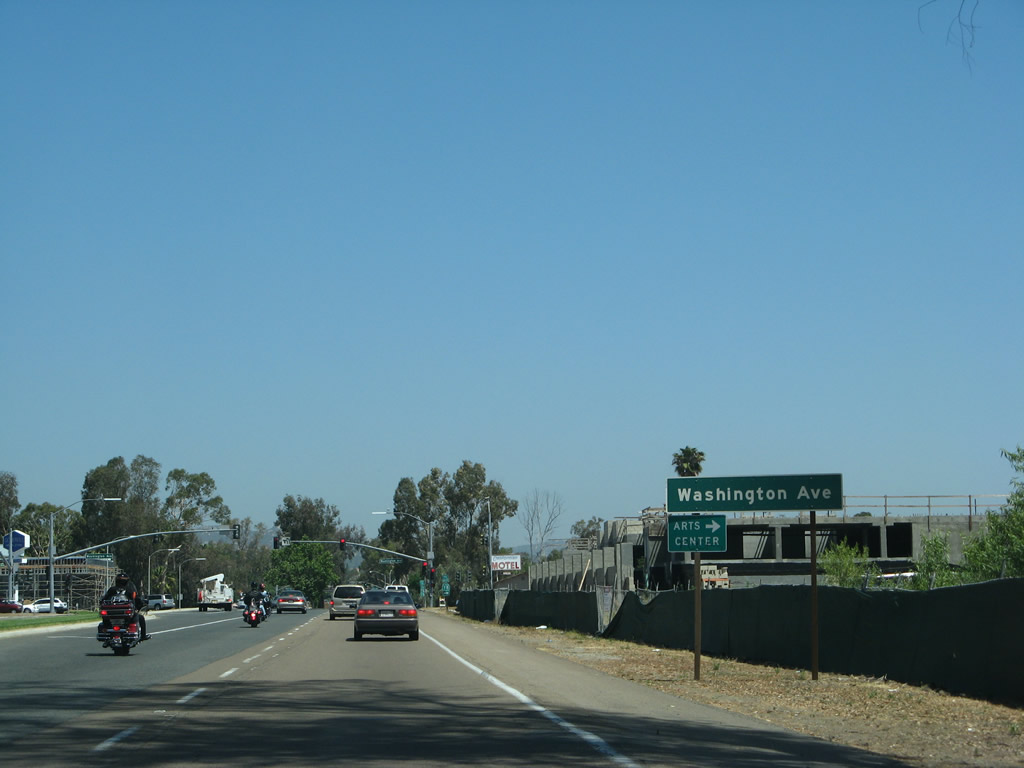
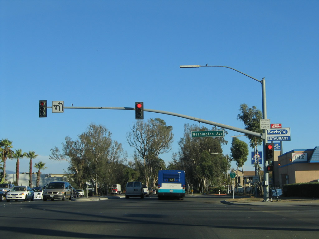
The next intersection along Centre City Parkway north is with Washington Avenue beside the latitude 33 apartment building built in 2011/12.
06/07/08
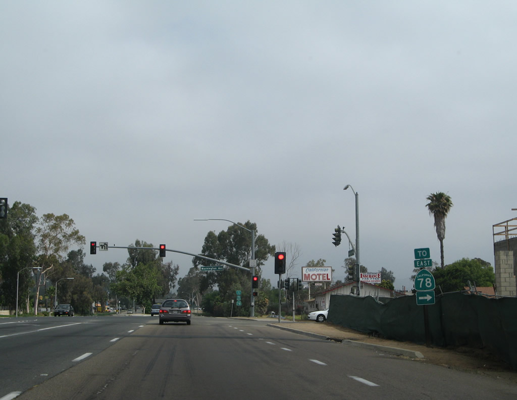
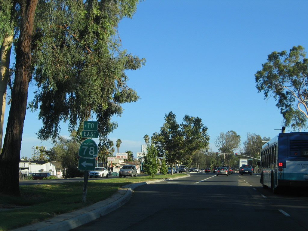
The trailblazer for SR 78 east was removed due to road work adding a right turn lane in 2011. SR 78 follows Washington Avenue east from N Broadway en route to San Pasqual Valley and Julian.
06/24/07
Replaced by 2012, the reassurance shield for Business Loop I-15 and trailblazer for SR 78 west posted after Washington Avenue were removed during construction of the Alcove development in 2018.
06/07/08
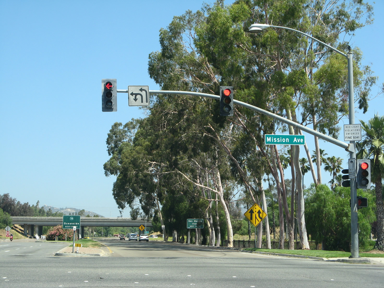
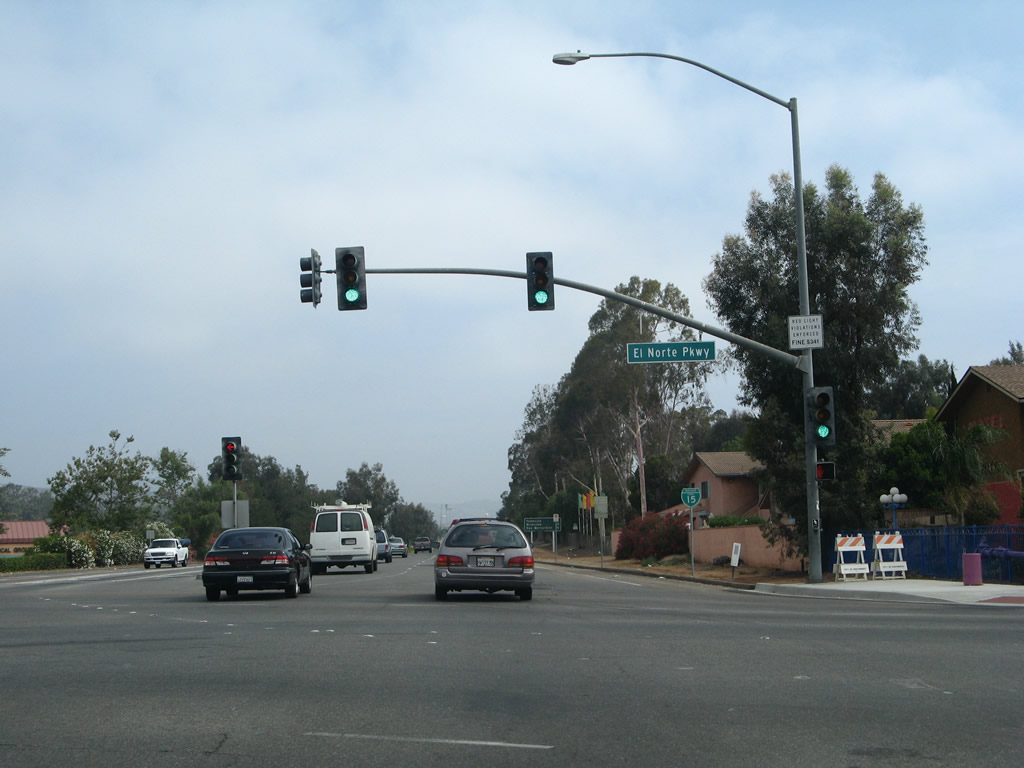
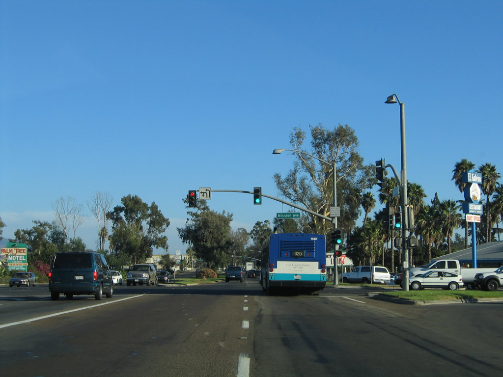
Centre City Parkway advances north to a signalized intersection with Mission Avenue.
06/07/08
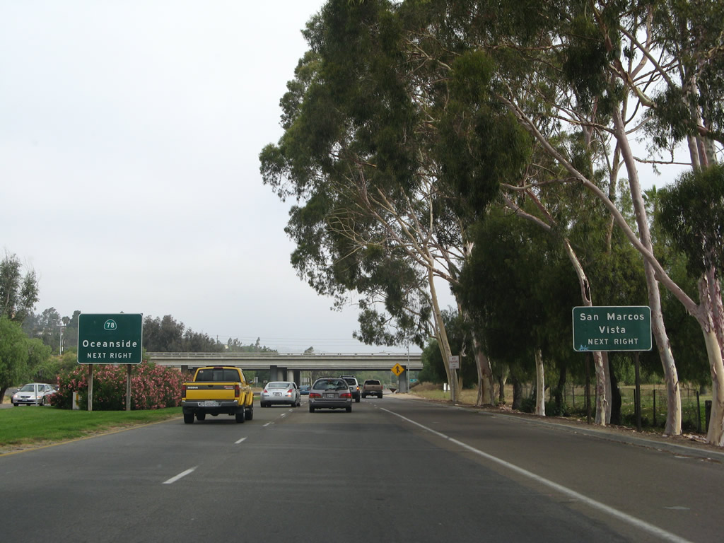
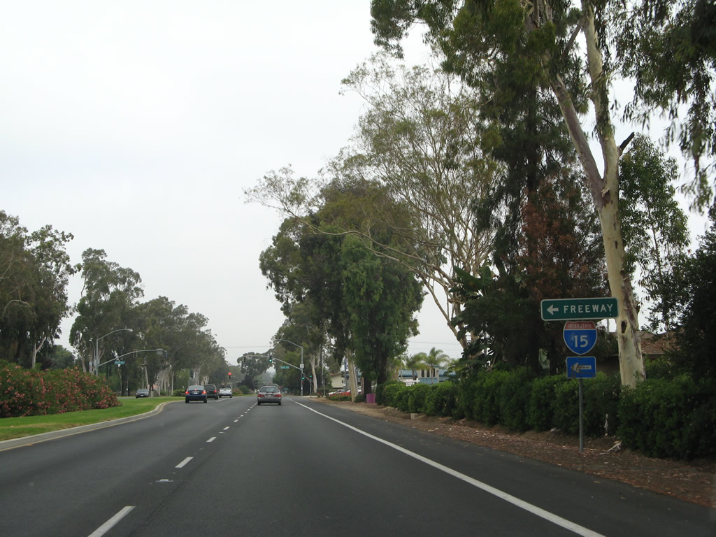
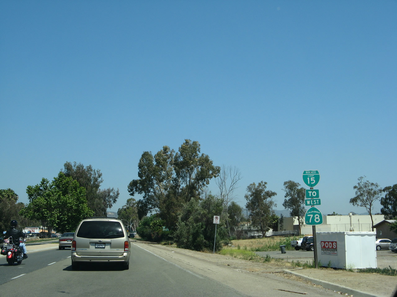
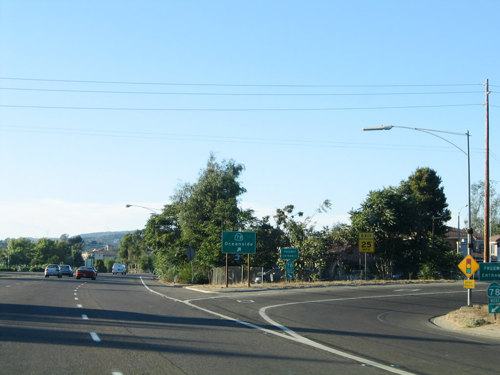
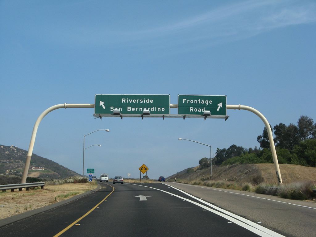
A half cloverleaf interchange joins northbound Business Loop I-15 with SR 78 west to Vista and San Marcos.
06/24/07
Unrealized plans originally called for the freeway along State Route 78 to extend further east.
06/24/07
The freeway taking SR 78 (Ronald Packard Parkway) westbound to I-5 at Oceanside begins at N Broadway in Escondidio to the east.
08/23/04
The first shield posted for Business Loop I-15 north along Centre City Parkway stands beyond the exchange with SR 78.
08/23/04
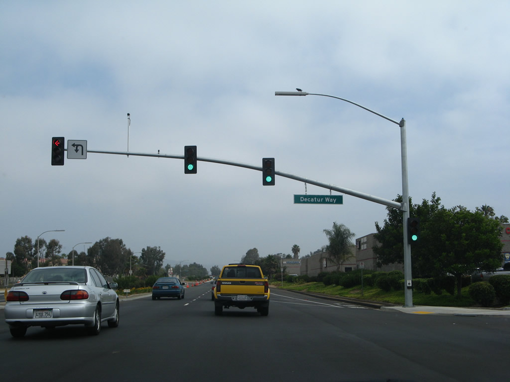
Northbound Business Loop I-15 next meets Decatur Way, which links to adjacent N Escondido Boulevard.
06/24/07
The trailblazer for Intertate 15 referencing forthcoming El Norte Parkway was removed by 2017 when a right turn lane was added for the arterial eastbound.
08/23/04
El Norte Parkway weaves between residential areas and retail northwest from Centre City Parkway to meet Interstate 15 at Exit 33.
06/24/07
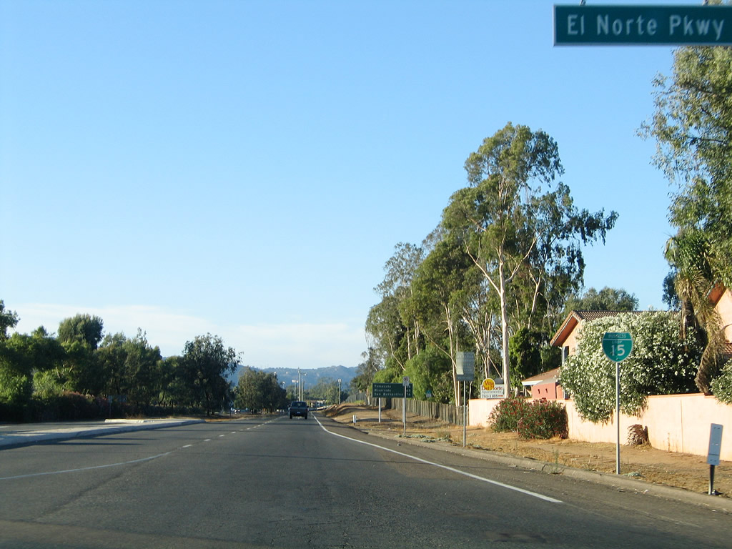
The second reassurance shield for Business Loop I-15 appears north of El Norte Parkway.
08/23/04
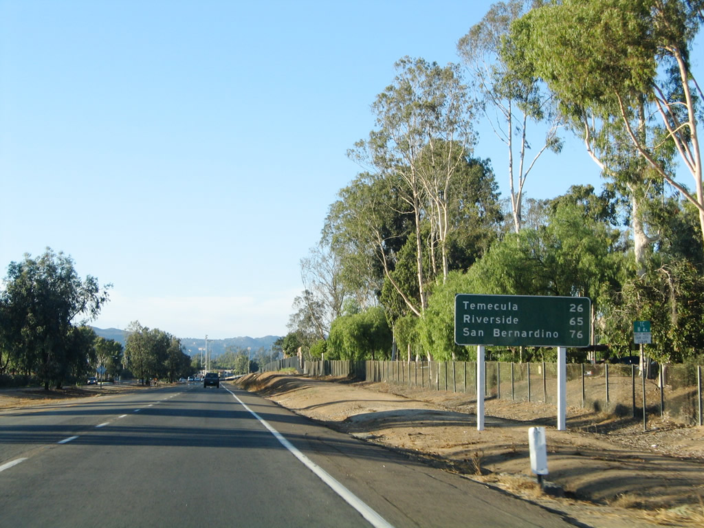
Posted north of El Norte Parkway, the design of the mileage sign referencing Temecula, Riverside and San Bernardino dates back to when this route was U.S. 395.
08/23/04
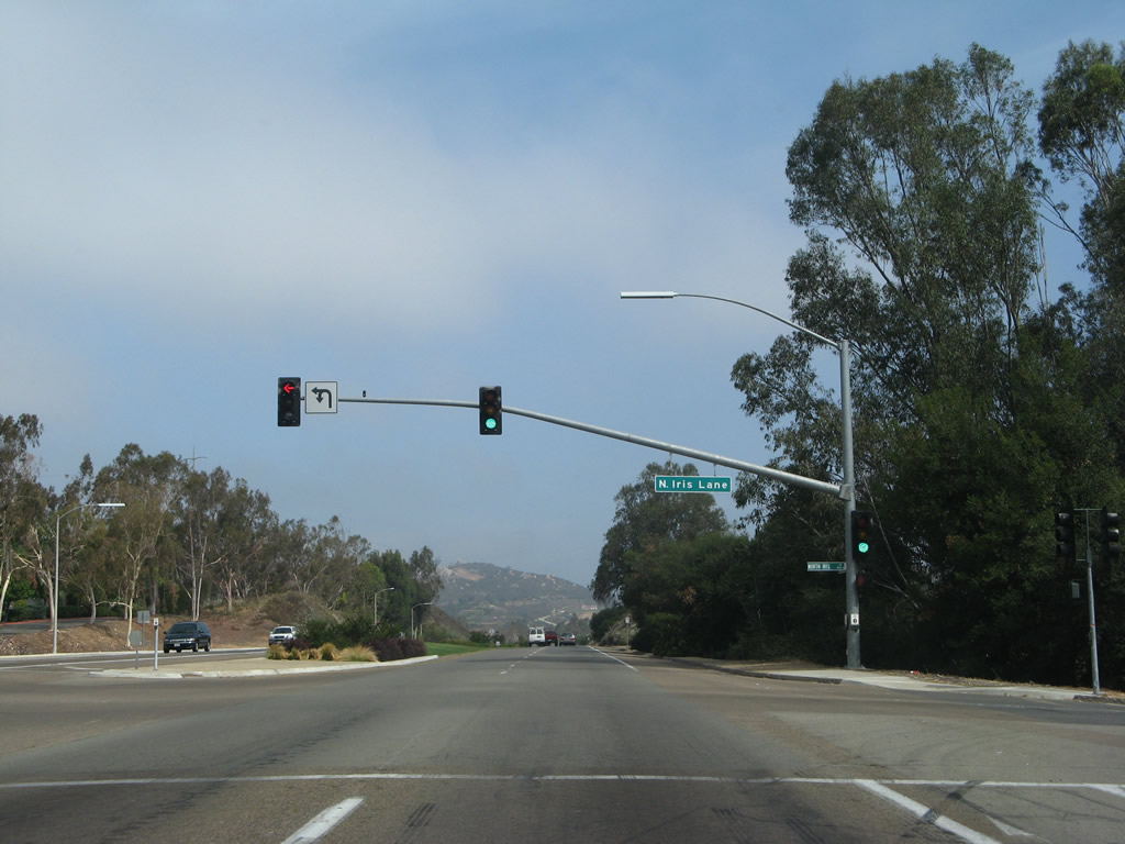
Business Loop I-15 (Centre City Parkway) continues north uninterrupted for 0.8 miles from El Norte Parkway to Iris Lane.
06/24/07
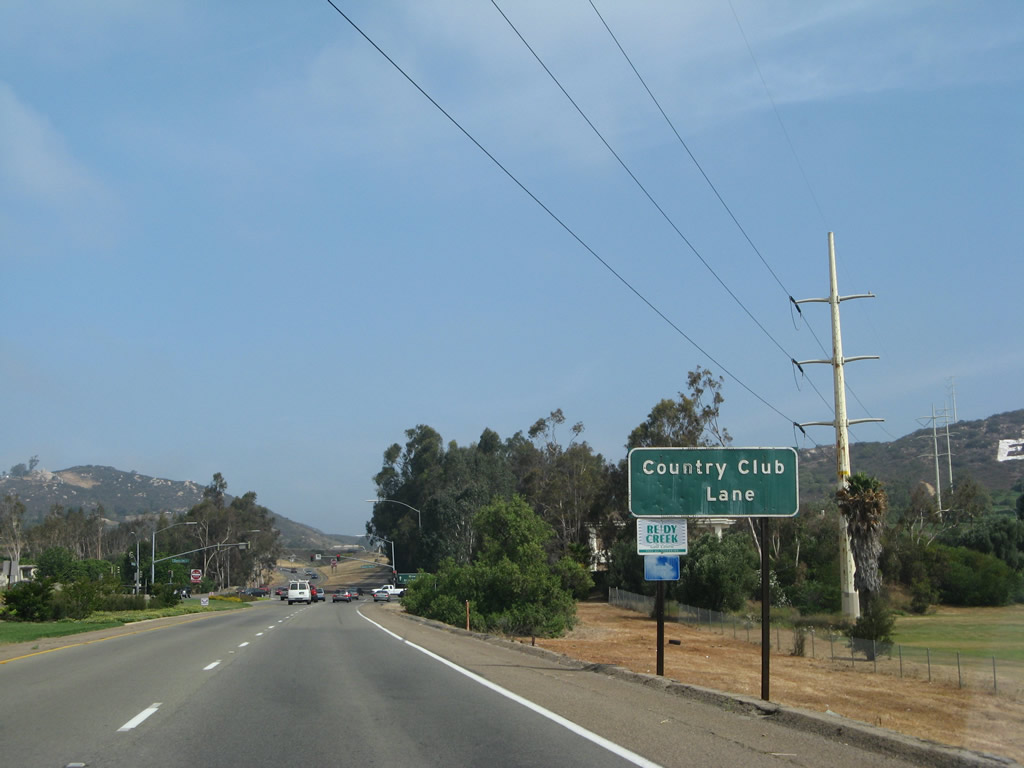
A San Diego Gas & Electric 230kV power line crosses over the expressway along Business Loop I-15 ahead of Country Club Lane.
06/24/07
0.4 miles beyond the traffic signal with Country Club Lane, Business Loop I-15 converges with Interstate 15 north.
06/24/07
Centre City Parkway splits with Business Loop I-15 north of Country Club Lane. Paralleling Interstate 15 to the east, the former route of U.S. 395 extends north to Champagne Boulevard at Mountain Meadow Road.
08/23/04
A tunnel connects from Interstate 15 south to Business Loop I-15 (Centre City Parkway).
06/24/07
The exit for Centre City Parkway (Old Highway 395) from Business Loop I-15 references Frontage Road. Some segments of the frontage road north of the city of Escondido are known as Old Highway 395, similar to the way Old Highway 80 is memorialized in eastern San Diego County as it provides local access to communities avoided by I-8.
06/24/07
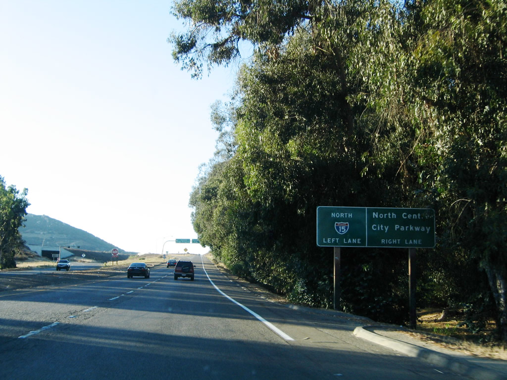
Business Loop I-15 ends along the entrance ramp to Interstate 15 north by the Merriam Mountains.
06/24/07
Business Loop I-15 (Centre City Parkway) advances south from the traffic light at Decatur Way to a half cloverleaf interchange with SR 78 (Ronald Packard Parkway) westbound.
06/22/02
Mission Avenue (San Diego County Route S-14) intersects Business Loop I-15 just south of the exchange with SR 78. The signed county route follows the old alignment of SR 78 west toward San Marcos, Vista and Oceanside.
08/23/04
As there was no direct access to SR 78 eastbound, motorists are directed south along Centre City Parkway to Washington Avenue to connect with SR 78 east toward Julian.
06/22/02
The next signalized intersection along southbound Business Loop I-15 is with Washington Avenue to SR 78 east toward the Wild Animal Park, San Pasqual Valley, Ramona and Julian.
08/23/04
Washington Avenue east from Business Loop I-15 (Centre City Parkway) to Escondido Boulevard south leads to Woodward Avenue east for the Escondido Civic Center, Grape Day Park, and the California Center for the Arts. A parking area is located off Woodward Avenue for these facilities.
08/23/04
A Business Loop I-15 reassurance shield stands along Centre City Parkway south of Washington Avenue.
08/23/04
San Diego County Route S-6 crosses central Escondido along the couplet of Valley Parkway westbound and 2nd Avenue eastbound. CR S-6 west links with Interstate 15 and continues southward as Del Dios Highway to Lake Hodges.
08/23/04
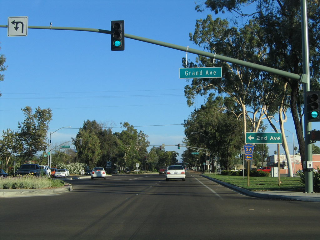
Grand Avenue intersects Business Loop I-15 (Centre City Parkway) south one block ahead of San Diego County Route S-6 east on Second Avenue. The length of Grand Avenue through Downtown Escondido has shops, restaurants and services.
08/23/04
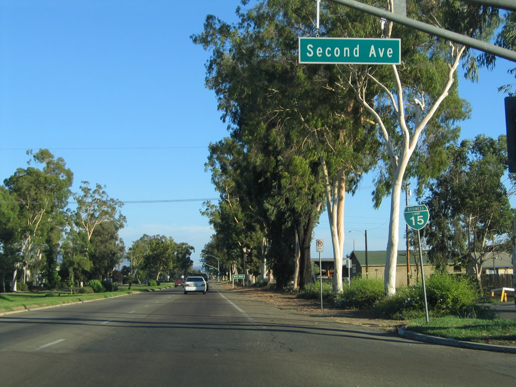
San Diego County Route S-6 (Second Avenue) leads northeast to Valley Center and Palomar Mountain. A reassurance shield for Business Loop I-15 is posted after the intersection.
08/23/04
Business Loop I-15 (Centre City Parkway) proceeds south from CR S-6 (2nd Avenue) to the signalized intersection with Fifth Avenue.
08/23/04
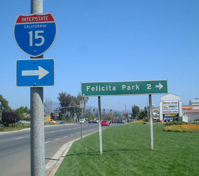
The guide sign for Felicita Park was replaced by 2009 with a sign referencing Felicita Avenue. Felicita Avenue angles southwest from Montview Drive to Interstate 15 at Gamble Lane west and Citracado Parkway east. Felicita County Park lies further south of the Escondido Freeway along Felicita Creek.
06/22/02
Citracado Parkway extends east from Felicita Road and entrance ramps for I-15 across City Centre Parkway to parallel Cranston Drive.
06/07/08
An access road links Business Loop I-15 with the expressway frontage road system, S Centre City Parkway and S Escondido Boulevard, prior to Interstate 15.
06/22/02
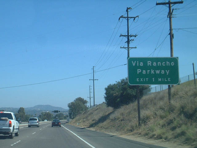
Business Loop I-15 defaults onto Interstate 15 south ahead of Exit 27 to Via Rancho Parkway.
06/22/02
Removed by 2018, this guide sign for Interstate 15 stood in the median of Grand Avenue west of Escondido Boulevard in Downtown Escondido. It referenced Business Loop I-15 north to Valley Parkway (CR S-6) west.
04/23/05
Photo Credits:
- Andy Field: 06/22/02, 08/23/04, 04/23/05, 10/13/05, 06/24/07, 06/07/08
Connect with:
Page Updated Thursday August 07, 2025.