
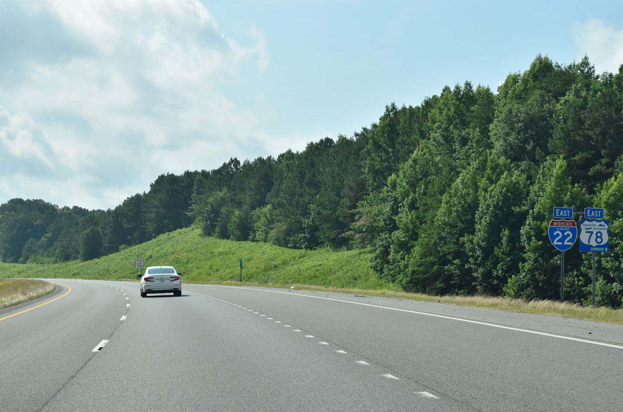
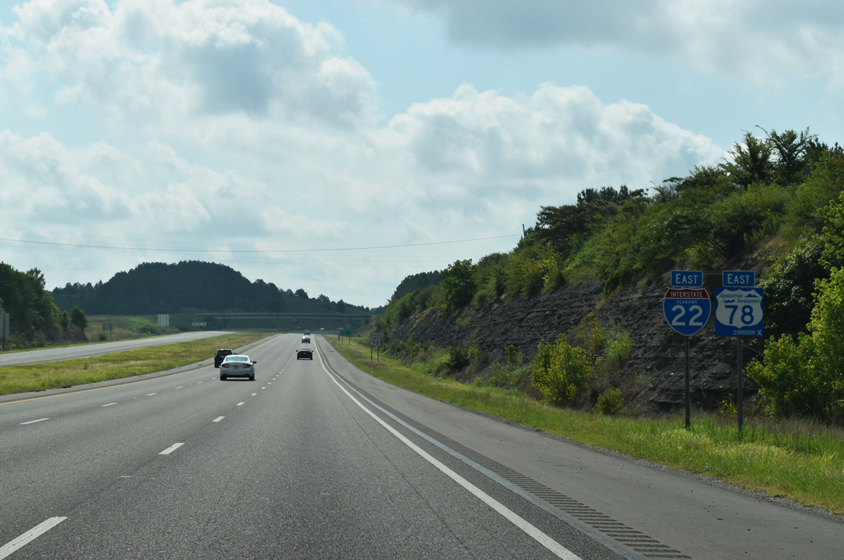
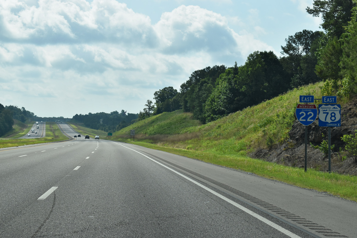
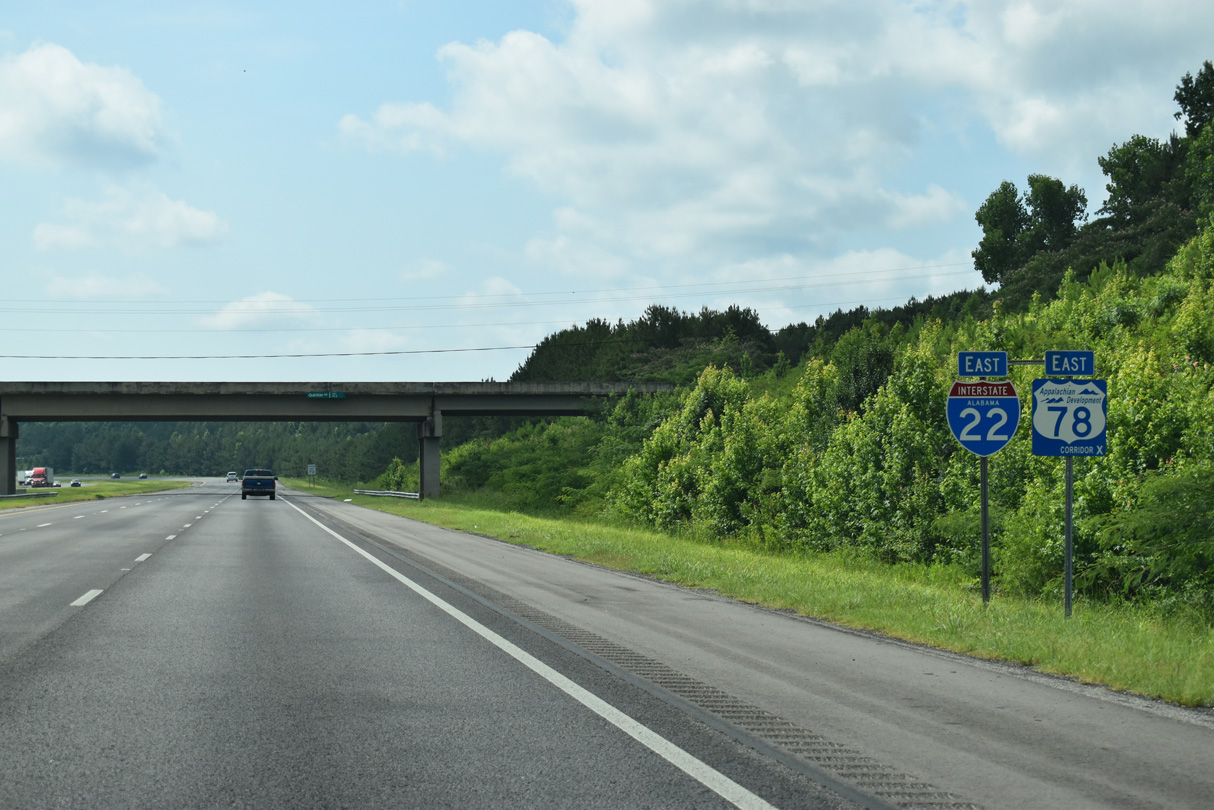
I-22/U.S. 78 East - Jasper to Dora

Like SR 17, SR 13 travels nearly the height of the state (336.00 miles) between Mobile and the Tennessee state line north of Florence. Also similar to SR 17 is that SR 13 is a hidden route for U.S. 43 from Mobile to Fayette County and again from Franklin County to Tennessee.
01/01/24
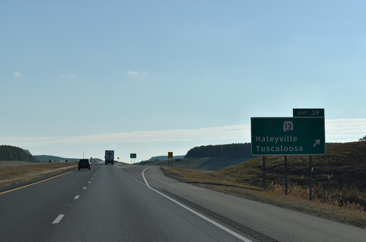
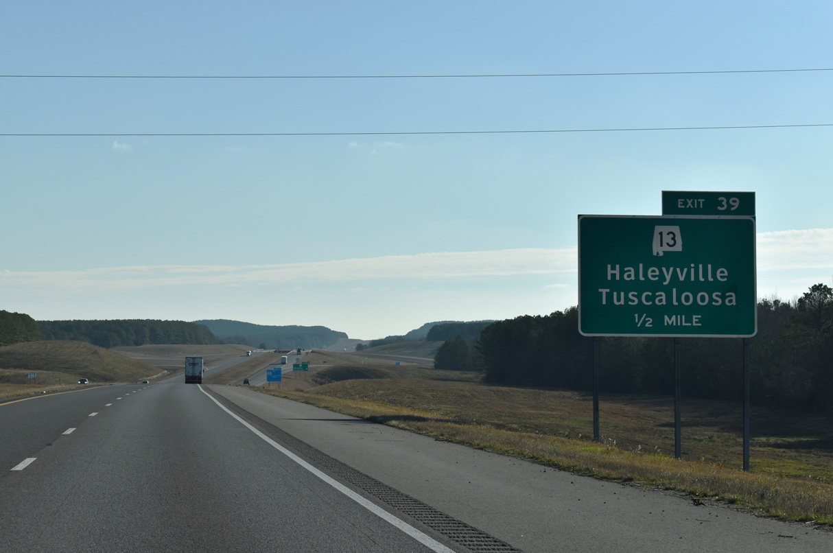
Exit 39 leaves Interstate 22 east for SR 13 at Elridge. The 12 mile long route between Eldridge and Natural Bridge was constructed in the 1960s.
01/01/24
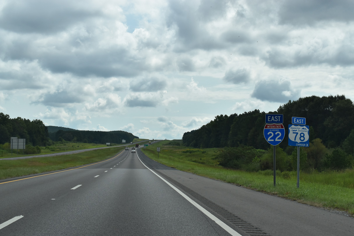
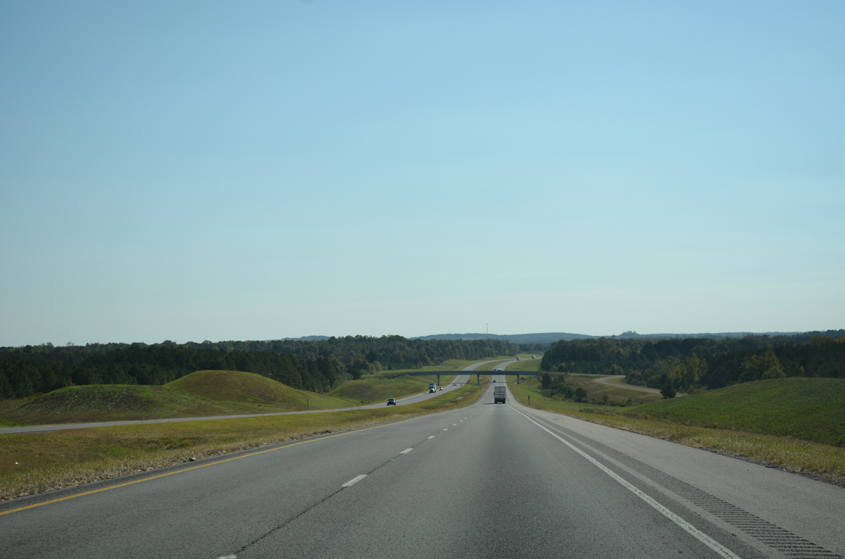
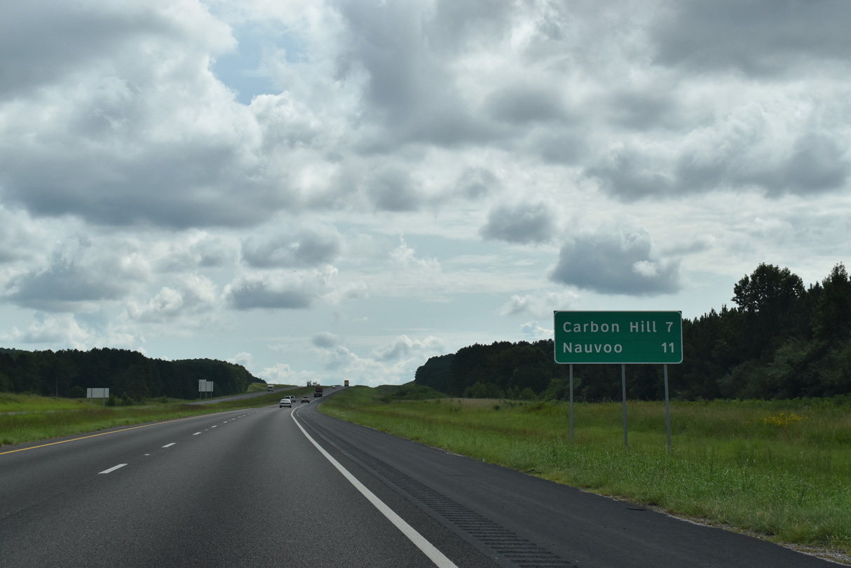
I-22 and U.S. 78/SR 4 continue seven miles east to Carbon Hill. Nauvoo is four miles north from upcoming Exit 46.
09/11/20
Dogtown Road meanders southeast from Dogtown and crosses over I-22/U.S. 78 south toward Seamore Mountain.
10/08/16
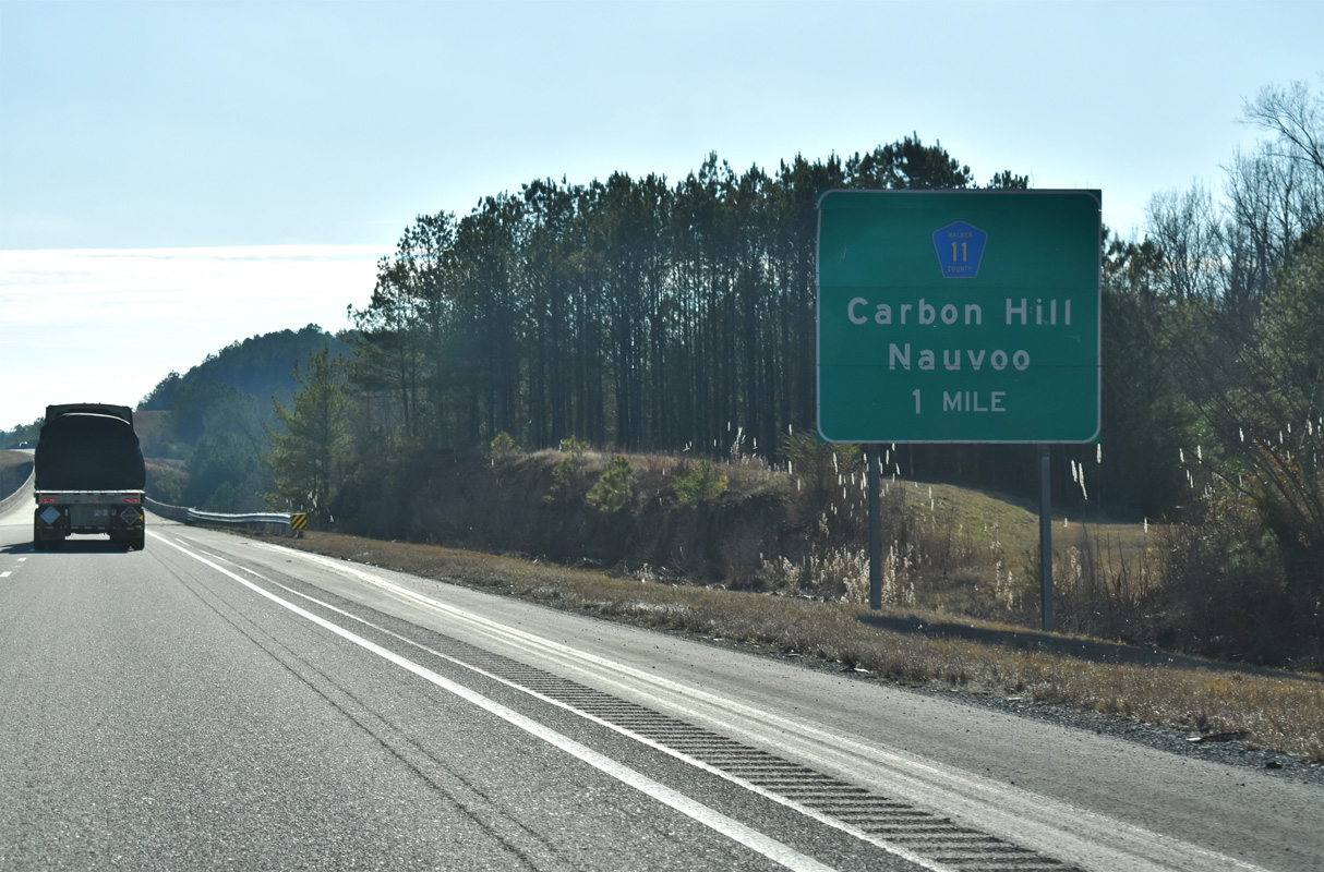
Walker County Route 11 stems northeast from 1st Street in Carbon Hill along Nauvoo Road to the diamond interchange at Exit 46.
01/01/24
I-22 spans Mill Creek and Clifty Branch ahead of Exit 46. CR 11 links Carbon Hill with the town of Nauvoo and CR 29 (4th Street) near SR 5 and the Winston County line.
09/11/20
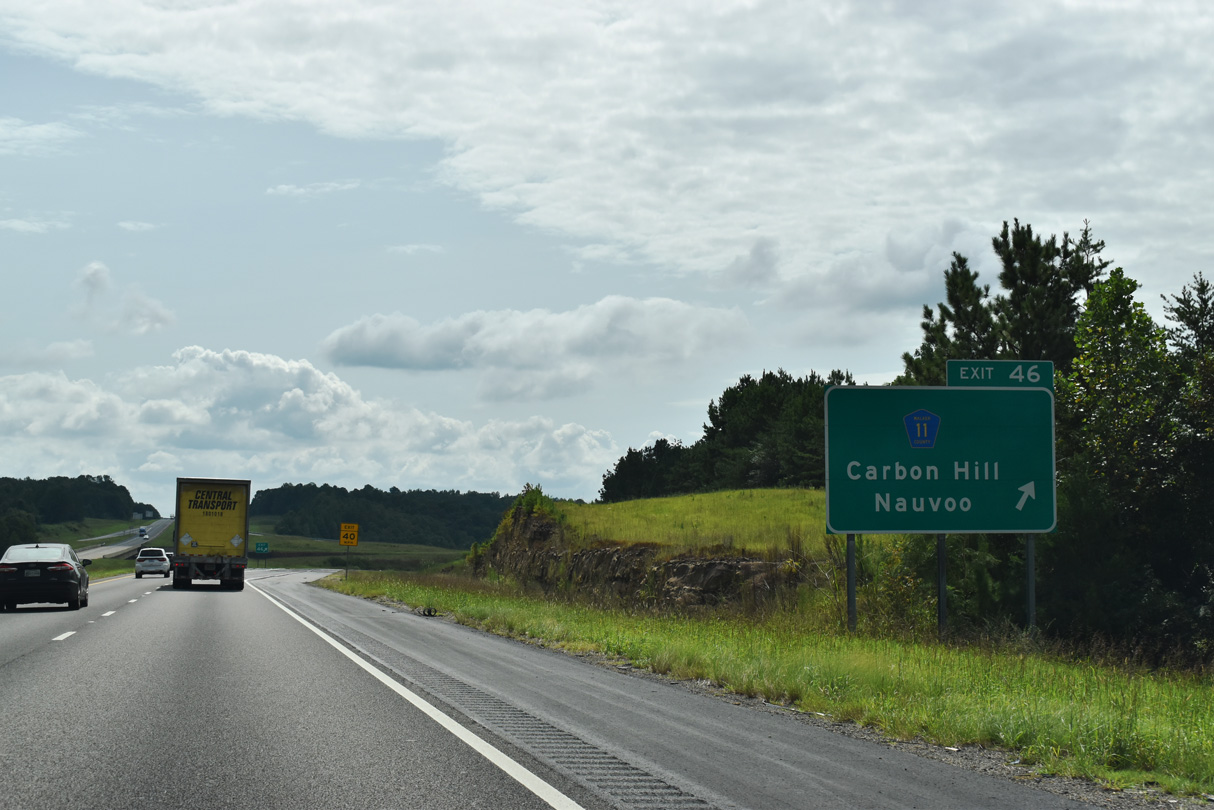
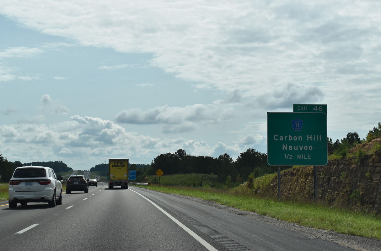
Bypassing Carbon Hill to the north, I-22/U.S. 78 briefly enter the city limits at Exit 46. SR 118 (Old U.S. 78) enters Carbon Hill from Kansas to the west along a four lane route.
09/11/20
Smith Chapel Road passes over Interstate 22 beyond these confirming markers.
06/26/22

Birmingham debuts on Interstate 22 distance signs in Alabama at 48 miles out. Jasper, the Walker County seat, is 12 miles to the east.
06/26/22
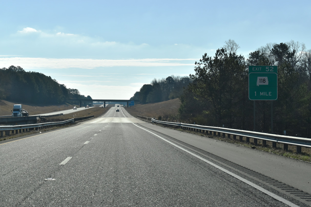
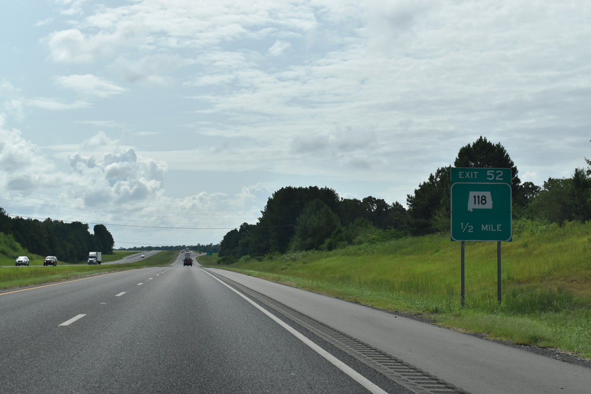
Heading east from Carbon Hill via Pocahontas, SR 118 shifts to the north of Interstate 22 at a parclo interchange (Exit 52) in one mile.
01/01/24
SR 118 continues alongside Interstate 22 from Exit 52 east to Exit 57 and western Jasper. The lack of control cities reflects the local use of the state route, which overlays Old U.S. 78.
09/11/20

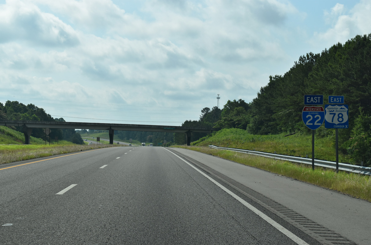
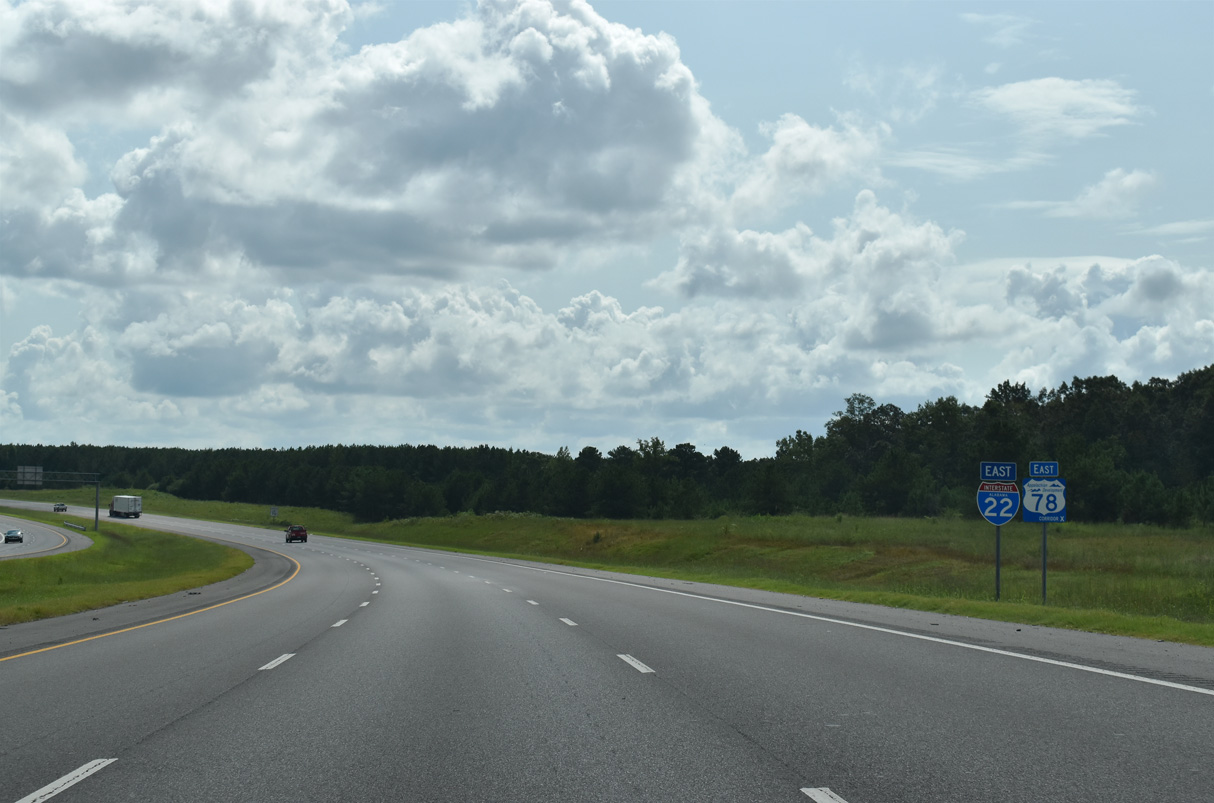
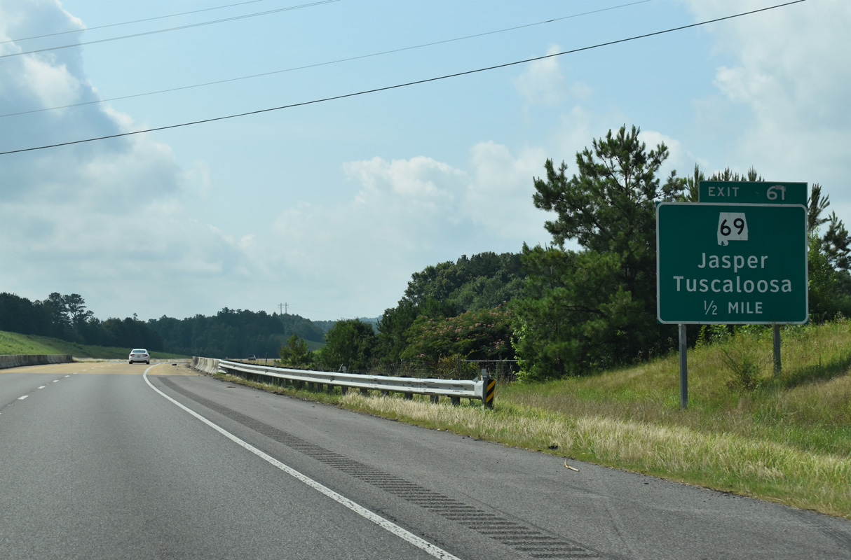
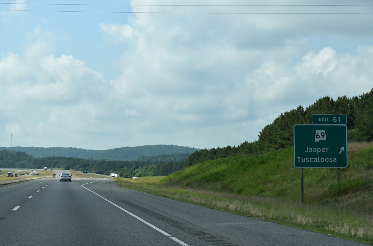
Exit 52 departs the eastbound freeway for SR 118. SR 124, 10.90 mile loop southeast to Townley and Exit 61, ties into the state route nearby.
06/26/22
Interstate 22 expands to six overall lanes east from Exit 52.
09/11/20
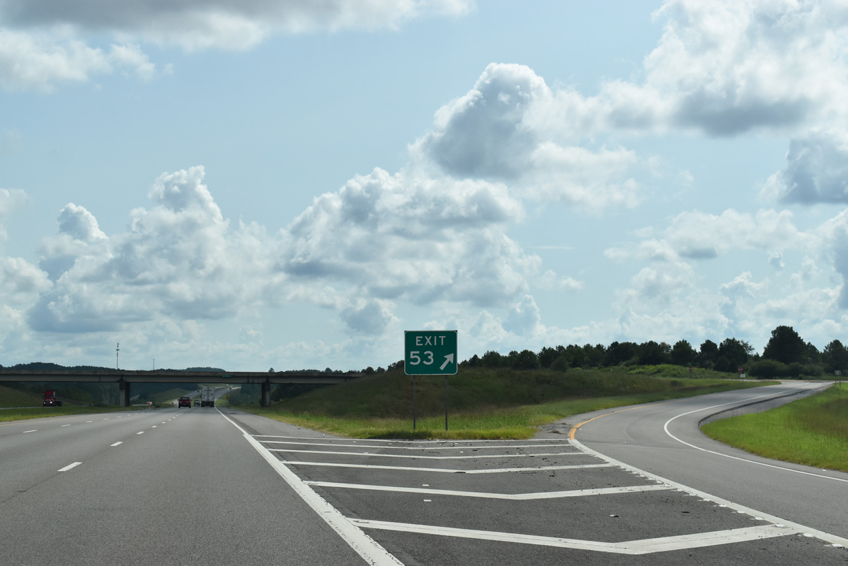
Exit 53 follows with an access road linking I-22 with S Frontage Road and adjacent SR 118 to the east of Wire Road. There are no guide signs for the diamond interchange in either direction of the freeway.
09/11/20
SR 118 runs along the north side of Interstate 22 east to Exit 57. Construction of Corridor X directly overlaid the original U.S. 78 alignment on this stretch.
01/01/24
06/02/11

SR 118 branches east from I-22/U.S. 78 beyond the trumpet interchange at Exit 57 in one mile.
01/01/24
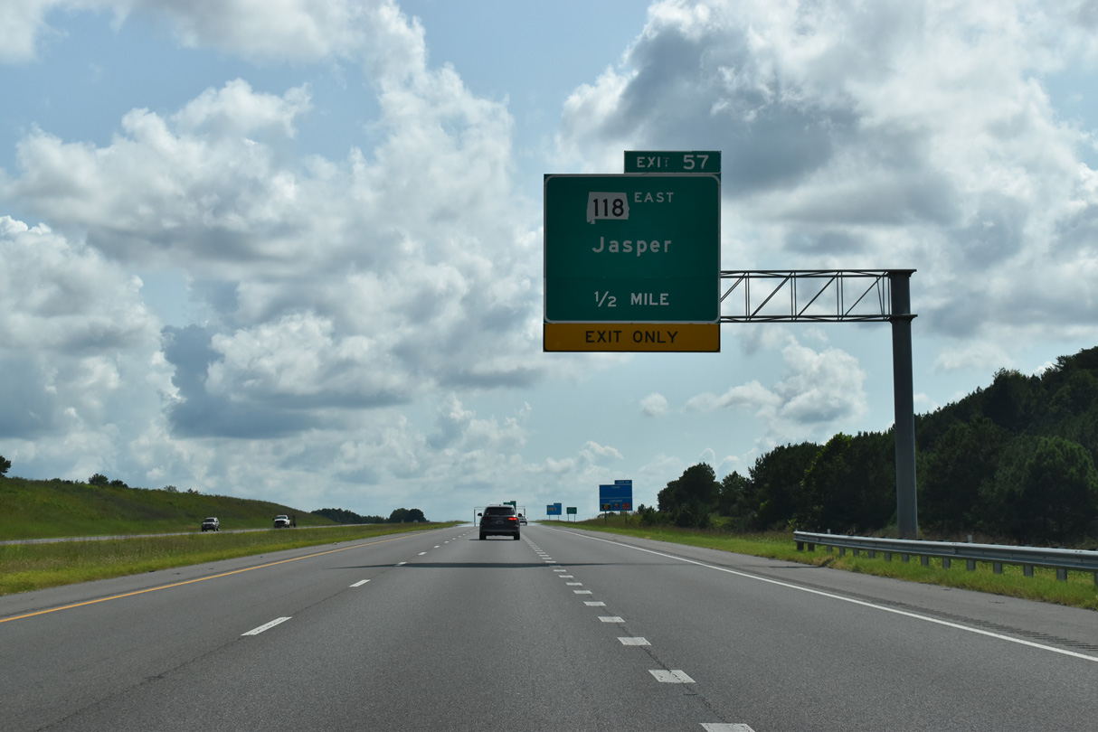
A lane drop occurs along I-22 east at Exit 57 for SR 118. SR 118 constitutes a four lane arterial east to SR 69 (Elliot Boulevard) in Jasper. SR 69 overtakes Old U.S. 78 east to a diamond interchange with SR 5 north and 9th Avenue south.
09/11/20
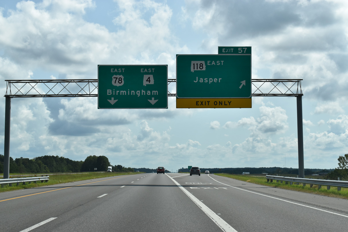
I-22/U.S. 78 turn southeast to bypass Jasper. The 57.46 mile long route of SR 118 concludes at SR 69 in Jasper. U.S. 78 formerly looped east along a combination of SR 118, SR 69 and SR 5 east from Jasper and south to Sumiton.
09/11/20
As recorded by ALDOT in 2015, traffic along I-22 increases slightly from Marion County to 14,380 vehicles per day (vpd) around Jasper.
06/26/22
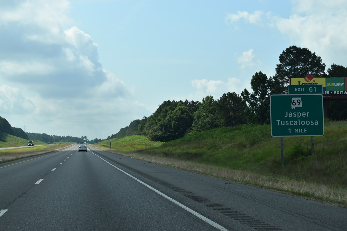
SR 69 overtakes Old U.S. 78 from SR 118, 2.6 miles east through Jasper. The state route turns southeastward along Elliott Boulevard toward Downtown before resuming a westward course 1.9 miles to Interstate 22 at Exit 61.
06/26/22
West from the diamond interchange (Exit 61) with Interstate 22, SR 69 travels to the nearby community of McCollum, where SR 124 branches west.
06/26/22
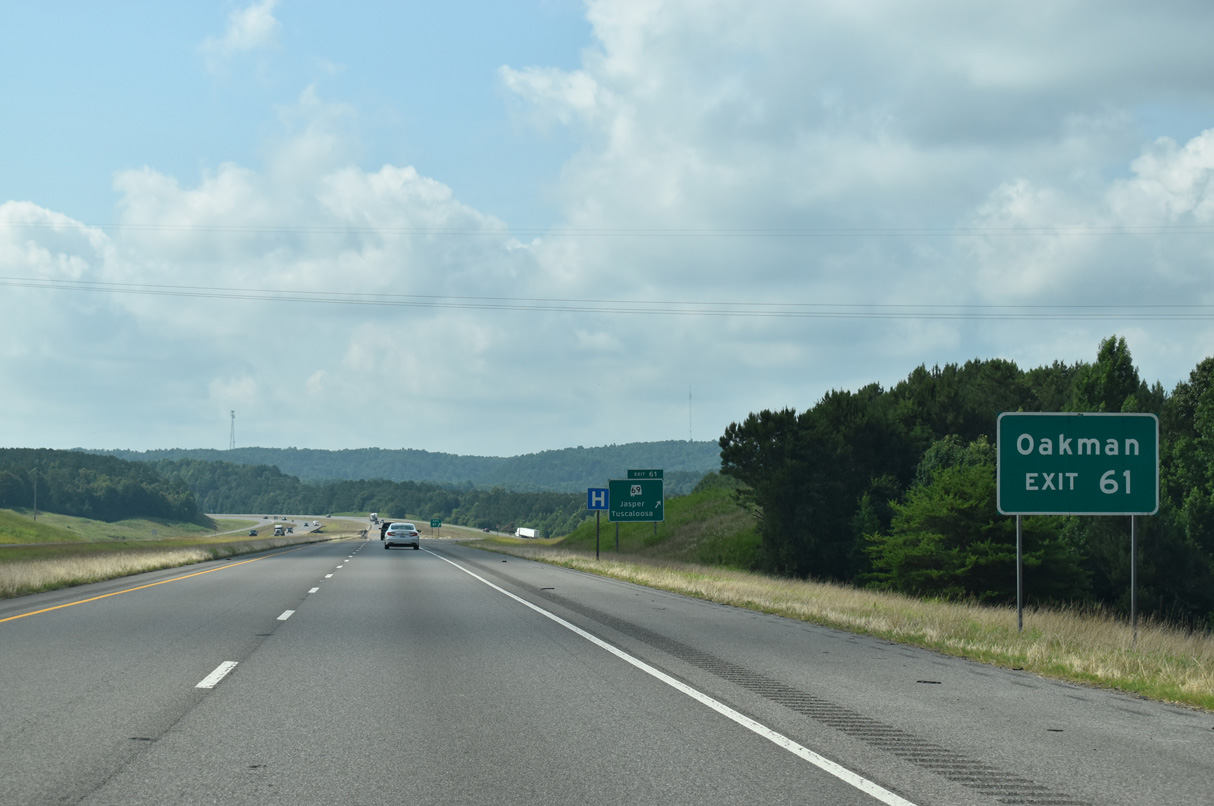
SR 124 travels 2.5 miles west from SR 69 through New Jagger to Hillard while SR 69 turns southward eight miles to Oakman and 49 miles to Northport.
06/26/22
Traveling 280.53 miles overall, SR 69 begins at Jackson in Clarke County and runs north to Linden, Greensboro and Tuscaloosa before reaching Jasper. The state route turns eastward from Walker County to an overlap with I-65 ahead of Cullman, Arab and Guntersville.
06/26/22
I-22/U.S. 78 passes through southern reaches of the Jasper city limits at Exits 61, 63 and 65.
06/26/22
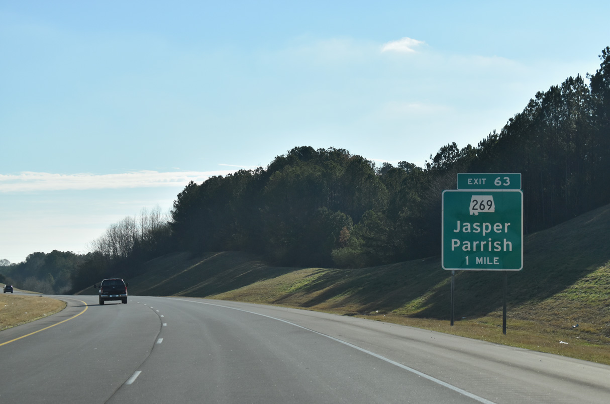
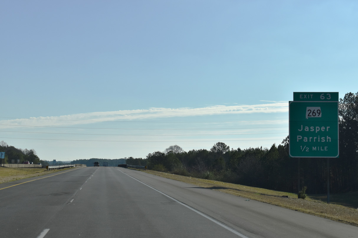
Beginning in Jasper, SR 269 leads south 1.8 miles to meet Interstate 22 at Exit 63 in one mile.
01/01/24
Within Walker County, SR 269 connects Jasper with the town of Parrish and the settlements of Key Camp, Goodsprings and Pumpkin Center. Overall the state route provides an alternate route into Birmingham.
01/01/24
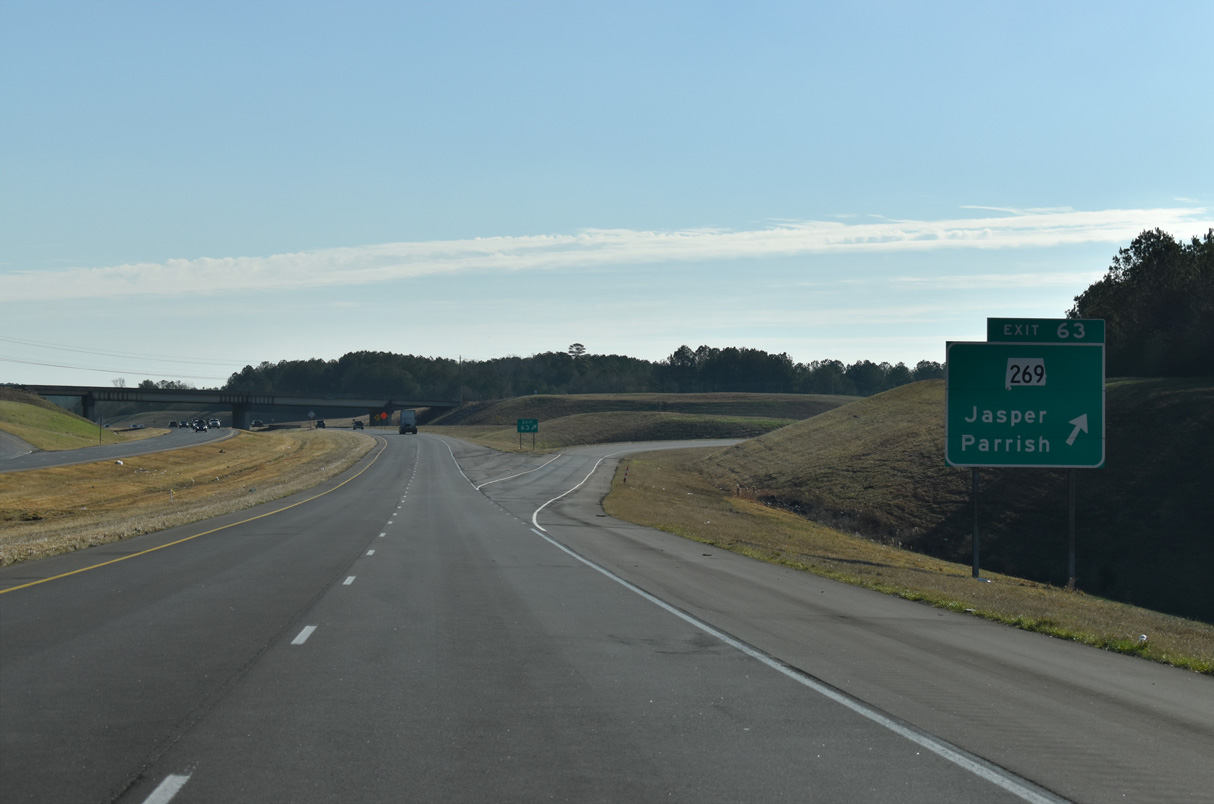
Entering the parclo interchange (Exit 63) with SR 269 for Jasper along I-22 east. The state route concludes a 41.52 mile course at I-20/59 in the Ensley section of Birmingham.
01/01/24
Interstate 22 again expands to six lanes east of Exit 63.
01/01/24
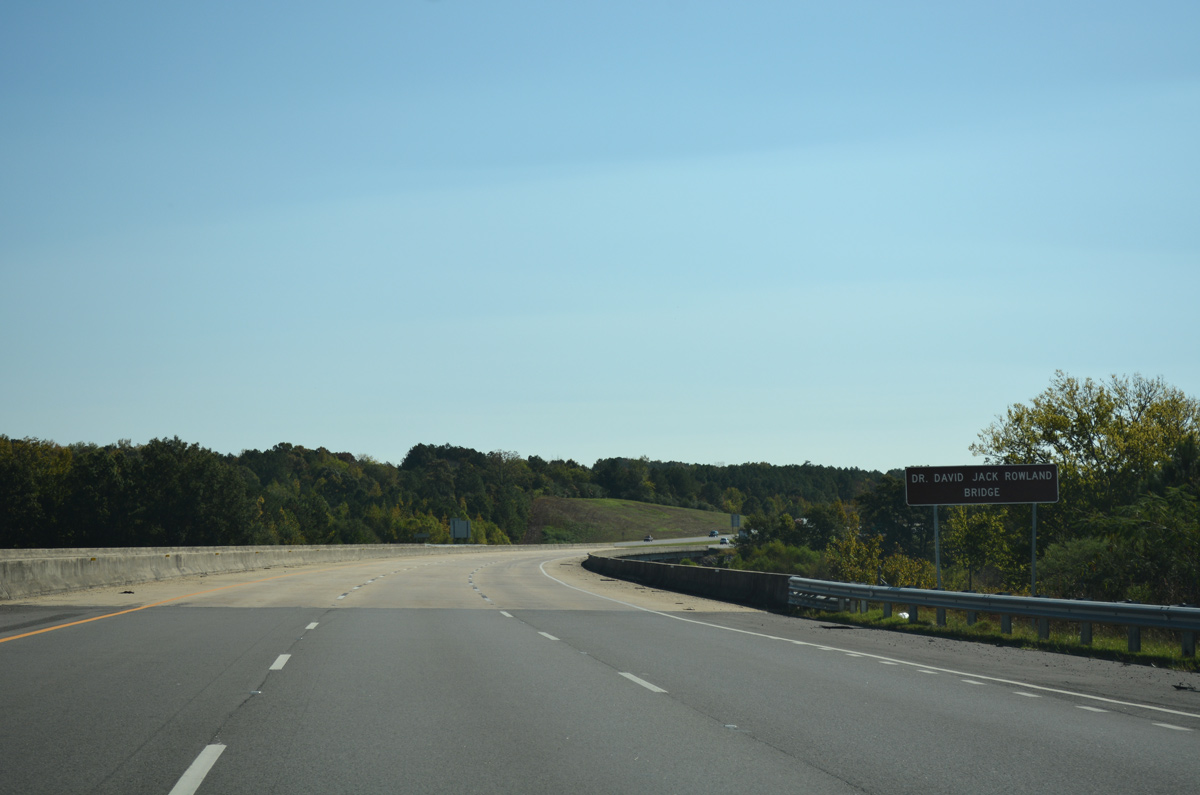
The Dr. David Jack Rowland Bridge takes Interstate 22 across Town Ceek and a Norfolk Southern Railroad line to the immediate east of Exit 63.
10/08/16
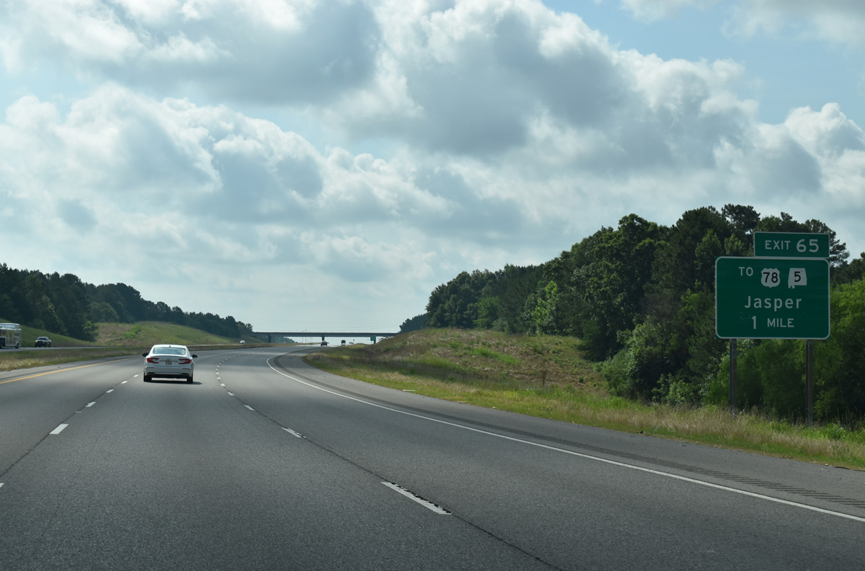
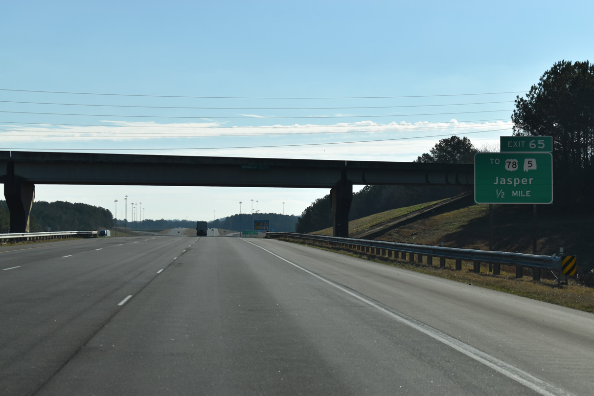
Interstate 22 next meets Industrial Parkway at a diamond interchange (Exit 65) in one mile.
06/26/22
Whitehouse Road heads south from Old Birmingham Highway in Jasper to cross Interstate 22, one half mile west of Exit 65. The local road ties into the south end of Industrial Parkway before continuing east to East Lake Road and Corinth.
01/01/24
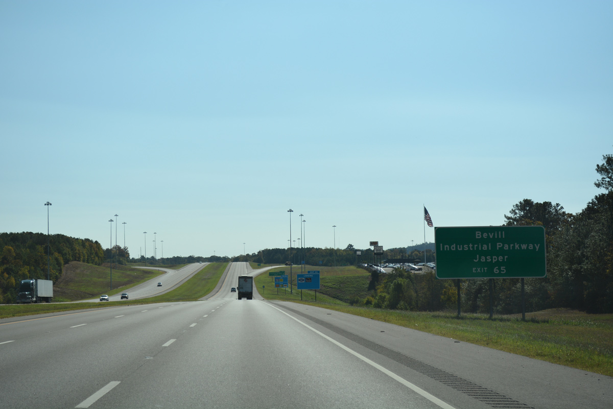
Industrial Parkway comprises a five lane arterial north to the intersection of SR 5 (old U.S. 78) with SR 69 north to Boldo, Red Rock and Cullman. This guide sign was replaced to display Bevill Industrial Park.
10/08/16
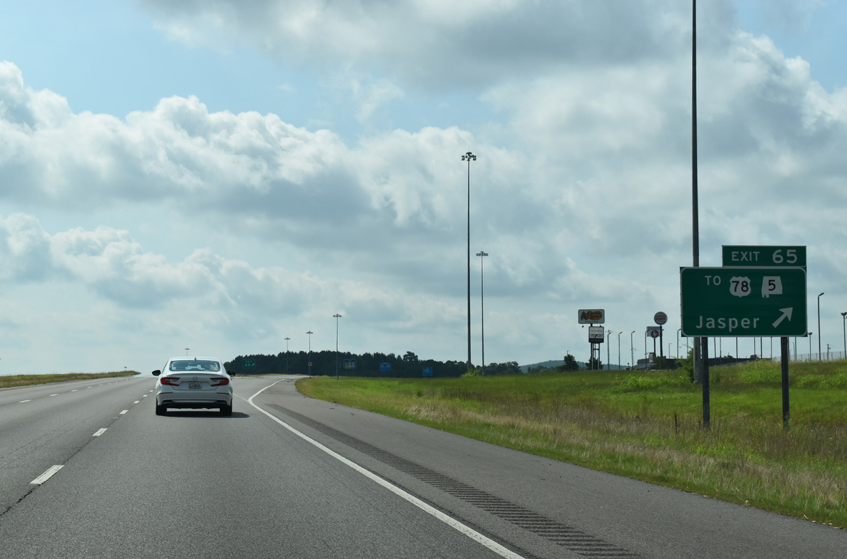
Exit 65 leaves I-22/U.S. 78 east for Industrial Parkway. The five lane boulevard represented a temporary alignment for U.S. 78 until the Jasper to Graysville section opened to traffic.
06/26/22
Whitehouse and West Lake Roads parallel Interstate 22 above rock cuts to the south of Walker County Lake by this shield assembly.
06/26/22
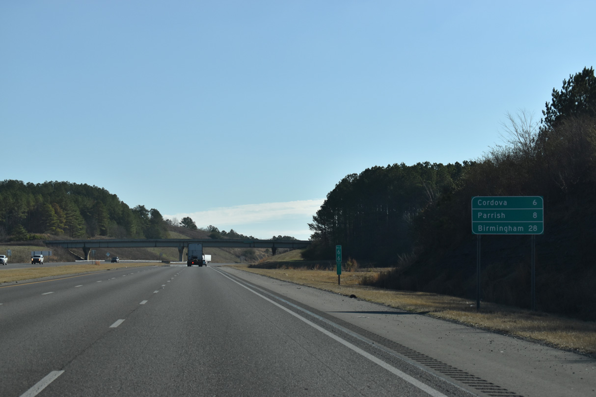
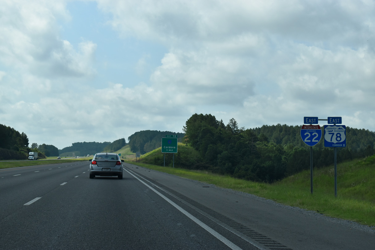
The ensuing exit along Interstate 22 connects the freeway with both the city of Cordova and town of Parish. Birmingham is 28 miles to the southeast.
01/01/24
Interstate 22 spans Cane Creek just outside the Cordova city limits.
09/11/20
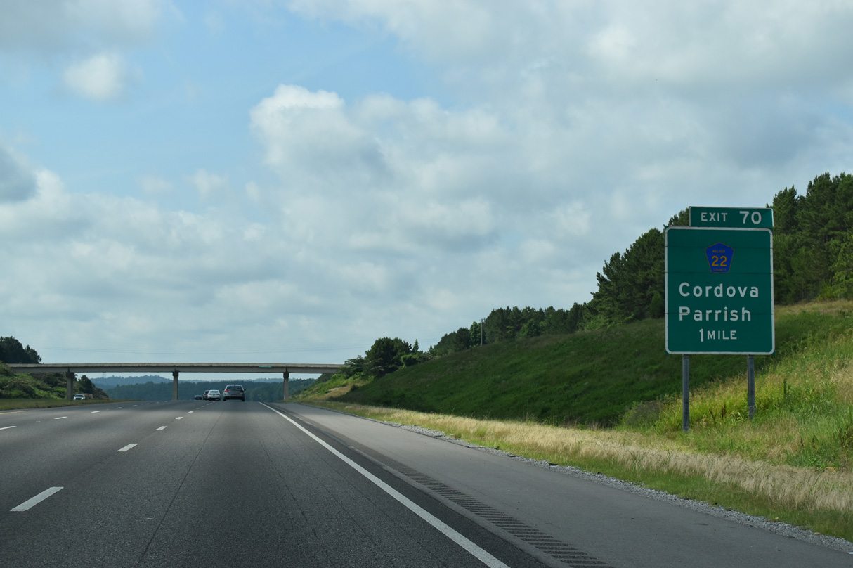
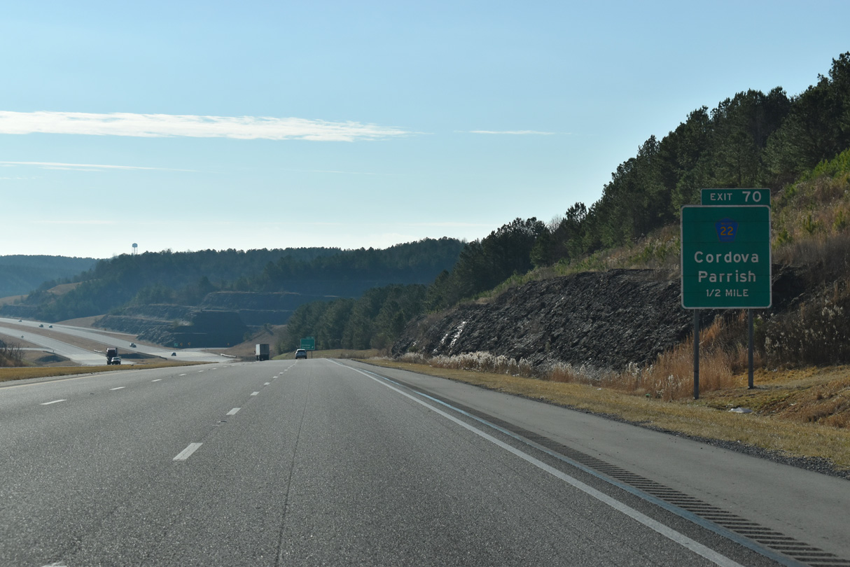
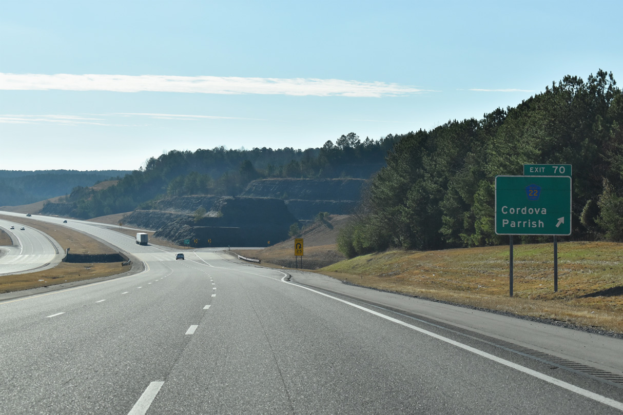
Walker County Route 22 (Cordova Parish Road) and Interstate 22 come together at Exit 70 in one mile. CR 22 connects I-22/U.S. 78 with the Cordova city center to the northeast.
06/26/22
The hills along Frog Ague Creek were terraced to accommodate the folded diamond interchange (Exit 70) linking I-22 and CR 22.
01/01/24
Walker County Route 22 (Cordova Parish Road) leads 3.9 miles west from I-22/U.S. 78 to SR 269 in the town of Parrish.
01/01/24
Interstate 22 confirming marker posted ahead of Frog Ague Creek, south of Cordova.
06/26/22
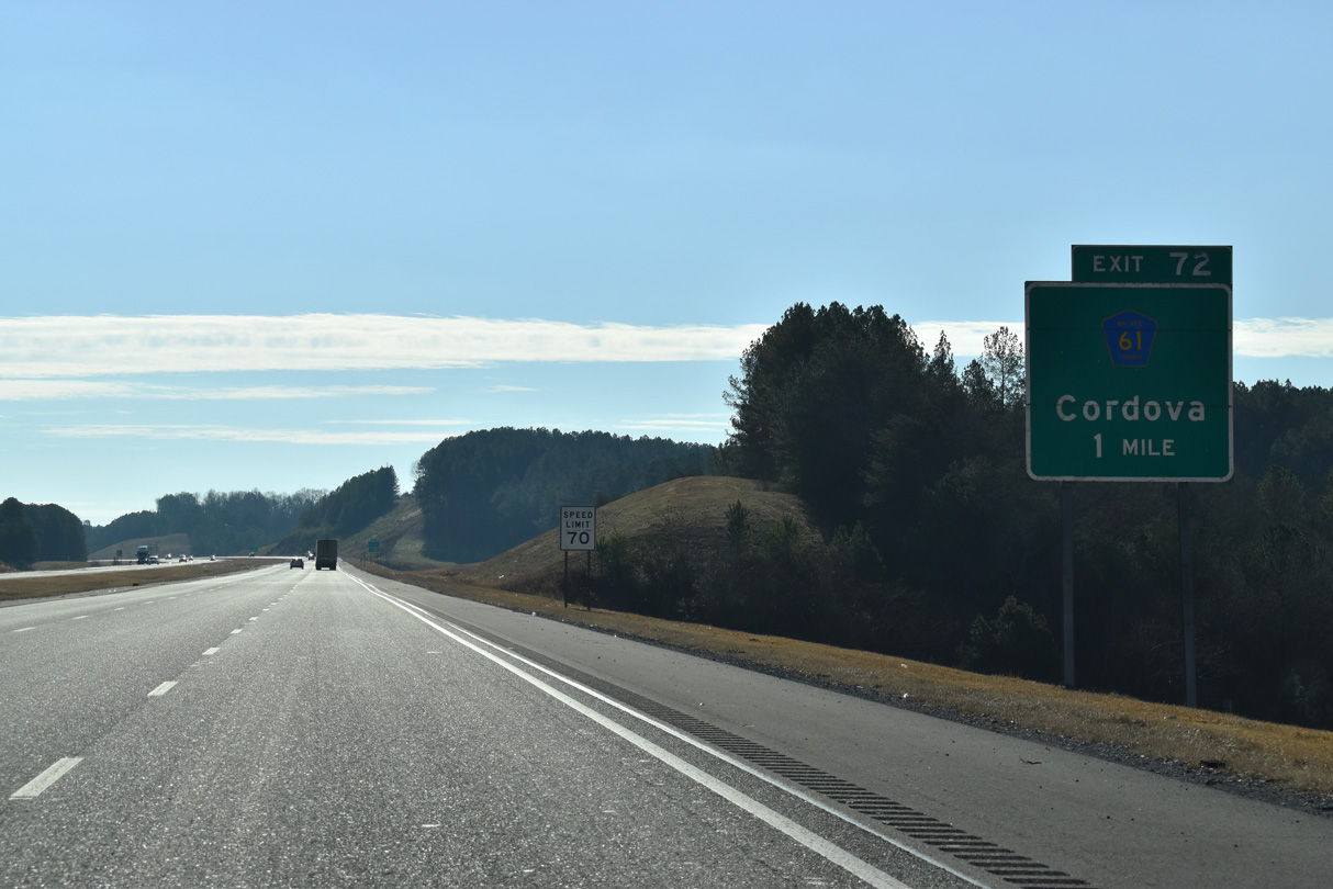
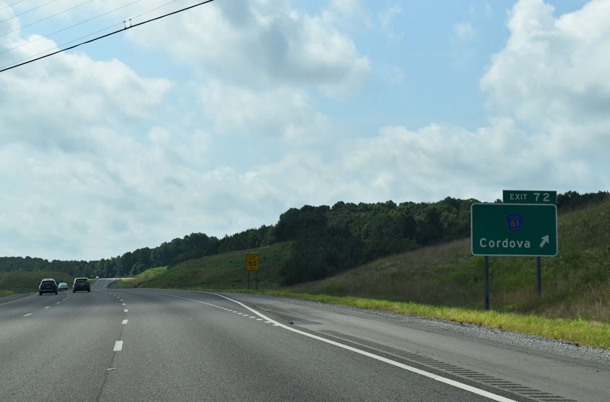
County Road 61 runs 2.36 miles south from County Rooute 22 in Cordova to meet I-22 at Exit 72 in one mile.
01/01/24
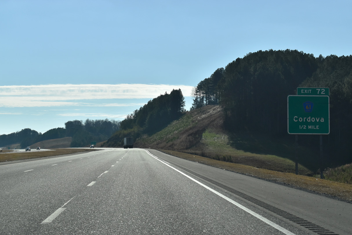
One half mile ahead of the diamond interchange (Exit 72) with CR 61 on I-22/U.S. 78 east.
01/01/24
South from Exit 72, County Route 61 traverses hilly terrain 4.65 miles to SR 269, east of High Level.
06/26/22
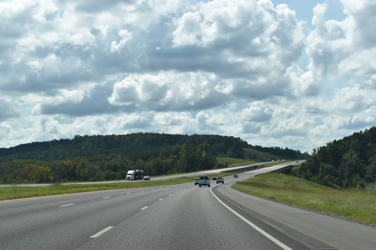
Interstate 22 travels south by the settlement of Barney.
06/26/22
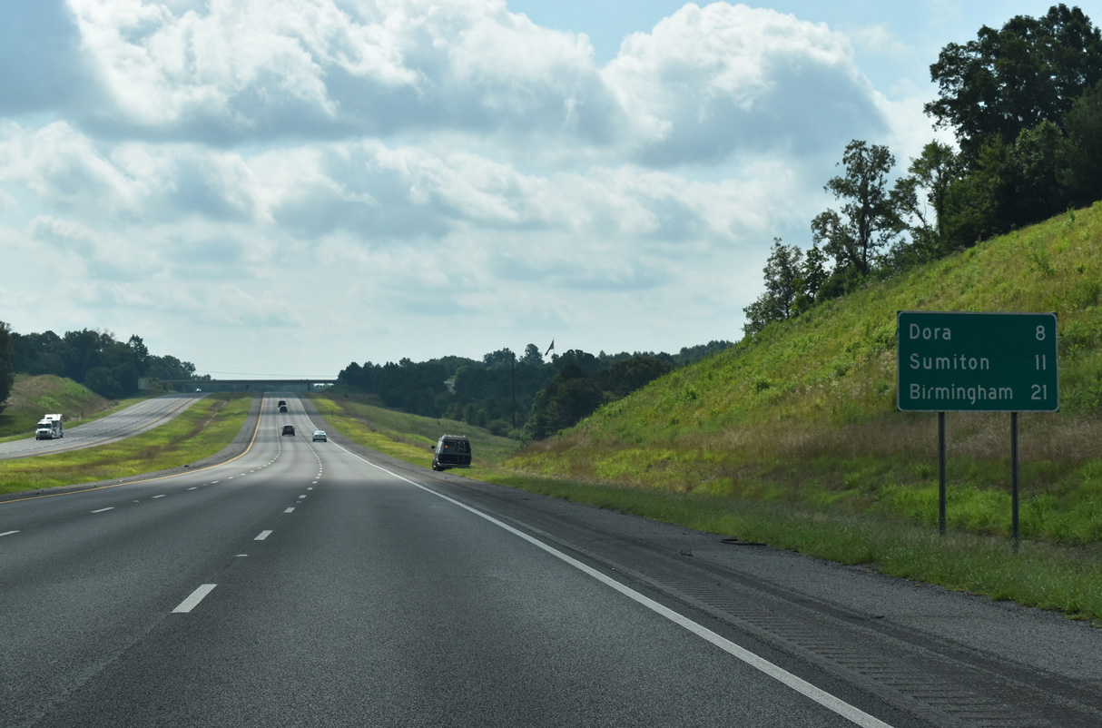
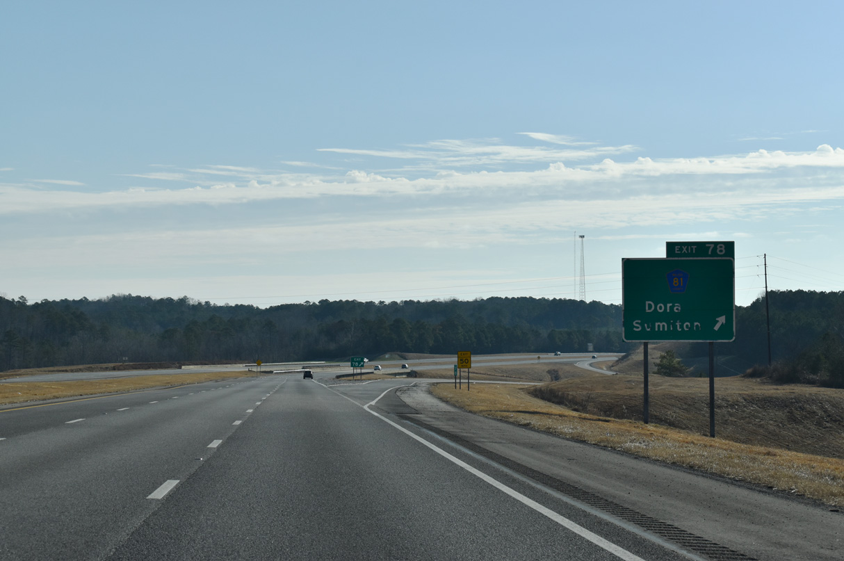
Dora and Sumiton area destinations off Interstate 22 east at Exit 78. 23 miles of I-22 remain east to I-65 at Birmingham.
06/26/22
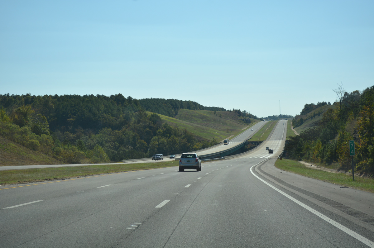
Interstate 22 spans the Mulberry Fork of the Black Warrior River just east of mile marker 74. This waterway flows 102 miles southwest from Cullman County, near Arab, into Bankhead Lake.
10/08/16
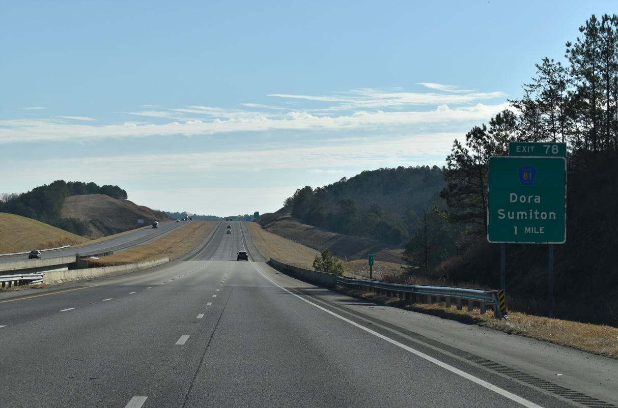
The diamond interchange at Exit 78 connects I-22/U.S. 78 with Walker County Route 81, one mile east of Burnt Cane Creek.
01/01/24
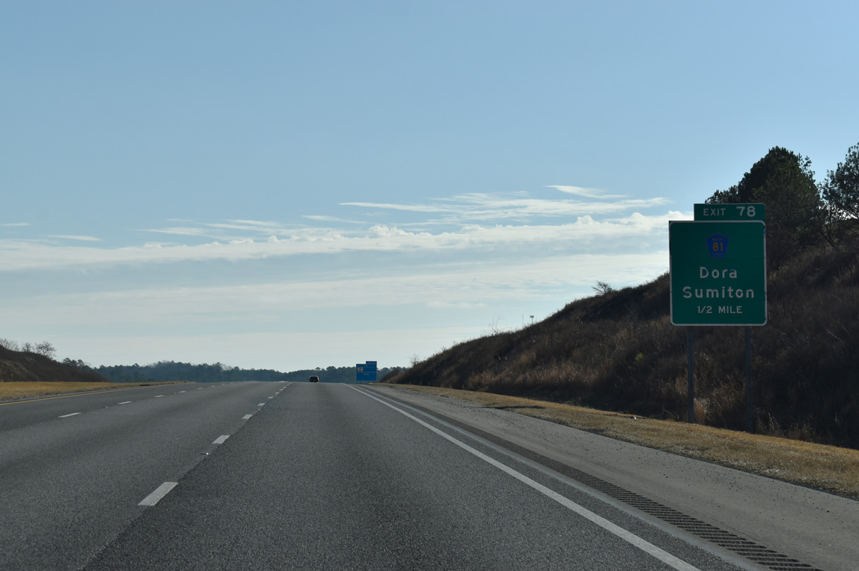
County Route 81 joins Interstate 22 with the cities of Dora and Sumiton to the north.
01/01/24
South from Exit 78, CR 81 crosses into Jefferson County at Twilley Town en route to Flat Creek, Quintown and SR 269 west of Praco.
01/01/24
Quinton Road spans Interstate 22 from CR 81 east to Quinton beyond this reassurance marker.
06/26/22
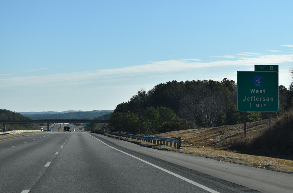
Jefferson County Route 45 (Snowville Brent Road) and Interstate 22 meet at a diamond interchange (Exit 81) between Media and Snowtown in one mile.
01/01/24
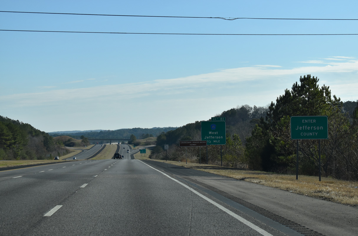
Interstate 22 crosses the Jefferson County line just east of the BNSF Railroad and Reeder Road.
01/01/24
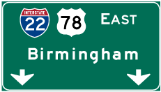
Photo Credits:
- Alex Nitzman: 10/08/16, 06/26/22, 01/01/24
- ABRoads: 06/02/11, 09/11/20
Connect with:
Page Updated Thursday February 26, 2026.