
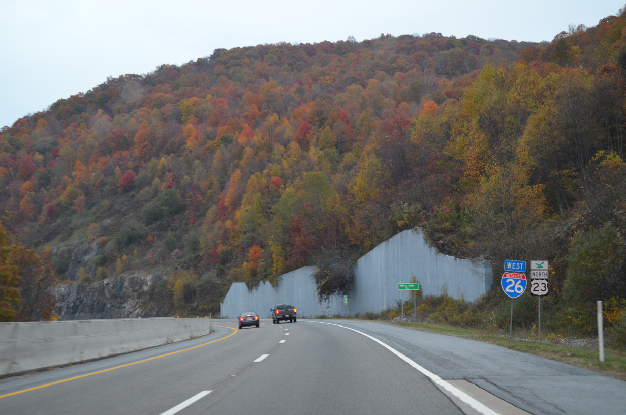
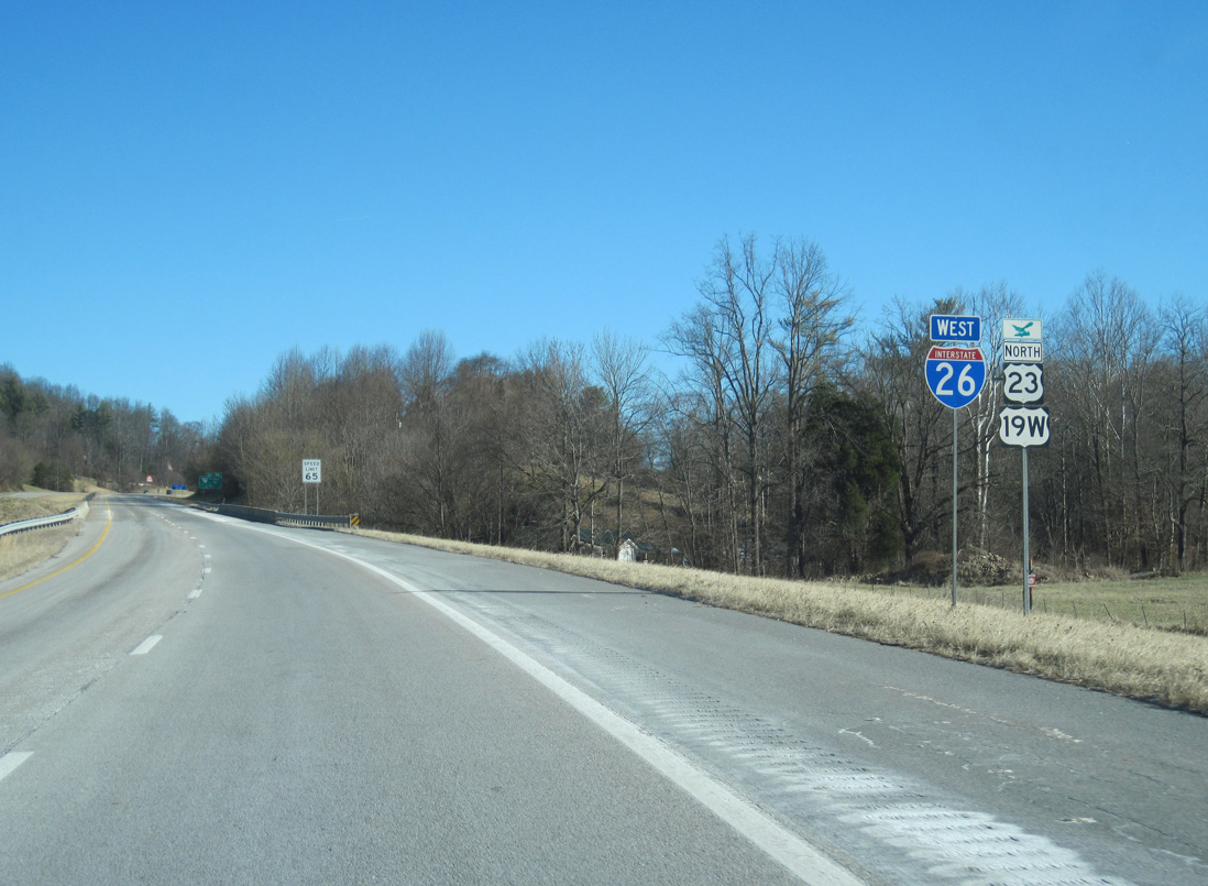
Interstate 26 West - Sams Gap to Johnson City

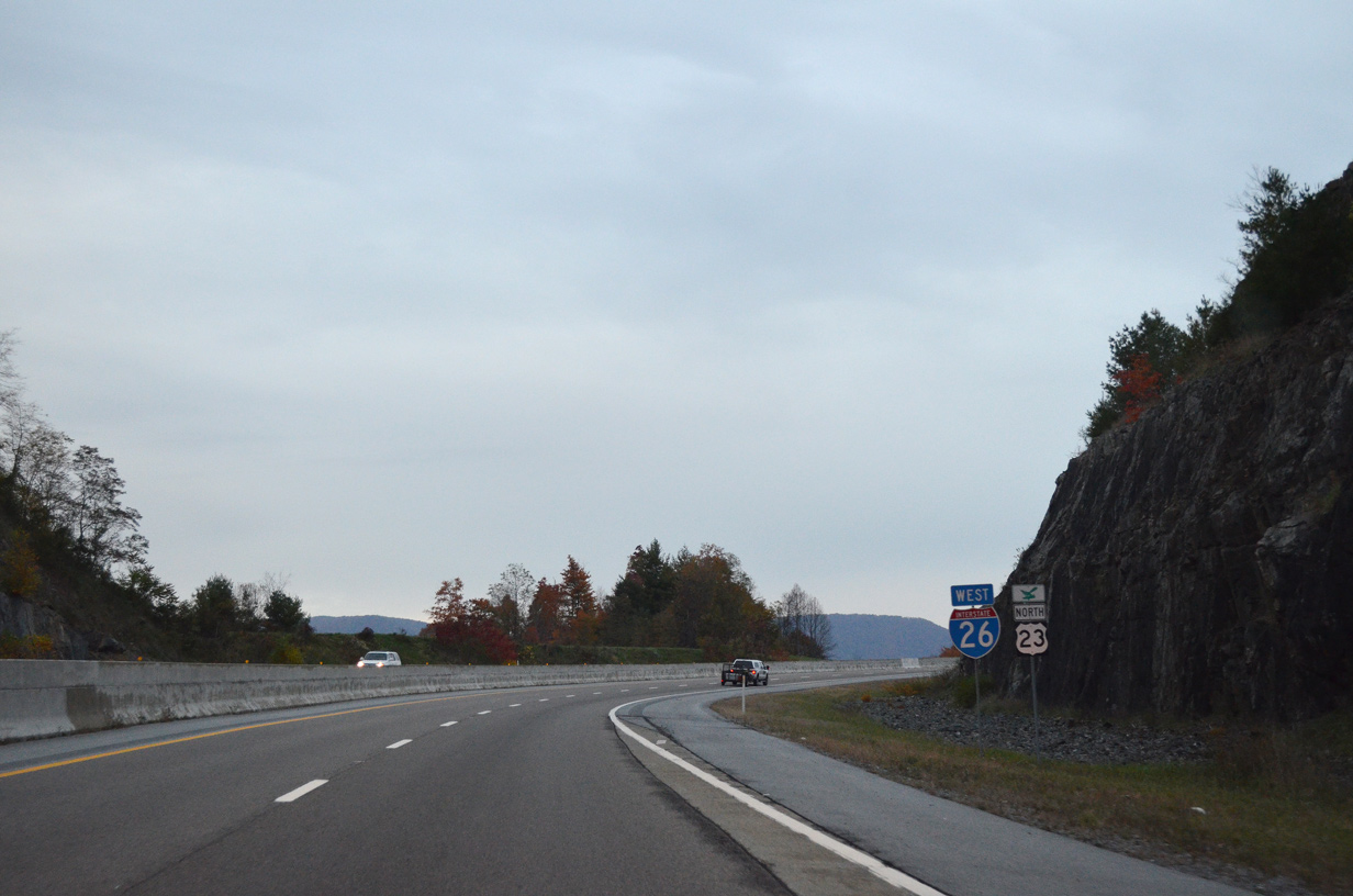
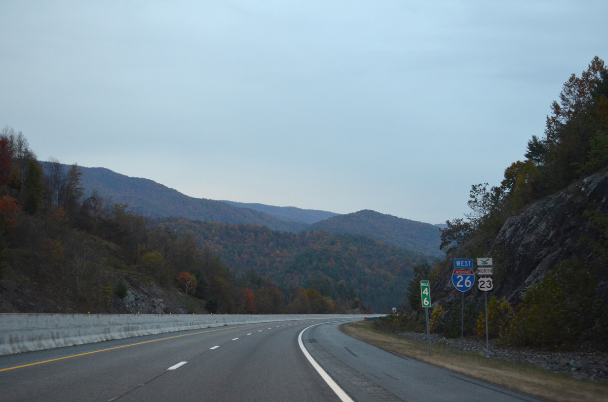
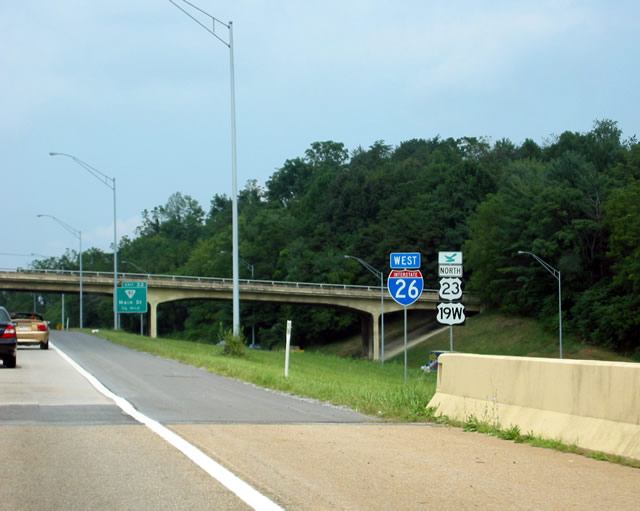
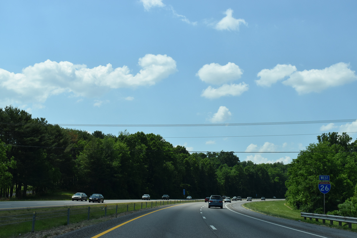
 West
West  North
North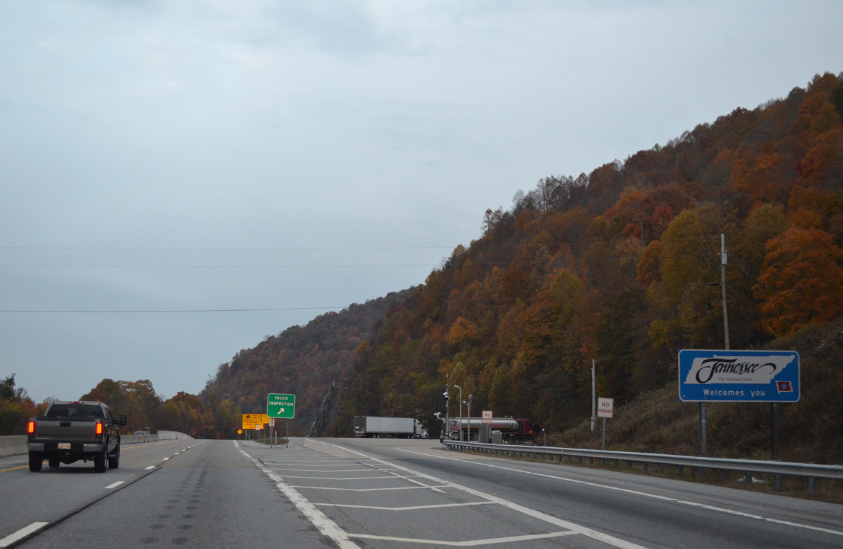
A welcome sign appears at the truck safety inspection area at Sams Gap.
10/24/15
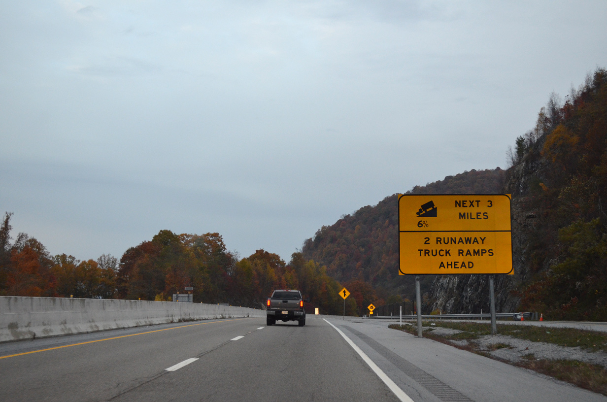
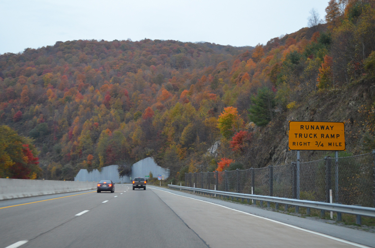
Descending from Sams Gap toward Erwin, I-26/U.S. 23 advance along a steep decline by a series of runaway truck ramps.
10/24/15
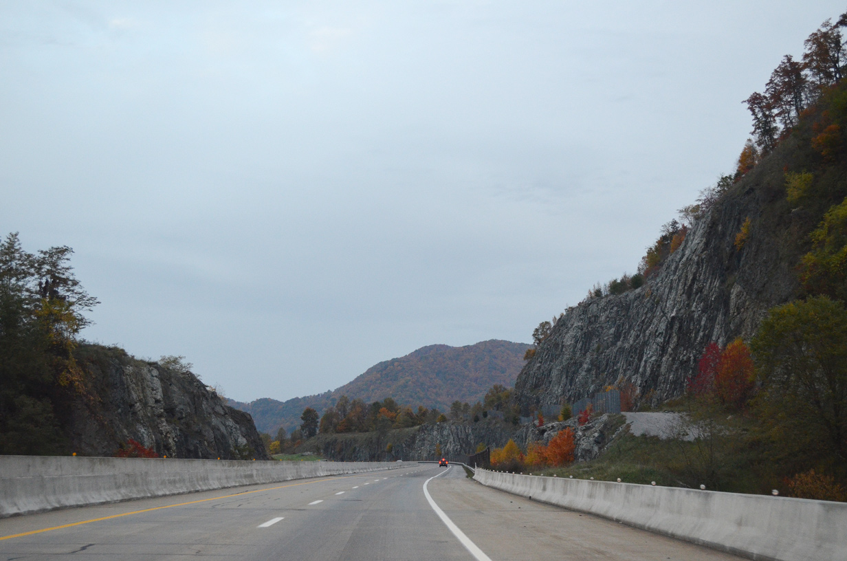
A Tennessee Scenic Parkway, Interstate 26 travels through the vast Cherokee National Forest northward from the Bald Mountains.
10/24/15

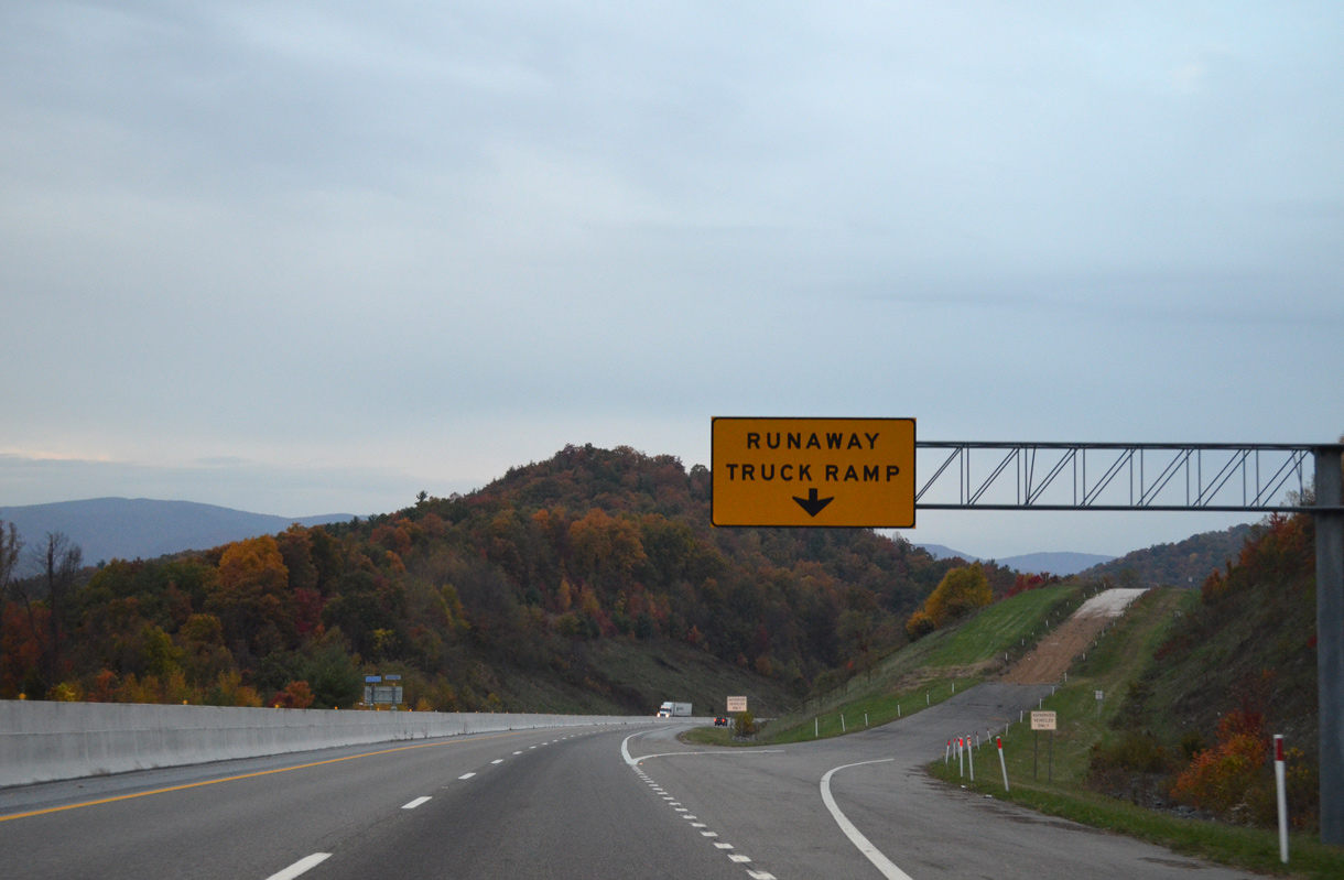
The first runaway truck ramp on Stamp Ridge.
10/24/15
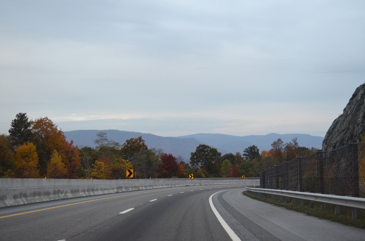
Northern reaches of the Bald Mountains and Rich Mountain appear along the horizon in this scene near mile marker 55.
10/24/15

A series of three bridges precede the second runaway truck ramp along Stamp Ridge.
10/24/15
I-26/U.S. 23 cuts through Stamp Ridge near Harris Mill. This section of freeway opened to traffic in 1995 as part of the long-term Interstate 26 construction project.
10/24/15
10/25/15

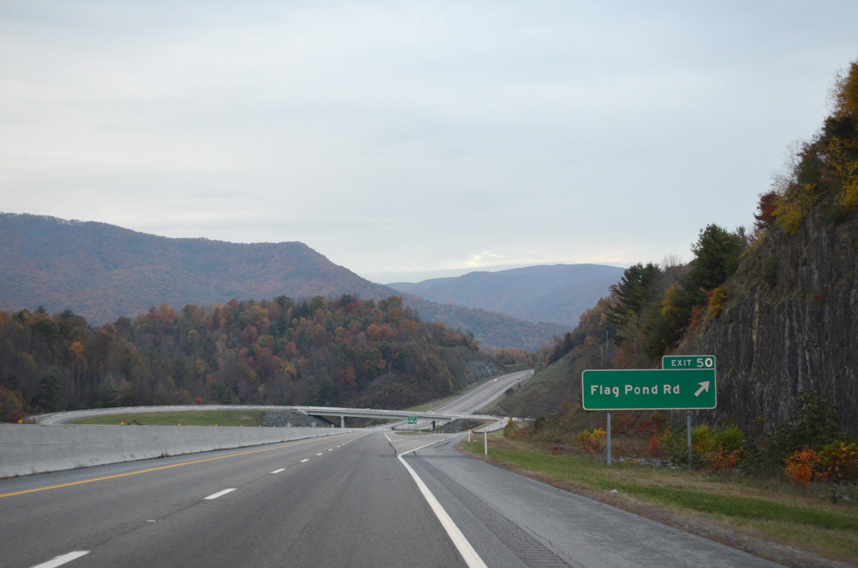
A trumpet interchange (Exit 50) links I-26/U.S. 23 with adjacent Higgins Creek Road at Gentry Hollow.
10/24/15
Upper Higgins Creek Road meanders northwest from Harris Mill and Tilson Mountain to Flag Pond Road (Old U.S. 23) near the community of Flag Pond.
10/24/15
Confirming markers posted north of the entrance ramp at Exit 50.
10/24/15
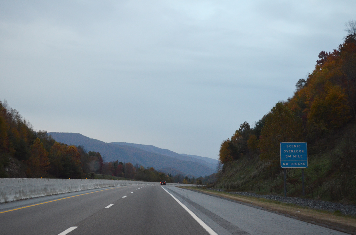
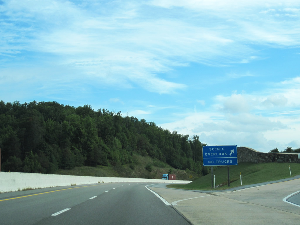
Interstate 26 advances north between Tilson Mountain and Indian Creek toward a scenic overlook.
10/24/15
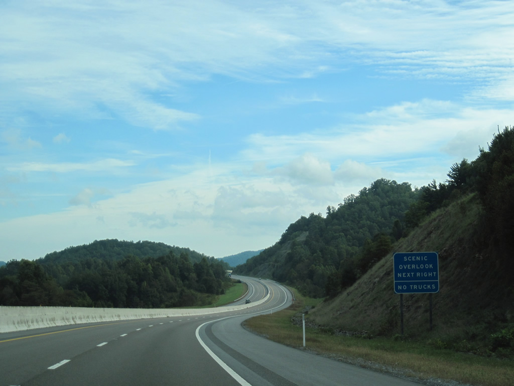
The scenic overlook in Unicoi County lines the westbound roadway east of Rocky Fork. Flint Mountain rises to the west and Higgins Ridge to the north.
09/29/10
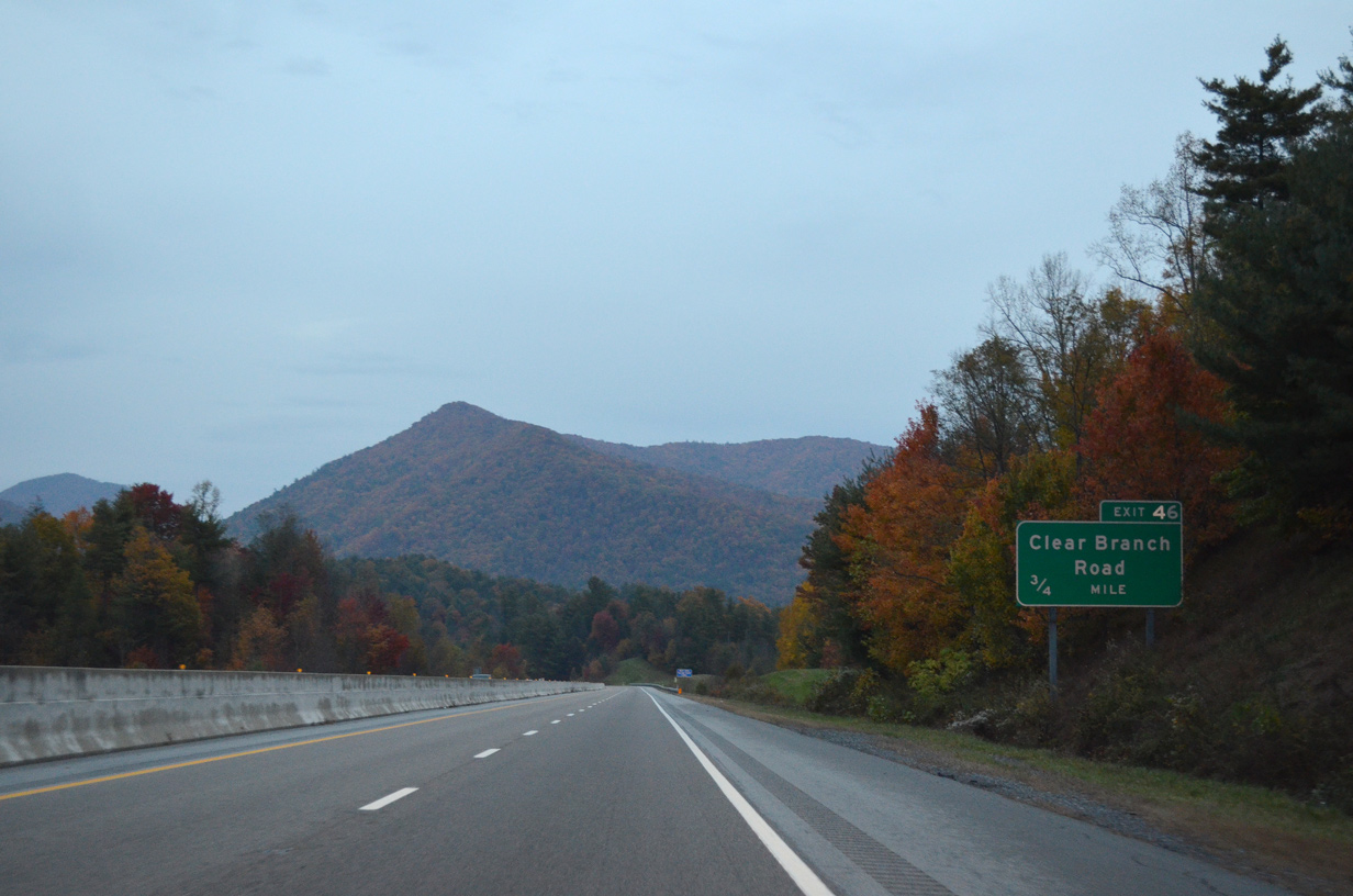
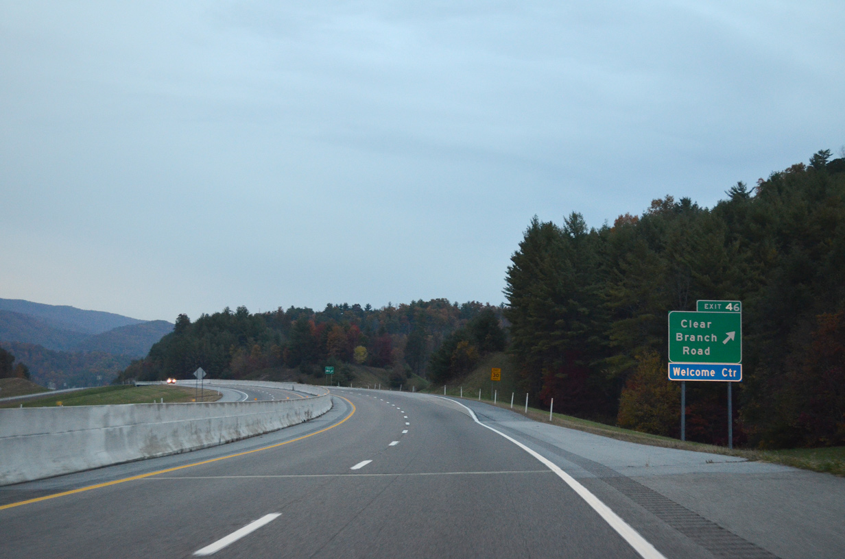
A diamond interchange (Exit 46) connects I-26/U.S. 23 with an access road to Clear Branch Road and the Tennessee welcome center.
10/24/15

The welcome center and rest area at Exit 46 opened on May 14, 2010.1
10/24/15
Clear Branch Road parallels Clear Branch north from Willis Store to SR 352 (old U.S. 23 / Flag Pond Road).
10/24/15
I-26/U.S. 23 continue north from Clearbranch by the community of Ernestville.
10/24/15
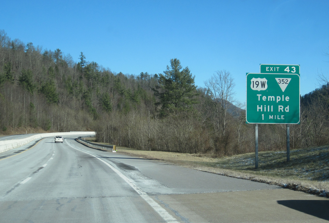
U.S. 19W (Spivey Mountain Road) and SR 352 (Flag Pond Road / Old U.S. 23) converge at Ernestville, 1.17 miles south of Exit 43.
02/10/14
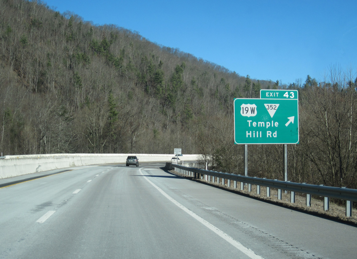
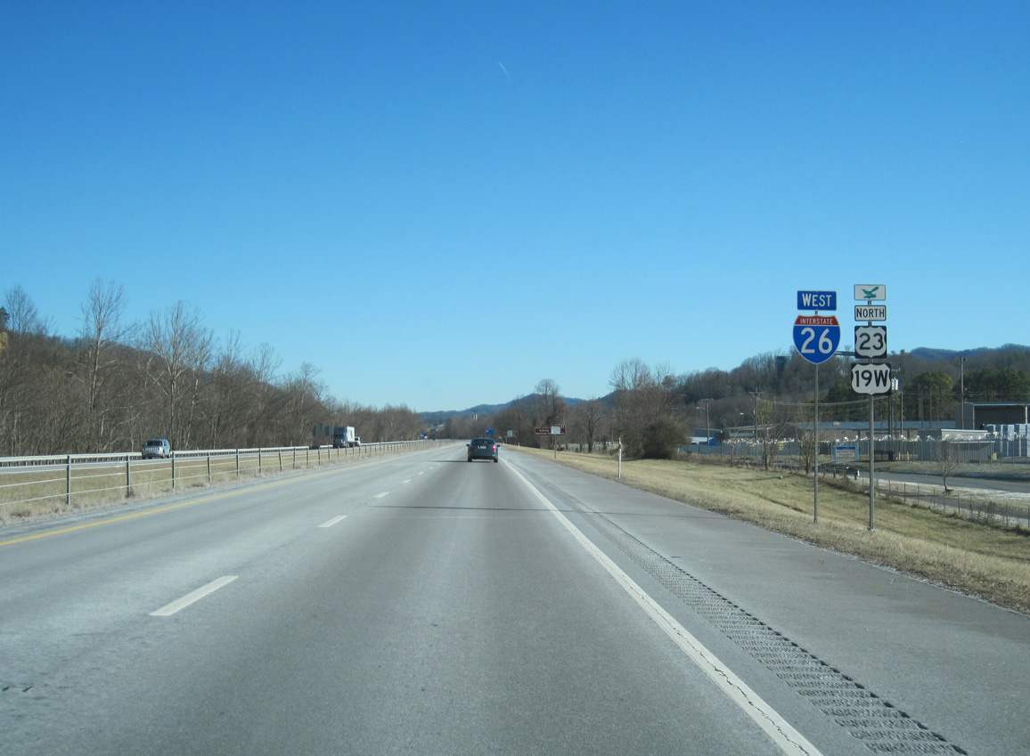
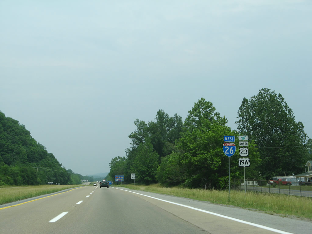
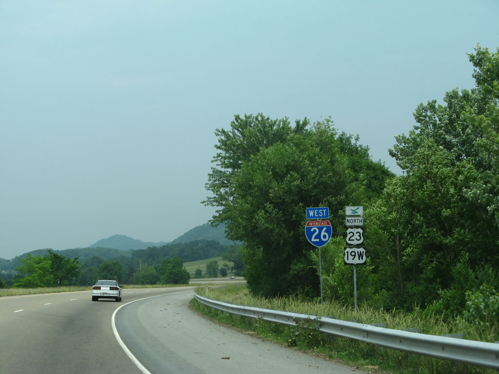
U.S. 19W shifts onto I-26/U.S. 23 at Exit 43. Temple Hill Road extends northeast along old U.S. 19W/23 to Shallowford and River Hill.
02/10/14
West  North
North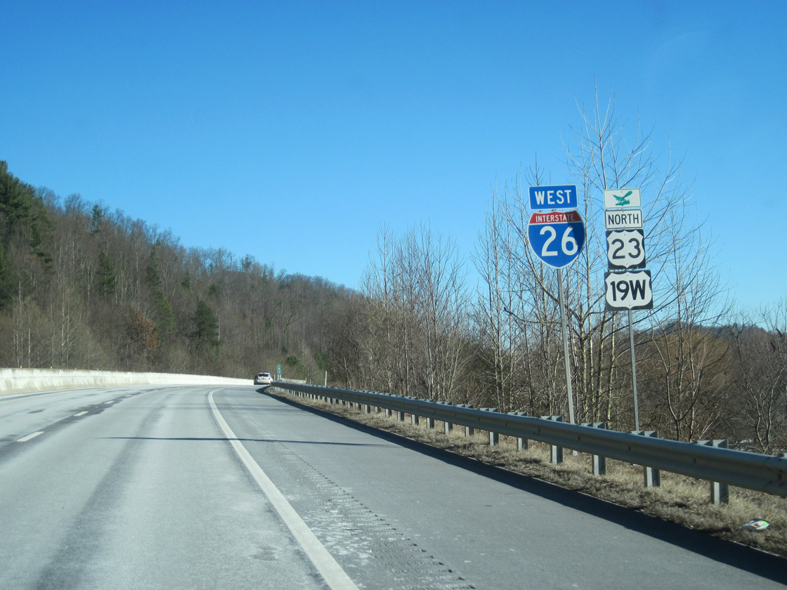
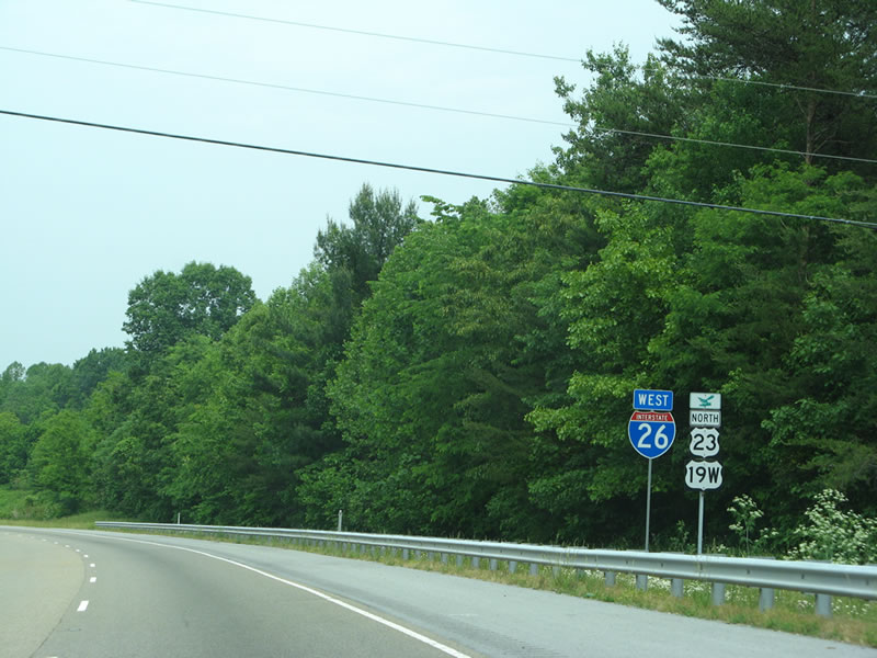
U.S. 19W overlaps with I-26/U.S. 23 northward 23.31 miles to Johnson City.
02/10/14
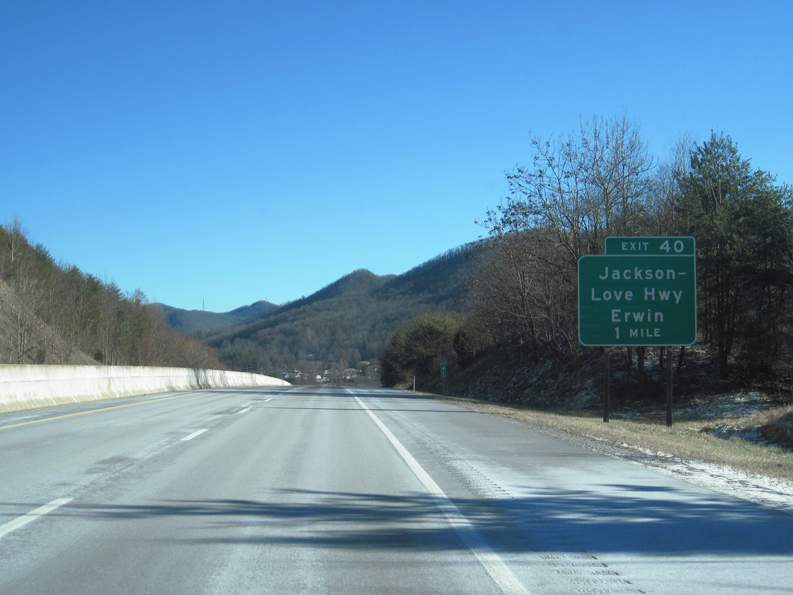
Jackson-Love Highway branches east from Interstate 26 along an old alignment of U.S. 19W/23east to Banner Hill and the town of Erwin.
02/10/14
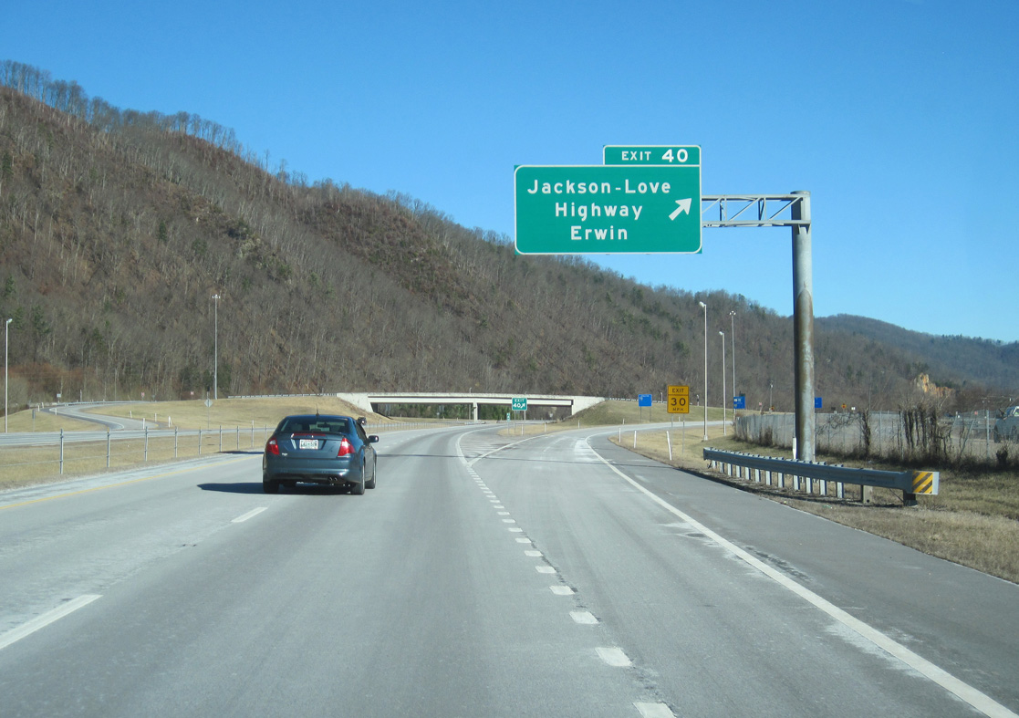
Looking Glass Mountain rises along the west side of I-26 at the diamond interchange (Exit 40) with Jackson-Love Highway. Old U.S. 19W-23 follow Ohio Avenue, Love Street, and N Main Avenue through Banner Hill and Erwin to SR 107.
02/10/14
Interstate 26 and U.S. 19W/23 span the Nolichucky River ahead of this shield assembly.
02/10/14
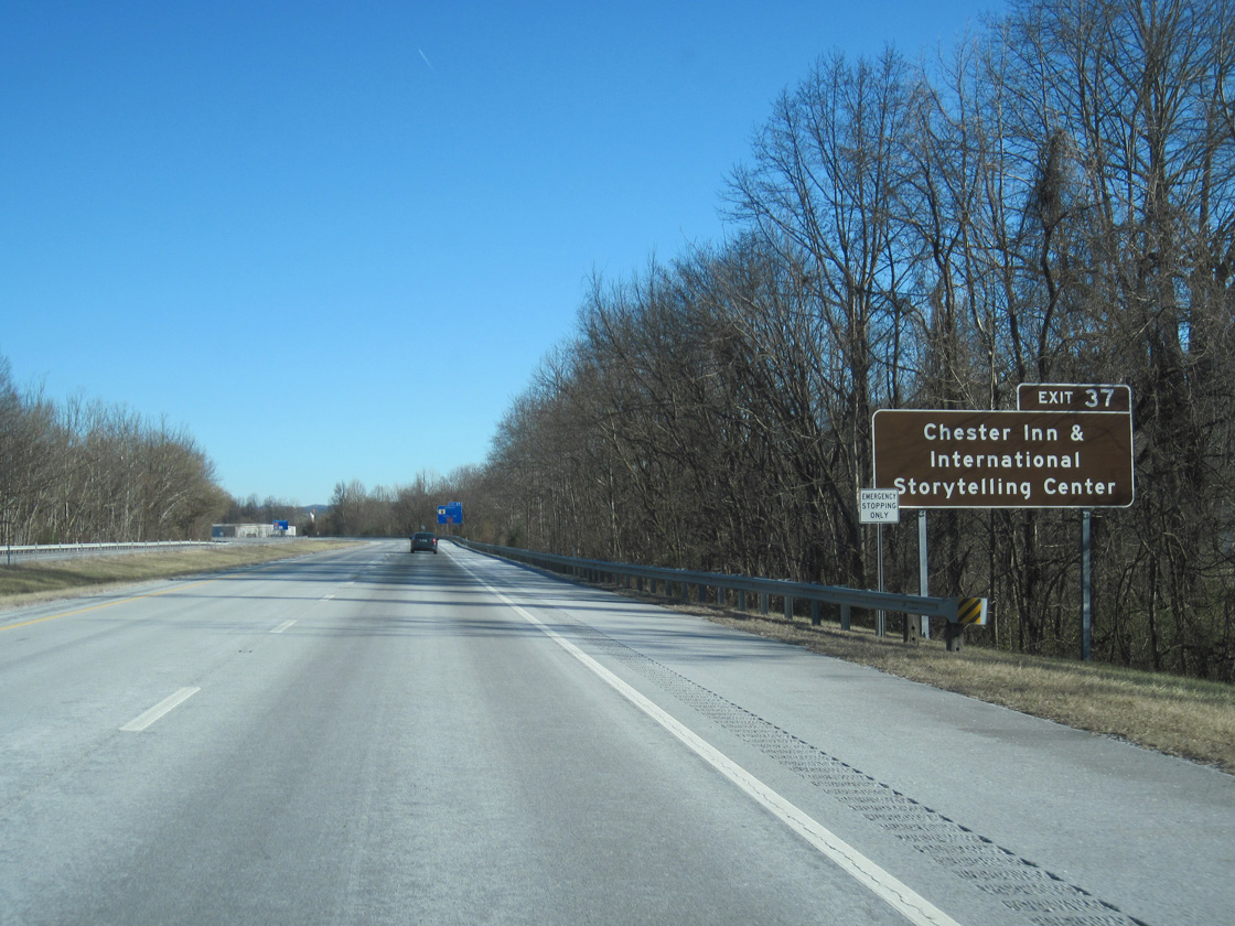
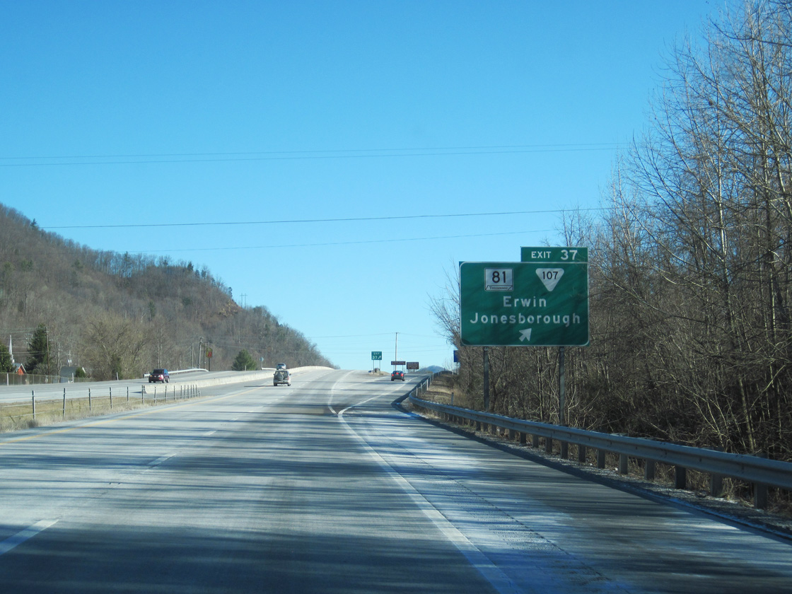
SR 81 travels north from forthcoming Exit 37 to Jonesborough, the Storytelling Capital of the World. Jonesborough is home of the International Storytelling Center, which hosts annual National Storytelling Festival started in 1973, and includes the Chester Inn, which was built in 1797.
02/10/14
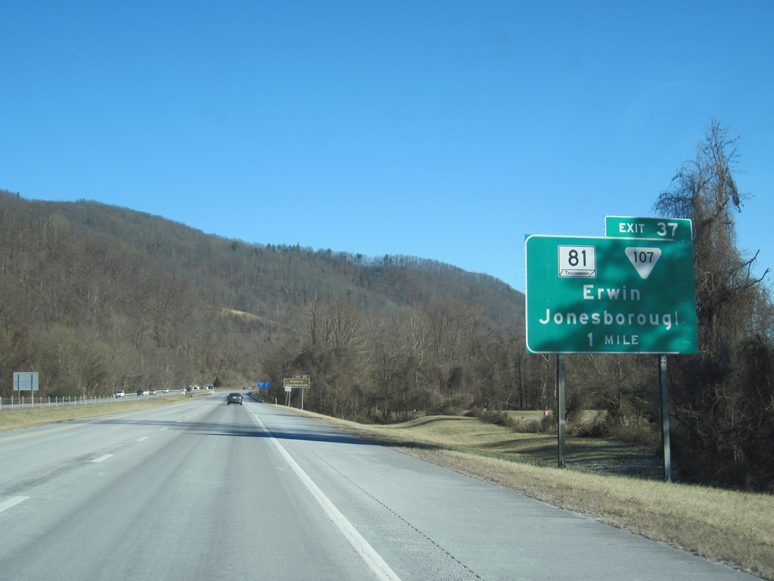
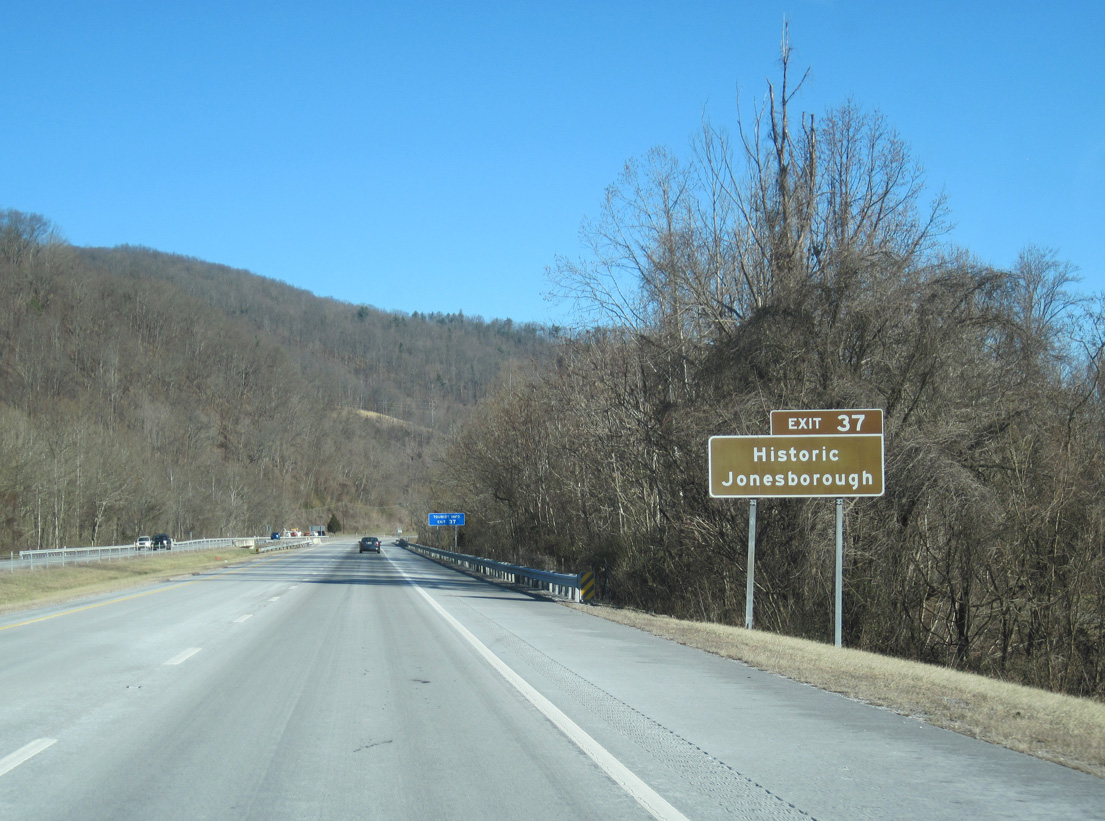
The diamond interchange at Exit 37 marks the south end of SR 81. SR 107 overlaps with SR 81 north en route to U.S. 11E/321 in Tusculum, east of Greeneville.
02/10/14
Founded in 1779, Jonesborough is the oldest town in the state. During the 17 years prior to the statehood of Tennessee, Jonesborough and other nearby towns considered forming the state of Franklin.
02/10/14
2nd Street (SR 107) leads southeast to N Main Avenue at Erwin Town Hall. Seat of Unicoi County in the "Valley Beautiful," Erwin was incorporated on April 21, 1891.
02/10/14
Straddling the Erwin town line, Interstate 26 and U.S. 19W-23 parallel North Indian Creek alongside Buffalo Mountain.
05/31/07
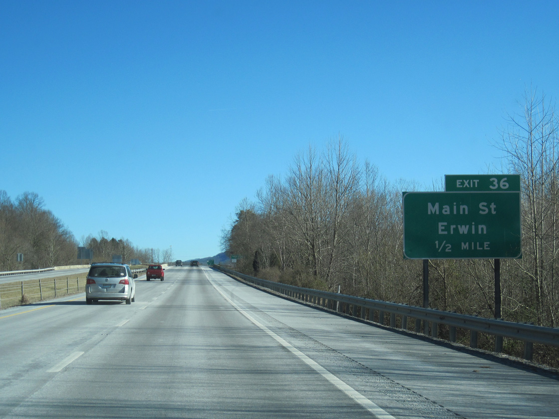
The succeeding exit joins Interstate 26 with Harris Hollow Road south to SR 107 (N Main Avenue) in Erwin.
02/10/14
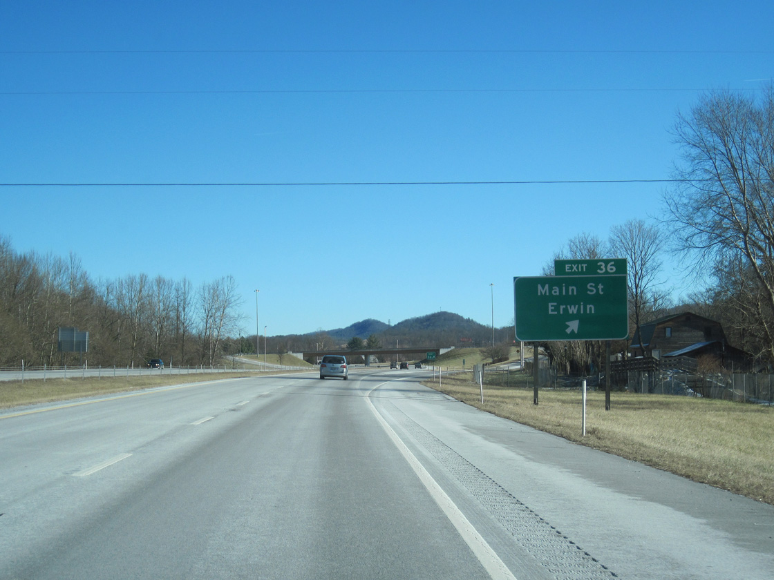
Entering the diamond interchange (Exit 36) with Harris Hollow Road north onto Buffalo Mountain and south to N Main Avenue (old U.S. 19W/23).
02/10/14
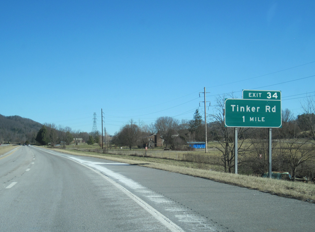
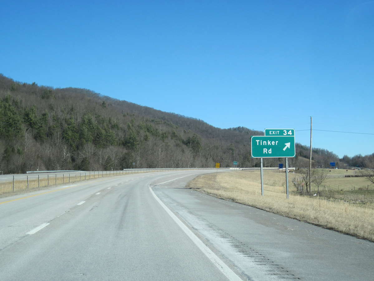
I-26/U.S. 19W-23 advance one mile northeast to a diamond interchange (Exit 34) with Tinker Road in the town of Unicoi.
05/31/07
02/10/14
Tinker Road links I-26/U.S. 19W-23 with adjacent big box retail and Zane Whitson Drive.
02/10/14
Interstate 26 crosses North Indian Creek again north of Exit 34 at White Road.
02/10/14
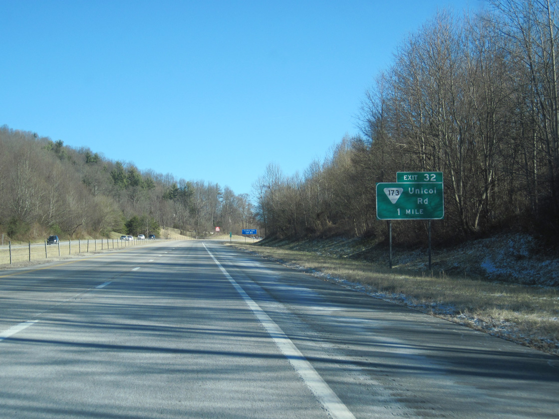
Exit 32 joins I-26 with SR 173 (Unicoi Road) east from Unicoi to recreational areas within Cherokee National Forest. Cherokee National Forest is the largest tract of public land in Tennessee with over 640,000 acres. Hiking, camping, and related activities are available for visitors.
02/10/14
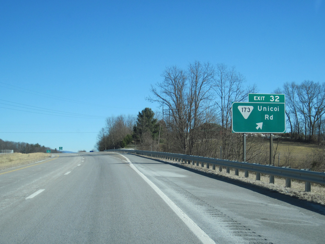
SR 173 heads south along Unicoi Drive (old U.S. 19W/23) to the Unicoi town center, where it comes with SR 107 east to Davis Springs.
02/10/14
Continuing through Unicoi, I-26/U.S. 19W-23 paralle. Buffalo Creek through a valley between Buffalo Mountain and Little Mountain.
05/31/07
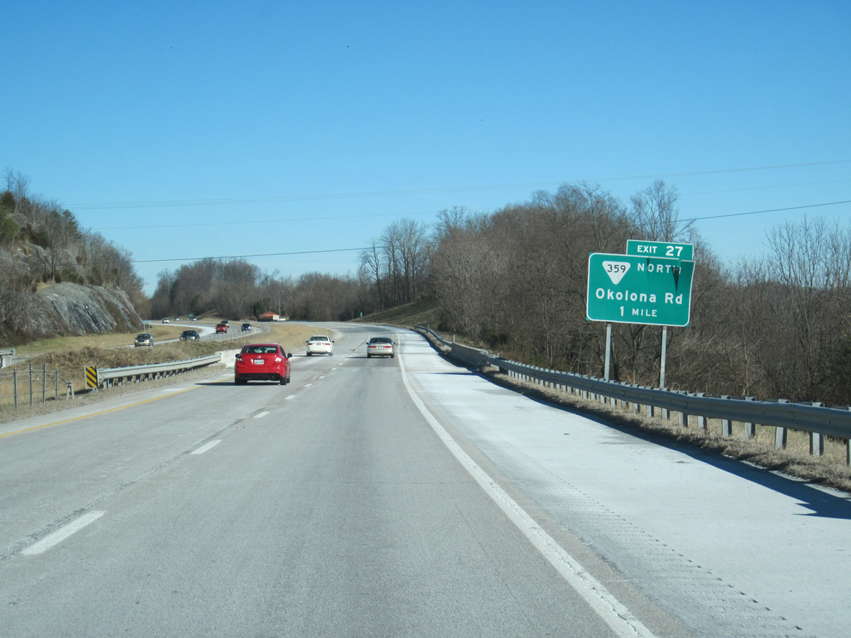
SR 359 (Okolona Road) branches northeast from Interstate 26 at Exit 27 along a 4.84 mile course to U.S. 321/SR 67 at Elizabethton.
02/10/14
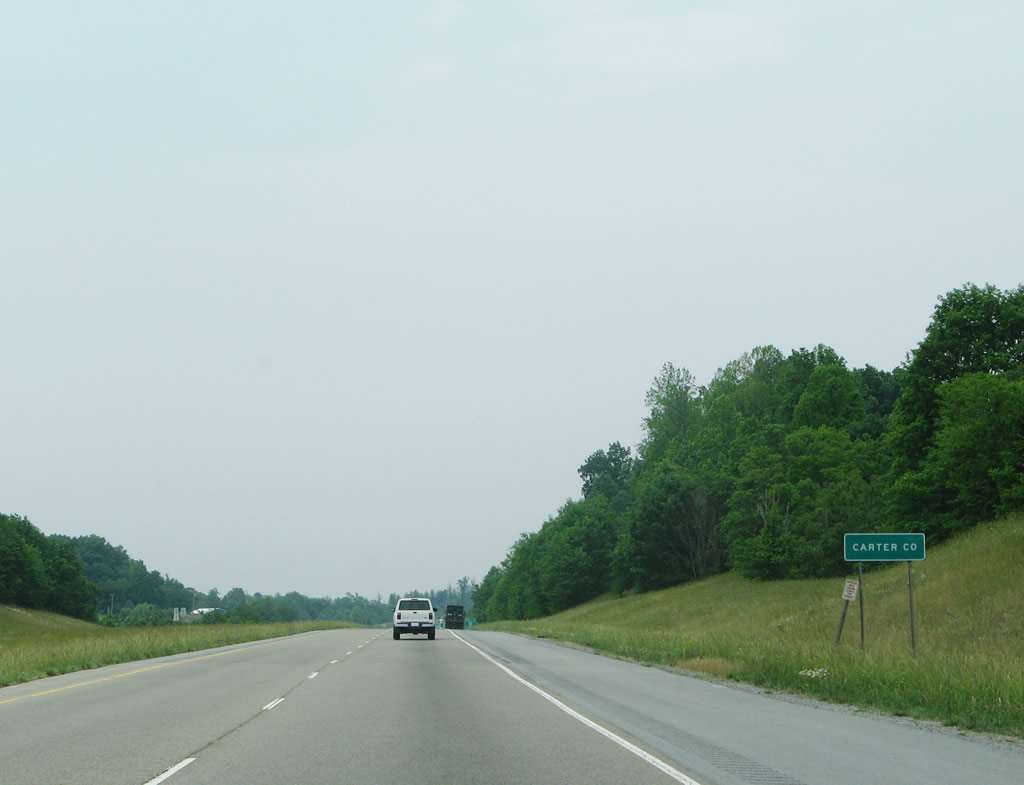
I-26/U.S. 23-19W enter Carter County east of Haynes Knob.
05/31/07
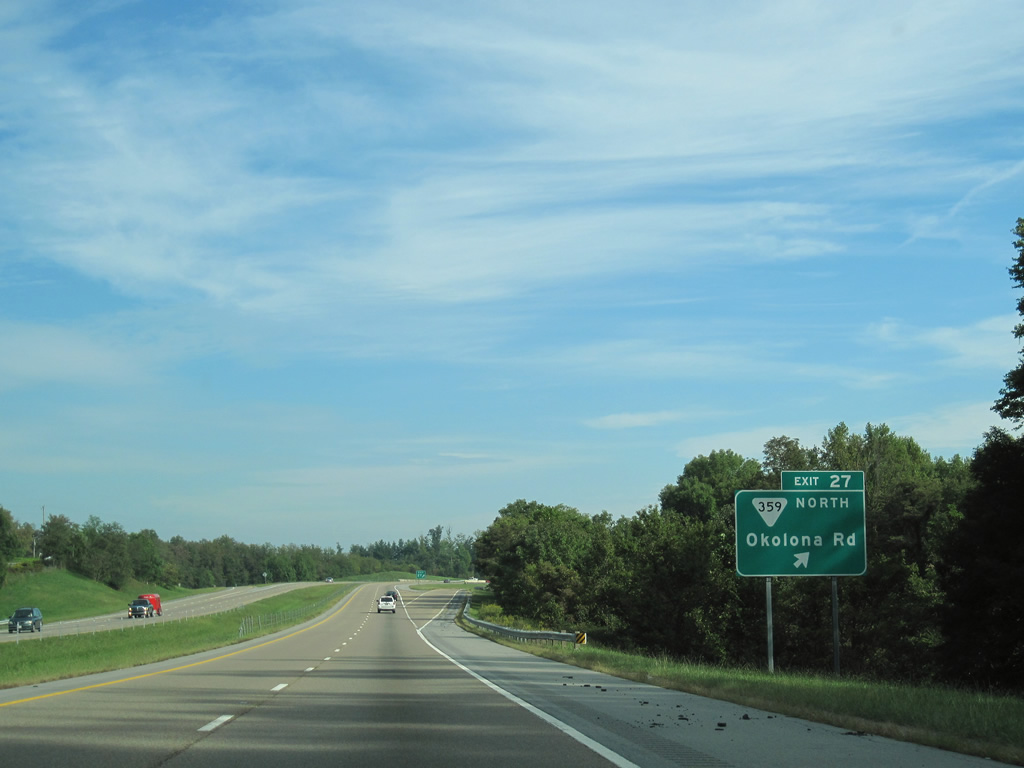
SR 359 dog legs north along S Roan Street (old U.S. 19W/23) from the diamond interchange at Exit 27 to Okolona.
09/29/10
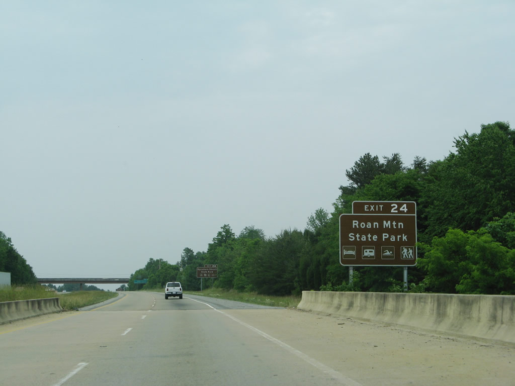
U.S. 321/SR 67 lead east from Exit 24 to U.S. 19E south for Roan Mountain State Park. Camping, hiking, swimming and other activities are available at the park, which is located on the forested foothills just north of 6,285-foot Roan Mountain.
05/31/07
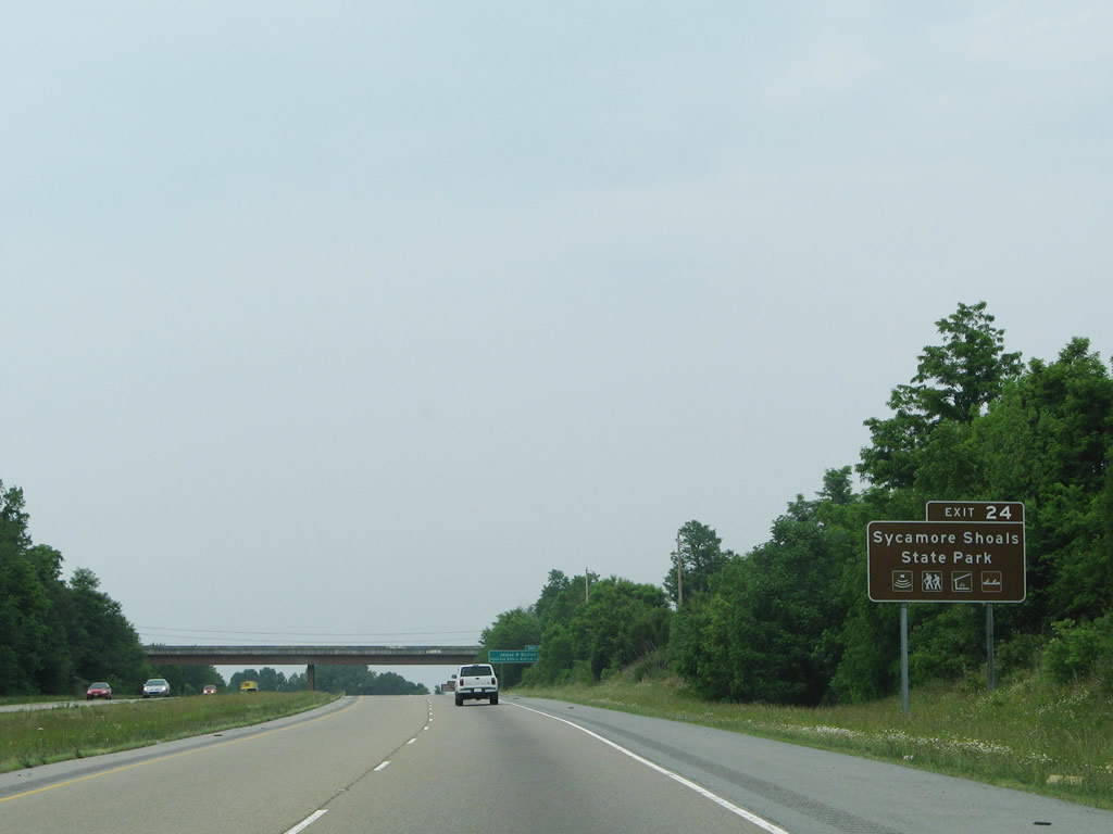
U.S. 321/SR 67 east also connect I-26 with Sycamore Shoals State Historic Park in Elizabethton. Open for day-use only, this site includes a hiking trail and features historical programming.
05/31/07
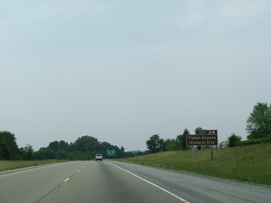
Points of interest for Exit 24 include the Tipton Haynes Historic Site, which was the Civil War-era home of Col. John Tipton and one of his slaves, George Haynes. An interpretive center and museum is also located at the site.
05/31/07
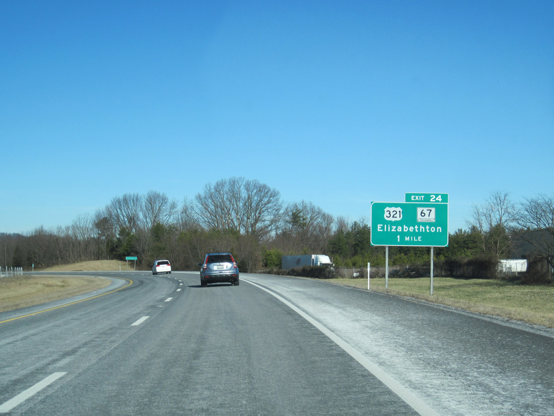
U.S. 321/SR 67 (University Parkway) meets I-26 at the first of six interchanges for Johnson City. Exit 24 also represents the historic south end of Interstate 181, which was truncated by I-26 in 2003.
02/10/14
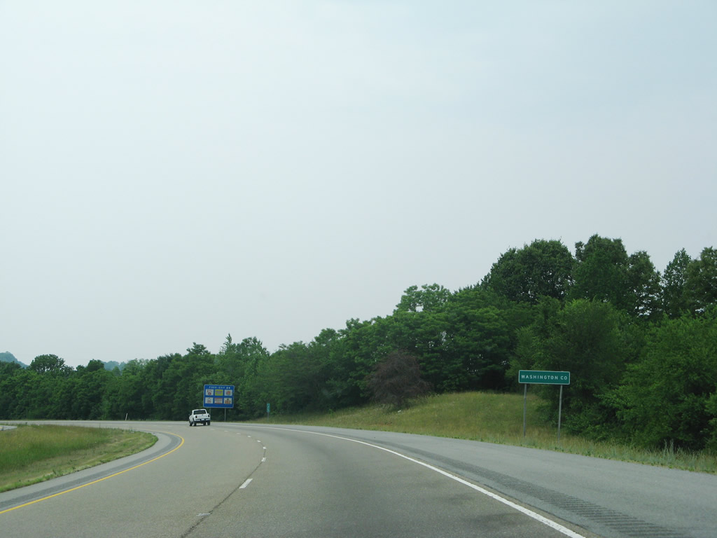
Interstate 26 travels through Carter County for just 1.91 miles before entering Washington County within Johnson City.
05/31/07
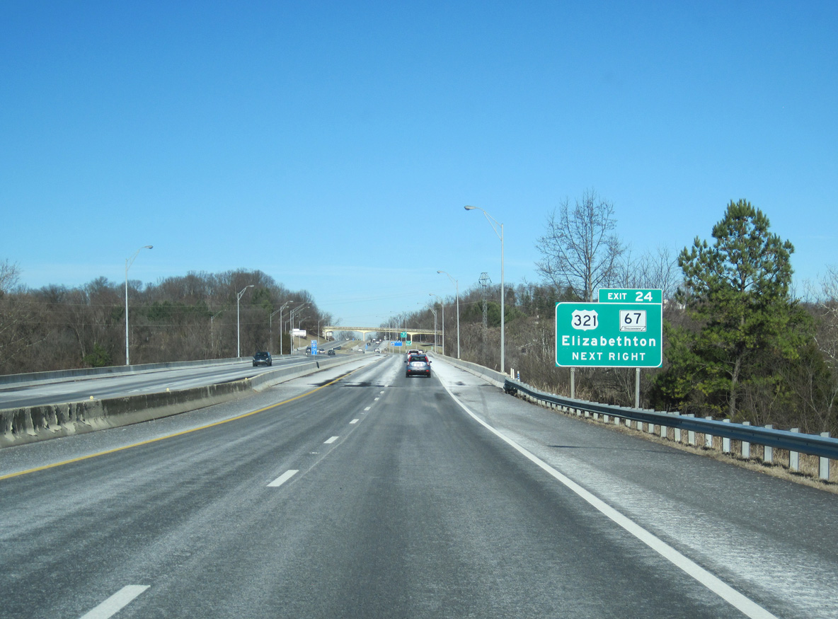
U.S. 321/SR 67 follow a freeway 3.8 miles east from a parclo interchange (Exit 24) with I-26 to SR 359 in Elizabethton. This freeway was once proposed by the Johnson City Metropolitan Transportation Planning Organization, a regional council of governments, as Interstate 326.2
02/10/14
Exit 24 departs for U.S. 321/SR 67 to East Tennessee State University and Elizabethton. U.S. 321 travels east to Boone, North Carolina and west to Greeneville, Newport, Sevierville, Maryville and I-40 at Exit 364 near Lenoir City.
05/31/07
I-26/U.S. 19W-23 navigate through an S-curve east from Roan Hill to Downtown Johnson City.
08/23/03
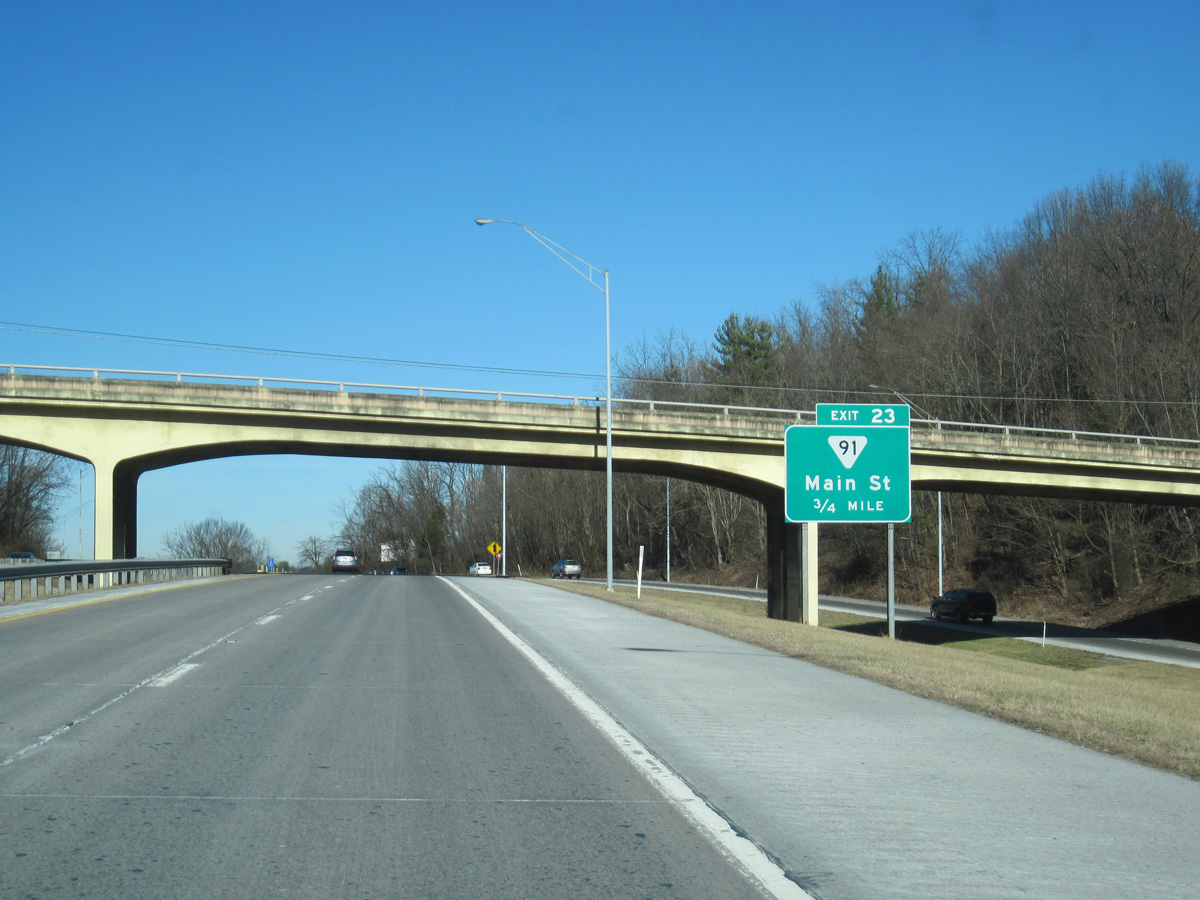
The first of two split diamond interchanges for Downtown Johnson City joins I-26/U.S. 19W-23 with the one way couplet (Main Street east / Market Street west) along SR 91 at Exit 23.
02/10/14
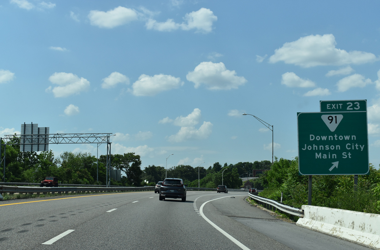
Exit 23 lowers from I-26 westbound above State of Franklin Road. SR 91 east from Johnson City to Central and Elizabethton is the former alignment of U.S. 321.
05/26/21
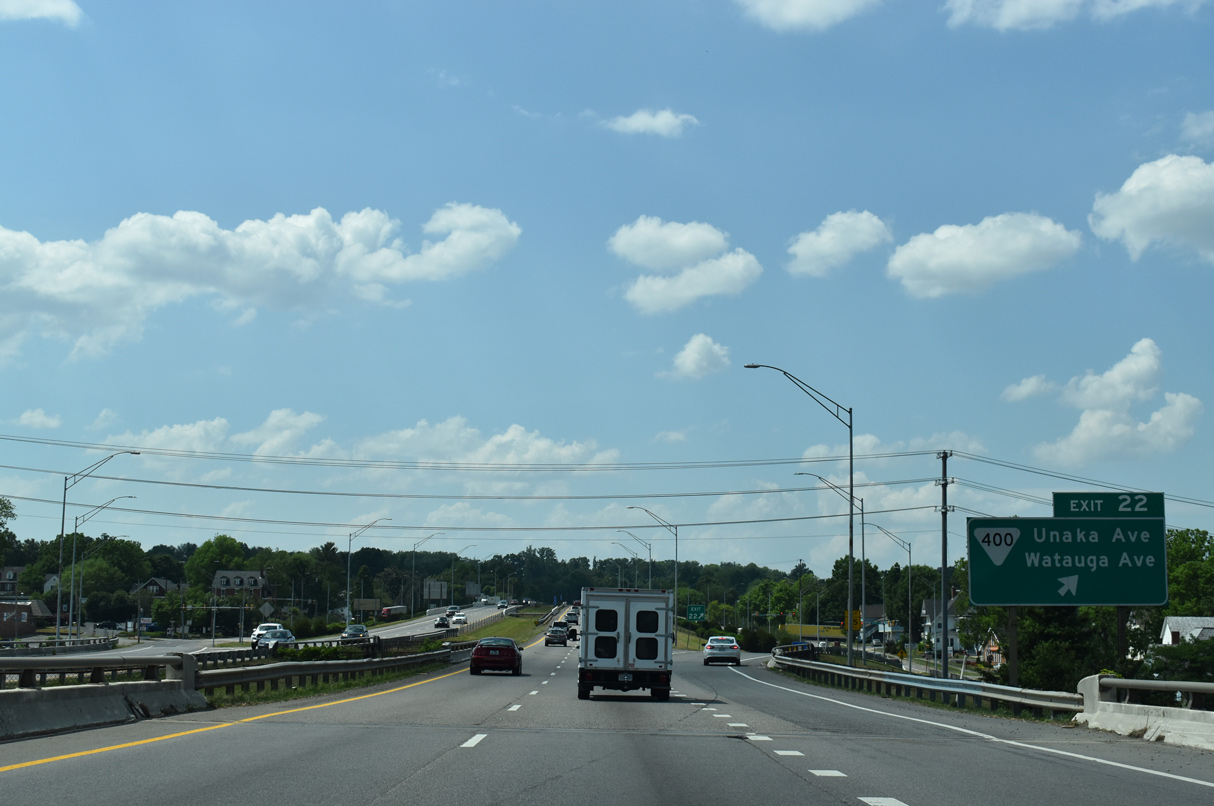
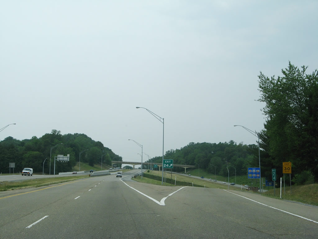
Interstate 26 continues past Tannery Knobs to Exit 22 with SR 400 (Unaka / Watauga Avenues). SR 400 arcs eastward from Johnson City to Johnson City Airport (0A4) and Elizabethton.
05/26/21
With 63,416 vehicles per day recorded by TDOT in 2019, the highest traffic counts along Interstate 26 in Tennessee are on the stretch between Exit 22 and 20.
05/26/21
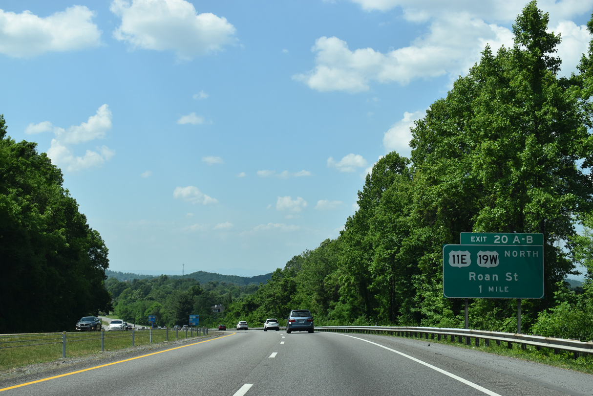
U.S. 11E overlaps with U.S. 321 east from Jonesborough to SR 381 (State of Franklin Road) in Johnson City. U.S. 11E continues along Market Street and John Exum Parkway northward to Roan Street and I-26 at Exit 20.
05/26/21
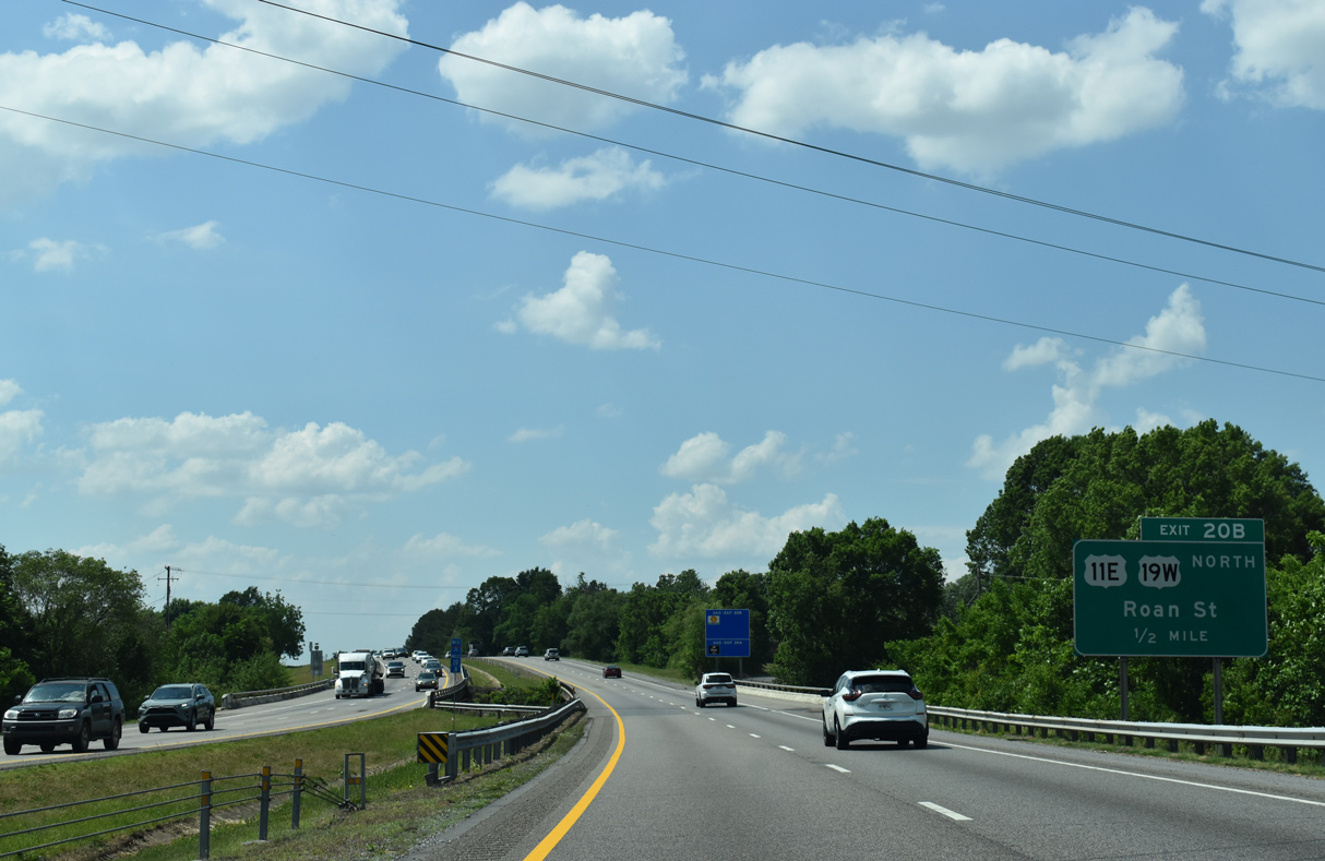
U.S. 19W splits with I-26/U.S. 23 at Exit 20B. Combining with U.S. 11E, U.S. 19W converges with U.S. 19E near Bluff City.
05/26/21
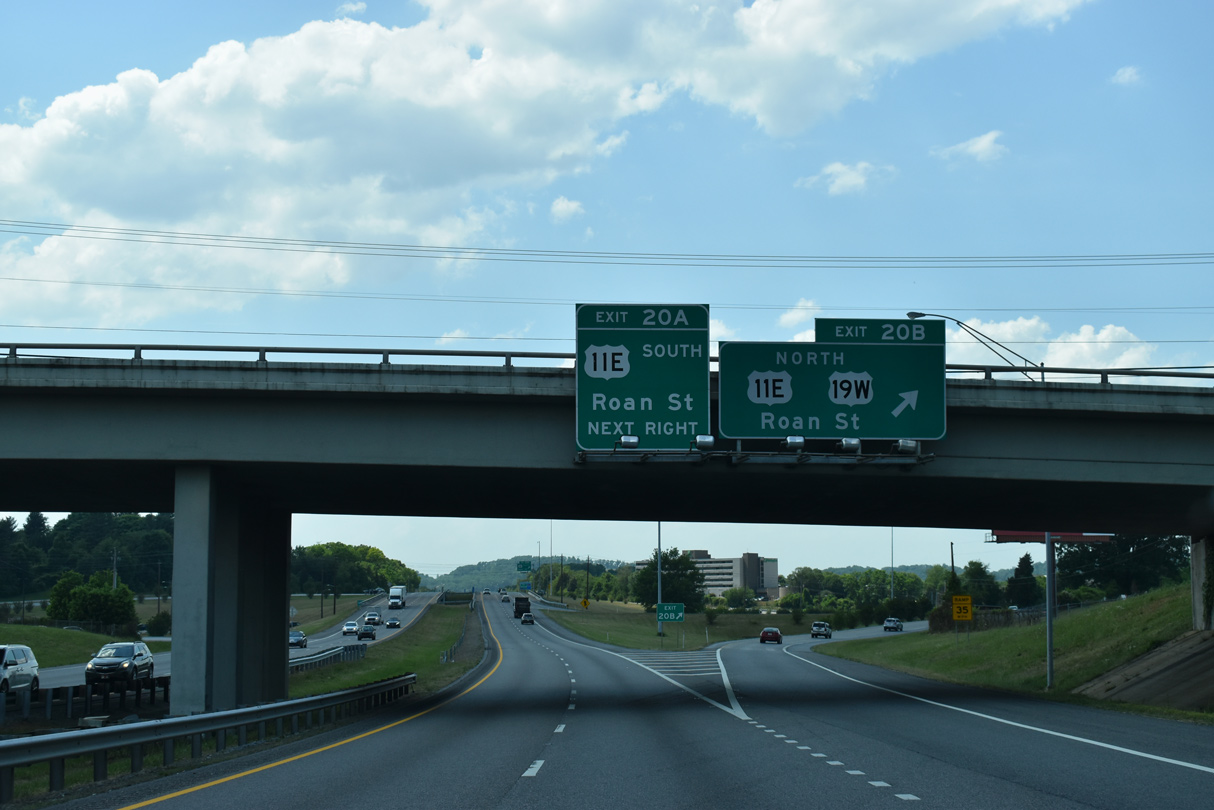
The cloverleaf interchange (Exit 20) with U.S. 11E/19W lines a heavily commercialized stretch of N Road Street anchored by The Mall at Johnson City.
05/26/21
References:
http://www.jcmpo.org/i26.htmhttp://news.tennesseeanytime.org/node/5155
Photo Credits:
- Alex Nitzman: 10/24/15, 10/25/15
- ABRoads, Carter Buchanan: 09/29/10
- Carter Buchanan: 02/10/14
- Andy Field, Carter Buchanan: 05/31/07
- Alex Nitzman, Justin Cozart: 08/23/03
- Brent Ivy: 05/26/21
Connect with:
Page Updated Monday August 09, 2021.