
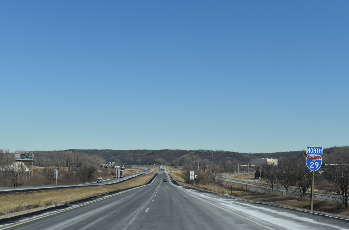
Interstate 29 North - Council Bluffs to Missouri Valley
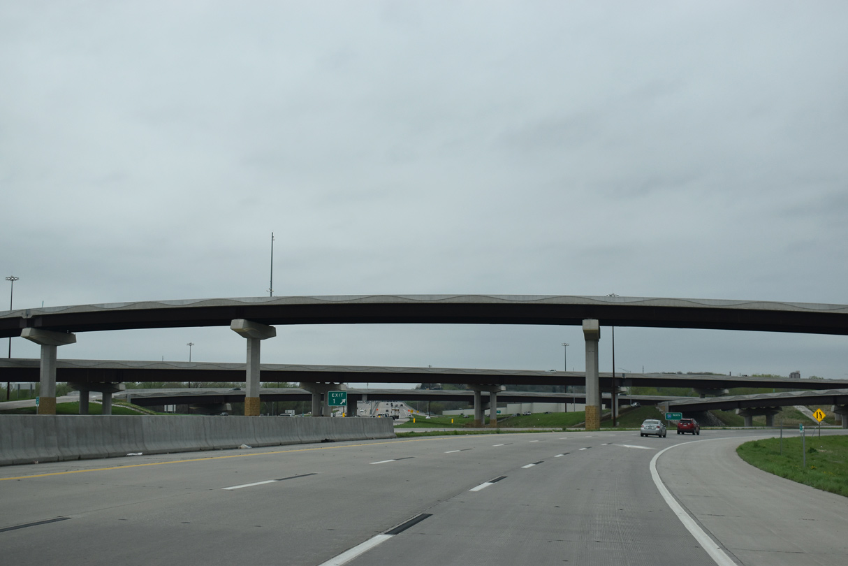
I-29 curves north from the I-80 Local lanes through the West Systems Interchange.
05/08/22
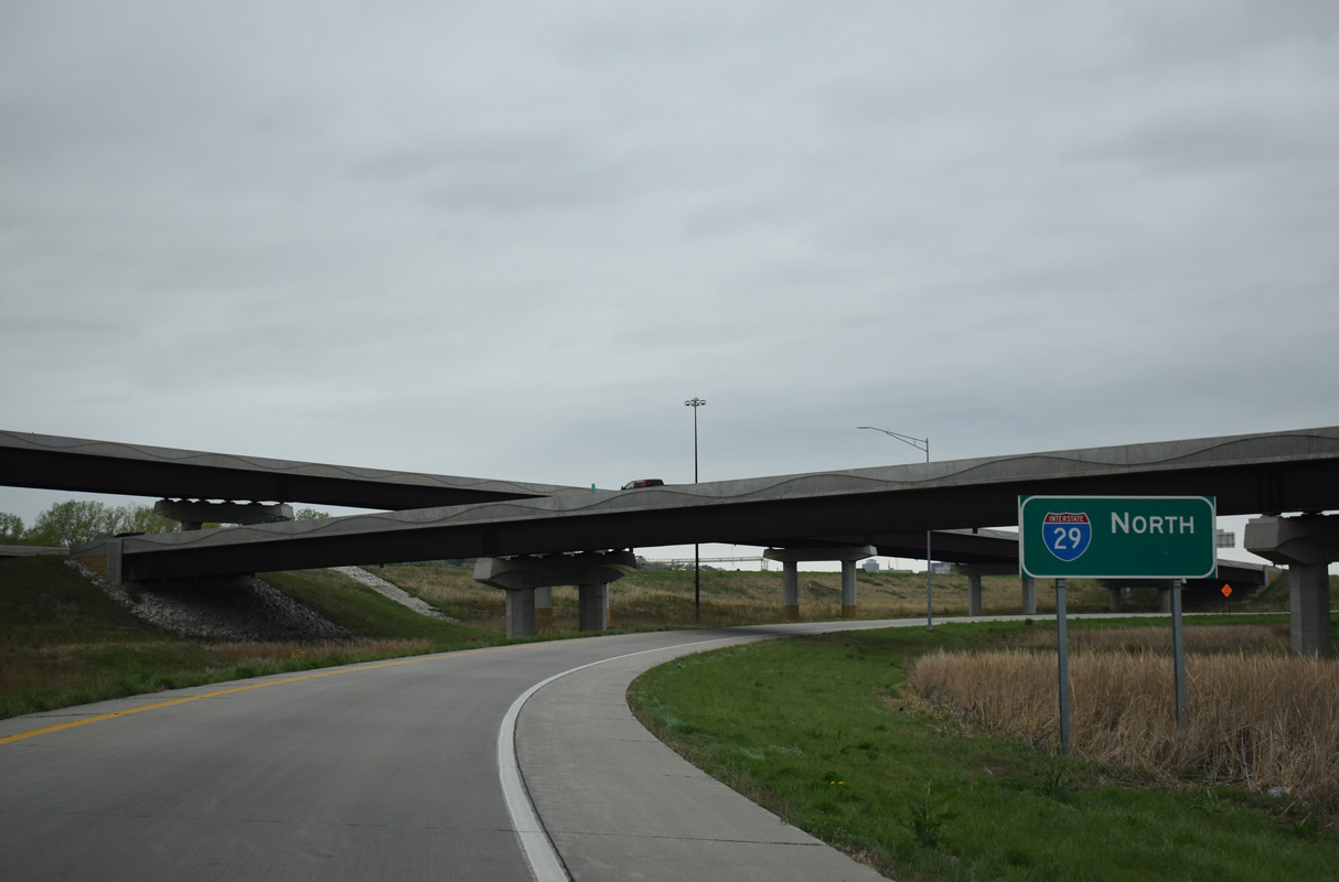
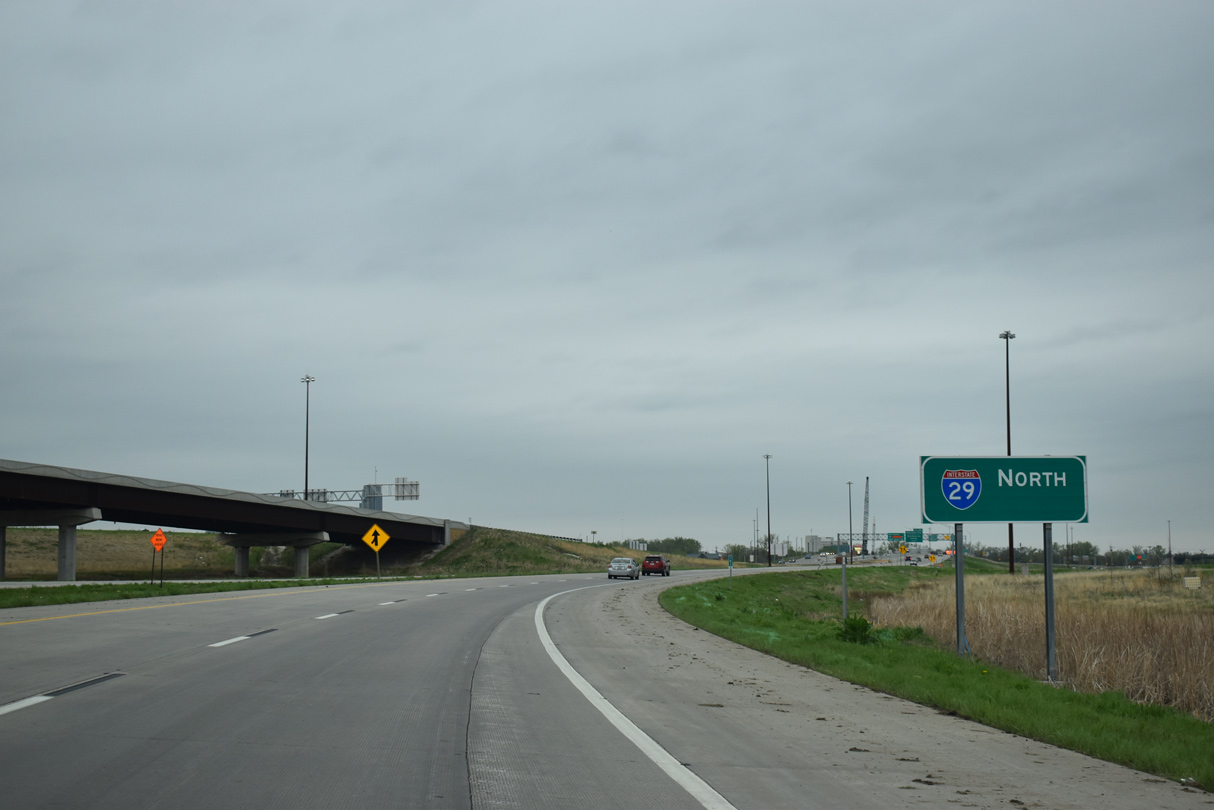
Follow the exit ramp linking the I-80 Express lanes with I-29/U.S. 6 north.
05/08/22
The northbound roadway for Interstate 29 was realigned so that the flyover from I-80 east merges from the outside lanes.
05/08/22
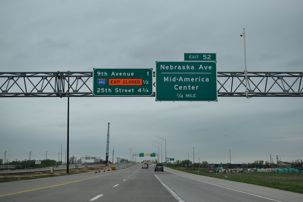
I-29/U.S. 6 proceed north a quarter mile to a folded diamond interchange (Exit 52) with Nebraska Avenue.
05/08/22
The exchange joining I-29/U.S. 6 with Nebraska Avenue at Exit 52 dated back to 1969. Construction underway from November 2019 to October 2021 rebuilt the interchange to current design standards.
05/08/22
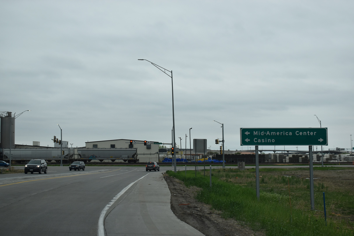
Nebraska Avenue east intersects S 35th Street nearby. 35th Street connects with Mid America Drive to the Mid-America Center convention complex. Nebraska Avenue west leads to a casino along the Missouri River.
05/08/22
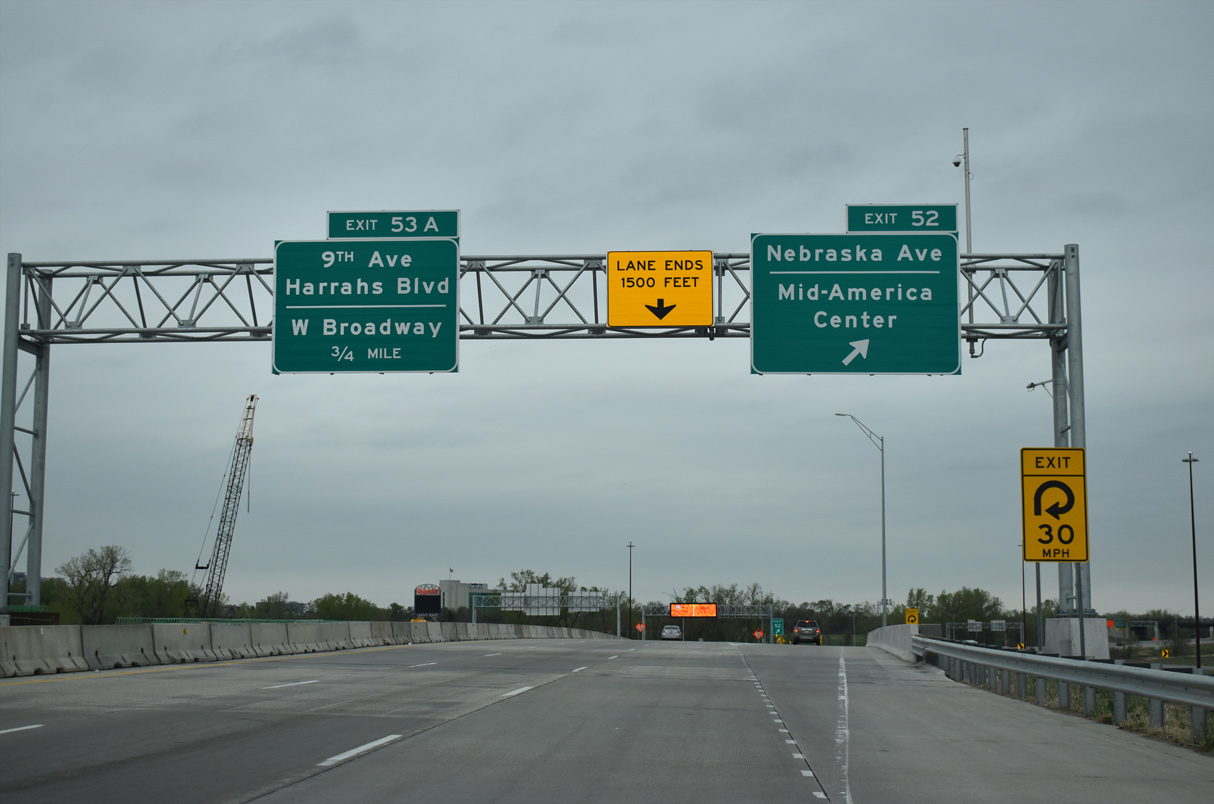
The Union Pacific Railroad Bridge spanning I-29/U.S. 6 ahead of Exit 53 A / 9th Avenue was reconstructed to allow for eight overall lanes along the freeway. Work was completed in Summer 2019.
05/08/22
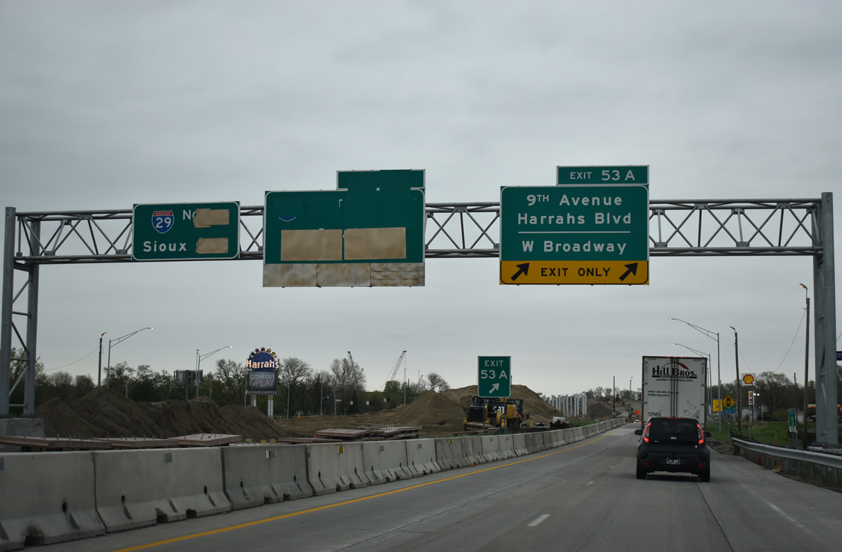
Started in late 2020, the West Broadway Interchange project lowered I-29/U.S. 6 to grade level north beyond Exit 53 A / 9th Avenue and shifted left exit ramps with I-480 to the right side.
05/08/22
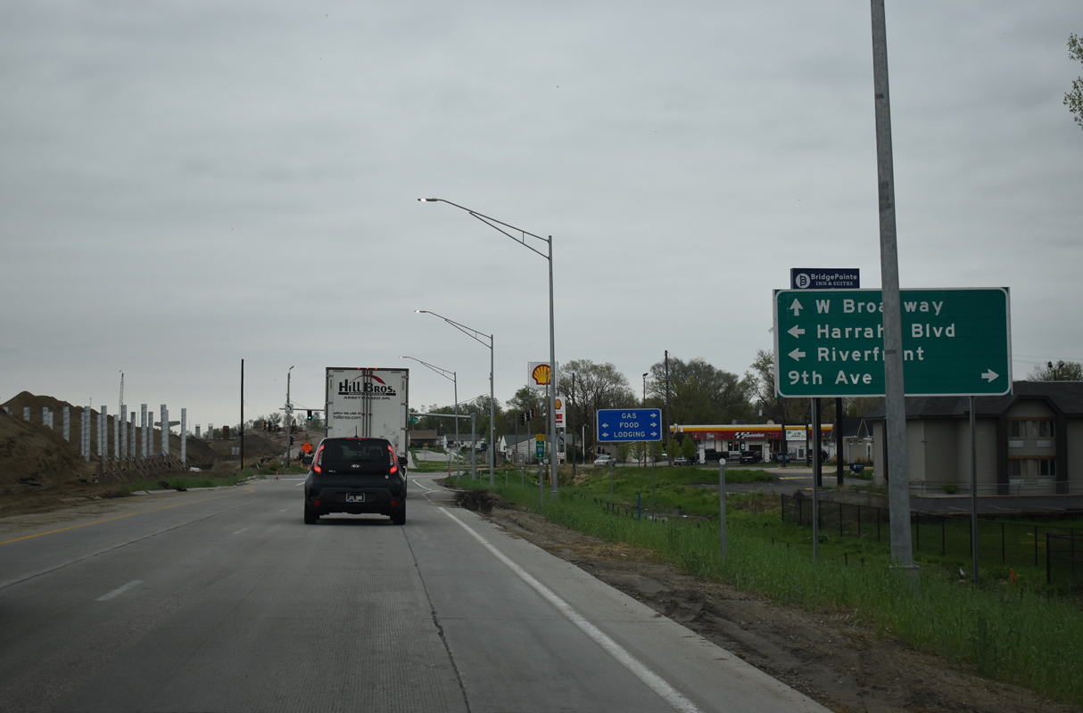
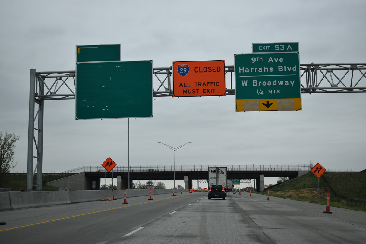
The half diamond interchange at Exit 53 A links I-29/U.S. 6 with the frontage road system leading north from Harrah's Boulevard west and 9th Avenue east in Council Bluffs.
05/08/22
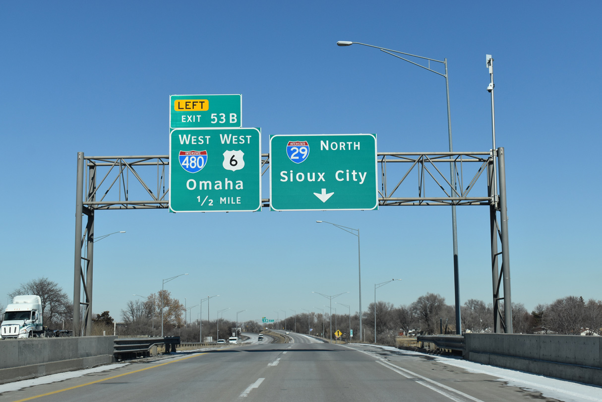
U.S. 6 combines with I-480 west across the Missouri River Bridge into Downtown Omaha. U.S. 6 was realigned onto I-80 west and I-29 north around Council Bluffs in 2016.
02/20/20
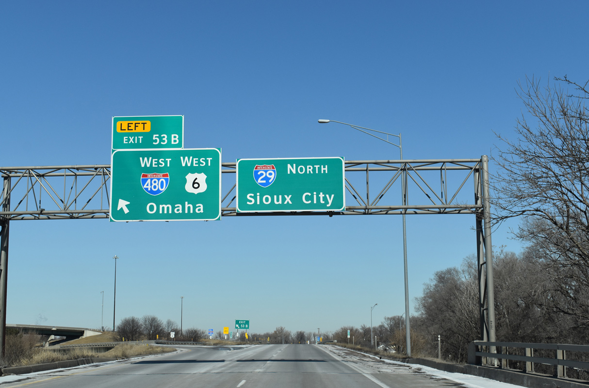
Interstate 480 constitutes an urban loop joining Council Bluffs with Downtown Omaha. The north leg leads west to U.S. 75 (North Freeway) at Midtown. The west leg combines with U.S. 75 south to I-80 by Hanscom Park.
02/20/20
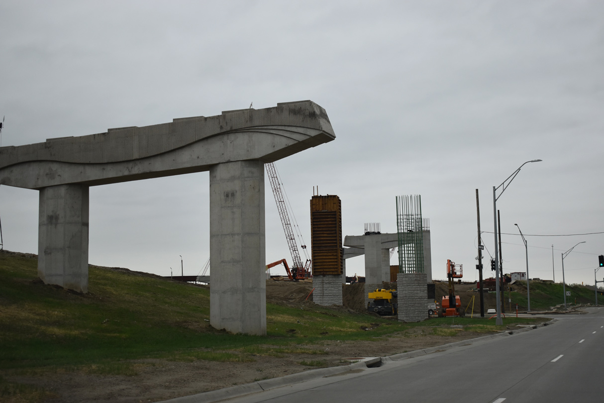
Having traffic previously shifted onto the frontage road system during the I-29/I-480/West Broadway System Interchange project, Interstate 29 reopened to traffic in August 2023. The final ramp at I-480 opened in Fall 2023.1
05/08/22
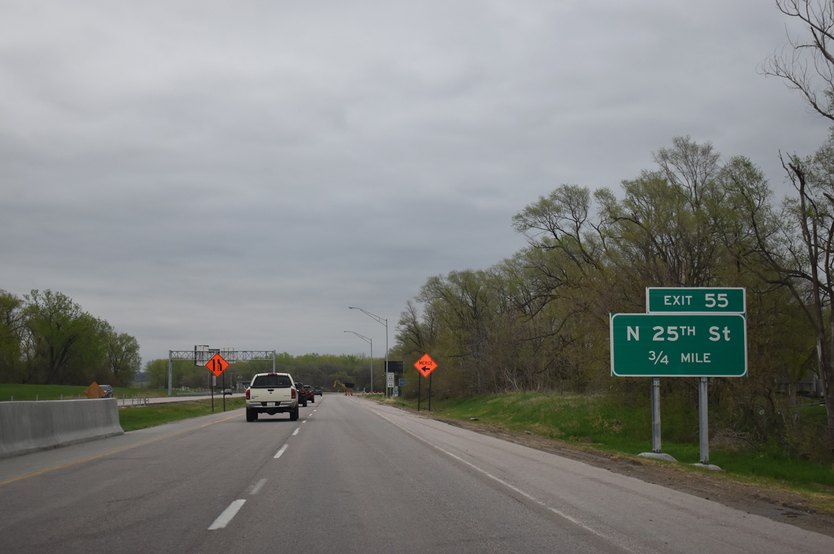
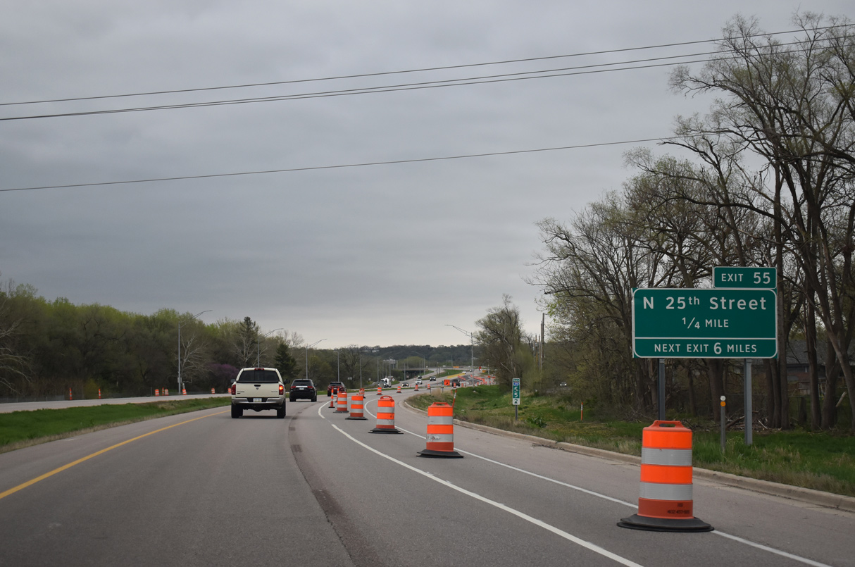
Curving northeast between the Missouri River and Council Bluffs residential street grid, Interstate 29 advances 0.75 miles to Exit 55 for N 25th Street.
05/08/22
N 25th Street is a residential street south from Exit 55 to 9th Avenue. North of I-29, 25th Street leads to Narrows River Park.
05/08/22
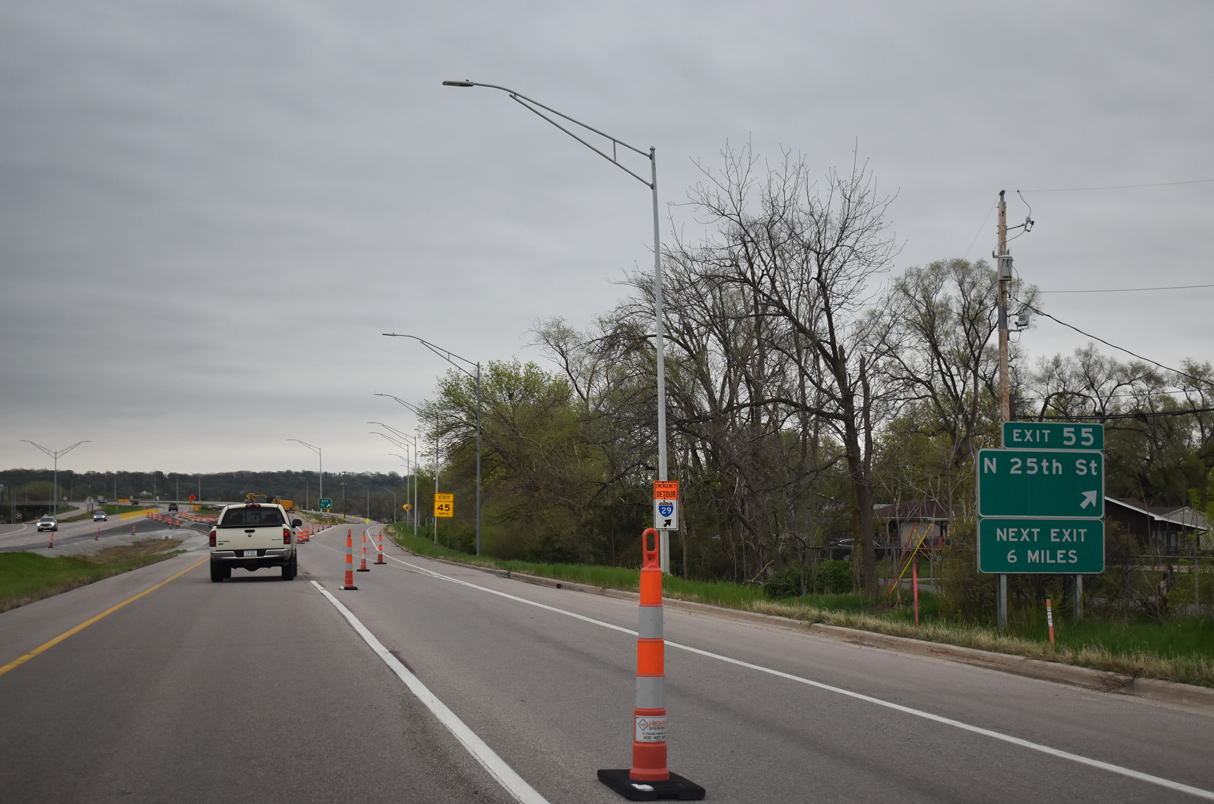
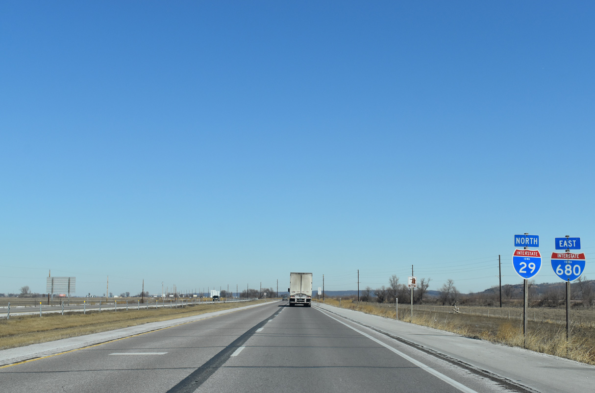
Beyond the diamond interchange at Exit 55, Interstate 29 leaves Council Bluffs six miles to I-680 west near Crescent.
05/08/22
Interstate 29 angles northeast to a wye interchange with N 16th Street (old Iowa 192).
02/20/20
Confirming marker posted north of the 16th Street entrance ramp and Council Bluffs city line.
05/08/22

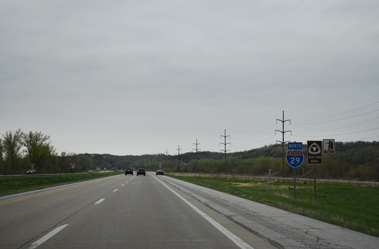
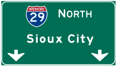
Interstate 29 runs north between the Missouri River and CN Railway past Lewis and Clark Monument Park toward Crescent. Sioux City is 90 miles to the north.
05/08/22
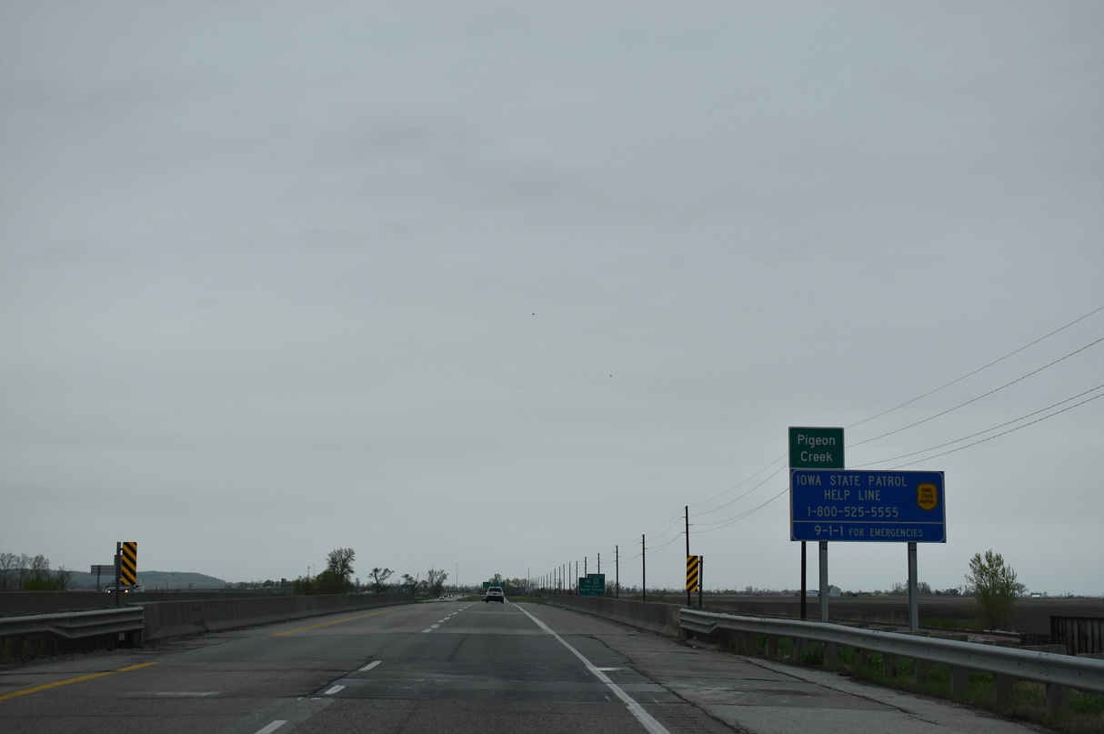
Interstate 29 diverges from the adjacent bluffs northwest across flat agricultural areas at Pigeon Creek.
05/08/22

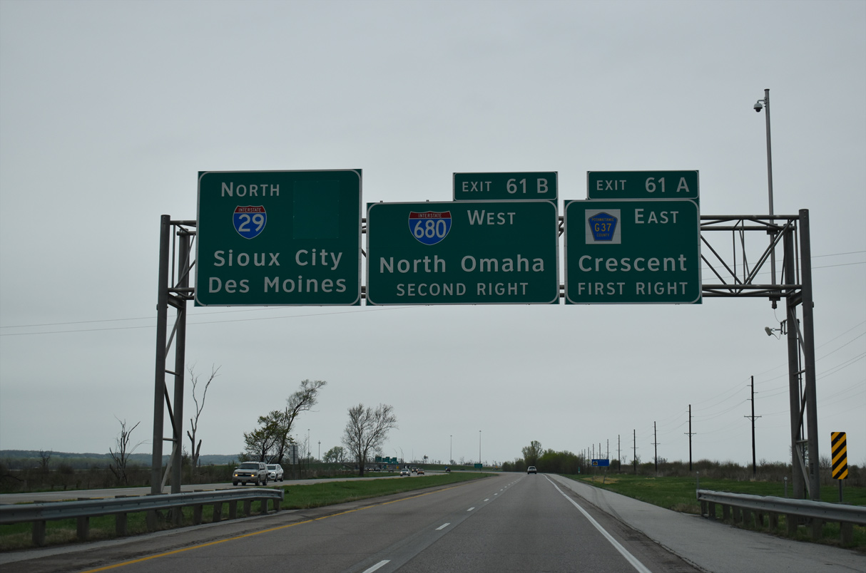
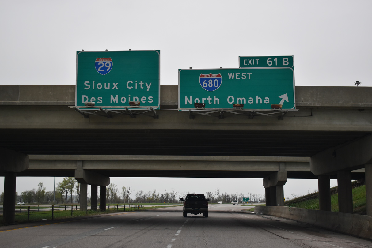
A cloverleaf interchange (Exit 61) joins Interstate 29 north with I-680 west and CR G37 (Old Mormon Bridge Road) east in one mile.
05/08/22
CR G37 (Old Mormon Bridge Road) extends 2.28 miles east from the end of Interstate 680 east to Old Lincoln Highway in the city of Crescent.
05/08/22
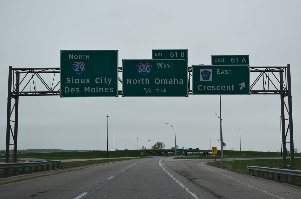
Interstate 680 travels 3.28 miles west from I-29 at Exit 61 B to the Mormon Bridge into Omaha, Nebraska at the Florence neighborhood.
05/08/22
Prior to Fall 2019, Interstate 680 combined with I-29 for 9.91 miles north from near Crescent to Loveland. I-680 was truncated at that time when Interstate 880 was established east from Loveland.
05/08/22
Interstate 29 continues paralleling the CN Railway north to Loveland.
02/20/20
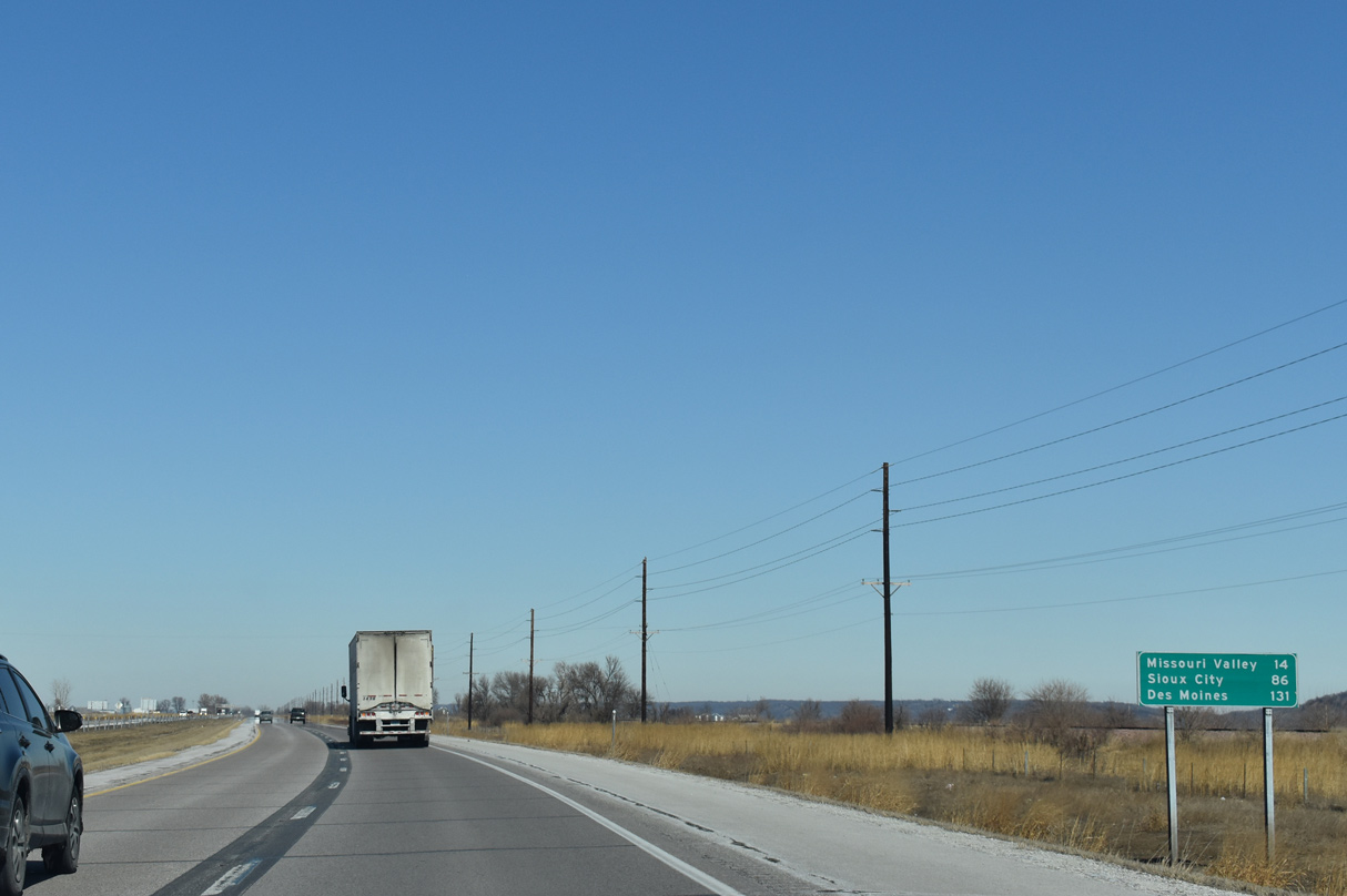
The city of Missouri Valley lies 14 miles north in Harrison County. 131 miles to the east, Des Moines referenced the former continuation of I-680 east to Interstate 80 near Minden.
02/20/20
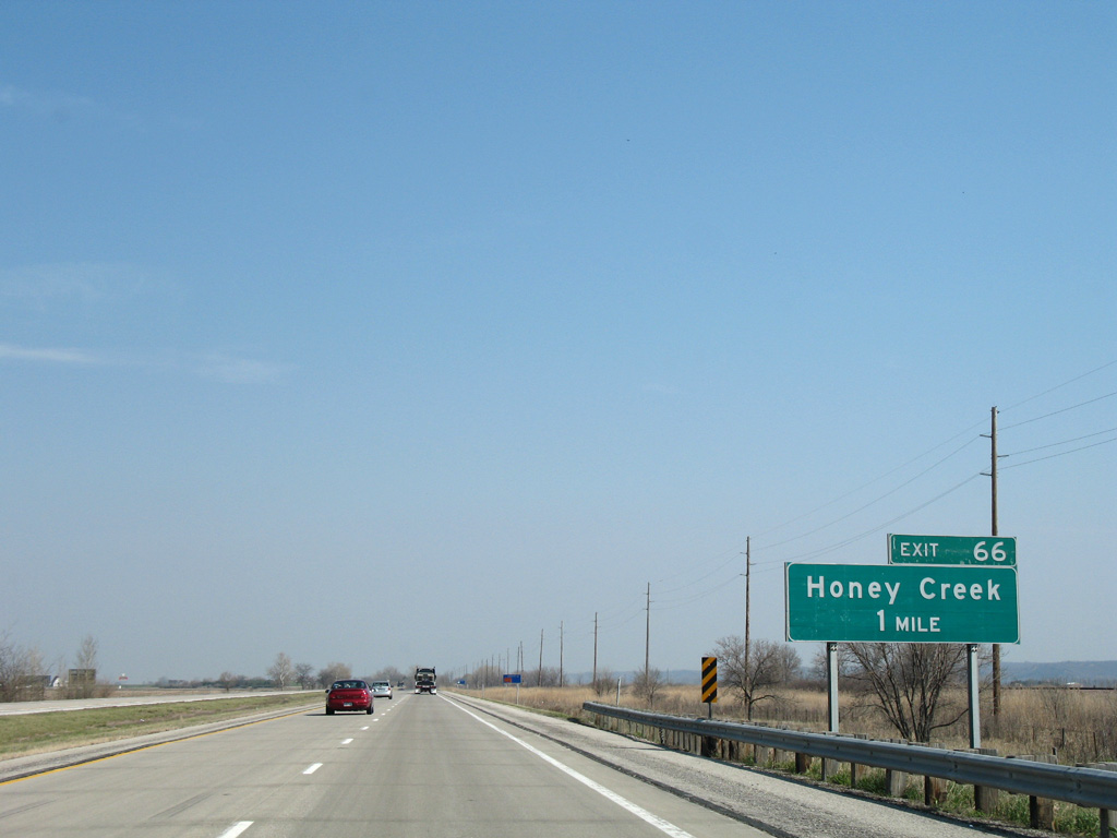
I-29 advances north to a diamond interchange (Exit 66) with Rosewood Road.
04/20/07
CR L19 follows Rosewood Road across I-29 at Exit 66 west to 145th Street and east to 152nd Street. 152nd Street extends north to Sumac Road, west of the settlement of Honey Creek.
02/20/20
152nd Street and a CN Railroad line run along the east side of Interstate 29 northward through Rockford township.
02/20/20
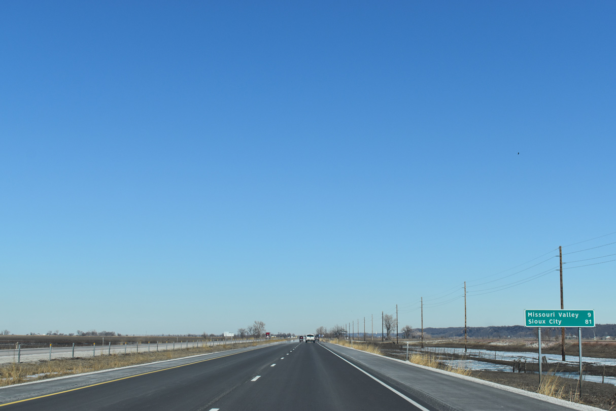
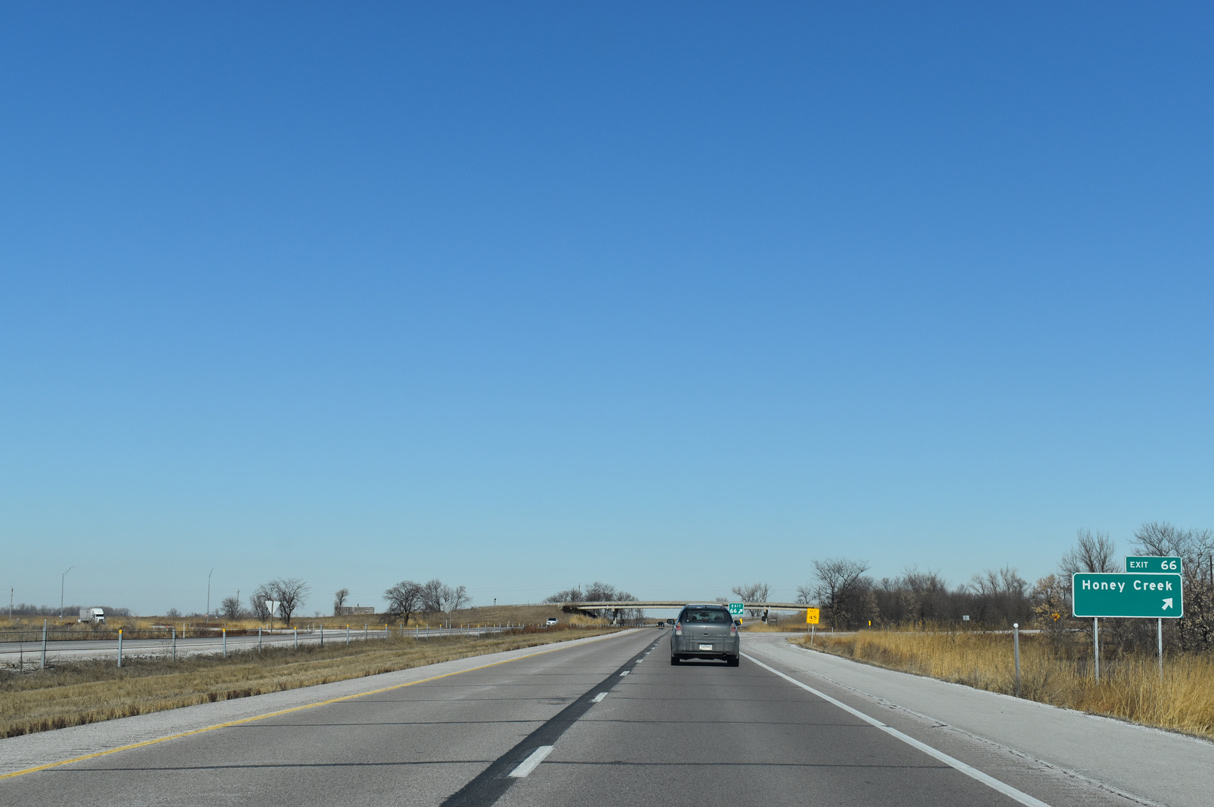
The city of Missouri Valley is nine miles to the north, followed by Sioux City in 81 miles.
02/20/20
IowaDOT recorded 20,600 vehicles per day (vpd) along Interstate 29 north between Exit 66 and 70 in 2022.
02/20/20
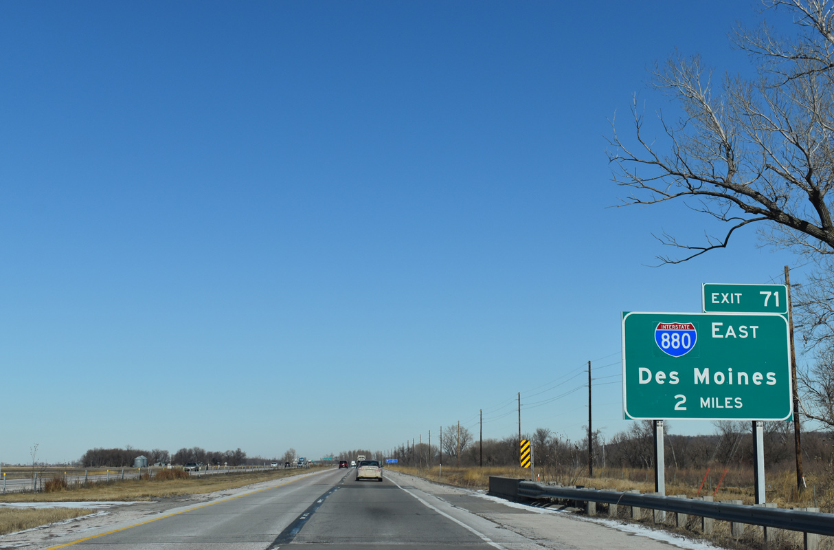
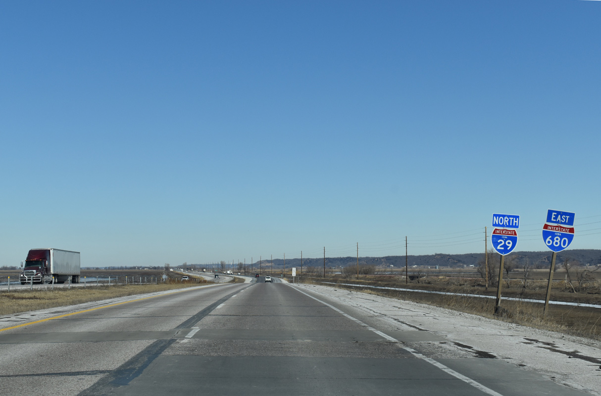
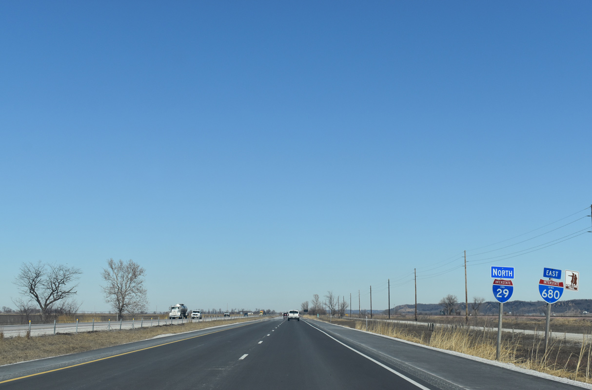
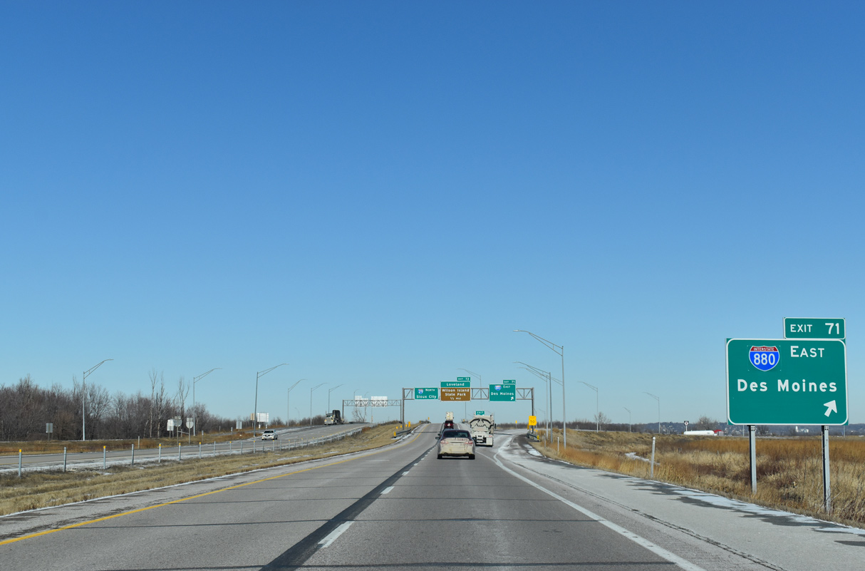
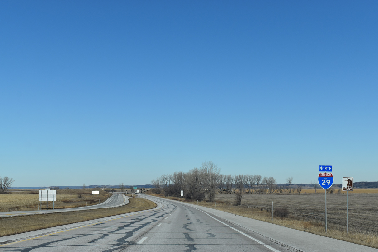
Interstate 680 previously branched east from I-29 north at Exit 71. The northern leg of I-680 was renumbered to I-880 in Fall 2019.
02/20/20
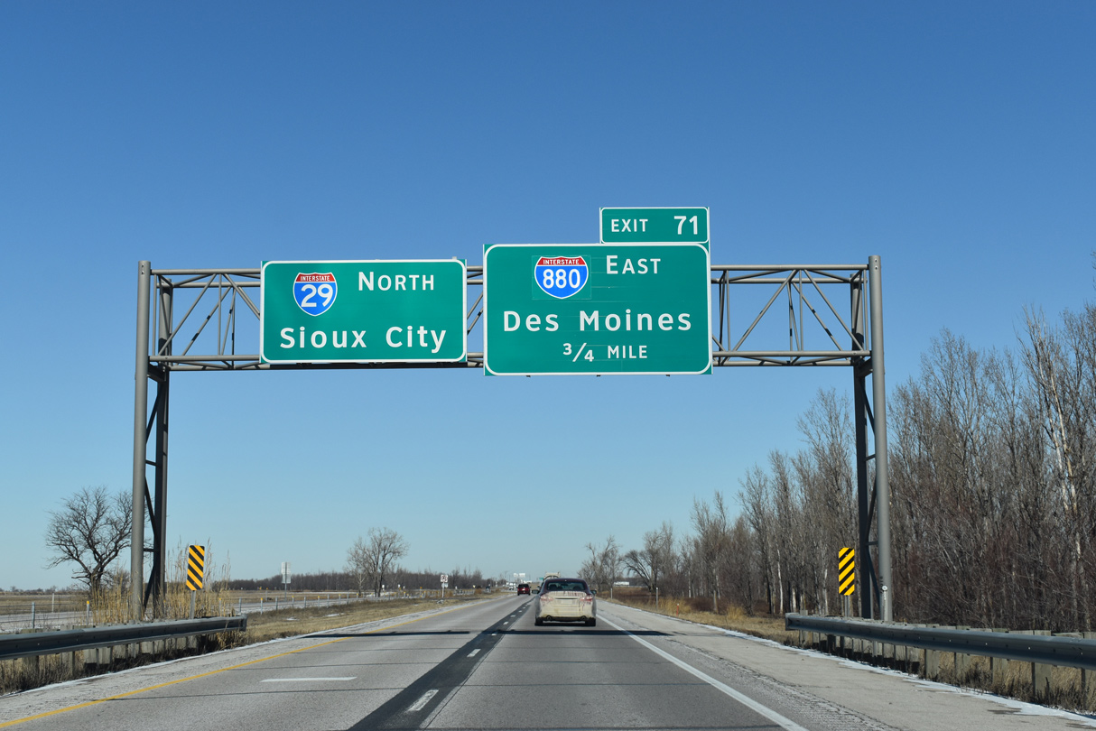
Interstate 880 climbs into the Loess Hills east from I-29 along a rural course 17.10 miles to I-80 in Minden township.
02/20/20
Providing part of a regional connection between Sioux City and Des Moines, the northern leg of I-680 was designated as Interstate 80N until 1966.
02/20/20

Interstate 880 stems east from the trumpet interchange at Exit 71.
02/20/20
A folded diamond interchange (Exit 72) with CR G12 (Desoto Avenue) lies immediately north of I-880 at the community of Loveland. CR G12 spurs west to Wilson Island State Park along the Missouri River.
02/20/20

Linking I-29 with CR L20 (Old Lincoln Highway) at Loveland, Desoto Avenue was previously designated as Iowa 382. Old Lincoln Highway was historically a part of U.S. 75, U.S. 30 Alternate and later Iowa 183.
02/20/20
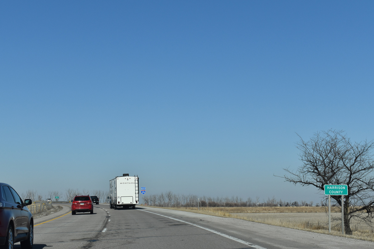
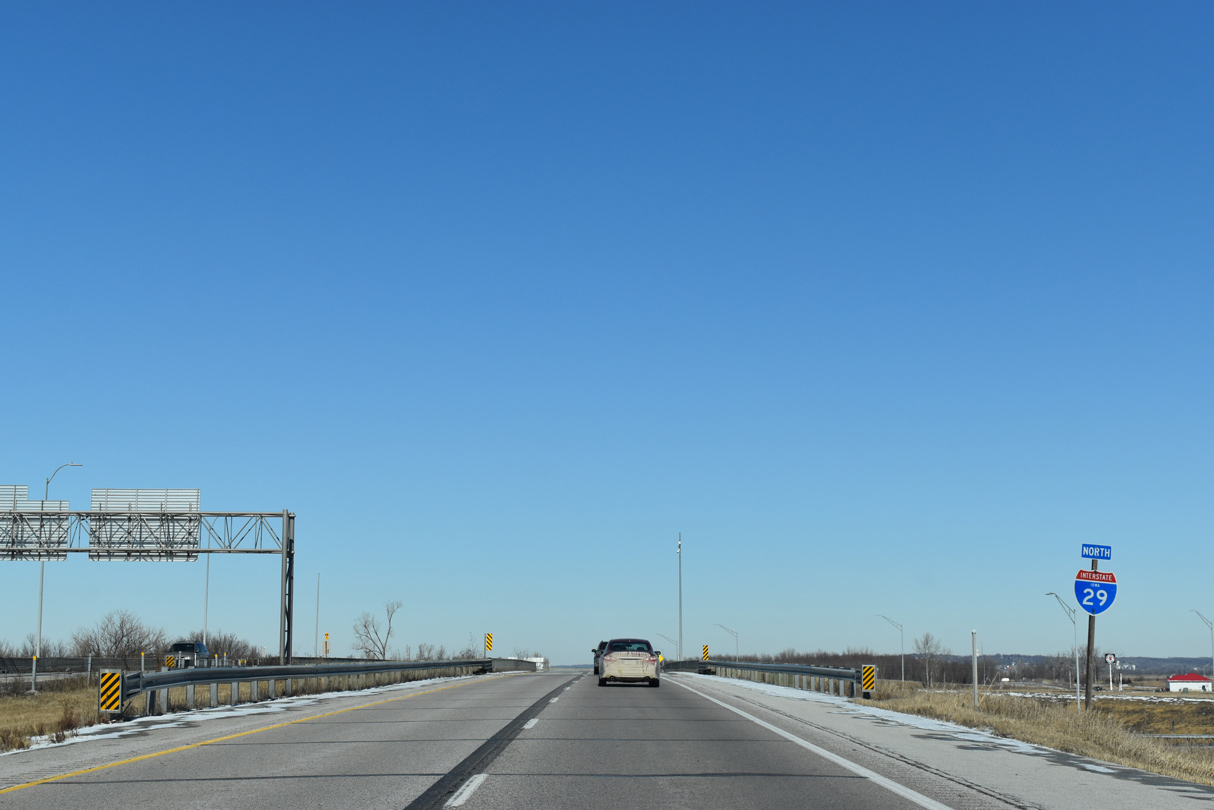
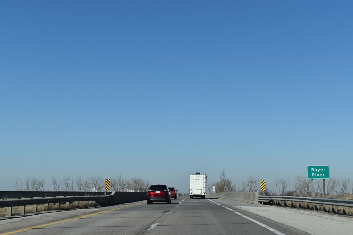
Turning northwest ahead of the Boyer River, Interstate 29 crosses into Harrison County.
02/20/20
Weigh stations formerly operated along both sides of Interstate 29 north of the Boyer River.
02/20/20
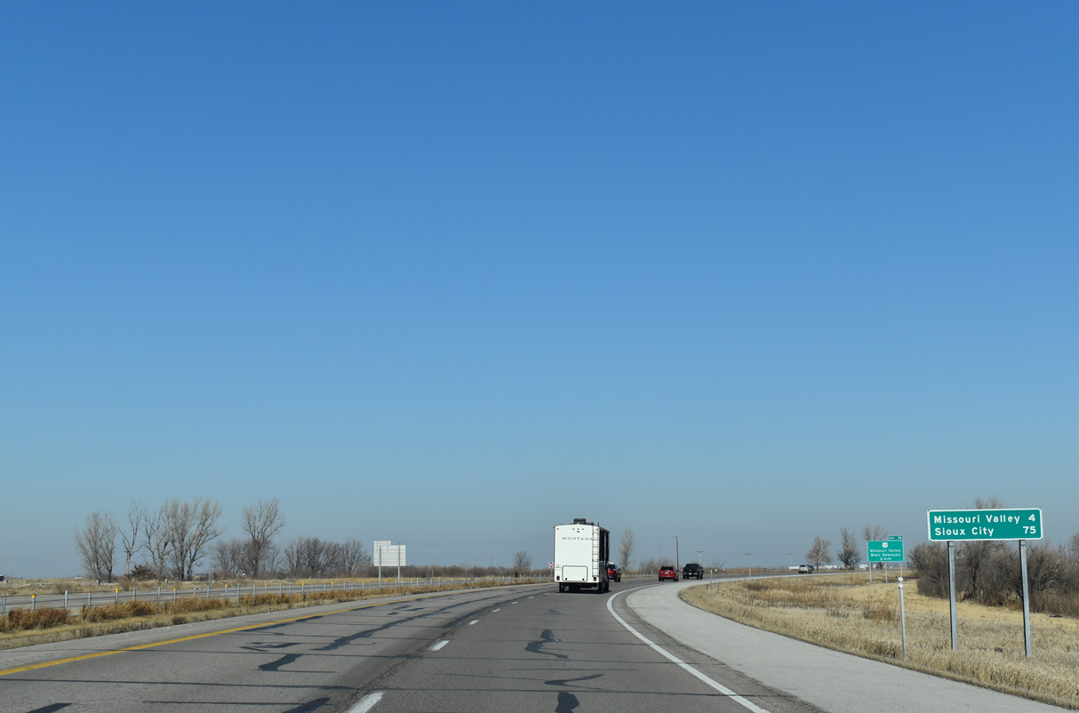
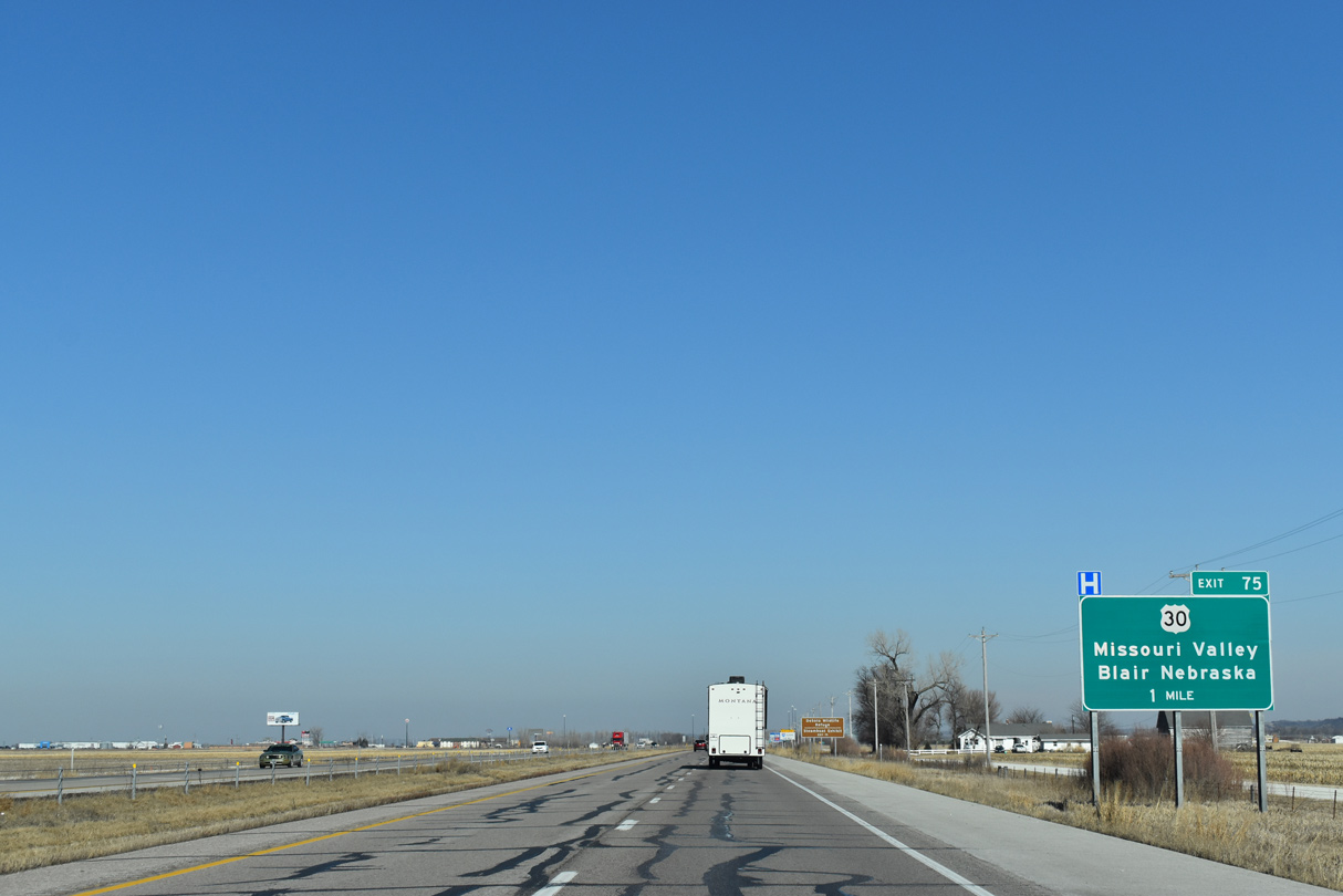
Curving back to the north, I-29 advances two miles to a parclo interchange (Exit 75) with U.S. 30 at Missouri City.
02/20/20
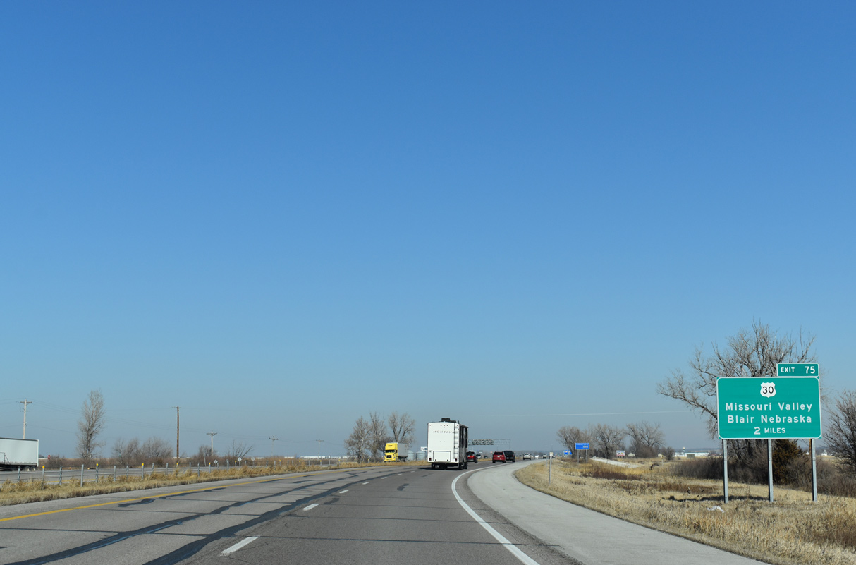
U.S. 30 travels west from Exit 75 ten miles to the city of Blair, Nebraska. Downtown Missouri Valley is 1.5 miles to the east.
02/20/20
U.S. 30 travels 330.85 miles across the Hawkeye State from the Blair Bridge spanning the Missouri River to the Gateway Bridge over the Mississippi River at Clinton.
02/20/20
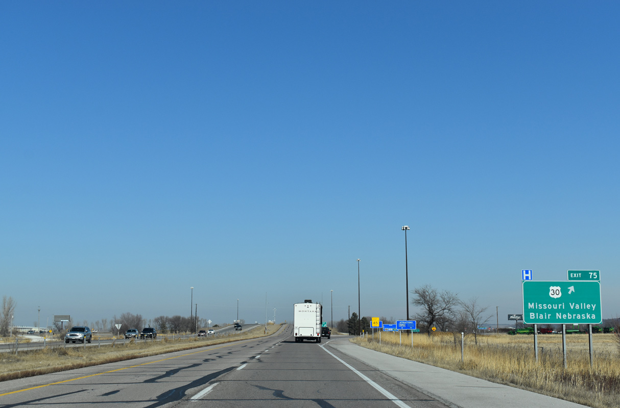
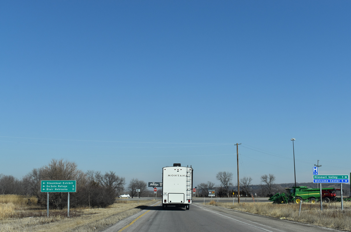
Exit 75 leaves I-29 north for U.S. 30 west to the DeSoto Wildlife Refuge and east to the Harrison County seat of Logan.
02/20/20
U.S. 30 heads 45 miles northeast to U.S. 59 in Denison, where the highway turns east toward Carroll, Ames and Cedar Rapids.
02/20/20
U.S. 30 in Harrison County is part of the Lincoln Highway Heritage Byway and Western Skies Scenic Byway.
02/20/20
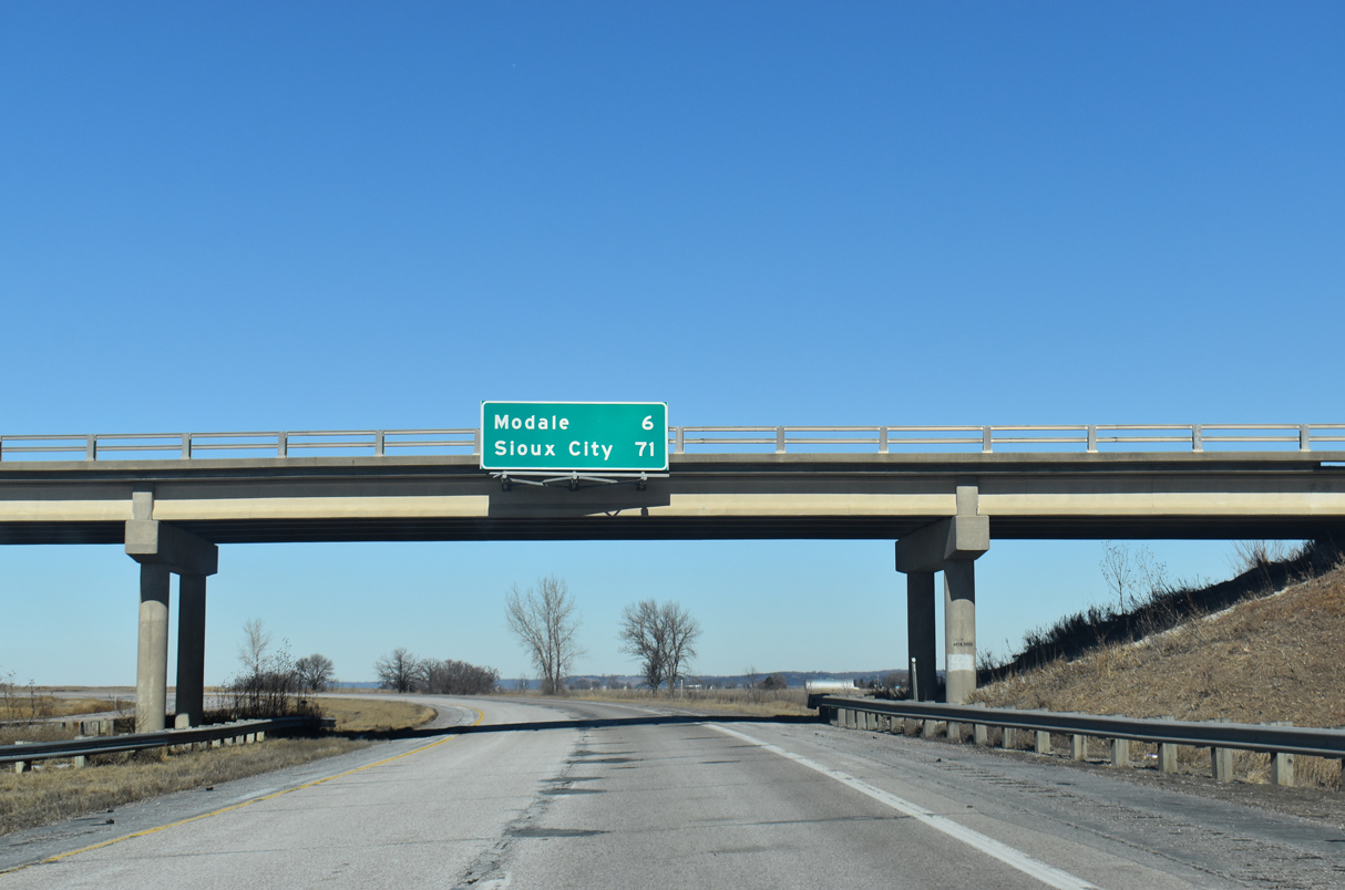
Vacating the city of Missouri Valley, Interstate 29 angles northwest six miles to Modale.
02/20/20
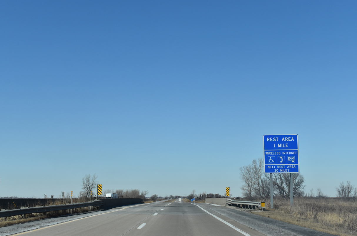
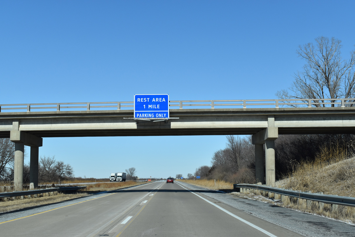
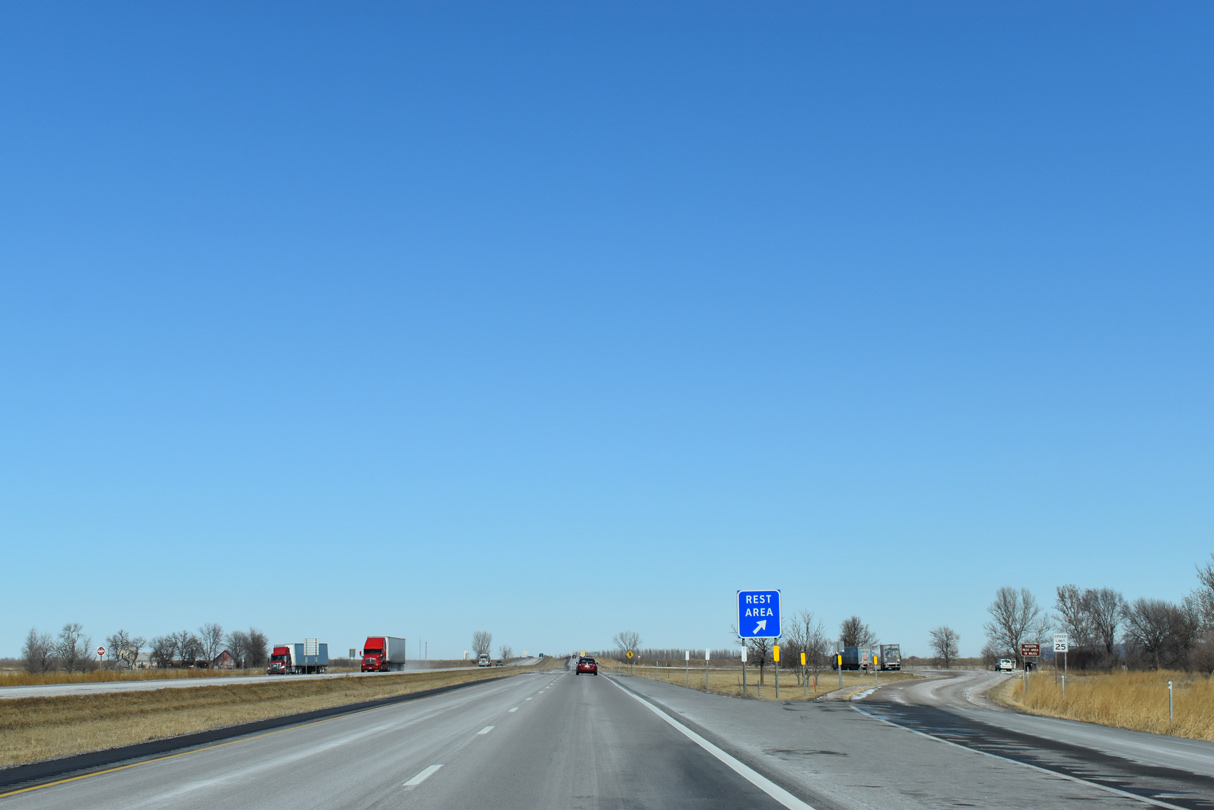
The second rest area along Interstate 29 north in Iowa lines the freeway beyond milepost 78.
02/20/20
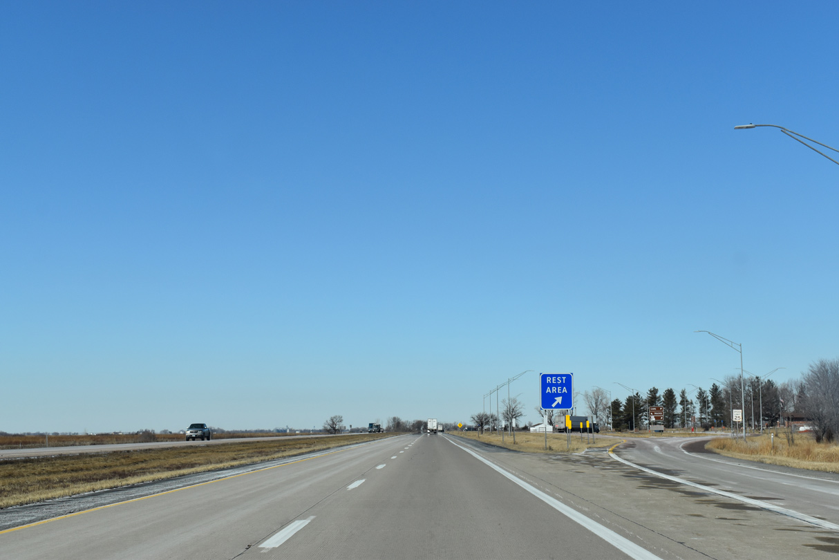
Interstate 29 north at the Missouri Valley Rest Area.
02/20/20
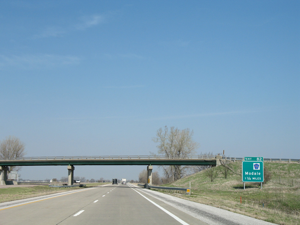
280th Street spans Interstate 29, 1.25 miles south of the diamond interchange (Exit 82) with Harrison County Route F50.
04/20/07

Modale is just west of Exit 82 via CR F50 (270th Street) and Martin Street. CR F50 replaced Iowa 300 between I-29 and the rural city.
02/20/20
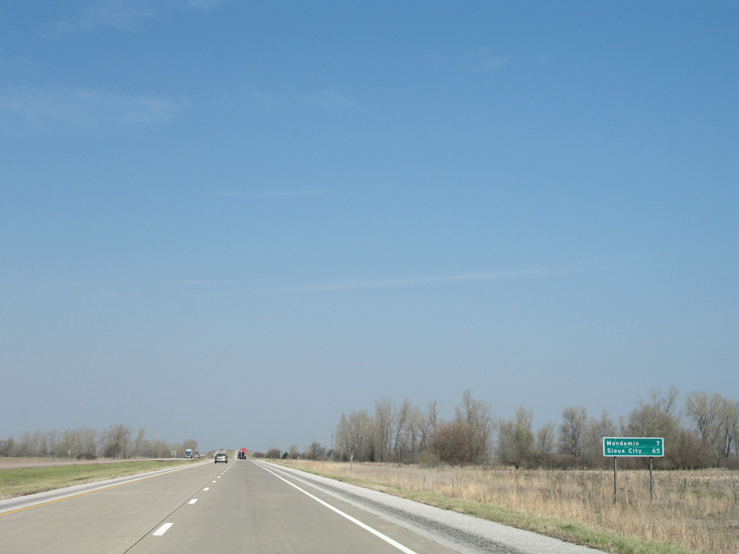
Interstate 29 advances 65 miles north from Modale to Sioux City.
04/20/07
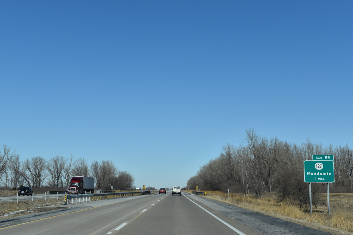
Iowa 127 extends 1.06 miles west from the Mondamin city limits to conclude at Interstate 29.
02/20/20
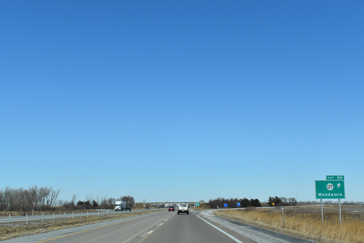
Iowa 127 travels 15.97 miles east from I-29 at Exit 89 to U.S. 30 by the Harrison County Courthouse in Logan.
02/20/20
Confirming marker posted north of the diamond interchange (Exit 89) with Iowa 127 east.
04/20/07
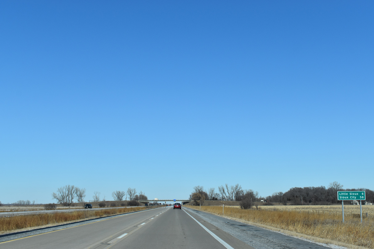
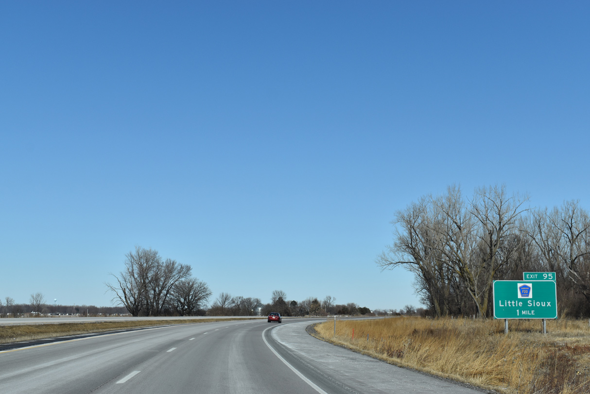
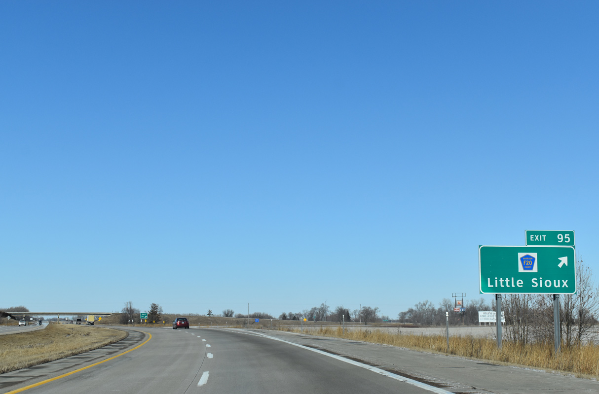
The city of Little Sioux lies east of the succeeding exit along I-29 north. Sioux City is 58 miles away.
02/20/20
Parking areas line both sides of Interstate 29 by Round Lake State Wildlife Management Area in Morgan township.
02/20/20
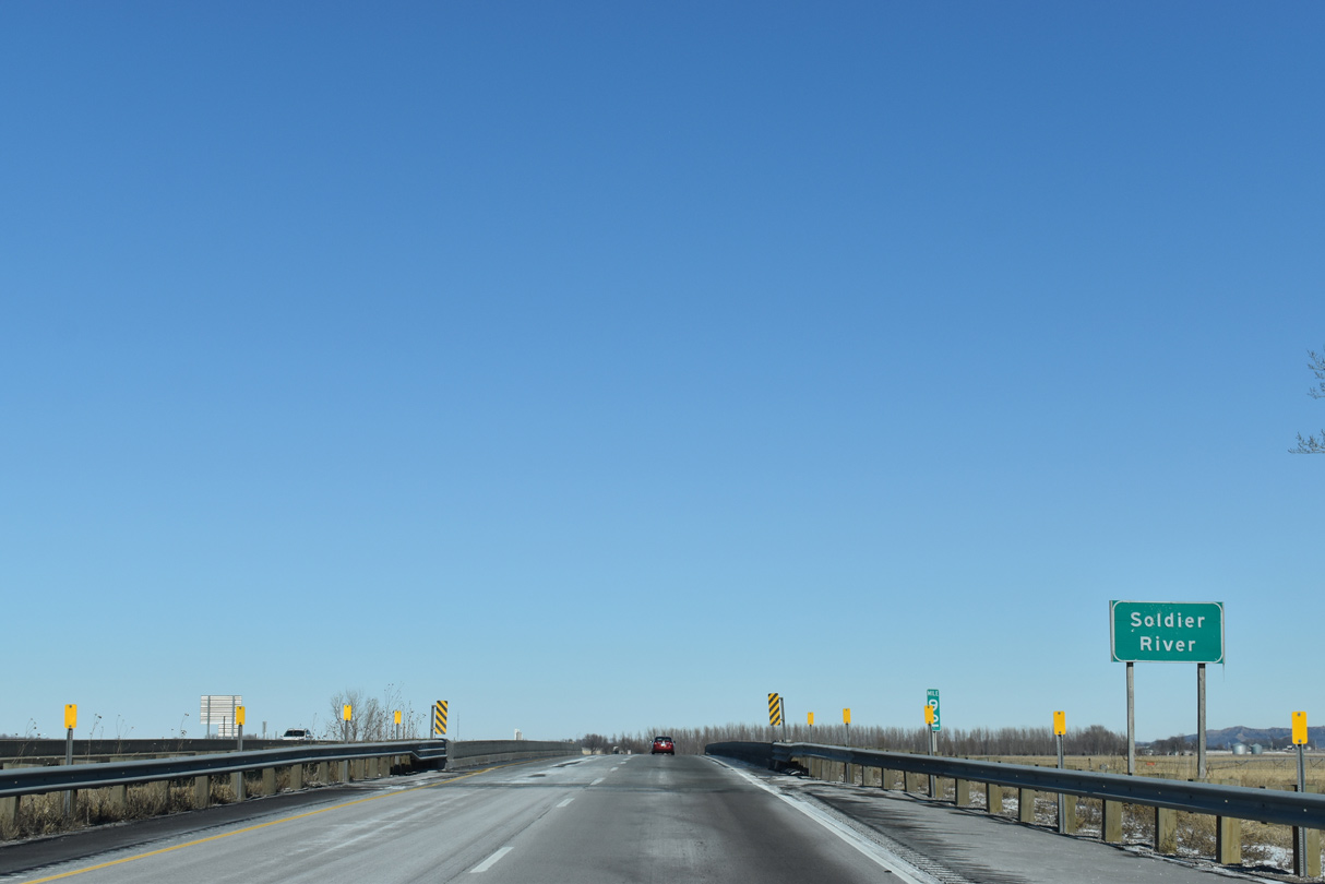
Interstate 29 crosses the Soldier River northwest of Round Lake State Wildlife Management Area.
02/20/20
County Route F20 replaced Iowa 301 east from Exit 95 to River Sioux and Little Sioux.
02/20/20
CR F20 meanders east around Loess Hills State Forest from Little Sioux to Iowa 183 at Pisgah.
02/20/20
Interstate 29 proceeds north across the Little Sioux River and adjacent to Three Rivers Wildlife Management Area beyond Exit 95.
02/20/20
Interstate 29 crosses Monona Harrison Ditch beyond this distance sign posted ten miles from Blencoe.
02/20/20
CR K45 (old U.S. 75) parallels I-29 to the east as both head north into Monona County.
02/20/20

References:
- I-29/I-480/West Broadway System Interchange. Council Bluffs Interstate System Improvement Program, Iowa Department of Transportation, project web page.
Photo Credits:
- ABRoads: 05/08/22
- Brent Ivy: 02/20/20
- Alex Nitzman: 04/20/07
Connect with:
Page Updated Saturday February 24, 2024.