
Interstate 39 North Lee, Ogle & Rockford Counties


 North
North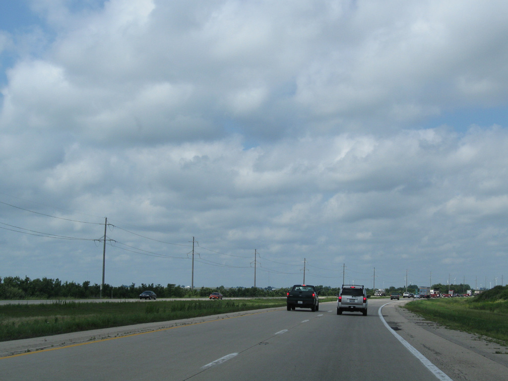
I-39/U.S. 51 make a gradual easterly turn through southeastern Lee County.
08/10/09

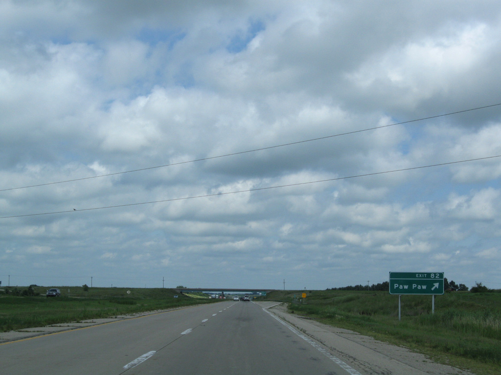
The three mile eastern shift takes I-39/U.S. 51 across County Road 10 between Roxbury and the village of Paw Paw.
05/06/10
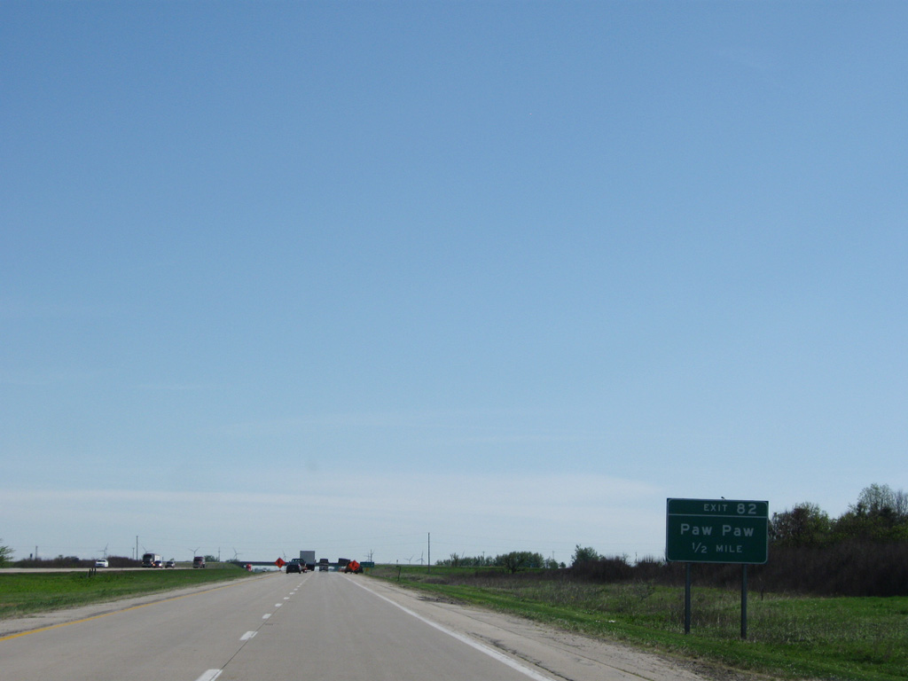
One half mile ahead of the diamond interchange (Exit 82) joining Interstate 39 with CR 10 (Chicago Road) to Paw Paw.
05/06/10
County Road 10 stretches 20.3 miles across Lee County, from Main Street in Amboy to De Kalb County east of Paw Paw.
08/10/09
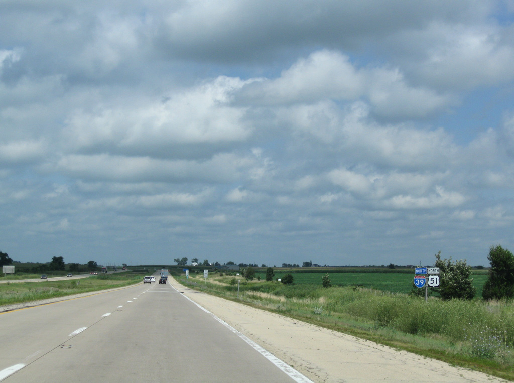
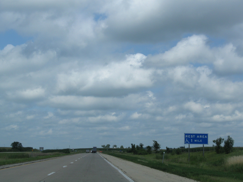
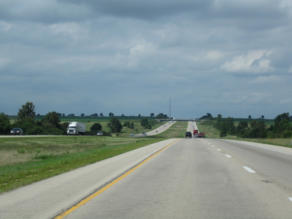
Continuing northeast from CR 10 (Chicago Road) and Roxbury, I-39/U.S. 51 next approach the Willow Creek Rest Area.
08/10/09
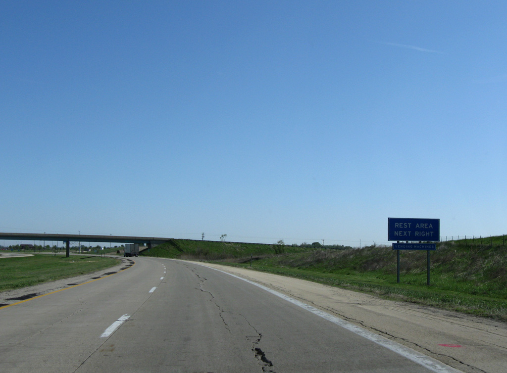
Rest areas line both sides of Interstate 39 just north of milepost 84 and the Beemerville Road overpass in Willow Creek township.
05/09/10
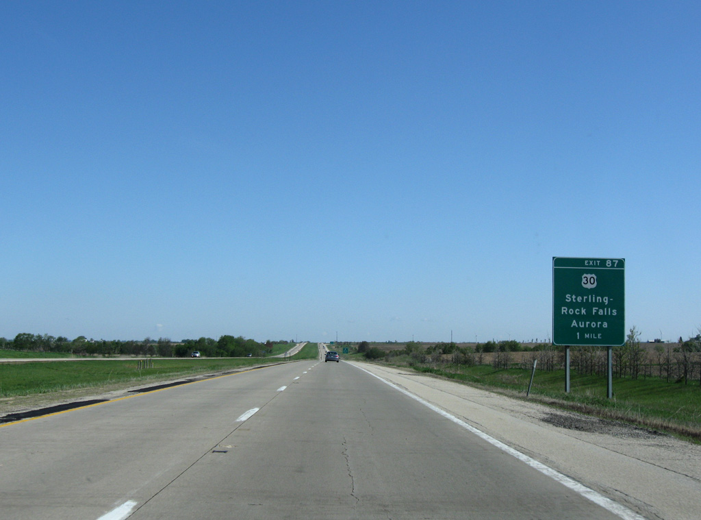
A diamond interchange (Exit 87) links Interstate 39 with U.S. 30 two miles north of the Willow Creek Rest Area.
05/09/10
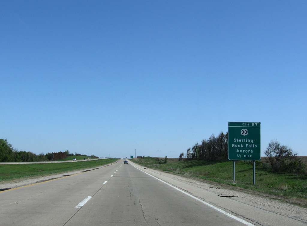
U.S. 30 is the fifth US route I-39 meets northward from Bloomington-Normal. Throughout Lee County, U.S. 30 follows a rural route, passing well south of Dixon to Sterling - Rock Falls and leading east to Waterman in De Kalb County.
05/09/10
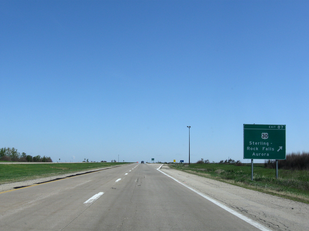
Exit 87 departs I-39/U.S. 51 north for U.S. 30 west to Sterling - Rock Falls and Clinton, Iowa and east to Shabbona Lake State Park and Aurura.
05/09/10
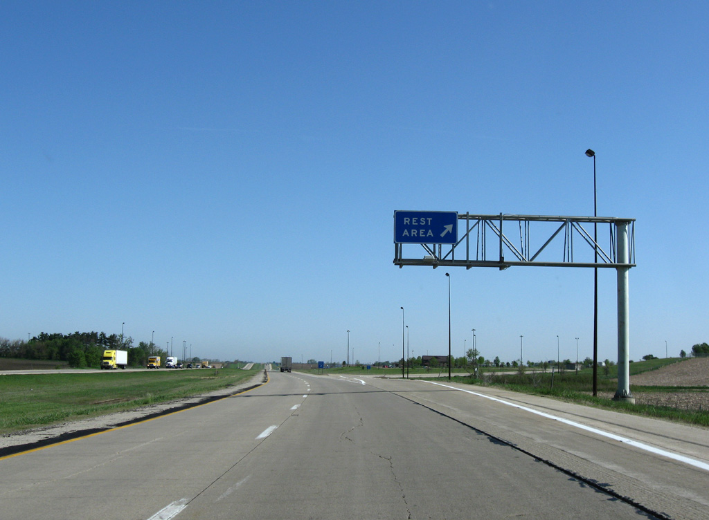
Interstate 39 traverses agricultural areas north from U.S. 30 to the rural village of Steward.
05/09/10
08/10/09
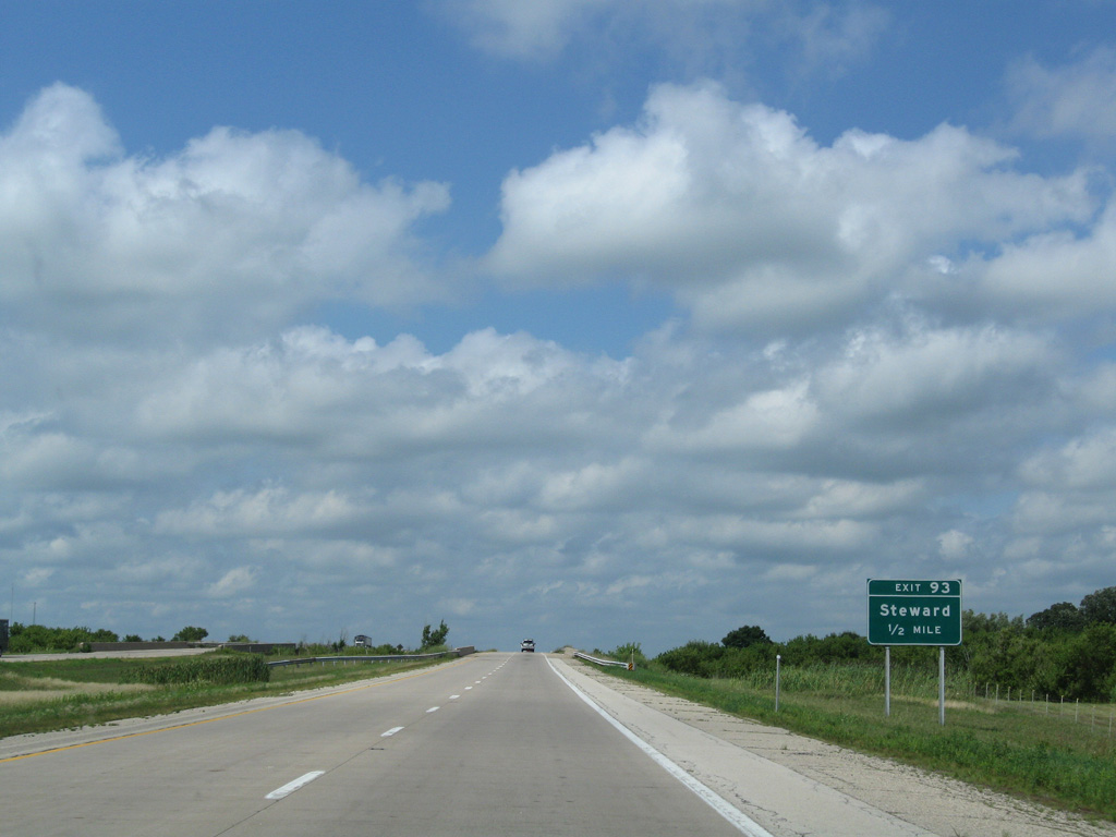
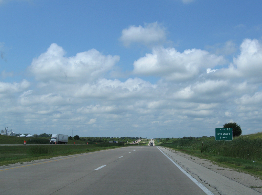
County Road 2 (Perry Road / Main Street) west links I-39/U.S. 51 with Steward from forthcoming Exit 93.
08/10/09
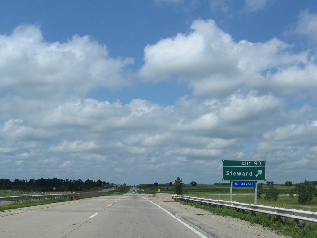
Passing over a BNSF Railroad line, Interstate 39 enters the folded diamond interchange (Exit 93) with CR 2 (Perry Road) at Steward.
08/10/09
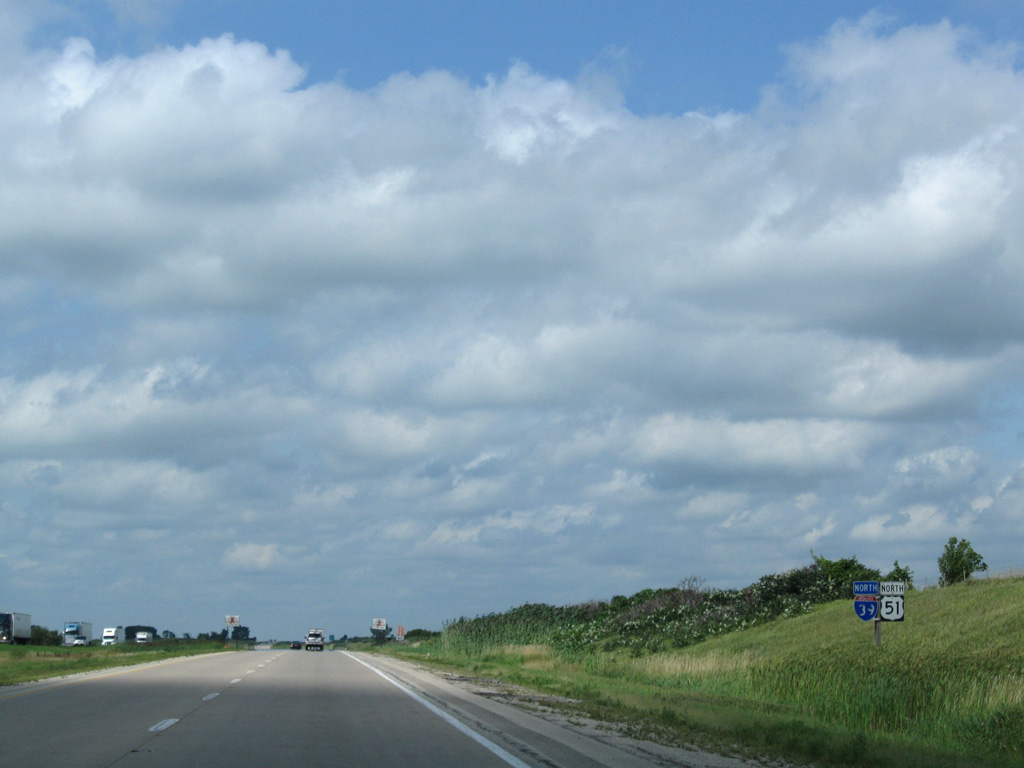
I-39/U.S. 51 travel 3.5 miles east of IL 251 (old U.S. 51) to the Ogle County line.
08/10/09

Running through eastern reaches of the Rochelle city limits, Interstate 39 north next meets I-88 (Ronald Reagan East West Tollway).
08/10/09
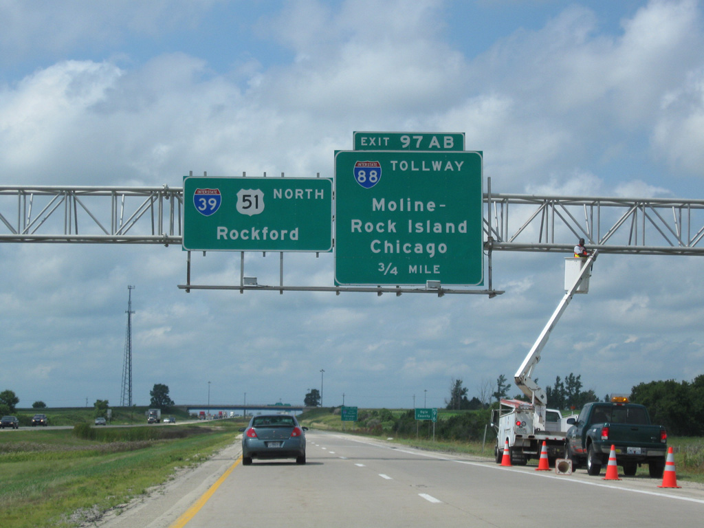
Interstate 88 in Illinois travels 140 miles overall from East Moline and the Quad Cities (I-80) to I-290 (Eisenhower Expressway) at Hillside, just outside Chicago.
08/10/09
Entering Ogle County, 0.75 miles ahead of Interstate 88 east to Chicago.
08/10/09
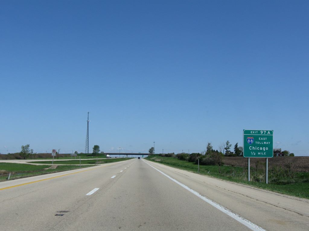
Operated by the Illinois Tollway Authority, the Ronald Reagan East-West Tollway (I-88) extends east from U.S. 30 a Sterling - Rock Falls to I-290 leading into Chicago.
05/09/10
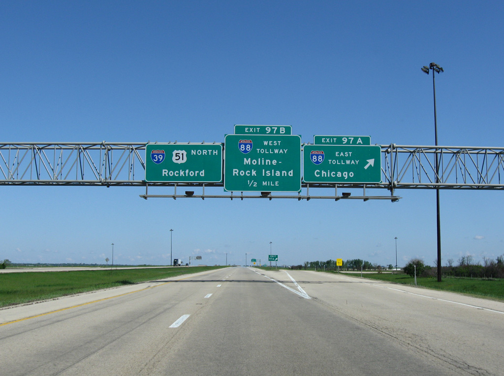
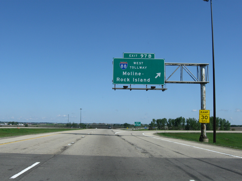
A cloverleaf interchange (Exits 97A/B) joins I-39/U.S. 51 with Interstate 88 (East-West Tollway) just outside the Rochelle city limits.
05/09/10
All of Interstate 88 west from Chicago doubles as the Chicago-Kansas City Expressway (CKC). Numbered IL 110, the CKC accompanies I-88 west to I-80 and I-74 leading south from East Moline to Galena.
05/09/10
Shields for I-39/U.S. 51 north posted ahead of the Creston Road overpass and the Union Pacific Railroad underpass.
05/06/10
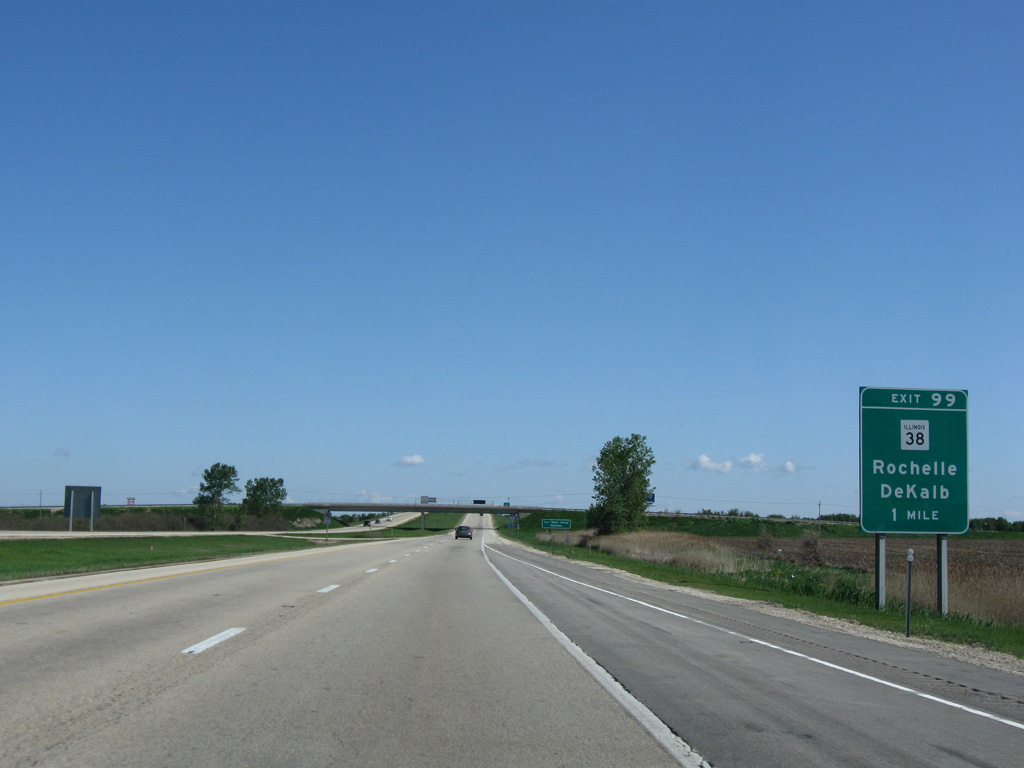
IL 38 (Eagle Drive) stems east from IL 251 (7th Street) along an arterial route 2.2 miles to a diamond interchange (Exit 99) with Interstate 39.
05/09/10

Leading north from Rochelle, I-39 is the E.J. "Zeke" Giorgi Highway.
08/10/09
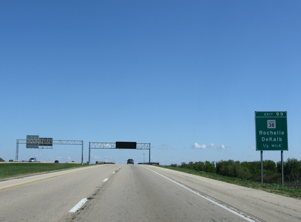
One half mile ahead of Exit 99 for IL 38 east to the villages of Creston and Malta and Northern Illinois University in the city of Dekalb.
05/09/10
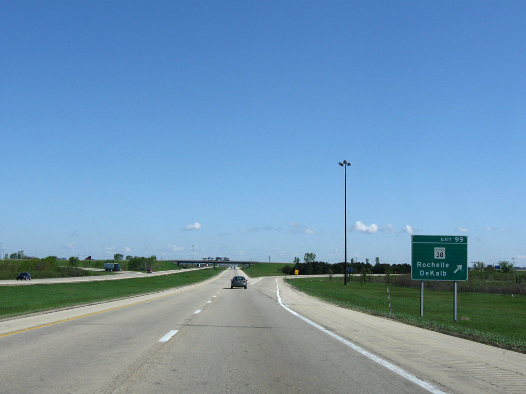
Exit 99 parts ways with I-39/U.S. 51 north for IL 38 (Eagle Drive) in Rochelle. An 89 mile route, IL 38 parallels Interstate 88 west to Dixon and east to Westchester
05/09/10
Leaving Rochelle, I-39/U.S. 51 pass east of the Hillcrest village limits ahead of an abandoned set of weigh stations.
05/09/10
05/06/10
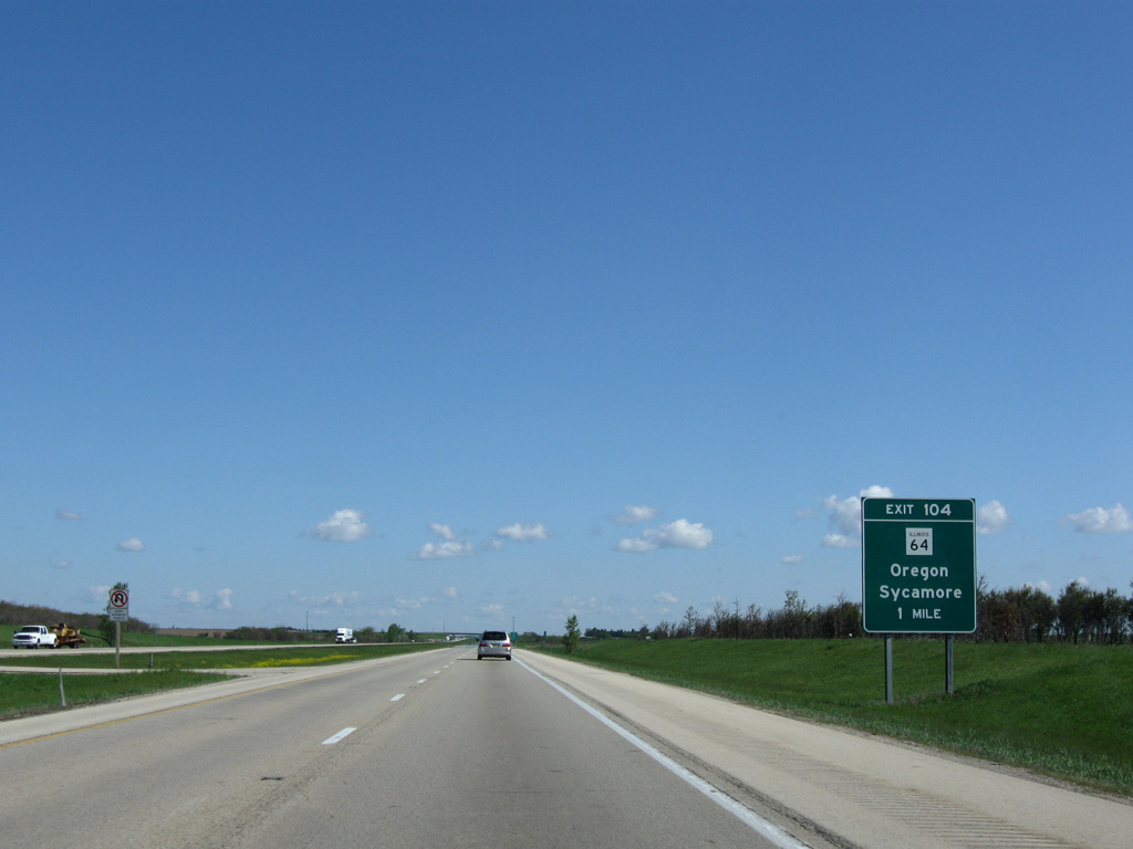
Meeting I-39/U.S. 51 at the succeeding interchange (Exit 104) is IL 64, a multi state route extending 200 miles from Chicago west to Anamosa, Iowa.
05/09/10
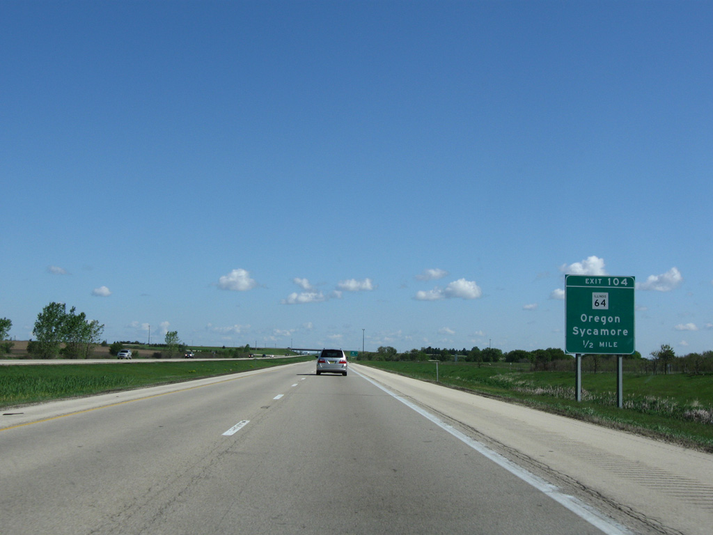
IL 64 heads 16 miles west from Exit 104 to the Ogle County seat of Oregon.
05/09/10
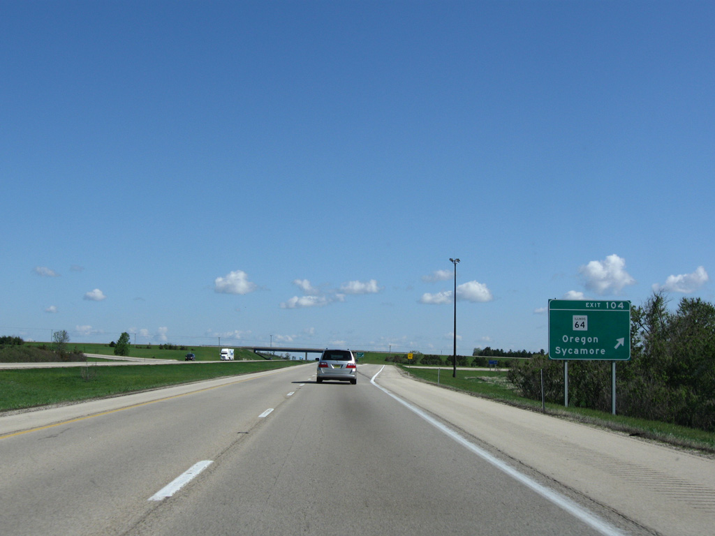
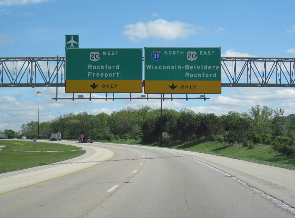
East from the diamond interchange (Exit 104) with I-39, IL 104 continues 17 miles to the Dekalb County city of Sycamore.
05/09/10

The ensuing stretch of I-39 north runs across farm land east of Killbuck Creek and ahead of Lindenwood.
05/06/10
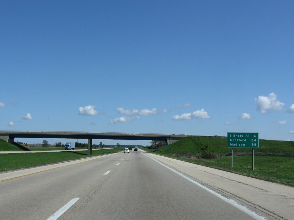
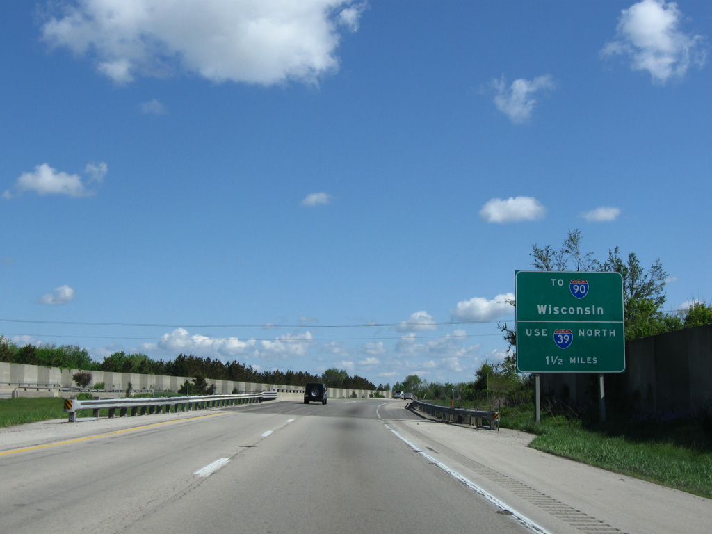
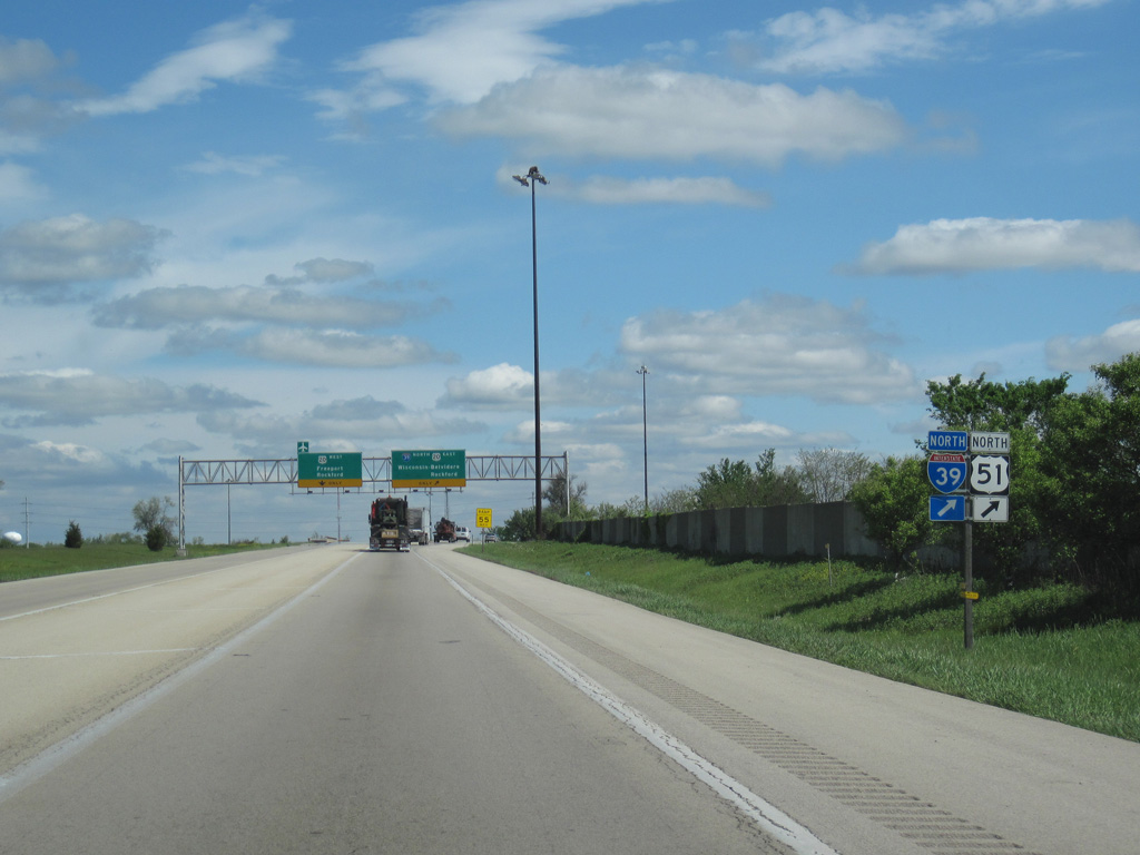
24 miles remain for motorists headed to Rockford. Madison, Wisconsin debuts at 98 miles out via I-39 & 90 north.
05/09/10
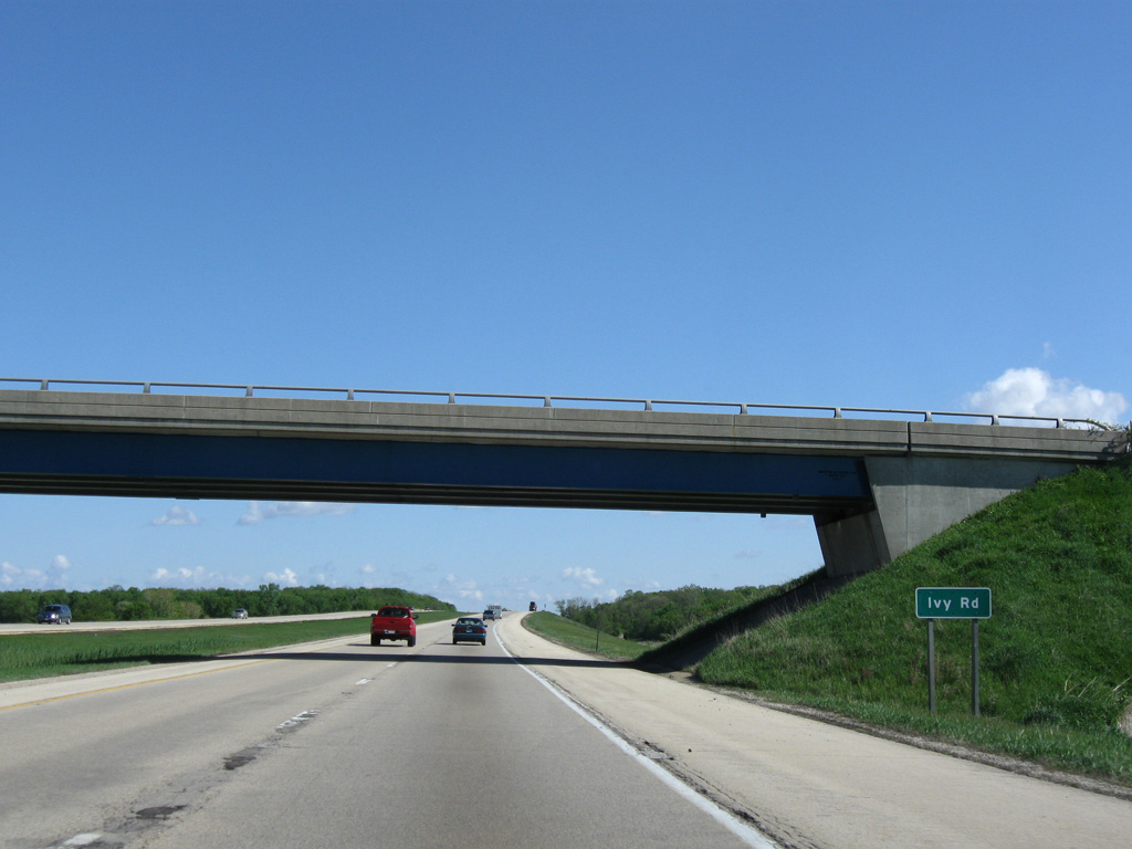
Ivy Road spans I-39/U.S. 51 east from parallel CR 15 (Linville Road) near unincorporated Lindenwood.
05/09/10
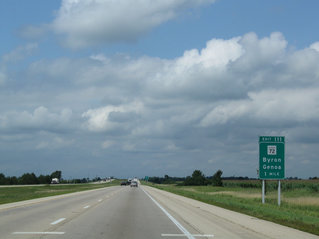
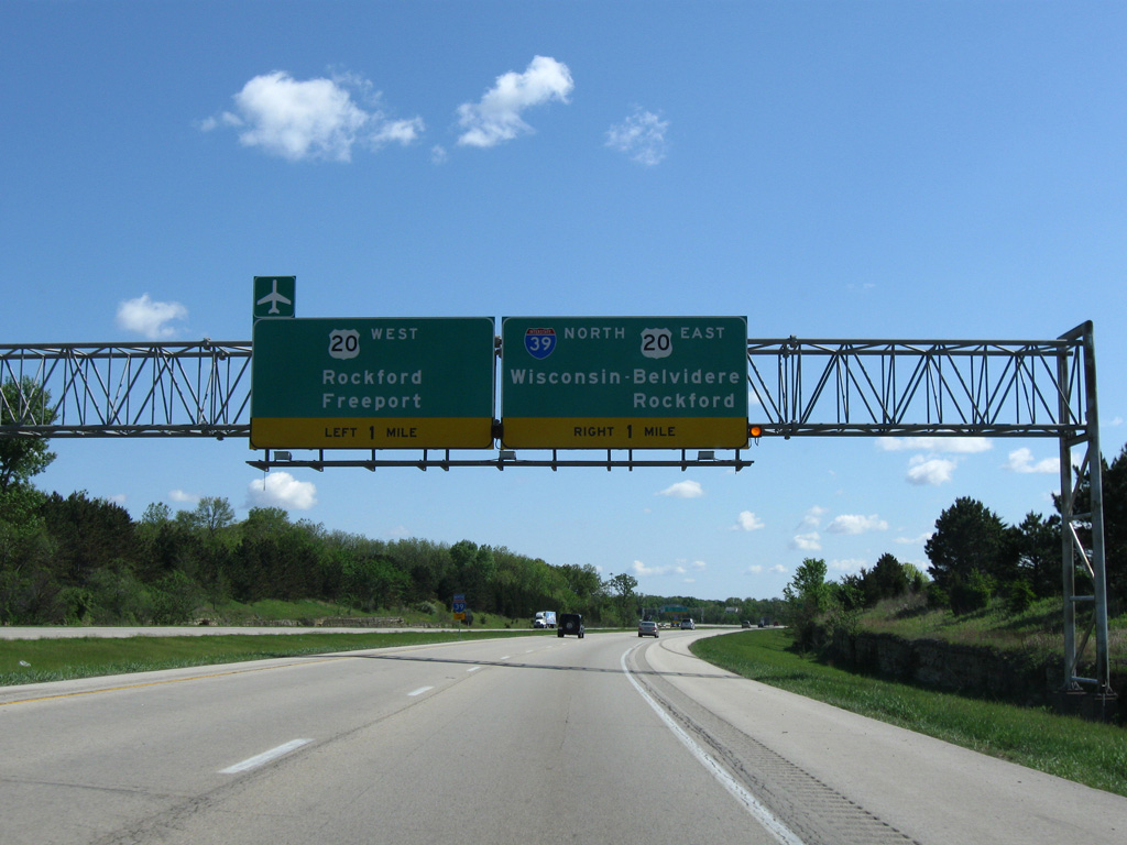
IL 72 converges with Interstate 39 at Exit 111 between the villages of Davis Junction and Monroe Center.
08/10/09
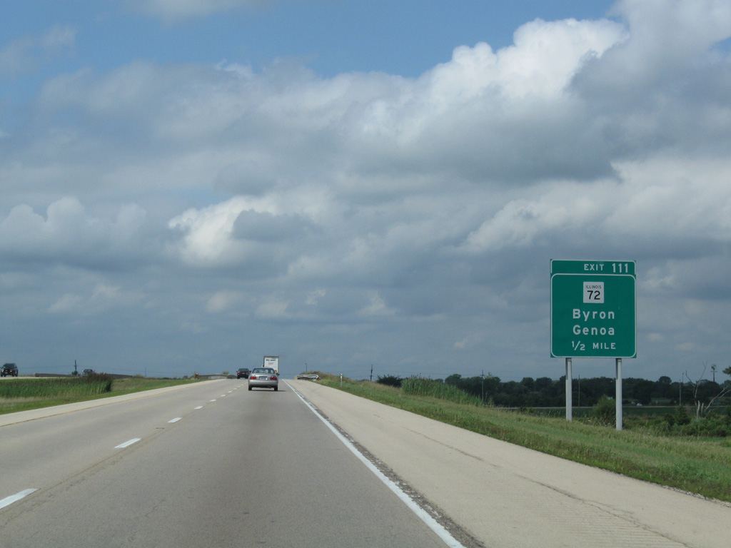
IL 72 travels 17 miles east from Interstate 39 to the DeKalb County seat of Genona and 12 miles west to the city of Byron.
08/10/09
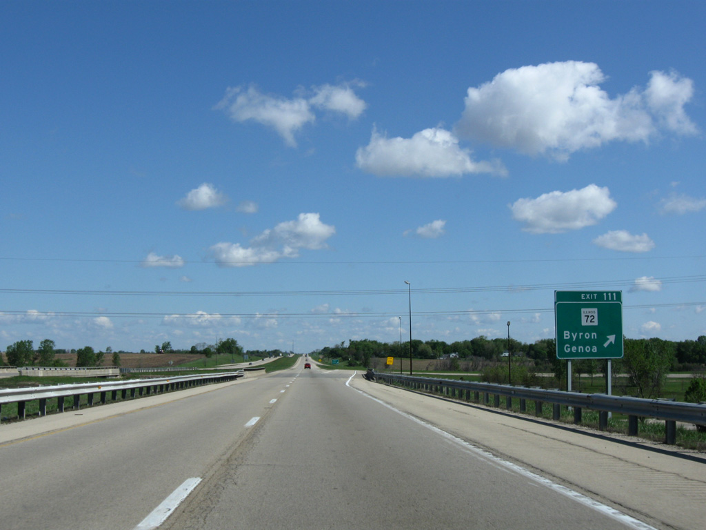
Interstate 39 spans the Canadian Pacific Railroad line (formerly the Dakota, Minnesota & Eastern Railroad) just ahead of the folded diamond interchange (Exit 111) with IL 72.
05/09/09
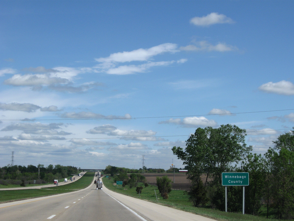
Bee lining 3.5 miles north, I-39/U.S. 51 leave Ogle County for Winnebago County.
08/10/09
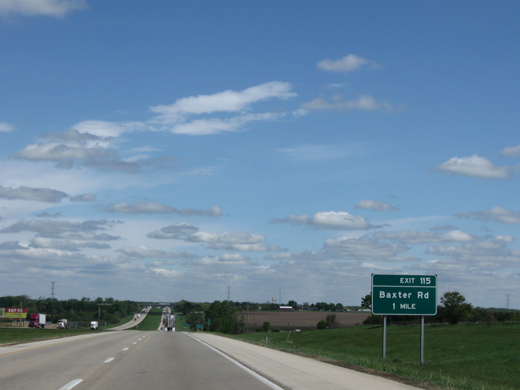
I-39/U.S. 51 enter Winnebago County one mile ahead of the diamond interchange (Exit 115) with Baxter Road.
05/06/10

Baxter Road is a rural road through outer reaches of the villages of New Milford to the west and Cherry Valley to the east.
05/06/10
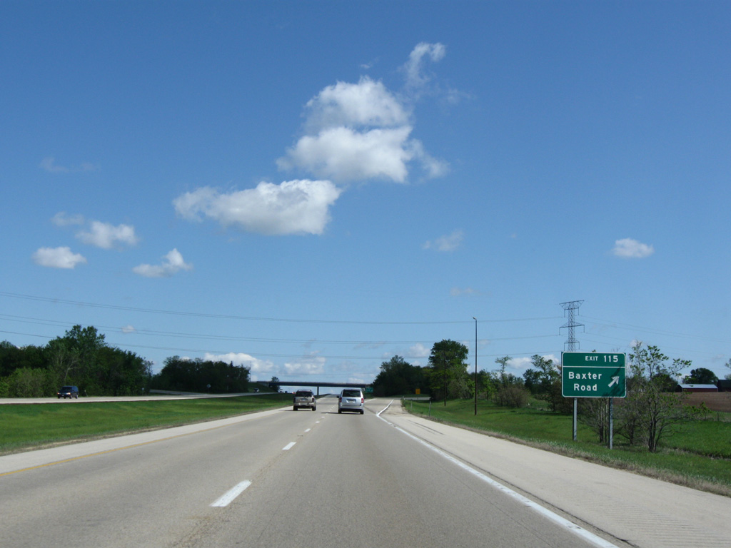
Exit 115 departs I-39/U.S. 51 north for Baxter Road.
05/09/10
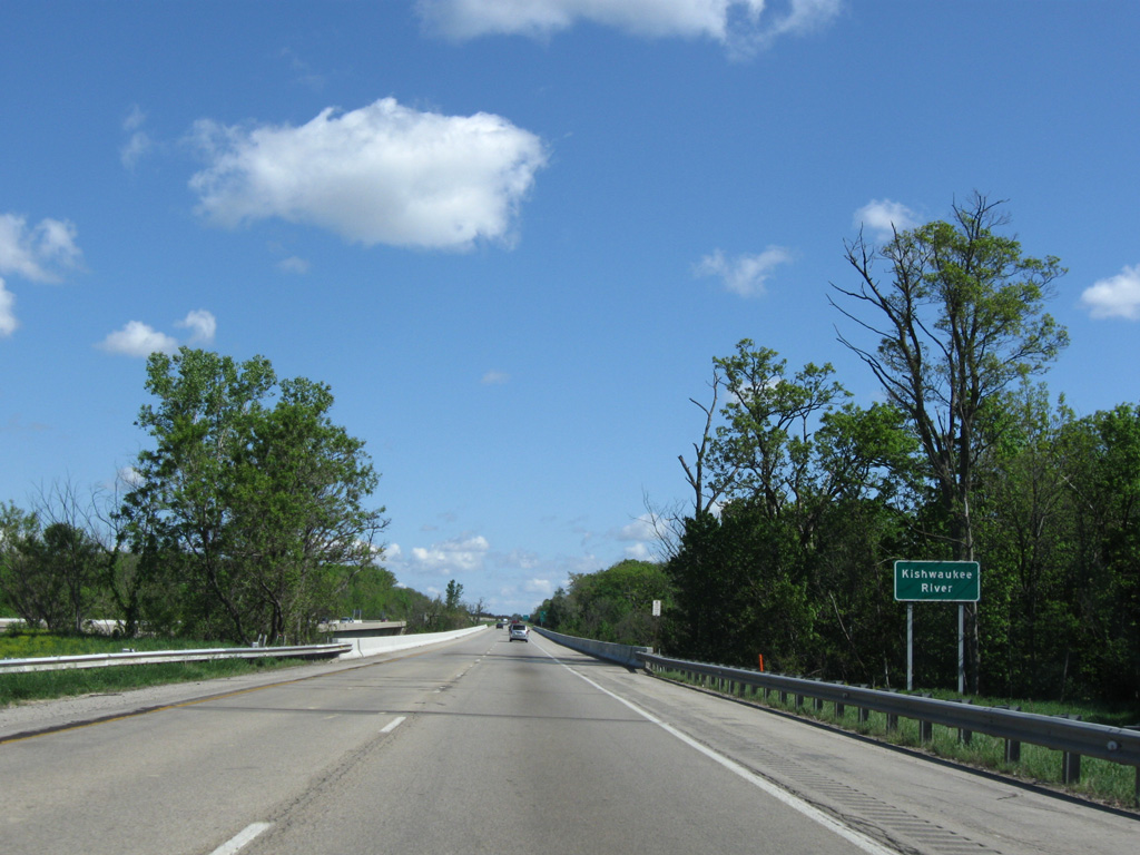
Limestone rock cuts line the broad descent Interstate 39 takes across the Kishwaukee River valley.
05/09/10
I-39/U.S. 51 wind northeast two miles through Cherry Valley township to combine with U.S. 20 on the southeast side of Rockford.
08/10/09
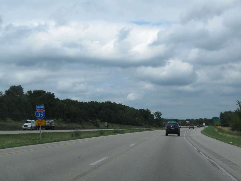
The first in a series of signs referencing the upcoming overlap of Interstates 39 and 90 stands at the Blackhawk Road underpass. I-39 & 90 combine for 96 miles from Cherry Valley to Portage, Wisconsin.
05/09/10
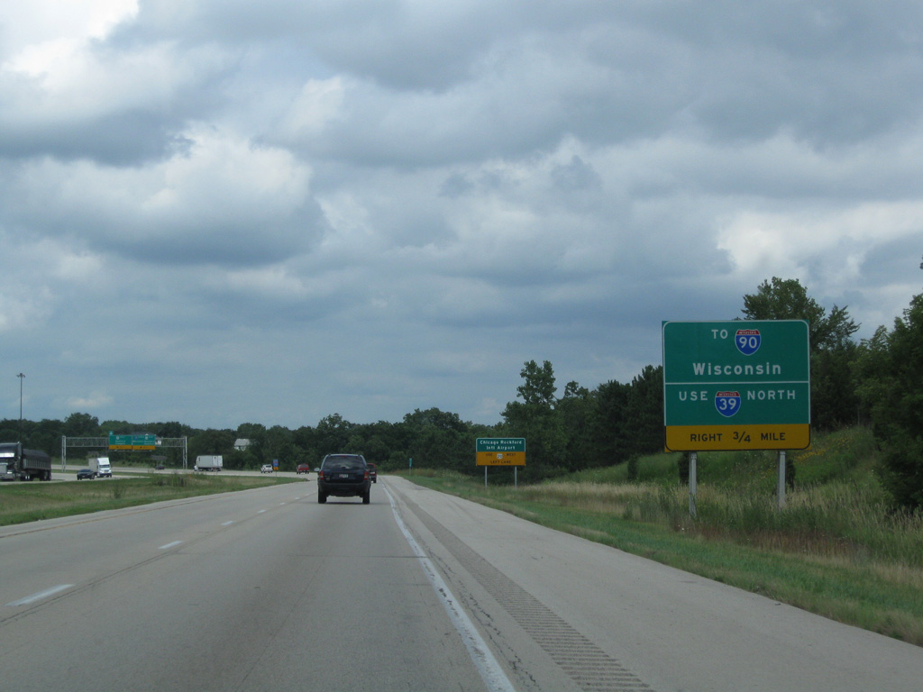
Traffic partitions in one mile at a wye interchange leading I-39 northeast onto the U.S. 20 freeway bypass of Rockford eastbound. The left land defaults onto a loop ramp connecting with U.S. 20 west to Chicago Rockford International Airport (RFD) and the west side of the city.
05/09/10
I-39/U.S. 51 curve northeast by a handful of subdivisions ahead of the ramp split for U.S. 20. The I-39 mainline reduces to a single lane through a TOTSO (turn off to stay on) movement.
05/09/09
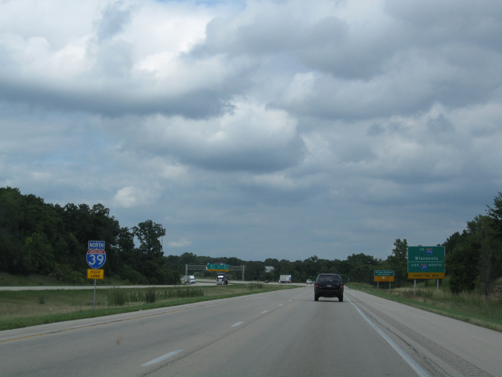
Guide signs use the Illinois Tollway control point of Wisconsin for the continuation of Interstate 39 north alongside I-90 (Jane Addams Memorial Tollway).
05/09/09
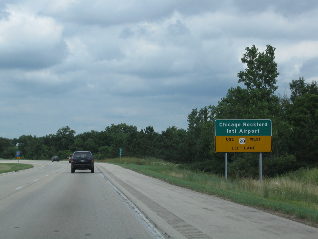
Chicago Rockford International Airport (RFD) lies south of the U.S. 20 freeway along the Rock River six miles to the west of I-39.
05/09/09
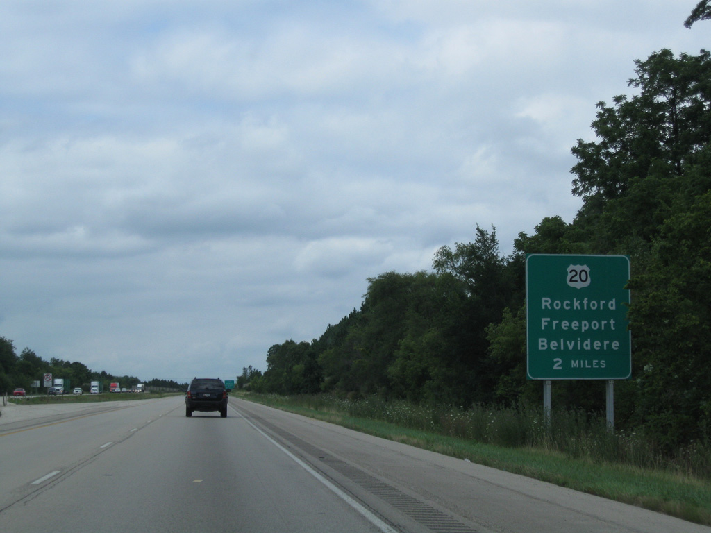
Traveling west from Rockford, U.S. 20 comprises a four lane, divided highway to Freeport. The US Route continues from there to Galena and Dubuque, Iowa.
05/06/10
Interstate 39 and U.S. 51 remain paired for another 21 miles to the last exit along the Jane Addams Tollway (I-90).
05/06/10
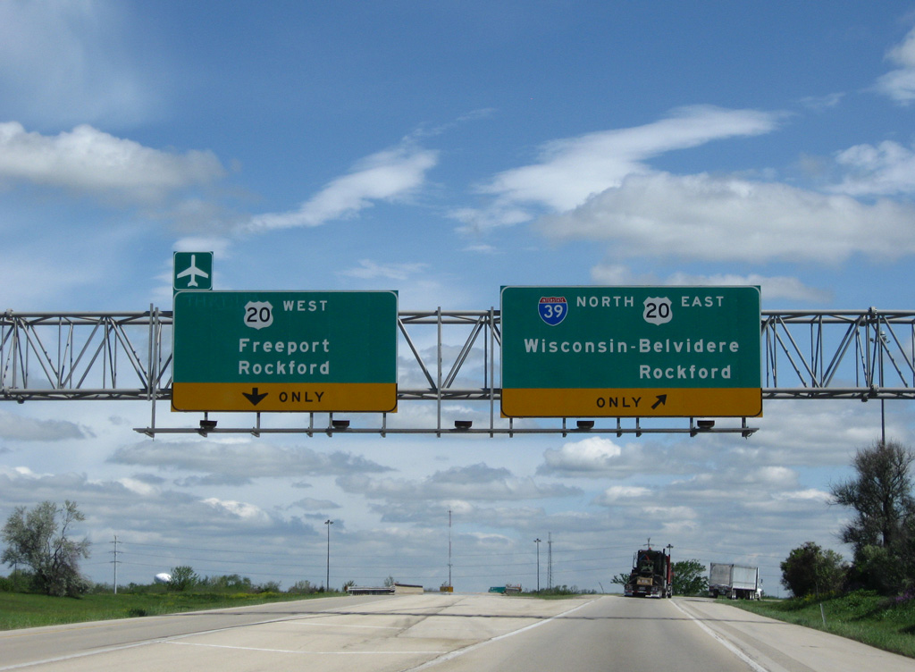
Interstate 39 north splits with the ramp for U.S. 20 west. U.S. 20 accompanies I-39/U.S. 51 north to Cherry Valley and the city of Belvidere.
05/06/10
North  East
East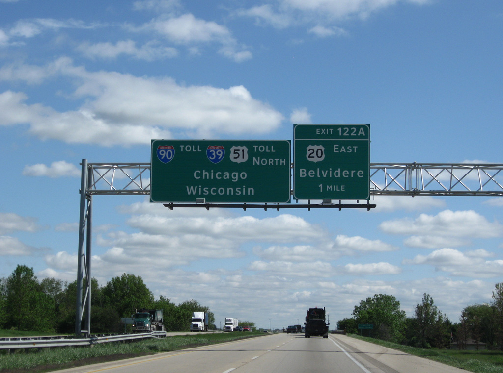
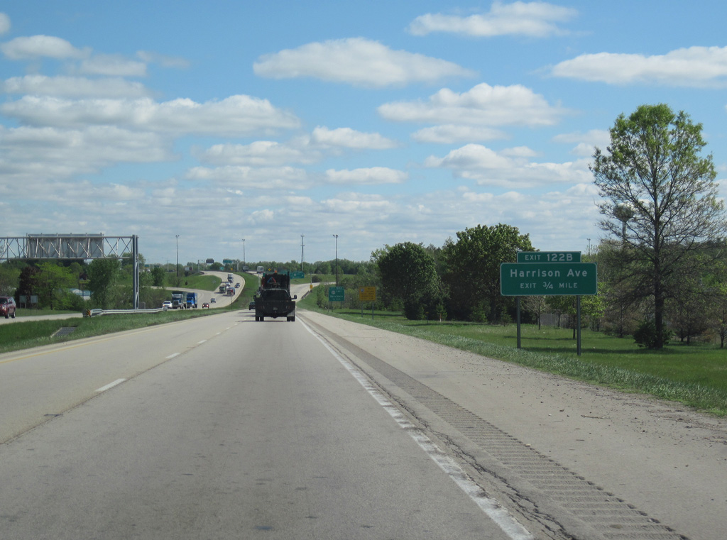
Traffic along I-39/U.S. 51 north combines with U.S. 20 east for 2.3 miles to a cloverleaf interchange (Exits 122A/B) with Harrison Avenue.
05/06/10
Motorists are alerted of the upcoming transition of Interstate 39 north into a toll road as the freeway crosses over the CN Railroad at milepost 121.
05/06/10
Harrison Avenue ties into the exchange with U.S. 20 east to Cherry Valley as a local arterial west to Cherry Vale Mall and south Rockford.
05/06/10
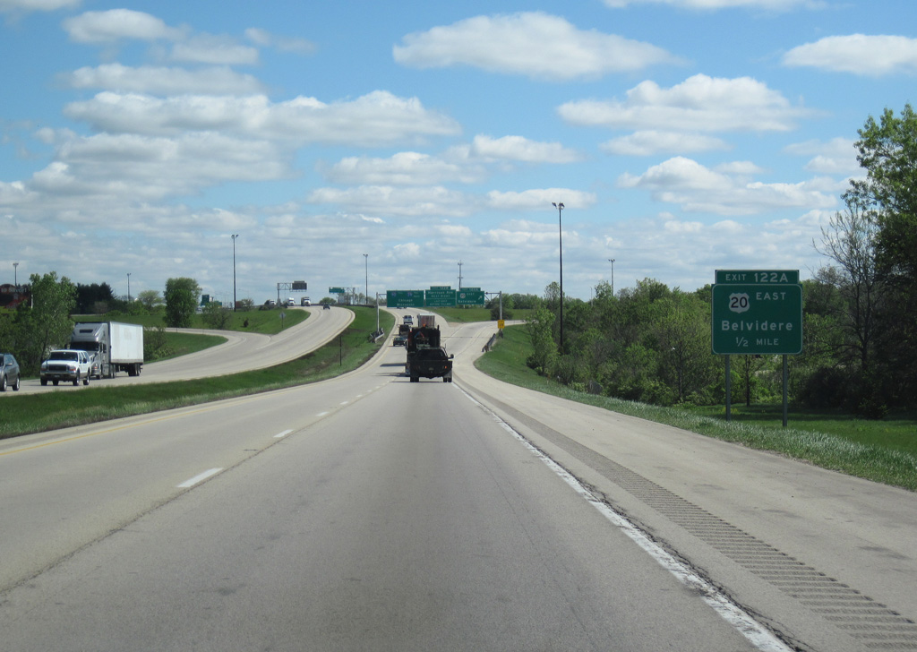
U.S. 20 parallels Interstate 90 (Jane Addams Tollway) east to Edgewood and across south Belvidere. U.S. 20 Business travels further north, linking the toll road with the Rockford business district.
05/06/10
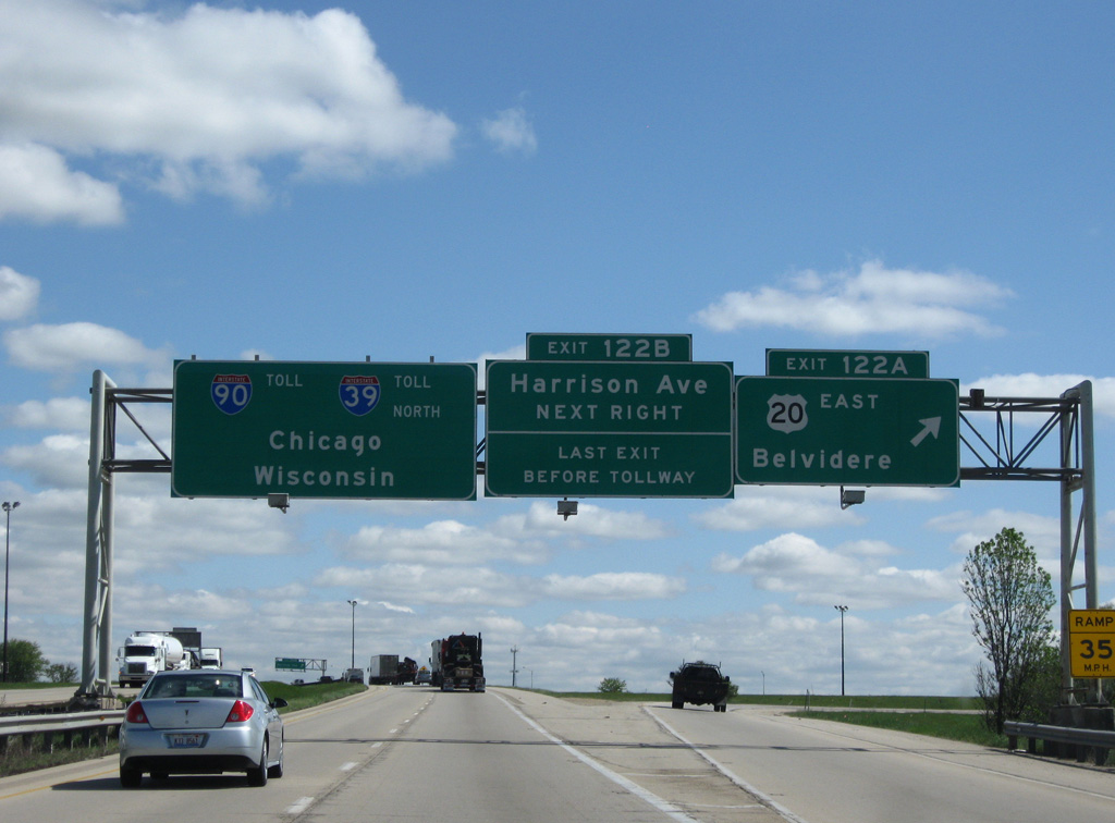
Exit 122A leaves I-39/U.S. 51 north. U.S. 20 arcs southeast from Belvidere to Marengo, meeting Interstate 90 directly ahead of Elgin and the west Chicago suburbs. I-90 turns north from the merge with I-39 to Beloit, Janesville and Madison, Wisconsin.
05/06/10

Construction reconfiguring the trumpet interchange with Interstate 90 realigned I-39/U.S. 51 onto a two lane left exit. This replaced a loop ramp.
05/06/10
North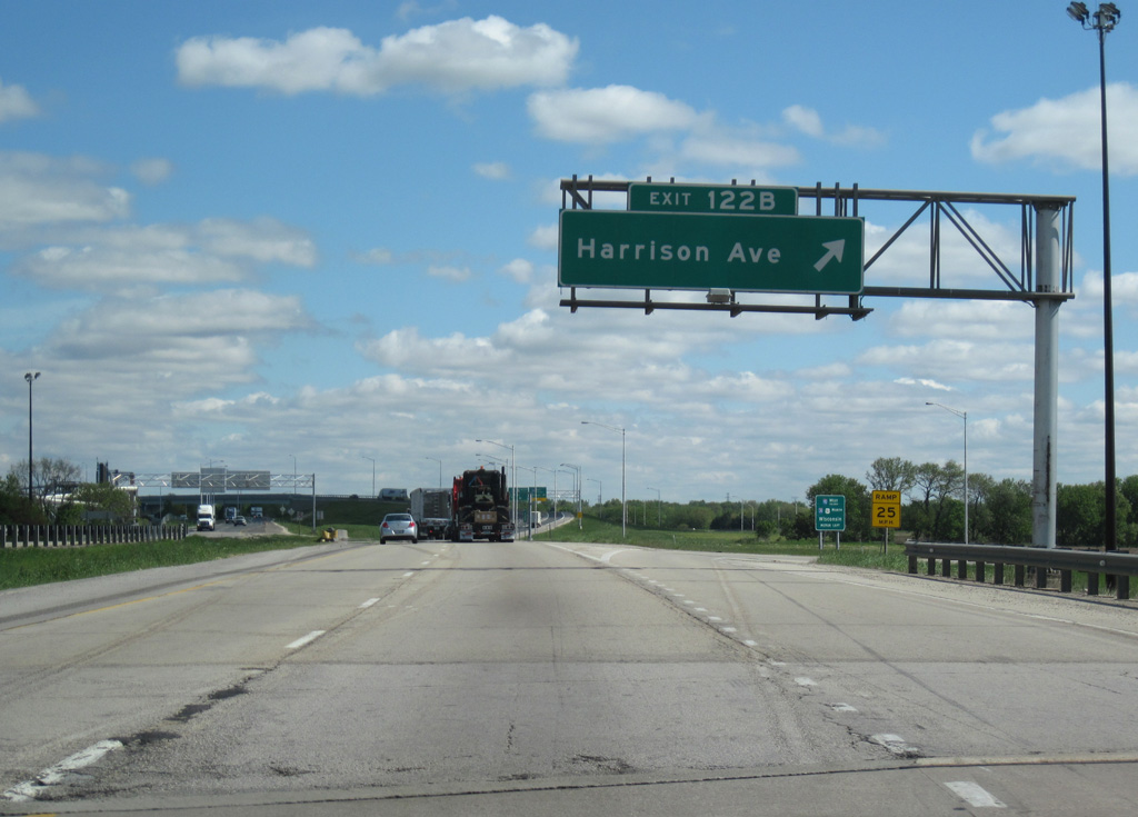
Exit 122B loops onto Harrison Avenue west to Perryville Road (CR 11) and Charles Street (CR 34) in the village of Cherry Valley.
05/09/10
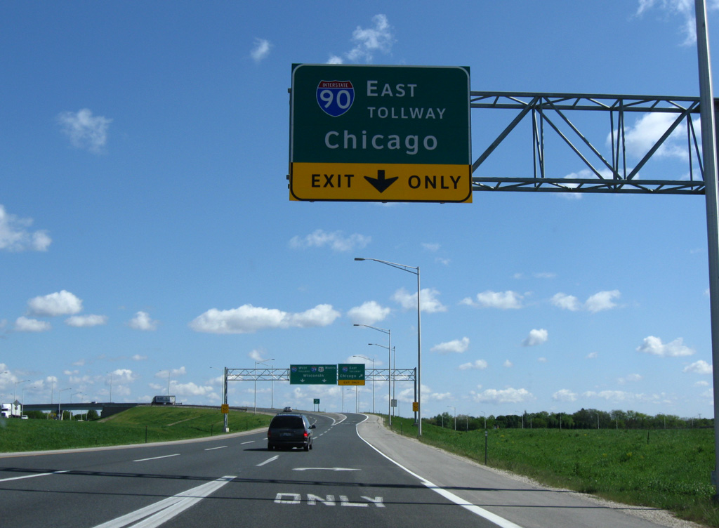
Road work completed in 2009 added a auxiliary lanes from U.S. 20 and Harrison Avenue north to the three-wye interchange with Interstate 90 (Jane Addams Tollway). Formerly named the Northwest Tollway, I-90 travels 61 miles southeast to I-190 and the Kennedy Expressway leading into Chicago.
05/06/10
Photo Credits:
- Andy Field: 05/09/09, 08/10/09
- ABRoads: 05/09/09, 05/06/10, 05/09/10
Connect with:
Page Updated Monday April 30, 2018.