
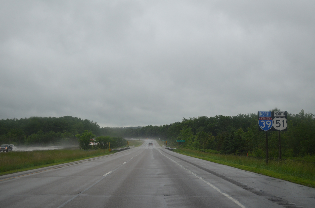
I-39/U.S. 51 North - Stevens Point to Wausau


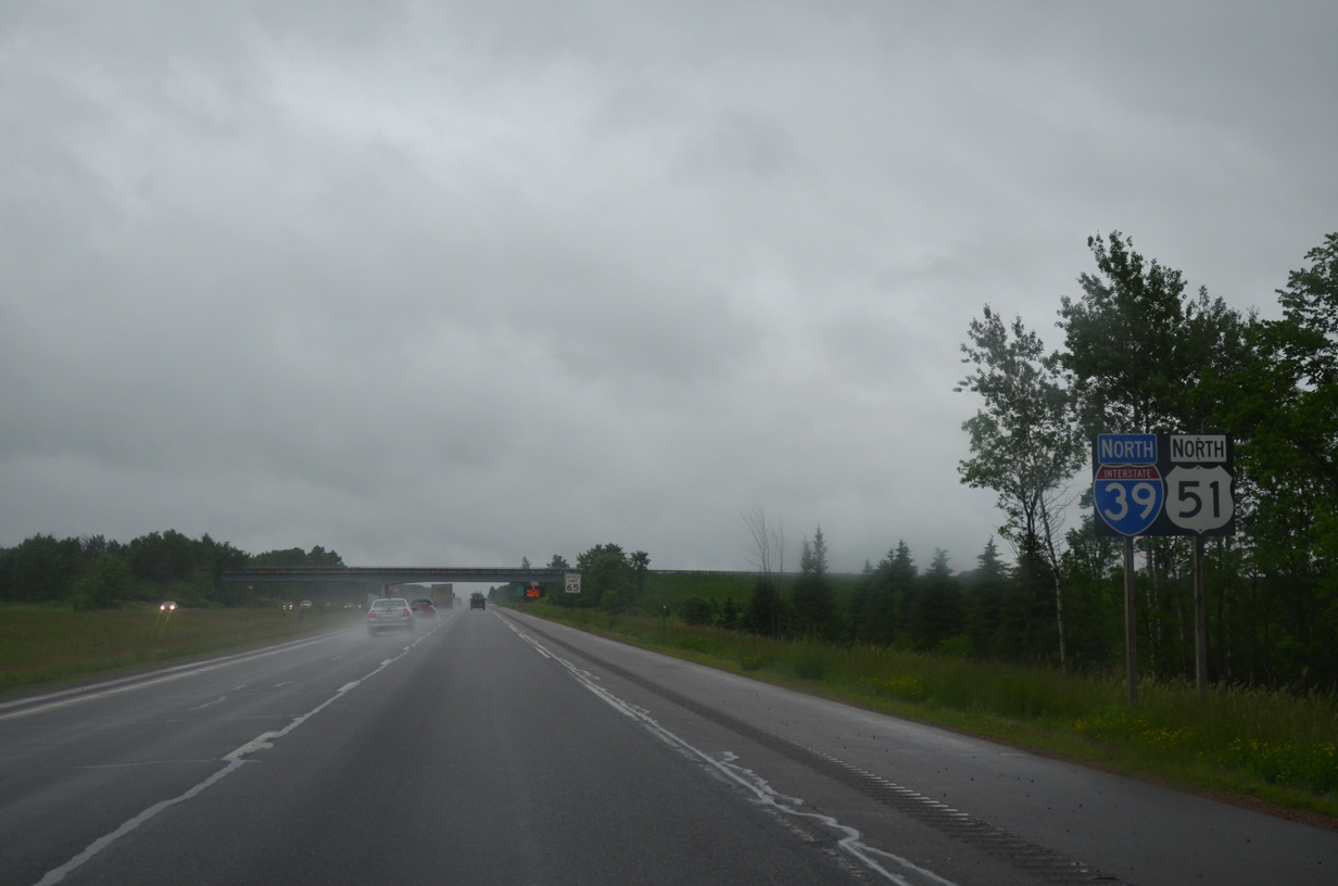
 North
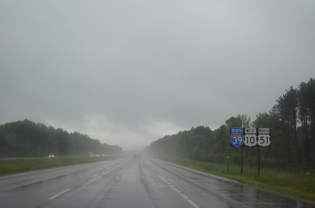
North  West
West 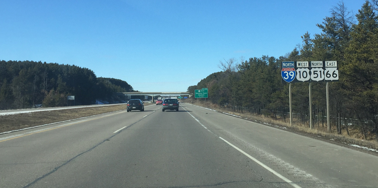
Wis 66 east joins I-39-U.S. 51 north / U.S. 10 west for 1.4 miles. This is a rare combination of all three route classes in Wisconsin.
03/02/16
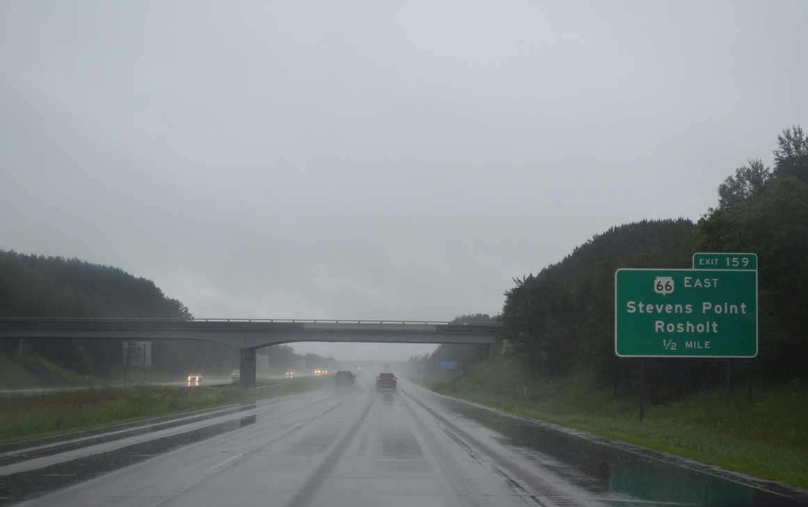
Angling northwest, the freeway crosses the Plover River ahead of the diamond interchange (Exit 159) with Stanley Street south and the continuation of Wis 66 east by Stevens Point Municipal Airport (STE).
06/15/15
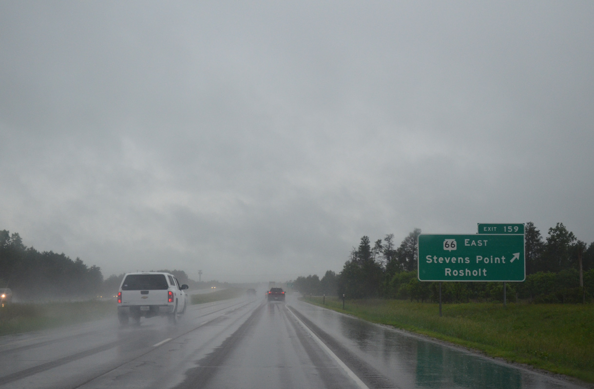
Stanley Street leads southwest to Michigan Avenue as the pre-2010 alignment of Wis 66. Wis 66 east joins Stevens Point with the village of Rosholt, 17 miles to the northeast.
06/15/15
North West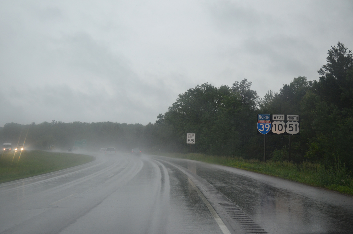
I-39/U.S. 10-51 turn west between Lake Susan and the SentryWorld Golf Course across the north side of Stevens Point.
06/15/15
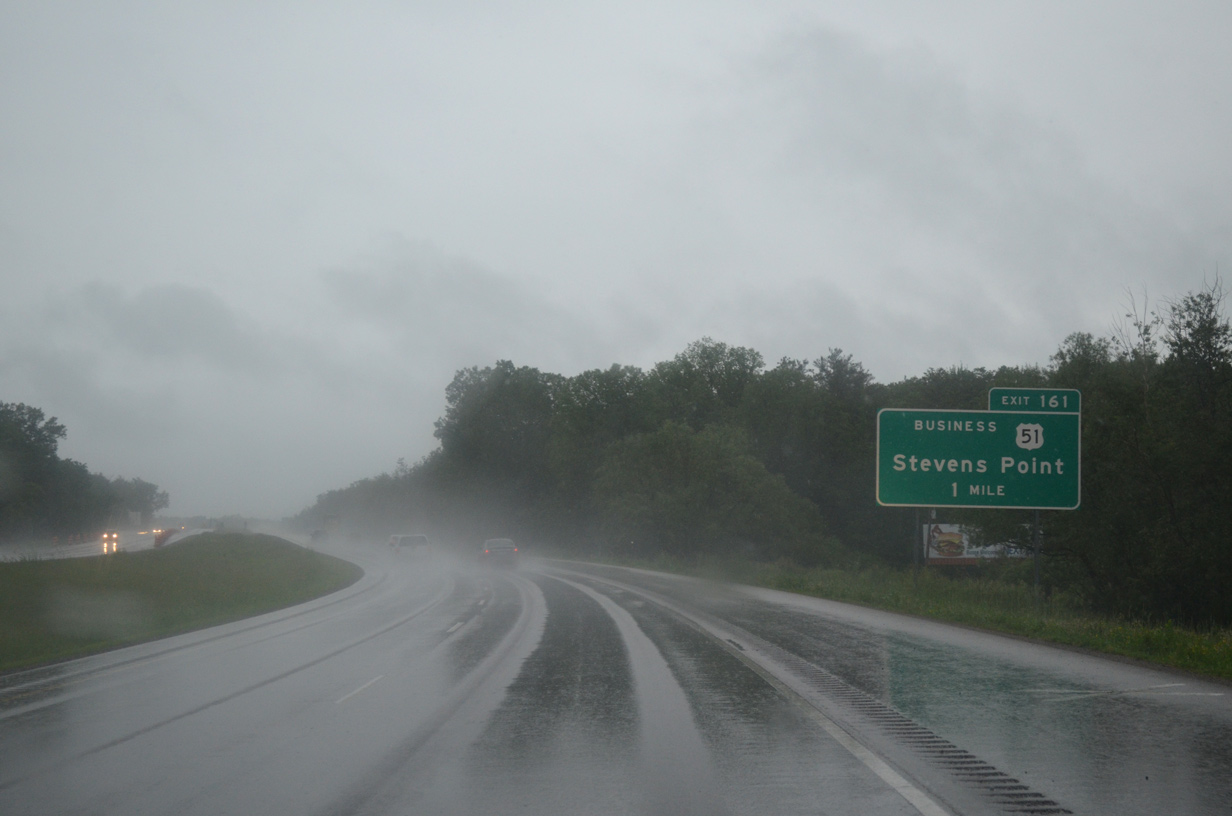
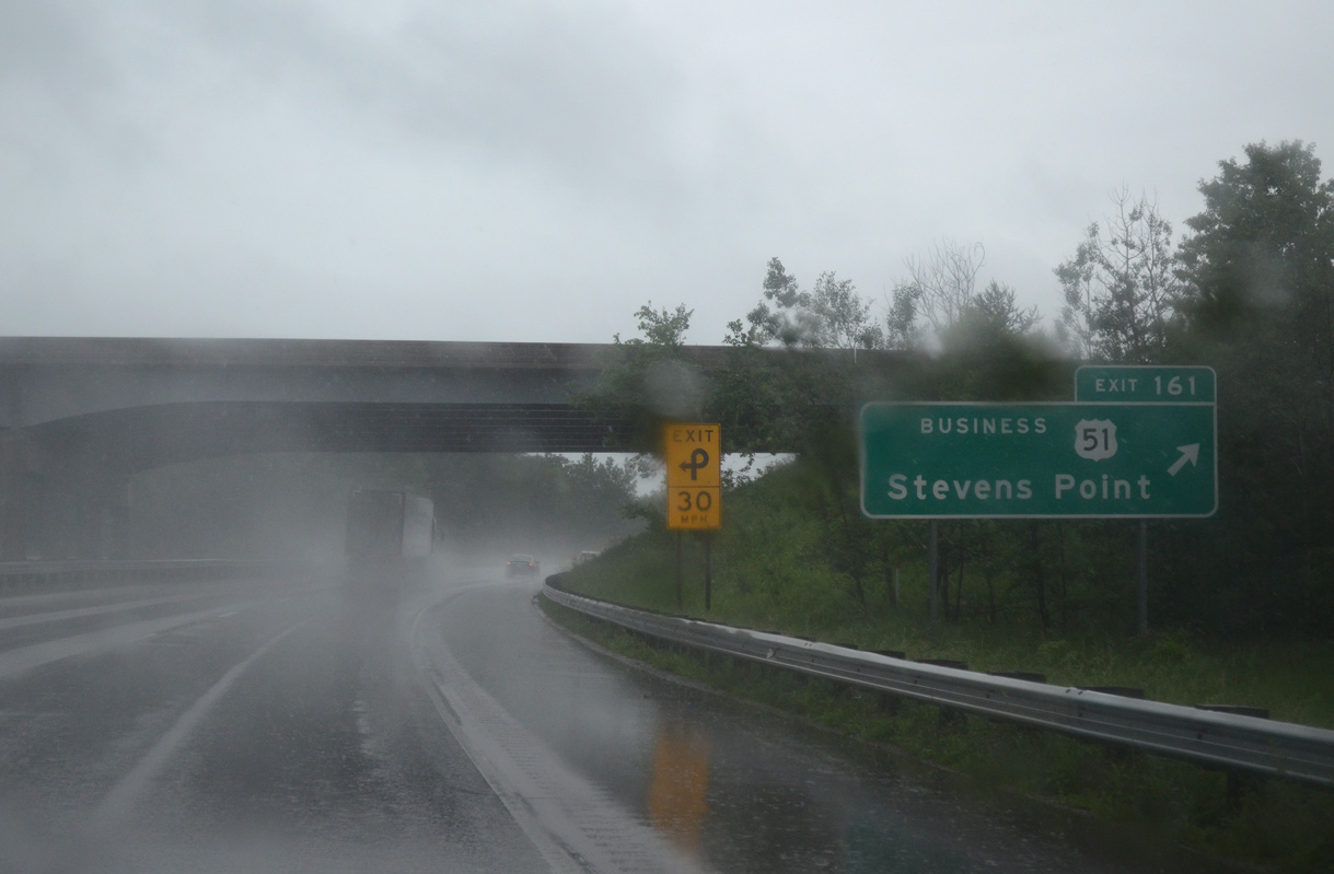
U.S. 51 Business returns to I-39/U.S. 51 via a trumpet interchange (Exit 161) with Division Street in one mile.
06/15/15
Division Street (U.S. 51 Business) comprises a commercial arterial south to 4th Avenue and the University of Wisconsin-Stevens Point.
06/15/15
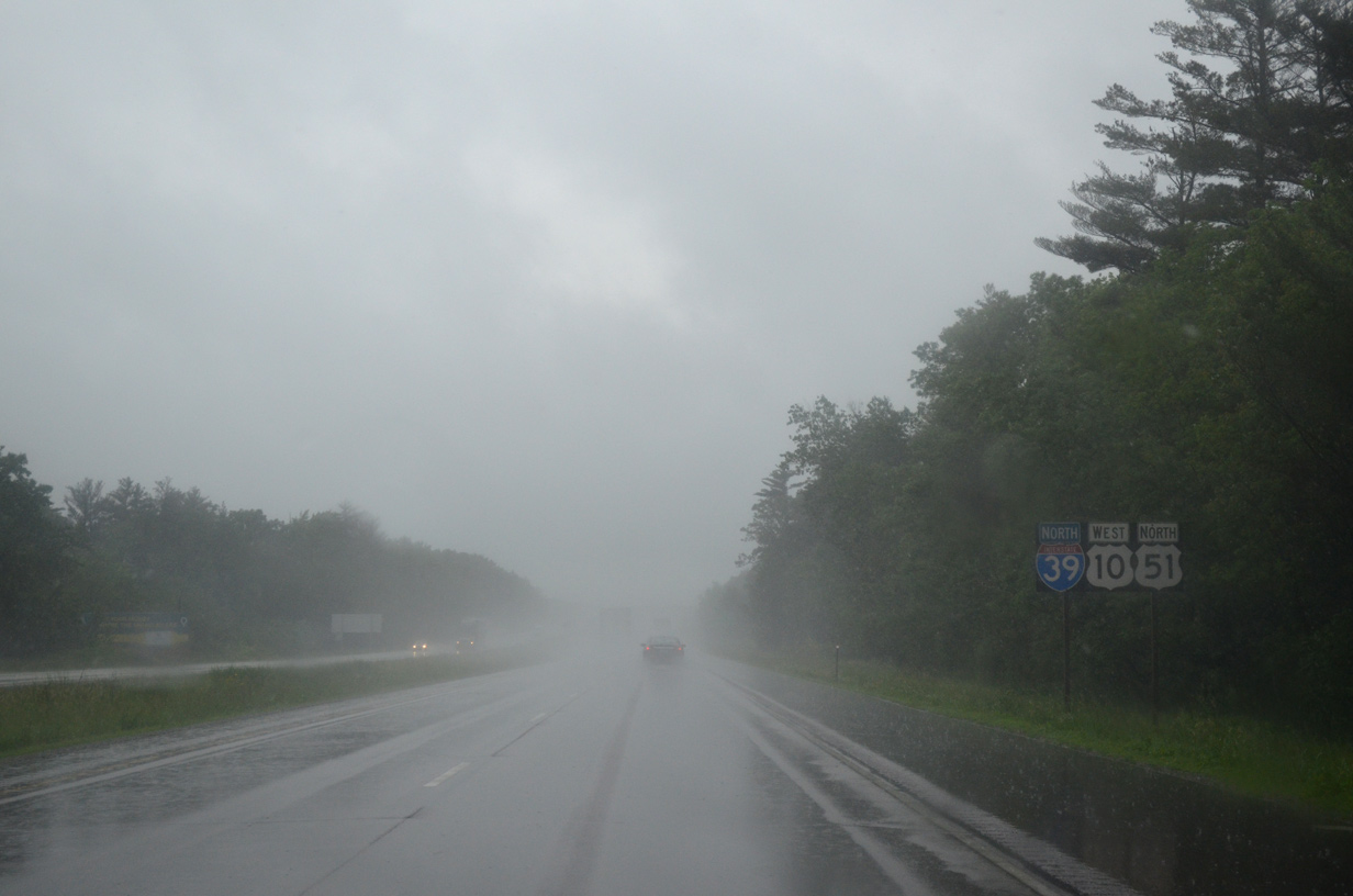
Confirming shields for I-39/U.S. 10-51 posted as the freeway turns northward again to parallel the Wisconsin River and its Flowage lakes. Old U.S. 10 runs along the west side of the river along a combination of CTH-E and CTH-HH.
06/15/15
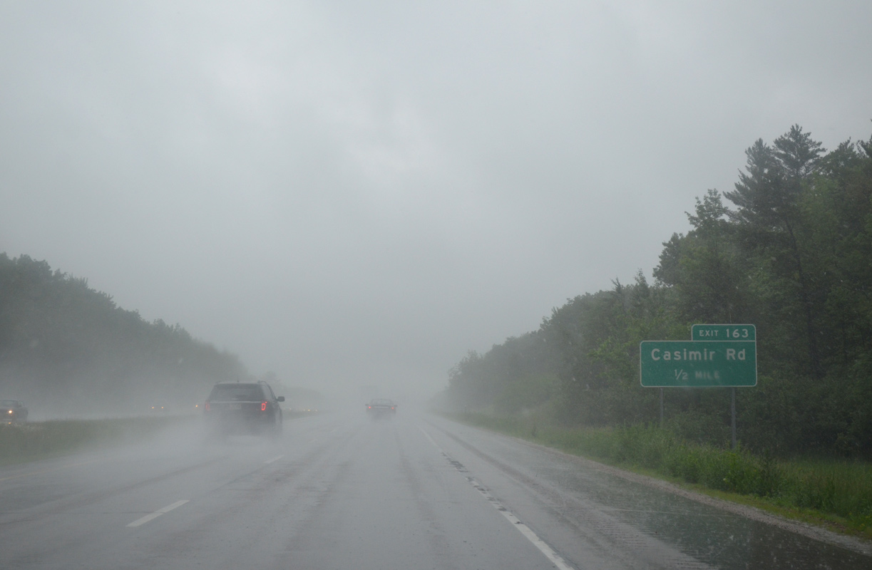
I-39/U.S. 10-51 next approach the diamond interchange (Exit 163) with Casimir Road.
06/15/15
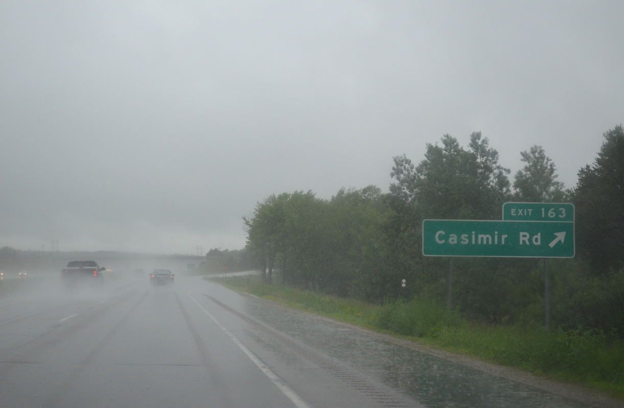
Casimir Road is a local road linking the freeway with 2nd Drive (old U.S. 51) to the east and the settlement of Casimir to the west.
06/15/15
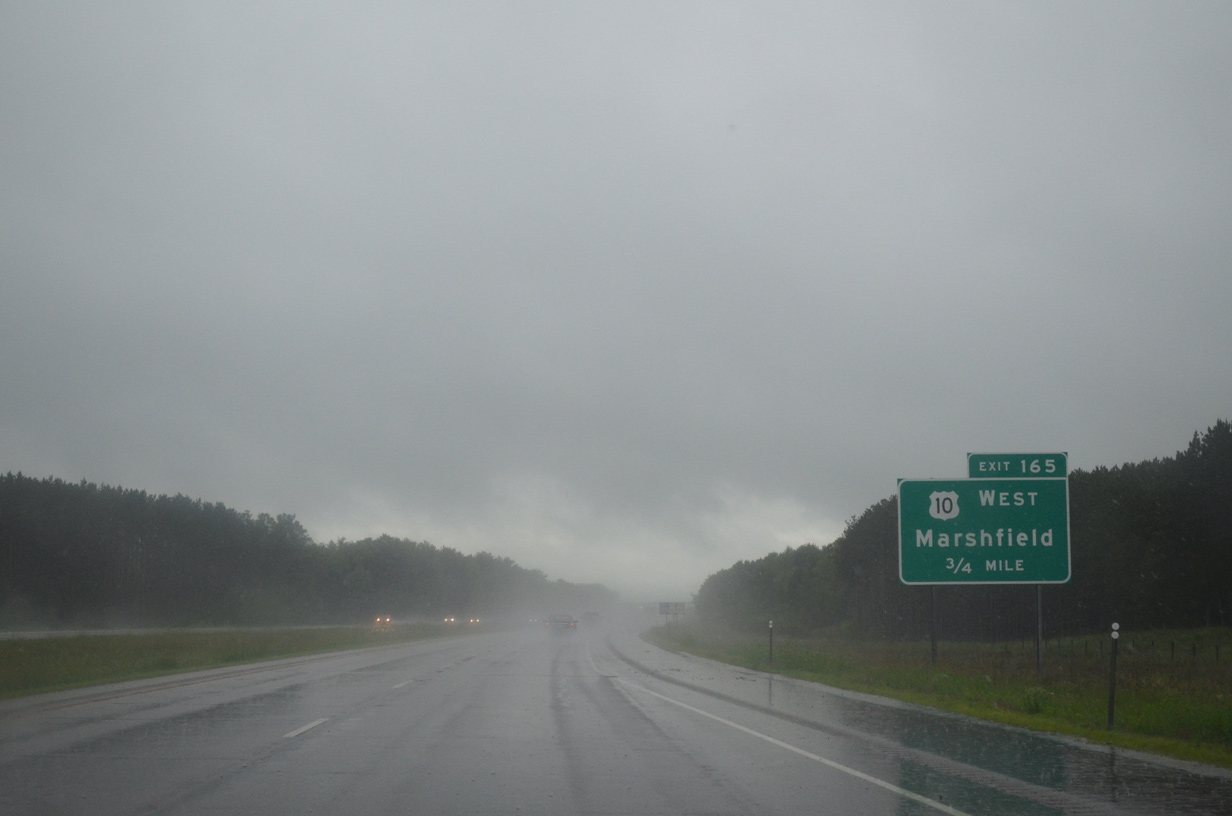
U.S. 10 concludes a seven mile overlap with I-39/U.S. 51 at a wide trumpet interchange (Exit 165) in 0.75 miles. The U.S. highway turns west nine miles to Junction City and 30 miles to Marshfield.
06/15/15
The U.S. 10 freeway west from I-39 opened to traffic in 2010. Upon completion, the former route of U.S. 10 southeast from Junction City to Stevens Point was downgraded to county trunk highways.
06/15/15
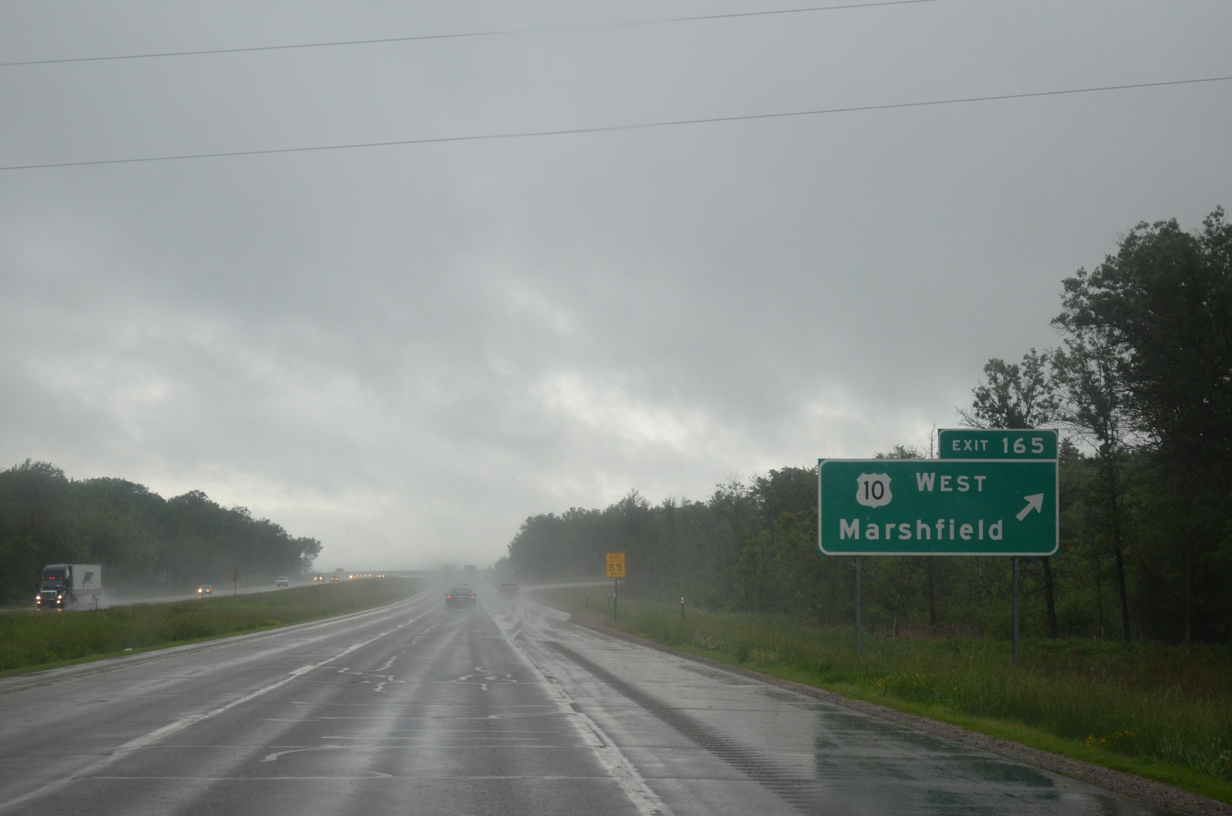
A sweeping ramp (Exit 165) leads U.S. 10 west over both County X and I-39/U.S. 51. U.S. 10 constitutes a full freeway west to the Wood County line and an expressway from there to Marshfield.
06/15/15
North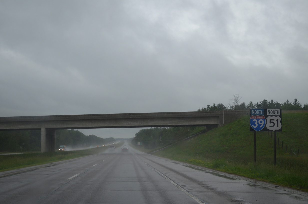
Construction of the U.S. 10 freeway replaced a diamond interchange with County X (Sawmill Road). The former on-ramp from CTH-X merged onto the freeway at this shield assembly.
06/15/15
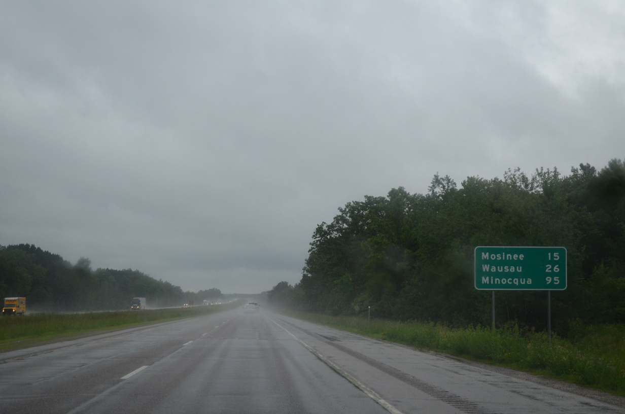
Mosinee and Wausau are lcoated in Marathon County, 15 and 26 miles respectively to the north. The distance to Minocqua is finally below 100 miles.
06/15/15
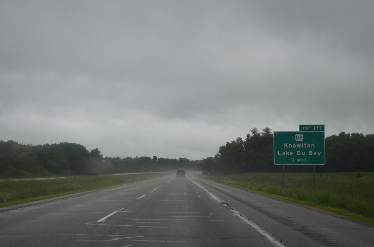
Exit 171 joins I-39/U.S. 51 with County DB in one mile. County DB loops west from County X to Wis 34 to Lake Du Bay and Knowlton.
06/15/15
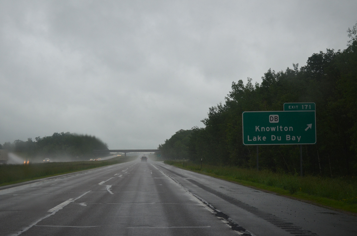
Opened by 1978, the U.S. 51 freeway bypassed the former two lane alignment from just south of the diamond interchange (Exit 171) with County DB to north of Knowlton. Park Road and CTH-DB across Lake Du Bay represents old U.S. 51.
06/15/15
This set of shields precedes bridges across an arm of Lake Du Bay fed by the Little Eau Claire River.
06/15/15
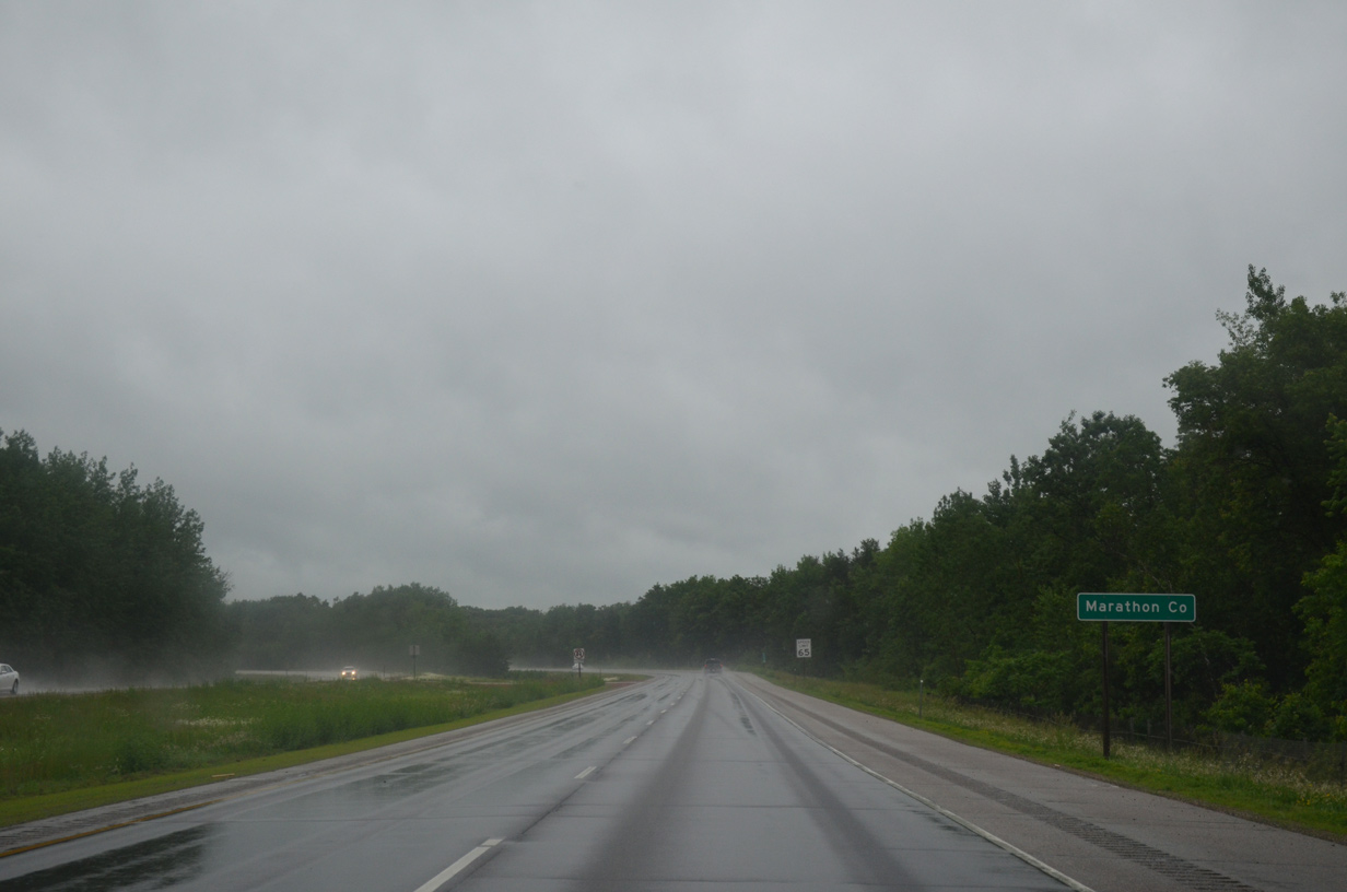
Travelers enter Marathon county just north of the Little Eau Claire River span as I-39/U.S. 51 turn northwest over another arm of the lake.
06/15/15
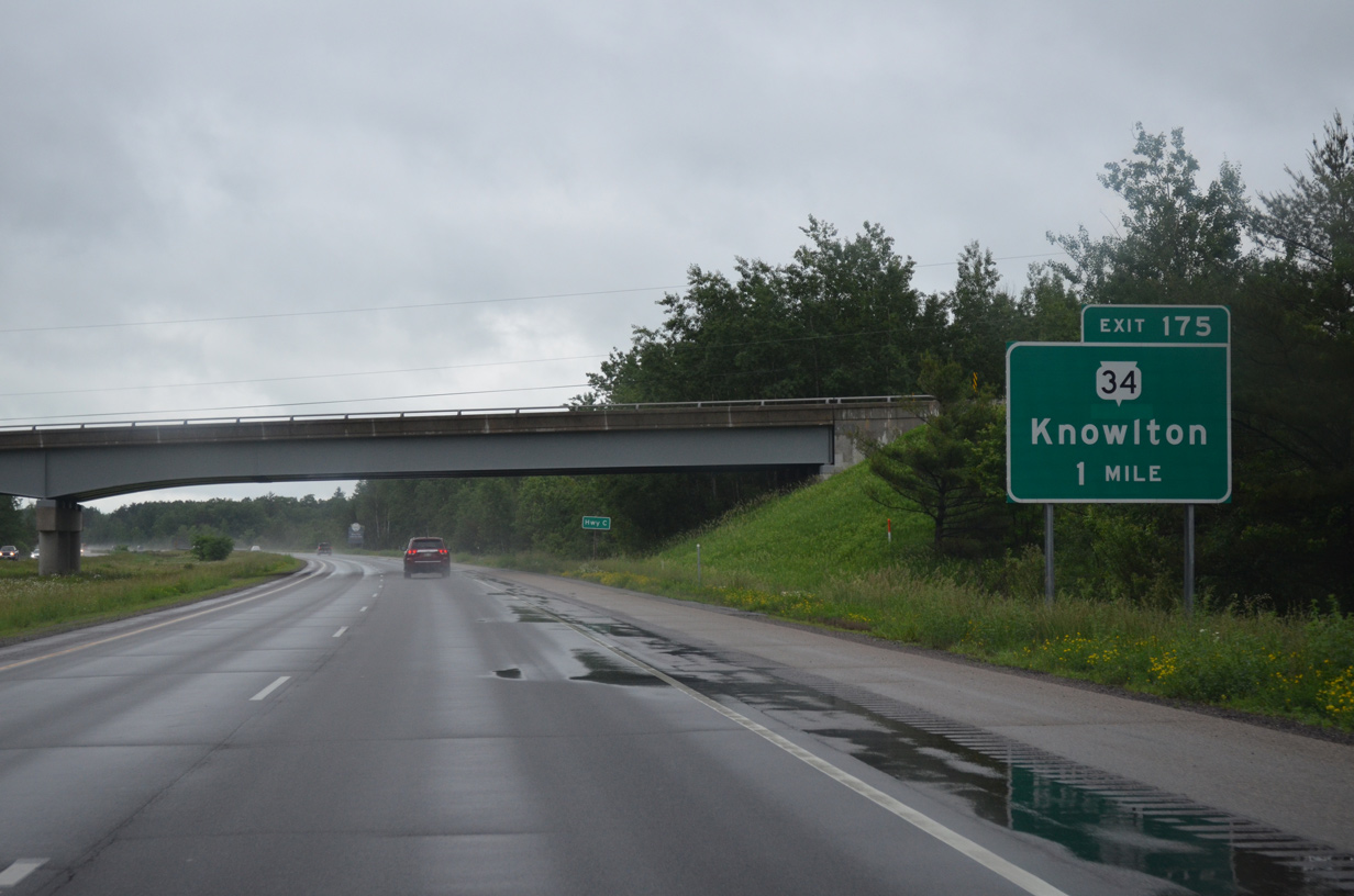
County C ventures west from County J and Rocky Corners to pass over I-39/U.S. 51 ahead of County DB and Knowlton. The freeway continues one mile northwest to a diamond interchange (Exit 175) with Wis 34 south and Balsam Road.
06/15/15
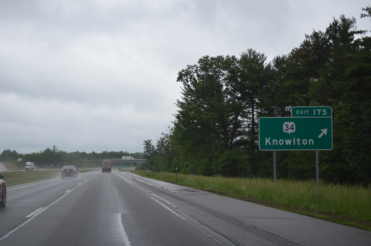
Wis 34 concludes a 23 mile route north from Wis Rapids, Junction City and Dancy at Exit 175. Prior to completion of the U.S. 51 freeway, Wis 34 ended in Knowlton via Seagull Drive and Redfield Road. Balsam Road ties into Exit 175 otherwise from the northeast as a local road.
06/15/15
I-39/U.S. 51 head due north to the city of Mosinee while Old U.S. 51 runs just to the west as a locally maintained road.
06/15/15
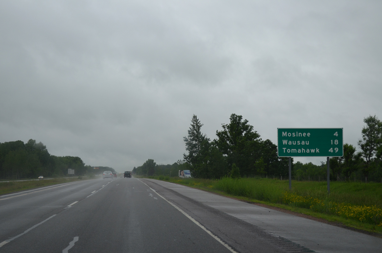
Wausau is now just 18 miles away while Tomahawk, near the north end of the U.S. 51 freeway / expressway, is reached in 49 miles.
06/15/15

Continuing north, I-39/U.S. 51 travel by Central Wisconsin Airport (CWA) and an abandoned wayside park on the one mile approach to the diamond interchange (Exit 179) with Wis 153 in Mosinee.
06/15/15
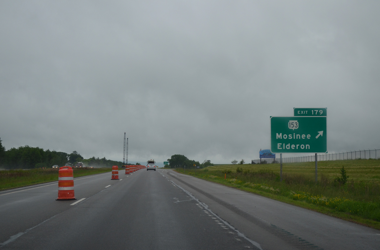
Exit 179 leaves I-39/U.S. 51 for STH-153. Traveling 61 miles overall, Wis 153 connects Mosinee with Straford and Wis 13 to the west and Elderon and U.S. 45 to the east.
06/15/15

Mosinee Hill (el. 1,598 feet) anchors the northern horizon as I-39/U.S. 51 shift eastward between the parallel Wisconsin River and Bull Junior Creek.
06/15/15
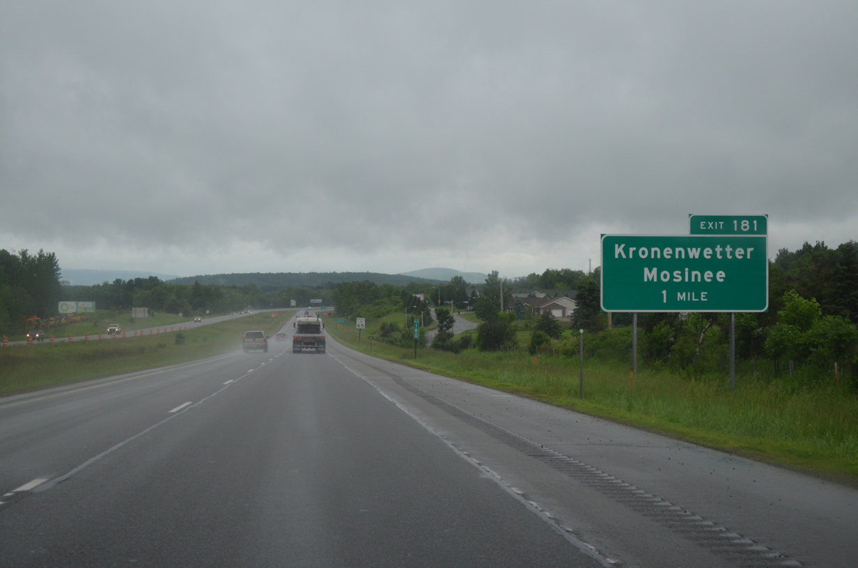
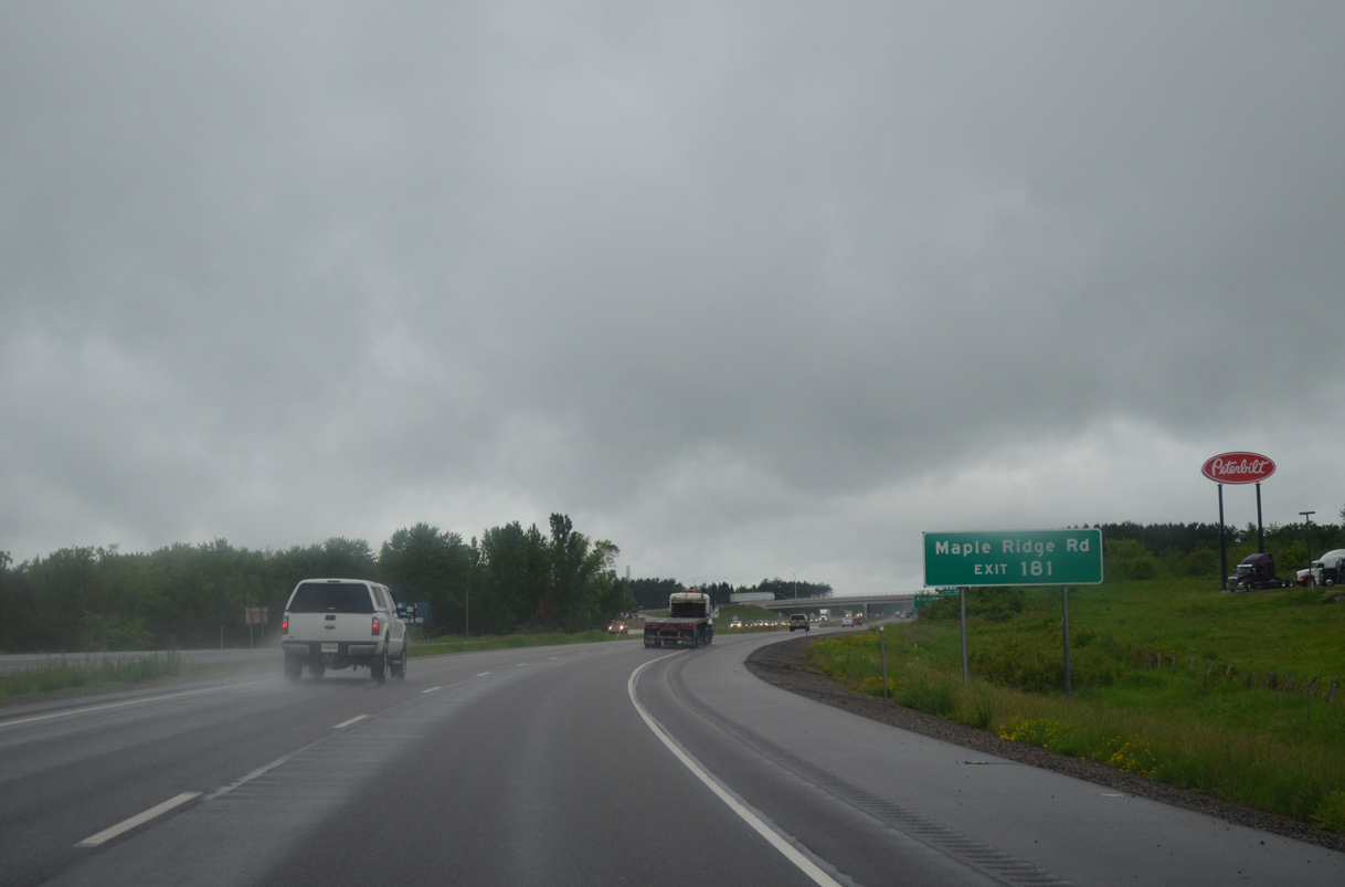
Northbound motorists enter the village of Kronenwetter at the forthcoming diamond interchange (Exit 181) with Maple Ridge Road.
06/15/15
Maple Ridge Road spurs west from Exit 181 toward the Wisconsin River across from Half Moon Lake. The 3.4 mile long road connects I-39/U.S. 51 with County X to the east.
06/15/15
Old Highway 51 leads motorists southwest from Exit 181 back into Mosinee and north through western reaches of Kronenwetter to the Weston Power Plant.
06/15/15
An east side frontage road accompanies I-39/U.S. 51 north to Kowalski Road in Kronenwetter.
06/15/15
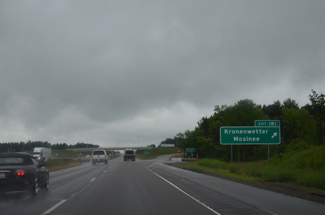
I-39/U.S. 51 make an S-curvee northwest to cross paths with Old Highway 51 (Exit 185) and the Wisconsin River. U.S. 51 Business overtakes the old alignment north along Grand Avenue through the heart of Rothschild.
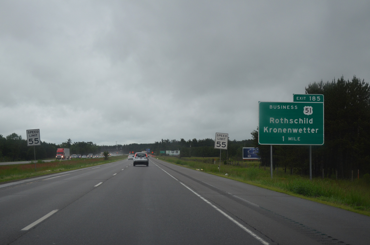
06/15/15
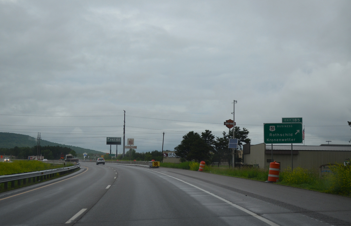
The folded diamond interchange (Exit 185) serves a number of industrial businesses, eateries and retail at the intersection of U.S. 51 Business and County XX (Imperial Avenue). U.S. 51 Business otherwise represents a state maintained route north to Schofield, Wassau and back to U.S. 51 ahead of Maine.
06/15/15
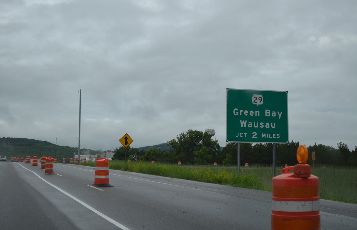
Wis 29, a cross-state expressway from Elk Mound to Green Bay, ties into U.S. 51 in two miles.
06/15/15
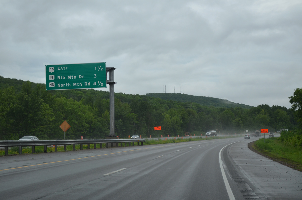
U.S. 51 runs between the Wisconsin River and Mosinee Hill and Rib Mountain (el. 1,919 feet) over the next 4.5 miles to County NN (Exit 190).
06/15/15
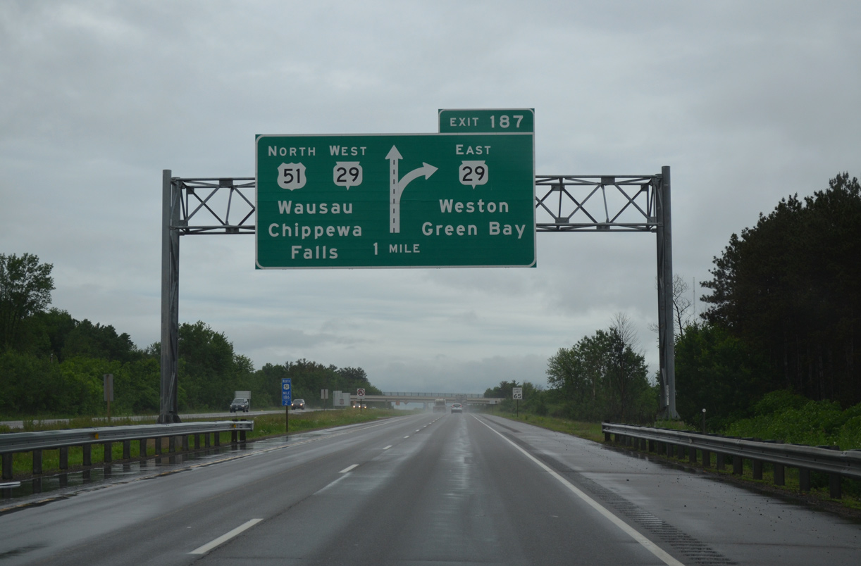
A directional T interchange (Exit 187) joins I-39/U.S. 51 with the Wis 29 freeway leading east to Weston and Ringle. The state trunk highway provides a high speed route to Green Bay and Interstate 41, 87 miles to the east.
06/15/15
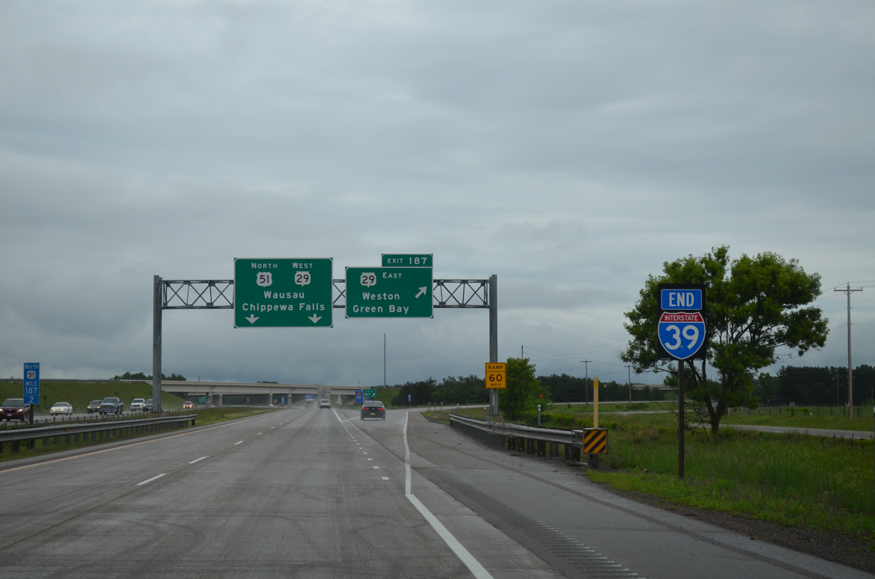
An end shield formally marks the conclusion of Interstate 39 north as Exit 187 departs for Wis 29 east. A wide trumpet interchange joined the two freeways here prior to the US 51/WIS 29 project started in 2004. High speed ramps were completed here in 2006 as part of a seven mile overhaul of both U.S. 51 and Wis 29 between Foxglove Road and Bridge Street in Wausau.
06/15/15
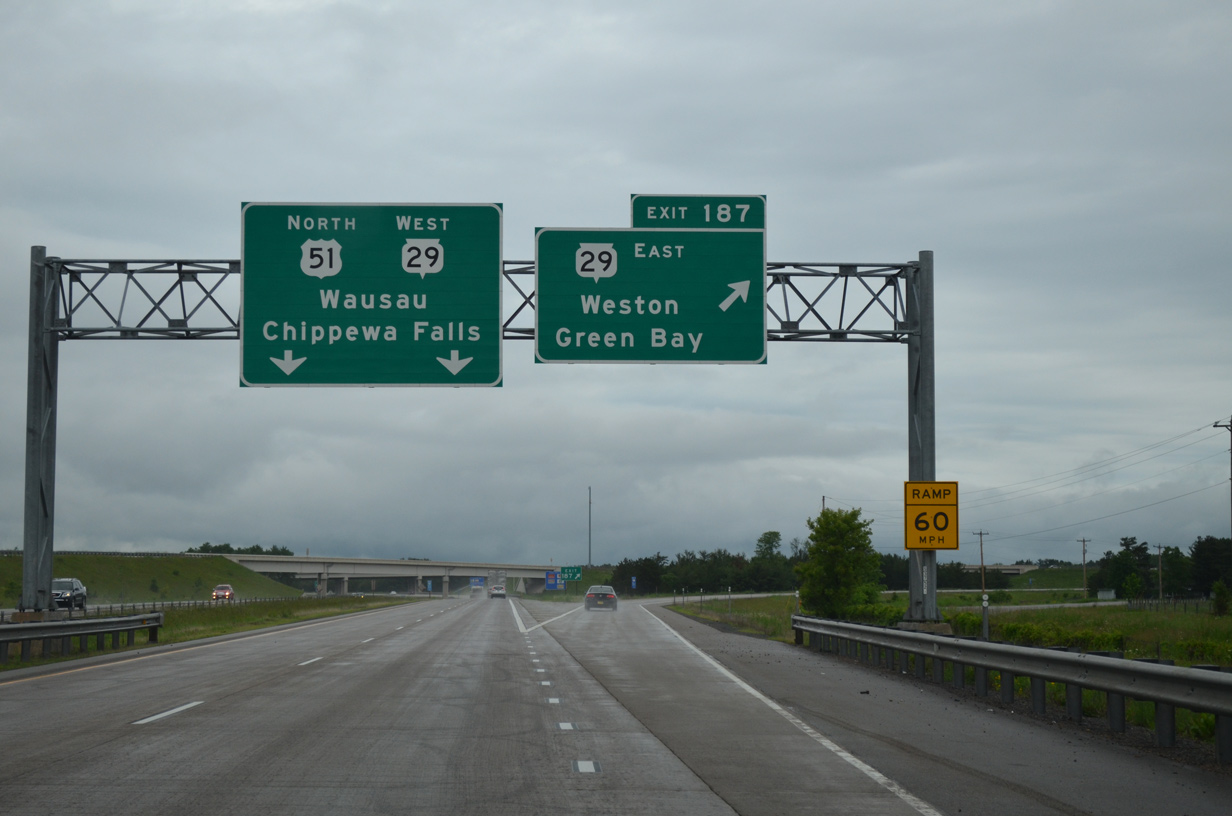
Exit 187 takes motorists east onto Wis 29 ahead of the Wisconsin river bridges to Rothschild and Schofield. Wis 29 comprises a cross-state route from Prescott near the St. Croix River to Kewaunee off Lake Michigan.
06/15/15


Photo Credits:
- Peter Johnson: 03/02/16
- ABRoads: 06/15/15
Connect with:
Page Updated Thursday April 28, 2016.