
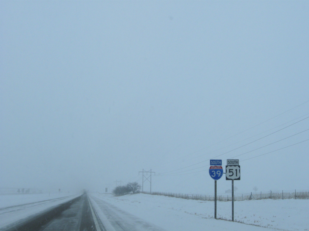
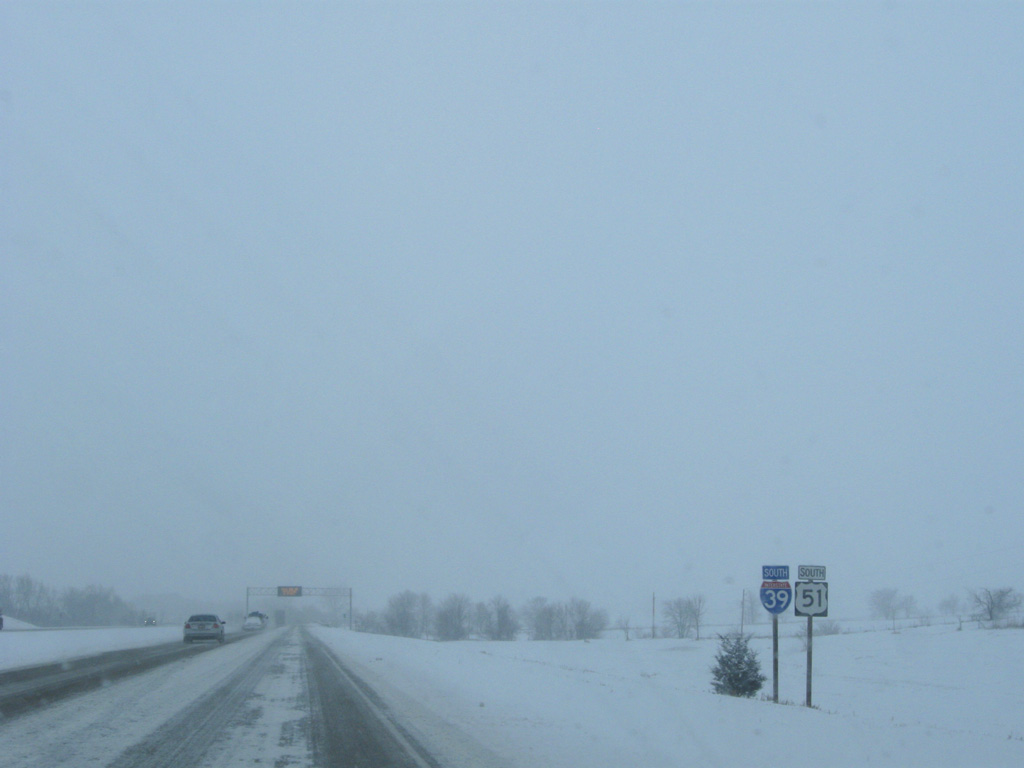
Interstate 39 South - Marshall, Woodford & McLean Counties

 South
South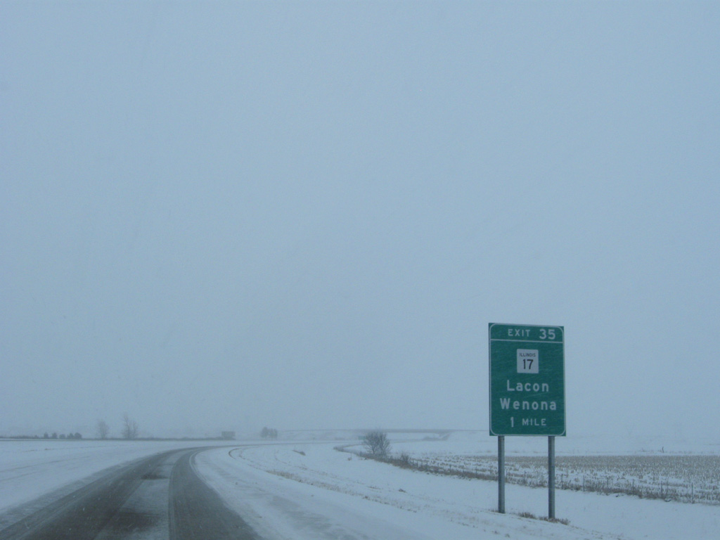
Interstate 39 runs along the southern section of La Salle County for 12 miles, meeting IL 17 at the city of Wenona next.
12/27/09
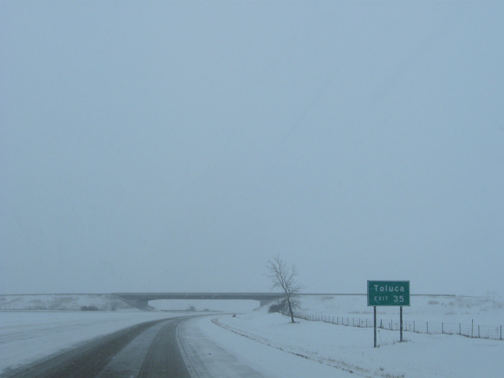
Home to around 1,500, the city of Toluca lies five miles to the west of forthcoming Exit 35 via IL 17 and IL 117 south
12/27/09
Interstate 39 curves eastward another half mile ahead of the County Road 800 North overpass through Wenona. The original U.S. 51 Wenona bypass tied into the freeway at this point.
12/27/09
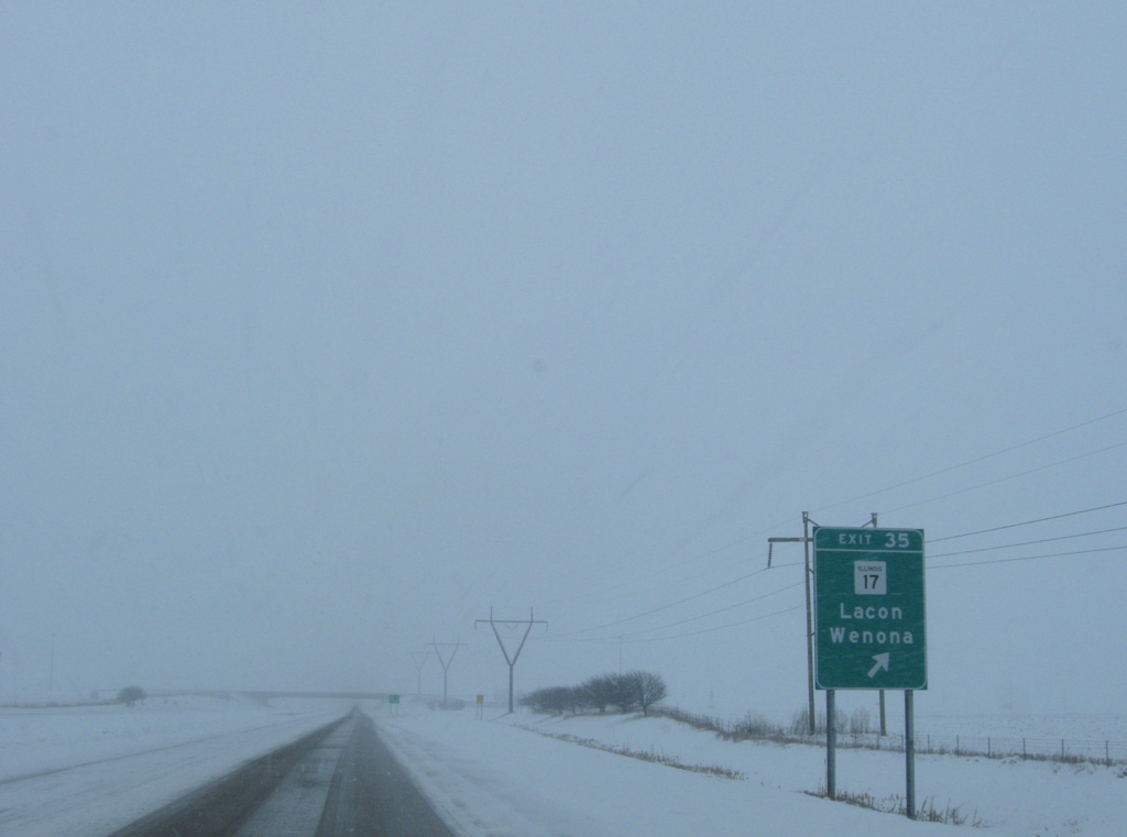
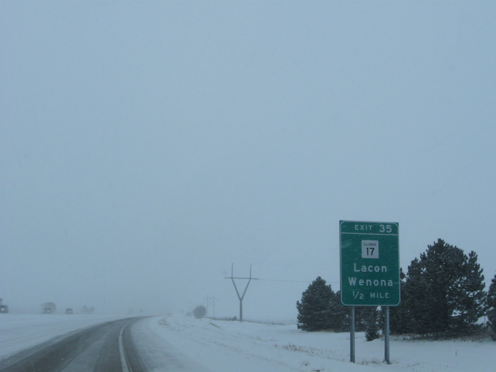
IL 17 is a cross state highway, originating at New Boston along the Mississippi River and ending as Indiana State Road 2 east of Kankakee. IL 17 spans the Lacon Bridge across the Illinois River, 18.7 miles west at Lacon.
12/27/09
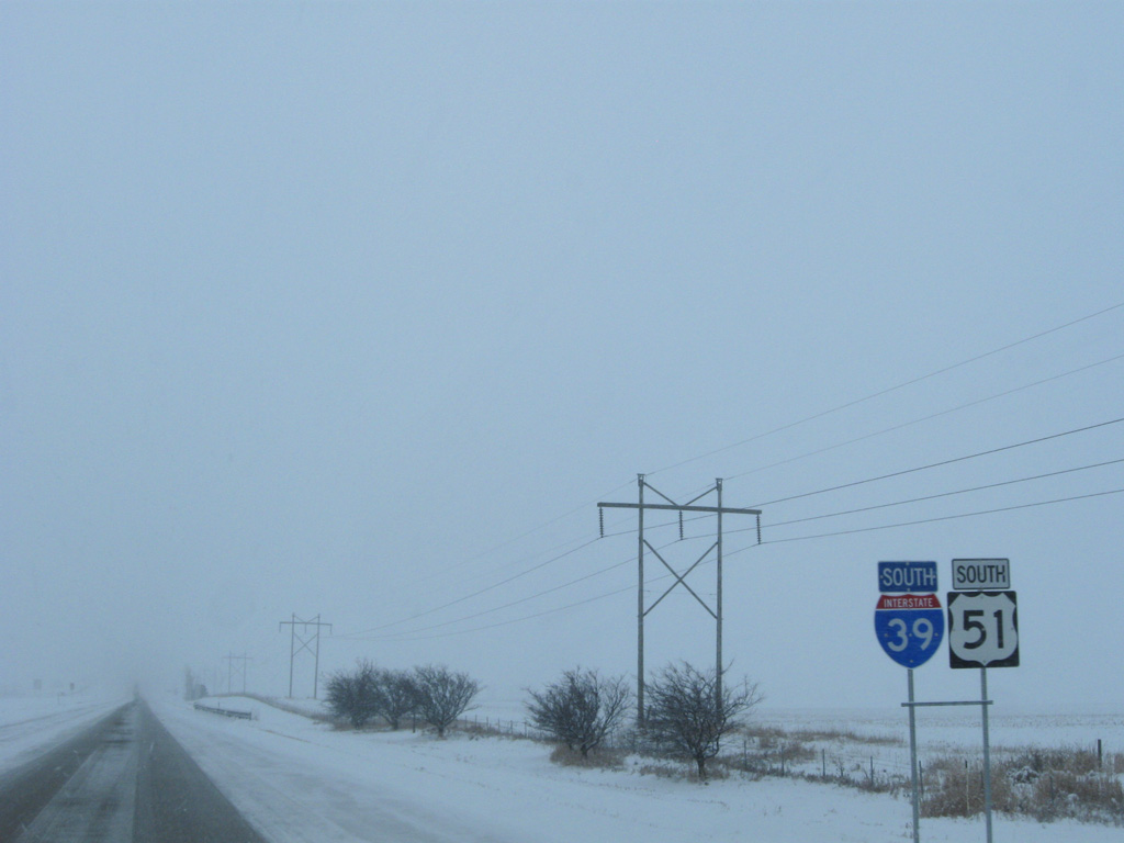
I-39/U.S. 51 bee line southward six miles to the Woodford County line. IL 251 runs a half mile to the east through the village of Rutland.
12/27/09
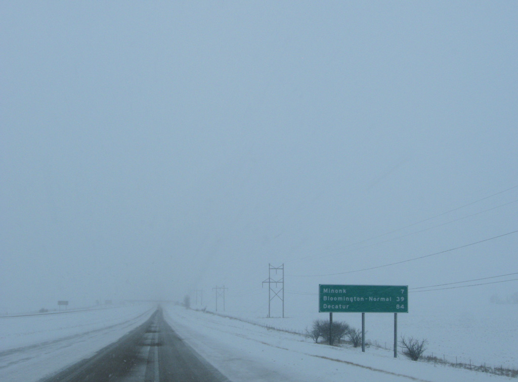
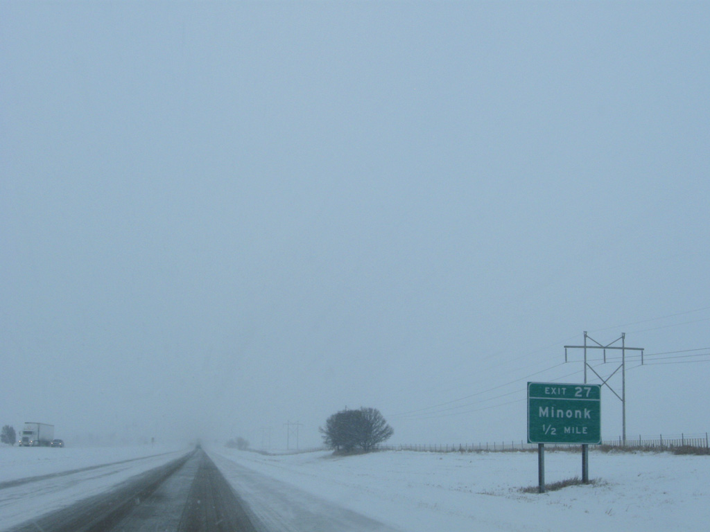
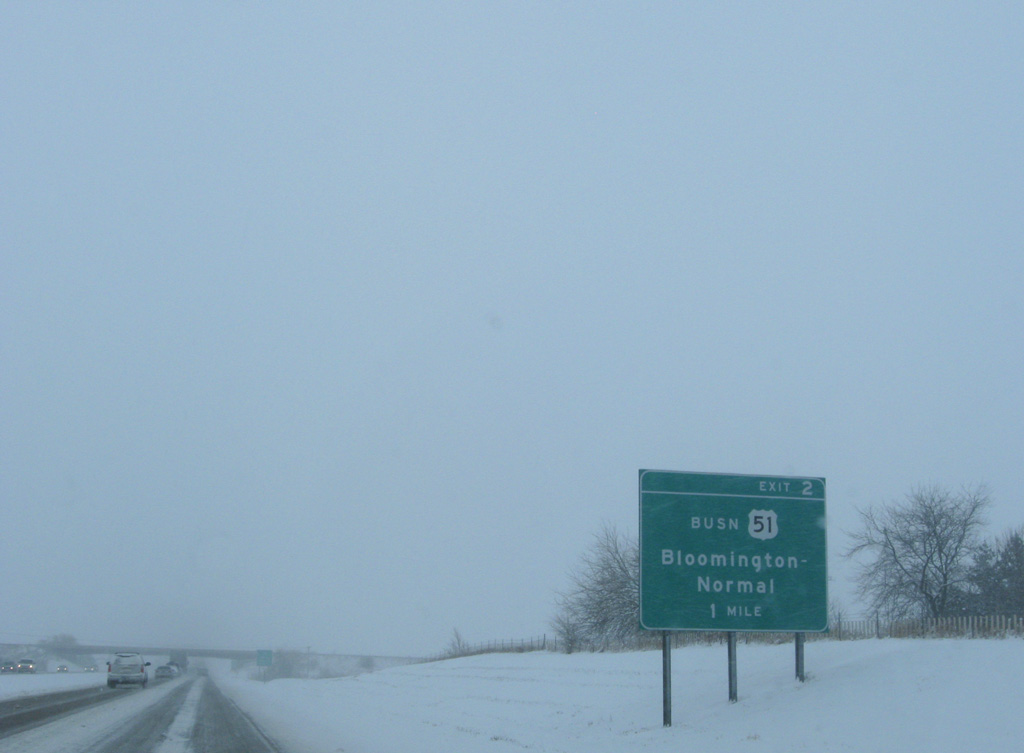
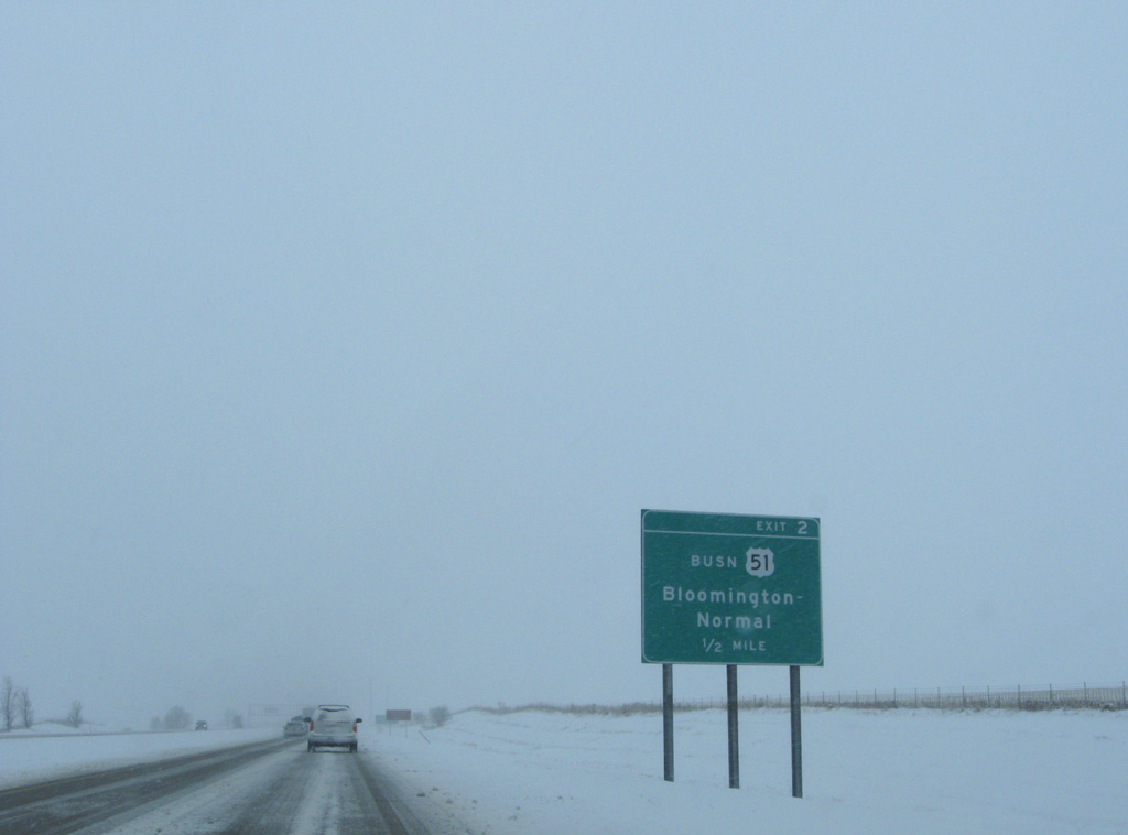
Minonk, a city of 2,000, represents the next departure point from the freeway south in seven miles. Bloomington-Normal follow in 39 miles via U.S. 51 Business south.
12/27/09
County Road 400 North passes over I-39 west from Broad Street and IL 251 at Rutland.
12/27/09
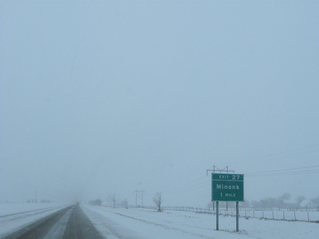
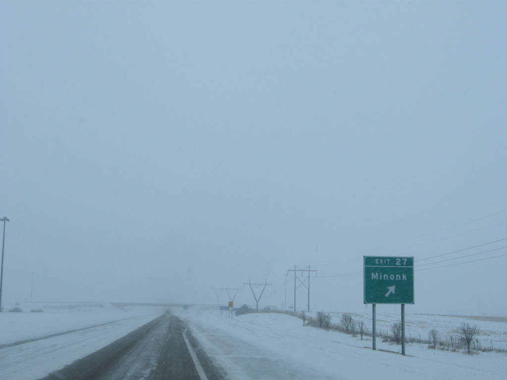
I-39/U.S. 51 bypass Minonk to the west, meeting CR 2 (County Road 2200 North) at Exit 27.
12/27/09
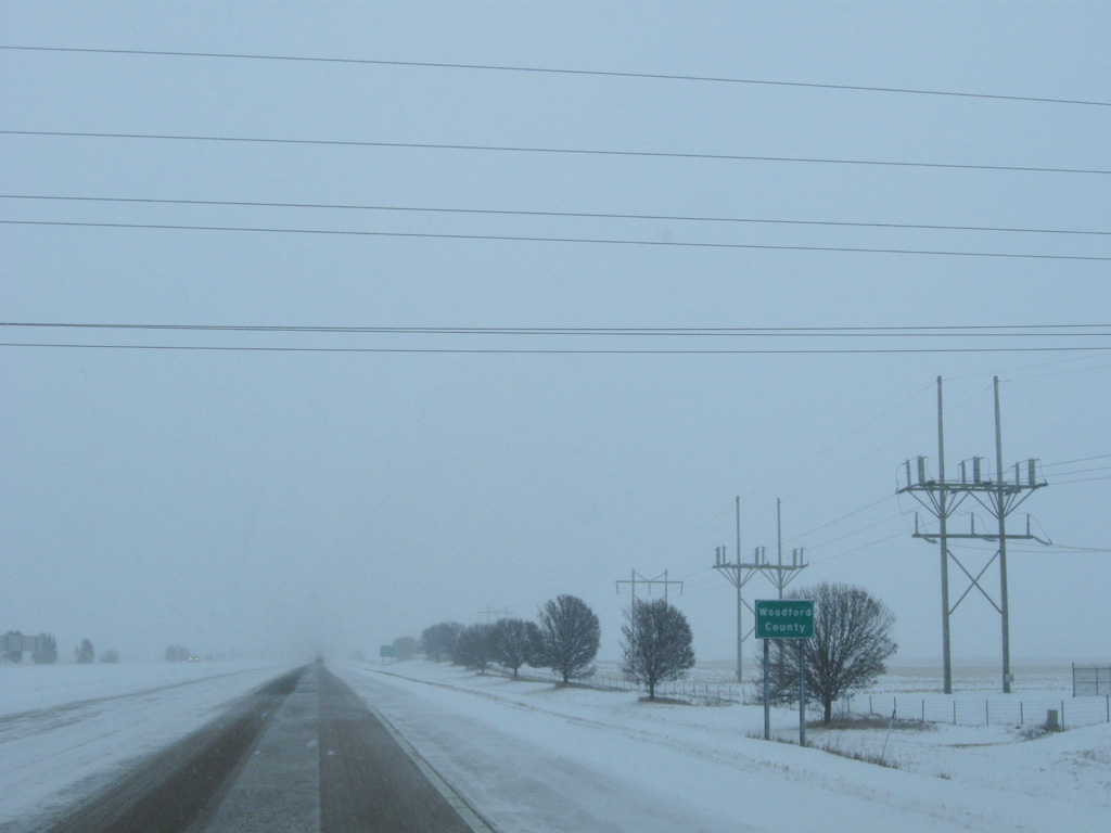
Southbound I-39 enters Woodford County one mile ahead of the diamond interchange (Exit 27) with County Route 2 at Minonk.
12/27/09
County Road 2200 North extends east from parallel IL 251 to Chestnut Street south leading into Downtown Minonk. Chestnut Street is the original alignment of U.S. 51 through the city.
12/27/09
West from Exit 27, County Route 2 travels another 11.4 miles to CR 1 outside the village of Washburn.
12/27/09
Shields for I-39/U.S. 51 posted beyond the entrance ramp from Exit 27.
12/27/09
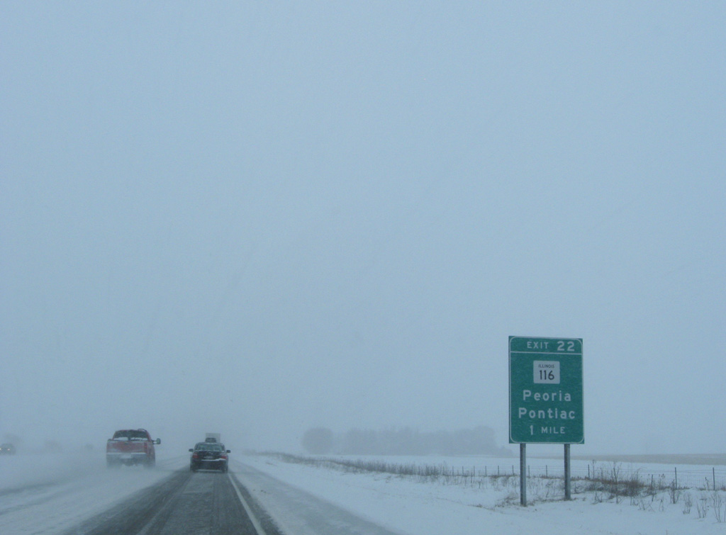
Interstate 39 continues trending east, mirroring the course of adjacent IL 251 (old U.S. 51). The ensuing off-ramp connects the freeway with IL 116 at Exit 22.
12/27/09
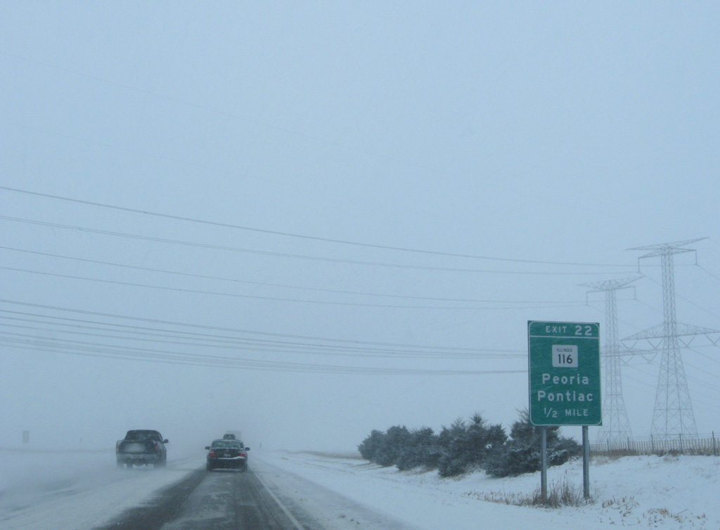
IL 116 is a lengthy route traveling nearly the width of the state between U.S. 34 and U.S. 45. Within Central Illinois, the state route links I-39 with Peoria and Metamora to the west.
12/27/09
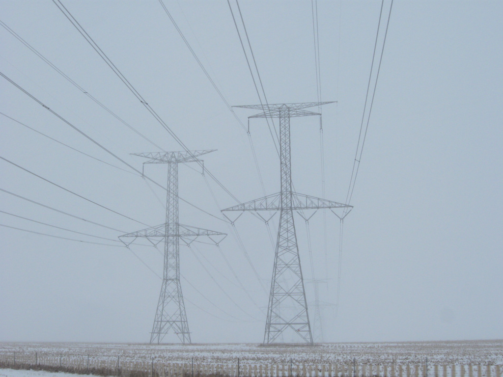
Steel tower transmission lines angle southwest across Interstate 39 near Woodford. The corridor extends southwest to the NRG Powerton Generation Station along the Illinois River at Pekin.
12/27/09
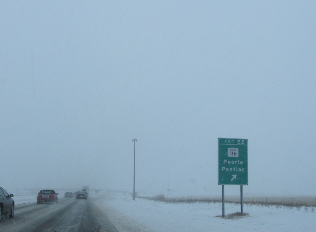
Entering the diamond interchange with IL 116 on I-39/U.S. 51 south. The state route dog legs one mile north alongside IL 251 from near Woodford to resume an easterly course en route to Flanagan and Pontiac.
12/27/09
These shields for I-39/U.S. 51 stand along the freeway as it passes just west of the old Illinois Central Railroad siding of Woodford.
12/27/09
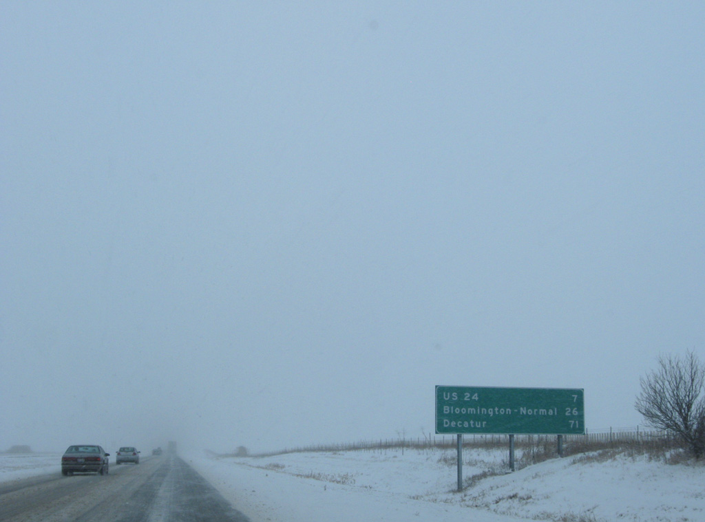
The succeeding exit along I-39 south lies seven miles ahead with U.S. 24. Bloomington-Normal follow in another 19 miles.
12/27/09
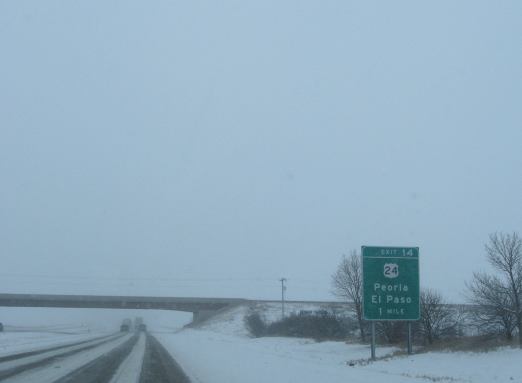
Clearview Road spans Interstate 39 one mile ahead of the folded diamond interchange (Exit 14) with U.S. 24 at El Paso.
12/27/09
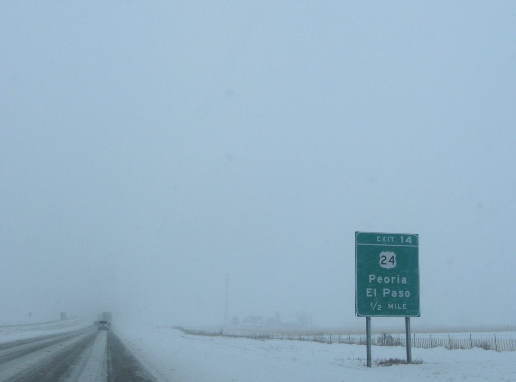
U.S. 24 runs alongside a Toledo, Peoria & Western (TPW) Railway line from the city of El Paso to Secor and Eureka in southern Woodford County. West into the Peoria area, U.S. 24 partitions with a business route through Washington.
12/27/09
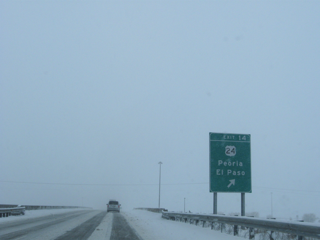
Exit 14 loops away from I-39/U.S. 51 south for U.S. 24 (Main Street) in El Paso. Outside of Peoria, U.S. 24 generally follows a rural route between Quincy and Watseka across the state.
12/27/09

Continuing south from El Paso, I-39 shifts east a quarter mile through an S-curve preceding Kappa.
12/27/09
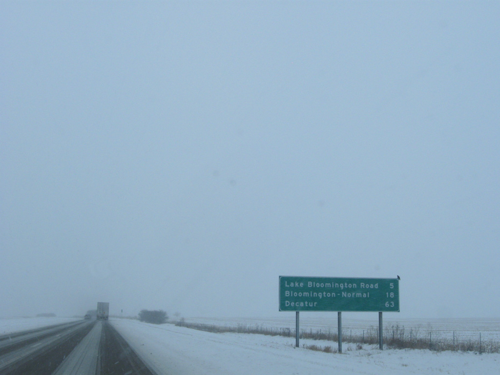
13 miles remain along Interstate 39 south to I-55 at Normal. Decatur is 63 miles away.
12/27/09
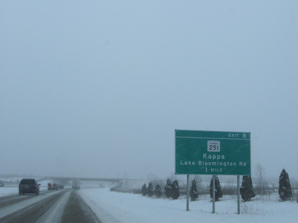
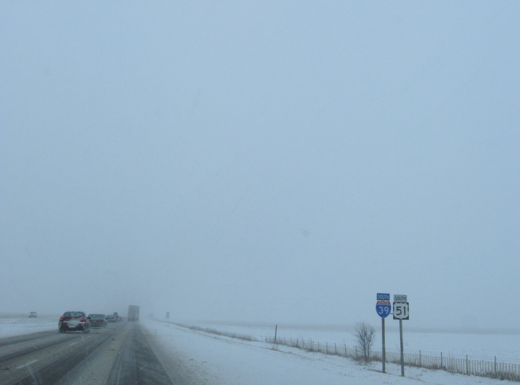
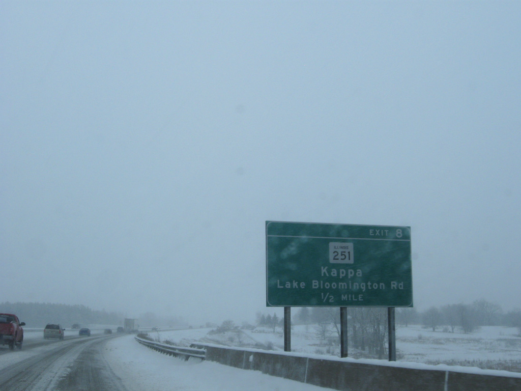
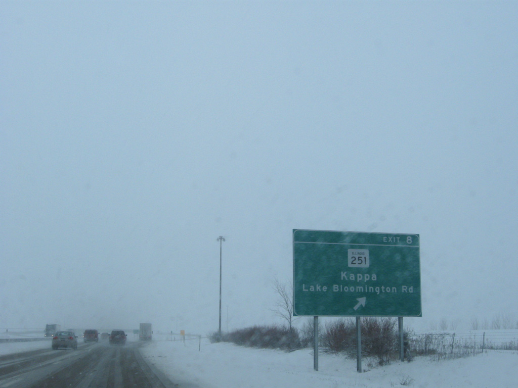
IL 251 converges with Interstate 39 to end at Exit 8 with Lake Bloomington Road and County Road 8.
12/27/09
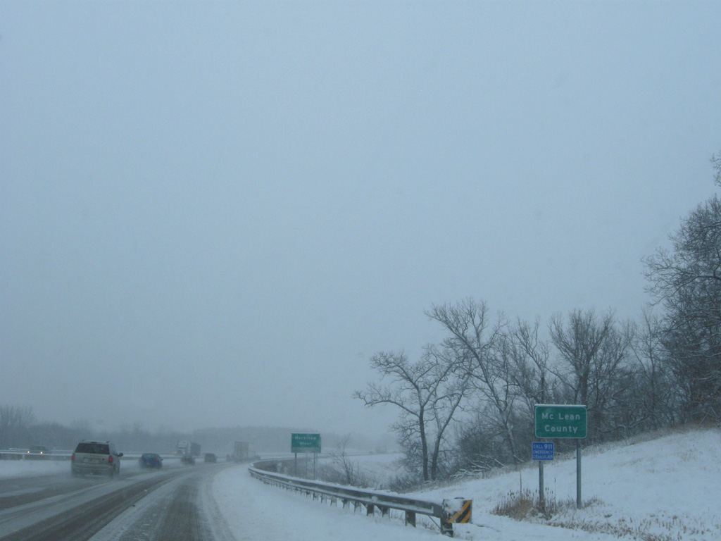
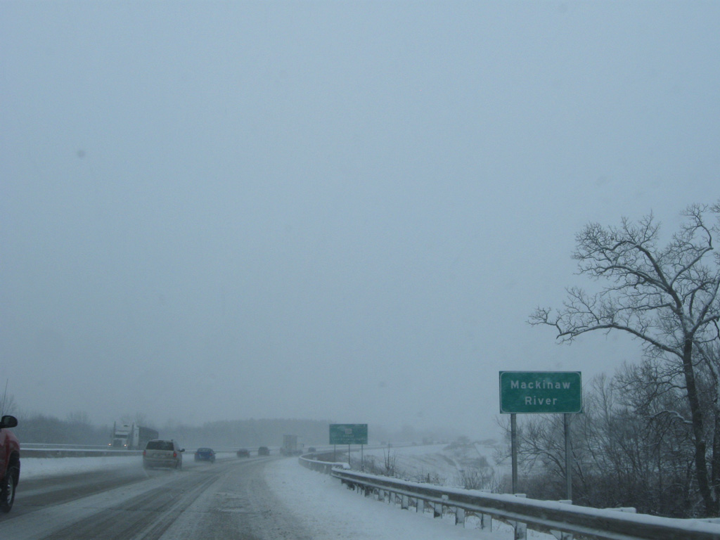
Interstate 39 makes a gradual southeasterly turn by Kappa, eventually overtaking the original U.S. 51 bypass of the village ahead of the Mackinaw River and Mc Lean County line.
12/27/09
IL 251 runs directly east of I-39/U.S. 51 to CR 8 (Lake Bloomington Road). CR 8 leads west to Comlara Park and Evergreen Lake.
12/27/09
A diamond interchange joins I-39 with CR 8 (Lake Bloomington Road) and IL 251 north back into Kappa.
12/27/09
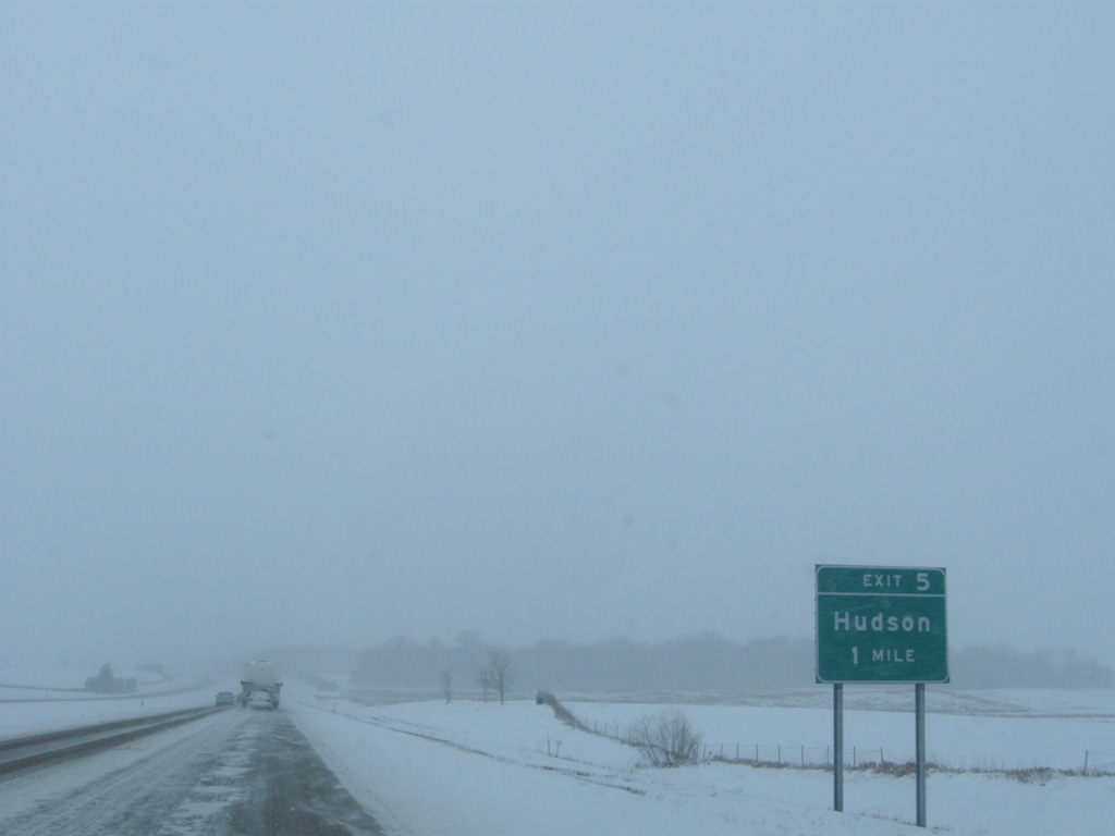
Construction to upgrade U.S. 51 to Interstate 39 directly overlaid the old route south by the village of Hudson.
12/27/09
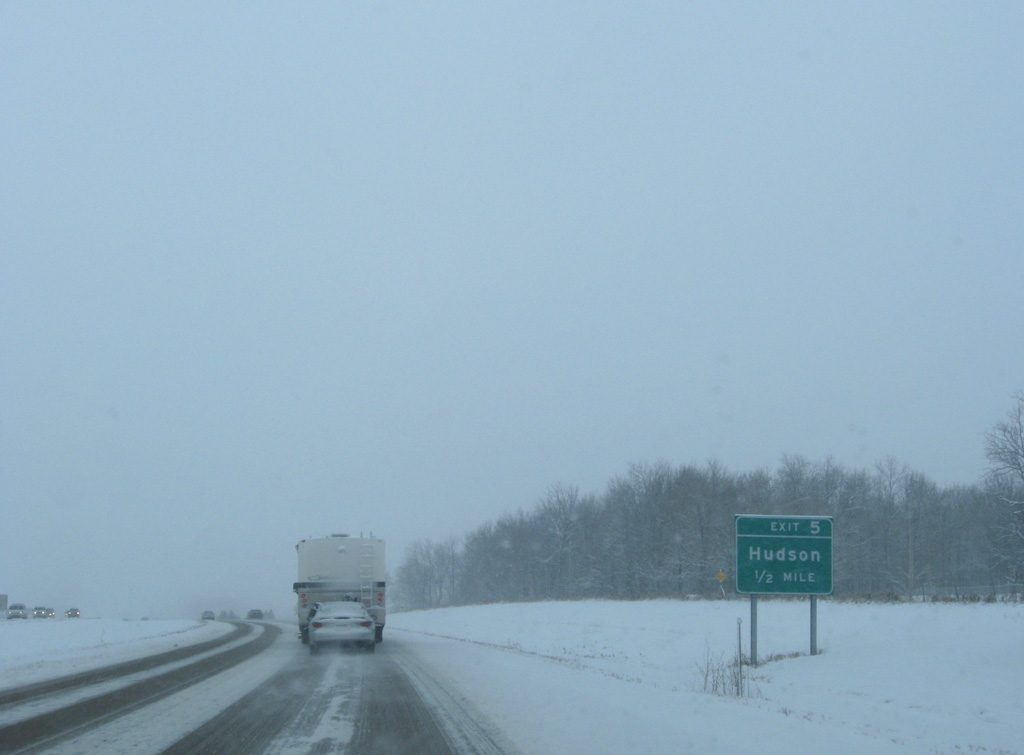
A diamond interchange (Exit 5) connects I-39/U.S. 51 with County Route 12 (Franklin Street) east to the Hudson village center.
12/27/09
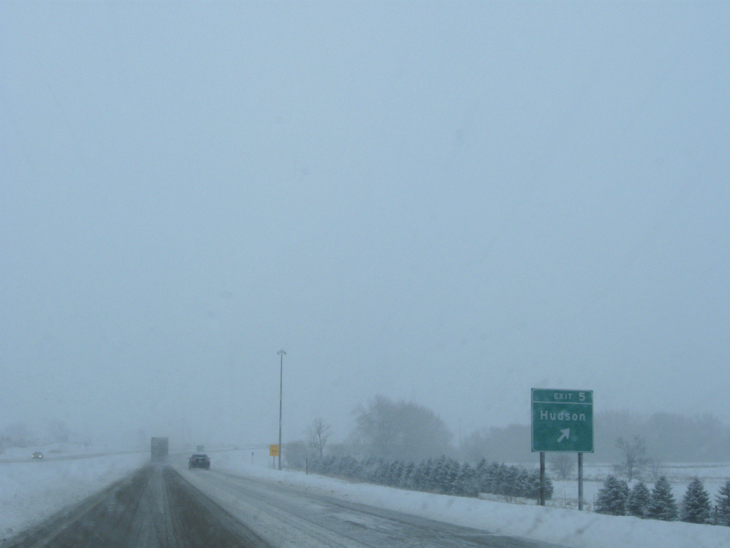
County Route 12 runs 16.7 miles overall, heading west from Exit 5 to U.S. 150 and east from Hudson to Historic U.S. 66 and CR 65.
12/27/09
The freeway bends slightly westward ahead of Sixmile Creek.
12/27/09
The historic alignment of U.S. 51 emerges from the foot print of Interstate 39 at County Road 2000 North. Paralleling to the east along North 1425 East Road, old U.S. 51 becomes U.S. 51 Business at forthcoming Exit 2.
12/27/09
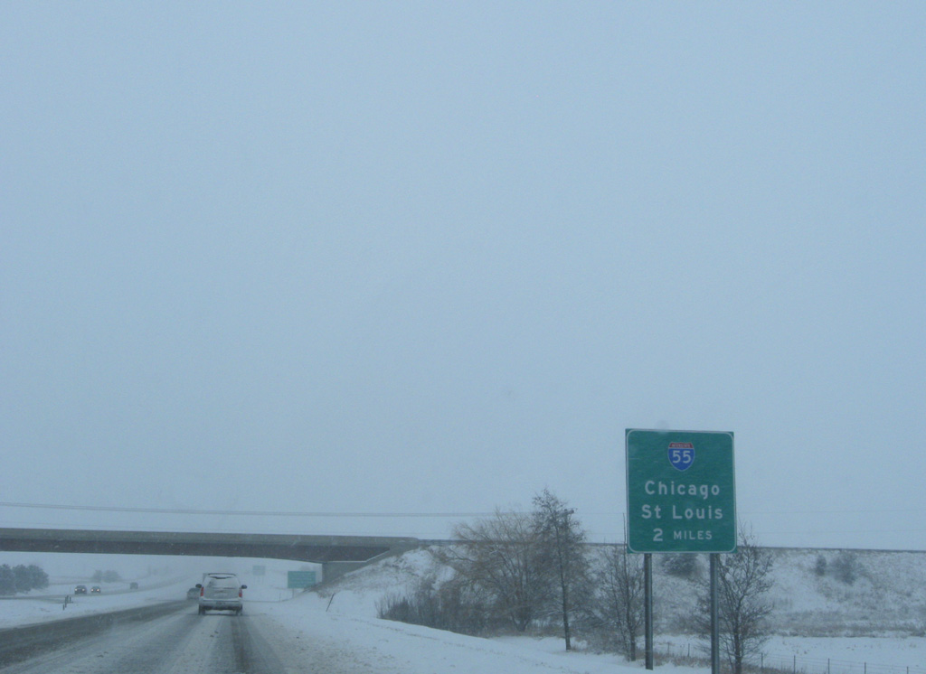
Two miles remain before I-39 concludes at a trumpet interchange with Interstate 55.
12/27/09
U.S. 51 Business branches east from I-39/U.S. 51 along Main Street, five lane boulevard leading south to Illinois State University in Normal.
12/27/09
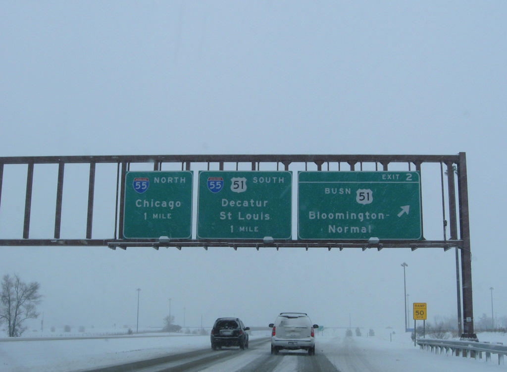
Southbound at the diamond interchange (Exit 2) with U.S. 51 Business (Main Street) south and Ziebarth Road west. Ramps for Interstate 55 north to Chicago and south to St. Louis partition one mile ahead.
12/27/09
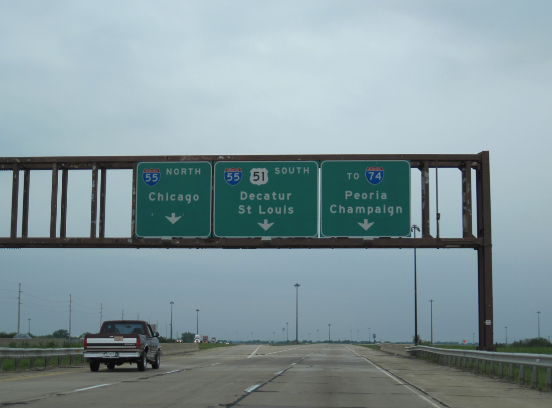
U.S. 51 bypasses Bloomington-Normal along a combination of I-55 south and I-74 east. The US route converges with U.S. 51 Business in ten miles, as it continues along an at-grade expressway to Clinton and Decatur.
05/07/10
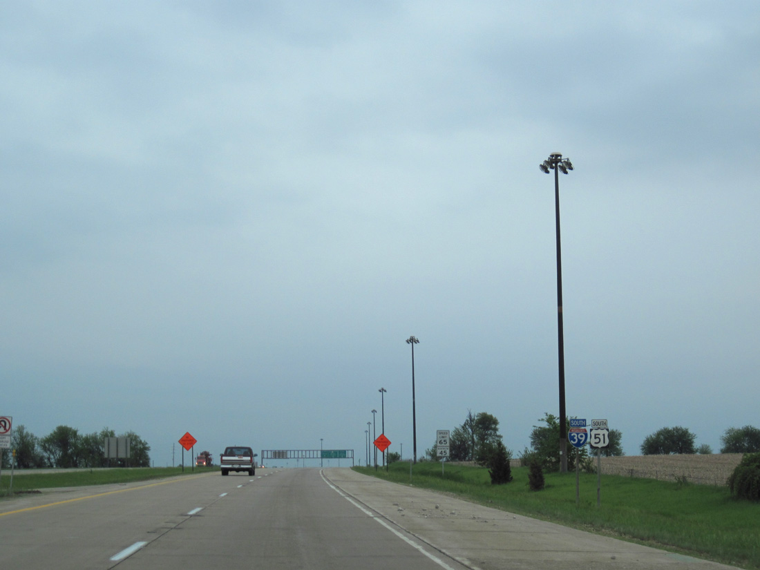
The final reassurance shield for Interstate 39 south stands just ahead of the Normal city line at the E 1800 North Road underpass.
05/07/10
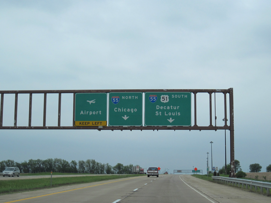
Two lanes default onto Interstate 55 south, as the freeway curves west around Bloomington-Normal. U.S. 51 and I-55 next meet I-74 west to Peoria and the Quad Cities while I-55 north heads east to Business Loop I-55, which provides the most direct route to Central Illinois Regional Airport (BMI).
05/07/10
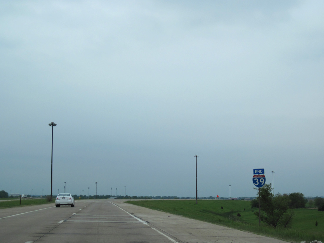
An end shield for Interstate 39 appears on the southbound ramp to I-55/U.S. 51.
05/07/10


Photo Credits:
- Alex Nitzman: 12/27/09
- ABRoads: 05/07/10
Connect with:
Page Updated Sunday April 29, 2018.